Guidelines for applicants 2020-21 - DEPARTMENT OF PLANNING, INDUSTRY & ENVIRONMENT
←
→
Page content transcription
If your browser does not render page correctly, please read the page content below
DEPARTMENT OF PLANNING, INDUSTRY & ENVIRONMENT

Guidelines for
applicants 2020-21
Floodplain Management Program

environment.nsw.gov.au
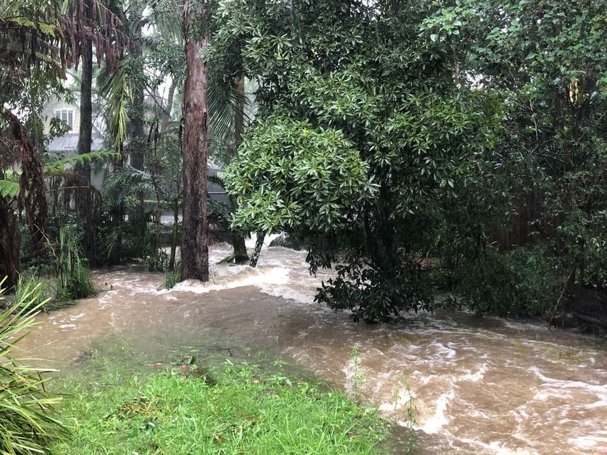
© 2020 State of NSW and Department of Planning, Industry and Environment
With the exception of photographs, the State of NSW and Department of Planning, Industry
and Environment are pleased to allow this material to be reproduced in whole or in part for
educational and non-commercial use, provided the meaning is unchanged and its source,
publisher and authorship are acknowledged. Specific permission is required for the
reproduction of photographs.
The Department of Planning, Industry and Environment (DPIE) has compiled this report in
good faith, exercising all due care and attention. No representation is made about the
accuracy, completeness or suitability of the information in this publication for any particular
purpose. DPIE shall not be liable for any damage which may occur to any person or
organisation taking action or not on the basis of this publication. Readers should seek
appropriate advice when applying the information to their specific needs.
All content in this publication is owned by DPIE and is protected by Crown Copyright, unless
credited otherwise. It is licensed under the Creative Commons Attribution 4.0 International
(CC BY 4.0), subject to the exemptions contained in the licence. The legal code for the
licence is available at Creative Commons.
DPIE asserts the right to be attributed as author of the original material in the following
manner: © State of New South Wales and Department of Planning, Industry and
Environment 2020.
Cover photo: Flooded creek. Alexandra Gardiner/DPIE

Published by:
Environment, Energy and Science
Department of Planning, Industry and Environment
4 Parramatta Square, 12 Darcy Street, Parramatta NSW 2150
Phone: +61 2 9995 5000 (switchboard)
Phone: 1300 361 967 (Environment, Energy and Science enquiries)
TTY users: phone 133 677, then ask for 1300 361 967
Speak and listen users: phone 1300 555 727, then ask for 1300 361 967
Email: info@environment.nsw.gov.au
Website: www.environment.nsw.gov.au
Report pollution and environmental incidents
Environment Line: 131 555 (NSW only) or info@environment.nsw.gov.au
See also www.environment.nsw.gov.au

EES 2020/0069
First published in February 2020; reprinted March 2020 with changes to closing date.

Find out more about your environment at:

www.environment.nsw.gov.au
Contents
Introduction                                                         1
Eligibility                                                          1
    What will be funded?                                             1
    What will not be funded?                                         2
Program objectives                                                   2
Funding priorities                                                   3
What applicants will need to contribute                              3
    Special consideration                                            3
    Partnerships                                                     4
Project implementation timeframe                                     4
Funding agreements                                                   4
Assessment process                                                   4
Assessment criteria                                                  5
    Essential criteria                                               5
    Other criteria                                                   5
Additional guidance on some specific items                           6
    Pit and pipe survey                                              6
    Floor level survey                                               6
    Community consultation                                           6
    New works ranking form                                           6
Contacts for assistance                                              7
    General administration inquiries                                 7
Submission process                                                   7
    Closing date                                                     7
Other programs                                                       7
Instructions for completing the New Works Ranking Form               8

List of tables
Table 1        Applications can be made for the following projects   1

                                        iii
Floodplain Management Program – Guidelines for applicants 2020-21
Introduction
The NSW Government provides technical and financial support to local government under
the Floodplain Management Program (the Program) to manage flood risk. The primary
objective of the Program is to support the implementation of the NSW Flood Prone Land
Policy, which aims to reduce the impacts of existing flooding and flood liability on
communities and to reduce private and public losses resulting from floods, using ecologically
positive methods wherever possible.
The Program is administered by the Department of Planning, Industry and Environment
(DPIE).
The NSW Government recommends that local government manage its flood risk by following
the floodplain risk management process outlined in the Floodplain Development Manual
(2005).
Closing date: 5.00pm 30 April 2020.
Eligibility
The following organisations are eligible to apply.
• local councils
• county councils
• other government bodies with equivalent floodplain risk management responsibilities to
local councils (e.g. Lord Howe Island Board, Hunter Local Land Services (LLS)).
Local councils can also work together in a group, provided that either:
• one council is the lead agency in terms of signing of the funding agreement, managing
monies and reporting on the project
• a relevant Regional Organisation of Councils applies for and manages the funding.
What will be funded?
Table 1 Applications can be made for the following projects
Project Category
Stage 1 Flood study (including data collection).
Stage 2 Prepare or review a floodplain risk management study and plan
Stage 3 Investigation, design and/or feasibility study (where required) for works
identified in a floodplain risk management plan; this stage must be
undertaken for all works projects that are likely to exceed a total project
cost of $500,000.
Stage 4 Implementing actions identified in a floodplain risk management plan,
including but not limited to:
• structural works such as levees, detention basins, floodgates and flow
conveyance improvements (if these are extensive works requiring a
high level of funding, they should be broken into stages)
• flood warning systems
• evacuation management
1Floodplain Management Program – Guidelines for applicants 2020-21
• upgrades of flood assets that have reached the end of their design life
• voluntary house raising (further information on the eligibility criteria and
implementation of voluntary house raising projects is available in
Floodplain Management Program Guidelines for voluntary house
raising schemes)
• voluntary purchase (further information on the eligibility criteria and
implementation of voluntary purchase projects is available in Floodplain
Management Program Guidelines for voluntary purchase schemes).
Note: Lodging an application for financial assistance does not guarantee assistance will be offered.
Separate application forms must be completed for each project.
Councils can submit a maximum of four applications per funding round, these should be the
highest priority projects for funding. An additional two applications (maximum six) will be
considered if the applicant can demonstrate the need for all the projects and the ability to
effectively manage the projects. Approval to exceed the four-application limit must be sought
prior to submitting the additional applications from the Manager Contestable Grants – Coast,
Estuary and Flood at coastalestuary.floodgrants@environment.nsw.gov.au.
What will not be funded?
Funding will not be provided for:
• GST – the project cost is to exclude GST.
• Retrospective projects – funding is not available for activities currently underway,
completed or contractually committed to prior to the awarding of grants to successful
applicants or prior to approval of the project work plan.
• Administration costs – unless otherwise approved in writing by the Department, all
internal costs (including on-costs) associated with the core activities of the applicant are
ineligible for funding. An applicant’s core activities include preparing study briefs,
reviewing proposals and tenders, researching and copying records, attending meetings,
contract and grant administration, accounting costs, staff costs associated with liaising
with the public and with government agencies. Costs related to the education of
residents via mailouts, workshops or other methods will be funded where those costs
are deemed to be reasonable and well justified.
• Project management costs – unless specifically approved at the time of application.
• Non-monetary contributions as matching funds – an applicant’s matching funds must be
in the form of monetary contributions from council revenue and cannot include in-kind or
voluntary contributions or funding from other parties.
• Contingencies – should not be included in the application or work plan.
• Projects the applicant can reasonably be expected to undertake without financial
assistance from the program.
• Maintenance of assets or replacement of assets that have not been appropriately
maintained.
• Additional funding after commencing the project of more than 30% of the original
amount requested.
Program objectives
The Floodplain Management Program objectives are to provide financial support to councils
and eligible public land managers to:
2Floodplain Management Program – Guidelines for applicants 2020-21
• reduce the impacts of existing flooding and flood liability on communities and to reduce
private and public losses resulting from floods
• make informed decisions on managing flood risk by preparing floodplain risk
management plans (and associated background studies) under the floodplain risk
management process
• implement floodplain risk management plans to reduce flood risk to both existing and
future development, and reduce losses through a range of property, flood and response
modification measures as outlined in the Floodplain Development Manual
• provide essential information to the NSW State Emergency Service to enable the
effective preparation and implementation of local flood plans to deal with flood
emergency response.
Note: Projects which cannot demonstrate that they meet the objectives of the Floodplain Management
Program will be considered ineligible for funding.
Funding priorities
Generally, the highest priority will be given to the following projects:
• Flood studies or floodplain risk management studies and plans (or reviews), with the
highest priority given to those in areas with significant development pressures or where
existing communities are exposed to flood risk but this risk is not fully understood.
• The next stage of a mitigation work that is integral to a stage in progress; for example,
the next stage of a levee project or works to offset the impacts from a levee project
being constructed.
• Mitigation works that are identified as a high priority in floodplain risk management
studies and plans adopted by councils.
What applicants will need to contribute
Assistance under the Program is $2 from government for every $1 provided by the applicant
(from council revenue), except where special consideration is provided.
Contributions to the project from other funding sources (not council revenue) must be
removed from the whole project cost prior to applying the funding ratio, except for voluntary
house raising.
Special consideration
An applicant unable to match the Program’s funding contribution may apply for special
consideration.
When applying for special consideration, the application should demonstrate why the issue
being addressed is of regional or statewide significance and that the applicant does not have
the financial capacity to address it.
The applicant’s financial capacity will be assessed considering its per capita general-
purpose grants under the Local Government Financial Assistance Grants, as established by
the Local Government Grants Commission.
If the applicant intends to apply for special consideration, they should contact the Manager
Contestable Grants – Coast, Estuary and Flood to discuss an agreed maximum funding ratio
prior to submitting the application.
3Floodplain Management Program – Guidelines for applicants 2020-21
If special consideration is awarded, the applicant will be eligible to:
• an increased government contribution towards the cost of the project
• claim project management costs (capped at a maximum of 10% of the total project cost)
undertaken either:
o internally (with the costs used as in-kind contributions to match funding)
o externally (selected by a competitive process and funded as a specific cost).
Partnerships
Where a group of local councils are working together in partnership (either under the lead of
one of the councils or a relevant Regional Organisation of Councils), then the lead council or
Regional Organisation of Councils is able to claim a maximum of 10% of the total project
cost for project management.
Eligible project management costs include:
• A project manager or staff member employed specifically for the project, who is selected
by a competitive process. Note: We will not pay for staff already employed by the
organisation submitting the application that will be supervising/project managing or
working on the project as part of their usual duties.
• Administrative costs directly related to the funded project. This can include those noted
under ‘What will not be funded?’
Project implementation timeframe
Projects should not extend beyond three years.
Projects should be realistically timed as extensions to timeframes may not always be
granted. It will also minimise the need for future paperwork to vary timeframes, which can
take time to be assessed and stall progress on the project.
Funding agreements
Successful applicants must enter into a funding agreement that stipulates all funding
obligations and conditions.
The agreement will need to be signed by the general manager (or someone with delegated
authority) within 45 days of the formal grant offer.
The project will be tracked and managed against the work plan which must be kept current
by the grant recipient, in consultation with the Department of Planning, Industry and
Environment, throughout the funded period.
Consider the conditions in the sample funding agreement before submitting an application as
changes to the agreement will only be made in exceptional circumstances.
Assessment process
Applications will be checked to confirm eligibility and completeness. Ineligible, late or
incomplete applications will be considered ineligible for funding.
4Floodplain Management Program – Guidelines for applicants 2020-21
Applications will then be assessed by the Department’s technical staff against the
assessment criteria.
An independent panel, which includes expert and stakeholder representation, will then
assess and prioritise applications on a statewide basis.
Successful applications will be announced.
Details of successful applications will be placed on the Department’s website. All applicants
will be notified in writing of the outcome of their application.
Assessment criteria
Essential criteria
All applicants must be able to demonstrate:
• the project meets the objectives of the Floodplain Management Program
• capacity to deliver the project, past grants management history, available resources and
financial commitment, proposed timeframe, and whether the project is realistic based on
completion of prerequisite consultant briefs, preconstruction work or approvals
• commitment to maintain any works in a condition suitable to meet its design intent for
the design life
• the floodplain risk management process outlined in the Floodplain Development Manual
(2005) has been followed.
Projects must meet all four essential criteria to be eligible for funding.
Other criteria
Applications will also be assessed on:
• the extent to which the project is cost-effective in addressing one or more of the
Program’s priorities
• the technical feasibility, effectiveness and efficiency of the risk mitigation solutions
• the level of regional significance, including the immediacy of any threats
• the level of community support
• for works, the outcomes of ranking based on the scoring system endorsed by Floodplain
Management Australia (see New Works Ranking Form and ‘Instructions on completing
the application form’ for more details)
• the priority of the project with regard to the relevant adopted floodplain risk management
plan (if applicable)
• the current risk to people and/or property from flooding in this area and how effectively
the application addresses these risks.
Note: An application will be awarded a reduced ranking if it is not well thought out or it has unclear
objectives or outcomes.
5Floodplain Management Program – Guidelines for applicants 2020-21
Additional guidance on some specific items
Pit and pipe survey
Floodplain risk management is primarily aimed at addressing riverine and local overland
flooding.
As part of this understanding, an assessment of the capacity and performance of trunk
drainage systems may be necessary. This may, in some cases, require some survey of the
trunk drainage system and this is generally eligible for funding. However, broader surveys of
minor and feeder drainage systems are not funded. Surveying for asset management
purposes is ineligible for funding.
The extent of the drainage system surveyed will need to be justified by the applicant
commensurate with the risk to ensure that the survey incorporated in the study is fit for
purpose. As a guide, trunk drainage systems can be considered to involve pipes of a
minimum of 0.75 metre diameter.
Floor level survey
Floor level surveys may be undertaken using a range of methods depending upon the
intended end use of the information and the terrain.
These purposes may vary from assessment of flood damages through to provision of more
specific advice to the community.
The applicant should consider the intended purpose and methodology relevant to their
situation and include a suitable budgetary allowance as part of their application. If highly
specific and detailed floor level survey is required then strong justification as to why this level
of detail is required should be included in the application.
Community consultation
Community consultation is an integral part of the floodplain risk management process.
The methodology used for community consultation will vary depending upon the type and
scale of the study, the area of concern, the needs of the community and the general
methods council may use to consult the community.
All applications for flood studies and floodplain risk management studies and plans are to
include an appropriate budgetary allowance that considers the scope and scale of
consultation appropriate for the study.
For projects dealing with evacuation management or flood warning systems, provide written
evidence of support from the State Emergency Service or Bureau of Meteorology,
respectively.
Detailed descriptions of what will be involved in the consultation are required for all projects
if costs are to be included as a component of the grant funding.
New works ranking form
This form only needs to be completed for implementation project (stage 3 or 4 as outlined on
page 1 of these guidelines).
For new works (including structural works, flood warning, evacuation management, voluntary
purchase and voluntary house raising) please submit a New Works Ranking Form to enable
6Floodplain Management Program – Guidelines for applicants 2020-21
ranking using the scoring system endorsed by Floodplain Management Australia. The new
works ranking form is available on the Floodplain management grants page.
Note that councils should update this form once the investigation and design have been
completed.
Contacts for assistance
For assistance with grant applications, contact the Department of Planning, Industry and
Environment offices listed below.
Region Telephone
Hunter/Central Coast 02 4927 3248
South West 02 6229 7170
North East 02 8289 6318
South East 02 4224 4153
Greater Sydney 02 8837 6097
North West 02 6883 5315
General administration inquiries
For general grant administration inquiries, contact the
Grants Unit – Coast, Estuary and Flood on 02 9895 6494
or by email at coastalestuary.floodgrants@environment.nsw.gov.au.
Submission process
Closing date
Applications must be received by 5.00pm 30 April 2020.
Any application that is late, incomplete or ineligible will not be considered.
Other programs
The Department of Planning, Industry and Environment also offers a Coastal and Estuary
Grants Program, for further information, please see the Current floodplain management
grants page.
The NSW Environmental Trust offers a range of other environmental grants for local
government. For further information, please see the Environmental Trust website.
7Floodplain Management Program – Guidelines for applicants 2020-21
Instructions for completing the New Works
Ranking Form
The New Works Ranking Form assists with the ranking of new works only and is the scoring
system endorsed by the Floodplain Management Association. It should be completed when
submitting an application for a new works project which has not previously been scored or
where the council would like to update a project’s scoring based on improved information.
The New Works Ranking Form includes a number of project assessment sheets.
All applicants are to complete sheets 1 and 2. In addition, depending on the type of project,
complete sheet:
• three for integrated schemes and structural works projects
• four for evacuation management improvement projects
• five for flood warning improvement projects
• six for voluntary purchase and house raising projects.
Information should be provided in relation to the flood on which the flood planning level is
based or, if this is not available, the largest known historical flood.
Sheet 1 Provides preliminary data. This is usually available from the relevant flood
study and/or floodplain risk management study and indicates the extent of the
flood problem to which a community is exposed.
Sheets 2-6 Provide detailed and specific data required for projects seeking funding for
floodplain management works. Works include structural works, flood warning,
evacuation management, voluntary purchase and voluntary house raising
projects. This data is used to determine the effectiveness and efficiency of the
project in reducing flood problems and meeting associated objectives so
these can be compared on a statewide basis.
Project assessment sheet 1: All categories of applications
C1. The source of flood information used to answer the questions must be indicated. Where
DPIE does not have a copy of the appropriate studies and other documentation such as a review
of environmental factors (REF) or environmental impact statement (EIS), as appropriate, a copy
will be requested to assist in undertaking an impartial check of the data provided.
C2. Hazard level in area assesses important factors in defining the level of flood hazard in the
area, as defined in the Floodplain Development Manual.
Questions C3 to C6 provide an outline of the impacts of the flood on the community.
C3. Scale of problem – number of dwellings affected provides an indication of the number of
people affected by flooding.
C4. Scale of problem – percentage of dwellings flooded provides an indication of the scale
of the problem from a local perspective.
C5. Scale of problem – occurrence of over floor flooding looks at the frequency of
damaging flooding and gives an indication of the regularity and therefore the ongoing impact of
flooding on the community.
C6. Scale of problem – evacuation requirements indicates the degree of evacuation
problems to which the community is exposed.
8Floodplain Management Program – Guidelines for applicants 2020-21
Project assessment sheet 2: Detailed data – all categories of applications
Detailed data are required for all projects.
C7. Community involvement in project investigates the degree of project development in
accordance with the principles of the Floodplain Development Manual.
C8. Strategic planning in place investigates the degree to which strategic planning is being
used to control new development and redevelopment in the floodplain.
C9. Benefit/cost ratio for proposed works considers the economic efficiency of the project in
reducing flood damages.
C10. Incorporation of environmental considerations and enhancements examines whether
environmental impacts have been considered and whether these have been incorporated in the
project. It also indicates whether opportunities for environmental enhancement have been
considered and are being implemented as part of the project.
C11. Environmental assessment for compatibility with ecologically sustainable
development (ESD) considers how the project has dealt with environmental impacts and
addressed ESD principles.
Project assessment sheet 3: Specific data – integrated schemes and structural works only
Integrated schemes are projects that involved a range of structural work components or measures
that work together as an integral scheme to provide flood benefits. The benefits of the scheme
would generally significantly outweigh the benefits of individual components.
C12. Average damage per dwelling examines the existing damage level in the town based on
average (determined from actual rather than potential) damage per dwelling that is likely to occur
without the proposed management measures.
C13. Average annual damage per dwelling examines the cost of flooding per dwelling across a
range of floods, not just the planning-level flood. This provides an indication of the long-term cost
of flooding to the community.
C14. Percentage reduction in average annual damage per dwelling examines the efficiency
of the project in reducing damage from a range of events on a per dwelling basis.
C15. Social improvements resulting from project examines the degree to which the project
has addressed the social impacts.
Project assessment sheet 4: Specific data – projects to improve evacuation management
only
C16. Hazard level (as defined in the Floodplain Development Manual) examines the hazard
that exists in the township, the potential for isolation, the logistics of evacuation and the hazard
associated with the evacuation route.
C17. Evacuation management examines whether external evacuation resources are required
and flood predictions are available, how flood ready the community is, whether the State
Emergency Service supports the project and whether their support reduces the need for external
evacuation resources, i.e. there are fewer people to evacuate, or they can evacuate themselves
unassisted.
C18. Scale of evacuation problem indicates the number of people requiring evacuation to
provide information on the scale of the problem.
C19. Social improvements resulting from project examines the degree to which the project
has addressed the social impacts.
9Floodplain Management Program – Guidelines for applicants 2020-21
Project assessment sheet 5: Specific data – projects to improve flood warning only
C20. Hazard level (as defined in the Floodplain Development Manual) examines the level of
hazard in the community.
C21. Flood warning examines the feasibility and likely effectiveness of flood warning projects.
These projects must have the support of the Flood Warning Consultative Committee.
C22. Flood warning – scale of problem examines the current shortcomings in the existing flood
warning system, if any system exists.
C23. Social improvements resulting from project examines the degree to which the project
has addressed the social impacts.
Project assessment sheet 6: Specific data – voluntary purchase and house raising projects
only
C24. Average damage per dwelling examines the existing damage level in the town based on
average (determined from actual rather than potential) damage per dwelling that is likely to occur
without the proposed management measures.
C25. Average annual damage per dwelling examines the cost of flooding per dwelling across a
range of floods, not just the planning-level flood. This provides an indication of the long-term cost
of flooding to the community.
C26. Hazard level (as defined in the Floodplain Development Manual) examines the hazard
that exists in the township, the potential for isolation, the logistics of evacuation and the hazard
associated with the evacuation route.
C27. Social improvements resulting from project examines the degree to which the project
has addressed social impacts.
10You can also read