2019 Gulf Coast Hurricane Preparedness - National Weather Service
←
→
Page content transcription
If your browser does not render page correctly, please read the page content below
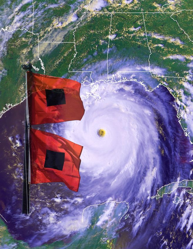
Gulf Coast Hurricane
   Preparedness
       2019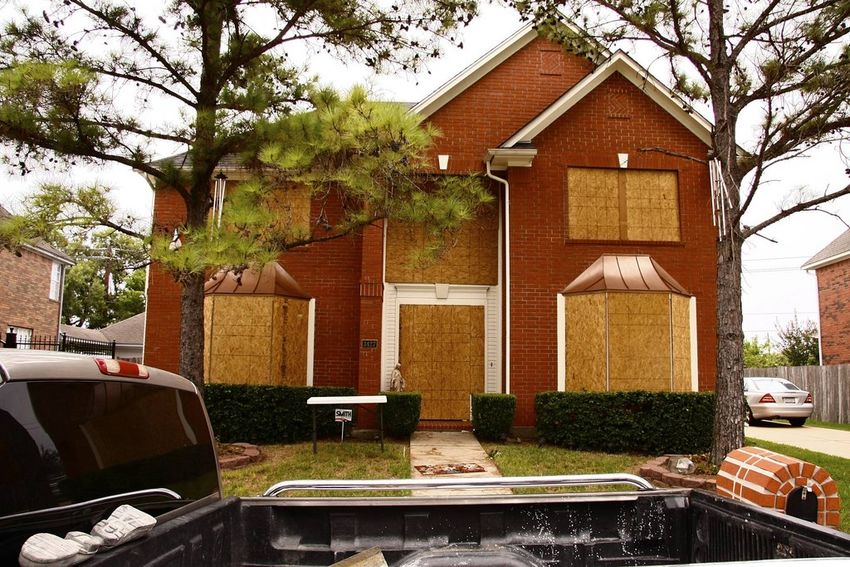
The Hurricane...................................... 3
                                                           We never want to wait until an emergency to figure out
Hurricane Forecasts & Advisories........ 4                 our plan of action. With the arrival of the 2019 Hurricane
                                                           Season, now is the time to ensure you have a plan for
Winds & Tornadoes ............................. 5          yourself and family when a hurricane threatens our area.
                                                           Do you know if you live in an area prone to storm surge?
Storm Surge......................................... 6     Do you know your evacuation zone? Do you have an
                                                           emergency preparedness kit? These are questions every
Inland Flooding.................................... 8      coastal resident should ask themselves.
Rip Currents......................................... 9    It only takes one storm to impact your location for it to be
                                                           a bad year. For those new to the area or those long time
NOAA All Hazards Radio..................... 10             residents: we urge you to NOT be complacent, but be
                                                           prepared! This Preparedness Guide is your resource to
Taking Care of Pets ............................. 11       learn about threats associated with tropical storms and
                                                           hurricanes and how you can prepare.
Planning & Preparation........................ 12          Please know your National Weather Service in Mobile
                                                           will be there for you before, during, and after the storm,
Emergency Supply Kit.......................... 14          providing the latest storm information. I encourage you to
                                                           follow us on Facebook and Twitter @NWSMobile and on
Final Checklist...................................... 15   the internet at weather.gov/mob.
                                                                                Jason Beaman, Warning Coordination
Portable Generator Safety................... 16                                                   Meteorologist (WCM)
After the Storm..................................... 17

Additional Resources........................... 18

More Information………………………. 19

 Contents and Editing: National Weather Service Mobile

                                                                2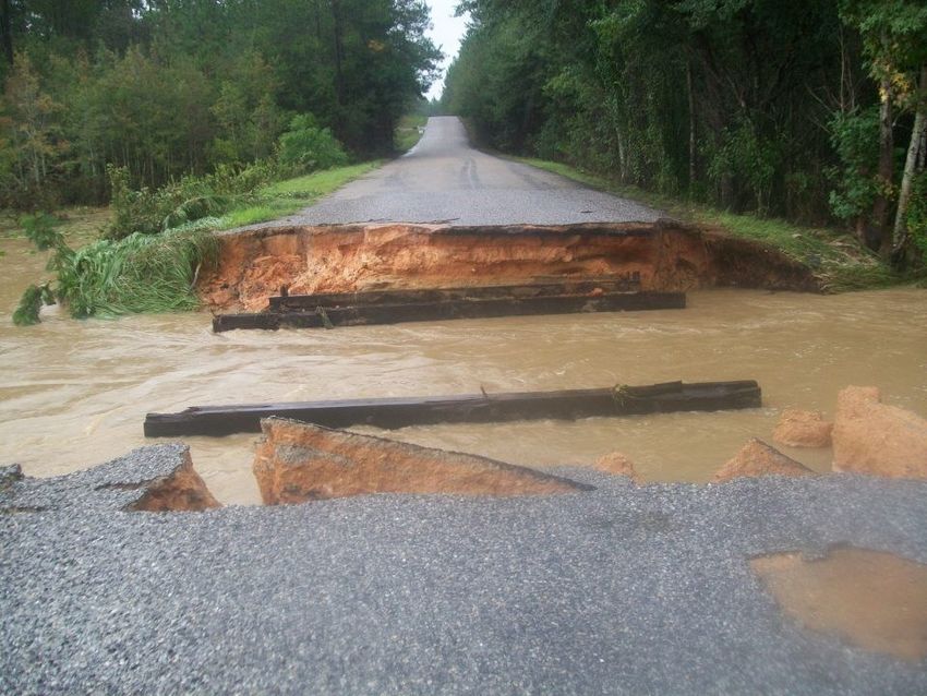
Hurricanes and tropical storms form over warm ocean
waters, like those found in the Gulf of Mexico, during the
summer and autumn each year.
On average, 11 tropical storms (6 of which strengthen to
hurricanes) develop in the Atlantic basin each hurricane
season.
Hurricane season is June 1st through November 30th.
Peak of hurricane season occurs in August and Septem-
ber for interior southeast Mississippi, southwest Alabama
and the western Florida panhandle.

                                                  Keep in mind, hurricanes can strike any month
                                                  during hurricane season.
                                                  Eleven hurricanes have either directly impacted or
                                                  had moderate impacts to interior southeast
                                                  Mississippi, southwest Alabama and western
                                                  Florida panhandle coast since 1990.
     Peak of Season Points of Origin & Tracks
              Courtesy: NOAA/NHC

Everyone along the central Gulf Coast
needs to be prepared for hurricanes
and tropical storms!
While the greatest damage resulting from
land-falling hurricanes or tropical storms is
along the coast near the strongest winds
and storm surge; inland areas experience
destructive winds, tornadoes and flooding
from heavy tropical rains.

          ALL Hurricane Strikes 1900-2010                    MAJOR Hurricane Strikes 1900-2010
                  Courtesy: NHC                                      Courtesy: NHC

                                                   3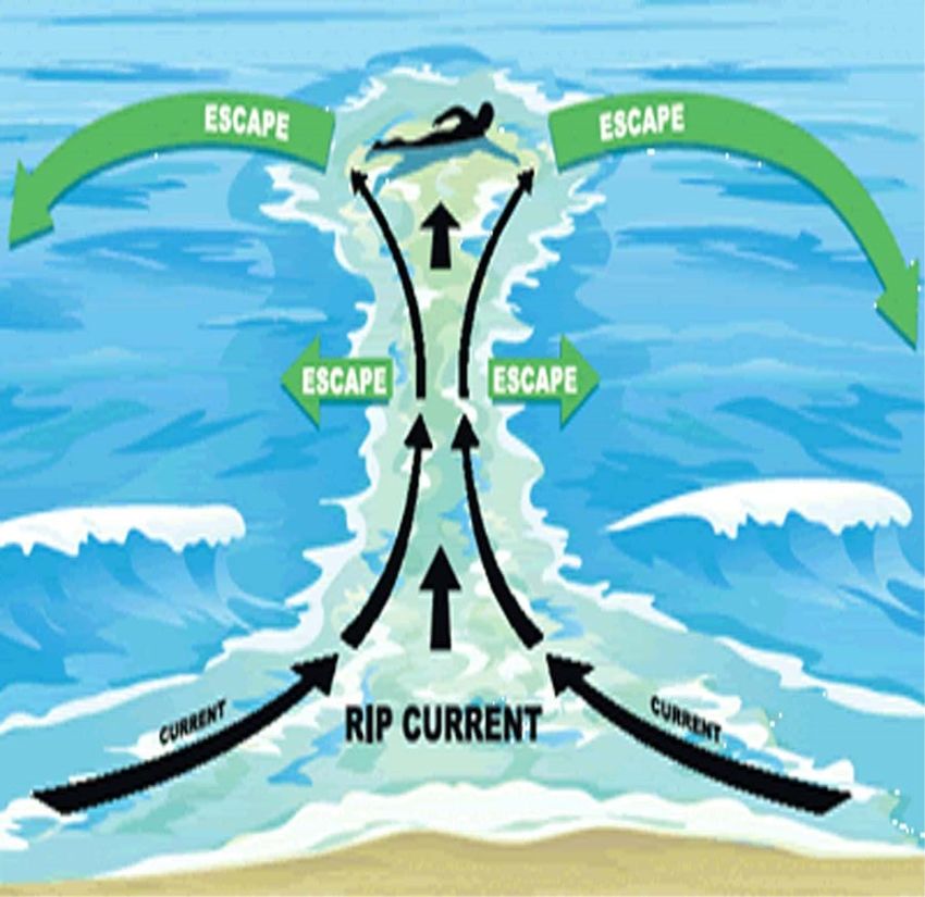
Tropical Watches and Warnings                            Common Tropical Cyclone
                                                         Products
Hurricane/Tropical Storm Watch:
                                                         • Tropical Weather Outlook (48 hour & 5 day)
Tropical Storm and/or Hurricane conditions
POSSIBLE in the Watch Area. Issued 48 hours              • Public Advisories
in advance of the onset of tropical storm force
winds.                                                   • Forecast Discussions
                                                         • Hurricane Local Statements (LOCAL impacts)
Hurricane/Tropical Storm Warning:
Tropical Storm and/or Hurricane conditions
EXPECTED in Warning area. Issued up to 36
hours in advance of onset of tropical storm force
                                                         Using and Interpreting the NHC
winds.                                                   Forecast Advisories
Extreme Wind Warning (EWW):                              The white uncertainty cone of the forecast
Short duration warning for the onset of extreme          advisory represents the 5-year average error.
sustained winds (115 mph+) associated with the
eyewall of a major hurricane. This is a final call       The center of the tropical cyclone will remain in
to SHELTER IN PLACE.                                     the white error cone 67% of the time.

                                                         REMEMBER: Hurricane conditions can be felt
                                                         100s of miles from the center of the storm.

                                                         DO NOT focus solely on the exact forecast
                                                         track!

                                                         DO NOT wait for a Hurricane Watch or Warning
                                                         to be issued before implementing initial prepar-
                                                         edness preparations — it may be too late!!

   Example of a Extreme Wind Warning Polygon

Storm Surge Watch:
The possibility of life threatening inundation
from rising water moving inland from the shore-
line somewhere within the watch area, generally
within 48 hours.
Storm Surge Warning:
The danger of life threatening inundation from
rising water moving inland from the shoreline
somewhere within the watch area, generally
within 48 hours.

                                                     4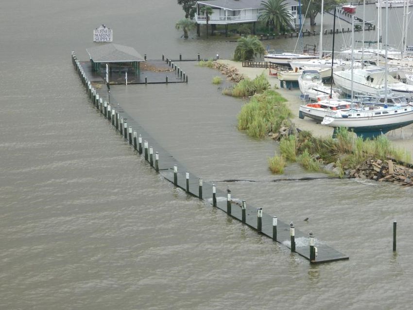
Hurricane force winds of 74 mph or greater can destroy buildings, mobile homes, power lines and
trees. Debris such as signs, roofing material and siding, as well as small items left outside, become
dangerous flying missiles during a hurricane.
Winds associated with a hurricane are most intense near the center of the storm, in a region called
the eyewall. As a hurricane moves inland, winds begin to rapidly decrease, but hurricane force winds
can be felt 150 miles inland from the coast.
General rule-of-thumb: wind speed will decrease by 50% within the first 12 hours of landfall. The
faster the hurricane is moving, the further inland the hurricane force winds will be experienced.

                                               To minimize the damage from wind, it is imperative to
                                               ensure that your home is well constructed .
                                               MOBILE HOME RESIDENTS MUST EVACUATE!!!
                                               No mobile home or manufactured home can provide safe
                                               shelter from hurricane force winds.
                                               Straps and other tie-downs will not protect a mobile
                                               home from high winds associated with a hurricane.
                                               Mobile home residents must evacuate when told to do
                                               so by local authorities.

 Category 3+ is considered a MAJOR hurricane
                                             Hurricanes can
produce tornadoes. Tornadoes are most likely to occur in
the right-front quadrant of the hurricane, and are often em-
bedded in the rainbands away from the center of the storm.
However, they can also occur near the eyewall.
Nearly 70% of land-falling hurricanes produce at least one
tornado, 40% spawned 3+ tornadoes and some even
spawned tornado outbreaks.
In 2004, Hurricane Ivan, which made landfall along the Ala-
                                bama Gulf coast, spawned
                                117 tornadoes over a 3
                                day period!
                                    Tornadoes produced by
                                    tropical cyclones are typically weak, EF0 to EF1 & short-lived. Tor-
                                    nadoes associated with hurricanes are generally less intense than
                                    those that are produced by supercell thunderstorms, but when add-
                                    ed to the larger area of hurricane-force winds, they can still pro-
                                    duce substantial damage and be
                                    potentially deadly.

             Foley, AL

                                                     5
Storm surge is the wall of water pushed toward the shoreline as a hurricane moves ashore. Storm
surge poses the greatest threat to life and property along our coast. Historically, storm surge claims
nine out of ten victims along the shoreline.
Storm surge is highest near and just to the right of where the eye of the hurricane crosses the coast.
The advancing surge combines with the normal tides to create what is known as the storm tide. A
major hurricane can produce a storm tide which is tens of feet higher than normal water levels.
Wind driven waves superimposed on top of storm tide can cause significant damage to structures
along the immediate coast. Many buildings can actually withstand hurricane force winds until their
foundations fail (undermined by erosion).
                                                                          Water level rise can cause
                                                                          severe flooding in coastal
                                                                          areas, especially when the
                                                                          storm tide coincides with
                                                                          normal high tide.
                                                                          In general, the more intense
                                                                          the hurricane and closer a
                                                                          community is to the center,
                                                                          right quadrant of a storm,
                                                                          the more destructive the
                                                                          storm surge.

There are a number of factors that determine maximum
storm surge for any location along the coast: forward
speed and size of the hurricane, angle of approach to
the coast, central pressure of the storm, and coastal
feature shape and characteristics, such as bays and
estuaries.
When making landfall, there is always uncertainty in the
intensity and exactly where the storm will make landfall.
Emergency managers and local officials balance that
uncertainly with the human and economic risks to their
community. This is why most emergency managers plan
for one category higher than what is forecast. This is a
reasonable precaution to help minimize the loss of life
from hurricanes.
Those living near and in coastal areas should know
the evacuation zone for their residence.
When local officials declare an evacuation for your
zone, move to the nearest possible evacuation
destination outside of the danger zones.

                                                   6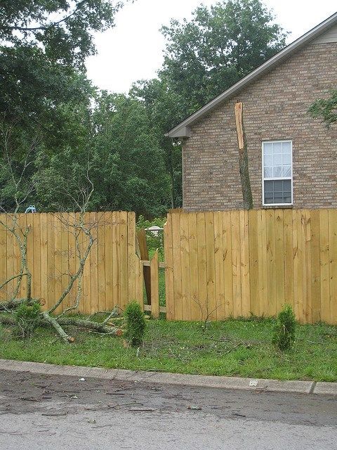
10 Tips to Be Ready!
                                From the National Hurricane Center
1. Storm surge is often the greatest threat
   to life and property from a hurricane. It
   poses a significant threat for drowning.
   Six inches of fast-moving flood water
   can knock over an adult. Two feet of
   rushing water to carry away most
   vehicles — including SUVs.
2. Storm surge can cause water levels to
   rise quickly and flood large areas —
   sometimes in just minutes, and you
   could be left with no time to take action
   if you have not already evacuated.
3. Storm surge values do not correspond
   well to the hurricane wind categories
   (Saffir-Simpson Hurricane Wind Scale)
   that range from 1 to 5. These categories
   are based only on winds and do not          If a tropical storm or hurricane is threatening your community,
   account for storm surge.                    go to www.hurricanes.gov to see a map like this, which will
                                               show potential storm surge flooding for your area
4. Tropical storms, category 1 or 2
   hurricanes, major hurricanes (category
   3 to 5) and post-tropical cyclones can      Know Your Maps, Know Your Zone!
   ALL cause life-threatening storm surge.    The Potential Storm Surge Flooding map is different
5. Storm surge can occur with non-tropical    from FEMA flood insurance rate maps and hurricane
   storms like Nor’easters and winter storms. evacuation zone maps.
                                              • You do not have to live in a floodplain to experience
6. Many U.S. Gulf and East Coast areas           storm surge from a hurricane or other storm
   are vulnerable to storm surge, including
                                              • Evacuation zones can be established for many public
   areas up to several miles inland from the     safety reasons & differ from areas shown on this map
   coastline. Find out today if you live in a
   storm surge evacuation zone.               Find out if you live in a hurricane evacuation zone!
7. Storm surge can occur before, during or
   after the center of a storm passes through an area. Storm surge can cut off evacuation routes, so
   do not delay leaving if an evacuation is ordered for your area.
8. During the peak of storm surge, emergency responders will likely not be able to reach you if you
   are in danger.
9. Even if your community is not directly affected by storm surge, it could experience other hazards
   from the storm such as impassable roads, water and sewage problems and power outages.
   If power remains on, downed electrical wires can pose an electrocution risk.
10. Weather conditions and the forecast can change. Local officials could issue evacuation or other
    instructions for many different reasons. Always follow the instructions of local officials.

                                                  7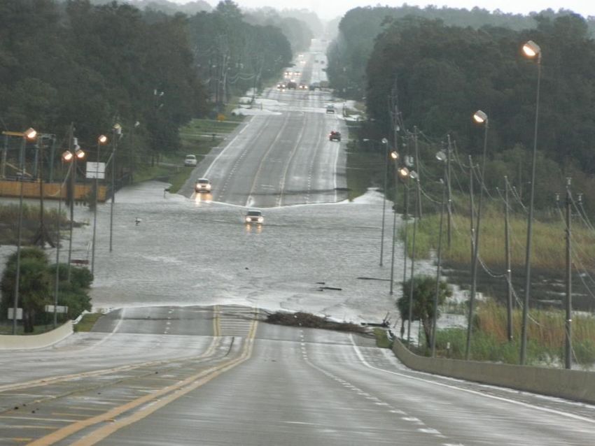
When it comes to hurricanes, wind and storm surge are only part of the story. Heavy rain and the
resultant inland freshwater flooding are equally as dangerous and destructive. In fact, behind storm
surge, rainfall induced flooding is by far the next most dangerous and destructive hazard associated
with tropical cyclones.
                                                Intense rainfall is not directly related to the intensity of
                                                a tropical cyclone. In fact, some of the greatest rainfall
                                                amounts have occurred during weaker storms that
                                                slowly drift or stall over an area.

                                                Very slow moving tropical storms and hurricanes can
                                                produce tremendous amounts of rain in a relatively
                                                short period of time. This often results in disastrous
                                                flooding, which can be a major threat to communities
                                                hundreds of miles from the coast.

What Can You Do?
• When you hear hurricane or tropical storm, think
  inland flooding
• Develop a flood emergency plan
• Determine if you live in a potential flood zone
• If advised to evacuate, do so immediately
• Keep abreast of road conditions through the media                                Brewton, AL
                                                                    Courtesy of Alabama Forestry Commission
• Move to a safe area quickly before access is cut off
  by the flood waters
• Do not attempt to cross flowing water on foot or in any vehicle
• Have flood insurance as flood damage is not usually covered by homeowners insurance
  NEVER drive across flooded roads or around barricades!
                                                                            Rule of Thumb:
                                                                            Do not drive through the water
                                                                            if you cannot see the road or
                                                                            the road markers. The road
                                                                            could be washed away or large
                                                                            debris could be located below
                                                                            the surface.
                                                                            Abandon your vehicle
                                                                            immediately and seek higher
          Lucedale, MS                          Mobile, AL                  ground if caught in rising water.
     Courtesy of Jackie Dunlap             Courtesy of Anna Mills

                                                    8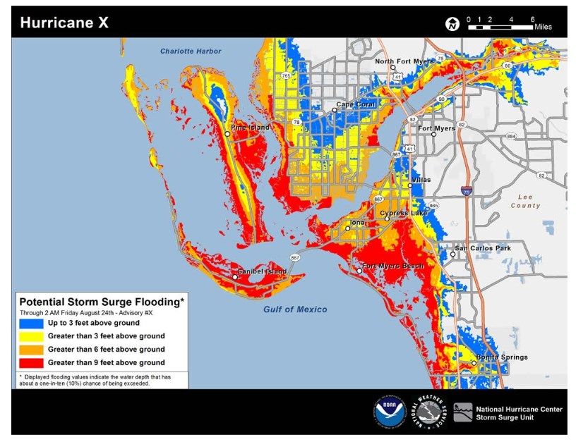
Rip currents are strong currents or channels of rapidly
                                          flowing water moving AWAY from the shore.
                                          Rip currents develop when excess water is piled against the
                                          shoreline during certain weather patterns.
                                          While rip currents can form at anytime, they are very likely
                                          to be present in high winds and rough seas that accompany
                                          tropical storms and hurricanes.
                                          Beachgoers should stay out of the water when a storm is
                                          approaching.

A tropical cyclone does not have to be directly affecting
the area for rip currents to develop along our coastline.
Anytime a tropical system is in the Gulf of Mexico, large
swells and above normal tides could combine to produce
dangerous rip currents along the beaches ahead of the
storm. As a result, beachgoers are at risk of getting
caught in a rip current even though the weather appears
tranquil and no evacuation orders have been given.

If Caught In A Rip Current
• DO NOT fight the current
• Swim out of the current, then back to shore
• If you can not escape, float or tread water
• If you need help, call or wave for assistance

Both Florida and Alabama use the 5 flag system to alert
beachgoers of surf conditions. Flags are posted at all
public beaches, where surf conditions and rip currents
are monitored throughout the day.
Red Flags means conditions are life threatening to
anyone entering the surf.
Remember: the absence of red flags does not assure
safe conditions.
In some locations, it is illegal to enter the water when
double red flags are being flown.

                                                    9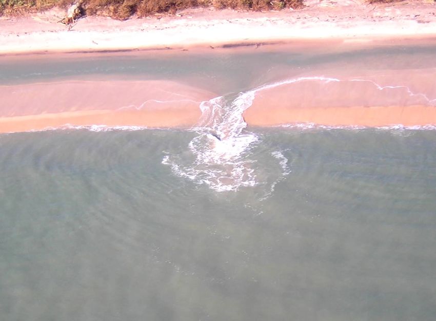
NOAA Weather Radio All Hazards (NWR) is the official voice of the National
Weather Service. NWR provides continuously updated weather information, 24
hours a day, 365 days a year.
Watches, warnings, advisories, forecasts, current weather conditions and
climate data are broadcast in 3-5 minute cycles on NWR stations.
A special radio capable of receiving signals in the Very High Frequency (VHF)
public service radio band is required to listen to NWR broadcasts. 7 frequen-
cies from 162.400 to 162.550 MHz are used. Weather radios can be purchased at most electronics
stores and online. Prices of these radios vary and depend based on the type of radio.
NOAA Weather Radio is useful anytime, but becomes especially important during severe weather.
During threatening weather, normal broadcasts are interrupted and the focus shifts to local severe
weather. Watches and warnings are given the highest priority with frequent updates.
NWS is a major part of the Emergency Alert System (EAS) that disseminates warning information
rapidly through commercial broadcast outlets. In an emergency, each NWR station will transmit a
warning alarm tone followed by information on the emergency situation. This signal is capable of
activating specially designed receivers by increasing the volume or producing a visual and/or audible
alarm. Not all weather radios have this capability, but all weather radios can receive the emergency
broadcasts.
The maps below show the locations of NOAA Weather Radio transmitters located in our area.

                     Transmitters in south Mississippi           Transmitters in south Alabama & west Florida

More Resources:
For SAME codes, visit:
                                                                  NWR Area Listings
                                                              KEC-61         Mobile, AL         162.550 MHz
weather.gov/nwr/coverage/county_coverage.html                 KEC-86         Milton, FL         162.400 MHz
For more local NOAA Weather Radio                              KIH-59        Dozier, AL         162.550 MHz
information, visit our website:                               WNG-607      Greenville, AL       162.425 MHz
www.weather.gov/mob/?n=nwr                                    WNG-640     Leakesville, MS       162.425 MHz
                                                              WNG-646       Brewton, AL         162.475 MHz
                                                              WWF-55        Jackson, AL         162.500 MHz

                                                         10
You must plan ahead to be sure you can properly care for your pet during a weather emergency or
an evacuation. Your plan should include all family members, including pets!
A Few Planning Suggestions
• Take Your Pet — If you must leave your home, take your pet with you if at all possible. You are
the best person to take care of your pet. Think about it: if the situation is dangerous for you then it
is likely just as dangerous for your pet.
• Where To Take Your Pet — Before you leave, know where you can take your pet. Find out which
motels or hotels are “pet friendly” or which will accept your pet in an emergency. Plan to go to a
friend or relative’s house who will allow you to bring
your pet.
• Crate — Before you travel, ensure your pet is used to
a crate. Familiar surroundings can help ease anxiety
in your pet. Getting your pet into a crate for travel will
be easier once your pet is used to the crate, too.
• Disaster Kit — Make sure to pack your pet’s food,
medicines, vaccination records and pet insurance
information (if you have a policy). Assemble this into
a disaster kit you can quickly grab.
• Pre-Arrangements — If you get stuck away from your
home, your pet will be better off if you made pre-
arrangements with a neighbor or friend to take care
of your pet. This temporary caretaker should have a list of phone numbers to reach you and in-
structions to properly care for your pet. Your
instructions should include a signed authorization for veterinary care and financial limits to the
veterinary care.
• Behavior — Emergencies can cause pets display unexpected and/or uncharacteristic behaviors.
Well-behaved pets may become aggressive and defensive after a major disruption in their lives.
Your pet may not return to their usual behavior for several weeks. Use caution when releasing
your pet after an emergency, especially in unfamiliar
surroundings. Ensure that your pet cannot escape.
Do not release your pet outside until you know the
area is safe. Allow your pet plenty of time
to rest and get used to new surroundings. Provide
familiar toys, if possible.
More Resources:
FEMA/Ready.gov Pet Website:
www.ready.gov/animals
Red Cross Pet Website:
www.redcross.org/prepare/location/home-family/pets
11Home Preparation Tips for Hurricane Season
Mobile Homes
• Check tie-downs for rust or breakage
Landscaping
• Trim trees, shrubbery and dead limbs (especially near your home)
• Repair or replace broken or damaged fences
• Shredded bark is preferred for landscaping instead of small
gravel or stone bedding
Roofing
• Inspect roof for loose tiles, shingles or debris. Consider
replacing old or damaged shingles with new ones rated for
hurricane force winds
• Check and install hurricane clips to secure roof trusses to side walls
• Clear clogged rain gutters and downspouts.
Doors
• Reinforce garage doors and tracks or replace with a
hurricane tested garage door
Courtesy of LAS Enterprises
• Reinforce double entry doors with heavy duty foot and
head bolts
• Use a security dead bolt with a 1” minimum bolt length
• Doors can be shuttered, but one entry must be left
easily accessible
Windows
• Install tested/manufactured hurricane shutters. Inspect existing
shutters to ensure good condition.
• Alternative: Use 5/8” or greater exterior grade plywood secured
by 2 ½” screws or special clips. Obtain wood and fasteners; cut
wood to size (labeling pieces); pre-drill holes; place anchors on
home.
• Store shutters or plywood lying flat to avoid significant warping
when not in use
12Protecting Your Boat — Tips for Boat Owners
• Check your marina contract for any hurricane
procedures and policies
• Check with your boat manufacturer for the proper
way to secure your boat during a tropical storm or
hurricane
• Consider moving arrangements well in advance
• Trailer boats should be removed from the water
and securely stored at least 48 hours before a
tropical storm or hurricane are expected to make
landfall
• Purchase necessary hurricane materials: additional
mooring lines, crew anchors, fenders, fender boards,
chafing gear and anchors
• Safe storm moorings should consist of good
condition ropes of a sufficient diameter and
length with at least 3-4 substantial anchor
points
• Do NOT moor parallel to bank. Receding tides
often breach and/or capsize boats in this type
of anchorage.
More Marine Safety Resources:
www.hurricanes.gov/prepare/marine.php
Dog River Marina, Mobile, AL
Courtesy of Anna Mills
Important Tips for Automobiles
• Make sure to have your vehicles serviced regularly
and in good working order during hurricane season so
it will be ready for use should you need to evacuate.
• Keep your gas tank full.
• Make an emergency kit specifically for your vehicle.
Include jumper cables, flashlight, cell phone charger,
first aid kit, water, snacks, etc.
More Vehicle Tips: www.ready.gov/car
13□ Water — at least 1 gallon daily per person
for 3 to 7 days □ Flashlight & Batteries
□ Food — enough for at least 3 to 7 days □ Keys
•Non-perishable packaged or canned food
and juices □ Vehicle fuel tanks filled
• Food for infants or the elderly
• Snack foods □ Cell phone — Fully charged cell phone with
• Cooking tools, fuel, non-electric can opener extra battery, non-cordless telephone set
• Paper plates, plastic utensils
□ Cash (some small bills) — Banks and ATMs
□ Blankets, Pillows & Bedding, etc. may not be available for extended periods
□ Clothing □ Credit Cards
• Seasonal
• Rain gear □ Important Documents - waterproof container
• Sturdy shoes or watertight re-sealable plastic bag
• Insurance
□ First Aid Kit, Medicines and Prescriptions • Medical records
• Bank account numbers
□ Special Items - for babies and the elderly • Social Security card
□ Toiletries and Hygiene items
□ Moist towelettes, garbage bags and plastic
ties for personal sanitation
□ Items for Children
• Toys
• Books
• Games
□ Tools - keep a set with you during the storm
□ Pet Care Items
• Proper identification, immunization records,
medications
• Ample supply of food and water
• Carrier or cage
• Muzzle and leash
□ NOAA Weather Radio — Battery operated
14Actions to Take When a Storm is in the Gulf of Mexico
□ Listen to radio, TV and/or NOAA Weather Radio for forecasts of the storms progress
□ Double check items in your emergency supply kit
□ Fuel and service your vehicles
□ Inspect and secure mobile home tie-downs
□ Make sure you have supplies to survive for at least 72 hours, but preferably for up to one week
□ Board up windows (if shutters do not exists). Do not use tape, it provides no protection
□ Store lawn furniture and loose, lightweight objects (garbage cans, patio plants, garden tools)
□ Get plenty of extra cash in case power goes out and ATM’s do not work
□ Store vehicles that are not being used
□ Follow instructions issued by local officials. EVACUATE IMMEDIATELY IF ORDERED!
Final Actions to Take (if Leaving)
□ Turn off propane tanks
□ Unplug small appliances. Turn refrigerator and freezer to coldest setting
□ Turn off utilities (if ordered)
□ Notify family members of your evacuation plans
□ Lower water level in swimming pool by one foot
□ Lock home securely
□ Board doors and brace garage door
□ Take pets with you
Final Actions to Take (if Staying)
□ Close storm shutters
□ Turn refrigerator and freezer to coldest setting and open only if necessary. (Note: 25 pounds of
dry ice will keep a 10-cubic foot freezer below freezing for 3-4 days)
□ Follow instructions from emergency managers and be prepared to turn off utilities if ordered
□ Board doors (leave an emergency exit), brace garage door and remain inside. Stay away from
boarded windows
□ Take refuge in a predetermined safe room, such as an interior closet, bathroom or hallway
□ Beware of calm wind in the eye of the storm. Do not venture outside as the strongest winds may
occur shortly after the eye passes.
DO NOT EXPECT EMERGENCY RESPONDERS TO BE OF ANY ASSISTANCE
DURING A LANDFALLING HURRICANE!
15After a hurricane, primary electrical power will likely be off for hours or days. During this time, many
people use portable power generators to run essential utilities such as lighting, air conditioning and
refrigeration.
Every year people are injured or killed in incidents related to portable generator use.
The primary hazards to avoid when using a portable generator are carbon monoxide (CO) poisoning
from the engine exhaust, electrical shock or electrocution, and fire.
Follow the directions supplied with the generator!!
Generator Usage Tips for When a Disaster Strikes:
• NEVER use portable generators INDOORS
• This includes garage, basement, carport,
crawlspace or other enclosed or partially-
enclosed area (even with ventilation)
• Using fans or opening windows or doors
will not prevent buildup of CO in your home
• Even if you cannot smell exhaust fumes,
you may be exposed to CO
• If you feel sick, dizzy or weak while using
a generator, get fresh air RIGHT AWAY,
DO NOT DELAY!
• Place generator AWAY from windows,
doors and vents that allow CO to come
indoors Courtesy of Consumer Product Safety Commission
• Keep the generator dry and do not use in rain or wet conditions
• To protect the generator from moisture, operate it on a dry surface under an open canopy-like
structure, such as under a tarp held up by poles.
• Dry your hands if wet before touching the generator.
• Turn the generator off and let it cool down before refueling
• Plug appliances directly in the generator or use a heavy duty, outdoor-rated extension cord
that is rated (watts or amps) at least equal to the sum of the connected appliance loads
• The cord must be free of cuts or tears and the plug must have all three prongs (especially a
grounding pin)
• Never power the house wiring by plugging the generator into a wall outlet, a practice
known as “backfeeding”. This is an extremely dangerous practice that presents an
electrocution risk to utility workers and neighbors served by the same utility transformer.
Generator Safety: www.redcross.org/prepare/disaster/power-outage/safe-generator-use
16IF EVACUATED, WAIT FOR “ALL CLEAR” FROM CITY / COUNTY / STATE OFFICIALS
BEFORE RETURNING HOME. PREPARE TO SHOW PROOF OF RESIDENCE.
General
□ Be cautious of structural damage and downed trees and/or power lines. Do not move structural
supports or large pieces of debris
□ DO NOT run power generators indoors. Ensure exhaust is well ventilated
□ DO NOT use open flames indoors
□ Restrict driving to emergency use only. Road conditions unsafe until road debris is cleared
Debris
□ Cities and counties will provide a schedule and instructions for debris pick-up and removal.
Debris usually cannot be removed from private property
□ Construction materials, vegetative debris, household hazardous waste and household appliances
will need to be placed into separate piles and moved to the curbside for pick-up
Water
□ Use bottled, boiled or treated water until you know that your water supply is safe
□ You can use household chlorine bleach to treat water for drinking or cleaning. Add 1/8 teaspoon
of bleach per gallon of clear water (¼ teaspoon of bleach per gallon if cloudy water). Allow water
to stand 30 minutes before using
Utilities
□ Check for gas leaks. If you smell or hear gas leaking, leave immediately. DO NOT use the phone
or turn on lights in your home. Call the gas company from a neighbor’s phone
□ Report any visible damage to electrical lines to the power company. Turn off power at main
breaker if any electrical equipment or circuits have been exposed to water
□ DO NOT connect generators to your home’s electrical circuits. If a generator is online when
electrical service is restored, it is a major fire hazard
Sewage
□ If you suspect water or sewage lines are damaged, do not use plumbing (toilets, sinks). Contact
the water company or a plumber
Interior Cleanup
□ Disinfect and dry interior buildings and inside items to prevent growth of bacteria, viruses, mold
and mildew that can cause illness
□ Clean walls, floors and counter tops with soap and water. Disinfect with a solution of 1 cup bleach
to 5 gallons of water
□ Wash all clothes and linens in hot water. Air dry and spray un-washable items with disinfectant.
Steam clean carpets. Throw away items touched by water than cannot be disinfected
17Coastal Alabama Counties — Emergency Management
□ State of Alabama
www.ema.alabama.gov
□ Mobile County
www.mcema.net
□ Baldwin County
www.baldwincountyal.gov/departments/EMA
Northwest Florida Counties — Emergency Management
□ State of Florida
www.floridadisaster.org
□ Escambia County
www.myescambia.com/beready
□ Santa Rosa County
www.santarosa.fl.gov/emergency
□ Okaloosa County
www.co.okaloosa.fl.us/ps/emergency-management
18Jeffrey Medlin (Meteorologist In Charge)
Jason Beaman (Warning Coordination Meteorologist)
Don Shepherd (Tropical Outreach & Preparedness)
John Purdy (Tropical Operations)
8400 Airport Blvd, Bldg 11
Mobile AL 36608
Phone: 251-633-6443
www.weather.gov/mob
Useful Websites:
National Weather Service, Mobile, AL
www.weather.gov/mob
National Hurricane Center (NHC)
www.hurricanes.gov
Social Media:
19You can also read