Integrating the
Planning of
Airports and
the City:
The Singapore Story
←
→
Page content transcription
If your browser does not render page correctly, please read the page content below

Integrating the Planning of Airports and the City: The Singapore Story
Urban Systems Studies Books

                                 Water: From Scarce Resource to National Asset

                             Transport: Overcoming Constraints, Sustaining Mobility

                          Industrial Infrastructure: Growing in Tandem with the Economy

                        Sustainable Environment: Balancing Growth with the Environment

                                  Housing: Turning Squatters into Stakeholders

                          Biodiversity: Nature Conservation in the Greening of Singapore

                        Financing a City: Developing Foundations for Sustainable Growth

                     Land Acquisition and Resettlement: Securing Resources for Development

                        Built by Singapore: From Slums to a Sustainable Built Environment

                               Planning for Tourism: Creating a Vibrant Singapore

                           Cleaning a Nation: Cultivating a Healthy Living Environment

                            Urban Redevelopment: From Urban Squalor to Global City

                               Port and the City: Balancing Growth and Liveability

                 The Active, Beautiful, Clean Waters Programme: Water as an Environmental Asset

                Working with Markets: Harnessing Market Forces and Private Sector for Development

                                      A City of Culture: Planning for the Arts

                  Sino-Singapore Guangzhou Knowledge City: A New Paradigm in Collaboration

           Land Framework of Singapore: Building a Sound Land Administration and Management System

                         Integrating Land Use & Mobility: Supporting Sustainable Growth
                                                                                                                  Integrating the
               Engaging Well, Forging Bonds: The Community as Stakeholders in Urban Development

                          Food and The City: Overcoming Challenges for Food Security                            Planning of Airports
                                                                                                                    and the City:
                             Technology and the City: Foundation for a Smart Nation

                             Energising Singapore: Balancing Liveability and Growth

                                                                                                                The Singapore Story
                         one-north: Fostering Research, Innovation and Entrepreneurship

                                            Planning for a Secure City

                         Past, Present and Future: Conserving the Nation’s Built Heritage

                                    The Rule of Law and Urban Development

For product                         URBAN SYSTEMS                                     CLC PUBLICATIONS
information,                        STUDIES SERIES                                    https://www.clc.gov.sg/
visit
                                    www.clc.gov.sg/research-                          research-publications/
                                    publications/publications/                        publications/books
                                                                                                                    First Edition, Singapore, 2019
                                    urban-systems-studies
Integrating the Planning of Airports and the City:                                                                                                                   iv          v
                The Singapore Story

                                                                                                                     CONTENTS
Editorial Team
Writer:                              Cheong Kay Teck
Research Supervisors:	Choy Chan Pong
                                     Michael Koh                                                                     Foreword					                                                                   vii
Editor:	Wu Wei Neng                                                                                                 Preface					                                                                    ix
Designer:                            Redbean De Pte Ltd                                                              Acknowledgements		                                                              xi
Production Supervisor:	Eunice Rachel Low                                                                            The Singapore Liveability Framework                                             xii

                                                                                                                     Chapter 1	Background and Evolution of Singapore’s International Airport          1
                                                                                                                     		         •	Singapore’s Early Airports: Seletar, Kallang and Paya Lebar        2
© 2019 Centre for Liveable Cities
All image rights are owned by CLC except where indicated otherwise                                                   			          Early Military Airports in Singapore                               4
                                                                                                                     		         •	Growing Need for a Bigger and Better Equipped Airport              11

                                                   CLC is a division of                                              Chapter 2	Major Decisions and Plans: The Changi Move                       13
                                                                                                                     		         •	Paya Lebar or Changi? That Was the Question                   14
Set up in 2008 by the Ministry of National Development and the Ministry of the Environment
                                                                                                                     			           Inclination to Keep Changi for Military Air Base Use         17
and Water Resources, the Centre for Liveable Cities (CLC) has as its mission “to distil, create                      		         •	Advantages of Having the Airport at Changi                    23
and share knowledge on liveable and sustainable cities”. The CLC’s work spans four main                              			           Extensive Preparations for the Big Move to Changi Airport    26
areas—Research, Capability Development, Knowledge Platforms, and Advisory. Through these
activities, the CLC hopes to provide urban leaders and practitioners with the knowledge and                          Chapter 3	Planning for Airports and City Growth                            29
support needed to make our cities better. For more information, please visit www.clc.gov.sg.                         		         •	Long-term Planning to Accommodate Airport                     30
Research Advisors for the CLC’s Urban Systems Studies are experts who have generously                                              Developments
provided their guidance and advice. However, they are not responsible for any remaining                              		         •	Capitalising on the Legacy of British Air Bases               32
errors or omissions, which remain the responsibility of the author(s) and the CLC.
                                                                                                                     		         •	Impact of Airport Developments on Urban Land Use              33
                                                                                                                     			          Sport and Recreation Land Use under Flight Paths              38
For product information, please contact                                                                              		         •	Leveraging Accessibility to the Airport for                   39
CLC Publications                                                                                                                   Urban Development
+65 66459576
                                                                                                                     		         •	Economic Strategy for Land Use around Airports                44
Centre for Liveable Cities
45 Maxwell Road #07-01                                                                                               		         •	Positioning Singapore as an Air Hub to                        52
The URA Centre                                                                                                                     Promote Tourism and Air Logistics
Singapore 069118
MND_CLC_Enquiries@mnd.gov.sg                                                                                         Chapter 4	Airport Planning and Development: Future Challenges              59
                                                                                                                     		         •	Building on Past Achievements and Navigating                  60
ISBN 9
      78-981-14-1386-5 (print)                                                                                                    More Complex Land-Use Trade-offs
ISBN 9
      78-981-14-1385-8 (e-version)
                                                                                                                     		         •	Seletar Aerospace Park for Industrial Growth                  62
All rights reserved. No part of this publication may be reproduced, distributed, or transmitted in any form or by    		         •	Relocation of Paya Lebar Air Base                             68
any means, including photocopying, recording, or other electronic or mechanical methods, without the prior           		         •	Building Tengah New Town                                      70
written permission of the publisher.
                                                                                                                     		         •	Further Expansion of Changi Airport                            71
Every effort has been made to trace all sources and copyright holders of news articles, figures and information in
this book before publication. If any have been inadvertently overlooked, CLC will ensure that full credit is given   Chapter 5   Conclusion                                                          75
at the earliest opportunity.
                                                                                                                     Post-script					                                                             80
Cover:
Aerial photo of Changi Airport © Singapore Press Holdings. Permission required for reproduction.                     Timeline					                                                                82
                                                                                                                     Endnotes					                                                                92
                                                                                                                     Bibliography				                                                            100
                                                                                                                     Appendix 					                                                              106
Integrating the Planning of Airports and the City:                                                                       vi         vii
The Singapore Story

                                                     FOREWORD
                                                     Sited at the crossroads of major shipping sea lanes and being a centre
                                                     of free trade, Singapore has been a strategic sea and air gateway for
                                                     traders from around the world since its days as a British colonial trading
                                                     post. However, while the country has also been fortunate to have good air
                                                     connectivity along major air trunk routes, it did not become an important
                                                     air junction by chance.

                                                     Early on, Singapore’s first airports were set up for the protection of
                                                     commercial interests and in defence of an important colonial seaport.
                                                     Major parts of the island had not yet been developed and were covered in
                                                     jungle. The airports were thus sited close to the fringes of the city centre
                                                     instead of at the island’s outermost fringes.

                                                     Post-independence, urban planners began to consider how airports could
                                                     both leverage the growth in air traffic as well as safeguard the nation’s
                                                     air defence needs. Airports support economic activities by generating
                                                     foreign trade, investments and tourism, while also facilitating the
                                                     movement of cargo and people internationally.

                                                     Faced with other national priorities competing for land, such as housing,
                                                     job creation, education and infrastructure, building a brand new and
                                                     costly airport would be a huge undertaking. The choice to build Changi
                                                     Airport and to reinforce air defence needs at the five air bases inherited
                                                     from the British thus had far-reaching ramifications.

                                                     Today, as Singapore’s limited land becomes increasingly built-up and
                                                     used more intensively, the country faces the challenges of maintaining its
                                                     status as a successful air hub and safeguarding national security, while
                                                     continuing to grow its economy.
Integrating the Planning of Airports and the City:                                                                                         viii        ix
    The Singapore Story

Drawing upon published research and new interviews, Integrating the
Planning of Airports and the City: The Singapore Story documents the         PREFACE
integrated approach taken to plan and coordinate Singapore’s airports
                                                                             The Centre for Liveable Cities’ (CLC) research in urban systems unpacks
and urban development. This Urban Systems Study demonstrates how
                                                                             the systematic components that make up the city of Singapore, capturing
judicious, long-term planning has enabled Singapore to accommodate its
                                                                             knowledge not only within each of these systems, but also the threads
many airports and their associated constraints, while optimally making
                                                                             that link these systems and how they make sense as a whole. The studies
use of land near to and beyond the airports. These efforts will ensure
                                                                             are scoped to venture deep into the key domain areas the Centre has
dynamic economic growth and a better quality of life for citizens.
                                                                             identified under the Singapore Liveability Framework, attempting to
                                                                             answer two key questions: how Singapore has transformed itself into a
                                                                             highly liveable city over the last five decades, and how Singapore can
                                                             Lim Hock San    build on our urban development experience to create knowledge and
              President and CEO of United Industrial Corporation Limited     urban solutions for current and future challenges relevant to Singapore
      Former Director-General of the Civil Aviation Authority of Singapore   and other cities through applied research. Integrating the Planning of
                                                                             Airports and the City: The Singapore Story is the latest publication from
                                                                             the Urban Systems Studies (USS) series.

                                                                             The research process involves close and rigorous engagement of CLC
                                                                             researchers with our stakeholder agencies, and oral history interviews
                                                                             with Singapore’s urban pioneers and leaders to gain insights into
                                                                             development processes and distil tacit knowledge that has been
                                                                             gleaned from planning and implementation, as well as the governance of
                                                                             Singapore. As a body of knowledge, the Urban Systems Studies, which
                                                                             cover aspects such as water, transport, housing, industrial infrastructure
                                                                             and sustainable environment, reveal not only the visible outcomes of
                                                                             Singapore’s development, but also the complex support structures of our
                                                                             urban achievements.

                                                                             The Centre would like to thank the Civil Aviation Authority of Singapore,
                                                                             the Ministry of Transport, and all who have contributed their knowledge,
                                                                             expertise and time to make this publication possible. I wish you an
                                                                             enjoyable read.

                                                                                                                                      Khoo Teng Chye
                                                                                                                                    Executive Director
                                                                                                                              Centre for Liveable Cities
Integrating the Planning of Airports and the City:                                                                       x         xi
The Singapore Story

                                                     ACKNOWLEDGEMENTS
                                                     The Centre for Liveable Cities (CLC) extends special thanks to the
                                                     following interviewees (in alphabetical order) for their contributions:
                                                     Aloysius Arlando, Cheong Pak Chow, Fong Kok Wai, Goh Yong Kiat,
                                                     Dr John Keung, Kok King Min, Liew Mun Leong, Lim Eng Hwee, Prof
                                                     Lui Pao Chuen, Ong See Ho, Wong Woon Liong and Tan See Nin. The
                                                     Centre is also grateful to the following colleagues from the Civil Aviation
                                                     Authority of Singapore and the Ministry of Transport for their generous
                                                     and meticulous help and contributions: Belinda Ang, Bert Wee, Chun
                                                     Yang Ong, Faezah Ramli, Gabriel Chong, Ming Feng Neo, Nuraien Shinei,
                                                     Phua Puay Li, Satwinder Kaur, Tan Xiao Yi and Xin Jing Jing.

                                                     The researcher, Cheong Kay Teck, additionally thanks Choy Chan Pong
                                                     for his invaluable writing advice and inputs, Dr Hee Limin for her support
                                                     and motivation, Michael Koh for his insightful and candid accounts, Sia
                                                     Kheng Yok for his wise counsel, and Wu Wei Neng for his vital editorial
                                                     inputs, Wong Kai Yeng for his hearty contributions, as well as Eunice
                                                     Rachel Low and the design team for their assistance in the production of
                                                     this Urban System Study.

                                                     Finally, the researcher would like to thank Cherub Ho, Grace Lau,
                                                     Gurubaran Subramaniam, Hazelina Yeo, Nicole Chew, Remy Guo, Michelle
                                                     Chng, Sheena Ang and other colleagues, family and friends for their help
                                                     and encouragement during the publication process.
Integrating the Planning of Airports and the City:                                                                                                         xii       xiii
    The Singapore Story

THE SINGAPORE                                                                                  Integrated Master Planning and Development
LIVEABILITY FRAMEWORK                                                                          Fight Productively
                                                                                               By the late 1950s, it became vital for Singapore to have a well-functioning
The Singapore Liveability Framework is derived from Singapore’s                                international airport with adequate capacity. Such an airport would allow
urban development experience and is a useful guide for developing                              the country to ride the wave of growth in air traffic, which became even
sustainable and liveable cities.                                                               more apparent in the 1960s.
The general principles under Integrated Master Planning and Dynamic
                                                                                               At the time, there was debate about whether to expand the existing Paya
Urban Governance are reflected in the themes found in Integrating the
                                                                                               Lebar Airport, or to build a new airport at Changi. Expanding Paya Lebar
Planning of Airports and the City: The Singapore Story .
                                                                                               Airport would be more fiscally prudent and cost-effective, as it did not
                                                                                               require the relocation of military facilities at Changi, nor the writing off
                                                                                               of Paya Lebar Airport.

                                                                                               But in contrast, building the new international airport at Changi offered
                                                                                               several advantages. Aircraft would not need to overfly densely populated
                                                                                               residential areas, which would reduce noise pollution for residents. There
                                                                                               would also be less height restrictions on future building developments, as
                                                     High                                      aircraft bound for Changi Airport would be flying over water. Additionally,
                                                    Quality                                    there would be less ground traffic congestion issues, given that the site at
                                                    of Life                                    Changi would offer a clean slate of land to comprehensively develop the
                                                                                               necessary infrastructure and facilities. Changi would also offer available
                                                                                               land for long-term airport expansion.

                               Competitive                  Sustainable                        After much debate, the government decided to proceed with building the
                                Economy                     Environment                        new airport at Changi, initially with one runway. This eventually developed
                                                                                               into today’s Changi International Airport.

                                                                                               (See “Advantages of Having the Airport at Changi”, page 23)

                      Integrated Master Planning and Development                               Think Long Term
                      •   Think Long Term
                      •   Fight Productively                                                   Deciding on the Changi location for the new airport was just the
                      •   Build in Flexibility                                                 beginning. Careful plans had to be drawn up to optimise land use
                      •   Execute Effectively
                                                                                               and ensure adequate space for future expansion of the airport and its
                      •   Innovate Systemically
                                                                                               complementary facilities. These early considerations made the Terminals
                                                    Dynamic Urban Governance*
                                                    •  Lead with Vision and Pragmatism         4 and 5 of today possible.
                                                    •  Build a Culture of Integrity
                                                    •  Cultivate Sound Institutions            To contribute to a city’s liveability, airports cannot remain separate and
                                                    •  Involve the Community as Stakeholders
                                                    •  Work with Markets                       disconnected from the broader urban environment. Most successful
                                                                                               airports are located not too near, but also not too far from the cities
                                                                                               they serve. They must also be closely linked through physical
                                                                                               transportation and logistics connections to meet local transportation
                                                                                               needs. Besides connectivity, there should additionally be complementary
                                                                                               and supporting land uses near the airport. This creates a good synergy
                                                                                               between different activities and alleviates traffic congestion.
Integrating the Planning of Airports and the City:                                                                                                   xiv      xv
    The Singapore Story

Fortunately for Singapore, Changi Airport offered a clean slate of land to          Execute Effectively
comprehensively develop the necessary infrastructure and facilities. It has         The big transition of civil aviation operations from Paya Lebar Airport to Changi
bolstered the country’s operational efficiency as a distribution centre for         Airport was done in one night without any disruption to air transport services.
people and goods, and as a hub for transport and communications. Taking             The move involved extensive and meticulous planning and preparations. As a
away from the Paya Lebar Airport experience, instead of having just one access      precaution, Paya Lebar Airport was kept as a contingency option. The plan was
road, Changi Airport was designed to be linked to the city by two highways.         to divert planes to Paya Lebar if any faults or breakdowns occurred at Changi
These were the East Coast Parkway and the Pan Island Expressway. Also, in           Airport, and to use buses to transport departing passengers over to Paya Lebar.
anticipation of future needs, land was safeguarded for a Mass Rapid Transit         Nonetheless, Changi began operations without a hitch, and no passengers had
(MRT) rail connection from the airport complex to the city.                         to be diverted to the former airport.

(See “Leveraging Accessibility to the Airport for Urban Development”, page 39)
                                                                                    The government had not set out to make Changi Airport the best in the world
Build in Flexibility                                                                when it first started operations. However, what worked in Singapore’s favour
As Singapore became more built-up, land-use trade-offs have become                  were the readily available spare capacity and the dedication of public service
increasingly complex. To free up prime land in the northeast, which could           leaders such as Mr Sim Kee Boon. Mr Sim, mindful that a huge amount of
accommodate up to 80,000 public and private homes, the government                   taxpayers’ money was being invested in the public infrastructure, made running
announced in 2013 that it would be closing down Paya Lebar Air Base and             the airport well an important responsibility. At the same time, the airport
relocating its military facilities to other air bases. The move would also remove   management was increasing its efforts to provide better customer service and
the height restrictions around Paya Lebar and its surroundings, permitting the      create better travel experiences for discerning travellers and Singaporeans alike.
construction of taller building in these areas.                                     These pioneering standards of service excellence paved the way for Singapore’s
                                                                                    airport to become one of the best in the world.
With the decision to relocate Paya Lebar Air Base, the plan was to expand
Tengah Air Base to host some of the facilities from Paya Lebar. This was not a      (See “Extensive Preparations for the Big Move to Changi Airport”, page 26)
small undertaking, as land had to be acquired and existing cemeteries needed
to be exhumed. Yet these did not deter the move. In fact, with careful planning     Innovate Systematically
and advances in noise reduction solutions, the government can concurrently          To ensure that it continues to deliver a superior passenger experience, Changi
plan for new developments in and around Tengah. For instance, the upcoming          Airport couples technology with business innovation in initiatives such as
Tengah New Town and Jurong Innovation District integrate both quality living        the Fast and Seamless Travel that eliminates check-in queues and increases
and work spaces.                                                                    passenger check-in throughput; and the Arrival Flight Predictor that uses
                                                                                    artificial intelligence to better predict aircraft landing times and enable other
(See “Relocation of Paya Lebar Air Base”, page 68; and “Building Tengah New
                                                                                    airport stakeholders to plan and deploy their resources to facilitate smoother
Town”, page 70)
                                                                                    passenger flow.
The government has continuously reviewed its planning and development of
                                                                                    Such innovation has also allowed Singapore to be a competitive and renowned
infrastructure in tandem with the evolving needs of travellers. For example,
                                                                                    international air logistics hub. Facilities are regularly upgraded to meet the
Village Hotel Changi, Crowne Plaza and Aerotel were built near the airport to
                                                                                    needs of businesses, such as dedicated climate control storage for perishables
service a growing number of in-transit travellers.
                                                                                    and pharmaceuticals, and 24-hour Free Trade Zone operations with expedited
(See “Positioning Singapore as an Air Hub to Promote Tourism and Air                customs procedures. These enable improvements in the areas of productivity,
Logistics”, page 52)                                                                efficiency and service standards.

                                                                                    (See “Positioning Singapore as an Air Hub to Promote Tourism and Air
                                                                                    Logistics”, page 52)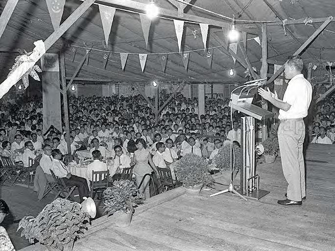
Integrating the Planning of Airports and the City:
     The Singapore Story
                                                                                      CHAPTER 1

* Dynamic Urban Governance
 Lead with Vision and Pragmatism
 In February 1968, in anticipation of British withdrawal from Singapore, the
 government set up the Bases Economic Conversion Department (BECD) to
 maximise the use of British legacy infrastructure and to generate economic
 spinoffs. For instance, extensive studies and preparations were conducted to
 decide how to convert former British facilities for economic use. For the air
 bases that were left behind, immediate steps were taken to create a large-scale,

                                                                                     Background
 competitive aerospace industry and compatible land uses for co-location.

 On the civil aviation front, Singapore had ambitions to become an air hub
 as it sought to industrialise and build up its tourism and logistics industries.

                                                                                    and Evolution
 Resources were deployed for the development of major tourist infrastructure,
 such as airports and hotels. Singapore also strived to become a competitive
 transhipment and international logistics hub, offering comprehensive

                                                                                    of Singapore’s
 infrastructure, services, support, electronic data interchange (EDI) systems
 such as TradeNet, and free trade zone statuses.

 (See “Positioning Singapore as an Air Hub to Promote Tourism and Air

                                                                                    International
 Logistics”, page 52)

 Work with Markets
 In 2007, the Changi Airport management was corporatised so that the
 reconstituted Civil Aviation Authority of Singapore (CAAS) could focus on
 being an aviation industry regulator, promoter and developer. On the other
 hand, Changi Airport Group (CAG) became responsible for the operational
 aspects of managing Changi Airport and the airport emergency services, as well
                                                                                        Airport
 as overseas investments. The CAG is presently run like a business entity: it can
 pursue business ventures and opportunities with greater flexibility, in response
 to industry changes and global market movements. It can also attract and retain
 top talent to compete with global airport operators. These developments show
 how Singapore is prepared to invest and take bold measures to stay ahead in
 the aviation business.

 (See “Further Expansion of Changi Airport”, page 71)
Integrating the Planning of Airports and the City: Chapter 1 2 3
The Singapore Story
We realise that our [airport’s]
services must be both
economical and efficient...if
we can provide a better and
cheaper entrepôt service for
others than they can provide
for themselves...our neighbours
[will] continue to trade with us.”
Lim Yew Hock, Then Chief Minister of Singapore
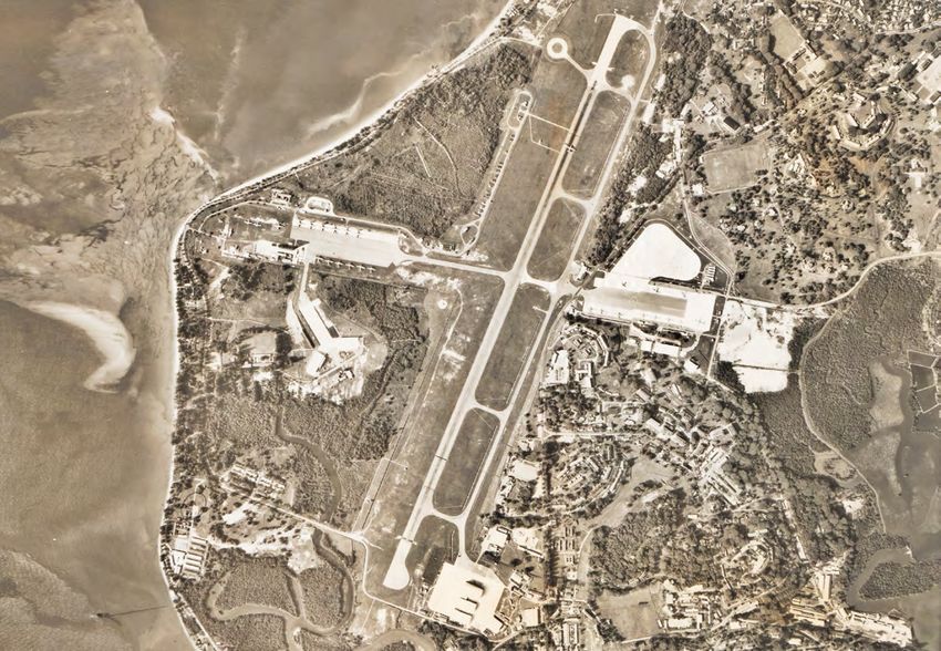
Figure 1: Aerial view of RAF Seletar in late 1945.
Photo courtesy of Wikipedia Commons.
that came with high risks. However, the potentially large benefits for the
SINGAPORE’S EARLY AIRPORTS: SELETAR, host countries were also immense. Meanwhile, air transport faced strong
KALLANG AND PAYA LEBAR competition from the maritime and shipping industry. Shipping was
The advent of commercial air transport and civil aviation has changed cheaper than air, and although the journey took a longer time, it remained
people’s way of life. With intercontinental travel, transit times were the most commercially viable option for transporting large quantities of
slashed. Important mail and goods could also be delivered rapidly, people, bulky materials and goods.2
improving communications and facilitating trade.
Singapore’s first airport was the Seletar Royal Air Force Station (RAF
Singapore was well positioned to take advantage of the revolution in Seletar). Completed in 1928, it was the first British Royal Air Force base
aviation. Its colonial ties to the British and geographical position at the located east of India,3 and served as the headquarters of the RAF Far East
centre of Asia made it conducive to international aviation, on the one Command. Military air bases such as RAF Seletar were important for the
hand. On the other, its location along major sea lanes made it favourable protection of British commercial interests during that time. In 1924, the
for shipping.1 annual value of trade by British vessels in the area protected by Singapore
was estimated at £890,000,000.4
However, Singapore’s eventual development into an international air travel
node did not happen by chance. Apart from military aircraft, RAF Seletar catered to Singapore’s civil
aviation needs. However, it was a modest airport, and its relatively distant
In the early years of air transport, the commercial viability of air routes location—15 miles (~24 km) north of the island’s city centre—made it
was a huge concern. Airlines would call at specific locations only if they inconvenient for operators and passengers alike.5 This was compounded
were confident of the demand for their services. Airport infrastructure
by the lack of good land transportation access to the area.
was expensive, and building new airports was an uncertain endeavourIntegrating the Planning of Airports and the City: Chapter 1 4 5
The Singapore Story
EARLY Other than RAF Seletar, the British
built Tengah and Sembawang Air
Bases in 1939. This was in response to
RAF
Sem
bawan
g
RAF
Seleta
r
MILITARY
the escalating geopolitical tensions
RAF
before the Second World War, and Teng
ah RAF
Chan
the looming threat facing the British gi
Empire’s trade routes and interests in
AIRPORTS
the Asia Pacific.
At the time, Sembawang was the
site of the most intensive British
IN SINGAPORE military build-up. A world-class
Naval Base was constructed there,
complete with air support from RAF
City Centre
Sembawang and RAF Seletar. The
command of these military assets was
so impressive that Winston Churchill, Figure 2: Location of RAF Airports in Singapore, 1960s (not drawn to scale).
then Prime Minister of the United
Kingdom, referred to Singapore as the Remarkably, the building of the fourth military airport, at Changi,
“Gibraltar of the East”, believing the was initiated in 1943 by the Imperial Japanese forces that occupied
country was an impregnable fortress. Singapore. Allied prisoners-of-war (POWs) were used as forced
labourers, but upon Japanese surrender, the British completed the
construction using imprisoned Japanese troops.
Table 1: L
ist of RAF Airports in Singapore
# Airport Year Built
1 RAF Seletar 1929
2 RAF Tengah 1939
3 RAF Sembawang 1939
RAF Changi
4 1946
[Later Changi Air Base (West)]
Figure 3: Kallang Airport Terminal Building, 1950.
Civil Aviation Authority of Singapore Collection, courtesy of the National Archives of Singapore.Integrating the Planning of Airports and the City: Chapter 1 6 7
The Singapore Story
The British themselves understood the need for a dedicated civilian
airport. Wanting to seize on the rosy prospects of air travel, and the
important role that Singapore could play as a gateway between England,
the Far East and Australia, they started constructing Kallang Airport. This
became Singapore’s first purpose-built civilian airport, built over a site
covering 1.03 km2 (103 ha) of tidal swamp. It was completed in 1937 at the
cost of 9 million Straits Dollars.
Kallang Airport was conveniently located just two miles (~3.2 km) from
the city centre, facilitating access for business travel.6 It was close to
the sea and could serve seaplanes, which were commonplace then.7
Unfortunately, the Second World War broke out soon after, and Kallang
Airport suffered wartime bombing damage and neglect. In February 1947,
following the end of the War, the Department of Civil Aviation (DCA) and
the Public Works Department (PWD) were tasked with its repairs and
rehabilitation.8
In the interim, aeroplanes operating between Singapore, Britain and
Australia were redirected to Seletar. Aircraft weighing more than 65,000
pounds (almost 30,000 kg) had to be diverted to the RAF airfield at
Tengah, and later to Changi Air Base after it opened to civilian traffic.
Air traffic was directed back to Kallang in May 1948 after rehabilitation
works were completed. By then, it became apparent that Kallang was
not equipped to handle the newer, larger and heavier aircraft, and the
sheer growth in air traffic volume. Kallang Airport’s runway thus had to
be strengthened and extended from 350 to 2,500 metres to cope with
the situation.9 While the works on the runway were ongoing, air traffic
diversions were necessary, but costly and disruptive.10 Moreover, increased
Kalla
air traffic at Kallang caused other problems. Traffic congestion occurred Airp ng
ort
at Mountbatten Road and Kallang Road whenever several aeroplanes
landed at the same time. Further, the noise pollution caused by planes
landing and taking off affected the quality of life of nearby residents.11
City Centre
There were also concerns that the proximity of Kallang to the densely
populated Geylang area would have disastrous consequences; for Figure 4: Aerial View of Kallang Airport, 1953 (map not drawn to scale).
instance, if a plane were to crash nearby.12 Aerial photograph by the British Royal Air Force between 1940 to 1970s, from a collection held by the
National Archives of Singapore. Crown copyright.Integrating the Planning of Airports and the City: Chapter 1 8 9
The Singapore Story
Due to these concerns and the “colossal sum”13 involved in acquiring land
from the heavily developed surroundings, further development of Kallang
Airport was not considered. The more economical alternative was to build
a new airport altogether. Therefore, in 1950, the colonial government
began to search for an alternative site for a civilian airport—one that
offered sufficient room for future expansion. The cost of acquiring the
new site from existing residents and squatters would be adequately
covered by the sale of the Kallang Airport site for subsequent private-
sector development—an estimated 20 to 25 million Malayan dollars.14
Changi was a site option for the new airport. From as early as 1946,
plans had been made to develop the area into a joint civilian and military
airport.15 However, these plans were abandoned in late 1948 because
Changi’s location in eastern Singapore was considered too far from the
city centre. Furthermore, there was the issue of unsatisfactory drainage, Paya
Airp Lebar
ort
which would make the construction of a modern runway at Changi
“exceptionally expensive, if not actually prohibitive”.16 The airfield then
ng
Kallaort
was “surrounded by swamp and soggy ground and had a deep, shifting Airp
subsoil”, and construction attempts were held up by the discovery of
“heavily saturated clay at considerable and varying depths”.17 These
conditions would hinder future expansion plans and increase costs.
City Centre
With Changi deemed unsuitable, the need to find a site for the new Figure 5: Aerial View of Paya Lebar Airport, 1967 (map not drawn to scale).
airport grew ever more urgent. At a Legislative Council meeting in Aerial photo by the British Royal Air Force between 1940 and the 1970s, from a collection held by the
National Archives of Singapore. Crown copyright.
1949, the then Governor emphasised the importance of air transport for
Singapore. As a focal point of air communications in Southeast Asia, air
transport would attract trade and commerce, and increase the revenues
of the Colony.
Finally, in 1951, a decision—championed by Singapore’s civil aviation
authorities and approved by the Colonial Office in London—was taken
to build a new airport at Paya Lebar. Located eight kilometres northeast
of the city centre, it was close to the city centre and well placed to
take over commercial and civilian air services previously handled by
Kallang Airport.
Figure 6: Paya Lebar International Airport, 1964.
Photo courtesy of the National Archives of Singapore.Integrating the Planning of Airports and the City: Chapter 1 10 11
The Singapore Story
GROWING NEED FOR A BIGGER AND BETTER
EQUIPPED AIRPORT
By the late 1950s, it became vital for Singapore to have a well-functioning
international airport with adequate capacity. The airport would support the
country’s role as an entrepôt for trade, tourism and foreign investments.
Moreover, air traffic was growing about 20% faster than the world’s
average rate, and passengers made up 25% of international traffic
passing through Singapore. These figures remained resilient in spite of
1958’s trade recession.20
We have an excellent natural harbour with the best of man-made
institutions to make it into one of the world’s greatest market places.
We are building our airport to ensure that every facility is given for
traffic in people and goods to come here from all nations. We realise
that our services must be both economical and efficient...if we can
provide a better and cheaper entrepôt service for others than they
can provide for themselves...our neighbours [will] continue to trade
Figure 7: Concorde at Paya Lebar Airport, 1972. with us.21
Ministry of Information and the Arts Collection, courtesy of the National Archives of Singapore.
Lim Yew Hock
Paya Lebar was free of obstructions, and the airport could be built
As Mr Lim described, although Singapore was a reputable seaport then,
there following the resettlement of existing squatters and residents. The
a world-class airport was essential to further develop the country into an
building cost could therefore be kept low. Consequently, in 1951, land
international air and sea junction. This was important for an island trading
acquisition affecting some 300 families over 1,000 acres (~4.05 km2) of
nation with no hinterland, and whose economic survival depended on its
land was carried out. Construction of the airport ensued in 1952, until its
ability to find economic relevance beyond its borders. As a shipping and
official opening in 1955, when it began operations with a single runway
air transport node and a manufacturing destination with links to major
and an interim passenger terminal building.
markets and clients, Singapore was well positioned for this next step.
Although there was a clear need for the civilian airport and a projected
By the 1960s, the world was experiencing a rapid surge in air traffic and
surge in air traffic, the Colonial government could only afford an
significant developments in aviation technology. Having a well-equipped
interim passenger terminal. There were also other aviation priorities,
international airport known for safety and efficiency would thus enable
such as making operational improvements to air traffic control, and
Singapore to ride this wave of growth. It would additionally cultivate
physical upgrades to airport infrastructure, such as runway lengthening,
an investment-friendly climate the government sought to establish. Air
enlargement of apron bays, etc.18
traffic and transport therefore became part of the national development
Nevertheless, building Paya Lebar Airport was a necessary, strategic strategy, and a pragmatic response to global trends.
move to enable Singapore to catch up with international aviation-
sector developments.19 Civilian and commercial aviation also grew in significance followingIntegrating the Planning of Airports and the City:
The Singapore Story
CHAPTER 2
Singapore’s independence in 1965. Under the previous plan for a common
market with Malaysia, road and sea transport would have been the
primary means of ferrying goods and people to and from the hinterland.22
However, as a newly independent state, Singapore sought to cast its
economic net far and wide. Beyond just the Southeast Asian region, the
Singapore government hoped to attract investments from companies in
the United States, Europe and Japan. And having an international airport
would make these international connections possible.
Alongside other national priorities such as providing jobs, housing and
defence, the government recognised that a good international airport was
essential. It would serve not only as an economic lifeline for the country
to tap into the global economy, but also reap longer-term benefits
commensurate with the high initial costs.
By the late 1960s and early 1970s, Paya Lebar Airport’s physical Major Decisions
and Plans:
infrastructure and development had come under strain due to air traffic
growth and emerging advancements in aviation technology. These
included a new generation of jet planes, the wide-bodied jumbo jets. Two
and half times the size of previous commercial planes, they boasted three
The Changi Move
times the seating capacity and twice the cargo space.23
As a result, measures were taken to prepare the airport for these modern
aircraft. Works on lengthening and resurfacing the runway began in 1967,
but it was clear that a new airport—with larger capacity to accommodate
the anticipated increase in air traffic—was required in the medium
term. Fundamentally, a decision had to be made between two options:
upgrading the existing airport, or building an altogether new and better
international airport elsewhere on the island.Integrating the Planning of Airports and the City: Chapter 2 14 15
The Singapore Story
Changi Airport is our major
investment to exploit our
geographic location. Singapore
must be prepared and ready
to seize every opportunity that
comes its way....Can Singapore
ever afford not to have such an
airport?”
Howe Yoon Chong, Then Minister for Defence
PAYA LEBAR OR CHANGI? THAT WAS
THE QUESTION
In the 1970s, the government realised that Paya Lebar’s single runway
would soon reach its maximum capacity and that a second runway was
needed to cope with projected air traffic growth. With the expansions,
Paya Lebar would be able to handle four million passengers per year. But Figure 8: Then Prime Minister, Mr Lee Kuan Yew, delivering his National
Day Rally Speech at Katong Community Centre, 7 August 1970.
this was four times that of the one million capacity it was designed for. Ministry of Information, Communications and the Arts Collection, courtesy of the National Archives
of Singapore.
Hence, in 1968, the government turned to a team of British airport
The earlier 1967 State and City Planning Project report had suggested that
consultants from Scott Wilson Kirkpatrick and Partners under the
Changi be used as Singapore’s main international airport after the British
Colombo Plan. These consultants were tasked to study the projected
growth in air traffic, and draw up plans and guidelines for the withdrawal.26 The vacated air base at Changi had existing facilities that
development of Paya Lebar Airport.24 could be utilised. Moreover, relocating the main airport to Changi would
free up space at Paya Lebar for future development, thereby increasing
After an evaluation, the consultants concluded that a second runway was the latter’s land value. With Changi situated further away from the city
needed by the middle of 1978. Their proposed airport development plan centre, there would also be minimal nuisance caused by aircraft activities.
also called for a three-phased $600 million expansion programme over a
20-year period, up to 1990.25 As it happened, then Prime Minister Lee Kuan Yew gave the first official
indication of the airport’s relocation. On August 1970, he shared future
But the question remained: was Paya Lebar the best site for Singapore’s plans for Singapore during a National Day rally speech at Katong
main airport in the long term? Community Centre.27 Mr Lee proclaimed that in 10 years, the airportIntegrating the Planning of Airports and the City: Chapter 2 16 17
The Singapore Story
INCLINATION
would shift to Changi, and that aircraft would no longer fly over Katong
and Kallang, two of Singapore’s prime residential districts. Some even
Built by British prisoners-of-war
speculated that the spontaneous nature of this announcement was
TO KEEP CHANGI
(POWs) from 1943, the 3,500 acre
in response to the noise of overhead aircraft drowning out the Prime (~14.2 km2) Changi Air Base was taken
Minister’s speech!28
FOR MILITARY
over by the Royal Air Force (RAF) in
1946. The largest RAF air base to be
Up until then, most people believed that an expanded Paya Lebar, with its inherited by the British, it initially had
second runway, would remain the republic’s major air gateway. Many were
also of the view that Changi would serve as a second international airport
only in the early 1990s.
AIR BASE USE north-south and east-west runway
strips which were unpaved and thinly
grassed. Perforated steel plates and
reinforcements were later added to
The decision between Paya Lebar and Changi was not an easy one, and the runways, allowing it to serve as
the main runway for military aircraft
various experts and officials had competing views. Some British officials
until 1949.33
supported the use of Changi as Singapore’s main airport. In 1971, British
Air Chief Marshal Sir John Grandy announced that the Changi Air Base
would be returned to the Republic at the end of the year when the British
military withdrawal was complete. He suggested that the authorities
prepare to divert the airport expansion programme, ideally to Changi,
where most aircraft noise would be over the sea.29
That same year, the Singapore Planning and Urban Research Group
(SPUR), a local society consisting of young architects and planners, set
out reasons why Changi should be developed instead of expanding Paya
Lebar. They pointed out that increasing air traffic and the development
of larger, noisier planes like jumbo jets and supersonic aircraft would
impose unbearable noise pollution levels on areas along the flight path to
Paya Lebar. These included Geylang and Katong,30 which had substantial
residential populations.31
Despite these comments and debates, the official position at the time
remained that Paya Lebar Airport should first be developed to its fullest
potential, before Changi was to be developed.32
Figure 9: Aerial View of RAF Changi
with its criss-cross runway, 1969.
Aerial photograph by the British Royal Air Force
between 1940 and the 1970s, from a collection held by
the National Archives of Singapore. Crown copyright.Integrating the Planning of Airports and the City: Chapter 2 18 19
The Singapore Story
INCLINATION Subsequently, the air base served as
TO KEEP CHANGI
the headquarters and communications
centre of Britain’s Far East Air Force
FOR MILITARY
until 1971, when it came under the
management of the Singapore Air
Defence Command.34 Due to the
AIR BASE USE growth in air traffic, Changi Air Base
was also used as a diversionary airport
for Paya Lebar Airport.
Continued...
Changi is a military air base and
it is likely to continue its present
military role for at least the next
decade, because it will be very
costly to duplicate the military
facilities already available at
Changi for defence purposes
elsewhere—the realistic choice is
Sem
not to develop Changi now and to b
Airp awang
ort
abandon Paya Lebar; rather, it is Seleta
Airp r Chan
ort Airp gi
to develop Paya Lebar to its fullest ort
Teng
potential and to develop Changi Airp ah
ort Paya
Airp Lebar
later.35 ort
Ngiam Tong Dow
As described by the Mr Ngiam, then
Permanent Secretary of the Ministry
of Communications, pragmatic use of
existing resources and fiscal prudence
were the more immediate concerns. Figure 10: Changi Military Air Base, one of five military air bases of
Singapore, 1965 (not drawn to scale).
Aerial photograph by the British Royal Air Force between 1940 and the 1970s, from a collection held by the
National Archives of Singapore. Crown copyright.Integrating the Planning of Airports and the City: Chapter 2 20 21
The Singapore Story
Soon after, in 1972, the government appointed American airport [After the oil crisis erupted in 1973, the] price of oil quadrupled from
consultancy Northrop Airport Development Corporation to review the US$1.20 to over US$5.00 per barrel. Air traffic slowed down and
1969 Airport Plan by the British consultants from Scott Wilson Kirkpatrick the Boeing 747 jumbos entered service. So fewer planes were using
and Partners.36 Since Mr Lee Kuan Yew himself was not convinced that the Paya Lebar. This delayed the need for a second runway. I took this
expanded Paya Lebar Airport was the best course of action, Northrop also opportunity to re-consider the decision.
studied the feasibility of using Changi as Singapore’s main airport.37
I appointed Howe Yoon Chong, then Chairman of the Port of Singapore
The new air traffic forecasts made by Northrop were much higher than Authority, to head a team to study if we could move to Changi in time
those reported in 1969. They claimed that, in order to cope with rapid air before a second runway was necessary. The team concluded that
traffic growth, expanding Paya Lebar was an urgent matter. Recognising Changi was possible and could be ready by 1981. However, between
the pressing need for expansion, the government approved the 1974 and 1981, we would have to invest in more facilities at Paya Lebar
construction of Paya Lebar’s second runway in July 1973. Nevertheless, to meet the yearly increase in traffic.42
the question of Paya Lebar’s long-term suitability remained. The following Lee Kuan Yew
month, Mr Cheong Pak Chow, then Director of Civil Aviation, remarked
that Singapore had to consider building a second international airport to Nevertheless, there was no immediate consensus on this complex
keep pace with growing needs.38 decision. In 1975, the Ministry of Finance re-submitted the proposal to
the government to extend the Paya Lebar Airport by building a second
The global oil price crisis of 1973–74 halted Paya Lebar’s expansion plans.39 runway. Following this, two opposing groups emerged.
The October 1973 oil crisis led to a five-fold increase in fuel costs by early
1974. As airlines struggled to cope with soaring fuel prices, flights became Mr Bernard Chen, then Assistant Secretary at the Finance Ministry,
far more expensive than before. This unexpected development arrested recalled the debate vividly.43 The first group, led by the Finance Ministry
the rapid growth of passenger air traffic worldwide. As a result, annual and its Minister Hon Sui Sen, believed that Paya Lebar was the best choice.
visitor growth at Paya Lebar Airport plummeted from an average of 25% His reasons were that it was more cost-effective, the airport was already
during the period of 1968–73, to just 9% in 1974.40 located there, and less new construction was required. Stressing the need
for financial prudence, Mr Hon fought “tooth and nail” for Paya Lebar. 44
Despite the impact of the oil crisis, the government remained confident
that aircraft and passenger traffic through Singapore would continue to The second group included then Minister for Communications Mr Ong
increase in the long term. After all, the country was situated “right in the Teng Cheong. Mr Ong believed that, despite higher initial costs, Changi
heart of the Association of Southeast Asian Nations (ASEAN), the fastest was a better choice in the long run because it could cater for future
growing economic grouping in the world”.41 The adoption of new wide- expansion.
bodied jets also meant that there would only be more and heavier aircraft,
and more passenger traffic and air cargo were to be expected. Then Prime Minister Lee was inclined towards Changi, largely on
environmental grounds. Paya Lebar was located within a densely
The oil crisis also came with a silver lining. It offered Singapore the chance populated area, and a second runway would have negative implications
to rethink its plans for expanding Paya Lebar Airport, since there was on the environment and the quality of life for residents nearby. When Mr
less urgency to cope with soaring passenger arrivals in the short term. Lee flew over Logan Airport in Boston in 1974, he was “impressed that
There was now more time to construct a new passenger airport at Changi, the noise footprint of planes landing and taking off was over water”.45 He
instead of rushing to expand Paya Lebar Airport. subsequently recognised the advantages of building an airport alongside
or onto the sea. With Changi, Singapore could retain the flexibility to
build additional runways into the sea without having to impose heightIntegrating the Planning of Airports and the City: Chapter 2 22 23
The Singapore Story
restrictions on future building developments. It additionally mitigated the cost of $1.2 billion—a decision subsequently endorsed by all heads of
noise pollution burden on residents.46 Years later, Mr Liew Mun Leong, government ministries and agencies involved. 52
current Chairman of Changi Airport Group (CAG), would reaffirm Mr
Lee’s decision. Mr Liew suggested that it would have been impossible Mr Howe recalled then Prime Minister Lee’s discomfort about the earlier
for the HDB New Town at Tampines to be built if Paya Lebar Airport had proposal to expand and continue using Paya Lebar:
proceeded with its expansion. The height restrictions imposed by flight
paths would have prohibited it.47 The Prime Minister was not fully comfortable with the earlier decision
to build the second runway at Paya Lebar. His concern was wide-
In 1975, a Special Committee on Airport Development (SCAD) was set ranging. It bothered him that the increased noise and air pollution with
up to study the issues and reccommend the best course of action.48 This an additional runway would irritate more and more people living in the
Special Committee comprised the Permanent Secretaries from various areas surrounding the expanded airport. The traffic congestion, already
government agencies and departments involved in finance, infrastructure, bad on the approach roads to the airport, would be further aggravated.
aviation and communications. It included engineers from the electricity, The resettlement of thousands of families would cause much suffering
water and gas departments of the Public Utilities Board, Port of Singapore and hardship. We would be accumulating problems for the future.53
Authority (PSA), Telecommunication Authority of Singapore and the
With that, the government decided in May 1975 to form an Executive
Public Works Department.49
Committee of Airport Development, headed by Mr Sim Kee Boon. Mr
It was chaired by Mr Howe Yoon Chong, then concurrently the Head Sim, then Permanent Secretary for the Ministry of Communications and
of Civil Service, Permanent Secretary of the Prime Minister’s Office, subsequently the Head of Civil Service, would oversee the construction of
Chairman of the Port of Singapore Authority and the Chairman of the Changi Airport within six years.
Development Bank of Singapore. SCAD’s report writing secretaries were
Finally, in June 1975, when announcing the Cabinet reshuffle, the Prime
Mr Lim Hock San and Mr Pek Hock Thiam. The former was Mr Howe’s
Minister’s Office confirmed that the Changi location would be developed
assistant at PSA, and later became the Director General of the CAAS,
as Singapore’s main international airport.54
while the latter was the Principal Assistant Secretary at the Ministry
of Communications.
Mr Howe and his team were tasked to come up with a master plan that ADVANTAGES OF HAVING THE AIRPORT
would define the roles of the Paya Lebar and Changi Airports. The idea AT CHANGI
was to maximise the potential of both airports while reducing the overlap Former Chief Defence Scientist Prof Lui Pao Chuen, who was closely
of functions.50 involved in the “Paya Lebar vs Changi” debate, championed this decision.
He noted that from the technical perspective, the choice of Changi was
To this end, four options were considered: to expand Paya Lebar with a obviously superior to Paya Lebar.
second runway to the West; to expand Paya Lebar with a second runway
to the East; to have a new airport at Changi with two runways; and to The Paya Lebar flight path was over populated areas. I lived, at that
have a new airport at Changi with one runway, and both civil and military time, near Katong Park. There was government housing in a place
operations at Paya Lebar. called Arthur Terrace on Arthur Road. It was directly in line with the
centre line of the runway. Every evening, the aircraft roared. You can’t
One of the SCAD report’s recommendations was for Changi to be hear that from Changi Airport. So the noise at Paya Lebar would have
“developed into a modern airport worthy of Singapore and that the plans created a lot of problems for residents.
for the second runway at Paya Lebar and for its expansion should be
scrapped”.51 It justified the choice of developing Changi, at the projectedIntegrating the Planning of Airports and the City: Chapter 2 24 25
The Singapore Story
The other thing was the height constraint for buildings affected by Some also wondered if Changi Airport could be built in six years’ time,
flight paths related to Paya Lebar. Changi Airport did not have this by 1981. It would be a challenging task to build a modern international
problem. Number one, [bound] for Changi aircraft will be flying over airport in such a short period. And finally, “Would the PWD, the oldest
water so it doesn’t cause any problem to homes and number two, department in the colonial government, be able to build the huge new
Changi could still grow and therefore, you would not be constrained airport? Did the PWD even have the technical competence to do it?” 57
as you would be with the Paya Lebar site. So it was so obvious that
Changi was the superior solution.55
Howe disagreed and had no such doubts. To him, the cost difference
An important corollary of the decision to build the international airport at was “very much of a bargain” since upgrading Paya Lebar would be
Changi was shifting most of the Changi Air Base operations to Paya Lebar. expensive, too. He pointed out that the cost for Phases I and II of Changi
In other words, Paya Lebar would become a military air base. Prof Lui cited was an estimated $1,241 million (~$1.241 billion), while the total projected
inadequate communication between the leaders and senior officials of the cost of the second runway and extensions to Paya Lebar was well in
different ministries as a reason for the delay in arriving at a final decision. excess of $800 million.58 While Changi was indeed more expensive in
absolute terms, the extra expenditure provided Singapore with a new,
So why didn’t we start building the airport earlier in Changi instead of
modern, world-class airport with expansion potential. And in terms of
having the military build an air base there? One reason was because
meeting the completion schedule, Mr Sim Kee Boon was able to pull
MINDEF [the Ministry of Defence] was so powerful that MINCOM
[Ministry of Communications] did not dare to try. They thought Goh together the various branches of the government and civil service to meet
Keng Swee [then Minister for Defence] would never let Changi go the stringent timeline.
because the Air Force was already building in Changi.
Mr Ong Teng Cheong also highlighted the technical challenges of
In the mind of MINCOM...Goh Keng Swee would say, ‘What?!’ to expanding Paya Lebar’s passenger and flight capacity. The second
moving from Changi. They did not know that Goh Keng Swee did not
runway, if built there, would be on a site straddling a river and a decade-
like the location of Changi for the military air base. Goh Keng Swee’s
old public refuse dump. As such, tackling problems such as “drainage,
assessment was that Changi was too close to the coast and therefore
canal diversion, squatter resettlement, removal of rubbish dumps and
vulnerable to attacks by naval commandos. Paya Lebar was superior.
refilling of the swampy areas” would be time-consuming. He then
So you’ve got a Minister for Defence who actually wanted Paya Lebar
for his air base. Had the two ministers only communicated! Finally they estimated that the expansion of Paya Lebar would not be completed
did and who was the communicator? Howe Yoon Chong. Sometimes, before 1984.59
the decision is so simple. Actually both parties wanted it but they didn’t
know that the other side wanted it too. On the other hand, Ong Teng Cheong argued,
While the reasons to build the airport at Changi appear compelling today, The present runway at the Changi airfield could be easily lengthened,
some of the people involved at the time were sceptical. Aside from the widened and strengthened into a runway acceptable for international
higher cost, they had doubts about the flight and growth forecast which air traffic operations by the middle of 1980, while the second runway
indicated that Changi would eventually handle 30 million passengers at Changi will be built on land reclaimed from the sea and it could be
per year. Liew Mun Leong, a civil engineer working in the PWD then, ready by the middle of 1982. This means two or three years ahead of
summarised such concerns:
scheduled completion of the second runway at Paya Lebar. In terms of
To be frank, [then Deputy Prime Minister] Goh Keng Swee was also timing, the Changi option is obviously superior.60
sceptical about it, and he said that if we were to have 30 million
passengers, all our children would have to become waiters, bellboys
and porters because there would be so many hotels and restaurants to
accommodate them all.56Integrating the Planning of Airports and the City: Chapter 2 26 27
The Singapore Story
EXTENSIVE Very few people appreciate this—we
moved from Paya Lebar to Changi in
Despite the challenge of land acquisition, one bright spot
was that fewer households (about 800) had to be resettled,
PREPARATIONS one night without any disruption in
[air transport] service. The last flight
compared to the Paya Lebar option, which would have required
4,000 households to move.68
FOR THE BIG MOVE TO out of Paya Lebar was an SIA flight
around 11.30 [pm]. The first flight into Next, additional land had to be reclaimed for the construction
CHANGI AIRPORT Changi was 6.00 [am] or something
like that, [via] Singapore Airlines.
of Changi Airport. Fortunately, the Port of Singapore Authority
(PSA) had already planned to reclaim 334.4 km2 of land in the
area for a potential air-sea terminal.69,70 It was deemed possible
Everything was ready. We didn’t then to co-locate a container terminal with the upcoming airport
have to bus anybody back [to Paya to facilitate the possibility of intermodal freight transport.71
Lebar]. This is quite an achievement...
nobody could have done it without Eventually, this idea was shelved by the PSA in 1979 because
all the planning.65 they needed a faster and less costly solution to manage the
rapid growth in container cargo.72 The containerisation of
Bernard Chen Tien Lap, Then Assistant Secretary,
Ministry of Finance
maritime cargo shipping would also have required the use of tall
cranes, but the cranes would have posed a safety risk so near to
Changi Airport.73 Instead, 7.07 km2 of the planned reclamation
Deciding on the Changi location was
was carried out by the PSA, and the land was used for part of
the first step. Thereafter, thousands
Changi Airport.
of experts and officials set to work at
making Changi Airport a reality. Plans
were carefully drawn up to optimise While the seaport did not materialise, a connection to the sea
land use and ensure adequate space remained important for Changi. Towards the north of the airport,
for future airport expansion. These accessibility to the sea was provided in the form of a jetty for
plans also factored in the siting of the delivery of aviation fuel directly from the fuel tanker to the
complementary facilities around the fuel farm. The extension to the jetty could also serve as a marine
future airport.66 base for rescue purposes.74
Adjacent land owned by the As a final precaution, Paya Lebar Airport was kept on standby
Housing and Development Board, as a contingency option when Changi Airport first opened.
Changi Republic of Singapore Air The plan was to divert planes to Paya Lebar if any faults or
Force (RSAF) Airbase and some breakdowns occurred at Changi, and to use buses to transport
private parties had to be acquired departing passengers to Paya Lebar. But as it turned out, Changi
to assemble the 16.63 km2 of land began operations without a hitch, and no passengers had to be
required for the new airport. In diverted to the former airport.
comparison, Paya Lebar occupied
only 2.85 km2 of land—about one-
sixth the size of Changi.67You can also read