MADISON, JERSEY, & MACOUPIN COUNTIES ILLINOIS - A GUIDE TO THE WOOD RIVER WATERSHED - MADISON COUNTY
←
→
Page content transcription
If your browser does not render page correctly, please read the page content below
A Guide to the Wood River Watershed

madison, JERsEY, & maCoUPin CoUntiEs illinois
Wood RivER
                                                                                      WatERshEd

WhERE thE WatER floWs                                             THIS WATERSHED
                                                                  FLOWS INTO THE
                                                                  MISSISSIPPI RIVER

      Painted Lady Butterfly on a cone flower &Northern Harrier above

2   A GUIDE TO THE WOOD RIVER WATERSHED
What is a WatERshEd?
A watershed is an area of land that drains into a common waterbody, such as a creek. Think of it
like a bathtub: when a drop of water hits anywhere in the tub, it eventually finds its way to the
drain (the lowest point). The rim of the bathtub is like the watershed boundary—any drop falling
inside it will eventually reach the main drain, a creek or river.
Healthy watersheds mean that people have clean drinking water, flooding in appropriate
locations, thriving wildlife, and recreation opportunities.
thE Wood RivER WatERshEd & thE Plan
Water in the Wood River watershed generally flows north to south and east to west. Water flow
starts in Macoupin County and moves south and west through Alton to the Mississippi River.
Funding for the Wood River Watershed-Based Plan was provided, in part, by the Illinois
Environmental Protection Agency (IEPA) through Section 604(b) of the Clean Water Act via
Financial Assistance. Additional funding and staff time was provided by Madison County to
address flooding issues alongside water quality issues.
The planning process involved surveys, public meetings, technical analysis, and recommendations
formed by a technical advisory committee and a stakeholder committee. The plan is a voluntary
document that provides guidance to governments and residents on flood reduction and
water quality in the Wood River watershed. The document can be found on the HeartLands
Conservancy webpage.
Goals of the plan are:
  • Improve surface and ground water quality.
  • Reduce flooding and mitigate flood damage.
  • Promote environmentally sensitive development.
  • Support healthy wildlife habitat.
  • Develop organizational frameworks.
  • Conduct education and outreach.
See page 30 of the watershed plan.

 WatERshEd Planning PRoCEss
Early on and throughout the planning process, Madison County and the planning team sought
guidance from more than 250 people and more than 25 entities. Interviews were conducted with
townships, municipalities, and County Board members. Small group meetings allowed attendees
to provide locations of floods and other issues on large paper maps, and give detailed input on
stormwater issues in the watershed.
Stakeholder input was of crucial importance in the planning process. Feedback from key
stakeholders and the public was used in identifying issues, selecting Critical Area locations and
specific project locations, and exploring opportunities for further outreach and education.

                                                                    A GUIDE TO THE WOOD RIVER WATERSHED   3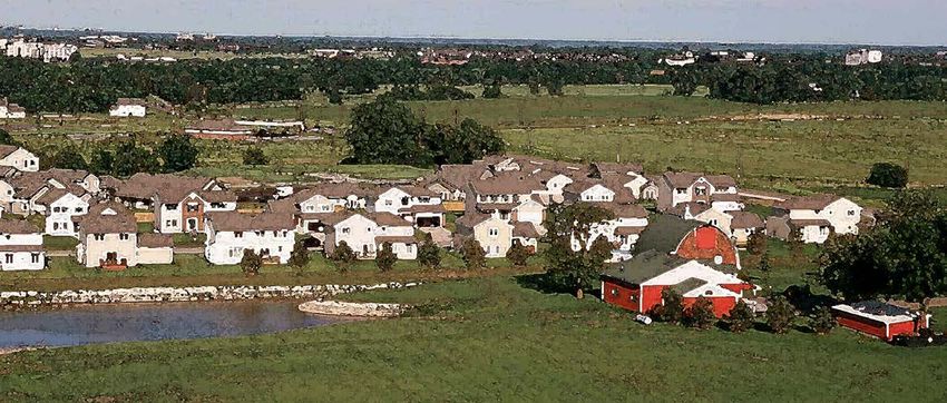
Jurisdiction   Area within watershed (acres)

                                                     Wood RivER
                                                     WatERshEd

4   A GUIDE TO THE WOOD RIVER WATERSHED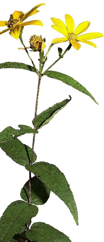
histoRiCal Wood RivER WatERshEd & CUltURE
                      thE Wood RivER WatERshEd is located northeast of St. Louis, Missouri, in Madison,
                      Macoupin, and Jersey Counties, Illinois. Three-hundred fifty-five miles of streams drain 78,500
                      acres of land.
                      The Wood River watershed is an archaeological hot-spot. Cahokia, a pre-Columbian Native
                      American city about 23 miles southwest of the watershed, covered about six square miles at
                      its population peak (1200s CE) and was the largest and most influential urban settlement in
                      Mississippian culture. Many earthen mounds were built by those people in and around Cahokia,
                      including some in the Wood River watershed.
                      Fourteen (14) mound sites have been identified in this watershed. They are all located in the
                      southern portion in Madison County. These mound sites primarily exist where the West Fork and
                      East Fork of Wood River converge, but several also occur along the East Fork north of I-255.
                      Once dominated by open oak-hickory forest with upland prairies, bison, woodcocks, elk, and
                      bears were prevalent wildlife in the watershed before colonial settlement.
                      Much of the forest land was timbered and nearly all of the prairie was converted to agriculture
                      and pasture land. What remains are remnants of woodlands along streams and ponds and small
                      remnants of prairies. While much has changed about the Mississippi and Wood River channels,
                      the mouth of the Wood River along the Mississippi River was the site of the Lewis & Clark
                      Expedition’s Camp Dubois, where they spent five months directing operations and collecting
                      supplies. The land was later valued for its coal deposits and many areas were mined.
                      In 1892, Franklin Olin settled in this watershed and started the Olin’s Equitable Powder Company,
                      which produced explosives for this area’s coal mines and limestone quarries. Soon after, the Olin
                      family expanded this industry to supply ammunition to the World War I effort, and eventually
                      ammunition to World War II. Clearly, this watershed has a long history of innovative American
                      industry and exploration that continues to this day.
                      additional fEatUREs of thE WatERshEd inClUdE:
                        • 35% of the watershed is deciduous forest.
                        • A total of 6% of the land in the watershed is in a designated floodplain.
                        • 22% of the watershed is developed.
                        • Only 1.5% of the watershed is woody wetland.

    White Tail Deer                           Photo: American College of Occupational and Environmental Medicine (ACOEM.org)

                                                                                           A GUIDE TO THE WOOD RIVER WATERSHED   5
What aRE somE of thE Conditions
CaUsEs of WatER PollUtion
More than 45,950 residents live in the Wood River watershed.
in thE Wood RivER Today, 42% of the land is used for farming, most of which is row-crop
WatERshEd? agriculture. There are five municipalities, twelve townships, three
• Soil erosion contributes nearly counties, and one levee district located within the watershed. Changes
82,000 tons of sediment to streams to the waterways and the landscape have contributed to declining
and waterways. surface water quality and flooding issues.
• An estimated 58% of sediment Abandoned mines, both surface and underground, may threaten water
in the watershed comes from quality and land use within this watershed. There are 70 mines in Jersey
streambank erosion (pg. 42)
County, 88 mines in Macoupin County, and several in Madison County,
• 48% of phosphorus comes from many of which reside in this watershed. Underground mines have
cropland (pg. 43) caused subsidence, which is the sinking of the Earth’s surface, making
• East Fork Wood River, West Fork them potentially dangerous. While many abandoned mines pose limited
Wood River, and Wood River environmental risks in this watershed, they may still present problems in
all have low levels of dissolved the future if land restoration does not occur.
oxygen, which is bad for fish and
other water dwellers (pg. 44). The amount of both developed land, such as subdivisions and shopping
areas, and farmland has increased over the past 20 years by 7%.
• Fecal coliform is the main pollutant
Developed land, and its impervious surfaces (e.g., asphalt, roofs) is
in Wood River Creek caused by
failed and poor maintenance of expected to continue to increase over the next 20 years. As a result,
private sewage systems, waste farmland and forests will decrease and the land available to absorb
from livestock on farms, and rainwater will also decrease. Low-impact development practices (e.g.,
infiltration into/out of aging pipes conserving open spaces and floodplains in development) and land
(pg. 43). restoration (i.e. pervious pavement, rain gardens, stream restoration,
and drainage basins) will be required to filter pollutants from the
Information in the Wood River Watershed Plan
are on page 42 and in the pages noted above.
water, reduce erosion, and manage flooding. The economic success of
this region is highly dependent on the land, and that success can only
continue with healthy lands and waters.
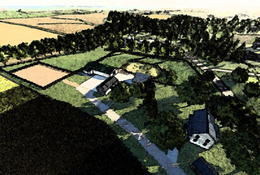
Character Image of Development
6 A GUIDE TO THE WOOD RIVER WATERSHED
Costs of flooding
Many issues exist in the Wood River watershed that harm the future
vitality of its ecosystem, water quality, and quality of life.
flooding and stREamfloW
Rain makes stormwater, which flows into streams and sometimes causes
flooding. Floods can be both positive and negative.
While general flooding inside floodplains helps recharge aquifers
(underground sources of water), revegetate the land, and clear natural
debris (all positive events), when development occurs inside the
floodplain, flooding worsens downstream and outside the floodplain,
causing further damage.
A flash flood is a rapid rise of water along a stream or low-lying area,
usually occurring with heavy rainfall over a short period of time. Flash
flooding is the most dangerous type of flooding because of the high
potential to cause damage. Besides “flash” rainfall events, pipes and
other stormwater infrastructure are often too small for the size of the
watershed’s storms. Maintenance has not kept up with needs.
Flooding and water pollution can have significant impacts on the
watershed’s residents.
Flooding has also caused stress, loss of property access, lost business
income, crop damage, and expensive replacement costs of buildings.
Flooding can cause pollution to migrate throughout the watershed.
Water pollution in streams, rivers, and ponds can pose health risks, such
as skin rashes, pinkeye, respiratory infections, and hepatitis. Pollution
can make fish unsafe to eat and rivers unpassable for barges and
shipping.
In 2019, a community Flood Survey was conducted in the Wood River
watershed and found:
  • 23% of respondents experienced flooding in the past 10 years.
  • Respondents reported 69 floods/year outside federally designated
    floodplains.
  • Flooding caused $12.8 million in damages over the last 10-year
    time span.
More information in the watershed plan (pg. 44-45), Appendix B, pages 25-26.

                                                                               Fantailed Darter

                                                                                                  A GUIDE TO THE WOOD RIVER WATERSHED   7
WatER QUalitY
Clean drinking water is the primary concern with water assessed streams are highly channelized in the Wood River
quality. Humans and animals need clean water to survive watershed. Fallen trees in the streams, or logjams, can
but the water in the Wood River watershed is being cause additional erosion problems by forcefully pushing the
negatively affected by several pollutants. Large amounts water into the streambanks. Lakes with too much sediment
of fecal coliform, or bacteria found in human and animal are shallow, reducing the amount of storage capacity, but
feces is found in large amounts in the water, particularly too much sediment can also damage the lake shoreline
Wood River creek. High fecal coliform levels creates unsafe and dam. Briarwood Lake’s dam, for example, is close to
drinking water conditions for residents. failure as a result of too much sediment in the lake causing
In the watershed, many people and communities use erosion of the dam.
well water for drinking water supply, Sediment from soil erosion also carries phosphorus
including the villages of Bethalto and nitrogen, two main parts of fertilizers, with it into
and East Alton. Contamination of streams and lakes. In large amounts, these two elements
these water sources is a life- can cause algae to grow in excess on the surface of
safety issue and can be very lakes and streams. This algae can be harmful to humans
expensive to fix. and pets and also reduces the oxygen level in the water
Sediment from soil erosion resulting in fish die-offs.
is often forgotten as a
pollutant. Too much AVG IN TARGET
WATERSHED AMOUNT
sediment in lakes and (2018)
streams causes poor water
quality and reduced storage
High sediment
capacity. In the Wood River means the water
Watershed, sediment mainly Sediment is murky and can
harm aquatic
comes from streambank life (they can’t
erosion, as well as gullies and 81,746 tons/ 65,397 tons/year breathe).
year 20% reduction
farm fields. Of the streams
reviewed, 56% have severe Too much
streambank erosion. phosphorous in
Total the water can
This erosion is made worse Phosphorous cause excess algae
growth, which
by straightened (channelized) (P)
suffocates fish and
streams, which cause water to 155,844 lbs/ 116,883 lbs/year other aquatic life.
year (25% reduction)
flow even faster and erode the
streams. Twenty-three percent of
Too much nitrogen
in drinking water
is harmful to
Nitrogen babies and young
livestock. It also
causes excess
algae growth,
which clogs water
676,841 lbs/ 575,315 lbs/year
intakes and kills
year (15% reduction)
fish.
Large quantities of
fecal coliform have
Fecal Coliform potential to cause
diseases, such as
gastroenteritis and
typhoid.
510 cfu/100 mL 200 cfu per
Northern Harrier 100 ml or 57%
reduction
8 A GUIDE TO THE WOOD RIVER WATERSHED
RiPaRian Condition
Just as water is essential for wildlife, many plants grow only in
areas with more water, such as wetlands and riparian areas
(the land area on either side of a stream or lake).
Healthy riparian areas are important because they:
• Slow flooding;
• Filter pollutants out of water;
• Reduce erosion along streambanks;
• Provide habitat for wildlife like birds, mammals, amphibians, reptiles,
and fish; and
• Offer recreation and scenic beauty, providing health and
wellness for people.
Today, 11% of the watershed’s riparian areas are in poor condition, while
57% are in fair condition and may be at risk of future degradation. Invasive
species, such as bush honeysuckle, have degraded riparian areas. In other
cases, riparian areas have been cleared to create more cropland.
Riparian condition is discussed on page 88 of Appendix A, pg. 48 of the watershed plan.
WildlifE
Wildlife can be a good indicator of stream health because it reflects the
conditions of multiple factors in the environment (see Appendix A pg. 65).
The following are just some of the critical and characteristic species in the
watershed:
• Franklin’s Ground Squirrel
• Monkeyface Mussel
• Indiana Bat (Federally endangered)
• Freckled madtom (fish)
• Northern Harrier
• Barn Owl
• Bald Eagle
• Ornate Box Turtle (State-Threatened)
• Pileated Woodpecker
• Fantailed Darter
• Painted Lady Butterfly
• Woodland Sunflower
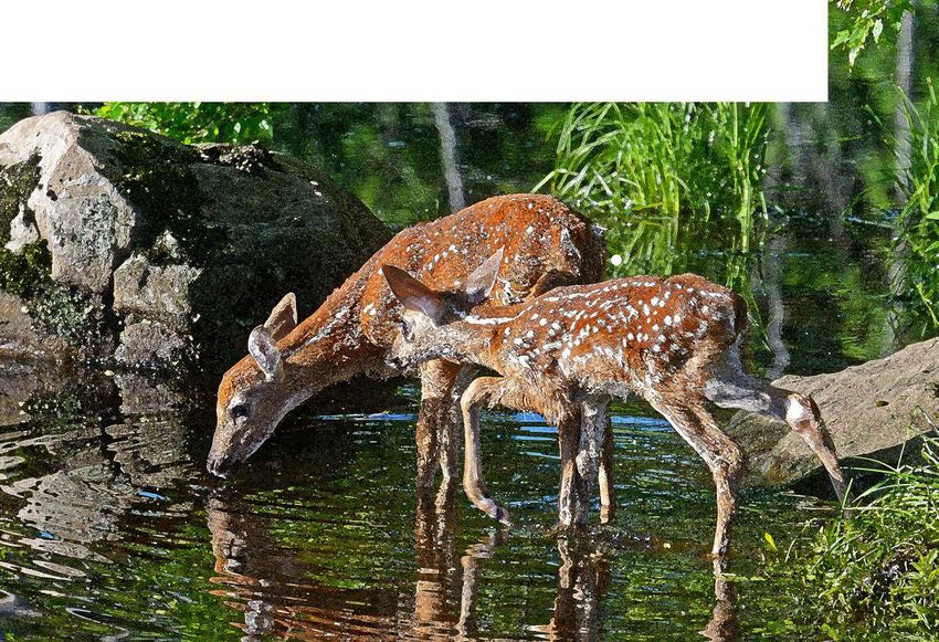
• White Tailed Deer
Invasive species, such as bush honeysuckle and wintercreeper, are threats
to natural areas and riparian areas because they crowd out native plants
and trees that protect streambanks from erosion.
See page 48 of the watershed plan for more information about wildlife Ground Squirrel & Woodland Sunflower
habitat issues and invasive species.
A GUIDE TO THE WOOD RIVER WATERSHED 9
PRoPosEd PRoJECts Within thE WatERshEd

                                                        1
                                                   2    3

                                                                          4

                                       5
                                           6
                                               7

                                                        8
                                                                 9
                                                            10
                                                                     11

                                                   12

10   A GUIDE TO THE WOOD RIVER WATERSHED
PRoJECt idEntifiCation
Twelve specific project locations were identified in the watershed. These projects
address life safety issues and multiple goals of the plan by implementing a variety of Best
Management Practices.
Jurisdictions and watershed groups can use this short list to help communities and landowners
in the watershed address needs identified in the stakeholder engagement process.
sPECifiC PRoJECt loCations
Specific project locations are only the sites of potential projects. Projects suggested are voluntary,
not mandatory, and each one warrants further outreach and assessment. Individual landowners
with a stake in the projects may not have been consulted. The sites identified are for outreach
purposes only and serve as a place to begin plan implementation.
[1] Countryview Lake Drive Flooding (Brighton)
[2] Village of Brighton Flooding
[3] Briarwood Lake Dam (Brighton)
[4] Honeycut Branch|East Fork Wood River Erosion (Foster Township)
[5] Pearl|Isabel|Gladys Street Flooding and Sanitary Sewer Overflow (Godfrey)
[6] Humbert and Wick-Mor Road Flooding (Godfrey)
[7] Savannah Trace Subdivision (Godfrey)
[8] Harris Land and Woods Station Road Flooding (Alton)
[9] Bethalto Sports Complex Flooding
[10] Erosion and Flooding at Route 111 (Cottage Hills)
[11] St. Louis Regional Airport|Stuart Road Flooding (Bethalto)
[12] Chessen Lane Flooding (Alton)
A GUIDE TO THE WOOD RIVER WATERSHED 11list of sPECifiC PRoJECt loCations
hoW Can YoU gEt involvEd? 1 Countryview Lake Drive Flooding
The cumulative actions of individuals and (Brighton)
communities across the watershed can
Description of Problem: Heavy rainfall causes water to run off
make a big difference in the health of
people, wildlife, and the environment.
from a farm field north of the subdivision, flooding streets and
yards on Countryview Lake Drive. The runoff has also caused
If you would like to help promote severe erosion.
healthy water quality and reduce
flooding in the watershed, there are Possible Solution: A partnership should be formed with the
several ways to get involved. farmer and subdivision to construct basins, grassed waterways,
If you are a landowner, farmer, or and swales to slow water runoff, reduce erosion, and direct the
land manager, you can make planting water to a creek to the east of the subdivision.
decisions that improve soil health and
water quality. The Madison County Soil 2 Village of Brighton Flooding
and Water Conservation District (SWCD) Description of Problem: There are two areas of flooding issues
can provide assistance on topics including near Rte. 111, which runs through the heart of Brighton, IL. One
fertilizers, tillage, seed mixes, cover crops, area is near the Casey’s General Store on the east side of Rte.
crop rotation, woodland improvement,
111. Ditches running parallel to the road frequently overflow
erosion control, and more. Find out more
causing water to pond in the road right of way.
by contacting madisoncoswcd@gmail.com
or calling 618-656-7300 ext. 3. The other area of concern is near Belvedere Circle on the west
If you are a homeowner, you can side of Rte. 111. Stormwater runoff from the farm fields to the
contact HeartLands Conservancy about north and west flow to a recently rocked ditch that borders
the Conservation@Home program, Belvedere Circle. The increased rainfall causes the ditch to
which offers guidance in designing overflow, flooding yards and roads.
your yard for wildlife and stormwater
Possible Solution: Stormwater culverts and pipes along
management. Find out more at https://
www.heartlandsconservancy.org/ Rte. 111 need to be improved to move water away from the
conservationhome.php. highway. Basins and swales could be constructed to capture
and release stormwater at a slower rate. Partner with farmers
If you live next to a creek, pond, or
on water and sediment control basins and grassed waterways
lake, you can protect the trees that grow
on its banks - and plant more! This will to help slow water coming from their fields. Drainage ditches
prevent soil erosion and make pleasant, should be widened and revegetated.
shady habitat for aquatic creatures. Find
out more at https://greatriversgreenway.
3 Briarwood Lake Dam (Brighton)
org/design-guidelines/environmental/ Description of Problem: Briarwood Lake is a privately owned
streambank-planting/. lake that is close to failure due to erosion. The lake has been
If you are interested in learning more filling with sediment, causing decreased water storage and
about stream health, you can join Illinois increased erosion of the banks, dam, and spillway.
RiverWatch to volunteer to assess stream
Possible Solution: Rock (riprap) needs to be installed on the
health using citizen science. This program,
locally based out of the National Great dam, shoreline, and on the emergency spillway. Planting local
Rivers Research and Education Center grasses with deep roots will help reduce gullies. Install swales
(NGREC) in East Alton, trains people to and basins at the inlet of the lake to capture runoff. Restore the
measure flow and collect aquatic insects upstream streambanks to prevent bank erosion from entering
in their neighborhood streams, and then the lake. Dredging the lake sediment may be required to
interpret the results to find out how prevent failure.
healthy the stream is. Find out more at
http://www.ngrrec.org/Riverwatch/.
12 A GUIDE TO THE WOOD RIVER WATERSHED4 Honeycut Branch|East Fork Wood River Erosion (Foster
Township)
Description of Problem: Honeycut Branch and East Fork Wood River near Fosterburg are
experiencing severe streambank and channel erosion caused by faster water flows and
decreased riparian zone.
Possible Solution: The riparian zone on both sides of the streams should be widened with
local plants, like oaks and hickories. The critical wetland area needs to be created and
restored to capture and slow runoff. The banks of the streams should be reshaped to a less
steep slope and protected with riprap and local plants.
5 Pearl|Isabel|Gladys Streets Flooding and Sanitary
Sewer Overflow (Godfrey)
Description of Problem: Stormwater runoff from a farm field causes frequent flooding
of Pearl, Isabel, and Gladys Streets. The flood water has also damaged cars, garages, and
basements. The stormwater and sewer pipes in this area have been listed as having frequent
overflow issues by the United States Environmental Protection Agency (USEPA).
Possible Solution: All stormwater and sewer pipes should be replaced to meet demands
and prevent any sewer overflow. A water detention basin, or an appropriately sized pond to
capture the runoff from the field could be constructed near the edge of the farm field. The
water could also be routed to the south to avoid the subdivision area and allowed to flow to
the street drainage ditches.
6 Humbert and Wick-Mor Road Flooding (Godfrey)
Description of Problem: At the intersection of Humbert Road and Wick-Mor Drive,
stormwater is causing flooding of the road and blocking access to homes in the Wick-Mor
subdivision, which only has one point of entry and exit. Stormwater flows through the
backyards of several houses and connects with Black Creek.
Possible Solution: Install a larger culvert under Wick-Mor Drive, as well as vegetated swales
and detention ponds upstream of the problem area to slow the release of stormwater. Install
rain barrels and rain gardens to reduce the peak flows of higher rain events.
7 Savannah Trace Subdivision (Godfrey)
Description of Problem: The Savannah Trace Subdivision experiences flooding that has
overtopped the road and entered the basement of some homes. During flooding, water is
unable to drain into an unnamed creek and Black Creek, causing backups.
Possible Solution: Improve or increase the size of stormwater pipes and culverts in the
subdivision. Install swales and detention ponds upstream to slow the stormwater. Install rain
barrels and rain gardens to reduce runoff.
A GUIDE TO THE WOOD RIVER WATERSHED 13list of sPECifiC PRoJECt loCations
8 Harris Land and Woods Station Road
Flooding (Alton)
Description of Problem: At the junction of West Fork Wood
River and two other streams, flooding occurs that overtops
Harris Lane and Woods Station Road. The streams also have
severe erosion.
Possible Solution: Harris Lane and Woods Station Road need
to be raised to above the natural floodplain. The banks of the
streams should be sloped and planted with local plants, and all
critical wetland areas should be restored. Farmers should be
encouraged to practice no-till planting and cover crops to help
slow runoff.
9 Bethalto Sports Complex Flooding
Description of Problem: The Bethalto Sports Complex and
Steve Bryant Community Park are located where East Fork
Wood River and Rocky Branch meet and flood often.
Possible Solution: The critical wetland areas upstream need to
be restored to capture runoff. The bridge downstream needs to
be cleared of all logjams to prevent backups. Since the parks are
in the floodplain, meanders should be restored in the streams
upstream to create natural flooding areas away from the parks.
10 Erosion and Flooding at Route 111
(Cottage Hills)
Description of Problem: The straightened East Fork Wood River
flows under Rte. 111 and the bridge is causing a pinch point in
the stream. This has caused severe erosion of the streambank
and flooding.
Possible Solution: The logjams need to be removed and kept
clear to prevent backups. The critical stream reach areas need
to be meandered and banks planted with the local plants to
reconnect the stream to its natural flooding area.
14 A GUIDE TO THE WOOD RIVER WATERSHED11 St. Louis Regional Airport drains towards the
Village of Bethalto
Description of Problem: Water runoff from the St. Louis Regional Airport drains
through surrounding neighborhoods contributing to flooding. Residents had to be
rescued from flood waters on Virginia and Stuart St.
Possible Solution: Dry basins and underground detention should be installed to
capture runoff. Where allowed, grass near the airport should be replaced with local,
deep-rooted plants to slow runoff.
12 Chessen Lane Flooding (Alton)
Description of Problem: The intersection of Chessen Lane and Vinegar Works Rd.
floods multiple times per year. The flood water prevents traffic from entering this
industrial area.
Possible Solution: Construct detention ponds and basins to capture the runoff from
the impervious surfaces. Improve stormwater infrastructure to convey water away
from the roads and allow for safe passing during heavy rainfall.
Ornate Box Turtle (State-Threatened)
A GUIDE TO THE WOOD RIVER WATERSHED 15White Tail Deer 16 A GUIDE TO THE WOOD RIVER WATERSHED
BEst managEmEnt PRaCtiCEs
 Preventive & Policy-based actions: communities, counties, townshiPs, units of government
                 There are many ways          PRotECtion,                     stoRmWatER                   natURal REsoURCE
                 for the community            REstoRation,                    infRastRUCtURE               ConsERvation PoliCiEs,
                                              and managEmEnt                                               sUCh as RiPaRian aREa
                 and residents to             of natURal aREas                                             (stREamsidE) vEgEtation
                 improve water                                                                             PoliCiEs
                 quality and reduce           Conserving, restoring, and      Stormwater infrastructure    A riparian buffer is an
                 flood impacts in the         managing open spaces,           does not typically have      undisturbed, naturally
                                              particularly natural areas,     a dedicated source of        vegetated strip of land ad-
                 Wood River Creek
                                              is a particularly useful way    funding like sewer or        jacent to a body of water
                 Watershed. This list is      to reduce negative impacts      water infrastructure.        (typically a stream). Among
                 a sample of possible         to water quality and            Possible solutions for       their many benefits, ripar-
                 actions and not a            flooding. Communities and       financing stormwater         ian buffers improve water
                 comprehensive list.          counties can protect steep      infrastructure (including    quality, reduce erosion,
                                              slopes, wetlands, and ri-       green infrastructure) and    store floodwater, and
                 For more detailed            parian areas through their      management include           provide habitat for wildlife.
                 information and resources,   comprehensive plans, or-        a stormwater utility,        A riparian buffer ordinance
                 see the Wood River Creek     dinances, and subdivision       property or sales taxes,     protects a riparian area
                 Watershed Plan.              regulations. In addition,       special assessment           from clearcutting, new
                                              natural areas often provide     districts, municipal bonds   development, and other
                                              excellent public recreation     and state grants, and low    disturbances and pro-
                                              areas for hiking, walking,      interest loans through the   motes planting new native
                                              wildlife observation, biking,   state revolving fund.        plants and trees.
                                              and paddling.                   Likewise, storm drains re-   HeartLands Conservancy
                                                                              quire regular maintenance    has developed a model
                                                                              and cleaning to prevent      riparian buffer ordinance
                                                                              clogging and backflow.       that communities can
                                                                                                           adopt. Email info@heart-
                                                                                                           landsconservancy.org for
                                                                              .                            information.

                                                                                                           .

                                                                                                A GUIDE TO THE WOOD RIVER WATERSHED        17
best
management
Practices
on-the-ground actions for residents, homeowners, farmers, & landowners
Further resources can be nUtRiEnt CovER CRoPs ConsERvation tillagE gRassEd WatERWaYs
found in the Wood River managEmEnt Plans A cover crop is a plant that Conservation tillage Grassed waterways are
Creek Watershed Plan. Farmers use Nutrient is used primarily to slow is a soil management broad, shallow, shaped
Management Plans to erosion, improve soil health, technique that leaves channels designed to carry
address manure disposal smother weeds, control at least 30% of the soil rainwater across farmland
and manage fertilizer. The pests and diseases, increase surface covered by residue without causing soil
goal is to supply plants biodiversity, and add other after planting. This planting erosion. The grass cover
with the ideal amount of benefits on a farm or large method increases water and root system in the
nutrients, minimize runoff, garden. In many research infiltration thanks to a waterway slows the water
and improve soil condition. studies, corn yields were more stable soil structure. flow and protects the
between 3 and 10 % higher channel from eroding.
after cover crops were
planted.
actions for communities, subdivisions, & businesses
BiosWalEs dEtEntion Basins singlE PRoPERtY flood stREEt tREEs
& vEgEtativE sWalEs A detention basin is an REdUCtion stRatEgiEs Street trees are trees
A bioswale is essentially a The plants and soil in the excavated area installed Basement flooding planted in the public
ditch or shallow depres- bioswale slow and clean near streams to protect is typically caused by right-of-way, typically the
sion designed to remove the water before it enters neighborhoods and improper site grading, area between the street
sediment and pollution the stream or ground. subdivisions against sewer backup, and and sidewalk or house.
from rainwater runoff. The . flooding and erosion by infiltration through Street trees capture and
gently sloping trough is storing water and slowly basement walls. Possible filter rainwater, reduce air
filled with native vegeta- releasing it. They require solutions for homeowners pollution, and increase
tion, providing a path for regular maintenance, include regrading the site, property values.
water to run through slow- which is typically the downspout disconnection,
ly rather than rushing into responsibility of a incorporating rain gardens,
the storm sewer or stream. homeowners association. and reducing impervious
pavement in the yard.
18 A GUIDE TO THE WOOD RIVER WATERSHEDactions for forests
WatER and sEdimEnt sEPtiC sYstEm timBER stand invasivE sPECiEs
ContRol Basins maintEnanCE imPRovEmEnt (tsi) REmoval
(WasCoB) Failing septic systems TSI involves periodic Invasive species are plants cause erosion problems
WASCOBs are earthen are expensive to replace cutting in an immature or animals that are not due to their shallow
basins constructed to or repair, and improper stand of trees to stimulate native to our area and roots. Removing invasive
trap sediment and water. maintenance is the most growth. The best way to are likely to cause harm plants, and replacing
The basins help prevent common cause of system determine if a forest is to the environment and them with native species,
sediment from reaching failure. When septic suitable for TSI is to have the economy. Invasive can significantly improve
streams and reduce gully systems fail, untreated a professional forester species are one of the environmental health,
erosion. waste is released posing assess the stand. TSI helps greatest threats to natural stormwater retention,
risk to the community’s native trees thrive and resources in Illinois. When and reduce erosion.
health and contaminating helps absorb stormwater invasive plants choke out
water wells. more effectively. the native plants, it can
actions for streams, Ponds, & lakes
logJam REmoval stREam/lakE dREdging shoRElinE/stREamBank Ponds and WEtlands RiPaRian BUffERs
Logjams are a natural Periodically, sediment will staBilization and Wetlands are among the Riparian buffers are
occurrence, and provide accumulate in ponds to the ChannEl REstoRation most effective ways to the undisturbed, native
beneficial habitat for fish point that they become There are several different remove pollution from vegetation areas next to a
and wildlife. However, too shallow to effectively ways to stabilize eroding stormwater and can also stream. They protect the
logjams can also have capture water. Although streams and shorelines. help with flood control. stream, support wildlife,
negative consequences; sediment must be tested Some methods include Native plants on the edge reduce erosion, provide
they can increase the prior to removal, it can stonetoe protection, of ponds and wetlands recreational space, and
impacts of flooding by usually be disposed of two-stage channels, and help protect against filter water pollutants.
causing water to back in a landfill or spread on structures (typically made erosion, provide critical
up and over the banks. land elsewhere and be of rock) that slow the flow habitat, and reduce
Logjam removal should reseeded. Occasionally of water to prevent further nuisance animals, such as
only be performed after a a permit is needed for erosion. Canada Geese.
thorough inspection. dredging.
A GUIDE TO THE WOOD RIVER WATERSHED 19Madison County Watershed Plans
www.co.madison.il.us/departments/planning_and_development
www.heartlandsconservancy.org
WATERSHED PLANNING & THIS DOCUMENT PREPARED FOR IEPA & MADISON COUNTY, ILLINOIS BY HEARTLANDS CONSERVANCYYou can also read