Monitoring with the CABIN Wadeable Streams Protocol in the Oil Sands Regions of Alberta - Allison Ritcey Justin Hanisch
←
→
Page content transcription
If your browser does not render page correctly, please read the page content below
Monitoring with the CABIN Wadeable Streams
 Protocol in the Oil Sands Regions of Alberta
Allison Ritcey
Environment and Climate Change Canada
allison.ritcey@canada.ca

Justin Hanisch
Alberta Environment and Parks
justin.hanisch@gov.ab.ca
Overview
• History and objectives of the
 nrcan.gc.ca

 Canada-Alberta oil sands
 monitoring program
• Study design in the major
 tributaries of the Lower
 Athabasca River
• Site selection and limitations
• Challenges in the field
• Data assessments
• Decision framework
• Summary

 Page 2 – March 2, 2021
Oil Sands Monitoring (OSM) Program
• Developed in 2011 by the governments
 of Canada and Alberta
• Includes monitoring of water quality
 and quantity, air quality, groundwater
 quality, benthic invertebrates and fish
• Based on recommendations from the
 Federal Oil Sands Advisory Panel and
 other reports that identified key
 shortcomings of historic monitoring
 efforts

 Page 3 – March 2, 2021
Benthic Program Objectives
Using standardized protocols (CABIN) and clearly
defined habitat (erosional):
1. Characterize the natural range in assemblage
 structure in reference areas (inside and outside
 the natural bitumen deposit)
2. Determine whether assemblages from areas of
 increasing oil sands development differ from
 those in reference areas
3. Develop predictive relationships that link
 environmental drivers to benthic assemblage
 responses

 Page 4 – March 2, 2021
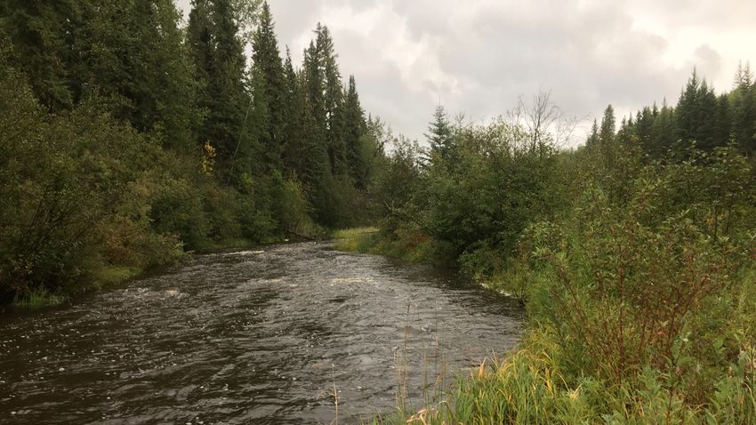
Scope in the Athabasca Tributaries
• Focus on major tributaries of the Lower
 Athabasca River north of Fort McMurray
 – Steepbank River
 – Ells River
 – Mackay River
 – Firebag River
• Data collected annually in the fall from 2011
 (pilot year) to 2019
• Large spatial coverage (120+ sites
 sampled)
• Core sites sampled annually with rotational
 sampling of other sites

 Page 5 – March 2, 2021
Study Design
• Intensive gradient design
• Reference sites
 – Outside bitumen deposit
 (no bitumen observed at
 site or upstream)
 – Inside bitumen deposit
 (bitumen observed and
 confirmed at site or
 upstream)
• Test sites
 – > 10% active lease and >
 1% land disturbance in
 the upstream catchment
 – Further subdivided into
 groups based on level of
 disturbance in upstream
 catchment
 Page 6 – March 2, 2021
Study Design Considerations
Natural co-occurring gradients:
• Slope
• Groundwater inputs
• Nutrients (bogs/fens in upper catchment)
• Natural bitumen seepage and presence in substrate

 Natural bitumen exposure

 Page 7 – March 2, 2021
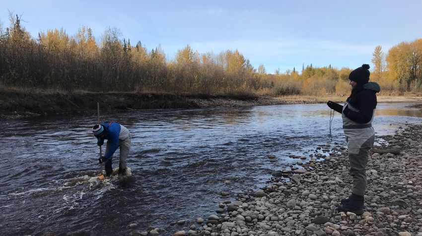
Sampling Methods
CABIN protocol for wadeable streams with additional
measurements for habitat/chemistry data

 Additional to the CABIN protocol
 • Sediment chemistry
 • Periphyton biomass
 • SPMDs (left) for water PACs

 Semi-Permeable Membrane Device

 Page 8 – March 2, 2021
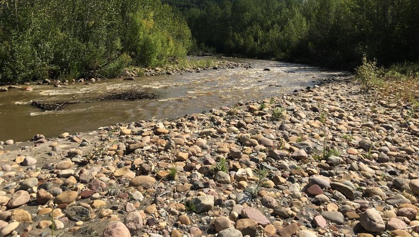
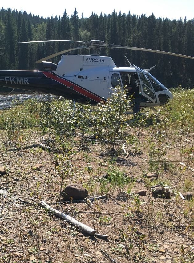
Site Selection and Limitations
• Desktop and aerial
 reconnaissance to find suitable
 erosional habitat and landing
 areas
• All sites are accessed by
 helicopter due to the scale (50+
 sites per year over hundreds of
 km) and remoteness of sampling
 locations
• Helicopter access can be limited
 during high water years

 Page 9 – March 2, 2021
Challenges in the Field
• Intensive field logistics and budget
 – Multiple crews (some years 12+ staff)
 – Multiple helicopters
 – Multiple sets of sampling gear
 – Shipping water samples to labs daily
• High (swift) water years
 – Difficulty accessing sites
 – Difficulty completing the benthic kick and
 other measurements
• Weather delays common in the fall
 (snow, fog)
• Beaver dams
• Keeping samples cool (water and
 sediment) or frozen (SPMDs)
 Page 10 – March 2, 2021
Steepbank River Gradient
 Oil Sands Mineable Area
 Test Group 3 ҧ = 3.2 %
 Development Footprint

 Test Group 2
 Test ҧ = 1.2 %

 Test Group 1 ҧ = 0.9 %

 Reference (Outside Deposit) ҧ = 0.4 %
 Reference (Outside Deposit)

 Page 11 – March 2, 2021
Steepbank River Invertebrates
 Non-metric MDS
 nMDS Plot (PRIMER v.7) Transform: Fourth root
 Resemblance: S17 Bray-Curtis similarity

 2D Stress: 0.19 Category
 Reference - Outside
 Test Group 1
 Test Group 2
 Test Group 3

 Page 12 – March 2, 2021
Steepbank River Invertebrates
PERMANOVA (Permutational MANOVA; PRIMER v.7)

 p values
 Test Group 3
 Ref Test 1 Test 2 Test 3

 Ref 0.0031* 0.0002* 0.0001*
 Test Groups 1 and 2
 Test 1 0.2863 0.0004*

 Test 2 0.0104*

 Test 3
 Reference

 Page 13 – March 2, 2021
Steepbank River Invertebrates
SIMPER (Similarity Percentages; PRIMER v.7)

 Reference vs. Test Groups
 Test Group 3 Plecoptera Nemouridae ↑ Ref
 Brachycentridae ↑ Ref
 Trichoptera Hydropsychidae ↑ Ref
 Test Groups 1 and 2
 Lepidostomatidae ↑ Ref
 Annelida Naididae ↑ Test

 Reference

 www.academic.oup.com

 Page 14 – March 2, 2021
Steepbank River Invertebrates
SIMPER (Similarity Percentages; PRIMER v.7)

 Reference vs. Test Groups
 Test Group 3 Plecoptera Nemouridae ↑ Ref
 Brachycentridae ↑ Ref
 Trichoptera Hydropsychidae ↑ Ref
 Test Groups 1 and 2
 Lepidostomatidae ↑ Ref
 Annelida Naididae ↑ Test

 Test Groups 1 and 2 vs. Group 3
 Reference
 Ephemeroptera Baetidae ↓ Test 3
 Lepidostomatidae ↓ Test 3
 Hydropsychidae ↓ Test 3
 Trichoptera
 Glossosomatidae ↓ Test 3
 www.academic.oup.com Brachycentridae ↓ Test 3

 Page 15 – March 2, 2021
Decision Framework
Level Trigger Magnitude

1 Effect detected Statistical change

 Statistical change in
2 Confirmation of effect
 same direction

3 Exceeds critical effect size Under development

 Exceeds critical effect size and Prolonged exceedance
Action Level
 is getting worse of critical effect size

Integrated Monitoring Plan for the Oil Sands (ECCC 2011)

 Page 16 – March 2, 2021
Summary
• OSM benthic program in Lower Athabasca River tributaries uses
 standardized CABIN protocols to assess invertebrate assemblages
 along a longitudinal gradient of increased oil sands mining development
• There are statistical differences in benthic assemblages from upstream
 reference areas and downstream test groups (in all major tributaries)
• A large portion of the dissimilarity between groups was explained by the
 abundances of several EPT (Ephemeroptera Plecoptera Trichoptera)
 families which are in higher abundance in reference areas and upstream
 test groups
• A critical effects size is being developed to assess
 the ecological importance of these changes and an
 investigation of potential environmental drivers is
 underway

 Page 17 – March 2, 2021
CABIN Biomonitoring in the In Situ
 Oil Sands Regions of Alberta

 Introduction to the Canadian Aquatic Biomonitoring Network
 Environment and Climate Change Canada and Alberta Environment and Parks
 February 24, 2021

Classification: Public
CABIN Monitoring in In Situ Regions
 • Bitumen extraction in the in situ regions of Alberta often occurs in a
 complex landscape of multiple stressors, including agriculture and urban
 development

 • How can a monitoring program be designed
 that teases potential oil sands impacts from other anthropogenic
 stressors?

 https://www.aer.ca/providing-information/by-topic/oil-sands
Classification: Public
CABIN Monitoring in In Situ Regions
 Roadmap for talk:

 1) Choosing sample sites in a complex landscape
 using GIS analysis

 2) Using desktop resources to identify erosional
 habitat in areas targeted for sampling

Classification: Public
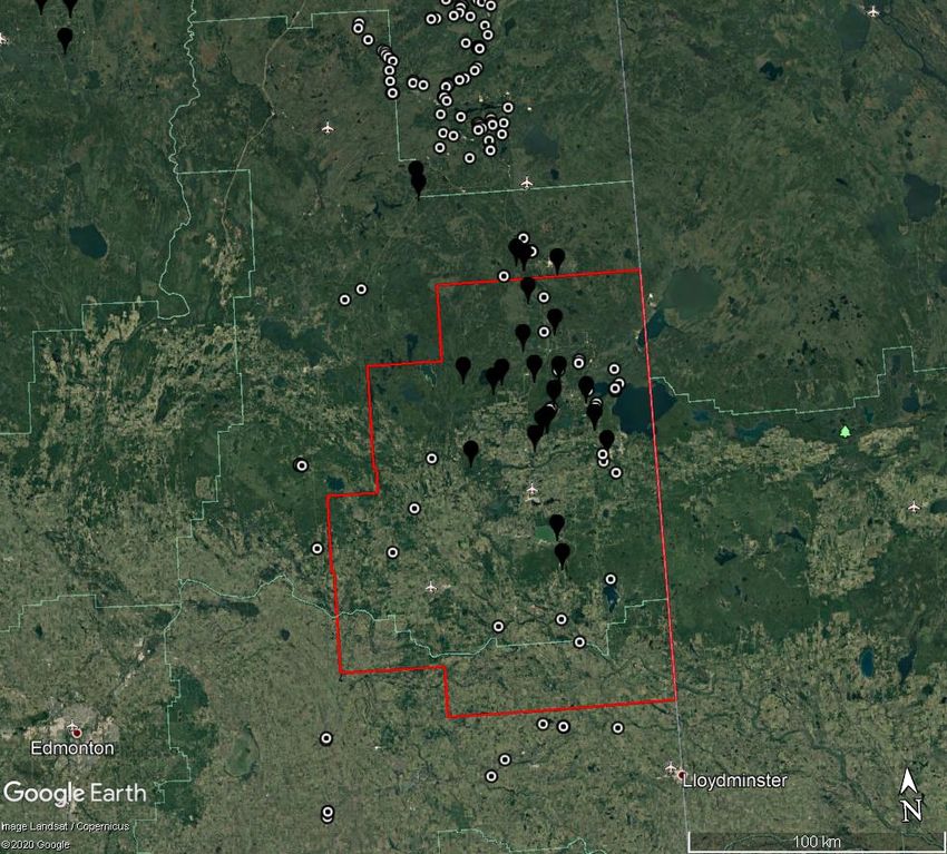
In Situ: Cold
 Lake OSR
 In situ facilities exist in
 agricultural/urban context

 • Agriculture/Urban

 • In situ facilities

 Some facilities are closer
 to agriculture and urban
 areas than others

Classification: Public
In Situ: Peace
 River OSR
 In situ facilities exist in
 agricultural/urban context

 • Agriculture/Urban

 • In situ facilities

 Some facilities are closer
 to agriculture and urban
 areas than others

Classification: Public
In Situ Regions: CABIN in complex landscapes
 • Study design and sampling are ongoing in the in situ regions of the
 province, and effort is focused on using GIS to define types and intensities
 of human activities on the landscape. This allows us to:

 • Choose test sites in areas likely to have potential oil sands impacts.

 • Choose reference sites in areas unlikely to have potential oil sands impacts.

 What about other potential anthropogenic impacts– urban development?
 Agriculture?

Classification: Public
Using GIS to identify potential sample sites
 • Geospatial programs (GIS) can be used to extract data for many types
 of human stressors in sub-watersheds and determine what the primary
 source(s) of potential impacts are

 • There are many publically-available data layers, including the Alberta
 Biodiversity Monitoring Institute’s Human Footprint Inventory (2016)

Classification: Public
Using GIS to identify potential sample sites

 For the in situ regions of oil sands extraction, we work with a GIS specialist to:

 1) Identify the spatial extent of our study areas including potential test and
 reference areas,

 2) Identify the scale to extract stressor information (e.g., “microbasins,” or small
 watersheds at least 25 km2 ),

 3) Identify all potential stressors of interest, including those related to oil sands
 extraction (e.g., facilities, pipeline crossings, etc.) and those related to other
 potential impacts (e.g., forestry, farming, and urban development).

Classification: Public
Using GIS to identify potential sample sites

 4) Once values for stressors are extracted for all microbasins of interest, we
 can quantify the types and intensities of potential impacts across our defined
 study area to help determine test and reference areas.

 What do the results of
 these analyses
 look like?

Classification: Public
Using GIS to identify potential sample sites
 In Situ: Cold Lake
 Microbasins in Green have
 primarily agricultural and/or
 urban activities

 Microbasins in Blue have
 primarily oil and gas-related
 activities

 Microbasins in Black represent the
 top 25% of microbasins with
 highest measured oil and gas-
 related activities
Classification: Public
Using desktop resources to identify erosional
 habitat

Classification: Public
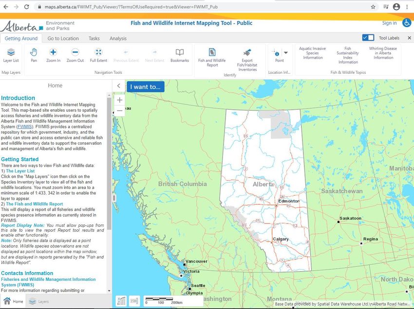
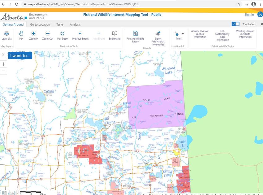
Using desktop resources to identify
 erosional habitat
 • Finding erosional sites appropriate for CABIN sampling can be a challenge
 in some regions
 – E.g., low gradient areas with slow-moving streams.

 • Field reconnaissance is essential, but some tools do exist to help guide
 effective “desktop” searches for erosional habitat.

 • Alberta’s Fisheries and Wildlife Internet Mapping Tool (FWMIT) can be used
 to locate potential erosional habitat.

Classification: Public
FWMIT
 Landing Page
 Everyone who applies
 to conduct a fish and
 fish habitat
 assessment in Alberta
 must submit the
 results of their
 assessments to AEP

 Results are publically
 available via the Fish
 and Wildlife Internet
 Mapping Tool

 Most people use the
 tool to query fish
 records, but habitat
 records are also
 available
Classification: Public
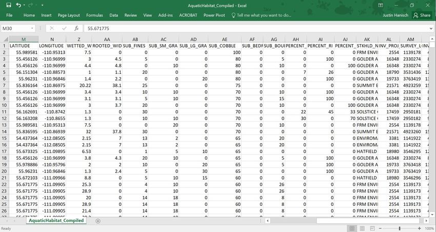
Export
 Fish/Habitat
 Inventories
 Results of fish and
 habitat surveys are
 available via a
 button at the top of
 the page

Classification: Public
Export
 Fish/Habitat
 Inventories
 Results of fish and
 habitat surveys are
 available via a
 button at the top of
 the page

 All surveys can be
 queried within a
 HUC 8

Classification: Public
Export
 Fish/Habitat
 Inventories
 Results of fish and
 habitat surveys are
 available via a
 button at the top of
 the page

 All surveys can be
 queried within a
 HUC 8

 Aquatic habitat
 results can be
 exported to CSV
 after the desired
 HUC 8 is chosen on
 the map
Classification: Public
Classification: Public
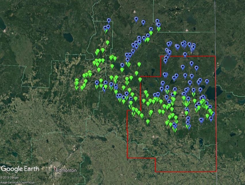
Combining GIS
 and desktop site
 reconnaissance
 We overlaid sites with > 80 % non-
 fine substrate with microbasins
 having the highest calculated oil and
 gas activities

 Conducted fly-over recon in an area
 with both documented erosional
 habitat and microbasins with
 potential O&G impact

 Located several sites for sampling in
 a region we were concerned
 wouldn’t be suitable for CABIN
Classification: Public
Conclusions
 • Process presented here is “screening-level” desktop exercise to identify
 potential test and reference areas and specific sampling locations.

 • FWMIT database is very helpful where lots of previous assessments have
 occurred (e.g., areas of exploration and development) but less so where
 exploration/development haven’t occurred.

 • Geospatial analyses will be combined with measurements of water and
 sediment quality at each site to better quantify potential gradients of
 impacts.

Classification: Public
Acknowledgments
• Funding: Canada-Alberta Oil Sands Monitoring Program
• ECCC and AEP scientific and technical staff
• National Laboratory for Environmental Testing
• Reports: https://www.canada.ca/en/environment-climate-
 change/services/oil-sands-monitoring/documents-reports.html

Classification: Public
Questions?

22
Classification: Public
You can also read