New Zealand Geospatial Research and Development Priorities and Opportunities 2016 2020 - Working in partnership to grow benefits for end users ...
←
→
Page content transcription
If your browser does not render page correctly, please read the page content below

New Zealand Geospatial
Research and Development
Priorities and Opportunities
2016 – 2020
Working in partnership to grow
benefits for end users

 Section A – Overview

Section A
Preface                                                                                                                    1
Overview                                                                                                                   2
Introduction                                                                                                               3
Purpose of this document
Wider contribution
The value of geospatial information                                                                                        4
The value of geospatial information for economies
The value of geospatial information for Maori
The value of geospatial information for sectors
The geospatial R&D ecosystem                                                                                               9
Data collected is fit-for-purpose
Data is accessible and trusted
Datasets appear seamless
Analytics inform and add value for end users
Geospatial R&D priorities                                                                                                  13
Fundamental principles
Priorities and opportunities – sector views
Findings from the workshops
Overarching R&D priorities and opportunities

Next steps                                                                                                                 19

Glossary                                                                                                                   20

Supporting documents
This strategy has been published in three sections.
This is Section A, and the other information is available online
in Section B - Appendix & Section C - Supplementary Information:

  New Zealand Geospatial                                                        New Zealand Geospatial
  Research and Development                                                      Research and Development
  Priorities & Opportunities                                                    Priorities & Opportunities
  2016 - 2020                                                                   2016 - 2020
  Working in partnership to grow                                                Working in partnership to grow
  benefits for end users                                                        benefits for end users

     Section B – Appendix                                                          Section C – Supplementary Information

Section B - Appendix                                                           Section C - Supplementary Information
Online PDF at: www.linz.govt.nz/grdpo-appendix                                 Online PDF at: www.linz.govt.nz/grdpo-supplementary-info

New Zealand Geospatial Research and Development Priorities and Opportunities
December 2015
P1

                                                                                                                                                  Section A - Overview

     Preface
      While working with government, the private
      sector, communities and research and
      development (R&D) providers, it has become
      apparent that there are many opportunities
      for new R&D projects that use geospatial
      information to help end users maximise the
      outcomes from their activities.1

     Currently there is no single document that
     provides an overview of these opportunities
     and identifies geospatial R&D priorities.
     This gap has been the impetus behind the
     development of this document.

     The R&D priorities and opportunities
     contained in this document reflect the views
     of a wide range of stakeholders. We are
     grateful to all those who have contributed to
     its development. In particular we would like
     to acknowledge the workshop facilitator and
     the two hundred or so workshop attendees
     who gave up their valuable time to share
     with us the rich information that has been
     used to inform this document.

1
    Across the public and private sectors there are already many R&D activities using
    geospatial information occurring. By publishing this document and implementing
    the ‘next steps’ we hope to raise overall awareness of these activities.

                                                                                          New Zealand Geospatial Research and Development Priorities and Opportunities
                                                                                                                                                       December 2015
P2

Section A - Overview

Overview
Geospatial information has
the potential to add significant
value to the social, cultural,
environmental and economic
fabric of New Zealand.
It allows us to grow more productive businesses; to deliver social              We recognise that there is already a considerable wealth of R&D
and health services more efficiently; to manage our natural                     material in the public domain and that government agencies,
resources more sustainably; and to manage risk and respond to                   research providers and private sector organisations have R&D
disasters more effectively.                                                     programmes focused on improving the quality, value and use of
                                                                                geospatial data and information. We hope that our work to
To enable us to maximise these benefits in a technologically                    identify these priorities and opportunities will result in R&D that
complex and rapidly changing environment requires an                            significantly improves the value of geospatial data and
intentional focus on developing our R&D capability.                             information to end users, and as a result delivers stronger
                                                                                economic, social and environmental outcomes for New Zealand.
In 2014, we held fourteen themed workshops to help identify the                 We recognise that to achieve this will require ongoing work to:
priorities and opportunities for geospatial R&D in New Zealand.                •	raise awareness of the value of geospatial information
Over 200 participants attended these workshops, which focused                  •	develop our pool of talented geospatial researchers
on identifying key themes for where geospatial R&D would                           and developers
deliver the biggest benefits for end users.                                    •	understand the extent of existing geospatial R&D, both
                                                                                   in the private and public sectors
 We used the findings of these workshops to develop five                       • understand the benefits geospatial R&D can deliver
 overarching R&D priorities for geospatial research:                           •	maximise the outcomes that can be achieved from the use
• understanding the value of geospatial information                                of geospatial information
• increasing the use of geospatial information                                 • encourage prioritised investment in geospatial R&D.
• increasing the collection, validation and analysis of data
•	improving the availability and intensity of                                 We are committed to making this happen, but we can’t do this
   geospatial information                                                      alone. We encourage researchers to engage with end users; end
•	improving the standardisation and interoperability                          users to engage with providers of research; and investors to help
   of geospatial datasets.                                                     end users and researchers realise their goals. We also encourage
                                                                               end users and researchers to consult with government about
To support their delivery we identified 40 associated R&D                      your needs and research proposals, as there may be initiatives
opportunities. We have also used the workshop findings to                      underway which could answer your questions, address your
identify a further 140 specific R&D opportunities. These are                   problems or provide opportunities to collaborate.
contained in the Appendix to this document and are presented
in seven specific topic areas2 and the 12 workshop themes.3
For those preparing proposals for R&D investment, more
detailed information gathered through the workshops has
been presented in the Supplementary Information document
available for viewing and download at www.linz.govt.nz/
grdpo-supplementary-info. These R&D opportunities will provide
benefits to end users across a wide spectrum of sectors.
                                                                               2

                                                                                 The   seven specific topic areas are: Crowd-sourcing, Data Intensity, Data
                                                                                 Management and Governance, Fundamental Datasets, High Value Manufacturing
                                                                                 and Services, Interoperability and Standards, and Metadata.
                                                                               3
                                                                                 The 12 workshop themes are: Auckland Today and Tomorrow, Buildings and Urban
                                                                                 Planning, Canterbury Earthquake Recovery, Culture, Heritage and Tourism, Energy
                                                                                 and Minerals, Environment, Emergency Services and Related Services, Health and
                                                                                 Society, National Infrastructure, National Resilience to Natural Hazards, Primary
                                                                                 Industries, and Strategic Interests Beyond our Borders.

New Zealand Geospatial Research and Development Priorities and Opportunities
December 2015
P3

                                                                                                                                        Section A - Overview

Introduction
Introduction
Purpose of this document                                              Wider contribution

 This document has been developed as part of New Zealand’s             The priorities and opportunities identified in this document
 Geospatial Strategy to help inform future decisions about             directly support the achievement of the LINZ Vision to achieve
 activity and investment in geospatial R&D. It will be particularly    a tenfold increase in the value generated by location information
 useful to researchers and end users, who will have access to          in 10 years (by 2023). They are also closely aligned with the:
 ideas and opportunities that span the breadth and depth of           •	New Zealand Geospatial Strategy
 geospatial activity across New Zealand. It will also enable          •	New Zealand Government’s Information and Communications
 R&D funders to gain a deeper understanding of the benefits               Technology (ICT) Strategy and Action Plan
 that derive from, and the end user demand for, geospatial R&D.       •	New Zealand Data Futures Forum Principles
 This document has a number of aims that contribute to                    and Recommendations
 the ongoing development of a broad-reaching, cross-sector            •	New Zealand Government Open Access and
 geospatial R&D programme, designed to support the                        Licensing (NZGOAL)
 functioning of the geospatial system, including to:                  • National Statement of Science Investment
•	raise the visibility of geospatial R&D in New Zealand              • New Zealand Business Growth Agenda
•	demonstrate how geospatial R&D can contribute to the               •	He Kai Kei Aku Ringa: Crown-Māori Economic
    New Zealand economy                                                   Growth Partnership
•	identify priority areas and opportunities for future               • Thirty Year New Zealand Infrastructure Plan
    geospatial R&D and investment to make the best use of our         • New Zealand’s National Security System
    limited resources                                                 • UN Sustainable Development Goals
•	contribute to achieving increased uptake, use and value            •	Australia and New Zealand Cooperative Research
    creation from geospatial data and information                         Centre for Spatial Information (CRCSI) Strategic Plan.
•	ensure that R&D projects are more closely aligned with
    end user needs                                                    The R&D priorities also contribute to the achievement of
• connect researchers to end user driven research ideas               Government priorities to build a more competitive and
• increase investment in geospatial R&D                               productive economy, to deliver better public services, and
• grow geospatial R&D capability in New Zealand                       to rebuild Christchurch.
•	increase collaboration, connectivity and alignment between
    researchers and end users domestically and internationally
•	identify challenges and constraints that may be impacting
    on developing and delivering geospatial data, information
    and services.

We believe that by working in partnership with researchers and
end users we will create a thriving and well connected geospatial
research community that will grow benefits for New Zealand.
In section 5 we identify a number of steps we will take to
support this approach.

                                                                                New Zealand Geospatial Research and Development Priorities and Opportunities
                                                                                                                                             December 2015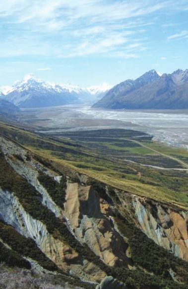
P4

Section A - Overview

The value of geospatial information

 Geospatial information, or at its simplest information about
 location, is changing how we see and interact with the world.                      GEONET – MAKING GEOLOGICAL HAZARD INFORMATION
 It lets us know where things are and how they relate to one                        UNDERSTANDABLE AND ACCESSIBLE
 another. By combining geospatial information with other forms
                                                                                    GeoNet is almost a household name in some parts of
 of data we can create the critical data infrastructure we need
                                                                                    New Zealand. Established in 2001 by GNS Science and
 to create benefit. For example geospatial information can:
                                                                                    sponsored by LINZ and the Earthquake Commission,
• enable the more efficient use of natural resources
                                                                                    GeoNet supports a wide range of activities that contribute
• improve biosecurity and cybersecurity management
                                                                                    to a better definition of potential geological hazards in
•	enhance disaster preparedness, response, recovery
                                                                                    New Zealand and enhanced emergency management and
     and risk mitigation
                                                                                    disaster response.
• support growth in economic development
•	deliver more efficient planning and community
                                                                                    It uses real-time geospatial information to communicate
     service delivery
                                                                                    with people across New Zealand, and also collects
• lead to more effective forecasting and policy formulation
                                                                                    information to extend the knowledge of the scientific
• strengthen national security
                                                                                    community. The network of sensors that underpin GeoNet
• result in cheaper service delivery by government agencies.
                                                                                    work alongside automated software and skilled staff to
                                                                                    detect, analyse and respond to earthquakes, volcanic
The internet, mobile devices and location-based services are
                                                                                    activity, landslides and tsunami.
bringing people into direct contact with geospatial information
on a daily basis. In-car navigation systems, dynamic maps, and
                                                                                    This information is then communicated in a clear and
geotagging of websites and apps have all been made possible
                                                                                    intuitive manner to end users through a range of channels,
by geospatial information.
                                                                                    including an interactive website and mobile phone app.
                                                                                    These have been developed to enable a two-way
Collection, use and reuse of geospatial information are
                                                                                    communication with the public, who can report back to
increasing at a rapid rate. The geospatial industry is estimated
                                                                                    GeoNet on their experiences of a particular event, adding
to be growing at a rate of 30% per annum globally.4
                                                                                    to the richness of information available.

                                                                               4
                                                                                    xera. (2013, January). What is the economic impact of Geo services?: Prepared
                                                                                   O
                                                                                   for Google. Retrieved from http://www.oxera.com/Latest-Thinking/Publications/
                                                                                   Reports/2013/What-is-the-economic-impact-of-Geo-services.aspx.

New Zealand Geospatial Research and Development Priorities and Opportunities
December 2015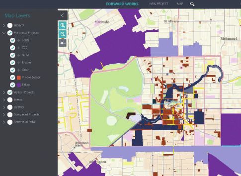
P5

                                                                                                                                            Section A - Overview

The value of geospatial information for
economies

The geospatial sector is having a significant economic impact.5         THE FORWARD WORKS VIEWER – PARTNERSHIP DELIVERS
The Boston Consulting Group estimated in 2012 that broader              PRODUCTIVITY GAINS
geospatial services companies drive $1.6 trillion in revenues and
                                                                        Coordinating building and infrastructure repair across
$1.4 trillion in cost savings throughout the United States
                                                                        multiple organisations under unprecedented conditions was
economy.6 This represents 10% of the United States’ gross
                                                                        the challenged faced after the Canterbury earthquakes.
domestic product (GDP). It is estimated that as much as 80%
                                                                        Enabling multiple parties to see a shared online view of the
of government information has a geospatial component, such
                                                                        horizontal infrastructure repairs, planned buildings, and
as an address or other reference to a physical location.7
                                                                        other construction planning was the solution the Forward
                                                                        Works Viewer (FWV) delivered.
McKinsey have estimated the value of personal
                                                                        The FWV helps users to identify conflicts between
location data to be greater than $100 billion per                       projects and planned network activity, thereby identifying
year in revenue and as much as $700 billion a year                      opportunities to better coordinate their work and resources.

in the value to consumer and business end users.8                       The FWV demonstrates how the private and public
                                                                        sectors can partner to solve big challenges, in this case
Geospatial information and related technologies are already             the $40 billion rebuild of Christchurch. As at 30
adding significant value to the New Zealand economy – in 2008           June 2015, the FWV has generated more than $13 million of
it was estimated that the use and reuse of geospatial information       quantifiable benefits, a figure that is set to grow in
was contributing $1.2 billion in productivity-related benefits;         coming years.
and that New Zealand could see a further $500 million dollars in
economic growth per annum through improved productivity
resulting from advances in geospatial information and
technology.9 This is in addition to the social, environmental and
cultural benefits it can deliver.

                                                                    5
                                                                        Dasgupta, A. (2013, May). Economic Value of Geospatial Data: The great enabler.
                                                                        Geospatial World. Retrieved from http://geospatialworld.net/Magazine/
                                                                        MArticleView.aspx?aid=30534.
                                                                    6
                                                                         Henttu, H., Izaret, J.M., Potere, D. (2012, June) Geospatial Services: A $1.6 Trillion
                                                                          Growth Engine for the US Economy: How Consumers and Business Benefit from
                                                                          Location-Based Information. Boston Consulting Group. Retrieved from http://www.
                                                                          bcg.com/documents/file109372.pdf; p 2.
                                                                    7
                                                                       Folger, P. (2012, April). Issues and Challenges for Federal Geospatial. Congressional
                                                                       Research Service. Retrieved from http://www.fas.org/sgp/crs/misc/R41826.pdf.
                                                                    8
                                                                      Zeiss, G. (2013, May). Economic Value of Big Geospatial Data Could Reach $700
                                                                      billion/yr by 2020. Between the Poles. Retrieved from http://geospatial.blogs.com/
                                                                      geospatial/2013/05/economic-value-of-big-spatial-data.html
                                                                    9
                                                                      ACIL Tasman. (2009, August). Spatial Information in the New Zealand Economy:
                                                                       Realising productivity gains. Retrieved from http://www.linz.govt.nz/about-linz/
                                                                       our-location-strategy/geospatial-projects/spatial-information-new-zealand-
                                                                       economy.

                                                                                  New Zealand Geospatial Research and Development Priorities and Opportunities
                                                                                                                                               December 2015
P6

Section A - Overview

 The value of geospatial information for Māori

Geospatial information makes a major contribution to Māori,
particularly through data/information, knowledge, science and                          MĀORI MAPS – HELPING MĀORI CONNECT TO
innovation, and the Māori economy (eg He Kai Kei Aku Ringa).10                         THEIR ANCESTRAL MARAE

                                                                                       Māori Maps (www.maorimaps.com) is a portal that uses
Geospatial information has the potential to                                            geospatial information to help Māori connect with their
                                                                                       ancestral marae and provide information to visitors.
deliver significant economic and social benefits for
Māori and enhance decision-making by Māori for                                         The initiative, which commenced in 2007 with the founding
                                                                                       of Te Potiki National Trust, went live in 2013 and since then
determining their aspirations.                                                         it has attracted 1600–2000 users per week. It now houses
                                                                                       details of 766 ancestral marae scattered throughout
                                                                                       the country. Marae communities are welcoming the greater
 For example, geospatial information makes a major
                                                                                       visibility and descendants are finding it easier to locate their
 contribution to understanding Māori land.11 Currently a large
                                                                                       tūrangawaewae. There are plans to add new layers of
 proportion of Māori owned land has been characterised as
                                                                                       information and mapping in future.
 under-utilised or unproductive. Geospatial information provides
 the underlying knowledge to increase the utilisation and
 productivity of this land.12 A number of strategies and actions
 can be used to achieve this including:
• identifying land potential
•	resetting New Zealand’s property rights system to accelerate
   Māori development
•	developing innovative and holistic systems thinking
   approaches to sustainable land management
•	implementing novel, natural resource, co-management
   operating models
•	documenting the rich indigenous cultural history, such as
   Māori values, ancestral stories and geographic place names,
   that can strengthen the connection between Māori and the
   land and support Māori economic development aspirations.

                                                                               10
                                                                                  Further information can be found at http://www.mbie.govt.nz/info-services/
                                                                                    infrastructure-growth/maori-economic-development
                                                                                  Examples include Māori Land Online: http://www.maorilandonline.govt.nz/gis/
                                                                               11

                                                                                  home.htm; and the Visualising Māori Land tool: http://whenuaviz.
                                                                                  landcareresearch.co.nz/.
                                                                               12
                                                                                   LINZ. (2015). Maori and Iwi Development. Retrieved from http://www.linz.govt.nz/
                                                                                    about-linz/m%C4%81ori-and-iwi-development.

New Zealand Geospatial Research and Development Priorities and Opportunities
December 2015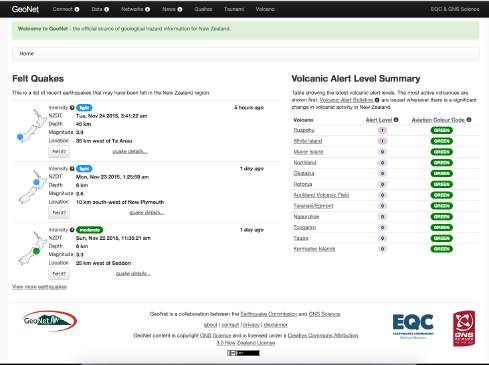
P7

                                                                                                                                   Section A - Overview

The value of geospatial information for sectors

 A 2013 study13 of the contribution of geospatial data
 and technology to the Canadian GDP found the sectors
 most impacted by productivity improvements were, in
 order of magnitude:
• mining, quarrying, oil and gas extraction
• transportation and warehousing
• utilities
• public administration
• construction
• agriculture, forestry, fishing and hunting
• management of companies and enterprises.

To realise similar gains in the New Zealand economy requires
an ongoing commitment to the development of the geospatial
infrastructure and associated technologies.

As the end users of geospatial research are spread
across the whole spectrum of public, not-for-profit and
private sector organisations, businesses, communities
and individuals our challenge is to capture their needs so
they feed into the development of future geospatial
R&D opportunities and priorities.

                                                                 eo Connections. (2015, March). Canadian Geomatics Environmental Scan and
                                                                G
                                                               13

                                                                Value Study. Natural Resources Canada. Retrieved from http://ftp2.cits.rncan.gc.ca/
                                                                pub/geott/ess_pubs/296/296426/cgdi_ip_41e.pdf

                                                                           New Zealand Geospatial Research and Development Priorities and Opportunities
                                                                                                                                        December 2015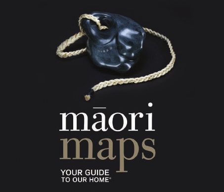
Section A - Overview

New Zealand Geospatial Research and Development Priorities and Opportunities
December 2015
P9

                                                                                                                                                                                                    Section A - Overview

The geospatial R&D ecosystem

Geospatial infrastructures are by their nature complex; they
require a pool of talented private and public sector researchers
delivering targeted and focused geospatial R&D to support their
development. A study commissioned by the Spatial Industries
Business Association (SIBA) and LINZ in 201214 identified that
New Zealand has a geospatial skill shortage that is constraining
the industry. As a result LINZ has initiated a number of
schemes, in partnership with other organisations, which are
aimed at increasing capability across the sector; for example
the multi-university Geographical Information System (GIS)
Masters programme.15

A successful and well-functioning geospatial R&D community
is one that is well-connected, particularly across the public and
private sectors, and has a strong focus on growing benefits for
end users, whether these are economic, environmental, social
or cultural. Figure 1 demonstrates how such a system can work.

Figure 1: Growing benefits for ends users and New Zealand

                                                              Connectivity

                                                                                                                           Benefit and value creation

                                Other relevant, non-location based
                                                                                                                                                                                                                          Well being for future generations

                                information and inputs needed to
                                                                                                                                                                                            Higher living standards for

                                     fully inform the decision
                                                                                                                             Environmental benefits
                                                                                                       Economic benefits

                                                                                                                                                                        Cultural benefits

                                                                                                                                                                                                New Zealanders
                                                                                                                                                      Social benefits

      1. Data collected is fit-for-purpose                  Supporting better decision
      2. Data is accessible and trusted         End
                                                            making: working smarter to
      3. Datasets appear seamless               user
                                                            raise productivity and benefits
      4. A
          nalytics inform and add
         value for end users

                                                                     14
                                                                            e Roiste, M. (2012, July). The Geospatial Skills Shortage in New Zealand. LINZ and
                                                                           d
                                                                           SIBA. Retrieved from http://www.victoria.ac.nz/sgees/about/staff/pdf/Geospatial-
                                                                           SkillsShortageReport.pdf#Geospatial%20skills%20shortage%20in%20New%20
                                                                           Zealand%20report.
                                                                     15
                                                                           Further information can be found at http://www.mgis.ac.nz/.

                                                                                   New Zealand Geospatial Research and Development Priorities and Opportunities
                                                                                                                                                December 2015
P10
Section A - Overview
Data collected is fit-for-purpose
Data can be, and is being, collected in many different ways. Figure 2 illustrates this by providing an example of how an
Sensors are being embedded across our cities to collect data end user considering building a housing development in
on how we move and interact with our environment; and mobile a specific location may need to take a systems view, which
devices and apps are being designed to transmit increasing takes into account information about other related objects
amounts of data to support the development of future services or attributes and their locations.
and offerings. This is leading to large collections of data,
known as ‘big data’.
But is all of this data ‘fit-for-purpose’? This is not an easy
question to answer; therefore for the purposes of this document
we have defined fit-for-purpose as data that allows the end users
to make well informed decisions. This may include information
relating to the:
• frequency of data measurement
• degree of data resolution
• accuracy and completeness of data
• provenance of data
• accessibility of data
• data cost and/or end user affordability.
Figure 2: Geospatial information enabling a holistic approach to end user decision making
Enabling a holistic approach for end user decision
making by using location-based information
Example: Is this the best new
housing development site?
Information Needed:
Are there natural hazard risks
such as flooding? Are there
endangered species living here?
Road access
Where is the nearest good road access?
Underground infrastructure and electricity
Is there underground infrastructure nearby with latent capacity?
Is the electricity grid nearby?
A large city
Is there a major city nearby?
New Zealand Geospatial Research and Development Priorities and Opportunities
December 2015P11
Section A - Overview
Data is accessible and trusted Datasets appear seamless
There are many obstacles to increasing the uptake and use of The collection and management of geospatial data are
geospatial information including concerns about data privacy, considered by many to be the costliest components of a GIS;
data ownership, the liability for the use of data and data some experts attribute close to 80% of GIS total costs to
confidentiality. In addition, datasets need to be discoverable data acquisition.18
so that they can be reused for other purposes, thereby
increasing their value. Implementing shared standards for metadata and understanding
the connectivity between datasets and data layers are key
enablers that will increase the value we can get from using and
SEA CHANGE – TAI TIMU TAI PARI – reusing data. They allow data to appear seamless, and enable
NEW ZEALAND’S FIRST MARINE SPATIAL PLAN users to more easily work across different datasets, and extract
Sea Change17 will be New Zealand’s first Marine Spatial Plan information from them with higher levels of confidence.
(MSP) when it is delivered in 2016. It is centred on the
1.2 million ocean hectares of the Hauraki Gulf, which
supports a range of wild life, as well as human activities Analytics inform and add value for end users
such as tourism, boating, aquaculture and fishing.
This jewel in Auckland’s crown is under pressure as it End users need to have access to reliable and understandable
faces challenges from increased accumulation of toxic information that supports them to make more informed
metals, reduction in species, changes in natural habitats, decisions. If information cannot be quickly and easily
and impacts of shipping on marine mammals. understood, or if it is unreliable or inaccurate, then this may
impact on decision making, resulting in unintended
The MSP is focused on finding ways to share and care consequences and outcomes.
for a marine environment now so it is available for future
generations. MSP is a proven methodology that has The quality and availability of analytical and decision
been used around the world. Mana whenua, and local and support tools is critical for some end users to enable them
central government are working in partnership to secure to extract value from geospatial data and information.
a healthy, productive and sustainable resource for now
and future generations.
17
Further information can be found at http://www.seachange.org.nz/.
18
New York State Department of Environmental Conservation, Center for
Technology in Government. (1995), Sharing the Costs, Sharing the Benefits:
the NYS GIS Cooperative Project. Project Report 95-4. Retrieved from http://www.
ctg.albany.edu/publications/reports/sharing_the_costs/sharing_the_costs.pdf
New Zealand Geospatial Research and Development Priorities and Opportunities
December 2015Section A - Overview New Zealand Geospatial Research and Development Priorities and Opportunities December 2015
P13

                                                                                                                                                Section A - Overview

Geospatial R&D priorities
Fundamental principles                                                  Priorities and opportunities – sector views

To determine and help develop New Zealand’s R&D priorities              Fourteen themed workshops were held in 2014 to help identify
we identified the following fundamental principles for                  the priorities and opportunities for geospatial R&D. Over 200
geospatial R&D.                                                         participants attended these workshops, which primarily focused
                                                                        on identifying end user needs. This allowed us to develop a
1.	Value is created by end users when they generate economic,
                                                                        greater understanding of the benefits that would accrue to end
    environmental, cultural or social benefits from their activities.
                                                                        users from access to appropriate geospatial information.
2.	Geospatial information and analytics have to be fit-for-
    purpose, easily understood and usable in order to create
                                                                        The outcomes of these workshops are captured on the
    benefit for end users.
                                                                        following pages and are presented in more detail within the
3.	Geospatial R&D should contribute to the desired
                                                                        Supplementary Information document available from
    tenfold increase in the value gained from the use and
                                                                        www.linz.govt.nz/grdpo-supplementary-info.
    reuse of geospatial data and information by 2023.
4.	End users have a key role to play alongside R&D specialists
                                                                        Critical to determining these priorities and opportunities in the
    in informing priorities for geospatial-related R&D investments.
                                                                        workshops was the recognition that how the R&D will be used
5.	There should be a core tier of well-validated fundamental
                                                                        by end users informs what researchers prioritise and undertake.
    datasets, for example space (x, y, z) and time (t), which
                                                                        Therefore an important element of gathering information to
    should be freely available to all New Zealanders.
                                                                        inform this document was to ensure strong alignment between
6.	The governance of New Zealand’s geospatial data, information
                                                                        the end use and benefits of R&D and the projects and results
    and systems should align to the principles and objectives of
                                                                        (Figure 3).19 The stronger the alignment, the more seamless the
    the NZGOAL framework.
                                                                        adoption of the R&D project outputs by the end user, and the
7.	Interoperability between geospatial and non-geospatial
                                                                        greater the value generated.
    datasets is critical given that most uses of geospatial data
    and information involve the integration of more than one
                                                                        A high-level view of workshop findings applying this model is
    of these datasets.
                                                                        presented in Figure 4.
8.	It is critical that we understand and can model
    the relationships between different data layers.
9.	Geospatial data and information should, where possible,
    be easily discoverable, actively promoted, accessible
    and reuseable.
10.The use of resources should be maximised by minimising
    duplication of R&D effort and by leveraging off R&D
    conducted both domestically and internationally.

Figure 3: Turning project results into end user benefits

                         R&D Providers                           Handover                                     R&D end users

         Projects                              Results                                       Uses                                          Benefits

                                                                  Engage

                                                                        19
                                                                             T
                                                                              he methodology developed by Phil Driver, OpenStrategies, was used in this pro-
                                                                             cess. Phil Driver also facilitated these workshops.

                                                                                        New Zealand Geospatial Research and Development Priorities and Opportunities
                                                                                                                                                     December 2015
P14
Section A - Overview
Findings from the workshops
A number of common themes and topics emerged from the • the development and application of consistent data
workshops. standards for all future geospatial datasets so that
they are automatically interoperable.
1. Stakeholders agreed that the potential exists to extract
greater value from the use of geospatial information. However 6. Application of the principles of NZGOAL20 to both
the achievement of the targeted tenfold growth will be fundamental and non-fundamental geospatial datasets
dependent on a significant increase in the amount of created by public sector organisations and encouragement to
information and data that is available, within the context of creators of non-government datasets to apply the principles
a well-functioning spatial data infrastructure (SDI) where: of NZGOAL.
• all fundamental geospatial datasets have been identified,
are readily discoverable, accessible, interoperable and 7. The workshops provided some insights into the needs of
useable, and are being promoted widely end users:
• governance issues relating to geospatial information • End users are constrained by their ability to understand the
including data ownership, privacy, confidentiality, information being conveyed; “intuitive use” was mentioned
discoverability, access and liability have been resolved often. Decision support tools were also noted as being
• datasets are fit for purpose, for example they needed for some end users.
are up-to-date, liability-free, precise, accurate, • Whilst some end users are constrained by their ability to
complete, standardised, interoperable and have use the information provided, there was a widely held belief
the appropriate resolution. that the uptake and use of geospatial information can be
increased by making key geospatial information available in
The work required to develop and implement a national
a relatively unprocessed form.
SDI is being implemented through the New Zealand
• Data of the appropriate scale and resolution is needed
Geospatial Strategy.
to support specific end user needs, for example, a farmer
might need sub-paddock level data about the nature
2. It wasn’t fully understood where the greatest value creation
of soils.
will come from eg commercial, public or individual use.
• Each sector has specific requirements, for example
the farming industry requires a greater understanding of
3. Overall there was a low awareness of the work-streams related
the soil variability on individual farms.
to the New Zealand Geospatial Strategy, for example strategic
• Most end uses of geospatial information require the
goals and actions focussed on establishing fundamental
overlaying of multiple, interoperable sets of geospatial
datasets, data standards and dataset interoperability.
information.
• Geospatial datasets need to be interoperable with
4. A number of New Zealand wide initiatives were identified
non-geospatial datasets.
as being needed to support the planned growth.
• What end users want in relation to geospatial information
and what the providers of geospatial information are
5. Raising general awareness to demonstrate and articulate
delivering is sometimes disconnected.
the additional value geospatial information and analytics
can create. For example:
• increased connectivity and coordination between domestic
and international research teams to increase the value
created by R&D
• coordination of the collection of key datasets across
multiple agencies so that efficiencies can be gained
through reducing duplication of resources, facilitating
interoperability, sharing standards and assuring quality
• a single portal, or ‘one door approach’, to make all online
access of geospatial information quick, easy and reliable
• a system-wide stocktake of datasets and their
interrelationships, feeding into a comprehensive up-to-
date and maintained ‘catalogue’
• geospatial communities of practice to accelerate knowledge
and best practice sharing and capability building across
different organisations
• use of a common language and definitions, for example
what does ‘data quality’ mean, to develop a common
and shared understanding
20
urther information can be found at: https://www.ict.govt.nz/guidance-and-
F
resources/open-government/new-zealand-government-open-access-and-
licensing-nzgoal-framework/.
New Zealand Geospatial Research and Development Priorities and Opportunities
December 2015P15
Section A - Overview
Figure 4: High-level view of workshop findings
Projects Results Uses Benefits
Fundamental/core 4D Other geospatial products Energy and minerals
position/time geospatial and services
dataset (x, y, z, t)
Canterbury
earthquake recovery
Fundamental attribute Fundamental/core 4D
datasets position/time geospatial
dataset (x, y, z, t) Economic, social,
National
cultural and
infrastructure
environmental benefits
Fundamental attribute datasets
Other key attribute datasets
Buildings and
urban planning
Other key attribute datasets Culture, heritage
Tools to enable interoperability and tourism
of existing datasets and
data layers
Tools to enable interoperability Natural hazards
of existing datasets and data
layers
Geospatial standards and
systems to guide future
Offshore interests
geospatial datasets
Standards/systems to guide Benefits to end users,
future geospatial datasets citizens, communities,
Analytic, communication and the geospatial sector
Health and society and New Zealand.
decision support tools to
help people use geospatial
information Analytic, communication
and decision support tools
Environment
Governance, management
and policies re geospatial
information Governance, management
and policies Agriculture and
forestry
Goespatial data collection
instruments and systems Data collection instruments Aquaculture and
and systems fisheries
Emergency and Higher living standards
Promotion, discoverability related services for New Zealanders and
access collateral Promotion, discoverability
well being for future
collateral
generations
Manufacturing and
services
Communities of practice Communities of practice
ICT
New Zealand Geospatial Research and Development Priorities and Opportunities
December 2015P16
Section A - Overview
Overarching R&D priorities and opportunities Increasing the use of geospatial information
We have identified five overarching priorities for R&D There are many constraints that limit the use of geospatial
using geospatial information: information. By fully understanding these we can develop and
• understanding the value of geospatial information implement strategies and approaches to significantly increase
• increasing the use of geospatial information the use and value-add of geospatial data and information.
• increasing the collection, validation and analysis of data
• improving the availability and intensity of RESEARCH QUESTIONS
geospatial information
a) What are the sector-specific barriers (technical, scientific,
• improving the standardisation and interoperability
social, economic and cultural) to greater use of geospatial
of geospatial datasets.
information by end users and what can be done to raise end
user awareness of the benefits of geospatial information
A number of the key opportunities for R&D that respond
within each sector?
to these priorities are presented below. Further details on
b) How can current and future R&D be made more relevant
the R&D opportunities that came out of these workshops
to end users?
are summarised in the Appendix which is available at
c) How can R&D outcomes be effectively disseminated to
www.linz.govt.nz/grdpo-appendix. More in-depth information
end users?
about this material is provided in the Supplementary Information
d) How can end users be empowered to make more use of
document, which is available from www.linz.govt.nz/
geospatial information?
grdpo-supplementary-info.
e) What R&D is required to support the development of
products and services that are intuitive for end users and
Researchers and end users should note that the opportunities
support decision making?
presented in this document may not take into account what R&D
f) How can developments in technologies, such as the semantic
projects have been undertaken, are currently underway, or are
web, improve the usability of geospatial information?
being planned. We urge researchers and end users to undertake
g) What approaches are needed to standardise and ensure the
their own investigation and take this into account when scoping
use of a common language within the geospatial community
up new R&D proposals. We also plan to undertake work to
and amongst end users?
develop a deeper understanding about the extent of geospatial
R&D and related activities across New Zealand. DEVELOPMENT OPPORTUNITIES
a) Marketing programmes to increase the use of
geospatial information.
Understanding the value of geospatial b) Projects to improve geospatial resource discoverability
information and access.
c) Approaches to improve geospatial data processing
and visualisation.
By understanding the value geospatial information can create
for end users it is possible to understand the value and potential
of each dataset, and the relationships between datasets.
RESEARCH QUESTIONS
a) What are the benefits to New Zealand from investments
that support the wider use of geospatial data and information
over the next 10 years and how are these best articulated?
b) Which fundamental geospatial datasets will deliver the
greatest end user benefit?
c) What is the net value to users of each fundamental dataset
and which ones need to be interoperable?
d) Which governance arrangements and business models deliver
the most value from geospatial data and information?
e) What is New Zealand’s uniqueness in terms of geospatial
information and what opportunities exist to develop
and exploit this?
DEVELOPMENT OPPORTUNITIES
a) Building upon what has already been conducted in
government, develop approaches to establish a hierarchy
of fundamental datasets and interoperable clusters of key
fundamental datasets.
New Zealand Geospatial Research and Development Priorities and Opportunities
December 2015P17
Section A - Overview
Increasing the collection, validation and Improving the availability and intensity of
analysis of data geospatial information
There are many approaches to creating, collecting, validating The availability and intensity of geospatial datasets varies across
and analysing geospatial data and information. We need to New Zealand, for example urban areas may require datasets with
develop a greater understanding of the strengths and higher levels of accuracy and resolution than remote national
weaknesses of the various mechanisms and approaches. parks such as Fiordland.
RESEARCH QUESTIONS RESEARCH QUESTIONS
a) What are the most effective mechanisms and processes for a) What is the concept of ‘data intensity’ and what are
rapidly collecting geospatial information and what are the the data management challenges that come with increasing
associated governance and management issues? data intensity?
b) How can geospatial information be cost-effectively extracted b) What data do we have, what is its intensity, and to what
from existing geospatial datasets (eg crowd-sourced extent is it enabling end users to generate value?
supermarket data)? c) What is the ideal intensity for different geospatial datasets
c) What are the unique characteristics of crowd-sourced data based on the correlation between end user needs and
and what is its potential value and impact? value generated?
d) How can crowd-sourced geospatial data be combined with d) What are the priorities for future geospatial data?
existing non-crowd-sourced datasets and how can the e) How much geospatial data is withheld and what is the impact
metadata of such a combined set be ‘mashed up’? of not sharing this information?
e) What protocols/tools/methods are needed for the ‘mash-up’ f) How can we best improve the governance and management
of metadata when geospatial datasets are inter-linked? of geospatial resources?
f) How can we remove duplication and ensure key datasets are
collected only once? DEVELOPMENT OPPORTUNITIES
g) What are the best protocols, methods and procedures for
a) Approaches that create more (or less) intense geospatial
addressing the trust/liability/validation issues associated with
datasets for identified, high value uses.
all types of geospatial information?
h)Why aren’t metadata standards being widely adopted? Are
existing metadata standards appropriate for end user needs?
i) What are the best ways of conveying ‘validation’ or ‘fitness- Improving the standardisation and
for-purpose’ concepts to those delivering products and
services to end users?
interoperability of geospatial datasets
j) How can the adoption of standards be best incentivised?
k) How are needs and uses for data evolving and what new data Ideally datasets should be standardised and fully interoperable.
might be required in the future? However, the scale of work needed to achieve this outcome
needs to be understood and alternative approaches need to
DEVELOPMENT OPPORTUNITIES be explored to achieve a similar outcome in the short to
a) New data collection approaches and technologies medium term.
for the creation, collection, validation and dissemination
RESEARCH QUESTIONS
of geospatial data.
a) How can we best understand and model the data
relationships between different layers of data?
b) What are the impacts of non-standardised
geospatial information?
c) What approaches can be used to make non-interoperable
geospatial data at least partially interoperable?
d) How does the adoption of interoperability standards for
fundamental datasets drive the adoption of interoperability
standards for non-fundamental datasets?
e) What are the costs and benefits of investing in full
interoperability versus developing interoperability tools or
upskilling end users to use non-interoperable, or partially-
interoperable, geospatial data?
DEVELOPMENT OPPORTUNITIES
a) Approaches that make non-fundamental datasets more
useable and interoperable.
New Zealand Geospatial Research and Development Priorities and Opportunities
December 2015Section A - Overview New Zealand Geospatial Research and Development Priorities and Opportunities December 2015
P19

                                                                                                                             Section A - Overview

 Next steps

The workshops identified a rich list of R&D priorities and
opportunities, both overarching and sector specific.

The overarching priorities capture the
pieces of research that will help to increase the
value that can be gained from the use of
geospatial information.

Our challenge is to influence key decision-makers so that
these pieces of research are integrated into the work-streams
of relevant government agencies.

We believe that the priorities identified in Understanding the
value of geospatial information should be given early attention in
order to inform the prioritisation of effort across sectors
and within sectors.

 We will continue to work in partnership with end users and
 research providers to ensure their needs are understood and well
 communicated. More specifically we will:
•	continue to raise awareness about the value geospatial
    information can create through engaging with stakeholders,
    investors and end users
•	review this document every 5 years and the Appendix and
    Supplementary Information document annually
•	focus efforts on growing capability with the aim of increasing
    engagement between researchers and end users both here
    and internationally, for example we will strengthen
    engagement with the CRCSI and tertiary education providers
•	gain a deeper understanding of the extent of, and develop
    a baseline for, geospatial R&D and related activities in
    New Zealand, for example through assessing levels of
    investment within topics and sectors
•	ensure ongoing governance of the implementation of this
    document and its ongoing development.

End users are encouraged to explore how geospatial information
can add value to your ventures. If you identify specific R&D
opportunities then we invite you to bring them to our attention
or to the attention of R&D providers or investors.

                                                                     New Zealand Geospatial Research and Development Priorities and Opportunities
                                                                                                                                  December 2015
P20
Section A - Overview
Glossary
There are a number of technical terms used in this document.
An explanation of these is given below.
Data New Zealand Government Open Access and
Information in raw or unorganised form (such as alphabets, Licensing (NZGOAL)
numbers, or symbols) that refers to, or represents, conditions, The government guidance for agencies to follow when releasing
ideas, or objects. Very large collections of data are sometimes copyright works and non-copyright material for reuse by others.
called ‘big data’. See https://www.ict.govt.nz/guidance-and-resources/open-
government/new-zealand-government-open-access-and-
End users or R&D end users licensing-nzgoal-framework/ for more information.
People who use R&D results to create economic, cultural, social
or environmental benefit for New Zealand. For example: Researchers or R&D providers
policy-makers in local and central governments and ‘people in These are people or organisations that conduct research and
the field’ such as farmers, foresters and service providers. development. They can be from both the public and private
sectors. For example, universities and Crown Research Institutes
Fundamental geospatial datasets (CRIs) as well as companies that operate in this area.
Nationally-significant geospatial data that is critical to the
effective running of New Zealand, and works together to help Spatial data infrastructure (SDI)
support growth in the economy. An SDI can be broadly defined as a network of components that
allows people to find, share and use spatial data.
Gross Domestic Product (GDP)
One of the primary indicators used to gauge the health of a
country’s economy. It represents the total dollar value of all
goods and services produced over a specific time period; you
can think of it as the size of the economy.
Geospatial
The terms ‘geospatial’, ‘spatial information’, ‘location information’
and ‘location-based information’ are often used interchangeably.
In this document we have primarily used the term ‘geospatial’.
Geographic Information Systems (GIS)
A system designed to capture, store, manipulate, analyse,
manage, and present all types of spatial or geographical data.
Interoperability
The ability of different information technology systems and
software applications to communicate, exchange data, and use
the information that has been exchanged.
Metadata
Data that describes other data. Metadata summarises basic
information about data, which can make finding and working
with particular instances of data easier.
New Zealand Geospatial Research and Development Priorities and Opportunities
December 2015Supporting Documents
This strategy has been published in three sections.
This is Section A, and the other information is available online
in Section B - Appendix & Section C - Supplementary Information:
New Zealand Geospatial New Zealand Geospatial
Research and Development Research and Development
Priorities & Opportunities Priorities & Opportunities
2016 - 2020 2016 - 2020
Working in partnership to grow Working in partnership to grow
benefits for end users benefits for end users
Section B – Appendix Section C – Supplementary Information
Section B - Appendix Section C - Supplementary Information
Online PDF at: www.linz.govt.nz/grdpo-appendix Online PDF at: www.linz.govt.nz/grdpo-supplementary-info
New Zealand Geospatial Research and Development Priorities and Opportunities
December 2015Creative Commons
This work is licensed under the Creative Commons
Attribution 4.0 New Zealand licence. In essence, you are
free to copy, distribute, and adapt the work, as long as you
attribute the work to the Crown and abide by the other
licence terms. To view a copy of this licence, visit http://
CONTACT: creativecommons.org/licences/by/4.0/nz/. Please note that
no departmental or governmental emblem, logo, or Coat of
nzgo@linz.govt.nz Arms may be used in any way that infringes any provision
New Zealand Geospatial Office of the Flags, Emblems, and Names Protection Act 1981.
Land Information New Zealand Attribution to the Crown should be in written form and not
PO Box 5501 by reproduction of any such emblem, logo, or Coat of Arms.
Wellington © Crown copyright
Phone: +64 4 460 0110
ISBN 978-0-478-10767-8
www.linz.govt.nzYou can also read