OPEN SPACE AND RESOURCE CONSERVATION ELEMENT
←
→
Page content transcription
If your browser does not render page correctly, please read the page content below
Sonoma County General Plan 2020

OPEN SPACE AND RESOURCE CONSERVATION
               ELEMENT

  Sonoma County Permit and Resource Management Department
                    2550 Ventura Avenue
                    Santa Rosa, CA 95403

              Adopted by Resolution No. 08-0808
          of the Sonoma County Board of Supervisors
                     September 23, 2008

    Amended by Resolution No. 10-0636 on August 24, 2010
   Amended by Resolution No. 13-0350 on September 10, 2013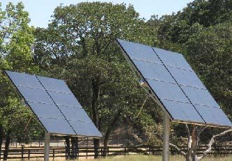
Open Space & Resource Conservation Element
OPEN SPACE AND RESOURCE CONSERVATION ELEMENT
TABLE OF CONTENTS
1. INTRODUCTION .................................................................................................5
1.1 PURPOSE..............................................................................................5
1.2 RELATIONSHIP TO OTHER ELEMENTS ...................................................5
1.3 SCOPE AND ORGANIZATION .................................................................7
2. SCENIC RESOURCES ............................................................................................7
2.1 POLICY FOR COMMUNITY SEPARATORS ................................................8
2.2 POLICY FOR SCENIC LANDSCAPE UNITS .............................................. 13
2.3 POLICY FOR SCENIC CORRIDORS ........................................................ 18
2.4 POLICY FOR OUTDOOR LIGHTING ....................................................... 20
2.5 POLICY FOR URBAN DESIGN ............................................................... 22
2.6 POLICY FOR RURAL CHARACTER ......................................................... 23
3. BIOTIC RESOURCES .......................................................................................... 25
3.1 POLICY FOR BIOTIC HABITAT AREAS .................................................. 25
3.2 POLICY FOR RIPARIAN CORRIDORS .................................................... 31
3.3 POLICY FOR MARINE FISHERY AND HARBOR RESOURCES .................... 36
4. SOIL RESOURCES .............................................................................................. 37
4.1 POLICY FOR CONSERVATION OF AGRICULTURE AND TIMBER SOILS .... 37
4.2 POLICY FOR REDUCTION OF SOIL EROSION ........................................ 38
5. TIMBER RESOURCES ......................................................................................... 39
7. ENERGY RESOURCES ......................................................................................... 42
7.1 POLICY FOR ENERGY CONSERVATION AND DEMAND REDUCTION ........ 43
7.2 POLICY FOR ENERGY PRODUCTION AND SUPPLY ................................. 45
8. AIR RESOURCES ................................................................................................ 47
9. OUTDOOR RECREATION .................................................................................... 49
9.1 POLICY FOR PARKS AND EQUESTRIAN AND HIKING TRAILS ................. 49
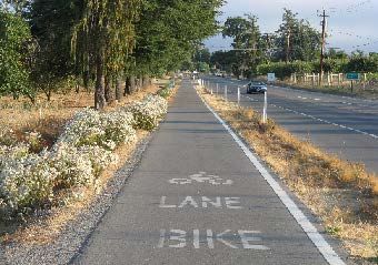
9.2 POLICY FOR BIKEWAYS ...................................................................... 52
10. ARCHAEOLOGICAL, CULTURAL, AND HISTORICAL RESOURCES .......................... 55
11. OPEN SPACE AND RESOURCE CONSERVATION IMPLEMENTATION PROGRAM ..... 57
Footnote: *Mitigating Policy
Page OS-2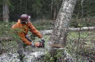
Open Space & Resource Conservation Element

                         Footnote: *Mitigating Policy
                                     Page OS-3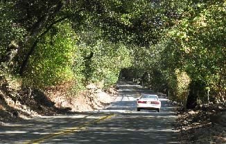
Open Space & Resource Conservation Element

                                               FIGURES
Figure   OSRC-1:     Scenic Resource Areas ........................................................... After       Text
Figure   OSRC-2:     Biotic Resource Areas ............................................................. After     Text
Figure   OSRC-3:     Trails After Text
Figure   OSRC-4:     Class I Bikeways .................................................................... After   Text
Figure   OSRC-5a     OPEN SPACE MAP: Sonoma Coast / Gualala Basin..................... After                       Text
Figure   OSRC-5b:   OPEN SPACE MAP: Cloverdale / N.E. County .............................. After                  Text
Figure   OSRC-5c:    OPEN SPACE MAP: Healdsburg and Environs ............................ After                    Text
Figure   OSRC-5d:    OPEN SPACE MAP: Russian River Area ..................................... After                Text
Figure   OSRC-5e:    OPEN SPACE MAP: Santa Rosa and Environs ............................ After                    Text
Figure   OSRC-5f:    OPEN SPACE MAP: Sebastopol and Environs ............................ After                    Text
Figure   OSRC-5g:    OPEN SPACE MAP: Rohnert Park - Cotati and Environs .............. After                       Text
Figure   OSRC-5h:    OPEN SPACE MAP: Petaluma and Environs ............................... After                   Text
Figure   OSRC-5i:    OPEN SPACE MAP: Sonoma Valley ........................................... After               Text

                                                                                            Footnote: *Mitigating Policy
                                                                                                        Page OS-4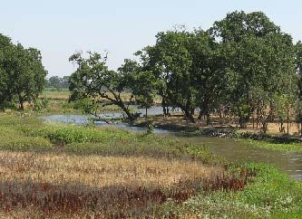
Open Space & Resource Conservation Element

OPEN SPACE AND RESOURCE
CONSERVATION ELEMENT

                                  1. INTRODUCTION

1.1    PURPOSE

State law recognizes that open space land is a limited and valuable resource which must be
conserved wherever possible. The element addresses open space for the preservation of
natural resources, for the managed production of resources, for outdoor recreation, for public
health and safety, and for Archeological, Historical, and Cultural resources.

The purpose of the Open Space and Resource Conservation Element is to preserve the natural
and scenic resources which contribute to the general welfare and quality of life for the residents
of the county and to the maintenance of its tourism industry. This element provides the
guidelines for making necessary consistency findings and includes an implementation program,
as required by law.

1.2    RELATIONSHIP TO OTHER ELEMENTS

The Open Space and Resource Conservation Element is coordinated with the Public Safety,
Public Facilities and Services, Agricultural Resources, and Water Resources Elements. The Land
Use Element reinforces the policies of this element and is consistent with the preservation of
open space lands for all five of the purposes identified below. Following are the relationships
among these elements:

Open Space for Preservation of Natural Resources:

•      The Land Use Element establishes the Countywide Land Use Policy Framework. This
       framework provides the underpinning for the preservation of natural resources by
       stressing city and community centered growth, compact city and community boundaries,
       use of environmental suitability for guiding rural growth, protection of agricultural lands,
       preservation of scenic and biotic resources, and sustainability.

•      The Open Space and Resource Conservation Element includes policies addressing the
       preservation of scenic resources and biotic habitats and riparian corridors. It also

                                                                              Footnote: *Mitigating Policy
                                                                                          Page OS-5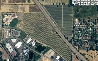
Open Space & Resource Conservation Element
      addresses air quality and energy resources, mineral and timber resources, and soil
      resources.

•     The Water Resources Element includes policies addressing preservation of both surface
      and groundwater resources, including water supply and water quality.

Open Space for Managed Production of Resources:

•     The Land Use Element establishes land use categories for agriculture, timber, and
      geothermal energy resource production.

•     The Open Space and Resource Conservation Element includes policies addressing
      management of mineral, energy, and timber resource production.

•     The Agricultural Resources Element includes policies addressing agricultural production.

•     The Water Resources Element includes policies addressing management of water
      resources.

Open Space for Outdoor Recreation:

•     The Land Use Element identifies areas where recreational facilities are needed and
      provides streamlined procedures for establishing new parks and trails.

•     The Open Space and Resource Conservation Element includes policies addressing
      Outdoor Recreation, Bikeways, and Scenic Resources.

•     The Public Facilities and Services Element includes policies addressing Park and
      Recreation services.

Open Space for Public Health and Safety:

•     The Land Use Element includes policies limiting development in hazardous areas, such
      as flood zones and fire and geologic hazard areas.

•     The Public Safety Element includes policies protecting the community from Geologic
      hazards, flood hazards, fire hazards, and hazardous materials.

•     The Open Space and Resource Conservation Element includes policies addressing air
      quality and soil and slope stability.

•     The Water Resources Element includes policies addressing water quality and quantity.

                                                                           Footnote: *Mitigating Policy
                                                                                       Page OS-6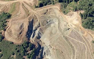
Open Space & Resource Conservation Element
Open Space for the Protection of Archaeological, Historical, and Cultural Resources:

•      The Open Space and Resource Conservation Element includes policies addressing the
       preservation and protection of archaeological, historical, and cultural resources. It
       includes policies for the preservation and protection of Native American cultural
       resources or sacred sites, places, features, and objects, including historic or prehistoric
       ruins, burial grounds, cemeteries, and ceremonial sites. It also addresses the
       confidentiality of records pertaining to such resources. It also provides for appropriate
       treatment of human remains and Native American human remains discovered during a
       project.

1.3    SCOPE AND ORGANIZATION

The Open Space and Resource Conservation Element has three major components, a policy
framework for the preservation of open space and conservation of natural resources, an open
space map for each planning area designating lands subject to various policies, and an
implementation program.

There are ten classifications of open space and resource conservation:

•      scenic resources,
•      biotic resources,
•      aquaculture,
•      soil resources,
•      timber resources,
•      mineral resources,
•      energy resources,
•      air resources,
•      outdoor recreation, and
•      archaeological/historical/cultural resources

                               2. SCENIC RESOURCES

The unique quality of Sonoma County results from the attractiveness and diversity of its
landscape. The scenic resources component includes three categories, Community Separators,
Scenic Landscape Units, and Scenic Highway Corridors. Figure OSRC-1 shows these designated
scenic resource areas.

                                                                               Footnote: *Mitigating Policy
                                                                                           Page OS-7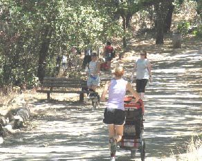
Open Space & Resource Conservation Element
2.1    POLICY FOR COMMUNITY SEPARATORS

A characteristic which distinguishes Sonoma County from many parts of the San Francisco Bay
Area is the continued existence of separate, identifiable cities and communities. Some land
areas need to remain open or retain a rural character in order to avoid corridor-style
urbanization. Community Separators are lands that function as rural open space to separate
cities and other communities, to contain urban development, and to provide city and community
identity by providing visual relief from continuous urbanization. Community Separators enhance
the identities of individual cities and communities. As Community Separators are rural areas
that have open space characteristics, many of these areas are also scenic. The lands within
Community Separators are frequently subject to pressure for development because they are
close to developed areas and major roads.

The following eight areas have been designated as Community Separators:

Petaluma/Novato

Approximately 2755 acres are designated to retain open space between Petaluma and the Marin
County line. Dominant features include rolling hills with trees and farms located along the
valley floor. Additional commercial development would detract from this rural atmosphere.
This Community Separator is bounded on the north by the Petaluma Urban Service Boundary,
on the east by NWPRR rail right-of-way, on the south by the Sonoma/Marin County line, and on
the west by the hills south of Petaluma.

Petaluma/Rohnert Park

This Community Separator between Petaluma, Penngrove and Rohnert Park/Cotati includes
Liberty Valley, one of the outstanding views in the County. Development on existing rural
residential lots would be intrusive unless properly sited and screened. About 3360 acres have
been designated within this separator.

Rohnert Park/Santa Rosa

Approximately 1650 acres between Rohnert Park and Santa Rosa are designated in order to
retain an open space break between these cities. Large parcels along Stony Point Road and
Petaluma Hill Road create relief from the urban area and provide views of fields and hills. Rural
development now limits the visual separation, but urban development along this corridor would
block views of the mountains and create a more intense urban form. Planting around any new
structures would help maintain the rural character.

Santa Rosa/Sebastopol

While some "strip development" exists along the Highway 12 corridor between Santa Rosa and

                                                                             Footnote: *Mitigating Policy
                                                                                         Page OS-8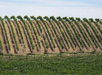
Open Space & Resource Conservation Element
Sebastopol, scenic views of the Laguna de Santa Rosa, oak studded pastures and Mt. St.
Helena are available. Approximately 1400 acres are designated to maintain the visual
separation between these cities. Retention of the existing oak woodlands and riparian
vegetation is critical to the scenic value of this area.

Windsor/Larkfield/Santa Rosa

This 2000 acre separator provides an open space
break along the Highway 101 and Old Redwood
Highway corridors between Santa Rosa,
Larkfield-Wikiup, and Windsor. Significant views
are available to the west across fields and
vineyards to the Mendocino Highlands and to the
east over the Mark West Springs Hills to Mt. St.
Helena. Development in the area may
significantly reduce rural quality.

Windsor/Healdsburg

Approximately 1200 acres along the Highway 101 corridor would be retained as open space to
prevent Windsor and Healdsburg from merging. Screening of future development in the rolling
hills to the east of the freeway would maintain scenic quality in this area.

Northeast Santa Rosa

This 3300 acre separator extends along Highway 12 near the Oakmont community and follows
the ridgeline above Rincon Valley northwest of Calistoga Road. Included in this area are
scattered rural residential development and open oak woodlands. Urban encroachment in the
hillside areas and valley floor would detract from the visual quality.

Glen Ellen/Agua Caliente

Approximately 1400 acres between Glen Ellen and Agua Caliente/Boyes Hot Springs are
designated to separate these urban areas. Highway 12, extending through the Valley of the
Moon, provides expansive views of the Sonoma-Napa mountains and vineyard covered hillsides.
Intense development along the valley floor and mountainsides would lessen the scenic quality in
this area.

GOAL OSRC-1:                   Preserve the visual identities of communities by
                               maintaining open space areas between cities and
                               communities.

                                                                           Footnote: *Mitigating Policy
                                                                                       Page OS-9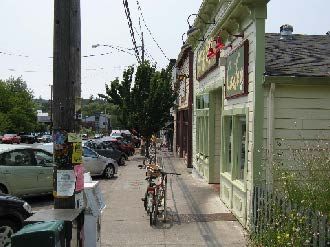
Open Space & Resource Conservation Element
Objective OSRC-1.1:             Preserve important open space areas in the Community
                                Separators shown on Figures OSRC-5a through OSRC-5i of the
                                Open Space and Resource Conservation Element.
Objective OSRC-1.2:             Retain a rural character and promote low intensities of
                                development in Community Separators. Avoid their annexation
                                or inclusion in spheres of influence for sewer and water service
                                providers.

Objective OSRC-1.3:             Provide opportunities for consideration of additional
                                development in Community Separators in exchange for
                                permanent open space preservation and other overriding,
                                substantial additional public benefits.

Objective OSRC-1.4:             Preserve existing specimen trees and tree stands within
                                Community Separators.

The following policies, in addition to those in the Land Use Element, shall be used to
achieve these objectives:

Policy OSRC-1a: Avoid amendments to increase residential density in Community Separators,
since these densities were established based upon the policies set forth in other elements of
this plan as well as the open space, separation and visual considerations identified in this
section. The integrity of Community Separators cannot be maintained at densities in excess of
one unit per ten acres. However, under no circumstances shall this policy be used to justify an
increase in density from that designated on the land use map.*

Policy OSRC-1b: Avoid commercial or industrial uses in Community Separators other than
those that are permitted by the agricultural or resource land use categories.*

Policy OSRC-1c: Notwithstanding conflicting policies or standards, the Board of Supervisors
may, through a development agreement, General Plan amendment, or other appropriate
mechanism, allow additional or varied development within Community Separators on a case by
case basis if, at a minimum, the following criteria are met:

(1)    Permanent open space preservation is provided through open space grants to the
       County and/or third party land trust.

(2)    Development is clustered, concentrated or located to maintain the visual quality of the
       Community Separator.

(3)    In addition to providing permanent open space preservation, the development is a
       public project or a private project which includes other substantial additional public
       benefits that outweigh the impacts of placing such development within the Community

                                                                            Footnote: *Mitigating Policy
                                                                                      Page OS-10
Open Space & Resource Conservation Element
Separator.
(4) The development is accompanied by a visual analysis that demonstrates that the
development either is not detrimental to or, in fact, enhances the visual quality of the
Community Separator as a whole.
(5) Adequate additional public services and infrastructure are available to serve the
development.
(6) The development is compatible with surrounding properties, especially those used for
agricultural pursuits.
(7) Where open space grants are offered by way of easement as opposed to fee title, the
development proposal includes a landscaping and maintenance plan that retains or
enhances the visual integrity of the permanent open space.
In addition to the mandatory criteria set forth above, special consideration will be given to
projects that incorporate one or more of the following:
(1) Aggregation of parcels within the Community Separator to achieve a project design that
enhances the separator as a whole.
(2) Creative financing mechanisms to maintain and preserve open space or parkland that
may be dedicated in fee as part of the proposed development.
(3) Project design features that provide for pedestrian or bicycle links between the
communities on either side of the Community Separator and to any parkland that may
be dedicated in fee as part of the proposed development.
Nothing set forth in this policy shall require the Board of Supervisors to allow this additional
development in Community Separators. Any development proposed pursuant to this policy may
be allowed after public hearing if the Board, in its sole discretion, determines that the proposed
public or private project provides a substantial public benefit and is otherwise consistent with
the General Plan and the criteria set forth above.*
Policy OSRC-1d: Consider amendments for outdoor recreational or other uses with a low
intensity of structures only in those Community Separators along the Highway 101 Corridor.*
Policy OSRC-1e: Apply the Scenic Resources combining district consistent with this Element to
all lands located within a Community Separator.*
Policy OSRC-1f: Unless there are existing design guidelines that have been adopted for the
affected area, require that new structures within Community Separators meet the following
Footnote: *Mitigating Policy
Page OS-11Open Space & Resource Conservation Element
criteria:
(1) Site and design structures to take maximum advantage of existing topography and
vegetation in order to substantially screen them from view from public roads.
(2) Minimize cuts and fills on hills and ridges.
(3) Minimize the removal of trees and other mature vegetation; avoid removal of specimen
trees, tree groupings, and windbreaks.
(4) Where existing topography and vegetation would not screen structures from view from
public roads, install landscaping consisting of native vegetation in natural groupings that
fits with the character of the area in order to substantially screen structures from view.
Screening with native, fire retardant plants may be required.
(5) Design structures to use building materials and color schemes that blend with the
natural landscape and vegetation.
(6) To the extent feasible, cluster structures on each parcel within existing built areas, and
near existing natural features such as tree groupings.
(7) Utilities are underground where economically practical.
(8) On hills and ridges, avoid structures that project above the silhouette of the hill or ridge
against the sky as viewed from public roads, and substantially screen driveways from
view where practical.
Exempt agricultural accessory structures proposed on parcels in the Diverse Agriculture, Land
Extensive Agriculture, Land Intensive Agriculture, and Resources and Rural Development land
use categories, and on parcels in the Rural Residential land use category with Agriculture and
Residential (AR) Zoning, from this policy if their use does not require a use permit in the
Development Code. If compliance with these standards would make a parcel unbuildable, site
structures where minimum visual impacts would result.
Exempt telecommunication facilities if they meet the siting and design criteria of the Scenic
Resources (SR) Zoning District.*
Policy OSRC-1g: Use the following standards in addition to those of Policy OSRC-1f for
subdivisions in Community Separators:
(1) Establish building envelopes for structures and consider use of height limitations if
necessary to further mitigate visual impacts.
Footnote: *Mitigating Policy
Page OS-12Open Space & Resource Conservation Element
(2) Use clustering to reduce visual impact where consistent with the Land Use Element.
(3) Locate building sites and roadways to preserve significant existing tree stands and
significant oak trees.
(4) To the extent allowed by law, require dedication of a permanent scenic or agricultural
easement at the time of subdivision.*
Policy OSRC-1h: Place a new measure on the ballot to extend the Sonoma County Agricultural
Preservation and Open Space District for another twenty years for the continuing purpose of
acquiring and administering open space lands, including an appropriate method of financing.*
Policy OSRC-1i: Consider voluntary transfer of development rights (TDR) and purchase of
development rights (PDR) programs and make Community Separators eligible with owner
consent.*
Policy OSRC-1j: Until the expiration or Ordinance No. 5003R (2016), require that revisions of
or amendments to the boundaries or land use designations and densities of the
Petaluma/Novato, Petaluma/Rohnert Park, Rohnert Park/Santa Rosa, Santa Rosa/Sebastopol,
Windsor/Larkfield/Santa Rosa, Windsor/Healdsburg, and Northeast Santa Rosa Community
Separators comply with the provisions of that ordinance.
Policy OSRC-1k: Until the expiration of Ordinance No. 5145R(2018), the General Plan land
use regulations for the lands within the Petaluma/Novato Community Separator shall not be
changed so as to increase either the allowed intensity or density of development by changing
the land use designations in Figure LU-2h of the Land Use Element without the prior approval of
the voters of Sonoma County.*
2.2 POLICY FOR SCENIC LANDSCAPE UNITS
Coastal bluffs, vineyards, San Pablo Bay, the
Laguna de Santa Rosa and other landscapes are of
special importance to Sonoma County.
Preservation of these scenic resources is important
to the quality of life of County residents and the
tourists and agricultural economy. Other features
such as the Mayacamas and Sonoma Mountains
provide scenic backdrops to communities.
As the County urbanizes, maintenance of the
openness of these areas provides important visual
relief from urban densities. These landscapes have
little capacity to absorb very much development
without significant visual impact. Major Scenic
Footnote: *Mitigating Policy
Page OS-13Open Space & Resource Conservation Element
Landscape Units have been identified as follows:
The Coast
The Sonoma coast is a scenic resource vital to the County. Three basic types of landscapes are
included, the flat terraces south of the Russian River, the more hilly terraces from Fort Ross
northward, and the cliffs and landslide areas in between.
Oat Valley
Oat Valley and the hillsides above it provide the scenic northern entrance to the County near
Cloverdale.
Alexander and Dry Creek Valleys
Protection of these agricultural valleys' scenic beauty is not only important from an aesthetic
standpoint, but also from an economic one as agricultural marketing is closely tied to the area's
scenic image. The hills along Highway 101 and above the valley floor are particularly sensitive.
Hills East of Windsor
These hills provide a scenic backdrop to the Santa Rosa Plain. North of Windsor the area
extends into the plain and adjoins the low, rolling hills that form part of the Windsor-Healdsburg
Community Separator.
Eastside Road
This area of rolling hills is an important transition between the community of Windsor and the
rich agricultural and mineral resource areas of the Russian River Valley.
River Road
This area provides a variety of landscapes, including valleys planted in vineyards, orchard
covered hillsides, and redwood groves adjacent to the Russian River.
Laguna de Santa Rosa
This area consists primarily of the scenic lowlands and floodplain around the Laguna de Santa
Rosa marsh, swamp and riparian forest. It also includes hills between Forestville, Sebastopol
and Meacham Hill. It defines the eastern boundary of Sebastopol and associated rural
residential development.
Bennett Valley
Footnote: *Mitigating Policy
Page OS-14Open Space & Resource Conservation Element
Bennett Mountain forms a scenic backdrop from Bennett Valley Road. This area defines Santa
Rosa's southeastern boundary and also abuts Annadel State Park.
Highway 116
The view corridor along Highway 116 contains unique views of orchards, redwood groves, and
the Russian River. This area also defines the community boundaries of Forestville, Guerneville,
and Monte Rio and their adjacent rural residential development.
Atascadero Creek
This area consists primarily of the lowlands and floodplains along Atascadero Creek and the hills
along Occidental Road. The area defines the western boundary of Sebastopol and its adjacent
rural residential development, separates Sebastopol and Graton, and creates a visual connection
to the Laguna de Santa Rosa.
Coleman Valley
The Coleman Valley Road area contains unique views of forests, canyons, grazing lands, and
the ocean.
Sonoma Mountains
These are highly valuable scenic lands, clearly defining the eastern edge of the Santa Rosa Plain
between Petaluma and Sonoma. They provide an important backdrop to the urban plains and
Sonoma Valley.
Hills South of Petaluma
The open grassy hillsides and ridgelines of the area are extremely sensitive. Located at the
Marin County border, this area serves as a gateway to the County.
Sonoma Valley/Mayacamas Mountains
Included in this area are the Sonoma-Napa Mountains that provide a backdrop to the valley and
agricultural areas bordering the valley. These areas define the boundaries of the urban and
rural communities and are very sensitive because of their small size and the unobstructed view
of them from roads and adjoining urban areas.
South Sonoma Mountains
These hillsides are an important part of the South County landscape with a simple landform,
Footnote: *Mitigating Policy
Page OS-15Open Space & Resource Conservation Element
minimal vegetation, and a clear widespread viewing area. Pasture and forage lands along the
Highway 37 corridor are included to preserve views of the San Pablo Bay.
GOAL OSRC-2: Retain the largely open, scenic character of important
Scenic Landscape Units.
Objective OSRC-2.1: Retain a rural, scenic character in Scenic Landscape Units with
very low intensities of development. Avoid their inclusion within
spheres of influence for public service providers.
Objective OSRC-2.2: Protect the ridges and crests of prominent hills in Scenic
Landscape Units from the silhouetting of structures against the
skyline.
Objective OSRC-2.3: Protect hills and ridges in Scenic Landscape Units from cuts and
fills.
The following policies, in addition to those of the Land Use Element, shall be used to
achieve these objectives:
Policy OSRC-2a: Avoid amendments to increase residential density in Scenic Landscape Units
in excess of one unit per ten acres. The land use plan may designate a lower density or larger
minimum lot size.*
Policy OSRC-2b: Avoid commercial or industrial uses in Scenic Landscape Units other than
those that are permitted by the agricultural or resource land use categories.*
Policy OSRC-2c: Apply the Scenic Resources combining district consistent with this element to
all lands located within Scenic Landscape Units.*
Policy OSRC-2d: Unless there are existing design guidelines that have been adopted for the
affected area, require that new structures within Scenic Landscape Units meet the following
criteria:
(1) Site and design structures to take maximum advantage of existing topography and
vegetation in order to substantially screen them from view from public roads.
(2) Minimize cuts and fills on hills and ridges.
(3) Minimize the removal of trees and other mature vegetation. Avoid removal of specimen
trees, tree groupings, and windbreaks.
(4) Where existing topography and vegetation would not screen structures from view from
public roads, install landscaping consisting of native vegetation in natural groupings that
fits with the character of the area in order to substantially screen structures from view.
Footnote: *Mitigating Policy
Page OS-16Open Space & Resource Conservation Element
Screening with native, fire retardant plants may be required.
(5) Design structures to use building materials and color schemes that blend with the
natural landscape and vegetation.
(6) On hills and ridges, avoid structures that project above the silhouette of the hill or ridge
against the sky as viewed from public roads and substantially screen driveways from
view where practical.
(7) To the extent feasible, cluster structures on each parcel within existing built areas and
near existing natural features such as tree groupings.
Exempt agricultural accessory structures proposed on parcels in the Diverse Agriculture, Land
Extensive Agriculture, Land Intensive Agriculture, and Resources and Rural Development land
use categories, and on parcels in the Rural Residential land use category with Agriculture and
Residential (AR) Zoning, are exempt from this policy if their use does not require a use permit
in the Development Code. If compliance with these standards would make a parcel
unbuildable, site structures where minimum visual impacts would result.
Exempt telecommunication facilities if they meet the siting and design criteria of the Scenic
Resources (SR) Zoning District.*
Policy OSRC-2e: Use the following standards in addition to those of Policy OSRC-2d for
subdivisions in Scenic Landscape Units:
(1) Establish building envelopes for structures and consider use of height limitations if
necessary to further mitigate visual impacts.
(2) Use clustering to reduce visual impact where consistent with the Land Use Element.
(3) Locate building sites and roadways to preserve significant existing tree stands and
significant oak trees.*
Policy OSRC-2f: Identify critical scenic areas within designated Scenic Landscape Units. To
the extent allowed by law, consider requiring dedication of a permanent scenic or agricultural
easement at the time of subdivision for properties within these critical scenic areas.*
Policy OSRC-2g: Consider voluntary transfer of development rights (TDR) and purchase of
development rights (PDR) programs and make Scenic Landscape Units eligible with owner
consent.*
Policy OSRC-2h: For development on parcels located both within Scenic Landscape Units and
adjacent to Scenic Corridors, apply the more restrictive siting and setback policies to preserve
visual quality.
Footnote: *Mitigating Policy
Page OS-17Open Space & Resource Conservation Element
2.3 POLICY FOR SCENIC CORRIDORS
Many residents of Sonoma County value highly
the variety and beauty of the County's many
landscapes as viewed from rural roadways.
Motorists can travel from urban centers into
orchard and forest covered hills, rolling dairy
lands, and scenic valleys planted in vineyards.
Preserving these landscapes is important to the
character of the County.
GOAL OSRC-3: Identify and preserve roadside landscapes that have a
high visual quality as they contribute to the living
environment of local residents and to the County's
tourism economy.
Objective OSRC-3.1: Designate the Scenic Corridors on Figures OSRC-5a through
OSRC-5i along roadways that cross highly scenic areas, provide
visual links to major recreation areas, give access to historic
areas, or serve as scenic entranceways to cities.
Objective OSRC-3.2: Provide guidelines so future land uses, development and
roadway construction are compatible with the preservation of
scenic values along designated Scenic Corridors.
The following policies shall be used to achieve these objectives:
Policy OSRC-3a: Apply the Scenic Resources combining district to those portions of properties
within Scenic Corridor setbacks.*
Policy OSRC-3b: For development on parcels located both within Scenic Landscape Units and
adjacent to Scenic Corridors, apply the more restrictive siting and setback policies to preserve
visual quality.
Policy OSRC-3c: Establish a rural Scenic Corridor setback of 30 percent of the depth of the lot
to a maximum of 200 feet from the centerline of the road unless a different setback is provided
Footnote: *Mitigating Policy
Page OS-18Open Space & Resource Conservation Element
in the Land Use Policies for the Planning Areas. Prohibit development within the setback with
the following exceptions:
(1) New barns and similar agricultural support structures added to existing farm complexes
on parcels in the Diverse Agriculture, Land Extensive Agriculture, Land Intensive
Agriculture, and Resources and Rural Development land use categories, and on parcels
in the Rural Residential land use category with Agriculture and Residential (AR) Zoning,
provided that such structures proposed within a State Scenic Highway or where local
design review exists by community choice in an adopted specific or area plan are subject
to administrative design review.
(2) New barns and similar agricultural support structures that do not require a use permit in
the Development Code on parcels in the Diverse Agriculture, Land Extensive Agriculture,
Land Intensive Agriculture, and Resources and Rural Development land use categories,
and on parcels in the Rural Residential land use category with Agriculture and
Residential (AR) Zoning, provided that such structures proposed within a State Scenic
Highway or where local design review exists by community choice in an adopted specific
or area plan are subject to administrative design review.
(3) Maintenance, restoration, reconstruction, or minor expansion of existing structures.
(4) Telecommunication facilities that meet the applicable criteria established in the
Development Code.
(5) Other new structures if they are subject to design review and
(a) they are associated with existing structures,
(b) there is no other reasonable location for the structure,
(c) the location within the setback is necessary for the use, or
(d) existing vegetation and topography screen the use.
(6) Compliance with the setback would render the parcel unbuildable.
(7) Satellite dishes that are not visible from the roadway.*
Policy OSRC-3d: Establish a building setback of 20 feet along the Highway 101 Scenic
Corridor in Urban Service Areas to be reserved for landscaping. Where a sound barrier or other
sound mitigating structure must be located along a Scenic Corridor, ensure that the landscaped
area is visible from the highway. Cooperate with State agencies to achieve compatible goals
with regard to visual quality along Scenic Corridors.
Footnote: *Mitigating Policy
Page OS-19Open Space & Resource Conservation Element
Policy OSRC-3e: In conjunction with Section 2.5 “Policy for Urban Design”, incorporate design
criteria for Scenic Corridors in urban areas.
Policy OSRC-3f: Refer building permits within the setback along historic Bohemian Highway
between Occidental and Freestone and along Bodega Highway between Bodega and Freestone
to the Sonoma County Landmarks Commission for review and recommendations.
Policy OSRC-3g: Avoid freeway oriented billboards along designated Scenic Corridors.
Establish design criteria for consideration of new freestanding outdoor advertising structures or
signs along designated Scenic Corridors to retain visual quality. Consider amortization of
existing signs subject to the limitations of State law as a condition of approval for discretionary
permits.*
Policy OSRC-3h: Design public works projects to minimize tree damage and removal along
Scenic Corridors. Where trees must be removed, design replanting programs so as to
accommodate ultimate planned highway improvements. Require revegetation following grading
and road cuts.*
Policy OSRC-3i: Recognize Highway 116 from Highway 1 to the southern edge of Sebastopol
as an official State Scenic Highway. The unique scenic qualities of this portion of Highway 116
shall be protected as generally outlined in the 116 Scenic Highway Corridor Study, September
1988. Consider requesting official State Scenic Highway designations for Highways 1 and 37.
Upon the request of local residents, the County may pursue similar State status for other Scenic
Corridors.*
2.4 POLICY FOR OUTDOOR LIGHTING
Sonoma County has a diversity of natural areas
and landforms that contribute to its quality of
life, economic well-being, and environmental
beauty. Night time views of both the landscape
and sky can be significantly degraded by
excessive and unnecessary levels of light that
increase “sky glow” around urban areas, make
the man-made environment prominent, and
result in visual clutter at night. Issues related to
resolving “light trespass” can direct County staff
resources away from other priorities.
Appropriate light levels for varying uses are balanced with a desire to maintain Sonoma
County’s rural character and preserve views of the night time skies for residents and visitors.
Footnote: *Mitigating Policy
Page OS-20Open Space & Resource Conservation Element
GOAL OSRC-4: Preserve and maintain views of the night time skies and
visual character of urban, rural and natural areas, while
allowing for nighttime lighting levels appropriate to the use
and location.
Objective OSRC-4.1: Maintain night time lighting levels at the minimum necessary to
provide for security and safety of the use and users to preserve
night time skies and the night time character of urban, rural and
natural areas.
Objective OSRC-4.2: Ensure that night time lighting levels for new development are
designed to minimize light spillage offsite or upward into the sky.
The following policies shall be used to achieve these objectives:
Policy OSRC-4a: Require that all new development projects, County projects, and signage
utilize light fixtures that shield the light source so that light is cast downward and that are no
more than the minimum height and power necessary to adequately light the proposed use.*
Policy OSRC-4b: Prohibit continuous all night exterior lighting in rural areas, unless it is
demonstrated to the decision making body that such lighting is necessary for security or
operational purposes or that it is necessary for agricultural production or processing on a
seasonal basis. Where lighting is necessary for the above purposes, minimize glare onto
adjacent properties and into the night sky.*
Policy OSRC-4c: Discourage light levels that are in excess of industry and State standards.*
Footnote: *Mitigating Policy
Page OS-21Open Space & Resource Conservation Element
2.5 POLICY FOR URBAN DESIGN
Sonoma County has adopted a basic
framework of directing the majority of
growth into incorporated cities or in
unincorporated Urban Service Areas of the
County where public sewer and water are
available, and where there is an existing
pattern of urban level development. This
pattern of compact development and
community-centered growth preserves the
open space, agriculture, and natural
resources that make Sonoma County
unique, and contribute to its valued quality
of life and economic vitality. Ensuring that
new development enhances existing
unincorporated communities, while retaining the unique character of each, is important.
Successful integration of community amenities such as attractive streets, safe bike and
pedestrian access, attractive and long lasting buildings, inviting public spaces, and important
natural and cultural resources will make urban spaces more livable.
GOAL OSRC-5: Retain and enhance the unique character of each of the
County’s unincorporated communities, while
accommodating projected growth and housing needs.
Objective OSRC-5.1: Develop Urban Design Guidelines on a community by
community basis to achieve the following: compatibility with
and connections to surrounding development; community
interaction and pedestrian activity; attractive public views; safe
and comfortable infrastructure and streetscape improvements
for bikes and pedestrians; increased public safety.
Objective OSRC-5.2: Establish community character as a primary criterion for review
of projects in Urban Service Areas.
The following policies shall be used to achieve these objectives:
Policy OSRC-5a: Develop Urban Design Guidelines appropriate for each Urban Service Area in
Footnote: *Mitigating Policy
Page OS-22Open Space & Resource Conservation Element
unincorporated Sonoma County that reflect the character of the community.
Policy OSRC-5b: Use the following general urban design principles until Urban Design
Guidelines specific to each Urban Service Area are adopted.
(1) Promotion of pedestrian and/or bicycle use.
(2) Compatibility with adjacent development.
(3) Incorporation of important historical and natural resources.
(4) Complementary parking out of view of the streetscape.
(5) Opportunities for social interaction with other community members.
(6) Promotion of visible access to buildings and use areas.
(7) Appropriate lighting levels.*
2.6 POLICY FOR RURAL CHARACTER
Sonoma County is nationally recognized for its
agrarian and “wine country” atmosphere, its
diverse and beautiful scenic resources, and
unique quality of life. Regulating the design of
certain types of new development in agricultural,
rural, and resource areas will help to preserve
the very qualities that attract new development
and enhance economic vitality. Rural character
design guidelines that avoid urban development
requirements in rural areas and promote
integration with the surrounding landscape and
quality construction and landscaping, will benefit
not only property owners and developers but all who live in and come to visit Sonoma County.
The rural character of Sonoma County is quite diverse. Over time, development guidelines
and/or design standards have been adopted for several areas, such as Bennett Valley and
Sonoma Mountain. These guidelines, while generally similar to each other, reflect the unique
quality of each area. As a result, the development of countywide rural character design
guidelines must be done in a way that recognizes local character. It is the intent of this policy
section that, where proposed development is subject to Area Plan and/or Local Area
Footnote: *Mitigating Policy
Page OS-23Open Space & Resource Conservation Element
Development Guidelines, those guidelines will take precedence over countywide rural character
design guidelines.
GOAL OSRC-6: Preserve the unique rural and natural character of
Sonoma County for residents, businesses, visitors and
future generations.
Objective OSRC-6.1: Develop Rural Character Design Guidelines to achieve the
following: preservation of existing site features contributing
to rural character; siting of buildings and development
features to blend in with the surrounding landscape; and
allowance for rural design features in rural areas.
Objective OSRC-6.2: Establish Rural Character as a primary criterion for review of
discretionary projects, but not including administrative design
review for single family homes on existing lots outside of
Urban Service Areas.
The following policy shall be used to achieve these objectives:
Policy OSRC-6a: Develop design guidelines for discretionary projects in rural areas, but not
including administrative design review for single family homes on existing lots, that protect and
reflect the rural character of Sonoma County. Use the following general design principles until
these Design Guidelines are adopted, while assuring that Design Guidelines for agricultural
support uses on agricultural lands are consistent with Policy AR-9h of the Agricultural Resources
Element.
(1) New structures blend into the surrounding landscape, rather than stand out.
(2) Landscaping is included and is designed to blend in with the character of the area.
(3) Paved areas are minimized and allow for informal parking areas.
(4) Adequate space is provided for natural site amenities.
(5) Exterior lighting and signage is minimized.*
Footnote: *Mitigating Policy
Page OS-24Open Space & Resource Conservation Element
3. BIOTIC RESOURCES
Sonoma County’s varied natural landscapes
range from the marine environments of the
coastal zone to the extensive forests, woodlands
and grasslands of the Coast Range mountains
and foothills to the vernal pools and freshwater
marshes of the Santa Rosa Plain and other valley
floors to the extensive marshlands along San
Pablo Bay. Areas of natural vegetation support
many native plant and animal species and
encompass habitat for special status species,
wetlands and sensitive natural communities.
The vegetative cover also helps reduce surface
runoff, protect water quality, maintain air quality,
retain soil, increase recharge, and maintain
stream channels. These areas together create a varied natural environment important to the
quality of life and the unique character of the County. The background and policies below are
separated into a Biotic Habitat Areas section that addresses protection of several types of biotic
habitat in the County and a section that focuses on one type of habitat, the Riparian Corridor.
Biotic Resource Areas are generally depicted on Figure OSRC-2.
3.1 POLICY FOR BIOTIC HABITAT AREAS
Protection of Biotic Habitat Areas is necessary because they are sensitive to change and the
adverse effects of human activities. Forests have been logged, natural areas converted to
urban and agricultural uses, non-native species introduced, and barriers created as a result of
development, roadway construction, installation of fencing, etc. These changes in the natural
landscape have forced wildlife into smaller areas and marginal habitat and limited the dispersal
and movement of native plants and animals.
The Biotic Habitat Areas designated on Figures OSRC-5a through 5i depict the habitats whose
locations are known and considered important for protection at this time. However, the policies
below provide for protection of biotic habitats both within and outside the designated areas.
Currently available information on the location and value of native habitats and sensitive
resources is incomplete and changes over time as sites are assessed, new occurrences are
reported, and additional locations are identified. As more habitat mapping information becomes
available in the future, changes in designations will be considered along with possible policy
Footnote: *Mitigating Policy
Page OS-25Open Space & Resource Conservation Element
changes. Regular collection and updating of reliable information and refinement of best
management practices are necessary to protect the County’s biotic resources over the long
term.
Following are the types of biotic habitat addressed by the policies in this section:
Special Status Species Habitat
Special status species are plant and animals that are listed or candidate species under the
Federal or State Endangered Species Acts and other species considered rare enough to warrant
special consideration. Reported occurrences of special status species are compiled by the
California Natural Diversity Data Base (CNDDB) of the California Department of Fish and Game
(CDFG) and are routinely updated as new information becomes available. Detailed surveys are
typically necessary to confirm the presence or absence of special status species.
Marshes and Wetlands
Wetlands are transitional areas between aquatic and terrestrial habitats and include marshes,
vernal pools, seeps, springs, and portions of riparian corridors with wetland vegetation.
Wetlands are recognized for their high fish and wildlife habitat values, occurrences of unique
plant and animal species, and importance in water recharge and filtration. Wetlands meeting
certain criteria are subject to regulations of the US Army Corps of Engineers, US Fish and
Wildlife Service (USFWS), CDFG, or applicable Regional Water Quality Control Boards. Wetland
areas mapped as part of the National Wetlands Inventory and other sources include the Laguna
de Santa Rosa, vernal pools, San Pablo Bay and Petaluma marshes, coastal and tidal marshes,
and such freshwater marshes as the Pitkin, Kenwood, Cunningham, and Atascadero Marshes.
Detailed delineations are typically necessary to confirm the presence and extent of any
jurisdictional wetlands.
Sensitive Natural Communities
CDFG has identified certain natural habitats as sensitive natural communities that are rare and
vulnerable to further loss. Sensitive natural communities identified in Sonoma County include
coastal salt marsh, brackish water marsh, freshwater marsh, freshwater seeps, native
grasslands, several types of forest and woodland (including riparian, valley oak, Oregon white
oak, black oak, buckeye, Sargent cypress and pygmy cypress), old growth redwood and
Douglas fir forest, mixed serpentine chaparral, and coastal scrub, prairie, bluff, and dunes.
Many of these communities also support populations of special status species and are important
to native wildlife.
Habitat Connectivity Corridors
Footnote: *Mitigating Policy
Page OS-26Open Space & Resource Conservation Element
Maintaining and improving opportunities for habitat connectivity throughout the County is
essential for protecting biodiversity and sustaining native plant and animal populations.
Linkages and corridors are needed to allow movement across the landscape and to connect
wetlands and other important habitat areas to undeveloped lands and permanent open space.
Important linkages and corridors include lands south of Glen Ellen connecting Sonoma Mountain
and the Mayacamas Range and lands connecting the Laguna de Santa Rosa to agricultural
areas south of Highway 116. It should be noted that riparian corridors also provide habitat
connectivity and are addressed in the next section.
GOAL OSRC-7: Protect and enhance the County's natural habitats
and diverse plant and animal communities.
Objective OSRC-7.1: Identify and protect native vegetation and wildlife,
particularly occurrences of special status species, wetlands,
sensitive natural communities, woodlands, and areas of
essential habitat connectivity.
Objective OSRC-7.2: Designate important Biotic Habitat Areas and update
designations periodically using credible data sources.
Objective OSRC-7.3: Establish development guidelines to protect designated Biotic
Habitat Areas and assure that the quality of these natural
resources is maintained.
Objective OSRC-7.4: Where appropriate, support regulatory efforts by other
agencies to protect biotic habitat.
Objective OSRC-7.5: Maintain connectivity between natural habitat areas.
Objective OSRC-7.6: Establish standards and programs to protect native trees and
plant communities.
Objective OSRC-7.7: Support use of native plant species and removal of invasive
exotic species.
Objective OSRC-7.8: Encourage voluntary efforts to restore and enhance biotic
habitat.
Objective OSRC-7.9: Preserve and restore the Laguna de Santa Rosa, San Pablo
Bay and Petaluma marshes and other major marshes and
wetlands.
Objective OSRC-7.10: Promote production of native marine and shoreline plant and
animal habitats along the Pacific Coast and San Pablo Bay
shorelines.
Footnote: *Mitigating Policy
Page OS-27Open Space & Resource Conservation Element
The following policies shall be used to achieve these objectives:
Policy OSRC-7a: Designate as Biotic Habitat Areas in the Open Space and Resource
Conservation Element the known locations shown on Figures OSRC-5a through OSRC 5i and
identified as Special Status Species Habitat, Marshes and Wetlands, Sensitive Natural
Communities, and Habitat Connectivity Corridors.*
Policy OSRC-7b: Rezone to the Biotic Resources combining district all lands designated as
Biotic Habitat Areas. Prepare and adopt an ordinance that provides for protection of designated
Biotic Habitat Areas in conformance with the following principles. Until the ordinance is
adopted, require that land use and development in designated areas comply with these
principles:
(1) For discretionary projects, notify applicants of protected habitats and species and
possible requirements of Federal and State regulatory agencies, request identification of
known protected habitats and species, and:
(a) In designated Biotic Habitat Areas, require site assessment and adequate
mitigation. The priorities for adequate mitigation are, in order of highest to
lowest priority:
• Avoid the habitat.
• Mitigate on site to achieve no net loss.
•• Mitigate off site to achieve
Create replacement habitatno
offnet
siteloss.
to achieve no net loss.
To the extent feasible, the mitigation required by the County should be
consistent with permit requirements of Federal and State regulatory agencies.
(b) In designated Marshes and Wetlands, require a setback of 100 feet from the
delineated edges of wetlands. The setback may be reduced based upon site
assessment and appropriate mitigation.
(c) In designated Habitat Connectivity Corridors, encourage property owners to
consult with CDFG, install wildlife friendly fencing, and provide for roadway
undercrossings and oversized culverts and bridges to allow movement of
terrestrial wildlife.
(d) The acreage required for adequate mitigation and replacement habitat shall be at
least two times the acreage affected unless a lower level is acceptable to the
applicable State and Federal agencies, with the amount depending on the habitat
affected and the applicable mitigation priority value.
(2) For discretionary projects in all designated Biotic Habitat Areas, send referrals to
Footnote: *Mitigating Policy
Page OS-28Open Space & Resource Conservation Element
appropriate regulatory agencies and, where such agencies’ comments or other agency
information indicates biotic resources could be adversely affected, require site
assessment, compliance with agency requirements and adequate mitigation pursuant to
the priorities in (1) (a).*
Policy OSRC-7c: Notify discretionary and ministerial permit applicants of possible
requirements of Federal and State regulatory agencies related to jurisdictional wetlands or
special status species.*
Policy OSRC-7d: In all areas outside Urban Service Areas, encourage property owners to
utilize wildlife friendly fencing and to minimize the use of outdoor lighting that could disrupt
native wildlife movement activity.*
Policy OSRC-7e: In coordination with resource agencies, landowners and affected public,
review Biotic Habitat Area designations and related policy issues periodically, but at least every
five years. If warranted, develop recommendations for additional policies that may be needed
to ensure appropriate protection of biotic resources. Include consideration of methods to
identify and monitor cumulative habitat loss and establish thresholds to protect sensitive
resources.*
Policy OSRC-7f: Support acquisition of conservation easements or fee title by the Sonoma
County Agricultural Preservation and Open Space District (SCAPOSD) of designated Biotic
Habitat Areas.*
Policy OSRC-7g: Where additional Biotic Habitat Areas are designated in Area Plans, revise
such plans and guidelines as needed to provide protection of biotic resources equivalent or
better than the protection provided by the General Plan.
Policy OSRC-7h: In coordination with resource agencies, landowners and affected public,
conduct a comprehensive study of the cumulative impacts of habitat fragmentation and
connectivity loss and the effects of exclusionary fencing on wildlife movement. If warranted,
identify essential habitat connectivity corridors and develop recommendations for policies to
protect essential habitat corridors and linkages and to restore and improve opportunities for
native plant and animal dispersal.*
Policy OSRC-7i: Conduct a comprehensive habitat identification and mapping program for use
in future policy determinations.*
Policy OSRC-7j: Establish a clearinghouse of information for public use related to biotic
habitat protection and management and work toward making this information available by
computer.
Policy OSRC-7k: Require the identification, preservation and protection of native trees and
Footnote: *Mitigating Policy
Page OS-29You can also read