PROGRESS OF THE AVIATION RESEARCH DEMONSTRATION PROJECT (AVRDP) - PETER PW LI NMRWG, MEMBER - WORLD METEOROLOGICAL ORGANIZATION
←
→
Page content transcription
If your browser does not render page correctly, please read the page content below
Progress of the
     Aviation Research
Demonstration Project (AvRDP)
               Peter PW Li

              NMRWG, member
         CAeM, ET/ASC, Core member
    Hong Kong Observatory, Hong Kong, China

           WMO, Geneva, Switzerland
             25 November 2015
Objectives
A joint effort between WWRP and CAeM (may involve CBS in Phase II), in
the next 4 years (2015‐2018):
• to conduct research and development in nowcasting and mesoscale
  modelling at several international airports located in Northern and
  Southern Hemisphere with a view to supporting the development of the
  next generation aviation initiative, namely, the Aviation System Block
  Upgrade (ASBU), under the new Global Aviation Navigation Plan (GANP)
  endorsed by International Civil Aviation Organization (ICAO) in 2013;
• to collaborate with the respective Air Traffic Management (ATM) to
  demonstrate the benefits of the MET information (nowcast and
  mesoscale modelling) to the aviation community;
• to transfer the knowledge gained in AvRDP to other WMO Members
  who need to enhance their aviation MET services to meet ASBU.
• Initially, six airports participate in AvRDP: CDG (Paris), HKG (Hong Kong,
  China), JNB (Johannesburg), SHA (Shanghai), YYZ (Toronto) and YFB
  (Iqaluit).

                                                                           2
WMO Congress XVII
• Aviation meteorological services: One of the 6 priorities in 2016‐2019

• Improve the ability of national meteorological services to provide
  sustainable high quality services to support safety, efficiency and regularity
  of the air transport worldwide, with due account to environmental factors.

• Congress noted with interest the development of a joint CAeM/CAS/CBS
  Aviation Research Demonstration Project (AvRDP), with a view to
  demonstrate the capability of nowcasting and mesoscale modelling
  techniques in support of so‐called “trajectory‐based operations (TBO)”,
  with a planned ‘fast‐track’ transfer of the research results into operational
  applications facilitated through a forecast demonstration phase

Trajectory‐Based Operation (TBO)
  Transition from nowcasting scale -> mesoscale -> global scale ->
  mesoscale -> nowcasting scale
                  Mesoscale / Global modelling

         Nowcasting                                Nowcasting

                             En Route Phase:
   Terminal Control Area:                          Terminal Control Area:
                            Mainly supported by
      Location specific                               Location specific
                              global/regional
                            Multi‐model Aviation
                             Weather Forecast
                              Centre (AWFC)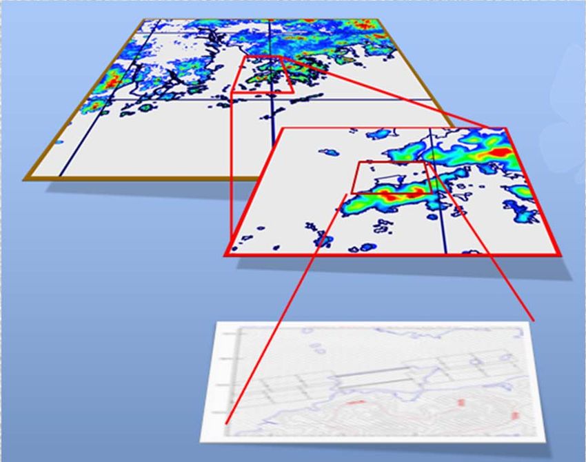
Meteorological Service for the Terminal Area
(MSTA)

                      airport

   This is the area needs 0‐6 hr nowcast                    • The closer to the airport, the high resolution
                                                              meteorological information will be required.
                                                            • Different airports will have different
                                                              requirements

* Nowcast or nowcasting hereafter refers to all techniques/systems including observation-based, expert
system-based, human-machine interfaced and meso/microscale NWP or any combination thereof which can
generate high resolution, rapidly updated forecasts for the next 0-6hr ahead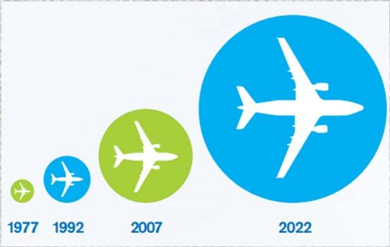
CAeM/ICAO Conjoint Meeting
7‐18 July 2014, Montreal, CA

                               6
Kickoff meeting cum CBS Nowcasting
Workshop (24‐26 June 2015, Shanghai, China)
7Kickoff meeting
• reviewed and refined the science plan, the implementation plan, adopted
the membership of the AvRDP Science Steering Committee (SSC), discussed
on data policy and other relevant issues.
• Phase I – MET capability research (May 2015 – July 2017), focusing on MET research
and development.
• Phase II – MET‐ATM impact translation and validation (Jul 2016 – Jun 2018),
focusing on translating MET information into ATM impact and demonstrate
the benefit to aviation community. Airports which start the Intense
Observation Period (IOP) in late 2015 or later may choose to enter Phase II in
late 2016
8AvRDP Website (https://avrdp.hko.gov.hk)
Website and sftp Data server (for data
exchange)
9Data Policy (to be finalized)
10Implementation Plan (adopted by SSC Jun 2015)
11AvRDP SSC
Name Representation
Peter Li, Chair HKO rep of CAeM
Estelle de CONING SAWS rep of JNB
Janti REID EC rep of YYZ & YFB
Jean‐Louis BRENGUIER MeteoFrance rep of CDG
Fengyun WANG CAAC rep of SHA
Sharon LAU HKO rep of HKG
Peter M. CHADWICK CAD rep of HKG (ATM expert)
Baode CHEN SMB rep of CMA
Cecilia MINER NOAA rep of NextGen
Stefane BELAIR EC rep of NMRWG
Paul JOE EC rep of NMRWG
Marion MITTERMAIER UKMO rep of JWGFVR
Dennis HART EuroControl rep of SESAR (will participate
in Phase II)
* The need of a co-chair in Phase II to be determined later 12HKG 1st IOP for Convection in Northern
Hemisphere (mid May – mid Sep 15)
HKO IOP Data and Data Manual (v.0)
• A number of significant
convection cases
• A few typhoon cases
• Observational data
• Nowcasting data
• Mesoscale model data
• NWC + NWP blended data
• ATM data
• Airport Capacity data
13Doppler Weather Radar
Wind profiler
Anemometer
Automatic Weather Station
Observations
AMDAR data
METAR
SYNOP
SHIP
Sounding
HKG
Lightning
Aviation Thunderstorm Nowcasting
HKG IOP Data summary
System (ATNS)
Forecast
Multi‐Sensor Quantitative
Precipitation Forecast (MSQ)
RAPIDS ‐ NHM
TAF
SIGMET
RAPIDS
Significant Convection Forecast
Nowcasting, NWP Model and
Hourly Airport Arrival Rate
Capacity forecast for AAR
ATM dataObservational Data collected
RADAR
SYNOP Sounding
METAR
Local AWS
AMDAR
Lightning Wind profilerNowcasting / Model / ATM data collected
ATNS MSQ NHM
SIGCONV and Capacity Notification RAPIDSOn‐going
• 1st IOP for winter weather, visibility and ceiling for airports in
Northern Hemisphere will start soon (CDG, YYZ, YFB)
• 2nd IOP for convective weather for Southern Hemisphere will
start soon (JNB), including setting up radar‐based
nowcasting system
• HKG:
• Apart from MET data, a few kinds of ATM data have been
collected for studying the benefits of the nowcasting
information to ATM;
• HKO will transfer the radar‐based nowcasting system
“com‐SWIRLS” to JNB and SHA for their setting up of
their nowcasting systems for their airports.
17On‐going (cont’)
• SHA:
• Have started selecting cases and collecting MET/ATM data for
convective and low visibility and ceiling cases (May 2015 – Jul 2017);
• Started to work on radar mosaic extrapolation and mesoscale model
rapid refresh (Oct 2015 – Jul 2017)
• CAAC/MET unit will collaborate with SMB (Shanghai Meteorological
Bureau) and Hong Kong Observatory (HKO) to further develop
nowcasting and high resolution mesoscale modelling system for
AvRDP starting in Dec 2015
• CAAC/MET unit Collaborating with ATM/ATC units actively to develop
CDM Support Tools. The study aims at how to translate MET data
(including METAR,SPECI, TAF, Radar, Satellite,NWO, etc.) into
ATM/ATC operation & capacity assessment
18On‐going (cont’)
• CDG:
• Preparing for the 1st IOP for winter weather in Northern
Hemisphere
• JNB:
• Collaborating with HKO to adopt a radar‐based nowcasting
system for convection over JNB in Dec 2015
• To conduct 1st IOP for convective weather (Nov 2015 – Mar
2016);
• Contacting aviation clients on possible collaboration to
provide better MET information for better decision making
and raise awareness of the project with ATM clients
19On‐going (Cont’)
• YYZ:
• Preparing for 1st IOP for winter weather especially on
setting up many MET instruments at or surrounding the
airport
• Preparing nowcasting products including: Aviation
Conditional Climatology, Integrated Weighted
Nowcasting, CARDS Point Nowcasting, HRDS 2.5km
model and RDPS 10km model outputs
• YFB:
• Preparing for the 2nd IOP for winter weather (2016‐2017)
20Next Year Planning
• Conduct 1st IOP for convective weather at JNB;
• Conduct 1st IOP for winter weather at CDG, YYZ and
start 2nd IOP for winter weather at YFB;
• Conduct 3rd IOP for convective weather at CDG, HKG
and SHA;
• Conduct 2nd IOP for winter weather, visibility at ceiling
CDG, YYZ, YFB;
• Conduct 2nd IOP for convective weather at JNB;
21Next Year Planning (cont’)
• Preliminary research results to be presented in the 4th
International Symposium on Nowcasting and Very‐short‐
range Forecast in Jul 2016 (WSN16) https://wsn16.hk;
• Organize an AvRDP Training Workshop on aviation
nowcasting and very‐short‐range forecasting techniques
back‐to‐back with WSN16 for WMO Members’ aviation
meteorological personnel;
• Begin to establish matrix for verification of aviation MET
products;
• Further discussion with ATM expertise on translation MET
information into ATM impact products as well as methods of
validation.
22Meetings to come
MeetingAvRDP When & Where Who
Aviation RDP Training 17‐19 July 2016 Invited experts
Workshop Hong Kong, China
22‐26 July 2016 NMRWG
WSN16 Hong Kong, China
AvRDP SSC Meeting July 2016 AvRDP SSC
AvRDP SSC July 2017 AvRDP SSC
Concluding Meeting TBD
for Phase I
23Connection with other WGs, Projects
• Collaborate with JWGFVR to develop verification &
validation methodologies for AvRDP;
• Collaborate with NMRWG, PDEFWG, DOAWG to explore the
possibilities of developing enhanced probabilistic MSTA
products under AvRDP;
• Collaborate with ATM (HK Civil Aviation Department, SESAR
and CAAC) on how to demonstrate the benefits for the
aviation community
• Keep in view other on‐going aviation initiatives: SESAR,
NextGen
• Collaborate with CAeM ET/ASC (Aviation Science and Climate)
24CAeM ET/ASC 1st meeting: 24-26 March 2015 25
Thank You
for Your Support

  Questions?

                   26
New Era of Aviation Industry
• Aeronautical meteorology is entering into an era of rapid and
fundamental changes, in response to the continuous growth of
aviation transport and the need of new concepts for Air Traffic
Management (ATM).
• The ASBU methodology aims at safe, sustained growth, increased
efficiency and responsible environmental stewardship.
• WMO Congress XVI recognized that these changes could pose
significant challenges to WMO Members, as well as provide new
opportunities.
27HKG IOP Data summary
Observational Data
Surface
METAR Half‐hourly weather report of aerodromes. UTC
SYNOP Three‐hourly WMO standard weather reports. UTC
SHIP Three‐hourly reports from observation marine vessels. UTC
Automatic Wind data recorded at 1 min intervals. A limited HKT
weather number of stations also provide temperature, humidity,
station and pressure data.
Upper air
Sounding Reports of twice daily WMO standard weather UTC
balloons.
AMDAR Automatic weather reports from inflight aircraft . UTC
Remote sensing
Lightning Time, positional and type (CG/CC) of strike. UTC
Radar Reflectivity factor in volumetric scan at 6 min intervals. HKT
Wind profiler Upper air wind data at 10 min interval with vertical HKT
resolution of about 100m.HKG IOP Data summary
Forecast Data
Text based forecast
TAF ICAO standard weather forecast for the aerodrome. UTC
SIGMET (TS) ICAO standard warning product for thunderstorm UTC
within the FIR, valid for 4 hours at most.
NWP gridded output
NHM Refresh rate of 3 hours. 0.02 degree resolution UTC
covering 19.8‐24.8N, 111.8‐116.8E. Output at hourly
interval up to 15hr. Forecast element includes
simulated radar reflectivity.HKG IOP Data summary
Nowcast and Blending Data
Gridded output
ATNS Forecast of radar reflectivity factor within 256km HKT
of HK at 6 min intervals for the next 60 min.
Refresh rate at 6 min.
MSQ Hourly forecast rainfall rate over an area of HKT
around 500km within HK for the next 9 hours.
Refresh rate at 6 min.
Gridded output
RAPIDS Forecast of hourly rainfall rate at hourly intervals for HKT
the next 6 hours, roughly covering 128km radar
range. Refresh rate at 6 min.
Textual output
SIGCONV Significant convection forecast time series for the UTC
aerodrome and key holding areas at hourly interval
for the next 6 hours. Automatic output but allowed
for human intervention. Refresh rate at 12 min.HKG IOP Data summary ATM Data Air traffic information Airport Number of aircraft scheduled to land hourly, and the HKT arrival rate number of aircraft actually landed in that hour. (AAR) Capacity forecast AAR Estimated AAR for the next few hours. Twice daily UTC estimated by and update as necessary. ATM unit
You can also read