Public Information Centre 2 Summary - Public ...
←
→
Page content transcription
If your browser does not render page correctly, please read the page content below
Niagara Region Transportation Master Plan

Public Information Centre 2
Summary

Prepared for Niagara Region
by IBI Group

July 29, 2016
IBI GROUP NIAGARA REGION TRANSPORTATION MASTER PLA N
PUBLIC INFORMATION CENTRE 2 SUMMARY
Prepared for Niagara Region

                Table of Contents

                1     Introduction ......................................................................................................................... 1

                2     Notification of Public Information Centres ...................................................................... 1

                3     Arrangement of Public Information Centres .................................................................... 2

                4     Attendance .......................................................................................................................... 3

                5     Comments and Questions Received ................................................................................ 3
                      5.1         Summary of General Comments Sheets Received ................................................. 3
                      5.2         Summary of Comments Posted on Display Panels ................................................. 4

                6     Online Survey ...................................................................................................................... 5
                      6.1         Online Survey Results ............................................................................................. 5
                      6.2         Online Survey Comments ...................................................................................... 10

                7     Summary............................................................................................................................ 12

                APPENDICES

                Appendix A – Notice of PIC

                Appendix B – Display Panels and Comment Form Questionnaire

                Appendix C – Comments received on Display Panels

                Appendix D – Comments received on Questionnaire/Survey Form

July 29, 2016                                                                                                                                               i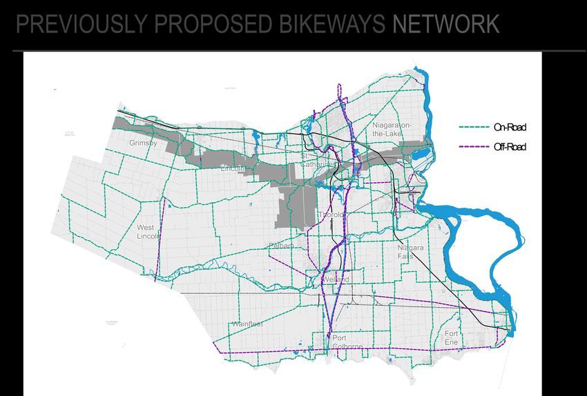
IBI GROUP NIAGARA REGION TRANSPORTATION MASTER PLA N
PUBLIC INFORMATION CENTRE 2 SUMMARY
Prepared for Niagara Region
1 Introduction
This report summarizes the second round of Public Information Centres (PICs) hosted by
Niagara Region as part of its Transportation Master Plan study.
The purpose of the second round of PICs was to inform the public of study progress to date,
create an opportunity for area residents and stakeholders to discuss the trends, challenges and
opportunities facing the Region’s transportation system, and provide input on transportation
opportunities in Niagara – on such issues as auto travel, transit service, active transportation
and other potential policies and strategies designed to enhance Regional travel.
As in the first round of public consultation in the Fall of 2015, this round of PICs was held jointly
with the Region’s Municipal Comprehensive Review and Water/Wastewater Master Servicing
Plan studies, and though attendees provided comments for all three studies, only the comments
relevant to the TMP study are summarized in this report.
The PIC was held on three evenings in June 2016 at three locations in Niagara. In addition to
the three PICs, online consultation was held through the TMP website for those not able to
attend the PIC in person. Online consultation included the same information and materials
presented at the PIC as well as a short questionnaire that mirrored the comment form
questionnaire distributed at the PICs. The input and comments received through the online
survey and PIC meetings are combined in the summaries provided in this report.
The PICs were held at the following locations in Niagara Region:
PIC Location No.1: Fort Erie Leisureplex Banquet Hall
June 15, 2016
4:00 pm to 8:00 pm
PIC Location No. 2: West Lincoln Council Chambers
June 16, 2016
4:00 pm to 8:00 pm
PIC Location No.3: Welland Civic Square Front Foyer
June 22, 2016
4:00 pm to 8:00 pm
2 Notification of Public Information Centres
Advance notification of the PICs was provided to potentially interested stakeholders and Niagara
Region residents by a variety of mediums:
Memo to Regional Council and copied to local area municipal councils.
Notice emailed to identified list of public and business stakeholders.
Posting on Niagara Region’s website
Newspaper advertisements as follows:
Fort Erie Times: June 2 and 9, 2016
InPort News: June 2 and 9, 2016
July 29, 2016 1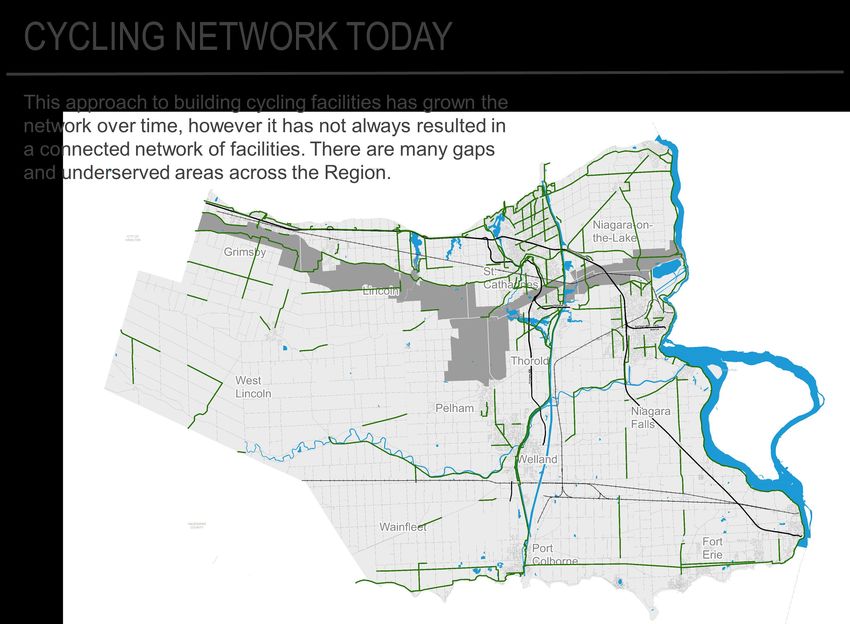
IBI GROUP NIAGARA REGION TRANSPORTATION MASTER PLA N
PUBLIC INFORMATION CENTRE 2 SUMMARY
Prepared for Niagara Region
News Now: June 2 and 9, 2016
The Niagara Advance: June 2 and 9, 2016
The Niagara Falls Review: June 2 and 9, 2016
Niagara This Week: June 2 and 9, 2016
Pelham News: June 2 and 9, 2016
The St. Catharines Standard: June 2 and 9, 2016
Thorold News: June 2 and 9, 2016
The Welland Tribune: June 2 and 9, 2016
The notices provided the following general information about the study:
Purpose, time, and location of the PICs;
Study background, and overview of the TMP process as well as the other two
components of Niagara 2041parts of the overall Plan;
Contact information for primary study team members; and
Information on further opportunities to participate.
A copy of the PIC #2 notice is included in Appendix A.
3 Arrangement of Public Information Centres
The PICs were arranged in an open house format for all three studies under Niagara 2041 –
How We Grow (Municipal Comprehensive Review), How We Flow (Water and Wastewater
Master Servicing Plan) and How We Go (Transportation Master Plan). Staff from Niagara
Region and the three consultant teams were present to engage attendees and answer
questions.
Display panels were arranged in an easy-to-view format, and included information on the
following study elements:
Overview of Niagara 2041 and context for the three component studies;
Overview of the TMP study process;
What we’ve heard so far from the public consultation process;
Emerging trends relevant to Niagara Region;
System performance and challenges; and
Opportunities that face Niagara Region.
A comment form questionnaire provided opportunity for attendees to provide specific feedback
on the information provided on the display panels. Attendees could also complete the
questionnaire at a later time via the online version of the questionnaire.
A copy of PIC display panels and the comment form questionnaire are included in Appendix B.
July 29, 2016 2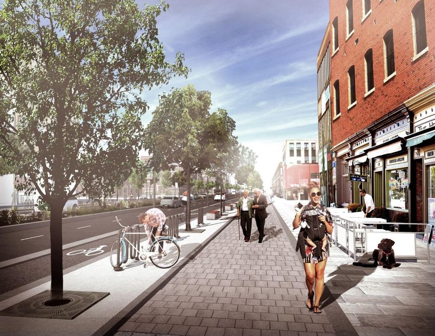
IBI GROUP NIAGARA REGION TRANSPORTATION MASTER PLA N
PUBLIC INFORMATION CENTRE 2 SUMMARY
Prepared for Niagara Region
4 Attendance
In total, 64 attendees signed in - 16 attendees signed in at the PIC held in Fort Erie, 18 signed in
at the PIC held in West Lincoln and 30 attendees signed in at the PIC held in Welland. It is
estimated that approximately 15 attendees chose not to sign-in at the PIC meetings.
5 Comments and Questions Received
Comments from members of public were received through the following methods:
General comment sheets (combined for the three studies);
Comment sheet questionnaires;
Online survey (online version of the comment sheet questionnaire);
Conversation with project team members; and
Email to the study contacts.
The comments received at the PIC are summarized in the following sections.
5.1 Summary of General Comments Sheets Received
The comments received via the general comment sheets were broken down into two categories
to assist in future analysis – specific comments related to the study and comments regarding the
conduct of the consultation/PIC. The comments received are documented below.
Specific Comments (Transportation):
Need expanded public transit which should include a sometime connection between
Wainfleet Village and Port Colborne link to connect students to Niagara College, Brock
University & specialized treatments at St. Catharines or Niagara Falls hospitals.
Development to south to preserve fruitlands.
Dumbest thing by Region give a bridge contract to a Quebec company. Doesn't anybody
read about the corruption in Quebec construction projects? I have seen nearly 40 years
of screw ups by Region costing taxpayers tens of millions of dollars.
Providing several options for growth is appreciated and helpful for context. More detail
on each option would have been helpful (i.e. identifying settlement area such as
Smithville. I believe growth reserves are coming from the west, and more emphasis
should be placed on accommodating growth in areas not constrained by Greenbelt (i.e.
Smithville).
I support strategic growth approach. One if its benefits is that it could help protect
forested areas within urban boundaries, through proposed greater intensification, a
strategy to protect these features should be developed.
West Niagara should be focus of transit supported development close to proposed GO
lands. The MCR need to push for Grimsby and Beamsville to get urban boundary area
expansions that will allow for 100, 150 ppl/Ha development.
New developments in Prudhommes need MTO partnership to have more carpooling
space and more carpooling options. Likewise, lobby GO for #12 GO Bus Stops in
Vineland and Beamsville. The bus goes on QEW but does not stop; missed opportunity.
July 29, 2016 3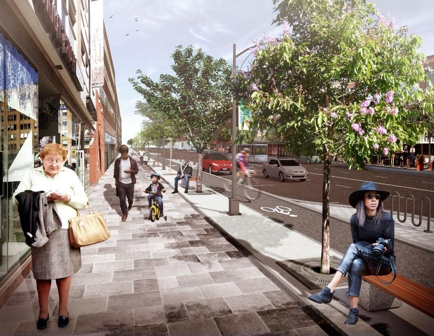
IBI GROUP NIAGARA REGION TRANSPORTATION MASTER PLA N
PUBLIC INFORMATION CENTRE 2 SUMMARY
Prepared for Niagara Region
Transportation and increasing connectivity between different areas of Niagara by
starting with better connections to Brock. Increasing student use of buses is key to
improving the transportation system overall.
We definitely need an escarpment crossing in Grimsby to take it to Smithville. We need
GO train now to catch up after being 20 years behind.
Comments Regarding Conduct of Consultation/PIC
Agree with the format. Perhaps 30 minutes of presentations at opening would help for
examining boards in detail.
Very helpful.
Very helpful. Would like to request a meeting with City of St. Catharines and Region to
review.
More clear start/finishing points for Boards; accidentally looked at them backward!
Very informative! Maybe have a sign saying "Start Here" so we know where the boards
start.
5.2 Summary of Comments Posted on Display Panels
Additional comments were received via sticky notes posted on the display panels. These
comments are documented in detail in Appendix C.
The general theme of the comments were:
Need for improvements to transit connections and schedules.
Coordination of transit. One transit system.
Need for GO Train expansion to Niagara.
Support for and against the Mid-Pen / Niagara to GTA corridor.
Locations of additional concerns
Highway 58 at Canal crossing as a congestion hotspot
Vertical curves on Merritville Highway
Hwy 406 off-ramp to hospital
Need for escarpment crossing at Bartlett Avenue / Park Road.
Using the airports for transporting cargo and for commuting.
High speed rail connections to the US.
Focusing active transportation routes on secondary roads for safety.
Support and questions on complete streets concepts
Using disused rail corridors for active transportation
Connect active transportation trails to transit
July 29, 2016 4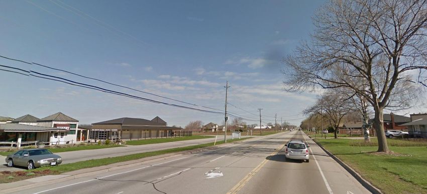
IBI GROUP NIAGARA REGION TRANSPORTATION MASTER PLA N
PUBLIC INFORMATION CENTRE 2 SUMMARY
Prepared for Niagara Region
6 Online Survey
In conjunction with the PICs, Niagara Region also conducted a second round of online
engagement using a simple survey/questionnaire on the Region’s website that mirrored the
questionnaire provided in hardcopy at the PIC meetings. The intent of the online survey was to
provide an opportunity for those not able to attend the PIC meeting in person to review the
display material online and provide feedback.
The survey was live between June 15 and June 30, 2016.
6.1 Online Survey Results
A total of 1,165 survey submissions were received, with 1,116 providing data. Of the 1,116
submissions with data, 834 were fully completed and 281 were partially completed. Of the
respondents:
503 (60%) respondents indicated that they were female, 312 (38%) indicated they
were male, and 17 (2%) answered “prefer not to say”.
179 (22%) respondents were between 18-34 years old, 256 (31%) were between
35-49 years, 299 (36%) were between 50-64 years, and 96 (12%) were over 65.
Residents from each of the 12 local area municipalities participated in the survey.
Respondents indicated that they lived in the following areas:
Location Responses %
Fort Erie 52 6%
Grimsby 55 7%
Lincoln 29 3%
Niagara Falls 131 16%
Niagara-on-the-Lake 40 5%
Pelham 42 5%
Port Colborne 33 4%
St. Catharines 300 36%
Thorold 25 3%
Wainfleet 8 1%
Welland 105 13%
West Lincoln 8 1%
Hamilton 2 0%
Greater Toronto Area 2 0%
Other 2 0%
Total 834 100%
A summary of the survey responses are included in this section.
July 29, 2016 5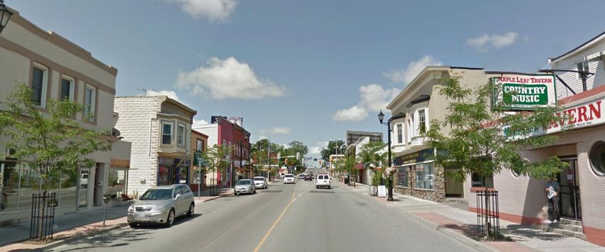
IBI GROUP NIAGARA REGION TRANSPORTATION MASTER PLA N
PUBLIC INFORMATION CENTRE 2 SUMMARY
Prepared for Niagara Region

                Question 1: Where do you think Niagara Region should focus its efforts to improve the
                efficiency of the road network? (select all that apply)

                Question 2: What prevents you from travelling by sustainable modes? (i.e. transit, walk, cycle,
                carpool) (select all that apply)

July 29, 2016                                                                                                     6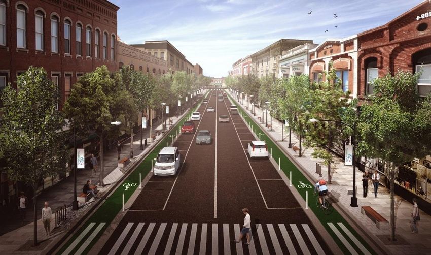
IBI GROUP NIAGARA REGION TRANSPORTATION MASTER PLA N
PUBLIC INFORMATION CENTRE 2 SUMMARY
Prepared for Niagara Region

                Question 3: What do you think will encourage people in Niagara Region to travel in a
                sustainable way? (select all that apply)

                Question 4: Which of these transit opportunities are most important to you? (select all that
                apply)

July 29, 2016                                                                                                  7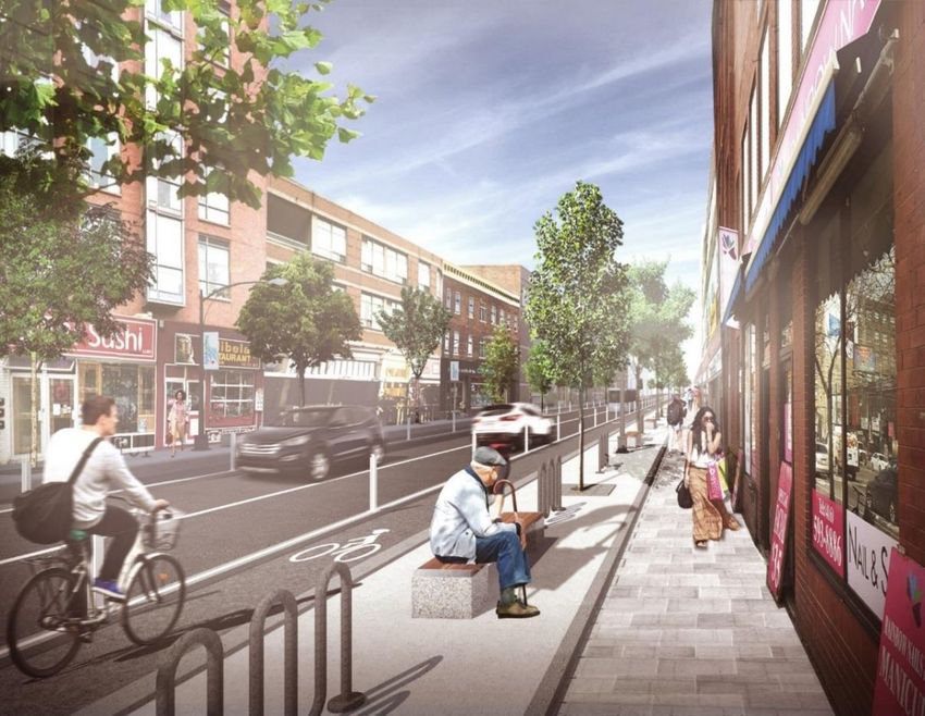
IBI GROUP NIAGARA REGION TRANSPORTATION MASTER PLA N
PUBLIC INFORMATION CENTRE 2 SUMMARY
Prepared for Niagara Region
Question 5: What type of complete streets are most important to you? (select all that apply)
Question 6: Which of the following factors do you think are most important for determining the
cycling network? (Rate on a scale of 1 to 5, with 1 being least important and 5 being most
important)
Average score:
Connectivity – 3.9
Density – 3.1
Potential Demand – 3.5
Key Destinations – 3.9
Barriers – 3.4
July 29, 2016 8IBI GROUP NIAGARA REGION TRANSPORTATION MASTER PLA N
PUBLIC INFORMATION CENTRE 2 SUMMARY
Prepared for Niagara Region
Question 7: Which public bicycle amenities on Regional roads are more important to you?
(select those that are most important to you)
Question 8: Which of the following Goods Movement road network improvements would benefit
Niagara Region the most? (check all that apply)
July 29, 2016 9IBI GROUP NIAGARA REGION TRANSPORTATION MASTER PLA N
PUBLIC INFORMATION CENTRE 2 SUMMARY
Prepared for Niagara Region
6.2 Online Survey Comments
In addition to the eight survey questions, respondents were provided an opportunity to provide
other thoughts or comments on the TMP study. Of the 1,116 submissions with data, 381
comments were received.
There were wide range of comments on provided. Respondents provided comments on their
personal experience with travel in Niagara, their priorities for future transportation in Niagara,
opportunities that Niagara should prioritize, and comments on the conduct of the study and
survey. General themes of the comments received are summarized below.
Transit and GO Transit
Better transit service was demanded by many respondents, including more efficient
service, better transfer connections, more affordable fares, longer service hours,
and expanded weekend/holiday service.
Integration of transit service providers in Niagara (i.e. one regional system) was
suggested by some respondents to improve service and efficiency.
Expansion of GO Train service to Niagara was mentioned by many respondents.
This was expressed as a must-have by many residents for travel between Niagara
and the Greater Toronto Area. Respondents also indicated that the GO expansion
was desired well before the planned 2021 service expansion. While almost all
comments regarding GO expansion were supportive of the expansion, there was
also a respondent that strongly opposed Niagara becoming a bedroom community
for Toronto-employed people.
Better connectivity, both by transit and road, between different areas of the Region
was identified as a need.
Active Transportation, including walking, cycling and mobility needs
More and safer active transportation infrastructure was identified as a need. The
lack of amenities (parking, washrooms) was also identified as barriers to riding
more often.
Better maintenance of sidewalks was mentioned with respect to winter maintenance
(snow removal) and maintaining safe, smooth paths for mobility devices (walkers,
scooters, wheelchairs).
Roads
Strong support for and against the Niagara to GTA corridor was expressed. Some
respondents wanted the new corridor as soon as possible to relieve congestion on
the QEW. Others wanted to protect the rural nature of the Region, the farmlands
that would be impacted by a new corridor, and other environmental reasons.
Congestion on the QEW was a high priority for many respondents. Improving
access to the QEW (i.e. interchange configuration improvements) was noted.
Timing of traffic signals and spacing of intersections were noted as causes of
congestion on arterial road corridors. Roundabouts were suggested as one
potential solution.
Better road maintenance to improve travel was noted by some respondents.
July 29, 2016 10IBI GROUP NIAGARA REGION TRANSPORTATION MASTER PLA N
PUBLIC INFORMATION CENTRE 2 SUMMARY
Prepared for Niagara Region
Environment
Protecting the environment and reducing emissions was noted by some
respondents.
The impact of new infrastructure such as the NGTA corridor and development
growth on Niagara’s prime agricultural lands was identified as a concern.
Development
Some respondents identified growth and intensification as opportunities for jobs,
culture, tourism, and mobility. Others were concerned regarding development
growth that impacts Niagara’s prime agricultural lands.
Several respondents noted that growth and transportation infrastructure go hand in
hand.
Technology
Better traffic signal coordination was noted as a potential solution for corridor
congestion. Ramp metering for the QEW was also noted for congestion
management.
Better access to, and mobile-friendly, traveller information for trip planning (i.e. all
on one website).
Facilities for electric vehicles (i.e. charging stations)
Advance warning systems for canal bridges in time to choose alternative routes.
Accommodation for autonomous vehicles – using the technology for “on demand”
mobility, but also how it may impact infrastructure design – was noted for
consideration.
Other
A ferry or bridge crossing connecting Niagara to the GTA was identified as potential
alternatives to widening QEW.
Better accommodation for an aging population is needed, notably for seniors to
access the hospital, medical centres and other daily needs through transit and
paratransit.
General
Some comments noted that the survey was difficult to understand, poorly worded
and too technical. [It appears that some respondents were not aware of the PIC #2
information that was available for their review which provided more insight on the
transportation needs and opportunities in Niagara Region. The intention of the
survey was to elicit feedback from the public in response to PIC #2, however it was
possible for a respondent to directly access the survey online without being aware
of the information being provided for their review and understanding.]
Respondents also requested to see the results of the survey.
For a full list of the comments received through the online survey, please see Appendix C.
July 29, 2016 11IBI GROUP NIAGARA REGION TRANSPORTATION MASTER PLA N
PUBLIC INFORMATION CENTRE 2 SUMMARY
Prepared for Niagara Region
7 Summary
Overall, residents and stakeholders involved in the second round of PICs were passionate about
transportation in Niagara Region. While a variety of issues were mentioned, a few common
themes were clear in the comments received. These common themes are nearly identical to
those identified in the first round of PICs and the first round of online consultation:
Attendees at all PICs and online supported the need for improved transit service,
particularly in smaller municipalities and areas currently underserved by transit, and
support merging local transit agencies into one Regional transit system.
Attendees at all three PIC events and online generally supported the need for more
- and safer - walking and cycling facilities throughout Niagara Region; active and
healthy lifestyles are important, and promote sustainable transportation.
Extending GO train service into Niagara Region was a very widespread priority in
the comments received at the PIC events and through the online survey. Regular
weekday GO trains would take cars off the road, and improve connections between
Niagara Region and the Greater Toronto Area. This is also desired before the
announced 2021 date.
Attendees and online survey respondents also expressed concern about
development in the Region, specifically its environmental impact when the
developments result in lost greenspace, forests, agricultural lands, and wetlands.
All of the information gleaned by Regional staff and the consulting team will be used in the
development of the final Transportation Master Plan.
July 29, 2016 12IBI GROUP NIAGARA REGION TRANSPORTATION MASTER PLA N
PUBLIC INFORMATION CENTRE 2 SUMMARY
Prepared for Niagara Region
Appendix A – Notice of PIC
July 29, 2016IBI GROUP NIAGARA REGION TRANSPORTATION MASTER PLA N PUBLIC INFORMATION CENTRE 2 SUMMARY Prepared for Niagara Region July 29, 2016 A-1
IBI GROUP NIAGARA REGION TRANSPORTATION MASTER PLA N
PUBLIC INFORMATION CENTRE 2 SUMMARY
Prepared for Niagara Region

                Appendix B – Display Panels and
                Comment Form Questionnaire

July 29, 2016
Welcome At this session, you can expect the following: An overview of Niagara Region’s socio-economic, demographic and travel trends and what this means for transportation in the Region An overview of the challenges and the opportunities that face Niagara Region’s transportation system A summary of what we’ve heard from the public so far A chance to provide your input on the transportation opportunities for the Region Background Goals The Transportation Master Plan (TMP) – How We GO – will direct how Niagara Region’s transportation system will be designed, who it will accommodate, and what investments will be needed. Niagara Region must plan to accommodate an increase of 168,000 persons and 80,000 jobs that has been forecasted by the Province by 2041. Vision In 2041, Niagara Region will be supported by a transportation network that will help establish Niagara as a leader in: building, preserving and enhancing livable communities; economic development; tourism; sustainable transportation practices and the emerging shared economy.
Study Process
    Transportation Master Plan Study Stages

•    Define TMP Goals                •   Identify trends                •   Analyze opportunities          •   Implementation plan
•    Establish vision & directions   •   Understand issues and needs    •   Assess options                 •   Funding strategy
•    Document existing conditions    •   Explore opportunities          •   Evaluate policies              •   Develop TMP
•    Public Information Centre #1    •   Public Information Centre #2   •   Public Information Centre #3
What We’ve Heard So Far
November December January February March April May June
Public Information Meetings Stakeholder Public Online Freight Public Information
Centre #1 with Municipalities Advisory Survey Industry Centre #2
Group Survey
Workshop
First Nations
Active Transportation Engagement
Stakeholder Meeting
Since the start of the study in Fall 2015, residents and stakeholders have told us the top priorities and
strategies they want us to focus on. They also identified transportation problems and opportunities in the
Region.
Top 3 Priorities Identified: Top 5-Rated Strategies Identified:
1. Travel within Niagara Region 1. Year-round daily GO Train service into Niagara
2. Travel to/from Niagara Region 2. Increase roads and transit service between Niagara municipalities
3. Healthy Communities 3. Improve north and south Niagara connections
4. Develop multi-modal transportation hubs
5. Build Niagara-to-GTA corridor.What We’ve Heard So Far
Strategy ID Strategy Normalized Score
Travel within Niagara Region
A1 Improve connections between north and south Niagara 91
A2 Increase roads and transit service between Niagara Region municipalities 91
A3 Improve road designs for walking and cycling 83
A4 Improve rail crossing safety 62
Travel to/from Niagara Region
B1 Extend year-round daily GO Train service to/from the greater Toronto and Hamilton area 100
B2 Improve rail, road and water access to the United States 61
B3 Improve travel to and from Niagara by building a new Niagara to the Greater Toronto Area corridor. 84
B4 Develop transportation hubs in the Region that connect multiple transportation options like buses, trains, cycling, etc. 90
B5 Encourage air travel for the movement of people and cargo 54
Healthy Communities
C1 Improve ways of moving around Niagara Region for residents of all ages by providing more walking, cycling pathways and trails 63
C2 Design roads for the convenience of everyone, without one type of transportation dominating the other, 57
C3 Design roads that are safer for pedestrians and cyclists. 62
C4 Establish public awareness and education campaigns to encourage walking, cycling and safe road use. 55
New Technology
D1 Have an easy transit fare payment system to promote more transit use in the Region 29
D2 Support ways of sharing rides through carpooling and car sharing 22
D3 Have policies that put Niagara Region on the leading edge of new transportation related technologies 28
D4 Provide real-time transit and traffic condition information 29
Business Transportation Needs
E1 Design Roads to support land development and economic investments 16
E2 Support tourism with more transportation options to popular area attractions 17
E3 Improve access to the United States to support border crossing and trade 15
E4 Support transportation policies that can help retain young people in Niagara. 19
Partnerships
F1 Involve residents more in transportation decisions 18
F2 Work with the private sector to deliver more transportation projects and services 16
F3 Continue to seek funding for transportation projects from the federal and provincial governments 20
F4 Improve coordination of services between the different transit providers in Niagara Region 19
This is based on the results from over 2150 online survey responsesEmerging Trends
Trend 1: The Region is Growing with Trend 2: Older Trend 3: Older residents
Changing Demographics residents are making are driving more while
Population growth will accelerate over the next 25 years by
more trips while younger residents are
more than 35% to 610,000. In particular, the 65+ age group is younger residents are driving less
forecast to grow significantly and will double by 2041. After making fewer trips The mode splits for the 50-64 and 65+
years of decline, the number of youth and young adults are
forecasted to grow by nearly 30% in Niagara Region. In a comparison between 1996 and Age groups are trending towards
2011, on average, the 65+ age group higher auto use, while the younger age
is making .33 more daily trips while groups are trending towards less car
the 18-34 age group is taking .35 use.
fewer daily trips.
What does this mean for Transportation?
What does this mean for transportation?
Current trends indicate a high reliance on automobiles due to limited transit
The Region’s transportation system will need to address the service and limited walking and cycling infrastructure, but as the population
mobility needs of both an aging population that will become continues to age and people lose their ability to drive, other mobility options
more dependent on alternative modes of transportation, and are needed.
a younger population that are interested in using a wide
range of transportation modes. Younger people are most likely to be transit users. To keep them as life-long
transit users and attract more ridership, better service and connections to
transit are needed.Emerging Trends
Trend 4: The fabric of the local economy Trend 5: Daily trips between Niagara’s
is changing Municipalities and daily trips to the GTA
The economy continues to change as manufacturing jobs decline and Hamilton are increasing
and professional, sales, and service jobs increase.
People are travelling further as the proportion of total trips that are
inter-municipal and inter-regional increased between 1996 and
2011.
What does this mean for Transportation? What does this mean for Transportation?
Improving transportation connections to Hamilton and the western GTA has Transportation infrastructure will be put under increased stress,
the potential to improve access to employment areas and attract new necessitating better management of the transportation network,
more capacity, and improved travel options.
employers and employees to Niagara Region.
Better multi-modal connections between communities within
Growth in professional, sales and service jobs supports “main street” land Niagara Region are needed.
uses which can promote intensification and increase the prevalence of
sustainable transportation modes.System Performance & Challenges
Transit Performance
The average ratio of travel time on transit
Niagara’s road network, natural barriers, and low population density make it compared to driving in Niagara Region. This
difficult to provide high quality transit connections. Most of the Region’s compares to 2.6 in Peel Region, 2.6 in York
urbanized areas do not currently have the population density to support Region, 2.8 in Halton Region, and 3.2 in Durham.
effective transit service and the quality of service suffers with low
frequencies and long transfer times. By 2041, areas with transit supportive
As a specific example, the ratio of travel time between Brock University and
densities will increase, making transit more efficient, but there will still be Downtown St. Catharines by transit compared to driving is 2:1 and the ratio
large parts of the Region that will not be considered transit supportive and of travel time between Downtown St. Catharines and Niagara Falls by transit
that will require innovative mobility solutions. compared to driving 3:1.
What does this mean for Transportation? What does this mean for Transportation?
Low densities make transit investment less economically sustainable Emerging and innovative mobility solutions will be required to improve transit
and result in limited connectivity between municipalities and to other for residents in low density areas.
regions.System Performance & Challenges
Road Network Performance Goods Movement
Road network hotspots in Niagara Region that need to be addressed include: Goods move through, to, and from Niagara Region in a number
the QEW, which experiences regular congestion during the weekday peak of ways: by truck, by rail, by water, and by air:
periods and during the peak tourist traffic times; crossing the Niagara
Escarpment; downtown St. Catharines, and bottlenecks crossing the Welland
Canal. Truck volumes are increasing, with a large
number of vehicles travelling through Niagara.
Issues for trucks include congestion on the
QEW, crossing the escarpment, and
connections to the local municipalities.
Rail traffic through the Region has remained
generally stable since 2008.
Marine traffic in the Welland Canal has been on
a slow decline over the last 20 years.
The Region’s two public airports have stable air
and freight traffic volumes with the potential to
grow.
While there are congestion and access
issues on the road network, there is adequate
capacity to serve goods movement through
other modes.Opportunities
There is an opportunity to transform the
Region’s transportation corridors by providing
greater mobility choice to all users, improving
public space, supporting healthy communities,
and encouraging economic development. This
can be achieved through integrated strategies
that combine improvements in:
Transit
Roads
Complete Streets
Active Transportation
Goods Movement
Emerging technologies have opened up
opportunities to address improvements in many
of these areas.Opportunities – Road Network Expansion With some strategic improvements, the Region’s road network will be able to accommodate forecasted increases in travel demand to 2041.
Opportunities – Network Efficiency
Improving the efficiency of the existing network is an effective way of increasing capacity and reducing
demand without physically expanding road widths. Emerging technologies are improving the viability of
these types of solutions.

Transportation System Management                                  Transportation Demand Management
Connecting network system components to each other to create      Supporting the expansion of travel choices, such as carpooling,
synergies and improve efficiency and connecting the system to     telework, transit and active transportation is an important part of
the user to improve the flow of traveller information to enable   managing the demand on the transportation system. This can be
informed decisions.                                               achieved through programs and policies that encourage alternative
                                                                  transportation choices. New advancements in ride-matching
                                                                  technology can also greatly improve the ease of finding suitable car-
                                                                  pool partners.

  Data Integration       Map Services   Connected Vehicles

Signal Timing & Coordination        Smart phone technology

   Real-time traffic alerts       Dynamic and managed lanes
 Including real-time canal
    bridge information
Opportunities – Transit
Niagara’s transit system needs to
serve a variety of travel patterns
over a wide area.
Enhance fixed-route transit in major
centres can help to make transit travel times
more competitive in Niagara’s urbanized
areas. These improvements could include
more frequent service, new routes, and transit
priority measures.
New inter-municipal transit routes can
serve the growing demand for travel between
the Region’s communities.
New inter-regional connections such as GO
rail can substantially reduce transit travel time
to the GTHA and help relieve increasing
congestion on the QEW.
Demand responsive transit is used to
provide public transportation to areas that are
not sufficiently dense to support fixed-route
transit service. These services—which are
leveraging recent improvements in ridesharing
and dispatching technology—pick travelers up
at their homes and drop them off at their final
destinations or at transit hubs to continue their
journey. Ride matching technology has also
enabled the ability to match riders with similar
origins and destinations to maximize the
efficiency of the service.
Coordination between transit operators can
be improved to improve schedule adherence,
transfer wait times, and improve the overall
user experience.Opportunities – Complete Streets
What are Complete Streets? Complete Streets Implementation
The purpose of a street should be more than just a The concept of Complete Streets isn’t always about
route for automobiles. Streets are the defining accommodating all modes of transportation on a street
elements of our towns and cities and showcase the to the highest level of service. Rather, where significant
character of a place. right-of-way constraints exist, the aim is to pursue
incremental improvement to a street, making it as
Improving streets across the Region is a crucial complete as possible. As such, Complete Street
component of the transportation strategy that will improvements can be realized through a wide variety of
ultimately contribute toward making the Region an roadway projects, from small operations to major
attractive place to visit, live, work, and do business. roadway constructions.
Complete Streets is an approach to street design
that balances the needs of all users. While design
does not always provide equal accommodation, it is
a context sensitive approach that considers both the
Attractive
transportation and placemaking function of the road. place to live
Attractive
and work
place to
locate a
The complete streets strategy will support investment business
in complete streets as the cornerstone of the High aesthetic
appeal and a
Public
Art
Region’s community development and, as a
comfortable
urban Balancing the Vegetation
environment needs of all Bike
transformative measure, help to establish a new Lighting
transportation
modes
Parking
identity for the Region as a leader in community Street
design and mobility. furniture Bicycle-
Infrastructure
Side-
walks
On-street
parkingOpportunities – Complete Streets
10 Guiding Principles Decision-Making Framework
Niagara Region’s roads and streets will: Plan
1. Be planned and designed using a complete approach, Step 1: Identify Upcoming Projects and Funding Opportunities
including right-of-way and adjacent land use. Step 2: Define a Vision and Goals for the Corridor
2. Be recognized as providing an important public space Step 3: Analyze Corridor Opportunities and Constraints
opportunity.
3. Serve as the land use spine for the community they serve,
integrating the various land uses and places along it.
Design
4. Be multi-modal, moving the largest numbers of people in the
Step 4: Select Typology from the Family of Street Types
widest variety of modes along both short and long distances.
5. Be universally accessible, inclusive and comfortable for users Step 5: Evaluate Alternative(s), Community Fit
of all abilities. Step 6: Design to Context using Design Guidelines
6. Be safe and comfortable for all road users.
7. Provide space to accommodate the broad range of vital
regional/municipal services and private utilities. Build and Operate
8. Be engines of economic development, attracting private Step 7: Construct
sector investment on adjacent lands.
Step 8: Operate and Maintain
9. Be an opportunity to showcase sustainable design.
Step 9: Monitor and Report Back
10. Be cost effective, designed to manage the cost of construction,
operation, maintenance and reconstruction.Complete Street Types
Main Street Urban General (Narrow) Urban General (Wide)
Concept
Main Streets are traditional Concept:
pedestrian oriented shopping Concept: Urban General (Wide) roads
streets (20m – 26m ROW width) Potential Urban General (Narrow) are major urban arterials
often with a heritage character Potential
Application are narrow roads (20m – (26m - 36m ROW width)
and street oriented, mixed use
East Main Street, 26m ROW width) located that support high density Application:
buildings at a human scale in the Region’s most
Potential development, commercial Stanley Avenue
Welland, ON
surrounded by stable residential urbanized, dense and Application: and retail uses and (Regional Road 102)
neighbourhoods. mixed-use urban centres. Ferry Street, Niagara accommodate all between Marineland
Falls, ON transportation modes. Parkway and Hwy 42,
Niagara FallsComplete Street Types
Transitioning Hamlet Rural
Concept
Concept Rural roads (20m –
Concept Hamlets are portions of streets Potential Application:
Potential 36m+ ROW width) The development of the wine
Transitioning roads have (20m – 26m ROW width) that are located primarily
wide ROWs (26m – 36m +) pass through villages in rural Application: route, which will improve the
Potential Victoria Avenue within the Region’s connections between wineries for
and are generally located in areas serving local residents as agricultural and
commercial or residential
Application: well as through-traffic. (Regional Road 24) all transportation modes is
at 1st Avenue, natural areas, such important for tourism and the
areas that are transitioning Niagara Street (Regional
Lincoln, ON as along the economic prosperity of the region
to a more urbanized and Road 50), Welland, ON
escarpment.
mixed-use context.Opportunities – Active Transportation
One of the major focus areas for this plan is creating Active modes of travel support healthier communities by promoting
a vibrant and connected network of active physical activity, encouraging social interaction, and improving air quality
transportation facilities that can support a wide
variety of users.
Active transportation provides affordable travel options for all
There is great potential in Niagara Region. residents, regardless of age or income level.
Approximately 55% of all trips made within the Region are less
than 5 km, which is considered to be a comfortable distance to
cycle. About 25% of all trips within the Region are less than 2 km, Cycle tourism has economic benefits across the Region -
a reasonable distance to walk. Despite the short distances, less improving the cycling network can mean growth in business and new
than 7% of all trips less than 5 km are made by walking or cycling. jobs for residents
.
The most recent cycling network plan for the Region of Niagara, the Bikeways Master Plan Study (BMPS), was
approved by Council in 2005. This study identified a significant network of 1200 km of on- and off-road facilities.
The Region has been implementing the BMPS network through their road capital program i.e. when roads are The existing cycling network throughout Niagara Region is just over 850 km. About 425 km are new facilities built as
reconstructed or resurfaced. The Region also contributes $250,000 annually to help local area municipalities part of the BMPS network since the plan was approved - about 34% of the total proposed network.
implement pieces of the network.Opportunities – Active Transportation
The intent of the Strategic
Cycling Network is to prioritize
a high-quality, connected
network, where it will most
likely be used, to be built over
the shorter-term.
The Strategic Cycling Network will be
developed based on several
components:
Existing Network – The existing region-
wide cycling network forms the
foundation of the strategic network
(shown in green).
Planned Capital Investment – In
keeping with on-going practice, the
capital plan provides an opportunity to
provide cycling facilities as roads are
reconstructed (yellow).
Key Infill Corridors – Infill links are the
primary new components of the strategic
network that will help to connect the other
network pieces. These infill corridors will
be identified using an infill analysis of the
The network of infill corridors will be analyzed based on the following criteria to identify priorities. network gaps (dashed purple).
In total, five factors are used to evaluate the overall priority of an infill link.
Which of these factors do you think are most important?
Connectivity – How many network Density – How dense are the Potential Demand – How many Key Destinations – How many Barriers – Does this link cross a
pieces will the infill link connect to? neighbourhoods surrounding the link? short trips (Opportunities – Active Transportation
The Region of Niagara is reviewing short-term needs for bicycle amenities on Regional roads.
Bicycle amenities should meet the following:
1 Location: 2 Placement: 3 Security:
15 m or less from Spacious and Sturdy, well-anchored,
entrances, rest areas, easy to access visible
or activity centres
On-street bicycle parking that is easy to Bicycle repair stations make it Bicycle corrals can hold 8 to 10 bicycles in
use and conveniently located encourages easier for cyclists to maintain their the equivalent space of one parked car.
people to ride. bikes during their trip.Opportunities – Active Transportation
The Region of Niagara will work with local area
municipalities and other agencies to develop Examples of existing route signs in Niagara
region
way-finding signs that complement trail and
on-street route signs by:
1 Developing guidance on 2 Installing route signs for the
what the trail and on-street Bicycle Master Plan Network
route signs should generally on Regional roads.
look like and where they
Sample:
should be placed.
3 Providing funding for route 4 Testing destinations signs
signs for trails and local area on a route in the Bicycle Examples of existing destinations sign
municipal streets in the Master Plan Network.
Bicycle Master Plan Network.
in Niagara region
Sample:Opportunities – Goods Movement
Potential road network improvements to serve the local
industry:
Build NGTA transportation corridor to improve flow
to/from and through the Region
Improve connections to the US border crossings
Improve escarpment crossings
Improve access to/from the QEW
Improve connections between the smaller municipalities
and St. Catharines/Niagara Falls
Goods Movement
Rail, marine and the Region’s two public airports have
available capacity to allow additional freight
movements to, from and through the Region.
Niagara Region has recently been designated as a
Foreign Trade Zone Point. This could provide
opportunities to improve the efficiency of goods
movement through initiatives such as enhanced
warehousing and distribution.Next Steps
Please complete the comment sheet or online survey:
niagararegion.ca/2041/transportation-master-plan/
This material is available on the Region’s website (in accessible format) at
niagararegion.ca/2041
After today, we will:
1 Review your input 2 Assess the 3 Meet with you 4 Develop the draft
opportunities and their again in the fall to Transportation
abilities to address the identify preliminary Master Plan
needs and support the strategies
Region’s Visions and
Goals
If you have questions, comments or ideas, please contact:
Loy Cheah, P. Eng.
905-980-6000 ext. 3482 or 1-800-263-7215 Thank you for your participation!
Loy.Cheah@niagararegion.caNiagara Region Transportation Opportunities
https://www.niagararegion.ca/2041/transportation-master-plan/transportation-opportunities-survey.aspx
Panel #11: Opportunities – Network Efficiency
Question 1: Where do you think Niagara Region should focus its efforts to improve the
efficiency of the road network? (select all that apply)
□ Reducing road safety risks
□ Reducing delays and congestion
□ Reducing harmful air emissions and fuel consumption
□ Reducing and eliminating bottlenecks
□ Enabling rapid response to traffic incidents
□ Providing information to help drivers decide routes and departure times
□ Prioritizing high-occupancy vehicles (including transit and carpool vehicles)
Question 2: What prevents you from travelling by sustainable modes (i.e. transit, walk,
cycle, carpool)? (select all that apply)
□ Car is faster than alternatives
□ Need car for shopping, personal trips and various activities throughout the day
□ Car is more convenient, comfortable or private than alternatives
□ Transit is not available or convenient
□ Cycle routes are not available or suitable in the places I need them
□ Walking routes are not available or suitable in places I need them
□ Distance is too far
□ Need car because of physical disability or health problem
□ Need car to drop children off at school or daycare
□ Nothing – I already travel by sustainable modes (transit, walk, cycle, carpool)
Question 3: What do you think will encourage people in Niagara Region to travel in a
sustainable way? (select all that apply)
□ Engineering: creating safe and convenient ways to get around
□ Education: helping people of all ages and abilities to explore their travel options
□ Encouragement: promoting and incentivizing sustainable travel
□ Enforcement: ensuring all road users follow the rules of the road
□ Evaluation & Planning: making decision based on robust data analysisNiagara Region Transportation Opportunities
https://www.niagararegion.ca/2041/transportation-master-plan/transportation-opportunities-survey.aspx
Panel #12: Opportunities – Transit
Question 4: Which of these transit opportunities are most important to you? (select all
that apply)
□ Improved fixed-route transit in major centres
□ New inter-municipal transit routes
□ New inter-regional connections
□ Demand-responsive transit
□ Integrated schedules and fares
Panel #15-16: Opportunities – Complete Streets
Question 5: What type of complete streets are most important to you?
(select all that apply)
□ Main Street
□ Urban General (Narrow)
□ Urban General (Wide)
□ Transitioning
□ Hamlet
□ RuralNiagara Region Transportation Opportunities
https://www.niagararegion.ca/2041/transportation-master-plan/transportation-opportunities-survey.aspx
Panel #18: Opportunities – Active Transportation
Question 6: Which of the following factors do you think are most important for
determining the cycling network? (Rate on a scale of 1 to 5, with 1 being least important
and 5 being most important)
Rating
Factors 1 2 3 4 5
Connectivity
Density
Potential Demand
Key Destinations
Barriers
Panel #19: Opportunities - Active Transportation
Question 7: Which public bicycle amenities on Regional roads are more important to
you? (select those that are most important to you)
Location Bicycle Parking Bicycle Repair Stations
Downtowns
Transit Stops
Smaller stores next to the road
Smaller employers next to the road
Trailheads at road crossings
Panel #21: Opportunities - Goods Movement
Question 8: Which of the following Goods Movement road network improvements would
benefit Niagara Region the most? (check all that apply)
□ Build NGTA transportation corridor to improve flow to/from and through the Region
□ Improve connections to the US border crossings
□ Improve escarpment crossings
□ Improve on/off ramps from QEW
□ Improve connections between the smaller municipalities and St. Catharines/Niagara
FallsNiagara Region Transportation Opportunities
https://www.niagararegion.ca/2041/transportation-master-plan/transportation-opportunities-survey.aspx
Comments: Do you have any other thoughts or comments on this study?
Demographic Information (Optional)
Age What municipality do you live in?
□ Under 17 □ Fort Erie
□ 18-34 □ Grimsby
□ 35-49 □ Lincoln
□ 50-64 □ Niagara Falls
□ 65+ □ Niagara-on-the-Lake
□ Pelham
Gender □ Port Colborne
□ St. Catharines
□ Male □ Thorold
□ Female □ Wainfleet
□ Trans* □ Welland
□ Prefer not to say □ West Lincoln
□ Hamilton
□ Haldimand County
□ Greater Toronto Area
□ United States
□ OtherIBI GROUP NIAGARA REGION TRANSPORTATION MASTER PLA N
PUBLIC INFORMATION CENTRE 2 SUMMARY
Prepared for Niagara Region
Appendix C – Comments on Display
Panels
July 29, 2016IBI GROUP NIAGARA REGION TRANSPORTATION MASTER PLA N
PUBLIC INFORMATION CENTRE 2 SUMMARY
Prepared for Niagara Region
Comments received via sticky notes on the display panels during the PIC meetings are documented below. The
panel number refers to the display panels provided in Appendix B.
PANEL COMMENT
3 Top 3 priorities should be “2,3,1”
Coordinate regional and municipal transit work with major employers to coordinate transit in
concert with shift schedules
Phase 1 GO to St. Cath. – where population can potentially support
This is dead, put a stake through its heart (next to “Build Niagara to GTA Corridor”)
4 Exactly how improve? A1
Fort Erie has no active transportation infrastructure other than the shoreline.
Poor highway crossings
Even though we are next to the US, what has it done for us in the past??
Region has publicly stated that the QEW Netherby Road-140-406 link is a PRIORITY
Porter commuter plane to T.O. is a good idea to pursue
B5 important – extend runway Niagara District airport to fly out flowers to Chicago by jet
Access to US a provincial priority
B1 not plausible without A2 and F4
A3, B1, A1
One blanket app for region – bike-transit-GO-taxi
Connect to New York State high speed rail
A2, D1, B4, E4, C1
Use safer secondary roads for active trans/rec – traffic behaviour trends make sharing more
dangerous
C1 and C4 must do as a matter of course
one transit system coordinate with CN and Metrolinx/GO
5 Older people need an alternative to driving (next to Trend 3)
In 10 to 15 years, 50 – 65+ will not be driving (next to Trend 3)
6 Need high quality, timely transit – Yes!
7 Stop building in wetlands and outside of city core
Regional transit needs great improvement
8 Merritville Highway – Brock U. to Regional Road 20 – numerous blind spots on vertical curves
Need to activate the Bartlett Avenue/Park Road Escarpment crossing
Add Highway 58 tunnel as a Canal crossing constraint “D”
St. Catharines – Glendale Avenue congested from Pen Centre to Merritt Street
10 Niagara to GTA design like NY interstate – very few interchanges, little agriculture loss, no
urban growth
This scheme is no good! (next to Niagara to GTA corridor)
Need the mid pen!
Will benefit provincial more than Niagara (next to Niagara to GTA corridor)
Agreed! (next to NGTA)
Niagara to GTA corridor would increase car congestion
406 off ramp to new hospital
Don’t widen again, build mid pen
Definite congestion relief for Niagara Falls
Mid Pen to White Pigeon (re: South Niagara East-West Arterial Road)
First transit priority (re: South Niagara East-West Arterial Road)
Region has publicly stated the QEW Netherby Road-140-406 link is a PRIORITY
July 29, 2016 C-1IBI GROUP NIAGARA REGION TRANSPORTATION MASTER PLA N
PUBLIC INFORMATION CENTRE 2 SUMMARY
Prepared for Niagara Region
PANEL COMMENT
11 All good. Return on investment? (next to section on Transportation System Management)
Is the Region promoting Niagararideshare.ca? (next to section on Travel Demand
Management)
University students need safety reassurance! (next to section on Travel Demand
Management))
12 Downtown St. Kitt to Grimsby Casablanca, GO along RR 81 makes sense
Smithville NRT connection makes no sense – will kill other ridership
Fort to Port does not yet exist – needed to link Welland
How do university students get from Regency/Stevensville to Brock University/Niagara College
– and Lincoln, too!
13 Complete streets is not a new idea; cities around the world have complete streets
Need to evolve as we become more dense and urban
Demand traffic infrastructure money dedicate set % to alternative modes other than car; all
resurfacing should include this
Need more pretty and formal park areas (e.g. in England) for people to sit and rest
Nice! (next to graphic of complete streets concept)
15 How would streets be closed? – by lower tiers or at regional level? (next to Main Street
concept graphic)
Who would be responsible for paying for these upgrades?
Should have grassed swales (next to Urban General Wide concept graphic)
16 Yes! (under Transitioning street type)
All communities need to be more dense
Existing bike lane here is fine (next to concept for Hamlet street type)
Wine Route desperately needs this (next to concept for Rural street type)
17 Open old bridleway from Friendship Trail at Helena Street through Walmart (to bus intermodal)
and to race course, leading east to Jarvis Street!
Also use disused railway from Stevensville to Jarvis Street and get connections!
It’s a learned habit, takes time, need to lead
Region could have billboards promoting cycling and walking alternatives to “normalise” AT.
18 King Street R.R. 81 needs bike lanes to be safe for whole route
A hill is not a barrier!
Clear maintained signage – secondary routes separating cyclists from main car routes
If you build it, they will use it
It’s very important to connect Friendship Trail and Walmart – buses!
19 Love these! (re: photos of repair station and bike corral)
20 Great idea! (re: wayfinding)
21 Region has publicly stated that the QEW Netherby Road-140-406 link is a PRIORITY
Truck only lanes or routes to improve flow – fast lane/center
Flavour of the month – let’s see if it works (re: Foreign Trade Zone Point)
Niagara has been here a long time – how have we benefitted from location?
Traffic is destined for GTA not Niagara
July 29, 2016 C-2IBI GROUP NIAGARA REGION TRANSPORTATION MASTER PLA N
PUBLIC INFORMATION CENTRE 2 SUMMARY
Prepared for Niagara Region
Appendix D – Questionnaire/Survey
Comments
July 29, 2016IBI GROUP NIAGARA REGION TRANSPORTATION MASTER PLA N
PUBLIC INFORMATION CENTRE 2 SUMMARY
Prepared for Niagara Region
Written comments received via the Questionnaire/Survey form are documented below. The comments have
been categorized under the following themes:
T = Transit (including GO Train)
A = Active Transportation, including cycling, walking and other active modes
R = Roads and road-related
E = Environment
V = Development
N = Technology
O = Other transportation-related, including ferry
G = General comments on the survey conduct
ID Comment Theme
1 Transit users need to know we can trust the transit to get us to places in areasonable time T
whats the sense of traveling from welland to toronto and have to make 3 transfers to get to
fairview mall to get go transit to toronto and No buses on Weekends in Welland really?
Recreation time to meet up with family is a trial and also the welland events on weekends
unless u drive forget it many families are left out who wants to walk young kids to park event
on weekends. No wonder i see poorer families drinking at home and kids lose as always. Its
2016 lets get the transit moving please
2 Thank you for your consideration. I have been riding in Niagara for 10 years and have faced
A
all of the challenges posed by issues raised in this survey. Win... Win.
3 Transit is most important to me. 1. Highways are hugely expensive, and do not help me get T
anywhere. 2. Transit options need to be available that are quick, reasonably priced and
reliable. Transit is too often set up to help the poor. When that is the focus, the priorities of
the region remain the car. The priorities have to change, and transit should be set up so
anybody can and will want to use it, if desired. 3. 30% of Niagara does not drive. Reasons
are: a. disability, b. poverty, c. driver's licenses suspension, d. choice, and e. age. Forcing car
ownership on all of Niagara in order to even get a job is a violation of human rights. Not all
non-drivers are seeking minimum wage, retail or service jobs. Many of us are very skilled and
need to be seen as skilled, despite the fact we don't drive. Why should we live in poverty or
settle for working poverty? 4. Access to community events is hampered by non-driving. On
stat holidays, many free events are in the community, but we can't get there because the
buses aren't running at the times the events take place. So people feel excluded and less
likely to want to partake in any activities. 5. Bus routes are poorly planned and not frequent
enough in many areas. For example, one cannot get to the Kiwanis Aquatic Centre. One city
staffer suggested a location of the nearest bus stop a few blocks over (when it is HOURLY
service). So why didn't the city put parking for that same facility several blocks over, so all
facility users are treated equally? 6. I should get a tax break for being a non-driver. I should
not have to pay for automobile infrastructure that I do not benefit from. 7. What are Niagara's
employers, including the region itself, doing to reach out to qualified non drivers for any jobs
available, rather than the usual addition: must have a class G driver's license and daily access
to a vehicle? People with disabilities will NOT apply for a position like that, yet many of these
jobs do no involve driving or could easily be set up so little or no driving is involved.
4 Have trucks use the QWE during the night too free up car traffic during the day. R
5 We need transit to all areas of the region that employ people at minimum wage, low wages. T
No transit service on Sunday's, Statutory holidays currently exists to the Outlet Collection on
Niagara on the lake but most staff are required to work ALL holidays and most Sundays.
July 29, 2016 D-1You can also read