Supporting high quality fieldwork using free maps and GIS from the internet.
←
→
Page content transcription
If your browser does not render page correctly, please read the page content below
Supporting high quality fieldwork using free maps and GIS
                      from the internet.

 David Holmes
 Geography Advisor to the Field Studies Council and Senior Examiner
 for Edexcel

Digital resources and new mapping technology must represent the cornerstone of
support for fieldwork at the beginning of the 21st century. In particular they can:
   1. help question and understand a range of primary and secondary data
   2. enable multiple interrogation of complex data
   3. make use of 3D representations, e.g. the use of Google Earth in fieldwork
   4. provide opportunities for modelling and decision-making, therefore adding value
       to the fieldwork experience

Digital resources from the internet deliver a number of advantages in the context of
fieldwork:
    • The vast majority of digital maps can be obtained free, or at least you have the
        ability to ‘grab’ still images from the screen to use in an educational context.
    • Maps and resources can be ‘live’ or at least updated on a more regular
        frequency than traditional printed versions.
    • Teachers and students can access to a host of specialist maps and resources
        which can stimulate young minds and improve spatial awareness. These can
        even be used as the foundation for an enquiry question.
    • Digital maps and resources are easy to store and retrieve – saving space and
        time.
    • Welcome to the 21st century! The future of maps lies in digital resources which
        can be easily updated. The future workforce will be using digital maps. Just
        about every conceivable sector of industry and public service depends on digital
        maps – its essential to retail, agriculture, the emergency services, building and
        planning.

Introducing the ‘pre-during-after’ model

Another significant role of high quality maps, GIS and other digital resources is to
support the entire fieldwork process, i.e. before going out (pre) and on return to the
classroom (post). Once a model such as this is adopted (see Figure 1 – based on the
Field Studies Council model), the whole fieldwork experience becomes more valuable
as the fieldwork is seen less a ‘one-off’ day visit, but more as integrated within a whole
scheme of work.

Figure 1 shows the Field Studies Council’s model of the pre-, during and post-fieldwork
experience – the hamburger bun.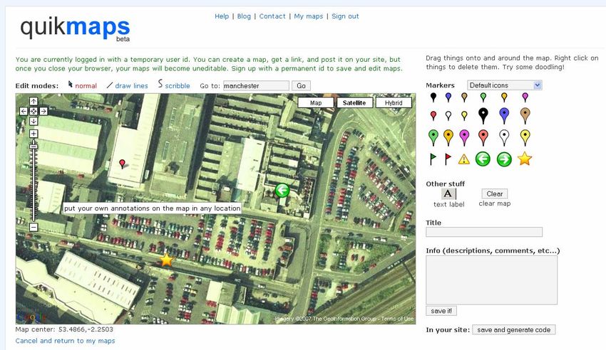
Figure 1

The basic maps sites
Probably the best maps resources for detailed and large scale maps is the ‘Get-a-map
resource’ from the Ordnance Survey
(http://www.ordnancesurvey.co.uk/oswebsite/getamap/ - Figure 2). Here you can get
your hands on an extract of a map
available at different scales
including 1:50,000 and 1:25,000.
A map extract is easily selected
simply by entering a postcode or
place name. This can be used to
find out what a place is like in
terms of its physical and human
geography (site, situation, aspect,
relief, drainage, land-use etc).

One of the other key benefits of
the site is that the license permits
free individual copies of the same
map for all students. Use the
command on the top-right of the
window ‘print/save/copy’ . The map Figure 2
can then be laminated and used for       Image produced from the Ordnance Survey Get-a-map service
fieldwork in the local area or to        (www.ordnancesurvey.co.uk/getamap). Image reproduced with kind
                                          permission of Ordnance Survey (www.ordnancesurvey.co.uk) and
contextualise a ‘virtual’ fieldtrip to a Ordnance Survey of Northern Ireland (www.osni.gov.uk)
contrasting place.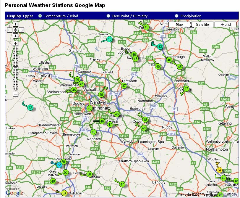
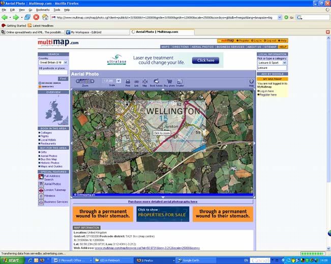
Another excellent map resource is ‘Multimap’ www.multimap.com (Figure 3). Multimap
seems to work best when its viewing window is maximised (click on the button on the
toolbar). This makes the map
more prominent in comparison
with the banner advertising
which surrounds the web
window.
Another recommended feature
of the site is to use the air-
photo element – again found
on the toolbar at the top of the
map window (it can only be
used with larger-scale maps,
i.e.>1:500,000). Once the
aerial view is active try
hovering the mouse over the
image to reveal the map
underneath. This is an
excellent method of linking air
and satellite imagery to map
features.
                                     Figure 3

Table 1 provides a summary of these and other map sites suitable for supporting high
quality fieldwork.

               What its best for                                 Not so good at…..
               Go to the “Get-a-map” section to get a free       Map coverage at larger scales (!:50,000
               section on an OS map anywhere (England,           and 1:25,000) is restricted to a few square
               Wales, Scotland) down to 1;25,000 scale.          km.
               Also searchable by postcode. Good for
               project work. Individual copies permitted.
               Coverage of most major countries. Ability to      Resolution of detail is poor at large scales,
               overlay map information on to an air photo of     especially in rural areas.
               a selected area. Also gives latitude and          Lots of adverts on the site.
               longitude.
               Maps are very much focused towards being          No one way system details.
               an electronic street map. Roads clearly           Heavy on adverts in the top and side
               marked and easy to read. Range of search          frames of the web page.
               options.
               http://local.google.co.uk/ has a range of local   Detail best in urban areas, no contours, few
               maps which are good at street level. A clever     boundaries etc. Satellite imagery resolution
               feature is the ability to search for particular   is questionable for much of the UK,
               shops, e.g. banks which are then shown on         especially in rural areas.
               the map.
               Looking at world atlas maps – small scale         Fairly heavy on adverts and sponsored
               maps, but lots of coverage. Also has a good       links.
               little country summary, including ‘ current       Strong US bias.
               environmental issues’ which is quite quirky.      Can be tricky to navigate to the map you
                                                                 are interested in.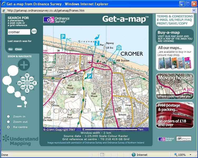
The ‘About Geography’ website                     Lots of adverts clutter the site – this can
                          http://geography.about.com/ has lots of good      make it tricky to navigate and find exactly
                          map resources, including free outline maps of     what you are looking for. There are also
                          countries of the world.                           lots of ‘sponsored links’ which you should
                                                                            avoid.
                          This site specialises in free downloads of old    The resolution of the maps is not so great,
                          maps from around 120 years ago. Easy              especially at large scale. Sometimes, its
                          search system and maps are fully scalable.        also difficult to match locations on old and
                          Seems to have full coverage of most of            new maps – best to use roads as guides.
                          Britain.
Table 1

          Using electronic maps in an appropriate manner is a really important way to add value
          to a piece of fieldwork. Look at the difference in quality in Figure 4a and Figure 4b.
          The use of a digital map (as opposed to a photocopied version) has added
          considerable worth.

                                                                           What is GIS?
                                                                           A geographical information system
                                                                           (GIS) has the ability to store,
                                                    Figure 4b
          Figure 4a
                                                                           retrieve, manipulate and analyse a
                                                                           range of spatially related data.
                                                                           With a GIS the user may ask
                                                                           questions of data related to the
          Free GIS from the web to support fieldwork                       map, search for patterns and
          The internet is becoming much more sophisticated                 distributions and investigate the
          in terms of the type of geographical data it can                 underlying relationships between
          deliver, not just limited to maps and map data, but              different sets of data.
          there are a host of other sites that may be useful in            GIS handles data quickly and
          terms of supporting GIS – Geographical In                        efficiently, proving mapping
          formation systems – see box opposite.                            facilities that may have taken many
                                                                           hours to complete manually.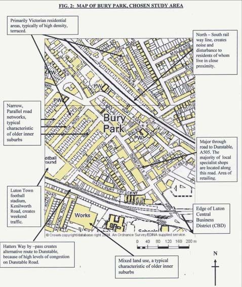
There are too many good sites to list at length but here are a few of my favourites!
(1) www.ononemap.co.uk see properties and prices in an area that are for sale (uses
the Google local platform). Good for comparing across areas, regions or postcodes.
Figure 5 – Windows Local Live. Add
3D buildings in parts of London!
Fancy stuff.
(2) Windows Local Live is an excellent site (http://maps.live.com/ ). Similar to Google
Earth, but the air-photo resolution is often much higher. It also has some clever
searching technology. Try as an alternative experience for the ‘virtual fieldtrip’
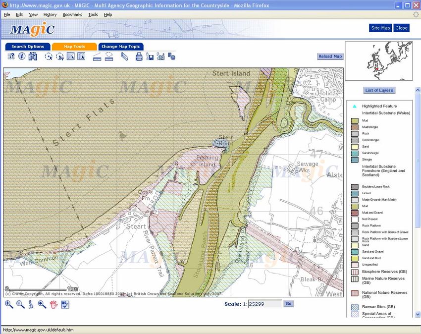
(3) The Magic site
(www.magic.gov.uk)
is a really good way
of getting into some
free GIS, simply by
using the internet.
The site advertises
itself as a multi-
agency countryside
resource. Type in a
place or postcode to
see a map with
countryside
information (Figure 6).
The best thing is that
you can change and
manipulate the maps
layers.
Figure 6
(4) A real favourite is this weather site which uses the ‘Google Local’ Whilst the BBC
and the Met Office offer excellent educational map based resources, this site has the
edge for me as it shows both highly localised and live information.
Selecting any of the sites (indicated by the circles) allows the user to see a graph of
past weather history and to find out more about the geography of the weather station.
The colours of the circles correspond to air temperatures (blues and greens colder and
yellows / reds warmer) and ‘arrowtails’ on the circles indicate the wind direction – see
Figure 7. The wind strength is indicated by the number in the centre of a circle. This is
the strength in mph. A full key is included on the website.

Figure 7

http://www.wunderground.com/stationmaps/gmap.asp?zip=00000&wmo=03535&thepr
efset=WPHO&theprefvalue=0

This site offers enormous potential in terms of pre, during and post fieldwork support.
Students can track the passage of a depression and compare their primary
observations to published information. How and why are there differences?
(5) A final recommendation is the Quikmaps site. Draw pictures and label things on a
       Google map using simple clicks and drags (Figure 8). Easily move the map to
       anywhere in the world. www.quikmaps.com The user-friendly nature of the site makes
       it ideal for students to create maps of their local or personal geographies and fieldwork
       activities.

Figure 8

       David Holmes works part time as Geography Advisor to the Field Studies Council and
       is a senior Examiner for Edexcel. He also co-ordinates The Gifted and Talented
       programme of courses at Kilve Court in Somerset. David can be contacted at
       dave.holmes@telinco.co.uk and offers consultancy / CPD on a range of geographical
       themes, including ICT.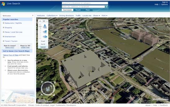
You can also read