Tasmanian Wilderness World Heritage Area - Draft Fire Management Plan - Tasmania Parks ...
←
→
Page content transcription
If your browser does not render page correctly, please read the page content below

Tasmanian
Wilderness World
Heritage Area
Draft Fire Management Plan
Acknowledgements
Whilst this fire management plan for a large part
focusses upon contemporary fire management and
bushfire response within the Tasmanian Wilderness
World Heritage Area, this is done with full recognition
that Tasmanian Aboriginal people have lived in this
country for at least 40,000 years. The landscapes
of the TWWHA are therefore intrinsically linked with
Tasmanian Aboriginal cultural and land management
practices.

With this understanding we acknowledge and honour
the Traditional Owners and their Elders, past, present
and of future generations.

ISBN:

© State of Tasmania 2021

Department of Primary Industries, Parks, Water and
Environment

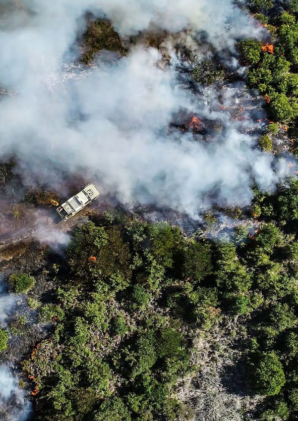
COVER PHOTO: Gell River bushfire, 2019.
Photo: Chris Emms

PHOTO THIS PAGE: Assessing bushfire damage,
Mount Eliza 2019. Photo: Stu Gibson
Contents

Glossary                                             3          3.2    Fire management zoning                            26
1     Background                                     6                 3.2.1   Asset Zone                                26
1.1
    Tasmanian Wilderness World Heritage Area                           3.2.2 Asset Protection Zone                       26
    Fire Management Plan                     6                         3.2.3 Strategic Fire Management Zone              27
1.2
    Tasmanian Wilderness World Heritage Area                           3.2.4 Land Management Zone                        27
    Fire Management Plan objectives          7
                                                                       3.2.5
                                                                             Fire management zoning ongoing
1.3   Plan status and authority                      7                       maintenance                                 27
2     Tasmanian Wilderness                                             3.2.6 Public access to zoning                     27
      World Heritage Area                            9                 3.2.7 Ecological Management Zones                 28
2.1   State fire planning context                    9          4      Prevention                                        31
      2.1.1   Fuel Reduction Program                 9          4.1    Planned burning                                   31
      2.1.2
            National Parks and Reserves                                4.1.1   Planned burn process                      31
            Management Act 2002                      11
                                                                       4.1.2   Planned burning objectives                32
      2.1.3	Other policies, procedures and
                                                                       4.1.3   Post-burn evaluation                      33
             guidelines                              11
                                                                       4.1.4   Constraints                               35
      2.1.4   Fire Management Area Committees 11
                                                                       4.1.5   Solutions to address constraints          35
      2.1.5   Three year TWWHA burn schedule        12
                                                                4.2    Landscape fire regions                        36
      2.1.6   Reserve Values Fire Protection Plans 12
                                                                4.3    Landscape burning                             40
      2.1.7   Response plans                        12
                                                                4.4    Aboriginal cultural burning                   40
2.2	Fire management in the Tasmanian
                                                                4.5    Campfires                                         42
     Wilderness World Heritage Area                 12
                                                                5      Preparedness                                  45
      2.2.1   Risk based management                 13
                                                                5.1    Pre-positioning                                   45
      2.2.2 Potential fire management risks         13
                                                                5.2    Fire detection                                    45
      2.2.3 Values identification                   14
                                                                5.3    Resourcing                                        45
2.3
    Fire research in the Tasmanian Wilderness
    World Heritage Area                       20                5.4    Training                                          45
                                                                5.5    Reserve Values Fire Protection Plans          46
      2.3.1   Climate change                       20
                                                                5.6    Equipment caching                                 47
      2.3.2 Monitoring and evaluation              20
                                                                       5.6.1   Specialist equipment                      48
3     Planning tools                               23
                                                                5.7    Fire trails                                       48
3.1   Tools                                         23
                                                                6      Response                                          51
      3.1.1   Aboriginal Heritage Register          23
                                                                6.1    Bushfires                                         51
      3.1.2   TASVEG                                23
                                                                       6.1.1   Rapid attack                              51
      3.1.3   Natural Values Atlas                  23
                                                                       6.1.2   Fire suppression                          51
      3.1.4   Bushfire Risk Assessment Model        23
                                                                       6.1.3   Limited action                            54
      3.1.5   Bushfire Operational Hazard Model 23
                                                                       6.1.4   Emergency Response Plans                  54
      3.1.6   Planned Burn Activity Manager         25
                                                                       6.1.5   Staging camps                         56
      3.1.7   Burn Risk Assessment Tool             25
                                                                6.2    Firefighting chemicals                        56
      3.1.8   Planned Burn Decision Support Tool 25
                                                                6.3    Biosecurity                                       57
      3.1.9   Firescape-SWTAS                       25                 6.3.1   Fire management activities            58

                                              DRAFT Tasmanian Wilderness World Heritage Area Fire Management Plan 2021    |   1
7         Recovery                                      61         Appendix 1 – Relationship between TWWHA
    7.1       Rehabilitation                                61                      Management Plan objectives
                                                                                    and the TWWHA Fire Management
    7.2       Impact assessment                             61                      Plan outcomes.                       72
              7.2.1   Triggers for impact assessment        61         Appendix 2 – Key risks and strategies             75
              7.2.2   Fire severity mapping                 61         Appendix 3 – Key fire management reference
    7.3       Managing wildlife                             62                      documents                            78
              7.3.1   Supplementary feeding                 62         Appendix 4 – Plan relationship to Press
                                                                                    Report (2016)                        79
    8         Community                                     64
                                                                       Appendix 5 – Inputs, data source and outputs for
    8.1       Fire safety                                   64
                                                                                     the different stages of the planned
              8.1.1   Visitor safety                        64                      burn process.                        81
    8.2	Fire interpretation, education and                            Appendix 6 – E xample of fire planning process
         communication                                      65                      for the TWWHA                        82
    8.3       Apiarists                                     66         Appendix 7 - Asset Protection Zones               84
    8.4       Other Tasmanian Wilderness World                         Appendix 8 – Treatable vegetation communities 85
              Heritage Area land managers and
                                                                       Appendix 9 – Tasmanian Emergency Risk
              neighbours                                    66
                                                                       		            Assessment Guidelines Consequence
              8.4.1   Aboriginal Land Council of Tasmania 67                        Table                           87
              8.4.2 Tasmanian Land Conservancy              67
              8.4.3 Tasmanian Aboriginal Centre             68
              8.4.4 Bush Heritage Australia                 68
              8.4.5 Sustainable Timber Tasmania             68
              8.4.6 Hydro Tasmania                          68
              8.4.7   TasNetworks                           69
              8.4.8 Other freehold land                     69
    9         Bibliography                                  70

2   |     DRAFT Tasmanian Wilderness World Heritage Area Fire Management Plan 2021
Glossary

Aboriginal burning                                             Climate change
Burning practices developed and undertaken by                  A change of climate which is attributed directly or
Aboriginal peoples to enhance the health of the land           indirectly to human activity that alters the composition
and its people.                                                of the global atmosphere and which is in addition to
AHT                                                            natural climate variability observed over comparable
Aboriginal Heritage Tasmania, a branch within                  time periods (UNFCCC definition)2 .
DPIPWE.
                                                               Community
AIIMS                                                          A group of people living in a specific geographic area,
                                                               or with mutual interests, who could be affected by a
Australasian Inter-service Incident Management
                                                               proposal.
System.

ALCT                                                           Conservation
Aboriginal Land Council of Tasmania.                           All the processes and actions of looking after a place
                                                               so as to retain its significance or values. This includes
APZ                                                            protection, maintenance and monitoring3.
Asset Protection Zone.
                                                               COP
Asset
                                                               Common Operating Platform.
Refers to natural, tourism, recreational, cultural
and historic values. The term ‘asset’ is used                  Cultural values
interchangeably with ‘values’ throughout this                  Aboriginal values of the TWWHA both tangible (e.g.
document.                                                      sites, and landscapes) and intangible (e.g. story, song,
AZ                                                             dance, language, kinship, custom, ceremony and
Asset Zone.                                                    ritual).

Biodiversity                                                   DPIPWE
The diverse variety of all life forms including                Department of Primary Industries, Parks, Water and
microorganisms, animals and plants. The term is                Environment.
scalable from the genetic diversity within a single
                                                               Environment
species, to community, and to ecosystem levels.
                                                               Has the same meaning as described in ISO 14050
BOHM                                                           Environmental management – Vocabulary.
Bushfire Operational Hazard Model.                             Environment includes air, water, land, natural
BRAM                                                           resources, flora, fauna, human-made or modified
Bushfire Risk Assessment Model.                                structures or areas. Social, political, and recreational
                                                               environments are included. Hence the term
BRAT
                                                               “environment” encompasses the natural, cultural,
Burn Risk Assessment Tool.
                                                               social and economic environments.
BRMP
                                                               Fire-dependent
Bushfire Risk Management Plan.
                                                               Natural and cultural values that persist only with
BRU                                                            periodic burning.
Bushfire Risk Unit.
                                                               Fire Duty Officer
Bushfire                                                       A PWS employee rostered to co-ordinate incident
Unplanned vegetation fire. A generic term which
                                                               response and resources on PWS management land.
includes grass fires, forest fires and scrub fires both
with and without a suppression objective1.

                                               DRAFT Tasmanian Wilderness World Heritage Area Fire Management Plan 2021    |   3
Fire refugia                                                     Management Plan
    Areas historically resistant to fire incursion due to            A statutory management plan prepared and approved
    topographic protection, the presence of natural fire             under the National Parks and Reserves Management
    breaks (expanses of rock, water or low flammability              Act 2002 covering reserved land, or under the Crown
    vegetation) or a combination of the two and therefore            Lands Act 1976 covering public reserves.
    support a suite of species not commonly found outside
                                                                     OUV
    these areas.
                                                                     Outstanding Universal Value - cultural and/or natural
    Fire-sensitive                                                   significance which is so exceptional as to transcend
    Natural, cultural and historic values that will be               national boundaries and to be of common importance
    significantly damaged by any fire. In some cases the             for present and future generations of all humanity, as
    value may survive a single fire but is unlikely to persist       detailed for the TWWHA in the properties Statement
    after subsequent fires.                                          of Outstanding Universal Value.
    Fire tolerant                                                    Palaeoendemic
    Natural, cultural and historic values that are likely            Clades (a group of organisms that are composed of a
    to persist in the presence of fire, however, may be              common ancestor) that are ancient but geographically
    eliminated if the tolerable fire intervals are exceeded.         restricted.
    FMAC                                                             PB-DST
    Fire Management Area Committee, established under                Planned Burn Decision Support Tool.
    the Fire Service Act 1979.
                                                                     Planned burn
    Historic values                                                  The controlled application of fire under specified
    European heritage values of the TWWHA, including                 environmental conditions to a pre-determined
    huts and convict sites.                                          area and at the time, intensity and rate of spread
                                                                     required to attain planned resource management
    IMT
                                                                     objectives. Planned burning is undertaken in specified
    Incident Management Team.
                                                                     environmental conditions4.
    LISTmap
                                                                     PTPZ
    An online map application that allows the user to
                                                                     Permanent Timber Production Zone Land.
    combine multiple layers of information in order to
    create and view maps.                                            PWS
                                                                     Tasmania Parks and Wildlife Service.
    LMZ
    Land Management Zone.                                            RAA
                                                                     Reserve Activity Assessment.
    Natural values
    A feature or system of nature, as opposed to humans              Reserve
    and human products. This includes native plants,                 Refers to land including land covered by water, and
    animals and other organisms; the communities they                the water, reserved under the Nature Conservation
    form; geological and geomorphic features and the                 Act 2002 and Crown land dedicated as public reserve
    landscapes these features combine to create.                     under the Crown Lands Act 1976.
    NCC                                                              Reserved land
    National Construction Code.                                      Land, including land covered by water, and the water,
                                                                     reserved under the Nature Conservation Act 2002.
    NCH
    Natural and Cultural Heritage division of DPIPWE.                Reserve management objectives
                                                                     Refers to the objectives for management of reserved
    NVA
                                                                     land listed in Schedule 1 of the National Parks and
    Natural Values Atlas.
                                                                     Reserves Management Act 2002, and the objectives

4   |   DRAFT Tasmanian Wilderness World Heritage Area Fire Management Plan 2021
for management of public reserves listed in Schedule 4        1. Australasian Fire and Emergency Service Authorities Council Bushfire
                                                                 glossary.
of the Crown Lands Act 1976. The objectives depend on
                                                              2. United Nations Framework Convention on Climate Change.
the reserve type and apply to the whole reserve.
                                                              3. Australian Heritage Commission, 2002, Australian Natural
Reserve values                                                   Heritage Charter: for the conservation of places of natural heritage
The natural significance and/or cultural significance            significance (2nd edn).

and/or historic significance of a thing, site or place        4. Australasian Fire and Emergency Service Authorities Council Bushfire
                                                                 glossary.
within a reserve. See also separate definitions for natural
values, cultural values and historic values.
RVFPP
Reserve Values Fire Protection Plans.
SFMC
State Fire Management Council.
SFMZ
Strategic Fire Management Zone.
Stakeholder
Any person or group with an interest in, or the potential
to be affected by, an activity.
STT
Sustainable Timber Tasmania.
TAC
Tasmanian Aboriginal Centre.
TERAG
Tasmanian Emergency Risk Assessment Guidelines.
TFS
Tasmania Fire Service.
TLC
Tasmanian Land Conservancy.
Tolerable fire interval
The minimum and maximum time since fire required for
ecological maintenance of the community. Tolerable
fire intervals are based on accumulated knowledge of
the fire responses of individual species, most commonly
plants.

Tourism
The business of providing services (recreational use)
for people on holiday including entertainment, lodging,
food, etc.

TWWHA
Tasmanian Wilderness World Heritage Area.
WPD
Weeds, pests and diseases.

                                              DRAFT Tasmanian Wilderness World Heritage Area Fire Management Plan 2021                  |   5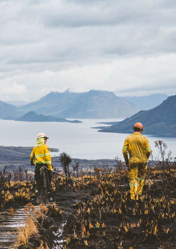
1. Background

    The Tasmanian Wilderness World Heritage Area                    such as planned burning, is preferable. As bushfires
    (TWWHA) is home to globally significant natural and             are uncontrolled they often cause damage to people,
    cultural values and was listed as a World Heritage Area         infrastructure and ecosystems. The conditions under
    by UNESCO in order to protect, conserve, present                which some bushfires occur mean that fire-sensitive
    and pass on to future generations one of the world’s            vegetation that is often too wet to burn (e.g. rainforest)
    outstanding natural areas. The ecosystems of the                may in fact burn. A high intensity fire also results in
    TWWHA are a product of millennia of active fire                 a uniform burn over a large area, a condition that
    management, with records of people using fire as a              is undesirable for ecosystem health. Management
    management tool in the region extending back at least           through the use of targeted planned burning
    40,000 years. Active fire management is still required          eliminates the above consequences and reduces
    in order to preserve the World Heritage values of the           the bushfire risk. Additional bushfire risk mitigation
    TWWHA.                                                          activities include having appropriate fire response
                                                                    strategies and prepositioning in place.
    Contemporary fire management refers to both the
    application of prescribed fire and the suppression of
    unplanned bushfires. Prescribed fire, or planned burns,
    are used for both asset protection, by reducing the fuel
                                                                    1.1 Tasmanian Wilderness
    load of treatable vegetation, as well as ecological             World Heritage Area Fire
    maintenance, as a healthy ecosystem is dependent on
    vegetation communities being burnt at a certain fire
                                                                    Management Plan
    frequency and intensity. Many of the ecosystems within          Fire management is essential to achieving the vision
    the TWWHA are fire dependent, meaning                           and objectives of the Tasmanian Wilderness World
    that in the absence of fire they will cease to exist,           Heritage Area Management Plan (2016). The need
    transitioning to a different vegetation community with          to develop a fire management plan for the TWWHA
    a longer fire return interval. In addition, the absence of      was recognised in Key Desired Outcome 8.1 of
    planned burning results in higher fuel loads in                 the Tasmanian Wilderness World Heritage Area
    flammable vegetation, increasing the chance of                  Management Plan (DPIPWE 2016) and addresses
    unplanned ignitions and resultant bushfires. For these          Recommendation 1 of the Tasmanian Wilderness
    reasons, complete fire suppression within the TWWHA             World Heritage Area Bushfire and Climate Change
    is not only impractical but also undesirable.                   Research Project (Press 2016).
    A bushfire can only occur when there is an ignition
    source present. The management and education of
                                                                        Tasmanian Wilderness World Heritage Area
    people within the TWWHA has reduced the number of
                                                                        Management Plan (2016)
    human ignited bushfires (e.g. escaped campfires), but
    this has coincided with an increase in the number of                Key Desired Outcome 8.1
    lightning ignited bushfires, which has risen
                                                                        Integrated fire management planning is
    substantially since circa 2000.
                                                                        undertaken in the TWWHA for public safety; asset
    It is important to reduce the fuel hazard because fires             protection; Aboriginal cultural practices and values;
    will burn at higher rates of spread and greater                     and management of natural values and processes.
    intensities when the fuel load is high. Thus, a lower fuel
                                                                        Management Action
    load makes a bushfire safer and more likely to be
    brought under control.                                              Develop a holistic fire plan for the TWWHA.
    Like planned burns, bushfires will also reduce the fuel
    hazard, however there are a number of reasons why
    reducing the fuel load in a controlled manner,

6   |   DRAFT Tasmanian Wilderness World Heritage Area Fire Management Plan 2021
Tasmanian Wilderness World Heritage Area                  •   Ensure no loss of life or injury as a result of bushfire
    Bushfire and Climate Change Research Project                  or planned burning.
    (2016).

    Recommendation 1 – Comprehensive fire
    management planning
                                                              1.3      Plan status and authority
    Clear, well-defined objectives for fire management        The Tasmanian Wilderness World Heritage Area
    should be incorporated into a Fire Management             Fire Management Plan is a non-statutory plan. The
    Plan for the TWWHA. These objectives should               Plan’s geographic scope is in line with the Tasmanian
    identify how fire management (fire suppression, ‘let      Wilderness World Heritage Area Management Plan
    go’ and management fires) will be used to protect         (2016), which applies to any land within the TWWHA
    and conserve the natural and cultural heritage            that is reserved under the Nature Conservation Act
    values in the TWWHA.                                      2002 and for which the Director is the managing
                                                              authority, however the Plan has been extended
    The Fire Management Plan for the TWWHA                    to include the Southwest Conservation Area as
    should clearly set out the circumstances in which         this reserve impacts on fire management in the
    priority will be given to protecting the Outstanding      TWWHA. The Plan does not apply to freehold land
    Universal Value of the TWWHA over built assets            subject to a conservation covenant under the Nature
    within its boundaries.                                    Conservation Act 2002, freehold land or vested land
The Tasmanian Wilderness World Heritage Area Fire             held by Hydro Tasmania, or any other freehold land
Management Plan (hereafter referred to as the Plan) is        where they occur within the TWWHA. It also does
a strategic level plan that will sit alongside, and where     not apply to Permanent Timber Production Zone
inconsistent, prevail over the Regional Strategic Fire        Land or land vested in the Aboriginal Land Council of
Management Plans. The Plan will be reviewed five              Tasmania. Further details regarding this topic can be
years from the date of publication.                           found in Section 1.6 of the TWWHA Management Plan
                                                              (2016).

                                                              Considering that fire management in the TWWHA
1.2 Tasmanian Wilderness                                      and surrounding tenure should not be managed in
World Heritage Area Fire                                      isolation, the fire management needs and objectives of
                                                              other land classes within and adjacent to the TWWHA
Management Plan objectives                                    are represented in this Plan (Sections 8.4 Neighbours
                                                              and 8.5 Other Tasmanian Wilderness World Heritage
The objectives of the Tasmanian Wilderness World
                                                              Area land managers). Where practical to do so, fire
Heritage Area Fire Management Plan are to:
                                                              management activities should always be conducted
•   Avoid loss of fire-sensitive vegetation and other         in consultation and cooperation with other land
    high conservation natural, cultural and historic          managers within and adjacent to the TWWHA.
    values in the TWWHA.

•   Maintain natural values through appropriate fire
    regimes.

•   Enhance protection of critical infrastructure within
    the TWWHA.

•   Provide opportunities for Aboriginal people to
    undertake cultural burning, free of onerous and
    culturally unacceptable requirements.

                                              DRAFT Tasmanian Wilderness World Heritage Area Fire Management Plan 2021       |   7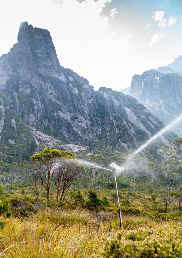
Parks and Wildlife Service firefighters setting up a sprinkler line for asset protection at Lake Rhona, 2019. (Photo: Chris Emms)

8   |   DRAFT Tasmanian Wilderness World Heritage Area Fire Management Plan 2021
2. Tasmanian Wilderness
   World Heritage Area
The Tasmanian Wilderness World Heritage Area                  All these factors have created a landscape that stirs
covers 1.58 million hectares, which equates to roughly        deep passions and a strong sense of belonging
one quarter of the land area of Tasmania. It was first        within the Tasmanian community. As such, decisions
inscribed onto the World Heritage List in 1982 with           regarding management are often accompanied by a
major extensions occurring in 1989 and 2013. The              wide range of thoughts and opinions, which will vary
TWWHA is recognised as being a place of Outstanding           depending on the objectives of the stakeholders.
Universal Value (OUV), meeting seven out of a
possible 10 criteria for listing. This includes all four
natural criteria and three cultural heritage criteria.        2.1      State fire planning context
The Tasmanian Wilderness World Heritage Area                  The Parks and Wildlife Service (PWS) is one of three
plays an important role in the culture and identity           statutory bushfire response agencies within Tasmania
of Tasmania. During the last ice age the TWWHA                (the others being the Tasmania Fire Service (TFS) and
was home to the southernmost humans on earth.                 Sustainable Timber Tasmania). All three agencies are
Tasmanian Aboriginal people have lived in, and used           signatories to the Inter-agency Bushfire Management
fire to manage and modify the landscape of the                Protocol.
TWWHA for at least 40,000 years and the evidence
for this is present in many of the vegetation patterns
of the landscape that we see today. The Tasmanian             2.1.1    Fuel Reduction Program
Wilderness World Heritage Area remains a diverse              In 2014 the Tasmanian Government established the
Aboriginal cultural landscape.                                statewide Fuel Reduction Program, which is a co-
                                                              ordinated program of fuel reduction burning across
Early European settlers often ventured into the
                                                              the state. The Tasmania Fire Service, Sustainable
TWWHA, with some making their home there.
                                                              Timber Tasmania and the Parks and Wildlife Service
Trappers, piners, miners and graziers all utilised the
                                                              are the key program partners. The Fuel Reduction
area with the evidence of this occupation ranging from
                                                              Program has an annual budget of $9 million.
the rudimentary timber huts they built for shelter to
the dead stags of burnt pencil pines that can be seen in      The Fuel Reduction Program is primarily focused on
many places across the landscape.                             reducing risk to human settlement areas through Asset
                                                              Protection Burns, therefore planned burns within the
The Tasmanian Wilderness World Heritage Area has
                                                              TWWHA were seldom eligible for funding through this
also been a key site in the emergence of the global
                                                              program. In recognition of the importance of burning
conservation movement. The loss of Lake Pedder to a
                                                              in the TWWHA for the protection of its Outstanding
hydro-electric scheme in the 1970s was the prelude to
                                                              Universal Value, the critical infrastructure that occurs
the battle to save the Franklin River, which ultimately
                                                              within and adjacent to the TWWHA, and the benefits
thrust the wilderness of western Tasmania into the
                                                              of strategic landscape scale burning for community
national spotlight, leading to its inscription on the
                                                              protection, some of the program funding is made
World Heritage register in 1982. Aboriginal history,
                                                              available for burning within the TWWHA each year.
through the rediscovery of Pleistocene cave sites
including kuti kina cave, also played a pivotal role in       Figure 1 shows the relationship of the Tasmanian
the listing of the area as World Heritage.                    Wilderness World Heritage Area Fire Management Plan
                                                              to the statewide context.
The Tasmanian Wilderness World Heritage Area is a
popular location for on and off-track bushwalking and
other recreational activities, providing a challenging
and remote environment. It is also a drawcard for
interstate and international tourism, with Cradle
Mountain being amongst the top 10 attractions within
Tasmania.

                                              DRAFT Tasmanian Wilderness World Heritage Area Fire Management Plan 2021   |   9
FIGURE 1. The relationship of the Tasmanian Wilderness World Heritage Area Fire Management Plan
to the statewide fire planning framework.
National Parks and
Reserves Management
Act 2002
TWWHA
Management Plan
Other legislation,
TWWHA
policies, procedures
Fire Management Plan
and guidelines
Fire Management Three year TWWHA Reserve Values Fire
Response Plans
Area Committees burn schedule Protection Plans
Bushfire Risk Emergency
Burn Plans Fire Action Plan
Management Plans Response Plans
10 | DRAFT Tasmanian Wilderness World Heritage Area Fire Management Plan 20212.1.2
National Parks and Reserves • PWS Fire Management Policy (P-050).
Management Act 2002
• PWS Fire Planning Policy (P-055).
The Parks and Wildlife Service (PWS) has responsibility
• PWS Planned Burning Policy and Procedures (P-
to manage the public land that makes up the TWWHA
052 and PR-052).
in accordance with the National Parks and Reserves
Management Act 2002. This Act requires, amongst • PWS Bushfire Season Fire Action Plan.
other things, that management plans be prepared
• Fire Operations in Tasmania’s Parks and Reserves
to indicate how the area is to be managed in order
(PR-110).
to protect and conserve the reserve estate, as well
as fulfilling international obligations with regards to
managing areas of World Heritage Area status. 2.1.4
Fire Management Area Committees
Fire management is a particular function listed in the The State Fire Management Council is an advisory
National Parks and Reserves Management Act 2002 group to the State Fire Commission and includes
that requires attention. representatives from PWS and Sustainable Timber
Tasmania (STT). The State Fire Management
Section 30, subsection 1 of the National Parks and Council provides support to Fire Management Area
Reserves Management Act 2002 states the managing Committees (FMAC).
authority:
Fire Management Area Committees are statutory
“ for any reserved land for which there is a bodies established under the Fire Service Act
management plan is to manage that land for the 1979 that provide a forum for effective bushfire
purpose of giving effect to the management plan risk management for each of the state’s 10 Fire
and in accordance with that plan; or for any other Management Areas. The principal aim of FMACs is to
reserved land is to manage that land in a manner that bring together a range of stakeholders that manage
is consistent with the purposes for which the land land across Tasmania and work collaboratively in
was reserved; and having regard to the management strategically planning the reduction of bushfire risk.
objectives for the class of that reserved land.” This includes activities such as managing vegetation
fuels, reducing ignitions, increasing community safety
2.1.3
O ther policies, procedures and and improving preparedness.
guidelines
Bushfire Risk Management Plans
Fire management in the TWWHA is conducted in
accordance with the following legislation, policies, The primary role of an FMAC is to prepare a Bushfire
plans, procedures and guidelines or any subsequent Risk Management Plan (BRMP) for their Fire
documents that serve the same purpose. Management Area. These plans identify and assess
community bushfire risks and prioritise strategic works
• National Parks and Reserves Management Act in response to those risks, including areas for fuel-
2002. reduction burning. Bushfire Risk Management Plans
• Fire Service Act 1979. are reviewed annually and the priorities they identify
guide the implementation of the Fuel Reduction
• Tasmanian Vegetation Fire Management Policy Program.
2017.
Representatives from PWS sit on each FMAC, however
• Tasmanian Emergency Management a primary focus of FMACs is community protection,
Arrangements. particularly in the urban interface area. Thus, FMACs
• Tasmanian Wilderness World Heritage Area do not tend to focus on fire management in the
Management Plan 2016. TWWHA.
DRAFT Tasmanian Wilderness World Heritage Area Fire Management Plan 2021 | 11For those reasons, fire planning within PWS must
2.2 Fire management in the
incorporate FMAC priorities as well as ensuring
reserve management obligations under the National Tasmanian Wilderness World
Parks and Reserves Management Act 2002 and the Heritage Area
Nature Conservation Act 2002 are also met. It is
important, however, that TWWHA fire management The Parks and Wildlife Service use fire to manage
strategies documented within the Plan are the natural and cultural values of the TWWHA and
summarised in the Bushfire Risk Management Plans, to reduce fuels with the aim of reducing unplanned,
and where appropriate, strategies may be developed predominately lightning, ignitions that can have
jointly with neighbouring landowners through FMAC a negative impact on TWWHA values as well as
collaboration. preventing the forward spread of a bushfire once it
becomes established. Fire management activities aim
to achieve the following strategies and outcomes:
2.1.5 Three year Tasmanian Wilderness
World Heritage Area burn schedule • Protect fire sensitive natural, cultural and historic
A key strategy of the Tasmanian Wilderness values from fire and extinguish bushfires that pose
World Heritage Area Fire Management Plan is the a threat to these values.
introduction of a rolling three-year planned burning • Reduce the incidence of large bushfires in the
program. The three year TWWHA burn schedule will be TWWHA.
developed and implemented to integrate the burning
objectives of Aboriginal cultural burning, burning for • Use fire to break up continuous layers of fuel,
asset protection, strategic fuel reduction burning and thereby creating a mosaic of different fuel loads
ecological management burning and covers the entire across the landscape.
geographic area of the TWWHA and the Southwest • Maintain vegetation communities within tolerable
Conservation Area.. fire regimes.
• Co-ordinate amongst PWS, other management
2.1.6
Reserve Values Fire Protection authorities within the TWWHA, and adjacent
Plans landholders.
Another key strategy the Plan identifies for the
protection of natural and cultural values from the • Protect people, particularly visitors, from bushfires.
negative impacts of bushfires is the development of • Engage with the local community about the
Reserve Values Fire Protection Plans. These plans will purpose and requirement for fire management
be developed for all high-value, fire-sensitive assets within the TWWHA.
and set out fire protection strategies and tactics that
can be implemented for protection. • Comply with the Tasmanian Wilderness World
Heritage Area Management Plan (2016).
2.1.7 Response plans
Response plans include the PWS Bushfire Season
Fire Action Plan which outlines how PWS detects and
responds to bushfires. The plan is reviewed annually
and is a key response document. Emergency Response
Plans are site-based plans centred on high visitation
locations that detail how people will be either
evacuated or managed when a bushfire threatens.
12 | DRAFT Tasmanian Wilderness World Heritage Area Fire Management Plan 2021FIGURE 2. The Tasmanian Emergency Risk Assessment Guidelines risk scores based on likelihood x consequence (TERAG 2017).
CONSEQUENCE LEVEL
LIKELIHOOD INSIGNIFICANT MEDIUM HIGH EXTREME EXTREME
Almost Certain MEDIUM MEDIUM HIGH EXTREME EXTREME
Likely LOW MEDIUM HIGH EXTREME EXTREME
Unlikely LOW LOW MEDIUM HIGH EXTREME
Rare VERY LOW LOW MEDIUM HIGH HIGH
Very Rare VERY LOW VERY LOW LOW MEDIUM HIGH
Extremely Rare VERY LOW VERY LOW LOW MEDIUM HIGH
2.2.1 Risk based management It is important to note that ‘doing nothing’ in terms of
Managing fire in the TWWHA is assessed through a fire management is not an acceptable response, as this
risk management framework. Appendix 2 considers will lead to changes in ecosystems across the TWWHA,
the risks associated with bushfires and other PWS a loss of threatened species, a buildup of fuel loads that
activities relevant to fire management in the TWWHA lead to even more destructive bushfires in the future
and the response strategies to be implemented. The and does not acknowledge the long history of the
Bushfire Risk Assessment Model (BRAM) is used to TWWHA as a cultural landscape managed through fire.
identify areas containing assets that are at risk from As a result, a level of acceptable risk needs to be
bushfires, and subsequently used to prioritise bushfire adopted.
mitigation works. Reserve Values Fire Protection Plans
(Section 5.4 Reserve Values Fire Protection Plans), Level of acceptable risk for planned
will be used to document strategies and actions to burning
mitigate the risks. In the TWWHA, planned burning The objectives of fire management activities in the
is a primary risk mitigation strategy. Other measures, TWWHA are presented in Section 1.2 Tasmanian
such as mechanical fuel removal or wetting vegetation Wilderness World Heritage Area Fire Management
through the installation of sprinklers may also be Plan objectives.
used. Tables 1 – 3 identify the highest priority sites
for protection through a bushfire risk rating, which is In line with these objectives, risks associated with
based on likelihood x consequence (Figure 2; TERAG planned burning will be acceptable as long as
2017). The Tasmanian Emergency Risk Assessment strategies are in place to prevent the loss of life or
Guidelines define consequence for five different injury, damage or destroy critical infrastructure or fire-
categories (people, economy, environment, public sensitive natural, cultural and historic values.
administration and social setting). A copy of this can If damage does occur to any of the above, an after
be found in Appendix 9. action review will be initiated and an adverse impacts
assessment undertaken (Section 4.1.3 Post-burn
2.2.2 Potential fire management risks evaluation).
Fire management activities are inherently risky, both in This level of risk acceptance acknowledges that
terms of the impact caused by planned fire escape, as occasionally planned burns will burn beyond intended
well as the indirect risks of a lack of certainty as to the boundaries for a single operation. As long as the
impact fire will have on the environment. It is common escape has been confined to fire-adapted vegetation,
for fire management activities to become paralysed does not damage known values, and is able to be
because of an overabundance of caution.
DRAFT Tasmanian Wilderness World Heritage Area Fire Management Plan 2021 | 13brought under control this should not be considered cultural heritage in the Tasmanian Wilderness World
unacceptable. Heritage Area. As such, a comprehensive and detailed
list of the highest priority cultural values requiring
In some instances it may not be practicable nor
protection from fires that occur in the TWWHA
desirable to burn within defined boundaries at all,
cannot be provided. The development of such a list
and a mechanism to allow burns to run free, under
will require further research to determine the impacts
appropriate conditions, within a low-risk geographic
of fire, while engagement, consultation and input
area, needs to be adopted and tolerated (for further
from Aboriginal people is crucial in order to develop a
information refer to Section 4.3 Landscape burning).
stronger understanding of the values. This work would
enable more effective management of Aboriginal
2.2.3 Values identification heritage sites, landscapes and values in the TWWHA to
The identification of values is required in order to plan, inform fire planning and decisions before, during and
prioritise and mitigate fire risk, as well as identifying following bushfire events.
priority areas of where to concentrate efforts during a While a detailed and comprehensive list cannot be
bushfire when the fire situation overwhelms available provided, Table 1 identifies some of the most highly
resources. significant sites requiring protection from bushfires.
This list includes significant sites and places listed as
Aboriginal landscape part of the OUV of the TWWHA.
The Tasmanian Wilderness World Heritage Area
comprises a range of diverse landscapes and Natural values
environments in which the rich cultural heritage of Table 2 identifies the highest priority natural values
Tasmanian Aboriginal people is preserved. Aboriginal requiring protection from bushfire that occur within
people have lived in, used, managed and modified the TWWHA. Many of the landscapes listed contain
the landscapes of the TWWHA for at least 40,000 a mixture of both fire-sensitive and fire dependent
years. The physical evidence of this connection and components, however it is the fire-sensitive elements
the Aboriginal cultural values are evident in elements that are the focus of bushfire mitigation strategies.
such as the vegetation types and coverage within This list has been developed from a combination
the landscape, which were managed and modified by of the BRAM values at risk layer, the outputs of a
targeted burning regimes, and the Aboriginal cultural workshop run by the Tasmania Fire Service and expert
heritage objects, sites and places, which provide knowledge, with the consequence and likelihood
evidence of the long connection with the landscape. values sourced from the BRAM (DPIPWE 2013) and
Aboriginal cultural values are also evidenced informs many of the Asset Protection Zones (see
through the intangible knowledge held by Tasmanian Section 3.2 Fire Management Zoning).
Aboriginal people associated with the TWWHA, which
includes stories, songs, dances, language, kinship, Historic values
customs, ceremonies and rituals that form part of the
The following historic values have been identified
ongoing cultural practices of Aboriginal people and
by historic values specialists within the Parks and
are often associated with physical sites, places and/or
Wildlife Service as being of the highest priority for
features within the landscape.
protection from bushfires that occur within the
Aboriginal cultural heritage, including objects, sites, reserves that make up the TWWHA (Table 3). The
places, landscapes and their associated values are likelihood scores have been sourced from the BRAM
susceptible to significant damage or destruction and the consequence scores come from Table 1 of the
from fire. Despite this, there is currently very limited Tasmanian Emergency Risk Assessment Guidelines
understanding of the impacts of fire on Aboriginal (TERAG 2017; Appendix 9).
14 | DRAFT Tasmanian Wilderness World Heritage Area Fire Management Plan 2021Table 1. Significant Aboriginal cultural values sites in the Tasmanian Wilderness World Heritage Area,
their consequence level, likelihood of being impacted by bushfire, and overall bushfire risk score.
VALUE CONSEQUENCE LIKELIHOOD RISK SCORE
kuti kina Major Unlikely High
ballawinne Major Rare High
wargata mina Major Extremely rare Medium
DRAFT Tasmanian Wilderness World Heritage Area Fire Management Plan 2021 | 15Table 2. Natural values of the Tasmanian Wilderness World Heritage Area, their consequence level,
likelihood of being impacted by bushfire, and overall bushfire risk score.
VALUE CONSEQUENCE LIKELIHOOD RISK SCORE
Landscapes
Cradle Mountain and Cradle Valley Catastrophic Likely Extreme
Mount Anne massif Catastrophic Unlikely Extreme
Walls of Jerusalem Catastrophic Unlikely Extreme
Mount Field Catastrophic Unlikely Extreme
Mount Bobs and the Boomerang Catastrophic Unlikely Extreme
Pelion West and Mount Ossa Major Likely Extreme
King William Range Major Likely Extreme
Western Arthur Range Major Likely Extreme
Mount Oakleigh Major Likely Extreme
Precipitous Bluff Major Likely Extreme
Sentinel Range Major Likely Extreme
Denison Range Major Likely Extreme
Cheyne Range Major Likely Extreme
Frankland Range Major Likely Extreme
Mount Olympus Major Likely Extreme
Raglan Range Major Unlikely Extreme
Ironstone Mountain Major Unlikely Extreme
Frenchmans Cap Catastrophic Rare High
Du Cane Range Major Unlikely High
Eastern Arthur Range Major Unlikely High
Adamsons Peak Major Unlikely High
Hartz Mountains Major Unlikely High
Poimena Hills Major Unlikely High
Maxwell River Major Unlikely High
Denison River Major Unlikely High
Greystone Bluff Major Unlikely High
Davey River Major Unlikely High
Nelson River Major Unlikely High
Ironbound Range Major Unlikely High
Upper Gordon and Franklin Rivers Major Unlikely High
Lower Gordon and Kelly Basin Major Unlikely High
16 | DRAFT Tasmanian Wilderness World Heritage Area Fire Management Plan 2021High Dome Major Unlikely High
Loddon Range Major Unlikely High
Snowy Range Major Unlikely High
Mount Picton Major Unlikely High
Weld Ridge Major Unlikely High
Wanderer River Major Unlikely High
South Picton Range Major Rare High
Pindars Peak Major Rare High
Birches Inlet Major Rare High
Spero River Major Rare High
Prince of Wales Range Moderate Likely High
Species
Orange-bellied parrot breeding ground Catastrophic Unlikely Extreme
Palaeoendemic species Catastrophic Unlikely Extreme
Lomatia tasmanica Catastrophic Unlikely Extreme
Miena Jewel Beetle Major Likely Extreme
DRAFT Tasmanian Wilderness World Heritage Area Fire Management Plan 2021 | 17Table 3. Historic values within the reserves of the Tasmanian Wilderness World Heritage Area,
their geographic location, consequence level, likelihood of being impacted by bushfire, and overall
bushfire risk score.
SITE EASTING/ CONSEQUENCE LIKELIHOOD RISK SCORE
NORTHING*
Waldheim Chalet 412020/5389801 Major Unlikely High
Hut 1 – Lake Ball (north) 441109/5367436 Major Unlikely High
Mount Kate House 412604/5390161 Major Unlikely High
Blandfordia Alpine Club 412705/5390165 Major Unlikely High
Narcissus Hut and Ranger’s Hut 425618/5348435 Major Unlikely High
Sir John Falls Hut 392468/5286099 Major Unlikely High
Lake Fenton Hut 469399/5274957 Major Unlikely High
Lake Nameless Hut 453187/5380405 Major Unlikely High
Claytons House 429615/5197487 Major Unlikely High
Old Pelion Hut 419911/5369083 Major Unlikely High
Basil Steers Hut No. 3 426004/5373337 Major Unlikely High
Dixons Kingdom Hut 442635/5368990 Major Rare High
Pelion Copper Mine (and hut) 419912/5369083 Major Rare High
Basil Steers Hut No. 1 427767/5383761 Major Rare High
Du Cane Hut 425538/5360432 Major Rare High
Junction Lake Hut 432693/5358502 Major Rare High
Lake Meston Hut 435587/5361773 Major Rare High
Hobart Walking Club Hut 466654/5274012 Major Rare High
Melaleuca (SW Conservation Area) 432394/5192202 Major Rare High
Rose Adams Cottage 491426/5174666 Major Rare High
Howes Hut 430613/5380784 Major Rare High
Hut No. 2 / Kerrisons Hut 445268/5372223 Major Rare High
Echo Point hut and Jetty 428685/5345023 Major Rare High
Government Huts 467238/5273772 Major Rare High
Trappers Hut 438018/5373793 Major Rare High
Lake Newdegate Hut 464030/5276882 Major Rare High
Kitchen Hut 412279/5385692 Major Rare High
Twilight Tarn Hut 464951/5277816 Major Rare High
Raglan Range Piners Hut 401880/5332511 Major Rare High
Yackandandah Hut 408276/5398687 Major Rare High
18 | DRAFT Tasmanian Wilderness World Heritage Area Fire Management Plan 2021Reindeer Lodge 379966/5309813 Major Rare High
Morleys Hut 443573/5270001 Major Rare High
East Pillinger 381038/5309615 Moderate Rare High
Red Shed 441737/5166994 Major Very rare Medium
Allisons Hut 460708/5369293 Major Very rare Medium
Braddon River Hut 373487/5312363 Major Very rare Medium
Cockle Creek Cemetery 491146/5174766 Moderate Unlikely Medium
Sarah Island Group 372200/5305800 Moderate Extremely rare Low
Maatsuyker Island Light Station 441251/5165947 Moderate Very rare Low
* Geodetic Datum of Australia 1994
DRAFT Tasmanian Wilderness World Heritage Area Fire Management Plan 2021 | 192.3 Fire research in the 2.3.1 Climate change
Following the bushfires within the TWWHA in 2016, the
Tasmanian Wilderness World Tasmanian government commissioned the Tasmanian
Heritage Area Wilderness World Heritage Area Bushfire and Climate
Change Research Project (Press 2016). This project
The responses of TWWHA values to fire are not fully resulted in a number of other reports that examined
understood, however, a perfect knowledge of fire the impact of climate change projections on fire
effects within any environment is an unobtainable management in the TWWHA, and are listed below:
aim. The current state of knowledge of fire dynamics
• Tasmanian Wilderness World Heritage Area Natural
within the TWWHA is sufficient to implement a highly
Values Climate Change Adaptation Strategy 2021-
effective and ecologically beneficial planned burning
2031 (DPIPWE 2020c).
program and bushfire response strategy. Nevertheless,
an ongoing program of scientific research and • An assessment of the viability of prescribed burning
monitoring provides vital information that assists PWS as a management tool under a changing climate
to implement an adaptive management approach to fire (Harris et al. 2018).
management, and therefore should be an ongoing part • Impact of changes in lightning fire incidence on the
of fire management in the TWWHA. values of the Tasmanian Wilderness World Heritage
As it is acknowledged that a complete understanding of Area (Kirkpatrick et al. 2018).
the exact fire requirements for every species will never • Impact of climate change on weather-related fire
be obtainable, as a general principle, fire management risk factors in the Tasmanian Wilderness World
within the TWWHA should be focused at the ecosystem Heritage Area (Love et al. 2017).
level, rather than the individual species level. ‘Ecosystem’
• Changes in lightning fire incidence in the Tasmanian
in this context includes plants, animals, geofeatures
Wilderness World Heritage Area, 1980-2016 (Styger
and their interactions. An ecosystem approach to fire
et al. 2018).
planning assumes that fire regimes that maintain an
ecosystem will similarly maintain its components. The Tasmanian Wilderness World Heritage Area
Nonetheless, the requirements of rare, threatened or Bushfire and Climate Change Research Project (Press
otherwise significant species and other natural values is a 2016) made several recommendations regarding fire
key consideration in fire management planning. management in the TWWHA. This plan addresses a
number of these recommendations and the relationship
To improve the knowledge base underpinning fire between the Press report recommendations and this
management, PWS fire managers work closely with Plan can be seen in Appendix 4.
values specialists within the Department of Primary
Industries, Parks, Water and Environment’s (DPIPWE)
Natural and Cultural Heritage Division, as well as 2.3.2 Monitoring and evaluation
fostering strong working relationships with external Fire Impacts on Biodiversity Values in the Tasmanian
researchers and other Australian fire agencies in Wilderness World Heritage Area: Monitoring Strategy
order to keep abreast of the latest research and 2020-2025 (DPIPWE 2020a) provides two key metrics
developments. A key forum for building these for monitoring and evaluating the success of fire
relationships is the annual TWWHA Bushfire Research management in the TWWHA. These are:
Group meeting, convened by DPIPWE. This group is • Minimise the area of fire-sensitive species habitat
comprised of TWWHA land managers and researchers and vegetation communities impacted by fire.
from across a range of agencies and institutions. The
TWWHA Bushfire Research Group provides an ideal • Ensure that less than 20% of the TWWHA and of
forum to identify research needs and develop an each Fire Landscape Region (see Section 4.2) is
outside the recommended tolerable fire regimes
implementation plan.
defined for constituent vegetation communities.
20 | DRAFT Tasmanian Wilderness World Heritage Area Fire Management Plan 2021In addition, this Plan recommends the development of a
comprehensive burn evaluation process (Section 4.1.3)
in order to measure the success of the burn program in
meeting planned burn objectives.
1 Key Desired Outcome:
Research needs are identified, prioritised and
implemented as resources allow.
Management Action:
1.1 Continue annual meeting of the Bushfire
Research Group and develop and maintain
relationships with academic institutions.
2 Key Desired Outcome:
Knowledge of climate change informs and
improves changing fire risk and associated fire
management practices.
Management Action:
2
.1 Keep abreast of climate change
research through relationships with academic
institutions, other fire agencies, and through
the Bushfire Research Group.
3 Key Desired Outcome:
Continuous improvement in fire management
through linking management and research
within an adaptive management framework.
Management Action:
3.1 Fire research to be targeted at addressing
risks (Appendix 2).
3.2 Adopt the monitoring approach
recommended in Fire Impacts on Biodiversity
Values in the Tasmanian Wilderness World
Heritage Area: Monitoring Strategy 2020-
2025 in order to measure the success of fire
management in the TWWHA.
DRAFT Tasmanian Wilderness World Heritage Area Fire Management Plan 2021 | 21Planned Burn, 2018. (photo: Chris Emms) 22 | DRAFT Tasmanian Wilderness World Heritage Area Fire Management Plan 2021
3. Planning tools

                                                              and STT. Natural and Cultural Heritage will remain the
                                                              custodians of this data.

3.1      Tools
There are a number of decision support tools at the           3.1.3    Natural Values Atlas
disposal of Tasmanian fire managers to assist in the
                                                              The Natural Values Atlas (NVA) is an authoritative
planning and management of fire.
                                                              database that houses geographic data on flora, fauna,
                                                              geodiversity and soil survey data. The NVA can be
3.1.1    Aboriginal Heritage Register                         used to produce a Natural Values Report, which brings
The Aboriginal Heritage Register is a database of             together several data sets and provides information
Aboriginal heritage places and objects which are of           that can be used for desktop assessments of natural
significance to the Aboriginal people of Tasmania.            values for specific areas.

Currently there are over 13,000 known places and              It needs to be noted that the NVA over-represents
objects of significance listed on the Register.               records from areas that are easy to access and survey.
                                                              Also, there are large parts of Tasmania that have not
The Register is not publicly accessible as it contains        been surveyed for flora, fauna, geodiversity and soils.
culturally sensitive information but is an important tool
for DPIPWE fire managers in ensuring the effective
management of Aboriginal cultural values.                     3.1.4    Bushfire Risk Assessment Model
                                                              The Bushfire Risk Assessment Model (BRAM) is a GIS
                                                              tool used to assist in the objective identification of
3.1.2    TASVEG
                                                              risk based on likelihood and consequence. The four
TASVEG is a statewide digital map of Tasmania’s               components that form the basis of the BRAM are:
vegetation. TASVEG describes and maps over 150
vegetation communities, including native vegetation           •   Fire behaviour potential (likelihood).
assemblages and human modified landscapes.                    •   Ignition potential (the likelihood of a fire starting).
Pyrke and Marsden-Smedley (2005) grouped                      •   Suppression capability (the likelihood of controlling
TASVEG communities into three themes useful to fire               a bushfire).
managers. These are:
                                                              •   Values at risk (consequence).
•   Fire attributes categories - broad groups of
    similar vegetation communities, such as dry               Combining the individual scores of the likelihood and
    sclerophyll forest or heathland.                          consequence grid, the BRAM produces a score which
                                                              indicates the overall level of risk. Risk is displayed
•   Fire sensitivity – classed as low, moderate, high,        in four levels: low, moderate, high and extreme. The
    very high and extreme.                                    Bushfire Risk Assessment Model is updated annually.
•   Flammability – classed as low, moderate, high and
    very high.                                                3.1.5    Bushfire Operational Hazard Model
These fire attributes underpin many of the planning           The Bushfire Operational Hazard Model (BOHM)
tools used by fire managers across Tasmania. In               utilises fuel data from the BRAM, along with daily
order that they are updated and maintained along              weather data from the Bureau of Meteorology, in order
with TASVEG updates, an Ecological Data Technical             to produce daily forecasted fire behaviour indices. The
Committee has been formed with representation                 Bushfire Operational Hazard Model is used to pre-
from PWS, Natural and Cultural Heritage (NCH), TFS            position resources to areas that pose a high fire risk
                                                              based on the forecast.

                                              DRAFT Tasmanian Wilderness World Heritage Area Fire Management Plan 2021      |   23
FIGURE 2. An example of the Tasmanian bushfire risk calculated from the Bushfire Risk Assessment Model for 2019/2020.
Very low (1)
Low (2)
Moderate (3)
High (4)
Extreme (5)3.1.6 Planned Burn Activity Manager up to seven days out, meaning that the PB-DST cannot
A Parks and Wildlife Service planned burn database is be used further than seven days in advance of the burn.
in the process of being developed. The database will The Planned Burn Decision Support Tool is not a
store information on burn units, approval progression, mandatory part of the pre-burn planning process
planned burn boundaries, post-burn assessment (Planned Burning Policy and Procedures (P-052 and
boundaries and flag when burn units are coming up for PR-052)), but rather a tool that can assist in decision
treatment, based on the zoning attribution of the unit making when required. This may be when the decision
and the ideal fire regime for that unit. to go ahead with a burn is borderline or the burn is in a
sensitive area requiring extra documentation.
3.1.7 Burn Risk Assessment Tool The Planned Burn Decision Support Tool can also be
The Burn Risk Assessment Tool (BRAT) provides a used when planning and implementing backburns.
standardised framework for assessing planned burning
risks versus benefits, to guide the preparation of 3.1.9 Firescape-SWTAS
Operational burn plans. The Burn Risk Assessment
Firescape-SWTAS is a landscape scale simulation
Tool allows data to be entered and calculations made,
model that enables the testing of different planned
applying the risk assessment framework of likelihood
burning treatments on management objectives.
x consequence to assess the chance of a planned
burn escaping against the potential of an escape to do Firescape-SWTAS was designed specifically for the
damage. The Burn Risk Assessment Tool incorporates landscape and vegetation characteristics of south-west
control measures to reduce the probability of escape Tasmania (King 2006). The Climate Futures group at
and the potential benefit of the burn in meeting fire the University of Tasmania has updated the original
management objectives. The Burn Risk Assessment Firescape-SWTAS. Updates include:
Tool then provides a burn risk score for the likelihood • An expanded geographic area (now encompasses
of the fire escaping, the risk of the burn causing
the entirety of the TWWHA).
damage and the level of benefit that could potentially
be gained. • Climate change projections for the TWWHA out to
2100.
The Burn Risk Assessment Tool allows for the
practitioner to identify the criteria that have the • An updated vegetation transitions model.
greatest influence on the level of fire risk and hence
The way in which Firescape-SWTAS will be
how the risk may be reduced. The practitioner can
then modify selected criteria to determine which incorporated into the planned burning program in the
parameters are elevating the burn’s risk and which TWWHA is addressed further in Section 4.1 Planned
could be modified to minimise the risk. The Burn Risk burning and Appendix 6.
Assessment Tool Overall Risk Rating determines the
level of approval required for a burn and can be found
in Planned Burning Policy and Procedures (P-052
and PR-052). 4 Key Desired Outcome:
Fire planning tools are maintained and continue
3.1.8 Planned Burn Decision Support Tool to be developed in order to assist with planned
The Planned Burn Decision Support Tool (PB-DST) burning and bushfire response.
can be used for the operational stage of planned Management Action:
burning, in order to assist with decision making.
The Planned Burn Decision Support Tool provides 4.1 Continue to develop and maintain fire
an assessment of relative risk based on current and planning tools.
forecast weather, and incorporates weather streams
DRAFT Tasmanian Wilderness World Heritage Area Fire Management Plan 2021 | 253.2 Fire management zoning Asset Protection Zone 1
Asset Protection Zone 1 (APZ1) occurs within 50
Fire management zoning is a high level tool to assist in
metres of the Asset Zone and is an area that has been
fire planning.
recognised as requiring intensive fuel modification.
A number of zones have been recognised within the Modification may refer to a number of strategies, such
TWWHA for fire management purposes. Each zone has as mowing, vegetation clearing, surface hardening
a fire management objective that matches the intent or fuel moisture manipulation (e.g. sprinklers). Asset
of the zone. Protection Zone 1 is not required for all Asset Zones
and will generally be more appropriate to built assets.
The zones identified in this Plan have been produced
through a semi-automated process in order to Intensive fuel modification will mostly be inconsistent
accommodate annual updates. with the management aims of Wilderness Zones (refer
to the Tasmanian Wilderness World Heritage Area
Management Plan (2016). This Plan has included APZ1
3.2.1 Asset Zone
around Asset Zones within Wilderness Zones as future
Objective conditions under climate change may necessitate
different approaches to protection of irreplaceable
To protect the asset from the deleterious effects of
fire-sensitive assets, in particular, assets of natural or
bushfire.
cultural value that would be destroyed by bushfire.
Definition Asset Protection Zone 2
An area encompassing asset(s) of high value
Asset Protection Zone 2 (APZ2) occurs adjacent to the
or importance. Assets include built assets
Asset Zone and may extend a number of kilometres
(infrastructure), natural assets (fire sensitive
away from the asset, with the area encompassed in the
ecosystems, species or landforms) and cultural assets
APZ2 based on prevailing wind direction, topography
(Aboriginal heritage).
and fire history. Asset Protection Zone 2 mapping
Examples include palaeoendemic species, includes areas of non-treatable vegetation, however,
Pleistocene caves and power stations. only the treatable vegetation will be subjected to fuel
modification. Asset Protection Zone 2s are not final
boundaries for individual burning blocks but show
3.2.2 Asset Protection Zone where one, several or many burn blocks are to be
Objective determined.
The objective of Asset Protection Zones (APZ) is An APZ2 will be subject to less intense fuel
to provide a reduced fuel level around Asset Zones modification than an APZ1, with the primary means
in order to protect assets within those zones from of fuel modification being planned burning. The
potential bushfire. fuel reduction regime for APZ2 will be more intense
than for an equivalent ecosystem outside of an
Definition APZ as protection of the Asset Zone is the primary
An area of high strategic importance to protect values management goal of this area.
in Asset Zones. These will be areas generally adjacent
or upwind from locations of highly significant values in
Asset Zones and managed for fuel reduction. There are
two levels of Asset Protection Zones. Further details
on Asset Protection Zones can be found in Appendix 7.
26 | DRAFT Tasmanian Wilderness World Heritage Area Fire Management Plan 2021You can also read


