The Bohemia Mining District: An Historical Reconstruction - HSTS 470X Jill M. Halupa
←
→
Page content transcription
If your browser does not render page correctly, please read the page content below
The Bohemia Mining District:
An Historical Reconstruction

              for
         HSTS 470X
        Dr. Bill Robbins

        Jill M. Halupa
          June 6, 2001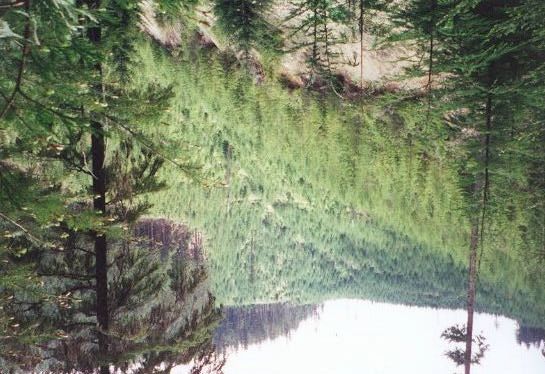
The Bohemia Mining District: An Historical Reconstruction

        Straddling the Calapooya Divide and encompassing both the Willamette and

Umpqua drainage basins, the Bohemia Mining district located 40 miles southeast of

Cottage Grove tells a story of natural and human change. Its position at the farthest

reaches of the Columbia Basin forces us to reexamine the notion that riverine headwaters,

far removed in the dendritic family tree from the powerful surge of the Columbia are not

the pristine, wild, untouched areas of popular thought. Rather, the areas comprising the

“edge” of the basin show the effects of the human hand. By focusing on geologic history

and the story of man on the landscape, this paper will show how geologic formation

birthed a rich storehouse of minerals and a home for native populations, how the

capitalistic opportunities envisioned in mining and lush forests lured white men into the

area, and how the environment has been altered due to these varied activities.

        The Western Cascades, of which the Bohemia Mining District is a part, were

formed about 40 million years ago in the Oligocene to Miocene periods. Much older than

the 2 million year old and well-known High Cascades (Mt. Hood, Mt. Jefferson, Three

Sisters), the Western Cascades were formed over 4 different volcanic events (Honey,

1981). Subduction-related volcanism of the Little Butte Formation gave Bohemia’s

geology a composition of volcanic (basaltic to rhyolitic) and plutonic (granitic and

gabbroic) rocks, which left elevations ranging from 5,987 foot Bohemia Mountain and

5,933 foot Fairview Peak to 2,100 feet in the bottom of canyons (Condon, 1992 and

Lutton, 1962). (View Figure 1) Quartz diorite intrusions were the impetus for the

formation of the mineral veins present in the district (Baldwin, 1976). As younger

molten rock pushed its way through older “country” rock, it carried with it small amounts

The Bohemia Mining District: An Historical Reconstruction                              Halupa 2001   -1-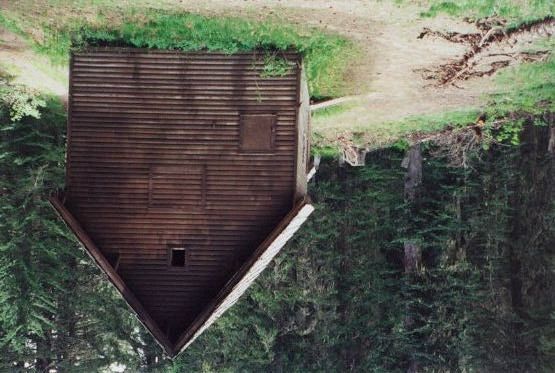
of trace elements such as gold, silver and lead. As this hot magma cooled, deposits

known as veins formed, thus yielding a ripe environment for mining (Honey, 1981).

        Overlain on this landscape was the generous work of a wet and seasonally diverse

climate. Covered in a vast array of Douglas fir, hemlock, and sugar pine, the area

provided “green gold” for those who came to harvest it. Several streams cut the surface;

Brice Creek, Sharps Creek, and Champion Creek, which all drain to the Row River, make

their way to the Willamette, and then eventually into the Columbia. (View Figures 5 and

6, Photo 2) The landscape was not without its treasure of natural commodities. Horace

Warner, an early 20th century writer who adventured to the area and wrote about his

excursion for the 100th anniversary of Lewis and Clark’s expedition, romanticized the

wealth of the region issued forth from the “bridal pair” of Fairview Peak and Bohemia

Mountain, announcing “Let the investing public bring the keys of means and

management, and our bridal pair will toss into the lap of the world a dowery of fabulous

worth and continuance” (Warner, 1904).

        It was this dowry that brought the first white settlers into the region, but the native

Americans were the first to inhabit this landscape. Although archaeological excavations

have not been performed on the area, scattered areas of cultural material have been found,

as well as reports from early explorers that tell of Indian camp remains and many trails

that lead to and from the divide (Honey, 1981). It is believed that the area served as a

hunting and gathering locale (camas root, salmon, etc.) for groups from the Willamette,

Umpqua, Klamath, and Deschutes River areas. It has also been suggested that Bohemia

Mountain may have served as a site for rite-of-passage and religious ceremonies called

vision quests. This ceremony precludes the passage of young males into adulthood, and

The Bohemia Mining District: An Historical Reconstruction                               Halupa 2001   -2-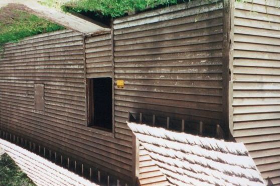
may also be performed for shamans and medicine men seeking a special vision (Honey,

1980,1981). Anthropologist William Honey (1981) suggests that the Calapooya divide

was instrumental in intertribal trade between 2500 BC and 1600 AD, linking the Klamath

Basin with the Willamette Valley. This trade is believed to have encompassed far

reaching areas: the Northwest, Rocky Mountains, Western Plains, Great Basin, and

Southwest. In fact, a sort of native “flea market” was only a few days walk from the area

to Illahee on the Umpqua River (Thoele, 1998). In relation to this large sphere of

influence and exposition Honey states, “Tribes of the inland and upland areas apparently

had strong north-south ties; tribes of the lower rivers and coast had varied relationships.

For these reasons Bohemia was not an isolated cultural province. The people who used it

undoubtedly represented a wide variety of adaptive modes, linguistic affinities and

intertribal relationships.”

        The Calapooyans were a connected people. Not only did they have significant

relationships with other tribes, but also had a connection with the land that encompassed

a substantial amount of environmental alteration. Fire was their tool. It was used to

enhance the growth of plants in their diet, and was used to clear areas in order to entice

game for hunting. Little did they know their habits would create the kind of open and

grassy landscapes that white homesteaders would find attractive (Thoele, 1998). In this

manner, a landscape was once used to provide local and individual needs became a land

that was utilized for exploitative purposes.

        The peacefulness of the Calapooyans partly enabled the first wave of Euro-

American settlement into the town now known as Cottage Grove. Settlers reached the

southern end of the Willamette Valley in 1848 while numbers of them poured into the

The Bohemia Mining District: An Historical Reconstruction                             Halupa 2001   -3-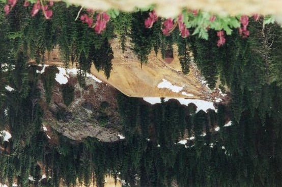
Umpqua Valley within a year (Oregon Blue Book, 2000). This in-migration was

furthered with the 1850 Donation Land Claim Act. Allotting 640 acres of claimed

homestead land to married settlers who were in the territory before 1850, and 320 acres to

those arriving afterwards, resulted in a rash of land claim stakings and filings. By 1852,

after only two years, many settlers had found their way to the soil of the Row River

Valley (Thoele, 1998).

        Who first discovered gold in the district is a debated question. Three different

stories exist for its finding, but the one examined here is that which gave the district its

name. James “Bohemia” Johnson, an immigrant from the region of Bohemia in former

Czechoslovakia (now the Czech Republic), first found gold in the region after fleeing

Roseburg under suspicion of killing and Indian (Thoele, 1998). While stopping at the

base of what would soon be known as Bohemia Mountain for a drink, Johnson spotted

pieces of gold-bearing quartz in City Creek. By 1864, a steady stream of gold-hungry

prospectors were making their way to the hills (Thoele, 1998).

        Mining put Bohemia City on the map. As Honey (1981) reports, the city had

several cabins, as well as a hotel and saloon by 1868 – and, needless to say, an arrastra

ore crusher (View Figure 3). The landscape was dotted with mining camps and

equipment. Bohemia came into its heyday with its greatest production of gold, silver,

copper and other minerals from 1889 to 1906. Total gold production from 1880 to 1930

was over 28,000 ounces, worth $600,000 (Baldwin, 1976). Several large mining outfits

were established, one of which inherited the name Musick Mine, after James Musick who

came to the mine in 1891, and discovered large amounts of previously unnoticed gold.

His operation was located on the east slope of Bohemia Mountain, and remnants of

The Bohemia Mining District: An Historical Reconstruction                                Halupa 2001   -4-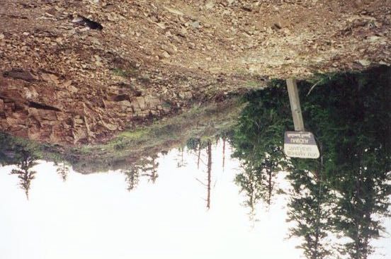
mining activities can still be seen today in the form of tailings. (View Photos 8a and 8b)

As a result of increased attraction, over 2,000 claims had been filed in the district by 1904

(Honey, 1981). Mining operations turned out to not be as profitable as imagined.

Periods of waxing and waning activity in the district followed the ebb of the economic

tide, especially during the Depression Era and World War II (Honey, 1981).

Nevertheless, Bohemia “remained the largest and most productive gold and silver mining

area in the Western Cascades” (Ambers 2001). (View Figure 2)

        New land use patterns were inevitable. An area at one time unfettered, and then

used only for basic needs by the Calapooyan culture, became an Eden for capitalistic

ventures. A land once groomed with occasional fires undoubtedly transitioned into a

safeguarded area, especially with the amount of mining equipment and capital invested.

Mining was not a cheap operation. And as Michael Thoele (1998) quips, miners often

“netted little more than red ink.” The landscape began to change dramatically by the

earth 20th century. Roads began to cross the landscape, the first being the conversion of

Annie Trail to the Noonday Road in 1896 at an estimated cost of $1,000 per mile. Roads

made transportation more feasible, especially for someone like Joseph Knott, an early

miner who transported a stamp mill up the steep terrain by wagon without the aid of a

cleared road (Honey, 1981).

        Yet, trails were only the beginning. Warner (1904), seemingly in touch with the

needs of the region, said in the early 1900’s, “Rail communication into the heart of this

district, well graded road-ways over its hills and through its valleys, milling facilities for

the local reduction of ores, judicious investment of scrupulous management, these are the

needs that cry out from these mighty ridges of precious rock.” So it was, that the roads

The Bohemia Mining District: An Historical Reconstruction                                 Halupa 2001   -5-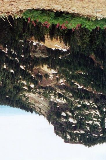
and rails came. And so it was that exploitative opinions prevailed in the early 1900’s.

Cottage Grove secured a link to the rest of America when the Northern Pacific, stretching

from Minneapolis to Portland was completed in 1883, and had a direct connection when

it found itself sitting astride the Southern Pacific, linking Oregon to California in 1887.

Shortly after, in 1904, electricity was introduced to the district via a hydro-electric

facility on Brice Creek, powering lights for the miners’ housing, running stamp mills and

tramways (Honey, 1981). With the advent of the U.S. Forest Service and the newly

created Cascade and Umpqua National Forests, timber – as an industry – took hold in the

Row River Valley (Honey, 1981).

        The timber industry was almost non-existent until 1890 in the Row Valley,

somehow bypassing the area while it progressed at a frenetic pace in Cottage Grove. In

fact, by 1884, the J.J. Comstock mill just south of Cottage Grove was churning out

15,000 board feet a day (Thoele, 1998). The lackluster timber industry in the valley came

alive in 1890 when circular saws made their appearance on the Row River at the Stocks

and Harlow sawmill – the first commercial lumber operation in the valley (Thoele, 1998).

Bohemia Lumber Company followed suit in 1916, with LaSells Stewart as one of the

prevailing patriarchs.

        The drastic changes on the landscape in the late 19th and early 20th centuries were

not without their share of environmental disturbances. Environmental intrusions such as

road-building, logging timber for mine shaft stabilization, commercial logging involving

clear-cuts, selective cutting, and splash dams that devastated watersheds, diverting water

to run machinery, and last but not least, stripping the mountains of its minerals took a toll

on the landscape. (View Photos 1 and 5) “Mining is…warfare” (Warner, 1904). This

The Bohemia Mining District: An Historical Reconstruction                                 Halupa 2001   -6-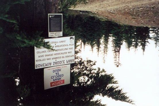
quip can be extended to any form of work that directly challenges the landscape. With a

mindset like this, continuously creating conflict that is in its simplest element

environment versus man, leaves no room for corroboration. Instead the miner was seen

as valiant, quoting again from the quixotic Warner, “Howling winds, blinding storms,

piercing temperatures, desolate isolations await the heroic ranks of the mining camp…All

honor to the heroes of the mountains and mines whose muscular, courageous ranks are

pushing this battle without sound of trumpet or roll of fame.” Warner’s writing shows no

concern that the landscape he excessively praises was being transforming into a visible

open wound; no condolence for precious contents splayed across its surface. Yet so

much more was taking place on the landscape than the visible.

         The situation had invisible repercussions as well. Recent studies conducted by

Rebecca Ambers and Bretagne Hygelund, show that mining operations are the culprit for

environmental contamination in some areas. However, a brief overview of these

particular mining operations must precede further discussion.

        Several modes of mining were used in the district: placer, hydraulic and lode

mining (Honey 1981). Placer mining simply removes free gold in creeks and streams

through panning or sluicing. Hydraulic mining, more detrimental in terms of water

systems, diverts water from the source and channels it into pipes were it is pressurized

and blasted toward an embankment. Lode mining is accomplished through a series of

tunnels that attempt to locate gold beneath the surface. This may sometimes include the

use of explosives, in which rock that took millions of years to form is pulverized in a

matter of seconds. All three of these forms displace material. Once the ore is mined it

frequently must undergo separation from other elements. Mercury amalgamation was

The Bohemia Mining District: An Historical Reconstruction                             Halupa 2001   -7-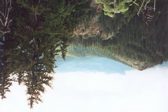
one of the earliest devised methods for the gold separation process. As crushed ore and

water pass over copper tables coated with mercury, the gold is trapped and separated.

Amalgamation and stamp milling (akin to large hammers pounding the ore until gold is

dislodged, View Photo 4) were the most common methods used in Bohemia (Honey,

1981).

         It is the use of mercury in the mining process that returns the discussion to

environmental concerns. The focus of Ambers’ and Hygelund’s study centers on both

Cottage Grove Lake and Dorena Reservoir. (View Figure 7) The Bohemia Mining

District drains to the Row River and thus, to Dorena Lake. It came into existence in 1949

upon completion of a flood-control dam by the Army Corps of Engineers (Yet another

important historical change on the landscape). Both lakes show mercury-contaminated

sediment as a result of mining. These levels are beyond background levels established

for the region by the US Geological Survey. Fish also exhibit this contamination

(Ambers, 2001). (Cottage Grove Lake is contaminated as a result of Black Butte mining

operations and Dorena Lake from Bohemia mining). Hygelund’s study establishes

Bohemia as the source of mercury-contamination, while Ambers’ study deals with the

consequences of such. Hygelund found that concentrations of mercury in streams that do

not drain the central mining district average 0.066 parts per million (ppm) while samples

taken downstream of the district measure 0.140 to 1.339 ppm. Tailings and mine waste

contain anywhere between 13.411 ppm up to 50 ppm mercury. Such measurements

target Bohemia as the source (Hygelund, in press).

         It has been established that mercury is significant in terms of its toxicity to

organisms. Ambers found that fish in both Cottage Grove Lake and Dorena Lake have

The Bohemia Mining District: An Historical Reconstruction                                  Halupa 2001   -8-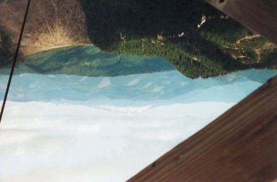
elevated levels of mercury in their bodies due to bioaccumulation. An average of 0.37

ppm has been found in Dorena Lake fish; note that the Oregon Health Division issues a

consumptive advisory at a level less than or equal to 0.35 ppm. Bass and squawfish from

the entire Willamette River downstream of the dams also contain elevated levels of

mercury (Ambers, 2001). These problems in the Dorena Lake watershed have resulted

due to 60-plus years of quicksilver use in the Bohemia Mining District. Ambers (2001)

suggests, “Since input of mercury to Cottage Grove Lake and Dorena Lake is not likely

to decrease any time soon, the only cost-effective way to decrease levels of fish

contamination might be to change the way the reservoirs are managed...however,

management changes may not be considered worthwhile if only small improvements in

fish contamination were likely to be achieved.”

        This leaves present generations with some degree of disillusionment about the

health of our environment and the ability to “right the wrongs” done to it through years of

misguided priorities and failed attempts at bettering humanity through “bettering” nature.

Through extracting limited mineral resources and leaving tailings to litter the landscape,

building roads (View Photos 1, 6, 7) and rail-lines so that we might more efficiently

strew machines and chemical waste upon the surface and reap the economic benefit from

a small portion of the earth’s crust, building dams, practicing poor harvest techniques,

endangering species (specifically referencing the spotted owl controversy of the late

1980’s), destroying flora, fauna and watersheds through the hasty construction of splash

dams, we have significantly changed the ecology of an area. What shall we call this area,

if not “The Bohemia Mining District”? Does it have a place in our spatial awareness

without having to first become economically identifiable?

The Bohemia Mining District: An Historical Reconstruction                               Halupa 2001   -9-
In an accidental encounter with Bud Stewart, President of the Bohemia Mine
Owner’s Association, son of lumber magnate-turned-politician Stub Stewart, and
grandson of Bohemia Lumber baron LaSells Stewart, while on an excursion to the
Bohemia Mining District, it is evident that private mining operations are not soon to
curtail even though large-scale commercial mining has ceased. About 1000 claims are
still had on the land, but with prices only fetching $275 an ounce, mining has once again
dwindled. Current rewards must double if any “action” is to be seen at the mines.
Logging, too, is still a part of the landscape. The last timber harvested was five years
ago, by Heath Lumber Co. based out of Cottage Grove. They had patented land that
extended from the heights of Noonday just east of Champion Saddle all the way down to
Champion Creek. They cut everything and left (From personal conversation with Bud
Stewart on-site at the Bohemia Mining District).
Thus, we have found ourselves alienated from place – our place. Until we find a
position within the broader spectrum of ecology, rather than the defining factor upon an
environment, we will continue to exploit and exterminate. A weighty realization lies
within the perceptions of Warner, and perhaps a more realistic perception can be drawn
from his words in retrospect:
These mountains, forests, mines and miners are full of song and story. Their
charm lingers with ceaseless appeal. Long after the scene is left behind, the
sweet smell of the flowers, the hum of the bees, the twitter of the birds, the
boom of the blasts echoing through the solitudes of the grand old woods, the
sighing of the pines, the sunset glories, the panoramic grandeur of mountain
peaks, all will live fresh, imperishable, among the richest treasures of
memory, and ever impel to return, some glad time, to this rare and favored
spot where vacation days have sped with the rhythm and movement of a
perpetual melody. (1904)
The Bohemia Mining District: An Historical Reconstruction Halupa 2001 - 10 -The mindset that our “quotable” Warner demonstrates will persist as long as we neglect that the “booms of the blasts echoing through the solitudes” do not belong within the images encapsulated above; that the places we imagine are not the places they’ve become. Only then will we find ourselves “in place.” The Bohemia Mining District: An Historical Reconstruction Halupa 2001 - 11 -
Works Cited

Ambers, RKR and Hygelund, BN. 2001. “Contamination of two Oregon reservoirs by
    cinnabar mining and mercury amalgamation.” Environmental Geology 40: 699-
    707.

Baldwin, Ewart M. 1976. Geology of Oregon. Kendall/Hunt Publishing Company,
     Dubuque, 147.

Condon, Peter D. 1992. Geology and Epithermal Mineralization at the Helena Mine,
    Bohemia Mining District, Oregon. M.S. Thesis, University of Oregon.

Honey, William D. 1981. Bohemia Mining District: A Brief History. Prepared for U.S.
    Department of Agriculture, U.S. forest Service, Region 6, Umpqua National Forest.

Honey, William D. 1980. Cultural Resource Evaluation Bohemia Mining District,
    Oregon Phase II. Prepared for U.S. Department of Agriculture, Forest Service,
    Umpqua National Forest, Contract Number 53-04T1-8-81, 356 p.

Hygelund, BN and Ambers, RKR. In Press. Tracing the source of mercury
     contamination in the Dorena Lake watershed, western Oregon. Environmental
     Geology.

Lutton, RJ. 1962. Geology of the Bohemia Mining District, Lane County, Oregon.
      Ph.D. Dissertation, University of Arizona.

McChesney, Stephen Michael. 1987. Geology of the Sultana Vein, Bohemia Mining
    District, Oregon. M.A. Thesis, University of Oregon.

Oregon Blue Book. “Oregon Blue Book History: Spread of Settlement.”
     http://www.sos.state.or.us/BlueBook/1999_2000/cultural/history/history13.htm
     [04/18/01]

Thoele, Michael. 1998. Bohemia: the lives and times of an Oregon lumber venture.
     Oregon Historical Society Press, Portland, 647.

Warner, Horace E. 1904. A Story of Bohemia. C.H. Beck and Co. Printers, Boston, 44.

The Bohemia Mining District: An Historical Reconstruction                     Halupa 2001   - 12 -
Appendix A Figures 1. Sideview of geology and landscape (Honey, 1981). 2. Oregon Mining Centers (Honey, 1981). The Bohemia Mining District: An Historical Reconstruction Halupa 2001
3. Arrastra Ore Crusher (Honey, 1981).

4. Stamp Mill (Honey, 1981).

The Bohemia Mining District: An Historical Reconstruction   Halupa 2001
5. Map of the Bohemia Mining District (Honey, 1981).

The Bohemia Mining District: An Historical Reconstruction   Halupa 2001
6. Drainage System ((Thoele, 1998).

The Bohemia Mining District: An Historical Reconstruction   Halupa 2001
7. Dorena Lake Watershed (Ambers, 2001).

The Bohemia Mining District: An Historical Reconstruction   Halupa 2001
Appendix B. Photos

Multi-aged growth about 3 miles up the Noonday Road (Jill Halupa)

A view of the drainage basin from the top of Fairview Peak (Jill Halupa)
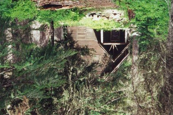
The old Musick Mine guard station (Halupa)

An abandoned building next to the guard station (Halupa)
Another view (halupa)

Clearcuts seen through the lookout on top of Fairview Peak; facing east (Halupa)
Evidence of destruction due to road-building at the trailhead to Bohemia Mountain
(Halupa)

Signs at the Bohemia-Fairview Saddle indicating management groups (Halupa)
Two views of the old Musick Mine on the eastern flank of Bohemia Mountain. Note the
abandoned building and scattered tailings (Halupa).
You can also read