The Council for Geoscience expands its leadership corps
←
→
Page content transcription
If your browser does not render page correctly, please read the page content below

VO
                                                                                                      LU
                                                                                                         M
                                                                                                            E5
                                                                                                               8.
                                                                                                                    SE
                                                                                                                      PT
                                                                                                                         EM
                                                                                                                             BE
                                                                                                                               R
                                                                                                                                   20
                                                                                                                                     19

INSIDE:                              The Council for Geoscience
The Council for Geoscience expands
its leadership corps I 1             expands its leadership corps
Mapping and associated work in
Malawi: the GEMMAP project I 4
Bob Thomas

Journey from a National Diploma to
an MSc degree I 7
Matome Sekiba

Vanadiferous magnetitite pipes
in the Main Zone of the Bushveld
Complex I 7
Flora Maja
                                            Taufeeq Dhansay           Sibongiseni Hlatshwayo            Willem Meintjes
                                           Geoscience Mapping            Economic Geology          Engineering and Geohazards
Training in the production of                                            and Geochemistry

geochemical synthesis reports I 9
Doreen van der Walt

International Mine Water
Association Conference in Perm,
Russia I 11
Gloria Dube

PanAfGeo Geoscientific Information
Management Training Workshop I 11
Ntsako Mhlarhi
                                             Fortress Netili               Clement Rabaji                 Magda Roos
                                          Water and Environment        Information Knowledge       GIS and Scientific Databases
                                                                           and Technology

                                     The Council for Geoscience wishes             metamorphosis. Taufeeq experimented
                                     to congratulate the managers who              in art, joining various communities who
                                     have been appointed in permanent              adorned the streets of Cape Town with
                                     positions during the first half of 2019.      colourful anti-gangsterism and anti-drug
                                     They are Taufeeq Dhansay, Sibongiseni         murals. Later, considering the proximity
                                     Hlatshwayo, Willem Meintjes, Fortress         to the ocean, surfing seemed like a
                                     Netili, Clement Rabaji and Magda Roos.        good pastime. However, after having
                                                                                   fallen off his surfboard once too often,
                                     Taufeeq Dhansay                               Taufeeq decided to focus really hard on
                                     Taufeeq Dhansay was born on the lower         his studies. He completed his secondary
                                     slopes of Devil’s Peak in South Africa’s      schooling at South Peninsula High before
                                     year of the Chameleons and grew up            continuing his education at the University
                                     in Cape Town’s southern suburbs of            of Cape Town. Considerations of a career
                                     Retreat and Steenberg during a time           as a biochemist, an engineer, an internet
                                     when the nation was undergoing its own        hacker and even an airforce pilot meant
2   I GeoClips

that his family never quite knew what          required to enable and assist South         Union from 2014 to 2018 where he dealt
he was studying. Eventually, Taufeeq           Africa’s sustainable development goals.     with a variety of labour issues.
crashed over some geology while
mountain biking down the Steenberg             Sibongiseni Hlatshwayo                      The mission of the Economic Geology
Hills which launched his career in             Sibongiseni Musawakhe Hlatshwayo            and Geochemistry Unit is to continue
the geosciences.                               was born in Bergville (Emangwaneni),        contributing valuable products such as
                                               KwaZulu-Natal. He completed                 geochemical maps and mineral potential
In 2008, he completed his Honours              his school career at Mqedandaba             maps in support of mineral exploration
degree in Geology. His studies focussed        High School in 2000. He initially           within the minerals and energy theme
on the tectono-metamorphic evolution           studied Electrical Engineering at the       of the Council for Geoscience. The
along the East African Orogen in               Mangosuthu Technikon in 2001. In            drilling of promising mineral targets
Mozambique. Taufeeq joined the                 2004, Sibo changed track to pursue          or anomalies and the assessment of
Limpopo regional office of the Council         a degree in Geology. He completed           mineralisation is critical in unravelling
for Geoscience as a junior scientist.          his undergraduate degree in Applied         new mineral deposits and increasing
Projects on various early earth cratonic       Geology at the University of the            the country’s exploration budget. The
sequences, surrounding accretionary            Western Cape in 2006 and enrolled for       mid-term vision of the unit is to introduce
orogenic belts and small-scale mining          an Honours degree at the University         3D modelling and mineral assessments,
programmes provided an ideal training          of Pretoria in 2007. Being a bursary        using the existing resources of boreholes
ground. Taufeeq also participated in           student, he joined the Council for          and other geoscience information to
mapping and exploration projects in            Geoscience as a junior scientist in the     add value to the products of the Council
Rwanda, Namibia and Tanzania before            Geochemistry and Laboratory Unit            for Geoscience. Sibo supports capacity
completing his Master’s degree on              in 2008.                                    building by encouraging staff to study
energy economics and geothermal                                                            towards MSc and PhD qualifications to
energy development. In this time, he           From 2008 to 2011, he was involved          enable the production of quality products
spent several months as a researcher           in geochemical mapping projects in          for the benefit of stakeholders and the
at the International Institute for Applied     support mainly of mineral exploration       public. The ultimate vision of the unit
Systems Analysis, working from the             and geological mapping. Sibo enrolled       is to produce geoscience products that
plush comfort of one of Maria Theresa’s        for his MSc in Exploration Geology          will contribute to prefeasibility studies of
Habsburg palaces in Vienna.                    at Rhodes University in 2012, after         exploration projects.
                                               receiving a Julian Baring Scholarship.
In 2015, Taufeeq moved to the Western          At the same time, he continued leading      Sibo is a passionate supporter of Kaizer
Cape regional office and began his             and participating in regional geochemical   Chiefs and Manchester United. He
research on brittle tectonics. This            mapping projects and target generation      enjoys travelling, visiting interesting
research considered sustainably                or follow-up projects. The main projects    places and meeting new people. Most of
inducing dynamic fracture reactivation         included work in the Sabie–Barberton,       all, he loves spending time with his family
and system processes within the earth’s        Bushveld Complex, Tugela, Hoedspruit–       and children.
Critical Zone. In 2017, he completed           Phalaborwa and Namaqualand areas.
his PhD degree at Nelson Mandela               He was also involved in international       Willem Meintjes
University, within the Africa Earth            geochemical mapping in Uganda in            Willem Meintjes was born on 24 March
Observatory Network, where he worked           2011. Sibo has presented at local and       1987 in the Highveld Ridge area,
in the Jena Structural Geology and             international geochemistry conferences      where he matriculated from Secunda
Tectonics research group at Friedrich          in the USA, New Zealand, China,             High School. After matriculating, he
Schiller University in Germany.                Canada and the 35th International           moved to Potchefstroom to complete
                                               Geological Congress in South Africa. His    his undergraduate tertiary studies
In 2017, Taufeeq swapped his field             main research interests are the geology,    in geology at North West University.
boots for a collared shirt when he             geochemistry and mineralisation of the      Willem furthered his tertiary education
took up first the position of technical        PGE-rich Bushveld Complex. He is a          in Geology as a result of his keen
assistant in the Office of the CEO             fellow of the Non-Aligned Movement for      interest in dolomite stability. His Master’s
and, eventually, of manager of the             Minerals Processing and Beneficiation       degree focussed on a correlation of the
Geoscience Mapping Unit in January             and attended a training programme at        structural geological context, dolomite-
2019. This is a particularly critical period   Mintek in 2017. Sibo was assigned to        related surface instability and regional
for the geosciences in South Africa as         the position of acting manager of the       dolomite risk management.
the country is transitioning towards           Economic Geology and Geochemistry
newer and more sustainable mineral and         Unit in 2018 and was subsequently           While conducting his tertiary studies,
energy technologies while also pursuing        appointed as the manager of the unit in     Willem worked as an external financial
socio-economic development. Taufeeq’s          January 2019. He is a member of the         auditor at KPMG before accepting a
aim will be to lead the Geoscience             Geological Society of South Africa, a       position as engineering geologist at the
Mapping Unit towards unravelling the           Professional Natural Scientist and was      geo-environmental and engineering
fundamental geological information             an ex officio executive of the Nehawu       consulting firm AGES.
Geoclips - Volume 58 - September 2019                                                                                     GeoClips I 3

During his time in the consulting industry,     consulting firm in Polokwane, where         planning in mining, and by supporting
Willem oversaw the successful execution         he worked briefly, before returning to      the coexistence of mining and other
of over 150 geotechnical, geohydrological       university to pursue further studies.       ecosystem infrastructures.
and geological site investigation
projects, ranging from investigations for       Fortress joined the Council for             Fortress holds an MSc (Hydrogeology),
infrastructure and urban development to         Geoscience in 2004 as a bursar after        BSc (Honours — Earth Sciences), a
integrated multidisciplinary programmes         receiving a sponsorship to study towards    Postgraduate Diploma in Business
on regional groundwater supply and              an MSc degree in Hydrogeology. For a        Administration and is currently registered
dolomite risk management. Before joining        decade (from 2004–2014), he gradually       for a PhD in Groundwater Governance.
the Council for Geoscience, Willem              developed within the ranks of the           He is a member of the International
headed the Geotechnical Business Unit           organisation as a hydrogeologist, project   Association of Hydrogeologists (IAH)
at AGES where he had the responsibility         manager and, later, as the manager of       and the Groundwater Division (GWD) of
of managing and executing all facets of         the Water Geoscience Unit. Fortress         the Geological Society of South Africa.
the geotechnical projects, maintaining          was a project leader of the mine water      Fortress is an Associate Member of
client relations and ensuring technical         management task in the Witwatersrand        the Water Institute of Southern Africa
excellence in the business unit.                which developed a range of solutions        and a Registered Professional Scientist
                                                for the management of mine water            with SACNASP. He has a keen interest
Willem joined the Council for Geoscience        pollution from the abandoned mines          in and is committed to continued
in April 2019 as the manager of the             of Gauteng Province. He was also a          professional development in decision
Engineering and Geohazards Unit.                member of the Team of Experts of the        making, environmental sustainability
He is focussed on steadily taking the           Inter-Ministerial Committee (IMC) tasked    and water security as well as all aspects
engineering and geohazards expertise            to advise the Cabinet of South Africa       of integrated environmental planning,
of the Council for Geoscience forward           on the assessment and reappraisal           policy, management and the assessment
towards realising the full potential of         of the situation with respect to acid       of natural resources.
the organisation. The organisation              mine drainage in the Witwatersrand
is mandated by government to act                goldfields, from which the IMC Acid Mine    Clement Rabaji
as the national advisory authority on           Drainage Report 2011 was produced.          Clement Rabaji was born on
geohazards. In order to fulfil this function,   Fortress left the Council for Geoscience    30 September 1971 in Lichtenburg in the
the Engineering and Geohazards                  in 2014 for a period of three years to      North West Province. He completed his
Unit will build on world-class research         pursue his career development and to        primary and secondary school education
undertaken by exceptional scientists and        tackle some of the most pressing water      in Itsoseng and obtained a BSc (Ed)
researchers over more than a century. As        security and environmental degradation      degree in Mathematics and Chemistry
the business magnate Mr Warren Buffett          issues. In this time, Fortress gained       at North West University. He briefly
eloquently stated: “Someone is sitting          experience in a wide range of sectors       worked at Plascon Paints as a laboratory
in the shade today, because someone             — consulting, government (Department        technician after which he pursued a
planted a tree a long time ago”.                of Water and Sanitation) and a non-         career in IT.
                                                profit organisation locally and in the
Family and relationships are at the core        SADC region (International Water            Clement joined Telkom as a software
of Willem’s world view and he is happily        Management Institute).                      tester after completing a programming
married to Nicolene. Their two children,                                                    diploma with Crux IT. He moved from
Thomas (3) and Joachim (8 weeks)                Fortress rejoined the Council for           software testing and joined Medscheme
are the joy of his heart. He enjoys             Geoscience in February 2019 as              as a Java and Oracle developer.
practicing various hobbies related to           manager of the Water and Environment        He worked on developing a claims
building things, and enjoys playing golf,       Unit. In this position, he provides         assessment system and automated the
cycling and participating in competitive        leadership to a team of more than           submission of claims from the Afrox
team sports.                                    50 staff who are dedicated and              Hospital group to Medscheme’s claims
                                                committed to developing and providing       assessment and processing systems.
Fortress Netili                                 a variety of groundwater and related
Fortress Netili was born and raised in          environmental services and solutions        Clement joined Paracon Consulting
the rural area Dzimauli Ha-Rambuda              to water and environmental challenges       as a contract developer. As a Paracon
in Mutale, Limpopo Province. His main           that threaten the socio-economic            contractor, he worked on a number of
interest during his school career at            development the country and that            projects at various financial institutions
Luheni Primary School and Ratshilumela          pose a risk to the sustainability of        as a Java and Oracle developer. The
High School were the natural sciences.          the ecosystem. His focus is to lead         most significant of the projects were
After matriculating, he headed to the           the team in contributing towards the        the implementation of a new insurance
University of Venda where he completed          realisation of vision 2030 (NDP) by         business management system at Sage
a four-year degree in the earth sciences.       implementing recommendations of             Life, the enhancement of an international
After graduation, Fortress started his          national ground(water) strategies           banking system at Standard Bank and
career as a junior hydrogeologist at a          by facilitating economic succession         the implementation of an operational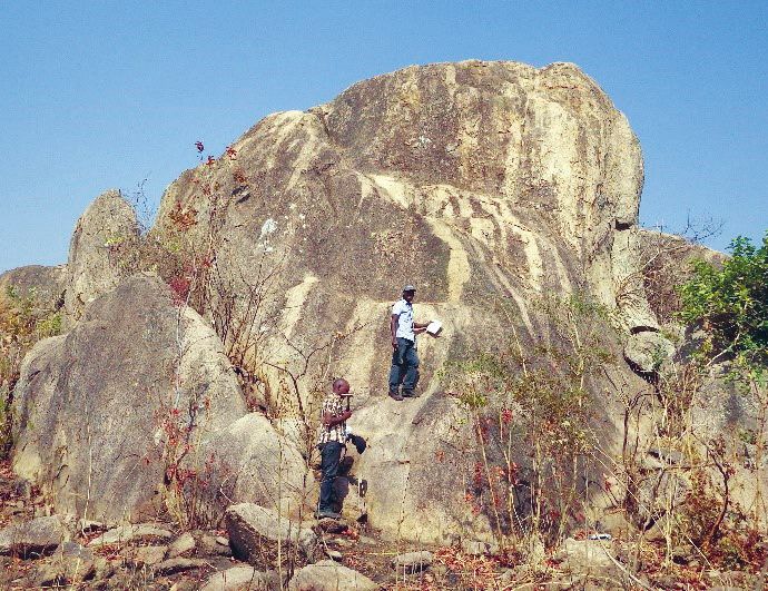
4   I GeoClips

risk and key risk scenario management      spending time with his family and           provided her with the opportunity to
system at ABSA.                            his wife, son and daughter. He is an        gain valuable experience in database
                                           enthusiastic reader and thanks to           management and interactive web-
After working for more than ten years      e-books, his library is compact and         based mapping. Magda’s vision is
as a developer on transactional            portable. Clement also loves cooking        to continue building on the CGS
systems, Clement joined SITA as a          and experimenting with new recipes.         legacy databases in pursuance
Business Intelligence (BI) consultant                                                  of an integrated geoscience data
where he completed a project to            Magda Roos                                  management solution.
modernise a legacy BI system. He           Magda Roos was born in the province
later joined FNB Life as a BI solutions    of the rising sun, Mpumalanga, and          With over 25 years of solid work
architect, and implemented a modern        matriculated from Lydenburg High            experience in geoscience data
BI and analytics platform.                 School in 1980. Her childhood dream         management and her meticulous
                                           was to become a teacher, but she            approach to data collation and
Before joining the Council for             decided to venture into the fascinating     presentation, Magda has the
Geoscience in April 2019, Clement was      world of cartography. Ms Roos holds a       knowledge and skills to assist the
a team leader in the SITA Applications     tertiary qualification in Cartography and   Council for Geoscience in delivering on
Development Department responsible         a Postgraduate Diploma in Geographic        its data and information strategies. She
for the e-government applications          Information Systems, obtained from the      has been pivotal in incorporating critical
platform and the modernisation of          University of Pretoria in 2001.             control measures into the development
legacy systems. His mission is to                                                      of the CGS data and information
implement stable and modern IT             Eager to absorb as much knowledge           policy which, in future, will provide the
infrastructure and applications to         and insight as possible in geoscience       foundation for data and information
support business operations and to         knowledge management, Magda                 management in the organisation.
enhance the service offerings of the       has been involved in a number of
Council for Geoscience.                    significant projects. The Seismotectonic    Magda is creative and a keen
                                           Map of Africa, among the official           reader and enjoys travelling. She
Clement has a keen interest in hiking      projects of the Organisation of African     prefers to take the roads less
and photography, and normally takes        Geological Surveys, and the SADC            travelled which mostly lead to truly
the family along on trips. He enjoys       Hydrogeological Mapping project have        amazing experiences.

Mapping and associated work in Malawi:
the GEMMAP project
The Geological Mapping and Mineral         the largest modules. The CGS project        5) C
                                                                                           onstruction of a documentation
Assessment Project (GEMMAP)                administration has been efficiently            centre at the GSD head office in
is presently undertaking various           handled by Gosia Paweska and, since            Zomba (BRGM)
geoscience activities for the Geological   the start of the current financial year,
Survey Department (GSD) in Malawi,         by Chameney Engelbrecht. The CGS            6) S
                                                                                           mall-scale and artisanal mining
including the production of geological     Project Leader, Bob Thomas, attends            (John Tyschen, subcontractor to the
maps of the whole country. The tender      the consortium meetings, held each             consortium).
for GEMMAP was awarded in 2016             January in Zomba and, occasionally,
to a consortium led by the BRGM            in France or Finland. The components        Training of GSD staff in all modules is
(French Geological Survey) with the        consist of:                                 seen by the client as one of the most
CGS (Council for Geoscience) and                                                       important outcomes of the project and
GTK (Geological Survey of Finland).        1) G
                                               eological mapping (Bob Thomas          the Council for Geoscience has played
GEMMAP is a five-year project which           — CGS Project Manager, Stephen           a significant part in this respect. Indeed,
will run until the end of 2021. The           Boger — on contract, Paul Macey —        on-the-job training is a continuous
project officially commenced in June          from 2019)                               feature of fieldwork. In addition, many
2016 and, in September 2016, the                                                       formal lecture courses and practical
full-time project managers (from the       2) M
                                               ineral resources (Alazar Billay,       sessions have been presented and five
BRGM) took up residence in an office in       Emmanuel Sakala)                         GSD geologists are currently enrolled
Zomba, Malawi.                                                                         for MSc studies on various aspects of
                                           3) Geohazards (BRGM)                        the project. Some courses are open to
GEMMAP has a modular structure                                                         geology students of Chancellor College
comprising six main components. CGS        4) D
                                               atabase design and implementation      (University of Zomba) and, in this
science staff are contributing to two of      (BRGM)                                   regard, the college provided the venue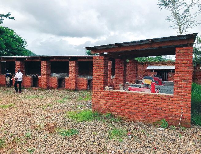
Geoclips - Volume 58 - September 2019                                                                                                        GeoClips I 5

  a)                                                  b)                                                    c)
                                  Revised
                            geological mapping
                                programme

GEMMAP mapping programme. a) Outline of the forty 100 000-scale sheets to be mapped in Malawi. There are also eleven 1:250 000 scale sheets to be produced;
b) New high-resolution geophysical data (aeromagnetics) for the whole of Malawi; c) Progress of mapping in 2019.

for a project conference in 2018 which                In addition, a substantial number                     the petrographic details entered into a
was attended by over 100 participants,                of radiogenic isotope analyses are                    custom petrographic database. The first
including representatives of the                      scheduled to elucidate the petrological               batches of whole-rock major- and trace-
private sector.                                       evolution of the basement rocks.                      element analyses, U-Pb zircon dates
                                                                                                            and Sm-Nd radiogenic data are under
The Geological Mapping module is by                   Over 90% of the surface area of Malawi                review by consortium experts.
far the largest component of the project              is underlain by Precambrian basement
and constitutes the largest contribution              rocks and this naturally forms the focus              In the inception report, delivered
by the Council for Geoscience. The                    of the mapping, especially as a mineral               early in 2017, a thorough analysis
entire country has to be surveyed and                 resource evaluation of the country is the             of all available geological, satellite,
geological maps produced at a scale                   main driver of the project. The younger               geophysical and geochemical data
of 1:100 000 (40 maps), 1:250 000                     rocks (Karoo Supergroup, Cretaceous                   (published and unpublished) in Malawi
(11 maps) and 1:1 million (1 map).                    “Dinosaur Beds” and widespread                        and the surrounding countries led to a
Each map will be accompanied by a                     Quaternary deposits) are being mapped                 proposal that the basement of Malawi
sheet explanation along with several                  by specialists from the BRGM and GTK.                 can probably be subdivided into nine
geological domain-specific memoirs.                                                                         separate tectonostratigraphic terranes.
                                                      To date, five of the eight x six-week                 These range from Palaeoproterozoic
The whole country was mapped from                     geological mapping seasons have been                  in age (Ubendian) to Mesoproterozoic
the 1950s to the 1980s by the British                 completed. Each season comprises                      (several “Grenville-age” terranes) with
Geological Survey, who produced highly                four or five teams (composed of a                     unknown, but probably pervasive,
detailed and geologically accurate maps               consortium expert, a GSD geologist                    reworking during the Neoproterozoic
at the same scales as those mentioned                 and a driver), with the Council for                   (Pan-African) East African Orogen.
above. GEMMAP mapping is thus                         Geoscience supplying two field teams                  The geological mapping and the new
concentrated on a modern approach                     each season. Two tranches of 12                       geochronological data tend to bear out
enabled by the new geophysics, remote                 x 1:100 000-scale draft geological                    these inferences, with the extent of
sensing and comprehensive analytical                  maps have been submitted to the                       Pan-African reworking and magmatism
programmes which will provide new                     client (i.e. 24 out of the 40 map sheets              probably exceeding expectations.
high-precision U-Pb zircon dates                      which comprise the country). The
(minimum 150 samples) and whole-rock                  sampling and analytical programme is                  The contribution of the Council for
major- and trace-element geochemical                  well underway. Several hundred thin                   Geoscience to the Mineral Resources
analyses (minimum 400 analyses).                      sections have been described and                      module has been completed, with Alazar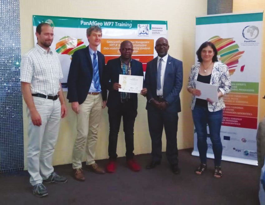
6   I GeoClips

     a)                                                                              b)

     c)                                                                              d)

a) Two GSD geologists studying an outcrop of Pan-African syenite; b) field training of GSD geologists in the Zomba area; c) the GEMMAP office just outside Zomba,
and d) the rock sample processing bays at the GEMMAP office site and the two rock-saw facilities.

                                                                                                             Billay’s review on the economic potential
                                                                                                             of the alkaline and associated rocks of
                                                                                                             Malawi and Emmanuel Sakala’s course
                                                                                                             on ground geophysics, delivered in and
                                                                                                             around Zomba.

                                                                                                             The project is on track to meet its
                                                                                                             targets within the prescribed timeframe
                                                                                                             and the Council for Geoscience is
                                                                                                             fully committed to playing its part
                                                                                                             in the successful submission of all
                                                                                                             contractual deliverables.

                                                                                                                For more information contact:
                                                                                                                Bob Thomas
                                                                                                                Geoscience Mapping
                                                                                                                +27 (0)21 943 6700
                                                                                                                bthomas@geoscience.org.za
Last outcrop of the day, GSD mappers at work in southern Malawi.
Geoclips - Volume 58 - September 2019                                                                                          GeoClips I 7

Journey from a National Diploma to an MSc degree
Fhatuwani Matome Adolph Sekiba               For his MSc degree, Matome studied the
was born in Nzhelele, Vhulaudzi in           application of geophysical techniques
Limpopo Province. He completed his           in the delineation of aquifer systems
primary school education at Mudzinga         in the Beaufort West area, Western
and Boduma Primary Schools and               Karoo, South Africa. The research
matriculated in 2000 from Sefoloko           aimed to elucidate the deeper aquifer
Secondary School. During 2001,               systems of the Karoo Basin in view of
Matome improved on his school results        improving the prediction of potential
by studying Physical Science and             impacts of georesource exploration
Mathematics at Tshwane South College.        activities on the deep groundwater
He continued his academic journey in         systems. Strong emphasis was placed
2002 and completed a National Diploma        on the use of airborne and deep-probing
in Geology through Tshwane University of     magnetotelluric (MT) geophysical
Technology. During his studies, Matome       techniques to better understand               In 2019, Matome Sekiba obtained an MSc degree in
joined the Council for Geoscience on         geological structures and deep aquifer        Geohydrology from the University of the Free State.
a twelve month contract as a Technical       systems. The results of the geophysical
Assistant, during which time he mostly       surveys showed that the airborne
conducted gravity surveys. In 2008,          magnetic method was very effective            Rwanda and Malawi. He has been
Matome was appointed by the Council for      in mapping intrusive magmatic bodies          involved in various projects where
Geoscience on a six-month experiential       and other major geological structures.        geophysical techniques have been
learning contract during which time he       The magnetotelluric results indicated         used to delineate groundwater-bearing
was exposed to various geophysical           the presence of highly resistive layers       structures, including the delineation
techniques such as survey planning and       that appear to be associated with             of pathways that may lead to the
data processing. Matome was appointed        dolerite intrusives. Furthermore, the         contamination of groundwater or surface
as a Technical Officer at the Council for    vertical displacement of a conductive         water. Matome has a keen interest in
Geoscience in February 2009. In this         zone indicated the possible presence of       geohydrological studies, particularly as
year, he completed a six-month course        lineaments. The results of this research      these relate to groundwater exploration.
in the basics of project management          showed that the combined use of
through the University of South Africa       airborne and deeper probing geophysical       In addition to his interest in science,
(UNISA). Matome obtained a BTech             methods can significantly contribute to       Matome likes reading motivational novels
degree in Geology through Tshwane            the understanding of the deep geological      such as “Who Moved My Cheese?” and
University of Technology in 2010. He         and geohydrological conditions in the         “Rich Dad, Poor Dad”. Being a family
correlated the southeastern limb of          Karoo Basin. The approach can be              man, he also enjoys spending quality
the Bushveld Igneous Complex with            further utilised for similar investigations   time with his family. Soccer, in particular,
other limbs of the complex to determine      of other Karoo satellite basins in South      is one of favourite pastimes.
whether similar physical properties can      Africa and neighbouring countries.
be delineated. The results of the study
were used in fulfilment of his BTech         Matome has a vast amount of experience
dissertation entitled “Magnetostratigraphy   in the application of geophysical               For more information contact:
of the southeastern limb of the Bushveld     techniques in geotechnical, mineral and         Matome Sekiba
Complex”. Matome obtained a BSc              groundwater exploration studies. He has         Geophysics and Remote Sensing
Honours degree in 2014 and an MSc            carried out geophysical investigations          +27 (0)12 841 1159
degree in Geohydrology in 2019 from the      to solve earth science-related problems         msekiba@geoscience.org.za
University of the Free State.                in South Africa, Mozambique, Zambia,

Vanadiferous magnetitite pipes in the Main Zone of
the Bushveld Complex
The Council for Geoscience, under            One of the key mineral resources being        iron-rich ultramafic pegmatite (IRUP) and
the theme “Geoscience for Minerals           investigated is vanadium. The Bushveld        as seams of magnetitite. Although the
and Energy”, is undertaking research         Complex has the world’s largest resource      demand for vanadium has traditionally
into hydrothermal and magmatic               of high-grade primary vanadium, found         been reliant on the demand from the
mineralisation in the Bushveld Basin.        in discordant pipe-like bodies called         steel market, recent interest in vanadium
8   I GeoClips

centres on its role as a potential battery
element for energy storage.

Bushveld Minerals has recently
announced the rolling out of vanadium-
based electricity storage devices for
Eskom as part of their flagship 360
MW/1440 MWh battery energy storage
system (BESS). South Africa, the
third-largest producer of vanadium,
is particularly well positioned for the
development of vanadium redox
batteries (VRB) because of the abundant
vanadium resources in the Bushveld
Complex. It is anticipated that the
increase in battery usage for large-scale
energy storage will stimulate the market
for a substantial increase in the demand
for vanadium. The magnetite-bearing
pipes occur erratically from the base of
the Main Zone up to the Upper Zone,           Simplified geology map showing the location of sampled magnetitite pipes in the Roossenekal mapped area
transgressing the stratigraphy of the         within an approximate 10 km radius around the existing Mapoch Mine.
Rustenburg Layered Suite. The V2O5
content of the magnetitite pipes seems to
correspond approximately with that of the     contain high-grade vanadium with a
seams in their vicinity, with the lowermost   strong potential to underpin a simple, low-
seams containing the highest V2O5             cost, high-grade direct shipping operation
content (2%). Pipes occurring below           (DSO) that can be sold to end users as
the main magnetitite layer may contain        feedstock for a downstream processing
higher V2O5 grades. It is for this reason     plant or solution to meet growing energy
that only the magnetitite plugs in the Main   storage demands.
Zone have been considered for sampling.
                                              Since these results were received,
During fieldwork undertaken in the            investigations into the potential for
2018/19 financial year, outcropping           other pipes in the eastern limb of the
magnetitite pipes were sampled. In            Bushveld Complex from a number of
the field, the magnetitite pipes form         current and historical sources have been
enormous quantities of magnetitite rubble     undertaken. These include historical
and, in places, small conical hills. The      reports, geological maps, high-resolution
dimensions of these pipes are difficult to    aeromagnetic data, remote sensing                    Outcropping vanadium pipe in the Main Zone with
determine in the field because of sand        data and Landsat imagery. Additionally,              enormous quantities of magnetitite rubble forming
cover, with evidence of minor rubble on       further work on the subsurface extent,               small conical hills.
the surface in places.                        length and geometry of these pipes is
                                              required to determine their potential                was extracted using the direct leaching
Samples from ten magnetitite pipes            contribution to future mineral resource              method, which simplifies the processing,
within the Main Zone returned consistent      estimations. For example, Tando’s                    resulting in a higher-purity vanadium
grades of 1.7% V2O5 (whole-rock XRF           high-grade SPD vanadium project                      product. Similarities between Tando’s
analysis) and 1.9% V2O5 (electron             in the Nebo mapped area is already                   SPD project (Nebo map sheet), Mapoch
microprobe analysis of magnetite)             estimated to host a resource three                   Mine (Roossenekal map sheet) and the
respectively and compare favourably           times bigger than similar projects, at               Kennedy’s Vale Mine mean that these
with the average resource grade of the        over 500 million tonnes. The discovery               operations could also possibly extract the
Mapoch Mine (estimated to be 1.52%            of further magnetite pipes outside of                magnetite using direct leaching, which
V2O5 — cf. ASX announcement 22                resource could indicate significant                  would make exploitation attractive to
March 2018). EMPA results of five             potential upside. The advantage of                   makers of vanadium redox flow batteries.
samples exceeded 2% V2O5 which is             magnetite pipes is that they comprise                These types of deposits may virtually
higher than many prominent vanadium-          almost 100% magnetite, meaning that                  amount to “dig and ship” operations.
producing mines globally. These results       there is no stripping of waste material              Given that the areas are relatively small,
further promote the advancement of the        required to obtain the mineral-bearing               they will be reasonably quick to drill out
project as they suggest that the pipes        ore. Ore from the Kennedy’s Vale Mine                and if these operations are successful in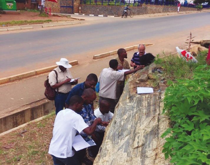
Geoclips - Volume 58 - September 2019 GeoClips I 9
finding a number of the magnetite pipes,
yielding a 5 to 10 million tonne resource,
they would provide at least five years’
worth of feed. Selectively mining the
pipes means that these operations could
fast track production.
It is envisioned that the results of this
study will provide critical information
on the geological controls on the
development of vanadium mineralisation
contributing towards the growing demand
for cleaner energy fuels.
For more information contact:
Flora Maja
Mapping Geology
+27 (0)12 841 1163
fmaja@geoscience.org.za
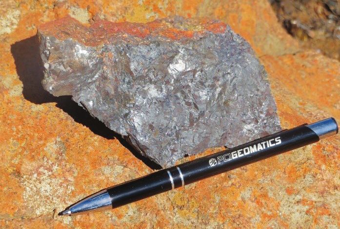
Hand specimen of vanadiferous titanomagnetite from the Roossenekal mapped area.
Training in the production of geochemical
synthesis reports
Geochemical synthesis reports are
the primary deliverable for most
international geochemical mapping
contracts. Since these reports are
such an important requirement, a
training programme was initiated
in the Economic Geology and
Geochemistry Unit as part of a skills
transfer initiative.
The study area selected for the
training programme is in the Regional
Griqualand West region in the geochemical
Northern Cape Province. The area index (Sr) for
consists of 32 1:50 000-scale mapped the Allanridge
areas, representing eight areas, Formation.
with each area covered by four
1:50 000-scale topographical sheets.
• Introduction, geology, economic to ArcGIS as well as the compilation
Both junior and senior staff members geology, geomorphology and of locality, topography, geology and
participated in the training programme. geochemical sample localities economic commodity maps. Phases
The trainees were Nthabiseng • Statistics and statistical interpretation 2 and 3 were completed in October
Mashale, Neithel Mashiane, Thato of the data 2018 and comprised the calculation of
Ntikang, Molebogeng Modiba, Rudzani • Geochemical map compilation, general statistics and the application
Lusunzi, Mzoli Breakfast, Mahlogonolo interpretation and synthesis of statistical methods such as
Kobola, Schalk Strauss, Mehdi Bensid, • C ompilation and editing of the Pearson correlation coefficients
Kobus Elsenbroek and Doreen van synthesis report. and principal component analyses,
der Walt. followed by the compilation of single-
Phase 1 of the training programme element geochemical maps and
The training programme consisted of was completed in July 2018. The synthesis maps. Phase 4 entailed
four phases: phase consisted of an introduction the compilation of eight synthesis
10 I GeoClips

                                                                                reports. This phase was completed in
                                                                                March 2019.

                                                                                These reports provide valuable
                                                                                background geochemical information in
                                                                                support of the geology in the study area.
                                                                                Areas where the geochemistry does not
                                                                                support the known geology normally
                                                                                suggest a deviation from the norm and
                                                                                remapping is suggested for these areas.
                                                                                An example of geological mapping using
                                                                                a predetermined geochemical index is
                                                                                shown for the Allanridge Formation where
                                                                                the upper classes clearly delineate the
                                                                                formation in the area. Only three small
                                                                                anomalies falling outside the known
                                                                                extent of the Allanridge Formation may
                                                                                have to be revisit in this case.

                                                                                The maps also predict possible
                                                                                exploration target areas that will
                                                                                eventually lead to exploration follow-
                                                                                up studies. An example of one such
                                                               Study area for   anomaly in the area that could serve both
                                                               the training     purposes (remapping and exploration)
                                                               programme.       is the large Cr anomaly which is neither
                                                                                supported by the known geology in the
                                                                                area, nor by any known Cr mineralisation,
                                                                                and is therefore suggested to present
                                                                                a major deviation from the norm. In
                                                                                such a case, it is the mandate of the
                                                                                Council for Geoscience to provide a
                                                                                logical geological and/or mineralogical
                                                                                explanation before the data is released
                                                                                into the public domain.

                                                                                Geochemical synthesis reports are the
                                                                                primary instrument for the evaluation of
                                                                                data and the presentation of geological
                                                                                information. The reports contribute
                                                                                significantly to geological mapping and
                                                                                exploration. The training programme
                                                                                therefore, in addition to having produced
                                                                                up-to-date geochemical synthesis
                                                                                reports, also served to equip staff with
                                                                                skills to face future challenges in the
                                                                                global market.

                                                                                  For more information contact:
                                                                                  Doreen van der Walt
                                                                                  Economic Geology and
                                                                                  Geochemistry
                                                                                  +27 (0)12 841 1410
                                                                                  doreen@geoscience.org.za
Regional geochemical anomalous distribution map of Cr (ppm).
Geoclips - Volume 58 - September 2019 GeoClips I 11
International Mine Water Association Conference in
Perm, Russia
The International Mine Water Association
(IMWA) has been hosting annual
conferences since 1979 and the 2019
IMWA conference took place in Perm,
Russia from 15 to 19 July 2019. The
theme for the conference was Mine
Water: Technological and Ecological
Challenges. The focus areas included
mine water treatment, hydrogeology,
geochemistry, environmental monitoring, Lufuno Ligavha-Mbelengwa, Rudzani Lusunzi and Gloria Dube discussing her MSc work with delegates
mine closure and remediation. Gloria Dube attending the conference dinner in at the conference.
Four delegates from the Council for Perm, Russia.
Geoscience — Viswanath Vadapalli,
Rudzani Lusunzi, Gloria Dube and biggest mineral wastes in South Africa for
Lufuno Ligavha-Mbelengwa — attended solutions many of these have not been mine reclamation: a geotechnical study
the conference. implemented. The conference focussed (Viswanath Vadapalli); application of
on providing insight into solution- artificial intelligence (AI) to predict mine
New solutions and cutting-edge oriented research and implementation, water quality, a case study in South Africa
technologies for mine water treatment, ranging from emerging technologies (Viswanath Vadapalli); geochemical
together with ways to prevent damage to proven solutions that have been and mineralogical characterisation of
to the environment and ecosystem, successfully implemented. precipitates from the Sabie–Pilgrim’s Rest
were presented. Some of the solutions goldfields for the potential of acid mine
will be incorporated into the present It was also beneficial to see how sources drainage (Rudzani Lusunzi); the use of
projects of the Council for Geoscience, of polluted mine water scattered over passive treatment systems to remediate
notably in the passive treatment of large areas are currently being managed AMD from abandoned coal mines,
polluted mine water, ingress control and treated abroad. The only existing eMalahleni, South Africa — column
and pollution prediction tasks. It was management programme of polluted experiments (Gloria Dube); assessment
noted that there are many countries who mine water in South Africa with an of water quality in the Witwatersrand
are already implementing advanced extensive footprint is the active lime Basin using inorganic contaminants
mine water control, treatment and treatment technique which is being (Lufuno Ligavha-Mbelengwa).
management protocols. applied in respect of some abandoned
mines in the Central, East and West
In South Africa, several studies have Rand Basins of the Witwatersrand
been done on contaminated mine goldfields and in the Witbank coalfield For more information contact:
water around gold and coal mines and in eMalahleni. Gloria Dube
many researchers have reported on Water and Environment Unit
poor-quality mine water discharge, The CGS team delivered oral and poster +27 (0)12 841 1395
disposal and contamination. Although presentations based on the following gdube@geoscience.org.za
some researchers have recommended topics: comparative study of the two
PanAfGeo Geoscientific Information Management
Training Workshop
Pan-African Geoscience, “PanAfGeo”, the Organisation of African Geological standards–Data dissemination allowed
is a project which supports the Surveys (OAGS) and is led by the trainees to attain a state-of-the-art
training of geoscientific staff from French Geological Survey (BRGM). tool kit and experience in various
African Geological Surveys through fields including geoscientific mapping,
the development of an innovative The PanAfGeo WP7-B Geoscientific geohazards, geoheritage, geoscientific
training programme. The programme Information Management Training information management and mineral
is a partnership between the Workshop in Spatial data infrastructure– resources assessment. The rationale
European Geological Surveys and Data modelling–Interoperability behind the training was to equip juniorscientists with geoscientific knowledge in
spatial data management, with a special
emphasis on data infrastructure, data
modelling, interoperability standards
and data dissemination. The training
focussed on the use of open-source
software as a tool to manage and
disseminate spatial data. Delegates from
various countries
The workshop took place in Lobatse, showing their
Botswana and was attended by about 20 certificates of
delegates from the geological surveys participation.
of nine African countries. The countries
that were represented were South
Africa, Botswana, Namibia, Tanzania,
Nigeria, Cameroon, Liberia, Kenya and
Ethiopia. The Council for Geoscience
is a leading participant in the OAGS
through programmes such as PanAfGeo.
Ntsako Mhlarhi and Siphindiwe Noruka
represented the organisation as trainees
at the workshop.
The delegates of the Council for
Geoscience and the Namibian
Geological Survey gave extensive Ntsako Mhlarhi and Siphindiwe Noruka receiving their participation certificates.
presentations of their spatial data
infrastructure and management systems
while the Geological Survey of Slovenia the OAGS. Case studies from Slovenia procedures and to enhance the
introduced the delegates to their and South Africa were used in most of production process of maps and other
geoportal. The Geological Survey of the exercises to demonstrate the user support services in the organisation.
Tanzania presented a comprehensive friendliness of the software in terms of This includes the improvement of digital
overview of the mineralogical potential of data manipulation, management and data dissemination, public awareness
their greenstone belts. Other geological dissemination. Open-source and custom and internal data sharing.
surveys provided contributions of their software for database management,
data infrastructure for comparison and web services, data dissemination and
knowledge sharing to find better ways of metadata cataloguing was utilised
implementing and managing their data. throughout the training. For more information contact:
Ntsako Mhlarhi
The workshop lasted ten days and The CGS delegates benefitted GIS and Scientific Databases
was facilitated by trainers from the immensely from this training and +27 (0)12 841 1085
Slovenian Geological Survey, European are currently investigating ways to nmhlarhi@geoscience.org.za
institutes and co-trainers from the implement some of the skills acquired
Botswana Geoscience Institute and in the workshop to improve working
If you are not on our mailing list and you would like to receive a copy of GEOclips, please send an e-mail to:
Mahlako Mathabatha, Marketing, Communication & Stakeholder Relations, mmathabatha@geoscience.org.za
Private Bag X112, Pretoria 0001, South Africa / 280 Pretoria Street, Silverton, Pretoria 0184, South Africa
Tel: +27 (0)12 841 1911 / Fax: +27 (0)12 841 1221 / www.geoscience.org.zaYou can also read