Town of South Windsor - Open Space Master Plan
←
→
Page content transcription
If your browser does not render page correctly, please read the page content below
Town of
              South Windsor
June 2010 Update

                   Open Space
                   Master Plan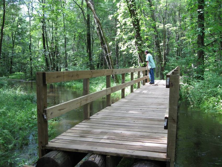
TOWN OF SOUTH WINDSOR
              OPEN SPACE TASK FORCE
                             January 2001
                       Updated through June 2010

                 Task Force Representatives
        Patricia Botteron, Chair, At-large
        Herb Asplund, SW Land Conservation Trust
        Marcia Banach, Director of Planning
        George Caye, Park and Recreation Committee
        Louise Evans, At-large
        Michael Gantick, Director of Public Works
        Carol Heffler, Inland Wetlands Agency/Conservation Commission
        Sue Larsen, At-large
        Roy C. J. Normen, At-large
        Elizabeth Osborne, Chamber of Commerce
        Karl Reichle, Superintendent of Parks & Grounds
        Elizabeth Warren, Agricultural Land Preservation Advisory Committee
        Viney Wilson, Planning and Zoning Commission

TOWN COUNCIL RESOLUTION OF ADOPTION APRIL 2, 2001

     WHEREAS, the Open Space Task Force has been charged by the Town Council with the task
     of preparing an Open Space Master Plan for the Town; and

     WHEREAS, the Open Space Task Force has prepared such a Master Plan; and

     WHEREAS, the Town Council wishes to add the condition that the Town will not pursue the
     purchase of any property in the Master Plan unless the property owner has voluntarily
     demonstrated an intent that the property become part of the Open Space Program, except for
     situations meeting the requirements of an eminent domain taking

     NOW, THEREFORE, BE IT RESOLVED that the South Windsor Town Council hereby
     adopts the Task Force’s Open Space Master Plan as the official open space plan for the
     Town of South Windsor, with the condition that the Town will not pursue the purchase of any
     property in the Master Plan unless the property owner has voluntarily demonstrated an
     intent that the property become part of the Open Space Program, except for situations
     meeting the requirements of an eminent domain taking.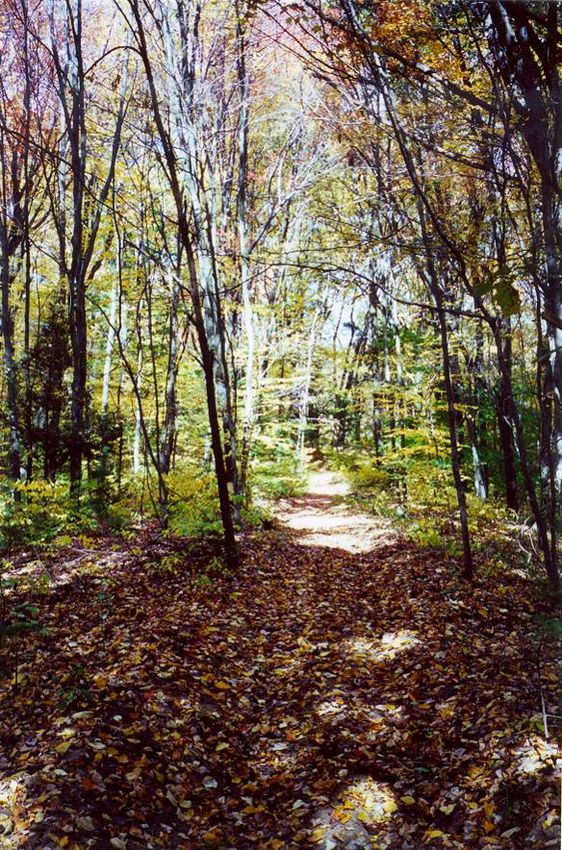
TOWN OF SOUTH WINDSOR
                          OPEN SPACE MASTER PLAN 2010

                                         Table of Contents

SECTION I: THE OPEN SPACE MASTER PLAN ..................................................................1
     Introduction .................................................................................................... 1
     South Windsor Open Space: The Vision for the Future................................................ 1
     Goals and Objectives ......................................................................................... 1
     The Open Space Plan ......................................................................................... 2
SECTION II: PLAN PREPARATION.................................................................................5
     The Open Space Task Force ................................................................................. 5
     The Master Plan Process ..................................................................................... 6
SECTION III: EXISTING CONDITIONS ............................................................................9
     Other Boards & Commissions with Open Space Responsibilities/Tasks ............................. 9
     Existing Plans/Strategies .................................................................................. 10
     Goals Accomplished; Goals Remaining From Previous Plans ........................................ 14
     Existing Open Space ........................................................................................ 18
     Natural Resource Data ..................................................................................... 18
SECTION IV: IMPLEMENTATION PLAN ........................................................................ 21
     Conservation/Preservation Sites ......................................................................... 24
     Conservation/Preservation Areas ........................................................................ 25
APPENDIX I: DEFINITIONS ...................................................................................... 27
APPENDIX II: TOWN-OWNED LAND LISTING ................................................................. 29
APPENDIX III: CRITERIA FOR REVIEW OF OPEN SPACE .................................................... 33

                                               List of Maps
PROSPECTIVE AREAS FOR CONSERVATION/PRESERVATION..............................FACING PAGE 4
PROSPECTIVE PROPERTIES FOR CONSERVATION/PRESERVATION ......................FACING PAGE 4
EXISTING OPEN SPACE ......................................................................... FACING PAGE 16
WETLANDS, WATERCOURSES AND FLOODPLAIN ......................................... FACING PAGE 18
PRIME FARMLANDS ............................................................................. FACING PAGE 18
STEEP SLOPES ................................................................................... FACING PAGE 18
FORESTS .......................................................................................... FACING PAGE 18

                                                                                                                   i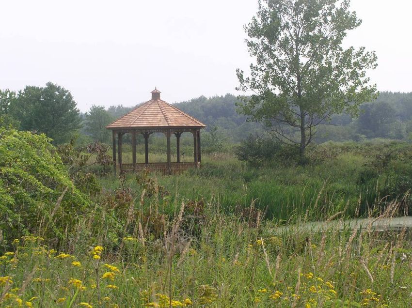
Town of South Windsor

                   The 100+-acre Major Michael Donnelly Land
                 Preserve on Sullivan Avenue, purchased in 2000
                  with the help of a grant from the Connecticut
                    Department of Environmental Protection.
                    Forty additional acres added since initial
                                     purchase

   ii
Open Space Master Plan

            Section I: The Open Space Master Plan

Introduction
     South Windsor has long been cognizant of the abundance and beauty of the area’s
natural resources, from the scenic Connecticut River to the farmlands of our Connecticut
Valley to rolling hills with spectacular views from the hilltops. Recognizing that land
preservation has become more critical than ever for South Windsor, the Town Council in
1994 appointed an Open Space Task Force. The Task Force has representation from a
variety of boards and commissions as well as resident representation. One of the tasks
assigned to the Open Space Task Force is the preparation of a long-range Open Space
Master Plan to help guide the Town’s open space preservation and conservation efforts. The
following Open Space Master Plan document has been prepared in response to the Council’s
charge.
     The Master Plan is arranged in a user-friendly format that presents the Task Force’s
Vision for South Windsor and the actual Master Plan goals, objectives and maps at the
beginning of the document. In-depth detail about the composition of the Task Force as well
as the Master Plan preparation process, previous plans for open space preservation, existing
open space, natural resources data and other information, comprise the remainder of the
Master Plan.

South Windsor Open Space: The Vision for the Future
     The Open Space Task Force envisions a South Windsor that continues to maintain its
character and charm, often described as “rural character,” as the town makes its transition
into a fully suburban community. The acquisition or preservation of carefully selected open
spaces is a key component of maintaining that community charm. The Task Force
recognizes that it is essential to provide a variety of types of open spaces, including:
   ♦ open spaces along major roadways to provide visual “resting places” for passing
     motorists,
   ♦ open spaces that preserve our natural resources, and
   ♦ open spaces that provide opportunities for the public to enjoy outdoor activities, both
     passive and active.

Goals and Objectives
     The Task Force developed the following set of goals and objectives to provide guidance
in acquisition and preservation efforts.
   1. Provide sites to protect surface and subsurface water resources
   2. Add to existing committed open space

                                                                                               1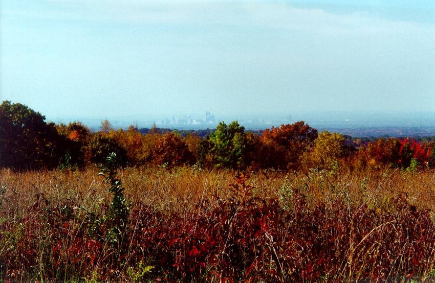
Town of South Windsor

   3. Assemble open corridors or greenbelts by adding to existing open space
   4. Protect critical or threatened habitats
   5. Protect groundwater within existing or potential public drinking water supply
      aquifers
   6. Protect natural drainage ways
   7. Protect lands of cultural importance
   8. Provide sites for active and passive recreation
   9. Protect South Windsor’s unique and significant natural features
   10. Preserve farmlands and viable forest land/woodland
   11. Preserve areas that shape community design and character
   12. Protect steep slopes
   13. Preserve areas that provide educational opportunities
     The Task Force recognizes that the above list of goals and objectives is quite
comprehensive, and that priorities need to be established to help determine areas and
properties that should be selected for preservation or acquisition. Accordingly, the Task
Force has placed a high priority on (1) properties with high residential development
pressure, and (2) properties that serve multiple purposes. It is critical to recognize properties
that are desirable for open space and that are also desirable for residential development,
since these sites must generally be sought and acquired in advance of a development
proposal. Acquiring properties with multiple uses is a methodology for receiving the most
benefit from limited open space funds.

The Open Space Plan
     The Task Force reviewed the available natural resource data and its relationship to
vacant land in South Windsor. This data was combined with the Task Force’s list of goals
and objectives and the two priorities of development pressure and multi-use land. By
applying and overlaying all of these data and criteria, the Task Force identified specific sites
(individual properties) and more general areas (such as greenbelts along selected rivers and
streams) that are desirable for preservation or acquisition. The Open Space Plan is a visual
compilation of all of the identified sites and areas, and consists of two maps:
   ♦ Prospective Properties, which includes specific sites; and
   ♦ Prospective Areas, which includes general areas.
    The Objectives identified on each map correspond with the objectives enumerated in the
Section III of this Plan.
    In addition to the mapped sites and areas, the Task Force has the following policy
recommendations.
   ♦ The adopted Park and Recreation Commission Master Plan should be used as the
     main guide for the acquisition of property for active recreation uses.

   2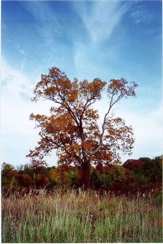
Open Space Master Plan
♦ The adopted South Windsor Agricultural Land Preservation Advisory Committee
Master Plan should be used as the main guide for the acquisition of property for
agricultural preservation.
The Prospective Sites and Prospective Areas maps, together with the above policies and
the previously-enumerated Goals and Objectives, constitute the Open Space Master Plan.
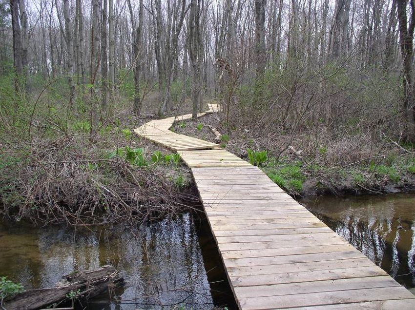
Major Michael Donnelly Land Preserve
3
Town of South Windsor

                 Wapping Park, Ellington Road and Clark Street

   4
Open Space Master Plan
Section II: Plan Preparation
The Open Space Task Force
Previous master plans, from the Planning and Zoning Commission’s 1968
Comprehensive Plan with its numerous updates, the Conservation Commission’s 1971 Open
Spaces Plan and 1973 Open Space Implementation Plan, recognized that open land is highly
desirable for development and likely to disappear to development unless actions were taken
to preserve some of that land. Even as far back as 1959, the Plan of Development indicated
that streams needed to be protected in order to prevent flooding. All of these documents
recognized that South Windsor was growing rapidly, a result of its close proximity to the
urban center and its highly desirable characteristics. Each plan contained recommendations
to preserve open land; their recommendations will be reviewed later in this document.
During the 1980’s, land development activity soared once again as developers
recognized the potential for large subdivisions on flat, prime farm acreage. Recognizing that
land preservation was becoming more critical than ever for South Windsor, the Town
Council in 1986 established a South Windsor Agricultural Land Preservation Advisory
Committee (SWALPAC) and in 1994 appointed an Open Space Task Force. The voters of
South Windsor also passed a $3 million referendum for acquisition of open space in 1987,
$4 million in 1996, and $4 million in 2005.
The Open Space Task Force is composed of a representative from the Inland Wetlands
Agency/Conservation Commission; Planning and Zoning Commission; Agricultural Land
Preservation Advisory Committee; Parks and Recreation Commission, Chamber of
Commerce, South Windsor Land Conservation Trust, the Director of Planning, Director of
Public Works, the Superintendent of Parks and Grounds; and three residents-at-large. The
initial purpose of the Open Space Task Force was to develop a subdivision open space use
and maintenance plan.
The Task Force proved to be an excellent innovation—so much so that in 1996, the
Town Council converted the Task Force into a Standing Committee whose purpose is to
implement an Open Space Policy Program that includes the following tasks:
♦ Developing an Open Space Master Plan;
♦ Providing recommendations to the Town Council regarding use of fee-in-lieu of
open space funds collected by the Planning and Zoning Commission under the
auspices of CGS §8-2;
♦ Providing recommendations to the Town Council regarding desirability of proposed
subdivision open space as well as the purchase of open space using the 1996 bond
monies; and
♦ Developing a public education program about the public’s rights and responsibilities
regarding Town open space.
The Task Force continues its work on these tasks.
5Town of South Windsor
The Master Plan Process
The development of an Open Space Master Plan has been a high-priority item for the
Task Force, which followed a process developed by Jim Gibbons, Land Use Specialist with
the University of Connecticut Cooperative Extension Service. The process includes the
following steps:
1. Conduct an open space/natural resource inventory
2. Categorize open space by function
3. Organize identified sites into corridors or greenways
4. Develop a set of open space objectives
5. Prioritize areas for preservation/conservation
6. Develop a financial plan based on how the land will be preserved/conserved and
managed
7. Create an information file on each identified parcel
8. Contact identified land owners
9. Conduct a series of informational forums on the Open Space Master Plan
The process of developing the Master Plan began in depth in 1998. An open space and
natural resource inventory was conducted. Initially, paper maps were used to identify all
existing State- and Town-owned lands, lands preserved via a land trust or other association,
and such natural resources as wetlands, prime farmlands, floodplains, and steep slopes.
Shortly after completion of the paper maps, the Assessor’s basic property maps were
digitized into a computer mapping format (known as a Geographic Information System, or
GIS).
The advent of the GIS computer mapping was a landmark event in the preparation of
the Master Plan. GIS allowed the Task Force to interactively view natural resources and
properties, thus facilitating the remaining steps in the process.
Open space properties were categorized by the following functions:
a. Natural resource protection (unique or fragile animal or vegetative habitat,
wildlife corridors, riparian buffer zones);
b. Outdoor recreation (active or passive);
c. Resource management (farmlands, forest);
d. Protection of public health and safety (floodplains, wetlands, aquifer recharge
areas);
e. Areas that shape community character (buffer strips, greenways); or
f. Historic or archaeological sites (historic districts, burial grounds).
Categorizing open space properties by function provides a means of characterizing
existing open space, thus providing a means to determine types of open space that the Town
needs to add to its inventory.
The next three steps were performed in an iterative manner; that is, initial results were
examined and modified in reaction to subsequent steps. Existing open space was loosely
grouped into corridors or greenways. The Task Force then developed a set of preservation
objectives with a recommended strategy for accomplishing each objective (see Section III).
Next, based on the results of the previous steps, properties and general areas were
6Open Space Master Plan
designated for conservation/preservation. Throughout this process, the computerized GIS
allowed the Task Force to instantly see the results of alternative decisions.
The final steps of the process include:
♦ having the Town Council adopt a financial plan for implementing the
recommendations of this Master Plan,
♦ continuing to update file information on each identified property,
♦ meeting with property owners and the public regarding this Plan, and
♦ continuing to conduct informational forums as progress on the implementation of the
Master Plan is realized.
Podunk River, Wapping Park in autumn
7Town of South Windsor
View from the Wildlife Sanctuary, Niederwerfer Road
8Open Space Master Plan
Section III: Existing Conditions
Other Boards & Commissions with Open Space
Responsibilities/Tasks
Town Council
The Town Council, as the legislative body for the Town, is a primary decision-making
authority regarding open space preservation. The Council can authorize funds, arrange
referenda and bond issues, accept land gifts, and authorize other programs (such as Purchase
of Development Rights).
Planning and Zoning Commission
The Planning and Zoning Commission (PZC) has a critical open space role also. PZC
has been responsible for the acquisition of hundreds of acres of open space through the
Commission’s open space subdivision regulations. Current open space subdivision
regulations allow the PZC to require that 50% of the land proposed to be subdivided be set
aside as open space when a property for which a subdivision is proposed is selected for
preservation in this Open Space Master Plan.
Inland Wetlands Agency/Conservation Commission
The IWA/CC is instrumental in securing conservation easements over sensitive and
vulnerable wetlands areas, through the inland wetlands permitting process. The conservation
easements are generally private-property easements, granted to the Town, that prohibit
destruction or alteration of the protected area. The primary purpose of the easements is
conservation, and the easement areas are usually not open to the public.
Park and Recreation Commission
The Park and Recreation Commission (PARC) was established by the Town Council in
1962. At that time, one of their duties was to provide to the Council a long-range plan of
additional park development. Their duties were amended in 1983 and now include making
reports or recommendations to the Council or the Recreation Director concerning the
initiation, development, maintenance or administration of recreational programs for the
Town, and the acquisition, development, use and maintenance of public parks, playgrounds,
swimming pools or other recreational facilities.
PARC has recently prepared a new Recreation Master Plan with a twenty-year horizon.
The Recreation Master Plan includes recommendations for recreation on open space lands.
9Town of South Windsor
South Windsor Agricultural Land Preservation Advisory Commission
The South Windsor Agricultural Land Preservation Advisory Committee (SWALPAC)
was created by the Town Council in 1986. SWALPAC includes representatives from the
Inland Wetlands Agency/Conservation Commission, the South Windsor Land Conservation
Trust, the Hartford County Soil and Water Conservation District, plus local farmers,
residents with real estate and banking associations, and residents at large. The purpose of
SWALPAC is to act in an advisory capacity to the Town Council by establishing farmland
preservation priorities for the Town and providing recommendations as to what the Town
Council and others can or should do to maintain and promote a viable agriculture industry
with South Windsor. Some of SWALPAC’s duties include:
♦ Developing information and maps of active and inactive farmland, prime and
important farmland;
♦ Conducting surveys to gather information from farmers about actions necessary to
maintain or enhance agriculture;
♦ Act as advisor to the Town Council regarding expenditures in the event an
Agricultural Land Preservation Fund is established.
SWALPAC completed and the Town Council adopted on February 18, 1997, a Master Plan
for Agricultural Land Preservation.
Quasi-public and Private Conservation Entities
There are other conservation groups that own property principally dedicated to conservation
interests in South Windsor. These groups include such entities as the Hartford Audubon
Society; the South Windsor Land Conservation Trust, and various water companies. The
groups generally have their own boards of directors and by-laws containing their own land
conservation programs, and the lands they hold may or may not be accessible to the general
public.
Existing Plans/Strategies
Town Plan of Conservation & Development, Planning and Zoning
Commission, 1959-Ongoing
The Planning and Zoning Commission is assigned the responsibility for preparing a
Town Plan of Conservation and Development (formerly called Plan of Development or
Comprehensive Plan) by State statute. The Plan includes provisions for open space among
its many recommendations.
The 1959 Plan of Development noted, “Just a few years ago South Windsor was a rural
community with large areas of land devoted to agricultural use….As the population,
business, and industry of Hartford and the Capitol Region have expanded, the pressures of
growth have impinged on South Windsor….” That plan, however, did not include any
discussion of open space preservation beyond the protection of rivers and streams and some
swamps and low-lying areas in order to prevent construction of costly drainage
infrastructure.
10Open Space Master Plan
In 1968, a new Comprehensive Plan was prepared. This Plan concluded that the lack of
sufficient open space lands was a detriment to the Town and included recommendations for
open space acquisition and protection. All subsequent updates address the need for open
space lands.
At the time of preparation of this Open Space Master Plan, the Planning and Zoning
Commission is in the process of a comprehensive update of the Town Plan. It is anticipated
that the Planning and Zoning Commission will make use of this Open Space Master Plan
within their Town Plan.
Conservation & Open Space Plan, Conservation Commission, 1971
The Conservation Commission (a separate agency until about 1980, when it became
combined with the Inland Wetlands Agency/Conservation Commission) recognized that
South Windsor was growing rapidly. The Commission prepared a Conservation & Open
Space Plan in 1971 because the Commission “recognizes that to maintain the quality of the
environment, we will have to plan for our recreation and conservation needs as we plan for
all our other needs.” The primary objective of this plan was to promote the conservation and
development of natural resources (water, air, land, plant, fish, wildlife and other). Among
the listed goals were:
♦ To preserve a variety of natural features;
♦ To preserve and improve the natural bodies of water, including wetlands;
♦ To preserve and improve the woodlands, open fields and floodplain meadows; and
♦ To maintain the rural atmosphere and charm of South Windsor.
The Plan included various recommendations for types of open space to be preserved.
Open Space Implementation Plan, Conservation Commission, 1973
The Conservation Commission continued the work it began with the 1971 Open Space
Plan by contracting with a consulting firm to prepare an Open Space Implementation Study,
which was completed in 1973. The Study was modified as it progressed so that the two main
areas of emphasis became: (1) streams and stream quality, and (2) the need for an action
program that maximized public involvement and minimized the necessity of Town funds for
acquisition and management. The Study included an extensive analysis of watersheds for
sensitivity, both long-range and short-range implementation programs, and a composite
drawing identifying critical resources and systems.
The short-range program was identified as a “Podunk River Preservation” project, to
include:
♦ Organization of a Podunk River Committee
♦ Detailed field survey of the Podunk River, including scenic areas, pollution sources,
recreation opportunities;
♦ Detailed data mapping at 400-scale;
11Town of South Windsor
♦ Organization of a Podunk River Monitors Group to set up stream gauging and water
quality stations, check the river on a regular basis, and report any unusual
disturbances or pollution (envisioned as including high school/junior high students);
♦ Organization of special activities along the river—nature walks, canoe trips, stream
fauna classes, etc.;
♦ Podunk River Preservation monthly newsletter; and
♦ Funds solicitation program for continuance of the program.
The long-range program included recommendations for such natural features as
stream corridors, wetlands, Connecticut River meadows, unique areas, prime
groundwater areas, and sensitive watersheds. The Plan’s Critical Systems map,
which identifies these areas, is included in this Master Plan for reference purposes.
Suggested implementation tools included:
♦ Purchase with grant monies, loan or bond monies, revenue sharing, installment plan,
eminent domain;
♦ Land exchange (trade a currently-owned property for a more desirable property);
♦ Donation of land;
♦ Gift as reservation in life estate;
♦ Donation to a nonprofit corporation formed for the purpose of receiving gifts;
♦ Preservation by conservation easements;
♦ Control development by zoning or by contract zoning;
♦ Form a nonprofit land holding corporation to develop, sell and reinvest profits into
land purchase.
Plum Gulley Brook Plan, early 1970’s
This plan recommended preservation of a portion of Plum Gulley Brook just north of
Town Hall by creating a park with walking trail along the brook. This strip of land would
have connected Town Hall and its adjacent open space to the land on Sand Hill Road where
the police station was later constructed. (At the time, it was widely thought that a new
library would be built where the police station now stands.) Voters rejected a referendum
question that would have provided half a million dollars to purchase and develop the park.
Proponents saw the proposed purchase as an opportunity to provide South Windsor’s first
green belt and walkway. Opponents were concerned about spending money on such a
project and expressed opinions that the wooded walkway would be subject to littering and
perhaps dangerous because of its isolation.
12Open Space Master Plan
Archaeological Survey, Public Archaeological Survey Team, Inc.,
University of Connecticut, 1978
This Survey was commissioned as the first step in assessing the potential impact of the
sanitary sewer project on the cultural resources of South Windsor. Included in the survey
were a literature search and a preliminary walk-over reconnaissance of the directly-impacted
areas. The study concluded that there are significant, extensive areas of archaeological
significance for Indian remains along Main Street, as well as along other streams and brooks
and along the ice-age boundary of Glacial Lake Hitchcock.
Agricultural Land Preservation Advisory Commission Preservation
Plan, 1997
The Agricultural Land Preservation Advisory Committee (SWALPAC) prepared a
Preservation Plan in 1997 to address preservation of farmland and farming. The Plan notes
that the Hartford County Soil and Water Conservation District considers almost all land in
South Windsor to be prime agricultural land (except for some wetland areas), due to its
location in the Connecticut Valley. Therefore, SWALPAC notes that acquisition priorities
should be based primarily on the risk of the land being developed for other purposes as well
as location. The Plan proposes that SWALPAC (in conjunction with other
boards/commissions) review parcels of land that are prime targets for development, but
should be set aside for open space and farmland. If the boards/commissions agree that a
property has merit for preservation, then SWALPAC will bring to the Town Council a
recommendation for acquisition. SWALPAC notes several approaches to land acquisitions:
♦ Gifts of land to the Town or Land Trust;
♦ Purchase of development rights by the Town and/or State; or
♦ Purchase by the Town or Land Trust.
Strategic Plan for Natural Resource Management, 1999
The overall intent of the Strategic Plan for Natural Resource Management is to provide
a coordinated approach to managing the Town’s forest, wildlife and other natural resources
consistent with the Town Plan of Conservation and Development, the Recreation Master
Plan, this Open Space Master Plan and the Town’s Strategic Plan. The goals of the plan are
to:
♦ Inventory and classify properties and their resources;
♦ Identify outdoor opportunities (such as trails, trail markers) in relation to resources;
♦ Prioritize properties according to size, location, and quality, opportunity, potential of
natural resources;
♦ Develop individual management plans for each property, to be completed within ten
years.
Implementation of this plan has begun with initial funding by the Town Council and a
USDA Forestry grant. These funds will result in the inventory and development of forestry
13Town of South Windsor
and wildlife management plans for the Town’s six major land holdings (Rye/Barton, Priest
Farm, Mitchell, Lawrence Rd, Nevers Road Park and Podunk Park). Forestry management
techniques and opportunities will be identified to improve conservation practices, improve
wildlife habitat and stimulate sustainable forest product market opportunities. In addition, a
guidebook/internet reference and public awareness seminar for public/private management
of forest resources will be developed. Completion of these activities is anticipated by July
2002.
Recreation Master Plan
The Park and Recreation Commission completed a Recreation Master Plan in 2000. The
Recreation Master Plan includes an assessment of existing open space, recreational facilities
and programs, a needs assessment, recommendations, and cost projections/funding sources.
Included also is a classification of target sites into categories: mini-park, neighborhood park,
school park, community park, natural resource area, sports complex, and special use area.
The recommendations include increasing active and passive recreation facilities on existing
Town-owned properties.
Among the recommendations that are complementary to the Open Space Task Force’s
goals for preservation/conservation of open space are the recommendations to provide a
town-wide network of parks and trails, to link park and school sites with residential
neighborhoods, and to tie into the park network of neighboring towns. The Recreation
Master Plan notes that pathways may include a variety of facilities including connector trails
(e.g., short links between parks or schools), all-terrain bike trails, jogging/walking trails,
cross-country ski trails, and equestrian trails.
Goals Accomplished; Goals Remaining From Previous Plans
Many of the goals and objectives included in the plans outlined above have been
accomplished. Many goals and objectives, such as preservation of floodplain, meadows, and
the Podunk River, are ongoing. Since these goals are not able to be accomplished by a
simple action such as acquisition of a single property, they are being accomplished
incrementally.
In the following list of goals, abbreviations for the referenced Plans are:
♦ POD – Comprehensive Plan of Development, Planning and Zoning Commission,
1968 and updates
♦ COSP – Conservation and Open Space Plan, Conservation Commission, 1971
♦ OSIP – South Windsor Open Space Implementation Study, Conservation
Commission, 1973
Accomplishments
♦ Barton property acquisition, Troy Road, purchased in 1998, added 50+ acres to Rye
Street Park.
14Open Space Master Plan
♦ Priest Farm acquisition, 75 acres on Sullivan Avenue, plus a 14 acre property
connecting the farm to Pierce Road, and 19 acres of abutting land preserved by other
organizations.
♦ Wapping Park, 170 contiguous acres of open space between Ellington Road and
Clark Street, purchased in part with a large grant from the Connecticut Department
of Environmental Protection. This land adjoins existing subdivision open space
lands.
♦ Major Michael Donnelly Land Preserve, 72 acres of open space with frontage on
both Sullivan Avenue and West Road, again with a large grant from CT DEP, offers
spectacular fall vistas. The Preserve was expanded with the addition of 40 acres of
open space acquired in part by the Planning & Zoning Commission, for a total of
over 130 acres.
♦ Foster Farm: purchase of 40 acres, with right of first refusal for the remainder of the
farm. The Foster family has the right of first refusal to lease the land for farming, and
the family continues to farm the property.
♦ Acquisition of two “linking” properties: the 11-acre Ireland property that forms a
link between Nevers Park and utility line trails/subdivision open space to the east;
and the 1-acre Nagy property that forms a vital link between subdivision open space
properties and Wapping Park along the Mill Pond.
♦ Numerous recommendations to the Town Council regarding desirability of specific
open space properties, including Planning and Zoning Commission subdivision
applications. Of particular note is the preservation of over 50 acres of the Dzen Tree
Farm on Barber Hill Road, including the 2nd highest point in South Windsor and the
pond that is used by the Super Sixties sportsmen for their annual fishing derby. (The
Town also owns the highest point in South Windsor at the Niederwerfer Wildlife
Sanctuary.)
Recommendations in past plans that have been or are still being
accomplished:
Recommendations for conservation/preservation Plan
Floodplain; Conn. River meadows COSP, POD
Drainage network COSP, OSIP
Podunk River; greenbelt COSP
Scantic River State Park (state) COSP
Avery Brook; acquisition to prevent flooding COSP
School natural areas: High School – acquire ponds along Lake St. COSP
15Town of South Windsor
Neighborhood areas via PZC subdivisions (ongoing) COSP
Veterans Memorial Park: acquire additional acreage COSP
Institute land filling regulations (erosion control; wetlands protection) COSP
Open space subdivisions (PZC) COSP
Wetlands (via regulatory means; Plan recognizes that the Inland Wetlands & OSIP
Watercourses Act does not guarantee protection, only regulation)
Remaining/ongoing recommendations
Recommendations for conservation/preservation Plan
Protect Podunk, Scantic, Avery, Plum Gulley, Quarry, Stoughton brooks COSP, OSIP, POD
(erosion and sedimentation controls via buffer zones in OSIP)
Protect meadows (acquisition/easements) COSP, POD
Protect terrace breaks (escarpments) COSP
Strong/West Road area; protect via easements POD, COSP
Unique areas; peat bogs (acquire) COSP
School natural areas; one next to each school, prefer with water COSP
Utility Rights-of-ways for hiking trails COSP, POD
Open space subdivisions for commercial./industrial uses COSP
Set aside funds each year for open space purchase COSP
Other streams; via adoption of IWA/CC regs OSIP, POD
Meadows; long-range acquisition to avoid the uses allowed in Floodplain zone OSIP
(land trust)
Unique areas - acquire; and use Critical Areas map during development OSIP
reviews
Prime groundwater areas OSIP
Upland valley outwash deposits (runoff check); impervious surfaces kept to OSIP
minimum in these areas
Contact zones between upland till and kame terrace areas OSIP
Sensitive watersheds OSIP
Podunk; high priority: establish Podunk River Committee, detailed field OSIP
survey, detailed mapping, organization of a monitoring group and special
activities, monthly Podunk River Preservation newsletter, funds solicitation
program; stream protection regulations
16Open Space Master Plan
POD – Comprehensive Plan of Development, Planning and Zoning Commission, 1968 and updates
COSP – Conservation and Open Space Plan, Conservation Commission, 1971
OSIP – South Windsor Open Space Implementation Study, Conservation Commission, 1973
17Town of South Windsor
Existing Open Space
The Town owns in excess of 1750 acres of land, of which more than 1400 acres are
parks, open spaces and other land with no buildings. The open lands are distributed
throughout the Town and serve a variety of functions. Some highlights include (see
Appendix for a listing of Town-owned land as of this date):
♦ Rye Street Park now has in excess of 170 acres, on both sides of the railroad tracks,
with the addition of the Barton property purchased in 1998.
♦ Nevers Road park contains over 138 acres, with a variety of uses including active
ballfields, a pavilion for picnics and concerts, and a walking/jogging trail that winds
through the various areas.
♦ The 117-acre Wildlife Sanctuary on Niederwerfer Road has a 42-acre property
adjoining it to the north (owned jointly by the State Dept. of Environmental
Protection and the Town), for a total of 159 acres.
♦ The 75-acre Priest Farm on Sullivan Avenue, with a 14 acre property connecting the
farm to Pierce Road, and 19 acres of abutting land preserved by other organizations.
♦ Wapping Park, 170 contiguous acres of open space between Ellington Road and
Clark Street, purchased in part with a large grant from the Connecticut Department
of Environmental Protection. This land adjoins existing subdivision open space
lands.
♦ Major Michael Donnelly Land Preserve, 72 acres of open space with frontage on
both Sullivan Avenue and West Road, again with a large grant from CT DEP, offers
spectacular fall vistas. The Preserve was expanded with the addition of 40 acres of
open space acquired in part by the Planning & Zoning Commission, for a total of
over 130 acres.
♦ Foster Farm, 40 acres acquired with right of first refusal for the remaining 50+ acres.
The Planning and Zoning Commission has acquired more than 600 acres of permanent
open space through their subdivision open space provisions. The Town-Owned Land map
illustrates that, while many of the subdivision open spaces may not be large in size, the
Commission has been successful at creating interconnected “green belts” along streams and
power lines.
Natural Resource Data
Natural resources are an integral component of an open space master plan, since it is
these very resources that such a plan is designed to conserve and protect.
There is an abundance of natural resource data available to the Town, much of it in
digital format that can be used in conjunction with the Town’s computer mapping. The data
used in the preparation of this Master Plan include:
♦ Soil types
18Open Space Master Plan
♦ 100-year floodplain
♦ Wetlands
♦ Watercourses and water bodies
♦ Steep slopes
♦ Surficial geology
♦ Prime farmlands
♦ Archaeologic sites (vicinity, not actual location)
♦ Rare & endangered species (vicinity, not actual location)
Compiling natural resource data helps to provide guidance regarding natural areas that
are unique or worthy of preservation, and to identify areas unsuitable for development
because of limitations such as steep slopes, wetlands, or floodplain. This resource data can
be layered with the Town’s property line base map to produce a guideline regarding where
the most sensitive resources are located. It must be noted, however, that the boundaries
shown for specific natural resource data should not be considered absolute, as the data is
primarily based on aerial photography or other general mapping and has not been field
verified for absolute accuracy. However, the data provides an excellent source of
information for planning purposes such as this Master Plan.
Where available in printable form, the natural resource data used in preparation of the
Plan have been included in this document.
19Open Space Master Plan
Section IV: Implementation Plan
There are a variety of methods to preserve open space land. The Task Force has
determined that the following mechanisms can be utilized to preserve open space in South
Windsor.
1. Outright Town acquisition. Acquisition can take various forms, including:
♦ Town purchase. The funding source can include bond monies obtained via referenda;
from the fee-in-lieu-of open space fund created by the Planning and Zoning
Commission; or from budget line or capital item. The Open Space Task Force
recommends that the Town Council allocate 0.75 percent of the annual budget for
the purchase of open space.
♦ Acquisition for back taxes.
♦ Grant programs such as the Department of Environmental Protection’s Open Space
and Watershed Land Acquisition Program.
♦ Dedication through PZC subdivision approval process.
♦ Outright donation. Property owners may obtain tax benefits from the donation of
land to the Town.
♦ Life estates. The Town acquires the property but provisions are made for the owner
(or others) to remain in occupancy for a specified period (such as remaining life).
2. Private acquisition. Acquisition by private organizations can be equally effective in land
preservation. Two effective methods for South Windsor include:
♦ Land Trust, Audubon Society, and similar organizations. Preservation can be
accomplished very effectively when lands are acquired by conservation
organizations such as the South Windsor Land Conservation Trust or Audubon
Society. These organizations generally hold properties with deed-restrictions to
ensure that the lands remain as conservation lands. The organizations may make their
properties open to the public.
♦ Homeowners associations (through PZC subdivision/open space requirements) also
hold open space land. These open spaces required by the PZC are required by PZC
regulations to remain as open space for at least 99 years. These private open spaces
are generally open to the members of the association, not the public.
3. State protection/acquisition. The State of Connecticut has programs for open space
preservation and acquisition by the State. Some of these programs include:
♦ Purchase of development rights. Under this program, the State (sometimes with the
participation of municipalities and/or Federal government) purchases development
rights for farms. Once the development rights are purchased, the property must
remain in agriculture use.
♦ Acquisition. The State can also purchase land and dedicate it to permanent open
space. This has been done in South Windsor, with the Town contributing a portion of
the purchase price.
21Town of South Windsor
4. Regulatory protection. The Town can preserve and protect land through regulatory
means without actually acquiring it. Methods of regulatory protection include:
♦ Conservation easements. Both the Planning and Zoning Commission and the Inland
Wetlands Agency/Conservation Commission have taken advantage of conservation
easements to protect land under private ownership. The easements are granted
naming the Town as the grantee, during the approval process for land development.
These easements generally prohibit land disturbance and vegetation cutting activities
unless the Town specifically agrees to them.
♦ IWA/CC buffer zones. The Inland Wetlands Agency is empowered by State Statute
to regulate not just wetlands and watercourses, but a buffer area around them.
Protection of areas surrounding wetlands and watercourses helps in the preservation
of the quality of the wetland/watercourse.
♦ Mandatory open space subdivisions. The Planning and Zoning Commission enacted
subdivision regulations in 1999 that require open space subdivisions under certain
circumstances. If a subdivision is proposed on a property for which preservation is
desired, as shown in a Master Plan, then the PZC can require the subdivision to be an
open space subdivision. The open space requirement would result in at least 50% of
that property being preserved as open space. The PZC can also determine which part
of the property will be preserved.
♦ Steep slopes protection. Zoning regulations prohibit building on slopes in excess of
15 % on residential lots. The Commissions also require slope protection and
stabilization, or avoidance, for construction proposed in areas with high erosion
hazards.
♦ Limit new roadways off Main Street. The Task Force makes this recommendation to
the Planning and Zoning Commission on order to preserve the unique character and
charm of this historic area.
5. Private protection. Property owners can preserve and protect land under their ownership
by the perpetuation of farming & forestry. Participation in tax abatement programs such
as Public Act 490 make farming and forestry advantageous from a property tax
perspective.
6. Public Education. Educating the public so that people are aware of the benefits of land
preservation and conservation, can be effective at increasing the number people who
practice conservation methods. In addition, informing people of the choices available to
them for estate planning can aid both the property owner and the conservation effort.
A matrix identifying prospective properties and areas for conservation or preservation,
with the recommended preservation method(s), follows on page 24.
Property Prioritization
The Task Force recognizes that priorities need to be established to determine whether a
property offered to the Town should be acquired. To that end, the Task Force developed a
rating system (see Appendix III) applied to all proposed Town open space properties,
22Open Space Master Plan
including both proposed subdivision open space properties and properties proposed for
Town purchase. The rating system has diverse criteria including such items as:
♦ Providing sites to protect surface and subsurface water resources,
♦ Adding to existing committed open space,
♦ Assembling open corridors or greenbelts,
♦ Protecting critical or threatened habitats,
♦ Protecting groundwater within existing or potential public drinking water supply
aquifers, and
♦ Protecting natural drainage ways.
The Task Force applies the rating system to each property referred to it by the Town
Council and prepares a recommendation to the Council regarding the desirability of that
property. The rating system should be maintained, updated when needed, and should
continue to be applied to all potential open space acquisitions.
23Town of South Windsor
Conservation/Preservation Sites
Objectives:
1. Provide sites to protect surface and subsurface water resources
2. Add to existing committed open space
3. Assemble open corridors or greenbelts by adding to existing open space
4. Protect critical or threatened habitats
5. Protect groundwater within existing or potential public drinking water supply aquifers
6. Protect natural drainage ways
7. Protect lands of cultural importance
8. Provide sites for active and passive recreation
9. Protect South Windsor’s unique and significant natural features
10. Preserve farmlands and viable forest land/woodland
11. Preserve areas that shape community design and character
12. Protect steep slopes
13. Preserve areas that provide educational opportunities
Target Properties 2010
ID # Location Acres ID # Location Acres
0 534 Barber Hill Road 57.60 21 R043 Main Street 17.30
1 R003 Ferry Lane 44.00 22 652 Main Street 11.29
2 495 Niederwerfer Road 5.79 23 R044 Main Street 4.50
3 485 Niederwerfer Road 1.74 24 L019 John Fitch Blvd 9.40
4 475 Niederwerfer Road 1.75 25 R037 Main Street 7.70
5 155 Griffin Road 18.00 26 R038 Main Street 7.20
6 L001 Ferry Lane 3.72 27 R039 Main Street 9.00
7 404 Rye Street 17.90 28 R031 Main Street 10.66
8 2535 Ellington Road 52.80 29 50 Chapel Road 8.62
9 R024 Graham Road 38.10 30 112 Chapel Road 3.65
10 559 Avery Street 19.15 31 178 Chapel Road 5.00
11 178 Foster Street 1.26 32 141 Pleasant Valley Road 1.36
12 255 Avery Street 0.69 33 135 Pleasant Valley Road 1.36
13 90 Foster Street 84.39 34 151 Pleasant Valley Road 1.36
14 989 Ellington Road 19.90 35 R011 Pleasant Valley Road 17.18
15 R002a Collins Lane 18.10 36 R036 Main Street 0.00
16 124 Brookfield Street 18.00 37 R036 Main Street 0.00
17 L011 Chapel Road 7.00 38 1488 Sullivan Avenue 17.74
18 L008a Chapel Road 3.40 39 490 Deming Street 11.60
19 R048 Main Street 5.30 40 440 Deming Street 9.90
20 726 Main Street 7.40 41 491 King Street 11.59
24Open Space Master Plan
Conservation/Preservation Areas
ID NAME OBJECTIVES CONSERVATION/PRESERVATION METHOD
Regulatory protection (PZC, IWA/CC),
Conservation easements, other means
A Bancroft-Stoughton Brook Area 12 Regulatory protection (PZC, IWA/CC)
Acquisition; Conservation Easements; PZC open
space subdivision; Regulatory protection (PZC,
B CT River Meadows 6, 7, 9 IWA/CC); education; other means
Regulatory protection (PZC, IWA/CC);
C Terrace Escarpments 6, 12 conservation easements; other means; education
Acquisition; Conservation Easements; PZC open
space subdivision; Regulatory protection (PZC,
D Sand Dunes 9 IWA/CC); education
Regulatory protection (PZC, IWA/CC),
E Talcottville Wellfield (CT Water) 5 Conservation easements), other means
Regulatory protection (PZC, IWA/CC),
F Kupchunos Wellfield (CT Water) 5 Conservation easements), other means
Acquisition; Conservation Easements; PZC open
Podunk River: High Priority space subdivision; Regulatory protection (PZC,
G Section 3, 6, 9, 11 IWA/CC); education
Acquisition; Conservation Easements; PZC open
H CT River Linear Area 2 space subdivision
Acquisition; Conservation Easements; PZC open
I Dry Brook 3 space subdivision; education
Acquisition; riparian buffers through IWA/CC/
J Plum Gulley Brook (portion) 3, 11 PZC; education
River/Stream Corridors: Podunk, Regulatory protection (PZC, IWA/CC); riparian
Plum Gulley, Scantic, Stoughton, buffer areas; conservation easements; education
Bancroft, Whaples, Dry, Avery,
K Farm, Hockanum tributary 1, 6
Acquisition; Conservation Easements; PZC open
space subdivision; Regulatory protection (PZC,
L Forest/Central Wetlands Area 9, 10 IWA/CC); education
Acquisition; Conservation Easements; PZC open
space subdivision; regulatory protection (PZC,
M Scantic River Area 11, 12 IWA/CC)
25Open Space Master Plan
Appendix I: Definitions
Accessway, public: a strip of land under town ownership, 50 feet or less in width, which
fronts on a public street, is located between side boundaries of two residential lots, and
serves as a primary entrance onto a larger parcel of town-owned subdivision open space.
Agriculture: Cultivating the soil, dairying, forestry, raising or harvesting any agricultural or
horticultural commodity, including the raising, shearing, feeding, caring for, training and
management of livestock, including horses, bees, poultry, fur-bearing animals and
wildlife, and the raising or harvesting of oysters, clams, mussels, other molluscan
shellfish or fish; the operation, management, conservation, improvement or maintenance
of a farm and its buildings, tools and equipment, or salvaging timber or cleared land of
brush or other debris left by a storm, as an incident to such farming operations; the
production or harvesting of mushrooms, the hatching of poultry, or the construction,
operation or maintenance of ditches, canals, reservoirs or waterways used exclusively for
farming purposes; handling, planting, drying, packing, packaging, processing, freezing,
grading, storing or delivering to storage or to market, or to a carrier for transportation to
market, or for direct sale any agricultural or horticultural commodity as an incident to
ordinary farming operations, or, in the case of fruits and vegetables, as an incident to the
preparation of such fruits or vegetables for market or for direct sale.
Conservation easement: a restrictive covenant running from the property owner to the
Town of South Windsor, which restrictive covenant shall attach to and run with the land
and be binding upon the property owner and his/her heirs, successors and assigns. The
effect of a conservation easement shall be a legal agreement between the property owner
and the Town, wherein the property owner agrees to perpetually preserve, protect,
conserve and maintain in a natural, scenic and open condition, all land contained within
the legal description encompassing the conservation easement.
Diversity: A multiplicity of geological/biological features.
Habitat: The place or type of site where a plant or animal naturally or normally lives and
grows.
Natural state: land that is undisturbed by human intrusions, including but not limited to,
construction; filling or excavation; removal or destruction of trees, shrubs or vegetation
(live or dead); and activities detrimental to drainage, flood control, water conservation,
erosion control, soil conservation or the preservation of wildlife.
Open space: any land used for agriculture, parks, natural areas, forests, camping, fishing,
wetland preservation, wildlife habitat, reservoirs, hunting, golfing, boating, historic and
scenic preservation, and other purposes as set forth in state and federal laws and
regulations.
Recreation, active: activities that require physical exertion by people and/or cause physical
alterations to the land, such as but not limited to exercise walking, sledding, skiing,
camping, running and organized group play.
Recreation, passive: minimally intrusive activities that allow the land to remain essentially
in its natural state, such as but not limited to nature walks, bird watching.
27Town of South Windsor Scenery/Vista: A picturesque view or landscape. Subdivision open space: any parcel or area of land or water essentially unimproved except where otherwise so designated by the Planning and Zoning Commission and set aside, dedicated, designated or reserved for public use or enjoyment, acquired through the planning and zoning subdivision process. 28
Open Space Master Plan

                 Appendix II: Town-owned Land Listing

       Common Name                         Location           Acres      Classification
Boat Landing                     L004 Vibert Road                 2.00   Park/Recreation
D Pond (Town Green)              R011 Pierce Road                 0.45   Open space
Eli Terry School                 569 Griffin Road                16.00   School
Ellsworth School                 1737 Main Street                 4.76   Town facility
Fire House                       1175 Ellington Road              5.00   Public safety
Fire House #2                    750 Foster Street                0.76   Public safety
Fire House #3                    124 Sullivan Avenue              2.05   Public safety
Fire-Ambulance Facility          765 Main Street                 26.50   Town facility
Foster Farm                      0215 Avery St                   39.99   Agriculture
Knights Of Columbus              148 Pierce Rd                   14.20   Open space
Larry Duprey Field               138 Ayers Road                  14.00   Park/Recreation
Lawrence Rd Park                 354 Dart Hill Road              26.20   Park/Recreation
Maj Michael Donnelly Preserve    1165 Sullivan Ave               49.90   Open space
Maj Michael Donnelly Preserve    190 West Road                   40.60   Open space
Nevers Rd Park/Comm Ctr          150 Nevers Road                 79.77   Town facility
Orchard Hill School              350 Foster Street               20.00   School
Pero Property                    425 Avery Street                12.50   Agriculture
Philip R Smith School            949 Avery Street                15.11   School
Pleasant Valley School           591 Ellington Road              15.60   School
Police Facility                  151 Sand Hill Road               5.31   Public safety
Priest Farm                      1407 Sullivan Ave               72.56   Open space
Rye St Park                      R013 Rye Street                 27.60   Park/Recreation
Rye Street Park                  R001b Griffin Road               5.99   Park/Recreation
Rye Street Park                  476 Rye Street                  18.60   Park/Recreation
Rye Street Park                  R004 Griffin Road                3.20   Park/Recreation
Rye Street Park                  R011 Rye Street                 13.40   Park/Recreation
Rye Street Park                  L005 Brookfield Street          15.00   Park/Recreation
Rye Street Park                  L003 Brookfield St              55.61   Park/Recreation
Swhs/Wapping School              161 Nevers Road                 23.70   School
Timothy Edwards School           100 Arnold Way                  16.50   School
Town Garage                      157 Burgess Road                42.10   Town facility
Town Hall                        1540 Sullivan Avenue            13.93   Town facility
Union School                     771 Main Street                  2.37   Town facility
Veterans Memorial Park           565 Pleasant Valley Road        16.30   Park/Recreation
Wapping Gym                      1776 Ellington Road              0.65   Town facility
Wapping Park                     R089 Ellington Rd               41.10   Open space
Wapping Park                     505 Clark St                    40.90   Open space
Wapping Park                     R088 Ellington Rd               33.80   Open space
Wapping Park                     765 Clark St                    47.20   Open space
Water Pollution Cntrl Facility   1 Vibert Road                   33.37   Town facility
Wildlife Sanctuary               R010 Barber Hill Road          117.00   Park/Recreation
(N/A)                            L004 QUAIL RUN                   2.05   Park/Recreation

                                                                                     29
Town of South Windsor
Common Name Location Acres Classification
(N/A) R015 DIANE DRIVE 1.58 Park/Recreation
(N/A) R016 DOGWOOD LANE 2.50 Park/Recreation
(N/A) R016 EDGEWOOD DRIVE 2.72 Subd open space
(N/A) L006 ABBE RD EXT 13.74 Open space
(N/A) R004A MARGARET DRIVE 0.74 Subd open space
(N/A) L014 CLARK ST 0.00 Open space
(N/A) R010 RYE STREET 0.71 Cemetery
(N/A) L003B NUTMEG ROAD 4.25 Detention basin
(N/A) L006 COMMERCE WAY 1.48 Detention basin
(N/A) L003 GREENWOOD DRIVE 2.26 Detention basin
(N/A) R001 PARTRIDGE LANE 0.00 Detention basin
(N/A) R013 GREENFIELD DRIVE 20.50 Open space
(N/A) L012 JOHN FITCH BLVD 9.35 Open space
(N/A) L245 MAIN STREET 3.20 Open space
(N/A) 48 SULLIVAN AVENUE 0.59 Open space
(N/A) L009 GRAY ROAD 35.00 Open space
(N/A) 625 SULLIVAN AVENUE 7.70 Open space
(N/A) R019 STRONG ROAD 5.70 Open space
(N/A) L087 ELLINGTON ROAD 2.50 Open space
(N/A) L001 DARLENE DRIVE 2.21 Open space
(N/A) L223 MAIN STREET 5.70 Open space
(N/A) 220 NEVERS ROAD 57.00 Park/Recreation
(N/A) R018 OAK STREET 2.40 Park/Recreation
(N/A) L004 ARNOLD WAY 0.94 Park/Recreation
(N/A) L004 BROOKFIELD STREET 30.80 Park/Recreation
(N/A) R004 SCOTT DRIVE 5.50 Park/Recreation
(N/A) R031 PLEASANT VALLEY ROAD 7.50 Park/Recreation
(N/A) 200 SCANTIC MEADOW ROAD 4.40 Pump station
(N/A) 15 SCANTIC MEADOW ROAD 0.01 Pump station
(N/A) 1055 AVERY STREET 0.13 Pump station
(N/A) L007 PLEASANT VALLEY ROAD 0.00 Pump station
(N/A) 1535 ELLINGTON ROAD 0.04 Pump station
(N/A) 450 CLARK STREET 0.18 Pump station
(N/A) 372 RYE STREET 0.50 Pump station
(N/A) L044A BENEDICT DRIVE 0.00 Pump station
(N/A) 31 EVERGREEN LANE 0.34 Pump station
(N/A) 947 PLEASANT VALLEY ROAD 0.00 Pump station
(N/A) R012A NIEDERWERFER ROAD 1.40 Subd open space
(N/A) R011 GORDON DRIVE 0.79 Subd open space
(N/A) 650 GRAHAM ROAD 18.50 Subd open space
(N/A) R020 NEVERS ROAD 4.05 Subd open space
(N/A) 175 LAWRENCE ROAD 16.64 Subd open space
(N/A) L013A BOURBON STREET 1.30 Subd open space
(N/A) L035A BEELZEBUB ROAD 7.00 Subd open space
(N/A) 340 QUARRY BROOK DRIVE 0.76 Subd open space
(N/A) L124 ELLINGTON ROAD 19.47 Subd open space
(N/A) L005 NORMA ROAD 0.72 Subd open space
30You can also read