DRAFT DESCHUTES RIVER
ACCESS & HABITAT
RESTORATION PLAN
JULY 2021
←
→
Page content transcription
If your browser does not render page correctly, please read the page content below
DRAFT DESCHUTES RIVER ACCESS & HABITAT RESTORATION PLAN JULY 2021
BEND PARK &
RECREATION DISTRICT

     ACKNOWLEDGEMENTS
     BOARD OF DIRECTORS                                          DISTRICT STAFF
     Ariel Méndez                                                Amanda Jamison, Community Outreach Coordinator
     Deb Shoen                                                   Adam Eno, River Recreation Specialist
     Jason Kropf                                                 Amy Hippenhammer, Natural Resources
     Nathan Hovekamp                                             Brian Hudspeth, Development Manager
     Ted Schoenborn                                              Bronwen Mastro, Landscape Architect
     Zavier Borja                                                Colleen McNally, Marketing Manager
                                                                 Eric Denzler, Outdoor Recreation Supervisor
     EXECUTIVE DIRECTOR                                          Ian Isaacson, Landscape Architect
     Don Horton                                                  Jared Grafenauer, Therapeutic Recreation Leader
                                                                 Jason Monaghan, Facilities Manager
     PLAN PROJECT TEAM                                           Jason Powell, Construction Manager
     Bryan Longoria, Marketing Coordinator                       Jeff Hagler, Park Stewardship Manager
     Henry Stroud, Trail Planner                                 Jennifer Padilla, Recreation Supervisor
     Jeff Amaral, Natural Resources Manager                      Joe Mauti, Natural Resources
     Kathya Avila Chóquez, Latino Community Specialist           Julie Brown, Manager of Communications &
     Kelsey Schwartz, Administrative Assistant                   Community Relations
     Rachel Colton, Park Planner                                 Justin Sweet, Business Analyst
     Sarah Bodo, Park Planner, Plan Project Manager              Kayla Sicard, Recreation Leader
                                                                 Kim Johnson, Community Engagement Supervisor
     NATIONAL PARK SERVICE, RIVER TRAILS AND                     Kim O’Hagan, Park Steward
     CONVSERVATION ASSISTANCE PROGRAM                            Kristen Stone, Therapeutic Recreation Supervisor
     Carlos Flores, Landscape Architect                          Lee Sherwin, Park Services Supervisor
     Dan Miller, Community Planner, Project Liaison              Lindsey Lombard, Administrative Services Director
     Erik Hazelton, Rivers, Trails, and Conservation             Marcia Copple, Finance Accountant
     Assistance Fellowship                                       Matt Mercer, Director of Recreation
     Taylor Bowden, Rivers, Trails, and Conservation             Michael Egging, Recreation Business Manager
     Assistance Fellowship                                       Michelle Healy, Deputy Executive Director
     Tory Slaughter, Rivers, Trails, and Conservation            Mike Duarte, Landscape Manager
     Assistance Fellowship                                       Robin Thompson, Natural Resources
                                                                 Ryan Richard, River Recreation Specialist
     FOCUS GROUP                                                 Sasha Sulia, Superintendent of Park Operations
     Aaron Henson, City of Bend                                  Shalee Hanks-Mink, Recreation Supervisor
     Brianna Metzler, DogPAC                                     Sheila Reed, Executive Assistant
     Brooke Eldrige, Central Oregon Coalition for Access         Steve Truelson, Natural Resources
     Dirk Renner, US Fish and Wildlife Service                   Sue Boettner, Recreation Services Manager
     Erik Moberly, Oregon Department of Fish and Wildlife        Taylor Beckley, Park Steward
     Erin Felder, Old Mill District
     Geoff Frank, Tumalo Creek Kayak & Canoe                     THE BEND COMMUNITY
     Jayson Bowerman, Bend Paddle Trail Alliance                 A special thanks to the dedicated residents of
     Kara DiFrancesco, OSU Cascades and Central Oregon           Bend who contributed their time, energy and
     Community College                                           ideas to this plan.
     Kevney Dugan, Visit Bend
     Kris Knight, Upper Deschutes Watershed Council
     Kristin Yurdin, DogPAC
     Mathias Perle, Upper Deschutes Watershed Council
     Pat Addabbo, Oregon Adaptive Sports
     Randy Welsh, National Wilderness Stewardship
     Alliance
     Val Gerard, DogPAC
     Zavier Borja, Latino Outdoors

                                                        PAGE 2
DESCHUTES RIVER ACCESS
                                                                   & HABITAT RESTORATION PLAN

TABLE OF
CONTENTS
ES   EXECUTIVE SUMMARY                          05   IMPLEMENTATION
                                                     PLAN AND NEXT STEPS
     Executive Summary                 04
     Plan Goals                        04            Timing                                   36
                                                     Funding                                  36
                                                     Project Permitting                       37
                                                     Community Engagement                     38

01   INTRODUCTION                               06   APPENDICES
     Introduction                      06            1. Glossary                              41
     Plan Background                   06            2. Existing Conditions Assessments       43
     Plan Scope                        07            3. Inventory of Recreational Use         71
                                                       at Parks on the Deschutes River,
     Data-Driven Approach              10              February 2020
     Plan Goals                        11            4. Deschutes River Habitat Inventory     223
     Incorporating Diversity, Equity   11               Summary Report, February 2020
     and Inclusion                                   5. Community Survey Summaries            270
                                                     6. Project Ideas Considered but          276
02   PLANNING PROCESS                                   Dismissed
                                                     7. Dog Off-Leash River Access Analysis   283
                                                     8. Project-Specific Maps                 318
     Phase 1: Data Collection          12            9. Regulatory Framework                  333
     Phase 2: Project Identification   13
     Phase 3: Plan Development         13

03   EXISTING                                   M    LIST OF MAPS
     CONDITIONS SUMMARY
                                                     District Parks Along the Deschutes       08
     Systemwide                        14            Designated and User-Created Access       09
                                                     Points at Each Park
     Park-Specific Condition Summary   16
                                                     Deschutes River Access Map               15
                                                     Project Location Map                     29

04   RECOMMENDED
     PROJECTS AND PRIORITIES
     Project List Development          20
     Project Prioritization            22
     Dog Off-Leash River Access        24
     Project List                      26

                                            PAGE 3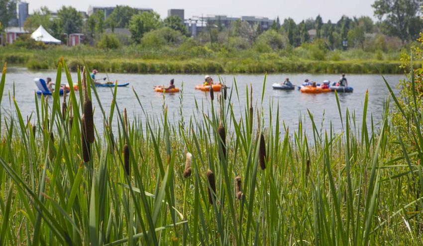
BEND PARK &
RECREATION DISTRICT

EXECUTIVE SUMMARY
     The Bend Park and Recreation District’s (district) Deschutes
     River Access and Habitat Restoration Plan is the guiding
     document for river access and habitat restoration for an
     approximate ten-year implementation timeframe. This
     plan addresses residents’ and visitors’ desire to recreate
     in the river, as well as improve riparian habitat along the
     river’s edge.

     With 25 district-designated access points, and nearly 100
     user-created access points, the plan sets out to address the
     complementary needs of improving access and habitat at
     14 riverfront parks owned or managed by the district. Two
     additional riverfront parks have design and construction
     projects already underway and are not addressed in this
     plan. The projects identified in this document are based
     upon the needs, desires and ideas identified by the
     community over a two-year public engagement process.
     The district used a data-driven approach, incorporating a
     number of data sources into the analysis.

                                                                    ABOVE: The South Canyon Reach

THE PLAN GOALS INCLUDE:

                      IDENTIFY AND PRIORITIZE PROJECTS THAT BALANCE HABITAT
                      RESTORATION AND USER ACCESS

                      IMPROVE AND CONSOLIDATE EXISTING ACCESS POINTS

                      ENGAGE DIVERSE STAKEHOLDERS TO INFORM THE PLAN

                      DEVELOP A FISCALLY SOUND IMPLEMENTATION PLAN

                                                    PAGE 4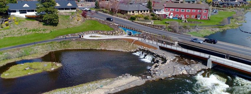
DESCHUTES RIVER ACCESS
                                                                  & HABITAT RESTORATION PLAN

The district acknowledges the unequal access to

                                                            “
parks, trails and programs that exists within the
community, and has considered how to promote
equity for all park users in this plan. While there is      The Deschutes River
more work to be done, this plan has made strides
towards addressing equitable access through
                                                            is such a treasure for
outreach to historically marginalized populations           Bend that how we
and by prioritizing projects in part, based on the          collectively decide
demographics of the surrounding communities.
                                                            to manage river
The planning process included three distinct
phases: data collection, project identification
                                                            access is essential
and analysis, and plan development. Community               to protect the
members provided input during each phase,
                                                            river, provide for
culminating in over 4,000 touchpoints with
residents including meetings, correspondence, and
survey participation. Also critical to the planning
                                                            recreation use and
                                                            enhance living for
                                                                                   “
process was the focus group - representing 14
community organizations, as well as district staff.
                                                            each of us.
The plan recommends 27 access and habitat
restoration projects. These projects include                Randy Welsh,
systemwide recommendations, as well as location             Bend resident
specific projects at 10 of the riverfront parks. Overall,   & focus group member
the projects balance the need for enhanced access
and habitat improvement, and will facilitate
accomplishment of the plan’s goals.

Projects are anticipated to be implemented over
approximately the next decade. While projects will
be funded through the district’s operating budget,
most projects will require support from outside
sources such as grants or community partnerships.
Projects in this plan are described at a conceptual
level and the feasibility of individual projects will be
studied further during project implementation. The
project list is anticipated to be a living document
that can be updated in response to changing
community preferences or project feasibility. When
appropriate, the district will seek additional input
from the community as it designs and implements
specific projects.

                                                   PAGE 5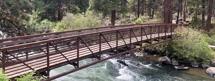
BEND PARK &
RECREATION DISTRICT

                                                                         ABOVE: River beach-goers at McKay Park.

1. INTRODUCTION
PLAN BACKGROUND
     The district owns or manages 16 parks within              The popularity of the river and associated
     the Deschutes River corridor, which include               intensive use has resulted in impacts such as
     eight miles of riverfront property, 17 miles of           trampled vegetation and erosion along the
     trails, 25 district-designated user access points,        riverbank. Population and tourism growth are
     and at least 94 additional user-created access            expected to add more use in the future and
     points. The considerable number of user-                  exacerbate the challenges being faced along
     created access points illustrates the popularity          this stretch of river. In addition, the district’s
     of the river and the fact that the riverfront parks       2018 Comprehensive Plan identifies “areas to
     and trails are some of the most beloved and               access the river” as a high community need.
     highly visited district amenities.                        Together, these data indicate the importance of
                                                               providing sufficient high-quality access points to
     The high level of river use is also evident when
                                                               both meet community needs while minimizing
     looking at the annual number of individuals
                                                               habitat impacts. The plan identifies access and
     who float through the Bend Whitewater Park,
                                                               habitat restoration projects that balance the
     which is adjacent to McKay Park and centrally
                                                               community and habitat needs.
     located within the plan’s project area. Specific
     data regarding the annual number of users who
     float this section of the river is provided below:

                              Year                                       Number of Floaters

                              2020*                                              205,360

                              2019                                               240,420

                              2018                                                251,485

                               2017                                               231,418

            *Changes in trail counter locations contributed to a lower number of river users counted in 2020.

                                                        PAGE 6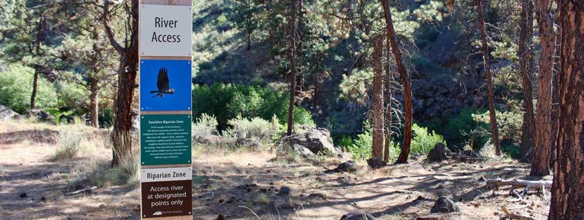
DESCHUTES RIVER ACCESS
                                                                                   & HABITAT RESTORATION PLAN

PLAN SCOPE
       This plan focuses on 14 parks the district owns or manages within the Deschutes River corridor. The
       plan doesn’t include analysis of projects at Drake and Pacific parks, as these parks are already the
       subject of an extensive capital project to address user access and habitat. Additionally, the district has
       easements over privately-owned land along some portions of the riverfront. These easement areas
       were not considered in the plan.

                                                                       “    As a participant in
                                                                            the River Planning
                                                                            Focus Group, I
                                                                            endeavored to be an
                                                                            advocate for people
                                                                            who experience
                                                                            disabilities; many
                                                                            of whom have
                                                                            encountered
                                                                            barriers which
                                                                            prevent them from
                                                                            accessing some of
                                                                            our community’s
                                                                            most popular
                                                                            destinations. This
                                                                            Plan not only serves
                                                                            as a benefit to the
                                                                            environment and
                                                                            its ecosystems, but
                                                                            it serves to make
                                                                            the rivers more
                                                                            accessible for all.
                                                                                                          “
                                                                            Brooke Eldrige,
                                                                            Central Oregon Coalition
                                                                            for Access

Right: Paddleboarders using the access point at Riverbend Park.

                                                           PAGE 7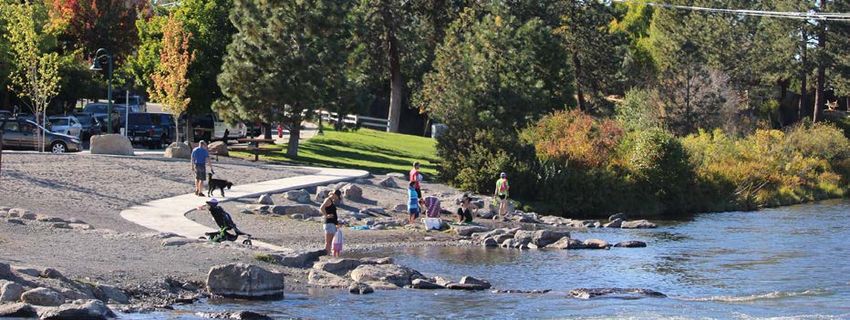
BEND PARK &
RECREATION DISTRICT

                                  I
            District Parks Along
           the Deschutes River                                       Riley Ranch Nature Reserve

                                                                                     Sawyer Park

                                                                                        Riverview Park

                                                       First Street Rapids Park

                                                                                    Pioneer Park
                                                             Brooks Park
                                                                                  Pacific Park
                                                       Pageant Park
                                                    Harmon Park
                                                                       Drake Park

                                               Columbia Park
                                                                      Miller’s Landing Park

                                                        McKay Park

                                                    Riverbend Park

                                                               Farewell Bend Park

                                   River Rim Park

     Map 1. District Parks Along the Deschutes River

                                                          PAGE 8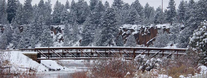
DESCHUTES RIVER ACCESS
                                                                                       & HABITAT RESTORATION PLAN

                              I
        River Access
      Points at each Park                                              Riley Ranch Nature Reserve          3   5

    25   Designated

    94   User-created

                                                                                        Sawyer Park        1 11

                                                                                           Riverview Park      1   1

                                                6 10     First Street Rapids Park

                                                                                       Pioneer Park        3
                                                         1 Brooks Park
                                                    1  Pageant Park
                                                                                    Pacific Park       1
                                                1   Harmon Park
                                                                         Drake Park     1 15
                                    1       1    Columbia Park
                                                                        Miller’s Landing Park      2
                                                     2    McKay Park

                                        1       8   Riverbend Park

                                                                  Farewell Bend Park    2 33

                               River Rim Park        1     6

Map 2. Designated and User-created Access Points at each River Park

                                                         PAGE 9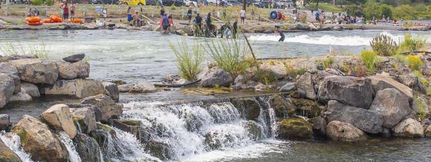
BEND PARK &
RECREATION DISTRICT

DATA-DRIVEN APPROACH
     This plan is based upon extensive outreach as discussed in Section 2, and relevant data. As a result,
     this plan is both reflective of community desires and data driven. Key data sources are summarized
     below:

        • Existing Conditions Assessments: an assessment was developed for each river park discussed
          in this plan. They are summarized in Section 3, and a complete set of existing conditions
          assessments is included as Appendix 2.

        • Inventory of Recreational Use at Parks on the Deschutes River, February 2020: this report
          is based on river use data collected at the 16 river parks over the 2019 summer. Data were
          collected from observation and surveys, inclusive of the number of visitors, types of use and trip
          characteristics. The full report is included as Appendix 3.

        • Deschutes River Habitat Inventory Summary Report, February 2020: this report is based upon
          habitat inventories for ten reaches over eight miles of district owned property. It includes
          inventories for all areas covered by this plan. The full report is included as Appendix 4.

        • Community Surveys: two non-statistically-valid community surveys were completed for this
          plan. Collectively, 1,692 responses were received for these surveys, which are discussed in Section
          2. A summary of the survey results is included as Appendix 5.

        • Demographic information: demographic information sourced from 2010 census data (as
          the 2020 census data was not available during plan development) helped inform project
          prioritization.

PLAN GOALS
     The following four goals guided plan development and will remain relevant throughout plan
     implementation.

        • Identify and prioritize projects that balance habitat restoration and user access: though
          habitat restoration and user access may seem to conflict, the plan sees them as synergistic. As
          opportunities are identified to consolidate and improve access, valuable land is made available
          to improve and protect habitat.

        • Improve and consolidate existing access points: currently at least 119 access points exist along
          an eight-mile stretch of the Deschutes River. Even with approximately 15 access points per mile,
          the community has expressed a desire for additional areas to access the river. To address this,
          the plan seeks to improve and consolidate access points to better serve the community.

        • Engage diverse stakeholders to inform the plan: this plan is based upon input from diverse
          stakeholders and includes an implementation plan that seeks to best meet the needs of the
          community and visitors.

        • Develop a fiscally sound implementation plan: the implementation of this plan will be funded
          by limited property tax monies, grants and partnerships. The identified projects are of a scope
          and quantity that enables the projects to be implemented over the plan’s implementation
          horizon.

                                                    PAGE 10
DESCHUTES RIVER ACCESS
& HABITAT RESTORATION PLAN
ABOVE: Participants in a Discover the Outdoors outreach event.
INCORPORATING
DIVERSITY, EQUITY AND INCLUSION
Ensuring equitable access to amenities and services is of utmost importance to the district. The
Deschutes River parks and trails are considered community-wide resources and the district strives to
provide access and an equitable experience for all visitors. The following measures were taken during
plan development to maximize input from a diverse range of constituents and to help ensure that
the plan supports the district’s equity goals.
• Representation: both the focus group and the interested parties list were inclusive and
representative of the community to the maximum extent feasible. As discussed in Section 2,
the focus group included a broad cross section of groups interested in river access and habitat,
including representatives for people with disabilities and the Latinx community. The interested
parties list originally included approximately 100 groups and individuals representing different
interests throughout the city, and the list grew over time to more than 300 as additional groups
and individuals expressed interest in the plan.
• Spanish Language Outreach: plan development included extensive efforts to reach a broad
cross section of the community including Spanish outreach and virtual and in-person meetings.
This outreach is further discussed in Section 2. In addition, the plan identifies projects to make
riverfront parks and trails more welcoming to the community through multi-lingual signage,
outreach and education.
• Equity Mapping: during the project evaluation process, the planning team considered racial or
ethnic category, age, disability, poverty, homeownership, population density and accessibility in
order to prioritize projects in proximity to potentially disadvantaged communities.
• Accessibility: physical improvements are critical to make parks and trails accessible for everyone
in the community. As part of the planning process, staff analyzed necessary accessibility
improvements at parks and trails. Recommended improvements include additional pathways,
changes to pathways, improved accessible water access, the addition of parking, and the
distribution of access points.
The district recognizes that there is more to be done to ensure that the Deschutes River parks are
inclusive spaces where all visitors feel welcome. The district will continue to seek input from a broad
range of constituents on significant projects as they are implemented.
PAGE 11BEND PARK &
RECREATION DISTRICT
2. PLANNING PROCESS
The sections below briefly describe the three phases of this two-year planning effort. At the time of
draft plan publication, staff have involved members of the public by hosting eight public meetings,
participating in 13 events or organized meetings, holding eight focus group meetings, responding
to 150 emails, sending 21 project updates, receiving approximately 1,700 survey responses, and by
participating in 13 media stories. In all, there were approximately 4,000 touchpoints with members of
the public during the planning process.
PHASE 1: DATA COLLECTION
The development of this plan was data driven. Extensive data collection and analysis was completed
prior to commencement of public engagement. In addition to the key data sources discussed in
Section 1, the planning team also gathered information from other agencies and applicable sources
to help inform the plan.
Public input was a critical component of the first phase of
the planning effort and included:
• Focus Group: Staff first engaged with over a dozen
stakeholders to get their feedback on how best
to approach plan development, and engage their
groups. As a result of these meetings, staff created a
diverse focus group to help guide plan development,
inclusive of representatives of 14 organizations. This
group includes representatives from natural resource
agencies, business interests, higher education,
environmental organizations, the City of Bend, universal
access organizations and recreational organizations.
• Community Survey 1: approximately 700 community ABOVE: The Deschutes River Trail
members shared comments through an online non- through Pioneer Park.
statistically-valid survey available in both English and
Spanish. The survey provided community members the
opportunity to provide general feedback on their use of the river and desired improvements.
• General Community Outreach: staff assembled an interested parties list of over 300 groups and
individuals to keep updated as the plan progressed. In addition, the project website, emails
to the interested parties list and broader community, and social media were used to keep the
public updated and engaged.
• Internal Team: the planning team discussed the plan and draft project list with over 30 staff
members including representatives from the Park Stewards, Natural Resources, Landscaping,
Recreation, Communications, and Planning and Development departments. Staff provided
insights on which projects may or may not be successful, and what additional projects should
be added to the draft project list.
• Board of Directors for the Bend Park and Recreation District (board): during this phase, the
planning team presented and sought feedback from board members at five board meetings.
These meetings were open to the public and public comment was welcomed. In their role,
board members communicate frequently with constituents to help inform their guidance and
decision making for the plan.
PAGE 12DESCHUTES RIVER ACCESS
& HABITAT RESTORATION PLAN
PHASE 2: PROJECT IDENTIFICATION AND ANALYSIS
Phase 2 focused on the identification and analysis of potential projects; key activities included:
• Focus Group: The focus group met eight times to identify a list of potential projects to address
river access and habitat restoration.
• Development of Evaluation Criteria: Staff and the focus group developed evaluation criteria to
help guide project priorities. These criteria are discussed in Section four.
• Community Survey 2: Nearly 1,000 community members commented on the draft project list
via an online non-statistically valid survey available in English and Spanish. This survey invited
community members to provide feedback on each of the potential projects, to rank projects
they felt were highest priority and to provide open-ended comments.
• General Community Outreach: The district hosted two online community meetings in English
and one in Spanish to discuss the draft project list and project priorities. The district also offered
to host meetings for any interested parties and hosted a virtual meeting for the River West
Neighborhood residents and presented to the Central Oregon Coalition for Access (COCA) at
their monthly meeting.
• Internal Team: District staff provided feedback on the feasibility of the draft project list.
• Board: during this phase, the planning team presented and sought feedback from board
members at three board meetings to share the project status, draft project list, and community
input.
PHASE 3: PLAN DEVELOPMENT
As a result of community input in phase 2, as well as additional staff analysis, the project list was
modified and incorporated into this draft plan. The draft plan will be available for public, focus group,
staff and district board review. A final plan will follow, and will be presented to the district board
for approval. If approved, project implementation would begin immediately and is expected to be
completed over an approximate ten-year period.
ABOVE: Riverfront at Columbia Park.
PAGE 13BEND PARK &
RECREATION DISTRICT
ABOVE: River frontage along the Old Mill District, between Riverbend Park and McKay Park.
3. EXISTING CONDITIONS
SUMMARY
SYSTEMWIDE
The river parks make up a system offering various experiences and geographic locations to enjoy river
recreation. The planning team gathered information on the 16 riverfront parks owned or managed
by the district to understand the existing offerings and for insights into the comparative potential
locations for different project opportunities. In addition to the 16 Deschutes River parks, nearby river
recreation opportunities also exist upriver in the Deschutes National Forest at the Rim Rock Trailhead
area (which includes an extensive off-leash dog area with water access), downriver at Tumalo State
Park, and along Tumalo Creek within Shevlin Park.
As depicted on the Deschutes River Access Map, nearly every river park provides river access and most
access points are used for multiple types of river recreation; few are single-use access points. Types of
river recreation shown on the map include: wheelchair access to the river, beach access, paddlecraft
launch, wading, fishing, wildlife viewing, and dog off-leash access. The icons indicate where each type
of use frequently occurs, however, access points are not limited to these activities. Restroom locations
are also identified on the map.
PAGE 14I
Deschutes River
Access Map
HW
Y2
97 0
Restroom
H WY
OB
RIL
Beach Access
EY
RD
NW
Hand Launch / Paddlecraft MT
BOYD ACRES RD
WA
SH
INGTON
Wading
DR
Fishing
Wildlife Viewing
NW
SH
E
Wheelchair Access
VLI
NE DIVISION
N PAR
Dog Park
KR
D
NE 8TH ST
River Rim Park
NE 4TH ST
Farewell Bend Park
Riverbend Park
NW 14TH
ST
NE GREENWOOD AVE
L
AL
W
D
McKay Park SR
ER
IN NE FRANKLIN AVE
K YL
S
3RD
Miller’s Landing Park
COLORADO
Columbia Park
Drake Park
S
T
ND
SE 9T
Harmon Park
BO
SW
HS
T
Pageant Park SE R
EED
MAR
KET RD
Brooks Park
Pacific Park
Pioneer Park DR POWERS RD
Y
TUR
C EN
First Street Rapids Park
Riverview Park
BROOKSWOOD BLVD MURPH RD
Sawyer Park Y
Riley Ranch Nature Reserve
Map 3. Deschutes River Access Map
Please note that the map is to be used only for analysis purposes, and should not be considered a marketing map.
For example, River Rim Park is a launch location for expert whitewater kayakers, as extreme whitewater conditions
exist downriver.BEND PARK &
RECREATION DISTRICT
PARK SPECIFIC CONDITION SUMMARIES
In addition to looking at the riverfront parks as a whole, characteristics of each park were gathered,
including physical characteristics, facilities and uses, site history, planned projects, systemwide
context, site context, and opportunities. This information aided the planning team and focus group
in identifying potential projects. The key conditions are summarized below and the full information is
available in Appendix 2.
River Rim Park
River Rim Park is a small natural area nestled in a residential neighborhood. This park is most
frequently visited by people walking dogs, fishing or wading, and whitewater kayaking. The river in
this section is fast moving with whitewater downriver. While the park sees lower numbers of visitors
than most other river parks, increased use has still contributed to deterioration of the riparian habitat
and there are opportunities to focus user access and improve riparian habitat.
Farewell Bend Park
As part of the planning process, Farewell Bend Park was categorized
into two distinct sections, each with different characteristics. Upriver
of the Bill Healy Bridge (south), the park has a more natural setting
that feels removed from Bend’s urban environment. In this section,
the Deschutes River Trail is a natural surface single-track trail and
there are many user-created access points to the river. This section
includes the Cedarwood trailhead, which is used by hikers as well
as those wishing to launch or remove paddlecraft. Opportunities
include focusing use to a smaller number of improved access points
and protecting and enhancing riparian habitat in other areas.
Downriver of the Bill Healy Bridge (north), the park is developed
with a playground, picnic shelter, and restrooms, as well as a
beach access and small canoe launch. A habitat restoration
project was completed adjacent to the boardwalk in partnership
with the Upper Deschutes Watershed Council (UDWC) in 2003.
Opportunities in this section include addressing erosion and
accessibility at the beach, addressing erosion at the canoe launch,
and protecting and enhancing habitat areas.
ABOVE: The Deschutes River Trail
Riverbend Park
through Farewell Bend Park. For the purposes of this plan, Riverbend Park was categorized into
two distinct sections. Upriver of the footbridge, the UDWC and the
district are coordinating on the design and construction of a habitat restoration and access project.
Downriver of the pedestrian bridge, habitat restoration was completed in select areas in 2006. In
2009 a large sloped area was developed into a beach and is a highly used access point, which was
further improved in 20197 to address erosion. Currently, the Ride the River shuttle service provides
alternative transportation to the park, and a concessioner offers tube and stand-up paddleboard
rentals. The district also leases two additional parking lots close to Riverbend Park that provide
additional parking for river users. There are opportunities to improve accessibility to the river.
McKay Park
In 2015, McKay Park was redeveloped with the addition of the Bend Whitewater Park. The
park’s access points are heavily used for floating, paddling, surfing and wading. Due to its recent
redevelopment, the park may have opportunities for smaller projects to improve visitor experience.
PAGE 16DESCHUTES RIVER ACCESS
& HABITAT RESTORATION PLAN
ABOVE: Park visitor on the Deschutes River Trail at Miller’s Landing Park.
Miller’s Landing Park
Miller’s Landing is surrounded by older neighborhoods and is directly across the river from McKay
Park. It offers access to the river from a boardwalk and at an open spot in the fencing downriver from
the boardwalk. There is potential to consolidate and enhance the existing access points, address
erosion and improve habitat.
Columbia Park
Columbia Park has one designated river access point that was developed in 2011 as a small
paddlecraft hand launch. It may be accessed from a combination of paved and natural surface trails
descending from the playground area, or from across the river via a pedestrian bridge. The access
point has severely eroded and was temporarily closed starting in the summer of 2020. Additionally, a
user-created access point immediately adjacent to the designated access point is also seeing erosion
and vegetation trampling. Illegal bridge jumping occurs at the city-owned pedestrian bridge, with
jumpers exiting the river at Columbia Park. The district is working with city staff on the feasibility
of installing bridge jumping deterrents to discourage jumping. Opportunities exist to address the
erosion and consolidate and enhance access.
Drake Park and Pacific Park
The Drake Park Bank and Trail improvements project defines changes to be made at Pacific and
Drake parks, including river access and habitat restoration elements. Since this project is underway,
additional projects at these parks do not need to be considered in this plan.
Harmon Park
Harmon Park’s river access is a small, gated (but unlocked) dock located along a paver pathway. The
remaining river frontage has a chain link fence providing a barrier between the river and playground
and ballfields. There is an opportunity to make the dock more visible and welcoming to visitors.
Pageant Park
Pageant Park’s river access is a small dock located in a grassy lawn near the pedestrian bridge to
Drake Park. The river access is in good condition. With limited parking availability, a small park
footprint, and nearby improvements planned at Drake Park, the park is not in need of river access and
habitat changes.
PAGE 17BEND PARK &
RECREATION DISTRICT
ABOVE: River access point at Riverbend Park..
Brooks Park
Brooks Park has a memorial plaza and dock to access the river. The access point is the farthest
downriver point on Mirror Pond. Because the river access is in good condition, projects to change
access or habitat are unnecessary during the plan’s implementation timeframe.
Pioneer Park
The Deschutes River Trail runs through Pioneer Park separated from the river by a stone retaining wall
and is surrounded by managed turf. While opportunities exist to improve riparian habitat at Pioneer
Park, the park is between two dams and any projects should be linked with any future changes to the
dams and water levels, which will most likely occur beyond the plan’s implementation timeframe.
First Street Rapids Park
First Street Rapids Park runs along river right and river left and is popular for river access and the
Deschutes River Trail. The park also offers fishing, wildlife watching and a nature play area. Due to its
popularity, the area has erosion and vegetation trampling. Opportunities exist to focus visitor use, add
plantings and protect existing habitat.
Riverview Park
Riverview Park is located on public right-of-way owned by the city, but the park is managed by the
district. The park includes a fishing boardwalk and sees low use. Riverview Park was developed to
provide views of the river and accessible fishing in partnership with Bend’s Lions Club. The path to
the boardwalk does not meet accessible grade and is in poor condition. Improving the path is not
included in the plan and should be reconsidered in partnership with the City of Bend when the Core
Area Plan is implemented, which will likely increase use of the park.
Sawyer Park
Sawyer Park sees high use in the summer. River access includes a fishing and wildlife viewing trail
upriver on river left; and several user-created access zones downriver of the footbridge on river left
and river right. While some access points are naturally armored with rocks, others are seeing erosion
and vegetation trampling. Opportunities exist to protect riparian habitat and focus and enhance
access.
Riley Ranch Nature Reserve
Riley Ranch was completed in 2017 and is the largest of the Deschutes River parks at 185 acres. The
river may be accessed from the lower trail system that is more than a mile from the park entrance.
Specific access points have been developed to the river to protect the banks and riparian zones.
Because it is a nature reserve, dogs and bikes are prohibited, and groups are limited in size. Although
the park was more recently developed, there are still opportunities to improve existing access points
and possibly provide additional river access at highly desired locations.
PAGE 18DESCHUTES RIVER ACCESS
& HABITAT RESTORATION PLAN
ABOVE: NW Galveston Avenue bridge over the Deschutes River at the southern boundary of Drake Park.
ABOVE: Summer river recreation from the habitat channel of the Bend Whitewater Park.
ABOVE: A snow-covered Deschutes River Trail bridge crossing between Farewell Bend and Riverbend parks.
PAGE 19BEND PARK &
RECREATION DISTRICT
4. RECOMMENDED
PROJECTS AND PRIORITIES
This plan recommends 27 projects within the Deschutes River Corridor. These projects include
systemwide projects, as well as location-specific projects. This section discusses the process for the
development of the project list, as well as the evaluation criteria used to determine project viability
and priority.
PROJECT LIST DEVELOPMENT
Public input was critical in the development of the project list. Development of the list spanned more
than a year and was driven by feedback from the board, focus group, community and district staff.
This section describes how the project list was developed and refined based on project feasibility,
staffing and budget constraints, and viability for implementation within the plan’s implementation
timeframe.
• Preliminary Project List: the focus group developed the preliminary project list over the course
of four meetings. At these meeting, the focus group reviewed the 14 river parks and generated
a total of 78 project ideas. Through discussion and ranking, the focus group worked to achieve
consensus on the project list.
• District Staff and Community Input: the preliminary project list was reviewed with more than
30 staff members who provided feedback on the suggested projects, and also generated 15
additional project ideas. In addition, the planning team received two suggested project ideas
from the community. As a result of focus group, district staff and community input, a total of
95 project ideas were generated over the course of eight months. Some of these project ideas
were combined, and at the end of this initial project list development process 86 project ideas
remained.
ABOVE: Habitat Channel at the Bend Whitewater Park.
PAGE 20DESCHUTES RIVER ACCESS
& HABITAT RESTORATION PLAN
ABOVE: Kayakers on the Deschutes River along the Deschutes River Trail and Farewell Bend Park.
• Planning Team Project List Analysis: the planning team reviewed all suggested projects with
a goal of focusing the project list to include the best and most feasible projects that could be
implemented within the plan’s implementation timeframe. Analysis of all 86 project ideas
resulted in 53 projects being deemed considered but dismissed, with a total of 33 projects
remaining. Reasons for project dismissal included a determination that they were outside of
the plan’s scope, were maintenance projects that would be completed outside of the plan’s
implementation, infeasible within the plan’s implementation timeframe, added to another
project on the list, or inconsistent with the goals of the plan. A full list of considered but
dismissed projects is included as Appendix 6.
• Public Review: the refined project list of 33 projects was presented for public input to further
inform the draft project list. This review included a non-statistically-valid community survey
soliciting feedback on all project ideas, which received nearly 1,000 responses, as well as three
virtual public meetings. The input received from the community was invaluable and after board
support for project list changes resulting from public input, the project list was further refined
resulting in a total of 28 projects, which were shared with the public in May 2021.
• Plan Development: during development of the draft plan, the projects were further refined and
consolidated, resulting in a total of 27 projects.
The 27 projects were prioritized to help focus plan implementation.
PAGE 21BEND PARK &
RECREATION DISTRICT
ABOVE: Deschutes River Trail bridge in the South Canyon Segment.
PROJECT PRIORITIZATION
To prioritize projects, the district developed evaluation criteria based upon the plan’s goals. The
evaluation criteria included the following factors:
• Would the project protect, create or enhance habitat?
• Would the project improve existing access or create a new access point?
• Would the project be eligible for grants and partnerships?
• Would the project advance equity in the community?
• Would the project address expressed community needs?
• Would the project address safety and facility risks?
The evaluation of the projects included numeric rankings based upon how well the project addressed
the above-mentioned criteria. Results of the evaluation established a threshold for high, medium and
low priorities based upon the natural break in the scores. Of the 27 potential projects, 12 were ranked
high priority, 11 were ranked medium priority and four were ranked low priority.
The results of the evaluation process are not intended to be a strict prescription of the order in which
projects should be developed, but rather help inform when each project should be considered for
funding in the district’s Capital Improvement Plan (CIP).
The priorities are designed to be flexible in order to accommodate changes in the market and
demographics, changes in the projects themselves, and to be able to take advantage of opportunities
as they arise. Ultimately, the district’s board has the final decision-making authority about when
projects proceed.
PAGE 22DESCHUTES RIVER ACCESS
& HABITAT RESTORATION PLAN
IDENTIFY PROJECTS
DATA COMMUNITY ANALYSIS
COLLECTION NEEDS
EVALUATION CRITERIA
Would the project protect, create or enhance habitat?
Would the project improve existing access or create a
new access point?
Would the project be eligible for grants and
partnerships?
Would the project advance equity in the community?
Would the project address expressed community needs?
Would the project address safety and facility risks?
PRIORITIZE PROJECTS
HIGH
MODERATE
PRIORITY LOW
PRIORITY
PROJECTS PRIORITY
PROJECTS
PROJECTS
PAGE 23BEND PARK &
RECREATION DISTRICT
ABOVE: Dog swimming in the dog off-leash area with river access near Riverbend Park.
DOG OFF-LEASH RIVER ACCESS
Dog off-leash river access required additional analysis given the numerous factors that inform
optimal locations for dog off-leash river access. This is a topic that many communities address, and
a summary of research related to other jurisdictions and dog off-leash water access can be found
in Appendix 7. This section discusses the analysis that was completed to help inform appropriate
locations for this type of use.
A total of 20 potential dog off-leash river access locations were analyzed during development of the
project list. These 20 sites included nine identified by DogPAC (a local Bend non-profit organization
that focuses on dog access and education), and eleven identified by the planning team or focus
group (including seven permanent locations and four seasonal locations). More details on all of these
sites are included in Appendix 7. The planning team and focus group developed 11 criteria to help
evaluate the sites including:
1. River current and dog safety: slow, moderate, fast and any characteristics that impact dog safety
2. Existing bank material: soil, vegetation, riprap, seawall, etc.
3. River Width: narrow, moderate, wide
4. Bank Slope: gradual, moderate, steep
5. Current streamside habitat condition: none, poor, moderate, good (consider access point and
immediate surroundings)
6. Endangered Species Act (ESA) Critical Habitat: yes, no
7. Parking availability/ease of access: low, medium, high
8. Potential conflict with other visitors: distance from parking to the dog off-leash river access,
congestion, kids, etc.
9. Existing level of dog use: low, moderate, high
10. Proximity to neighboring properties: describe distance from the neighbors upriver, downriver
and across the river
11. Project complexity: low, moderate, high
PAGE 24DESCHUTES RIVER ACCESS
& HABITAT RESTORATION PLAN
ABOVE: Dogs using the dog off-leash area with river access near Riverbend Park.
These criteria were used to evaluate the potential dog off-leash river access sites and helped to
identify opportunities and constraints associated with each site. The expressed goal of DogPAC was
to identify a total of at least three sites, one each in the northern, central and southern portions of
the plan area. However, after extensive review and consultation with district staff and a number of
outside agencies, the planning team was only able to identify one potential permanent dog off-leash
river access at Riverbend Park (location to be confirmed), one seasonal dog off-leash river access at
Riverbend Park beach, and one seasonal off-leash river access at Farewell Bend Park beach. These
three locations were presented as potential options during the public outreach process to garner
feedback on the draft project list. The seasonal dog off-leash river access locations were not well
favored by the public or DogPAC and as such, these locations are not included in the draft plan.
Though the planning team hoped to identify more than one dog off-leash river access location, based
upon the plan’s goals and identified challenges, this was not feasible. Some of the key challenges
include:
• Potential impacts to Endangered Species Act (ESA) critical habitat, riparian habitat and water
quality: both dogs and humans can impact habitat by creating bank erosion and damaging
vegetation. In addition, dogs relieving themselves in inappropriate locations will have negative
impacts to water quality.
• Potential impacts to wildlife: research has documented that that people with dogs, on- or off-
leash, are more detrimental to wildlife than people without dogs.1
• Conflicts with other user groups: the majority of the identified locations are already used by
numerous different user groups. Introducing a new user group that requires a designated area
focused on a single use type could result in reduced opportunities and conflicts for other users.
• Conflicts with neighboring uses: many of the identified locations are proximate to private
property and residential uses.
• Space constraints: though the plan covers eight miles of riverfront parks, many of the parks
are not of significant depth and create challenges for meeting the needs of multiple and
sometimes conflicting user groups.
1. Metro Parks and Nature. “The impacts of wildlife and water quality: A literature review.” April 2016.
PAGE 25BEND PARK &
RECREATION DISTRICT
PROJECT LIST
The following pages discuss each of the 27 projects starting with systemwide projects, and then
by park location, upriver to downriver. Project scope is high level at this time and may be adjusted
based upon opportunities and/or challenges identified in the design and construction process. The
following information is provided for each project.
• Project Title
• Project Number
• Park Name
• Description of the Project
• Priority: based upon the evaluation criteria discussed above and shown as high, medium or
low
• Planning and Design Level of Effort: based upon the amount of time, effort and complexity
associated with planning and designing the project and shown as high, medium or low
• Estimated Design and Construction Costs and shown as:
• $ (< $5,000)
• $$ ($6,000-$50,000)
• $$$ ($51,000-$300,000)
• $$$$ (>$301,000)
These projects are in addition to projects identified in the district’s comprehensive plan, the district’s
capital improvements plan, the city’s transportation system plan, and other local plans. However, it is
anticipated that these projects will be incorporated into the district’s comprehensive plan and capital
improvement plan in future years.
General project locations are identified are identified on Map 4—Project Locations Map. More detailed
maps and existing site images for all projects sites are included as Appendix 8.
“ Growing up here in the 1970s and 80s, I never
could have imagined the massive growth in
recreation along the Deschutes River as it flows
through Bend. My hope is this river plan will
help mitigate some of the negative effects of
such heavy use, so that future generations can
“
still enjoy the river as much as I have.
Aaron Henson,
Bend resident & focus group member
PAGE 26DESCHUTES RIVER ACCESS
& HABITAT RESTORATION PLAN
ABOVE: River Access Signage at Riley Ranch Nature Reserve.
ABOVE: Visitors at the McKay Park beach and access point.
ABOVE: Trail runner on the Deschutes River Trail - South Canyon Segment.
PAGE 27BEND PARK &
RECREATION DISTRICT
PROJECT PARK NAME PROJECT TITLE
NUMBER
1 Systemwide Consistent Signage
2 Systemwide Outreach and education
3 Systemwide Volunteer ambassador program
4 Systemwide Adopt-a-trail program
5 River Rim Park Consolidate access/protect habitat
6 River Rim Park Enhance experience
7 River Rim Park Modify trail
8 Farewell Bend Park - South Consolidate/Improve Access
9 Farewell Bend Park - South Trail access
10 Farewell Bend Park - Cedarwood Trailhead Trail access
11 Farewell Bend Park - North Parking analysis
12 Farewell Bend Park - North Parking improvements
13 Farewell Bend Park - North Habitat restoration
14 Farewell Bend Park - North Improve access
15 Farewell Bend Park - North Beach enhancements
16 Farewell Bend Park - North Evaluate restoration
17 Riverbend Park Improve beach accessibility
18 Riverbend Park Off-leash dog water access
19 McKay Park Plant trees
, Refine access
20 Miller s Landing Park
21 Columbia Park Refine access
22 Harmon Park Improve dock
23 First Street Rapids Park - River Left Close access points
24 First Street Rapids Park - River Right Consolidate/Improve Access
25 Sawyer Park - River Left Consolidate/Improve Access
26 Sawyer Park - River Left Trail refinement
27 Riley Ranch Nature Reserve Create access
PAGE 28DESCHUTES RIVER ACCESS
& HABITAT RESTORATION PLAN
Proposed Projects
Tumalo
State
Projects 1-4 are systemwide Park
projects and are not COOLEY RD
displayed on map
Rockridge
Riley Ranch Park
18TH ST
Nature Pine
27 Reserve Nursery
Park
OB
RIL
E
EM
Y RD
RD
R P IR
E
N
D
26 A BUTLER MARKET
TO Archie Briggs
NG
VE
HI Canyon
Shevlin Park 25
WAS
Natural Area Sawyer Park
T
M
SH
EV
L
IN
Al Moody Park
Big Sky Park
PA R
23
K
RD
24
4TH ST
Hollinshead
8TH ST
Discovery
Park NEFF RD
Park
NEW PORT
AV
22 E Pilot
Juniper Park Butte
S RD
ER State Park
Y LIN
SK
21 20
BEAR CREEK RD
19 Ponderosa
Park
Riverbend
17 18 Park
Skyline Park 11 12 13 14 15 16 Larkspur Park
10
REED MARKET RD
Farewell 8 9
R Bend Park
YD
15TH ST
UR
NT
27TH ST
CE
5 6 7
VD
BLO O KS W OOD
D
R
TT
O
KN
R
B
I
# Proposed Project District Boundary
Existing Trail Urban Growth Boundary
USFS Trail BPRD Property 0 0.5 1 Miles
Tumalo Creek State Park
Deschutes River Deschutes National Forest June 2021
Bend Park & Recreation District
Golf Course
Map 4. Project Locations Map
PAGE 29BEND PARK &
RECREATION DISTRICT
1 Project: Systemwide
Consistent Signage
Priority: High Implement a consistent signage and educational
approach for all district river access properties. This
High
Planning & should include multi-lingual signage. Kiosks with
Design effort: Low information about river and riparian zone restoration
and protection would be useful at some river parks
Relative cost: $$
2 Project: Systemwide
Outreach and education
Priority: High Provide outreach and education with partners to
make parks more welcoming to all. Riverbend and
High
Planning & Harmon parks were identified as potential locations
Design effort: Medium
Relative cost: $$
3 Project: Systemwide
Volunteer ambassador program
Priority: High Expand volunteer ambassador program to include
high use river parks
High
Planning &
Design effort: Low
Relative cost: $
4 Project: Systemwide
Adopt-a-trail program
Priority: High Expand the adopt-a-trail program to support the
use of designated trails along the river
High
Planning &
Design effort: Low
Relative cost: $
5 Project: River Rim Park
Consolidate access/protect habitat
Priority: Medium Consolidate access to 1 or 2 access points to protect
Medium
and enhance remaining sensitive habitat, and armor
Planning & those areas to reduce erosion. Improve safety and
Design effort: Medium aesthetics of irrigation station
Relative cost: $$$
PAGE 30DESCHUTES RIVER ACCESS
& HABITAT RESTORATION PLAN
6 Project: River Rim Park
Enhance experience
Priority: Low Designate a loop trail to direct visitors. Add seating
as appropriate
Low
Planning &
Design effort: Medium
Relative cost: $
7 Project: River Rim Park
Modify trail
Priority: Low Modify steep trail to be more sustainable, make
drainage improvements
Low
Planning &
Design effort: Low
Relative cost: $$
8 Project: Farewell Bend Park - South
Consolidate/Improve Access
Priority: High Determine which of the existing 35 (including 6
at Cedarwood Trailhead) access points should be
High
Planning & improved and which should be closed. Implement
Design effort: High applicable projects
Relative cost: $$$$
9 Project: Farewell Bend Park - South
Trail access
Priority: Medium Improve access from the sidewalk on the
Medium
southeastern side of the Bill Healy bridge to the
Planning & Deschutes River Trail
Design effort: High
Relative cost: $$
10 Project: Farewell Bend Park - Cedarwood Trailhead
Trail access
Priority: Medium Formalize the trail leading to the Deschutes River
Medium
Trail and restore surrounding areas
Planning &
Design effort: Low
Relative cost: $$
PAGE 31BEND PARK &
RECREATION DISTRICT
11 Project: Farewell Bend Park - North
Parking analysis
Priority: Medium The district shall complete a parking analysis for
Medium
parking proximate to Farewell Bend and Riverbend
Planning & Parks to determine how best to adequately address
Design effort: Medium parking needs for these parks
Relative cost: $$
12 Project: Farewell Bend Park - North
Parking improvements
Priority: Medium If supported by the parking analysis, the district
Medium
should increase parking for park users by changing
Planning & parallel parking to angled parking. In addition, a
Design effort: High loading zone should be added.
Relative cost: $$$$
13 Project: Farewell Bend Park - North
Habitat restoration
Priority: Medium Close fence gaps at the picnic shelters to eliminate
Medium
user-created access points and reestablish habitat
Planning &
Design effort: Low
Relative cost: $
14 Project: Farewell Bend Park - North
Improve access
Priority: High Improve existing canoe launch to address erosion
High
Planning &
Design effort: Medium
Relative cost: $$
15 Project: Farewell Bend Park - North
Beach enhancements
Priority: Medium Address erosion at the beach, including exploring
Medium
alternatives to sand, while also maintaining a
Planning & portion of sandy beach area. Improve accessibility to
Design effort: Medium the water at the beach
Relative cost: $$$
PAGE 32DESCHUTES RIVER ACCESS
& HABITAT RESTORATION PLAN
16 Project: Farewell Bend Park - North
Evaluate restoration
Priority: Medium The district should evaluate additional restoration
Medium
options to enhance the existing wetland restoration
Planning & project adjacent to the boardwalk, to improve
Design effort: Medium conditions for the Oregon Spotted Frog and other
species. Implement, as applicable.
Relative cost: $$
17 Project: Riverbend Park
Improve beach accessibility
Priority: High Improve beach accessibility including addition of an
accessible boat launch. Enlarge beach as necessary
High
Planning & to allow for multiple uses.
Design effort: High
Relative cost: $$$$
18 Project: Riverbend Park
Off-leash dog water access
Priority: High Provide permanent off-leash dog water access with
the exact location to be determined
High
Planning &
Design effort: High
Relative cost: $$$$
19 Project: McKay Park
Plant trees
Priority: Medium Plant trees along the fish ladder section (floater
Medium
channel) within the fenced area to provide shade
Planning &
Design effort: Low
Relative cost: $$
20 Project: Miller›s Landing Park
Refine access
Priority: High Close and revegetate existing downriver access,
while redesigning the boardwalk access for safety
High
Planning & and improved access
Design effort: Medium
Relative cost: $$$
PAGE 33BEND PARK &
RECREATION DISTRICT
21 Project: Columbia Park
Refine access
Priority: High Improve existing designated access point to facilitate
safe access and improve the bank stability and
High
Planning & riparian environment. Close downriver user-created
Design effort: High access point by replacing single-rail fence with more
protective fence to eliminate user-created access and
Relative cost: $$$$
improve vegetation in flattened grass area
22 Project: Harmon Park
Improve dock
Priority: Low Improve the dock so it’s more stable and provides
easier access in and out of the water
Low
Planning &
Design effort: Low
Relative cost: $$
23 Project: First Street Rapids Park - River Left
Close access points
Priority: High Close user-created access points to protect
vegetation and protect trail. Scope will include
High
Planning & addition of fencing and revegetation
Design effort: Medium
Relative cost: $$
24 Project: First Street Rapids Park - River Right
Consolidate/Improve Access
Priority: Medium Evaluate consolidation and improvement of access
Medium
points on river right and implement applicable
Planning & projects
Design effort: Low
Relative cost: $$
25 Project: Sawyer Park – River Left
Consolidate/Improve Access
Priority: Medium Armor 1-2 access points and close other redundant
Medium
access points along the Fisherman’s Trail
Planning &
Design effort: Low
Relative cost: $
PAGE 34DESCHUTES RIVER ACCESS
& HABITAT RESTORATION PLAN
26 Project: Sawyer Park Park - River Left
Trail refinement
Priority: Medium Define trail system, and eliminate duplicate and
Medium
social trails on river left
Planning &
Design effort: Low
Relative cost: $
27 Project: Riley Ranch Nature Reserve
Create access
Priority: Low Designate 1-2 additional access points where high
use is observed
Low
Planning &
Design effort: Low
Relative cost: $
PAGE 35BEND PARK &
RECREATION DISTRICT
5. IMPLEMENTATION PLAN
AND NEXT STEPS
This section outlines timing, potential funding sources, permitting requirements, and future public
engagement for projects identified in this plan.
TIMING
Projects within the plan are intended to be implemented over approximately the next ten years. As
with any long-range plan, certainty decreases over time, and opportunities and challenges may arise
with implementation. On an annual basis, projects within this plan will be considered for addition to
the district’s capital improvement plan, asset management plan, and operating workplans. Staff will
monitor plan accomplishments annually, and may make adjustments as necessary.
FUNDING
These projects will be funded primarily by property taxes. Many of these projects will additionally
require some element of partnership and/or grant funding. Due to this, plan implementation is
contingent upon identifying successful partnerships and/or grants. Potential funding sources for
these projects are discussed below:
• General Fund: The general fund is the district’s general operating fund, and accounts for nearly
all district operations. Principal sources of revenue are property taxes, user fees and charges,
interest income, grants and contributions. Primary expenditures are personnel, materials and
services necessary to provide quality services for the community. Property taxes are the largest
source of revenue for the district and are allocated annually to the CIP to fund the improvement
of existing facilities and maintenance. The CIP is a five-year plan that is reviewed annually
with funding allocated as part of the district’s annual budget. Funding for projects will be
incorporated into the CIP based upon project priority, staffing availability, permitting timeframes
and other capital project priorities.
• Grant Funds: Grants will be a critical element in facilitation of plan implementation. There are
numerous grants that may be appropriate funding sources. Some potential grants include:
• Oregon State Marine Board (OSMB) - potential grants from OSMB include Waterway Access
Grants and Small Grants. These grants could be used for facility improvements and new
construction.
• Oregon Parks and Recreation Department (OPRD): potential grants from OPRD include
Land and Water Conservation Funds and Local Government Grants. These types of grants
could be used for acquisition and/or development or redevelopment of river parks.
• Oregon Watershed Enhancement Board (OWEB): potential grants from OWEB include
technical assistance grants that support project design and restoration grants that can
support project implementation. These types of grants would be for projects focused on
restoration, or that include a restoration component.
PAGE 36You can also read