United States Department of the Interior - US Fish and Wildlife ...
←
→
Page content transcription
If your browser does not render page correctly, please read the page content below
United States Department of the Interior
                                Fish and Wildlife Service
                            Arizona Ecological Services Office
                             9828 North 31st Avenue, Suite C3
                                 Phoenix, Arizona 85051
                      Telephone: (602) 242-0210 Fax: (602) 242-2513
In reply refer to:
AESO/SE
02EAAZ00-2019-F-1018

                                           May 7, 2020

Karla S. Petty
Division Administrator, Arizona Division
Federal Highway Administration
4000 North Central Avenue, Suite 1500
Phoenix, Arizona 85012-3500

RE:    Verde Connect Project
       FHWA File # YYV-0(209)Z

Dear Ms. Petty:

Thank you for your request for formal consultation/conference with the U.S. Fish and Wildlife
Service (FWS) pursuant to section 7 of the Endangered Species Act of 1973 (16 U.S.C. 1531-
1544), as amended (Act). We received your request via electronic mail (email) on November 25,
2019, along with the biological assessment (BA) for the project, dated November 2019. The
Federal Highway Administration (FHWA) is the lead federal agency for this project, which also
includes project associated actions by the Army Corps of Engineers (ACOE) (404 permitting);
and U.S. Forest Service (USFS) (Forest Plan updates including right-of-way [ROW]) addressed
by this consultation. At issue are effects that may result from the proposed “Verde Connect”
roadway and bridge across the Verde River, in Yavapai County, Arizona.

You determined, following our input and changes to proposed rules (see Consultation History),
that the proposed action “may affect, and is likely to adversely affect” the endangered
southwestern willow flycatcher (Empidonax traillii extimus) (flycatcher), threatened western
yellow-billed cuckoo (Coccyzus americanus) (cuckoo), and threatened northern Mexican
gartersnake (Thamnophis eques megalops). You also concluded the proposed action “may
affect, and is likely to adversely affect” flycatcher designated critical habitat, and proposed
critical habitat for the northern Mexican gartersnake and cuckoo.

In addition, you determined that the proposed action “may affect, but is not likely to adversely
affect” the narrow-headed gartersnake (Thamnophis rufipunctatus), threatened Mexican spotted
owl (Stix occidentalis lucida) (owl), and three endangered fish species and their designated
critical habitats: razorback sucker (Xyrauchen texanus) (sucker), spikedace (Meda fulgida), and
loach minnow (Tiaroga cobitis).
Karla S. Petty, Division Administrator                                                                2

You also determined that the proposed action would have “no effect” on the Arizona cliffrose
(Purshia subintegra), Gila chub (Gila intermedia), woundfin (Plagopterus argentissimus), and
narrow-headed gartersnake proposed critical habitat. No effect determinations do not require our
review and are not addressed further.

This biological opinion and conference opinion is based on information provided in the
November 2019 and January 2020 BAs, subsequent BA addendums, telephone conversations,
field investigations, and other sources of information. Literature cited in this biological and
conference opinion is not a complete bibliography of all literature available on the species of
concern, effects of road and bridge construction, or on other subjects considered in this opinion.
A complete record of this consultation is on file at this office.

Consultation History

November 25, 2019      We received your BA and request for formal and informal consultation
                       and conference for the project.

December 18, 2019      We sent you our review of the BA.

December 19, 2019      We sent a 30-day letter indicating that all information required to initiate
                       consultation was in the BA or otherwise available for our reference.

January 21, 2020       We received your revised BA, dated January 17, 2020, incorporating our
                       guidance on conservation measures. You also changed your determination
                       for the Arizona cliffrose from “may affect, not likely to adversely affect,”
                       to “no effect,” and your narrow-headed gartersnake determination from
                       “likely to adversely affect,” to “not likely to adversely affect.”

February 7, 2020       You sent an erratum to the BA correcting acreages for permanent
                       vegetation removal caused by bridge piers.

February 27, 2020      We published a proposed yellow-billed cuckoo critical habitat revision (85
                       FR 11458). Yellow-billed cuckoo proposed critical habitat now is within
                       the Verde Connect action area.

April 17, 2020         We received an addendum to the January 17, 2020, revised BA that
                       included an evaluation of potential effects to proposed western yellow-
                       billed cuckoo critical habitat, and an updated formal consultation request
                       adding cuckoo proposed critical habitat to the request.

April 21, 2020         We received your addendum to the revised BA in which you changed your
                       Mexican spotted owl determination from “no effect” to “may effect, is not
                       likely to adversely affect,” and requested our concurrence.

April 24, 2020         We sent you our draft BO.
Karla S. Petty, Division Administrator                                                            3

April 28, 2020        We received your comments on the draft BO. On this date, we also
                      revised our proposed rule on northern Mexican gartersnake and narrow-
                      headed gartersnake critical habitat (85 FR 23608). Under the revised
                      proposed rule, the action area does not fall within proposed critical habitat
                      for the narrow-headed gartersnake. Accordingly, you changed your
                      determination for narrow-headed gartersnake proposed critical habitat
                      from “likely to adversely affect” to “no effect.”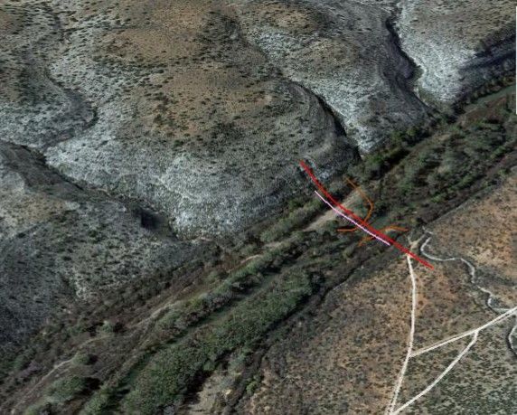
Karla S. Petty, Division Administrator                                                               4

                       BIOLOGICAL AND CONFERENCE OPINION

DESCRIPTION OF THE PROPOSED ACTION

Regulations implementing the Act (50 CFR 402.02) define “action” as all activities or programs
of any kind authorized, funded, or carried out, in whole or in part, by federal agencies of the
United States or upon the high seas.

FHWA, as the lead federal agency (ACOE and USFS are participants) and Yavapai County as
the project sponsor, are proposing to construct a new 7.1-mile-long roadway, called Verde
Connect. The Verde Connect project purpose is to reduce out-of-direction travel, meet current
and future growth and development needs, and improve emergency response times in the Verde
Valley between the cities of Camp Verde, Cottonwood, and other rural communities. The
proposed roadway will extend from SR 260, at the Coury Road roundabout, east to the
intersection of Cornville Road and Beaverhead Flat Road (Figure 1). The new road will include
a bridge that crosses the Verde River 1.25 miles east of SR 260. The new bridge will span a
shallow canyon (hereafter the Verde River Canyon) approximately 80 feet above the Verde
River (Figure 2). About 0.6 mile east of the Verde River, the Verde Connect roadway will
branch to the southeast to connect with Middle Verde Road—an existing county road that dead
ends southeast of the proposed bridge crossing. Hereafter, we will refer to the 1.1-mile branch as
the MVR Connector. FHWA retains discretion over the project during its construction, but once
completed Yavapai County becomes responsible for its operation and maintenance (R. Yedlin,
FHWA, personal communication).

Definitions

We use the term construction footprint to describe areas within the affected environment where
permanent and temporary surface disturbances will occur. The construction footprint for the
Verde Connect project is the roadway connecting SR 260 and Cornville Road, new bridge over
the Verde River, MVR Connector road, new access roads, and staging areas. The construction
footprint will also extend laterally from the roadways to accommodate its development. For
example, the construction footprint will extend laterally 100 feet north and 100 feet south of the
proposed bridge alignment and bridge approaches. The proposed bridge (slightly over 900 feet)
plus the bridge approaches (50 feet on each end; see definition below) is a total length of 1,000
feet (Figure 2). All bridge construction activity (geotechnical tests, pre-construction access and
staging, bridge construction, and post-construction site restoration) will occur within a 4.6-acre
(1,000 x 200-foot) area.

In this BO, we use the term floodplain, to mean the 100-year floodplain as defined by the
Federal Emergency Management Agency (FEMA) (https://www.fema.gov/national-flood-
insurance-program). A 100-year flood is one having a one percent chance of being exceeded in
magnitude in any given year, and a 100-year floodplain is the area inundated by that flood. We
examined FEMA flood insurance rate maps (FIRMs) for the action area to determine the width
of the 100-year floodplain at the proposed bridge crossing. We also measured the floodplain
using the ruler feature in Google Earth. In both cases, the 100-year floodplain measured
approximately 600 feet in width (Figure 3), including the floodplain terraces on each side of the
Karla S. Petty, Division Administrator                                                               5

canyon which are elevated slightly above the canyon floor). Thus, the overlap of the
construction footprint and Verde River 100-year floodplain is 2.7 acres (600 feet x 200 feet).

For our purposes, we will also refer to the floodplain margins and bridge approaches. The
floodplain margins are the embankments (slopes) above the floodplain terraces up to and
including the bridge abutment on each side of the river. The floodplain margins encompass
approximately 1.4 acres (150 feet x 200 feet x 2, or 0.7 acres on each side of the river). Paved
bridge approaches will link the new Verde Connect roadway with the new bridge. The
approaches will encompass 0.46 acre (50 feet x 200 feet x 2, or 0.23 acres on each end).

Finally, we use the term action area to describe all areas of the environment the project may
affect, extending out from and including the construction footprint. Typically, the action area is
the total area included in our effects analysis; however, the term also has a statutory definition
we provide in a later section.

Landownership

Coconino National Forest (CNF) administers most lands east of the Verde River, including the
MVR Connector (Figure 1). The Arizona State Lands Department (ASLD) manages most lands
west of the river with the exception of a small Prescott National Forest (PNF) parcel at the bridge
and ADOT ROW at the Verde Connect roadway western terminus (SR 260).

Scope of Work

The Verde Connect project will occur in four steps, three of which (the two roadways and
bridge) will run concurrently:

   •   Geotechnical investigations.
   •   Construction of a 7.1-mile-long roadway from SR 260 to Cornville Road (Verde
       Connect).
   •   Construction of a 1.1-mile-long connection east of the river between Verde Connect and
       Middle Verde Road (the MVR Connector).
   •   Construction of a new bridge across the Verde River.

Construction of the Verde Connect and MVR Connector may be done in two phases due to
funding. The first phase would extend from SR 260 to the MVR Connector and include the
MVR Connector. The second phase would begin at the Verde Connect/MVR Connector
intersection and end at Cornville Road.

Geotechnical investigations will occur prior to construction activities. Preliminary test borings at
the proposed bridge crossing and at a few locations along proposed roadways will occur during
summer 2020. Additional geotechnical test borings would be completed during final design.
Yavapai County expects to procure a design-builder with design/construction on the Verde
Connect roadway, bridge over the Verde River, and MVR Connector to begin in the fall of 2021
and to end in early 2023 with the opening of Verde Connect, the MVR Connector, and new
bridge to traffic. Road construction will begin ahead of bridge construction to allow road crews
Karla S. Petty, Division Administrator                                                              6

time to provide access to the bridge construction site. Road and bridge construction will then
proceed concurrently until both are completed.

Geotechnical Investigations

Three preliminary test borings at the bridge will provide the data needed to finalize bridge pier
and abutment designs. The preliminary test borings will include one in the floodplain and two
above the floodplain at the bridge abutments. A full geotechnical investigation will follow
during final design to support roadway pavement design and construction. Full geotechnical
work will include test borings at various locations along the Verde Connect roadway and MVR
Connector alignments. In all cases, the geotechnical engineer will use a truck-mounted drill rig
to drill auger holes. Work crews will avoid springs, seeps, streams, and other wetlands to the
extent possible during geotechnical work, and will place the drill rig on rubber mats for any
borings done near wetlands. Approximately 0.02 acre (30 feet x 30 feet) of vegetation clearing
and surface disturbance will occur at each boring location. The geotechnical engineer will plug
test holes with native materials or cement/bentonite mixture and cap them as needed with small
amounts of concrete.

Access, Staging, and Equipment in the Floodplain

The geotechnical engineer will access the proposed bridge crossing via existing dirt roads on
both sides of the Verde River. To access the test site on the floodplain, work crews may use one
of these roads, some of which descend into the floodplain. Alternatively, during final design and
construction the contractor will construct a temporary access road into the floodplain to conduct
the geotechnical test, and will leave the road in place for use during bridge construction.

When road construction begins in the fall of 2021, crews will clear vegetation from the proposed
build corridors and establish the subgrade to provide access to the bridge construction site from
two directions—from the west via SR 260 and the Verde Connect alignment, and from the
southeast via the MVR Connector. Access roads for bridge construction will be 20 feet wide and
aligned along the centerlines of the future finished roadways. Some excavating, grading, and fill
will likely be necessary to create the subgrades. To access the floodplain during bridge
construction, the contractor will construct a temporary access road from the east abutment down
to the riverbed (if not done during the geotechnical investigation), by contouring down the
floodplain embankment. This will be the only access road into the floodplain and will need to
accommodate flatbed trucks, cranes, drill rigs excavators, and other heavy equipment.

Work crews will establish staging and stockpiling areas on the floodplain inside the construction
footprint, and may need staging areas above the floodplain to support work on each of the bridge
abutments and bridge approaches. Earthwork associated with these activities will require
containment systems, dust and spill controls, erosion control measures, and other conservation
measures as described in a later section of this BO.

Temporary Bridge

The contractor will install a temporary bridge on the floodplain across the low-flow channel to
permit movement of work crews, equipment, and materials during construction. The bridge will
Karla S. Petty, Division Administrator                                                             7

sit above the river channel on temporary abutments made of large precast concrete beams set
back from the channel. Crews will pack native floodplain material on the channel side of each
abutment as fill. Planners will design the temporary bridge to be dropped onto its foundations
with a crane or large front-end loader, and lifted quickly from the floodplain in the event of high
flows.

Berms

Construction adjacent to the Verde River’s active low-flow channel will require earthen berms to
protect the work areas and equipment during overbank flows. The contractor will construct two
berms from native floodplain material, one on each side of the active channel (Figure 4). The
berms will be approximately 3 feet high and 10 feet wide. On the east side of the channel the
berm will be approximately 275 feet long, and on the west side approximately 520 feet long.

Bridge Construction

The new bridge will span the Verde River with five single- or double-column, cast-in-place piers
arranged so that no piers are in the active river channel. The bridge will be 907 feet long, with
six 150-foot-long precast spans. Its width (64 to 67 feet wide) will be sufficient to include one
12-foot-wide vehicle travel lane in each direction and a multimodal shoulder at the time of
construction, and two travel lanes and a multimodal shoulder in each direction at a future date.
Bridge height above the active channel will be a minimum of 80 feet.

Bridge construction will take up to 9 months and will begin in early April 2022 with the drilling
of pier shafts. Three piers will be on the floodplain and two will be above the floodplain on the
floodplain margins (Figure 2). To the extent feasible, the contractor will phase pier construction
on the floodplain to occur when flows are lower and the area around the pier is dry. The
proposed bridge design will utilize drilled shafts sized so that additional scour protection such as
concrete aprons or riprap will not be required. Verde Connect planners anticipate that all stages
of pier construction—drilling shafts, placing steel reinforcing cages, and pouring concrete—can
be accomplished through standing groundwater by using a concrete pump and tremie (a
watertight pipe used to avoid washout of cement when pouring concrete underwater). Work
crews will contain water expelled during the process and will not allow it to enter the flowing
Verde River.

Piers may have one column approximately 10 feet in diameter or two columns approximately
8 feet in diameter and would be cast in place. Yavapai County anticipates that piers will be in
place by September 2022. Crews will construct abutments and wingwalls, place girders, and
pour the decks from September to December 2022. Placement of new girders will likely require
two cranes. Crews may place crane pads inside and outside the floodplain, but will not place
them within the low-flow channel.

Bridge Approaches

To construct bridge approaches, crews will clear vegetation at each end of the bridge and use
dozers and graders to create an even road surface. Crews will then haul aggregate base to the
construction sites, add the aggregate in layers to create the road subgrade, compact each layer
Karla S. Petty, Division Administrator                                                             8

with mechanical drum rollers, and finally overlay the asphaltic concrete surface. In most places
along the Verde Connect roadway, the road will have one 12-foot-wide travel lane and a paved
8-foot-wide multimodal shoulder in each direction, for a total width of 40 feet. The MVR
Connector will have a reduced 2-foot paved shoulder but would be graded to provide the full 8-
foot shoulder width to match the geometrics and community character of the existing Middle
Verde Road.

Vegetation Removal

Construction of the new bridge will require vegetation removal, grading, and other surface
disturbances within approximately 4.6 acres of the Verde River floodplain, the floodplain
margins, and bridge approaches. A proportion of the vegetation removed will be permanent and
result directly from bridge construction. Up to 0.007 acre of riparian woodlands will be lost to
bridge piers in the floodplain (estimate from the BA), and work crews will permanently remove
up to 0.25 acre of upland (semidesert grassland) vegetation to accommodate paving of the bridge
approaches and construction of permanent bridge supports (the east and west abutments,
wingwalls and two piers—our estimates). Thus, no more than 0.26 acre of permanent vegetation
loss will occur at the bridge portion of the project.

Most vegetation removal and floodplain surface alterations will occur during the run-up to bridge
construction in February and March 2022, when work crews will establish temporary work areas
and facilities needed during construction. These actions will require grading and leveling to
some extent and removal of most vegetative cover. Construction of 800 feet of earthen berms
alone will require heavy equipment operations within up to 1 acre of the floodplain, and the
likely removal of 0.7-0.8 acre of cottonwood and willow woodlands along the Verde River’s
active channel (our estimate). We estimate that preconstruction activities and temporary
facilities will affect up to 2 acres of the floodplain and its riparian vegetation; however, most or
all of the affected vegetation will recover after construction through natural regrowth and
planned restoration efforts.

Project Summary and Schedule

Summer 2020            Conduct preliminary geotechnical tests.

Fall 2021              Clear vegetation and lay and compact subgrade from the roadway
                       alignment start points (SR 260 and the Middle Verde Road dead end) to
                       the bridge construction site. Construct a temporary access road into the
                       floodplain (if not done during geotechnical tests).

February 2022          Clear vegetation from the floodplain and proposed bridge crossing.

March 2022             Construct a temporary bridge, earthen berms, and other facilities needed
                       for bridge construction.

April 2022             Begin drilling bridge pier shafts.
Karla S. Petty, Division Administrator 9
September 2022 Finish road construction, including right-of-way (ROW) fencing,
guardrails, and road striping. Finish bridge piers. Begin work on bridge
abutments and superstructure.
November 2022 Pave bridge approaches.
December 2022 Finish work on the bridge superstructure. Connect the bridge to its
approaches. Begin restoration and revegetation of the bridge construction
site.
January 2023 Finish bridge site restoration. Open all new facilities to the public.
Applicable Design Standards and Best Management Practices
FHWAs proposed design standards and best management practices (BMPs) are to help avoid
negative effects to soils and water quality during construction
• Before ground-disturbing activities occur within 0.5 mile of the Verde River, Yavapai
County will develop plans for erosion and sediment control, stormwater management,
stormwater pollution prevention, and spill prevention and containment. FHWA and
Yavapai County will assure full implementation of these plans at all stages of
construction.
• The erosion and sediment control plan will specify measures to minimize discharge of
sediments into the Verde River during or after construction using approved wattles, silt
fences, hay bales, sediment basins, berms, and other sediment control measures. Work
crews will regularly inspect erosion-control measures and products to assure proper
function.
• A spill prevention and containment plan will describe measures to prevent pollutants such
as fuel, oil, fresh concrete, raw sewage, muddy water, chemicals, construction debris, and
other harmful materials from entering the Verde River’s active channel or floodplain.
The plan will also specify appropriate actions the contractor will take if a spill occurs.
Prevention measures will include a containment system on the bridge to prevent
construction materials and debris from falling into the river, and secondary containment
protection in the Verde River floodplain for containers of hazardous materials and
gasoline-powered tools and equipment.
• Any vehicle and equipment refueling, storage, or repair that occurs in the floodplain will
be restricted to a staging area or other designated area that includes secondary
containment protection that includes a berm or excavated ditch to impound potential
leaks or spills.
• All vehicles and heavy equipment that operate in the floodplain will possess spill
containment equipment.
• Crews will pour concrete only in dry conditions or within confined waters not being
returned to surface waters of the Verde River, and shall cure concrete for at least 24 hours
before contact with surface water occurs.
• Work crews will remove litter and trash from the river corridor on a daily basis, and will
remove all construction materials, debris, and temporary structures from the floodplain
upon completion of the project.Karla S. Petty, Division Administrator 10
• In the event of a spill or containment breech, work crews will cease all construction
activity immediately. The biological monitor will contact FWS and other cooperating
agencies to determine appropriate actions, including clean-up measures and measures to
prevent additional spills.
• Stormwater plans will prescribe responses to flood events that may occur during
construction. If work areas become inundated or saturated with water during a flood,
work crews will cease all construction activity and remove vehicles and heavy
equipment, the temporary bridge, and materials and supplies stored in secondary
containment areas from the floodplain.
Conservation Measures
Conservation measures represent commitments made by the action agencies and project sponsor
to minimize effects of the proposed action on listed species and their designated and proposed
critical habitats. Conservation measures will help to define and limit work areas, reduce
vegetation removal when possible, and minimize effects to listed species. We have organized
general conservation measures roughly in chronological order and present species-specific
measures, and several measures identified for the USFS to implement, at the end of the section.
Appointment of a Biological Monitor
• Before February 2022, when vegetation removal and other pre-construction activities
begin, Yavapai County with FHWA oversight shall appoint and hire a full-time field
biologist to monitor construction activities throughout the construction footprint,
implement conservation commitments, including a relocation protocol for northern
Mexican gartersnakes, and report encounters with listed species. The biological monitor
will be on site at all times during bridge construction, beginning with vegetation clearing
and other pre-construction activities in the Verde River floodplain in February 2022, and
ending with completion of post-construction site restoration at the bridge site in January
2023. The biological monitor shall be or shall work under the supervision of a qualified
biologist holding a FWS section 10 (a)(1)(A) recovery permit for the northern Mexican
gartersnake.
Environmental Awareness Training
• Before February 2022, the biological monitor will produce a handout on listed species
that occur in the action area and present an environmental awareness program to on-site
project personnel, including but not limited to contractors, contractors' employees,
supervisors, inspectors, and subcontractors. The program will contain, at a minimum,
information concerning the biology and distribution of the southwestern willow
flycatcher, yellow-billed cuckoo, Mexican spotted owl, northern Mexican gartersnake,
narrow-headed gartersnake, razorback sucker, spikedace, and loach minnow, their
occurrence in the action area, measures to avoid impacts, and procedures to follow if
encounters with these species occur.Karla S. Petty, Division Administrator 11
Pre-Construction Conservation Measures
• A Yavapai County biologist or biologist under contract to Yavapai County shall be
present during preliminary geotechnical tests at the proposed bridge crossing in July 2020
to monitor encounters with listed species during the tests. The biologist’s primary role
will be to observe and shall not make hands-on contact with any listed birds or snakes
seen during the tests. The biologist shall provide a brief report to FWS providing details
of any observations or encounters that occur.
• In spring and summer 2020 and/or 2021, a Yavapai County biologist or biologist under
contract to Yavapai County will conduct botanical surveys for USFS sensitive species,
targeting limestone soil endemics, including the endangered Arizona cliffrose. This soil
type does not occur in the action area but occurs nearby. If surveyors find Arizona
cliffrose plants, they will contact FWS and USFS to determine if conservation actions are
necessary.
• To assure work crews and heavy equipment remain inside designated limits during bridge
construction, the construction contractor will conduct a pre-construction site visit to
identify and mark (fence or flag) the perimeter of the construction footprint.
• Before vegetation clearing occurs in the floodplain, the contractor and biological monitor,
in cooperation with USFS personnel, will identify and mark all facility and work area
locations in the construction footprint, including the temporary bridge, earthen berms,
piers, abutments, bridge approaches crane pads, and staging, stockpiling, and
containment areas.
• Before vegetation clearing occurs in the floodplain, the contractor and biological monitor,
in cooperation with USFS personnel, will identify and mark all stands of woody
vegetation requiring removal. The biological monitor will also demarcate riparian
vegetation to avoid and retain.
• Trees >12 inches in diameter will be avoided when possible and no trees >24 inches in
diameter will be removed unless it is clearly necessary to achieve project objectives.
Before removal, the contractor and biological monitor will individually mark trees >12
inches in diameter that will be removed.
• Before vegetation removal occurs, the biological monitor will submit a report to FWS
and USFS summarizing the number of trees marked for removal by species, their
diameters, relative positions in the canopy, and locations. The report will also provide
data on acreages and species compositions of riparian woodlands marked for removal.
The report will aid the development of a post-construction revegetation plan as described
below.
• Trees removed from the riparian corridor will be cut to ground level, but when possible,
root masses will be left intact to help stabilize soils and provide opportunities for
regrowth through adventitious shoots (e.g., in the case of willows).
• The biological monitor will be present during all vegetation clearing operations.
• After vegetation clearing and before bridge construction begins, Yavapai County will
prepare a biological monitor-drafted and Federal Highway Administration-approved post-
construction revegetation and habitat restoration plan for the Verde River floodplain that
is consistent with the Biological Opinion. The plan would be submitted to FWS, ACOE,
and USFS for review and approval. The FWS must approve the revegetation plan at least
60 days before site restoration efforts begin.Karla S. Petty, Division Administrator 12
• The revegetation plan will also provide for seeding of disturbed areas along the bridge
approaches with appropriate upland seed mixtures, and may include protocols for
salvaging and transplanting special-status species, including limestone soil endemics, if
found during pre-construction surveys.
Conservation Measures Observed during Construction
• During construction, the contractor will permit no work in flowing surface water
anywhere on the Verde River floodplain. No vehicles or construction equipment of any
kind shall enter the river’s wetted channel for any purpose. All vehicle traffic and
movement of heavy equipment, materials, and personnel between the east and west sides
of the Verde River will cross the active channel on a temporary bridge installed for that
purpose.
• The contractor shall not pump water from the Verde River for any reason.
• The contractor shall not designate or construct parking or trailhead areas in the action
area that would attract the public to the Verde River corridor.
• To prevent the introduction of invasive plants into the construction footprint, the
contractor shall wash all vehicles and earthmoving equipment at the contractor’s
equipment storage facility prior to entering the construction footprint.
• To prevent invasive species from leaving the construction footprint, the contractor shall
inspect all construction vehicles and equipment and remove all attached plants, plant
debris, soil, and mud before leaving the construction footprint.
• After construction begins, work crews will not remove large trees or riparian patches that
were not initially marked for removal, without FWS concurrence.
• The contractor and all project personnel shall avoid all flagged or otherwise designated
sensitive resource areas within or adjacent to the construction footprint.
• Project personnel shall avoid shrubs and trees to the extent possible, even if not
demarcated for avoidance.
• The biological monitor will assure that construction activities and equipment remain
within the construction footprint during construction and that no unauthorized vegetation
removal occurs.
Post-Construction Conservation Measures
• After construction, and following procedures outlined in an approved revegetation plan,
the contractor will rehabilitate and return all disturbed areas within the construction
footprint to as near their original condition as possible, including the floodplain,
floodplain embankments, the temporary access road, and upland areas disturbed during
construction of the bridge approaches.
• To restore disturbed areas, work crews will re-contour and grade altered ground surfaces,
seed disturbed areas with appropriate native seed mixes, and plant pole cuttings of native
cottonwoods and willow in the floodplain to hasten recovery of affected riparian
woodlands (see additional discussion on the revegetation plan below).
• To discourage public access to the river after construction, in addition to restoring the
temporary access road into the floodplain, the construction contractor will restore any
temporary parking areas near the bridge used during construction.Karla S. Petty, Division Administrator 13
Southwestern Willow Flycatcher and Western Yellow-billed Cuckoo Conservation Measures
• A Yavapai County contractor will conduct protocol surveys for the flycatcher and cuckoo
in the construction footprint and action area during the 2020 breeding season. Results of
these surveys will supplement data from protocol surveys completed in 2019 and used in
our effects analysis for flycatchers and cuckoos. If the 2020 survey data submitted by
Yavapai County indicate the need to reconsider the FWS effects analysis in this BO for
either species, FWS will notify FHWA.
• Vegetation clearing in the construction footprint will occur in February 2022, outside the
migration and breeding periods of the flycatcher and cuckoo to prevent injuries or
fatalities to adult flycatchers or cuckoos, their eggs, or young that could be expected to
occur as a result of vegetation removal operations.
• Bridge construction will begin in early April 2022 before flycatchers and cuckoos arrive
at breeding areas along the Verde River. This measure will minimize the likelihood that
construction activities will disrupt or displace ongoing breeding attempts from the
construction footprint when bridge construction begins. Due to ongoing construction
activities, birds may avoid the construction footprint when attempting to establish nesting
territories.
• Flycatchers and cuckoos may attempt to establish nests in or near the construction
footprint in spite of elevated disturbance levels when they arrive on the Verde River
during spring 2022. If this occurs, the contractor will establish and mark avoidance areas
around occupied nests.
Northern Mexican Gartersnake Conservation Measures
• A Yavapai County biologist or biologist under contract to Yavapai County will develop a
gartersnake monitoring and relocation protocol and FWS will approve the protocol prior
to any ground-disturbing activity within the construction footprint. The snake monitoring
and relocation protocol will specify procedures for conducting visual encounter surveys
for gartersnakes during construction, for capturing and releasing snakes, and for
processing and reporting snakes found dead or injured. The protocol will also specify
appropriate responses if the biological monitor is unable to capture a detected gartersnake
and the snake does not leave the construction site on its own.
• No more than 24 hours before vegetation removal or other ground-disturbing activities
begin on the Verde River floodplain, the biological monitor will arrange for and conduct
a pre-construction survey for northern Mexican gartersnakes. The objective will be to
capture and safely relocate as many gartersnakes as possible from the construction
footprint. This survey will be conducted by a minimum of five persons walking the
banks or wading close to the shoreline of the Verde River. Surveys will extend into
upland habitat, including the planned access road location and bridge approaches. These
surveys are intended to produce captures; they will not be strictly time- or area-
constrained.
• At the start of each work day, the biological monitor will check under vehicles,
equipment, and construction materials for sheltered northern Mexican gartersnakes and
relocate any snake found.Karla S. Petty, Division Administrator 14
• The biological monitor will search for northern Mexican gartersnakes in boulder piles,
vegetation, and along the streambank ahead of work crews every day that work occurs
within 600 feet of the Verde River’s active channel.
• To discourage gartersnakes from sheltering inside the construction footprint during
construction, work crews will avoid the creation of debris piles that may attract snakes
and will not leave such piles in place (e.g., overnight). During pre-construction activities,
crews will remove woodpiles and items of human-made trash that are already present on
the floodplain (snakes can hide under human trash).
• The biological monitor will report any northern Mexican gartersnakes detected during the
project to FWS within 48 hours of detection.
• To prevent entrapment of gartersnakes, holes and trenches will be backfilled the same
day they are excavated or will be covered overnight. Work crews will cover holes with
pieces of plywood or suitable material and cover that material entirely with plastic.
Crews will secure the edges of the plastic with excavated soil so there are no gaps where
wildlife may enter.
• To minimize risks of gartersnake entanglement in erosion control products, use of these
products will conform to the following guidelines:
o Loose-weave netting. Use erosion control products with movable (not fixed or
welded) joints between the horizontal and vertical twines. Twines that move
independently reduce the risk of gartersnake entanglement. Netting designs with
movable joints are called loose weave, leno weave, or gauze weave.
o Mesh Size. Avoid using products with a mesh size of 0.5-inch square; this mesh
size has the highest likelihood of snake entanglement. Instead, use larger mesh
sizes (3 x 3, 3 x 4, or 1.7 x 0.8 inches), or rectangular meshes with a smaller,
0.25-inch aperture in one direction (1.25 x 0.25 inches), which are less prone to
snake entanglements.
o Natural-Fiber Materials. Use biodegradable, natural-fiber products (including
netting, filling, and thread) as opposed to synthetic plastic products. They are
more wildlife-friendly than synthetic plastic products. Natural fibers allow
entangled snakes a better opportunity to escape because of their lower tensile
strength.
o Products without Netting. Some erosion and sediment control products do not
contain netting. These include net-less erosion control blankets (for example,
made of excelsior), loose mulch, hydraulic mulch, soil binders, unreinforced silt
fences, and straw bales. Net-less erosion control products do not risk
entanglement of gartersnakes.
o Prompt Removal of Products. Remove erosion control products promptly after
they have served their purpose to lessen the risk of gartersnake entanglement.
• When a northern Mexican gartersnake is found, all work will stop within 50 feet of the
animal while the biological monitor relocates it from harm's way.
• The biological monitor will thoroughly document all gartersnake fatalities related to
project activities, and will report them to FWS immediately. When the bridge is
complete, the contractor will replace escape cover and shelters eliminated by construction
activities by stacking debris from tree clearing activities (e.g., sticks, branches, limbs)
into piles along the river bank and throughout the floodplain. Because subsequent floods
are likely to remove woody debris subsequent floods, the contractor will also create rock
piles along the riverbanks to provide shelters for gartersnakes.Karla S. Petty, Division Administrator 15
Conservation Measures for U.S. Forest Service
• ROW fencing will be wildlife friendly, with a maximum fence height of 42-inches for the
top wire, and a minimum of 12-inches between the top two wires. The bottom wire is to
be smooth (un-barbed), and a minimum height of 18-inches from the ground. Work
crews will follow fencing guidelines provided by the Arizona Game and Fish Department
(AGFD) (Wildlife Compatible Fencing) (AGFD 2006).
• To assist in the design, planning, and placement of culverts and to minimize impacts of
these structures on wildlife movements, culvert construction will follow AGFD’s
Guidelines for Culvert Construction to Accommodate Fish and Wildlife Movement and
Passage (AGFD 2011). Culvert design objectives will include maintenance of the
dimension, pattern, and profile of the stream’s geomorphology; sizing to allow wildlife
passage; use of rip-rap in limited amounts; and use of natural materials in floor
construction.
Action Area
The action area is defined as all areas to be affected directly or indirectly by the federal action
and not merely the immediate area involved in the action (50 CFR § 402.02). In delineating the
action area, we evaluated the farthest-reaching physical, chemical, and biotic effects of the
action on the environment.
The action area for this project includes: 1) the proposed Verde Connect roadway, bridge, and
MVR Connector areas subject to vegetation removal and other construction-related surface
disturbances (the construction footprint); 2) areas immediately surrounding the construction
footprint that may be affected by construction noise and disturbance; and 3) the Verde River
surrounding the construction area that may be affected by the bridge, construction, sediments, or
contaminants. It is difficult to know specifically where these surrounding effects (noise,
sediment, etc.) may extend, but expect the farthest reach conservatively at a mile radius around
the road project at the Verde River.
STATUS OF THE SPECIES AND DESIGNATED AND PROPOSED CRITICAL
HABITATS
Southwestern Willow Flycatcher
The flycatcher was listed as endangered without critical habitat on February 27, 1995 (60 FR
10694). Critical habitat was initially designated on July 22, 1995 (62 FR 39129) and was revised
on October 19, 2005 (70 FR 60886) and January 2, 2013 (78 FR 344). A recovery plan for the
species was completed in 2002 (USFWS 2002), and a 5-year review was completed in 2014
(USFWS 2014). In 2017, a 12-month review (including an updated 5-year review), responding
to a delisting petition, determined that no change was needed to the flycatcher’s subspecies
classification or its status as endangered (USFWS 2017).
The flycatcher is endangered primarily because land and water management actions associated
with agriculture and urban development have reduced, degraded, altered, and eliminated much ofKarla S. Petty, Division Administrator 16 its riparian habitats. Other threats include human recreation along rivers and streams, livestock grazing, predation, brood parasitism by brown-headed cowbirds (Molothrus ater), release and spread of the tamarisk-eating leaf beetle (Diorhabda carinulata), and wildfires that have become more frequent and destructive as a result of the drying of rivers, degrading of watersheds, increase in in ignition sources, and proliferation of exotic vegetation. Nestling predation and cowbird parasitism are the most common forms of direct mortality. Tamarisk (Tamarix spp.) often flourishes in areas where native trees are unable to grow due to water regulation and groundwater pumping; thus, loss of tamarisk without replacement by native trees will likely impact flycatchers wherever their range overlaps with the tamarisk leaf beetle. All existing threats are compounded by the risk of stochastic events because flycatcher habitats are fragmented and because populations occur at low numbers. The southwestern willow flycatcher is one of four currently recognized subspecies of the willow flycatcher, a neotropical migrant and spring/summer resident of North America (Unitt 1987, Browning 1993). This subspecies breeds in the southwestern U.S. and winters in Mexico, Central America, and possibly northern South America (Phillips 1948, Stiles and Skutch 1989, Peterson 1990, Ridgely and Tudor 1994, Howell and Webb 1995). This flycatcher is a riparian obligate and insectivore. Flycatchers are typically found along rivers, lakesides, and other wetlands with dense riparian habitat consisting of multi-layered tree canopies of varying sizes and age classes. Occupied flycatcher territories are usually located near or over surface water or saturated soils. In Arizona, nesting flycatchers are found within two general areas: 1) monotypic native riparian or tamarisk habitats, and mixed native riparian and tamarisk habitats, along broad, flat floodplains below about 4,000 feet in elevation; and 2) willow (Salix spp.) thickets along streams typically occurring in broad, flat meadows above 7,000 feet. Historical egg/nest collections and species descriptions throughout its range describe the flycatcher’s widespread use of willow for nesting (Phillips 1948, Phillips et al. 1964, Hubbard 1987, Unitt 1987); however, in Arizona and other states tamarisk is an important nest tree species for flycatchers. Tamarisk is a non-native species, yet in 2001, 323 of the 404 known flycatcher nests in Arizona (80%) were in tamarisk (Smith et al. 2002). Tamarisk had been thought to represent poorer flycatcher habitat; however, comparison of reproductive performance, prey populations, and physiological condition of flycatchers breeding in native and exotic vegetation showed no differences (Durst 2004, Owen and Sogge 2002, Sogge et al. 2005, Sogge et al. 2008, USFWS 2002). Flycatcher habitat is dynamic and can change rapidly (Finch and Stoleson 2000). Tamarisk and native willows, under good growing conditions, can develop from seed to nesting habitat in 3-5 years. Heavy flooding can eliminate habitat or reduce habitat quality in a day. Flycatcher use of habitat in different successional stages may also be dynamic. Over-mature or developing riparian vegetation not suitable for nest placement can be used for foraging and shelter by migrating, breeding, dispersing, or non-territorial flycatchers (McLeod et al. 2005, Cardinal and Paxton 2005).
Karla S. Petty, Division Administrator                                                         17

The riparian patches used by breeding flycatchers vary in size and shape. They may be relatively
dense, linear, contiguous stands or irregularly-shaped mosaics of dense vegetation with open
areas. Southwestern willow flycatchers nest in patches as small as 0.25 acre along the Rio
Grande, and as large as 175 acres in the upper Gila River in New Mexico (USFWS 2002). More
recently, Cardinal and Paxton (2005) found that home ranges of telemetered flycatchers at
Roosevelt Lake, Arizona, varied from 0.37 to 890 acres (USFWS 2002). Mean patch size of
breeding sites supporting 10 or more flycatcher territories was 62.2 acres, although aggregations
of occupied patches within a breeding site may create a riparian mosaic as large as 494 acres or
more (USFWS 2002). Flycatchers are generally not found nesting in confined floodplains where
only a single narrow strip of riparian vegetation less than approximately 33 feet wide develops,
although they may nest in such vegetation if it extends out from larger patches, and they may use
vegetation of this type during migration (USFWS 2002).

Evidence gathered during multi-year studies of color-banded populations shows that although
most southwestern willow flycatchers return to former breeding areas, flycatchers regularly
move among sites within and between years (Netter et al. 1998, Kenwood and Paxton 2001, M.
Whitfield unpubl. data). From 1997 through 2000, 66% to 78% of flycatchers known to have
survived from one breeding season to the next returned to the same breeding site; conversely,
22% to 34% of returning birds moved to different sites (Luff et al. 2000). Both males and
females move within and between sites, with males showing slightly greater site fidelity (Netter
et al. 1998). Within-drainage movements are more common than between-drainage movements
(Kenwood and Paxton 2001). Typical distances moved range from 1.2 to 18 miles; however,
long-distance movements of up to 137 miles have been observed on the lower Colorado River
and Virgin River (McKernan and Braden 2001). In some cases, willow flycatchers are faced
with situations that force movement, such as when catastrophic habitat loss occurs from fire or
flood. Several such cases have been documented, with some of the resident willow flycatchers
moving to remaining habitat within the breeding site, some moving to other sites 1.2 to 16.8
miles away (Paxton et al. 1996, Owen and Sogge 1997), and others disappearing without being
seen again.

Southwestern Willow Flycatcher Designated Critical Habitat

We revised designated flycatcher critical habitat on January 2, 2013 (78 FR 344). The revision
designated approximately 1,227 stream miles and 208,973 acres of critical habitat for the
flycatcher in 24 management units in six states, including Arizona. The physical and biological
features for flycatcher critical habitat include items associated with the development of
flycatcher habitat and insect prey populations such as water, river flow, flooding, groundwater,
seedbeds, and plant germination and growth. We identified the following primary constituent
elements (PCEs) for flycatcher critical habitat based on riparian plant species, structure and
quality of habitat, and insects for prey:

1. PCE 1— Riparian Vegetation. Riparian habitat along a dynamic river or lakeside, in a
   natural or manmade successional environment (for nesting, foraging, migration, dispersal,
   and shelter) that is comprised of trees and shrubs (that can include Gooddings willow, coyote
   willow, Geyer’s willow, arroyo willow, red willow, yewleaf willow, pacific willow,
   boxelder, tamarisk, Russian olive, buttonbush, cottonwood, stinging nettle, alder, velvet ash,
Karla S. Petty, Division Administrator                                                            18

     poison hemlock, blackberry, seep willow, oak, rose, sycamore, false indigo, Pacific poison
     ivy, grape, Virginia creeper, Siberian elm, and walnut) and some combination of:

        (a) Dense riparian vegetation with thickets of trees and shrubs that can range in height
            from about 6 to 98 feet. Lower-stature thickets (6 to 13 feet tall) are found at higher
            elevation riparian forests and tall-stature thickets are found at middle and lower-
            elevation riparian forests;
        (b) Areas of dense riparian foliage at least from the ground level up to approximately 13
            feet above ground or dense foliage only at the shrub or tree level as a low, dense
            canopy;
        (c) Sites for nesting that contain a dense (about 50 percent to 100 percent) tree or shrub
            (or both) canopy (the amount of cover provided by tree and shrub branches measured
            from the ground);
        (d) Dense patches of riparian forests that are interspersed with small openings of open
            water or marsh or areas with shorter and sparser vegetation that creates a variety of
            habitat that is not uniformly dense. Patch size may be as small as 0.25 acre or as
            large as 175 acres.

2.      PCE 2—Insect Prey Populations. A variety of insect prey populations found within or
        adjacent to riparian floodplains or moist environments, which can include: flying ants,
        wasps, and bees (Hymenoptera); dragonflies (Odonata); flies (Diptera); true bugs
        (Hemiptera); beetles (Coleoptera); butterflies, moths, and caterpillars (Lepidoptera); and
        spittlebugs (Homoptera).

Western Yellow-billed Cuckoo

We listed the western yellow-billed cuckoo as threatened on October 3, 2014 (79 FR 59992).
Only the Western Distinct Population Segment (DPS), which is larger than its eastern
counterpart, was listed. We proposed western yellow-billed cuckoo critical habitat on August
15, 2014 (79 FR 48548), and revised proposed critical habitat on February 27, 2020 (85 FR
11458).

The primary threat to the western yellow-billed cuckoo is loss or fragmentation of riparian
nesting habitat. Many factors have altered and eliminated cuckoo habitats, including water
diversions, ground water pumping, stream channelization and stabilization, agricultural
development, mining, livestock grazing, wildfires, establishment of nonnative vegetation,
drought, defoliation of tamarisk by the introduced tamarisk leaf beetle, and prey scarcity due to
pesticides (Ehrlich et al. 1992, Corman and Wise-Gervais 2005, 79 FR 48548, 79 FR 59992).
Habitat fragmentation has led to the isolation of small populations and has increased their
susceptibility to further declines and local extirpations due to all the factors discussed above and
to stochastic factors such as weather, fluctuating prey populations, and climate change
(Thompson 1961, McGill 1975, Wilcove et al. 1986).

Cuckoos in the DPS were formerly widespread and locally common in much of the western U.S.,
Canada, and Mexico (American Ornithologists’ Union 1998, Hughes 1999). The largest
remaining breeding areas are in southern and central California, Arizona, New Mexico, and
northwestern Mexico (79 FR 59992). In Arizona, the species was a common resident chiefly in
Karla S. Petty, Division Administrator 19 the lower Sonoran zones of southern, central, and western Arizona (Phillips et al. 1964). The cuckoo now nests primarily in the central and southern parts of the state. Western populations of the cuckoo are most commonly found in large tracks of dense, multi- layered gallery forests consisting primarily of cottonwood (Populus spp), willow, and mesquite (Prosopis spp) (including mesquite bosques) along riparian corridors in otherwise arid areas (Laymon and Halterman 1989, Hughes 1999). The association of breeding within large tracts of riparian habitat is likely related to home range size, although home ranges are flexible and territories may overlap in this weakly territorial species (Hughes 1999, Halterman 2009, Sechrist et al. 2013). Rangewide, individual home ranges during the breeding season average over 100 acres (Laymon and Halterman 1987, Laymon et al. 1997, Laymon and Williams 2002, Halterman 2009, Sechrist et al. 2009, McNeil et al. 2011, 2012, 2013, Sechrist et al. 2013). However, Laymon et al. (1993) reported an average cuckoo home range size of 42 acres, and home range estimates for radio-telemetered cuckoos in New Mexico varied from 12 to 697 acres (Sechrist et al. 2009). In New Mexico, the average maximum daily distance traveled was 2,795 feet, (0.52 mile) and the average maximum seasonal distance traveled was 4,790 feet (0.91 mile). Extensive riparian forests may support the greatest density of breeding cuckoos, but other habitats are also important for recovery (USFWS 2015). In Arizona, cuckoos may use narrow bands of riparian woodland for nesting (AGFD 2015, Cornell Lab of Ornithology 2015) and even non-riparian habitats (e.g., Madrean evergreen woodlands in the mountain drainages of southeastern Arizona) (Brown 1994, Cornell Lab of Ornithology 2015, Corman and Magill 2000). Tamarisk may be a component of breeding habitat, but there is usually a native riparian tree component present (Gaines and Laymon 1984, Johnson et al. 2008, McNeil et al. 2013, Carstensen et al. 2015). Site-specific variation is likely a result of characteristics unique to each location (e.g., type and quality of habitat, patch configuration) (Hughes 1999, Halterman 2009, Sechrist et al. 2013). Habitat can be found in relatively contiguous stands of dense vegetation, in irregularly shaped mosaics of dense and open vegetation, and in patches that are narrow and linear or savannah-like. Humid conditions created by surface and subsurface moisture and a multi-layered canopy appear to be important for successful hatching and rearing of young (Hamilton and Hamilton 1965, Gaines and Laymon 1984). Within the boundaries of the DPS, cuckoos occur from sea level to elevations up to 7,000 feet or more; however, the moist conditions that support riparian plant communities typically occur at lower elevations. Cuckoo breeding habitat in much of the species’ range is associated with perennial rivers and streams in regulated and unregulated flows (Poff et al. 1997). In southeastern Arizona, cuckoos are also found nesting along more arid ephemeral and intermittent drainages (Corman and Magill 2000, Corman and Wise-Gervais 2005, AGFD 2015, Cornell Lab of Ornithology 2015). Hydrologic conditions at cuckoo breeding sites can vary widely in a single year and among years, and due to these changes, cuckoos may move from one area to another in the same season and from year to year. Recent guidance on cuckoo habitat use (USFWS 2015) indicates that cuckoos are more flexible in their choice of foraging and migration stopover habitat than they are in selecting nesting habitat. Foraging areas can be less dense and patchy than nesting areas, with lower levels of
You can also read