Warrumbungle Shire Economic Development & Tourism Strategy 2018 2023 - NSW Government
←
→
Page content transcription
If your browser does not render page correctly, please read the page content below
Warrumbungle Shire
Economic Development & Tourism Strategy
              2018 - 2023

                                          1
CONTENTS
1. INTRODUCTION 1
2. WARRUMBUNGLE SHIRE 4
3. STRATEGIC CONTEXT 20
4. DRIVERS OF CHANGE 28
5. BUILDING OUR ECONOMY 32
6. PRIORITIES, STRATEGIES & ACTIONS 49
7. MONITORING PROGRESS 63
REFERENCES 64
PHOTOGRAPHS 65
WARRUMBUNGLE SHIRE ECONOMIC DEVELOPMENT
& TOURISM STRATEGY
Prepared by:
JENNY RAND & ASSOCIATES
www.jennyrand.com.au
WARRUMBUNGLE SHIRE COUNCIL
Coonabarabran Office
PO Box 191 Coolah Office
14-22 John Street 59 Binnia Street
Coonabarabran 2357 Coolah 2843
Website: www.warrumbungle.nsw.gov.au
Email: info@warrumbungle.nsw.gov.au
Telephone: 02 6849 2000 or 02 6378 5000
Disclaimer: ACKNOWLEDGEMENTS
Any representation, statement, opinion or advice, expressed or implied, in this document is made in good faith,
on the basis that Jenny Rand and Associates, Warrumbungle Shire Council or its employees are not liable (whether Warrumbungle Shire Council wishes to thank all residents,
by reason of negligence, lack of care or otherwise) to any person or organisation for any damage or loss businesses and organisations that attended our consultative
whatsoever, which has occurred or may occur in relation to that person or organisation taking action in respect forums, met with our staff and consultant and provided information
to any representation, statement or advice referred to in the Warrumbungle Shire Economic Development & for our Shire’s Economic Development & Tourism Strategy.
Tourism Strategy.
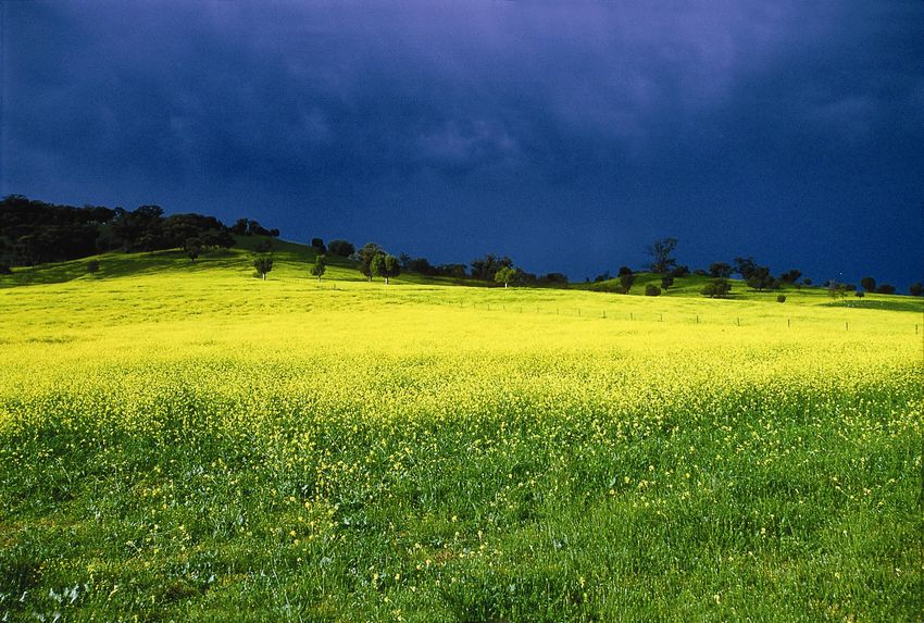
Photographs: Front Cover – Canola Fields, David Kirkland Above: Macha Tor, Warrumbungle National Park, David Kirkland
2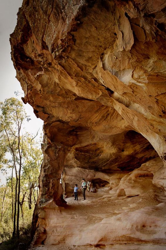
1. INTRODUCTION
1.1 Background
Located in the central west of NSW, Warrumbungle Shire is a large rural Shire. The Shire’s economy is driven primarily by the agricultural sector, with tourism also a significant
contributor. The performance of the agricultural sector impacts directly on the local economy, with Shire businesses experiencing significant highs and lows as a result of variations
in agricultural production, demand, commodity prices and weather. In recent years the Shire has experienced significant drought, wildfires and a reduction in surface and ground
water allocations for agricultural use resulting from the introduction of the Murray Darling Basin Plan. Strong growth in the surrounding regional centres of Dubbo, Tamworth (both
Evo-Cities) and Mudgee, and the on-line economy, has increased the competition for local businesses. On the plus side, there has been investment in new visitor facilities in the
Warrumbungle National Park, Pilliga Forest and at Siding Spring Observatory; the Shire is attracting investment in renewable energy projects; and the aged care sector is growing.
Generational change, new production technologies, advances in communication and information technologies, the declaration of the Warrumbungle Dark Sky Park, and the coming
of the Inland Rail, are creating opportunities to improve the productivity of existing businesses and explore new business opportunities.

Warrumbungle Shire Council is seeking to grow and diversify the Shire’s economy and build sustainability and resilience. Council’s goal for the local economy is:

      ‘Our economy is strong and sustainable, providing our communities with localised employment opportunities and ease of access to markets, goods and services’. 1

Council and the Warrumbungle Shire community recognise that economic growth can be achieved by supporting the agricultural sector, growing the tourism sector, strengthening
local businesses and attracting new residents, businesses and investment. Council is also seeking to capitalise on opportunities arising from the State and Federal Government’s
increasing focus on growing and strengthening regional economies through infrastructure investment and supporting key sectors including agriculture, tourism and renewable energy.

In facilitating economic growth Council is seeking to:

• Stabilise and potentially grow the Shire’s population base.
• Support, retain, strengthen and grow local businesses.
• Position Warrumbungle Shire as a place where people wish to live, work, visit and invest.
• Attract new investment that is sustainable and compatible with the Shire’s environment and community
  aspirations.
• Support the creation of local employment opportunities.
• Upgrade existing infrastructure and secure enabling infrastructure.
• Ensure responsible stewardship of resources.

While business development and investment will be driven primarily by the private sector, Council will play
an active role in encouraging, supporting and facilitating this by ensuring that the Shire offers a positive
investment environment.
                                                                                                                 Neilson Park Coonabarabran

1   Warrumbungle Shire Council Community Strategic Plan 2032
                                                                                                                                                                                    1
1.2      Purpose of the Economic Development Strategy
                                                                                                                                             Economic development
The Economic Development Strategy provides the direction and framework to encourage, support and facilitate economic
                                                                                                                                                 is the process of
development within Warrumbungle Shire. It aims to:
                                                                                                                                                   improving the
• Ensure the foundations are in place to take the local economy forward and realise emerging opportunities.                                   economic wellbeing of
• Guide Council’s actions, policies, regulations and resource and funding allocations to ‘deliver’ a positive investment environment.        the community, through
• Inform Government agencies and service providers of the potential and needs of Warrumbungle Shire, including its infrastructure               efforts focused on
  needs.                                                                                                                                       strengthening local
• Encourage development and investment, including expansion, diversification and retention of existing businesses, attraction of              businesses, attracting
  new businesses, residents and investment into the Shire and creation of employment and wealth.                                                  investment and
The Economic Development Strategy is aligned with the goals of the Warrumbungle Shire Community Strategic Plan 2032.
                                                                                                                                                    creating jobs

1.3      Key Players
Economic development in Warrumbungle
Shire will require collaboration with, and
support and investment from, a diverse range
of stakeholders including:

•   Federal and State Government Agencies
•   Infrastructure and service providers
•   Regional agencies and authorities
•   Warrumbungle Shire Council, working both
    individually and in cooperation with other
    Councils within the surrounding region and
    along the main access corridors.
•   Siding Spring Observatory / Australian
    National University
•   Private sector – including local businesses
•   Business and community groups
•   The broader Shire community
                                                                                                                          Siding Spring Observatory and the Warrumbungle National Park

                                                                                                                                                                                         2
1.4     Community Priorities
In preparing this Strategy, input was sought from a diversity of representatives from each
of the town within the Shire, the business community and the main industry sectors. The
main priorities identified were:

• For Council to have a positive, ‘can do’ attitude focused on removing barriers and
  problem-solving, and improving communication.

• To grow the population / attract new residents to increase the viability of local
  businesses and to ensure that services are retained.

• To diversify the local economy, reducing the dependence on agriculture. Tourism was
  considered the main opportunity, with attracting tree-changers and retirees also
  identified as possible opportunities.

• To improve infrastructure (roads, water, sewerage, power and telecommunications)
  to improve business productivity and enhance lifestyle.

• To provide employment locally and address skill shortages.

                                                                                             Memorial Hall, Baradine

                                                                                                                       3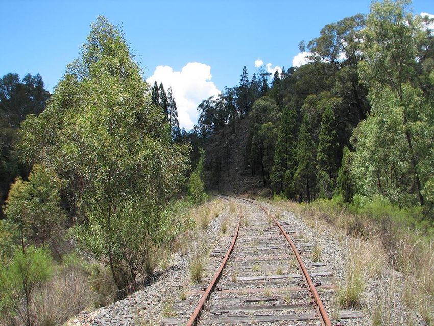
2.        WARRUMBUNGLE SHIRE

2.1       Our Shire                                                                                                 Figure 2.1 Warrumbungle Shire

Warrumbungle Shire is located on the central western slopes and plains of NSW. The Shire2 lies approximately
450 kilometres north of Sydney, 150 kilometres north of Dubbo, 185 kilometres west of Tamworth, and 190
kilometres north of Mudgee. The Shire is part of the Orana Region of NSW and is bounded by Narrabri Shire
to the north, Gunnedah and Shires to the east, Mid-Western and Dubbo Regional Councils to the south and
Gilgandra and Coonamble Shires to the west.

Four highways traverse the Shire – the Newell, Oxley, Castlereagh and Golden Highway, providing strong
connections to the surrounding regional centres as well as to Sydney, Melbourne, Brisbane and Newcastle.
The southern and central areas of the Shire have access to the Binnaway – Werris Creek, Gwabegar and Troy
Junction to Merrygoen railway lines for freight transport.

Incorporating an area of 12,380 square kilometres, the Shire extends from the Liverpool Range in the east
through to the ancient Warrumbungle shield volcano in the west. The topography ranges from the high basaltic
plateau of Coolah Tops in the Liverpool Ranges, through rolling hills, the highly eroded volcanic landscape of
the Warrumbungle National Park and alluvial plains. The south eastern and southern areas of the Shire lie
within the Macquarie River catchment area; the central areas of the Shire are drained by the Castlereagh River;
and the northern and north eastern areas lie within the Namoi River catchment. The eastern and southern
parts of the Shire lie within the Gunnedah and Ulan geological basins and have extensive coal resources, while
the northern part of the Shire has coal seam gas resources. There are currently no proposals to mine coal or
extract coal seam gas within the Shire.

The Shire has a warm temperate climate with hot summers (average temperature range 15-32oC) and cool to
cold winters (0-17oC)3. The average annual rainfall is 746.1mm in Coonabarabran and 613.9mm in Dunedoo,
with rain occurring year-round with a summer peak. Frosts are prevalent in winter and snow falls have been
recorded at Coolah Tops and in the Warrumbungle Ranges. The climate is conducive to cropping and grazing
year-round.

Agriculture is the primary land use and economic activity, with cattle and sheep production and cereal cropping
being the main activities. Other crops include canola, pulses (chick peas, mung beans, faba beans), cotton and
pasture. The Shire has several piggeries, a large thoroughbred horse stud and several viticultural, horticultural
and apiary producers. The Shire has a specialist native plant nursery and cut flower grower, and several native
seed collectors and a large native seed distributor.

                                                                                                                     Source: Base Map - Google Maps
2 The distances given are by road to Coonabarabran which is the main town and administrative centre of the Shire.
3 Bureau of Meteorology – minimum and maximum temperatures for January and July, Coonabarabran

                                                                                                                                                      4
Tourism is a significant economic activity, with the Shire having high profile tourist attractions including the
Warrumbungle and Coolah Tops National Parks, Pilliga Forest 4, Siding Spring Observatory, Pilliga Pottery and
the recently announced Warrumbungle Dark Sky Park.

At the 2016 Census, Warrumbungle Shire had a resident population of 9,3845. From 2006 to 2016, the
population of the Shire declined by 4.3% (424 people). With the status quo in economic activity, the
population of the Shire is projected to continue to decline with the Shire’s population forecast to decrease to
8,650 by 20366. Increased economic activity with employment opportunities is needed to drive population
growth. The population of the Shire is aging with the median age in 2016 being 49 years.7

Warrumbungle Shire has six small towns and eleven villages. Coonabarabran (population 2537) 8 is the largest
town and the administrative centre of the Shire. Located at the junction of the Newell and Oxley Highways,
Coonabarabran is a highway service centre as well as the main gateway to the Warrumbungle National Park.
Coolah (pop. 795) located on the Black Stump Way, approximately 90km south-east of Coonabarabran, is the
gateway to the Coolah Tops National Park. Dunedoo (pop. 747) located on the Golden and Castlereagh
Highways on the southern edge of the Shire approximately 115km south of Coonabarabran, is a highway and
rural service centre. The smaller towns of Baradine (pop. 626), Binnaway (pop. 425) and Mendooran (pop.
269) are local service centres, with Baradine being the gateway to the Pilliga Forest. From 2006 to 2016, the
population of Coonabarabran (-2.8%), Dunedoo (-10.6%), Binnaway (-14.1%) and Mendooran (-15.7%)
declined, with the population of Coolah remaining static and the population of Baradine (+5.6%) increased.
Over the same period, the population of the rural areas declined by 4.2%, with the population declining 6.3%
between 2006 and 2011, and growing (up 2.3%) between 2011 and 2016.

                                                                                                                                               Sandstone Caves, Pilliga Forest

4 The Pilliga Forest incorporates a number of National Parks, Nature Reserves, State Conservation Areas, State Forests and Aboriginal Areas.
5 Australian Bureau of Statistics, Census of Population and Dwellings 2016, Resident Population, Warrumbungle Shire
6 NSW Planning and Environment 2016 NSW Population and Household Projections – Warrumbungle Shire
7 Australian Bureau of Statistics Census of Population and Dwellings, 2016: Warrumbungle Shire.
8 Australian Bureau of Statistics Census of Population and Dwellings, 2016: Population of the towns is given for the urban locality.

                                                                                                                                                                            5
2.2          Access
Warrumbungle Shire is well connected by road. There are four highways and several regional roads that feed into the Shire:

• Newell Highway - located along the western side of the Shire, the Newell Highway is the main inland interstate route linking Melbourne, via inland NSW to southern Queensland.
  The Highway is a designated national freight route and a very popular touring route. The Newell links Coonabarabran with Dubbo to the south and Narrabri to the north.
• Oxley Highway - a state highway linking the Pacific Highway at Port Macquarie to the Mitchell Highway at Nevertire, via Tamworth, Gunnedah and Coonabarabran. The Highway
  is used by agricultural producers in the Shire to access to the saleyards, grain and feed mills and livestock processing plants in Gunnedah and Tamworth.
• Castlereagh Highway – a state highway linking the Great Western Highway at Lithgow to Central Queensland, via Mudgee, Dunedoo and Gilgandra.
• Golden Highway – a state highway located along the southern edge of the Shire linking the Hunter Valley to Dubbo and the Great Western Plains, with this route being an
  important freight route providing access to the Port of Newcastle.
• Black Stump Way – a regional road along the eastern edge of the Shire connecting the Golden Highway near Dunedoo to the Oxley Highway at Mullaley with an unsealed link
  (Grain Valley Way) through to the Kamilaroi Highway at Boggabri.
• Purlewaugh Road – an important east-west link between Coonabarabran and Liverpool Plains Shire, with the route providing access to the grain receival sites, feedlots and
  feedmills in Liverpool Plains Shire.
• Baradine – Gwabegar Road – a north-south link along the north-western edge of the Shire, providing access to the Pilliga Forest and north to the hot artesian baths at Pilliga and
  Burren Junction.
• Timor Road – John Renshaw Parkway – linking Coonabarabran and the Warrumbungle National Park with local road connections through to Gilgandra and Coonamble Shires.
• Number 1 Break – an unsealed road through the Pilliga Forest, links the Newell Highway to Baradine and is part of the access road to Dandry Gorge and the Salt Caves. Different
  sections of the road are controlled by NSW National Parks, Forestry Corporation of NSW and Warrumbungle Shire Council

Roads and Maritime Services are forecasting significant increases in
traffic, particularly freight traffic, on the Newell, Oxley and Golden
Highways over the next 2 decades9.

The southern and central areas of the Shire have access to the Binnaway-
Werris Creek, Gwabegar and Troy Junction to Merrygoen railway lines.
These lines are part of the national rail freight network and are managed
by ARTC. Binnaway and Dunedoo have rail access. The Gwabegar and
Troy Junction to Merrygoen lines link Dubbo to the Port of Newcastle with
connections south to Port Botany and Port Kembla, while the Binnaway-
Werris Creek line, links north to join the Main North West and Mungindi
lines at Werris Creek. The Mungindi line services the north west of NSW
and will link with the Inland Rail line at Narrabri. The Gwabegar line

                                                                                                                                                Road Train – Bypass Stockfeeds, Baradine

9   RMS Highway Corridor Strategies
                                                                                                                                                                                           6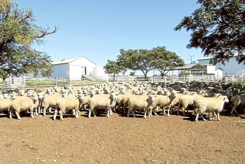
between Binnaway and Gwabegar is closed with the corridor identified as possibly
suitable for a rail trail. The closed Coolah to Craboon rail line has also been identified   Section of the closed Gwabegar Rail Line between Coonabarabran and Baradine –
as potentially suitable for a rail trail to link Coolah and Dunedoo.                         ideal for a rail trail

The proposed Inland Rail line is located along the western edge of the Shire and will
connect with the closed section of the Gwabegar line near Kenebri. The closest Inland
Rail intermodal terminals (transport and logistic hubs) to Warrumbungle Shire are
proposed for Narrabri to the north and Narromine to the south west. Both towns
already have intermodal terminals for containerisation of grains, pulses and cotton.
Baradine and Coonabarabran are ideally located to provide accommodation and
services for rail workers and contractors during the construction of the Narromine –
Narrabri section of the Inland Rail line and Council needs to advocate strongly for this
to occur. Longer term, there may also be opportunities for accessing the line for the
transport of grain and timber.         Gilgandra Shire Council is advocating for the
establishment of a construction camp and a transport and logistics hub at Curban.

TrainsNSW provides a coach service between Lithgow and Baradine, with the service
stopping in each of the towns in the Shire. Transport NSW is currently trialling a twice
weekly coach service between Tamworth and Dubbo, via Gunnedah and
Coonabarabran. There is a commercial coach service operating along the Golden
Highway between Newcastle and Dubbo which connects with the TrainsNSW service
at Dunedoo. The nearest airports with commercial RPT services are located at Dubbo,
Tamworth, Mudgee and Narrabri.

                                                                                                                                                                    Reedman Transport, one of the
 Freight train on the Merrygoen line, at Merrygoen                                                                                                                  Shire’s trucking companies

                                                                                                                                                                                                    7
2.3         Economic Snapshot10

                                  Warrumbungle Shire is primarily dependent on agriculture. The Shire’s Gross Regional Product (GRP) is estimated at $452.349 million, equating to 5.59%
         Output                   of the Orana Region GRP and 0.08% of the NSW Gross State Product. GRP per capita is $48,118 which is lower than the Regional average of $68,095 with
       $810.638M                  GRP per worker being $145,222n which is also lower than the Regional average of $161,926. From 2012 to 2016 the Shire achieved year-on-year growth
                                  in the GRP, with GRP decreasing in 2017, primarily due to the drought.

          GRP                     The total output (gross revenue) generated by the Shire economy is estimated at $810.638M (5.04% of the Orana Region). The sectors with the highest
       $451.349M                  output are Agriculture, Forestry, Fishing ($260.235M); Rental, Hiring and Real Estate Services ($92.938M); Construction ($64.477M) and Public
                                  Administration and Safety ($50.328M). The total value-add by the Shire’s economy is estimated at $405.496M (5.43% of value-added in the Orana Region),
                                  with the value of goods and services exported from the Shire being $329.968M (5.6% of the value of exports from the Orana Region).
     Value Added
      $405.496M                   The Agricultural sector is the major employer (900 jobs), followed by Health Care and Social Assistance (412 jobs) and Education and Training (412 jobs).
                                  From 2011 to 2016, employment increased in the Construction (57 additional jobs), Agriculture (56), Education and Training (49), Public Administration
                                  and Safety (39), Health Care and Social Assistance (38), Administration and Support (31) and Transport, Postal and Warehousing (22) sectors, with
     Value Exports                employment in other sectors declining. In March 2018, the unemployment rate in the Shire was 3.7%, which was lower than the Orana Region at 4.3%.
      $329.968M                   There were 160 people in the Shire seeking work.

                                  At June 2017, there were 1003 businesses in the Shire. Small businesses dominate with 63.6% of businesses being non-employing, 27.5% employed 1 to 4
       Businesses                 people, with 8.1% employing 5 to 19 people and 0.8% employing 20 to 199 staff.
         1,003                    Industries within the Shire can be broadly divided into:

         Jobs                     • Engines – industries that bring money into the Shire and drive the local economy
     3,108 people                 • Enabling – industries that support the engines (eg transport)
                                  • Population serving – industries that support the local population (eg retail)

     Unemployment                To foster economic development, it is important to focus on the engine sectors that drive growth, and the enabling industries that support these. The
         3.7%                    fortunes of the population serving industries depend primarily on the success of the engine industries.
      160 people
                                 The primary engine industries in Warrumbungle Shire are agriculture and tourism. Other activities that bring money into the Shire include the Education
     seeking work                and Training and Public Administration and Safety sectors. The Education and Training sector includes Siding Spring Observatory which is owned and
                                 operated by the Canberra-based, Australian National University.

10
     Economic data in this section has been extracted from the Warrumbungle Shire Economic Profile, prepared by REMPLAN based on 2016, 2017 and 2018 data.
                                                                                                                                                                                         8
Figure 2.2 Performance (Output, Value Add, Export) by Industry Sector – Warrumbungle Shire
($million)
Agriculture, Forestry & Fishing
Rental, Hiring & Real Estate Services
MAJOR EMPLOYERS
Construction Warrumbungle Shire Council
Woolworths Supermarket
Public Administration & Safety
Cooinda Coonabarabran
Education & Training Siding Spring Observatory
Health Care & Social Assistance
Western NSW Health
NSW Department of Education
Manufacturing
Accommodation & Food Services
Transport, Postal & Warehousing
Retail Trade
Electricity, Gas, Water & Waste
Professional, Scientific & Technical
Administrative & Support Services
Other Services
Wholesale Trade
Financial & Insurance Services
Arts & Recreation Services
IT Media Telecommunications
$- $50 $100 $150 $200 $250 $300
Output $M Value-Add $M Exports $M
9Table 2.1 Warrumbungle Shire – Economic Indicators by Sector
Industry Sector Output Value Add Value of Exports Value of Imports Net Employment
$ million % of $ million % of $ million % of $ million % of Value of Jobs As % Total Change 2011-16
Shire Shire Shire Shire Exports - 2011 2016 2011 2016 No. %
Imports
$ million
Agriculture, Forestry & Fishing $260.235 32.1% $100.191 24.7% $223.550 67.7% $96.794 40.1% $126.76 844 900 27.8% 29.0% 56 6.6%
Rental, Hiring & Real Estate Services $ 92.938 11.5% $ 69.649 17.2% $ 1.377 0.4% $15.976 6.6% -$ 14.60 17 16 0.6% 0.5% -1 -5.9%
Construction $ 64.477 8.0% $ 21.138 5.2% $ 1.592 0.5% $20.379 8.4% -$ 18.79 81 138 2.7% 4.4% 57 70.4%
Public Administration & Safety $ 54.328 6.7% $ 30.838 7.6% $ 19.454 5.9% $12.962 5.4% $ 6.49 203 242 6.7% 7.8% 39 19.2%
Education & Training $ 52.940 6.5% $ 40.776 10.1% $ 23.974 7.3% $ 7.528 3.1% $ 16.45 363 412 11.9% 13.3% 49 13.5%
Health Care & Social Assistance $ 51.797 6.4% $ 38.056 9.4% $ 0.823 0.2% $ 8.930 3.7% -$ 8.11 374 412 12.3% 13.3% 38 10.2%
Manufacturing $ 39.696 4.9% $ 9.031 2.2% $ 21.977 6.7% $22.379 9.3% -$ 0.40 105 85 3.5% 2.7% -20 -19.0%
Accommodation & Food Services $ 34.569 4.3% $ 14.419 3.6% $ 13.695 4.2% $15.531 6.4% -$ 1.84 211 203 6.9% 6.5% -8 -3.8%
Transport, Postal & Warehousing $ 33.686 4.2% $ 15.073 3.7% $ 7.013 2.1% $ 9.313 3.9% -$ 2.30 99 121 3.3% 3.9% 22 22.2%
Retail Trade $ 28.681 3.5% $ 17.522 4.3% $ 1.067 0.3% $ 6.225 2.6% -$ 5.16 338 247 11.1% 7.9% -91 -26.9%
Electricity, Gas, Water & Waste $ 23.039 2.8% $ 11.037 2.7% $ 4.276 1.3% $ 3.593 1.5% $ 0.68 42 24 1.4% 0.8% -18 -42.9%
Professional, Scientific & Technical $ 17.961 2.2% $ 8.356 2.1% $ 1.110 0.3% $ 5.550 2.3% -$ 4.44 67 66 2.2% 2.1% -1 -1.5%
Administrative & Support Services $ 14.814 1.8% $ 7.481 1.8% $ 1.819 0.6% $ 4.019 1.7% -$ 2.20 37 68 1.2% 2.2% 31 83.8%
Other Services $ 14.788 1.8% $ 7.540 1.9% $ 2.663 0.8% $ 5.291 2.2% -$ 2.63 102 93 3.4% 3.0% -9 -8.8%
Wholesale Trade $ 13.492 1.7% $ 6.715 1.7% $ 1.635 0.5% $ 3.864 1.6% -$ 2.23 73 35 2.4% 1.1% -38 -52.1%
Financial & Insurance Services $ 7.315 0.9% $ 4.519 1.1% $ 1.804 0.5% $ 2.153 0.9% -$ 0.35 29 10 1.0% 0.3% -19 -65.5%
Arts & Recreation Services $ 3.274 0.4% $ 1.716 0.4% $ 1.146 0.3% $ 0.879 0.4% $ 0.27 45 26 1.5% 0.8% -19 -42.2%
IT Media Telecommunications $ 2.609 0.3% $ 1.439 0.4% $ 0.993 0.3% $ 0.898 0.4% $ 0.10 11 10 0.4% 0.3% -1 -9.1%
Total $810.638 100.0% $405.496 100.0% $329.968 100.0% $241.370 100.0% $ 88.60 3,041 3,108 100.0% 100.0% 67 2.2%
Source: Warrumbungle Shire Council – Economic Profile - REMPLAN
Inside the Dome at the Australian –
Anglo Telescope, Siding Spring
Observatory
10Agriculture
Figure 3.3 Contribution to Value by Production Type
Agriculture (including Forestry) is the main economic activity and primary driver of the Shire’s
economy. Agriculture accounts for 32.1% ($260.235M) of the output from the Shire, 24.7%
Warrumbungle Shire, 2015-16
Source: Australian Bureau of Statistics – Agricultural Census, 2015-16
($100.191M) of the value add and 67.7% ($223.55M) of the Shire’s exports. 53.7% (539) of
60%
registered businesses and 29.0% of jobs (900) are in the agricultural sector. In June 2017, 67% of
agricultural businesses were non-employing, with 24.5% employing 1-4 people, 7.8% employing 5- 50%
19 people and 1.5% employing 20-199 staff.
40%
The performance of the agricultural sector impacts directly on the performance of the transport,
rental-hire-real estate, retail, wholesale, construction, financial, manufacturing and professional, 30%
scientific and technical services sectors.
20%
In 201611, around 45.7% of the land area of the Shire was in agricultural production, with 86.8% of
this land used for livestock production (primarily grazing) and 13.2% for cropping. The gross value 10%
of production was $153.761M, with livestock production accounting for 68.1% ($104.724M) of the
value of production and cropping 31.9% of the value ($49.037M). 0%
Cattle production ($78.36M) dominates, accounting for 51% of the total value of production and
74.8% of the value of livestock production. There is increasing specialisation in cattle production.
Sheep generated $23.99M (15.6% of the total value of production) with $10.08M coming from
meat and $13.91M from wool. The Shire also has several piggeries ($2.0M) as well as small scale
goat, dairy and poultry production, horse studs and several honey producers.
Cereal crops (wheat, oats, barley, triticale and sorghum) are the primary income earner (61.6% of
gross value of crop production), followed by pulses (20.0%), hay and pasture seed (8.9%), oilseeds
(6.7%), dryland cotton (1.7%) and horticulture / viticulture (1.1%).
Most of the grain produced in the Shire is exported, going primarily by road to receival sites in the
surrounding regions or direct to the Port of Newcastle. Some of the grain also goes to feedlots in
Liverpool Plains Shire and the Dubbo area and to mills and feed-mills in the surrounding regions.
Baradine is the only active grain receival site still operating in the Shire, but is limited in the grain
that it can receive. Some pulses are transported to Narrabri and Narromine for containerisation
for export, with oilseeds going to Newcastle, Narrabri and Manildra for crushing and processing.
Bilby Blooms is the main horticultural producer, producing native plants (wholesale nursery) and
cut flowers. There are also several native seed collectors and a native seed distributor. Other niche
activities include Mannin Grove Olives and poppy production for medicinal purposes. Sheep breeders’ sale, Dunedoo
11 Australian Bureau of Statistics Agricultural Census, 2015-16
11Value-adding to agricultural produce is limited and includes the Bypass stock
feedmill in Baradine and the Black Gate Distillery at Mendooran. The Abattoir
on Warrumbungle Way midway between Coonabarabran and Binnaway,
which closed in 2016, has been sold, with plans to re-open in the future.
Several of the Shire’s producers are participating in the Regional Platters
program, which is a paddock to plate initiative, which is helping to raise the
profile of the Region’s produce
Warrumbungle Shire has a range of services to support the agricultural sector
including agronomists, rural suppliers, stock and station agents, transport /
freight operators, farm contractors, earth-moving contractors, fencers, feral
animal control, shearers, harvesters, wool classers and brokers, seed cleaners,
and vets, as well as engineers / fabricators and financial and legal services.
Above: Agri-processing
Many of the agricultural service providers are in the Rental, Hiring and Real businesses include Bypass
Estate Services sector, which in terms of output, is the second largest Stockfeeds at Baradine
economic sector in the Shire. and the Black Gate
Distillery at Mendooran
Right: Regional Platters
Tourism Promotional Collateral
Although small in comparison to agriculture, the tourism sector is a significant contributor the Shire’s
economy. Visitors bring ‘new’ dollars into the Shire, with this income being independent of the agricultural sector,
generating cash flow year-round and reducing the impacts of seasonal and cyclical activities. Through marketing and
promotion, and visitation, tourism helps to raise the profile of the Region and can play a part in relocation decisions.
The estimated output of the Shire’s tourism sector is $46.972M with tourism having a value-add of $21.441M and
employing 239 people12.
Tourism Research Australia estimated that in 2016, Warrumbungle Shire attracted 125,000 visitors who stayed one or
more nights in the Shire, with 123,000 being domestic visitors and 2,000 being international visitors 13. Estimates of the
number of day visitors to the Shire are not available. Visitors stayed an estimated 258,000 nights in the Shire and spent
in the order of $30 million during their stay. From 2011 to 2016, the number of domestic overnight visitors increased by
17.1%, with the number of international visitors remaining static. The number of nights spent by domestic visitors
decreased by 10%, with the average length of stay in the Shire falling from 2.56 nights in 2011 to 1.98 nights in 2016.
Open Day at Bilby Blooms, near Dunedoo
12 Warrumbungle Shire Council – Economic Profile – REMPLAN Note: The tourism industry cuts across most industry sectors including accommodation and food, retail and wholesale, transport, manufacturing and arts and
recreation.
13 Tourism Research Australia LGA Profile, 2016 - Based on a 4 year rolling average.
12High profile tourist attractions, include:
• Warrumbungle National Park – currently attracts over 30,000+ visitors
per year, however visitation was higher (45,000+/year) prior to the
media coverage of the destruction caused by the 2013 Wamberlong
bushfire. The Park is popular for camping, bushwalking, bird-watching
and rock sports.
• Siding Spring Observatory – attracts 30,000+ visitors per year (35,500
in 2017/18).
• The internationally accredited Warrumbungle Dark Sky Park – the only
Dark Sky Park in Australia.
• Pilliga Forest – with attractions including the Pilliga Forest Discovery
Centre, Dandry Gorge and the Sculptures in the Scrub, Sandstone
Caves, Salt Caves and the Fire Tower Lookout – the only one in NSW.
• Coolah Tops National Park.
• Pilliga Pottery – attracts 10,000+ visitors per year
These attractions are supported by a range of local attractions (eg Virtual
Solar System Drive, Dunedoo Woodland Learning Centre, the
Warrumbungle and Milroy Observatories, Black Gate Distillery, Crystal
Kingdom, Tibuc Gardens), quality events, contemporary shopping and
dining and a diversity of accommodation options.
In recent years, tourism in parts of the Shire has become stagnant,
however the recent declaration of the Dark Sky Park, the opening of the
new Warrumbungle National Park Visitors Centre, the proposed Royal
Hotel redevelopment and the Australian Wildlife Conservancy in the Pilliga
Forest provides opportunity to reinvigorate the industry.
Top: Warrumbungle National Park Bottom from left to right: Bracken Cottage Coolah Tops National Park; Pilliga Pottery; Sculptures in the Scrub at Dandry Gorge in the Pilliga Forest, Milroy Observatory
132.4 Workforce
At March 2018, there were 4,282 people in the labour force within Warrumbungle Shire and 160 people actively seeking work14. Over the past 5 years, there has been an 8.8%
increase in the number of people in the labour force within the Shire (348 additional people), with the unemployment rate falling from 6.3% to 3.7%.
At the 2016 Census, 67.6% of the workforce had formal qualifications with 17.9% having university degrees, 11.2% with diplomas and advanced diplomas and 38.5% with vocational
certificates. The proportion of the workforce with qualifications in Warrumbungle Shire is slightly lower than the proportion for the Orana Region (72.3%).
Like most rural localities, businesses in Warrumbungle Shire find it difficult to attract and retain staff, particularly people with skills and experience. Job vacancies exist in most sectors.
Factors that deter people from relocating to Warrumbungle Shire include the small size of the towns; availability of similar employment opportunities in larger towns; limited career
progression opportunities; lack of suitable housing; perceived limited education options for children; and perceived lifestyle constraints.
2.5 Infrastructure & Services to Support Economic Growth
Utilities
Water – Potable water supplies are available to each of the towns and to the villages of Kenebri and Bugaldie, with non-
potable water available at Merrygoen. The water supply for Coonabarabran is not secure with the town on Level 6 water UTILITY INFRASTRUCTURE
restrictions. Council is supplementing Coonabarabran’s water supply with bore water and has approval to sink several PRIORITIES
‘emergency’ bores. Council is also seeking to increase the capacity of Timor Dam. The water supply infrastructure in
the Shire is approaching the end of its economic life. Water: Securing the water supply for
Coonabarabran and replacing aging
Sewerage – Coonabarabran, Coolah, Dunedoo and Baradine are sewered. Mendooran and Binnaway not sewered, infrastructure.
with this seen as a constraint to growth by both communities. The sewerage infrastructure in the Shire is approaching Sewerage: Replacing aging infrastructure
the end of its economic life. Power: Ensuring reliability through network
upgrades and/or development of alternative
Power – Warrumbungle Shire is part of Essential Energy’s Beryl sub-transmission network, with a single 66kV line
sources
servicing Dunedoo and Coonabarabran. Being at the ‘end of the line’ the Shire experiences fluctuations in power supply,
including surges, black outs and brown outs. Although variability of power is an on-going problem, particularly in
Coonabarabran, the transmission grid is not identified as having limitations or requiring upgrading in Essential Energy’s Telecommunications:
distribution planning15. • Access to high speed, reliable, affordable
internet with adequate carrying capacity
The approved Liverpool Range Windfarm, is located south east of Coolah. The Farm will have the capacity to generate • Extend mobile phone coverage – a secondary
1,000MW of power, with this power to be fed back into the Hunter transmission network. It will not address the power network of towers is needed
supply issues in Warrumbungle Shire. A large solar farm is proposed for Dunedoo.
14 Australian Department of Employment (2016) Small Area Labour Markets, Warrumbungle Shire, March 2018.
15
Essential Energy (2017) Distribution Annual Planning Report
14Telecommunications – Telecommunications infrastructure in the Shire is limited and the internet is expensive to access. There are significant ‘black spots’ in the mobile phone
coverage. Coonabarabran (town only) and the Dunedoo and Coolah areas have fibre to the node access to the NBN, with the remainder of the Shire having access to the NBN via
satellite. The decision not to provide the NBN to the Coonabarabran industrial area is detrimental to economic growth, rendering both the industrial estate and the businesses within
the estate, less competitive to those in the surrounding region which have fixed line NBN access. The 55 existing businesses within the estate, and future businesses have to rely on
slow ADSL connections or unreliable and expensive satellite services to access the internet.
For the Shire to be competitive there is a need to increase the reliability, speed and affordability of the internet and extend mobile phone coverage. This is essential to enabling the
application of technology to improve farming and business productivity, accessing national and global markets and increasing access to online service and training opportunities.
Transport Infrastructure
Roads – With the closure of the Gwabegar rail line to the north west of Binnaway, and most of the grain receival sites and abattoir, there has been a signficant increase in the use of
road transport. This has increased costs for producers and impacted on the Shire maintained and funded road network. Grains and pulses are being transported to bulk receival sites
in Gilgandra, Liverpool Plains, Narrabri and Gunnedah Shires; direct to the Port of Newcastle; to intermodal terminals in Narrabri and Narromine; to mills and feedmills in Dubbo,
Gunnedah and Tamworth; and to feedlots in Liverpool Plains Shire and the Dubbo area. Livestock is primarily going to saleyards in Gunnedah, Tamworth, Mudgee and Dubbo; to
feedlots in the Liverpool Plains and Upper Hunter; and to processing plants in Dubbo, Tamworth and the Hunter Valley.
Key routes for agricultural freight include the Newell, Golden and Oxley Highways, Black Stump Way, and the Baradine, Purlewaugh and Mendooran Roads. These routes are accessible
to 25/26 metre general mass limit (GML) trucks. The Newell, Golden and Oxley Highways and the Purlewaugh and Mendooran Roads are accessible to high mass limit vehicles (HML).
Road train access to the Shire is extemely limited. There is no road train access on the Newell Highway between Tooraweenah and Coonabarabran, nor to any areas to the east of
the Highway. There is road train access from Baradine west to Coonamble and north to Pilliga. The farming community identified the Black Stump Way and the Purlewaugh and
Baradine Roads as priorities for upgrading.
Roads and Maritime Services (RMS) is forecasting that from 2011 to 2031, the volume of truck traffic on the
Newell will increase between 62% and 100% depending on the location along the Highway, with truck traffic
through Coonabarabran to increase by 80%. The RMS is proposing to upgrade the Newell Highway to take
high productivity vehicles (up to 36.5metres) along the length of the Highway. RMS has ranked the need
for a by-pass around Coonabarabran as a medium term priority (within 10 years from 2016), and the
preferred route corridor has been identified. Removal of heavy vehicle traffic from Coonabaran will
increase the amenity and safety of the town centre, however, a bypass could reduce other traffic coming
into town, possibly resulting in a loss of revenue for some local businesses.
Heavy vehicle traffic on the Oxley Highway to the east Coonabarabran and on the Golden Highway through
Dunedoo is also forecast to increase with the freight tonnage forecast to grow by 52% on the Oxley
Highway16 and 64% on the Golden Highway17. Unloading Hay, Dunedoo
16 RMS Oxley Highway Corridor Strategy, 2016
17 RMS Golden Highway Corridor Strategy, 2016
15Black Stump Way and the Baradine and Purlewaugh Roads need to be improved to cater for the increasing volume of
freight and touring traffic. Gunnedah and Narrabri Shires are seeking funding to complete the seal of Grain Valley
Way which will provide a fully-sealed link from the Black Stump Way to the Kamilaroi Highway, improving access from ROAD & RAIL PRIORITIES
the eastern areas of Warrumbungle Shire to the cotton gins at Boggabri and Wee Waa, and to the intermodal terminals
and Cargill Crush Plant (cotton and canola seed) in Narrabri. It also provides an alternative route to the Newell Roads
Highway for the drive touring market. • Plan for the Coonabarabran by-pass to
deliver the best outcomes for the town
The feedlots in Liverpool Plains Shire are looking to expand, which will increase livestock and grain freight movements
centre and local businesses.
on the Purlewaugh Road. A large abattoir is proposed for Gunnedah which will result in an increase in livestock traffic
along both the Black Stump Way and Oxley Highway. To the north west, Narrabri Council is seeking funding to seal
• Progressively upgrade the Black Stump Way
Forest Way (Baradine Road) between Pilliga and Gwabegar. This will result in increased freight and touring traffic on and the Baradine and Purlewaugh Roads to
the route, which will have direct benefits for Baradine. If Baradine gains access to the Inland Rail, this will further support the agricultural sector.
increase freight traffic on the Baradine Road. • Support applications by neighbouring
Councils to seal roads that feed into
Drive touring (which includes the touring caravan and RV markets) is increasing, with both Destination NSW and the Warrumbungle Shire, including Grain Valley
Country and Outback Destination Network looking to significantly grow this market within the Country and Outback Way and Forest Way.
Region. From a tourism persepctive, the key roads are the highways and regional roads that feed into the Shire, the • Explore options for upgrading roads that
regional roads (Warrumbungle Way, Mendooran Road and Baradine-Gwabegar Road) that connect the towns
provide access to the key tourist attractions.
(providing off-highway touring routes), and the access roads to key attractions – Warrumbungle and Coolah Tops
National Parks, Siding Spring Observatory, Pilliga Forest and Pilliga Pottery. Rail
Rail - The operating rail infrastructure in Warrumbungle Shire is part of the National Rail Freight Network, with this • Explore options to capitalise on the Inland
infrastructure being progressively upgraded. The Gwabegar line between Binnaway and Gwabegar and the Coolah Rail.
Branch line (Coolah to Craboon) are closed and it has been suggested that sections of these corrridors could be suitable • Explore options to convert sections of the
for rail trails. The proposed Inland Rail Line between Melbourne and Brisbane will connect with the closed section of closed Gwabegar and Coolah rail lines for
the Gwabegar line near Kenebri. With the grain receival site at Baradine still operational, and the potential to export rail trails.
logs and timber from the Pilliga Forest, there may be potential to upgrade and utilise the railway infrastructure from
Baradine to Kenebri to access the Inland Rail line.
Aerodromes – Warrumbungle Shire Council maintains aerodromes at Coonabarabran, Coolah and Baradine. The Coonabarabran aerodrome has a sealed runway and is licenced
for general aviation. It is used for charter flights, recreational flying, air ambulance, rural fire service (RFS) and agricultural support services. The Coolah and Baradine strips are
primarily used by the RFS and other emergency services. There is opportunity to use the Coonabarabran aerodrome for charter flights for high-yield tour groups visiting Siding Spring
Observatory.
Cycle – Warrumbungle Shire Council is progressively developing cycleway networks in the each of the towns. These networks will facilitate use of bicycles and enhance the lifestyle
and liveability of the towns. Both cycle tourism (visiting a location specifically to ride or to participate in a cycle event) and the number of caravanners and RV’s travelling with cycles
is increasing, with visitors looking for attractive, safe places for people to ride. Rail trails would be ideal for these markets. A safe cycleway linking Coonabarabran with the
16Warrumbungle National Park would also prove popular. They may be opportunities for mountain
bike trails in parts of the Pilliga Forest and the Warrumbungle and/or Coolah Tops National Parks.
Agricultural Infrastructure
The infrastructure to support agriculture within the Shire has been decreasing with the closure of
the Gwabegar (Binnaway to Gwabegar) and Coolah Branch lines and most of the grain receival
sites. Infrastructure available includes:
• GrainCorp receival site at Baradine (limited in the grain that it will accept).
• Saleyards at Binnaway, Dunedoo and Coonabarabran, with these operated by local agents.
Sales are limited, with most of the stock in the Shire going to the larger saleyards in Gunnedah,
Dubbo, Tamworth and Mudgee.
The Abattoir, which closed in 2016, has recently sold with the new owners looking to re-open the
facility, possibly for halal kill. A truck wash is needed in the Shire to improve bio-security.
Cattle sale, Dunedoo
Other Facilities & Services
Facilities and services to support the Shire community and facilitate economic growth include:
• Education and Training – Coonabarabran has a public High School and primary school, with the smaller towns each having a Central School (K-12). Catholic primary schools are
located in Coonabarabran, Coolah, Baradine and Dunedoo. Coonabarabran High School has a very good reputation, with people moving to the town to access the school. The
Coonabarabran and Dunedoo TAFEs are connected learning centres providing access to a range of TAFE courses.
• Child Care – Long day, pre-school, out-of-school-hours care and family day care are available in Coonabarabran, with pre-schools in each of the smaller towns, and family day care
in Coolah and Dunedoo.
• Health Services – There is a district hospital in Coonabarabran and Multi-Purpose Health Centres in Baradine Coolah and Dunedoo. Coonabarabran also two medical centres, two
dental services and several allied health practitioners. Coolah, Dunedoo and Baradine each have medical services with resident doctors, with Mendooran having a visiting doctor.
Binnaway is seeking to attract a doctor. Like most rural LGAs, Warrumbungle Shire struggles to attract and retain doctors, registered nurses and other health professionals.
• Aged Care – Coonabarabran has a large aged-care complex with self-care units, hostel and nursing home facilities. An aged-care facility is currently under construction in Dunedoo.
Nursing home beds are available as part of the Multi-purpose Health Centres in Baradine, Coolah and Dunedoo. There are facilities and services available to support aging-in-
place. Baradine and Coolah have identified a need for self-care units, with Dunedoo needing additional nursing home beds.
• Library Services – Warrumbungle Shire is a member of the Macquarie Regional Library and operates libraries in each of the towns.
17• Business Services – including post offices, accountants, banks and financial services, IT support
and legal services. Baradine has a Rural Transaction Centre.
• Supermarkets – Coonabarabran has a Woolworths Supermarket, with an IGA Supermarket
about to open. Coolah has an IGA supermarket with small supermarkets in Binnaway (Friendly
Grocer), Dunedoo (Spar) and Baradine (IGA).
• Construction, engineering and automotive services are located in each of the towns.
• Recreation and sporting facilities and Sporting Clubs – playing fields/ovals, netball courts,
swimming pools, golf courses, showgrounds and horse sport facilities, lawn bowls, tennis, are
located in each of the towns with fitness gyms in Coonabarabran and Coolah, an indoor sports
centre in Coonabarabran and skateparks in most communities. The Coonabarabran community
is advocating for an indoor heated pool for year-round use.
• Creative and performing arts – the Shire has a range of creative and performing arts groups.
• Clubs, hotels restaurants and eateries – registered clubs and/or hotels in each of the towns
and cafes in the larger towns and at Tibuc Gardens, Siding Spring Observatory and Pilliga
Pottery.
• Visitor Centres – a Visitor Information Centre at Coonabarabran (Level 1 accredited), and
information outlet in Coolah (Pandora’s Gallery) and National Park Visitor Centres at Baradine
and in the Warrumbungle National Park.
• Accommodation – As a highway service centre, Coonabarabran is well supplied with motel,
hotel and caravan park accommodation with facilities to accommodate large groups including
coach tour groups. Motel, cabin and speciality accommodation is available along Timor Road,
to service the Warrumbungle National Park. Coolah and Dunedoo both have a motel, caravan
park, pub hotel accommodation and B&B accommodation. Baradine, Binnaway and
Mendooran have pub accommodation, Camp Cypress in Baradine provides powered sites,
cabins and group accommodation. Primitive camping is available on the river at Mendooran,
Binnaway (where visitors can also access power), near Coolah and in the Warrumbungle and
Coolah Tops National Parks and Pilliga Forest. Siding Spring Observatory has quality lodge
accommodation for astronomers and pre-booked tour groups, with Barkala Farm Stay (Pilliga
Pottery) providing unique farm-stay accommodation and camping sites.
From top to bottom: Horse racing at Mendooran, Tibuc Gardens Café & Gallery, Dunedoo Arts
Unlimited Pencil Sculpture, Autumn at the John Oxley Caravan Park, Coonabarabran
182.6 Land & Premises
Industrial Land – The five larger towns have general industrial areas which provide serviced industrial land. Coonabarabran has a The limited availability
purpose-built general industrial estate on the northern edge of town. The estate has vacant and under-utilised sites, however these of industrial land and
sites are privately held. There are virtually no vacant sites and no factory units available for businesses looking to establish in premises, well presented
Coonabarabran, and the absence of the NBN to the industrial area works against development. There are no factory units or sheds
available for sale or lease in the smaller towns. The Warrumbungle Shire LEP permits (with consent) rural industries (including
retail and commercial
agricultural processing facilities) in rural areas. premises, residential
properties for lease and
Commercial and Retail Premises – Availability of retail and commercial properties for sale or rent in Coonabarabran, Coolah and rural small holdings (10-
Dunedoo is very limited. Premises are available in Baradine. Most of the vacant premises throughout the Shire are older buildings
which require significant refurbishment. As there is insufficient return on investment, many owners are reluctant to invest in the 200ha) are a constraint
premises, preferring to leave them vacant. It is difficult for businesses looking to establish in the Shire to find suitable premises. to business and
population growth.
Residential – There is a range of residential properties in each of the towns for sale, with the property prices being highly affordable,
particularly when compared to prices in the major regional centres and capital cities. Based on information provided by
Realestate.com, the level of interest in residential properties in Coonabarabran, Coolah and Baradine is very low with viewers per
property being 85, 73 and 85 respectively (NSW average 847 viewers). Interest in properties
in Dunedoo and Mendooran is higher, 104 and 103 viewers per property respectively. In Figure 2.4 Median House Prices – Selected Towns, 2018
contrast, the interest in properties in Binnaway is significantly higher, attracting 513 views $400,000
per property. Pre-2013, there were less than 35 residential properties per year sold in $350,000
Coonabarabran, with sales post 2013 being 50-65 per year. There are around 20-25 sales
per year in Coolah, 10-15 per year in Mendooran and Baradine and 10-20 per year in $300,000
Binnaway. Pre-2017, there were less than 20 houses sold per year in Dunedoo, with 36
$250,000
properties sold in 2017.
$200,000
There are very few habitable rental properties available in the Shire, rendering it difficult
$150,000
for people to move to the area. Lack of capital gain is a major deterrent to investors entering
the market. $100,000
Under the LEP there is provision for rural lifestyle lots (2 hectare minimum) adjacent to $50,000
each of the towns. These lots are often too small for people looking for a ‘tree change’. $-
There is a lack of lots from 10-200 hectares which have a dwelling entitlement, with this
being property size that the real estate agents get enquiries for. The minimum lot size for
rural holdings on which a dwelling can be built, is 500 hectares in the north of the Shire and
600 hectares in the south.
Source: Realestate.com Suburb Profiles, August 2018.
193. STRATEGIC CONTEXT
The Warrumbungle Shire Economic Development Strategy has been prepared within the framework set by the NSW Government through the Premier’s Priorities and its 20 Year
Economic Vision for Regional NSW, and aligns with regional plans and strategies, and the Warrumbungle Shire Community Strategic Plan.
3.1 NSW Government Priorities
Premiers Priorities Premier’s Priorities
• Creating jobs – 150,000 new jobs by 2020
The NSW Premier has identified 12 priorities for NSW. Of these, 4 will help to drive economic growth in
regional areas. The Warrumbungle Shire Economic Development Strategy aligns with the Premier’s priorities • Building infrastructure
of creating jobs and building infrastructure. • Improving education results
• Making housing more affordable / faster housing
Priorities for Regional NSW - A 20 Year Economic Vision for Regional NSW approvals
In July 2018, the NSW Government released its priorities for driving economic growth in Regional NSW 18.
Priorities & Initiatives Key Directions
Infrastructure Leverage existing infrastructure and other • Improved digital connectivity beyond the NBN.
technologies in growth centres for a digitally • Improved mobile phone coverage.
connected future. • Innovative delivery methods for health, education etc.
• Low-bandwidth infrastructure for application of agricultural technologies.
Make regional travel faster and easier between and • Improving public transport options between rural communities and regional centres and to Sydney.
within regional communities, and to metropolitan • Improved road and rail connectivity.
areas.
Improve freight networks from regional NSW to global • Intermodal terminals in regional areas, with strong connectivity to ports.
gateways, to increase exports. • Improved east-west freight links across NSW.
• Realising the benefits of Inland Rail.
Manage vital energy and water resources sustainably • Providing energy security, including new energy projects.
to ensure supply will meet long-term regional needs. • Providing water security for engine industries and regional communities, including climate resilient water
infrastructure.
Skills Provide clear skills pathways to jobs in regions. • Aligning education and training with skills shortages and job opportunities in regional areas.
• Training support – including mentoring and assistance with transport and accommodation.
• Innovative training delivery models.
• Initiatives to encourage skilled workers to relocate to regional areas.
18 NSW Government (2018) A 20 Year Economic Vision for Regional NSW
20Priorities & Initiatives Key Directions
Boost regional NSW’s knowledge economy and • Industry, government and university partnerships.
excellence in innovation, particularly in agricultural • Fostering development of industry clusters in regional areas.
technology, aged care, energy, aerospace, logistics,
advanced manufacturing, and other areas linked to the
future of the regions.
Advocacy and Draw in more domestic and international tourists in • Improve infrastructure and transport to support tourism to wine and produce regions – focusing on areas where the
Promotion areas with tourism potential. NSW brand is recognised overseas.
• Increase the efficiency and connectivity of east-west transport across NSW.
Attract more domestic and international students to • Market and promot4 to further raise the profile of regional NSW’s education, training and research strengths.
regional NSW. • Dedicated campuses or precincts for international students to study in regional NSW.
• Tertiary-accredited integrated work-study qualifications in sectors of strength in regional NSW.
Business Provide an attractive environment for businesses to • Initiatives to encourage business investment in regional areas.
Environment establish and invest in regional NSW • Attract skilled labour to regional areas.
locations, consistent with regions’ economic • Encourage increased value-add in agriculture and manufacturing in regional areas.
endowments. • Streamline regulatory requirements.
• Provide business support services and international trade advocacy.
• Build flexibility into Crown land use to better respond to economic opportunities.
Grow vibrant places to live and work to encourage • Invest in cultural infrastructure in regional NSW.
business and population growth. • Invest in recreation infrastructure in growing regional centres.
• Ensure that planning delivers appropriate housing, utilities and transport to support growth in growing regional
centres.
• Activate regional town centre that have growth potential.
Source: NSW Government (2019) A 20 Year Economic Vision for Regional NSW
Pilliga Forest Discovery Centre, Baradine
New Visitor Centre,
Warrumbungle National Park
21You can also read