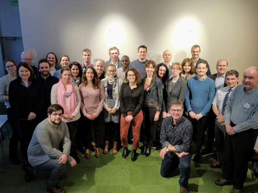
Workshop on Sea Level Data Archaeology - UNESCO
←
→
Page content transcription
If your browser does not render page correctly, please read the page content below
Intergovernmental Oceanographic Commission
Workshop Reports No. 287

Workshop on Sea Level
Data Archaeology
Paris, France
10–12 March 2020

                                      UNESCO
Intergovernmental Oceanographic Commission
Workshop Report No. 287

Workshop on Sea Level
Data Archaeology
Paris, France
10–12 March 2020

In partnership with:

                                  UNESCO 2020
IOC/2020/WR/287
Paris, April 2020
English only
The authors are responsible for the choice and the presentation of the facts contained in this
publication and for the opinions expressed therein, which are not necessarily those of
UNESCO and do not commit the Organization. Every care has been taken to ensure the
accuracy of information in this publication. However, neither UNESCO, nor the authors will
be liable for any loss or damaged suffered as a result of reliance on this information, or
through directly or indirectly applying it. The designations employed and the presentation of
the material in this publication do not imply the expression of any opinion whatsoever on the
part of the Secretariats of UNESCO and IOC concerning the legal status of any country or
territory, or its authorities, or concerning the delimitation of the frontiers of any country or
territory.
This report was compiled by the workshop rapporteurs: Elizabeth Bradshaw, Yann Ferret,
Frédéric Pons, Laurent Testut, Philip Woodworth.
Technical editing: Thorkild Aarup and Elena Iasyreva.
For bibliographic purposes this document should be cited as follows:
UNESCO/IOC 2020. Workshop on Sea Level Data Archaeology, Paris, France, 10-12
March 2020. Paris, UNESCO, IOC Workshop Reports, 287, 39 pp. English.
(IOC/2020/WR/287)
Published in 2020
by the United Nations Educational,
Scientific and Cultural Organization
7, place de Fontenoy, 75352 Paris 07 SPIOC Workshop Reports, 287
TABLE OF CONTENTS
SUMMARY page
1. WELCOME BY IOC EXECUTIVE SECRETARY
AND REPORTING ARRANGEMENTS ....................................................................... 1
2. DAY 1 SESSION 1 HISTORICAL SEA LEVEL
DATA AND DATA AT RISK......................................................................................... 1
3. DAY 1 SESSION 2: METHODOLOGY FOR TRANSFER
OF PAPER RECORDS TO DIGITAL DATA ................................................................ 2
4. DAY 2 SESSION 2 (CONT.): METHODOLOGY
FOR TRANSFER OF PAPER RECORDS TO DIGITAL DATA .................................... 3
5. DAY 2 SESSION 3: AUXILIARY HISTORICAL ARCHIVES
RELATED TO SEA LEVEL ......................................................................................... 4
6. DAY 2 SESSION 4: APPLICATIONS AND KNOWLEDGE
PRODUCTS FROM RECOVERED DATA ................................................................... 4
7. DAY 3 SESSION 4 (CONT.): APPLICATIONS
AND KNOWLEDGE PRODUCTS FROM RECOVERED DATA .................................. 5
8. POSTER SESSION .................................................................................................... 5
9. WORKSHOP SUMMARY............................................................................................ 6
RECOMMENDATIONS .......................................................................................................... 8
ANNEXES
I. PROGRAMME
II. ABSTRACTS
III. RESULTS FROM A POLL ON DATA RESCUE EXPERIENCES
IV. LIST OF PARTICIPANTS
V. LIST OF ACRONYMSIOC Workshop Reports, 287
1. WELCOME BY IOC EXECUTIVE SECRETARY
AND REPORTING ARRANGEMENTS
Dr Vladimir Ryabinin, Executive Secretary of the Intergovernmental Oceanographic
Commission (IOC), opened the Workshop on Sea Level Data Archaeology at 09:15 on
Tuesday 10 March 2020. He welcomed the participants of the workshop to the IOC and
thanked them for their attendance and dedication to Oceanography during this challenging
time.
Dr Ryabinin highlighted the aims of the UN Decade for Ocean Sciences (2021–2030)
(IOC/BRO/2018/2) and stressed that observations are essential for management of the ocean.
He emphasized the importance of data archaeology and the contributions workshop like this
makes towards the Decade objectives as well as the WCRP Grand Challenge project on
Regional Sea-level Change and Coastal Impacts (https://www.wcrp-climate.org/gc-sea-level).
Philip Woodworth acted as rapporteur for session 1 of the workshop, Yann Ferret was
rapporteur for session 2, Frédéric Pons was the rapporteur for session 3 and Laurent Testut
acted as rapporteur for session 4. Elizabeth Bradshaw helped in this process and summarized
the main outcomes of this workshop.
All presentations are available from: http://www.ioc-unesco.org/workshop-sea-level-data-
archaeology.
2. DAY 1 SESSION 1
HISTORICAL SEA LEVEL DATA AND DATA AT RISK
Elizabeth Bradshaw presented the opening keynote talk, giving a brief history of GLOSS data
archaeology efforts. She justified why sea level data rescue is important. The requirement for
more baseline data was highlighted, as well as the importance of sea level data rescue in the
context of international ocean observation programmes. Funding is a limiting resource but data
rescue is multidisciplinary and we should look to find funding on a large scale.
At the end of the presentation a poll was conducted among the workshop participants, asking
them about previous data rescue projects they had been involved in. The results are
synthesised below, and the complete answers are listed in the Annex III.
What went well? – We identified data we were not aware of, recovered data and found
a helpful community.
What challenges did you face? – It was difficult to find metadata, particularly datum
connections. Digitising is time consuming. Resources and funding.
What would you do differently next time? – Scan/capture the data (for redundancy and
to prevent further data loss), prioritise the most important sites (evaluate quality control
beforehand, pick best/longest record), work with others.
Kathleen McInnes presented the experience of data rescue activities in Australia, where
several potential long records have been identified in a data sparse region. The justification for
the data rescue has been to improve the confidence in predictions of extreme events. There
were challenges in retrieving records that had been relocated, but the project has been
particularly successful in employing the use of volunteers, including students. Students gain
the benefit of experiencing the wider work of CSIRO and are also credited for their work.
David Pugh presented his experience on recovering tidal data from around Ireland. David
thanked the International Hydrographic Organization (IHO) for producing throughout its history
benchmark lists that he had found very useful. He stressed the importance of searching forIOC Workshop Reports, 287
page 2
multiple data sources and of historic levelling of benchmarks. The presentation looked at
considering clusters of historic measurements and not just individual gauges. Modern
measurements were made with temporary tide gauges that were levelled to the historic datum.
Laurent Testut gave a presentation on behalf of Richard Coleman who was unfortunately
unable to attend the workshop, on data rescue from several sites in the Southern Hemisphere.
The data recovery at Port Arthur, Macquarie Island and Hobart are of special importance as
they extend series in a data sparse region. Again the importance of locating historic
benchmarks was emphasised, including linking benchmarks across from islands. Records
were also complemented with saltmarsh proxy data.
Philip Woodworth presented five examples of data archaeology. He stressed that it was
important to know why people made the measurements at the time, how they did it (what
instruments were used, type of tide gauge) and the importance of ancillary measurements
including air pressure (especially for quality controlling very short records). He also stated that
it was important to consider what to do with the data that is rescued, as data quality and
metadata will affect the data’s application. He stressed that data rescue is never as simple as
imagined.
Andy Matthews gave a brief overview of the activities of the Permanent Service for Mean Sea
Level (PSMSL). Challenges include maintaining datum stability over long records and how to
process multiple versions of the same station. The PSMSL has proposed a new category of
station data called ‘recovered data’, and asked for community input on the requirements for
accepting recovered data. It is important that a user can follow each step on the processing of
a series and be able to go back to the original supplied dataset.
3. DAY 1 SESSION 2:
METHODOLOGY FOR TRANSFER OF PAPER RECORDS TO DIGITAL DATA
Frédéric Pons presented the marigram digitising software, NUNIEAU. The software is based
on MATLAB and is freely available. Manually digitising charts is a time consuming process and
the software was developed during a project to digitise a large number of charts. Before
digitising the chart, a user should ask themselves several questions in order to ensure that the
output will be suitable for their requirements. What format are your data in? What product do
you require? Do you have related metadata? Are the data to be used to study sea level rise or
extreme events? Frédéric Pons welcomed suggestions to enhance the NUNIEAU software.
Localised versions of the NUNIEAU exist in French, English and German. Other language
versions can easily be developed as text fields are stored in an Excel file which contains
translation information and this file can be updated and returned to Frédéric Pons.
In the discussion following the presentation, there was a suggestion that a NUNIEAU users’
group be established to share experiences, suggest enhancements and to see who has
digitised data.
Stefan Talke discussed his experiences with data rescue and suggested a number of lessons
learned. The first lesson was to make a catalogue. Lots of different institutes and people have
collected data but we should check that the data still exist. Lesson 2 was “Don’t take no for an
answer”. There are more records to find and looking at other sources e.g. letters gives
confidence to data quality and contained metadata. Lesson 3 was to use multiple types of data
e.g. High and low water measurements, hourly averages and charts to quality control digitised
data. Lesson 4 was to think like a historian and lesson 5 was to try to give a reason as to why
the old records matter. Stefan Talke is investigating improved ways of digitising, including
working with students on using machine learning to recognise handwriting.IOC Workshop Reports, 287
page 3
The discussion following this presentation was on the difficulties of using an internet search in
languages not spoken by a user. It was easier to find additional data and metadata sources on
the internet in languages the user was familiar with, but more difficult when the user was
unfamiliar with terms to search for.
Jürgen Holfort presented work on digitising data along the German coast, focusing on the site
at Warnemünde. The work began at the institute in the 1980s as technicians had time available
while operating a 24/7 warning service. Freely available digitisation software (Engauge) has
been used more recently to digitise paper charts. Chart scanning was a relatively quick process
when the charts were in a small format and a form-feed scanner could be used, but a more
expensive contactless scanner had to be purchased to scan larger format more delicate charts.
At the current rate of digitisation, it will take ~20-30 years to digitise all of the analogue records.
Funding was an issue but all records have been imaged (if not digitised) so users can at least
request data.
In the discussion following the presentation it was identified that there has been recent interest
in meteotsunami records and Jürgen Holfort reported that they had seen 30 events that were
over 30 cm high in one record, but that the network was not dense enough to track the passage
of a meteotsunami.
4. DAY 2 SESSION 2 (CONT.):
METHODOLOGY FOR TRANSFER OF PAPER RECORDS TO DIGITAL DATA
Rob Allan gave an introduction to the interlinked Atmospheric Circulation Reconstructions over
the Earth (ACRE) and Copernicus Climate Change Service (C3S) Data Rescue Service (DRS)
initiatives. He highlighted the importance of regional densification of programmes and hosting
workshops in each region. Citizen science and data rescue had helped to improve the
reanalysis as increasing amounts of data increased resolution and allowed better capture of
dynamic patterns. The 20th Century Reanalysis version 3 is now available (go.usa.gov/XTd).
Sylvie Jourdain (Météo-France, France) presented the data rescue activities of Météo-France,
who have extensive climate archives. It is part of Météo-France’s mission to make access
possible to data and so it is considered that data rescue activities are part of this mission. This
mission objective gives good weight to requests for funding. Météo-France is responsible for
preserving, organising and cataloguing the national climate archives. Sylvie advised that it was
essential to give people good guidelines for keying in information.
Gwenaële Jan (and Chair of International Hydrographic Organisation Tides, Water Level and
Currents Working Group) gave a presentation on the activities of the IHO TWCWG to highlight
their experiences and areas of expertise. The WG is interested in recovering historical data to
monitor developments in tides, currents and tidal analyses. The WG would like to use long-
term datasets to compare tidal analysis methodologies and will come up with guidance or
recommendations on harmonic analyses. The presentation showed how different approaches
to data rescue work in different countries, focusing first on the recovery of records from the
Republic of Korea, where books and papers were scanned and digitised. The WG raised the
point on metadata assigning image full filename information to select the pertinent information
from historical data. The WG would like to see some guidelines for data consistency: measures
of uncertainty, detailed historical data in a collective bank / database for several gauges (not
only tide) for research in climate, land vertical trend, water level trend, vertical reference etc.
to inform the scientific community.IOC Workshop Reports, 287
page 4
5. DAY 2 SESSION 3:
AUXILIARY HISTORICAL ARCHIVES RELATED TO SEA LEVEL
Nathalie Giloy reported on a new French national Working Group (WG) “Historical Storms and
Floodings” that has been working on a database of storm events. There will soon be a web-
based page to access the data. The WG includes researchers, statisticians and historians from
different entities (IRSN, Artelia, BRGM, Cerema, EDF, LIENSs, SHOM and Université
Populaire du Littoral Charentais). It was mentioned that for statistical approaches “a bad value
with high uncertainty is better than no value.” and consequently the work on qualitative
measurements can be valuable.
David Pugh (National Oceanography Centre, UK) gave a presentation discussing the work of
Thomas G Bunt, who instigated a levelling exercise and sea level measurements in 1837 and
1838, to compare mean sea levels in the English and Bristol Channels. Again, David Pugh
highlighted the importance of being able to locate historical benchmarks and datum information.
Frédéric Pons spoke about the development of a database, from historical archive data to
study extreme marine events in the Thau watershed and the eastern part of the Sète
agglomeration community. The data rescue used a historian-focussed approach and the
database is challenging to maintain due to the number of links it contains. It was discussed
how one can convert from the qualitative to the quantitative data. Frédéric Pons asked the
workshop to think about how best it would be to store the data and metadata identified in such
projects so that others could be made aware.
Emmanuelle Athimon discussed data rescue from a historian’s perspective. She advised that
we try to define guidelines to assess archives/documents reliability and spoke about the
importance of primary and secondary sources. In her talk she highlighted why it was important
to analyse historical documents critically and not just take them at face value and consider the
authenticity of a document. For each document, we should be trying to answer “what, where,
when, who and why”.
Ed Hawkins presented work done by Citizen Scientists to recover historical weather
observations. Ed Hawkins reported that it was important to tell people why the observations
had been done and by whom, to help them feel involved and that it was important to tell the
story of the data. ~3000 volunteers had rescued 3.8 million observations in a year, but the work
needed to speed up! There are 1 billion observations still to be digitised. 20% of the volunteers
did 80% of the work. Weather rescue projects have been set up in the UK, Canada and New
Zealand.
6. DAY 2 SESSION 4:
APPLICATIONS AND KNOWLEDGE PRODUCTS FROM RECOVERED DATA
Ivan Haigh reported on a data rescue project that focused on the Thames estuary, where
various different data types (charts, high and low water measurements) were used to re-
evaluate the changing flood risk. The Thames barrier and other schemes protect 1.3 million
people and £275 billion property and the study was considering adaptive defences. Students
had helped with the data rescue activity by keying in high and low waters.
Déborah Idier described how BRGM had built a database of storm events based on archives,
newspapers, maps and photographs. The database could be incorporated into models, to
validate the model assumptions. Using the historical data, they were able to characterise past
events over 100 years and identify significant flood events.
Marta Marcos discussed recent data rescue activities in Spain, which were partly prompted by
the forthcoming retirement of a colleague. There was the impetus to carry out the project beforeIOC Workshop Reports, 287
page 5
the local knowledge was lost. Analogue data were identified for several sites, but Alicante and
Santander were chosen as the longest and most complete records. A large amount of effort
was invested in investigating and correcting the datum but there were still some issues. The data
from Alicante was buddy checked with the record from Marseille, and Santander with Brest.
Peter Hogarth presented his work on developing an average Mean Sea Level curve for the
British Isles, incorporating recovered data. Data sources included the archives of the Admiralty
United Kingdom Hydrographic Office (UKHO), PSMSL documentation, Ordnance Survey
publications and miscellaneous other documents. Peter Hogarth again emphasised the
importance of datum information, as well as assembling a site history for each location,
detailing instrument and sensor changes, site visits, surveys etc. which would help to explain
any datum shifts/jumps in the data series. The presentation also discussed the use of grouping
sites into regional clusters.
Walter Grismeyer discussed the data rescue activities along the Argentinean coast. The
longest historical series is from the Port of Buenos Aires (1905 onwards). Data exists in the
archives of the Naval Hydrographic Service in paper format or other obsolete media. Alongside
the tide gauge measurements, the archives also contain site diagrams and datum information.
The archives also contain many important short records from refuges in Antarctica beginning
in 1929. More recent data rescue work has been focused on recovering data from the San
Matías and San José gulfs.
7. DAY 3 SESSION 4 (CONT.):
APPLICATIONS AND KNOWLEDGE PRODUCTS FROM RECOVERED DATA
Hui Wang and Wenshan Li gave a presentation about the factors that could affect the quality
of data being collected. They highlighted again why it was important to build up a
comprehensive site history for a location, to help identify issues with data, such as changes of
instruments, sites being relocated and the change of the gauge zero level and why it was a
good idea to compare data with neighbouring stations if possible. A knowledge of local and
regional phenomena (land subsidence, earthquakes, ocean circulation) was also required to
help understand anomalies in the data.
8. POSTER SESSION
Seven posters were delivered and open-discussions took place during break times.
Fabio Raicich presented the potential sources of historical sea-level measurements in Italy
where modern observations started in the mid-19th century. He pointed out that many tide
gauge data and metadata have never been published and survive in several archives (the
Geographic Military Institute for the 1872–1922 period, the former ‘Magistrato alle Acque’ in
Venice, local archive centres …).
Torbjørn Taskjelle gave an overview of the historical tidal records in Norway. Many historical
sea level measurements have already been recovered, but some work on digitisation remains.
The Oslo sea level time series could be extended for almost 30 years. By digitising the analog
marigrams and/or the tabulated hourly values, time series from other locations along the
Norwegian coast could also be extended, or have gaps filled. Torbjørn Taskjelle indicated this
work of data rescue is challenging because of the funding issues, it is a time consuming
process and it is sometimes hard to make the time series coherent (tie to benchmarks).
Issa Sakho presented a study on the estimation of Sea Level Rise in West Africa. Trends are
estimated from Tide gauge observations performed in Senegal (Dakar, 1993–2018),
Mauritania (Nouakchott, 2008–2014) and Cape Verde (Palmeira, 2001–2018). On the studiedIOC Workshop Reports, 287
page 6
periods, all the tide gauge stations showed significant positive trends. Signal processing
methods were also carried out in order to decompose these time series into several
components (non-linear trend, seasonality and noise components). The authors stressed that
the recovery of older tidal measurements could be very useful to confirm or refute their results
over a long term period.
Yann Ferret gave an overview of the Inventory of Sea level data to rescue from SHOM archives
and from other French institutions. He briefly presented the work of Data Rescue performed at
SHOM (Sea level time series reconstruction) but the poster was mainly focussed on the Sea
Level Documents inventory. These old tide measurements are essentially related to French
ports but also to some locations around the world. The cataloguing initially started with the
content of SHOM archives, but the ultimate aim is to include old measurements from others
institutions in order to get a general overview of the available sea level data in France. The up-
to-date inventory can be downloaded from http://refmar.shom.fr/dataRescue.
Oleg Nikitin gave an overview of the sea level observations performed in Russia: several
hundred stations located on the coast and islands of 13 seas surrounding Russia (spanning
time intervals ranging from many decades to more than 100 years at some stations). Hourly or
daily sea level data are in digital form since 1977, the records before are still stored only in
analog form in regional agencies. Historical monthly mean sea level have been digitised in the
framework of some short-term archaeological projects, in the State Oceanographic Institute,
and organised in a database which is partially accessible online.
Richard Crouthamel and Elizabeth Griffin wondered about the next steps of Data Rescue.
He stressed that research deriving from legacy data can be life-saving by offering vital
information towards solving humanitarian problems (rainfall and droughts; flash floods and
mud slides; Preventing the spread of disease). In order to make it possible, digitised historical
data and metadata has to be easily accessible, the use of these historical has to be promoted
and guided and teaching must be delivered to local communities on how to forecast, and
prepare for, major events. In order to get there, Richard Crouthamel advised on 1) the creation
of an International Panel for Historical Scientific Data with prominent organizations as
sponsors; 2) including worldwide memberships, governments, etc.; 3) the necessity of
identifying trusted long-term repositories for digitised data and 4) sharing experience,
knowledge, programmes.
Inge van den Beld presented the work of reconstruction of the historical sea level time series
of Saint-Jean-de-Luz / SOCOA (French Basque Coast), currently performed at SHOM. The
recovery of these old paper documents allowed the reconstruction of systematic sea level
observations: hourly values from handwritten ledgers for the 1875-1920 period, and from
marigrams for more recent periods. The freely available digitisation software NUNIEAU has
been used to digitise marigrams. Inge van den Beld detailed the image processing method
applied to these old documents in order to make them operable.
9. WORKSHOP SUMMARY
The underlying challenges linking the presentations were:
Funding projects – limits to resources (time and cost);
Finding data – importance of datum and levelling metadata, previously known records
going missing;
Capturing original data – importance of scanning original data sheets to prevent further
data loss;
Capturing ancillary data (e.g. air pressure, meteorological data) if included with sea
level records;IOC Workshop Reports, 287
page 7
Digitising—still time consuming, but improvements are being made and several
participants are interested in exploring volunteer help arrangements (e.g. citizen
science); and
Emphasizing that data archaeology is not just rescuing historical analogue data, but
also about recovering more recent born-digital data and metadata to improve and
extend measurement series.
A full set of recommendations is provided in the following section.IOC Workshop Reports, 287
page 8
RECOMMENDATIONS
The workshop made a number of recommendations pertaining to both organisational and
technical nature.
Organisational recommendations and action items
The workshop recommends that the GLOSS Group of Experts establish a Data Rescue
Working Group (DRWG) to promote and progress the recommendations and action items.
(Until the working group can be formally established, interested (workshop) participants and
their institutions may want to advance the activities based on interim organisational
arrangements.)
Reactivation of the GLOSS data archaeology web pages.
Develop a catalogue of recovered data and a catalogue for potential data repositories,
archives and scanned files still to be digitised. (Where available this should also include
ancillary data like air pressure or meteorological observations).
Develop definitions/guidelines for the various types of observational and metadata that
can be recovered e.g. marigrams, high and low water measurements, hourly
observations, and compile advice for the rescue of each data type.
Investigate the development of persistent URLs e.g. DOIs for the delivery of data,
identification of instruments and sensors, identification of sites etc.
Compile inventory of data rescue tools (incl. software) and facilitate sharing of best
practices.
Liaise with international efforts such as the Research Data Alliance Data Conservation
Interest Group (https://www.rd-alliance.org/groups/data-conservation-ig), the
International Data Rescue (I-DARE) (https://www.idare-portal.org/) and the
Atmospheric Circulation Reconstructions over the Earth (ACRE) (https://www.met-
acre.net/).
Explore and develop guidelines in collaboration with historians on the use of archives
and what terms or keywords to search that may facilitate unveiling of historic sea level
observations.
Assemble and develop a multi-lingual vocabulary of common archive terms to search
for.
Explore opportunities with relevant communities and networks (eg. IHO/TWCWG,
IOC/GLOSS GE, WMO, technology companies…) for capacity development that can
support data rescue activities and initiatives.
Technical guidelines and recommendations
The workshop recommends that during the development phase of a data rescue project
that careful consideration be given to the purpose and subsequent usage of the data.
Scan/capture any data first for redundancy and/or to prevent further data loss and then
prioritise the most important sites. Evaluate the data quality beforehand, pick
best/longest record, decide if it is better to focus on data sparse regions rather than
already well covered areas and work with others.IOC Workshop Reports, 287
page 9
The workshop stresses the importance of preservation of original records (usually
paper) through appropriate archive arrangements and to avoid dispensing records
when they have been data rescued.
The workshop identified some basic requirements for the quality control of rescued data
and recommends that a “raw” version of a dataset as well as a quality controlled version
for processing be stored together alongside lineage metadata that describes and
documents any processing the dataset has undergone.
The workshop invites researchers that have developed projects involving students and
volunteers consider to share any useful experiences.
The workshop stresses the importance of building on existing networks and knowledge
(e.g. For rescue of meteorological data – see for instance Guidelines on Best Practices
for Climate Data Rescue, WMO No 1182:
https://library.wmo.int/doc_num.php?explnum_id=3318 )
The workshop suggests that scientists and researchers consider adding a Task/Work
Package on data rescue when they submit funding proposals related to scientific
exploitation of long-term sea level data, in order to contribute to the international data
rescue effort.
The workshop recommends to include historians or draw from historical expertise when
looking at qualitative data.
The workshop recommends that sea level agencies include data rescue in their mission
statement.
The workshop highlights the importance of the publication Tidal Harmonic Constants
(International Hydrographic Bureau Special Publication 26). For data archaeology,
research the publication provides an inventory of ~ 1000 locations where tidal
measurements have been made. The publication is made up of sheets for individual
harbours containing information on average height (Z0) and local datum. The workshop
recommends that the publication be scanned in its entirety and made available for data
archaeology research.
The workshop invites the community to proposals for how the PSMSL should identify
and make available recovered data.
The workshop recommends that the Data Rescue Working Group collate and provide
guidance for processing data from Mean Tide Level to Mean Sea Level.
The workshop recommends that data rescuers try to discover the method used to
determine the time when measurements were made and record this information
(e.g. solar time).
The workshop invites community to send updates and/or suggestions for
enhancements of the NUNIEAU digitisation software package to Frédéric Pons.
The workshop recommends that levels of confidence/uncertainty in recovered data be
provided.
The workshop recommends to explore the feasibility of a pilot project for the Zooniverse
platform for citizen science research (https://www.zooniverse.org/). The elements for
such an effort would require “a compelling story for the data collection”, why the records
were collected and the purpose of rescuing the data. It would also require a substantialIOC Workshop Reports, 287
page 10
set of ledgers in need of digitising, as thousands of images are required to justify setting
up a project.
The workshop suggests production of a summary article for submission to e.g. Eos,
Nature Scientific Data or similar.IOC Workshop Reports, 287
Annex I
ANNEX I
PROGRAMME
Tuesday, 10 March 2020
09:15 – 10:30 Welcome from Vladimir Ryabinin, IOC Executive Secretary
Opening and practical arrangements
Thorkild Aarup, IOC Secretariat, Technical Secretary GLOSS
S1. Historical sea level data and data at risk
Keynote: Why Rescue data
Elizabeth BRADSHAW (BODC, UK)
o Extending Australia’s tide gauge records through data digitization
Kathleen MCINNES (CSIRO, Australia)
10:30 – 11:00 Coffee break
11:00 – 12:15 S1. Historical sea level data and data at risk
Irish sea levels since 1840
David PUGH (NOC, UK)
Sea-level change from historical records to present times – case
studies for Port Arthur (1839-1842 to 2002), Macquarie Island (1912-
1913 to 2009) and Hobart (1889- )
Richard COLEMAN (UTAS, Australia), presented by Laurent Testut
Poster presentations
Fabio Raicich (CNR, Italy)
Torbjørn Taskjelle (Norwegian Mapping Authority Hydrographic
Survey)
Issa Sakho (Université Amadou Mahtar MBOW de Dakar, Sénégal)
Yann Ferret (SHOM, France)
Oleg Nikitin (State Oceanographic Institute, Russia)
Richard Crouthamel (IEDRO, USA) & Elizabeth Griffin (DAO, Canada)
Inge van den Beld (SHOM, France)
-
12:15 – 13:30 Lunch break
13:30 – 15:00 S1. Historical sea level data and data at risk
Some Experiences of Sea Level Data Archaeology
Phil WOODWORTH (NOC, UK)
Including recovered data in the Permanent Service for Mean Sea
Level (PSMSL) global sea level dataset: opportunities and challenges
Andy MATTHEWS (PSMSL, UK)
S2. Methodology for transfer of paper records to digital data
Keynote Methodology to transfer data from marigrams (NUNIEAU
software)
Frédéric PONS (Cerema, France)
15:00 – 15:30 Coffee break
15:30 – 17:00 S2. Methodology for transfer of paper records to digital data
NUNIEAU demo
Frédéric PONS (Cerema, France)IOC Workshop Reports, 287
Annex I – page 2
Water Level Data Rescue in the United States + Experiments in using
software to digitise analog tide data
Stefan TALKE (Cal Poly, US) [video]
Digitalization of Station Warnemünde at the German Baltic coast
Jürgen HOLFORT (BSH, Germany)
Open discussion
17:30 – 19:15 Reception at UNESCO
Wednesday, 11 March 2020
09:00 – 10:30 The international ACRE initiative: Lessons from major global historical data
rescue activities in the climate sciences
Rob ALLAN (ACRE, C3S Data Rescue, MetOffice, UK) [video]
Experience of data rescue at Météo-France
Sylvie JOURDAIN (Météo-France) [video]
Overview of long term sea level observation and analysis in the IHO
context. Usefulness of historical data on prospective studies at tide, water
level, current IHO-working group
Gwenaelle JAN (Chair of TWCWG)
S3. Auxiliary historical archives related to sea level
Keynote Presentation of the French flooding database and experience
sharing of work together with Sea level scientist and historians
Nathalie GILOY (IRSN, France)
10:30 – 11:00 Coffee break
11:00 – 12:15 S3. Auxiliary historical archives related to sea level
Historical and statistical analysis of extreme marine events for
implementation of numerical surge models of the Thau territory,
France
Frédéric PONS (Cerema, France)
In Praise of Bunt: The 1838 levelling to compare mean sea levels in
the English and Bristol Channels
David PUGH (NOC, UK)
First methodological steps to define the reliability of historical
documents and datasets used to study past storms, storm surges and
surge levels
Emmanuelle ATHIMON (Historian, France)
12:15 – 13:30 Lunch break
13:30 – 15:00 Rescuing historical weather observations with citizen scientist
volunteers
Ed HAWKINS (NCAS, UK) [video]
S4. Applications and knowledge products from recovered data
Keynote Sea level register for the Thames Estuary and how it has
informed coast flood defense plans
Ivan HAIGH (NOC, UK)
A composite method for past events characterisation providing
insights on past, present and future coastal flood hazards: Joining
historical, statistical and modeling approaches
Déborah Idier (BRGM, France) [video]IOC Workshop Reports, 287
Annex I – page 3
15:00 – 15:30 Coffee break
15:30 – 17:00 S4. Applications and knowledge products from recovered data
Historical tide-gauge sea-level observations in Alicante and Santander
(Spain) since the 19th century
Marta MARCOS (UIB, Spain) ) [video]
Changes in Mean Sea Level around the British Isles over the past 200
years
Peter HOGARTH (NOC, UK)
Digitizing tide gauge records to extend recovered data along
Argentinean coast
Walter GRISMEYER (Argentina Hydrographic Office) [video]
Open discussion
17:30 – 19:15 Self-paid dinner at restaurant near UNESCO
Thursday, 12 March 2020
09:00 – 10:30 - S4. Applications and knowledge products from recovered data
Sea Level Data Rescue and Products in China
Hui WANG (NMDIS, China) [video]
Open discussion
Common challenges, needs, future actions
10:30 – 11:00 Coffee break
11:00 – 12:00 Summary and recommendations
ClosingIOC Workshop Reports, 287
Annex II
ANNEX II
ABSTRACTS
Tuesday, 10 March 2020
Why rescue data?
Elizabeth Bradshaw
British Oceanographic Data Centre, National Oceanography Centre, Liverpool, UK
The United Nations Decade of Ocean Science for Sustainable Development will begin in 2021. It aims
to develop scientific knowledge, build infrastructure and foster relationships for a sustainable and healthy
ocean. Planning meetings have already identified priority issues 1 for programme development including:
More data are needed to support accurate, real‐time ocean hazard detection, forecast, warning
and responses, including baseline data
Gaining access to a large amount of existing data not currently shared
Challenging biases. Current research has geographic biases (e.g., where data are collected,
with gaps in the global south, for example)
Incorporating citizen science data
Data rescue activities are one response to these issues.
The OceanObs19 conference also aimed to develop the direction for the next decade of Ocean
Observations and one recommendation was there be a:
“Commitment to extend the historical SL record through data rescue, digitization and the accurate
detailed integration of historic tide gauge data into international repositories to reduce spatial and
temporal gaps and to validate process‐understanding as well as process‐based climate models, and to
detect and attribute the influence of natural (intrinsic and externally forced) and human‐induced drivers.”2
This workshop will help sea level researchers and the wider scientific community develop an action plan
to contribute to the next decade of Ocean Science. We need to do this in a context wider than just sea
level as another OceanObs paper notes:
“International co‐ordination of data rescue is needed for several reasons, most obviously to avoid
duplication of effort but also because those countries or organizations with the resources or
requirements for data digitization may not be the same as those with holdings of undigitised data.”3
We need to coordinate our plans, share resources and expertise to effectively rescue and reuse
observational data.
1
Intergovernmental Oceanographic Commission of UNESCO. "Summary Report of the First Global Planning
Meeting: UN Decade of Ocean Science for Sustainable Development". Decade Reports and Documents No.4
(2019).
2
Ponte, Rui M., et al. "Towards comprehensive observing and modeling systems for monitoring and predicting
regional to coastal sea level." Frontiers in Marine Science 6.437 (2019).
3
Kent, Elizabeth C., et al. "Observing requirements for long‐term climate records at the ocean surface." Frontiers
in Marine Science 6 (2019): 441.IOC Workshop Reports, 287
Annex II – page 2
Extending Australia’s tide gauge records through data digitisation
Kathleen L. McInnes1, Rebecca Gregory1, Julian O’Grady1, William Mitchell2
1 CSIRO Climate Science Centre, Aspendale, Australia
2 Bureau of Meteorology, Adelaide, Australia
High quality tide gauge records of sufficient duration, temporal resolution and spatial coverage are
required to understand trends, the role of interannual variability and sea level extremes at the regional
scale. Australia’s extensive coastline extends from the tropics to the mid-latitudes and is influenced a
range of meteorological and climatological drivers that cause sea level extremes and interannual
variability. Understanding how extreme sea levels may be changing as a result of climate change
requires analysis of long tide gauge records. However, in Australia, fairly complete digital records of
quality-controlled, hourly sea level observations are available at only two locations; the Fremantle record
that commenced in the late 19th Century on Australia’s west coast in Perth and the Fort Denison record
that commenced in the early 20th Century on the east coast in Sydney. Most other digital tide gauge
records in Australia commenced in the mid-1960’s or later. However, tidal records, mainly in the form of
marigrams are available at a number of locations along Australia’s coast and offer the opportunity to
increase the number and diversity of coastal locations where long, hourly sea level observations in
Australia are available for research of past changes in sea level and extremes. Here we will report on
progress towards digitising one of these records, located at Williamstown in Melbourne on Australia’s
south coast. At this location a combination of records including paper tide charts and tide registers of
daily high and low water levels have been digitised from 1875 through to 1965 after which the digital
record commences. This talk will discuss the progress on this record and other records that are
potentially available for digitisation.
Irish sea levels since 1840
David T. Pugh and Gerard D. McCarthy
National Oceanography Centre, Liverpool, UK and
Irish Climate Analysis and Research Units (ICARUS), Maynooth University, Ireland
Tides and sea level around Ireland have a history of being under-observed and analysed. However,
careful searching through various sources has revealed a wealth of contemporary and historical 19C
sea level data.
The earliest source of systematic data comes from the Ordnance survey and the then Astronomer Royal,
G B Airy. In 1842 they made tide pole measurements at 22 sites around Ireland from June to August.
Data are 5-minute readings during the day and high water/low water observations at night, all reduced
to GMT and to fixed benchmarks, which still exist. Other contemporary sources are used to compare
19C sea levels to present-day observations, made by the Irish Ordnance Survey, the Irish Office of
Public Works, and our own measurements.
Sea-level change from historical records to present times – case studies for
Port Arthur (1839-1842 to 2002), Macquarie Island (1912-1913 to 2009) and
Hobart (1889- )
Richard Coleman1, John Hunter1, Chris Watson2, Benoit Legresy3, Laurent Testut4, and others
(Burgette, Brolsma, Handsworth, Pugh, Ridgway, Tregoning, ...)
1 Institute for Marine and Antarctic Studies, University of Tasmania, Hobart, Australia
2 Discipline of Geography and Spatial Sciences, University of Tasmania, Hobart, Australia
3 Oceans and Atmosphere, CSIRO, Hobart, Australia
4 Université de la Rochelle, La Rochelle, France
A number of case studies are presented to outline some of the methodologies required to extract sea
level estimates over more than 100 years.
Historical sea level measurements were made at Port Arthur, Tasmania by T.J. Lempriere, related to a
still existing benchmark struck by Capt James Clark Ross on his way to Antarctic expeditions from 1839-
47. A modern tide gauge was established close to the original tide gauge site and measurements madeIOC Workshop Reports, 287
Annex II – page 3
during 1999-2002. Connections were made to the original benchmark using a variety of geodetic
techniques. Reconstructed sea-level trends were derived by Gehrels et al. (2011) using sedimentary
records from salt marsh cores taken during late 2006 extending the historical sea level record in
Tasmania.
During Sir Douglas Mawson’s Australian Antarctic Expedition of 1911-14, 9 months of sea level records
were made on Macquarie Island between Aug 1912-May 1913. These data were complemented with
observations during 1969-71, 1982, 1998-2007. To arrive at sea level and land level change values, a
variety of issues had to be dealt with, from benchmark reconstruction, crustal displacement estimates,
co-seismic and post-seismic earthquake deformation modelling as well as standard/non-standard tide
gauge analyses.
A recording tide gauge was installed in Hobart in December 1889, near the site of the current CSIRO
building. The first set of observations were the times and heights of High Water and Low Water. The
tide gauge hut still exists and operates today. However, putting together a complete historical sea-level
record has yet to be accomplished. Much of the original tide data was digitised by Ken Ridgway from 6
leather-bound volumes, but one volume of records is missing (destroyed in the 1967 Hobart bushfires?).
The available vertical datum information is ‘next to useless’ and so recovery of useable Hobart tide
gauge records prior to 1989 is a new priority and challenge.
Can we estimate long-term sea level changes from the medimaremetre data?
M. Karpytchev1, A. Coulomb2, M. Vallée1
1 La Rochelle Université, CNRS UMR 7266 LIENSs, La Rochelle, France
2 Institut National de l’Information Géographique et Forestière, Géodésie, Saint Mandé, France
Evaluation of changes in sea level during the end of the XIX - the first half of the XX century is mainly
based on a limited number of historical tide gauge records and any new record or indirect information is
precious. Since the end of the XIX century, many French ports were equipped by medimaremetres, the
gauges designed by Charles Lallemand for measuring mean sea level. By construction, the
medimaremetre consisted of a vertical tube connected to the sea through a kind of porous porcelain
crucible in order to damp tides and higher frequency sea level oscillations. Uncontrolled properties of
this porcelain crucible and some systematic errors made the medimaremetre data to be ignored in the
recent sea level researches. In this study, we examine the quality of sea level measurements performed
by a medimaremetre operated in Nice from 1887 to 1909 and transferred in 1913 to the nearby town of
Villefranche-sur-Mer where it stayed in operation until 1974. We compare the data to two available
historical tide gauge records from Marseille and Genova and analyse the low frequency variabilities in
the decadal sea level variations and trend in this part of the Mediterranean (the Ligurian Sea) since the
end of the XIX century.
Some Experiences of Sea Level Data Archaeology
Philip Woodworth
National Oceanography Centre, Liverpool, UK
Data archaeology (DA) in the context of this meeting refers to the discovery of historical sea level
records, usually in the form of paper tabulations or charts. This is then followed by the conversion of the
scientific information that they contain into computer data sets, thereby making the data available for
research. Inevitably, each DA exercise is different because the original records (which of course must
always be preserved safely) take different forms.
A simple example of DA involves the discovery of historical tidal tabulations in an old document. The
easy part is typing the tabulations into a computer. Sometimes the tabulations will be hand-written so
your brain has to get used to that. It is essential that the typing and checking is done at least twice, and
ideally by more than one person, in order to avoid conversion errors. You can then, in theory, write a
paper comparing the historical tides or sea levels to modern values and perhaps learn something on
how they have changed.IOC Workshop Reports, 287
Annex II – page 4
However, in practice, the problems usually start when you come to think about the data you have
collected. For example, how were the historical measurements made? This could mean knowing the
type of tide gauge, or the method by which someone noted the heights and times of high and low waters.
Who was responsible for the measurements and why did those people make them? That can take you
into the social history of the time. Are there ancillary data sets to help with quality control? For example,
air pressure information can check whether the IB relationship with sea level was the same then as now.
And then, when you have found your apparently big changes in the tide or sea level, have you enough
information to say whether that knowledge is useful scientifically, or whether the changes have arisen
due to some local processes (e.g. river dredging or harbour reconstruction)? It is sometimes possible to
do without such ancillary information. For example, if you observe similar changes at more than one
location on a coastline then that provides an assurance that they are really to do with the ocean, but it
is obviously highly desirable to have them.
This presentation will present several examples of DA of sea level information from the 18-19th
centuries. Two examples consisted of sets of numbers without much scope for quality control by ancillary
data sets (tidal measurements by James Cook at Tahiti and by Nevil Maskelyne and Manuel Johnson
at St. Helena). However, in spite of the limitations of the data, these examples were important in
providing a feel for how these famous scientists worked. Another example took the form of tabulations
of high and low waters together with air pressure values which proved to be extremely useful (James
Clark Ross’s measurements at Port Louis, Falklands). In a final example, we were awash with many
years of high water heights and times and ancillary information, which inevitably raised many more
questions (William Hutchinson’s measurements at Liverpool).
There have not been so many exercises in sea level DA that it would be difficult to construct a
spreadsheet pointing to them all (say for data from before 1850), what forms the original and modern
data sets take, where they can be found, the publications that have come from them etc. That would be
very useful to future researchers. (Perhaps the PSMSL could be imposed on by expanding its ‘Other
Long Records’ list). In addition, GLOSS has circulated questionnaires in the past to determine where
interesting historical sea level records might exist that require help with DA. That exercise could be
repeated.
Including recovered data in the Permanent Service for Mean Sea Level (PSMSL)
global sea level dataset: opportunities and challenges
Andy Matthews, Liz Bradshaw, Kathy Gordon
The Permanent Service for Mean Sea Level (PSMSL) is the internationally recognised global sea level
data bank for long-term sea level change information from tide gauges, and provides advice on the
collection, publication, analysis and interpretation of sea level data. Each year, the PSMSL collect data
from about 800 stations supplied by over 60 authorities worldwide, with some records dating back to the
start of the 19th century. Data from the PSMSL plays a vital role in our understanding of sea level change
over the past two centuries. As a result, additions to the PSMSL from recovered series would be
particularly valuable.
Recent work, such as the recovery of historical data in Boston (Talke et al, 2018) and near Ravenna
(Bruni et al, 2019) have involved great effort to extend existing records. However, they often do not meet
the strict conditions of vertical datum control and data provenance required to be included in the
PSMSL’s scientific quality RLR (Revised Local Reference) dataset. Here, we explore some proposals
concerning how the PSMSL can incorporate these series into its distributed dataset in a way that
balances data integrity with convenience to users.
References:
Bruni, S., Zerbini, S., Raicich, F., & Errico, M. (2019). Rescue of the 1873–1922 high and low waters of the Porto
Corsini/Marina di Ravenna (northern Adriatic, Italy) tide gauge. J Geod 93, 1227–1244.
https://doi.org/10.1007/s00190-019-01238-w
Talke, S. A., Kemp, A. C., & Woodruff, J. (2018). Relative sea level, tides, and extreme water levels in Boston
harbor from 1825 to 2018. Journal of Geophysical Research: Oceans, 123, 3895– 3914.
https://doi.org/10.1029/2017JC013645IOC Workshop Reports, 287
Annex II – page 5
Methodology to transfer data from marigrams with NUNIEAU software
Frédéric Pons, Céline Trmal
1Cerema, Pôle d’Activités les Milles, Aix en Provence, France
In 2004, Cerema was involved in the sea level data rescue on the French Mediterranean Sea. We
received a package of fifteen years of weekly paper marigrams for Port-Vendres harbor near Spain.
These 750 paper marigrams have a size close to A3-format and in most cases there is only one signal
on the paper.
To digitise these data we did a brief research about available software. Except for some interpolation
that could be done with AutoCAD software, nothing seemed to be available.
We decided to create a MATLAB program based on
the recognition of the color
the referencing of the paper in analogy to what was available in GIS software.
The main principles were to “geo”-reference the marigram, to extract the good value for the color signal,
to clean some parts and to digitalise. The software works with an image and a referencing file
associated, all your job (or the job done by a subcontractor) can be review.
This was the beginning of NUNIEAU4. NUNIEAU was subsequently deposited under the organisation
for the protection of authors and publishers of digital creations, and from 2006 NUNIEAU was available
publically on a website.
Our needs and the feedback from external users lead us to debug and improve the software with
different collaborations for
Sea level rescue
o Best cleaning of the image,
o Improvement for the daily marigram with 5 to 15 signals in the Atlantic coast (SHOM),
o Tools based on SHOM software to detect change in tidal constituents (gap in time, gap
in altimetry) and integrate shifts in referencing files,
o Summary reports,
o English and German language versions,
Water river levels
o Some tools for rivers as mirror effects,
Rainfalls
o Management of non orthonormal system and checking tools.
NUNEAU is now a tried-and-tested software. Cerema has produced close to 10 000 referencing files
with NUNIEAU. The French service for hydrometeorology and flood warning support launched a tender
to rescue river water level and private companies have done the job. The French research organism
IRD works to diffuse NUNIEAU for rainfall data rescue in West Africa. It could be used for temperature,
pressure, and wind observations.
4 Ullmann A., Pons F., Moron V. (2005), Tool Kit Helps Digitize Tide Gauge Records, Eos Trans. AGU,
86(38), doi:10.1029/2005EO380004.IOC Workshop Reports, 287
Annex II – page 6
To focus on sea level, we do not have further ideas to speed up (i) the rescue of marigrams that contain
many signals in the same marigram and (ii) long marigrams with a paper length of say 50 meters!
Participants are invited to bring some examples of their own marigrams and test the software.
Water Level Data Rescue in the United States
Stefan Talke
California State Polytechnic University, USA
Though water level measurements began in the early-to-mid 1800s in the United States, these records
are (for the most part) not available from governmental databases, and have been 'lost and forgotten'
until recently. This talk discusses how many of the records were documented and later found, and
describes ongoing efforts to digitise the records and make them useful in a scientific context. The
importance of meta-data, including letters, surveys, clock measurements, and time measurements, will
be discussed. Similarly, the possibility of using modern statistical techniques to help QA the records will
be explored. While much work has been done, more remains. Of the more than 5000 station years of
data from between 1850 and ~1980 that have been identified, only about 1500 years have been
recorded and a little over 600 station years digitised. These records are providing insights into historical
sea-level rise, tidal change, altered river flow, and trends in extremes. Because the records often predate
20th century modifications of harbors, the water level records often record environmental changes, in
addition to a less warm climate. For such reasons, data rescue can play an important part in
understanding the effects of past changes, and our current trajectory.
Experiments in using software to digitize analog tide data
Stefan TALKE
California State Polytechnic University, USA
Many historical tidal records are not available as hourly data. In this situation, digitizing the original
analog tide record (from a tide roll or marigram) by software may enable high-resolution data to be
recovered. In this talk we discuss how 16 years of analog tidal records from Astoria (OR) were digitised
at better than 6 minute frequency via a software-based line finding algorithm. We discuss the pros and
cons of the software based method, lessons learned, and possible ways forward. We also discuss
experiments in using character recognition to digitise tabulated data.
Digitalization of Station Warnemünde at the German Baltic coast
Jürgen Holfort
Federal Maritime and Hydrographic Agency (BSH), Germany
We will present the available data (1894-today) and the digitisation process of data from the tide gauge
Station Warnemünde at the German Baltic Coast. In the process there are several difficulties and
problems that arise: from delicate paper wrapped from long storage, handwritten corrections on the
paper, inversion functions, slippage, etc. Even if not all data is already digitised, we explore the available
data in several, mostly statistical ways. It is not only the possible scientific knowledge we are interested
in (most of such work is done at a later stage at universities and not at the water level service) but we
also use these investigations in our quality control.You can also read