Wyoming: Airborne Snow Observatory and Ground Penetrating Radar - Matt Hoobler Wyoming SEO
←
→
Page content transcription
If your browser does not render page correctly, please read the page content below
Matt Hoobler
                      Wyoming SEO

Wyoming:
Airborne Snow Observatory and
Ground Penetrating Radar
ASO in Wyoming
} SEO has established a draft agreement with NASA JPL
} Was the top priority of Initiative #1 (Credible Climate,
Weather and Stream Flow Data) of the Governor’s Water
Strategy
} Wyoming Mountain Ranges
} Wind River Range
} Wyoming Range
} Snowy Range
} Sierra Madre Range
} $850K initial year includes one snow off and 4 snow on flights
} Complementary assessment tool for the Wyoming Weather
Modification Project
Implementing National Aeronautics and Space Administration’s
(NASA) Airborne Snow Observatory (ASO) for Wyoming
} Because most of the water in Wyoming’s streams and rivers originates as snow,
improving the predictive modeling of atmospheric, land-surface, and snowpack-to-
meltwater processes is pivotal in understanding and planning for water availability
each spring. Management and regulation associated with water availability is a
major component of Wyoming’s water law and abiding by the State’s nine distinct
interstate compacts and court decrees. Developing a more robust and accurate
water supply forecast model assists water managers in preparing and planning for
the scarcity or abundance of runoff. NASA’s Jet Propulsion Laboratory administers
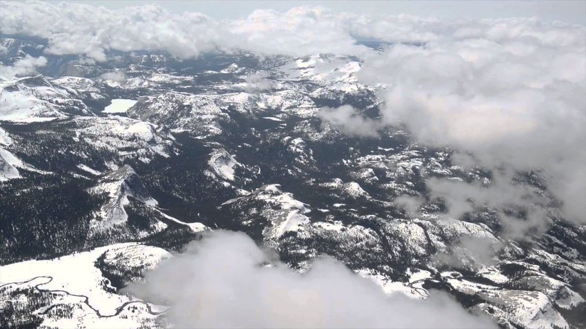
the ASO utilizing aircraft-based Light Detection and Ranging (LIDAR) to collect
three-dimensional information about the shape of the Earth and its surface
characteristics, including snow depths and snow water equivalent (SWE). Because
snow LIDAR maps cover large expanses of mountainous terrain, it can provide
more information about the entire range’s snowpack in near real-time. This
information then builds upon the individual snow telemetry station (SNOTEL) and
manual snow survey site data to provide a more accurate understanding of future
runoff and water supplies. LIDAR also provides a means to verify SNOTEL data
which can often produce misleading data as a result of instrumentation problems.
Processed data from ASO flights can aid in generating a more accurate snowpack
run-off and thus an improved water-supply forecast, as well as a complementary
assessment tool for the Wyoming Weather Modification Project.
} Contact: Matt Hoobler, Wyoming State Engineer’s Office, Matt.Hoobler@wyo.gov
Ground Penetrating Radar in Wyo
Ground Penetrating Radar in Wyo
Wyoming Partnership
} GPR readily maps snow thicknesses and use of the GPR
wave velocity provides snow-to-water content conversion
factors
} Build upon the existing snow surveys in Wyoming by
collecting complementary data
} GPR available for use in Laramie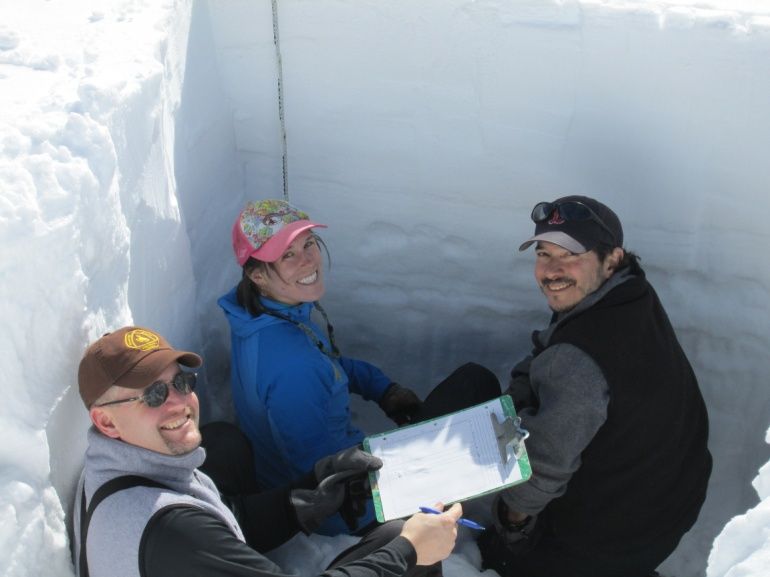
Ground Penetrating Radar in Wyo
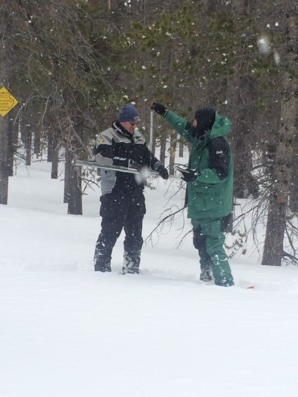
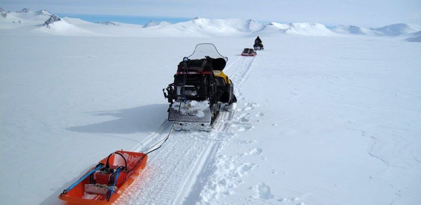
} Estimating snow-water equivalent (SWE) over long mountain
transects with snowmobile-mounted GPR.
} Dr. W. Steven Holbrook, Matthew Provart, Dr. Scott Miller & Dr. Mine Dogan. Univ. of Wyoming
The hydrologic balance in most alpine watersheds is dominated by snowmelt, which provides peak
spring runoff and recharges mountain aquifers, contributing to baseflow throughout the year.
Measurement of snow-water equivalent (SWE) is necessary for accurate modeling of alpine
hydrology but is challenging due to the variability in snow accumulation, ablation and redistribution
at scales from microtopography to hillslopes to mountainsides. Here we present a method for
imaging snow stratigraphy and estimating SWE over large distances from a ground-penetrating radar
system mounted on a snowmobile. We mount commercial GPR systems (500 and 800 MHz) to the
front of the snowmobile to provide maximum mobility and ensure that measurements are taken on
pristine snow. High-quality images show detailed snow stratigraphy down to the ground surface over
snow depths up to at least 8 m, enabling elucidation of snow accumulation and redistribution
processes. We estimate snow density (and thus SWE, assuming no liquid water) by measuring radar
velocity of the snowpack through migration focusing analysis. Results from the Medicine Bow
Mountains, Wyoming, show that estimates of snow density from GPR (0.40±0.15 gm/cm3) are in
good agreement with those from coincident snow cores (0.35±0.08 gm/cm3). Using this method,
snow thickness, snow density, and therefore SWE can be measured over large areas solely from
rapidly acquired common-offset GPR profiles, without the need for common-midpoint acquisition or
snow cores.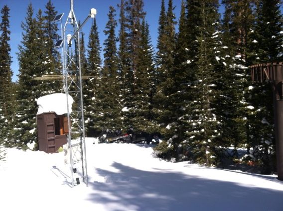
Modeling Seasonal Snowpack Evolution
} National Center for Atmospheric Research (NCAR)
} Evaluation of six land surface models against SNOTEL
data
} Perform same evaluation in Wyoming mountain ranges,
hopefully utilizing additional ASO and GPR data
} Utilize NCAR Supercomputer in Cheyenne
} Establish a model accuracy value and identify data gaps
} Modeling seasonal snowpack evolution in the complex terrain and forested
Colorado Headwaters region: A model intercomparison study
} Chen, F., M.J. Barlage, M. Tewari, R.M. Rasmussen, J. Jin, D. Lettenmaier, B. Livneh, C. Lin, G. Miguez-Macho,
G.-Y. Niu, L. Wen, and Z.-L.Yang, 2014: Modeling seasonal snowpack evolution in the complex terrain and
forested Colorado Headwaters region: A model intercomparison study. Journal of Geophysical Research-
Atmospheres, 119, 13795-13819, DOI: 10.1002/2014JD022167
} Correctly modeling snow is critical for climate models and for hydrologic applications.
Snowpack simulated by six land surface models (LSM: Noah,Variable Infiltration Capacity,
snow-atmosphere-soil transfer, Land Ecosystem-Atmosphere Feedback, Noah with
Multiparameterization, and Community Land Model) were evaluated against 1 year snow
water equivalent (SWE) data at 112 Snow Telemetry (SNOTEL) sites in the Colorado River
Headwaters region and 4 year flux tower data at two AmeriFlux sites. All models captured the
main characteristics of the seasonal SWE evolution fairly well at 112 SNOTEL sites. No single
model performed the best to capture the combined features of the peak SWE, the timing of
peak SWE, and the length of snow season. Evaluating only simulated SWE is deceiving and
does not reveal critical deficiencies in models, because the models could produce similar SWE
for starkly different reasons. Sensitivity experiments revealed that the models responded
differently to variations of forest coverage. The treatment of snow albedo and its cascading
effects on surface energy deficit, surface temperature, stability correction, and turbulent fluxes
was a major intermodel discrepancy. Six LSMs substantially overestimated (underestimated)
radiative flux (heat flux), a crucial deficiency in representing winter land-atmosphere feedback
in coupled weather and climate models. Results showed significant intermodel differences in
snowmelt efficiency and sublimation efficiency, and models with high rate of snow
accumulation and melt were able to reproduce the observed seasonal evolution of SWE. This
study highlights that the parameterization of cascading effects of snow albedo and below-
canopy turbulence and radiation transfer is critical not only for SWE simulation but also for
correctly capturing the winter land-atmosphere interactions.
Contact Information
} Matt Hoobler
Wyoming State Engineer’s Office
122 W. 25th Street
Cheyenne, WY 82002
Matt.Hoobler@wyo.gov
307-777-7641
Snow.wyo.govYou can also read