2017 Greater Parramatta - APO
←
→
Page content transcription
If your browser does not render page correctly, please read the page content below
2017
                       July

     Greater
 Parramatta
   Interim Land Use
and Infrastructure
  Implementation
Plan Background
          Analysis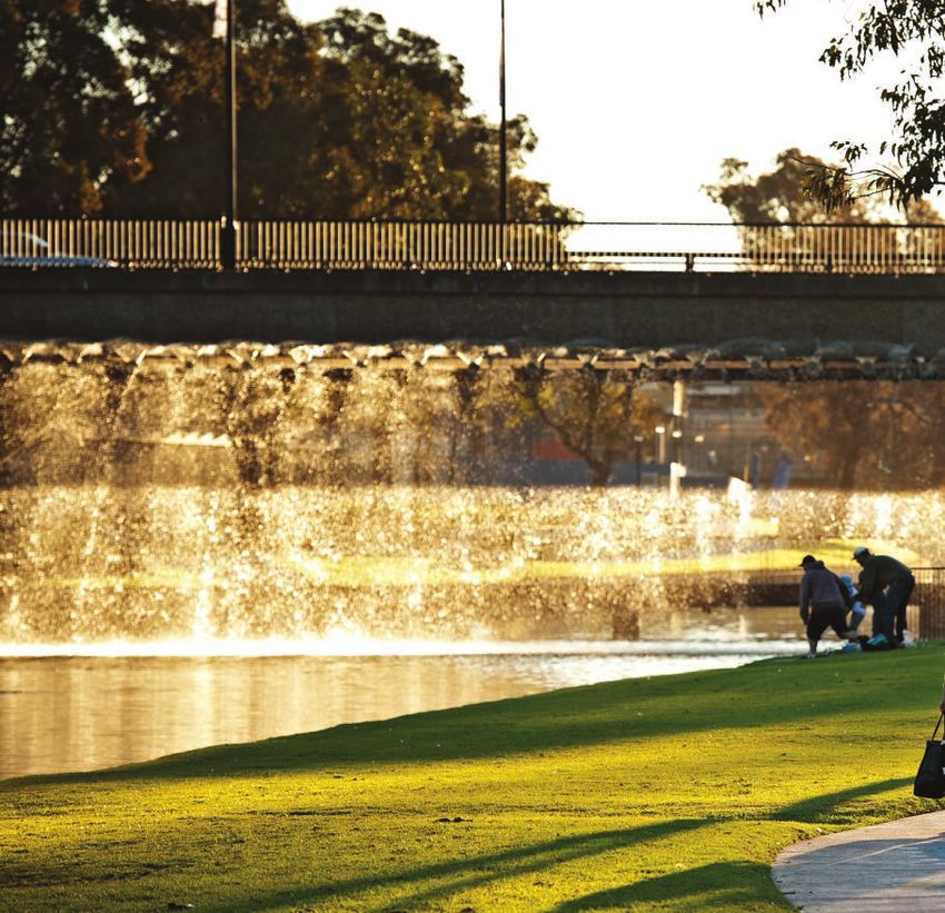
To view an electronic version in PDF format,
visit www.planning.nsw.gov.au
© Crown Copyright 2017
Department of Planning and Environment
Printed June 2017
Disclaimer
While every reasonable effort has been made to ensure that
this document is correct at the time of printing, the State of
New South Wales, its agents and employees, disclaim any
and all liability to any person in respect of anything or the
consequences of anything done or omitted to be done in
reliance or upon the whole or any part of this document.
Copyright Notice
In keeping with the Department of Planning and
Environment’s commitment to encourage the availability of
information, you are welcome to reproduce the
material that appears in this Planning Report for personal,
in-house or non-commercial use without formal
permission or charge. All other rights are reserved. If
you wish to reproduce, alter, store or transmit material
appearing in this Planning Report for any other purpose,
a request for formal permission should be directed to:
Department of Planning and Environment
GPO Box 39
Sydney NSW 2001
You are required to acknowledge that the material
is provided by the Department or the owner of the
copyright as indicated in this Planning Report and to
include this copyright notice and disclaimer in any
copy. You are also required to acknowledge the author
(the Department of Planning and Environment) of
the material as indicated in this Planning Report.

Glossary
Act              Environmental Planning and Assessment Act
AHD              Australian Height Datum
CBD              Central Business District
DCP              Development Control Plan
Department       Department of Planning and Environment
FSR              floor space ratio
GFA              gross floor area
GPOP             Greater Parramatta to Olympic Peninsula
GSC              Greater Sydney Commission
ha               hectare
LEP              Local Environmental Plan
LGA              local government area
The Interim
Plan             Interim Land Use and Infrastructure Implementation Plan
Minister         Minister for Planning
PGA              Priority Growth Area
RMS              Roads and Maritime Services
SEPP             State Environmental Planning Policy
SIC              Special Infrastructure Contribution
TfNSW            Transport for New South Wales
VPA              Voluntary Planning Agreement

Contents
1. Introduction 4 3.3 Q
UADRANT 2 –
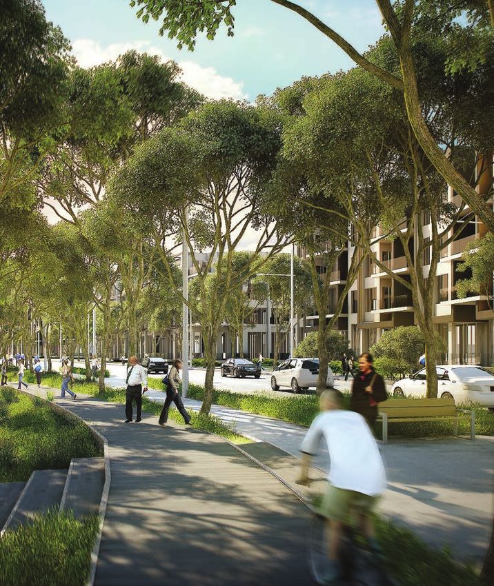
Next Generation Living
1.1 Context of the Interim Plan 5
from Camellia to Carlingford 42
1.2 Objectives of the Interim Plan 5
3.3.1 Carlingford Corridor 42
1.3 Greater Parramatta to Olympic Peninsula (GPOP) 6
3.4 Q
UADRANT 3 –
1.4 A Plan for Growing Sydney 7 Essential Urban Services, Advanced
Technology and Knowledge Sectors 46
1.5 West Central District Plan 8
3.4.1 Camellia 46
2. The Regional Context 9
3.4.2 Rydalmere Education 50
2.1 Location and Description 9
3.4.3 Silverwater 54
2.2 Jobs and Employment 10
3.4.4 Parramatta Road 58
2.3 Population and Housing 12
3.5 Q
UADRANT 4 –
2.4 Parramatta River 13 Olympic Park Lifestyle Super Precinct 62
2.5 Regional Open Space and the Green Grid 14 3.5.1 Sydney Olympic Park and Carter Street 62
2.6 Transport 16 3.5.2 Wentworth Point 66
2.7 Social Infrastructure 18 3.5.3 Homebush 70
2.8 Hydrology 19
4. I nfrastructure Strategy 74
2.9 Land Ownership 20
5. Key Actions 78
2.10 Heritage 21
2.11 Sustainability 22 6. Implementation 79
2.12 Regional Servicing Infrastructure 23 6.1 Updates to the Interim Plan 79
2.13 Challenges 23 6.2 Local Planning Direction 79
6.3 Planning Pathways 79
3. Land Use and Infrastructure
Implementation Plan 24 6.3.1 Priority Growth Area 79
3.1 Greater Parramatta Priority Growth Area 25 6.3.2 Priority Precincts 79
3.2 Q
UADRANT 1 – 6.3.3 Comprehensive LEP Reviews 79
Parramatta CBD and Westmead
6.3.4 Local Planning Proposals 79
Health and Education Super Precinct 26
6.3.5 Special Infrastructure Contribution 79
3.2.1 Westmead Health and Medical Research 26
6.3.6 Local Infrastructure Upgrades 79
3.2.2 Parramatta North 30
6.3.7 Housing Acceleration Fund 79
3.2.3 Parramatta CBD 34
6.3.8 Precinct Support Scheme 79
3.2.4 Harris Park and Rosehill 38
6.4 Monitoring 79
7. Supporting Documentation 80
Greater Parramatta Priority Growth Area: Interim Land Use and Infrastructure Implementation Plan Background Analysis June 2017 3
1. Introduction
The Land Use and Infrastructure Implementation Plan (the M2
interim Plan) for the Greater Parramatta Priority Growth Area
(growth area) has been developed by the Department of Epping
Planning and Environment (the Department), in collaboration
with the City of Parramatta (CoP) and Greater Sydney
Commission (GSC). The primary purpose of the interim Carlingford
Plan is to develop a land use framework to guide the future Macquarie Park
redevelopment of the growth area to meet the 20 year jobs
and housing targets in the Draft West Central District Plan 7 Eastwood
and to identify and plan for the infrastructure required to PARRAMATTA Telopea
unlock its potential.
Denistone
Whilst the interim Plan currently forecasts more than 1
72,000 additional dwellings and more than 113,000 Wentworthville Dundas
West Ryde
additional jobs within the priority growth area over 2
VICTO
RIA RO
RYDE
AD
the next 20 years, it is acknowledged that there Rydalmere
Westmead
will be further opportunities for renewal and more 3 5
Meadowbank
homes and jobs as planning investigations continue Parramatta Camellia
SILVERWATER ROAD
and additional infrastructure comes on line. Work 4
Harris Park
currently being undertaken by the NSW Government Rosehill 10
estimates that the priority growth area has the M4 6
capacity to accommodate more than 100,000 Rhodes
Granville
additional dwellings and 300,000 additional 8
Clyde
jobs. The recent announcement of new priority
precincts within and adjacent to the priority PA
R RA 9
MA
growth area (ie. Wentworthville, Burwood,
TTA
RO Olympic Park
AD
Strathfield and Homebush) as well as work the
Concord West
Greater Sydney Commission is undertaking in Auburn 12
relation to finalising the West Central District CANADA BAY
Plan will further increase this number. 11
North Strathfield
The interim Plan is not intended to be a Legend
static document, rather it will evolve and CBD 4 Harris Park 9
Sydney Olympic Park and
Carter Street Precinct
be updated as planning within the growth Lidcombe
Flemington
Wentworth Point Precinct
Strategic Centre 5 Rydalmere Education Precinct 10
Rezoned June 2014
Homebush
area progresses over the next 20 years. In 1 Westmead Health and Medical Research Precinct 6 Camellia Precinct 11
Parramatta Road
Homebush Precinct
Strathfield
particular, the interim Plan will be updated
Parramatta North State Significant Precinct Carlingford Light Rail Corridor Parramatta Road
2 7 12
Rezoned October 2015. (excluding deferred area) (including Telopea Priority Precinct Investigation) Granville and Auburn Precincts
to capture the exciting new opportunities Burwood
3 Parramatta CBD Precinct 8 Silverwater
for revitalisation and urban renewal in the Figure 1. Greater Parramatta Priority Growth Area
growth area generated by Parramatta
4 Light Rail and Sydney Metro West.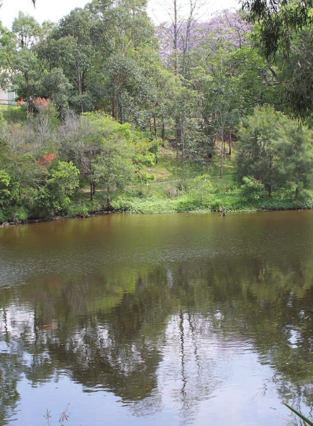
1.1	Context of the Interim Plan                                                                                                       1.2	Objectives of the Interim Plan
A Plan for Growing Sydney, released by the Department in                                                                               The primary objectives of the interim Plan are to:
December 2014 as proposed to be amended by Towards our
                                                                                                                                       zz Implement the GPOP vision and 20 year forecasts
Greater Sydney 2056, is the NSW Government’s plan for the
                                                                                                                                          for additional housing and jobs growth through
future of the Sydney Metropolitan Area over the next 20 years.
                                                                                                                                          targeted precinct-level actions and priorities;
The Plan provides key directions and actions to guide Sydney’s
productivity, environmental management, and liveability,                                                                               zz Identify areas for and guide future growth based on a
including the delivery of housing, employment, infrastructure                                                                             strategic analysis of opportunities and constraints;
and open space. It highlights the significance of the growth                                                                           zz Prepare an Infrastructure Schedule, which will form
area and sets out a direction to build on existing infrastructure                            Metropolitan Strategy                        the basis of a Special Infrastructure Contributions
and undertake targeted growth that supports the growth of the                                                                             (SIC) levy for the priority growth area; and
corridor and in particular Parramatta as Sydney’s second CBD.
                                                                                                                                       zz Develop and communicate appropriate planning
The Greater Parramatta and the Olympic Peninsula vision                                                                                   pathways for the implementation of change by
(GPOP Vision), released by the GSC in October 2016 and                                                                                    establishing land use, infrastructure, environmental
touched upon in the preliminary chapter of this document,                                                                                 and social benchmarks within the growth area.
takes the strategic vision provided within A Plan for Growing
Sydney forward and sets out a distinct 2036 vision for GPOP.                                                                           To ensure the infrastructure requirements for the growth in
                                                                                                                                       this area is considered holistically, the interim Plan has been
The GPOP area includes the current growth area as well as                                        Draft West Central                    prepared to cover all precincts within the growth area. The
additional land to the south of Parramatta Road in Auburn and                                      District Plan and                   precincts, whilst all unique with differing opportunities for
Lidcombe and to the north in North Parramatta and Carlingford.                                          GPOP Vision                    growth, all have implications for surrounding infrastructure.
The Draft West Central District Plan, released by the GSC in
late November 2016, sets out the 20 year vision, priorities and
actions for the district, which has Greater Parramatta at its heart.
The interim Plan supports the growth targets set out in the
Draft West Central District Plan and establishes the timing
and critical infrastructure needs for the growth area. It brings                                      Land Use and
together existing detailed work completed or underway                                                 Infrastructure
for identified precincts (i.e. Camellia, Sydney Olympic Park,                                       Implementation
Carter Street, Wentworth Point) and other significant projects
                                                                                                                Plan
proposed within the growth area (i.e. Parramatta Light Rail
and Sydney Metro West) and sets out a framework for more
detailed planning work for precincts where planning has not
yet commenced to enable them to realise their potential.
Coordinating infrastructure provision is important to ensure                                    1. Priority Precinct
that growth in this area will be supported by roads and
public transport, community facilities, health facilities,
                                                                                     2. State Significant Precinct
schools, green open space and other public spaces to make                         3. Council led LEP Amendment
Greater Parramatta a vibrant, attractive and great place to
                                                                                         4. Land owner initiated
live and work. The interim Plan is supported by an indicative
infrastructure list which identifies how the growth area and                                   Rezoning Proposal
nominated precincts can be serviced efficiently and in a timely
socially and environmentally sustainable manner, aligning,
where possible, augmentation of existing systems with                                                Development
planned growth, utility asset renewal and future proofing.                                             Assessments
                                                                                              (by DPE and Councils)

                                                                       Greater Parramatta Priority Growth Area: Interim Land Use and Infrastructure Implementation Plan Background Analysis June 2017    5
1.3	Greater Parramatta
         to Olympic Peninsula (GPOP)
    1.3.1 The Vision
    In October 2016, the GSC, in conjunction with CoP and other
    government agencies, released a draft vision for GPOP, as the
    first step towards a coordinated design and delivery approach
    for the growth area, boldly putting forward Parramatta as the
    geographic and demographic centre of Greater Sydney.
    The strategic vision for GPOP over the next 20 years and
    beyond is to be:
    1. A central city close to Sydney’s heart
        GPOP will be a thriving, accessible and inclusive civic heart
        with its own rich history. It will be situated close to Greater
        Sydney’s growing population and strategically positioned          1.3.2 The Four Quarters
        between Sydney CBD and the new Western Sydney Airport.            The GSC envisages four distinct quarters within GPOP:
    2. A link forging one Greater Sydney                                  Quarter 1: Parramatta CBD and Westmead
                                                                          Health and Education Super Precinct
        GPOP forms a physical bridge for all parts of the city.
        Renewal of the GPOP area will help build a unified,               Parramatta CBD and Westmead will play a critical role for GPOP,
        coherent and integrated city: one Greater Sydney for all.         offering a dynamic combination of commercial core, civic
                                                                          heart, health, education and research hub. This super precinct
    3. A jobs hub within reach of skilled workers                         will be GPOP’s westernmost economic anchor – attracting
        GPOP will be an employment and entrepreneurial                    human talent, investment, and creative and innovative activity.
        centre, with Parramatta CBD–Westmead and Olympic                  The main areas of focus for this quarter are:
        Park providing key work and business opportunities.
        This will help address the deficit of skilled work                zz Parramatta CBD as a strong commercial
        opportunities in the west and lessen the daily west–                 core interwoven with the river;
        east travel to Sydney CBD and surrounds.                          zz Westmead as a health city and international innovator;
    4. An attractive place to invest                                      zz North Parramatta as a creative, heritage
        GPOP has the foundations to be a magnificently diverse               and entrepreneurial hub; and
        21st century urban economy that can service the city’s            zz Parramatta Park as a green connector.
        needs, its people and its enterprises – including
                                                                          Quarter 2: Next Generation Living
        managing the fundamentals like waste, water, energy
                                                                          from Camellia to Carlingford
        freight and logistics.
                                                                          A 21st-Century living, learning and leisure district is
    5. A place of celebrated natural beauty                               planned for this northern GPOP spur. It will comprise a
        GPOP will be known for its own city-scale natural treasures       mix of medium to high-density housing types with nearby
        – its river, its parklands and its landscapes. It will be loved   education, research, retail, recreation and entertainment           Figure 2. Four Quarters (source: GSC, 2016)
        and enjoyed by Greater Sydney’s extraordinary mix of              facilities providing all the conveniences of ‘inner-city’ living.
        people. It will be a truly attractive and liveable place.         Smart, vibrant and inclusive communities are the goal.              Quarter 3: Essential Urban Services, Advanced                Quarter 4: Olympic Park Lifestyle Super Precinct
                                                                          The main areas of focus for this quarter are:                       Technology and Knowledge Sectors in Camellia,                The world-class sporting and event venues of Sydney Olympic
                                                                                                                                              Rydalmere, Silverwater and Auburn                            Park to GPOP’s east come alive when there are crowds of tens
                                                                          zz Parramatta as the ‘30-minute city’;
                                                                                                                                              At GPOP’s centre is a major hub of urban services spanning   of thousands – that is, on major game days, concerts and events
                                                                          zz Revitalisation of Telopea;                                       across Rydalmere, Camellia, Silverwater and Auburn.          like the Royal Easter Show. Olympic Park is GPOP’s eastern
                                                                          zz Rydalmere as a ‘Smart Precinct’;                                 This areas unique centrality in Greater Sydney offers its    economic anchor offering inner-city style living in the Olympic
                                                                                                                                              businesses great access to markets and customers.            Park Town Centre, Carter Street and Homebush Precincts.
                                                                          zz Development of Camellia Town Centre and
                                                                             revitalisation of the river at Camellia;                                                                                      The main areas of focus for this quarter are:

                                                                          zz Establishment of an entertainment and leisure                                                                                 zz Green living and wellbeing in the heart of the park;
                                                                             precinct in Rosehill Gardens; and                                                                                             zz Sustainable transport to realise lifestyle potential; and
6                                                                         zz Infill around new light rail stops.                                                                                           zz Parramatta’s new celebration space.
1.4       A Plan for Growing Sydney
A Plan for Growing Sydney as proposed to be amended by              zz Growing the knowledge economy as part of the extension
Towards our Greater Sydney 2056 highlights the significance            of the global economic corridor. The government will focus
of Greater Parramatta to the Olympic Peninsula and sets out a          its support on growth in the knowledge economy, with the
direction to establish a new ‘Priority Growth Area’ within this        Greater Parramatta Priority Growth Area to form an extension
established urban area, building on existing infrastructure and        of the Global Economic Corridor. The government is:
targeted growth that takes advantage and supports the growth            −− Working with CoP to progress the Parramatta
of Parramatta CBD as Sydney’s second and central CBD.                      CBD Planning Proposal and opportunities it
Within this direction there are a number of actions that                   provides for an expanded and more intense
the government has committed to, specifically:                             commercial core supported by higher density
                                                                           mixed use and residential development;
zz Establishing a new partnership model of cooperation and
   governance to deliver investment and infrastructure in the           −− Working with the Sydney Olympic Park Authority to
   Greater Parramatta Priority Growth Area. This includes:                 identify opportunities for new retail, office and residential
                                                                           space at Sydney Olympic Park and a more active and
   −− Working with the GSC and other stakeholders                          vibrant town centre as part of the 5 year review of the
      to develop a vision for the Greater                                  Sydney Olympic Park Master Plan 2030 (2016 Review);
      Parramatta Priority Growth Area; and
                                                                        −− Investigating the future role of the Silverwater
   −− Working with Councils, Transport for NSW,                            employment area; and
      and other key stakeholders to provide strategic
                                                                        −− Identifying potential locations for major new
      direction and to resolve any significant issues
                                                                           business parks, including locations at Rydalmere.
      that may affect the delivery of the vision.
                                                                    Towards our Greater Sydney 2056 is an ambitious future plan for
zz Identifying and delivering enabling infrastructure
                                                                    a growing Greater Sydney. Released by the GSC in November
   to support growth and urban renewal within
                                                                    2016, it is a connector between the NSW Government’s current
   the growth area. This involves:
                                                                    and future regional plans. While the draft District Plans use A Plan
   −− Unlocking the development potential of the area to            for Growing Sydney as its base, they also draw on the emerging
      support population and jobs growth, making sure               new vision for Greater Sydney’s future. This vision involves
      people can move easily between precincts, providing           a major shift in strategic planning for Greater Sydney which
      new schools, health services, child care centres, arts and    focuses on the regional significance of central and western
      cultural facilities, recreation facilities and open space;    Sydney. Towards Our Greater Sydney 2056, with its strategy for
                                                                    a metropolis of three cities provides a framework that better
   −− Looking at improvements to public transport to
                                                                    underpins strategic planning for a more productive, liveable
      enable residents and workers better access to jobs and
                                                                    and sustainable city. Of the three cities, the developing ‘Central
      services in Greater Parramatta, the Global Economic
                                                                    City’ with GPOP at its heart is anticipated to experience the most
      Corridor and other centres (e.g. delivery of Parramatta
                                                                    significant urban transformation over the next 10 to 15 years.
      Light Rail, connection across Duck River); and
   −− Delivering Priority Precincts. This involves continuing
      our work on technical investigations currently underway
      in relation to the Camellia Precinct, which has been the
      focus following the rezoning of both the Wentworth Point
      and Carter Street Precincts and carrying out investigations
      within other parts of the growth area to identify other                                                                              Figure 4. A Plan for Growing Sydney
      precincts that have good access to transport and services
      and where development is feasible and there is demand.

                                                                    Figure 3. A metropolis of three cities: Global Sydney                  Greater Parramatta Priority Growth Area: Interim Land Use and Infrastructure Implementation Plan Background Analysis June 2017   7
1.5       West Central District Plan
    Background                                                         Key Actions
    The Draft West Central District Plan prepared by Greater           The proposed priorities and actions for the West Central
    Sydney Commission (GSC) and released on 21 November                District are centred around a productive city; a liveable city;
    2016, sets out priorities and actions for an area of Greater       and a sustainable city.
    Sydney that comprises the local government areas of:
                                                                       Four of the key actions for the west central district include:
    zz Blacktown;
                                                                       Action 1: 	Align land use planning and infrastructure planning
    zz Cumberland;
                                                                       Action 2: 	Develop a framework to monitor growth
    zz Parramatta; and                                                            and change in Greater Sydney
    zz The Hills.                                                      Action 3: 	Develop an interactive information hub
    The Draft West Central District Plan allows for 1,036,850                     – the Greater Sydney Dashboard
    people over 85,100 hectares with 455,000 jobs and 14%              Action 4: Report on local planning
    of land designated for open space. The District has been
                                                                       Key Economic Assets
    recognised has having the highest population out of Sydney’s
    six districts therefore putting increasing pressure on managing    The West Central District has recognised
    the growth of this metropolitan area that plays an important       its key economic assets to include:
    role for Greater Sydney. The population and household              zz An established and well-connected Parramatta CBD;
    growth projections for the district’s next five years results in
    a need for 53,500 dwellings by 2021. Housing strategies            zz A unique set of health and education resources in
    are to be put in place to ensure that local Councils can meet         Westmead, Blacktown, Parramatta CBD and Rydalmere;
    the District’s minimum 20 year housing target for Greater          zz Sydney Olympic Park;
    Sydney, which is forecast at 725,000 dwellings and 202,500
                                                                       zz An established and strong employment and
    additional dwellings by 2036 in the West Central District.
                                                                          urban services sector, with significant advanced
    The also identifies the importance of the Greater                     manufacturing capabilities, particularly in Blacktown,
    Parramatta area for jobs growth to 2036. The minimum                  Rydalmere, Silverwater, Camellia and Norwest;
    target for additional job creation for Greater Parramatta
                                                                       zz Connectivity to the established Eastern City and proximity to
    is 201,000 jobs which is an increase of 74,400.
                                                                          the planned Western City including Western Sydney Airport;
    Vision
                                                                       zz A growing, young and well educated population; and
    The 20 year vision for the West Central District is to play a
    key role as Greater Sydney’s key economic and employment           zz Significant planned and committed investment                    Jobs Growth GPOP
    powerhouse, to be a core hub for transport and services and           in public infrastructure.
    a home of vibrant and diverse centres and communities.
    The District Plan aims to deliver its vision through:
                                                                                                                                               60-70% increase in jobs
                                                                                                                                                                            JOBS 2016: 126,000
                                                                                                                                                                          JOBS 2036: 201,000
    1. Priorities that are guided by the relevant planning                                                                                                                          – 217,000
       authorities in the making and amending
       of local environmental plans; and
                                                                                                                                          Housing Growth GPOP
    2. Actions that will be delivered by the Commission,
       State agencies or relevant planning authorities.
    The plan will directly inform local council planning
    and influence the decisions of state agencies.
                                                                                                                                                86%
                                                                                                                                                  increase in
                                                                                                                                                                          HOMES 2011: 25,275
                                                                                                                                                                         HOMES 2021: 46,925
    Role of the District Plan                                                                                                                        housing
    The role of the district plan is to encompass the goals and
    objectives of the Environmental Planning and Assessment
    Act 1979 (EP&A Act) and A Plan for Growing Sydney.

8
2.	The Regional   2.1        Location and Description
                   The Greater Parramatta Priority Growth Area              Within the growth area, there are a number of           Parramatta River, Parramatta Park and Sydney

    Context        stretches from Westmead in the west, to Strathfield in
                   the east and incorporates areas such as Westmead,
                   Parramatta CBD, Rydalmere, Camellia, Silverwater
                                                                            existing, proposed and potential future precincts
                                                                            earmarked for urban renewal. These currently include:
                                                                            1. Westmead;
                                                                                                                                    Olympic Park parklands are key features of the growth
                                                                                                                                    area. These areas will become even more important
                                                                                                                                    within the growth area for additional workers and
                   and Sydney Olympic Park (refer to Figure 1). Key                                                                 residents as urban renewal occurs in terms of the
                   linkages throughout the growth area include the          2. Parramatta North;                                    recreation opportunities, connectivity and amenity.
                   Parramatta River, arterial road routes, heavy rail       3. Parramatta CBD;
                                                                                                                                    The growth area has a diverse economic base that
                   and the proposed Parramatta Light Rail, which will       4. Harris Park and Rosehill;                            accommodates a diverse range of jobs. In 2011,
                   connect Westmead to Strathfield and Camellia             5. Camellia;                                            there were 133,360 jobs in the growth area, with
                   to Carlingford (including Telopea) in the north. It
                                                                            6. Rydalmere Education;                                 three major economic anchors, being Parramatta
                   covers an area of approximately 3,478 hectares
                                                                            7. Carlingford Corridor including                      CBD, Westmead and Sydney Olympic Park.
                   in the centre of Sydney and incorporates areas
                                                                               Telopea and Dundas;                                  The growth area also includes the employment
                   that are now, or will in the future, experience
                                                                                                                                    areas of Silverwater, Rydalmere and Camellia.
                   significant change as they transition from their         8. Silverwater;
                   current land uses and undergo redevelopment.             9. Sydney Olympic Park and Carter Street;
                                                                            10. Wentworth Point;
                                                                            11. Homebush; and
                                                                            12. Parramatta Road.

                   Figure 5. Regional Context

                                                      Greater Parramatta Priority Growth Area: Interim Land Use and Infrastructure Implementation Plan Background Analysis June 2017        9
2.2 Jobs and Employment
         The West Central District, which includes the growth area,                           Precincts with significantly higher proportions of jobs in the        With the release of the Draft West Central District Plan,
         is home to half a million jobs, equating to approximately                            industrial sector include Silverwater, Rydalmere, Homebush            Parramatta is expected to continue to grow to provide new
         20% of all jobs in Sydney. Forty three per cent of the West                          and Parramatta Road precincts. Westmead, Parramatta North             employment opportunities for people outside the region.
         Central District jobs are located in eight strategic centres                         and Carlingford Corridor precincts all have a much larger share       Parramatta CBD, in conjunction with the larger employment
         (Greater Parramatta, Bankstown, Blacktown, Castle Hill,                              of jobs in health and education than the number of business           centres within the growth area such as Westmead,
         Norwest, Rouse Hill, Sydney Olympic Park and Bankstown                               premises. This is because schools, universities and hospitals         Camellia and Rydalmere will continue to produce high
         Airport - Milperra). The remaining 57% are scattered                                 employ large amounts of people. The domestic services sector          volumes of high-skilled knowledge based employment
         across a number of industrial areas and smaller centres.                             across all of the precincts are fairly consistent in the proportion   concentrated in various sectors. The regional economics
                                                                                              of jobs to the proportion of businesses.                              of Western Sydney will take on a hub and spoke formation
         Greater Parramatta is the largest employment destination
                                                                                                                                                                    whereby Parramatta CBD, the administrative ‘hub’, will
         in Western Sydney and the second largest employment                                  Greater Parramatta has a diverse economic base. There is
                                                                                                                                                                    service ‘client’ firms in the employment lands around it.
         destination for the metropolitan area after the Sydney CBD. In                       an emerging strength in knowledge intensive (professional/
         2011, total employment in the growth area was approximately                          financial/media telecommunications) industries in key centres         Key considerations in relation to employment within
         133,360, with one third of all jobs in the Parramatta CBD.                           within the broader region including Parramatta CBD and Sydney         the growth area include:
         Existing employment areas within the growth area include                             Olympic Park, which have added 320,000 square metres of
                                                                                                                                                                    zz Providing employment close to centres and proximity
         Parramatta CBD, Camellia, Rydalmere, Silverwater, Westmead,                          office space over the past decade. Manufacturing also plays an
                                                                                                                                                                       to suppliers and customers;
         North Parramatta, Sydney Olympic Park and Auburn.                                    important role in the subregion and to Greater Parramatta and
                                                                                              is significant in the Sydney and Australian economy. There is the     zz Providing good public transport options for workers
         Each of the precincts in the growth area are characterised by                                                                                                 with good levels of service;
                                                                                              potential for manufacturing in Greater Parramatta and other parts
         different industries. The proportion of jobs in an industry and
                                                                                              of the subregion to evolve and develop further up the value           zz Better linkages between other centres and
         the proportion of businesses in an industry does not always
                                                                                              chain by drawing on the advice of knowledge intensive business.          employment areas;
         correspond. The proportion of jobs in each of the industries
         also vary with 34% knowledge intensive, 24% domestic                                 Based on information from the Australian Business Register,           zz Providing freight access for heavy vehicles, efficient
         services, 25% industrial and 17% health and education.                               the industry with the greatest economic contribution to the              connections for commercial and service vehicles to
                                                                                              growth area was the knowledge intensive sector with over                 Greater Sydney and beyond;
         Jobs per Industry                                                                    $21 billion of output followed by the industrial sector with over
                                                                                              $18 billion of output. When looking at each precinct within           zz Providing an appropriate level of car parking for a particular
                                                                                              the corridor individually, this varies greatly. For example,             use (which does not discourage public transport usage)
                  25%                                             Knowledge intensive jobs    Parramatta CBD and Sydney Olympic Park have over half                 zz Investment in additional public transport and
                                                    34%
                                                                                              of the economic contribution for the precincts from the                  road infrastructure;
                                                                  Domestic services jobs
                                                                                              knowledge intensive sector. While Silverwater, Camellia,
                                                                  Health and education jobs   Rydalmere, Homebush and Parramatta Road have over half                zz Providing jobs closer to homes and workforce;
               17%                                                Industrial jobs             of their economic contribution from the industrial sector.            zz Ensuring residential users do not crowd out potential
                                        24%
                                                                                                                                                                       office development within the Parramatta CBD; and
                                                                                                                                                                    zz Higher levels of amenity – retail uses, public
            Knowledge intensive jobs     Domestic services jobs
            Health and education jobs    Industrial jobs                                                                                                               domain, sporting facilities and water.
s
         The precincts driving the knowledge intensive jobs are
         Parramatta CBD and Sydney Olympic Park, which have a
         significantly higher proportion of jobs in the industry than
         number of businesses in the industry. This indicates that few
         businesses are employing large amounts of people in the sector.

    10
Figure 6. Existing employment areas Greater Parramatta Priority Growth Area: Interim Land Use and Infrastructure Implementation Plan Background Analysis June 2017 11
2.3 Population and Housing
     Supporting the economy is a thriving community which
     boasts a diversity of cultures unlike any other within the
     greater metropolitan region. The population of the growth
     area in 2015 was estimated at 88,671 people. This is an
     increase from 70,748 in 2011, or 25% growth in 4 years,
     representing an annual growth rate of approximately
     6%, more than four times the NSW average of 1.4%.
     Approximately 75% of the existing residential population in the
     growth area is contained within five of the twelve precincts (i.e.
     Carlingford Corridor, Harris Park and Rosehill, Parramatta CBD,
     Silverwater and Westmead), which make up the growth area.
     The largest population is in Westmead Health and Medical
     Research, at 15,481 people, which has had 14.6% growth
     over 4 years. In percentage terms the largest increases in
     population were in the Wentworth Point and Silverwater areas,
     both increasing more than 50% over the 2011-2015 period.
     Camellia and Carter Street, being predominantly for
     employment uses have virtually no population, although
     this will change as planning continues within Camellia
     and development commences in Carter Street.
     The Draft West Central District Plan proposes an Affordable
     Rental Housing Target of 5-10% (subject to viability) for
     nominated urban renewal areas for very low and low
     income households within GPOP. Through the precinct
     planning process, the Department in conjunction with
     the GSC and Councils will investigate opportunities to
     increase affordable housing in the growth area.

     Population Growth to 2015

                     25%
               increase in people
                                                     PEOPLE 2011: 70,748
                                                   PEOPLE 2015: 83,671

                       4x
                   NSW AVERAGE

12                                                                         Figure 7. Housing
2.4 Parramatta River
The Parramatta River is the main tributary of Sydney Harbour
and binds together diverse communities across three Districts
– Central West, Northern and Central. It is one of Australia’s
most iconic waterways and is at the heart of Sydney. The
river’s catchment area is one of the most highly urbanised in
Australia. By the 1950s, lack of regulation and rapid industrial
development along the river caused substantial pollution
and degradation of water quality, resulting in the closure of a
number of popular community swimming spots along the river.
Past industrial sites are now being replaced by major
residential developments along the river’s foreshore, with
the river connecting key development areas of Ermington,
Rhodes, Camellia, Westmead, North Parramatta and the
Parramatta CBD. However, stormwater and sewer overflows
continue to pollute the river, and with desired future growth,
this will only increase pressure on this valuable asset.
To improve access and amenity to this burgeoning business
and residential population, the Parramatta River has become
the focal point for enhancing the region’s network of open
spaces, walkways and cycleways. The river is the subject of the
Parramatta River Catchment Group (PRCG) Parramatta River
Master Plan and Parramatta Ways Strategy, being developed
by CoP to balance water quality and biodiversity requirements
with site activation and infrastructure, informed by community
preferences and socio-economic benefit. This will support the
development of a connected blue and green grid across the
region that enhances biodiversity and water quality outcomes
while at the same time opening up more foreshore areas to
public space and activation. In addition, CoP has developed
the Parramatta City River Strategy (2015) which provides an
integrated vision for the riverfront, includes a design and
activation strategy and plan for implementation to start the
process of turning the vision and strategy into a reality.
To extend on the value of the river for recreation and provide
more local, natural places to swim for Western Sydney residents,
at least three new river swimming destinations will be opened by
2025. This will build on the success of Lake Parramatta in North
Parramatta, which opened to public swimming in 2015 for the
first time in 72 years, with 12,000 people swimming in
the Lake in its first season.
Greater Parramatta Priority Growth Area: Interim Land Use and Infrastructure Implementation Plan Background Analysis June 2017 132.5 Regional Open Space
and the Green Grid
Open space provides an important role in the health and well- Sydney Olympic Park promotes active transport options as
being of communities. The growth area is characterised by urban 33% of the parklands visitors are cyclists with the provision
land uses (which make up approximately 65% of the growth of 35 kilometres of pedestrian and cycle pathways. The
area) and areas of open space and conservation. Significant parklands include four kilometres of water frontage along
areas of open space include the Parramatta River and foreshore, the Parramatta River and Homebush Bay, which are
which connects key places from Westmead and Parramatta generally not well connected to broader growth area.
Park to Sydney Olympic Park and Rhodes. The growth area also
The Parklands hold important environmental and historical
contains areas of threatened vegetation and flora and fauna
significance that provides a rich biodiversity with over 280
species listed under the Threatened Species Conservation Act
hectares of habitat for threatened and endangered flora
1995 (TSC Act) and Commonwealth Environment Protection
and fauna and home to the largest remaining populations
and Biodiversity Conservation Act 1999 (EPBC Act).
of the endangered Green and Golden Bell Frog in NSW.
The growth area is bookended by two areas of regional
A Plan for Growing Sydney identifies the opportunity to create
parklands, being Parramatta Park in the west and Sydney
Sydney’s Green Grid, a network of interlinked, multipurpose
Olympic Park and Bicentennial Park in the east. On the
open and green spaces across Sydney. There are two
western edge of the Parramatta CBD and comprising
priority Green Grid projects within the growth area:
86hectares, Parramatta Park is a significant local and
regional asset. Its importance lies in evidence of its zz Parramatta River Foreshore - a continuous open space
historical evolution, its natural heritage and its recreational corridor along both sides of the Parramatta River,
values and it is considered of exceptional cultural connecting Westmead and Parramatta Park to Sydney
significance to Australia, NSW and the CoP because it: Olympic Park and Rhodes with further connections
eastward towards Iron Cove in the Central District.
zz Contains remnant vegetation of the Cumberland
Plain Woodland; zz Duck River Open Space Corridor - a continuous
walking and cycling link north-south linking
zz Is the core of the territory of the Burramatta clan
Parramatta, Camellia, Granville, Auburn, Regents
of the Darug;
Park and south to Bankstown in the South District.
zz is an enduring symbol of early European settlement in
‘Parramatta Ways’ is a regional plan being developed
Australia and is evidence of 18th Century Parramatta;
by CoP that seeks to implement the Green Grid and sets
zz Is a place of early Government enterprise, contains out to improve walkability across broader Parramatta,
the oldest surviving Government House in linking Parramatta CBD with surrounding suburbs via a
Australia and is Governor and Mrs Macquarie’s network of interconnected pedestrian pathways.
landscaped park and estate; and
Enhancing and expanding the existing open space assets
zz Is the site of 19th Century and 20th Century within the growth area to establish connected regional open
recreation and public sporting activities. space corridors will be investigated as part of a growth area
Parramatta Park is also a major green space and public recreation wide open space and social infrastructure analysis to be
area for the people of Parramatta. By 2036, Parramatta undertaken by the Department within the next 12 months.
Park will be a highly activated space that will connect to a Along with the work being undertaken by CoP as part of the
green belt running through the Cumberland Hospital site ‘Parramatta Ways’ project, this work will provide better access
within the Westmead and Parramatta CBD precincts, Lake to open space through high quality active transport links.
Parramatta and the river foreshore to Rosehill Gardens.
The Parklands at Sydney Olympic Park cover approximately
430 hectares, and with over 2.7 million visitors per year, they
are one of Australia’s largest urban parklands. They play a critical
local and regional role in providing significant open spaces,
recreation areas, wetlands and waterways for growing Sydney.
14Figure 8. Open space Greater Parramatta Priority Growth Area: Interim Land Use and Infrastructure Implementation Plan Background Analysis June 2017 15
2.6 Transport
     The Greater Parramatta to Olympic Peninsula Corridor is
     undergoing significant change, with an emerging and an
     increasingly diverse mix of uses proposed from Westmead
     to Sydney Olympic Park. Meeting customer needs for
     transport into the future requires staged investment
     in infrastructure and services that ensure accessibility,
     quality, choice and a policy framework that maximises the
     efficiency of our network through demand management.
     The NSW Government is already committed to major projects
     that will support and shape the land use vision for the corridor
     such as Parramatta Light Rail and the M4 Widening, as well
     ferry and bus, walking and cycling improvements across the
     corridor. Investigations are also underway for Sydney Metro
     West, linking Parramatta CBD to Sydney CBD. New north south
     connections and longer term rail solutions which would support
     Parramatta CBD’s role as the centre of Western Sydney will
     also be investigated as part of the Future Transport program.
     The key transport challenges in the Greater
     Parramatta to Olympic Peninsula Corridor are:
     zz The land use vision is currently constrained
        by the existing transport network.
     zz Significant investment in the transport network will
        be needed to support the proposed growth.
     zz Transport connections to Parramatta CBD from new
        growth areas and surrounding districts provide
        poor quality of service and improvement is needed
        to ensure connection between where people live
        and employment opportunities in the corridor.
     zz The road network across the corridor is
        congested. This has economic implications for
        essential trips and freight movements.
     zz The rail network primarily caters for east-west trips,
        besides the limited services currently available on
        the Carlingford and Sydney Olympic Park line.
     zz Train travel towards Sydney CBD on the Western
        line is congested in the peak periods.
     zz Transport connections to Parramatta CBD from new
        growth areas and surrounding districts do not provide the
        quality of service needed to support the growing CBD.
     zz There is heavy reliance on private vehicles as the              Figure 9. Transport
        primary mode of travel, with approximately 40 percent
        of journeys to from or within the corridor are less
        than 5km and of these, 63 percent are by car.
     zz The road network across the corridor is also
        congested, which has economic implications
        for essential trips and freight movements.

16
The corridor also has great potential. The opportunities include: The Long Term Transport Master Plan and key projects Table 1: Proposed transport initiatives within the PGA
zz The increasingly diverse mix of uses and activities TfNSW has identified a program of short, medium and long-term
SERVICE/INFRASTRUCTURE STATUS FUNDING STATUS DELIVERY
within the corridor provide an opportunity for a initiatives across all modes of transport to complement current
high degree of containment of jobs, education, investment to help achieve the land use vision. Longer term Parramatta Light Rail project Planning and Partially funded with $64 Construction begins
recreation and travel within the corridor. initiatives that require significant new investment such as new development underway million committed in late 2018
north south connections and major interchange improvements, 2016/17 budget and public
zz The delivery of key transport corridors such as connections offer the opportunity to significantly improve access to new jobs commitment to $1 billion
to a new Western Sydney Airport and north/south and education facilities planned for Parramatta CBD. However, Government funding.
connections that could shape growth in the GPOP while infrastructure-focused solutions are essential for the
corridor. Increased employment in the corridor that success of the corridor, behavioural change is also critical.
WestConnex – M4 Widening Under construction Fully funded (Stage 1) and Completion date 2019
enables a reduction in the length of trips, including and M4 East Motorway under construction.
The success of the growth area, particularly Parramatta Parramatta to Haberfield
the need to travel outside the corridor for work.
CBD, is dependent on ensuring that a great number of
Strategic Context people can access employment, schools, shopping, Complete Active Transport Planning underway Unfunded On-going improvements
The NSW Long Term Transport Master Plan (the Long Term Links including: delivered in conjunction
services and recreational facilities within 30 minutes. The
with local government.
Master Plan) (Transport for NSW, 2012) provides a framework Sydney Metro West and Parramatta Light Rail are projects 1. Westmead to Parramatta
for addressing transport challenges over the next 20 years. that will go a long way in achieving this objective. 2. Parramatta to Rhodes
It supports the strategies of A Plan for Growing Sydney by through Olympic Park.
Key transport projects and initiatives within the
integrating land use and transport planning, locating increased 3. Olympic Park to Cooks
growth area iInclude:
development in locations with increased transit capacity River Cycleway.
to make more efficient use of transport infrastructure. zz Light rail connecting Westmead, Parramatta North,
4. Parramatta
Parramatta CBD, Camellia, to Carlingford in the Laneways Project
Relevant to the growth area, the Long Term Master Plan identifies:
north as stage 1 of Parramatta Light Rail;
zz Parramatta to Sydney CBD via Sydney Olympic Park Parramatta River Wharf Rydalmere Planning Funded with $25.5 million On-going delivery of
zz Sydney Metro West, which will provide rail connection
as a corridor under pressure, with trains on the T1 upgrades and Parramatta underway for wharf for Parramatta River Ferry upgrades under the Ferry
from Parramatta, Sydney Olympic Park, the Bays
Western Line experiencing high congestion and River Ferry Growth Services upgrades additional Growth services and Wharf Upgrades program.
Precinct and Sydney CBD (announced in November weekend services currently commitment to Parramatta
the M4 Western Motorway and Parramatta Road
2016 and currently in planning) (refer to Figure 11); being delivered. River Wharf upgrades.
operating at capacity during peak periods.
zz Parramatta River ferry initiatives;
zz Sydney Olympic Park as a key employment centre Sydney Metro West Planning underway Unfunded Timing to be confirmed
for workers from across metropolitan Sydney zz M4 widening and connections to Port Botany/
Sydney Airport through the WestConnex project
zz Investigation of the following key corridors
including new Hill Road on and off ramps;
to support urban renewal:
zz Implementation of Inner and Outer Ring
−− Westmead-Parramatta-Sydney Olympic Park‒Burwood
Roads around the Parramatta CBD; and
−− Macquarie Park to Sydney Olympic Park.
zz Active transport plans, including ‘Parramatta
zz Development of mixed land uses to balance the movement Ways’ and Parramatta Cycling Strategy
of people and freight in and out of areas, which provides (currently being prepared by CoP).
the opportunity for a high degree of containment of jobs,
Proposed transport initiatives are shown in Table 1.
education, recreation and travel within the growth area.
The Long Term Transport Master Plan is currently under review.
This plan also considers:
zz A Plan for Growing Sydney (as proposed to be
amended by Towards our Greater Sydney 2056);
zz NSW State Infrastructure Strategy;
zz Sydney’s Modal Future Plans;
zz WestConnex planning and program; and
zz The Parramatta Road Urban Renewal Strategy.
Greater Parramatta Priority Growth Area: Interim Land Use and Infrastructure Implementation Plan Background Analysis June 2017 172.7 Social Infrastructure
Social infrastructure incorporates facilities and services that are used for
physical, social, cultural or intellectual development or welfare of the
community. It includes physical infrastructure such as libraries, community
centres and cultural facilities that facilitate the delivery of social services
and activities, as well as open spaces, parks, recreation areas and sport
fields that support sport, recreational and leisure uses. Importantly, social
infrastructure also incorporates the services, activities and programs that
operate within these facilities.
Key Implications
The NSW Government, through a number of policies and strategies, has
made significant contributions and commitments to infrastructure within
the growth area that will support anticipated population growth. Key
implications for social infrastructure include:
zz Establishment of the Green Grid as a framework for planning open
space and green linkages between existing open spaces. CoP is
currently progressing this work through the ‘Parramatta Ways’ project;
zz Investment in health and education that will result in the upgrade of
existing facilities as well as new facilities such as new schools;
zz A new Parramatta Cultural Precinct around Civic Link and Parramatta
River including the new Museum of Applied Arts and Science (MAAS);
zz Investment in a new Western Sydney Stadium;
zz Parramatta Light Rail and Sydney Metro West have the potential
to improve legibility and connection of transport services and
deliver more frequent services linking areas within and beyond
the growth area. This will improve accessibility to existing and
proposed social infrastructure.
Social Infrastructure Review
In October 2016, the Department undertook a high level review of social
infrastructure within the growth area. Its purpose was to identify next
steps for undertaking a social infrastructure assessment, considering the
potential cumulative impact of all existing and planned urban renewal
projects and identifying information gaps critical for future planning at
the precinct level. The review found that rezoned urban renewal projects
either relied on existing facilities and/or made provision for community
and social infrastructure to meet the immediate needs of the potential
new community. The assessments were based on a desktop review only.
In terms of existing facilities, a more detailed audit of these facilities needs
to be undertaken including condition and capacity. An assessment of
recreation needs and open space for the entire growth area has not been
undertaken in sufficient detail.
While urban renewal projects in the growth area will result in additional
dwellings and jobs, the cumulative impact of this renewal on existing
facilities or staging of development of new facilities has not been
adequately considered. A more robust assessment, that addresses
cumulative impact, would allow for the more efficient planning and Figure 10. Social Infrastructure
development of social infrastructure within the growth area.
182.8 Hydrology
There are nine creeks and rivers which run through
the growth area. These include:
zz Parramatta River;
zz Duck River;
zz Duck Creek;
zz A’Becketts Creek;
zz Toongabbie Creek;
zz Subiaco Creek;
zz The Ponds Creek;
zz Powells Creek; and
zz Haslams Creek.
Flooding is a key constraint for some parts of the growth area
(i.e. Camellia, Parramatta CBD) (refer to Figure 12). In September
2016, the Department undertook a review of broad scale
drainage and flooding studies within the growth area. The
review found that whilst flood modelling had been carried out
for all of the creeks and rivers in the growth area, the details
in the modelling and the accompanying flood study reports
varied significantly. This is a reflection of the age of many of the
flood models which were one dimensional models completed
more than a decade ago. Two dimensional modelling of most
of these catchments is currently being undertaken by CoP.
To better inform the consideration of flooding for precincts
within the growth area, further flood modelling should be
undertaken to ensure a consistent flood modelling approach.
The modelling will establish benchmark levels to inform
the consideration of potential impacts of development on
flooding in the growth area, at the precinct planning stage.
CoP is currently developing a Parramatta River flood
warning system, collating real time data, established
decision support systems, combined with Bureau of
Meteorology forecast modelling to enable effective
emergency response and flood preparedness.
Figure 11. Waterways
Greater Parramatta Priority Growth Area: Interim Land Use and Infrastructure Implementation Plan Background Analysis June 2017 192.9 Land Ownership
The majority of land within the growth area is in private
ownership. However, there are a number of larger land holdings
that are in NSW Government and Council ownership (i.e.
Westmead Health and Medical Research, Sydney Olympic Park,
Rydalmere, Carlingford, Parramatta North and Homebush).
There are significant opportunities within the growth area to
use underutilised government-owned land to act as a catalyst
for renewal, redefine a precinct, provide better community
facilities, affordable housing and generate economic growth
and jobs within the growth area and broader region.
Figure 12. Land Ownership
202.10 Heritage
There are a number of significant heritage buildings and
places in the growth area. Long before European settlement
the Aboriginal people inhabited the Sydney area, including
Parramatta. The Darug people were known to have occupied
the Sydney basin for more than 40,000 years. Made up of
many small clans, the Darug followed seasonal food routes
within strict territorial boundaries. One of these clans, the
Burramattagal, lived at the head of the Parramatta River. Many
places and items remain in Parramatta that are important to the
local Aboriginal community and to the Aboriginal people of
New South Wales. There are also a number of non-indigenous
heritage items, conservation areas and view corridors within the
growth area, the most significant of which is Old Government
House and the Government Domain and the Lancer Barracks
Precinct, which are listed as National heritage items.
Figure 13. Heritage
Greater Parramatta Priority Growth Area: Interim Land Use and Infrastructure Implementation Plan Background Analysis June 2017 212.11 Sustainability
The renewal of the growth area provides an opportunity
to plan and build efficient and resilient precincts, through
smart design, a diversified approach to energy, water
and waste management and the creation of vibrant, well
connected public spaces that encourage social interaction.
Energy efficiency and the use of renewable energy sources
will be investigated at the strategic level as part of future
precinct planning, through development control plans
and at the detailed level when development applications
are submitted for new buildings and public infrastructure.
The need to review current utility infrastructure provision as
part of planning for the growth area provides a substantial
opportunity for investigating alternative options such as
precinct scale energy and water systems. Such systems can:
zz deliver a more cost effective solution than traditional
centralised utility provision models (both from an upfront
capital and ongoing operational cost perspective);
zz improve resilience to resource shortages/climate
disruptions through greater diversity of supply; and
zz provide greater efficiency and deliver better environmental
outcomes (e.g. reduced greenhouse gas emissions,
impacts on adjoining waterways/natural areas).
EarthPower, located in Camellia, is Australia’s first food
waste to energy facility, producing green energy and
fertiliser (as a bi-product) from food wastes. A number
of other resource recovery industries also exist in the
growth area, including Concrete Recyclers and Veolia,
providing a basis for growing these specialised industries
which deliver better environmental outcomes for the
growth area and the wider Sydney metropolitan area.
Integrated water cycle management, incorporating the
practices of flood management, water sensitive urban
design, stormwater quality control, wastewater management,
community needs and preservation of the natural
environment will be adopted for future precinct planning.
The PRCG has established a vision to make Parramatta River
swimmable again. Whilst this is a long term objective, future
planning in the growth area will incorporate solutions to deliver
regeneration and activation of the river and its foreshores.
A number of other sustainability initiatives will be
pursued in future planning processes including:
zz establishing well connected, green streets to reduce the
impacts of urban heat, support healthy lifestyles, improve
stormwater quality and reduce dependency on cars; and
zz the provision of quality public spaces to encourage
social interaction and provide a range of experiences
for people working, living and visiting the growth area.
222.12 Regional Servicing
Infrastructure
There are a number of regionally significant utility
infrastructure items within the growth area. These include:
zz Sydney Water’s Wastewater Pump Station 067 in Camellia,
the largest pumping station within Western Sydney;
zz Rosehill Recycled Water Scheme;
zz Sydney Water’s Prospect East Trunk Water Delivery System;
zz Major pipelines for both gas and petroleum in Camellia,
providing a critical function to the Sydney metropolitan
area and NSW more broadly (i.e. Shell’s Gore Bay Pipeline,
Joint User Hydrant Installation (JUHI) pipeline to Kurnell
and Sydney Airport, and Caltex’s Hunter Pipeline); and
zz Fuel supply pipeline that services the Viva Energy
site in Camellia. This is a critical facility for fuel supply
in NSW, currently supplying 40% of NSW’s fuel
requirements via either pipeline or road freight.
While these services are critical for enabling both existing
and future development within the growth area, they can
also limit where development occurs due to constraints
they impose e.g. costs associated with augmentation,
relocation and upgrades, odour, noise, required setbacks.
Future planning processes in the growth area will need
to ensure that these services remain fully effective and
accommodate any upgrades necessary to support growth.
2.13 Challenges
Following a high level analysis of the growth area, a
number of challenges were determined which will in
part influence any future planning for precincts or which
require further investigation and resolution. The key and
challenges for the growth area are shown in Figure 14.
Figure 14. Constraints and challenges
Greater Parramatta Priority Growth Area: Interim Land Use and Infrastructure Implementation Plan Background Analysis June 2017 23You can also read