2020 Highlights - NASA Applied Science
←
→
Page content transcription
If your browser does not render page correctly, please read the page content below
2020 Highlights
In case you missed it, here’s a highlight from each program area,
with many more at appliedsciences.nasa.gov.
Ecological Food Security
Disasters Water Resources Health & Air Quality Capacity Building
Forecasting & Agriculture
Ecological Forecasting
Disasters
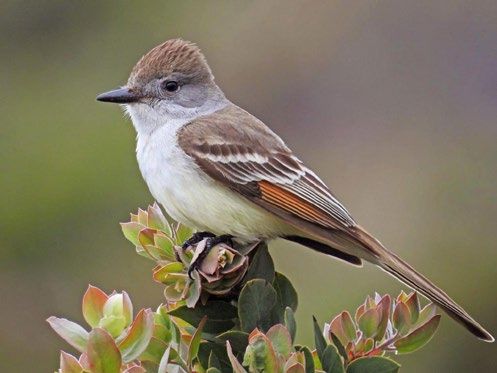
Mapping Wildlife Sensory
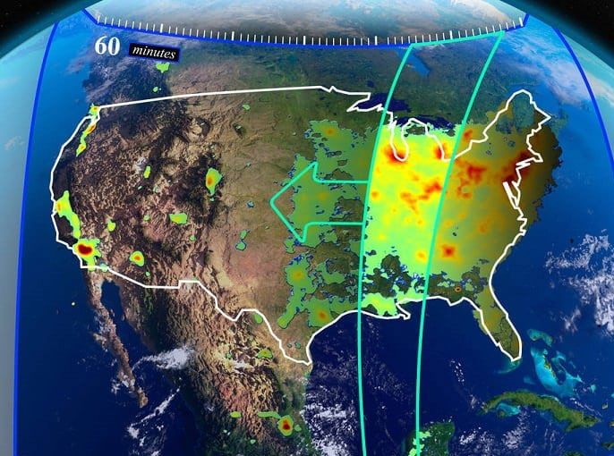
Tracking Hailstorms
“Danger Zones”
This ash-throated flycatcher is one of the 142 North American bird species This image from GOES-16 is color-enhanced of infrared wavelength temperature
included in the NestWatch study. overlaid upon visible wavelength brightness imagery during a massive Midwest
hailstorm on May 22-23, 2020.
The U.S. National Park Service is constructing Risk Hailstorms cause catastrophic damage to homes,
Maps to identify which wildlife habitats within the businesses, agriculture and infrastructure, making them
parks are most vulnerable to human activity. Early the costliest severe storm hazard for the insurance
results show the effects of people on everything from industry. That makes reliable, long-term data necessary
cougars hunting their prey to birds nesting. Working to estimate damage and assess risks. In a first-of-its-
with Ecological Forecasting, these maps include NASA kind project, the Disasters program area is bringing
satellite information of Earth at night, land use together commercial partners with satellite data to
changes and other details as well as computer models create long-term regional to global scale maps of severe
of migration patterns, radio collars on ‘apex predators’ storm occurrence, new methods of forecasting and
and a vast collection of data collected by the citizen catastrophe models. The project builds on data collected
scientist program NestWatch. during a 2020 hailstorm in the American Midwest that
set records for storm intensity and damage.
LOCATION: U.S. National Park System
LOCATION: U.S. Midwest, South Africa
DATA USERS AND COLLABORATORS: U.S. National Park
Service’s Natural Sounds and Night Skies Division, con- DATA USERS AND COLLABORATORS: Reinsurance Industry,
servation groups Meteorologists
PRODUCT: Risk Map PRODUCT: South Africa CAT Model, Satellite Mapping
EARTH OBSERVATIONS: VIIRS aboard Suomi NPP and Analysis of Severe Hailstorms (SMASH)
and additional NOAA satellites, Landsat, Terra, Aqua EARTH OBSERVATIONS: GPM and related historical
TRMM data, the GOES series of satellites, ESA’s
Copernicus satellites
appliedsciences.nasa.gov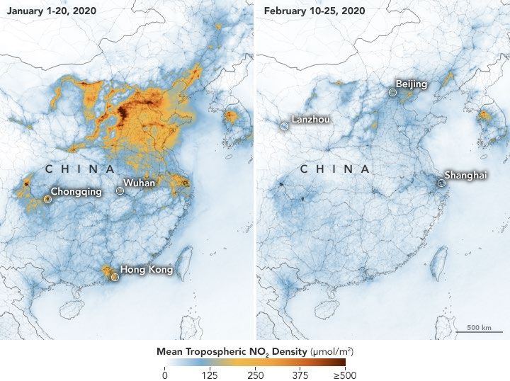
2020 HIGHLIGHTS

                 Water Resources
                                                                               Food Security & Agriculture
                 Transforming Water Management
                                                                               Monthly Crop Reports
                 in the U.S. West

Nevada alfalfa farmer and OpenET contributor Denise Moyle.   Soybean fields like this are included in the Crop Reports developed by
                                                             NASA Harvest.

Farmers, water managers and conservation groups              NASA Harvest is NASA’s Food Security and Agriculture
worked with the Water Resources program area to              Program and it’s a multidisciplinary consortium with
create the first-ever operational system for data            the University of Maryland. It enables and advances
on freshwater use and availability at the scale of           adoption of the satellite Earth observations by
individual fields across the western United States.          public and private organizations to benefit food
Launched in September 2020, OpenET compiles                  security, agriculture and human and environmental
publicly available data and open-source computer             resilience in the U.S. and worldwide. In 2020 both
models to provide satellite-based information on             record floods and record droughts greatly affected
evapotranspiration (the “ET” in OpenET). The system          world-wide agricultural output, showcasing the need
is set to be available to the public in 2021, supplying      for NASA Harvest’s monthly Crop Reports. With
evapotranspiration data across 17 western states.            details regarding yields, field size, areas harvested
                                                             and economic outputs of crops included, reports were
LOCATION: U.S. Western States                                deemed so helpful to farmers they were released as
DATA USERS AND COLLABORATORS: Farmers, water                 often as every two weeks during the harvest season.
managers, the Environmental Defense Fund and
                                                             LOCATION: East Africa, South Asia
other conservation groups
                                                             DATA USERS AND COLLABORATORS: USDA, Asian Rice
PRODUCT: OpenET
                                                             Crop Estimation & Monitoring (Asia-RiCE), U.N. Food
EARTH OBSERVATIONS: Landsat, Terra, Aqua and the             and Agriculture Organization, Famine Early Warning
GOES series of satellites                                    System Network (FEWS Net)
                                                             PRODUCT: GEOGLAM Crop Monitor
                                                             EARTH OBSERVATIONS: SMAP, GPM, NOAA’s
                                                             Advanced Very High Resolution Radiometer, GOES
                                                             series of satellites

appliedsciences.nasa.gov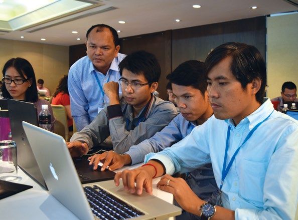
2020 HIGHLIGHTS

                  Health and Air Quality                                           COVID-19 Response
                  Forecasting Dust Storms

Clear skies over Luis Muñoz Marín International Airport in San Juan, Puerto Rico   Air quality changes were see in China early in the COVID-19 pandemic.
on June 20 (top) and during a massive 2020 dust storm on June 23 (bottom).

A three-day air quality warning system is now in place                             Air and water quality changes, rescheduling field work and
in Puerto Rico, giving officials and doctors the time                              pivoting existing projects to new data were all impacts
to prepare for the poor visibility and health effects of                           of the 2020 COVID-19 pandemic. The Health and Air
events like dust storms. This Health and Air Quality                               Quality program area led data collaborations and adapted
program area-supported project incorporated NASA                                   ongoing projects, for example, it moved to include
satellite and other data into existing air pollution                               coronavirus into an existing disease tracking project at
warning systems and was in place just in time for a                                Johns Hopkins University. The Capacity Building program
historically large dust storm in the summer of 2020. Due                           area held topic-specific trainings; Ecological Forecasting
to our warming world, dust storms are becoming more                                reviewed biodiversity changes and Disasters supplied
intense and more prolific. In the southwest U.S. they can                          expertise in resource allocation. The entire Program, in
spread the disease Valley Fever. In another dust-focused                           particular NASA Harvest, also provided data to the tri-
project the program is combining satellite data with                               agency COVID-19 Earth Observation Dashboard as well as
innovative types of on-the-ground sensors in the U.S.                              NASA’s impact dashboards air, land, water and climate.

LOCATION: Puerto Rico, U.S. southwest                                              LOCATION: Worldwide
DATA USERS AND COLLABORATORS: Healthcare workers,                                  DATA USERS AND COLLABORATORS: USGS, European Space
meteorologists, public health officials, state departments                         Agency, Japan Aerospace Exploration Agency
of transportation, National Weather Service                                        PRODUCT: NASA dashboards: air, land, water and climate.
PRODUCT: Puerto Rico Air Quality Warning System, U.S.                              COVID-19 Earth Observation Dashboard
National Dust Forecasting, Public Health Surveillance                              EARTH OBSERVATIONS: Terra, Aqua, the Landsat series
EARTH OBSERVATIONS: VIIRS aboard Suomi NPP and                                     of satellites, Suomi NPP and additional NOAA satellites,
additional NOAA satellites, Landsat, Terra, Aqua, the                              ESA’s Sentinel satellites
GOES series of satellites

appliedsciences.nasa.gov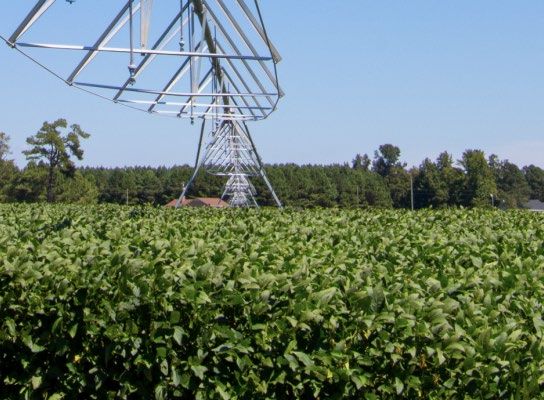
2020 HIGHLIGHTS
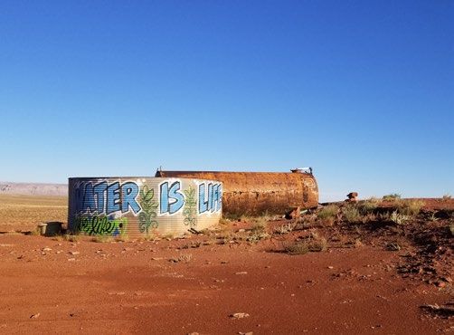
Capacity Building
Training on using NASA Earth science data at the SERVIR-Mekong hub in Thailand. A water cistern at the Navajo Nation painted with “WATER IS LIFE.”
SERVIR: Thailand Harnesses the Power Indigenous Peoples Pilot:
of NASA Observations Remote Training for Tribal Lands
In 2020 the Thai government unveiled its use of NASA Water managers in the drought-prone Navajo Nation
satellite and other Earth science data into its decision- now use NASA remote sensing data to better track
making process to improve on air pollution alerts and forecast freshwater resources. This Drought
and air monitoring. Working with the SERVIR-Mekong Severity Evaluation Tool (DSET) is an outcome of the
hub, the government brought together experts in air Indigenous Peoples Pilot, a project of Capacity Building
quality measurement, technology design, atmospheric and Water Resource’s Western Water Application Office
modeling and civic engagement. It developed a web- (WWAO). The Pilot is a project that continues to be
based platform for tracking and forecasting air quality. scaled up from its origin a few-month long early career
SERVIR is a joint initiative between NASA and the project. It now includes Navajo Nation NASA interns,
United States Agency for International Development remote sensing trainings specific to the Navajo Nation,
to boost environmental resilience and decision-making community engagement and ongoing work with other
in developing regions around the world. indigenous communities.
ARSET: New Languages and Topics DEVELOP: Pivoting to Virtual
ARSET stands for the Applied Remote Sensing Training The early-career training program DEVELOP pivoted in
program and in 2020 again trained a record number 2020 to an entirely virtual process and still succeeded
of people world-wide on how to access and interpret in bringing in more than 20 ‘DEVELOPers’ for each term.
NASA Earth science data with more than 30 thousand Projects included working with the aptly named town
people trained over the program 11 years. In 2020 of Satellite Beach, Florida on a goal of 100 percent
ARSET expanded beyond English and Spanish trainings renewable energy use and assisting Bhutan track
into French and held trainings on air quality as it global warming impacts on the Himalayas. The goal
relates to COVID-19 response, as well as new trainings of DEVELOP is to increase use of Earth observations
on urban heat islands. by early career scientists and in partner organizations,
all to better address current and future challenges.
appliedsciences.nasa.gov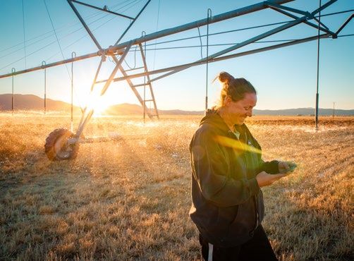
2020 HIGHLIGHTS
Support for Mission Planning
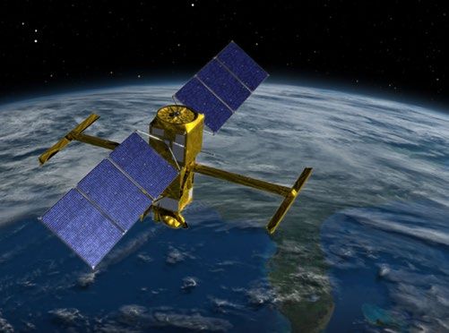
Graphic overview of TEMPO mission. An artist’s depiction of the upcoming SWOT satellite.
Participants from the Minnesota Pollution Control More than 30 computer programmers collaborated in a
Agency the Idaho Department of Environmental Quality virtual Summer 2020 Hackathon to develop real-world
were among the more than 100 participants from applications of simulated data from the upcoming
domestic and international organizations that took Surface Water and Ocean Topography (SWOT) satellite.
part in a Nov. 2020 Early Adopters Workshop for the This sprint-like event focused on real-time, rapid
TEMPO mission—Tropospheric Emissions: Monitoring diagnoses of hurdles faced by early adopters of the
of Pollution. Part of the Early Adopters program, this data. In one-on-one sessions between these data users
workshop showcased the latest information about and SWOT trainers, more than 50% of diagnosed issues
synthetic data products, demonstrations, and examples were successfully resolved in the first four hours. For
of application experiment requests. Attendees shared example, in trying to apply SWOT for improving flood
and compared how TEMPO data could add value in their forecasting over the Godvari basin in India, the SWOT
health applications and air quality forecasting and simulator was not producing information for the basin;
decision-making activities. the hackers revised the file and defined the correct
directory for orbits to resolve the issue.
appliedsciences.nasa.gov
You can also read