ANLABY, WILLERBY AND KIRK ELLA LOCAL CYCLING AND WALKING INFRASTRUCTURE PLAN 2021 - 2039 - East Riding of Yorkshire Council
←
→
Page content transcription
If your browser does not render page correctly, please read the page content below
www.eastriding.gov.uk

                                          K ELL A
                                                         Part of East Riding of Yorkshire
                 IL L E R BY  A N D  K IR
     ANL ABY, W
                                                          Council’s Local Transport Plan

              C Y C L IN  G A N  D  W ALKING
      LOCAL
              R A S TR U  C T U R E PL AN
          INF
                   2021 - 2039

                                                    “Keep East Riding moving”
LOCAL SUPPORT FOR THE LCWIP
Parish Councils and local Ward Councillors support the LCWIP and the programme of works for
2021/22 to 2023/24 as described in the Implementation Plan.

Chair of Anlaby Parish Council                    Ward Councillor
Signed:                                           Signed:

Name:                                             Name:

Date:                                             Date:

Chair of Willerby Parish Council                  Ward Councillor
Signed:                                           Signed:

Name:                                             Name:

Date:                                             Date:

Chair of Kirk Ella Parish Council                 Ward Councillor
Signed:                                           Signed:

Name:                                             Name:

Date:                                             Date:

Ward Councillor                                   Ward Councillor
Signed:                                           Signed:

Name:                                             Name:

Date:                                             Date:

                                    Town Centre

                      Supermarket   Park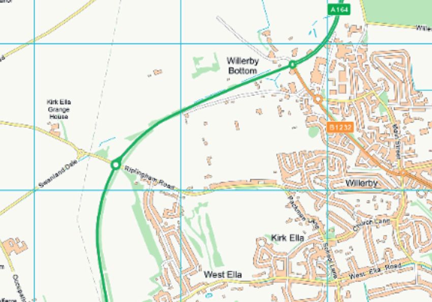
CONTENTS

    Setting the Scene                                           4

    Introduction                                                5

    The Local Context                                           8

    The Local Transport Context                                12

    Developing Cycling and Walking Networks                    16

    Consultation                                               19

    Anlaby, Willerby and Kirk Ella LCWIP Programme 2021-2024   20

    Monitoring and Key Outcomes                                21

3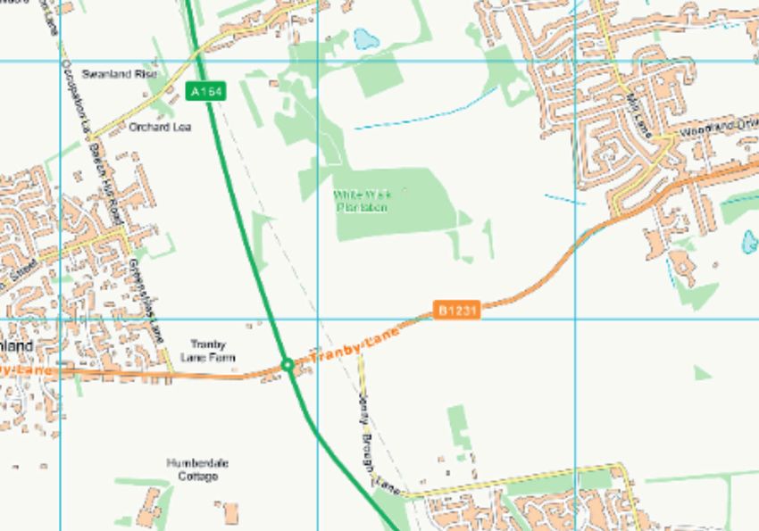
Developing                                       Anlaby, Willerby
                                                                        The Local
    Setting the                                  The Local                          Cycling and                                       and Kirk Ella           Monitoring and
                       Introduction                                     Transport                              Consultation
      Scene                                      Context                             Walking                                        LCWIP Programme           Key Outcomes
                                                                         Context
                                                                                    Networks                                           2021-2024

                                 CHALLENGES                                                                        OPPORTUNITIES

                      The Environment - Reducing pollution                                                 Cutting CO2 emissions - Cycling and walking improves
            CO2                                                                                            our carbon footprint
                      Globally transport accounts for around a quarter of
                      CO2 emissions

                                                                                                           Healthier lifestyles - Making walking or cycling to work
                      Health - Obesity, convenience and dependency                                         or school part of daily routine
                      on the car
            64%                                                                      1 mile =   1 mile =
                      In the UK 64% of adults are classed as being overweight        approx     approx
                                                                                      6 mins    20 mins    Reliability - Predictable journey times by walking
                      or obese
                                                                                                           and cycling

        A         B
                      The Economy - Too many short journeys by car
                                                                                                           Access - Providing safe maintained facilities for cyclists
                      Loss of work time due to traffic costs over £100m a year                             and pedestrians

                      Safety - Feeling safe travelling by bike or on foot                                  Sustainability - Encouraging a long-term shift to cycling
                                                                                                           and walking by improving access

                      Population - Expanding residential development and
                      potential traffic

4
Developing                                    Anlaby, Willerby
                                                                                     The Local
    Setting the                                          The Local                                        Cycling and                                    and Kirk Ella     Monitoring and
                            Introduction                                             Transport                                     Consultation
      Scene                                              Context                                           Walking                                     LCWIP Programme     Key Outcomes
                                                                                      Context
                                                                                                          Networks                                        2021-2024

       Background                                                                                      LCWIPs in the East Riding
       Every local transport authority in England has a statutory duty to produce a Local              LCWIPs have been prepared for the following 14 settlements,
       Transport Plan for their area. East Riding of Yorkshire Council’s current Local Transport       providing consistency with the East Riding Local Plan:
       Plan (LTP) contains a long term 18 year Strategy (2021-2039) and a shorter term three
       year Implementation Plan (2021/22 to 2023/24) to action the recommendations set out             Principal Towns:
       within the Strategy.                                                                            Beverley
                                                                                                       Bridlington
       As part of the development of the council’s previous Local Transport Plan we developed          Driffield
       individual transport strategies for each of the 14 main settlements in the East Riding, as      Goole
       identified in the settlement network included in the East Riding Local Plan. The individual
       transport strategies were focussed on improving facilities for sustainable modes and were       Major Haltemprice Settlements:
       well received by local residents and stakeholders. They were an effective way of delivering     Anlaby/Willerby/Kirk Ella
       targeted schemes for each area.                                                                 Cottingham
                                                                                                       Hessle
       Local Cycling and Walking Infrastructure Plans                                                  Towns:
       Following the publication of the national Cycling and Walking Investment Strategy (CWIS) in     Elloughton/Brough
       April 2017, government guidance recommended that local authorities should develop Local         Hedon
       Cycling and Walking Infrastructure Plans (LCWIPs) for their area. Given the structure of the    Hornsea
       LTP with a focus on targeting investment on key settlements, East Riding of Yorkshire Council   Howden
       has developed LCWIPs for the 14 main settlements.                                               Market Weighton
                                                                                                       Pocklington
       In accordance with this guidance each of the council’s LCWIPs includes the following:           Withernsea

           A network plan for walking and cycling which identifies preferred routes and core zones
           for further development.
           A prioritised programme of infrastructure improvements for future investment.
           An explanation of the underlying analysis carried out and a narrative which supports the
           identified improvements and network.

5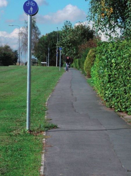
Developing                                       Anlaby, Willerby
                                                                                   The Local
    Setting the                                         The Local                                           Cycling and                                       and Kirk Ella              Monitoring and
                             Introduction                                          Transport                                          Consultation
      Scene                                             Context                                              Walking                                        LCWIP Programme              Key Outcomes
                                                                                    Context
                                                                                                            Networks                                           2021-2024

       The LCWIPs will contribute towards achieving the East Riding Local Plan Strategy Document policy S8 ‘Connecting People and Places’ and the five strategic objectives for the LTP,
       which are as follows:
       Objective 1        Improve the maintenance and management of the existing transport network
       Objective 2        Support sustainable economic growth and regeneration
       Objective 3        Reduce carbon emissions and encourage healthy lifestyles
       Objective 4        Improve road safety
       Objective 5        Improve access to key services
       In addressing Objective 5, a key element of each LCWIP will be to improve inclusive mobility through footway improvements including the provision of dropped kerbs and tactile paving.

       LCWIP Aims
       The primary aim of each LCWIP is to increase walking and cycling by encouraging residents to make short local trips on foot or by bike rather than travelling by single occupancy private car.
       Encouraging more trips to be made using active travel modes and reducing associated car use has a number of advantages shown below:

                                                                                                                                       Reduced traffic congestion and associated
                                                                                                                                             carbon emissions and noise

                        LCWIP Aims                                                                                                    Healthier residents by incorporating physical
                                                                                                                                                activity into everyday life
                       Increase walking
                          and cycling
                                                                                                                                      Improved local environment and streetscape
                     By encouraging more
                      short trips by bike
                           and foot                                                                                                             Predictable journey times

                                                                                                                                              Active and sustainable travel

6
Developing                                       Anlaby, Willerby
                                                                                 The Local
    Setting the                                        The Local                                          Cycling and                                       and Kirk Ella              Monitoring and
                            Introduction                                         Transport                                         Consultation
      Scene                                            Context                                             Walking                                        LCWIP Programme              Key Outcomes
                                                                                  Context
                                                                                                          Networks                                           2021-2024

       LCWIPs and the National Cycle Network
       The National Cycle Network (NCN) is a series of safe, traffic-free paths and quiet on-road cycling and walking routes that connect to many major towns and cities. It stretches over 14,000
       miles across the length and breadth of the UK. Almost 5 million people use the National Cycle Network, and despite its name, the Network is also popular with walkers, joggers, wheelchair
       users and horse riders.
       The council has been working with sustainable transport charity Sustrans over many years to develop and manage the NCN in the East Riding, which provides links to several of the main
       settlements, villages in between, and countryside, as well as providing connections into the neighbouring areas of Hull, Selby, York, Ryedale and Scarborough.
       The NCN in the East Riding of Yorkshire includes part of the popular Way of the Roses coast2coast route between Stamford Bridge and Bridlington, the eastern section of the Trans
       Pennine Trail through to Hornsea, and the circular Yorkshire Wolds Cycle Route. National Cycle Route 1, which runs through the East Riding, is also part of the North Sea Cycle Route
       (EuroVelo route 12).
                                                                                                                               The Trans Pennine Trail (TPT) is managed in partnership with the
                                                                                                                               TPT office based in Barnsley. They coordinate volunteer activity
                                                                                                                               and events to support and enhance the Trail.
                                                                                                                               Sustrans also recruits and manages local people to volunteer
                                                                                                                               time and effort to help maintain the NCN in their area. This
                                                                                                                               direct support from both Sustrans and TPT to help the Council
                                                                                                                               maintain facilities to a good standard is very welcome and greatly
                                                                                                                               appreciated.
                                                                                                                               In some areas, particularly around larger settlements, the NCN/
                                                                                                                               TPT provides useful links for commuting and access to services and
                                                                                                                               other facilities. Where appropriate, each LCWIP will support the
                                                                                                                               development of these links to maximise their contribution.

7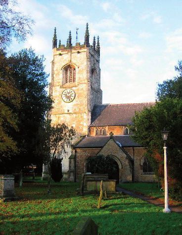
Developing                    Anlaby, Willerby
                                                                                      The Local
    Setting the                                            The Local                                    Cycling and                    and Kirk Ella     Monitoring and
                             Introduction                                             Transport                       Consultation
      Scene                                                Context                                       Walking                     LCWIP Programme     Key Outcomes
                                                                                       Context
                                                                                                        Networks                        2021-2024

       Anlaby, Willerby and Kirk Ella are three small suburban settlements to the west of Hull that
       have merged together over time but remain separated from Hessle, Cottingham and parts of
       Hull by areas of valued green open space.
       The three settlements have a combined estimated population of 23,523 (Office of National
       Statistics (ONS) 2018). Together the area forms one of the Major Haltemprice Settlements
       and is the third largest settlement in the East Riding.
       Willerby Square is a focus for local retail and community development. There are also small
       parades of shops along Kingston Road in Willerby and on Hull Road in Anlaby and Anlaby
       Common. Kirk Ella retains a village feel with fewer shops and is centred on the grade 1 listed
       St. Andrew’s Church within a conservation area.
       The main centres of employment are in Great Gutter Lane Industrial Estate in Willerby
       (including an East Riding of Yorkshire Council depot), along Springfield Way in Anlaby and at
       Willerby Hill Business Park adjacent to the A164. Willerby Manor and the Mercure Grange
       Park Hotel are also important employment sources. In addition, given the area’s proximity to
       Hull, a high number of residents travel to work in the city. Anlaby Willerby and Kirk Ella are
       not based around a traditional town centre; instead local residents do the majority of their
       food and grocery shopping in ‘out-of-centre’ supermarkets listed below.
       A location map showing the main services and facilities in Anlaby, Willerby and Kirk Ella is
       included below. The area has the following key facilities:
          Six primary schools which feed into Wolfreton Secondary School and Sixth Form on Carr

          Lane in Willerby plus Hull Collegiate (independent) School on Tranby Ride in Anlaby, and
          The Hub specialist school Springfield Lane.
          Numerous GP surgeries in the area plus the private Spire Hull and East Riding Hospital

          managed by Spire Healthcare on Lowfield Lane in Anlaby.
          The Haltemprice Hub which includes a new GP surgery, a library, customer service centre,

          and an East Riding Leisure centre with gym, squash courts, swimming pool and classes.
          Willerby shopping park adjacent to the A164 to the north west of the settlement contains

          a large Waitrose, an Aldi, a Lidl and other large national chain stores.
          Morrisons supermarket on Springfield Way in Anlaby with an adjacent retail park including

          Marks and Spencer’s Simply Food, Iceland and Argos stores.
          Hull Golf Club in Kirk Ella, and Springhead Park and Golf Course on Kingston Road in

          Willerby.
8
Map of Anlaby Willerby & Kirk Ella The Main Services
                  - Not to Scale -                                                                            I
                                                       v

 0   Bus Station

     Children's Centre

 -   Customer Service Centre

     Cycle Parking

     Health Centre

 v   Hospitals
     Library                                                                                       v
     Public Conveniences
     Schools

     Sports Centre

     Off-road cycle route (surfaced)
     Off-road cycle route (unsurfaced)

     On-road cycle lane (marked)

     On-road suggested link (unmarked)

       National Cycle Network
                                                 Contains OS data © Crown Copyright and database right 2020
Developing                            Anlaby, Willerby
                                                                   The Local
     Setting the                            The Local                          Cycling and                            and Kirk Ella        Monitoring and
                      Introduction                                 Transport                 Consultation
       Scene                                Context                             Walking                             LCWIP Programme        Key Outcomes
                                                                    Context
                                                                               Networks                                2021-2024

             LOCAL STATISTICS
                                                                                                  Job application
                                                                                       CV

                                                        27.9%                                                                    3%
                                                    of residents                                                            of residents are
                                     0-64           are over 65                                                              unemployed

                                     65+

                                                        15.9%
                                                   of households                                                              36.5%
                                                    do not have                              Under 3                       travel less than 3
                                                   access to a car                            miles                          miles to work
                                                       or van

                                                                                                                                Cycling
                                                        5.1%                                                                 commute has
                                                   of residents                                                               reduced by
                                                   walk to work
                                                                                                                               1.6%

10
Developing Anlaby, Willerby
The Local
Setting the The Local Cycling and and Kirk Ella Monitoring and
Introduction Transport Consultation
Scene Context Walking LCWIP Programme Key Outcomes
Context
Networks 2021-2024
Population and Local Economy Future Development
Anlaby, Willerby and Kirk Ella parishes have a combined total estimated population of The East Riding Local Plan (2012-2029) states
23,523 (ONS 2018). The area has a slightly higher proportion of residents of a pensionable that the Major Haltemprice Settlements,
age, with 27.9% of residents aged 65 or over compared to 25.8% in the East Riding and together with Hull, form a city of regional
18% in England (ONS 2018). importance. As such, this area is a key focus
for development over the Local Plan period
Only 4.6% of residents describe themselves as being in bad or very bad health, lower than with 14.9% of all new housing in the East Riding
the East Riding and nationally averages of 5.4%. to be constructed in the Major Haltemprice
Settlement, equivalent to 3,550 new dwellings.
An average of 15.9% of residents do not have access to a car or van, although this varies
The Local Plan Allocations Document sets
considerably between the different settlements (8% in Kirk Ella, 14% in Willerby and
out seven sites in Anlaby, Willerby and Kirk
21.7% in Anlaby). The high car occupancy, combined with good health, presents challenges
Ella for residential development, primarily on
in encouraging trips on foot or by bike. Although car availability in Anlaby is lower, it is
the northern and southern fringes, with some
closer to local shops on Hull Road, Anlaby and on Springfield Way. The compact nature
substantially constructed. Two employment
of the area and good quality footway and cycle infrastructure offer significant potential to NEW
sites are also allocated on Springfield Way and
encourage more Anlaby, Willerby and Kirk Ella residents to walk and cycle, where possible, PICTURE
at Willerby Hill Business Park.
as an alternative to driving to work. HERE
It is essential that new development can be
The Indices of Multiple Deprivation (IMD) (2019) show standards of living in this area accommodated without having an adverse
is high overall. Willerby and Kirk Ella ward is within the 20% least deprived in England. impact on the existing transport network,
However, the First Lane/Lowfield Road/Hull Road area in Anlaby falls within the 50% and the Local Plan highlights it should be well
most deprived in England. Only 1.5% of residents in Willerby and Kirk Ella ward claim job integrated with public transport corridors serving Hull.
seekers allowance (July 2015) compared to the East Riding average of 2.7%. Long term
A review of the Local Plan is currently being undertaken to reflect changes which have
unemployment rates are also lower than the national and East Riding averages.
occurred since its adoption, including new national policy and ‘real world’ changes. The
. review is likely to result in changes to allocations for development in the East Riding area.
The Council’s Highway Development Management Team will work with developers to
ensure that new housing and employment development is well connected to the existing
transport network and is accessible for local residents by sustainable modes of transport,
particularly through the provision of good quality footway and cycle links.
11Developing Anlaby, Willerby
The Local
Setting the The Local Cycling and and Kirk Ella Monitoring and
Introduction Transport Consultation
Scene Context Walking LCWIP Programme Key Outcomes
Context
Networks 2021-2024
Walking Cycling
Footways run throughout Anlaby, Willerby and Kirk Ella There has been a significant amount of investment in
and link the main trip generators in the town with nearby improvements to cycling facilities in Anlaby, Willerby and Kirk Ella,
residential areas. The footways are connected by a number of supported by the Council’s Local Transport Plan, including; Off-
pedestrian crossing points on the busier roads. The area is flat road shared cycleway/footways; On-road cycle lanes; and Cycle
and relatively easy to navigate, and local shops and services are parking at key attractors.
generally within walking distance of most of the surrounding
Larger cycle schemes installed included:
residential areas.
Off road shared use footway/cycleway along Hull Road and Springfield Way between
The council runs a ‘Walking the Riding’ website which contains
Hull city boundary and Haltemprice roundabout (Springfield Way/South Ella Way/
details of over 300 walks across the East Riding. The site includes
Beverley Road/Gorton Road), with cycle crossing facilities at the roundabout itself;
a number of walks starting in Anlaby, Willerby and Kirk Ella.
Pedestrian improvement schemes which have been On road advisory cycle lanes along both sides of Kingston Road between Hull city
implemented in recent years in Anlaby, Willerby and Kirk Ella boundary and Willerby Square;
using Local Transport Plan funding include: Off road shared footway/cycleway along west side of Gorton Road;
Dropped crossings with tactile paving; Off road shared footway/cycleway facility along Beverley Road between Willerby
Pedestrian crossings; Square and Willerby shopping park/A164.
There is also a surfaced off road cycle path running from Carr Lane to Wold Road along
Part-time 20mph zone.
the northern side of Springhead Golf course, and a further off road cycle route along First
Walking and cycling maps are available to download Lane. As part of the A164 major transport scheme there is now a continuous cycle link to
from the Council’s website. Beverley from Anlaby, Willerby and Kirk Ella.
Secure cycle parking facilities are available throughout the area including cycle stands
in Willerby Square, at the Haltemprice Hub, where there are also cycle lockers, and at
Willerby shopping park and the Springfield Way retail park.
There are two bike shops just inside the Hull boundary, one on Willerby Road and another
on Anlaby Road. Several long distance cycle routes pass through or close to the area
including National Cycle Network (NCN) route 1 which connects Dover and the Shetland
Islands. The National Byway also runs north/south through the three settlements, roughly
following NCN route 1. Both NCN route 1 and the National Byway are clearly signed.
12Developing Anlaby, Willerby
The Local
Setting the The Local Cycling and and Kirk Ella Monitoring and
Introduction Transport Consultation
Scene Context Walking LCWIP Programme Key Outcomes
Context
Networks 2021-2024
Cycling times to Anlaby, Willerby and Kirk Ella centre (minutes)
Cottingham
18
minutes
28 Hull
minutes
20 ANLABY,
minutes WILLERBY AND
Skidby
KIRK ELLA
13
minutes
18
minutes
Hessle
Swanland
13Developing Anlaby, Willerby
The Local
Setting the The Local Cycling and and Kirk Ella Monitoring and
Introduction Transport Consultation
Scene Context Walking LCWIP Programme Key Outcomes
Context
Networks 2021-2024
Road
Anlaby, Willerby and Kirk Ella all have good road links to the City of Hull via the B1232 (Kingston Road) and the B1231 (Springfield Way/Hull Road). The area
is also well connected to Beverley and the strategic road network by the A164.
Following a successful £10 million bid by the Council to the Department for Transport for major transport scheme funding, the A164 Humber Bridge to
Beverley improvement scheme was completed in May 2013 which aimed at improving congestion and journey times, especially at peak times. The scheme
included dualling part of the A164 between Willerby and Cottingham, providing two-lane entry/exits on the A164 roundabouts, and a continuous cycle
facility between Beverley and the Humber Bridge.
Some local roads can become congested with queuing traffic at peak times including the B1232 Beverley Road in Willerby between Willerby Square and the
A164, and the Hull Road/Anlaby Park Road North/Trenton Avenue signalised junction (this falls just within the Hull boundary). Springfield Way in Anlaby
can also experience queuing traffic at peak times, particularly in the vicinity of the retail park. A 20mph speed limit exists on parts of Main Street and along
Victoria Road in Willerby.
Bus
Most of the bus services which serve Anlaby, Willerby and Kirk Ella are run by East Yorkshire buses, with frequent services
linking with Hull. Willerby Square and Wilson Street in Anlaby are terminus points for many services.
There are also a number of college bus services that run during term time only which transport students from Willerby and
Anlaby to Hymers College and Wyke College in Hull.
Rail
Willerby and Kirk Ella railway station and Springhead Halt near Anlaby were on the Hull to
Barnsley railway line. Both stations closed to passengers in 1955 and the line closed in 1964. In
1970 part of the route of the line was used to construct the B1232 Beverley Road.
The nearest railway station now for Anlaby, Willerby and Kirk Ella residents is at Hessle or
Cottingham. Hessle provides regular links to Hull and Doncaster, while Cottingham also links to
Hull and has services to Beverley, Bridlington and Scarborough.
14Developing Anlaby, Willerby
The Local
Setting the The Local Cycling and and Kirk Ella Monitoring and
Introduction Transport Consultation
Scene Context Walking LCWIP Programme Key Outcomes
Context
Networks 2021-2024
Community Transport
The council supports several Community Transport schemes which provide a dial-a-ride service to ensure that those who cannot use conventional
public transport due to poor health or disability can continue to access services and healthcare. The Beverley Community Lift covers the Anlaby,
Willerby and Kirk Ella area and works with local community groups and sheltered accommodation providers to run regular minibus services. This is
complemented by community transport groups in Hull, some of which also cover the Major Haltemprice Settlements.
The council also operates a MediBus service which provides a well-used service by local residents for transport from their front door to local
hospitals, doctors’ surgeries, clinics and dentists, including for visiting friends and relatives in hospital.
Key Transport Challenges
Overarching transport challenges for the East Riding are set out within the LTP
Strategy. A number of local challenges for Anlaby, Willerby and Kirk Ella have been
identified through this LCWIP.
The key transport challenges for the town are:
Of residents who live less than 1.2miles (2km) from their place of work, over
48% choose to drive this short distance.
A high proportion of residents who travel between 2km and 5km (1.2 to 3miles)
to their place of work choose to drive (71%).
The number of residents commuting by bike has reduced by 1.6%.
Addressing these three key challenges for Anlaby, Willerby and Kirk Ella and
encouraging residents to commute short distances using active travel modes will help
to reverse the trend in the increasing number of people driving to work. Providing
high quality and safe walking and cycling links to encourage modal shift will also
ensure that households without a car or van can continue to access local services.
Reducing the reliance of local residents on travelling by car for short local trips will
also support the existing high numbers of people walking to work in the town.
15Developing Anlaby, Willerby
The Local
Setting the The Local Cycling and and Kirk Ella Monitoring and
Introduction Transport Consultation
Scene Context Walking LCWIP Programme Key Outcomes
Context
Networks 2021-2024
Identifying Priority Routes Walking Hierarchy and Use
Given the area’s close proximity to Hull, it is reasonable to assume that the potential
for walking and cycling to work can be extended to a large area of the city as well as to Category 1 - Primary Walking Route
Haltemprice.
Busy urban shopping and business areas, and main pedestrian routes, linking
The processes described in ‘Local Cycling and Walking Infrastructure Plans: Technical interchanges between different modes of transport, such as railway and bus
Guidance’, published by the DfT in April 2017 have been followed in identifying priority stations. All routes within the Haltemprice Settlements, Principal Towns and
routes in the town and links to nearby villages. A full explanation of the methodology is Towns as set out within the Local Plan.
included in the Local Transport Plan Strategy.
Walking
The mapping of walking trip generators and identification of Core Walking Zones as Category 2 - Secondary Walking Route
recommended in DfT guidance is already part of the process of managing the highway asset.
This is necessary to develop a hierarchy of footways to help prioritise maintenance investment. Medium usage routes through local areas feeding into primary routes, local
shopping centres, large schools and industrial centres etc. All routes within
The process is responsive with regular review as described in the council’s Transport Haltemprice Settlements, Principal Towns and Towns as set out within the
Asset Management Plan and corresponds with the process and categorisation shown Local Plan.
in ‘Well Managed Highway Infrastructure: A Code of Practice’ published in October 2016.
Previous work on walking routes, using a ‘link and place’ approach to categorise footways
within Anlaby, Willerby and Kirk Ella for maintenance purposes, has been further developed
to identify a priority network for investment in pedestrian facilities. Category 3 - Link Footway
Following national guidance, footways are prioritised based on their purpose in a process Linking footways from urban centres to key services within walking distance.
developed as part of the council’s Transport Asset Management Plan. All routes within Haltemprice Settlements, Principal Towns, Towns, Rural
The footway hierarchy based on this prioritisation is set out adjacent. Using this as a basis, Service Centres and Primary Villages as set out within the Local Plan.
officers used current information on origins and destinations within the town to develop a
draft network.
The footway network showing categories and therefore overall priorities for investment is
shown in Appendix A.
Category 4 - Local Access Footway
The consultation process helped to identify potential key, affordable schemes on these
routes. These schemes were then prioritised based on the council’s appraisal process All other footways associated with low usage, short estate roads to the main
described in the LTP to create a three year funded programme. routes and cul-de-sacs.
The programme for Anlaby, Willerby and Kirk Ella is shown in a following section.
16Developing Anlaby, Willerby
The Local
Setting the The Local Cycling and and Kirk Ella Monitoring and
Introduction Transport Consultation
Scene Context Walking LCWIP Programme Key Outcomes
Context
Networks 2021-2024
Cycling Cycle Network Hierarchy
To assist in the development of a Cycling Network, aid the prioritisation of improvements, and
inform management of the cycle infrastructure, the council has categorised the public highway Category 1 - Primary Cycleway
establishing a cycle category.
High flows of cyclists are forecast along desire lines that link large residential
This uses a series of selected Origins and Destinations as well a route criteria to provide clear areas to trip attractors such as a town or city centre. All routes within the
determination of the cycle category along ‘desire line’. The council has expanded on DfT’s Haltemprice Settlements, Principal Towns and Towns as set out within the
guidance to provide a four category hierarchy shown adjacent. Local Plan (DS1, DS2, DS3)
The cycleway network definitions have been expanded to include the size of settlement which
may attract the desired trafficking. For the purposes of categorisation, a distance of five miles
has been considered an acceptable distance for cycling in line with national guidance.
The council has included an additional Category of ‘Link Cycleway’ to establish connectivity to Category 2 - Secondary Cycleway
satellite settlements around the key towns. Settlements with a population less than 500 have Medium flows of cyclists are forecast along desire lines that link to trip
been considered too small to attract a significant level of cycling. attractors such as schools, colleges and employment sites. All routes within
Haltemprice Settlements, Principal Towns and Towns as set out within the
Local Plan (DS1, DS2, DS3)
Category 3 - Link Cycleway
Medium flows linking cycleways from primary to key services within cycling
distance to settlements with population greater than 500 within 5 miles. All
routes must originate from within Haltemprice Settlements, Principal Towns,
Towns, Rural Service Centres and Primary Villages as set out within the
Local Plan
Category 4 - Local Cycleway
All other footways associated with low usage, short estate roads to the main
routes and cul-de-sacs.
17Developing Anlaby, Willerby
The Local
Setting the The Local Cycling and and Kirk Ella Monitoring and
Introduction Transport Consultation
Scene Context Walking LCWIP Programme Key Outcomes
Context
Networks 2021-2024
In determining appropriate routes between origin and destinations, as well as directness of The PCT provides a scenario based approach to cycle planning allowing users
route, the following factors were considered: to visualise potential growth in cycle commuter trips based on cycling levels
recorded in the 2011 census. A number of different scenarios are available to
Attractiveness
generate possible outcomes which can be presented in area or route format,
Comfort each indicating potential cycling commuter growth.
Safety
Coherence The PCT has the ability to generate a cycling route network, with thicker lines
indicating routes with higher commuter cycling potential. This can then inform
Direct
investment prioritisation. However, up to date local knowledge is crucial in
The council has also used the DfT’s Propensity to Cycle Tool (PCT) to identify routes with correctly reinterpreting the data provided by the model.
potential high use and referred to reports posted on the Widen my Path website.
Starting with the PCT ‘government target’ scenario and focussing on the ‘route
Hierarchy of Location network’ output, officers used current information on origins and destinations
within the town to develop a draft network. This work was informed by the
A B economic and demographic data set out earlier in this report.
Local stakeholders were then consulted, as described in the following section, to
INTERNATIONAL NATIONAL
ensure that a wide knowledge base was built into a final cycling network. A map
Site that attracts significant traffic The location is considered to be an is appended as Appendix B showing the results.
internationally e.g. docks or attractor of national importance,
airports. attracting journeys from across the The consultation process also helped to identify potential key, affordable
UK. This is limited to Hospitals schemes on these routes. These schemes were then prioritised based on
and Transport Hubs such as Bus probable demand, partially identified by the PCT, and using the council’s
and Rail Stations. prioritisation process. The programme is shown later in this document.
C D
REGIONAL LOCAL
The location is considered to be an The location is considered to be
attractor of regional importance, an attractor of local importance,
attracting journeys from across generating a small number of
the East Riding. This includes journeys, predominantly local.
areas of education, leisure This includes small commercial
facilities, retail parks, industrial properties, retail, dentists,
estates and car parks. surgeries and bus stops.
18Developing Anlaby, Willerby
The Local
Setting the The Local Cycling and and Kirk Ella Monitoring and
Introduction Transport Consultation
Scene Context Walking LCWIP Programme Key Outcomes
Context
Networks 2021-2024
R
CONSULTATION FO
Process and Key Stakeholders RBY
THE ANLABY, WILLE
WIP
Local stakeholders were consulted in the development of each of
AND KIRK ELLA LC
the LCWIPs. This ensured that local knowledge and expertise on
transport issues in each area was fed into the plan, and that any
schemes included within the programme were locally acceptable
and deliverable.
Ward Councillors
The consultation process for the Anlaby, Willerby and Kirk Ella
LCWIP was undertaken in two stages. Firstly, stakeholders were
asked to suggest any potential improvements to the walking
and cycling networks identified that they would like to be
Local
considered for appraisal and prioritisation. Stakeholders included Stakeholders
Town and Parish
the local Ward Councillors, parish Councils and internal council including
departments. This first stage was completed in autumn 2020. Councils
accessibility
Secondly a final version of the LCWIP, including a prioritised list of
schemes for implementation in 2021/22-2023/24, was circulated
groups
to all stakeholders in November 2020. The final version of the
individual LCWIP was then formally signed off by the Parish
Councils and Ward Councillors. LCWIP
Cycling Groups Emergency Services
Council Officers
19Developing Anlaby, Willerby
The Local
Setting the The Local Cycling and and Kirk Ella Monitoring and
Introduction Transport Consultation
Scene Context Walking LCWIP Programme Key Outcomes
Context
Networks 2021-2024
The programme of schemes for the Anlaby, Willerby and Kirk Ella LCWIP covers
the three year period 2021/22 to 2023/24. Following appraisal the prioritised
schemes were developed into a programme of works, shown in the table
below. In developing the three-year delivery programme for the LCWIP a large
number of potential schemes have been identified. To assess and prioritise these
schemes the council applied a comprehensive appraisal framework described
in the LTP, which considers each scheme in terms of benefits (contribution to
achieving the LTP objectives and tackling the key priorities) and affordability. Any
major schemes identified which were beyond the scope of LTP funding will be
considered for additional future funding opportunities.
Prioritised Programme of LCWIP Schemes for Anlaby, Willerby and Kirk Ella Area (All proposed schemes are subject to detailed technical appraisal)
Anlaby, Willerby and Kirk Ella Schemes Scheme Origin Notes
Beverley Road, Willerby zebra crossing south of Grange Park Lane
Councillor McMaster (plus previous requests)
roundabout
Dropped kerbs and tactile paving in the wider area to improve
Area Engineer Exact locations to be identified
accessibility
Beverley Road/Lowfield Road roundabout visibility from Lowfield
Ward Councillor
Road
Improve crossing facilities in vicinity of Hull Road/Wilson Street/ RoHSS consultation via Economic Development
Lowfield Road team
Secure cycle parking including for adapted bikes/trikes TPT
Shared off-road footway/cycleway Beverley Road between Lowfield
Area Engineer Contribution to joint scheme with Hessle
Road mini roundabout Anlaby and houses at Hessle
20Developing Anlaby, Willerby
The Local
Setting the The Local Cycling and and Kirk Ella Monitoring and
Introduction Transport Consultation
Scene Context Walking LCWIP Programme Key Outcomes
Context
Networks 2021-2024
In order to assess whether the LCWIP is effective and to
determine its contribution towards meeting the five LTP
objectives and government walking and cycling targets a
monitoring framework has been developed. The level of
monitoring is proportionate to the budget and type of schemes
set out within this strategy, and monitoring will also be
undertaken through the other LTP strategies and other areas of
our work.
In the national CWIS the government has set the following
objectives for 2025:
Double cycling based on 2013 levels;
Increase walking activity;
Increase the percentage of children age 5 to 10 who usually
walk to school from 49% in 2014 to 55% in 2025.
A number of outcome indicators have also been developed for
each LCWIP, as shown in the table below. These will generally
be monitored using existing sources of data. The outcome
indicators are closely linked to the objectives and will be
influenced by the delivery of the LCWIP.
Outcome indicators for each LCWIP
Indicator Desired direction of travel Data source
Percentage of people walking to work Increase Census
Percentage of people cycling to work Increase Census
Percentage of pupils age 5 to 10 usually
Increase Annual survey
walking to school
21This document can be made available in other languages or formats if required. To request another format, please contact us on Tel: (01482) 391756 or Email: transport.policy@eastriding.gov.uk
You can also read