Bicycle and Pedestrian Improvement Plan 2020 Update - Town of Brunswick
←
→
Page content transcription
If your browser does not render page correctly, please read the page content below
Town of Brunswick
Bicycle and Pedestrian
Improvement Plan 2020 Update
Acknowledgements
This update of the Bicycle and Pedestrian Improvement Plan is the result of the efforts
of the Brunswick Bicycle and Pedestrian Advisory Committee and the Town of Brunswick
staff.

Brunswick Bicycle and Pedestrian Advisory Committee

Peggy Brown, Chair

Annee Tara

Blaine Moore

Kris Haralson

Kathy Thorson

Christopher Watkinson, Town Councilor

Project Team

Jared Woolston AICP, Town Planner

Laurel Margerum, Planning Assistant

Cooper Dart, Planning Intern- Summer 2019

Town of Brunswick Staff

Ryan Barnes, Town Engineer

                                                     Illustration by Laurel Margerum
2|P a g e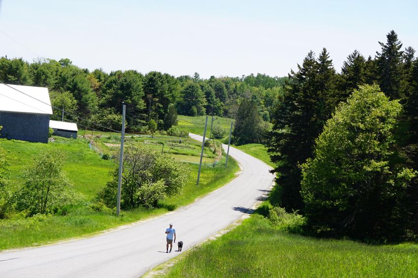
Table of Contents

01                                            Schools & Surrounding
                                              Neighborhoods……………………… 26
Introduction………………………………………... 4              Rural Roads……………………………. 30
                                              Trails………………………………………. 32
 Multi-Modal Transit Improvements:
                                              Watersheds……………………………. 33
 Planning for Bicyclists and
                                           Town-Wide Goals…………………………. 34
 Pedestrians……………………………………….. 5

 Brunswick Bicycle and Pedestrian
 Improvement Plan History & Use…….. 6    03
 Benefits of Bicycle and Pedestrian      Usage and Sources of Funding…………. 39
 Infrastructure……………………………………. 7
                                           Usage……………………………..…………….. 40
 Relationship to Other Plans &
 Policies……………………………………..………. 8            Sources of Funding………………………. 42

 Brunswick Bicycle & Pedestrian
 Advisory Committee (BBPAC)…………. 13

 Recent Bicycle and Pedestrian
 Improvements………………………………… 14

                                         Appendix I: Benefits of Improving
02
                                         Bicycle and Pedestrian
Existing Conditions, Goals & Action      Infrastructure…………………………………….. 44
Items………………………………….……………... 17
                                         Appendix II: Bicycle and Pedestrian
   Transit Areas…………………………………. 19        Infrastructure Design………………………… 52

       Downtown & Inner Pleasant         Appendix III: Guide to Popular Bike &
       Street……………………………………… 19          Pedestrian Routes…………………………….. 60
       Outer Pleasant Street…………….. 21
                                         Appendix IV: Completed Pop-Up
       Brunswick Landing & Cooks
                                         Projects……………………………………………... 69
       Corner……………………………………. 23

3|P a g e
h
    01: Introduction

       4|P a g e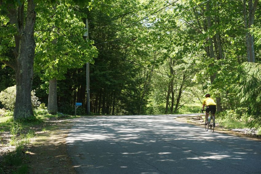
Multi-Modal Transit
Improvements: Planning for
Bicyclists and Pedestrians
The Town of Brunswick is committed to improving the quality of life of its residents and
visitors by providing multi-modal transit infrastructure that builds a safe, accessible, and
healthy community. In this context, multi-modal transit refers to transportation by car,
truck, boat, bicycle, and pedestrian modes including walking, running, and wheelchair
use. The focus of this Bicycle and Pedestrian Plan 2019 Update is to identify transit
areas, planning goals, and plan implementation strategies for sustainable biking and
pedestrian transit conditions in Brunswick that foster town vitality and yield significant
economic, environmental, social, and health benefits.

Increasing Brunswick’s bicycle and pedestrian resources provides a much-needed
alternative to automobile travel, easing traffic on town streets, reducing carbon output,
and improving local air and water quality. The benefits of improved bicycle and
pedestrian infrastructure reach all community members, and the Brunswick Bicycle and
Pedestrian Advisory Committee (BBPAC) hopes that one day a middle-school-aged child
will be able to walk or bicycle safely and comfortably anywhere in Town.

Brunswick is an attractive town for college students and young people and is popular
with retirees looking for a comfortable life on the Maine coast close to amenities.
Improved infrastructure for pedestrians and bicyclists will better serve these groups who
are less reliant on cars and more likely to choose alternative forms of transit.

Bike and pedestrian improvements should support the overall cohesiveness of
Brunswick’s transit systems. Bike and pedestrian infrastructure should connect to other
transit systems, both public and private, and should be tied into new projects and
improvements of existing resources.

This plan aims to outline an argument for increasing and improving bike and pedestrian
resources and infrastructure in
Brunswick and recommend and
prioritize future projects. This plan
presents short and long-term goals
and should be updated periodically to
reflect progress and change.

5|P a g e
Brunswick Bicycle and Pedestrian
Improvement Plan History & Use

The Brunswick Bicycle and Pedestrian Advisory Committee (BBPAC) produced the
October, 1998, Brunswick Bicycle and Pedestrian Improvement Plan after three (3) years
of work on the project. An update of the plan began in 2002 at the request of the Town
Council. The BBPAC completed the second update of the plan in March, 2004, and the
Town Council adopted the plan in March, 2005. A brief update to the plan was added in
2016.

BBPAC intends for this plan to be a resource for the Town Council, School Board,
Planning Board, Recreation, Police, Public Works and Planning Departments, land
developers, businesses, non-profit organizations, individual citizens, and anyone else
who is interested in promoting human-powered transportation in Brunswick. BBPAC
understands that this plan can only reflect the conditions that exist at the time it is
written - periodic reviews and amendments of the plan are necessary, desirable, and
expected.

While working on the 2002 plan update, the Committee formulated a simple but
significant long-range goal of a middle school aged child being able to walk or bicycle
safely anywhere in town.

       See it on your walk or ride: The Androscoggin River along the Bike Path.

6|P a g e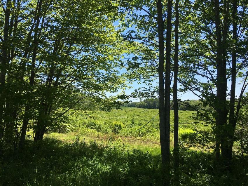
Benefits of Bicycle and Pedestrian
Infrastructure
Improving bicycle and pedestrian infrastructure brings many benefits to the community
and individuals. Appendix I provides a more comprehensive analysis of economic,
environmental, and health benefits with discussion of research and references.

Health Benefits                               individuals save money on car expenses
                                              by increasing their biking and walking,
Choosing a human-powered alternative          they can spend more money in local
to driving a car benefits a person’s          economies. Homeowners benefit from
health by increasing their daily physical     increased house values when bicycle
activity. Traveling to school on foot or      and pedestrian resources improve in
by bike is particularly important for         their area, and towns save money on
establishing healthy habits in young          road repair when more individuals bike
children. Reducing car use can reduce         or walk over driving. Bicycle and
asthma rates by improving air quality.        pedestrian friendly towns also attract
Improving bike and pedestrian                 more young college grads who improve
infrastructure can also reduce crash          local workforces. Importantly, bicycle
rates, a very tangible benefit to public      and pedestrian infrastructure can reduce
health. Bike and pedestrian                   economic exclusion by allowing
infrastructure also improves the social       individuals unable to afford a car to
health of a community by increasing in-       reach jobs, stores, and resources.
person interactions between friends and
acquaintances.                                Environmental
Economic Benefits                             Benefits
                                              Redirecting vehicle traffic to bike and
Improved bicycling and pedestrian
                                              pedestrian travel reduces CO2 output
facilities economically benefit a variety
                                              which contributes to global warming.
of groups. Towns with strong pedestrian
                                              Reducing car travel and the pollution it
and bike infrastructure attract more
                                              creates also improves air and water
tourists who will spend money in town.
                                              quality. Additionally, studies show that
Bike and pedestrian friendly areas are
                                              environmentally friendly communities
more attractive to stores and bring in
                                              make for happier people.
more customers to shop. When

7|P a g e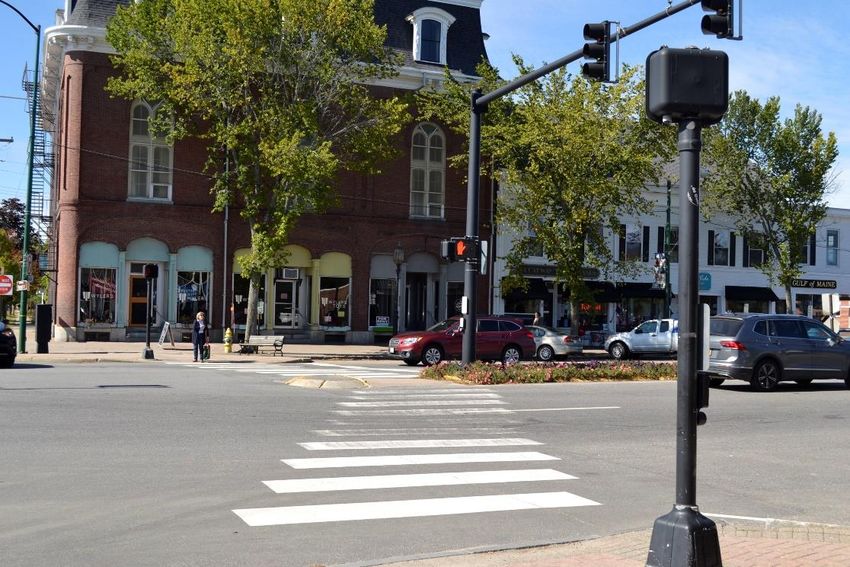
Relationship to Other Plans &
Policies
The goals and action items of the Bicycle and Pedestrian Improvement Plan Update
relate to other Town and State plans and national policies. Considering how this plan
ties into others provides greater motivation for the objectives of the Bicycle and
Pedestrian Improvement Plan.

Comprehensive Plan
The 2008 Comprehensive Plan Update outlines policy goals and implementation
strategies to steer future change and development in Brunswick. Consideration of
bicycle and pedestrian infrastructure is a part of the 2008 Comprehensive Plan, and the
in-progress 2020 Comprehensive Plan Update will tie in the goals of the 2019 Bicycle
and Pedestrian Improvement Plan as well. The following policy areas connect to bicycle
and pedestrian infrastructure:

   Policy Area 4: Support the Development and Maintenance of Infrastructure that
   Promotes Livable Neighborhoods and the Desired Pattern of Residential and
   Commercial Growth.

      Key Objective #2 specifically addresses the use of sidewalks and paths to
      promote Brunswick’s desired pattern of growth and the safety of automobiles,
      pedestrians, and bicycle traffic. Action 4 specifically references the improvements
      of roads and sidewalks per the 2004 Bicycle and Pedestrian Improvement Plan.
      Action 5 recommends the adoption of new road standards for new streets that
      will accommodate for interconnectivity and sidewalks.

   Policy Area 5: Encourage a Diversity of Housing Types in the Designated Growth
   Area and Facilitate the Preservation and Development of Affordable and Workforce
   Housing.

      While this section does not directly reference provisions for pedestrians and
      bicyclists, providing for parking spaces adds to the cost of housing, particularly in
      downtown regions, and cars are expensive to maintain. Bicycle and pedestrian
      resources can improve the quality and usefulness of affordable development.

   Policy Area 6: Protect Open Space and Natural Resources and Provide Outdoor
   Recreational Opportunities.

8|P a g e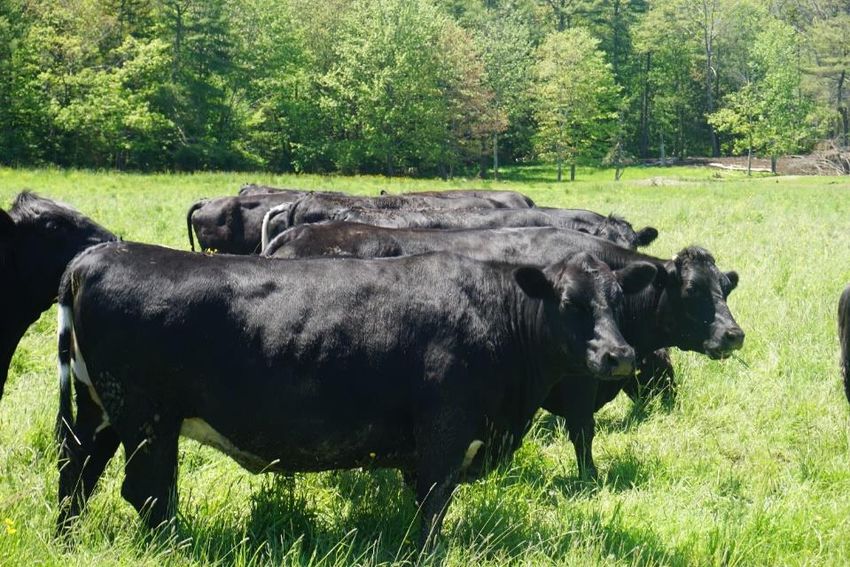
Key Objective 5 addresses providing adequate recreational facilities for current
      and future needs. Actions 2 & 4 reference the 2004 Bicycle and Pedestrian
      Improvement Plan as part of this effort in the context of the redevelopment of the
      Naval Air Station and creating interconnected trails through Brunswick.

   Policy Area 7: Promote an Economically Viable, Attractive Downtown.

      Key Objective 2 aims to make the Downtown District safer and more pedestrian
      friendly, specifically mentioning the 2004 Bicycle and Pedestrian Improvement
      Plan as a guide. Key Objective 4 aims to make the Downtown more attractive,
      inviting, and the hub of community activity; bike and pedestrian infrastructure
      support these goals by increasing social interactions (see “Benefits”).

   Policy Area 8: Promote a Diverse and Healthy Local Economy.

      As outlined in the above in “Benefits,” improving bicycle and pedestrian resources
      directly affect economic outcomes, particularly the vitality of downtown shops, the
      concern of Key Objective 5.

Zoning Ordinance
Descrip

            I.   Parts that apply

Cooks Corner Design Standards

Descrip

            I.   Parts that apply

Appendix: Complete Streets Policy

Descrip

            I.   Parts that apply

9|P a g e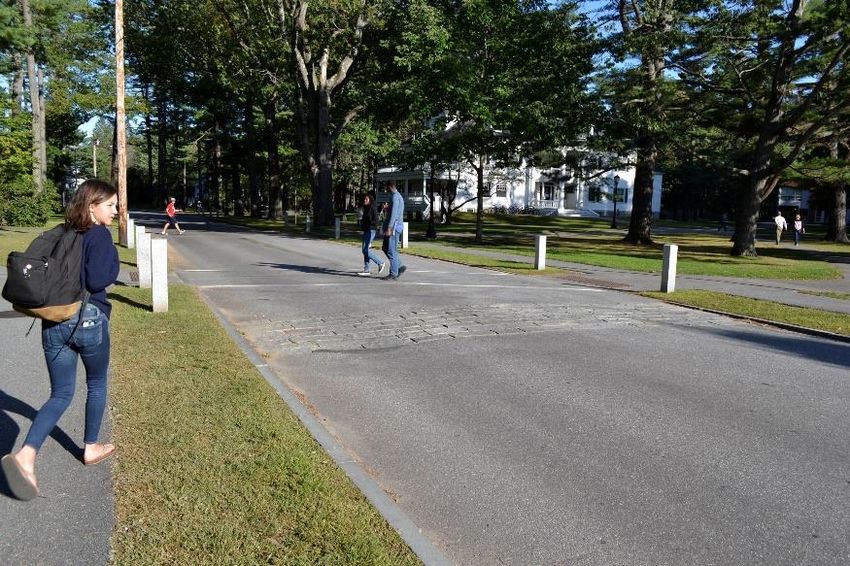
Capital Improvement Plan
The 2020-24 Capital Improvements Plan (CIP) outlines Town infrastructure projects for
the coming years, many of which address bicycle and pedestrian infrastructure and
would affect bicycle and pedestrian activity.

   Androscoggin River Pike Path Extension- The proposed 2.6-mile extension of the
   existing bike path would extend its terminus to Petersen Lane, creating a connection
   for the East Coast Greenway between Brunswick and the Sagadahoc Bridge. This
   project would allow for bike commuting between Bath and Brunswick.

   William Fitzgerald Bike Path Connection- A path constructed from the new
   Fitzgerald Recreation and Conservation Area to the Androscoggin Bike Path would
   connect the land to downtown Brunswick. This would provide an alternative
   transportation connection to downtown Brunswick for the neighborhoods around the
   conservation land which are currently difficult to access other than by car.

Recreation, Trails & Open Space Management Plan
The Recreation, Trails & Open Space Management Plan guides “the management of the
Town of Brunswick public benefit conveyance lands, public access and open space
properties [resulting from the closure of the Naval Air Station] for the purposes of
recreation, trails and open space conservation.” Sections of the plan address the
establishment of trail systems which serve bicycling and pedestrian activities.

   The Trails and Recreation Opportunities section, which outlines standards for the
   establishment of trails the Kate Furbish Preserve Management Plan, details the
   offerings of trails available on the property. The Perimeter Trail System Conceptual
   Plan addresses the resources offered by the Brunswick Landing trail. The Perimeter
   Trail’s value extends beyond recreation, and it serves as a transit connection to
   Brunswick Landing which is otherwise difficult to access by bike.

Master Plan for Downtown Brunswick & the Outer Pleasant
Street Corridor
The 2011 Master Plan recommends ways to improve the experience and function of
downtown Brunswick. Short-term and long-term goals address pedestrian and vehicular
movement to improve the pedestrian facilities in Brunswick’s various areas.

10 | P a g e
Pedestrian-related improvements focus on minimizing curb cuts, improving
   crossings, and traffic calming features. Public opinion surveys identify the areas of
   Maine Street and Pleasant Street that need the most. Many of these areas are
   selected in part for their poor bicycle and pedestrian infrastructure.

National Register of Historic Places
The National Register of Historic Places identifies buildings and places across the
country with historical significance. Many of Brunswick’s historical places are in areas
where people enjoy biking or pedestrian activities, adding to the areas’ attraction.

   Crystal Spring Farm- Crystal Spring Farm is a popular destination for visitors to the
   farmers’ market and trail system. It is important to consider Crystal Spring’s
   accessibility by bike and pedestrian: Pleasant Hill Road, which provides access to the
   farm, is notoriously busy and without strong bike and pedestrian infrastructure.

   Federal Street Historic District- The Federal Street Historic District provides a
   visually interesting environment for pedestrians and cyclists off Maine Street.

   First Parish Church- The Downtown landmark creates a focal point to the end of
   Maine Street; however, the church is surrounded by a tangle of roads.

   Lincoln Street- Lincoln Street provides a quiet counterpart to busy Maine Street and
   features cobbled sidewalks.

   Pennellville Historic District- The Pennellville historic district is particularly relevant
   to bicycle and pedestrian planning due to its popularity with cyclists. The quiet, rural
   roads attract both sport and recreational cyclists.

   St. Paul’s Episcopal Church- This Pleasant Street church sits next to Curtis Memorial
   Library, forming block of the street attractive to pedestrians.

Brunswick Naval Air Station Reuse Master Plan
The Reuse Master Plan outlines existing conditions and plans for the full redevelopment
of the former Brunswick Naval Air Station. A space for jobs and housing, Brunswick
Landing needs a multimodal transit network that will accommodate pedestrians,
bicyclists, and cars. The plan considers transportation networks and the need for
pedestrian infrastructure; however, an outline for improving such infrastructure is not
present.

11 | P a g e
MaineDOT Work Plan
The MaineDOT Work Plan presents the Maine Department of Transportation’s planned
improvements across the state for the next three years. The plan lists projects planned
for Brunswick; the largest of which is the $16 million replacement of the Frank J. Wood
bridge. DOT plans also include four pedestrian activated flashing crosswalks on Maine
Street which will have a direct effect on pedestrian safety in downtown Brunswick.

12 | P a g e
Brunswick Bicycle and
Pedestrian Advisory Committee
(BBPAC)

In 1995, the Town Council created the Bicycle and Pedestrian Advisory Committee
(BBPAC). BBPAC was charged with the tasks of evaluating existing bicycle and
pedestrian conditions and recommending improvements to make Brunswick more
bicycle and pedestrian friendly. The committee continues to advise on the biking and
walking conditions in Brunswick and work on related projects.

Mission

The mission of the BBPAC is to advocate and work towards improving bicycle and
pedestrian networks in Brunswick. It will accomplish this by:

    1. Using the Town’s Complete Streets Policy as adopted by the Town Council in
       2016 as guidance while working with the Town Manager, the Departments of
       Planning and Development, Engineering, Public Works, Police, and Parks and
       Recreation to prepare an annual schedule of improvements to be included in the
       Capital Improvement Plan (CIP).
    2. Acting as a resource for Town officials and the community on bicycle and
       pedestrian issues regionally and nationally and sharing this information with
       others.
    3. Making recommendations as warranted on proposed projects requiring
       development review by the Planning Board.
    4. Presenting to the Town Council an annual report on the Committee’s activities
       and the state of the non-vehicular travel in the Town.

Membership & Meetings

The Town Council appoints seven citizens to the BBPAC. One member of the Committee
is a Town Councilor. Committee members serve for three (3) years and may serve an
indefinite number of terms through reapplication. Committee meetings are held once a
month at the Brunswick Town Hall.

13 | P a g e
Recent Bicycle & Pedestrian
Improvements
BBPAC and a number of other groups and agencies have undertaken projects to
improve Brunswick’s bike and pedestrian resources. While there is more work to do,
many noteworthy projects have been completed to improve Brunswick’s bicycle and
pedestrian safety in the past 20 years.
❖ Curb extensions and elevated crosswalks on Maine Street
❖ Bowdoin College recognized as a Bike Friendly University in 2013
❖ Recognition by the League of American Cyclists as a Bronze Level Bicycle Friendly
Community
❖ Formation of a Safe Routes to School (SRTS) Working Group
❖ Honorable Mention as a Walk-Friendly Community
❖ Opening of three points of bicycle and pedestrian access to Brunswick Landing
❖ Striping of Federal Street to create a bicycle lane and a sharrow
❖ Repaving, striping, and shoulder widening of sections of the Mere Point Road to
the Mere Point Boat Launch
❖ Pedestrian activated crossings at Mill Street and Cushing Street, around Bowdoin
along Maine Street and Harpswell Road
❖ Traffic calming raised crosswalks on College Street
❖ Bicycle activated signal technology installed at intersections of Bath Road and
Harpswell Road and Pleasant Street and Union Street
❖ Repaving of Greenwood Road
❖ Bike lane striped at Maquoit Road and Maine Street intersection
14 | P a g e❖ Signage and road surfacing routing cyclists off Route 1 and through town
provided by Merrymeeting Wheelers
❖ Erection of signage reminding motorists of the three-foot law, initially provided
by the Merrymeeting Wheelers and subsequently by M.D.O.T.
❖ Permanent addition of a Town Councilor to Brunswick Bicycle and Pedestrian
Advisory Committee
❖ Instillation of two-popup projects at Bath Road and Sills Drive and on Union
Street in collaboration with Bowdoin College and the Bicycle Coalition of Maine
❖ Addition of two bike lanes on the new Landing Drive
15 | P a g e16 | P a g e
02: Existing Conditions, Goals &
Action Items

    17 | P a g e
Inventory of Current Conditions &
Related Goals
The following section describes and analyzes bicycle and pedestrian issues in
Brunswick’s transit areas, which range from the multi-lane Cooks Corner to secluded
forest paths.
Freeport (southwest), Durham (west), Topsham (north), Bath (east), and Harpswell
(south) border Brunswick. U.S. Interstate I-295, U.S. Route 1, Maine Routes 24, 24B, and
Route 123 cut through Brunswick and provide access by vehicle to surrounding towns.
Regional trail systems in Brunswick provide designated on-street bicycle ways and some
off-street bicycle and pedestrian paths. A portion of the East Coast Greenway (ECG), a
3,000-mile long bicycle and pedestrian route from Calais, Maine to Key West, Florida,
runs through Brunswick. While
public streets form most of the
ECG in Brunswick, the
Androscoggin River Trail
provides paved off-street bicycle
and pedestrian access between
Brunswick’s downtown and
Topsham. At the time of this
plan update, the Maine
legislature is considering a bill
to create the off-street
Merrymeeting Trail from
The East Coast Greenway along Woodside Road. Gardiner to Topsham. This trail
system would connect the ECG
to the Kennebec River Rail Trail in Augusta, Hallowell, Farmingdale, Gardiner, and the
Androscoggin River Trail in Brunswick.
While many of Brunswick’s roads and trails are popular with pedestrians and bikers, safe
pedestrian and bike infrastructure is not present everywhere in town. In fact, many areas
present substantial challenges or dangers to pedestrians and cyclists.
18 | P a g eBrunswick’s Transit Areas
4. Rural Roads
1. Downtown & Inner Pleasant
Street 5. Schools & Surrounding
Neighborhoods
2. Outer Pleasant Street
6. Trails
3. Brunswick Landing & Cooks
Corner 7. Watersheds in Transportation
Corridors
Downtown & Inner Pleasant Street
The Downtown & Inner Pleasant Street transit area includes Maine Street, the streets
surrounding Maine Street to Union and Federal Streets, and the inner section of
Pleasant Street from Maine Street to Stanwood Street.
Downtown & Inner Pleasant Street contains shops, restaurants, food trucks, a seasonal
farmers’ market, and classic New England neighborhoods listed on the National Register
of Historic Places (NRHP) including Federal Street Historic District, Brunswick
Commercial Historic District, Lincoln Street Historic District, and the Androscoggin
Swinging Bridge.
Most sidewalk sections on Maine Street and inner Pleasant Street are wider than the
minimum 5-foot wide Americans with Disabilities Act (ADA) standard. Downtown
sidewalk areas accommodate pedestrians, bicyclists, store entrances, sandwich board
sign advertisements, street trees, and public art. The streets around Maine Street,
including Union, Federal, and the perpendicular streets in between, all have sidewalks
for pedestrians. Many crosswalks bisect Maine Street, and a few are raised on a diagonal
with the street. Two crosswalks at the intersection of Pleasant and Maine Streets have
timers and signals for pedestrians.
19 | P a g eInner Pleasant Street is currently one-way from Mill Street and Stanwood Street
eastbound. Incoming vehicle traffic to outer Pleasant Street approaches from Route 1
from Freeport, Bath, and Topsham (via Maine Street); and from areas north and south on
Interstate I-295.
Downtown Brunswick has a hub of public transportation at Brunswick Station with
connections to the Amtrak Downeaster train, and local and regional buses. The
downtown area is serviced by the local Brunswick Explorer which provides connections
to Cooks Corner, Baribeau Drive, Thornton Oaks, and Parkview Medical Center, among
other stops. The Metro Breez bus connects to Portland from multiple locations in the
Downtown area. Pedestrian and bicycle links to such public transport is stronger in the
Downtown Area, and the Brunswick Station has wide sidewalks and contrasting material
crosswalks. Brunswick Station also features ample bike racks under the roof of the
building’s breezeway.
The Downtown & Inner Pleasant Street area presents problems for pedestrians and
bikers. The entirety of Maine Street is inaccessible to bicyclists: there are no bike lanes
and angled parking creates a danger to any cyclists attempting to ride in the road.
Ideally bicyclists would use Union or Federal Streets as downtown accessways; however,
many cyclists still end up on the sidewalks.
The crosswalks across Maine Street are still daunting to many pedestrians because they
cross four lanes of traffic, and visibility is not good. While some businesses provide
makeshift ramps for sidewalk access, most businesses have raised entrances and steps
from the public sidewalk that limit access to persons with disabilities.
Wayfinding in the downtown area is also a frequently encountered problem for visitors
to the downtown area. People searching for points of interest, historical sights, and
monuments often report being unable to find for what they are looking. There is a
distinct lack of directional signage in downtown Brunswick.
Goals:
1. Support the efforts of the Brunswick Downtown Association (BDA), the Master
Plan Implementation Committee (MPIC), the Village Review Board (VRB), the
Maine Department of Transportation (MaineDOT), and the Planning Board to
maintain and enhance the pedestrian-friendly village character of the Maine
Street and Lower Pleasant Street Area
2. Bicyclist feel safer in the downtown transit area and more convenient bike routes
exist through the downtown
20 | P a g e3. Safer transit systems support bicycle riders and pedestrians travelling to
Topsham (Route 201)
4. It easier for visitors to find points of interest, historical sites, and monuments in
the downtown
Action Items:
Union Street Bike Safety Project
Union Street has subpar bicycle and pedestrian facilities. Because it is a preferred bicycle
route to Maine Street, it is important that it accommodate cyclists.
ACTION ITEM – Study Union Street to determine better bicycle and pedestrian access
and required improvements to sidewalks, curbs, and striping.
Outer Pleasant Street
The outer Pleasant Street (Route 1) corridor from Old Portland Road and I-295 (west) to
Stanwood and Mill Streets (east) is a major travel corridor inhospitable to pedestrians
and bicyclists. Dense businesses and associated driveway entrances (curb cuts) line the
north and south sides of outer Pleasant Street. Neighborhood traffic to outer Pleasant
Street from the north comes from River Road, Range Road, Mill Street, and Westminster
Avenue. Neighborhood traffic to outer Pleasant Street from the south comes from
Robinson Avenue, Church Road, Lavallee Street, Webster Street, Lombart Street,
Summer Street, and Stanwood Street.
Sidewalks are constructed along most of outer Pleasant Street; however, most sidewalks
are narrower than the 5-foot wide ADA standard travel width and contain obstructions
to persons with disabilities including parked cars, overgrown vegetation, seasonal
snowbanks (from adjacent private landowners), telephone poles, and structures. Most
sidewalks along outer Pleasant Street provide curb ramps to crosswalks, but only the
road crossing at Stanwood Street provides detectable warning surfaces for the visually
impaired. Most sidewalks are frequently interrupted by curb cuts, and no buffer or street
tree row separates the sidewalk from the heavily traveled street. There are no delineated
bicycle lanes or shared-lane pavement markings on outer Pleasant Street.
It is difficult for bicyclists turning left from Stanwood Street onto Pleasant Street to
reach the River Road area to the north of Pleasant Street. The River Road area is only
21 | P a g ereachable from Pleasant Street, which causes it to be generally inaccessible to bikers
and pedestrians approaching from Stanwood Street.
The outer Pleasant Street area does not have any connections to public transit and is
serviced by neither the Metro Breeze or the Brunswick Explorer. People living in the
outer Pleasant Street area would have to go downtown to access public transportation,
highlighting the importance of pedestrian and bicycle connections to the downtown
from Pleasant Street. The poor bike and pedestrian facilities combine with the lack of
public transit in outer Pleasant Street to create an area accessible basically only by car.
Goals:
1. Support the efforts of the Master Plan Implementation Committee (MPIC) and the
Planning Board to enhance and improve pedestrian-friendly infrastructure within
the outer Pleasant Street area
2. Make all sidewalks and crosswalks accessible to persons with disabilities
3. Connect neighborhoods that are isolated from other areas of town by Pleasant
Street
4. Support the efforts of the Department of Parks and Recreation for bicycle and
pedestrian access to the Androscoggin Swinging Bridge and Topsham
Action Items:
Stanwood to River Road Bike and Pedestrian Connection
A system of connected “paper streets” and rights-of-way behind businesses along
Pleasant Street could connect Stanwood Street to Webster Street with a path for
bicyclists and pedestrians. The crossing at Webster Street and River Road would
complete the connection to the River Road area. Continuing such a path to Church
Road would create a safer way for bicyclists to move along the Pleasant Street Corridor
from Route 1.
ACTION ITEM – Investigate the use of “paper streets” and ROWs to provide an
alternative path for bicyclists and pedestrians off Pleasant Street.
ADA Accessible Sidewalks
Reducing curb cuts and ensuring that private property or winter snow piles do not
interrupt the outer Pleasant Street sidewalks would make them safer and more
22 | P a g ecomfortable for all pedestrians. Widening sidewalks should accommodate for ADA-
required width even where sidewalks are interrupted by telephone poles.
ACTION ITEM – Investigate feasibility of sidewalk widening and closure of curb cuts
along outer Pleasant Street.
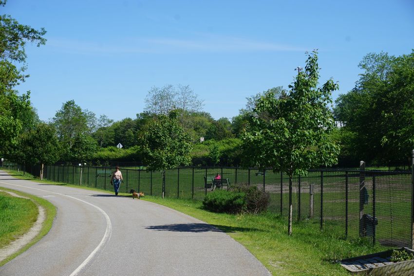
Brunswick Landing and Cooks Corner
Brunswick Landing, the former Brunswick Naval Air Station, is continuously undergoing
reuse and redevelopment as parcels of land transition from the Federal Government and
Midcoast Regional Redevelopment Authority (MRRA) to new public and private entities.
Unlike most public streets and sidewalks in Brunswick, the travel corridors at Brunswick
Landing are primarily owned and maintained by MRRA. Brunswick Landing hosts new
and renovated Navy housing, offices, industrial and manufacturing facilities, schools,
restaurants, public conservation land, and
recreation areas.
Brunswick Landing and Cooks Corner converge at
Bath and Gurnet Roads. Bath Road is a signed
bicycle route with primarily wide shoulders from
Sills Road to Old Bath Road. However, there are no
designated bicycle lanes or sharrows, and traffic
travels around 40 miles per hour. The Bath Road is
also interrupted by frequent curb cuts, increasing
risks for bicyclists.
The Brunswick Landing Perimeter Trail provides an
alternative access route for bicyclists and
pedestrians to Brunswick Landing. The trail begins
at the end of Pine Street and parallels the Bath
Road. This bicycle path is designated a safe bicycle
route on Brunswick Landing by the BBPAC. Brunswick Landing Perimeter
Bicycle and pedestrian access to businesses along theTrail
Bath Road is limited by vehicle
traffic. Some sidewalk sections have been constructed on portions of commercial lots
along Bath Road right-of-way. Unfortunately, most sidewalk sections along Bath Road
are fragmented, narrower than the 5-foot wide minimum travel width for ADA
23 | P a g ecompliance, and without curb or detectable warning surfaces within the sidewalk
terminus at driveway crossings to aid the visually impaired.
The new connecting Landing Drive between Brunswick Landing and the Gurnet Road
provides bike lanes in both directions, sidewalks protected by street trees, and
detectable warning surfaces where sidewalks meet driveway crossings. Landing Drive’s
bike and pedestrian facilities connect to the Brunswick Landing Perimeter Trail; however,
no bike and pedestrian infrastructure exists on the Gurnet Road, fragmenting the transit
system.
Public transit in the form of the Brunswick Explorer services the Cooks Corner area
including stops at the malls, Walmart, Sweetser, and Mid Coast Hospital. There is no public
transit service to Brunswick Landing. Due to the inaccessibility of Cooks Corner to
pedestrians and bicyclists, bus service in the area is unable to be part of connected
systems of multi-modal transit beyond its stops.
Goals:
1. Support the Public Works Department, Midcoast Regional Redevelopment
Authority (MRRA), and the Planning Board for bicycle and pedestrian access on
Bath Road, Admiral Fitch Avenue, Gurnet Road, and the new Cooks Corner
connector road
2. Safely and comfortably accommodate pedestrians and bicyclists into Brunswick
Landing and Cooks Corner multi-modal transit networks
3. Improve access to Brunswick Landing and Cooks Corner for bicyclists and
pedestrians from surrounding areas
4. Encourage common development of Brunswick Landing businesses for safe
bicycle and pedestrian transit networks between businesses and public land
Action Items:
Cooks Corner Bicycle and Pedestrian Accessibility
Landing Drive sets a standard for bike and pedestrian infrastructure, and the new
infrastructure will hopefully encourage people to bike to Brunswick Landing. The rest of
Cooks Corner lacks adequate bike and pedestrian facilities, and a network of
infrastructure is needed to complete and support the bike and pedestrian systems
present on Landing Drive and Brunswick Landing. Building bike and pedestrian facilities
in Cooks Corner will allow previously unconnected neighborhoods to have access to
stores and restaurants. Building pedestrian and bike infrastructure will also improve the
comfortability and attractiveness of the Cook Corner area.
24 | P a g eACTION ITEM – Identify opportunities to build and prioritize all types of bike and pedestrian facilities in the Cooks Corner area to connect currently inaccessible areas. ACTION ITEM - Educate developers on the Cooks Corner Design Standards to encourage transit-oriented boulevards for improved bicycle and pedestrian access on Bath Road for new and redevelopment projects. ACTION ITEM - Evaluate the potential for off-street or sheltered bicycle and pedestrian access from Harpswell Road & Sills Drive to Pine Street, Allagash Drive, Katahdin Drive, and Admiral Fitch Avenue. ACTION ITEM - Evaluate the potential for bicycle and pedestrian access from Pine Street and Allagash Drive to Jordan Avenue. ACTION ITEM – Add shoulders for greater bicyclist protection to the Old Bath Road ACTION ITEM – Evaluate feasibility of public access through the currently locked Purrinton Road gate. Public Access to Off-Road Fitness Trails on Brunswick Landing Included in the land transfer from BNAS to Midcoast Regional Redevelopment Authority was a fitness trail formerly used for Navy training. The trail offers excellent opportunities for mountain biking; however, the fitness stations along the trail are not in good condition. Development of the trail and improved transit connections could make it a valuable resource to the community. Action Item - Support redevelopment of off-road fitness trail systems and new connections for public use. 25 | P a g e
Schools & Surrounding Areas
Public and private schools for grades K-12 draw multi-modal traffic from children,
parents, teenage students, and staff. The planning goals and implementation strategies
for bicycle and pedestrian access from neighborhoods to schools varies by school
location and student age group. The K-12 schools in Brunswick are:

    1.  Coffin Elementary School-Closing 2020 (Barrows Street)
    2.  Harriet Beecher Stowe Elementary School (McKeen Street)
    3.  Kate Furbish Elementary School-Opening 2020 (Jordan Avenue)
    4.  The REAL School for grades 5-12 (Seahawk Avenue)
    5.  Harpswell Coastal Academy grades 6-12 (Leavitt Drive)
    6.  Brunswick High School (Maquoit Road)
    7.  Brunswick High School’s Off-Campus Learning Center - Union School (Federal
        Street)
    8. Brunswick Junior High School (Columbia Avenue)
    9. Region 10 Technical High School (Church Road)
    10. St. John’s Catholic School for grades P-8 (Pleasant Street)

Five of these schools, Brunswick Junior High, Coffin, Harriet Beecher Stowe, Kate Furbish,
and St. John’s, are located in dense, residential neighborhoods closer to Downtown
Brunswick, attracting more pedestrian and bicycle traffic. However, it is important that
pedestrian and bike access be considered for all schools in order to improve student
safety and encourage environmentally friendly, health transit choices in youths.

 Harriet Beecher Stowe

Harriet Beecher Stowe Elementary School (HBS) is sandwiched between McKeen,
Stanwood, and Spring Streets, all of which receive substantial car traffic. Two busy
intersections are created where Spring and Stanwood Streets meet McKeen Street.
Some crosswalks create safe paths to school; however, neighborhoods to the west of
Stanwood lack the infrastructure to allow children to safely reach HBS. Stanwood has a
sidewalk on only its east side and there are no crosswalks to allow children to safely
reach the school from the west side of the street. The north end of Baribeau Drive meets
neighborhoods which are cut off from easy paths to HBS by a problematic crossing at
Baribeau and McKeen. The crosswalk starts from a corner with no pedestrian protection
and requires pedestrians to cross Baribeau on the southern side of McKeen as well.

 Brunswick Junior High School & Coffin Elementary School

26 | P a g e
Brunswick Junior High and the soon-to-close Coffin Elementary School are located in the same lot flanked by Columbia Avenue, Barrows Street, and Baribeau Drive. While the streets immediately around both schools are only 25 miles per hour, not all have sidewalks. Columbia Avenue, Spring Street, Richards Drive, Shulman Drive, and Baribeau Drive north of Columbia all have sidewalks. The neighborhoods west of Stanwood Street and north of McKeen Street face the same challenges reaching BJHS and Coffin as reaching HBS. Some subdivisions to the west of BJHS would benefit from improved pedestrian and bike connections in the form of shared use paths. The Willow Grove Road subdivision backs up to Columbia Avenue; however, no path between the two exists, causing the distance between the neighborhood and the school to be much longer. The Arrowhead Drive development could also be within bikeable distance to BJHS if a ROW where to connect the east end of the development to Columbia Avenue. Kate Furbish Elementary School The new Kate Furbish Elementary School will be built off Jordan Avenue tucked in an area with many meandering side streets. Jordan Avenue creates a main thoroughfare from the surrounding neighborhoods and Federal Street. Jordan Avenue has a sidewalk on its north side that runs from Federal Street to Lori Drive and a partial sidewalk on its south side from Federal Street to Stetson Street. Although crosswalks connect to the side streets on the south side of Jordan Avenue, most side streets around Jordan Avenue lack sidewalks. Jordan Avenue’s northern sidewalk is narrower than ADA requirements and towards Federal Street is interrupted by telephone poles. The south sidewalk narrows to be almost unusable for even one pedestrian towards Federal Street. Due to the number of side streets south of Jordan Avenue, it would be beneficial for student safety to have a sidewalk on both sides of the street. The REAL School & Harpswell Coastal Academy Both Harpswell Coastal Academy and the REAL School are located on Brunswick Landing. While Brunswick Landing is further away from many neighborhoods, the Brunswick Landing Perimeter Trail provides bike and pedestrian access to the area, and many streets have sidewalks. However, the road on which the REAL School is located does not have sidewalks. The road to Harpswell Coastal Academy has sidewalks. Brunswick High School The driveway for Brunswick High School is accessed from Maquoit Road and provides ample protection for cyclists and pedestrians in the form of a shared use path protected from the drive by a median of street trees. Maquoit Road itself has a sidewalk on its 27 | P a g e
eastern side north of BHS. The rest of Maquoit features decent sand shoulders; however,
the road is unstripped. Upper Maine Street features wide, stripped shoulders, and a
sidewalk on the eastern side that connects to Maquoit via a crosswalk.

Despite this infrastructure, the remote nature of BHS and the high traffic levels at start
and end times are not conducive to biking and pedestrian transit. Additionally, Maquoit
Road lacks sidewalks or wide, striped shoulders south of BHS, discouraging access to
BHS from neighborhoods to the south.

 Region 10 Technical High School

Region 10 is located off the Church Road which has no sidewalks, and the driveway for
the school also has no sidewalks. Church Road does have wide, striped shoulders that
are beneficial for bicyclists; however, the school is cut off from easy access to
neighborhoods within bicycling distance on River Road or Range Road by upper
Pleasant Street. Brian Drive, Hennessy Avenue, Country Lane, and Bouchard Drive could
be within walking or biking distance to Region 10 if connected by ROWs.

 St. John’s Catholic School & Brunswick High School Off-Campus Learning Center

Both schools are located in downtown Brunswick off Union Street. Since both schools
are located downtown and off Maine Street, the pedestrian infrastructure near the
schools is strong. However, Union Street presents challenges for pedestrians near the
Town Hall. A temporary pedestrian safety installation has tried to address the lack of
pedestrian protection in the section.

Safe Routes to School
As stated on the MaineDOT website, “Safe Routes to School is a federal, state, and local
effort to enable and encourage children, including those with disabilities, to walk and
bicycle to school, and to make walking and bicycling to school safe and more appealing.
A major goal of the program is to increase bicycle, pedestrian, and traffic safety. In
partnership with the Maine Department of Transportation, the Bicycle Coalition of Maine
provides staff support and resources to schools and communities to increase the
number of students walking and bicycling to school.” Safe Routes to School in
Brunswick also collaborates with BBPAC to identify and strengthen walking and biking
routes to local school. Safe Routes to School in Brunswick is largely supported by local
citizens and school staff to identify safe routes, organize bike/walk to school days, and
educate children on safe bicycle and pedestrian behavior.

28 | P a g e
Goals:
    1. Improve the safety and security of routes to school for biking and pedestrian
       children
    2. Increase the use of bike and pedestrian modes of transit to school
    3. Improve and create connections between schools and currently unconnected
       neighborhoods
    4.

Action Items:

Pedestrian Infrastructure around Harriet Beecher Stowe
Elementary School
Improving pedestrian connections to the neighborhoods west of Stanwood Street will
increase the safety of children who already travel to school by such routes and
encourage more families to choose alternative modes of transit to school. Developing
safe bike and pedestrian paths to school could also have an impact on childhood heath
by encouraging students and parents to be active on their commute to school. Of major
importance to improving access to HBS are building a sidewalk on the west side of
Stanwood, striping crosswalks across Stanwood, and improving the safety of the
Baribeau and McKeen crossing and intersection.

ACTION ITEM- Prioritize and build pedestrian and bike infrastructure to connect the
neighborhoods west of Stanwood Street to Harriet Beecher Stowe Elementary School.

Paper Street Connections Between Schools and Neighborhoods
Many neighborhoods that could be within biking or walking distance to nearby schools
are closed off from access due to the layout of Brunswick Streets. Paper streets and
ROWs could be utilized to build multi-use paths to connect currently inaccessible
neighborhoods with local schools. This would allow more children to reach school by
bicycle or foot, reducing morning car traffic and increasing children’s activity levels.

ACTION ITEM – Investigate the use of paper streets and ROWs to create connections
between isolated neighborhoods and schools across Brunswick.

Jordan Avenue Bike Safety Zone
Jordan Avenue is quite narrow at parts and does not have any bicycle facilities.
Consideration should be taken on how best to accommodate the new pedestrian and

29 | P a g e
bike usage that will arise from the opening of the Kate Furbish Elementary School.
Striping wider shoulders or painting sharrows could increase bicycle safety and comfort
on the road.
ACTION ITEM – Restripe or paint sharrows to accommodate cyclists
Safe Routes to School Zoning Map
Safe Routes to School has identified paths to various Brunswick schools that provide the
most safety for students. A zoning map for each school published on the Town website
for public view would provide better knowledge of the safest ways to reach school and
could encourage families to walk or bike to school more often.
ACTION ITEM – Develop Safe Routes to School Zoning Map
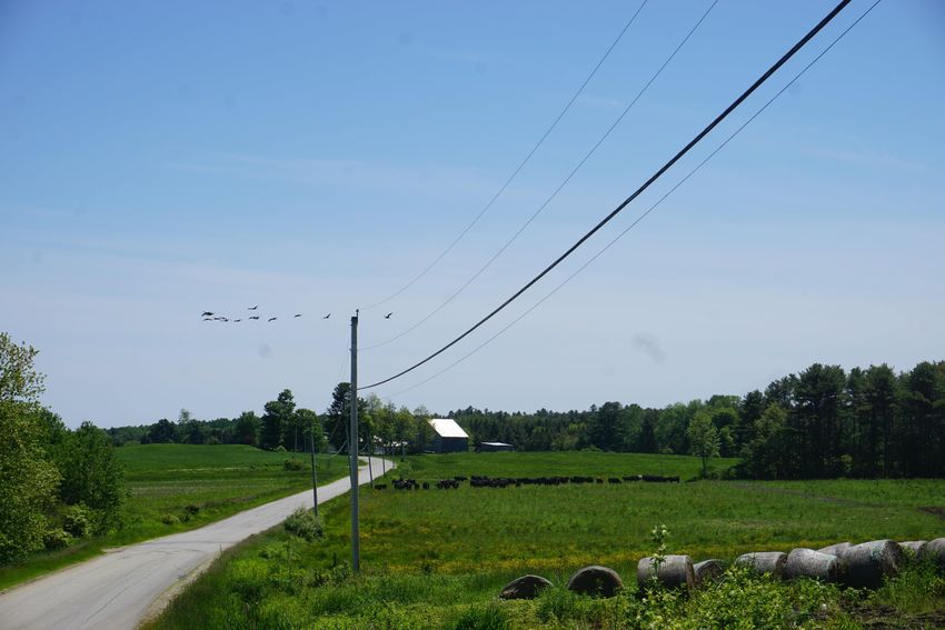
Rural Roads
The quieter country roads in rural parts of town provide enjoyable scenery and plentiful
routes for bicycle riders and pedestrians from Brunswick and surrounding towns. Most
of the designated scenic areas featured in Brunswick’s adopted Parks, Recreation, and
Open Space Plan are on rural streets and bike paths in southern parts of Brunswick.
Brunswick’s rural roads feature open
meadows, pasture land for cattle,
forests, coastal estuaries, and bays, all
spread through low density
neighborhoods. Many of these scenic
places in Brunswick are listed on the
NRHP, including Crystal Spring Farm,
the Pennellville Historic District,
Middle Bay Cove, and Pennell Way.
Though most rural roads do not have
designated bicycle lanes, sharrows, or
alternative off-street access ways, they
are frequently used by bicycle riders
The 2019 Trek Across Maine on Pennell Way.
for sport and regional travel.
30 | P a g eThe East Coast Greenway makes use of Brunswick’s rural roads and gives cyclists the
option to travel on inland or coastal routes. The ECG is marked by small signs along the
route, but wayfinding on Brunswick’s rural roads is lacking. For example, no signage
points to the popular swimming spot at Simpson’s Point.
Despite the number of bicyclists and pedestrians, anecdotal evidence from residents
indicates automobile traffic tends to move faster than the posted speed limit on
Brunswick’s low volume rural roads. The Mere Point Road, a particularly popular route,
challenges cyclists with poor asphalt conditions and occasional narrowness which often
force cyclists further into the roadway. The Pleasant Hill Road is also inhospitable to
cyclists and runners despite its use by both groups. Cars travel quickly along the straight
road into town, and stripped shoulders are often narrow with little protection from cars.
Maps of frequently traveled bicycle rides with scenic views of Brunswick are provided in
Appendix III.
Goals:
1. Reduce speeding on rural roads
2. Improve on-street bicycle routes for access to regional travel and points of
interest
3. Increase use of preferred routes for recreational bicycling and pedestrian
activities
Action Items:
Public Guide to Preferred Routes
Brunswick’s rural roads provide connections to regional areas of interest as well as
recreational opportunities. It would be helpful for the public if the Town provided an
easily accessible guide to preferred bike or running routes that also highlighted
connections to regional points of interest. This would allow and encourage new
residents, visitors, or individuals taking up an activity for the first time to easily find
good places to recreate.
ACTION ITEM - Prepare or advise on advertising materials for bicycle riding routes in
Brunswick with regional connections to areas of interest.
ACTION ITEM - Prepare and publish an inventory of preferred on-street bicycle routes
for public use on the Town of Brunswick GIS maps.
31 | P a g eRural Wayfinding
In order for citizens to best take advantage of preferred bicycle routes on rural roads,
signage must be clear and easy to follow. Brunswick lacks any significant wayfinding
system, and navigation on rural roads requires familiarity with the area or the use of a
mapping system. Better wayfinding resources could encourage greater use of
Brunswick’s rural roads for recreation and would support the publishing of guides to
preferred routes.
ACTION ITEM - Identify and evaluate preferred bicycle riding routes and advise the
appropriate review entity if modifications to existing signs or additional wayfinding
signage is recommended.
Trails
Through conservation easements and public land holdings, the Town of Brunswick has a
variety of bicycle and pedestrian access ways on paved and unpaved trails for citizens
and visitors to enjoy. Trail systems offer intrinsic safety from cars. Many trails are within
isolated parcels of land, but others connect to points of interest off-site via public and
private streets. Some of the most popular off-road trails on unpaved surfaces are
depicted on the online public GIS map through the Department of Planning and
Development’s webpage. Other sources of public trail maps are available in the Parks,
Recreation, and Open Space Plan, and on the Brunswick Topsham Land Trust (BTLT)
webpage.
Goals:
1. Expand Brunswick’s trail system to improve or maintain trails and connections,
conserve land, and provide more public green space where appropriate
32 | P a g eWatersheds in Transportation Corridors
It is important that relevant bicycle and pedestrian improvement projects take
advantage of opportunities to incorporate environmentally friendly design including the
installation of green infrastructure to reduce impacts to nearshore coastal resources and
inland wetlands and waterbodies. According to Maine Department of Environmental
Protection (DEP) Rule 502, Brunswick has four (4) urban impaired stream watersheds
that are compromised in-part by impervious areas and road crossings. At the time of
this plan update, the Town of Brunswick received conditional award from the Maine DEP
for funds to prepare a watershed management plan for the Mare Brook urban impaired
stream watershed.
Goals:
1. Reduce impervious areas in established travel corridors
2. Improve watershed health while increasing bicycle and pedestrian safety and
access
Action Items:
Complete Streets Policy Amendment
The Complete Streets Policy adopted by the Town Council as an appendix to the Zoning
Ordinance outlines a cooperative agreement between BBPAC, the Town Engineer, the
Department of Planning and Development, and the Town Manager that insures any
future infrastructure development and rehabilitation considers the needs of all potential
users, including bicyclists and pedestrians. Traffic calming measures including
vegetation and other green infrastructure can treat non-point source pollution and
reduce peak flow runoff. These green infrastructures to be considered include street
trees, filter basins, vegetated filter strips, curbing and level spreaders (to reduce runoff
channelization), and bioswales.
ACTION ITEM - Amend the Complete Streets Policy to consider green infrastructure in
the required alternatives analysis.
33 | P a g eTown Wide Planning Areas
Temporary Demonstration Projects in Travel
Corridors: Popup Planning
In 2018-19, the BBPAC and Department of Planning and Development collaborated with
the Bicycle and Pedestrian Coalition of Maine (BPCM) and other Department staff to
develop and install popup demonstration projects (see Appendix IV for extended
descriptions and analysis of completed popup projects). Popup demonstration projects
are implemented across the country to test traffic calming, bicycle and pedestrian
egress, parking alternatives, and public recreation and park areas. These projects are
designed to test public infrastructure at a low cost prior to recommending capital
improvements for permanent infrastructure which have a much higher cost. As with all
public services, the cost of the service should be equal to or less than the cost of the
negative externality it is intended to mitigate. In bicycle and pedestrian improvement
popup projects, negative externalities may include high speed traffic, reduced access for
bicycle riders and pedestrians, unsuitable infrastructure for multi-modal use, and unsafe
or otherwise undesirable conditions for the use and enjoyment of the public right-of-
way for users.
Goals:
1. Use pop-up projects to improve bicycle and pedestrian safety in Brunswick and
test potential infrastructure improvements
2. Better measure and evaluate the bicycle and pedestrian needs of Brunswick
beyond the advising provided by BBPAC
Action Items:
Popup Demonstration Projects to Inform Sustainable
Infrastructure
Popup panning projects are useful for determining the feasibility of permanent
infrastructure development; however, the process of popup planning could be improved
and made more effective.
34 | P a g eACTION ITEM – Coordinate with staff and stakeholders to develop, implement, and evaluate popup demonstration projects to inform permanent infrastructure retrofits. ACTION ITEM - Develop an instrument to evaluate the effectiveness of popup demonstration projects including a schedule for adjustments and removal. ACTION ITEM - Engage the Brunswick Public Works and Engineering Departments, MaineDOT, Bicycle and Pedestrian Coalition of Maine (BPCM), the Merrymeeting Wheelers, Safe Routes to School (SRTS), and other interested stakeholders where applicable to review popup demonstration projects prior to installation. ACTION ITEM - Advise the Town Council and other Brunswick Boards, Commissions, and Committees about anticipated popup demonstration projects prior to installation. ACTION ITEM - Advise the appropriate entity on the results of the popup demonstration project and provide recommendations on capital improvements. Town Transportation Planner Brunswick has ample opportunities to improve its multimodal transportation networks across town and the number of potential bike and pedestrian improvement projects is extensive. Identifying and prioritizing bike and pedestrian projects across town falls on the Brunswick Bike and Pedestrian Advisory Committee and the Planning Department; however, a transportation planner would be able to better analyze the needs of the town as a whole. A transportation planner would better be able to identify and carryout bike and pedestrian improvements. ACTION ITEM – Consider the feasibility of hiring of a transportation planner. 35 | P a g e
You can also read


