Bourj Hammoud Municipality Rapid Building-level Damage Assessment - Municipality of Bourj Hammoud and UN-Habitat October 2020 Working Version
←
→
Page content transcription
If your browser does not render page correctly, please read the page content below
EXPLOSIONS RESPONSE
BEIRUT PORT

 Bourj Hammoud Municipality Rapid Building-level
 Damage Assessment
 Municipality of Bourj Hammoud and UN-Habitat
 October 2020
 Working Version

                                    With support from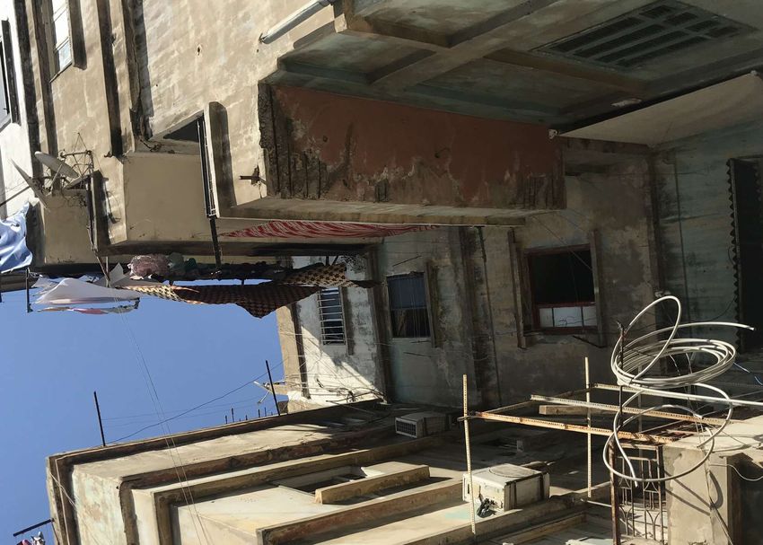
Citation format: Municipality of Bourj Hammoud and UN-Habitat (2020), Beirut: UN-Habitat Lebanon.
Copyright © 2020 Municipality of Bourj Hammoud and UN-Habitat. All rights reserved.
Cover photo: © UN-Habitat (2020).
PARTNERS
   Academic institutions:

   International and local organisations:

CREDITS
   UN-Habitat Lebanon
   Authors: Lady Habchy; Wael Sinno.
   GIS and IM: Charbel Abou Chakra.
   Data Analysis/Visualization and Report Production/Design Layout: Georges Abi Sleiman; Ruba Abou El Houda.
   Editor: Suzanne Maguire; Taina Christiansen.

   Municipality of Bourj Hammoud
   Georges Krikorian.
   Garine Balian.
   Lila Kendirjian.
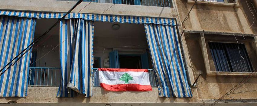
TABLE OF CONTENTS
   Introduction                                            1
        Purpose of report
        Administrative boundaries and assessment zones
        Background and context

   Methodology                                             3
       Zoning
       Visual inspection steps for surveyors
       Habitability based on signs of damage
       Work progress milestones

   Findings                                                8
        Coding of buildings for damage and habitability
        Assessment findings

   Next Steps                                             10

   Annex                                                  11
       Photo gallery
INTRODUCTION
The Port of Beirut explosions of 4th August 2020, situated the extent of damage and particularly structural impacts,
ADMINISTRATIVE BOUNDARIES AND ASSESSMENT ZONES PURPOSE OF REPORT
within the boundaries of the Municipality of Beirut (MoB) immediately identifying buildings at risk of collapse and
and in close proximity to the neighbouring Municipality in need of evacuation whilst also providing evidence for
of Bourj Hammoud (MoBH), resulted in devastating loss formulating early recovery measures.1
of life, injury and the destruction of vast tracts of urban
fabric within these municipalities and beyond. This report describes the method and results of the
survey which was conducted through a collaboration
One of the initiatives undertaken in response by the between the MoBH and UN-Habitat in its ongoing role
MoBH with the support of UN-Habitat was a rapid of support to local authorities. Data was gathered from
exterior visual survey at the building level, The survey immediately after the blast until 31 August 2020.
covered all building types, to gain an understanding of
The Port of Beirut is located around 2km north-west of area of Beirut which spans around 110 square kilometres
MoBH, in the neighbouring Municipality of Beirut. The in size (Figures 1 and 2).2 MoBH is made up of seven
MoBH, itself a cadastre in its own right within the district sub-areas3 (Figure 3) which were then broken down into
of Baabda, is 2.7 square kilometres in area and is part of zones for the purposes of the current assessment.
the central core of a larger continuously built up urban
Bourj
Akkar Hammoud
Beirut
North
Baabda
Baalbek - Hermel
Bourj
Hammoud Aley
Beirut Figure 2 Explosion site relative to the Municipalities of
Beirut and Bourj Hammoud
Mount
Beirut Central
Lebanon District
Bekaa Medawar
Aamaret Chalhoub
Marfaa Bourj
Hammoud
Saifeh
Remeil
Nabatiyeh Jdaidet El-Matn
Bachoura
South Baouchriyeh
Achrafieh
Fanar
Sin El-Fil Dekouaneh
Mazraa Furn_Ech_
Chebak
Chiyah
Figure 1 Mount Lebanon Governorate within Lebanon Figure 3 Assessed zones within Bourj Hammoud
Municipality
Lebanon Municipality of Sub-area
Explosion site boundary Beirut River
boundary Bourj Hammoud
Beirut City (continuously
Governorate built-up area) Cadasters District
1
The approach is complementary to other assessments conducted at household level, notably the Multisectoral Needs Assessment
of the Lebanese Red Cross undertaken in conjunction with the Lebanese Armed Forces, and may be triangulated with these in due
course.
2
UN-Habitat (forthcoming) “Beirut City Profile”. Beirut, UN-Habitat.
3
Sea Side, Adana, Maraach, Aghabios, Nabaa, Trad and Siss.
1
The Port of Beirut explosions took place in close
BACKGROUND AND CONTEXT
                         proximity to the city centre with its historic core, vibrant
                         commercial districts and dense urban neighbourhoods,
                         many of which are vulnerable. It resulted in over 200
                         deaths, 6,500 injured and 7 missing. The blast caused
                         material damage to an estimated 77,000 apartments
                         located across 10,000 buildings within a 3km radius of
                         the blast, impacting around 300,000 people.4 The entry
                         point to more than 70% of Lebanon’s imports, the port
                         blast has also affected the availability of goods in the
                         country.

                         In the aftermath of the incident, there was a spontaneous
                         proliferation of public and private actors and associated
                         initiatives seeking to respond to needs on the ground,
                         which underscored the need for an efficient and
                         rationalised response. With support from local and
                         international entities, the municipalities remain at the
                         centre of supporting public safety whilst working towards
                         inclusive post-disaster planning for urban recovery.

                         In this context, a building-level damage assessment
                         was undertaken to provide an evidence basis for guiding
                         action. The MoBH worked with the support of UN-Habitat
                         to conduct this assessment, aiming to come up with
                         a general overview of the damages affected MoBH’s
                         neighbourhoods and to identify the most affected zones         UN-Habitat (2020)
                         and buildings therein.

                            7                         212                 6,500
                         MISSING                     DEAD               INJURED

                                     77,000                    300,000
                                    DAMAGED                   RESIDENTS
                                    HOUSING                   AFFECTED                  UN-Habitat (2020)
                                     UNITS

                                                                                        UN-Habitat (2020)

                         4
                             Shelter sector dashboard (12 September 2020).

       2
METHODOLOGY
ZONING

                                                                       Sea Side

                                                                                    Adanah
                                                 Maraach

                                                               Siss

                                                                             Trad
                                                   Aghabios

                                                              Nabaa

                                                                                                       500   250     0         500 m
               Beirut River                  Cadasters                       Sub-area boundary
         Figure 4 Sub-areas of MoBH for assessment purposes
         As shown in Figure 3, the MoBH comprises seven sub-                      This assessment was then uploaded onto a mobile
         areas. These were further subdivided into 40 operational                 application to channel data transfer into a GIS platform.
         zones for the purpose of the current assessment.                         Noting that there are around 4,000 lots in MoBH, around
                                                                                  80 volunteers were selected and were divided into 40
                                               Number of                          teams; each team was composed of 2 volunteers. Each
             Sub-areas of MoBH              assessment zones
                                                                                  team then took on assessment of a zone.
              Sea Side                              10
                                                                                  A training was conducted for all teams on the mobile
                                                                                  application and on field data collection.
              Adana                                 3                             Following the completion of fieldwork, a coordination
              Maraach                               6                             meeting, led by MoBH was conducted with national
                                                                                  and international partners to present preliminary
              Aghabios                              4                             findings and to discuss the urgency of comprehensive
              Nabaa                                 5                             intervention.

              Trad                                  6                             The field assessments were launched on 11th of August
              Siss                                  6                             2020 and completed on 31 August 2020.

         Table 1 Dividing Bourj Hammoud sub-areas into 40
         operational zones
           UN-Habitat’s team met with MoBH on 7th August to
           discuss the effect of the blast on local communities
           residing in the municipality.
           At the request of the MoBH to map the damages, a
           meeting was conducted with partners willing to take
           part in the assessment. Polish Aid for International
           Aid (PCPM), Naba’a NGO, and Beirut Arab University
           committed to take part of this assessment with support
           from MoBH.
           The assessment questionnaire, comprising questions                                                            UN-Habitat (2020)
           related to building’s exterior conditions, was finalized.
                                                                                                                                         3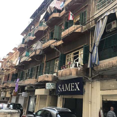
Based on the Applied Technology Council’s Field Manual
VISUAL INSPECTION STEPS FOR SURVEYORS
                                        (ATC-20-1),5 the following visual inspection steps were
                                        adopted by surveyors:
                                        1. Examine the building’s exterior envelope.
                                        2. Examine the ground and the pavement around the
                                           structure for fissures, bulged ground, or signs of slope
                                           movement.
                                        3. Enter the building whenever the structure is not clearly
                                           visible from the outside, and in the case of suspected
                                           or confirmed problems that are non-structural (e.g.
                                           collapsed ceiling or damaged partitions). However,
                                           do not enter the building if the structure is obviously
                                           unsound.
                                        4. Assess the structure using the visual signs of damage      UN-Habitat (2020)
                                           criteria .
                                        5. Complete a Rapid Assessment Form (REF). Add any
                                           instances of restrictions placed on the use of the
                                           structure to the REF. Questionable buildings should be
                                           flagged for a detailed assessment.
                                        6. Explain the significance of inhabitable or uninhabitable
                                           structures to the building occupants if present. Where
                                           buildings including buildings’ common areas appear
                                           unsafe, advise residents to vacate immediately without
                                           causing panic whilst also expediting notice of unsafety
                                           to the municipality for taking action including in the
                                           form of serving evacuation notices.

                                        Surveying was conducted using the Geopal mobile
                                        application.

                                        1                        2                     3              UN-Habitat (2020)

                                        6                        5                     4

                                                                                                      UN-Habitat (2020)

                                                                                  UN-Habitat (2020)   UN-Habitat (2020)

                                        5
                                            http://www.atcouncil.org/pdfs/ATC45Rapid.pdf

              4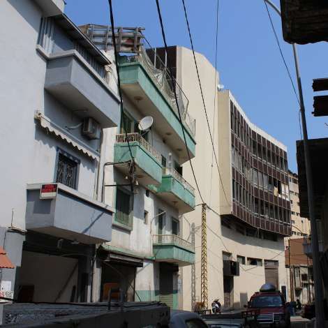
HABITABILITY BASED ON SIGNS OF DAMAGE

                                                                                                                                          UN-Habitat (2020)

                                        Based on visual signs of damage, buildings were divided     Habitable / Does not require evacuation
                                        into those that were uninhabitable requiring evacuation
                                        and those that remain habitable.                             Slight cracks in render (plaster) of the wall and/or
                                                                                                     ceiling.
                                        Uninhabitable / Requires evacuation                          Damage limited to windows, doors and non-structural
                                                                                                     items (that are not at risk of falling onto inhabitants).
                                          Total or partial collapse of the building.                 Slight cracks in walls (load bearing and/or non-load
                                          Major damage and deformation/deviation from the            bearing), and slight separation between load-bearing
                                          vertical axis of load-bearing structure.                   and non-load bearing elements.
                                          Severe damage to the beam-column joints.                   Hairline non-diagonal cracks in horizontal reinforced
                                          Neighbouring structure in danger of collapse onto          concrete structural beams.
                                          building.                                                  Hairline cracks in load-bearing masonry walls, where
                                          The load-bearing elements show any deformation.            the cracking covers less than 30 per cent of the wall
                                          Floor panels displaced away from original supports         area.
                                          Load-bearing shear walls show any out-of-plane
                                          deformation.
                                          Significant cracks (>2mm) in load-bearing elements
                                          made of reinforced concrete.
                                          Significant cracks (>2mm) in load-bearing walls.
                                          Hairline cracks in load-bearing masonry walls, where
                                          the cracking covers more than 30 per cent of the wall
                                          area.
                                          Diagonal cracking or crumbling of the material in
                                          the walls between the windows or doors or similar
                                          elements of construction.
                                          Damage, significant distortion or collapse of the roof.
                                          Slight damage, partial or complete sliding of the roof.
                                          Large items that could fall and cause harm, including
                                          glass, detached air conditioner units, water tanks,                                             UN-Habitat (2020)
                                          cladding, plaster, balconies.

                                                                                                                                                           5
WORK PROGRESS MILESTONES

                                                             7/08/2020 - 11/08/2020
                                                              Meeting with Municipality of Bourj Hammoud
                                                              Coordination meeting with partners to join efforts in the
                                                              rapid damage assessment.
                                                              Finalization of the assessment questions and incorporation
                                                              into the mobile application.
                                                              Dividing Bourj Hammoud district into 40 zones and
                                                              selection of teams per zone.
                                                              Training of the teams on the mobile application and data
                                                              collection.

                           11/08/2020
                            Start of field data collection

                                                             18/08/2020
                                                              Press conference led by Municipality of Bourj Hammoud

                           31/08/2020
                            End of field data collection

                                                                                                   UN-Habitat (2020)

        6
UN-Habitat (2020)
FINDINGS
CODING OF BUILDINGS FOR DAMAGE AND HABITABILITY

                                                  Unsafe / evacuate                                                Safe / minor damage
                                                  Buildings that are structurally unsound and require              Buildings that were subject to minor defects, such as
                                                  evacuation.                                                      broken glass.

                                                  Restricted use                                                   Not affected5
                                                  Buildings that incurred considerable damage in their             For buildings that were not affected at all.
                                                  architectural components (falling architectural elements
                                                  that might affect public safety).

                                                  5
                                                   The category “Not affected” was added to the ATC-20-1 coding list by the Municipality of Bourj Hammoud to adapt the assessment
                                                  categories to building conditions observed post-Beirut Port explosions.

              8
ASSESSMENT FINDINGS
0 225 550 1100 m
Unsafe / evacuate Restricted use Safe / minor damage Not affected Unsurveyed
Figure 4 Detailed map showing the different damage categories for all assessed plots (including hospitals, schools
and heritage buildings)
9Unsurveyed Restricted use
Building damage Assessment Assessment 1.08% 4.68%
category Count %
Unsafe / evacuate
Unsafe / evacuate 4 0.10
0.10%
Restricted use 182 4.68
Safe / minor damage 1,957 50.27
Not affected 1,708 43.87
Unsurveyed 42 1.08 Not affected
43.87% Safe / minor
Total 3,893 100 damage
50.27%
Table 2 Number of assessed buildings by category Figure 6 Percentage of assessed buildings by category
NEXT STEPS
The findings of the Bourj Hammoud Municipality Rapid Data from the assessment can be made available
Building-level Damage Assessment serves to inform the through the Bourj Hammoud Municipality through
ongoing blast response, recovery and reconstruction of contacting: coordinator.bourjhammoud@gmail.com or
the impacted areas. +961 81 304185.
The data is intended to inform the prioritization of The assessment can be used in complement to
interventions, highlighting the most affected areas other assessments, and notably the household level
of Bourj Hammoud municipal boundaries, including Multisectoral Needs Assessment of the Lebanese Red
by pinpointing structurally unsound buildings and the Cross undertaken in conjunction with the Lebanese
households whose shelters and livelihoods have been Armed Forces and may be triangulated with these in due
impacted as a result. course.
UN-Habitat (2020) UN-Habitat (2020)
10ANNEX
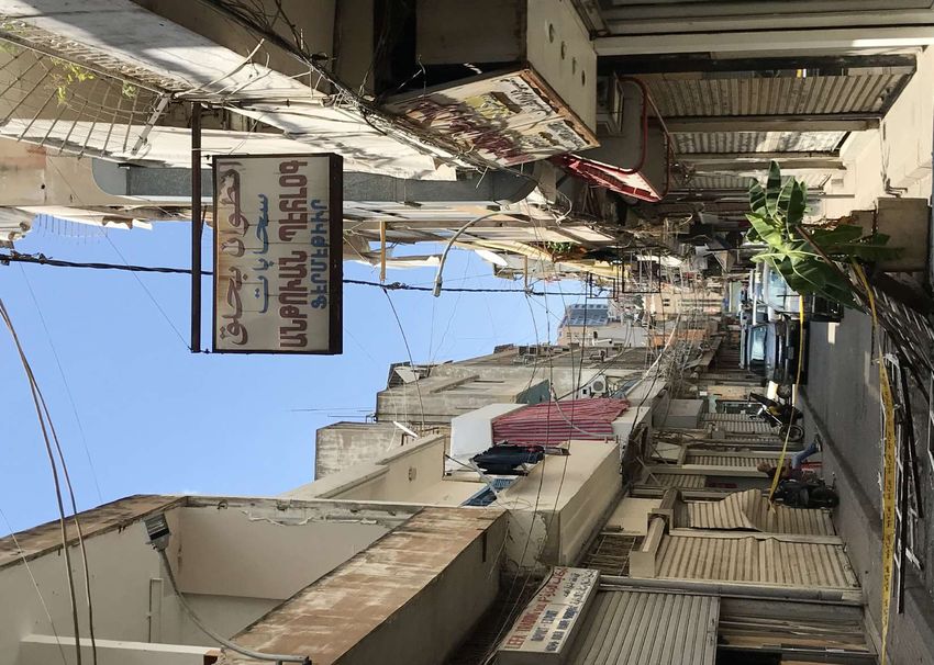
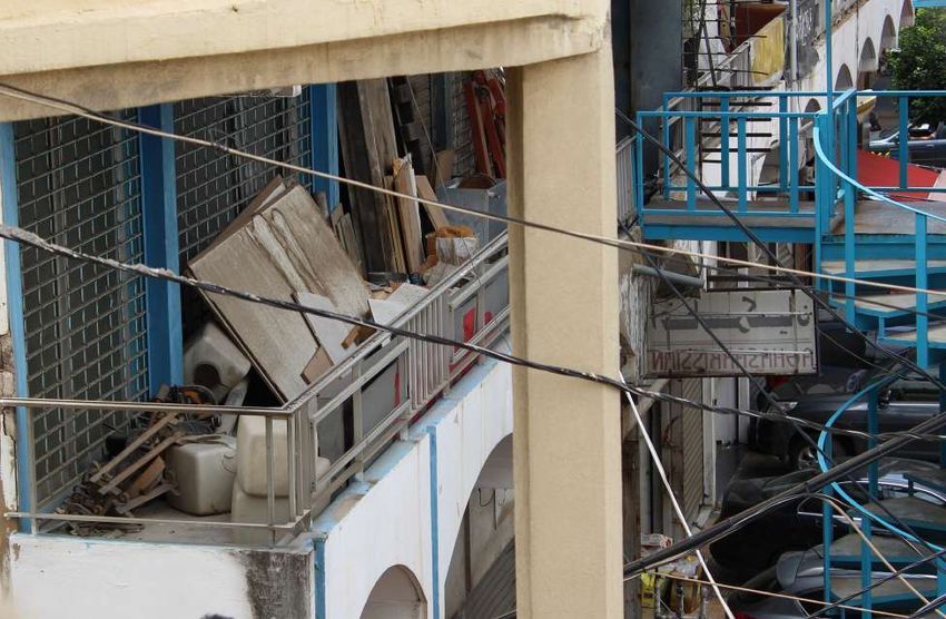
PHOTO GALLERY
UN-Habitat (2020) UN-Habitat (2020)
UN-Habitat (2020) UN-Habitat (2020)
UN-Habitat (2020) UN-Habitat (2020)
UN-Habitat (2020) UN-Habitat (2020)
11UN-Habitat (2020) UN-Habitat (2020)
UN-Habitat (2020) UN-Habitat (2020)
UN-Habitat (2020) UN-Habitat (2020)
UN-Habitat (2020) UN-Habitat (2020)
12A better quality of life for all
in an urbanizing world
@UNHABITATLB
UNITED NATIONS HUMAN SETTLEMENTS PROGRAM
E: unhabitat-lebanon@un.org
T: +961 1 985484
www.unhabitat.org/Lebanon
MUNICIPALITY OF BOURJ HAMMOUD
E: info@bourjhammoud.gov.lb
T: +961 1 260 155
www.facebook.com/bourjhammoud.gov.lb/You can also read