Brisbane River
Strategic Floodplain
  Management Plan
←
→
Page content transcription
If your browser does not render page correctly, please read the page content below

Brisbane River Strategic Floodplain Management Plan
The Brisbane River Strategic Floodplain Management Plan project is a joint initiative of the Australian
Government, Queensland Government, Brisbane City Council, Ipswich City Council, Lockyer Valley
Regional Council, Somerset Regional Council and Seqwater.

Document details
 Security classification                       Approved
 Date of review of security classification     February 2019
 Authority                                     Queensland Reconstruction Authority
 Document status                               FINAL
 Version                                       1.0

Copyright                                                 Interpreter
This publication is protected by the                                 The Queensland Government is
Copyright Act 1968.                                                  committed to providing accessible
                                                                     services to Queenslanders from all
© The State of Queensland (Queensland                                culturally and linguistically diverse
Reconstruction Authority) February 2019.                  backgrounds. If you have difficulty in
                                                          understanding this report, you can access
Licence                                                   the Translating and Interpreting Services via
                                                          www.qld.gov.au/languages or by phoning
                   This work is licensed by State of      13 14 50.
                   Queensland (Queensland
Reconstruction Authority) under a Creative
Commons Attribution (CC BY) 4.0 international             Disclaimer
licence. To view a copy of this licence, visit:           While every care has been taken in preparing this
                                                          publication, the State of Queensland accepts no
http://www.creativecommons.org/licenses/                  responsibility for decisions or actions taken as
by/4.0/                                                   a result of any data, information, statement or
                                                          advice, expressed or implied, contained within.
In essence, you are free to copy, communicate             To the best of our knowledge, the content was
and adapt this Brisbane River Strategic                   correct at the time of publishing.
Floodplain Management Plan, as long as you
attribute the work as follows.
                                                          Copies
Attribution                                               Copies of this publication are available on our
                                                          website at www.qra.qld.gov.au.
The Brisbane River Strategic Floodplain
Management Plan is a joint initiative of                  Further copies are available upon request to:
the Australian Government, Queensland
Government, Brisbane City Council, Ipswich                Queensland Reconstruction Authority
City Council, Lockyer Valley Regional Council,            PO Box 15428
Somerset Regional Council and Seqwater.                   City East QLD 4002
                                                          Phone (07) 3008 7200
                                                          info@qra.qld.gov.au
                                                          www.qra.qld.gov.au

                                                                                                              0289
The Brisbane River Strategic Floodplain                 This Strategic Plan is a resource for state and
Management Plan (Strategic Plan) is a non-              local governments to enable the coordinated
statutory guide for delivering a coordinated            implementation of flood resilience actions
approach to managing flood risk across the              over time. Its purpose is to facilitate regionally
Brisbane River floodplain, now and into the             consistent flood risk management outcomes for
future. It sets out a range of strategies and actions   the region, with flexibility in local implementation
for state and local governments to consider in          approaches and processes. It does not alter the
order to strengthen the flood resilience of the         statutory effect of existing legislation and policy.
region. The strategies and actions can be applied
to a range of floodplain management measures            The Strategic Plan provides the basis from which
that include but are not limited to land use            local governments will further their understanding
planning, disaster management, building controls        of flood risks and impacts at the local level
and structural mitigation options.                      through the development of Local Floodplain
                                                        Management Plans.

                                                                                                               1
Our Shared Vision

     residents, businesses, community
    groups and governments working
      together to better manage flood
     risk and strengthen the resilience
    of our communities, our economy,
                 our infrastructure and
                      our environment

2                      Brisbane River Strategic Floodplain Management Plan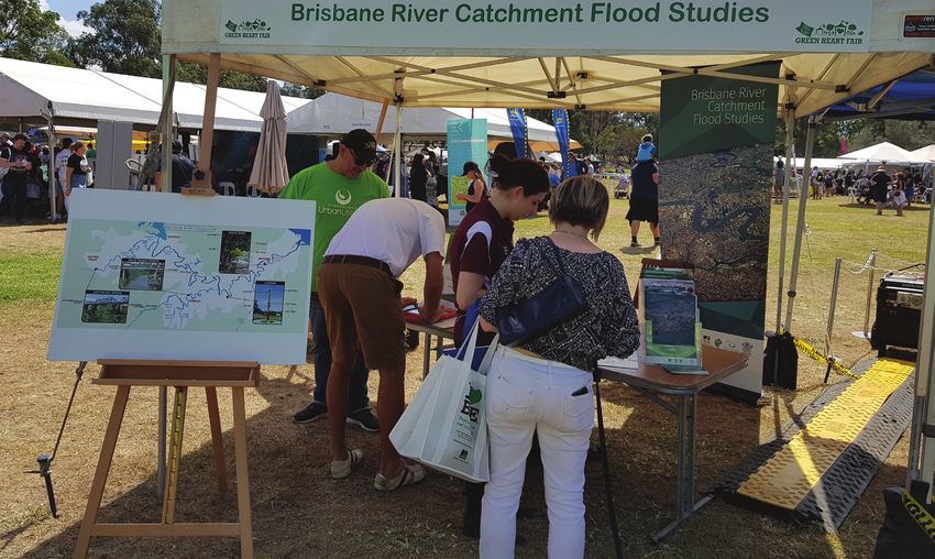
Foreword
The Brisbane River Strategic Floodplain Management Plan provides
the blueprint for how we will better prepare for and manage flood
risk across the Brisbane River floodplain.

This plan has been developed in proud partnership between the
Queensland Government, the four local governments of Brisbane,
Ipswich, Somerset and Lockyer Valley, and Seqwater.

It builds on 2017’s Brisbane River Catchment Flood Study, which
was the largest study of its kind to be undertaken in Australia, and
I commend all the stakeholders who have contributed.

Floodwaters hold no regard for local government boundaries,
which is why it’s so important we take a whole-of-catchment,
regional approach to identify more efficient ways to strengthen our
flood resilience.

The Queensland Government is committed to keeping communities
safe, and this strategic plan will play a major part in that for the
Brisbane River floodplain area.

This work contributes to the Queensland Strategy for Disaster
Resilience and Resilient Queensland 2018-2021 – Delivering
the Queensland Strategy for Disaster Resilience vision of making
Queensland the most disaster resilient state in Australia.

Professionals seeking guidance from this strategic plan are
encouraged to join us in our efforts to ensure we build flood
resilience in ways that support this regional plan.

Cameron Dick MP
Minister for State Development, Manufacturing,
Infrastructure and Planning

                                                                       3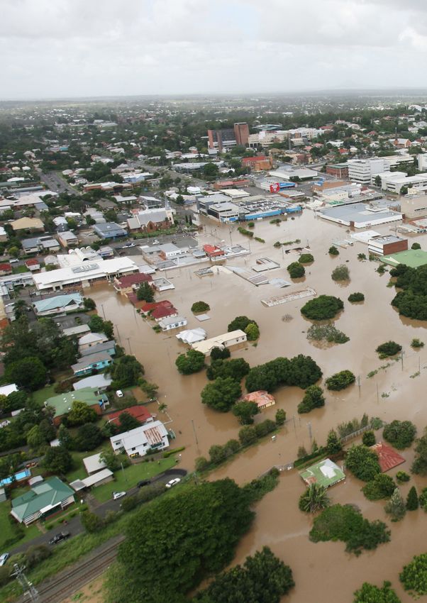
Introductory statements
                               Brisbane’s subtropical                                    Ipswich City and its
                               climate makes our city                                    region is no stranger to
                               a great place to live,                                    river flooding having
                               work and relax.                                           experienced significant
                                                                                         events in 1893, 1974 and
                               Defined by its river,                                     2011.
                               it’s important that
                               Brisbane is a resilient                                The flood of 2011 was a
                               New World City that                                    stark reminder that we
    can plan for, respond to and recover from floods.                                 live, work and play in the
                                                         Brisbane and Bremer River floodplains, and given the
    Brisbane City Council is committed to building       right climatic conditions, flooding can and will occur
    a more liveable, resilient city – a city that is     again.
    safe, confident and ready to respond to natural
                                                         Despite these events we witnessed incredible
    disasters.
                                                         examples of community resilience, determination and
    The WaterSmart City priority actions in Council’s    mateship in the aftermath.
    Brisbane. Clean, Green, Sustainable 2017-            Flooding in the Brisbane and Bremer River catchment
    2031 is our long-term approach to managing           is not just an issue that affects Ipswich. It is a regional
    and reducing the risks of flooding for Brisbane      issue determined by a single large catchment that
    residents, businesses and infrastructure.            also affects the council areas of Somerset, Lockyer
                                                         Valley and Brisbane.
    The challenge of managing floods also needs a
    whole-of-catchment approach that transcends          The Strategic Floodplain Management Plan is the
    local government boundaries. The Brisbane River      outcome of the Brisbane River Catchment Flood
    Strategic Floodplain Management Plan embodies        Studies in response to the Queensland Floods
    this approach, outlining actions that support        Commission Inquiry.
    resilience across the Brisbane River catchment.
                                                         The catchment studies encompass an extensive
    In combination with the Council of Mayor’s           body of work which required a strong collaborative
    Resilient Rivers Initiative, this work provides      partnership across state and local governments, and
    a coordinated approach that helps us work            many other entities involved in the Brisbane and
    together to improve community safety and reduce      Bremer River floodplains.
    the impacts of flooding.
                                                         The plan provides a framework for the four local
    While we cannot prevent flooding altogether, we      governments (and other entities) to strategically
    now have the best possible information               assess and develop regionally consistent approaches
    and framework to ensure our community is             to improving community resilience to the impact of
    prepared, adaptable and can recover more             future floods.
    quickly after a flood.                               Ipswich City Council will refer to the Brisbane River
                                                         Strategic Floodplain Management Plan when
    Adrian Schrinner
                                                         formulating a Local Flood Management Plan for the
    Lord Mayor
                                                         Bremer River.
    Brisbane City Council
                                                         Major floods will happen again.
                                                         By adopting a coordinated regional approach it will
                                                         be possible to better manage flood risks in the future.
                                                         David Farmer
                                                         Chief Executive Officer
                                                         Ipswich City Council

4                                                                            Brisbane River Strategic Floodplain Management Plan
Living with flooding                                     Following the historic
                         is a part of life in                                     floods of 2011, it
                         the Brisbane River                                       was vital for Lockyer
                         catchment. We live in                                    Valley Regional
                         a sub-tropical climate                                   Council to take action
                         so from time to time                                     and ensure we were
                         we will experience                                       doing everything
                         flooding and as a                                        possible to protect
                         community we need to                                     our community.
be informed, ready and resilient.
                                                     While it’s impossible to avoid flooding events
The floods experienced across Queensland in          altogether, the Brisbane River Catchment Flood
2010/11 was the catalyst for change in how we        Study is a key part of the puzzle in providing the
understand our flood risk and plan for the future.   information we need to strengthen the resilience
                                                     of our growing community.
Flood waters cross local boundaries and taking
a whole-of-catchment approach allows us to           Using the data from the Study, the Brisbane
understand the bigger picture and better manage      River Strategic Floodplain Management Plan will
flood risk together.                                 be instrumental in undertaking local flood risk
                                                     assessments for residential properties as well as
Local governments will now use the Brisbane          new infrastructure projects.
River Strategic Floodplain Management Plan
to inform local floodplain management plans          It has been a challenging, but rewarding journey
to apply regionally consistent approaches to         since 2011 and a pleasure to partner with State
increase flood resilience in their communities.      Government and other key organisations on
                                                     projects such as this and the Resilient Rivers
Cr Graeme Lehmann                                    Initiative to protect the future of the Lockyer Valley.
Mayor
Somerset Regional Council                            Cr Tanya Milligan
                                                     Mayor
                                                     Lockyer Valley Regional Council

                                                                                                               5
6 Brisbane River Strategic Floodplain Management Plan
CONTENTS

  Introduction                                   8

  Understanding our flood risk                   19

  Desired outcomes of this Strategic Plan        35

  Actions supporting improved flood risk
  management in the Brisbane River
  floodplain                                     54

  Implementation and monitoring
  arrangements                                   64
  Appendix A – Glossary of terms                 65
  Appendix B – Acronyms and abbreviations        69
  Appendix C – Potential Hydraulic Risk Matrix   70
  Appendix D – Reference list                    72

                                                      7
Introduction
    The floods experienced across Queensland in        management of the Brisbane River floodplain.
    2010-11 demonstrated the impact flooding can       They represent a firm commitment between the
    have on our community. The events reinforced       Queensland Government and local governments
    that floods do not respect local government        to deliver on a long-term plan that will further
    boundaries and regional-scale and multi-           manage the impact of future floods and enhance
    disciplinary approaches are necessary to better    community safety and resilience in the Brisbane
    coordinate efforts to identify and respond to      River floodplain. The Flood Studies comprises
    flood risk.                                        four phases and are illustrated in Figure 1 and
                                                       listed below:
    The Brisbane River Catchment Flood Studies
    (Flood Studies) responds to recommendations        Phase 1   Data Collection (2013)
    from the Queensland Floods Commission
    of Inquiry (QFCoI), including undertaking a        Phase 2   Brisbane River Catchment Flood Study
    comprehensive flood study of the Brisbane River              (2017)
    Catchment and other (floodplain management)
    matters relating to land use planning, building    Phase 3   Brisbane River Strategic Floodplain
    controls and emergency management that assist                Management Plan and Technical
    us in managing the flood risk of the Brisbane                Evidence Report (2018)
    River floodplain.
                                                       Phase 4   Local Floodplain Management Plans
    The Flood Studies are a partnership between                  (2018-19).
    the Queensland Government, Seqwater and the
    four local governments of Brisbane City Council,
    Ipswich City Council, Somerset Regional Council
    and Lockyer Valley Regional Council. The Flood
    Studies are a major program of work, which
    encompasses a new approach to integrated

    The Brisbane River floodplain is the most flood impacted area
    in Australia. Some 1.2 million† people live within the Brisbane
    River catchment. The Brisbane River floodplain has a population
    of more than 280,000 people and almost $300 million in
    annualised damages. As our population grows, this will increase.

    Increasing our flood resilience is necessary to improve community
    safety and reduce the costs of floods.

    †
        Geoscience Australia 2016.

8                                                                        Brisbane River Strategic Floodplain Management Plan
Figure 1 – Phases of the Brisbane River Catchment Flood Studies
Strategic
Floodplain
Brisbane Management Local
Data TE RiverLETE PlanLETE Floodplain
M PLE
Collection M P M P Management
CO O
Catchment
C C O +
Flood Study Technical Plans
Evidence
Report
Phase 1 Phase 2 Phase 3 Phase 4
2013 2017 2018 Commencing 2018–19
9The peer reviewed Brisbane River Catchment • acknowledging that a range of interests
Flood Study (Flood Study) took four years to need to be considered in floodplain
complete using industry leading modelling management
techniques. The Flood Study modelling provides
a better understanding of flood behaviour based • recognising that floodplain management
on a range of scenarios looking at the location of strategies and actions can offer multiple
rainfall, ground conditions, sea levels and dam benefits in addition to flood risk reduction
water levels. While we can’t prevent flooding
from occurring, a greater understanding of • identifying how floodplain management
catchment behaviour can help us improve how strategies and actions may impact the
we prepare and respond to the various flood delivery of other strategic plans.
events that may come our way.
This Brisbane River Strategic Floodplain
Management Plan (Strategic Plan) has been The Brisbane River Strategic Floodplain
informed by more than 18 months of work by a Management Plan Technical Evidence Report
range of key stakeholders. It outlines our shared (Technical Evidence Report) assessed the
understanding of current and future flood risk in consequences which may occur for the full range
the Brisbane River floodplain. It also identifies of flood events, now and in the future, and how
the desired outcomes and strategies for the they can be managed. The Technical Evidence
ongoing management of the floodplain and Report considered potential regional-scale flood
contributing catchment, and identifies a suite management measures including structural
of actions that the Queensland Government, options, land use planning, building controls,
Seqwater and the four local governments will landscape management, disaster management
work towards to improve community safety and and community resilience. This analysis provided
reduce the costs of floods. the evidence base for making decisions about
ways we can collectively manage current and
This Strategic Plan focuses on flooding from future risks, informed by integrated and whole-of-
the Brisbane and Bremer Rivers (referred to as floodplain considerations.
riverine flooding), and is the first time flood risk
has been explored on a regional scale across This Strategic Plan builds on the extensive work
the Brisbane River floodplain. This Strategic Plan already undertaken since 2011 by the four local
provides guidance to a range of professions governments, Seqwater and the Queensland
across all levels of government for more detailed Government to better manage flood risk in the
consideration and implementation of consistent catchment. This work will continue to develop
regional scale strategies to flood risk over time. through the implementation of this Strategic Plan
and the development and implementation of
The Brisbane River floodplain is located subsequent Local Floodplain Management Plans.
within a dynamic region encompassing
multiple community, environmental and Implementation of the floodplain management
economic interests. A holistic, integrated and strategies and actions outlined in Section 4,
collaborative approach, which engages these will work towards achieving these outcomes,
interests in decision making and action, will supported by governance arrangements as
ensure floodplain management is effective detailed in Section 5 of this Strategic Plan.
and sustainable. An integrated planning
Local Floodplain Management Plans will be
approach involves:
delivered as the fourth and final phase of
• collaboration with the community and all the Flood Studies program of work. The Local
levels of government Floodplain Management Plans will build on
the Strategic Plan to establish more detailed
• capturing the connections between key floodplain management approaches within each
strategic planning processes and building of the local government areas.
on the extensive work already undertaken
10 Brisbane River Strategic Floodplain Management PlanThis Strategic Plan provides guidance for a
range of professionals involved in building
flood resilience in the Brisbane River
floodplain.
Supporting information contained in the
Appendices includes a glossary of terms, list
of acronyms and a reference list to assist in
interpreting and applying this Strategic Plan.
11Our shared vision for the Brisbane River floodplain
Residents, businesses, community groups and governments working together to better manage
flood risk and strengthen the resilience of our communities, our economy, our infrastructure and
our environment.
Figure 2 – An integrated approach to managing the Brisbane River floodplain
1.1 Working together to
achieve our shared vision each of these organisations has been critical to
Effective floodplain management requires an the successful development of this Strategic Plan
integrated and whole-of-catchment approach. and has involved a range of professions including
Floods do not respect local government engineering, planning, community development,
boundaries and there may be cause and effect disaster management, transport, environment
impacts experienced in different parts of the and communications.
catchment. Figure 2 illustrates the coordinated
A coordinated approach to each (flood
approach across a range of disciplines for
resilience) measure shown in Figure 2 helps to
delivering flood resilience.
reduce the impact of flooding in different ways
This Strategic Plan has been developed and enhance the flood resilience of communities
as a partnership between the Queensland in the catchment. Measures such as land use
Government, Seqwater and the four local planning and structural options focus on the
governments located within the Brisbane River reduction of exposure to flooding whereas
floodplain. Collaboration and engagement within community awareness and resilience are aimed
at improving how we prepare for, respond to,
and recover from floods.
12 Brisbane River Strategic Floodplain Management PlanThis multi-disciplinary approach has informed 4. community awareness, understanding and
the development of nine desired outcomes for response is the foundation for community
flood risk management. When implemented resilience
these outcomes will support the delivery of our
shared vision and guide the regionally consistent 5. land use is planned, located and considers
and integrated response required for robust design elements to ensure development
floodplain management of the Brisbane River appropriately responds to the level of
floodplain. The nine desired outcomes are: flood risk
6. building design and construction improves
1. floodplain management initiatives are delivered
community resilience and reduces property
using a holistic, integrated and collaborative
damages
approach
7. infrastructure is used to reduce flood risks
2. floodplain management initiatives are
where appropriate
informed by a regional understanding of
current flood risks 8. landscape management is planned across
the catchment in a way that contributes to
3. future climate change impacts are recognised
flood risk reduction
and planned for through adaptation and
resilience building 9. disaster management planning and response
applies a regionally consistent approach
whilst recognising local flood risks.
131.2 About the study area The Flood Study investigated regional-scale
flooding on the Brisbane River floodplain that
The Brisbane River Catchment spans would be caused by substantial rainfall across
approximately 13,570 square kilometres the Brisbane River Catchment. The Brisbane River
and is home to the largest river in South East floodplain extends into parts of the four local
Queensland. Approximately half of the catchment governments of Brisbane, Ipswich, Somerset
drains into the Wivenhoe and Somerset Dams, and the Lockyer Valley (refer Figure 3). The Flood
providing the primary source of water supply for Studies also included a five kilometre buffer area
communities located in the region. around the floodplain to consider any indirect
implications of flooding from the Brisbane River.
The focus for the Flood Studies is on flooding
in the Brisbane River floodplain downstream of
Wivenhoe Dam to Moreton Bay, as well as the
lower reaches of the major tributaries of Lockyer
Creek, Oxley Creek and the Bremer River. However,
flooding from local creeks and tributaries within
the study area are not addressed.
Figure 3 – Brisbane River catchment and floodplain
Somerset Dam
Wivenhoe
Dam
Lockyer
Creek
Bremer Brisbane River Catchment
RIver Brisbane River Floodplain
14 Brisbane River Strategic Floodplain Management Plan1.3 Key influences on the whole-of-catchment scale is required. It also
recognised that the absence of such an approach
development of this Strategic Plan is a missed opportunity to undertake integrated
Queensland Floods Commission of catchment management, incorporating flood
risk mitigation with other elements of catchment
Inquiry recommendations management such as water quality, biodiversity
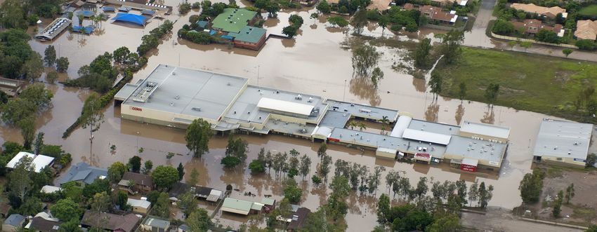
In January 2011, Queensland experienced and recreational activities.
widespread flooding that caused extensive damage
A key recommendation of QAO (2016) was that
to both public and private property, the evacuation
the Queensland Government coordinate flood
of towns and the loss of more than 30 lives.
resilience activities and funding on a catchment
The Queensland Floods Commission of Inquiry scale in collaboration with local governments
(QFCoI) Final Report was released in March 2012 and other relevant entities, to effectively identify,
and recommended a comprehensive flood study assess, prioritise and manage catchment scale
of the Brisbane River Catchment be completed flood risks.
to identify the probability and extent of various
floods occurring. Key recommendations included: Local government
• Recommendation 2.2 – ‘as soon as Each local government within the floodplain is
practicable, a flood study of the Brisbane continuously refining responses to flood risks
River catchment should be completed.’ as resources permit, through the integration of
best practice floodplain management principles
• Recommendation 2.12 – ‘councils in in their community engagement, disaster
floodplain areas should, resources management, land use planning and other
allowing, develop comprehensive floodplain management activities. Collaboration
floodplain management plans that accord at a whole-of-catchment level and guidance for
as closely as practicable with best practice the preparation of Local Floodplain Management
principles.’ Plans for the Brisbane River catchment will
enhance the effectiveness, integration and
In addition, a range of other recommendations consistency of these local scale initiatives.
were made relating to land use planning,
development regulation, building controls, Queensland State Planning Policy
emergency management, community awareness - adoption of a risk-based planning
and other matters relevant to managing the
Brisbane River floodplain. approach
The QFCoI recommendations relating to land use
The 2011 floods and outcomes of the QFCoI planning have been incorporated into a range
represent a benchmark against which future of state planning instruments including the
major flood events in the Brisbane River Queensland Planning Act 2016 and the State
catchment will be compared. Planning Policy July 2017.
Queensland Audit Office review of The Natural Hazards, Risk and Resilience policies
flood resilience since the 2011 floods and guidance material was updated as part
of the State Planning Policy July 2017 review.
In 2016, the Queensland Audit Office (QAO) This update incorporates a risk-based land use
undertook a review of the effectiveness of planning approach as recommended by the
flood resilience activities since the 2011 QFCoI. This approach has been further supported
floods, focusing specifically on the four local by the 2015 Productivity Commission Report
governments covering the Bremer, Lockyer, Mid into Natural Disaster Funding (Volume 1) and
and Upper Brisbane River Catchment; namely is recognised as best practice by the Planning
Ipswich, Somerset, Lockyer Valley and Scenic Institute of Australia in supporting community
Rim. The findings concluded that a coordinated resilience to natural hazards as outlined in
strategic approach that manages risk at a the National Land Use Planning Guidelines for
Disaster Resilient Communities (2016).
15SEQ Regional Plan – aspirations for Queensland Climate Adaptation
flood resilience Strategy 2017
The ShapingSEQ – South East Queensland The Queensland Climate Adaptation Strategy
Regional Plan 2017 (ShapingSEQ) identifies this 2017 (Q-CAS) provides a framework for the
Strategic Plan as an action for natural hazard Queensland Government to lead action on
management (flood risk) within the Brisbane adaptation to climate change. The Q-CAS
River Catchment, for the purpose of ensuring acknowledges the risks associated with a
‘the resilience of SEQ communities to flooding changing climate and is an important point of
through a coordinated approach to management reference in understanding and responding to
of risk to acceptable levels’. climate change related impacts on future flood
risks within the Brisbane River floodplain.
Queensland Disaster Resilience Policy
The Queensland Strategy for Disaster Resilience 1.4 An integrated catchment
was updated in 2017 to incorporate climate planning approach
change risk and deliver a comprehensive ‘all
An integrated catchment planning approach will
hazards’ approach to building disaster resilience
ensure appropriate linkages are made with other
throughout Queensland. Further to this, the
planning processes to deliver multiple benefits
Queensland Strategic Policy Framework for
for the region and avoid unintended outcomes.
Riverine Flood Risk Management and Community
Figure 4 provides a visual representation of this
Resilience was developed in 2017, which also
approach and shows how the common elements
informs this Strategic Plan.
between the planning processes occurring in the
catchment are considered. Refer to Section 3.1
Queensland State Natural Hazard of the Technical Evidence Report for further detail
Risk Assessment 2017 about this collaborative approach.
The Queensland Disaster Management The success of integrated catchment planning is
Committee endorsed the Queensland influenced by several key elements as discussed
State Natural Hazard Risk Assessment (Risk in QAO report, including:
Assessment) on 28 August 2017 as an ‘all
hazards’ assessment of natural hazard • recognising and balancing the
risks to the state of Queensland. The Risk relationships between cause and
Assessment identifies that “riverine flooding effect impacting on people, property,
is of equal highest priority (natural hazard risk) infrastructure and ecosystems within a
for Queensland. However a range of climate catchment
influences, as indicated within this report, may
give rise to riverine flooding, thereby making it • a coordinated approach from all levels of
a more frequently manifesting hazard.” government
The approach to flood risk management • community and private enterprise
underpinning this Strategic Plan aligns with the engagement.
risk management approach of the Queensland
State Natural Hazard Risk Assessment 2017 and
the Queensland Emergency Risk Management
Framework.
16 Brisbane River Strategic Floodplain Management PlanFigure 3 – Integrated Catchment Planning components
Integrated Catchment Planning
Balancing social, environmental and economic considerations
Dam operations and upgrades
Critical infrastructure network
Water Flood
supply management
Secure, sustainable Improving
and safe water public safety and
for all users reducing costs
of flooding
Common elements Making space for rivers
Efficient water Water quality
allocation and use Allocating land uses across
Ecosystem health floodplain
Catchment condition Hazard-appropriate built form
Landscape Land use
Management planning
Balancing the needs of Sustainable,
multiple landusers and connected liveable
the environment communities now and
into the future
Meeting current
and future demands
Water sensitive urban design
Re-engaging floodplain
17Strategic planning processes for the Brisbane • Landscape management – the South East
River Catchment include: Queensland Resilient Rivers Initiative
aims to improve the resilience and health
• Land use planning – the Queensland of the region’s waterways through the
Government’s ShapingSEQ sets out a development of Catchment Action Plans
regional framework for sustainable growth, for key catchments throughout South
global economic competitiveness, world- East Queensland. Catchment Action Plans
class infrastructure, ecological and social aim to enhance investment collaboration
sustainability and high quality living. across local government boundaries by
ShapingSEQ was developed through a number of investors. Catchment Action
extensive community engagement and Plans have been completed for the Lockyer,
collaboration between all levels of Mid Brisbane, Lower Brisbane/Redlands
government. It considers the need to and Bremer catchments. Local Floodplain
protect our natural environment and Management Plans will be incorporated
lifestyle in addition to managing future into revisions of the Catchment Action
growth. Local governments are required Plans as appropriate.
to reflect the relevant outcomes of
ShapingSEQ through their local planning
instruments.
• Floodplain management – the focus of the
Flood Studies is to deliver complementary
regional and local structural and non-
structural measures that improve public
‘reflect the local context and integrate
safety and reduce flood damages across with other planning processes’
the Brisbane River Catchment.
Sayers et. al 2014: 10 Golden
• Water supply – Seqwater is responsible Rules for managing floods
for providing ‘a safe, secure and reliable
water supply’ to South East Queensland.
Seqwater has adopted a whole-of-
catchment approach to water quality
and recognises that water treatment
begins at the source. In addition to being
South East Queensland’s primary bulk
water provider, Seqwater offers public
recreation facilities as well as essential
flood mitigation services through the
operation of Wivenhoe and Somerset dams
for flood storage. Of particular relevance
to this Strategic Plan is the planning work
underway for upgrades to the Somerset
and Wivenhoe dams.
18 Brisbane River Strategic Floodplain Management PlanUnderstanding our flood risk
2.1 Landscape characteristics The function of the floodplain varies between
different flood events, i.e. flood fringe areas in
that influence flood behaviour smaller floods may become flood storage areas
The Brisbane River valley was carved out of in larger, rare events.
bedrock over millions of years as waters drained
from the catchment into Moreton Bay. This Downstream of Wivenhoe Dam, the Brisbane
river valley is relatively narrow with steep sides River valley is very incised – meaning the
in some places, and has a generally flat base riverbed is bounded by a steep floodplain, with
that has been infilled by sediment washing off several points of restriction. When flooding
the catchment over millennia. The Brisbane occurs, water quickly fills the lowest-lying parts
River Catchment is capable of generating large of the floodplain. During larger floods, the spread
volumes of floodwaters depending on the of water is constrained by the narrow width and
magnitude and extent of a major rainfall event steep edges of the floodplain. This means that as
and the condition of the catchment (e.g. soil floods get bigger, the waters rise upwards rather
moisture). Just 1 millimetre of run-off across the than dispersing sideways. In comparison, areas
whole catchment is sufficient to fill over 5000 upstream of Amberley in the Bremer Catchment
Olympic-size swimming pools. and within the Lockyer Creek Catchment have
more extensive and broad floodplains that
Most floodplains contain three functional areas capture and temporarily store floodwaters during
as follows: significant flood events.
• Flood conveyance is where the vast Given it has mostly steep valley sides, there
majority of water flows and where flood are very few areas within the Brisbane River
waters are typically deep and fast flowing floodplain that can be considered flood fringe
during big floods (refer Figure 4). This means that for most of the
floodplain, floodwaters in the Brisbane River can
• Flood storage areas are parts of the potentially be quite deep, while areas closer to
floodplain that fill up with floodwaters, the river can also flow relatively fast during big
and are then temporarily detained during floods. This unique topography also means the
a flood. (Flood waters in these areas are floodplain is sensitive to changes in landform as
typically deep and slow moving) most of the floodplain has an important natural
function during a flood.
• Flood fringe represents the remainder of
the floodplain, which features generally
shallower flooding.
19Figure 4 – Example river cross section showing the physical characteristics of the Brisbane River
floodplain
The Technical Evidence Report introduces the 2.2 Terminology describing
concept of Potential Hydraulic Risk (HR), which
has been defined based on the hydraulic floods
behavior of floods and their likelihood of Floods are described in terms of the probability
occurring. This concept was the first step in of their occurrence as expressed by the term Annual
identifying flood risk however it does not define Exceedance Probability (AEP). AEP refers to the
the overall flood risk. Flood risk considers a probability of a flood of the nominated size or larger
range of factors in addition to potential hydraulic occurring in any given year. For example, a 1% AEP
risk and is best suited to be determined at the flood describes an event that has a 1 in 100 chance
local level to reflect local context. The HR is of being equalled or exceeded in any given year.
determined by grouping similar hydraulic risks
into five bands, with HR1 being the highest risk The 1% (1 in 100) AEP is commonly used to
and HR5 the lowest (refer to Appendix C of this identify areas at risk from large-scale flooding.
Strategic Plan, and Section 4.2 of the Technical However, it is important to understand the risks
Evidence Report). The HR categories broadly and potential consequences of the full range of
correlate to, and help visualise, the level of risk floods, from the small and frequent to the very
associated with flood conveyance, flood storage large and rare.
and flood fringe areas. This information can be
used, along with other factors, to inform risk The Flood Study provided estimates for 11 different
assessments. likelihoods of flood events, ranging from a frequent
50% (1 in 2) AEP, to extremely unlikely with a
Flood conveyance areas, within the Brisbane 0.001% (1 in 100,000) AEP. The 0.001% (1 in
River floodplain shown in Figure 2, generally 100,000) AEP flood inundation extent is considered
align with those defined as HR1 and HR2. These the notional extreme event and in the context of
are the most potentially hazardous parts of the the Flood Studies has been used to define the full
floodplain and are critical for transporting floods extent of the Brisbane River floodplain.
downstream. Flood storage areas generally align
with those defined as HR3 and HR4. Changes in Table 1 compares the likelihood of a range of
the topography of these flood storage areas can floods occurring in an 80-year lifetime and their
cause increased flood levels elsewhere in the corresponding flood levels at Brisbane City and
catchment. A detailed discussion and mapping Ipswich gauges.
of HR areas is provided in the Section 4.2 of the
Technical Evidence Report.
20 Brisbane River Strategic Floodplain Management PlanTable 1 – Likelihood for a range of flood AEPs occurring in an 80-year lifetime in the Brisbane River
floodplain derived from the Flood Study
AEP At least once in At least twice in Brisbane City Ipswich CBD
80 years 80 years gauge (m, AHD)
(m, AHD)
10% (1 in 10) 100% 100% 1.8 14.8
5% (1 in 20) 98% 91% 2.2 16.1
2% (1 in 50) 80% 48% 3.2 18.7
1% (1 in 100) 55% 19% 4.5 20.1
0.2% (1 in 500) 15% 1% 7.3 23.4
0.05% (1 in 2000) 4% 0.1% 9.9 25.7
0.001% (1 in 100,000) 0.1% < 0.1% 23.7 36.1
2.3 History of flooding in the Over an 80 year period, there is a 55
Brisbane River floodplain per cent chance that a 1% (1 in 100)
AEP event will occur at least once.
Brisbane River flooding has occurred for
millennia. Since formal records began 170 years
ago, there have been a number of significant
floods including in 1841, 1844, 1893 (two
events), 1974 and 2011. Figure 4 highlights the
peak flood levels for the 1% (1 in 100) AEP and
the 0.2% (1 in 500) AEP floods at key locations
compared to major recorded floods. Modelling
carried out for the Flood Study shows the 1%
(1 in 100) AEP flood event is higher than the
2011 and 1974 floods in some areas, while in
other parts of the floodplain it is lower. A number
of factors contribute to floods inlcuding rainfall
variability, ground conditions, tidal conditions
and dam operations. These factors vary between
flood events, meaning that no two floods are the
same, and similar or larger sized floods could
occur in the future.
21Figure 6 – Historical flooding in the Brisbane River floodplain
BRISBANE RIVER FLOODPLAIN
SOUTH BANK
0.2% AEP
Wivenhoe SOMERSET
Dam 1974 flood
1% AEP
2011 flood
Brisbane
Lockyer River Brisbane
BRISBANE River
Creek
LOCKYER
VALLEY DAVID TRUMPY BRIDGE
0.2% AEP 1974 flood
1% AEP 2011 flood
GOODNA
1893 flood
0.2% AEP
GATTON RAIL BRIDGE
IPSWICH 1974 flood
0.2% AEP Bremer 1% AEP
1% AEP 1893 flood
1974 flood 2011 flood River
2011 flood
Purga
Warrill Creek
Creek Oxley
Creek
Flood behaviour varies across the floodplain as a Localised flooding in creeks and tributaries are
result of different combinations of rainfall across the result of high rainfall occurring in an isolated
the catchment (amounts, timing and location), area of a creek catchment over a short period of
ground and tidal conditions, and dam operations. time. In contrast, the majority of regional floods
The level of flooding experienced in parts of in the lower Brisbane River have almost always
the floodplain is particularly influenced by the been the result of ex-tropical cyclones that
location of rainfall, which can occur in the Bremer, delivered persistent rainfall to the region over a
Lockyer or Upper Brisbane sub-catchment areas, number of days. This Strategic Plan focuses on
or a combination of any or all of these. History also regional riverine floods and associated risks.
shows that the occurrence of major floods does Localised flooding and overland flow issues are
not prevent other major or moderate floods from investigated and managed separately by local
occurring in short succession. governments.
22 Brisbane River Strategic Floodplain Management PlanFigure 7 – Flood AEPs experienced during the 2011 floods
savages
crossing
0.77% AEP
(1 in 130)
Mt crosby JindaLee
Lowood 0.8% AEP 1% AEP brisbane
0.7% AEP (1 in 120) (1 in 100) city
(1 in 140) 1% AEP
(1 in 100)
ipswich
waLLoon
1.3% AEP
2% AEP
(1 in 80)
(1 in 50)
MoggiLL
0.9% AEP
(1 in 110)
one MiLe
LoaMside bridge
20% AEP 3.3% AEP
(1 in 5) (1 in 30)
Figure 7 shows the AEPs of the peak flood levels Understanding both the likelihood and
experienced throughout the Brisbane River consequence of a range of possible floods
floodplain during the 2011 floods. will inform decisions for appropriate flood
risk management including assessment and
Flood levels in the Brisbane CBD were estimated selection of flood risk management measures.
to be a 1% (1 in 100) AEP, while flood levels in Risk reduction can be achieved by lowering the
other areas such as Lowood reached a 0.7% (1 chance of the hazard occurring or reducing the
in 140) AEP and for Ipswich a 1.3% (1 in 80) AEP. potential consequences when it does occur.
Although significant, it was not the largest flood
experienced in the floodplain. In the context of flooding, the likelihood
of a flood hazard occurring is relatively
straightforward to determine (e.g. a 1%
2.4 How flood risk is (1 in 100) AEP). The consequence of flooding is
determined more complex and dependent on a number of
Risk occurs when a community is potentially factors including:
affected by a hazard, such as flooding. In
• hydraulic behaviour – where the flood
accordance with leading practice risk standards,
waters will go (such as depths and
including the Queensland Emergency Risk
velocities)
Management Framework (QFES, 2017), risk is
defined as the combination of the likelihood of
• exposure – land uses, buildings and
the hazard occurring and the consequence once
population in the path of the flood
the hazard occurs. Likelihoods can range from
very frequent to very rare, while consequences • vulnerability – susceptibility or sensitivity
can range from insignificant to catastrophic. of land uses and populations to flooding
• tolerability – the degree to which a level of
flooding is considered acceptable for the
Risk = Likelihood x Consequence land uses and populations in the path of
the flood.
23Socio-economic drivers often dictate that the Risk-based approach
more vulnerable members of our community have
a higher degree of exposure to hazards as these Consideration of the full range of flood risks
may be the only convenient and affordable areas has become embedded in best practice, as
to live. Within the Brisbane River floodplain, described in key flood management guidelines
an estimated 20001 people live in the highest for Australia (Ball et al., 2016, AIDR, 2017). The
potential hydraulic risk category (HR1), of which SPP also requires floodplain management to
three-quarters (1700 people) are considered adopt a risk-based approach and Queensland Fire
to be highly vulnerable. However, across the and Emergency Services (QFES) has incorporated
remainder of the floodplain (HR2 – HR5) less this approach in its State Natural Hazards Risk
than half of the population is considered highly Assessment 2017 and the Queensland Emergency
vulnerable (130,000 of the estimated 280,000 Risk Management Framework 2017. This means
people). Refer to Figure 6 and Section 4.5 of the that rather than considering hazards for a single
Technical Evidence Report for further detail. likelihood such as a 1% (1 in 100) AEP, the total
risk covering a suite of flood likelihoods and
resulting hazards is to be considered, ranging from
Figure 7 - Vulnerable population within small and frequent events up to the most extreme
hydraulic risk categories and unlikely event.
HR1 A risk-based approach also requires judgement on
what is considered to be an acceptable, tolerable
or intolerable risk. The SPP Natural Hazards, Risk
and Resilience (Flood) Guidance Material (DSDMIP,
2017) defines these as follows:
Acceptable risk is a risk that, following
an understanding of the likelihood and
76% consequence, is sufficiently low to require no
Vulnerable new treatments or actions to reduce risk further.
Population Individuals and society can live with this risk
without feeling the necessity to reduce the risk
any further.
Tolerable risk is a risk that, following
an understanding of the likelihood and
HR2-5 consequence, is low enough to allow the
exposure to continue, and at the same time high
enough to require new treatments or actions to
reduce risk. Society can live with this risk but
believes that, as much as reasonably practical,
steps should be undertaken to reduce the risk
further.
50% Intolerable risk is a risk that, following
Vulnerable an understanding of the likelihood and
Population consequence, is so high that it requires actions
to avoid or reduce the risk. Individuals and
society will not accept this risk and measures
are put in place to reduce the risk to at least a
tolerable level.
1
Population numbers are indicative only based on building footprint counts (which in some areas does not identify multi-storey or
multi-unit dwellings) and census averages.
24 Brisbane River Strategic Floodplain Management PlanTolerability of flooding will vary along the risk For a 10% (1 in 10) AEP flood, 51 buildings would
spectrum from individual to individual, land flood above floor level in Brisbane, 74 buildings
use to land use, and community to community. in Ipswich, 10 buildings in the Lockyer Valley and
Tolerability is largely driven by a community’s 15 buildings in Somerset.
awareness of flooding and resilience to impact.
Tolerability may also change over time as a For a 1% (1 in 100) AEP flood, about 17,300
community changes. Tolerability cannot be buildings across the floodplain would experience
assessed at a regional scale and should be flooding, two thirds of these are located in the
determined at the local scale to establish Brisbane City Council area. Of these properties,
levels of flood acceptance. The Local Floodplain about 12,000 are expected to be flooded above
Population in Flood Plain
Management Plans to be developed as part the main habitable floor level (refer Figure 8).
2,000
of the Flood Studies will establish acceptable, HR1
tolerable and intolerable risk on a local For the 0.2% (1 in 500) AEP flood, the number of
17,000
government scale. buildings
HR2 flooded above floor level increases to
32,000. For the40,000
extreme 0.001% (1 in 100,000)
HR3
Risk treatment involves an array of approaches AEP flood, an estimated 130,000 buildings
including: would
HR4
be flooded above floor level.
41,000
• avoidance – keeping inappropriate land HR5 182,000
use and development away from certain
areas to minimise risk to life Populationbuildings in
Figure 9 – Number of existing
• accommodation – using controls and Brisbane that would
Existing Buildings flood
Flooded over above the lowest
Floor Level
measures to increase flood resilience and habitable floor level for different sized floods
1 in 2 AEP
minimise damage to property 10
1 in 10 AEP 150
• protection – changing flood behaviour
through structural measures such as dams, 1 in 50 AEP 3,300
levees and floodgates 1 in 100 AEP 12,000
• awareness – ensuring the community 1 in 500 AEP 32,000
understands their risk and can respond
1 in 2,000 AEP 48,000
accordingly to maintain community safety.
1 in 10,000 AEP 76,000
2.5 Current flood risk and 1 in 100,000 AEP 130,000
impacts
Buildings
Urban development has been extensive
throughout the Brisbane River floodplain over
the past century (refer Figure 4). As of 2017, an
estimated 134,0002 buildings were located in the
Brisbane River floodplain. Approximately 75 per
cent of these buildings were located in Brisbane,
22 per cent in Ipswich, 3 per cent in Somerset The Brisbane River floodplain is
and 0.5 per cent in the Lockyer Valley (refer estimated to have the largest number
Chapter 6 of the Technical Evidence Report).
Existing development in the Brisbane River of existing buildings of any floodplain
valley is the result of evolution from the original in Australia.
colonial settlements and infrastructure, as well
as taking advantage of the continuing social and
amenity values provided by living near water.
2
Building numbers are indicative only based on the limitations of the Flood Study modelling and building database as described in
Section 6.3.8 of the TER.
25Flood levels for different AEP events at the Approximately 20001 (see previous page) people
Brisbane City and Ipswich gauges are presented live within the HR1 area, which is the highest
in Table 1. Sensitivity of the floodplain to hydraulic risk area (refer Figure 10). Residents
changes in flow means that flood levels increase living in these areas may experience flooding
significantly from one AEP to the next. In the on a regular basis, with larger less frequent
mid reaches of the Brisbane River and the lower floods resulting in financial losses, substantial
reaches of the Bremer River, a 1% (1 in 100) AEP disruption to their lives and emotional stress.
flood is approximately three to four metres higher Approximately 19,0001 people live within the
than a 2% (1 in 50) AEP flood. A 0.2% (1 in 500) combined HR1 or HR2 areas.
AEP flood is approximately four to five metres
Figure 10 – Approximate population1 by HR areas
higher than a 1% (1 in 100) AEP flood. Population in Flood Plain
Most properties located within the Brisbane HR1 2,000
River floodplain are residential. Within
HR1 areas, two-thirds of the properties are HR2 17,000
residential. The remaining properties are mostly
40,000
industrial, commercial and agricultural. For HR3
lower risk areas HR2 to HR5, the proportion of
41,000
residential properties progressively increases HR4
and the proportion of industrial, commercial and
182,000
agricultural properties progressively decreases HR5
(refer Figure 9).
Figure 19 – Proportion of property types Population
impacted by flooding in each HR area
Existing Buildings Flooded over Floor Level
1 in 2 AEP 10
Proportion of properties impacted (%)
86
Residential
It is 1not just the occupants
in 10 AEP 150
of directly affected
78
77
properties that are impacted by flooding. A much
70 larger1 in section
50 AEP of our
3,300community can be indirectly
66 impacted as a result of services and facilities
affected
1 in 100 by
AEP floods 12,000
such as key transport network
14
linkages, loss of power and communications and
13
1 in 500 AEP 32,000
11
9
Industrial essential community services such as health
8 Commercial
7
7
7
7
8
5 Other
and welfare support. Loss of 48,000
1 in 2,000 AEP
these services and
6
2
3
2
3
2
4 4
1
Agricultural facilities can have cascading effects including an
inability
1 in 10,000 toAEPwork, get to school, supply 76,000
shops with
HR1 HR2 HR3 HR4 HR5
goods for consumption or impact on the ability to
1evacuate.
in 100,000 AEP 130,000
Buildings
An estimated 280,000 people live in the
Brisbane River floodplain as at 2018.
2 Population numbers are indicative only based on building footprint counts (which is some areas does not identify multi-storey or multi-unit
dwellings) and census averages
26 Brisbane River Strategic Floodplain Management Plan2.6 Economic impacts approximately $50 million each year in disaster
adaptation funding and in the last decade spent
The Queensland Strategy for Disaster Resilience more than $8 billion on post-disaster relief and
(2017) notes that Queensland is the most recovery (Productivity Commission, 2014).
disaster impacted state in Australia. The
frequency of tropical and ex-tropical cyclones Economic impacts of flooding in the Brisbane
and storms in Queensland means that storm River floodplain are detailed in Chapter 6 of the
and flood damage can be significant, requiring Technical Evidence Report. The cost of flooding in
enormous disaster relief and reconstruction the Brisbane River floodplain has been estimated
efforts. The Australian Government invests by including both tangible and intangible
damages as outlined in Table 2.
Table 2 – Definition of tangible and intangible damages
Tangible (measurable) damages Intangible damages
Direct Indirect
Includes costs to repair or Includes the estimated loss in Includes the ‘social costs’ of
replace damaged property, production or revenue, loss of wages, flooding reflected in increased
goods, perishables and additional accommodation and living levels of emotional stress and
infrastructure; or the loss in expenses, and any other additional psychological and physical
value if it is not repaired or expenses incurred by society due to illness including loss of life.
replaced. floods. Intangible damages also includes
environmental, cultural and
Indirect damages are estimated by heritage losses incurred.
adding a factor to direct residential
and business losses in accordance Intangible damages have been
with Guidance on the Assessment estimated by reviewing the social
of Tangible Flood Damages by the costs of catastrophic events in
Department of Natural Resources, Australia and overseas, including
Mines and Energy (2002). the 2011 Brisbane River floods
and the 2009 Black Friday
bushfires in Victoria.
Refer to Section 6.1 of the Technical Evidence Report for further information
27This Strategic Plan includes Intangible damages are difficult to measure
and meaningfully quantify in dollar terms.
intangible damages in the Nevertheless, these are very real, significant and
assessment of overall economic often enduring ‘costs’ that emerge as a result of
costs. disasters such as floods.
Estimated damages (tangible and intangible)
resulting from floods in the Brisbane River
floodplain are summarised in Table 3.
Table 3 – Estimated cost of flooding in the Brisbane River floodplain for different size floods
AEP Tangible Intangible Total
($million) ($million) ($million)
10% (1 in 10) $39 $0 $39
2% (1 in 50) $1,560 $190 $1,750
1% (1 in 100) $5,150 $1,610 $6,760
0.2% (1 in 500) $14,360 $11,050 $25,410
0.05% (1 in 2,000) $22,960 $24,500 $47,460
0.001% (100,000) $73,650 $127,100 $200,750
For a 1% (1 in 100) AEP flood, the total damage The AAD in the Brisbane River floodplain is $289
cost is estimated at approximately $6.8 billion million per year, comprising $187 million for
($1.6 billion intangible and $5.2 billion tangible). tangible damages and $102 million for intangible
Refer to Figure 11. These costs are comparable damages.
to actual damages incurred in the Brisbane River
floodplain as a result of the 2011 floods. Average annual damage
When considering the likelihood of all floods, 65% 35%
the total cost of flooding can be calculated on an Tangible Intangible
annual average basis , which is referred to as the
Average Annual Damages (AAD). This is the cost
incurred by flooding each year when averaged
$289M per year
over a significant period of time.
28 Brisbane River Strategic Floodplain Management PlanFigure 12 - Expected tangible costs for a 1% The high flood damage costs for the Brisbane River
(1 in 100) AEP flood
Expected Tangible Costs for a 1 in 100 AEP Event
floodplain is due to the large number of properties
potentially affected by rare but devastating events.
More than 70 per cent of the total AAD is due to
Residential Other infrastructure
floods that are rarer and larger than the 1% (1 in
100) AEP flood (refer Figure 12).
Figure 12 – Percentage of Average Annual
$1.3B $0.6B Damages for AEP floods
Non-residential Utilities
$2.2B $0.1B
29%
Transport Clean-up
38%
$0.7B $0.2B
33%
= $5.2B total
By comparison, tangible damages in the
Hawkesbury-Nepean River are estimated Floods rarer than 0.2% (1 in 500) AEP
at approximately $80 million per year. The
Hawkesbury-Nepean River has its own strategic
plan and is a catchment somewhat comparable Floods up to 1% (1 in 100) AEP
to the Brisbane River in its size. Located on the
outskirts of Sydney, it has long been regarded Floods between 1 in 100 AEP
as one of the most dangerous for flooding due and 1 in 500 AEP
to the significant flood depths and evacuation
difficulties for local communities.
The Brisbane River has the highest
potential flood damages of any
floodplain in Australia.
2965% 35%
Tangible Intangible
$289M per year Expected Tangible
Figure 13 – Estimated property damage costs by Hydraulic Risk categories
Resident
Property damages
37.2
Residential Non-residential
$1.3B
21.4
$m/year
$m/year
19.4
17.6
Non-reside
12.9
6.8
4.1 4.4
1.8 1.6
HR1 HR2 HR3 HR4 HR5 HR1 HR2 HR3 HR4 HR5 $2.2B
Transpo
Property damages
The AAD for the Brisbane River floodplain has 2.7 Existing dam flood
also been calculated for residential and non-
residential properties across different Hydraulic operations
Intangible
Risk areas. HR1 is the highest risk area and Both Somerset and Wivenhoe dams include
Damages
contains 880 residential and 460 non-residential purpose-designed flood mitigation capacity $0.7B
buildings, from which tangible damages of and are well located within the Brisbane River
$m damages
$6.8 million per year and $12.9 million per year catchment to provide significant flood mitigation
would be derived, respectively (refer Figure 13). during many flood events.
Impacts to property within HR2 contribute Impacts from floods in 1999 and 2013 were
the most to the AAD for both residential and Tangibleto the extent that potentially Major
mitigated
non-residential damages due the high frequency Damages
flood conditions were reduced to only Minor
of flooding. flood levels. In 2011, the dams effectively
reduced peak flood levels by 2.8 metres at
HR5 contains by far the largest population and
2 5 10 20 50 100 200 Ipswich, 2.3 metres at Fernvale,
largest number of buildings (approximately 3.2 metres at Moggill and 2 metres at Brisbane
83,000). However, its contribution to the AAD City. These estimated flood levels are relative to
is minor as it is very rare for these properties to the equivalent ‘no dams’ scenario modelled in
be impacted. the Flood Study.
Central to the dams’ ongoing flood mitigation
effectiveness is the ability to establish flood
operation procedures that reduce adverse
impacts downstream. Planning for the reduction
of flood impacts requires an understanding of
potential damages across the range of Brisbane
River flood flows.
30 Brisbane River Strategic Floodplain Management PlanYou can also read