City of Fremantle
Greening Fremantle: Strategy 2020
←
→
Page content transcription
If your browser does not render page correctly, please read the page content below
City of Fremantle Greening Fremantle: Strategy 2020
Acknowledgements
The City of Fremantle thanks the Green Plan Working
Group in helping drive and create the Strategy and in
providing valuable time, expertise and passion to the
project.
Cr Jon Strachan (Chair)
Cr Rachel Pemberton
Cr Andrew Sullivan
Dr Martin Anda
PhD, BSc (Hons), BE (Mech), MIE Aust
Academic Chair of Environmental Engineering
School of Engineering and Information Technology –
Murdoch University
Dr Paula Hooper
BSc (Hons), MSc, PhD, Post Doc Research Fellow,
RESIDE-II Research into Practice Project Co-ordinator
Centre for the Built Environment and Health, School of
Population and Health – University of Western Australia
Mr Francis Burke
Director
Earthcare
Mr Clinton Matthews
Architect
B. Arch, B.App Science
Mr Luke Priddle
Landscape Architect
Mr Rhys Gustafsson
Environmental Engineering Student
Murdoch University

Photos contributed by Amanda Miller.

City of Fremantle
Greening Fremantle: Strategy 2020
Executive Summary
There is increasing research and evidence to show open and green spaces have a
positive effect on community sociability, local economy and ecology. These spaces
are particularly important in city urban environments, where people live, work and
recreate. Throughout 2016/17, the City of Fremantle (‘City’) has been progressing the
greening of Fremantle and developing the detailed Urban Forest Plan. To better
align City document intents, the Green Plan 2020 has been renamed “Greening
Fremantle: Strategy 2020”, which provides the overarching strategy for the detailed
Urban Forest Plan.

Green spaces and places are important to our         Key projects over the next five years
community and have been identified as valued         include:
assets through the Fremantle 2029 Community          Investigation and identification for accessing
Visioning process as “… a City that values its       public open space in the priority areas of Hilton,
environment and heritage and the protection          O’Connor, White Gum Valley, North Fremantle
and enhancing the natural environment, green         and Beaconsfield.
spaces and heritage features”.
                                                     Investigation and identify options to improve
To achieve this vision, the Greening Fremantle:      and/or expand public open space in proximity to
Strategy 2020 has six focus areas to maintain        future high density areas.
and enhance green spaces, increase quality and
distribution of green spaces, increasing and         Undertaking an Urban Forest Plan to manage
improving biodiversity, water efficiency and         and guide tree and vegetation population across
encouraging the greening of private property.        the public and private realm, to increase canopy
                                                     and biodiversity and to mitigate the Urban Heat
The Greening Fremantle: Strategy 2020 provides       Island Effect.
the background, rationale and framework to
deliver projects and programs over the next five     Undertaking water demand modelling to inform
years.                                               future fit for purpose water supply options.
                                                     Prepare planting plans for green links including
Key initiatives and targets include:
                                                     design factors such as biodiversity links and links
Every resident and worker to be within walkable      between green spaces and activity centres.
distance to public open space.
                                                     The six focus area objectives and action plan is the
Progressively increase tree planting across the      culmination of the development of the Greening
city to achieve at least 20% canopy coverage.        Fremantle: Strategy 2020 through the City and
Design adaptable open space that allows for          the Green Plan Working Group.
future flexibility as the community and open
space function and needs change over time.
                                                     “… a city that values its
Planning for future water security to identify
opportunities for best available water sources for   environment and heritage and
existing and new open space.                         the protection and enhancing
Develop links that increase the amount of            the natural environment, green
flora/vegetation and increase habitats for native
fauna and encourage their movement between           spaces and heritage features”.
green spaces and to increase and improve
biodiversity areas.

                                                                                                            ii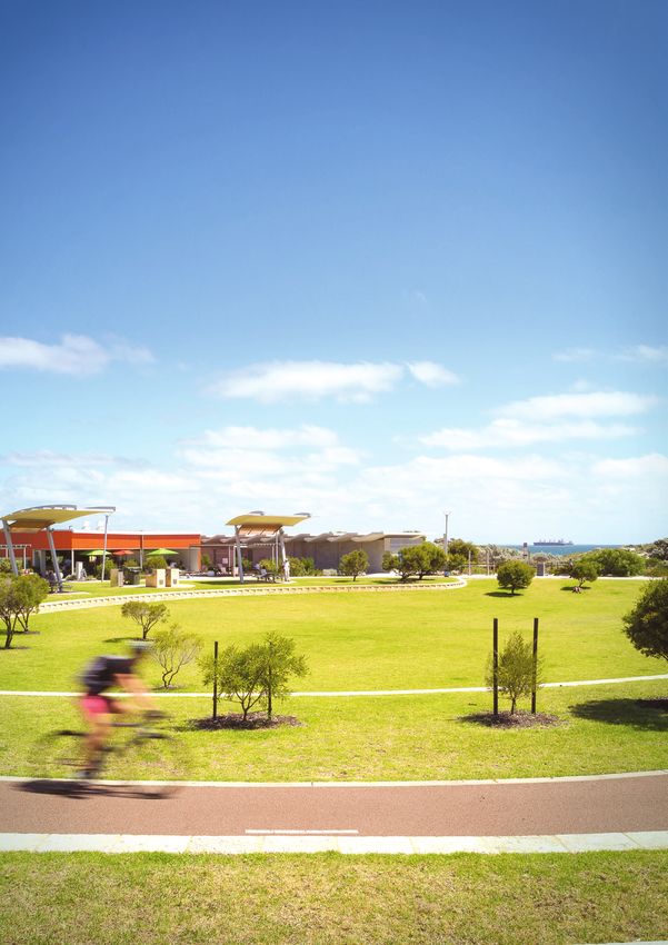
A strategy to
inform, guide
and implement
a greener city.

City of Fremantle
Greening Fremantle: Strategy 2020
Table of Contents

Executive Summary.................................................. i

PART 1
Background.................................................................. 3
  WHAT’S BEEN ACHIEVED SINCE 2001?.............................5
  STRATEGY AND POLICY CONTEXT.......................................7
  FUTURE CHALLENGES & OPPORTUNITIES.....................8

PART 2
Greening Fremantle: Strategy 2020.............11
  STRATEGY FOCUS AREAS & OBJECTIVES.......................11
  GREEN SPACE TYPES & USE................................................... 13
  MAP 1: EXISTING GREEN SPACE..........................................14
  GREEN SPACE DESIGN.............................................................. 17
  MAP 2: PARK CATCHMENTS...................................................18
  COMMUNITY INVOLVEMENT.................................................21
  URBAN FOREST............................................................................. 23
  WATER SECURITY......................................................................... 27
  NATURAL LANDSCAPES, BIODIVERSITY
  & LINKAGES......................................................................................28
  MAP 3: GREEN LINK FUNCTIONS & MATRIX..........30-31
  IMPLEMENTATION & REVIEW............................................... 33

Glossary of Terms ................................................. 37

References ............................................................... 39

                                                                                                       1
City of Fremantle
                   Key Greening Initiatives & Targets

                Every resident and                     Progressively increase
               worker to be within                    tree planting across the
               walkable distance to                    city to achieve at least
                public open space.                     20% canopy coverage.

             Design adaptable open                       Planning for future
               space that allows for                      water security to
              future flexibility as the                identify opportunities
              community and open                      for best available water
            space function and needs                  sources for existing and
                change over time.                         new open space.

                             Develop links that increase the amount
                            of flora/vegetation and increase habitats
                               for native fauna and encourage their
                             movement between green spaces and
                           to increase and improve biodiversity areas.

City of Fremantle
Greening Fremantle: Strategy 2020
PART 1: Background

                                                                             PART 1
                                                                         Background

CITATION
This Greening Fremantle: Strategy 2020 (the ‘strategy’), formerly Green Plan 2020, is
adopted as a Corporate Strategy to support delivery of the Strategic Community Plan.
It replaces the 2001 Green Plan for the City of Fremantle (the ‘City’).

INTRODUCTION
There is increasing research and evidence to show   Green spaces and places are important to our
open and green spaces have a positive effect        community and have been identified as valued
on community sociability, local economy and         assets through the Fremantle 2029 Community
ecology. These spaces are particularly important    Visioning process:
in city urban environments, where people live,
                                                    “… a city that values its environment and heritage
work and recreate.
                                                    and the protection and enhancing the natural
Green spaces and infrastructure are important –     environment, green spaces and heritage features”.
trees, natural areas, exotic gardens and grass as
                                                    How we manage and develop our Public Open
they all play a part in;
                                                    Space (POS) and other green spaces, particularly
»» Filtering extreme weather conditions from        in a drying climate, is a key focus for the future.
   heat; cold, rain and wind.                       The 2001 Green Plan sought to define how we
»» Humidifying the air.                             manage and develop public and private owned
                                                    green spaces to:
»» Taking up carbon.
                                                    1. Ensure canopy and POS catchment targets are
»» Improving soil and air quality.                     met.
»» Controlling erosion (wind and water).            2. Investigate and implement ways to encourage,
»» Protecting groundwater resources (nutrient          support and promote greening initiatives on
   management and salinity controls).                  private land.
»» Amenity and landscape relief.                    3. Align streetscape, infrastructure and land use
»» Sense of place, heritage and culture.               planning to provide functional green spaces
                                                       and links for existing and future communities.
»» Enhancing biodiversity.
                                                    4. Engage and support the community in green
»» Increasing fauna habitat as a shelter and food      space development and environmental
   source.                                             initiatives.
»» Social values.                                   5. Identify opportunities for innovative ways to
»» Increasing pedestrian and other transport           use water effectively and sustainably for our
   comfort.                                            green spaces.
»» Extending hard infrastructure asset life.        In June 2014, the Council initiated the review
                                                    of the 2001 Green Plan. A working group was
»» Health and wellbeing of people and their pets.
                                                    formed consisting of elected members, City staff
                                                    and community members with professional
                                                    backgrounds in the delivery of parks, green space,
                                                    nature play and environmental/biodiversity
                                                    management. The Green Plan Working Group
                                                    has been integral in reviewing and developing
                                                    the new strategy.

                                                                                                          3
2001 GREEN PLAN
                                    The 2001 Green Plan was initiated as a result of
                                    community feedback on the need to;
                                    »» Improve and increase existing POS.
                                    »» Develop ecological and recreational linkages
                                       across the city.
                                    Its development involved extensive community
                                    involvement and research, culminating in the
                                    adoption of the City’s first Green Plan in April
                                    2001.
                                    Mapping to support the development of the
                                    2001 Green Plan was undertaken in 1999. The
                                    mapping identified (by land area) the city (public
                                    and private land) comprised of 28% tree and
                                    vegetation cover, 8.3% irrigated grass (on public
                                    opens space) 30.3% “other” open areas (including
                                    verges, bare ground and unirrigated grass) 9.3%
                                    roads and 24.1% buildings
                                    The 2001 Green Plan identified these key
                                    objectives:
                                    »» Maintain and enhance green spaces in the
                                       City.
                                    »» Increase the quantity and improve           the
                                       distribution of green spaces in City.
                                    »» Increase and improve linkages between green
                                       spaces.
                                    »» Increase the amount of flora/vegetation cover
                                       and increase habitats for native fauna and
                                       encourage their movement between green
                                       spaces.
                                    »» Protect existing vegetation and encourage the
                                       greening of private property.
                                    The 2001 Green Plan has been reviewed as part
                                    of the work to prepare the new strategy and as
                                    part of the actions identified in the One Planet
                                    strategy (Land Use and Wildlife). The 2001 Green
                                    Plan objectives have been included and built
                                    on through the development of key focus areas,
                                    objectives and actions identified in Part 2 of this
                                    document.

City of Fremantle
Greening Fremantle: Strategy 2020
PART 1: Background
WHAT’S BEEN ACHIEVED SINCE 2001?
Since 2001 there has been a range of development, programs and projects resulting from and related to
the Green Plan 2001.
GREEN PLAN 2001 ACTION UNDERTAKEN
LEIGHTON MARSHALLING Revegetation and additional planting has been undertaken through the
YARDS SITE Leighton development.
APACE SITE AND NORTH Revegetation (approximately 4000 native plants) access improvement,
FREMANTLE WETLAND weeding and foreshore stabilisation of “Prawn Bay” in 2009 through the
Swan River Trust Riverbank Grant Scheme and City of Fremantle.
FREMANTLE ARTILLERY A master plan and detailed concept plans including landscape
BARRACKS AND improvements for Cantonment Hill have been prepared which includes
CANTONMENT HILL revegetation and tree planting to be implemented. New trees planted
with Stage 1 Redevelopment. Revegetation was undertaken in 2014.
FORMER WATER Now being developed and will include public open space, landscaping
CORPORATION LAND and street tree planting as development progresses (located in
(KNUTSFORD STREET) Development Area 1of the Local Planning Scheme).
LAND ADJACENT TO Located in Development Area 4 of the Local Planning Scheme No. 4 the
STEVENS RESERVE land has a Council approved structure plan and includes retention and
restoration of Stevens Street vegetation and 1 hectare of public open
space with additional park and street tree planting.
LEFROY ROAD Part of this area has been developed as residential and includes a
(FORMER QUARRY SITE) 1280sqm public open space with tree planting (Sardelic Park, located
in Development Area 7 of the Local Planning Scheme). The quarry site
has had an approved structure plan (Lefroy Road Quarry Structure Plan)
and includes 4.05 hectares of public open space.
WESTRAIL LAND Now privately and City owned land, part has been developed as
residential as part of the South Beach redevelopment and includes
public open space and street tree planting. The remainder forms the
Hollis Park open space area.
NEW DEVELOPED OPEN New open space has been provided through residential and other
SPACE development including; Naylor Reserve, Sardelic Park, Salentina
Ridge, Booyeembara Park and the formalisation of the Kim Beazley
redevelopment site.
REVEGETATION Revegetation of Arthur Head, railway link, and coastal reserves, ongoing
PROGRAMS tree planting program, ongoing street tree program, ongoing natural
area protection and restoration.
APPROVED NEW OPEN Through the structure planning process of the City’s redevelopment
SPACE areas, approximately 5 hectares of new public open space will be
provided as development occurs through the subdivision process.
PLANNING SCHEME AND Range of Scheme and Policy requirements to retain and encourage
POLICY PROVISIONS retention of vegetation and mature trees on developable land.
VERGE BEAUTIFICATION Encourages residents to develop native verge gardens, supplemented
PROGRAM with access to free mulch and subsidised plants.
ANNUAL STREET TREE Ongoing operational street tree and park tree planting and
AND PLANTING PROGRAM replacement program.
55City of Fremantle Greening Fremantle: Strategy 2020
PART 1: Background
STRATEGY AND POLICY CONTEXT
The strategy is not a standalone document and it has been informed by the Fremantle 2029 Community
Visioning Project and its key theme for Fremantle to be:
“…a liveable city that services its resident’s needs; a City that values its
environment and heritage and the protection and enhancing of the
natural environment, green spaces and heritage features.”
The strategy also relates and integrates with the Council’s Strategic Community Plan and Corporate
Strategies, including One Planet which has the following vision:
“The City aims to become Perth’s most sustainable local government –
a place where we foster community in a way that supports quality of life,
while respecting the limits of the planet on which we live.”
Other related strategies, plans and policies include:
STATE GOVERNMENT FRAMEWORK LOCAL STRATEGIC FRAMEWORK
»» Draft Perth and Peel @ 3.5 Million »» One Planet Strategy
»» Planning and Development Act »» Integrated Transport Strategy
»» Environmental Protection Act »» Water Conservation Strategy
»» Swan and Canning Rivers Management Act »» Climate Change Adaptation Plan
»» State Planning Policy Bush Forever »» Local Planning Strategy
»» Liveable Neighbourhoods Guide »» Strategic Recreation Plan
»» Department of Sport and Recreation SD5 »» Play Spaces Plan
»» Public Parkland Planning and Design Guide »» Asset Management Strategy
LOCAL STATUTORY FRAMEWORK MANAGEMENT PLANS AND STRATEGY
»» Local planning strategy »» Reserve and park master plans
»» Local planning scheme »» Reserve and park management plans
»» Structure plans »» Urban design plans
»» Local planning policies »» Infrastructure plans
»» Design guidelines »» Community engagement plans
»» LTFP and Capital works program
»» Operational plans
7FUTURE CHALLENGES
& OPPORTUNITIES
Given the context of a highly urbanised strategic Population Growth
metropolitan centre, the strategy needs to In 2001 the city had a population of approximately
consider competing functions and interests for 24,200 which has grown to 30,883 in 2014 and is
existing and new green spaces. This includes projected to continue to grow to 36,263 in 2031.
providing space for pedestrians,cycle ways, road Increasing urbanisation to match population
reserves, recreation and other activities, with growth means more “hard” space in the form of
competition for space for utilities and other roofs and roads and intensifying the use of existing
urban infrastructure. green spaces. This presents the challenge of:
»» Mitigating the social and economic effects
of the built form e.g. increased heat and
increased water runoff and water pollution.
»» Safeguarding existing POS and other green
spaces from development.
»» Creating new, usable POS through structure
planning and subdivision process to meet the
needs of the existing and future community.
»» Developing innovative collaborations on
how other urban land can be used by the
community where structure planning and
subdivision process mechanisms do not apply.
In a highly urbanised area such as the city, existing
POS, particularly large land parcels such as those
used for organised sport, are essential to the local
and wider community and must be retained and
enhanced.
Detailed mapping was undertaken in March
2015 to determine the type and percentage of
tree canopy cover, POS function and walkable
catchments to inform future recreation, amenity
and linkage opportunities.
Tree canopy cover is important as it provides
shade to reduce heat and improve amenity as
well as important habitats for fauna. In a growing
population, the provision of trees and their
associated canopy is important as they provide
aesthetic value, economic and environmental
benefits, reduce stormwater runoff, improve
energy conservation, improve air quality and
enhance community vitality.
The March 2015 vegetation mapping identified
the city (as a whole) has 25.2% of total vegetation
(485ha) with 12% of the city area of trees 3 metres
and over in height (230.6ha). The total City land
area includes Fremantle Ports land area.
City of Fremantle
Greening Fremantle: Strategy 2020
PART 1: Background
Services and in apartment developments. Good planting
Careful consideration and design is required outcomes must be in balance with achieving
where landscaping impacts on utility services other sustainability targets, compliance with
such as gas, power, water and sewerage. Services State government planning requirements and
located both above (e.g. power lines and poles) the City’s density targets.
and below the ground can restrict planting and In addition to private development controls
growing space, particularly for trees with large the City will also work with key agencies such
root systems or canopies. as Fremantle Ports, Main Roads WA, LandCorp,
Opportunities exist to ensure that important Department of Parks and Wildlife and Public
services are not impacted by poor planting Transport Authority to promote and advocate for
choices. Tree species selection such as those greening initiatives on land within their control.
whose height can provide shade and not
Urban Form and Public Land
interfere with overhead power lines provides an
opportunity to green the City in a cost effective Planting of trees and other vegetation
way whilst not impacting on services. A balance is influenced by a variety of factors and
needs to be obtained between the provision management within an urban environment such
of essential services and the benefits that trees as the City Centre. Design factors such as historic
provide. Other opportunities such as the roll out and streetscape vistas, safety sightlines, soil
of underground power across Perth will allow and microclimate conditions, universal access
for the planting of tree species with higher and requirements, land use and water availability all
greater canopies in the future. influence the location and type of tree planting
and landscaping in an urban area.
Private Land There are established controls for POS and
There is existing state and City planning and landscaping requirements through subdivision
development controls for the provision of POS, and structure planning processes. The challenge
to encourage the retention of large trees and to lies in how to provide green space in areas of
maintain significant vegetation on private land. high density or where there are gaps in our
Development and redevelopment will result in existing network outside of structure plan areas.
the loss of large trees. The challenge is how the Opportunities lie in how to use local and State
City can educate, encourage and regulate to government land in innovative ways to provide
ensure large trees are retained and functional new and functional green spaces, for example
open space is provided across the City. Large better use of road reserve.
trees are important on private lands in providing
shade, wind protection, character and a sense
of place. Large trees provide vertical relief in
building design, provide a cultural connection
to a place and can be used to scale and balance
the built form. There is also recent research in the
health and economic benefits in providing and
maintaining trees in public and private spaces
including property values.
The City has adopted a number of mechanisms
to retain large trees on private land including
Planning Policy 2.10 Landscaping for Development
and Existing Vegetation on Development Sites.
The challenge now is how to allow for larger trees
for canopy cover on increasingly smaller lots
9The principal objective of the Greening Fremantle: Strategy 2020 is to: “increase the quality and distribution of green areas in City, while improving the linkages, vegetation and the quantity of flora and fauna”. City of Fremantle Greening Fremantle: Strategy 2020
PART 2: Greening Fremantle: Strategy 2020

                                                   PART 2
                        Greening Fremantle: Strategy 2020

STRATEGY FOCUS AREAS & OBJECTIVES
The principal objective of the Greening Fremantle: Strategy 2020 is to “increase the quality and distribution
of green areas in City, while improving the linkages, vegetation and the quantity of flora and fauna”. This
objective is supported and enhanced by six new Focus Areas which relate to:
»» Maintaining and enhancing green areas
»» Increasing the quality and distribution of green spaces
»» Increasing flora cover, diversity and fauna habitats
»» Improving links between green spaces
»» Encouraging the greening of private property.

The Greening Fremantle: Strategy 2020 Focus Areas are:
            FOCUS AREA 1                                           FOCUS AREA 4
            GREEN SPACE TYPES & USE                                URBAN FOREST
            Knowing what we have, how it                           To manage and develop the urban
            functions and where the gaps are for                   forest of the City in an integrated way,
            future consideration in planning and                   across the public and private realm of
            development.                                           the City.

            FOCUS AREA 2                                           FOCUS AREA 5
            GREEN SPACE DESIGN                                     WATER SECURITY
            Best practice public and private land                  Ensuring that green space design
            development that ensures quality                       reflects fit for purpose water resources
            open space design for consolidating                    and optimum water use efficiencies,
            green spaces and green links.                          considering all water sources available.

            FOCUS AREA 3                                           FOCUS AREA 6
            COMMUNITY INVOLVEMENT                                  NATURAL LANDSCAPES,
            How the City can engage and                            BIODIVERSITY & LINKAGES
            support the community in planning,                     To protect and enhance natural
            design and implementation of green                     landscapes    and     ecosystems      by
            space plans that contribute to the                     identifying opportunities to expand/
            restoration of natural areas and                       increase natural plant communities to
            green links.                                           improve biodiversity and their links.

                                                                                                                11
City of Fremantle Greening Fremantle: Strategy 2020
PART 2: Greening Fremantle: Strategy 2020
GREEN SPACE TYPES & USE
Understanding how POS and other green spaces are used is important to enable planning for
redevelopment of existing POS and where the provision of new POS will be required in the future. The
mapping and analysis identifies:
»» Existing POS and its form and function
»» Where new POS has been approved and will be provided in the future
»» Where there are increases in population density for future planning of POS provision and enhancement
opportunities
»» Where there are gaps in POS provision (using a 400m walkable catchment area).
The 400m walkable catchment target is derived from the basic building block of walkable neighbourhood
design. The idea is the community has access to open space within a five (5) minute walk, which is around
400m.
POS terminology in the mapping has been applied to reflect form and function in the City’s coastal and
river environment setting.
RECREATION SPACE These parks provide a setting for informal play and physical activity,
relaxation and social interaction.
COASTAL RECREATION These parks are located adjacent to / on the river or coastal foreshore,
these spaces provide a setting for informal play and physical activity,
relaxation and social interaction (does not include natural areas).
COASTAL NATURAL Located adjacent to / on the river or coastal foreshore, these spaces
provide a setting where people can enjoy nearby nature and protect local
biodiversity and natural area values.
SPORTS Sport spaces provide a venue for formal structured sporting activities such
as team competitions, physical skill development and training. These
spaces also function for informal recreation such as dog walking, running,
walking etc.
NATURAL Provide a setting where people can enjoy nearby nature and protect local
biodiversity and natural area values. May provide opportunity for low-
impact recreational activities, such as walking, cycling, picnicking, playing,
watching or exploring natural features. Natural spaces may include
bushland, coastal areas, wetlands and riparian habitats, and geological
and natural features. Sites are managed to enable recreational access
while protecting local ecological and biodiversity values.
13MAP 1
EXISTING
ST
IR
LI
N
G
H
TY
GREEN SPACE
W
DE
Y
MA
N RD
D
HR
AC
BE
RT
PO
WY
N GH
CAN NI
HIGH ST
SOUTH ST
K RD
STOC
HA
MP
TO
N
RD
SOURCE DATA: CITY OF FREMANTLE
BASE MAP: GEOSCIENCE AUSTRALIA
LEGEND
Parks - Recreation Spaces Coastal - Natural Spaces
Parks - Sports Spaces Sport / Recreation Facilities
Parks - Natural Spaces School Sites
Coastal - Parks - Recreation Spaces City of Fremantle LGA BoundaryPART 2: Greening Fremantle: Strategy 2020
The mapping analysis includes the identification
of future POS opportunities that have OBJECTIVES
been identified through the structure plan
development process. This new term identifies
POS/green spaces that are yet to be constructed; Every resident and worker is to have access
“Potential New Green Spaces - Parks and to POS within a 400m walkable catchment.
open space opportunities identified for future
Ensure POS mapping informs the planning
development through the planning process.”
and development of land and infrastructure
Map 1 provides the location and form and across the city.
function of the POS throughout the city.
There is a gap in POS within a 400m walkable
catchment in areas of Beaconsfield, White Gum
Valley (east), Hilton (north and east), Samson ACTIONS
(west), North Fremantle (south) and the O’Connor
industrial area (see Map 2).
1.1. Investigate and identify options for
POS gaps could be addressed as part of any
accessing functional POS in the priority
comprehensive redevelopment proposal and
areas of Beaconsfield, Hilton, O’Connor,
structure planning process.
North Fremantle and White Gum Valley.
Informal use of school ovals increases the amount
1.2. Investigate and identify options
of green space available for the community but
to improve the quality and/or expand
due to school locations, does not significantly
functional POS within 400m of future high
address the walkable catchment gaps, however
density (R60 or above) development.
school ovals can still be considered for informal
and formal community use, in consultation with
the Department of Education and the schools.
Further analysis of POS access provision indicates
that, generally the community has good access to RELEVANT STRATEGY,
POS, under the state planning policy of hectares PLANS & POLICIES
per resident provision model. The suburb of
Fremantle has the largest amount of POS area
at 131 hectares. The residential suburbs of White One Planet - land use and wildlife
Gum Valley and Hilton – O’Connor have the lowest Redevelopment Areas (LPS 4)
amount of POS at 1.12 hectares and 3.7 hectares
respectively. Structure Plan Development requirements
The current standard of POS provision through City Centre Structure Plan requirements
state planning policy is 3.36 hectares per 1000 Play Spaces Plan requirements
residents. The city currently has a higher provision
at 3.5 hectares per 1000 residents.
Projected population growth indicates the
provision of a POS ratio may be reduced to 3.28
hectares per 1000 residents by 2031. This could
result in a potential shortfall of 0.22 hectares
across the city, which could be addressed through
structure planning and subdivision processes.
Alternative and innovative methods such public
access to private open space and creative use of
verges, road reserves, and car parks could assist in
taking up this shortfall.
15City of Fremantle Greening Fremantle: Strategy 2020
PART 2: Greening Fremantle: Strategy 2020
GREEN SPACE DESIGN Development Areas
POS and other green spaces are used in a variety Areas designated for (re)development under
of ways in urban and suburban areas, namely: the City’s Local Planning Scheme No. 4 often
nominate higher density provisions. POS and
»» The protection of remnant flora and fauna green spaces in development areas are delivered
»» Play spaces through structure planning and subdivision
processes. The City works with developers as part
»» Organised sports
of the planning approval process in the design
»» Contemplation, relaxation and recreation and provision of POS. Up to five (5) hectares of new
»» Buffers to streets and service corridors POS has been allowed for in future development
through this process.
»» Festivals and events
»» Culture and heritage Public Land
»» Stormwater retention There is a great potential in greening incidental
public land such as street verges and unused road
»» Fitness and social connection. reserves. Verge beautification with native species,
These areas also function as community hubs verge vegetable gardens and larger community
and are often co-located with other services and gardens that are managed by the community
land uses. are encouraged. Guidelines have been updated/
prepared to assist with these initiatives. It is
Applying best practice design principles for POS recognised these types of initiatives provide
and other green spaces is important to ensure positive outcomes by increased public ownership,
these spaces are functional for the community. It improved visual amenity, water efficiencies
is also important to ensure the provision of good and community food production. The City can
quality POS, through its purpose, design, location, assist the community in greening initiatives
management and maintenance. on public land. The City’s Verge Beautification
Design guidelines such as the Healthy Spaces Guidelines and Community Gardens Policy
and Places Manual and the Public Parkland provide information on how the City can
Planning and Design Guide (WA) developed by empower the community to undertake these
the Heart Foundation, Department of Sport and initiatives.
Recreation, Department of Water and Western Projected population growth indicates the
Australian Planning Commission and Healthy provision of a POS ratio may be reduced to 3.28
Active by Design guidelines are helpful tools in hectares per 1000 residents by 2031. This could
POS design and provision. Additionally, new types result in a potential shortfall of 0.22 hectares
of play elements such as “nature play” are being across the city, which could be addressed through
applied in POS to cater for changing community structure planning and subdivision processes.
need for active healthy development.
Alternative and innovative methods such public
access to private open space and creative use of
verges, road reserves, and car parks could assist in
taking up this shortfall.
17MAP 2
PARK CATCHMENTS
ST
IR
LI
N
G
H
TY
W
DE
Y
MA
N RD
D
HR
AC
BE
RT
PO
WY
N GH
CAN NI
HIGH ST
SOUTH ST
K RD
STOC
HA
MP
TO
N
RD
SOURCE DATA: CITY OF FREMANTLE
BASE MAP: GEOSCIENCE AUSTRALIA
LEGEND
Parks - Recreation Spaces Coastal - Natural Spaces
Parks - Sports Spaces Sport / Recreation Facilities
Parks - Natural Spaces Parks - 800m Catchment
Coastal - Parks - Recreation Spaces Parks - 400m Catchment
City of Fremantle LGA BoundaryPART 2: Greening Fremantle: Strategy 2020
OBJECTIVES RELEVANT STRATEGY,
PLANS & POLICIES
Design adaptable POS and other green
space infrastructure that allows for future One Planet
flexibility as the community and POS
Community groups and volunteers
function and needs change over time, e.g.
changes in age demographics and trends in Community Gardens Policy
recreation and sports use.
Play Spaces Plan
Design safe and comfortable POS and other
Recreation Strategy
green spaces in accordance with Crime
Prevention through Environmental Design Master plans and concept plans
(CPTED) principles.
Community engagement frameworks and
Apply the Public Parkland Planning and policy
Design Guide (WA) principles in the design
Verge Beautification Program
of POS. New and redeveloped POS and
other green spaces shall adhere to the best
practice principles of these guidelines.
ACTIONS
2.1 Develop guidelines for landowners and
developers on the City’s requirements for
open space, water sensitive urban design
and landscaping.
2.2 Pending the outcome of Action 1.1 design
and construct new POS and/or open space
in the priority areas of Beaconsfield, Hilton,
O’Connor, North Fremantle and White
Gum Valley.
2.3 Provide direction, advice and support in
the design and implementation of public
reserves and public/private open spaces to
encourage and support community uses.
19City of Fremantle Greening Fremantle: Strategy 2020
PART 2: Greening Fremantle: Strategy 2020
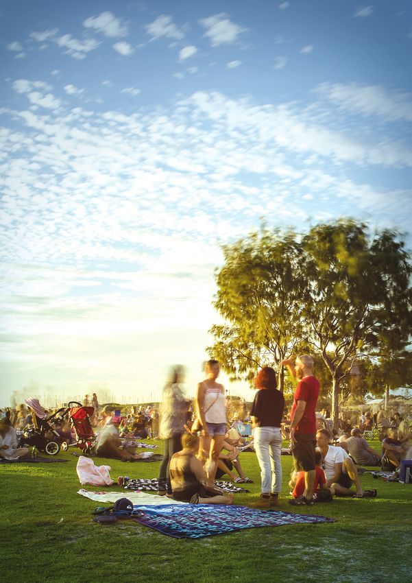
COMMUNITY INVOLVEMENT
OBJECTIVES
Community feedback through the Fremantle
2029 Community Visioning Project indicated
the local community is keen to participate in Meaningful engagement with community
community gardens, natural area maintenance/ for optimum green space outcomes across
regeneration and the care and development of community gardens, community led
our parklands and verges. The City recognises greening projects and supported volunteer
there are social capital benefits for ongoing initiatives.
participation by the community in these activities.
Continuous development of partnerships
There are a variety of ways the City currently with the community for the design and
supports community greening initiatives: implementation of redeveloped and/or new
»» Providing space for community gardens such green space.
as a roof top garden at the Administration Support the work of volunteers in enhancing
Centre and White Gum Valley Orchard the greening of the urban landscape
»» Volunteer support in revegetation and through social / community lead initiatives.
landscaping including coastal planting, natural
areas weed management and replanting
»» Annual community participation and well-
being grants ACTIONS
»» Community sponsorship rounds.
The City encourages community involvement in
3.1 Review and develop management
the design and development of our green spaces.
plans and programs for community group
Community and City partnership models include
participation in design, implementation
the community driven redevelopment of the
and ongoing management of POS and
Gold Street Park in South Fremantle. This project
other green spaces.
provided for community project management
and sponsorship as an alternative method of park 3.2 Provide and promote grant opportunities
redevelopment. This process promotes genuine for community partnering projects.
community collaboration for development 3.3 Develop the City’s capacity to assist
ownership and ongoing care of parks. “Friends of” and other groups for the
implementation of enhancement plans.
RELEVANT STRATEGY,
PLANS & POLICIES
One Planet
Community Engagement policy
Community Gardens Policy
Play Spaces Plan
Recreation Strategy
Master plans and concept plans
21City of Fremantle Greening Fremantle: Strategy 2020
PART 2: Greening Fremantle: Strategy 2020
URBAN FOREST Other mitigating actions are to reduce the
amount of hard surfaces under the sun’s influence
State government planning documents such as and to reduce the heat absorption properties
Liveable Neighbourhoods and The Urban Forest of those surfaces. Typically this can be done
of Perth and Peel detail urban forests provide: through planning policies and reducing the area
»» Reduction in air pollution of at-grade car-parking.
»» Control of storm water The need for more tree cover is acknowledged in
the City’s strategies and plans. However actions
»» Mitigation of wind and noise
related to such cover are limited to a commitment
»» Improved biodiversity to plant 1,000 trees per annum and general aims
»» Reduced UV exposure to be a more sustainable city. There needs to
be a more coordinated approach, including
»» Reduced heat island effect and
development and adoption of an Urban Forest
energy demand
Plan and review of relevant the urban planning
»» Enhanced sense of place and wellbeing and building policies to address UHIE.
»» Increased property values A review of nine international, national and state
»» Encouragement of outdoor activity. Urban Forest Strategies and Plans has informed
this strategy. All documents reviewed were
Across the world, extreme temperatures
unequivocal about the advantages of increasing
associated with global warming, deforestation
tree cover.
and urban development are significantly
impacting our cities and their inhabitants’ health Canopy Mapping
and wellbeing. The Urban Heat Island Effect
Detailed canopy mapping was undertaken in
(UHIE) is contributing to higher temperatures in
March 2015. This mapping provides a current
our cities and is defined as an urban area being
base line that will inform the analysis for an Urban
hotter (sometimes by several degrees) than
Forest Plan. It includes the Fremantle Ports area
surrounding rural areas.
to reflect the city wide vegetation and canopy
UHIE is caused by heat energy being absorbed cover (see vegetation cover figures).
into the thermal mass of hard surfaces such
Mapping and analysis included a breakdown of
as buildings and roads, which is then radiated
vegetation in height class from 0-3 metres, 3-10
back into the urban environment. This not only
metres, 10-15 metres and plus 15 metres:
means our cities are becoming hotter, they are
also becoming drier. Thermal currents generated »» The city has a total of vegetation cover of 25.2%.
by UHIE can force rain clouds away thus further »» The city has a total of 12% vegetation three
reducing a vital cooling mechanism. metres high or greater.
An effective way of combating UHIE is to »» The greatest area of vegetation is in the 0-3
promote the greening of our cities, particularly metre height class; grass, shrubs and low trees.
through tree cover which provides shade and an
evapotranspiration cooling effect. »» The suburb of Fremantle has the greatest total
cover of vegetation (170.7ha) and greatest
An urban forest is the total percentage cover of cover of vegetation taller than three metres.
trees and vegetation above three metres in height
»» O’Connor has the lowest cover of vegetation
in an urban environment, taken as a whole across
(19.0ha) due to the industrial area.
the public and private realm. Managing an urban
forest effectively can help address and assist »» North Fremantle has the lowest percentage
with mitigating against negative environmental cover of vegetation over three metres in
factors such as UHIE. Urban Forest Strategies and height 4.9% due to Fremantle Ports and other
Plans are being undertaken by local governments industrial land use.
across Australia to manage, conserve and develop
trees and vegetation.
23CITY OF FREMANTLE 2015 VEGETATION COVER
300.0
250.0
200.0
Area (HA)
150.0
100.0
50.0
0.0
0-3m
3-10m
10-15m
Height Clas s 15m+
BEACONSFIELD 2015 VEGETATION COVER FREMANTLE 2015 VEGETATION COVER
60.0 100.0
80.0
Area (HA)
Area (HA)
40.0
60.0
40.0
20.0 84 H A 171 H A
20.0
0-3m 0-3m
3-10m 3-10m
10-15m 10-15m
Height Clas s 15m+ Height Clas s 15m+
HILTON 2015 VEGETATION COVER NORTH FREMANTLE 2015 VEGETATION COVER
30.0 25.0
20.0
20.0
Area (HA)
Area (HA)
15.0
10.0 61 H A 10.0
40 H A
5.0
0-3m 0-3m
3-10m 3-10m
10-15m
15m+ 10-15m
15m+
Height Clas s Height Clas s
O’CONNOR 2015 VEGETATION COVER SAMSON 2015 VEGETATION COVER
10.0 25.0
8.0 20.0
Area (HA)
Area (HA)
6.0 15.0
4.0 10.0
19 H A 42 H A
2.0 5.0
0-3m 0-3m
3-10m 3-10m
10-15m 10-15m
15m+ 15m+
Height Clas s Height Clas s
SOUTH FREMANTLE 2015 VEGETATION COVER WHITE GUM VALLEY 2015 VEGETATION COVER
20.0 20.0
15.0 15.0
Area (HA)
Area (HA)
10.0 10.0
5.0 34 H A 5.0 36 H A
0-3m 0-3m
3-10m 3-10m
10-15m 10-15m
15m+ 15m+
Height Clas s Height Clas s
City of Fremantle
Greening Fremantle: Strategy 2020
PART 2: Greening Fremantle: Strategy 2020
In people’s front and back yards there are a great
number and variety of trees and vegetation that ACTIONS
contribute to the overall environmental and
social benefits of having green areas. There are
several ways to protect important trees on private 4.1 Undertake thermal mapping to identify
property. These vary from state to state but areas within the city susceptible to UHIE to
include Tree Preservation Orders, Significant Tree inform the Urban Forest Strategy.
registers, planning controls, incentive programs 4.2 Prepare and implement an Urban Forest
and education. Plan for the City including best practice/
The City’s Local Planning Scheme No. 4 and effective options to retain vegetation and
associated planning policies encourage the trees on private land.
retention of trees and/or significant vegetation. 4.3 Develop operational policy and
A Significant Tree Register and trees listed management practice for the identification,
under the Heritage Register also help identify management and population of the
and preserve important and large trees in our Significant Tree Register.
community. The strategy seeks to investigate
and implement the best fit option to enable the 4.4 Collaborate with major landowners and
retention of trees on private land as part of the operators to help them reduce the impact
development of an Urban Forest Plan. of UHIE on their land through landscaping,
particularly the planting of large tree
species.
OBJECTIVES 4.5 Review Council’s policy suite to consider
how best to promote the protection of trees
on private land and if appropriate develop
Progressively increase tree planting across further policies.
the city to achieve at least 20% canopy
coverage.
Support greening initiatives that mitigate
the environmental impacts and associated
RELEVANT STRATEGY,
effects of the UHIE.
PLANS & POLICIES
Apply a coordinated approach through
the City’s strategies, policy, plans and
development applications to target a SG28 Tree planting and preservation policy
reduction in UHIE. LPP 2.10 Landscaping or development and
Encourage the retention of vegetation on existing vegetation on development sites
private land. LPP 2.12 Planning applications impacting
Encourage the greening of exposed heat on verge infrastructure and verge trees
sink and winter cold urban hard surfaces LPP 2.9 Residential streetscape
such as car parks.
LPP 2.2 Split density codes and energy
efficiency and sustainability schedule
LPP 2.13 Sustainable buildings design
requirements
Foreshore reserves and management plans
Local Planning Scheme No. 4
Local area design policies and urban design
Verge Beautification Program
25City of Fremantle Greening Fremantle: Strategy 2020
PART 2: Greening Fremantle: Strategy 2020
WATER SECURITY
OBJECTIVES
The City takes seriously its duty to manage
irrigation water responsibly. It is important
for the City to consider ways in which water Green spaces are managed for optimum
for green spaces will be managed in light of function, amenity, fit for purpose water
reduced rainfall, finite groundwater resources, resource and water efficiency.
a drying climate, atmospheric moisture deficits
and increasing water demand. In 2013 the City The City plans for future water security to
adopted a Water Conservation Strategy to identify opportunities for best available
manage our water resources, which includes: water sources for existing and new open
space.
»» Implementing staged water management
actions for all City properties and recreation Water Sensitive Urban Design and best
facilities. water efficiency practice and principles
for achieving optimum green space
»» Set clear targets for reduced water usage and
outcomes are a primary criteria for meeting
improved water health in accordance with the
community fit for purpose green spaces.
State Water Strategy (Water Forever).
Options to use water efficiently in the City’s green
spaces have been explored, including;
»» Water requirement investigation for future ACTIONS
urban trees, open space and vegetation
»» Opportunities for water re-use and savings 5.1 Finalise water requirement demand
»» Water Sensitive Urban Design street planting modelling for existing and future open
infrastructure space and tree planting to inform feasibility
studies and planting staging plans for
»» Overview analysis of water use and water
effective water re - use and alternative water
cycles.
supply options.
As part of the One Planet Fremantle Strategy, the
City is committed to implementing the actions 5.2 Develop an assessment matrix tool for
identified in the Water Conservation Strategy alternative water supply options and/or
including investigating viable alternative water supply combinations for the City to apply to
source opportunities and implementing best green site planning and other City planting
practice water efficiencies. regimes.
The City has undertaken a water audit and re-use 5.3 Undertake assessment and feasibility
feasibility study for the Fremantle Leisure Centre of fit for purpose water supply options as
to build on the energy efficiencies achieved identified in the Water Security Investigation
with the recent pool heating system upgrade. and their application for existing and future
Investigations into the capture and re-use of grey green spaces and planting regimes in
water in City assets have also been completed. conjunction with the Water Conservation
Strategy (e.g. grey water re-use, sewer
Water efficiency and re-use opportunities are mining, commercial waste water re-use).
highlighted as part of the (re)development of
land under Local Planning Scheme No.4. Further,
the business case for the Knutsford East Structure
Plan redevelopment area considers objectives
RELEVANT STRATEGY,
of incorporating zero carbon/sustainability
PLANS & POLICIES
development, of which water re-use forms a part.
One Planet - sustainable water
Water Conservation Strategy
Climate Change Adaptation
27NATURAL LANDSCAPES, Some of the reserves such as Samson Park are
remnant bushland containing endemic species.
BIODIVERSITY AND LINKAGES Samson Park and a section of Cantonment Hill
The city has landscape areas that, although are Bush Forever sites and are protected under
historically have been modified, provide a state planning controls.
natural habitat for flora and fauna. These areas
The remnant bushland reserves are comparatively
include river foreshores, coastal areas and urban
small and require active management to
bushland such as Cantonment Hill and Samson
maintain their integrity. They are protected by
Park. These areas are important to provide a
management plans which include re-vegetation,
connection to nature in an urban setting and
maintenance and improvement programs.
areas to protect and enhance biodiversity. Links
between these areas are important to allow for Biodiversity
fauna movement, increase flora biodiversity and
Biodiversity is the variety of all life forms - the
improve amenity to encourage walking, cycling
different plants, animals and micro-organisms
and other transport modes across the city.
and the ecosystems of which they are a part.
Natural Landscapes Whilst the city is a highly urbanised and
developed environment, there are habitats and
Appropriate management and maintenance is
ecosystems that retain biodiversity. There are
required to enhance these ecological systems for
opportunities to enhance and improve these
current and future generations. The City has 10
areas and biodiversity links within and across the
natural Reserves under its management:
city.
1. Bathers Beach*
The City took part in the Western Australian
2. Port Beach* Local Government Association Local Biodiversity
Program as a member council of the South West
3. Leighton Beach*
Group which began in 1999 with the culmination
4. South Beach* of various guidelines, strategy methodologies
and detailed mapping and statistical data in
5. Booyeembara Park
2014. The Program was established to guide the
6. Cantonment Hill development and implementation of the 2013
Regional Natural Resource Management Strategy
7. Prawn Bay*
(NRMS). As part of the program, mapping and
8. Rocky Bay* analysis was undertaken at a regional level to
identify biological areas and links.
9. Swan River Foreshore*
This program identified 8 areas in the city as
10. Samson Park
Areas of Priority Conservation Action. These areas
* Part of the regional Reserve system and reflect the City’s natural area reserves currently
are managed in conjunction with the State under management, with the exception of
government and include management orders Clontarf Hill and the Hollis Park area.
and plans.
Biodiversity includes the retention and
Whilst not currently under City management, the enhancement of habitat areas for local flora and
strategy identifies Main Roads WA property of fauna. Local flora and fauna habitat creation is
Clontarf Hill as a natural space which also forms a encouraged on private and public land. Through
link through to South Beach. the South West Group, the City actively engages
with other local governments, State government
The majority of these reserves have been altered
and non-government organisations on
through historic land use practices. Subsequently
opportunities and programs to retain and attract
they are regenerated landscapes that emulate, as
local flora and fauna to the area.
far as practical, the original native environment.
City of Fremantle
Greening Fremantle: Strategy 2020
PART 2: Greening Fremantle: Strategy 2020
Linkages
As part of the plan the City is working with the ACTIONS
South West Group to determine how best to
protect and enhance natural landscapes and
biodiversity linkages to create fauna and flora 6.1 Develop road reserves to enhance and
habitats at a local and regional scale. The Local link natural areas for retaining ecosystems,
Biodiversity Program mapping identifies 3 main reducing water use and beautification.
Regional Ecological links and 3 Local Linkages 6.2 Prepare planting plans for green links as
across the city. These links are identified in the identified in map 3 including design factors
local Green Links identified by this plan, which such as biodiversity links and links between
provide an ecological and biodiversity function green spaces and activity centres.
(see map 3).
6.3 Continue active participation in the
As well as performing an environmental function, SWG and assist delivery of NRMS i.e. NRM
the links identified in the plan also function to facilitator and Coast Care facilitator network.
connect green spaces and POS across the city
and to encourage walking and cycling to and 6.4 Develop a biodiversity plan which
from commercial, community and recreation identifies critical ecological communities
activity nodes. with recommendations for protection and
enhancement.
OBJECTIVES
RELEVANT STRATEGY,
Develop links that increase the amount of PLANS & POLICIES
flora/vegetation cover and increase habitats
for native fauna and encourage their
movement between green spaces. One Planet - land use and wildlife
Increase and improve linkages between Trail Strategy
green spaces and areas of biodiversity. Reserve management plans
Ensure biodiversity areas and links are Verge Beautification Program
protected and/or managed and integrated
into development so as to maintain function Master plans and concept plans
and integrity. Structure plans / redevelopment areas
Provide connectivity and encourage walking Annual Tree Planting Program
and cycling between green areas and POS
and between activity nodes and centres. Volunteer Policy
291
11
1O
ST
MAP 3
IR
LI
PORT BEACH
N
G GREEN LINKS
2
H
TY
W
DE
Y
MA
N RD
D
HR
AC
BE
RT
PO
WY
N GH
CAN NI
UR
O
RB
HA
E
TL
AN
4
EM
13
FR
3
HIGH ST
14
12
15 16
5
6
17
WR
AY
FISHING BOAT
AV
E 18
HARBOUR
SOUTH ST
K RD
STOC
7
8
CARRINGTON ST
SOUTH TC
HA
MP
E
TO
N
RD
SOUTH BEACH
9
SOURCE DATA:
SOURCE CITY CITY
DATA: OF FREMANTLE
OF FREMANTLE
BASE MAP: GEOSCIENCE AUSTRALIA
LEGEND
Central Fremantle
Schools
Public Open Space
Green Linkages
City of Fremantle
LGA Boundary
City of Fremantle
Greening Fremantle: Strategy 2020
PART 2: Greening Fremantle: Strategy 2020
GREEN LINK FUNCTIONS MATRIX
EAST - WEST LINKS FUNCTION
Coventry Pde, Stirling Hwy,
Pedestrian
McCabe St
Tydeman Rd Pedestrian, Cyclist
Ellen St Pedestrian, Regional Biodiversity
Forrest Rd Local Biodiversity
Fothergill St Pedestrian, Green Space
Howard St, Stevens St Pedestrian, Regional Biodiversity
Pedestrian, Cyclist, Regional &
Sydney St, Lefroy Rd
Local Biodiversity
Rennie Cres, Holmes Pl, Pedestrian, Cyclist, Local
Snowden Dr, McCombe Ave Biodiversity, Green Space
Regional Biodiversity,
Hollis Park
Green Space
NORTH - SOUTH LINKS FUNCTION
Pedestrian, Regional Biodiversity,
Port Beach Road
Cyclist
North Fremantle River Foreshore Regional Biodiversity
Marine Terrace, Waterfront, Pedestrian, Regional Biodiversity,
Beach Street Cyclist
Ord Street Pedestrian, Cyclist, Green Space
Parry Street Pedestrian, Green Space
Swanbourne Street Pedestrian, Green Space
Montreal Street Regional Biodiversity
Carrington Street Pedestrian, Green Space
Wiluna Avenue, Lewington Street,
Regional Biodiversity
Redevelopment Area
31City of Fremantle Greening Fremantle: Strategy 2020
PART 2: Greening Fremantle: Strategy 2020
IMPLEMENTATION & REVIEW
The strategy has a five year action plan that will Progress reporting of the plan to the Executive,
be implemented from the 2015/16 financial year Committee and/or Council will be determined as
through to the 2019/20 financial year. Projects part of project planning. At the end of the five
arising from the actions identified under each year program the strategy will be reviewed and
focus area will be implemented in accordance mapping will be undertaken to ascertain if the
with the table below. targets have been met.
FOCUS SHORT MEDIUM LONG
ACTION
AREA TERM TERM TERM
GREEN SPACE TYPES
1.0 2015/16 2016/17 2017/18 2018/19 2019/20
AND USE
1.1 Investigate and identify options for
accessing functional POS in the priority
areas of Beaconsfield, Hilton, O’Connor,
White Gum Valley and North Fremantle
COMPLETE
1.2 Investigate and identify options to
improve the quality and/or expand
functional POS within 400m of
future high density (R60 or above)
development.
FOCUS SHORT MEDIUM LONG
ACTION
AREA TERM TERM TERM
2.0 GREEN SPACE DESIGN 2015/16 2016/17 2017/18 2018/19 2019/20
2.1 Develop guidelines for landowners and
developers on the City’s requirements
for open space, water sensitive urban
design and landscaping.
2.2 Pending the outcome of 1.1 design and
construct new POS and/or open space
in the priority areas of Beaconsfield,
Hilton, O’Connor, White Gum Valley and
North Fremantle.
2.3 Provide direction, advice and support
in the design and implementation
of public reserves and public/private
open spaces to encourage and support
community uses.
33You can also read