City of Sparks Jurisdiction-Specific Annex - Washoe County Regional Hazard Mitigation Plan - 2020 Plan Update
←
→
Page content transcription
If your browser does not render page correctly, please read the page content below
City of Sparks Jurisdiction-Specific Annex – Washoe
      County Regional Hazard Mitigation Plan

                2020 Plan Update
City of Sparks             Washoe County Multi-Jurisdictional Hazard Mitigation Plan
                                                                Jurisdictional Annex

                 THIS PAGE LEFT INTENTIONALLY BLANK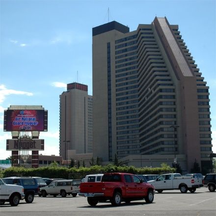
City of Sparks                                                                      Washoe County Regional Hazard Mitigation Plan
                                                                                                               Table of Contents

TABLE OF CONTENTS
1. Introduction......................................................................................................................................... 1-1
      1.1     City of Sparks Hazard Mitigation Program ................................................................................. 1-1
      1.2     What’s New in the 2020 Update? .............................................................................................. 1-1
      1.3     Plan Adoption............................................................................................................................. 1-2
2. Community Profile............................................................................................................................... 2-1
      2.1     Governance ................................................................................................................................ 2-1
      2.2     Geography and Climate ............................................................................................................. 2-3
      2.3     Population and Demographics ................................................................................................... 2-3
      2.4     Economy..................................................................................................................................... 2-4
      2.5     Land Use and Ownership Trends ............................................................................................... 2-5
      2.6     Natural Resources ...................................................................................................................... 2-6
      2.7     Cultural Resources and Values ................................................................................................... 2-6
3. Hazard Profiles and Vulnerability Asessments .................................................................................... 3-1
      3.1     General ....................................................................................................................................... 3-1
      3.2     Hazard Ranking Methodology.................................................................................................... 3-2
      3.3     Hazard-Specific Profiles and Risk Assessments.......................................................................... 3-2
               3.3.1       Wildland Fire................................................................................................................. 3-4
               3.3.2       Energy Emergency ........................................................................................................ 3-5
               3.3.3       Severe Storms (Windstorm) ......................................................................................... 3-7
               3.3.4       Earthquake.................................................................................................................... 3-8
               3.3.5       Flooding ...................................................................................................................... 3-10
               3.3.6       Severe Storms (Winter Storm) ................................................................................... 3-12
               3.3.7       Criminal Acts and Terrorism ....................................................................................... 3-14
      3.4     Vulnerability Assessment ......................................................................................................... 3-16
               3.4.1       Asset Inventory ........................................................................................................... 3-16
               3.4.2       Repetitive Loss Properties .......................................................................................... 3-16
               3.4.3       Exposure Assessment ................................................................................................. 3-16
      3.5     Land Use and Development Trends ......................................................................................... 3-19
4. Capability Assessment ......................................................................................................................... 4-1
      4.1     Human and Technical Resources ............................................................................................... 4-1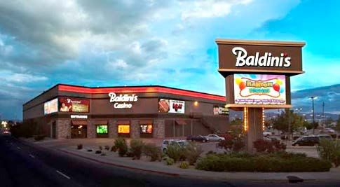
City of Sparks                                                                     Washoe County Regional Hazard Mitigation Plan
                                                                                                              Table of Contents

      4.2     Financial Resources .................................................................................................................... 4-1
      4.3     Legal and Regulatory Resources ................................................................................................ 4-4
      4.4     National Flood Insurance Program Participation ....................................................................... 4-5
      4.5     Integration of Mitigation into Existing Planning Mechanisms ................................................... 4-6
               4.5.1       Existing Plans ................................................................................................................ 4-6
5. Mitigation Strategy .............................................................................................................................. 5-1
      5.1     Review of 2015 Hazard Mitigation Actions ................................................................................ 5-1
      5.2     2020-2025 Mitigation Implementation Plan ............................................................................. 5-1
6. References ........................................................................................................................................... 6-1
City of Sparks Washoe County Regional Hazard Mitigation Plan
1. Introduction
1. INTRODUCTION
1.1 City of Sparks Hazard Mitigation Program
The City of Sparks has a fully integrated approach to hazard mitigation planning and program imple-
mentation. Throughout the 2020 update process, the following Hazard Mitigation Plan (HMP)
participation roles were recorded:
Name Position Role in Hazard Mitigation
Mark Meranda Building Official Mitigation Program Lead
Michael Drinkwater Treatment Plant Manager
Brian Cason Capital Projects Manager
Armando Ornelas Assistant Community Services Director Subject Matter Expert and program
Pete Krall Police Chief implementation
Jim Reid Fire Chief
Jon Ericson City Engineer
1.2 What’s New in the 2020 Update?
With the 2020 HMP update, Washoe County and its regional partners have recognized changes in
planning priorities by placing an added emphasis on incorporating actionable strategies in the mitigation
implementation plan and moving away from including ongoing coordination activities. Recent disasters
and emerging hazards have also influenced the planning priorities and development of mitigation
actions for the 2020 HMP update.
In the years since the release of the 2015 HMP, the city has undergone near constant change—with a
growing population, some vulnerabilities have increased, while others have been effectively mitigated
to an acceptable level. New development in the city has primarily occurred in the Spanish Springs Valley,
which is more prone to wildland fire hazards. Mitigation actions have been added in the 2020 HMP
update to reflect the increase in priority of actions to address wildland fire hazards.
The 2020 update of the HMP includes the following major revisions to the 2015 plan:
Incorporation of additional hazards and more comprehensive risk assessments (see Chapter 3);
Expanded capability assessment (see Chapter 4);
Integration of hazard mitigation planning into existing mechanisms (see Section 4.5); and
Comprehensive and focused mitigation strategy with prioritized mitigation actions (see Chapter
5).
See Appendix C in the Basic Plan for the completed Federal Emergency Management Agency (FEMA)
Local Plan Mitigation Review Tool for the Washoe County Regional HMP.
1-1City of Sparks Washoe County Regional Hazard Mitigation Plan
1. Introduction
1.3 Plan Adoption
44 CFR §201.6(c)(5) requires that the HMP be formally adopted by elected officials from each
participating jurisdiction. City Council formally adopted the 2020 update of the Washoe County Regional
HMP on [Date].
This HMP was approved by FEMA Region IX on [Date]. A copy of the City of Sparks’ adoption resolution
is included in Appendix H of the Basic Plan.
1-2City of Sparks Washoe County Regional Hazard Mitigation Plan
2. Community Profile
2. COMMUNITY PROFILE
2.1 Governance
The city of Sparks was established as a planned community by the Southern Pacific Railway Company
(Southern Pacific), and incorporated in 1905. The City of Sparks government operates using a council/
manager form of government, under which the mayor and city council make policy decisions that are
implemented by the city manager and staff. The mayor and the five members of city council are elected
for staggered four-year terms.
The City is organized into the following departments and offices, which oversee a variety of divisions and
programs:
Building Permits Government Affairs
Business License Department Housing Program
City Attorney’s Office Human Resources
City Clerk and Records Management Maps and Geographic Information
City Manager’s Office System (GIS) Resource Portal
Code Enforcement Parks & Recreation
Community Services Planning and Zoning
Customer Service Police Department
Engineering Services Public Information/Community
Environmental Control Section Relations
Financial Services Purchasing
Fire Department Public Works
Fire Prevention Bureau Sparks Municipal Court
2-1City of Sparks Washoe County Regional Hazard Mitigation Plan
2. Community Profile
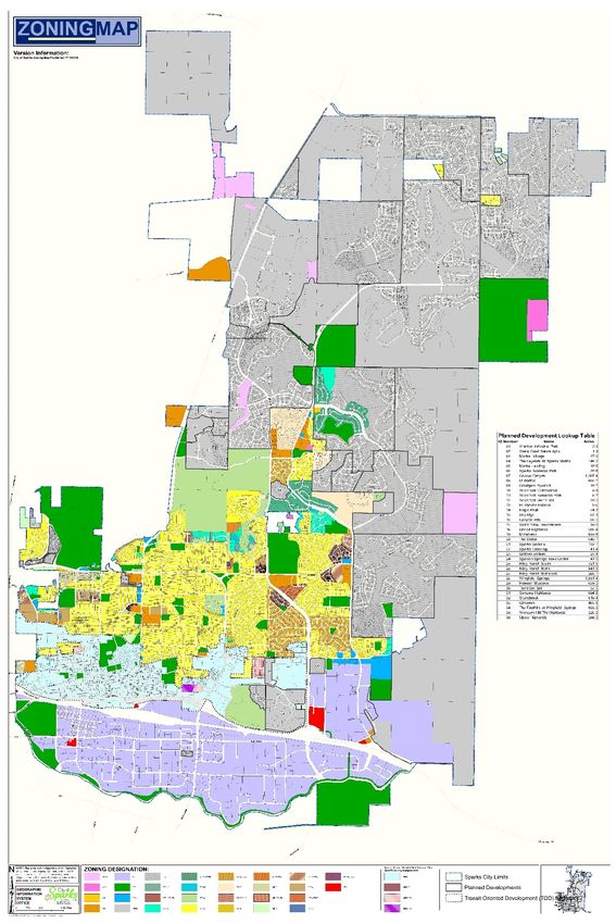
City of Sparks Zoning Map (2018 City GIS Services)
2-2City of Sparks Washoe County Regional Hazard Mitigation Plan
2. Community Profile
2.2 Geography and Climate
Sparks is located at 4,410 feet above sea level in the semi-arid Truckee Meadows basin, situated
between the Sierra Nevada range and the Great Basin. The city covers approximately 36 square miles
east of the city of Reno. Interstate 80 (I-80) crosses the southern part of the city from east to west, and
the Truckee River forms most of the city’s southern boundary. The oldest parts of the city are located in
the south between the railroad line and the river. Starting in the 1970s, commercial and residential
development began to spread to areas north and east of downtown, and during the 1990s, Sparks
expanded its city limits northward into the Spanish Springs Valley.
The Truckee Meadows region has a semi-arid climate, with summer highs averaging in the 80s
(Fahrenheit) to low 90s and winter lows in the 20s. The region generally experiences low humidity and
precipitation, though severe snowstorms and heavy precipitation can occur.
2.3 Population and Demographics
The 2010 Census recorded a population of 90,264 people in the city of Sparks (U.S. Census Bureau
n.d.[a]). Between 2010 and 2017, the population grew by approximately 12%, resulting in an estimated
2017 population of 100,878 people (U.S. Census Bureau 2017a).
Table 2-1 City of Sparks Demographic Characteristics
Nevada (%)
City of Sparks (%)
(2017)
Population by age, 2017
Under 10 years old 10% 13%
Under 20 years old 22% 25%
60 years and older 24% 21%
Women, 2017 50% 50%
Race/Ethnicity, 2017
White 60% 49%
Black 1% 9%
American Indian, Alaskan Native 1% 1%
Asian, Native Hawaiian, other Pacific Islander 6% 9%
Hispanic or Latino, any race 28% 29%
Source: U.S. Census Bureau 2017a,b
As of 2017, an estimated 5.5% of Sparks’s population under the age of 65 years is disabled, and 3.4% of
the city’s population under age 65 do not have health insurance (U.S. Census Bureau 2017c). The
median household income in 2017 was $58,961, with 8.3% of the city’s population living in poverty. In
the time range between 2013 and 2017, approximately 25% of children between ages 5 and 17 and 25%
of people over the age of 18 spoke a language other than English at home (U.S. Census Bureau 2017a).
As of 2017, the city of Sparks had 41,471 housing units, of which 55% are owner-occupied. The median
value of owner-occupied homes is $305,800 (U.S. Census Bureau 2017a). During this time, 95% of
households owned a computer, and 87% had a broadband internet subscription (U.S. Census Bureau
2017d).
2-3City of Sparks Washoe County Regional Hazard Mitigation Plan
2. Community Profile
The 2017 American Community Survey 1-year estimates reported that approximately 65.4% of the
population over 16 years old within the city was employed and 4.0% of the population over 16 years old
was unemployed (U.S. Census Bureau n.d.[a]). Per capita income in the city in 2017 was $31,254, and
approximately 8.3% of the city’s population lived below the poverty line (U.S. Census Bureau 2017).
2.4 Economy
In 2009 Business Week named Sparks the number one city in Nevada to start a new business. Nevada
has no corporate income or gross receipts taxes, which supports economic development.
By employment, the largest sectors of Sparks’s economy are the service sectors of entertainment, hotel,
and food services, followed by education. Construction also plays a major roll. The city has benefited
from recent development of advanced manufacturing and technology facilities in the Reno-Sparks
metropolitan area, which has resulted in a period of job growth (City of Sparks 2016).
Downtown is a redevelopment district.
BUSINESS HIGHLIGHT
El Rancho Flea Market
Baldini’s Sports Casino and Restaurant
Nugget Casino
2-4City of Sparks Washoe County Regional Hazard Mitigation Plan
2. Community Profile
2.5 Land Use and Ownership Trends
According to its Comprehensive Plan, the City of Sparks experienced 38% growth from 2000 to 2010 and
an additional 4% from 2010 to 2015. “People who live in Sparks appreciate its quality of life and small-
town feel. Sparks is known as the premiere special events venue for northern Nevada, hence the City
Slogan “It’s Happening Here.” Most properties in the city are privately owned. The City of Sparks owns
and operates public facilities, including government administration facilities; City parks and open space;
public works facilities and utilities, including the Truckee Meadows Water Reclamation Facility (jointly
owned with the City of Reno); libraries; and fire and police stations.
The Comprehensive Plan provides the following information (City of Sparks 2016):
“As of January 2016, Sparks covers approximately 36 square miles with an estimated current population
of 93,581 (Source: Nevada State Demographer). Situated at 4,410 feet above sea level in a semiarid
valley, daily temperatures are temperate with daily highs and lows varying by as much as 45 degrees
Fahrenheit. The sun shines roughly 290 days a year, or eight of every 10 days. Annual precipitation
averages 8.26 inches per year. Sparks has four seasons with a relatively short growing season.
Sparks is one of two incorporated cities within Washoe County (County). The other city is Reno. Sparks is
connected to the western United States by U.S. 395, Interstate 80 and the Union Pacific Railroad and is
served by the Reno-Tahoe International Airport.
Older housing is located within the vicinity of downtown while most of the newer housing is located in
the Spanish Springs Valley. Single family detached houses make up approximately 64 percent of the
housing stock. The City of Sparks utilizes a strong city manager form of government. The city manager
reports to the mayor and a five-member city council.”
Historically—in the early 1900s—the area was just swampland and ranches. When Southern Pacific
altered its railroad lines, they offered incentives for employees to move to lots in what became Sparks in
1905. Sparks remained small until growth in Reno pushed populations outward in the 1950s. “In the
1970s, the area south of the railroad to the Truckee River started to develop with warehouses and
industry and in time became the main employment area for Sparks. During the 1970s, Sparks experi-
enced a housing boom in the area north and east of its downtown, which continued into the 1980s.”
Numerous commercial spaces were developed in the decades that followed, including a high-rise
hotel/casino, movie complex, and public plaza. By the 1990s city limits were expanded northward to
Spanish Springs Valley, which continues to grow with 15 approved developments.
In 1997, a 77-acre lake was developed. “From 1999 through 2006, the City of Sparks experienced an
upward trend in revenue, number of building permits, jobs and new businesses. The number of both
building permits and planning cases peaked in 2006. Starting in 2007, City revenues and the number of
building permits and planning cases, all indications of a growing economy, began to contract. The Great
Recession, which proved to be more severe and last longer that in many parts of the United States, had
come to Sparks.
2-5City of Sparks Washoe County Regional Hazard Mitigation Plan
2. Community Profile
Consolidated Taxes (the primary component of which is sales taxes), a major source of revenue for the
City’s general fund, dropped for the first time ever in 2007. This was followed by a six-year decline in
total General Fund revenue. Nationally, the Great Recession is recorded as lasting from December 2007
to June 2009, but not until 2014 did Sparks begin to see an increase in revenues. During those tough
years, one third of city personnel were laid-off. The City is still recovering, but it has not significantly
increased personnel or City services.”
2.6 Natural Resources
The following major natural systems are present in the Truckee Meadows basin:
Geology: The city of Sparks and Washoe County are located on the western edge of the
geological formation known as the Great Basin, which is part of the Basin and Range geological
province. The Basin and Range Province is characterized by high desert punctuated by rows of
mountain ridges that run roughly north to south. As these mountain ridges push up through the
earth’s crust, they can cause earthquakes, making this region one of the most earthquake prone
in the United States. These ridges also create a closed basin, meaning water that falls within the
basin stays there until it evaporates or is removed through human activity (Earth Observatory
n.d.).
Watersheds: Sparks lies within the Truckee River watershed. The Truckee River flows 140 miles
from Lake Tahoe to Pyramid Lake, north of Sparks. The river drains an area of 3,120 square miles
in western Nevada and eastern California. The basin includes 11 major streams that drain into
the river. Most of the river flow is allocated to users through a system of user rights set out in
the Truckee River Operating Agreement (2015).
Wildlife: Species that are native to lower montane woodlands and sagebrush habitats in the
Truckee Meadows region include raptors like the ferruginous hawk and bald eagles, bats,
sparrows, burrowing owls, lizards, small mammals such as the dark kangaroo mouse and kit fox,
mule deer, pronghorn antelope, and sage grouse. Natural communities and open spaces con-
tribute to the region’s scenic character and provide recreational opportunities for residents
(Washoe County 2008).
2.7 Cultural Resources and Values
Cultural resources can be defined as the “physical evidence or place of past human activity: site, object,
landscape, structure; or a site, structure, landscape, object or natural feature of significance to a group
of people traditionally associated with it” (National Park Service 2015). Evidence of long-term human
inhabitation of the Truckee Meadow region still exists in archaeological sites, including rock art, seasonal
camps, and residential communities, and the artefacts that may be found at these sites. The region was
part of the territory of the Northern Paiutes, who inhabited and moved between a variety of habitats.
Historic buildings within the city that are older than 50 years and eligible for listing in the National
Register of Historic Places also are considered cultural resources and important contributors to the city’s
character (City of Sparks 2016).
2-6City of Sparks Washoe County Regional Hazard Mitigation Plan
2. Community Profile
Most cultural sites in the city have not been mapped or surveyed, which can lead to the degradation of
these sites if they are developed. Private development has the potential to degrade archaeological sites
because federal and state regulations do not require protection of cultural resources on private
property. Unregulated use of off-road vehicles, mountain bikes, or hiking can also damage
archaeological sites (City of Sparks 2016).
2-7City of Sparks Washoe County Regional Hazard Mitigation Plan
3. Hazard Profiles and Vulnerability Assessments
3. HAZARD PROFILES AND VULNERABILITY ASESSMENTS
Chapter 3 contains hazard profiles and vulnerability assessments to determine the potential impact of
hazard to the people, economy, and built and natural environments of the city of Sparks. They have been
streamlined to increase the effectiveness and usability of the HMP. Additional details are contained
within Appendix F in the Basic Plan.
B1. Does the Plan include a description of the type, location, and extent of all natural
hazards that can affect [the City of Sparks]? (Requirement §201.6(c)(2)(i))
B2. Does the Plan include information on previous occurrences of hazard events and on the
probability of future hazard events for [the City of Sparks]? (Requirement §201.6(c)(2)(i))
B3. Is there a description of each identified hazard’s impact on the community as well as an
overall summary of the community’s vulnerability for each jurisdiction? (Requirement 44
CFR 201.6(c)(2)(ii))
3.1 General
Washoe County has experienced several major disaster declarations that may have affected the city of
Sparks. In total, the County has received 20 major disaster declarations, including four since the previous
HMP update. Table 3-1 identifies the declarations since 2015 that affected the city of Sparks.
Table 3-1 Major Disaster Declarations in Washoe County Since 2015
Individual Public
Hazard M
Disaster Assistance Assistance Declaration
Program Title
Number Program Program Date
Declared
Declared Declared
4307 No Yes Yes 3/27/2017 Severe Winter Storms, Flooding, and
Mudslides
4303 No Yes Yes 2/17/2017 Severe Winter Storms, Flooding, and
Mudslides
4303 No Yes Yes 2/17/2017 Severe Winter Storms, Flooding, and
Mudslides
4303 No Yes Yes 2/17/2017 Severe Winter Storms, Flooding, and
Mudslides
Source: FEMA 2019
The hazard profiles and vulnerability assessments contained in this annex represent a considerable
amount of work performed by the Mitigation Planning Team (MPT). Planning Team members ranked
hazards using several key considerations, followed by activities to validate hazard analysis results and
identify specific areas of risk. Table 3-2 displays the high-priority hazards that City of Sparks representa-
tives to the MPT selected for further assessment.
Refer to the HMP Basic Plan for regional risk assessments for moderate and low-priority hazard profiles.
3-1City of Sparks Washoe County Regional Hazard Mitigation Plan
3. Hazard Profiles and Vulnerability Assessments
Table 3-2 Hazards Addressed in Plan
Hazard Type Hazard Name
Wildland Fire
Natural Hazards Severe Storms (Windstorm)
Earthquake
Human-Caused Hazards Criminal Acts and Terrorism
Technological Hazards Energy Emergency
3.2 Hazard Ranking Methodology
The hazards identified in the HMP were initially ranked based on MPT feedback during MPT Meeting #1.
Following the individual hazard ranking activity, the results were added up and aggregated to show an
average score for all City of Sparks MPT members (Table 3-3).
3.3 Hazard-Specific Profiles and Risk Assessments
The following sections profile and assess the risks associated with hazards that are high planning
priorities for the City of Sparks, which are hazards that were scored an average of 3.00 or higher during
the hazard ranking activity. No natural hazards that have the potential to affect the city were omitted
from the initial hazard assessment and ranking activity. The hazard profiles and risk assessments align
with EMAP standards by focusing on hazards with a high magnitude or high probability. Each risk
assessment considers the following attributes:
Location: An indication of geographic areas that are most likely to experience the hazard.
Past Occurrences/History: Similar to location, a chronological highlight of recent occurrences of
the hazard accompanied by an extent or damage cost, if available.
Extent/Probability: A description of the potential magnitude of the hazard, accompanied by the
likelihood of the hazard occurring (or a timeframe of recurrence, if available).
Vulnerability: A description of the potential magnitude of losses associated with the hazard.
Vulnerability may be expressed in quantitative or qualitative values depending on available data.
Identifies development trends’ impact on the city’s vulnerability to each hazard since the 2015
plan development (Increased, decreased, unchanged).
Note: Hazard Descriptions, Potential Impacts from Future Climate Conditions, and Cascading Impacts can
be found in Section 4 of the HMP Basic Plan, as these are not place-specific.
3-2City of Sparks Washoe County Regional Hazard Mitigation Plan
3. Hazard Profiles and Vulnerability Assessments
Table 3-3 City of Sparks Hazard Rankings
Jurisdiction: City of Sparks - Hazards
Probability Magnitude Frequency Onset Duration Change in Risk
(1=lowest, (1=lowest, (1=lowest, (1=slowest, (1=shortest, (↑, ↓, ↔ Average Rank
5=highest) 5=highest) 5=highest) 5=fastest) 5=longest) since 2015)
Wildland Fire 4.00 3.00 4.00 4.00 2.00 1.00 3.75 1
Energy Emergency 3.00 2.00 5.00 5.00 3.00 1.00 3.75 1
Severe Storms (Windstorm) 4.00 2.00 5.00 3.00 2.00 0.00 3.50 3
Earthquake 4.00 4.00 1.00 5.00 1.00 1.00 3.50 3
Flooding 4.00 3.00 3.00 3.00 3.00 0.00 3.25 5
Severe Storms (Winter Storm) 4.00 2.00 4.00 3.00 3.00 0.00 3.25 5
Criminal Acts and Terrorism 3.00 3.00 2.00 5.00 2.00 1.00 3.25 5
Avalanche and Landslide
(Landslide) 2.00 2.00 1.00 5.00 1.00 0.00 2.50 8
Hazardous Materials Incident 2.00 2.00 1.00 5.00 2.00 0.00 2.50 8
Drought 4.00 1.00 2.00 1.00 5.00 1.00 2.00 10
Infectious Disease 1.00 3.00 2.00 2.00 4.00 -1.00 2.00 10
Note: Radiological waste transport and volcano hazards were not initially ranked by the MPT. In subsequent meetings, these hazards were identified as low probability but
potentially high magnitude hazards. Risk assessments for both hazards are included in Section 4.5 of the Basic Plan. Avalanche and Landslide and Transportation Incident
(Aircraft Crash) were not identified as hazards for Sparks.
3-3City of Sparks Washoe County Regional Hazard Mitigation Plan
3. Hazard Profiles and Vulnerability Assessments
3.3.1 Wildland Fire
Wildland Fire
Probability Magnitude Frequency Onset Duration Average Rank
4.00 3.00 4.00 4.00 2.00 3.75 1
Location
South of Baring Boulevard and N. McCarran Boulevard, Sparks is largely built out. Developed proper-
ties and open spaces in this part of the city have a very low to moderate potential for wildland fire.
Since the 1990s, development has spread from the city’s urban center north into areas of increased
fire risk. Wildland-urban interface (WUI) areas occur in the foothills of the northern and eastern parts
of the city, where the potential for wildland fire is rated between moderate and very high. As residen-
tial development occurs in the foothills, more homes are located in areas of increased fire risk in the
WUI. For example, in the Spanish Springs Valley north of Vista Boulevard, residential development has
occurred in an area with high to very high fire potential.
Past Occurrences/History
Past wildland fires within the city between 2015 and 2018 are listed below. This information supple-
ments the past wildland fire occurrences that may have affected the city listed in Section 4.5.1 of the
Basic Plan.
The Earthstone Fire in 2017 burned 41,515 acres in the northeastern part of the city. This fire
was determined to be human caused.
The Prater Fire in 2017 burned 2,816 acres in the eastern part of the city near the foothills.
The cause of this fire has not been determined.
The I-80 Fire in 2017 burned 514 acres adjacent to I-80 on the southern edge of the city. The
cause of this fire has not been determined.
The S Fire in 2016 burned 2,554 acres in the southeastern part of the city near the foothills.
The cause of this fire has not been determined.
Extent and Probability
As economic growth continues to increase demand for residential and commercial growth, more
development is likely to occur in the foothills east of the city center and to the north in the Spanish
Springs Valley. Increased development in these areas increases the risk that future wildland fires will
cause damage to structures, including homes and businesses.
In Washoe County, wildland fires are frequent and inevitable due to the arid climate, availability of
fuels such as sagebrush, rabbit brush, and cheat grass, and mountainous terrain (City of Sparks 2016).
The vast majority of wildland fires burn between June and October. While Washoe County experi-
ences wildland fires nearly every year, fewer fires have historically occurred in the city of Sparks. No
fires were recorded in the city between 2002 and 2015. Based on recent historic occurrences of
wildland fires, there is an estimated 10% to 15% chance of a wildland fire occurring in the city each
year.
Future Probability Trend – Based on projected changes in the timing and quantity of snowmelt and
increases in the frequency and magnitude of drought and extreme heat, the city may be impacted by
an increase in the probability of future wildland fires.
3-4City of Sparks Washoe County Regional Hazard Mitigation Plan
3. Hazard Profiles and Vulnerability Assessments
Wildland Fire
Vulnerability
As development continues to increase in the WUI, the risk of wildland fire damage to homes and
other structures will increase. New development in the Spanish Springs Valley has extended the
response area for the city’s fire department, resulting in longer response times that may increase the
city’s vulnerability to wildland fires. Currently, the city relies on the Truckee Meadows Fire Protection
District to provide fire response in areas of the Spanish Springs Valley through a mutual aid agree-
ment. Mitigation action AH-5, discussed in Section 5, is designed to address this vulnerability.
Property
Critical facilities in the city are in areas of very low wildland fire potential.
Recent Development Trends
Economic: Continued economic development across the region is likely to result in additional
population growth in Sparks, increasing the demand for fire response services. (Increased
Vulnerability)
Land Use: Residential development has increased in the Spanish Springs Valley and foothills
near the edges of the city, which have a moderate to very high potential for wildland fire.
(Increased Vulnerability)
Future Land Use
Future development is planned in areas with a moderate to very high potential for wildland fire.
Mitigation action AH-5 would somewhat reduce this increased vulnerability by constructing a new fire
station in the northern part of the city, reducing response times to locations in the Spanish Springs
Valley.
See Appendix F in the Basic Plan for maps.
3.3.2 Energy Emergency
Energy Emergency
Probability Magnitude Frequency Onset Duration Average Rank
3.00 2.00 5.00 5.00 3.00 3.75 1
Location
Any area of the city may potentially be impacted by an energy emergency or power outage. Sparks is
an urban area, and sufficient redundancy in electrical infrastructure exists in most areas of the city to
prevent widespread power outages as a result of localized damage to the power system.
Past Occurrences/History
Historically, power outages have been caused by natural events and human-caused accidents, but
have not been recorded in a way that is publicly accessible. Numerous power outages occur every
year and may last as short as hours or as long as weeks. A recent power outage in July 2019 affected
3-5City of Sparks Washoe County Regional Hazard Mitigation Plan
3. Hazard Profiles and Vulnerability Assessments
Energy Emergency
more than 7,000 customers in Sparks until electrical service was restored to all customers approxi-
mately 11 hours later. Previous longer-duration power outages have led to temporary increases in
welfare checks and needs for medical care, as well as negatively impacting local economic interests.
Interruptions in energy services may also be planned, for example to allow for system repairs or
maintenance. In 2019, NV Energy and Pacific Gas and Electric Company (PG&E) (in California) began
implementing extensive public safety outage management programs in areas with extreme fire risks.
To prevent downed power lines and damaged equipment from causing fires, these electric providers
may de-energize parts of the electrical grid during weather conditions conducive to wildland fires
(e.g., high temperatures, low humidity, high winds, lightning storms) or based on field observations or
information from first responders (NV Energy 2019). Planned outages have the potential to affect fuel
availability for Washoe County. Outages affecting PG&E’s system would cut power to the equipment
that controls operation of the fuel pipeline serving the region.
Extent and Probability
It is difficult to predict the impacts of future energy emergencies, but they have the potential to
impact all government and business operations and cause extensive economic losses, among other
impacts. Due to the sporadic nature of power outages and other energy emergencies, it is also
difficult to estimate how frequently such failures will occur, or their duration. The city’s electric
provider, NV Energy, generally deals with power outages multiple times per year, with many of
them only lasting a matter of hours. Every several years, more significant power outages are
experienced.
Future Probability Trend – Based on potential increases in heat waves and increasing regional
development resulting in greater demand, the city may be impacted by an increase in the probability
of future energy emergencies.
Vulnerability
NV Energy has provided electric power to northern Nevada for over 150 years. Customers in the
Reno-Sparks area are served by multiple power generation facilities and a transmission system with
built-in redundancy, which decreases the risk for widespread and longer-duration power outages.
However, power outages have the potential to disrupt government and business operations over time
periods ranging from several hours to several days. Electricity customers in areas on the fringes of the
electric system may be some of the last to have service restored as repairs to urban areas with more
customers are prioritized.
Recent Development Trends
Economic: NV Energy is actively diversifying its energy generation facilities by adding
renewable energy facilities to its system. NV Energy handles planning, expansion, and
maintenance of its electric facilities in accordance with Nevada Public Utility Commission
regulations. (Decreased Vulnerability)
Land Use: The city’s upward trend in development increases the overall demand on utilities.
(Increased Vulnerability)
3-6City of Sparks Washoe County Regional Hazard Mitigation Plan
3. Hazard Profiles and Vulnerability Assessments
Energy Emergency
Future Land Use
Additional development will increase demand on utilities and may increase the severity of power
outages or other energy emergencies. NV Energy will continue to expand and diversify its energy
generation facilities, which will reduce the overall vulnerability of the city to power outages.
3.3.3 Severe Storms (Windstorm)
Severe Storms (Windstorm)
Probability Magnitude Frequency Onset Duration Average Rank
Windstorm 4.00 2.00 5.00 3.00 2.00 3.50 3
Location
Any area of the city may be affected by windstorms. Windstorms can result in power outages from
downed power lines, tree damage, damage to homes and other buildings and aboveground struc-
tures, and damaged or blocked roads and bridges.
Past Occurrences/History
High winds can accompany winter storms and severe thunder storms and may occur multiple times a
year. The National Oceanic and Atmospheric Administration’s National Climatic Data Center records
that the Reno-Sparks area experienced 50 days with weather events that had measured wind speeds
above 40 knots (46 miles per hour) between January 2015 and July 2019. One of these high wind
events resulted in reports of property damage outside of the city of Sparks.
Extent and Probability
A severe windstorm could cause moderate damage and disrupt economic activity, electric service,
government operations, and transportation across the city. High winds can accompany other types
of severe storm events like thunderstorms and winter storms and typically occur multiple times
each year.
Future Probability Trend – The city is likely to continue to experience a high frequency of wind
storms. There is no reliable data indicating whether or not windstorms will increase or decrease in
frequency or intensity due to climate change.
Vulnerability
Windstorms may affect any aboveground structures and can cause secondary effects like damage to
buildings, power outages caused by fallen trees or tree limbs, or disruption to transportation if roads
are blocked by debris. Sparks businesses, residents, and visitors who rely on electric power would be
affected in the event of a power outage caused by a windstorm, and high winds could potentially
disrupt government operations and business activities, especially those operating outdoors.
Recent Development Trends
Economic: The City has established policy to work with utility companies to place new electric
transmission infrastructure underground to minimize safety risks and the risk of outages.
(Decreased Vulnerability)
3-7City of Sparks Washoe County Regional Hazard Mitigation Plan
3. Hazard Profiles and Vulnerability Assessments
Severe Storms (Windstorm)
Land Use: Increased development in the foothills may expose more properties and structures
to damaging winds. (Increased Vulnerability)
Future Land Use
As the city continues to build out, additional structures will be at risk of damage from windstorms.
Taller structures and development in the foothills will be more vulnerable to damage.
3.3.4 Earthquake
Earthquake
Probability Magnitude Frequency Onset Duration Average Rank
4.00 4.00 1.00 5.00 1.00 3.50 3
Location
Any area of Washoe County, including the city of Sparks, is vulnerable to the noticeable effects of
earthquakes. The most hazardous fault zones in the County are the Mount Rose fault zone, West Tahoe
fault, and Pyramid Lake fault. While these fault zones do not underlie Sparks, smaller faults do occur
within the city boundaries, and the city may experience noticeable shaking and damage resulting from
an earthquake along any of the region’s faults.
During an earthquake, the city may experience severe seismic ground motion hazards. Most of the city,
including areas north of E. Prater Way and east of Vista Boulevard, may experience peak ground
acceleration with a 2% probability of exceedance in 50 years of between 48 and 64 percent gravity,
which would be experienced as severe shaking capable of causing moderate to heavy damage. Areas of
the city generally south of Prater Way and E. Prater Way and west of Vista Boulevard could experience
more severe shaking. These areas may experience peak ground acceleration with a 2% probability of
exceedance in 50 years of greater than 64 percent gravity, which would be experienced as violent
shaking with the potential to cause heavy damage.
Past Occurrences/History
Information on previous major earthquakes with magnitudes greater than 5 on the Modified Mercalli
Intensity (MMI) Scale in Washoe County is included in Section 4.5.4 of the Basic Plan. Shaking from
these earthquakes would have been felt in the city of Sparks and may have caused structural damage.
See Section 4.5.4 of the Basic Plan for more details.
Extent and Probability
A major earthquake has the potential to cause widespread and significant damage to structures in the
city of Sparks, as well as injuries and deaths. Because of their potential to cause damage to structures,
roads, and utilities, earthquakes may disrupt government operations and the local economy for a period
of days to weeks and may require evacuations or create increased demand for emergency medical
services. Response to and recovery from an earthquake may require state and federal support.
3-8City of Sparks Washoe County Regional Hazard Mitigation Plan
3. Hazard Profiles and Vulnerability Assessments
Earthquake
Future Probability Trend – A total of 17 earthquakes with a magnitude greater than 5 on the MMI Scale
have occurred in Washoe County in the last 150 years. The probability of future occurrence can be
estimated at 10%; this means that there is roughly a 10% chance of an earthquake with magnitude >5
to occur every year. Climate, economic, and land use trends do not affect the probability of an
earthquake; however, economic trends and land use patterns can affect the amount of damage caused
by an earthquake. With additional development occurring in the city of Sparks, there is an increased
probability that future earthquakes will result in damage to structures, roads, and utilities in the city.
Vulnerability
Earthquakes have the potential to cause significant, widespread structural damage throughout the
region. Critical facilities in Sparks are located in areas that may experience relatively high seismic
ground motion hazards. Most of these facilities may experience peak ground acceleration with a 2%
probability of exceedance in 50 years of between 48 and 64 percent gravity, which would be experi-
enced as severe shaking capable of causing moderate to heavy damage. For most critical facilities in the
city, smaller earthquakes (resulting in peak ground acceleration with a 10% probability of exceedance in
50 years) could produce ground motion ranging from 32 to 48 percent gravity. These levels of peak
ground acceleration would be experienced as very strong to severe shaking with the potential to cause
moderate to heavy damage. Figures F-3 and F-4 in Appendix F show seismic ground motion hazards in
the city.
Property
Several critical facilities would be exposed to higher seismic ground motion hazards, including:
Sparks Police Department – In an area with potential peak ground acceleration of greater than
64 percent gravity, with 2% chance of being exceeded in 50 years. This level of peak ground
acceleration would be experienced as violent shaking with the potential to cause heavy
damage.
Sparks Fire Department Station 3 and the University of Nevada Farm – In areas with potential
peak ground acceleration of greater than 64 percent gravity (with a 2% chance of being
exceeded in 50 years) or 48 to 64 percent gravity (with a 10% chance of being exceeded in 50
years). At the high end, peak ground acceleration would be experienced as violent shaking with
the potential to cause heavy damage. At the low end, peak ground acceleration would be
experienced as severe shaking with the potential to cause moderate to heavy damage.
Sierra Regional Center (Hospital), Lincoln Park Elementary School, and Sparks Fire Department
Station 1 – In an area with potential peak ground acceleration of 48 to 64 percent gravity (with
a 10% chance of being exceeded in 50 years). This level of peak ground acceleration would be
experienced as severe shaking with the potential to cause moderate to heavy damage.
Recent Development Trends
Economic: Many companies are constructing new facilities and hiring employees in the Reno-
Sparks metropolitan area, which results in exposure of additional people and structures to
earthquake hazards and increases the potential for economic disruption following an earth-
quake. (Increased Vulnerability)
3-9City of Sparks Washoe County Regional Hazard Mitigation Plan
3. Hazard Profiles and Vulnerability Assessments
Earthquake
Land Use: Increased development in the city exposes more properties and structures to
damage caused by earthquakes. The City has established Policy RC18 in its comprehensive plan
to “protect the public from the impacts of earthquakes and landslides/debris flow areas
through compliance with building codes and federal standards” (City of Sparks 2016). (Increased
Vulnerability, but actions taken to decrease vulnerability)
Future Land Use
New development in the city will be required to comply with local building codes and federal standards.
While future development will result in additional people and structures exposed to earthquake
hazards, compliance with building codes would reduce local vulnerability.
See Appendix F1 in the Basic Plan for full Risk Exposure Tables and Appendix F2 in the Basic Plan for maps.
3.3.5 Flooding
Flooding
Probability Magnitude Frequency Onset Duration Average Rank
4.00 3.00 3.00 3.00 3.00 3.25 5
Location
The geographic location of flooding is concentrated in the floodway and floodplain of the Truckee
River and its tributaries, including Evans Creek and Steamboat Creek. The Truckee River runs through
southern Sparks, south of the railroad tracks and I-80. Historically, areas of the city prone to riverine
flooding include:
About 75% of Sparks’s industrial area south of the railroad tracks;
Recreational and residential areas north of the river, south of Prater Way, and east of
McCarran Boulevard;
Areas between Greg and Mill Streets west of McCarran Boulevard; and
Bridges over the Truckee River and tributaries, which are closed during major floods (with
observed stage readings over 20.5 feet at the Vista gauge).
The 100-year and 500-year floodplains within the planning area are shown on Figure F-2 in Appendix F
in the Basic Plan.
Flash flooding is usually associated with development and urbanization, as well as inadequate storm
drainage systems. Localized flooding of roadways and low-lying areas with poor drainage may occur
after heavy precipitation or severe storms. Areas in Sparks that are prone to flooding include the
intersections of Rock Boulevard and Prospect Avenue, Pyramid Way and Greenbrae Drive, Tyler Way
and Pyramid Way, and the Rock Boulevard underpass of I-80. These intersections are located in older
residential areas north of the city’s industrial area. New development in the foothills in the eastern
part of the city also is more vulnerable to flash flooding.
3-10City of Sparks Washoe County Regional Hazard Mitigation Plan
3. Hazard Profiles and Vulnerability Assessments
Flooding
Past Occurrences/History
In January 2017, northern Nevada experienced significant flooding from a storm that dropped
between 3 and 6.5 inches of rain in the region and snow in the mountains. The combination of heavy
rain and mountain snow led to flood conditions in the valleys of the Reno-Sparks area. Other recent
major floods in the region that affected Sparks include:
December 24, 2005 to January 3, 2006
December 16, 1996 to January 6, 1997
February 11 to February 20, 1986.
These flooding events are profiled in detail in Appendix B in the Basic Plan.
Extent and Probability
Severe flooding may result in serious injuries and deaths, as well as damage to public facilities and
private property. Extent of flooding can be determined by the height of river flows in comparison to
flood stages determined by U.S. Geological Survey stream gauges located throughout the area. It can
also be measured by past flooding damage.
Sparks may experience limited, localized flooding on an annual basis. Major riverine flooding has
occurred approximately once a decade. (Regional Water Planning Commission 2003)
Future Probability Trend – Based on potential increase in high-intensity precipitation events and
increased urban development in the Spanish Valley, Sparks may be impacted by an increase in the
probability of future floods and flash flooding.
Vulnerability
Riverine or flash flooding in the city often results in the washout or flooding of roadways and infra-
structure in waterways, such as bridges or culverts. The city of Sparks has concentrated industrial,
commercial, and recreational land uses within mapped floodplains along the Truckee River, and most
of the city’s critical facilities are located outside of these floodplains. Flash flooding can affect smaller
creeks and streams and areas near burn scars, and critical facilities outside of mapped floodplains
may be affected.
Major flooding can impact the community by displacing residents and business owners; damaging and
disrupting infrastructure, including roads and bridges, water treatment facilities, and wastewater
treatment facilities; and causing health risks due to contaminated public water supplies and private
wells. Major floods can disrupt, and have in the past disrupted, business activities, transportation, and
recreation in the southern part of the city for a period of days or weeks.
Property
Four critical facilities, including three dams and one fire station, are located within the 100-
year floodplain
One school, the University of Nevada Farm facility, is located within the 500-year floodplain
3-11City of Sparks Washoe County Regional Hazard Mitigation Plan
3. Hazard Profiles and Vulnerability Assessments
Flooding
Existing Mitigation Case Study
The City of Sparks works with land owners and developers to construct flood improvements for new
development in northern Sparks in order to mitigate downstream flooding. These improvements
include completion of the North Truckee Drain realignment in 2018 and construction of the Kiley
South flood detention facility and associated flood channel improvements.
Recent Development Trends
Economic: New residential and commercial development within the closed basins of Lemon
Valley and Cold Springs Valley that are near lakes (like Swan Lake) that are fed from snowpack
and do not have rivers to drain into will put surrounding communities at an increased risk.
(Increased Vulnerability)
Land Use: Recent development in the Spanish Springs Valley has increased impervious surface
in the Truckee River watershed and contributed to increased flooding risk downstream of
new developments. (Increased Vulnerability)
Future Land Use
Future growth is planned for northern and eastern Sparks. Residential, commercial, and other types
of land use will increase impervious surface in these areas and increase the city’s flood risk. New
development in the foothills east of the city’s downtown will be more vulnerable to flash flooding.
See Appendix F1 in the Basic Plan for a full Risk Exposure Table and Appendix F2 in the Basic Plan for
maps.
3.3.6 Severe Storms (Winter Storm)
Severe Storms (Winter Storm)
Probability Magnitude Frequency Onset Duration Average Rank
Winter Storm 4.00 2.00 4.00 3.00 3.00 3.25 5
Location
Any area of the city may be affected by winter storms. High elevations of the western portion of
Washoe County experience the effects of winter storms, often snow storms, with greater frequency
than low elevations. Winter storms plunge southward from arctic regions and drop heavy amounts of
snow and ice. The severity of winter storms is generally minor. However, a heavy accumulation of ice
can create hazardous conditions. A large winter storm event can also cause exceptionally high rainfall
that persists for days, resulting in heavy flooding. Extreme cold temperatures often accompany severe
winter storms in Washoe County.
3-12City of Sparks Washoe County Regional Hazard Mitigation Plan
3. Hazard Profiles and Vulnerability Assessments
Severe Storms (Winter Storm)
Past Occurrences/History
Winter Storm
Sparks’s annual average snowfall is 6 inches, with snowfalls generally occurring in November through
March according to data from 1981–2010 climate normal (U.S. Climate Data, n.d.). The same source
shows 8.26 inches average annual precipitation; monthly averages of 0.87 inches and higher occur in
the same months. The City of Reno Public Works Department notes that Reno experiences 13 storms
annually.
The 2018 State of Nevada Enhanced HMP lists the following severe winter storms occurring in Washoe
County over the past 15 years:
December 29, 2004 – January 10, 2005: Severe winter storm in Northern Nevada, prompting
FEMA to designate 16 counties for federal funding to alleviate the cost for emergency
protective measures.
February 25, 2011: Winter storm with up 18 inches of snow and 50-mile-per-hour winds,
causing multiple car accidents, two injuries, and roughly $250,000 in damages.
January 13–14, 2013: Prolonged winter temperatures led to Governor Sandoval declaring a
state of emergency, and subzero temperatures were responsible for deaths across the state,
including in Reno, Nevada.
November 9–10, 2015: Severe winter storm resulted in downed power lines due to heavy, wet
snow, and over 35,000 customers were without power in Washoe County.
January 30–31, 2016: Snow totals of 4 to 8 inches around Reno/Sparks area. Whiteout
conditions occurred due to heavy lake-effect snow off Pyramid Lake.
Extent and Probability
Typical severe storm events are handled at the city or county level, can disrupt service for a period of
days to weeks, and can have economic impacts on a statewide scale. Considering a worst-case
scenario, a severe storm event could require federal level support, could impact critical facilities and
disrupt services for more than 20 days, and could have nationwide economic impacts.
Future Probability Trend – The future probability of severe storms is high, and the potential impact
from future climate conditions could increase the risk of severe storm events. However, since severe
storms occur each year, Sparks has a number of mechanisms in place to promote safety, as described
in the Vulnerability section below.
Vulnerability
Vulnerabilities from winter storms include those related to power outages and impairments to
transportation. Because nearly all social and economic activity is dependent on transportation, snow
can have a serious impact. Road closures and hazardous conditions can delay or prevent emergency
vehicles from responding to calls. Vehicle accidents rise among those who try to drive. Power outages
can result from physical damage to electrical infrastructure as a result of ice or snow, downed trees, or
debris, or from increases in demand beyond the capacity of the electrical system.
Power outages may disrupt businesses, especially facilities without back-up generators, potentially
increasing the economic impact of severe storm events. Members of the community who are isolated
or have disabilities may be more vulnerable, especially those that may be trapped in their homes from
power failures, heavy snow and ice, and debris from falling trees and power lines.
3-13City of Sparks Washoe County Regional Hazard Mitigation Plan
3. Hazard Profiles and Vulnerability Assessments
Severe Storms (Winter Storm)
Snow storms can also adversely impact employees without certain benefits, as closures may result in
unpaid time away from work.
The City mitigates some vulnerability through planning. Per the 2014–2015 City of Sparks Snow and Ice
Control Plan—accessed via the City of Sparks website—the City of Sparks roadway network consists of
665 lane miles and is divided into six snow routes, with priority given to arterial and collector streets
along with school zones and bus routes. Crews (including a supervisor, seven truck drivers, one heavy
equipment operator, and one mechanic) have been identified to work alternative shifts to maintain
coverage during an emergency. Contracts are in place for support if snow exceeds 6 inches. At 10
inches, the City Manager can declare a Snow Emergency through the Inter-local Agreement for
Emergency Snow Removal Plan, which gives local jurisdictions, including the City of Sparks, the ability
to coordinate resources in the event of a snow emergency. When weather conditions severely impede
vehicular traffic in the Truckee Meadows, the County and City Managers can jointly declare a snow
emergency. The three agencies can then pool resources to ensure the continuation of emergency and
public safety agency operations on designated snow routes.
Recent Development Trends
Economic: Increased regional economic development increases the potential for disruptions
during and after severe storm events. (Increased Vulnerability)
Land Use: The County’s upward trend in development increases the overall strain on respond-
ing to winter storm impacts at various locations. (Increased Vulnerability)
Future Land Use: The city’s increasing population trends put more individuals and assets at risk
from severe storms. (Increased Vulnerability)
3.3.7 Criminal Acts and Terrorism
Criminal Acts and Terrorism
Probability Magnitude Frequency Onset Duration Average Rank
3.00 3.00 2.00 5.00 2.00 3.25 5
Location
Any populated area can be impacted by acts of violence. These areas include, but are not limited to,
shopping centers, business centers, financial districts, clinics/hospitals, schools, and government
offices and buildings. The Nugget Casino or a crowd-drawing event like the Best in the West Nugget
Rib Cook-off are examples of potential locations.
Past Occurrences/History
October 21, 2013: A 12-year old student opened fire with a semi-automatic handgun at
Sparks Middle School, injuring two students and killing a teacher.
Extent and Probability
It is difficult to estimate the extent or probability of acts of violence. Nonetheless, it can be deduced
that active threat could affect all populated areas in Washoe County; government facilities and
schools may be most likely targeted for acts of violence and acts of terrorism.
3-14You can also read