CLIMATE ADAPTATION STRATEGY - Cork County Council - Draft (B) 2019-2024
←
→
Page content transcription
If your browser does not render page correctly, please read the page content below
Cork County Council

CLIMATE ADAPTATION
STRATEGY

Draft (B)
2019-2024
2
Executive Summary

Under the National Adaptation Frameworks (NAF), which was published in response to the
provisions of the Climate Action and Low Carbon Development Act 2015, all Local Authorities
were tasked with producing a Climate Adaptation Strategy for their functional areas. The
Environment Directorate of Cork County Council developed the Climate Adaptation Strategy for
Cork County. The strategy draws on the data issued by both national and international forums
in addition to those from regional and local sources. It establishes an extreme weather event
baseline and predicts the challenges and risks that climate change will pose for the county in
the future. Furthermore, the strategy proposes a series of actions to adapt to those climatic
changes which are already taking place.

The strategy is based on extensive review, research and stakeholder engagement. The public
consultation process will also inform the objectives and actions set out in the strategy. Once
adopted, the Climate Adaptation Strategy will be the main instrument to achieve the over-
arching commitment by Cork County Council towards a low carbon, climate resilient and
sustainable environment.

A climate risk register has also been compiled as part of this strategy and it aims to identify a
set of actions to minimise impacts from extreme weather events. The risk register is informed
by the hazards and vulnerabilities associated with climate change across the county.

This Climate Change Adaptation Strategy is the first of its type for Cork County Council. It is a
high-level document designed to mainstream the issue of climate change in Local Authority
plans, policies and operations. In order to prepare for the challenges of climate change and
adapting to its effects, seven high level goals were identified:

•          Local Adaptation Governance and Business Operations
•          Infrastructure and Built Environment
•          Landuse and Development
•          Drainage and Flood Management
•          Natural Resources and Cultural Infrastructure
•          Community, Health and Wellbeing
•          Other Sectors and Agencies

The development of these high level goals, are supported by a number of objectives and actions
that form that basis of the strategy.

                                                                                                    3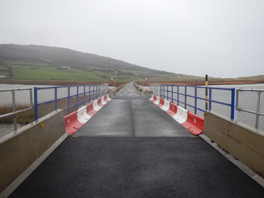
Contents

 Executive Summary ................................................................................................................................. 3

  Chapter 1: Introduction

  1.1 Background to Climate Change .......................................................................................................... 6
 1.2 Climate Change Adaptation Strategy ....................................................................................................... 7
 1.3 Climate Adaptation & Climate Mitigation ................................................................................................ 8
 1.4 Climate Change Challenge for Ireland and County Cork ........................................................................... 9
 1.5 Adaptation Policy Context .................................................................................................................... 10
 1.6 Methodology ........................................................................................................................................ 15

 Chapter 2: Regional and Local Context

 2.1 Climate Action Regional Office ............................................................................................................. 19
 2.2 Cork County Profile ............................................................................................................................... 19
 2.3 Cork County Council Climate Adaptation Case Studies .......................................................................... 22

 Chapter 3: Adaptation Baseline Assessment

 3.1 Introduction .......................................................................................................................................... 28
 3.2 Baseline Assessments ........................................................................................................................... 28

Chapter 4: Climate Risk Identification

 4.1 Identification of Climate Risk ................................................................................................................ 32
 4.2 Climate Variables and Climate Risk ....................................................................................................... 32
 4.3 Climate Change Risk Prioritization ......................................................................................................... 37
 4.4 County Cork Risk Register ..................................................................................................................... 39

                                                                                                                                                  4
Chapter 5: Adaptation, Goals , Objectives and Actions

  5.1 Introduction .......................................................................................................................................... 42
  5.2 Guiding Principles ................................................................................................................................. 43
  5.3 Climate Change Actions ........................................................................................................................ 43
  5.4 Cork County Council Adaptation Actions .............................................................................................. 45

Chapter 6:: Implementation, Monitoring and Evaluation

  6.1 Introduction ......................................................................................................................................... 59
  6.2 Priortise Actions .................................................................................................................................. 59
  6.3 Develop an approach and Initiate implementation ............................................................................... 60
  6.4 Liaise with other Stakeholders/ Sectors ............................................................................................... 61
  6.5 Monitor and Evaluate Implementation ................................................................................................ 61
  6.6 Report on Progress ............................................................................................................................. 62

References ................................................................................................................................................. 63

                                                                                                                                                   5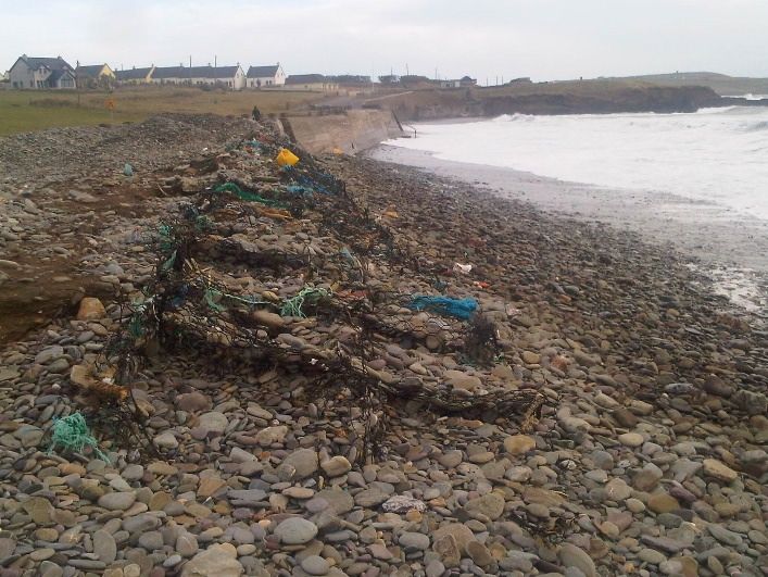
CHAPTER 1: INTRODUCTION

1.1 Background to Climate Change

The Earth’s climate is changing and the impact of these changes are becoming increasingly
more evident. Such visible climate changes include variations in air and ocean temperatures,
accelerated melting snow and ice caps, widespread retreat of glaciers, rising global sea level
rise and extensive changes in weather patterns. These changes are creating significant
global economic, environmental and social impacts.

Climate change refers to a change in climate patterns, in particular a change apparent from
the mid to late 20th century onwards, and attributed largely to the increased levels of
atmospheric carbon dioxide (CO2) produced by the use of fossil fuels, resulting in numerous
climatic shifts and impacts around the globe.

Several gases, such as carbon dioxide and
methane (CH4), exist naturally in the
atmosphere and contribute to the
warming of the Earth's surface by trapping
heat from the sun in what is known as the
greenhouse effect. When the proportion
of such greenhouse gases in the
atmosphere is stable, the effect is
beneficial, making surface temperatures
warmer and alleviating temperature
swings. However, human activity is
increasing    the     concentration     of
greenhouse gases in the atmosphere,               Figure 1.1 Greenhouse Gas Effect [1]
which is already causing average
temperatures to rise.

There is broad scientific consensus that human activities, most notably the burning of fossil
fuels for energy, have led to the rapid build-up in atmospheric greenhouse gases.
The Intergovernmental Panel on Climate Change (IPCC) stated in 2007 that CO2 levels in the
atmosphere rose from a pre-industrial level of 280 parts per million (ppm) to 379ppm in
2005 [2]. This coincided with an increase in the average global temperature of 0.74°C
between 1906 and 2005. In 2013, the U.S. National Oceanic and Atmospheric
Administration announced that CO2 levels had reached 400ppm [3]. That same year, the
                                                                                                 6
IPCC concluded that "human influence has been detected in warming of the atmosphere and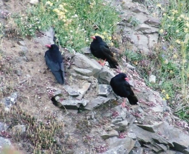
the ocean, in changes in the global water cycle, in reductions in snow and ice, in global mean
sea level rise, and in changes in some climate extremes.... it is extremely likely that human
influence has been the dominant cause of the observed warming since the mid-20th century"
[4]. In 2012, the World Meteorological Organization [5] released analysis showing that the
decade spanning 2001-2010 was the warmest ever recorded in all continents of the globe.

Climate scientists from the UK Meteorological Office expect to see one of the largest
global rises in atmospheric carbon-dioxide concentration in 2019 with average levels of
CO2 expected to reach 411ppm [6]. This forecast is based on a combination of factors
including rising anthropogenic emissions and a reduction in the uptake of carbon-dioxide
by ecosystems due to tropical climate variability [6]. Most recently, the IPPC reported that
human activities are estimated to have already caused approximately 1.0oC of global
warming above pre–industrial levels [7]. It concluded that if current rates continue, the
world would reach a human-induced global warming of 1.5oC by 2040.

Impacts from this global warming are readily observed and include increases in global
average air and ocean temperatures, accelerated melting of snow and sea ice, widespread
retreat of glaciers, rising global average sea level, and extensive changes in weather
patterns, including changes in precipitation levels and increased storm intensity.

Observations show that Ireland’s climate is also changing in line with international climate
patterns outlined above. Some of the projected physical climate changes include:
• increase in average temperature (surface air temperature, sea surface temperature);
• changes in precipitation patterns;
• ongoing mean sea level rise;
• changes in the character of weather extremes such as storms, flooding, sea surges and
    flash floods.

1.2 Climate Change Adaptation Strategy

Climate adaptation planning aims to build climate robust communities, to safeguard people,
ecosystems, businesses, infrastructure and buildings from the negative impacts of climate
change. As a Local Authority, Cork County Council plays an important role in planning for,
and responding to, emergency situations within the county.

This Cork County Adaptation Strategy (2019- 2024) is Cork County Council’s first step in the
climate adaptation process. This strategy will essentially set out the Local Authority’s
strategic priorities, measures and responses for climate adaptation in the county over the
next 5 years.
                                                                                                 7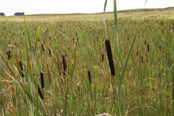
Cork County Council provides a wide range of services, many of which are already and will
increasingly be affected by climate change. The Local Authority will continue to play a
critical role in responding locally to the impacts of extreme weather events and other
impacts that are likely to emerge over the coming decades.

This Cork County Council Adaptation Strategy is set against the background of increasing
risks associated with climate change and seeks to reduce and manage these risks at local
level in all Local Authority activities.

1.3 Climate Adaptation & Climate Mitigation

Mitigation and adaptation are important strategies in responding to climate change and
represent two different paths for dealing with climate change. Mitigation deals with
the causes of climate change and works to reduce man-made effects on the climate system.
In contrast, climate adaptation refers to actions taken to reduce the negative effects of
climate change or to take advantage of emerging opportunities.

The Intergovernmental Panel on Climate Change (IPCC), 2014 [8], define Climate Mitigation
as “human intervention to reduce the sources or enhance the sinks of greenhouse gases”.
It essentially refers to efforts to cut or prevent the emission of greenhouse gases thereby
limiting the magnitude of future global warming.

The IPPC, in 2013 [9], defined climate adaptation as: “The process of adjustment to actual
or expected climate and its effects. In human systems, adaptation seeks to moderate or
avoid harm or exploit beneficial opportunities. In some natural systems, human
intervention may facilitate adjustment to expected climate and its effects.” Climate
adaptation is essentially a planning mechanism to proactively action and make adjustments
to reduce the existing and projected impacts from climate change.

Climate change mitigation and adaptation are not mutually exclusive but are key partners in
any strategy to respond to climate change (Figure 1.2). As effective mitigation can restrict
climate change and its impacts, it can also reduce the level of adaptation required by
communities.

                                                                                              8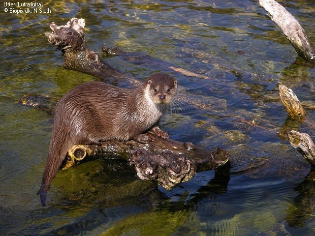
However, there is a significant time lag
between mitigation activities and their
contribution to climate change reduction.
Even if emissions were to be dramatically
reduced today, current greenhouse gases
in the atmosphere would continue to
result in global warming and drive climate
change for many decades.

In general, the more mitigation there is,
the less will be the impacts to which
society will have to adjust, and the less
the risks for society to prepare.                        Fig. 1.2 Strategies to address climate
Conversely,                           the                               change.
greater the preparatory adaptation, the
less may be the impacts associated with
any given degree of climate change.

1.4 Climate Change Challenge for Ireland and County Cork

A recent Environmental Protection Agency report “A Summary of the State of Knowledge on
Climate Change Impacts for Ireland [10] states that there is “evidence that Ireland is being
impacted by global climate change and that projects of future climate change across all
scenarios suggest that changes will continue, but uncertainties on details of these for
countries such as Ireland remain large”.

The impacts of climate change are felt more prominently at a local level. County Cork has
experienced severe weather events over recent years including increases in storm events,
higher incidences of flooding and periods of prolonged drought. All these events impacted
on the lives and livelihoods of County Cork’s residents and businesses. A synopsis of these
weather events is outlined in Chapter 3.

                                                                                                  9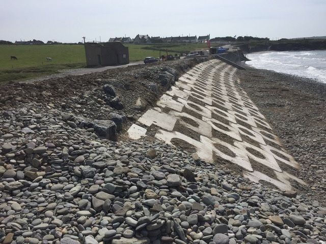
1.5     Adaptation Policy Context

This Cork County Council Adaptation Strategy is set within a policy framework at International,
European and National level.

1.5.1 International & European Context

These International & European Policies and Agreements are outlined in Figure 1.3 below:

Fig 1.3 International & European policies and agreements

                                                                                                  10
In 2015, countries adopted the 2030 Agenda for Sustainable Development and its 17
Sustainable Development Goals (SDGs). The SDGs are a blueprint to achieve a better and more
sustainable future. They address global challenges related to poverty, inequality, climate,
environmental degradation, prosperity, and peace and justice. The Goals interconnect and are
interdependent. Goal No. 13 addresses Climate Action with an objective to: Take urgent action
to combat climate change and its impacts by regulating emissions and promoting developments
in renewable energy
The Goal recognizes Climate Change as a global challenge that does not respect national
borders and requires solutions that need to be coordinated at the international level to help
developing countries move toward a low-carbon economy. Further, it serves to underpin
international, European and National policy context and frameworks that address climate
action and pursue efforts to combat climate change.
1.5.2 National Context
At a national level, the National Policy Position on Climate Action and Low Carbon Development
(2014) sets out the national objective of achieving a transition to a low carbon economy. This
was given legislative effect by the Climate Action and Low Carbon Act 2015. The Act provided
for the development of a National Adaptation Framework (NAF), which was published in
December 2017. The NAF requires sectoral and local adaptation strategies to be developed.
This adaptation strategy is set within the context of a national framework for adaptation
planning which is prescribed in the Climate Action and Low Carbon Development Act 2015 and
elaborated upon in the National Adaptation Framework.
This adaptation strategy commits to aligning with national commitments on climate change
adaptation. It must be noted that the process of making 8 sectoral adaptation strategies
(identified in the NAF) is running concurrently with the making of local authority strategies.
Once published, the plans will be assessed against Cork County Council’s strategy with a view to
identifying common goals and addressing any areas of disaccord. For both the preparation of
this strategy and the implementation of actions, opportunities will be advanced in collaboration
with adjoining local authorities including Clare, Kerry and Limerick County Councils as well as
Cork City Council.
The Local Authority Adaptation Strategy Development Guidelines 2018 provides guidance to
Local Authorities to develop their own Climate Action Adaptation Strategy. In developing this
adaptation strategy Cork County Council has been consistent with these guidelines.
11See outline of all national polices and legislation below:
Fig 1.4 National legislation and agreements
121.5.3 Sectoral Context
The National Adaptation Framework (NAF) has also identified twelve sectors across seven
Government Departments/Agencies for the development of Climate Adaptation Strategies.
These include actions to be implemented at a Local Government level.
Sector Parent Department
Seafood Department of Agriculture, Food and the Marine
Agriculture Department of Agriculture, Food and the Marine
Forestry Department of Agriculture, Food and the Marine
Biodiversity Department of Culture, Heritage and the Gaeltacht
Built and Archaeological Department of Culture, Heritage and the Gaeltacht
Heritage
Transport Infrastructure Department of Transport, Tourism and Sport
Electricity and Gas Networks Department of Communications, Climate Action and Environment
Communications networks Department of Communications, Climate Action and Environment
Flood Risk Management Office of Public Works
Water Quality Department of Housing, Planning and Local Government
Water Services Infrastructure Department of Housing, Planning and Local Government
Health Department of Health
Table 1.1 Government Departments and Sectoral Plans [11]
1.5.4 Local Context
Again, under the National Adaptation Framework, each Local Authority is required to develop a
Climate Adaptation Strategy for the period 2019-2024. The Environment Directorate of Cork
County Council has been tasked with developing this Climate Adaptation Strategy for County
Cork. These strategies will be used to inform development plans and other statutory plans and
policies of the Local Authority in addition to mainstreaming climate adaptation into day-to-day
Local Authority operations. The local strategies will also take on board the actions identified in
the draft sectoral plans described in Section 1.5.3 above.
13This Climate Adaptation Strategy is the primary instrument at local level to:
1. Ensure a proper understanding of the key risks and vulnerabilities of climate change
2. Advance the implementation of climate resilient actions in a planned and proactive manner
3. Ensure that climate adaptation considerations are mainstreamed into all plans and policies
and integrated into all operations and functions of the Local Authority
141.6 Methodology
1.6.1 Introduction
This Adaptation Strategy was developed utilising a five step process (Fig. 1.5 below). This was
supported by data gathered through a number of initiatives including workshops (outlined
below), interviews, literary research and consultation with various stakeholders such as CARO,
Elected Members and the Centre for Marine & Renewable Energy in addition to undertaking
the statutory environmental assessments. The methodology followed the objectives and
processes outlined in the Local Authority Adaptation Strategy Guidelines which were published
by Department Communications, Climate Action and Environment in 2018.
Fig.1.5 Outline of five step process utilised in the development of Cork County Climate Adaptation Strategy
151.6.2 Cork County Council Adaptation Team
In the preparation of this Adaptation Strategy, a multi-disciplined climate adaptation team was
assembled across all functions of Cork County Council. This team comprised of staff members
from various departments, each with their own expertise and knowledge of climate change
effects in their respective areas. A number of workshops and meetings were held to assess Cork
County Council’s adaptation baseline and identify vulnerabilities and risks to projected climatic
events.
In addition to the above, regard was also had to the various Cork County Council policy and
planning documents. Other sources of climate related data such as Met Eireann,
ClimateIreland.ie, EPA, Centre for Marine and Renewable Energy (MaREI), floodmaps.ie were
used to inform the adaptation process.
Pict. 1.1 Cork County Council Climate Adaptation Team Workshop
1.6.3 Public Consultation
The draft adaptation strategy will be made available for public consultation ahead of the
preparation of the final draft. A final draft will then be prepared for adoption by Cork County
16Council before the 30th September 2019, prior to its formal publication. The public consultation
process will also inform the objectives and actions set out in this strategy.
1.6.4 Environmental Assessment
Screening Overview for SEA:
Under the European Communities (Environmental Assessment of Certain Plans and
Programmes) Regulations 2004 (S.I. 435 of 2004 as amended by S.I. 200 of 2011), all plans
which are likely to have a significant effect on the environment must undergo screening to
determine whether a Strategic Environmental Assessment (SEA) is required. “Screening” is the
process for making a determination as to whether a particular plan, would be likely to have
significant environmental effects, and would thus warrant SEA. This strategy has been screened
for SEA and it is determined that full SEA is not required. The initial screening report
accompanies this strategy.
Picts 1.2 Some examples of flora and fauna in County Cork that are affected by climate change and subject to AA
and SEA screening
17Screening overview for AA:
Screening of this strategy has been undertaken in accordance with the requirements of Article
6(3) of the EU Habitats Directive (directive 92/43/EEC) to determine if the Climate Change
Adaptation Strategy is likely to significantly affect Natura 2000 sites (i.e. Special Areas of
Conservation (SAC) and Special Protection Areas (SPA)) within or surrounding the plan area. It is
determined that stage 2 Natura Impact Report is not required.
The initial screening report accompanies this strategy.
18CHAPTER 2: REGIONAL AND LOCAL CONTEXT
2.1 Climate Action Regional Office
For the purposes of preparing the Climate
Change Adaptation Strategies, the country
has been divided into four regions; Dublin
Metropolitan, Eastern & Midlands, Atlantic
Seaboard South and Atlantic Seaboard
North. The regional offices are based on
regions which face similar risks from climate
change. Cork County Council is one of five
Local Authorities in the Atlantic Seaboard
South Climate Action Region Office (CARO)
and includes the Local Authority areas of
Limerick City and County, Cork City, Kerry
and Clare.
All of the Local Authorities in the Atlantic
Seaboard South region face similar risks
from sea level rise, coastal flooding, storms,
ground water flooding and rural pluvial
flooding. The function of the CARO is to
assist and coordinate the preparation of
county level adaptation strategies. Cork
County Council has been appointed as the Pict.2.1 Map of the counties in the Atlantic
lead Local Authority for the CARO Atlantic Seaboard South region
Seaboard South Region.
2.2 Cork County Profile
Cork County Council is one of the Ireland’s largest Local Authorities serving a population of
322,211 (6.81% of the total population) [12] and is responsible for a geographical area of 7,457
km2 (10.6% of total area of the State) [13]. The Cork County Development Plan 2014 [14]
identifies 302 designated settlements including towns, villages and 7 Islands in the county. The
combined Cork City and County administrative areas are reported to contribute 19% of the
National GDP [15].
19Pict 2.2 Cork County Profile
The coastline of County Cork extends for 1,118km, which is 20% of that of the country [13].
This coastline is home to 65% of the County’s populations who live on or adjacent to the coast
[14]. The coastline also contains centres of important economic activity of national significance
such as Cork Harbour, Whitegate Oil Refinery, Whiddy Island Oil Trans-shipment Terminal and
Castletownbere fisheries port [14]. The coastal region supports many harbours, beaches and
biodiversity areas of national importance. Cork Harbour is the most significant port outside of
Dublin and has an important role in the leisure, recreation and tourism sectors in County Cork.
Furthermore, there are 27 beaches which have been identified by Cork County Council for
annually monitoring and management in line with the Bathing Water Quality Regulations
(2000). Of these 27 beaches, 7 have attained the Green Flag status for 2018 while another 13
attained the Green Coast award for 2018 also [15].
The county is mainly drained by the catchments of the Rivers Blackwater, Bandon and Lee,
which rise at the west of the county and flow in an easterly direction before turning southward
and discharging into the Celtic Sea. The remaining rivers outside of these catchments, such as
the Ilen, the Argideen and the Owenacurra generally flow southward to the sea. The county
with 7,593 km of river length, accounts for 10% of the total river length of the state [17]. Some
of the County’s main towns and centres of population such as Bandon, Bantry, Carrigaline,
Clonakilty, Skibbereen and Youghal are on or close to the coastline, while inland towns are on
20or close to the main rivers such as the Blackwater (Fermoy and Mallow) and the Lee
(Macroom). The ESB operate one of the Country’s largest hydro-power schemes on the River
Lee upstream of Cork City with reservoirs and dams at Inniscarra and Carrigadrohid which have
a storage capacity of 45 million cubic metres [18].
As well as 6,510 public housing units, the Local Authority owns up to 150 municipal buildings
whose functions encompass the full range of local government activity and vary from Area
Offices and Libraries to Civic Amenity Sites and Leisure Centres.
The National Road network, which is managed by TII (Transport Infrastructure Ireland), has a
total length of 5,306km, of which 445km (8.4%) are in the Local Authority administrative area
[19]. Cork County Council has responsibility for the Regional and Local Roads in its
administrative area and, with 1,343 km of Regional Roads and 10,053 km of Local Roads [20],
has 10.25% and 12.5% by length respectively of the State’s Regional and Local Road network.
In relation to bridges, there are records for 1,367 bridges on the network, which represents
6.7% of the State’s estimated Regional and Local Road bridge stock of 19,000 bridges [21].
With regard to Emergency Services, Cork County Council provides a fire and rescue service from
20 fire stations located throughout the county. There are 11 Upper Tier Seveso Sites and 10
Lower Tier Seveso Sites located in the county [22], the majority located in the coastal areas of
Ringaskiddy and Little Island.
In the area of procurement, Cork County Council recognises the importance it plays in the local
economy and its obligations to procure goods and services in an environmentally sustainable
manner. Cork County Council will continue to support and implement green procurement
policies and initiatives in its day-to-day purchasing of goods, services, works and utilities. Such
policies include GPP 4 Growth which is an Intereg project bringing together partners from nine
countries (including Ireland) to exchange experiences and improve capacities on implementing
resource efficiency policies that promote eco-innovation and green growth through Green
Public Procurement.
In the case of the natural environment, the National Biodiversity Action Plan for 2017-2021 [23]
states that there is evidence that climate change is negatively impacting Irish habitats and is
driving ocean acidification. In Cork County there are 30 Special Areas of Conservation, 18
Special Protection Areas, 9 Natural Heritage Areas and approximately 89 proposed Natural
Heritage Areas [24]. Expected increases in temperature, changes in precipitation patterns,
weather extremes (storms and flooding, sea surges, flash floods) and sea-level rise will affect
the abundance and distribution of Irish species and possibly encourage the spread of alien
21invasive species. All these protected biodiversity areas will need to be given careful
consideration during climate adaptation planning.
Given the size and geographical features of the area as well as the infrastructure assets and
responsibilities of Cork County Council, the negative impacts of climate change pose a
significant risk to citizens, the economy, the environment and the delivery of local government
services. It is therefore imperative to introduce climate adaptation measures as soon as
possible.
2.3 Cork County Council Climate Adaptation Case Studies
Cork County Council has already experience in the area of adaptation planning and has been
successfully responding to climatic events over recent years. Examples of adaptation initiatives
are outlined in this Section.
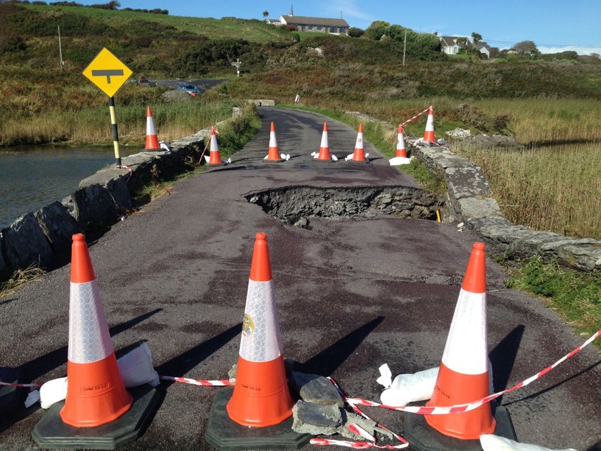
2.3.1 Barleycove Causeway Temporary Bridge Project
A section of roadway on the causeway located between Crookhaven/Barleycove and Mizen
Head was closed due to the subsidence of a bridge structure after a flood/rainfall event in
September 2015. The site was particularly difficult in that it was located in a tidal location and
also situated within a Special Area of Conservation.
The situation caused disruption to local residents and a permanent replacement project
commencing over the summer, with a necessary road closure, would have impacted upon
tourist traffic. In an effort to maintain traffic movements across the causeway, Cork County
Council explored alternative options of opening the causeway to traffic using a short term
temporary solution. A solution was devised for the stabilisation of the existing structure and
the installation of a temporary steel bridge which allowed the reopening of the roadway to
single line traffic. A temporary bridge (12m span x 5m width), suitable for vehicular traffic was
sourced in the UK.
The temporary bridge was put in place in November 2015 which allowed the road to be
reopened. This was left in place until the end of the 2016 tourist season. At that point, the
temporary bridge was removed and the permanent repair work was carried out. The road
reopened to two way traffic in early December 2016. The installation of the temporary bridge
had the advantage of facilitating the reopening of the causeway in a matter of a few weeks. At
the end of the exercise the temporary bridge ultimately became an asset available to Cork
County Council in dealing with future emergency bridge or culvert collapse situations at short
notice.
22Pict 2.3 Damaged road before temporary bridge Pict 2.4 Road after temporary bridge installation
2.3.2 Mallow Flood Relief Project
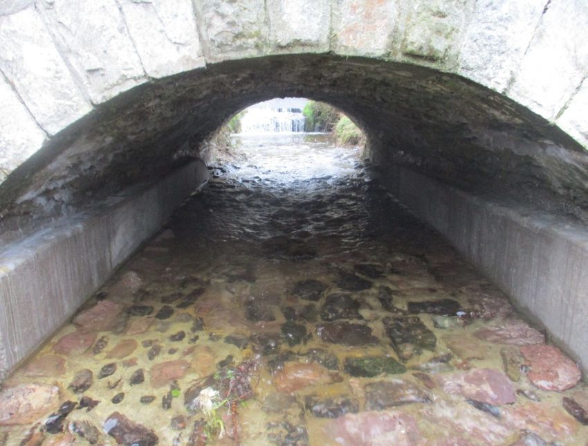
Mallow has a long history of flooding, principally from the River Blackwater, which flows
through the town. There are other watercourses including the Spa Glen Stream which
also caused flooding problems, as it flows through the town centre, mostly beneath the
streets in a series of culverts.
Major floods have occurred in Mallow in 1853, 1875, 1948, 1969, 1980, 1988, 1995, 1998,
2004, 2008, 2009 and 2010. The most severe flood occurred in 1853 when the town
bridge was swept away.
A Flood Relief Scheme was undertaken by the OPW from 2008 to 2010 and comprised of
new culverts, walls and embankments, demountable defences, pumping stations and the
lowering of ground at Mallow Bridge. Upon receipt of a warning from the Early Flood
Warning System developed by the OPW, Cork County Council staff install demountable
defences at required locations to retain the flood waters.
At a cost of €36.7M, the Mallow Flood Relief Scheme has been fully operational for over 5
years and has resulted in:
• reduced economic loss to vulnerable traders,
• reduced damage to residential and commercial property,
• reduced social disruption to the local economy,
• reduced disruption and delays to traffic in the town.
23Pict. 2.5 Mallow in flood Pict 2.6 Demountable defense during flood event
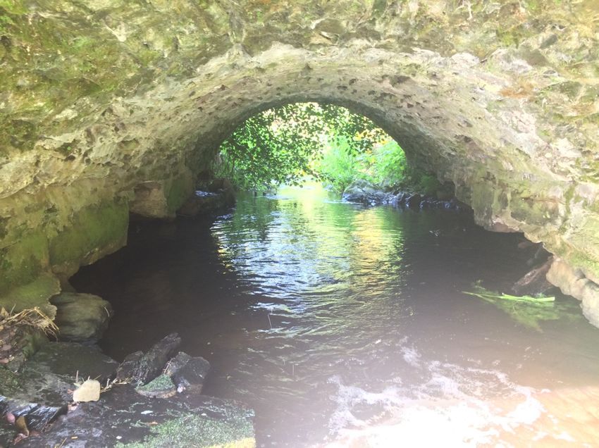
2.3.3 Bridge Scour in County Cork
A bridge condition survey, undertaken to Eirspan Bridge Management System standards
was carried out by Cork County Council between 2012 and 2014. This survey showed a
considerable amount of damage to a number of bridge abutments and piers resulting
from scour action. Scour is phenomenon whereby the level of the riverbed becomes
eroded due to the action of water flow, leading to the exposure of bridge foundations, as
shown in Fig.2.1.
Fig 2.1. Bridge Scour at Pier and Abutment [25 ]
An analysis of the information from this survey showed that 62% of critically damaged
bridges surveyed in County Cork had levels of bridge failure due to scour when compared
to 15.51% [26] , 25% [27] and 20.65% [28] from other similar international studies.
24The findings concluded that scour was a particular issue in the Cork area and is a
significant consequence of climate change resulting from increased rainfall intensity and
larger flows. Following on from this survey, remedial works were carried out on a number
of bridges and associated structures in County Cork. An example of this is on the L6822
Ballygrogan Bridge, Rathduff, where a floor slab and scour skirts were constructed to re-
strengthen the bridge and to alleviate future damage from scour action.
Pict 2.7 Scour damage on Ballygrogan Bridge Pict 2.8 New bed and scour skirts installed
2.3.4 Garrettstown Beach Coastal Protection Works
Garrettstown beach is located approximately 9km south of Kinsale. This location consisted of
sea walls, gabion baskets, rock armour and embankments all performing as coastal protection
measures. During the storms of 2014, however, the gabion baskets suffered severe damage and
alternative coastal protection measures had to be investigated.
In June 2017, an ECAB (Erosion Control Armour Block) coastal protection system was installed
by Cork County Council to address the issues with coastal erosion and flooding at this location.
The ECAB is manufactured from a blend of Ordinary Portland Cement (OPC) and Ground
Granulated Blast Furnace slag (GGBS). This system allows the concrete to achieve a lighter
colour finish; it is a more environmentally friendly, stronger and a more durable concrete. The
lighter colour allows the ECAB blocks to match the local sands and the voids allow indigenous
vegetation such as marram grass to grow between the blocks to enhance their aesthetic and
biodiversity appeal.
This ECAB revetment was designed primarily to protect the regional road (R604) from being
overtopped. Overtopping resulted in sand and other beach debris being strewn across the road
thereby limiting traffic movements in the area. During winter time this was a common
occurrence and the road was cleared repeatedly by Cork County Council at considerable
expense. The ECAB revetment has also been shown to be extremely stable when tested during
25storms when compared to the traditional rock armour boulders which can be displaced in
similar conditions.
Pict 2.9 Garretstown Beach after storm & before Pict.2.10 ECAB revetment in place at Garretstown
coastal works beach
2.3.5 Energy Management System in Cork County Council
Under the National Energy Efficiency Action Plan (NEEAP), Cork County Council has been set an
energy efficiency improvement target of 33% on 2009 energy efficiency figures by 2020. To
date an improvement of 20.8% has been achieved. Ireland’s second National Energy Efficiency
Action Plan to 2020 (NEEAP II) gives an exemplar role to Local Authorities which includes local
authorities with an energy spend of greater than €5million to become ISO 50001 Compliant.
ISO 50001 is based on the management system model of continual improvement also used for
other well-known standards such as ISO 9001 or ISO 14001. In May 2016, Cork County Council
became the first Local Authority in Ireland to achieve ISO 50001-2011 certification for its Energy
Management System and repeated the feat in 2019 by becoming the first Local Authority to
become ISO 50001-2018 certified. The benefit of certification is having a structured energy
management system, promoting awareness among staff and encouraging a culture that
champions best practice. The data collated as part of this system can also assist in establishing
baseline energy information in the context of this strategy and in developing a system to
monitor energy reduction progress.
In 2018, public lighting accounted for 54% of energy use within the Local Authority (Fig 2.2).
With that in mind Cork County Council is participating in an ambitious national Public Lighting
Energy Efficiency Project which aims to retrofit approximately 30,000 lights across Cork County.
Once complete this will have a major impact on the Local Authority’s overall energy use and
26assist in achieving energy reduction targets.
Fig 2.2 Cork County Council’s significant energy user primary energy consumption 2018
27CHAPTER 3: ADAPTATION BASELINE ASSESSMENTS
3.1 Introduction
The purpose of the baseline is to understand the challenges of current climatic hazards. A
review of recent climate events help local authorities anticipate and prepare for future extreme
weather events. This process is critical in developing the climate adaptation strategy as it
responds to the effects of climate events at a local level.
3.2 Baseline Assessments
A review of climate events that have affected County Cork was undertaken using Met Éireann
data [29] along with data gathered from workshops and local research. This is not a complete
listing but is intended to give an idea of extreme weather events with which Cork County
Council has dealt with in the recent past.
With all climate events comes an understanding of the level of unpredictability. Nevertheless,
knowledge and experience acquired from past events (including information from many sectors
eg Met Eireann, OPW etc) will benefit future planning and preparedness and a continuous
review of extreme events will help to build resilience and prevent the worst of risks.
28Extreme weather Description
events
Coastal flooding • February 2002: Cork City Flooding
Coastal storms • February 1990: Severe gusts and heavy rainfall
• January 1993: Severe gusts and heavy rainfall
Extreme heat • Summer 1995: Warmest weather since 1955
• Summer 2006: Warmest weather since 1995
• Summer 2018: High temperature & drought conditions
Extreme rainfall • November 2009: 55mm 1-day total recorded in Baile Bhuirne
• June 2012: 58mm 1-day total recorded in Bandon
Fluvial flooding • November 2000: River Lee
• August 2008: River Blackwater
• February 2014: River Lee
• December 2015: River Bandon
Freezing conditions • December 2010: Cork recorded -7.2 degrees
• March 2018- Storm Emma- -7.0 degrees recorded at Cork Airport
Groundwater flooding • January 2016: N25 flooded between Killeagh and Castlemartyr
Heavy snowfall • January 1987: 12cm of snow at Roches Point
• March 2018: 14cm of snow at Cork Airport- Beast from East & Storm Emma
Pluvial flooding • June 2012: Douglas
• August 1997: Freemount
Storm force winds/ • February 1988: Gusts in excess of 84 Knots recorded at Cork Airport
windstorms • January 1991: Gusts in excess of 68 knots recorded at Roches point
• October 2017: Hurricane Ophelia.
Table 3. 1 Extreme weather events in Cork 1987-2018
29Fig 3.1 Extreme
weather events in Co.
Cork 1987-2018
30Having regard to Table 3.1 and Fig 3.1 and above, it is evident that the main category of
extreme weather events has been flooding (coastal, fluvial and pluvial), with fluvial being the
most common. This is followed by windstorms and coastal storms and there is a general
similarity in the numbers of the remaining event types.
In accordance with the National Framework for Major Emergency Management [30], Cork
County Council has a comprehensive Major Emergency Plan in place to ensure that staff at all
levels are aware of their responsibilities and that appropriate actions are initiated in a timely
and effective manner to deal with major emergencies. The Plan, which describes actions
required in the event of severe weather and flood events, has come into operation on a
number of occasions, with the most recent activation being Hurricane Ophelia in October 2017
and Storm Emma in March 2018.
31CHAPTER 4: CLIMATE RISK INDENTIFICATION
4.1 Identification of Climate Risk
In identifying climate risk, it is important to realise that risk is based on projections and
therefore requires regular updating. The main climate related risks are outlined below and the
following is an account of possible effects on key operational areas of the Local Authority as set
out in the Local Authority Adaptation Development Guidelines [11]. In terms of assessing how
such events affect operational areas of Cork County Council, some examples are included.
4.2 Climate Variables and Climate Risk
Based on available sources, observed and projected changes in seven climate variables have
been investigated. They are summarised below, with future climate risks identified:
4.2.1 Hydrology
Observed The analysis of river flows is complex and subject to large variability and as a result, it
is difficult to identify impacts of climate change. For Ireland during the period 1954
to 2008, summer mean flows were dominated by decreasing trends, while for winter
there is a tendency for increases in mean flows. Annual and winter high flows are
also dominated by increasing trends [31].
Drier summers could have effects on summer base-flows of rivers in Cork and
recharge of underlying aquifers. This ultimately has implications for the provision of
drinking water as was evident in many parts of the county during the prolonged
drought period in Summer 2018.
Projected Changes in temperature and precipitation will affect hydrological response. Due to
the uncertainties associated with projected changes in precipitation, projected
changes in hydrological response remain subject to a high level of uncertainty. The
response of individual catchments will be determined by individual catchment
characteristics (e.g. groundwater versus surface water dominated catchments). For
example, summer reductions for groundwater dominated catchments are not as
severe as those projected for surface water dominated catchments [32]. Using runoff
impact models a robust indication of increasing seasonality in hydrological regimes is
evident with increases in winter and spring stream flow likely and a decrease in
summer. A 20% increase in the amount of water flowing during winters through
rivers are expected for the majority of catchment by mid-late century while for
summer, decreases of over 40% (those with little groundwater storage in particular)
have been simulated for the end of the century [32][33]. Projected increases in
32winter flows coupled with likely increases in extreme precipitation events are likely
to lead to an increased flood risk. However, catchment response time will be critical
in determining the changing nature of extremes and catchments with fast response
times are likely to be most at risk.
Summary of Increasing seasonality in hydrological regimes is expected with decreased summer
Change and increased winter flows likely.
Flood risk will increase due to a combination of higher river flows and increases in
extreme precipitation events. This is referred to as “combination events” and are
likely to play a greater role in climatic events in the future. One example of this is
high tides coupled with fluvial and pluvial events especially in the lower reaches of
the Lee and Lower Harbour. This would have specific effects in settlements such
Cork City and its environs.
Climate Risks Groundwater flooding, which is the emergence of groundwater at the surface away
Identified from river channels and watercourses, under conditions where the 'normal' ranges
of groundwater level and flow are exceeded. This is likely to be exacerbated in areas
along the estuary where ground water is subject to tidal influence.
Pluvial, or surface-water flooding, which results from rainfall-generated overland
flow, which may occur during or immediately after intense rainfall events and before
the runoff enters a watercourse or drainage system. This was evident in Douglas in
2012 and Freemount in August 1997.
Fluvial or river flooding, which occurs when excessive rainfall causes a river to exceed
its capacity. This was evident in Cork City environs with the River Lee exceeding
capacity in 2000 and 2014 and elsewhere in the County, the River Bandon in 2015
and River Blackwater in 2008.
4.2.2 Rainfall
Observed Throughout Ireland, annual average rainfall amounts have increased, by roughly 5 %,
relative to the 1961-1990 baseline period with this increase observed across all
seasons. However, spatially, rainfall intensity and amounts vary with no clear
direction of change yet apparent [34]. Severe rainfall events have had significant
local effects in County Cork, such as 55mm 1-day record measured in Baile Bhuirne in
November 2009 and 58mm 1-day record measured in Bandon in June 2012.
Projected Precipitation projections are less certain than those for temperature and when
examined on an individual basis, climate models indicate differing temporal and
spatial patterns. However, the projections provide a robust indication of increased
seasonality with wetter winters and drier summers likely [35] [36] [37] [38]. For
spatial variations, there is a level of disagreement between individual climate models
and as a result spatial details are not deemed reliable [38]. As global temperatures
increase, the hydrological cycle is expected to become more intense and will result in
more extreme precipitation events [4]. For Ireland, projected changes in the
frequency of very wet days (>20mm of precipitation) indicate a marked increase for
33winter (approximately 20%) [38].
Summary of Increasing seasonality in precipitation can be expected with drier summers likely.
Change
An increase in the occurrence and magnitude of extreme rainfall events is also likely.
Climate risks Groundwater flooding
Identified
Pluvial flooding
Fluvial flooding
4.2.3 Sea Level Rise.
Observed Observations indicate that sea level around Ireland has risen by approximately
3.5cm a decade since the early 1990s, which means an increase of up to 7.0cm
between 1990 and 2015 [39].
Projected An increase in global sea levels is projected suggest in the range of 0.26 to 0.55m for
the low emissions scenario and 0.52 to 0.98 for the high emissions scenario [4].
However due to an as yet limited understanding of some of the important effects
that contribute to rates of increase, a best estimate for sea level rise cannot be
provided with confidence, and estimates of up to 4 to 6 m have been projected by
some models [40].
The trend is likely to accelerate over the coming years with projected increases of
81 cm by the end of the century [9]. With 65% of Cork county’s population living on
or adjacent the coast, Cork is particularly vulnerable [14].
Summary of Sea levels are expected to increase for all Irish coastal areas.
Change
Climate Risks Coastal flooding, which occurs when normally dry, low-lying land is flooded by
Identified seawater.
Coastal erosion, which is the process of wearing away material from the coastline
due to imbalance in the supply and export of material from a certain section. It
takes place in the form of scouring at the foot of cliffs or sand dunes and results in
coastline retreat.
4.2.4 Sea Temperature
Observed The seas around Ireland have been warming at a rate 0.60 C per decade since 1994,
which is unprecedented in the 150 year observational record. The greatest warming
has been observed over the Irish Sea [41].
34Projected In line with global changes, the seas around Ireland are projected to continue
warming over the coming decades. Projected changes for the Irish Sea indicate a
warming for all seasons with the highest warming in Autumn and the lowest in
Spring [30]. However, due to a limited number of climate model projections,
projected changes remain uncertain.
Summary of In line with global trends, the seas around Ireland are expected to continue
Change warming.
Climate Risks Coastal flooding
Identified
Coastal erosion
Effects on marine bio-diversity
4.2.5 Surface Air Temperature
Observed Observations indicate an increase in the surface temperature for Ireland of 0.8°C
since 1900. In addition, the number of warm days has increased while the number of
frost days has decreased [42].
Projected Mean air temperatures are expected to increase everywhere and for all seasons
relative to the present [38]. With increasing air temperatures, an increase in the
intensity and duration of heat waves is expected, with a coincident decrease in the
occurrence of frost days likely [38]. Projections indicate that the warmest 5% of daily
maximum summer temperatures (TMAX 95%) are expected to increase more
strongly than those of average seasonal temperatures with most regions
experiencing an increase in TMAX 95% of 0.7 to 2.6°C [38].
Summary of Surface air temperatures are expected to increase everywhere compared to the
Change present
An increase in the intensity and duration of heat waves is expected
Climate Risk Heat waves (defined by the UK Met Office as when the daily maximum temperature
Identified of more than five consecutive days exceeds the average maximum temperature by
5°C, the normal period being 1961-1990) [43]. These may lead to severe drought
and violent thunderstorms that impact upon human health, physical infrastructure,
and river water levels, and may cause forest fires.
Freezing conditions: fewer frost days and milder nighttime temperatures are
expected.
One benefit might be a longer growing season, which might suit agricultural
production.
354.2.6 Waves and Surges
Observed Analysis of satellite data for the period 1988 to 2002 shows a general increase in wave
height in the northeast Atlantic [44].
Projected Projections indicate an increase in the occurrence of coastal storms and surges in spring
and winter for all areas of the Irish coast with the exception of the southwest. However,
confidence in these projections is limited due to a limited number of climate models
[45] [46].
Summary of The magnitude and intensity of storm wave heights are expected to increase for spring
Change and winter
Climate Risk
Identified Coastal flooding
Coastal erosion.
4.2.7 Wind
Observed For Ireland, observations indicate a high degree of yearly variability in wind speeds and,
due to a lack of correlation in the available data, analysis of long term trends cannot yet
be determined with confidence [47].
Projected Due to a limited number of climate model projections for wind speed, predictions
remain uncertain and further work is required to increase confidence in their outputs.
Nonetheless, available projections which focus on 60m wind speeds, the typical height
of wind turbines, indicate an increase in wind speeds during winter and a decrease
during summer (3-15% reduction) [35][36][37]. As a result of changes in the
development regions and tracks of tropical cyclones, a decrease in the frequency of
extreme wind storms affecting Western Europe is expected. However, projections
indicate an increase in the intensity of extreme wind storms [38].
Summary of
Change • Projections indicate a decrease in wind speeds for summer and increases for
winter.
• An increase in the intensity of extreme wind storms is expected.
Climate Risk
Identified Wind storms or High winds, that are defined as a having a wind speed greater than
50 km/h which equates to a Force 7 (28–33 knots) on the Beaufort wind force scale.
364.3 Climate Change Risk Prioritisation
The future climate risk is calculated by combining the projection confidence (i.e. the level of
confidence attributable to projections of change in the climatic variable) with the future impact
consequence (i.e. the estimated future level of service disruption caused) [48]. A notional scale
is developed for each parameter as shown in matrix format in Table 4.1 and the future climate
risk is calculated using the equation:
Future climate risk = Projection Confidence X Future impact consequences
Table 4.1 Climate Risk Matrix [44]
Calculation of the future climate risk for each variable allows the ranking and
prioritisation of risks as shown in Table 4.2. The future risk priorities are given scale values
with the following definitions [48]:
Projection Future Definition
Confidence Consequence
Ranking
5 Critical Must not be accepted as part of routine (unadapted)
operational procedures; urgent attention at the most senior
level required; adaptation measures that function to diminish
risk must be proposed and acted on immediately.
4 Major May be accepted as a part of routine operations only where
adaptation measures have been identified and are
immediately feasible, monitoring/early warning of the risk is
routine and the nature of risk is well understood; senior
management must be informed of the status and evolution of
the risk over time.
373 Moderate May remain part of routine operations, but a schedule for
future adaptation should be in place, with a thorough
investigation of any lead time and/or required precedent
steps prior to adaptation measures becoming feasible having
been conducted.
2 Minor Likely to remain part of routine operations; should be
assigned a monitoring and observation protocol; existing
controls are sufficient and no further action will be required
unless significant change occurs
No further action will be required in the short term unless
1 Negligible
significant change occurs in the climate variable or receiving
environment in question.
Table 4.2 Future climate risk definitions [48]
Using the matrix in Table 4.1 and definitions set out in Table 4.2, a prioritisation of future
climate risks was identified for County Cork which can be seen in Table 4.3 below:
Future Climate Risk Projection Confidence Future Consequence Future risk
priorities
Fluvial flooding 4 5 5
Heat waves 5 4 5
Coastal flooding 4 4 4
Pluvial flooding 2 5 4
Wind storms 3 4 4
Groundwater flooding 1 4 3
Coastal erosion 2 4 3
Freezing conditions 5 1 2
Table 4.3. Prioritisation of future climate change risks in County Cork
384.4 County Cork Risk Register
The hazards and consequences of extreme climate events forms the basis for the risk register,
which under the headings below, summarises the services and business functions impacted:
Local Adaptation Governance and Business Operations
Services & Functions Climate Events Climate Hazard Impacts Consequences
Affected
Business Services Storm Events, Snow Building closures Economic Loss
Events, Extreme Electrical faults
Rainfall Events Risks to staff welfare,
Public safety
Tourism
Infrastructure and Built Environment
Services & Climate Events Climate Hazard Consequences
Functions Affected Impacts
Roads, footpaths, All Extreme Weather Increasing deterioration Economic Loss
bridges, construction Events Collapsing
and maintenance infrastructure Public Safety
Impassable areas
Building Stock – LA Storm, Rainfall, Snow Housing stock damage Economic Loss
Buildings and social and Heatwave Events Heating issues
housing stock Closure of Local Public Safety
Authority buildings
Community Sustained Extreme Weakening of Economic Loss
Infrastructure Events community
infrastructure Social Loss
Impacts on recreation
amenities and Public Safety
tourism activities
Cultural & Heritage Storm, Rainfall , Snow Damage to cultural and Economic Loss,
Events heritage assets
Environmental & Heritage
Loss
39You can also read