Developing a Rock Garden at Edith J. Carrier Arboretum, Harrisonburg VA (U.S.A.) as a Resource for Promoting Geotourism - MDPI
←
→
Page content transcription
If your browser does not render page correctly, please read the page content below
geosciences
Article
Developing a Rock Garden at Edith J. Carrier
Arboretum, Harrisonburg VA (U.S.A.) as a Resource
for Promoting Geotourism
Chiara Elmi 1, * , Amanda G. Simal 1 and Gregory P. Winchester 2
 1   Department of Geology and Environmental Sciences, James Madison University, Harrisonburg,
     VA 22807, USA; simalag@dukes.jmu.edu
 2   Department of Geographic Science, James Madison University, Harrisonburg, VA 22807, USA;
     winchegp@dukes.jmu.edu
 *   Correspondence: elmicx@jmu.edu

 Received: 20 September 2020; Accepted: 17 October 2020; Published: 19 October 2020

 Abstract: Virginia is a state in the Southeastern and Mid-Atlantic regions of the United States of
 America that offers spectacular sceneries and varied geologic history that covers about 1.5 billion years.
 A rock garden was developed at the Edith J. Carrier Arboretum in Harrisonburg, VA. The rock garden
 at the Edith J. Carrier Arboretum is a place where rocks look as they did when they were part
 of an outcrop on the side of a mountain or a creek in the Shenandoah National Park. Rock slabs
 were collected along the existing trails of the Arboretum and classified based on the mineralogy
 and physiographic province. The rock garden offers a place to observe Earth materials from
 Virginia without potentially travelling long distances. The goal is to educate the community
 on the local resources and promote sustainable geotourism. This paper illustrates a method for
 rapid and accurate quantitative mineralogical analysis of complex mixtures using X-ray powder
 diffraction. Correctly classifying a fine-grained sample such as a sedimentary rock using primarily
 the identification of minerals in a thin section or in hand specimens could not be accurate; thus, X-ray
 diffraction was used to confirm hand sample analyses. The samples are mostly sedimentary rocks
 from the Appalachian Mountains. Three different lithological types (dolostone, limestone, and shale)
 play the most important role in the geological context of the Rockingham county. The mineralogical
 features shown in this paper provide a detailed picture of the geological significance of the resources
 that shape the Appalachian Mountains in the Shenandoah National Park.

 Keywords: rock garden;                 geological setting;   mineralogical composition;    powder X-ray
 diffraction; geotourism

1. Introduction
      Geoheritage is a part of geodiversity that is assessed as worthy of geoconservation [1].
Geoheritage and geoconservation are concerned with the preservation of Earth Science features,
and are important endeavors globally, as reflected in various international and intra-national
bodies set up for conservation, with agreements, conventions, and inter-governmental
initiatives [2]. Geological and geomorphological conservation (geoconservation) have a long
history [3]. Historically, the United Kingdom is considered the birthplace of geology, geoheritage,
and geoconservation; both endeavors are integral components of education, tourism, planning and
environmental management [2,4]. The search for representative sites has been a guiding principle
for conservation site selection in the United Kingdom since the Second World War, and can also be
detected as the basis for new site selection criteria in Ireland, the USA, and many other countries [1,4].

Geosciences 2020, 10, 415; doi:10.3390/geosciences10100415                   www.mdpi.com/journal/geosciences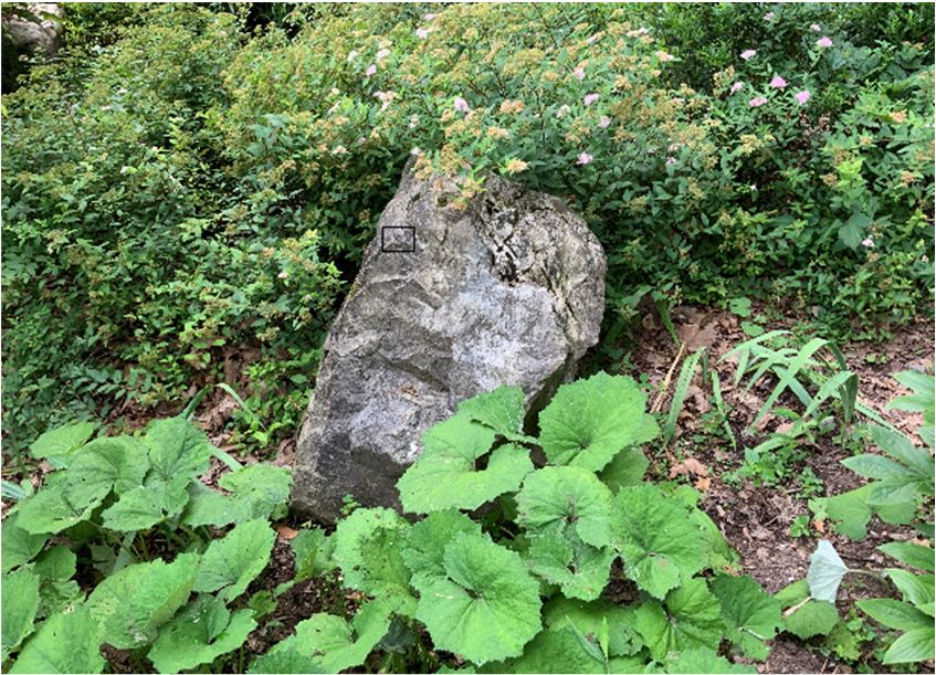
Geosciences 2020, 10, 415 2 of 16
Geoparks are single, unified geographical areas where sites and landscapes of geological
significance are managed with a holistic concept of protection, education, and sustainable development.
The greatest strength of the geopark initiative is the attention it brings to Earth resources and
the resulting socioeconomic development that occurs in rural areas [5]. A geopark operates as a
partnership of people and land managers working to promote Earth heritage through education and
sustainable tourism [6]. The purpose of a geopark is to explore, develop, and celebrate the links
between the geological history and other aspects of the area’s natural and cultural heritage, and to
enhance awareness and understanding of key issues facing society, such as using our Earth’s resources
sustainably, mitigating the effects of climate change, and reducing natural disasters-related risks.
Geotourism has been recently recognized as an approach to tourism that embraces interpretation,
education, is locally beneficial, and fosters protection of geoheritage [7]. Geotourism and the cultural
landscape involve complex interactions of cultural practices and values within geoparks as well as
providing economic benefits from tourism activities. Geotourism and the cultural landscape also give
rise to a range of relational benefits such as shaping people’s experiences that enhance well-being,
mental and physical health, and self-awareness skills [8].
Virginia is a state in the Southeastern and Mid-Atlantic regions of the United States that offers
spectacular panoramas and a geologic history that spans nearly 1.5 billion years. Rocks exposed
throughout the state reflect a long and complex geologic history that resulted in unique and exotic
geologic terranes, which extends from the high rocky summits in the Blue Ridge Mountains to low-lying
barrier islands exposed to the Atlantic Ocean. Across Virginia, the landscape exhibits all rock types:
igneous, metamorphic, and sedimentary [9].
Shenandoah National Park in north-central Virginia is 5- to 10-km wide with a very irregular
boundary that encloses small portions of the Shenandoah Valley to the west and many of the lower
Blue Ridge foothills to the east. The park occupies more than 700 km2 and is characterized by diverse
reliefs and geological structures. The park provides a look at a thick, mountain-forming sequence of
volcanic rock that may be as much as 800 million years old. The Blue Ridge mountains in Shenandoah
National Park lie entirely within the Blue Ridge physiographic province, the narrow mountainous
area between the low-lying Piedmont province to the east and the Valley and Ridge physiographic
province to the west. The Blue Ridge consists of broad mountains, interconnected by high gaps and
saddles with many peaks, and sinuous, sharp-crested ridges. The present forms of the Blue Ridge
are smooth and rounded except where an occasional quartzite ledge or basalt cliff breaks through the
flourishing forest cover [10]. The Blue Ridge rocks were folded, metamorphosed, and faulted 325 to
260 million years ago.
Some of the rocks exposed in the Shenandoah National Park date to over one billion years in age,
making them among the oldest in Virginia. The ancient granitic basement rocks, the metamorphosed
basalt rocks, and the sediments represent the three main geologic units found within the park.
Bedrock in the park includes Grenville-age granitic basement rocks (1.2–1.0 billion years old) and
a cover sequence of metamorphosed Neoproterozoic (570–550 million years old) sedimentary and
volcanic rocks of the Swift Run and Catoctin formations. Clastic rocks of the Chilhowee Group are
542–520 million years old (early Cambrian age). Quaternary surficial deposits are common and cover
much of the bedrock throughout the park [10].
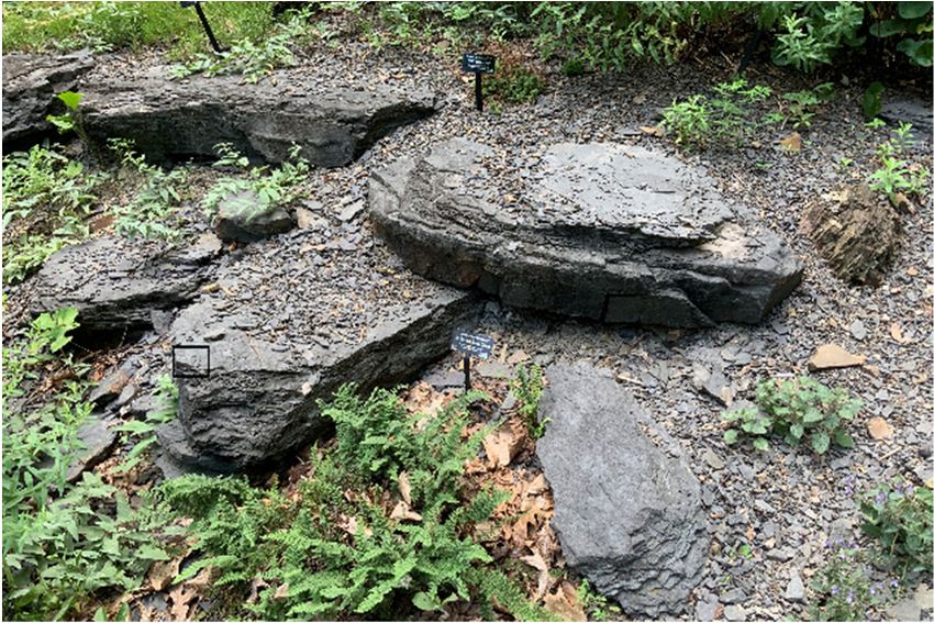
A rock garden was developed at the Edith J. Carrier Arboretum in Rockingham county, VA, USA,
with the participation of undergraduate students who expect to pursue a career in the geosciences and
science education. The Edith J. Carrier Arboretum provides a detailed overview on biodiversity in the
Shenandoah Valley and Rockingham county, but a limited perspective on the rocks along the arboretum
pathways and the geologic context. The rock garden at the Edith J. Carrier Arboretum is a place where
rocks look as they did when they were part of an outcrop on the side of a mountain or a creek in the
Shenandoah National Park. The rock garden potentially offers the opportunity to observe rocks and
minerals from Virginia without having to travel too far. The mineralogical characterization and the
geologic history of the rock slabs arranged along the pathways of the Edith J. Carrier Arboretum were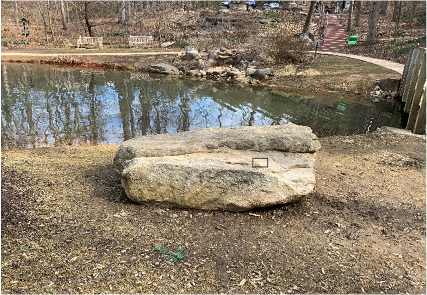
Geosciences 2020, 10, 415                                                                                3 of 16

the core of the present study. The present research aims to build an appreciation of mineral resources by
communities living and working around the Shenandoah National Park. A walk along the pathways
of the arboretum can inspire and educate visitors to explore the geologic history of the Appalachian
Mountain region by experiencing the mineralogy of the rocks and by considering the geologic context.

2. Materials and Methods

2.1. Edith J. Carrier Arboretum and Rock Specimens
     The Edith J. Carrier Arboretum (38◦ 250 44” N, 78◦ 510 46” W) is a 125-acre public urban garden
and forested greenspace located in the eastern border of the James Madison University campus
in Harrisonburg, VA. Of the 125-acre arboretum, 87 acres are wooded with hickory and oak trees.
The arboretum preserves native plant species, provides opportunities for research, and promotes
knowledge of the botanical and natural world for visitors of all ages. The Edith J. Carrier Arboretum
serves over 1400 students per year on field trips for enriching botanical educational experiences with
guided tours [11].
     Eleven rock specimens were collected along the major pathways in the Edith J. Carrier Arboretum,
and GPS locations were recorded to design an ArcGIS map.

2.2. Powder X-ray Diffraction (PXRD)
      Powder X-ray powder diffraction (PXRD) was used to identify the mineralogy of the eleven
rock specimens. The analyses were performed at the Department of Geology and Environmental
Science, James Madison University. X-ray patterns were collected at room temperature using a Malvern
PANalytical Empyrean diffractometer equipped with an X’Celerator detector, and CuKα radiation
(45 kV/40 mA). The incident beam optical module Malvern PANalytical Bragg-BrentanoHD was used
to improve the peak-to-background ratio and increase intensity in measured spectra. Analyses of the
samples were performed with spinner-mode analysis, a 2θ scan range between 3◦ and 70◦ , a step size
of 0.02◦ 2θ, a divergence slit of 0.125◦ , and anti-scatter slits of 0.5◦ . The fitted peak width for collected
data was about 0.01◦ 2θ.
      Quantitative mineralogical analyses via the Rietveld method [12] were carried out for selected
samples using General Structure Analysis System-II (GSAS-II) software [13].

2.3. Geological Setting of the Harrisonburg-Rockingham County Area, Virginia (U.S.A.)
     Rockingham County is in the northwestern part of Virginia and extends from the Blue Ridge on the
southeast to West Virginia on the northwest boundaries enclosing an area of 2127 km2 , mostly within
the Appalachian Valley and Ridge province [14].
     Bedrock includes a suite of Grenvillian basement rocks (basalt, gneiss, and granitoid),
Neoproterozoic metamorphosed sedimentary and volcanic rocks (quartzite and garnet-graphitic
gneiss surrounded by orthogneiss and granitoid), and early Cambrian siliciclastic sedimentary
rocks [15]. The rocks of sedimentary origin have a maximum apparent thickness of 7.62 km.
Limestone, shale, and dolostone occur extensively in Rockingham County. Deposits of iron, manganese,
zinc ores, limestone, building stone, and natural gas are also found in the county [14].
     Precambrian rocks are located in the Blue Ridge to the SE and the Mississippian rocks occur in the
western part of the Rockingham county. Precambrian rocks of the Blue Ridge consist of a complex of
igneous and metamorphic rocks (metabasaltic greenstone with thin layers of meta-arkose, phyllite,
and epiclastic breccia) known as a Catoctin formation [16]. The Catoctin rocks are overlain by a
sequence of sedimentary rocks (dolomites, limestones, and shales) known as the Chilhowee Group [16].
On the NW side of the Blue Ridge are Lower Cambrian sandstone, shale, and quartzite succeeded by
dolostone and limestone [14].
     The Shenandoah Valley (central part of Rockingham county) contains principally Cambrian
and Ordovician limestones, dolomites, shales, and sandstones [17]. Only the southern end of the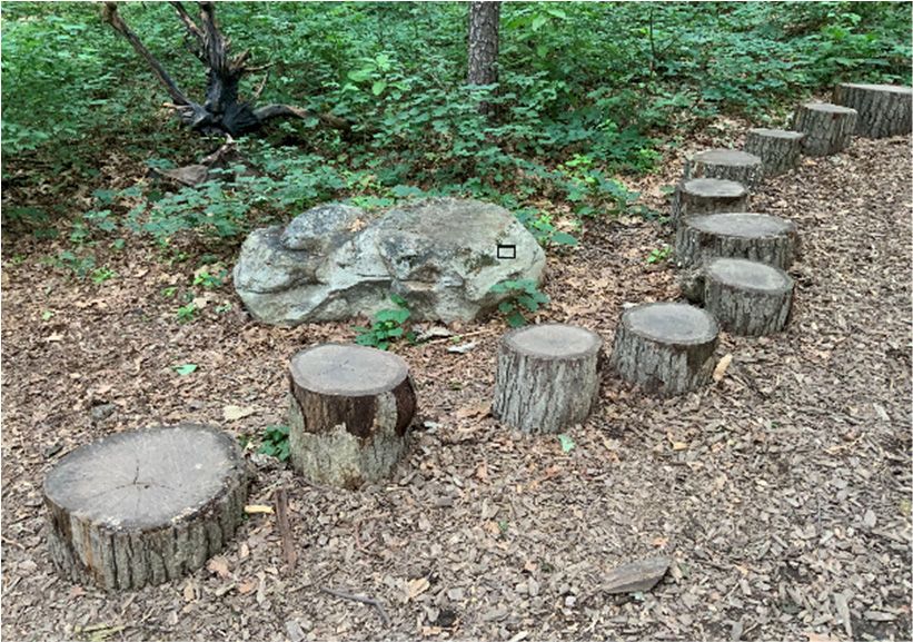
Geosciences 2020, 10, 415                                                                        4 of 16

Massanutten mountain lies within Rockingham County, where it ends abruptly in a peak that is visible
over most of the region. Massanutten Mountain is a ridge of about 80 km that lies entirely in the
Shenandoah Valley. Limestone and dolomite form the floor of the Shenandoah Valley and sandstone
forms the crest of the Massanutten mountain range west of the park; shale underlies the lower slopes of
the Massanutten mountain range [10]. Well-cemented quartz arenites of Silurian age underlie the long
linear ridges of the Massanutten Mountain complex. The rock layers in Massanutten Mountain are
folded downward in a syncline that accounts for its peculiar canoe-shaped area between a double ridge.
Like many of the mountains in western Virginia, erosion-resistant quartz-rich sandstone remained to
give Massanutten Mountain its distinctive shape [10,15,18].
     The western part of Rockingham county consists mainly of Devonian and Mississippian sandstones
and shales. A few basic magmatic intrusions in the form of dikes and sills and one wedge cut the
Cambrian and Ordovician sedimentary rocks [14].

2.4. Stratigraphy of Rockingham County, Virginia
     In Rockingham County bedrock ranges in age from Precambrian to Mississippian with a maximum
thickness of approximately 7 km for the sedimentary rocks. The Precambrian rocks (granodiorite,
granitoid, and other altered igneous rocks) crop out in the Blue Ridge along the southeastern margin of
the county [14].
     Overlying the Precambrian is a group of rocks of doubtful age, either Precambrian or Cambrian,
which crops out at the crest and along the northwest flank of the Blue Ridge and is composed of rocks
of igneous and sedimentary origin. Lower Cambrian shales, siltstones, sandstones, and quartzites are
exposed along the northwest side of the Blue Ridge and rest on these older rocks.
     The Shenandoah Valley is underlain principally by folded and faulted Cambrian and Ordovician
dolomites, limestones, shales, and subordinate sandstones. About 8 km northwest of the foot of
the Blue Ridge is the Massanutten synclinal complex, which has preserved Silurian and Devonian
sandstones, shales, and limestones.
     Little North Mountain consists mainly of steeply inclined Ordovician, Silurian, and Devonian
sandstones, shales, and limestones. From Little North Mountain northwest to the West Virginia
boundary is an area of chiefly Devonian and Mississippian sandstones and shales, but one anticline
exposes Ordovician and Silurian sandstones, shales, and limestones. The folding to the northwest
of Little North Mountain is commonly more gentle than that to the southeast of the mountain [14].
For further details on the geologic units in Rockingham County and stratigraphic column, see [19].

3. Results and Discussion
      Every specimen collected represented an outstanding example of rocks of the Appalachian
Mountains (Figure 1). PXRD was chosen for mineralogic analysis because of its inherent ability
to analyze fine-grained and impure complex crystalline mixtures such as sedimentary rocks.
PXRD analyses were intended to establish the presence of specific minerals (qualitative analysis) and
their percentage in weight (quantitative analysis via Rietveld method) (Figure 2). X-ray diffraction
is also rapid and accurate. Each crystalline component produces a characteristic pattern that can
readily be distinguished from patterns of other components in a mixture. These characteristic patterns
provide a qualitative identification of minerals in complex mixtures, as found in sedimentary rocks,
wherever thin-section petrographic studies may not be feasible owing to the fine crystallite size and
complexity of the mixture. Table 1 summarizes the mineralogy, mineral weight percentages, and the
rock type of the samples analyzed. Based on the mineralogy, the rock types found in this study are
limestone, shale, dolostone, and quartzite. Sample 8 was classified as dolomitic limestone using the
mineral weight percentages.
Geosciences 2020, 10, 415                                         5 of 16

Geosciences 2020, 10, x FOR PEER REVIEW                           5 of 16

                            (a)                             (b)

                            (c)                             (d)

                            (e)                             (f)

                            (g)                             (h)

                                          Figure 1. Cont.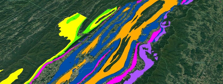
Geosciences 2020, 10, 415                                          6 of 16

 Geosciences 2020, 10, x FOR PEER REVIEW                            6 of 16

                            (i)                              (j)

                            (k)                              (l)

                            (m)                              (n)

                            (o)                              (p)

                                           Figure 1. Cont.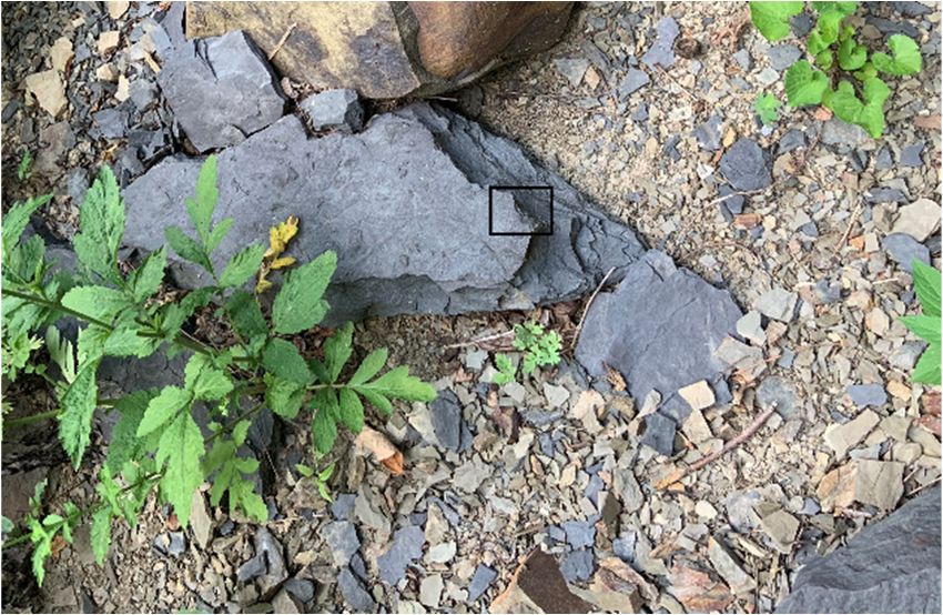
Geosciences 2020, 10, 415                                                                                                            7 of 16
Geosciences 2020, 10, x FOR PEER REVIEW                                                                                              7 of 16

                                (q)                                                                    (r)

                                (s)                                                                    (t)

                                (u)                                                                   (v)
       Figure 1.
      Figure      1. Samples
                     Samples collected
                                 collected atat the
                                                 the Edith
                                                     Edith J.J. Carrier
                                                                Carrier Arboretum
                                                                          Arboretum representing
                                                                                        representing thethe rock
                                                                                                            rock types
                                                                                                                   types described
                                                                                                                           described
       in   this study.   Penny   for scale.   (a) Sample   1 (shale);   (b) sample  1 (detail);  (c) sample
      in this study. Penny for scale. (a) Sample 1 (shale); (b) sample 1 (detail); (c) sample 2 (shale);      2 (shale);  (d) sample
       2 (detail);
      (d)    sample(e)    sample (e)
                      2 (detail);  3 (quartzite);    (f) sample (f)
                                       sample 3 (quartzite);       3 (detail);
                                                                      sample (g)   sample(g)
                                                                               3 (detail);   4 (quartzite);  (h) sample(h)
                                                                                                sample 4 (quartzite);      4 (detail);
                                                                                                                              sample
      4(i)(detail);
            sample(i) 5 (dolostone);    (j) sample (j)
                         sample 5 (dolostone);        5 (detail);
                                                          sample(k)    sample (k)
                                                                   5 (detail); 6 (quartzite);   (l) sample 6(l)
                                                                                   sample 6 (quartzite);      (detail);
                                                                                                                 sample  (m)  sample
                                                                                                                           6 (detail);
       7 (quartzite);
      (m)                 (n) sample 7(n)
              sample 7 (quartzite);       (detail);
                                             sample(o)   sample 8(o)
                                                       7 (detail);   (dolomitic
                                                                        sample 8limestone);     (p) sample 8(p)
                                                                                  (dolomitic limestone);       (detail);
                                                                                                                  sample(q)   sample
                                                                                                                           8 (detail);
       9   (dolostone);     (r) sample    9  (detail);  (s) sample     10  (quartzite);  (t) sample    10 (detail);
      (q) sample 9 (dolostone); (r) sample 9 (detail); (s) sample 10 (quartzite); (t) sample 10 (detail); (u) sample (u)  sample   11
       (dolostone);
      11    (dolostone); (v)(v)
                             sample
                                sample11 11(detail).
                                              (detail).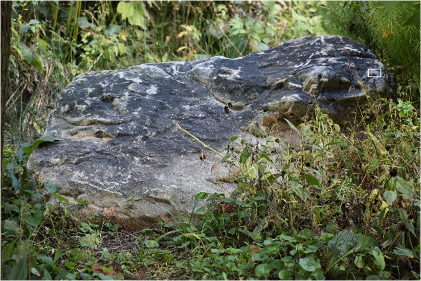
Geosciences 2020, 10, 415                                   8 of 16
Geosciences 2020, 10, x FOR PEER REVIEW                     8 of 16

                                                (a)

                                               (b)

                                                (c)

                                          Figure 2. Cont.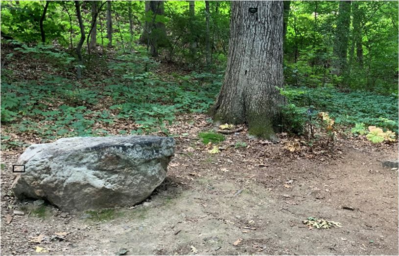
Geosciences 2020, 10, 415                                   9 of 16
Geosciences 2020, 10, x FOR PEER REVIEW                     9 of 16

                                                (d)

                                                (e)

                                                (f)

                                          Figure 2. Cont.
Geosciences 2020, 10, 415                                   10 of 16
Geosciences 2020, 10, x FOR PEER REVIEW                     10 of 16

                                                (g)

                                                (h)

                                                (i)

                                          Figure 2. Cont.
Geosciences 2020, 10, 415 11 of 16
Geosciences 2020, 10, x FOR PEER REVIEW 11 of 16
(j)
(k)
Figure 2. X-ray
X-ray diffraction
diffraction (XRD)
(XRD)patterns
patternsforfor(a)
(a)sample
sample1;1;(b) (b)sample
sample2;2;(c)(c)sample 3; 3;
sample (d)(d)
sample
sample4;
(e)(e)
4; sample 5; (f)
sample 5; sample 6; (g)6;sample
(f) sample 7; (h)7;
(g) sample sample 8; (i) sample
(h) sample 9; (j) sample
8; (i) sample 10; (k) sample
9; (j) sample 10; (k)11. Rietveld
sample 11.
refinement
Rietveld results are
refinement reported
results in Table in
are reported 1. Table 1.
Table 1. Mineralogy of the samples collected at the Edith J. Carrier Arboretum. Standard deviation
Documentation of the field location and geologic context were crucial for the correct
in parentheses. The rock type was determined based on the quantitative mineralogic analyses.
interpretation of the analytical PXRD data (see Geological setting of the Harrisonburg-Rockingham
The geologic unit was determined using the hand specimen analyses.
County area, Virginia (U.S.A.)). Hence, the mineralogy of the rocks analyzed using PXRD was used
to reconstruct the geographicMinerallocation
Amount of the sample collected (Table 1). All rocks are part of the
Sample ID Minerals Rock Type Geologic Unit [10,14,19]
Present (wt%) in the Harrisonburg-Rockingham County area (Virginia,
geologic history of the Appalachians
Quartz
U.S.A.). Cambrian 65.1(2)limestone and dolostone form the floor of the Shenandoah Valley,
and Ordovician
Feldspar 3.4(4) Brallier Formation (Devonian). Shale, medium-gray,
whereas
Sample quartzite
1 is exposed15.1(1)
Muscovite
along the northwest
Shale
side of theyellowish
Blue Ridge. The medium-gray,
weathering, sedimentary rocks
developed as dolostone,
Illite limestone,
12.7(5) and shale are overlain Precambrian granitic
medium-grained, friable, and metamorphic
thin-bedded.
Clinochlore 3.7(6)
rocks. Granitic rocks where not found in the arboretum trails. Several samples of quartzite were
found in the arboretum
Quartz as part of the Chilhowee group (Weverton Formation, Harpers Formation,
58.4(2)
Feldspar 15.2(4)
and Antietam
Sample 2
Formation). Martinsburg Formation (Devonian). Dark gray to
Muscovite 13.6(5) Shale
black thinly laminated to fissile shale.
Illite 9.9(3)
Clinochlore 2.9(4)Geosciences 2020, 10, 415 12 of 16
Table 1. Cont.
Mineral Amount
Sample ID Minerals Rock Type Geologic Unit [10,14,19]
Present (wt%)
Chilhowee Group (Cambrian). Quartzite, fine- to
coarse-grained, well rounded quartz-pebble
Sample 3 Quartz Quartzite conglomerate beds locally, medium- to thick-bedded,
cross-bedded, very resistant, with ferruginous
cement in some beds.
Chilhowee Group (Cambrian). Quartzite,
medium-gray to pale-yellowish-white, fine- to
Sample 4 Quartz Quartzite
medium grained, locally with very minor
quartz-pebble conglomerate, very resistant.
Calcite 1.4(3)
Beekmantown Group (Ordovician). Dolostone, light-
Sample 5 Dolomite 95.2(2) Dolostone
to dark-gray, medium-grained, thick-bedded.
Quartz 3.4(2)
Chilhowee Group (Cambrian). Quartzite,
medium-gray to pale-yellowish-white, fine- to
Sample 6 Quartz Quartzite
medium grained, cross-laminated, medium- to
very-thick-bedded, very resistant.
Chilhowee Group (Cambrian). Quartzite is
Sample 7 Quartz Quartzite very-light-gray, fine-grained, thick-bedded and
cross-bedded, very resistant.
Calcite 80.8(1) Elbrook formation (Cambrian). Dolostone and
Sample 8 Dolomitic limestone, light- to medium- yellowish
Dolomite 13.3(2)
limestone white, fine-grained.
Quartz 5.9(1)
Quartz 4.9 (3)
Beekmantown Group (Ordovician).
Feldspar 1.6(7)
Sample 9 Dolostone Dolostone, mottled, fine- to coarse-grained,
Calcite 2.1(6)
thick-bedded, calcareous.
Dolomite 91.3(4)
Chilhowee Group (Cambrian) Quartzite,
Sample 10 Quartz Quartzite light-gray with few nearly white, fine- to
medium-grained, thick-bedded.
Quartz 2.9(4)
Beekmantown Group (Ordovician). Dolostone, dark-
Feldspar 0.8(5)
Sample 11 Dolostone to light-gray, fine- to medium-grained, medium- to
Dolomite 95.7(3)
thick-bedded with minor nodular white chert.
Calcite 0.6(6)
Documentation of the field location and geologic context were crucial for the correct interpretation
of the analytical PXRD data (see Geological setting of the Harrisonburg-Rockingham County area,
Virginia (U.S.A.)). Hence, the mineralogy of the rocks analyzed using PXRD was used to reconstruct
the geographic location of the sample collected (Table 1). All rocks are part of the geologic history of
the Appalachians in the Harrisonburg-Rockingham County area (Virginia, U.S.A.). Cambrian and
Ordovician limestone and dolostone form the floor of the Shenandoah Valley, whereas quartzite is
exposed along the northwest side of the Blue Ridge. The sedimentary rocks developed as dolostone,
limestone, and shale are overlain Precambrian granitic and metamorphic rocks. Granitic rocks where
not found in the arboretum trails. Several samples of quartzite were found in the arboretum as part of
the Chilhowee group (Weverton Formation, Harpers Formation, and Antietam Formation).
To localize the geologic units where the samples were analyzed belong (Figure 3), a simplified
geologic map was designed based on the U.S. Geological Survey (USGS) GIS database of geologic
units, lithology, age, and structural features in Virginia [20].Geosciences 2020, 10, 415 13 of 16
Geosciences 2020, 10, x FOR PEER REVIEW 13 of 16
Figure
Figure 3. Simplified geologic
3. Simplified geologic map
map designed
designed to localize the
to localize geologic units
the geologic units where
where the
the samples
samples analyzed
analyzed
belong. The map was based on the U.S. Geological Survey (USGS) GIS
belong. The map was based on the U.S. Geological Survey (USGS) GIS database of database of geologic
geologic units,
units,
lithology,
lithology, age,
age, and
andstructural
structuralfeatures
featuresin
inVirginia
Virginia[20].
[20].
An ArcGIS map was designed based on the GPS location of the samples (Table 2) collected to
An ArcGIS map was designed based on the GPS location of the samples (Table 2) collected to
pinpoint the rock locations of specimens along the arboretum trails. The map was digitized over a
pinpoint the rock locations of specimens along the arboretum trails. The map was digitized over a
satellite image of the Edith J. Carrier Arboretum using Adobe Illustrator (Figure 4). The legend in the
satellite image of the Edith J. Carrier Arboretum using Adobe Illustrator (Figure 4). The legend in the
map was constructed from the analytical PXRD data. The map is used during guided tours at the Edith
map was constructed from the analytical PXRD data. The map is used during guided tours at the
J. Carrier Arboretum and is made available to the public at the Visitor Center to help with locating the
Edith J. Carrier Arboretum and is made available to the public at the Visitor Center to help with
rock specimens along the arboretum trails.
locating the rock specimens along the arboretum trails.
The protection of the cultural heritage represents an interdisciplinary process at the intersection
Table 2. GPS location of the sample analyses.
between art, history, science, policies for management, and exploitation [6,21]. Current geological
activity in Shenandoah National ParkIDis a result
Sample of natural
Latitude and man-made forces acting on the
Longitude
surrounding mountains and valleys. Sample People
1 have lived in the
38.4292824 Blue Ridge Mountains for at least 9000
−78.8612711
years and the geology of the Blue Ridge2 greatly
Sample influenced−78.8613368
38.4291792 the location of the settlements. The early
mountain people and probably Sample 3 Americans
the Native −78.8614467
38.4289492 before them selected homesites where water,
Sample 4 38.4288391
gentle slopes, and fertile soils were present [10]. Local and −78.8607638
foreign visitors alike do not generally
Sample 5 38.4288047 −78.8607712
recognize the impact of geological Sample 6
heritage, in particular
38.4287855
mineralogy, on ecosystems and the
−78.8608165
development of cultures. This Sample creates7 a need for educational
38.4287839 programs that employ inventive
−78.8605754
communication techniques. The Sampledevelopment
8 of a rock garden
38.4293457 at the Edith J. Carrier Arboretum aims
−78.8620704
Sample 9as a 38.4291133
to nurture interest in the geosciences prominent and −78.8622960
lasting effective informal educational
Sample 10 38.4290886 −78.8620922
experience. Through different methods, the rock garden pushes to involve the general public, offering
Sample 11 38.4282564 −78.8628335
hands-on workshops free of charge to ensure that a sound basis in scientific disciplines is not just a
privilege. The rock garden is also acting as an extension to an indoor mineral museum housed nearby,
thus reaching a diverse public. The mineral museum features more than 600 unique and unusual
crystal and gemstone specimens from all around the world. Two cases of the museum contain about
100 mineral specimens from Virginia. The mineralogy of the rock slabs in the arboretum aids to
educate the community on the importance of minerals, develop an understanding of where rocks and
minerals used in everyday life come from, improve the public perception of mineral resources, and
promote responsible and sustainable use of natural resources.Geosciences 2020, 10, 415 14 of 16
Geosciences 2020, 10, x FOR PEER REVIEW 14 of 16
Figure 4. ArcGIS map designed digitized over a satellite image of the Edith J. Carrier Arboretum
Figure 4. ArcGIS map designed digitized over a satellite image of the Edith J. Carrier Arboretum using
using Adobe Illustrator. The GPS data of the samples collected along the arboretum trails were used
Adobe Illustrator. The GPS data of the samples collected along the arboretum trails were used to locate
to locate the samples on the map (Table 2). Legend: 1. shale; 2. shale; 3. quartzite; 4. quartzite; 5.
the samples on the map (Table 2). Legend: 1. shale; 2. shale; 3. quartzite; 4. quartzite; 5. dolomite;
dolomite; 6. quartzite; 7. quartzite; 8. dolomitic limestone; 9. dolomite; 10. quartzite; 11. dolomite.
6. quartzite; 7. quartzite; 8. dolomitic limestone; 9. dolomite; 10. quartzite; 11. dolomite.
Table 2. GPS location of the sample analyses.
The protection of the cultural heritage represents an interdisciplinary process at the intersection
between art, history, science,Sample policiesID for management,
Latitude Longitude
and exploitation [6,21]. Current geological
Sample 1 38.4292824 −78.8612711
activity in Shenandoah National Park is a result of natural and man-made forces acting on the
Sample 2 38.4291792 −78.8613368
surrounding mountains and valleys. People have lived in the Blue Ridge Mountains for at least
Sample 3 38.4289492 −78.8614467
9000 years and the geology Sample of the 4Blue Ridge greatly influenced
38.4288391 the location of the settlements.
−78.8607638
The early mountain people and probably
Sample 5 the Native
38.4288047 Americans before
−78.8607712 them selected homesites
where water, gentle slopes, and fertile
Sample 6 soils were present [10].−78.8608165
38.4287855 Local and foreign visitors alike do not
generally recognize the impact Sample 7
of geological 38.4287839 −78.8605754
heritage, in particular mineralogy, on ecosystems and
Sample 8 38.4293457 −78.8620704
the development of cultures. This creates a need for educational programs that employ inventive
Sample 9 38.4291133 −78.8622960
communication techniques. The development of a rock garden at the Edith J. Carrier Arboretum
Sample 10 38.4290886 −78.8620922
aims to nurture interest in theSample geosciences
11 as38.4282564
a prominent and lasting effective informal educational
−78.8628335
experience. Through different methods, the rock garden pushes to involve the general public,
offeringTo hands-on workshopsawareness
raise community free of charge to ensure
about that a sound
the importance basis mineralogy
of local in scientific as
disciplines
well as isthenot
justinteraction
a privilege. The rock garden is also acting as an extension to an indoor mineral
of the intrinsic properties of natural stones and environmental impact, a workshop museum housed
nearby,
focusingthusonreaching a diverse of
the identification public.
mineralsTheandmineral
rocksmuseum features
was proposed morefor
in 2018 than 600 unique
public educationand
unusual crystal
(children andand gemstone
adults) usingspecimens
the newlyfrom all around
developed rockthe world.The
garden. Twoworkshop
cases of the museum
provides contain
several
about 100 mineral specimens
multidisciplinary from Virginia.
activities involving The mineralogy
interpretative processesofbased
the rock
on slabs in the arboretum
the relationships between aids
local mineralogy,
to educate rocks, on
the community soils,
theand plant growing.
importance One develop
of minerals, of the workshop activities of
an understanding designed for
where rocks
andchildren
minerals was a learning
used game aiming
in everyday life come to identify differentthe
from, improve rocks
publicbased on the pictures
perception of specimens
of mineral resources,
displayed in the Edith J. Carrier Arboretum. Participants
and promote responsible and sustainable use of natural resources. in a game received a photo of a rock in the
Edith J. Carrier Arboretum and searched for the rock in the photograph. After the
To raise community awareness about the importance of local mineralogy as well as the interactionparticipants located
the rock,
of the children
intrinsic were encouraged
properties to drawand
of natural stones the environmental
rock using a clipboard,
impact,colored pencils,focusing
a workshop crayons,onandthe
then bring their drawing at the Visitor Center. A brief explanation of the minerals, the rock type, andGeosciences 2020, 10, 415 15 of 16
identification of minerals and rocks was proposed in 2018 for public education (children and adults)
using the newly developed rock garden. The workshop provides several multidisciplinary activities
involving interpretative processes based on the relationships between local mineralogy, rocks, soils,
and plant growing. One of the workshop activities designed for children was a learning game aiming to
identify different rocks based on the pictures of specimens displayed in the Edith J. Carrier Arboretum.
Participants in a game received a photo of a rock in the Edith J. Carrier Arboretum and searched for
the rock in the photograph. After the participants located the rock, children were encouraged to draw
the rock using a clipboard, colored pencils, crayons, and then bring their drawing at the Visitor Center.
A brief explanation of the minerals, the rock type, and geologic origin was provided. Participants who
identified the rock correctly received a giveaway as a reward for participating. The outcomes of
the activity included fostering a sense of wonder for minerals and rocks, being respectful of the
environment, and gathering in a social environment.
4. Conclusions and Future Work
Sustainable tourism development needs to be integrated with best practice management to
enhance the visitor experience, promote inclusive social integration, and protect natural resources and
cultural heritage. What we see today in the Blue Ridge is a part of the geologic framework of the Earth’s
crust being altered and partially exposed by geologic events, and the impact of climate and biological
processes on the rock material that now forms the mountains. Education is a fundamental prerequisite
for the achievement of sustainable tourism. Using examples of rock slabs from surrounding areas is a
unique way for visitors to gain a better appreciation of geologic materials, their uses, and the local
natural environment. Visitors have the educational and recreational opportunity to observe local rocks
within a pleasant urban environment.
Shales and limestones are the most abundant sedimentary rocks throughout Rockingham county,
but their mineralogical components are difficult to study thoroughly because of their fine-grained
nature. Due to the inherent difficulty of analyzing fine-grained minerals in thin sections and hand
specimens, this paper illustrates a method for rapid, feasible, and accurate quantitative mineralogical
analysis of complex mixtures such as sedimentary rocks. The quantitative mineralogical analysis of
the rock slabs allowed us to classify the samples precisely.
Further developments of the present project will pertain to the design of special educational
materials. To make the visit at the rock garden an inclusive experience, the educational materials
(guidebook and posters) will be accessible to individuals with impairments. Using a speech-to-text
software, the guidebook will be converted to an audiobook and translated to several languages.
A permanent mineral museum established in the area will implement the outreach activities of the
Edith J. Carrier Arboretum in Rockingham county (Virginia, U.S.A.).
Author Contributions: Conceptualization, C.E. and A.G.S.; Data curation, C.E., A.G.S. and G.P.W.; Investigation,
C.E. and A.G.S.; Methodology, C.E.; Supervision, C.E.; Validation, C.E.; Writing—original draft, C.E.;
Writing—review and editing, C.E., A.G.S. and G.P.W. All authors have read and agreed to the published
version of the manuscript.
Funding: This research was funded by JMU Faculty Senate Mini-Grants for Engagement Projects and Doherty
Geology Student Research Endowment.
Acknowledgments: We acknowledge the Edith J. Carrier Arboretum Director, Jan Sievers Mahon for her support
during the sample collection and continuing interest in the development of engaging educational activities.
We are grateful to Stephen Guggenheim for the critical reading of the manuscript and his thoughtful and
constructive feedback. Three anonymous reviewers are acknowledged for their comments that greatly improved
the manuscript.
Conflicts of Interest: The authors declare no conflict of interest.
References
1. Brilha, J.; Gray, M.; Pereira, D.I.; Pereira, P. Geodiversity: An integrative review as a contribution to the
sustainable management of the whole of nature. Environ. Sci. Policy 2018, 86, 19–28. [CrossRef]Geosciences 2020, 10, 415 16 of 16
2. Brocx, M.; Semeniuk, V. Geoheritage and geoconservation history, definition, scope and scale. J. R. Soc.
West. Aust. 2007, 90, 53–87.
3. Gray, M. Geodiversity: Valuing and Conserving Abiotic Nature; John Wiley & Sons: Hoboken, NJ, USA, 2004;
ISBN 0-470-84895-2.
4. Gray, M. Geodiversity: The origin and evolution of a paradigm. Geol. Soc. Lond. Spec. Publ. 2008, 300, 31.
[CrossRef]
5. Górska-Zabielska, M.; Witkowska, K.; Pisarska, M.; Musiał, R.; Jońca, B. The Selected Erratic Boulders in
the Świ˛etokrzyskie Province (Central Poland) and Their Potential to Promote Geotourism. Geoheritage 2020,
12, 30. [CrossRef]
6. Bailey, H.; Hill, W. The Future of North American Geoparks. Georg. Wright Forum 2010, 27, 52–59.
7. Dowling, R.; Newsome, D. Handbook of Geotourism; Edward Elgar Publishing: Cheltenham, UK, 2018;
ISBN 978-1-78536-885-1.
8. Gordon, J.E. Geoheritage, Geotourism and the Cultural Landscape: Enhancing the Visitor Experience and
Promoting Geoconservation. Geosciences 2018, 8, 136. [CrossRef]
9. Marr, J.; Sites, R. A guide to the educational rock and mineral garden: Samples of Virginia’s geological
diversity. Va. Miner. 2002, 48, 1–24.
10. Gaithright, T.M., II. Geology of the Shenandoah National Park. Va. Div. Miner. Resour. 1976, 86, 146.
11. James Madison University Edith J. Carrier Arboretum. Available online: https://www.jmu.edu/arboretum/
(accessed on 19 August 2020).
12. Rietveld, H.M. A profile refinement method for nuclear and magnetic structures. J. Appl. Crystallogr. 1969, 2,
65–71. [CrossRef]
13. Toby, B.H.; Dreele, R.B.V. GSAS-II: The genesis of a modern open-source all purpose crystallography
software package. J. Appl. Crystallogr. 2013, 46, 544–549. [CrossRef]
14. Brent, W.B. Geology and Mineral Resources of Rockingham County. Va. Div. Miner. Resour. 1960, 76, 174.
15. Southworth, S.; Eaton, L.S.; Lamoreaux, M.H.; Burton, W.C.; Bailey, C.M.; Hancock, G.; Litwin, R.J.; Whitten, J.
Geology of the Shenandoah National Park Region. In Proceedings of the 39th Annual Virginia Geological
Field Conference, Charlottesville, VA, USA, 2–3 October 2009; p. 44.
16. Johnson, A.; Bailey, C. The Catoctin Formation Virginia Is for Lavas. Available online: https://geology.wm.
edu/bailey/CatoctinFormation.pdf (accessed on 18 June 2020).
17. Levy, R. Contrasting Ridges in Virginia. Available online: https://earthobservatory.nasa.gov/images/89843/
contrasting-ridges-in-virginia (accessed on 20 September 2020).
18. Sherwood, W.C. A Brief Geologic History of Rockingham County. Available online: http://csmgeo.csm.jmu.
edu/geollab/vageol/outreach/fieldtrips/rockingham/whole.html (accessed on 25 May 2020).
19. U.S. Geological Survey (USGS). Geologic Units in Rockingham County, Virginia. Available online: https:
//mrdata.usgs.gov/geology/state/fips-unit.php?code=f51165 (accessed on 22 June 2020).
20. U.S. Geological Survey (USGS). Virginia Geologic Map Data. Available online: https://mrdata.usgs.gov/
geology/state/state.php?state=VA (accessed on 4 October 2020).
21. Margottini, C. Engineering Geology in Shaping and Preserving the Historic Urban Landscapes and Cultural
Heritage: Achievements in UNESCO World Heritage Sites. In Engineering Geology for Society and Territory;
Lollino, G., Giordan, D., Marunteanu, C., Christaras, B., Yoshinori, I., Margottini, C., Eds.; Springer:
Berlin, Germany, 2015; Volume 8, pp. 1–28.
Publisher’s Note: MDPI stays neutral with regard to jurisdictional claims in published maps and institutional
affiliations.
© 2020 by the authors. Licensee MDPI, Basel, Switzerland. This article is an open access
article distributed under the terms and conditions of the Creative Commons Attribution
(CC BY) license (http://creativecommons.org/licenses/by/4.0/).You can also read