Draft Mobility Strategy - January 2022 This draft Mobility Strategy is provided for public feedback before finalizing in Spring 2022 - City of ...
←
→
Page content transcription
If your browser does not render page correctly, please read the page content below
Draft Mobility Strategy

January 2022

This draft Mobility Strategy is provided for public
feedback before finalizing in Spring 2022

                                                      mobilitystrategy@cnv.org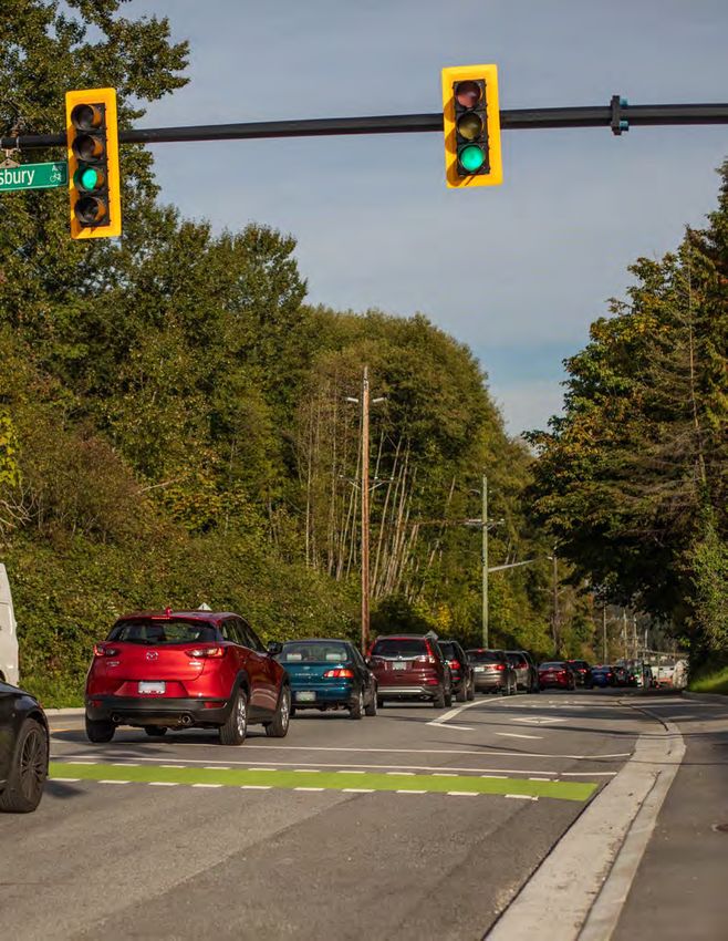
Our streets have
many purposes
for residents,
businesses, and
visitors.
This is our strategy
  to create healthy
  streets that work
       for ever yone.
Table of Contents
1: The Introduction (pp. 6-15) summarizes the opportunities and challenges that exist to create
a healthier city with a transportation system that works for everyone. It also describes the work
undertaken to date to develop this Draft Mobility Strategy.

2: The Vision and Goals (pp. 16-21) outlines a shared vision for the future of mobility in the city, with
four supporting goals and how we propose to monitor our progress. It describes the proposed future
transportation system and what is needed to achieve a safe, sustainable, vibrant, and connected
network of streets that provides a high quality experience for everyone.

3: The Strategies and Actions (pp. 22-67) presents 11 strategies, along with supporting actions
that we can take to achieve our vision and goals for mobility in the city. It also introduces a new way
for all of us to think about our streets – one that puts people first.

4: Implementation (pp. 68-69) describes how we will implement the final version of this strategy,
including how the City will set priorities, and involve the public in our decision-making, build
partnerships, and make the best use of resources.

5. The Glossary (p. 70) defines the mobility-related terms that we use throughout this draft.

                        We want to hear from you!

  The ideas and feedback we receive will inform a final version of this Draf t
  Mobility Strategy that staf f will present to City Council for approval in early
  2022.

  The 2-minute read: Only have a few minutes to par ticipate? Skip to page 22 for
  a summar y of the strategies.

  The 20-minute read: Take a look at pages 25, 35, and 45, which outline
  actions at a glance.

  The in depth read: Keep going! You’ll get a full picture of the challenges and
  oppor tunities, as well as the vision, goals, strategies, and actions.

                                    C N V D R A F T M O B I L I T Y S T R AT E GY
                                                         4                                     DRAFT
C N V D R A F T M O B I L I T Y S T R AT E GY
                     5                          DRAFT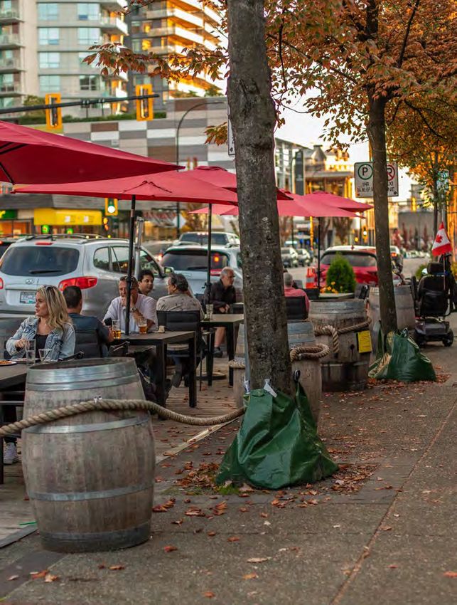
1 . Introduction
What is the Draft Mobility
Strategy?
This Draft Mobility Strategy proposes a new blueprint for a modern, well-balanced transportation
system in the City of North Vancouver that provides real mobility choices, creates great and inclusive
places, and supports climate action.

The needs and demands on our City’s streets and transportation system today are rapidly evolving and
becomingly increasingly complex. The actions and strategies included in the Draft Mobility Strategy
are proposed to guide transportation planning and policy decisions over the next ten years towards
ensuring our streets can work better for everyone.

                                  C N V D R A F T M O B I L I T Y S T R AT E GY
                                                       6                                  DRAFT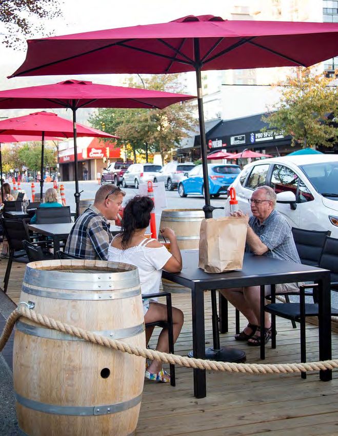
Our proposed approach:

Puts people first:
Everyone who lives or works in our community will be able to prosper, no matter who they are or how
they move around the city.

Supports a thriving economy:
Our streets will support efficient goods movement, foster more foot traffic for local businesses, and
make it easier for businesses to attract and retain workers.

Recommends actions tailored for our City:
Our city, along with the region, is growing in population and employment. More people, jobs, services,
uses, and activities are creating new demands on our streets. This strategy takes proven best practices
from places that face similar challenges and opportunities and tailors these for our City’s context.

Prepares for the future of travel:
The ways we travel and the options we have available continue to evolve. This strategy is about creating
the enabling conditions to provide a variety of travel options for people in the city that are high-quality,
affordable, and sustainable.

The Draft Mobility Strategy was developed by taking a comprehensive assessment of our City’s and
regional mobility needs, challenges and opportunities and aims to reflect the values and priorities that
we heard from the public and stakeholders during the spring of 2021. Now we want to hear from you
again as we work towards a final Mobility Strategy!

                                  C N V D R A F T M O B I L I T Y S T R AT E GY
                                                       7                                        DRAFT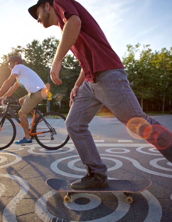
Mobility and transportation
in the city today
                                                                                                    District of
                                                                                                 North Vancouver
                                                        1

  The City is the urban core
  of the North Shore. Our                           District of West
                                                      Vancouver
  streets help get people to
  school and work, support
  businesses, provide a place                                          Squamish
                                                                        Nation
  for people to gather, and                                                                                    1

  connect us with the rest of
  the region.
                                                 City of Vancouver
                                                                                                 To Lower Mainland

How residents move today
         trips we make each day                                               of trips stay local
         Including going to work or                                           Most of our trips are
  3-4    class, dropping our kids at                        70%               shorter trips that stay
         school, or running errands.1                                         on the North Shore.2

         of trips are by vehicle                                              average distance driven / day
         Driving trips have decreased                                         Though driving trips have
 70%     by 3% in the last decade even                      15 km             decreased, we are driving
         as our population has grown.1                                        longer distances—2 km
                                                                              more than a decade ago.2
         of trips are sustainable
         Trips that include walking and                                       average distance driven / person
 30%
         rolling, cycling, or taking transit
         have increased about 3% in
                                                            8,000             The average distance we drive
                                                                              each year is roughly the same as
                                                              km
         our City over the last decade.1                                      driving to Toronto and back.2

                                                                         1
                                                                             2017 TransLink Regional Trip Diary
                                                                         2
                                                                             2019 North Shore Transportation Survey

                               C N V D R A F T M O B I L I T Y S T R AT E GY
                                                    8                                                      DRAFT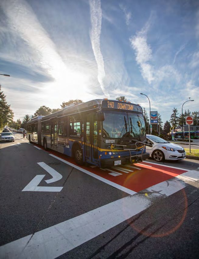
The context of our streets
Our mobility network

Our network of streets, sidewalks, mobility
lanes, public trails, and bus lanes stretches
over 550 km, enough to stretch from North
Vancouver to Vernon. That’s about 20% of all
space in the City. About 80% of that space is
dedicated to vehicles and nearly a third of that
is dedicated to parking. We don’t have much
space to expand the road network, so we must
make the best use of what we have.

A shared responsibility

Multiple agencies, levels of government, and
service providers are responsible for making
our transportation system work. The City is
responsible for streets and sidewalks. The
Province is responsible for highways. TransLink
takes care of providing our bus and SeaBus
service. Modo and Evo operate car-share
services. Uber and Lyft offer ride-hailing services.
Lime is piloting an e-bike share system. Public
and private partnerships will continue to be
valuable to provide transportation services to
meet a wide range of needs, even if technologies
and companies change over the lifespan of this
Strategy.

Building on our recent success

We have accomplished a lot in the last decade.
We have expanded our sidewalk and cycling
network which has contributed to increases in
the amount of walking and rolling trips. We have
worked with TransLink and other partners to
introduce more reliable transit services which
has increased the amount of people who take
transit. Our municipality has one of the highest
sustainable mode shares (walking, rolling, and
transit) in the region and this is an important
trend to continue as the city and region continue
to grow.

                                   C N V D R A F T M O B I L I T Y S T R AT E GY
                                                        9                          DRAFT
Our city and our streets
are changing

We are in the middle of a growing &                        Our mobility choices impact the
changing region:                                           environment & our climate:

Metro Vancouver is one of the fastest growing              Emissions from motorized vehicles generate
regions in Canada. In the last decade, the North           carbon pollution, impact storm water
Shore has added nearly 10,000 jobs but only                management, add to the urban heat island
7,000 residents, which means more people                   effect, and impact our air quality. Our use of
are commuting between the North Shore and                  vehicles accounts for about 57% of our city’s
other parts of the region every day. Many people           total carbon emissions.4 We need to provide
choose to drive (70 percent of trips in the                better options for sustainable travel in order to
City)3 because transit is perceived to not be as           collectively reduce our emissions.
convenient or efficient, and walking and rolling
infrastructure is not sufficiently attractive and          The demands on our streets are
comfortable.                                               becoming increasingly complex:

Our mobility options are growing:                          Our streets are places where we travel, connect,
                                                           dine, rest, shop, and exercise. They support
New technologies and services are providing                goods delivery and help our businesses,
new travel options and challenges. E-bikes,                industries, and economy prosper. Our streets
ride-hailing, car-sharing, and rapid transit               are places where we celebrate, meet with
are all changing how we move around. Our                   others, and conduct business. This wide range
smartphones provide us with real-time data at              of demands on our streets makes planning
our fingertips, but are also linked to distracted          and allocating space for different uses more
driving incidents. The rise of e-commerce and              challenging without proper guidelines.
online shopping means more trucks and delivery
vehicles than ever before. Automated vehicles
are also on the horizon. Technology can create
improved efficiency, but can also create more
pressures on our streets, and in some cases, be            3
                                                               2017 TransLink Regional Trip Diary
a detriment to our safety.                                 4
                                                            Climate and Environment Strategy Phase 1
                                                           Discussion Guide, October 2021

                                  C N V D R A F T M O B I L I T Y S T R AT E GY
                                                      10                                            DRAFT
What have we heard so far?
In spring 2021, City staff engaged with the public and over thirty stakeholder groups, including partners,
community associations, and neighbouring jurisdictions. Our focus was to receive feedback on the
Mobility Strategy’s preliminary set of goals and strategies, as well as to hear and learn about the range
of experiences people and businesses have with using our streets and transportation system.
Eighty percent of public respondents felt that the draft vision and goals introduced in the initial framework
for this Strategy reflected what was important to them, and all stakeholder groups we met with saw their
own strategic direction being reflected through one or more of the Mobility Strategy goals. Through this
engagement, several themes rose to the top in terms of opportunities, challenges, and values.
Increased traffic is making us feel frustrated, less safe,
and is hurting our economy. Being stuck in traffic makes
it difficult to plan our day, increases our stress, and can I am interested in driving less, but it's not
result in wasted productivity. Congestion is spilling onto always easy or convenient for me to walk,
cycle, or take transit so I need to drive.
our local streets, making people feel less safe, and it has
significant impacts on businesses attracting and retaining
staff throughout the North Shore.
It’s becoming increasingly frustrating to
We want to use our vehicles less. Many residents wish move around the City, especially using a
to walk and cycle more. Our community recognizes the vehicle. Congestion seems to happen almost
daily – even on weekends.
negative impacts that vehicle travel has, including safety
impacts for people walking and rolling (vulnerable travellers),
the environmental impacts of emitting greenhouse gas
emissions, and congestion that negatively impacts our Cars are travelling too fast, especially on
wellbeing and the prosperity of our businesses. local residential streets, which makes me less
inclined to let my kids walk or bike to school.
Mobility needs to be affordable and accessible. Recent
progress has been made on providing accessible and
affordable mobility options, such as the introduction
of RapidBus across the North Shore. However, our Truck and traffic noise is getting louder. Noisier
transportation system can become even more equitable. streets are increasing my stress and making it
difficult for me to enjoy being outside.
We need to continue to invest in solutions that will facilitate
affordable and accessible transportation options for
everyone.
Finding parking or a loading space close to my
The prosperity of neighbourhoods and businesses depend destination can sometimes be very difficult.
on our streets. Our business community and residents
recognize the importance of our streets, not only as a
mobility system that facilitates the movement of people and
goods, but as places for a range of alternate uses that can I am having trouble hiring or retaining employees
contribute to local economic development, neighbourhood because of long and unreliable commutes.
activation, and place-making.
C N V D R A F T M O B I L I T Y S T R AT E GY
11 DRAFTHow will the Draft Mobility
Strategy benefit all travellers?
For people who are driving: For moving goods:
All we need is a small drop in vehicle trips during The recent increase in urban deliveries has
peak hours to reduce congestion and create made it more difficult to find space to deliver and
more reliable travel conditions (which we saw at receive goods. We will take steps to establish a
the onset of the COVID-19 pandemic in 2020). modernized network where goods movement
In order to do this, we need to create improved and the economy are prioritized while limiting
conditions for more people to consider non- local neighbourhood impacts. This will include
vehicle travel. Nearly one-third of vehicle trips in improvements to the efficiency and safety of
the city are less than five kilometres in length, goods movement through more dedicated
a distance that many people could travel by delivery spaces on our busiest streets, and
walking or rolling.5 Enabling the shift to walking, developing solutions to right-size deliveries in our
rolling, and transit is the best action that the dense urban areas. Efficient deliveries benefit
City can take to improve driving conditions on residents, businesses, and the economy by
the North Shore. For people who need to drive, decreasing congestion and freeing up space for
this strategy makes it easier for people to adopt all travellers.
electric vehicles and car-sharing as options.
C N V D R A F T M O B I L I T Y S T R AT E GY
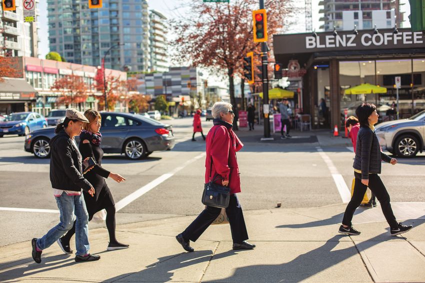
12 DRAFTFor people who are walking and rolling: For people who are taking transit:
The city already has high rates of walking and Transit has high people-moving capacity and can
rolling (23 percent of trips)5, in part due to many carry up to 50 people in the same amount of
residents living in close proximity to shops, space as two vehicles. Increasing transit priority
services, and amenities. We plan to improve measures on the Frequent Transit Network is
our sidewalk infrastructure, introduce more needed, as these routes are within walking
amenities like places to rest, weather protection, distance for more than 75 percent of City
secure bicycle parking, and improved wayfinding, residents.6 This will be paired with advocating
and increase place-making and public realm for a North Shore-wide initiative for a rapid
activation to make it more enjoyable to spend transit connection across the Burrard Inlet.
time on our streets. We will also continue with These efforts to shift people to use transit will
expanding the Mobility Lane Network and use not only benefit transit users, but also drivers
quick-build materials to increase our delivery and goods movement by removing vehicle trips
efficiency. This Strategy has the benefit of from our streets.
cleaner air and lower emissions for everyone.
For emergency responders:
Increased traffic makes it challenging for our
Walking and Rolling
emergency responders to quickly travel where
When we talk about walking and rolling, we they need to go. We will continue to work closely
are referring to walking, using a mobility with emergency responderson implementing
device (e.g., wheelchair), biking, skating, signal pre-emption on key corridors for
taking a scooter, or using a micromobility emergency vehicles, and improve street safety
device (e.g., e-bike share). measures so that there are fewer incidents on
our streets in the first place.
5
2019 North Shore Transportation Survey
6
CNV internal analysis, 2021
C N V D R A F T M O B I L I T Y S T R AT E GY
13 DRAFTWe cannot build our way out
of congestion
Our dependence on personal vehicle travel for Nearly one-third of vehicle trips in the City are
most of our trips results in greenhouse gas under five kilometres in length, suggesting there
emissions, air pollution, road-related deaths, is a significant opportunity for us to take more
decreased physical and mental wellbeing, and trips by walking, rolling, or transit. This Draft
decreased productivity in congested traffic. Mobility Strategy proposes steps to create a
shift that recognizes the automobile as just one
Vehicles are, and will continue to be, an choice amongst a wide range of travel options.
essential part of moving people and goods
on the North Shore and across the region. The City and our partner agencies are working
Increased traffic is a challenge that we need to on improving transit and active transportation
tackle, but building more lanes in the city will infrastructure, while also exploring travel
not solve the issue. There is limited ability to demand management initiatives at a regional
expand the road network due to our dense built level, such as the application of mobility
form and complex topography. Even if we could, pricing in a way that is equitable and reduces
adding road space usually makes traffic worse congestion. Taking steps to reduce the amount
than it originally was after only a few years: this of vehicles from the road by building compact,
is called induced demand. transit-oriented neighbourhoods and providing
compelling alternative ways to travel is the most
effective way the flow of traffic on our streets
can be improved.
C N V D R A F T M O B I L I T Y S T R AT E GY
14 DRAFT2. The Vision & Goals
The Vision “Healthy streets that work for everyone”
This proposed vision for the City of North Vancouver’s mobility future recognizes that city streets are
under pressure, are becoming more dynamic, and serve more than just one function. Along with being
used by cars, they facilitate the movement of transit, goods, and people walking and rolling. Beyond their
transportation function, our streets are critical elements of our environmental, cultural, economic, and
public utility infrastructure. They also serve as collective spaces for relaxation, socializing, shopping,
exercise, and more. The vision is a commitment to enabling the many demands of our streets in ways
that support our overall health and wellbeing. This vision is supported by four goals.
C N V D R A F T M O B I L I T Y S T R AT E GY
16 DRAFTThe Goals
1. Our streets will help our city prosper and be a vibrant place
A healthy city is one where streets and sidewalks hum with economic and social
activity, where people meet and shop and enjoy the beautiful city we live in, side
by side with efficient goods delivery. Our goal is to use our streets to improve our
collective prosperity, health, and happiness.
2. Our streets will support real and accessible choices for how we move around
The City’s Official Community Plan (2014) prioritizes the development of a multimodal
transportation system. This means creating a more integrated, reliable network that
recognizes we all move throughout the city in different ways, and that our streets
should support greater access to a range of mobility options.
3. Our streets will be safe and comfortable
In 2016, the City adopted a goal of achieving zero fatalities and serious injuries on
city streets. Safe streets are foundational to creating a healthy, people-oriented city.
4. Our streets will reduce our impact on climate change and the environment
More than half of our community’s greenhouse gas emissions (GHG) come from
burning fossil fuels to power vehicles. This contributes to climate change and air
pollution. In 2019, the City adopted a GHG reduction target of net zero emissions by
2050. The decisions we make about our transportation system will shape our ability
to meet this commitment.
How we will monitor our progress
The City will measure progress toward these goals to evaluate where we are succeeding and where we
are falling short. Once the final Mobility Strategy is approved and actions are implemented, we expect
to see the following changes:
1. A year-over-year decrease in the number of collisions that result in serious injury or death.
2. A year-over-year decrease in the amount of greenhouse gas emissions generated by travel
3. An year-over-year increase in the number of trips made by sustainable modes and a decrease
in the number of trips made by vehicles.
The City will work to create the conditions that will enable us to meet our goals, but we can’t do it alone.
All of us have a role to play in achieving the vision and goals in this strategy.
C N V D R A F T M O B I L I T Y S T R AT E GY
17 DRAFTHow does the Draft Mobility
Strategy relate to and support
other City plans?
The City of North Vancouver is currently developing four major strategies to guide our next decade
of planning and decision-making in key areas: mobility, climate and the environment, community
well-being, and the economy. When complete, these strategies will provide modernized guidance
to support advancing the broader goals and ambitions of the City’s Official Community Plan. The
Mobility Strategy supports, and is supported by, each of these Strategies through aligned goals, and
coordinated actions.
The Climate and Environment Strategy will be the City’s first comprehensive strategy
to help us become a resilient and sustainable City where everyone thrives. This
strategy will identify actions to cut carbon pollution from buildings, transportation
and materials to achieve our climate targets, and improve the health, connectivity
and biodiversity of our natural areas across the City.
The Community Wellbeing Strategy will provide direction through policies,
programs, and projects for social, economic, environmental, health, cultural, and
political conditions that are essential for individuals and communities to flourish
and fulfill their potential.
The Economic Strategy will provide a five-year framework to balance economic,
social, and environmental objectives with specific actions that are integrated with
other City plans and strategies. The overarching goal is to support community
prosperity based on an inclusive, sustainable and resilient economy that provide
opportunities for the growth of local business.
C N V D R A F T M O B I L I T Y S T R AT E GY
18 DRAFTC N V D R A F T M O B I L I T Y S T R AT E GY
19 DRAFT3. The Strategies
& Actions
The strategies below represent the key steps our City proposes to take to help realize our vision
for healthy streets that work for everyone. Each of the strategies contribute to multiple goals. Each
strategy includes a range of specific actions, policies, and programs that we will aim to deliver over
the next 10 years.
Make it easier for everyone to choose sustainable and affordable options for the trips we take.
Strategies
1. Make walking and rolling the easiest choice for more of our shorter distance trips.
2. Make transit the easiest choice for more of our medium and longer distance trips.
3. Make shared and zero-emission vehicles the easiest choice when we need to use a car.
4. Encourage people to make sustainable travel choices.
Improve our mobility experience through the design of our streets and neighbourhoods.
Strategies
5. Improve the safety and comfort of vulnerable road users.
6. Rebalance the space along our curbs to meet a wide range of needs.
7. Reclaim more street space for people and nature.
8. Support sustainable mobility through how we grow and develop.
Improve reliability for people and goods to move around our city and region.
Strategies
9. Keep urban freight, deliveries, and emergency vehicles moving.
10. Strengthen our connections within the city, and across the North Shore and Metro Vancouver.
11. Optimize our mobility system through proactive management, operation, and access to information.
To make it easier to follow along and understand
why we are proposing certain actions, we have Concept Callout
Recent Progress
added two types of callout boxes called Concept
Callouts and Recent Progress. Look for these Recent Progress
to learn more!
C N V D R A F T M O B I L I T Y S T R AT E GY
20 DRAFTOur streets have dif ferent roles
Each street in our city has a different set of uses and functions that merits specific design
considerations. In order to better communicate how we plan and design our streets, a set of street
types has been developed that establishes typical transportation functions, land use context, and
design objectives. These street types are introduced here and expanded upon on pages 52-66.
Main Streets Local Streets
are the main activity spines of the city for are low-volume, low-speed streets in
shopping, services, and amenities. residential neighbourhoods.
City Connector Streets Shared Streets
provide access across the city and to are curbless streets that prioritize
regional networks. pedestrians and vibrancy.
Neighbourhood Connector Streets Service Streets
connect Local Streets to the broader provide access to service and industrial
network. areas in the city.
These street types are intended to provide guidance on how we plan and design our streets, and how
we communicate these intentions with the broader community. These street types are mentioned
several times throughout the strategies and actions in the next section of the Draft Mobility Strategy
to indicate prioritization, or where certain actions are expected to occur.
C N V D R A F T M O B I L I T Y S T R AT E GY
22 DRAFTMake it easier for everyone to choose sustainable and
affordable options for the trips we take.
Currently, using a vehicle is usually the most efficient way to get from one place to another, particularly
for longer distance trips. As our city and the region grow in population, our streets are becoming
increasingly congested, making vehicle travel less competitive and reliable. The best thing the City
can do to maintain reliability on our streets is to provide safe, convenient, and sustainable options.
C N V D R A F T M O B I L I T Y S T R AT E GY
24 DRAFTStrategies and actions at a glance
1. Make walking and A. Deliver a complete, accessible, and high-quality pedestrian
rolling the easiest network.
choice for more of our B. Deliver an all ages and abilities Mobility Lane Network that
shorter distance trips. connects all our neighbourhoods and key destinations.
C. Make our walking and rolling networks easier to navigate.
D. Provide abundant amenities that increase the enjoyment of
walking and rolling.
E. Improve access to micromobility for everyone.
2. Make transit the easiest A. Create enabling conditions for enhanced transit service and
choice for more of our coverage across the city.
medium and longer B. Support an inclusive transit system that is easy to
distance trips. understand, and accommodates people of all abilities.
C. Create enabling conditions for mobility hubs to provide
seamless connections between transit and other modes.
3. Make shared and zero- A. Support easier access to car-sharing and carpooling services.
emission vehicles the B. Support the transition to zero-emission vehicles.
easiest choice when we
need to use a car.
4. Encourage people to A. Expand educational programs for walking and rolling.
make sustainable travel B. Collaborate with employers to increase sustainable
choices. commuting and reduce trips.
C. Expand delivery of youth-oriented programs that support safe
and active travel to school.
D. Continue education and outreach programs for improving
neighbourhood-wide and independent sustainable travel.
C N V D R A F T M O B I L I T Y S T R AT E GY
25 DRAFTStrategy 1: Make walking and rolling the easiest choice for
more of our shorter distance trips.
Today, about 11 percent of vehicle trips in the City are under 1.5 km in distance and 29 percent are
under five km – distances that could be easily travelled by walking or rolling, by many people. Walking
and rolling provide a wealth of social and economic benefits that will improve individual wellbeing
along with more foot traffic for our local businesses.
Actions
1A. Deliver a complete, accessible, and high-quality pedestrian network.
Provide a complete sidewalk network on both sides of the street of all streets within a reasonable
walking distance (typically 400 metres) of all key pedestrian areas and destinations like schools,
i community centres and frequent transit corridors. Prioritize improving the quality of existing narrow
sidewalks along and within a reasonable walking distance of the City’s Main Streets.
Increase the connectivity of the city’s pedestrian network by delivering and encouraging more mid-
ii block pathways in redevelopments and improving connections over ravines, creeks, and through
parks, where environmentally appropriate.
Prioritize universal design and accessibility standards when designing or redesigning all streets,
iii sidewalks, connections, and pathways.
1B. Deliver a AAA Mobility Lane Network that connects all our neighbourhoods and key destinations.
Complete the priority corridors for All Ages and Abilities (AAA) mobility lanes and identify new
i phases for network expansion on a regular basis as corridors are delivered.
ii Ensure all new mobility lane infrastructure is designed to meet AAA standards.
Upgrade existing mobility lane infrastructure to meet AAA standards, prioritizing investments on
iii corridors with high use and the greatest potential for risk reduction.
Make better use of low-cost, quick-build solutions, such as using temporary delineator posts to
iv separate mobility lanes from vehicle traffic, and observing these temporary solutions in advance
of upgrading to fully developed infrastructure.
1C. Make our walking and rolling networks easier to navigate.
Deploy a user-friendly mobility wayfinding system at key locations across the city, and provide this
i in an open format to encourage third-party development of wayfinding solutions. Coordinate with
North Shore governments to ensure sub-regional alignment.
Require the provision of direct, unobstructed, and protected routes for people walking or rolling, as
ii part of the permitting process for construction and development, special events, and public works.
C N V D R A F T M O B I L I T Y S T R AT E GY
26 DRAFT1D. Provide abundant amenities that increase the enjoyment of walking and rolling.
Expand amenities such as benches, secure bicycle parking, weather protection, and washroom
i facilities, and create an inventory and prioritization schedule with community input.
ii Provide more trees on all streets, and achieve a double row of trees wherever feasible.
Deliver a network of public micromobility charging stations, prioritizing delivery on Main Streets
iii
and Shared Streets.
Ensure public micromobility parking spaces are designed to accommodate e-bikes and cargo
iv
bikes, especially along Main Streets and Shared Streets.
1E. Improve access to micromobility for everyone.
Work with shared micromobility service providers to ensure there is equitable fleet distribution
i
and prioritization across the City’s AAA Mobility Lane Network and close to major destinations.
Ensure affordable access, with incentives developed for people with low incomes or low personal
ii vehicle access.
Work with the Squamish and Tsleil-Waututh Nations to expand shared micromobility services that
iii support travel options for people living on North Shore reserve lands.
Work with shared micromobility service providers to ensure devices do not impede other travellers
iv through application of end-of-trip procedures and education programs
Advocate for new incentives and loan programs from senior levels of government to support greater
v
uptake of electric micromobility devices, including e-bikes and other emerging devices.
Concept Callout
AAA Mobility Lane Network
AAA mobility lanes are facilities
that include separated lanes with
physical barriers and off-street
paths on higher traffic streets,
and signed neighbourhood
bikeways on local streets
with lower traffic volumes and
speeds. Today, the City has
approximately 15 km of AAA
Recent Progress mobility lane infrastructure. In
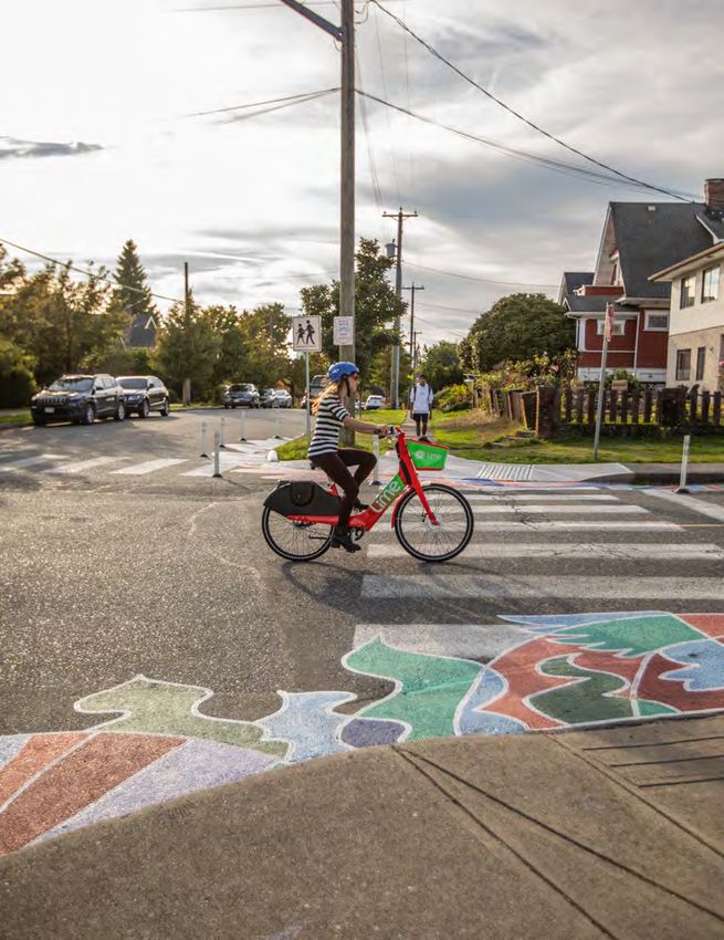
E-Bike Share Pilot Program 2019, Council endorsed the
priority corridors for AAA mobility
In the summer of 2021, the City and District of North lanes network expansion plan
Vancouver implemented a two-year pilot program with that would increase the total
Lime to operate an e-bike share system, the first of length of these facilities to
its kind in the province. approximately 25 km.
C N V D R A F T M O B I L I T Y S T R AT E GY
27 DRAFTStrategy 2: Make transit the easiest choice for more of our
medium and longer distance trips.
One bus can carry the same number of people that would normally fit into about 50 cars. We currently
make 17 percent of our trips by transit. Making transit more accessible, frequent, and reliable will
make it easier for more people to use it. This will free up space on our streets and help everyone move
more efficiently.
Actions
2A. Create enabling conditions for enhanced transit service and coverage across the city.
Work with TransLink to expand and enhance local transit service, ensuring all businesses and
i residents are within a reasonable walking distance of the Frequent Transit Network. This involves
protecting and designing space for fast and reliable transit.
Work with TransLink to plan, design, and implement measures, such as signal priority and bus-only
ii lanes, prioritizing investments at unreliable locations on the Frequent Transit Network.
2B. Support an inclusive transit system that is easy to understand, and accommodates people
of all abilities.
i Ensure all transit passenger facilities are designed to be universally accessible.
ii Provide consistent digital and physical wayfinding and signage.
Provide high-quality stops on the Frequent Transit Network by working closely with partners to
iii expand the availability of passenger waiting shelters, real-time information, ample bike parking,
and washrooms in high ridership and transfer areas.
Advocate for TransLink to accelerate the delivery of key recommendations identified in the Transit
iv Fare Review to improve the equity of the regional transit fare structure, including introducing fares
that better reflect distance travelled on all transit modes and additional income-based discounts.
2C. Create enabling conditions for mobility hubs to provide seamless connections between
transit and other modes.
Create mobility hubs in Lower Lonsdale, Central Lonsdale, and other sites along the Marine-Main
i corridor. These will include improved transit priority measures, increased availability of car-sharing
and ride-hailing options, and plentiful walking and rolling infrastructure.
Concept Callout
Mobility Hubs
Mobility hubs are locations where
different sustainable transportation
modes are integrated seamlessly to
help promote connectivity.
C N V D R A F T M O B I L I T Y S T R AT E GY
28 DRAFTRecent Progress
R2 Marine Drive RapidBus
In April 2020, Translink launched the Marine Drive RapidBus, which provides a high-capacity,
efficient and reliable connection between Park Royal and Phibbs Exchange. RapidBus offers a
more efficient experience by providing fewer stops compared to local transit, all-door boarding,
and redesigned streets that prioritize transit.
C N V D R A F T M O B I L I T Y S T R AT E GY
29 DRAFTStrategy 3: Make shared and zero-emission vehicles the easiest
choice when we need to use a car.
Many of us need to use a vehicle on occasion. Making it easier to access shared and zero-emission
vehicles is necessary to lessen our transportation impacts on the environment. The City of North
Vancouver has moderately higher uptake of electric vehicles than other mid-sized municipalities in
BC. While we reduce our emissions through decreased reliance on polluting vehicles, car-sharing is
also important as it provides an affordable option to get around without needing to own a car, which
can help to reduce congestion.
Actions
3A. Support easier access to car-sharing and carpooling services.
Enable expansion of car-share vehicle fleets by ensuring adequate facilities exist for car-share
i vehicles, on- and off-street. This will be undertaken with regulations, incentives, and design
guidelines.
Enhance accessibility requirements for car-sharing fleets and work with service providers to
ii increase fleet distribution to ensure effective spatial coverage across all neighbourhoods.
Promote carpooling services and educate the public on how these services work, so that this
iii option is accessible to those who need it.
Work with service providers to increase car-share access for families, lower income households,
iv and people with mobility limitations.
3B. Support the transition to zero-emission vehicles.
Encourage a shift to electric vehicles (EVs) in the short-term, while exploring other low-emission
i transportation technologies such as hydrogen. This includes a shift for personal vehicles, as well
as supporting the shift for transit, freight, and car-share vehicles.
Continue to implement actions from the City’s Electric Vehicle Strategy, including improving access
ii to Level 2 and DC fast chargers that are close to community centres and commercial areas.
Support equitable EV-ready retrofits of multi-family buildings and lower income rental buildings
iii through promotion, education, and top-up rebates.
Advocate for increased incentives and loan programs from senior levels of government to support
iv greater uptake of EVs, particularly for lower income households.
C N V D R A F T M O B I L I T Y S T R AT E GY
30 DRAFTRecent Progress
Enabling Electric Vehicle Use
In recent years, the City has
encouraged EV ownership by
installing charging stations for
public use. The City currently
provides six Level 2 dual port
charging stations and there are
four DC fast chargers in the city.
The use of these stations has
increased exponentially each year,
showing demand for more public
charging stations.
Concept Callout
Future of Automated Travel
Widespread automated vehicle adoption
is not anticipated to occur until after
the horizon date of this plan (2032). As
such, there is not a significant focus
on automated travel within the Mobility
Strategy. Even though automated vehicles
will significantly change how we move
around, there are some aspects that will
not change.
• The City will continue to prioritize
safety and comfort of vulnerable
travellers, and design streets in a way
that puts people first.
• The City remains committed to moving
people in a manner that is space-
efficient. Walking, rolling, cycling
and transit are all modes that can
accommodate many people in a small
amount of space compared to that of a
private vehicle, whether it is operated
by a human or not.
S. Jurvetson
C N V D R A F T M O B I L I T Y S T R AT E GY
31 DRAFTStrategy 4: Encourage people to make sustainable travel
choices.
In some cases, providing infrastructure is not enough to help change travel behaviour. Sometimes
there is a lack of awareness, or training is needed to help people feel confident with new travel
options. To this end, the City will reimagine and expand the range of supportive services that have
been shown to increase sustainable travel.
Actions
4A. Expand educational programs for walking and rolling.
Reimagine how educational programs are provided to facilitate more active travel, including school
i safe travel campaigns, individualized trip planning assistance, and promotion of new transit and
mobility lane infrastructure.
ii Create education programs tailored to specific community groups, hosted in a variety of languages.
4B. Collaborate with employers to increase sustainable commuting and reduce trips.
Expect employers to provide high-quality end-of-trip facilities for people to comfortably walk and
i roll to work.
Assist employers to establish corporate travel demand management (TDM) programs to reduce
ii congestion on the network, particularly at peak hours. This may include providing incentives such
as subsidized transit passes, and disincentives to driving, such as charging for parking.
Engage major employers to update their policies and practices to encourage more flexible working
iii hours and remote working policies, to reduce overall demand on our roads, particularly at peak
hours.
Coordinate with TransLink and municipalities to develop and implement a regional approach to
iv
employer TDM programs.
4C. Expand delivery of youth-oriented programs that support safe and active travel to school.
Develop and update school travel plans on a regular basis, in coordination with school staff and
i students.
Work with schools and surrounding residents and businesses to pilot new pick-up and drop-off
ii protocols that reduce vehicle congestion around schools.
Enable new programs to support walking and rolling to and from school, especially for younger
iii
children.
Bring youth into the design of transportation improvements around schools, such as by co-
iv
designing signage and creating murals to demarcate no-stopping zones.
C N V D R A F T M O B I L I T Y S T R AT E GY
32 DRAFT4D. Continue education and outreach programs for improving neighbourhood-wide and
independent sustainable travel.
Undertake educational campaigns with community groups, and provide tools for enhancing the
i understanding of conventional transit and HandyDART accessible services.
Establish a sustainable trip planning service for residents that require personalized assistance in
ii planning their transit trips.
Work with neighbourhood community groups to establish programming through GoCNV that
iii promotes sustainable travel and include events, education, prizes, and other activities to enable
residents to travel sustainably.
Recent Progress
Safe and Active School Travel Program
The City, in partnership with the North Vancouver
School District, has worked with nine schools
to encourage safe and healthy school travel
habits through outreach and improvements to
the transportation infrastructure around schools.
School Travel Planning Facilitators work directly
with administration, students, and families at
each school for one to two years to identify
barriers to active travel, encourage walking and
rolling, and develop maps and an action plan
tailored specifically to each school.
Recent Progress
GoCNV
GoCNV is a promotional program
that encourages CNV residents
to use sustainable travel over the
summer months. As part of the
campaign, there are prizes, events,
and other activities to keep residents
travelling in a healthier and happier
way. In 2019, the Central Lonsdale
East community was selected to
participate in the GoCNV program. A
third of participants reported walking,
cycling, and using transit more after
the program was completed. This
program will be expanded to more
neighbourhoods in years to come.
C N V D R A F T M O B I L I T Y S T R AT E GY
33 DRAFTImprove our mobility experience through the design of our
streets and neighbourhoods.
We know that the experience people have on our streets influences travel choice. We have heard
from the community that more attractive and comfortable infrastructure is required for walking,
rolling, and transit. Increasing the number of active and sustainable trips will also benefit people
who have to drive, as there will be fewer people competing for the finite amount of space available
on our streets. These design-focused strategies will improve the safety and comfort for travelling on
our streets, improve the resilience of our network in the face of more extreme weather, and make
our streets a more desirable place to spend time.
C N V D R A F T M O B I L I T Y S T R AT E GY
34 DRAFTStrategies and actions at a glance
5. Improve the safety and A. Minimize the potential for conflict where different street users
comfort of vulnerable come together.
road users. B. Manage travel speeds and access to improve neighbourhood
safety and livability.
C. Support enforcement that reduces dangerous conduct and
prioritizes protection for vulnerable road users.
D. Make it easier for everyone to be seen while travelling.
6. Rebalance the space A. Review curb space use across the city to better meet the
along our curbs to meet needs of street users.
a wide range of needs. B. Ensure there are sufficient loading zones, pick-up and drop-
off zones, and accessible parking spots in high-demand
locations.
7. Reclaim more street A. Foster vibrant public spaces and streets.
space for people and B. Provide more street trees.
nature. C. Make our streets and public spaces rain-friendly.
D. Reduce vehicle noise and vibrations.
8. Support sustainable A. Use land use and development to support shorter trips and
mobility through how we sustainable mobility choices.
grow and develop. B. Require most developments to provide Travel Demand
Management (TDM) options for residents and/or employees.
C. Reduce the amount of vehicle parking that developers are
required to provide in new buildings and increase the amount
of parking for sustainable modes.
D. Set clear mobility expectations from new developments.
C N V D R A F T M O B I L I T Y S T R AT E GY
35 DRAFTStrategy 5: Improve the safety and comfort of vulnerable road
users.
Every year, there are an average of ten collisions on City streets that result in a serious injury or
fatality. In recent years, people walking or rolling (vulnerable road users) have accounted for nearly all
of the serious injuries and fatalities on City streets.
Actions
5A. Minimize the potential for conflict where different street users come together.
Increase the separation of different users at our busiest intersections, particularly for the protection
i of vulnerable road users.
Expand the use of measures like pedestrian- and cyclist-activated signals, dedicated and protected
turning signal phases, centreline medians, “no right turn on red” restrictions, one-way streets,
ii
and advanced pedestrian and cyclist crossing phases at intersections that have high volumes of
people using different transportation modes.
5B. Manage travel speeds and access to improve neighbourhood safety and livability.
Create a network of 30 km/h streets that includes all Local Streets and Shared Streets, and
i streets around schools, parks, and community centres.
ii Decrease speed limits on other street types, to be determined on a case-by-case basis.
Complement speed reductions with design interventions and access limitations. This may include
iii
medians, pinch points, speed humps, roundabouts, diagonal diverters, and curb bulges.
5C. Support enforcement that reduces dangerous conduct and prioritizes protection for vulnerable
road users.
i Update City bylaws to ensure the safety needs of our most vulnerable road users are prioritized.
Continue to work with the North Vancouver RCMP to identify locations for enforcement at high-risk
ii intersections and corridors.
Work with the Province and North Vancouver RCMP to implement electronic enforcement to deter
iii
speeding, red light running and other dangerous behaviour at high-risk intersections and corridors.
Support the North Vancouver RCMP to reduce distracted drivers through education and
iv
enforcement.
5D. Make it easier for everyone to be seen while travelling.
i Improve street and pathway light levels with prioritization at poorly lit intersections.
Increase visibility of travel lanes, medians, crosswalks, and signage under all conditions by applying
ii retroreflective tape and paint.
C N V D R A F T M O B I L I T Y S T R AT E GY
36 DRAFTRecent Progress
Ridgeway Slow Speed Zone
In 2020, the City implemented a 30 km/h slow speed zone for the Ridgeway neighbourhood,
bounded by St. Georges Avenue, East 13th Street, Grand Boulevard East, and East Keith Road.
Data collected has shown the speed limit change has reduced travel speeds in the neighbourhood
by nearly 5%. The slow speed zone increases the safety and comfort of families and other vulnerable
road users in the neighbourhood, while having limited impacts on vehicle travel time. Frontage
improvements and intersection adjustments have been undertaken with temporary delineators,
along with student-led street art from Ridgeway Elementary School at nearby intersections.
Concept Callout
Reduced Speed Limits
Speed is a fundamental factor in the severity of
a crash or collision. A person walking or rolling
that is hit by a car travelling at 50 km/h has a
10% chance of survival. The same person hit by
a car travelling at 30 km/h has a 90% chance of
survival. The faster a person is travelling, the
less time they have to react to avoid a collision,
and the more severe any resulting injuries will be.
C N V D R A F T M O B I L I T Y S T R AT E GY
37 DRAFTStrategy 6: Rebalance the space along our curbs to meet a wide
range of needs.
Over 90 percent of the City’s curb space is dedicated to parking. This leaves less room for a growing
number of other uses, including transit, delivery vehicles, bikes and scooters, ride-hailing and taxis,
all of which need a safe space to pull over. Tailoring our street design to prioritize a range of functions
will create a more complete mobility network that enhances safety, efficiency, and comfort for all
modes.
Actions
6A. Review curb space use across the city to better meet the needs of street users.
Undertake a review of the City’s Resident Exempt Parking Program, and work with residents and
businesses to develop a more comprehensive approach to vehicle permitting that meets the needs
i of street users, manages spillover concerns associated with off-street reductions, and better
reflects the high value of street space. This may include changes to permit costs and eligibility
criteria, expansion of permit areas, or transitioning to an area-wide on-street parking model.
Work with businesses to introduce pricing of on-street short-term parking spaces, to manage
ii turnover and support better use of available off-street spaces.
Work with residents and businesses to develop neighbourhood curb space plans to outline
iii appropriate measures, regulations, and designs to better meet access and parking needs.
6B. Ensure there are sufficient loading zones, pick-up and drop-off zones, and accessible parking
spots in high-demand locations.
Ensure at least one dedicated loading zone is available on both sides of the street on every block
i
in the city.
Explore options for an urban delivery program that tracks loading zone use to determine supply on
ii high-demand corridors.
Coordinate with ride-hailing companies and users to identify the effectiveness of existing pick-up
iii and drop-off zones, and where adjustments may be needed on Main Streets and City Connector
Streets.
Work with community members to undertake a review of accessible parking spot locations to
iv determine underserved areas.
C N V D R A F T M O B I L I T Y S T R AT E GY
38 DRAFTC N V D R A F T M O B I L I T Y S T R AT E GY
39 DRAFTStrategy 7: Reclaim more street space for people and nature.
Streets are part of our public space network. Green street elements bring life to the street, capture
carbon, reduce heat island effects, and provide storm water management functions. Creating a better
sense of place on our streets will help improve connections to our neighbours and communities.
Actions
7A. Foster vibrant public spaces and streets.
Create concept designs for key streets in alignment with street types that will allow Council to
i provide direction for future right-of-way acquisition through development.
Review opportunities to increase the number of plazas and parklets on our Main Streets, City
ii Connector Streets, and Shared Streets. This may include expanding the City’s Living Lane initiative
for laneways that receive limited vehicle use.
iii Work with the business community to extend the longevity of the City’s temporary patio program.
Expand the amount of local and First Nations art, with priority on our Main Streets and Shared
iv
Streets.
Expand activation and place-making on Local Streets with more pocket parks, benches, and street
v
art.
7B. Provide more street trees.
Prioritize planting in underserved areas that have fewer street trees through the City’s Street Tree
i Program. Main Streets and City Connector Streets will also be prioritized with anticipated high
activity levels of walking and rolling.
ii Provide a double row of street trees where space allows.
7C. Make our streets and public spaces rain-friendly.
Develop weather protection guidelines to facilitate appropriately wide, continuous, and well-
i designed awnings and canopies on our Main Streets.
ii Improve the permeability of our streets for rainwater management.
Expand the application of bioswales and rain gardens in areas where we reallocate space on our
iii
curbs.
Work with the Squamish and Tsleil-Waututh Nations to emphasize ethnobotany and prioritize local
iv
flora in parklets and rain gardens.
C N V D R A F T M O B I L I T Y S T R AT E GY
40 DRAFT7D. Reduce vehicle noise and vibrations.
i Accelerate the transition to zero-emission vehicles which have lower noise volumes.
ii Support specifications for goods movement and transit vehicles that reduce noise and vibrations.
Incorporate transportation noise impacts into development review processes to ensure setbacks
iii
and materials mitigate noise.
iv Establish speed limits and employ traffic calming measures to reduce noise and increase safety.
v Investigate the application of sound barriers on goods movement corridors.
C N V D R A F T M O B I L I T Y S T R AT E GY
41 DRAFTStrategy 8: Support sustainable mobility through how we grow
and develop.
As our city continues to grow over the next decade, new developments can help residents and
employees access more travel options and programs that make it easier to move around in ways that
limit negative impacts on our streets.
Actions
8A. Use land use and development to support shorter trips and sustainable mobility choices.
Prioritize and encourage a dense and diverse mix of housing types, jobs, services, and amenities
i in areas well-served by frequent transit.
Enable the concept of building a 15-minute city, where there is easy access to jobs and services,
ii and a range of housing types of different sizes and levels of affordability.
iii Encourage local major trip generators to be situated adjacent to the Frequent Transit Network.
Design buildings to contribute to a public realm that feels safe and supports sustainable mobility
iv choices.
8B. Require most developments to provide Travel Demand Management (TDM) options for
residents and/or employees.
Introduce a new program that right-sizes the amount and type of TDM measures required by
i developers based on location, type, and size of development.
8C. Reduce the amount of vehicle parking that developers are required to provide in new buildings
and increase the amount of parking for sustainable modes.
Reduce minimum vehicle parking supply standards in close proximity to the Frequent Transit
i Network.
ii Establish vehicle parking maximums for multi-unit residential buildings.
Increase the minimum requirements for bicycle parking, and require more horizontal bicycle parking
iii and charging points to accommodate the increased popularity of cargo bicycles and e-bikes.
iv Review possibilities for shared vehicle parking among complementary uses, where appropriate.
C N V D R A F T M O B I L I T Y S T R AT E GY
42 DRAFT8D. Set clear mobility expectations from new developments.
Develop improved guidance on mobility-related improvements that need to be accommodated
i through new development using street types as a guide.
Update the City’s Development Cost Charges program to incorporate key projects that can be used
ii for a wider range of mobility improvements, and ensure this is reviewed regularly to align with
evolving needs.
Ensure financial contributions for transportation generated through new developments are
iii directed to the highest and best use for sustainable transportation outcomes.
Concept Callout
Overbuilding our Parking Supply
Parking supply exceeds demand for apartment
buildings across the region, including in the City
of North Vancouver.⁷ This adds a significant cost
to residents, is environmentally impactful, and
incentivizes people to own vehicles. Decreasing
parking minimums improves the choice and
flexibility in how businesses and residents use
their properties to meet parking needs, will
improve affordability through decreased parking
costs, and moves us towards creating a vibrant
and walkable city that is envisioned through this
Draft Mobility Strategy.
7
Metro Vancouver Regional Parking Study, 2018
Concept Callout
Travel Demand Management Measures
As more people and jobs come to the region,
there is a need to ensure that many travel
options exist. Our existing road network
has limited capacity for more vehicle trips.
TDM options can include provision of on-
site car-share vehicles and parking spaces,
subsidized transit passes, subsidies for
bicycles, and individualized trip planning
services.
C N V D R A F T M O B I L I T Y S T R AT E GY
43 DRAFTImprove the reliability for people and goods to move around
our city and region.
As our region continues to grow in population, efficient movement will be challenged as more
trips take place. However, there are many ways that we can improve the transportation system’s
reliability. These include maintaining assets in a state of good repair, addressing the sources of
unpredictability, and providing tools that share information with system users so people can make
informed decisions for all trips.
C N V D R A F T M O B I L I T Y S T R AT E GY
44 DRAFTYou can also read