Environmental Assessment Checklist - Montana DNRC
←
→
Page content transcription
If your browser does not render page correctly, please read the page content below
City of Helena; Mt. Helena-North Face Grant Award
                                                     Montana Department of Natural Resources and Conservation

               Environmental Assessment Checklist
Project Name: Mount Helena – North Face
Proposed Implementation Date: February 2021
Proponent: City of Helena & Montana DNRC
County: Lewis & Clark

                              Type and Purpose of Action

Description of Proposed Action:
The Forestry Division of the Montana Department of Natural Resources and Conservation
(DNRC) in partnership with the United States Forest Service State and Private Forestry
(USFS) offers financial assistance to reduce wildfire risk, improve the health and resiliency
of forest ecosystems. These funds are offered through the Western States Wildland Urban
Interface Grant Program (State Fire Assistance Program, CFA of 1978), referenced
hereafter as the Grant Program.

This EA Checklist is being conducted to review the awarding of Grant Program funds to the City
of Helena. The City has applied for grant funding to implement fuel reduction measures on 120
acres of City owned forest land located on the North Face of Mount Helena and immediately
adjacent to the City of Helena. The fuel reduction measures are proposed to reduce wildfire
risks on the North Face of Mount Helena and the adjacent neighborhood (see Appendix A:
Vicinity Map A-1 and Project Map A-2). The Mount Helena – North Face Fuels Reduction
Project not only proposes to reduce forest fuels, but consequentially provides other ecological
benefits more closely aligned with the historic range of variability of this geography.

The City of Helena owns and manages 1,838 acres of open space properties located in the
wildland urban interface (WUI) surrounding the city. Approximately 1,525 acres of city's
open lands properties are covered with coniferous forests surrounded by grasslands. These
properties, including the project area identified within this proposal, are defined as a WUI
management area in the City of Helena Open Lands Management Plan (HOLMP) which
also recognizes wildfires in the WUI as the greatest natural hazard in the city.

Historically, low to mixed severity fires occurred in 5-25 year intervals within the warm-dry,
mixed conifer forest types occurring across the project area. Successful suppression of
surface fires on Mount Helena over the last century has altered the forested sites to a Fire
Regime Condition Class 3 (highly departed; landscapes which reflect vegetation and
disturbances that are uncharacteristic of the natural fire regime), thereby resulting in a high
fuel hazard rating for the forested portions of Mount Helena's north face.

The geographic position of the city-owned forests upwind from urban development and
critical infrastructure (electrical lines, municipal water supply), combined with the current
fuel condition, render Helena's open lands one of the Montana's most important focal areas
for fuels reduction. Managing to reduce the fuel quantity and altering spatial composition of
vegetation (also fuel), both horizontally and vertically, will be the focus of this project.

                                                 1
City of Helena; Mt. Helena-North Face Grant Award
                                                 Montana Department of Natural Resources and Conservation

Several locally developed and adopted plans have been identified that support fuels
reduction work in and around Mount Helena, including the proposed Mount Helena - North
Face Project. A list of these plans and more information regarding these plans can be
found in the section of this EA addressing “Locally Adopted Environmental Plans and
Goals”.

A non-commercial silvicultural prescription has been developed to achieve hazardous
forest fuel reduction goals. The aim is to reduced tree-canopy bulk density and remove
ladder fuels within treatment areas to promote forest conditions more likely to support
low-severity surface fires. The specific fuel reduction activities included in the City of
Helena’s proposal are:

   •   Hand thinning trees to provide a retained tree spacing that is approximately
       equivalent to the diameter at breast height (DBH = 4.5 ft.) plus ten feet. Given a 4”
       tree, spacing would be an average of 14’.
   •   Lower branches on retained trees will be pruned up to 1/3 of the total tree height, or six
       feet; whichever is less.
   •   Approximately two wildlife snags/acre will be retained.
   •   Cut material less than six inches in diameter on the large end will either be hand piled
       and burned on site, or mechanically chipped and distributed on the forest floor
       depending on the accessibility and topography of the project areas.
   •   In chipped areas, chips will be equally distributed on the forest floor at depths not to
       exceed three inches.
   •   Approximately 27 stems/acre generated from cut material larger than four inches DBH
       on the large end will be retained on the forest floor to meet course woody debris
       requirements. Excess felled trees > six inches on the small end will either be chipped or
       converted to firewood and donated to individuals/families in need by participating
       volunteer groups.
   •   Following completion of an adequate drying period, slash piles constructed during the
       thinning process will be ignited and burned when conditions are favorable and approved
       by burn permitting authorities.
   •   Areas disturbed during the burn disposal process will be raked and then seeded with a
       grass/clover mix applied at an approximate rate of 15 lbs./acre to discourage weed
       invasion and promote soil stability.

                       Duration of Activities:
                                                       February 2021—June 6
                      Implementation Period:
                                                                2021

                                                  2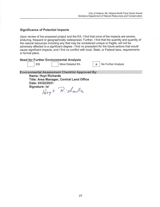
City of Helena; Mt. Helena-North Face Grant Award
                                             Montana Department of Natural Resources and Conservation

                                Project Development

SCOPING:

  • PUBLIC SCOPED:
  Between July 23, 2020 through August 21, 2020, a scoping notice was posted on the DNRC
  Public Information Website: http://dnrc.mt.gov/public-interest/public-notices, identifying the
  proposal to award funding to the city of Helena for the North Face Mount Helena Fuel
  Reduction Project. Both the DNRC and the City of Helena, Parks and Recreation,
  independently circulated the scoping notice via email to local and municipal government
  representatives, and local citizens and organizations who had expressed interest in the
  project.

  •   AGENCIES SCOPED:
        o A scoping notice was also sent to Montana Department of Fish, Wildlife and
           Parks; and
        o DNRC consulted with the Montana State Historic Preservation Office and
           requested a search of proposed project area in the State’s cultural resource files.

  •   COMMENTS RECEIVED:
        o Public Scoping of the Mount Helena North Face Fuel Reduction Project resulted
          in written comments from seven different individuals.
        o Three of these individuals provided feedback in general support for the project,
          with one of those requesting measures to mitigate impacts to hiking trails and
          use of trails. Another letter primarily requested clarification on the treatments
          proposed.
        o Three detailed letters were received that contained a broad range of concerns
          and requests for completion and documentation of specific types of analysis. Two
          of these letters were from Polly Pfister, a Helena resident and the other was from
          Mike Garrity, representing the Alliance for the Wild Rockies and Native
          Ecosystem Council (AWR). Garrity’s comments were also made on the behalf of
          Sara Johnson, Native Ecosystems Council and Steve Kelly, Montana
          Ecosystems Defense. A fourth letter was also received from George Ochenski
          that expressed general concern over the proposed project and expressed
          support for the comments received from Polly Pfister.
        o The State Historical Preservation Office provided DNRC with a report of all
          recorded sites within the proposed project area and the results of previous
          cultural resource inventories done in the proposed project area.
        o The issues and concerns contained in the public comments were compiled,
          classified, and assessed to determine the relevance and applicability to the
          proposed project. Those determined to be applicable and within the scope of this
          Environmental Assessment are included in the assessment completed for this
          document. Those concerns that were determined not relevant to the project or
          not within the scope of the proposed Environmental Assessment are not
          addressed in this document. The justification and rationale for those decisions is
          contained in a Public Scoping Comment Assessment Report that is available in
          the DNRC Project File for this Environmental Assessment, upon request.

                                              3
City of Helena; Mt. Helena-North Face Grant Award
Montana Department of Natural Resources and Conservation
DNRC specialists were consulted, including Devin Healy, Karen Shelly, Erik Warrington, Crystal
Beckman, Heidi Crum and Gary Frank.
Internal and external issues, concerns and recommendations were incorporated into project
planning and design and will be implemented in associated contracts.
OTHER GOVERNMENTAL AGENCIES WITH JURISDICTION, LIST OF PERMITS
NEEDED:
Allocations of State Fire Assistance (now known as National Fire Capacity) Program Funding,
including the Western States Wildland Urban Interface Grant Program, do not require
environmental assessment under the National Environmental Policy Act (NEPA) because the
funding is provided under the Cooperative Forestry Assistance Act of 1978, which is exempt
from NEPA review as described in the scope of Executive Order 12372. This order allows
certain states processes to exclude Federal programs from NEPA review and comment and use
the State’s own measures of review. Therefore, allocations of State Forestry Assistance funding
are reviewed under the Montana Environmental Policy Act (MEPA), not NEPA.
All work performed under the Grant Program must fully comply with all applicable federal, state
and local laws, rules and regulations. Applicable rules and regulation include but are not limited
to:
• The City of Helena would manage lands involved in this project in accordance with the
City of Helena Open Lands Management Plan
https://www.helenamt.gov/parksdocuments
• Lewis and Clark County Burn Permit.
• Montana Environmental Policy Act.
ALTERNATIVES CONSIDERED:
• No-Action Alternative: Under the No-Action Alternative, DNRC would not provide Grant
Program funds to the City of Helena to perform the proposed fuels reduction treatments on
City owned forest lands located on the North Face of Mount Helena. The applicant (City of
Helena) would have to seek other sources of funding to complete the project.
• Action Alternative: Under the Action Alternative, DNRC would award $125,000 of Grant
Program funds to the City of Helena to implement the fuels reduction measures on the North
Face of Mount Helena as described in the “Description of Proposed Action” listed above.
4City of Helena; Mt. Helena-North Face Grant Award
Montana Department of Natural Resources and Conservation
Impacts on the Physical Environment
VEGETATION:
Historic and Existing Conditions:
According to the Montana Natural Heritage Program (MHP) website, the Mount Helena project
area includes the following land cover classifications: Rocky Mountain Ponderosa Pine
Woodland and Savanna, Insect-Killed Forest, Rocky Mountain Montane Douglas-fir Forest and
Woodland, Rocky Mountain Lower Montane, Foothill, and Valley Grasslands, Montane
Sagebrush Steppe, Rocky Mountain-Foothill Deciduous Shrubland, and Big Sagebrush Steppe.
Historically, the majority of the project area vicinity was open pine woodland/savanna and
grasslands. Frequent low to moderate intensity fires maintained an open forest condition;
although the openness of the lands was also maintained by grazing, and timber was harvested
for construction and mining during Helena’s settlement era.
Since the beginning of fire suppression, about 130 years ago, Douglas-fir has become much
more prominent on the landscape. The project area consists of thick, over-crowded Douglas-fir
stands. The average stand age of upper canopy trees is mostly 50-75 years. Tree species
composition is predominately Douglas-fir. Douglas-fir comprise about 88% of the stems in the
project area, with ponderosa pine making up the remaining 12%. Limber pine occasionally
occurs at higher elevations. Radial growth has been poor over the last 10 years. There has
been a moderate level of insect and disease activity in the past decade. western spruce
budworm and Douglas-fir beetle have been active in the Douglas-fir. A very substantial
mountain pine beetle outbreak occurred just over a decade ago causing a great deal of mortality
in the ponderosa pine.
Forest and rangeland habitat types found in the area include bitterbrush/rough fescue, rough
fescue/bluebunch wheatgrass, limber pine series, ponderosa pine/bitterbrush, Douglas-fir/rough
fescue.. An inclusive list of native and non-native plant species known to occur on Mount Helena
is located in the HOLMP, Appendix I. A site visit completed on September 2, 2020 by DNRC
employee Heidi Crum noted the grass, forb and shrub species in the Douglas-fir dominated
treatment area. The ground flora of the more open portions of the project area’s hand
piling/burning unit includes native and invasive species: bluebunch wheatgrass
(Pseudoroegneria spicata), Idaho fescue (Festuca idahoensis), rough fescue (Festuca
campestris), Wood’s rose (Rosa woodsia), western yarrow (Achillia millifolium), blanketflower
(Gaillardia aristata), toadflax (Comandra umbellata), cudweed sagewort (Artemisia ludoviciana),
serviceberry (Amelanchier alnifolia), Rocky Mountain juniper (Juniperus scopulorum), common
juniper (Juniperus communis) pinegrass (Calamagrostis rubescens), smooth brome (Bromus
inermis), Kentucky bluegrass (Poa pratensis), orchardgrass (Dactylis glomerata), timothy
(Phleum pratense), slender wheatgrass (Elymus trachycaulus) musk thistle (Carduus nutans),
fluffweed (Filago arvensis) and mullein (Verbascum thapsus). Ground flora of portions of the
mechanical chipping treatment areas includes native and invasive species: rough fescue,
bitterbrush (Purshia tridentata), rubber rabbitbrush (Ericameria nauseosa), bluebunch
wheatgrass, prairie junegrass (Koeleria macrantha), prairie coneflower (Ratibida columnifera),
silver sagebrush (Artemisia cana), arrowleaf balsamroot (Balsamorhiza sagittata), blue flax
(Linum lewisii), stoneseed (Lithospermum ruderale), hairy goldenaster (Heterotheca villosa),
5City of Helena; Mt. Helena-North Face Grant Award
Montana Department of Natural Resources and Conservation
scarlet globemallow (Sphaeralcea coccinea), Canada thistle (Cirsium arvense) and big
sagebrush (Artemisia tridentata).
Douglas-fir thickets within the treatment areas maintain a depauperate native ground flora,
containing low species diversity, species with low coefficients of conservatism, and in dense
areas very low ground cover. Typical shade-tolerant species occur including pussy toes
(Antennaria racemosa), arnica (Arnica cordifolia), fairybells (Prosartes trachycarpum), fragile
fern (Cystopteris fragilis), showy aster (Eurbia conspicua), and lupines (Lupinus argentea); all
found commonly in dry to moist forests and woodlands. These species that may thrive with
higher levels of moisture and shade are limited to localized habitats within the north side
woodlands. They are abundant state or region-wide in secure forested habitats and are not
currently known to be at risk of decline. Conditions favoring these species within the project
area may be converted to more open environments which may facilitate restoration of the
historic native open pine woodland flora.
Noxious weeds seen in the project area during the September 2, 2020 field visit, include spotted
knapweed (Centaurea stoebe), dalmatian toadflax (Linaria dalmatica), sulphur cinquefoil
(Potentilla recta) and Canada thistle (Cirsium arvense). The City of Helena Parks and GIS
Departments weeds database (2020) shows 295 total mapped weed locations on Mt. Helena,
42 locations are mapped within a 15 meter buffer of the project area: 14 knapweed locations,
one leafy spurge location, 5 mullein (Verbascum thapsus) locations (not listed as noxious),18
musk thistle (Carduus nutans) locations and 4 tansy (Tanacetum vulgare) locations. Infestation
cause is not documented. All five of the proposed thinning units have weeds mapped within or
near their boundaries. Weeds listed as occurring in the HOL system in the HOLMP Appendix F.
Noxious Weed List include: whitetop (Cardaria draba), diffuse knapweed (Centaurea diffusa),
spotted knapweed (Centaurea stoebe), Oxeye daisy (Leucanthemum vulgare), Canada thistle
(Cirsium arvense), field bindweed (Convolvulus arvensis), houndstongue (Cynoglossum
officinale), leafy spurge (Euphorbia virgata), meadow hawkweed (Hieracium pratense), orange
hawkweed (Hieracium aurantiacum), dalmatian toadflax, (Linaria dalmatica), sulfur cinquefoil
(Potentilla recta) and tansy (Tanacetum vulgare). Introduction source/cause is not documented.
Any of these weeds may potentially invade the treatment areas after soil disturbance caused by
the thinning project or other anthropogenic or natural disturbances.
Sensitive plant species are species that the Montana Natural Heritage Program Database
(MHP) tracks as Species of Concern (SOC) or Potential Species of Concern (PSOC). SOCs
and PSOCs are considered sensitive plant species in this analysis. SOCs include plants listed
as Threatened, Endangered or Candidates on the Federal Endangered Species list. The only
federally listed plant species known for Lewis and Clark County is whitebark pine (Pinus
albicaulis), which is listed as a Candidate species. The project area does not contain suitable
habitat for whitebark pine. The MHP lists two SOCs in the project area: Lesser Rushy Milkvetch
(Astragalus convallarius), and Wedge-leaf Saltbush, (Atriplex truncata). Two PSOCs are
documented by MHP: Hare's-foot Locoweed (Oxytropis lagopus var. conjugans) and Small
Yellow Lady's-slipper (Cypripedium parviflorum). Personal communication with the MHP
botanist indicates the locoweed and milkvetch are currently present in the Mount Helena
grasslands, and could occur in the project area but MHP database mapping has not been
updated to reflect known current locations. Suitable habitat for the lady’s slipper and saltbush is
not located within the project area.
No field surveys were specifically conducted within the proposed project area for sensitive
species by DNRC. The SOCs known to occur and any additional SOCs were not located in the
6City of Helena; Mt. Helena-North Face Grant Award
Montana Department of Natural Resources and Conservation
September 2, 2020 field visit. SOCs known from the vicinity would be very difficult to locate or
unidentifiable during the time frame of this fall field visit and project planning. Surveys for these
species should be conducted in June-July.
Helena Open Lands Management Plan
The HOLMP addresses and promotes forest management priorities including wildfire mitigation,
control of noxious weeds, and preserving biological integrity through conservation forestry
practices (HOLMP page 2-3).The HOLMP identifies weed management as one of its top five
concerns, stating that the City of Helena will use cultural, biological or chemical methods to treat
at least 15% of open lands weed infestation annually. The city will assess treatments for
effectiveness; and according to the plan, treatments are prioritized to protect species of concern
and excellent-condition rangelands. Trail and transportation corridor weed infestations are the
second priority. HOLMP Appendix F lists weed species occurring on HOL. According to the
HOLMP, weed control is a time-sensitive issue because of its impact on all the uses and
functions of the open lands. The reduction of weeds through a variety of methods and control of
weed seed sources is a priority goal. Protection of native plant species goes hand in hand with
weed control and healthy forest and range management (HOLMP page 2-3). Although weed
seed is spread by soil disturbances of all kinds, wind, animals, people, vehicles and other
means, a healthy native plant community, like this site’s formerly open pine/Douglas fir
woodlands and native grasslands with high ground flora species diversity, may be more
resistant to infestation than today’s current degraded plant community with diminished species
diversity and abundance due to Douglas fir over-growth/succession.
This project, although designed for fuel mitigation, may, at a fine scale, begin to restore the
balance of trees, grass and forbs that characterize a diverse, open ponderosa pine woodland
that likely occurred on the north side of Mount Helena prior to early settlement timber harvest.
Weed infestations resulting from this project would need to be diligently searched for,
monitored, prioritized and managed according to HOLMP guidelines as fuel
reduction/vegetation thinning projects continue to restore the ecosystem integrity on the
landscape. Weed management objectives and strategies from the HOLMP (pages 5-2 to 5-4)
will be followed.
The City is aware of plant species of concern in the project vicinity (page 6-2-3) and would
cooperate with DNRC, MHP botanists, and the Montana Native Plant Society to avoid SOCs
during treatments according to the HOLMP, Chapter 6. Protection of Native Plant Species goals
and objectives listed in Table 6.3.1, and Priority Projects, pages 6-7.
The 2020 HOLMP’s Recreation Update recognizes growing community pressures and demand
for recreational opportunities. Goal 2 of the plan states that the city will strive to conserve open
lands and provide quality recreational opportunities using stewardship as the guiding principle,
managing HOLs to balance conservation and recreational use. (pages 3- 5).
Effects common to both Action and No Action Alternative
Grazing – Current native grazing uses would continue under both the action and no action
alternatives. It is accepted that native ungulates can act as dispersal agents for weed seed
movement. Based on existing levels of weed infestations, on-going treatment efforts, and the
effectiveness of past weed control efforts, there is low risk for grazing activities to result in
measurable weed spread in un-infested lands within the project area.
Recreation use – Hiking and biking on Mount Helena would continue under the both the no
action and the action alternatives. Current and future use of trails may result in a continued,
7City of Helena; Mt. Helena-North Face Grant Award
Montana Department of Natural Resources and Conservation
long-term threat of invasive plant species being introduced and/or spread within the project
area. Although the City of Helena can require certain weed prevention best management
practices be followed by its employees and contractors, the city cannot enforce the public to
adhere to them. Based on existing levels of weed infestations, on-going treatment efforts, and
the effectiveness of past weed control efforts, there is moderate risk for public activities to result
in measurable weed spread in un-infested lands within the project area.
Effects of Action Alternative
The Mount Helena – North Face Fuels Reduction Project proposes to reduce forest fuel loads
which would potentially provide ecological benefits within the treated area. The gain of
ecological benefits is contingent upon adherence to the 2004 Helena Open Lands Management
Plan and 2020 Recreation Plan Update directives, goals and objectives.
The historically dry, open ponderosa pine woodlands and grasslands contained within the
Mount Helena project area are fire-adapted natural communities that have become overgrown
due to decades of fire exclusion. Thinning young to mature invasive Douglas fir and ponderosa
pine opens the understory providing more light, and thus more growth opportunity for
suppressed native ground flora species that formerly thrived. Additionally, thinning treatments
would enhance resilience to future high-severity fires and would begin to restore historical
woodland stand structure.
Many studies have demonstrated the effectiveness of fuel reduction treatments in reducing
potential fire intensity and severity, including the types of treatments proposed (Kim et al. 2013,
Graham et al. 2004, Martinson and Omi. 2013, Hureau et al. 2019, McCauley et al. 2019,
Cochrane et al. 2013, and Stephens et al. 2012). Thinning and chipping will result in fewer trees
per acre, reduce ladder fuels and disrupt tree-canopy continuity. When certain fuel and weather
conditions align in open grown forest stands, the potential for increased rate of fire spread
exists; however, increased rate of spread does not equate to increased fire intensity or severity.
Fuel reduction treatment, such as the proposed treatments, increases the ability to safely and
effectively conduct initial-attack suppression efforts, resulting in reduced threat to communities.
Also, surface fires in area treated with fuel reduction activities, are less likely to produced less
embers and spot fires during active and passive crown fire behavior. A more detailed discussion
of the effectiveness of the proposed fuel reduction treatments is contained in the Public Scoping
Comment Assessment Report that is available in the DNRC Project File for this Environmental
Assessment.
Overgrown stands of ponderosa pine and Douglas fir extract large amounts of water from the
soil. Removal of the overabundance of young- mature trees, as prescribed, may reduce the
amount of water taken up by transpiration and may alleviate drought stress by reducing
competition, in addition to taking the step towards restoration of the more-resilient historical
plant community and enhancing resistance to high-severity fires (Tepley et al. 2020).
Motorized vehicle travel – Current and future maintenance and thinning equipment use may
result in an ongoing threat of invasive plants species being introduced and/or spread within the
project area. Based on existing levels of weed infestations, on-going treatment efforts, and the
effectiveness of past weed control efforts, there is moderate risk for the proposed motorized
vehicle activities to result in measurable weed spread in un-infested lands within the project
area.
Management/Restoration Activities – Thinning and pile burning activities have the potential to
create ground disturbance susceptible to weed invasion when weed infestations are found
within units, or in proximity. Based on existing levels of weed infestations, on-going treatment
8City of Helena; Mt. Helena-North Face Grant Award
Montana Department of Natural Resources and Conservation
efforts, and the effectiveness of past weed control efforts, there is moderate potential for
thinning/pile burning activities to result in additional weed establishment and spread.
Both direct and indirect effects would be expected to result in at least a slight increase in
noxious weed infestations over time, contributing to the long-term cumulative impacts of
increased infestations from other past, present, and future activities.
Impact Can
Comment
Vegetation Direct Secondary Cumulative Impact Be
Number
Mitigated?
No Low Mod High No Low Mod High No Low Mod High
No-Action
Noxious Weeds X X X
Rare Plants X X X
Vegetation
X X X
Communities
Old Growth X X X 6
Action
Noxious Weeds X X X yes 1,4,7,8
2,3,4,7,8,
Rare Plants X X X yes
9,
Vegetation 2,4,
X X X yes
Communities 5,7,8,9
Old Growth X X X 6
Comments:
1. Disturbed sites from slash pile burning can create receptive seed beds for noxious weeds.
2. The vegetation communities will be altered by the removal of trees, thus allowing more
light to reach the forest floor.
3. Rare plants may be impacted by the reduced crown density, wood chips on the forest
floor, use of chipping equipment and slash pile burning.
4. Recreational use is and will continue to be the largest vector for introducing noxious
weeds.
5. A healthier forest is one that is less susceptible to fire, insects and disease. Healthy
forests of the forest types found in the project area tend to contain a high proportion of
trees that can be described as dominant and co-dominant with space between the trees
that allow those present to capture more of the available water than if the trees present
had more competition for available water. The proposed action would remove trees
typically described as intermediate and suppressed as well as those that show signs of
insect and disease damage or susceptibility. Dominant and co-dominant trees tend to be
larger; larger trees tend to be more fire resilient than smaller trees. By reducing
competition (thinning trees) there is increased growth and vigor of the remaining dominant
and co-dominant trees in the treatment area. Trees that are not stressed by lack of water
(either by drought or by competition) are more resistant to insect and disease damage or
mortality.
6. Forest stands in the treatment area do not meet the standards of old growth as defined in
Old-Growth Forest Types of the Northern Region (Green et al.)
9City of Helena; Mt. Helena-North Face Grant Award
Montana Department of Natural Resources and Conservation
7. Herbicide application can negatively affect native plant communities. Weeds were
identified as a major issue in the public scoping phase of the 2004 HOLMP planning
process, impacting recreation, wildlife habitat, soil erosion, native vegetation communities
and aesthetics. The presence of weeds near and in the project area necessitates the strict
adherence to weed management best practices. Weed infestations would be located,
monitored, prioritized and managed according to HOLMP guidelines. Weed management
objectives and strategies from the HOLMP (pages 5-2 to 5-4) would be followed.
8. The impact of weeds on biological communities is well documented in the Statewide
Integrated Noxious Weed Management Plan (MT FWP). Weeds such as spotted
knapweed (Centaurea stoebe formerly C. maculosa) and leafy spurge (Euphorbia virgata)
have been shown to influence biological communities, including small and large mammal
populations, by reducing forage, modifying habitat structure—such as changing
grasslands to a forb-dominated community—and changing species interactions within the
ecosystem. Non-native plants also threaten biological diversity of native plant communities
by displacing native species and can threaten the survival of rare and sensitive plants.
Ecosystem processes, including physical and chemical components of the environment,
can also be altered by weed invasion. Studies have shown that replacement of native
bunchgrasses with taproot weeds such as spotted knapweed can increase surface water
runoff and soil erosion by 56% and 192% respectively (Lacey et al. 1989).
9. Thick layers of chips may kill or diminish the growth of native flora in open areas. When
dried they could increase wildfire risk and spread. Wood chips may retain moisture longer
than optimal, and could influence micro-habitats, favoring dry-mesic woodland plant
species over dry woodland ground flora.
Vegetation Mitigations:
1. The project area would be monitored for noxious weeds after fuel reduction operations are
complete and herbicide treatments may be applied if needed.
2. All equipment used for herbicide treatments would be washed and inspected prior to start
of work.
3. All new burn piles would be lightly scarified with a hand rake and reseeded to site adapted
grass to reduce the threat of noxious weed spread. The City of Helena currently uses a
mixture of mountain brome & slender wheat grass.
4. Mitigation actions to reduce adverse impacts caused by chipping may include removal of
chipped material if thickness exceeds recommendations.
5. If any SOC plants are found during this project period, then thinning efforts would be
diverted from those locations and further reviewed by City of Helena, DNRC and MT
Native Plant Society.
6. Opportunities for recovery/maintenance of shade plant microhabitat (vascular and
bryophytes) may be enhanced by retention of small undisturbed forest patches
(Söderström et al. 1992, in Nelson and Halpern 2005). Best management practices (MHP)
for shade plant/moss microhabitat retention include maintaining logs in contact with soil in
shaded ground concavities, and other water collecting microsites.
Reference citations included in Appendix B
10City of Helena; Mt. Helena-North Face Grant Award
Montana Department of Natural Resources and Conservation
SOIL DISTURBANCE AND PRODUCTIVITY:
Existing Conditions:
Soils within the project area and proposed treatment units are predominately Whitecap
Channery loam, and to a lesser extent Windham-Lap Channery loam, with a small amount of
Whitecow-Warneke Channery loam. All of these soil types are well drained gravely soils derived
from limestone colluvium parent material. There are very low levels of existing detrimental soil
impacts from compaction, displacement, and erosion occurring in the previously thinned and
mechanically chipped areas located adjacent to the proposed treatments. Based on ocular
estimates the levels of existing detrimental soil impacts from previous fuel treatments is less
than 5% of the treated area. This level of impact is well within those levels accepted under
Montana’s Forestry Best Management Practices (BMPs). No areas with substantial levels of
slope instability or that are prone to mass wasting were observed during field review of the
proposed treatment areas.
Effects of the Proposed Alternatives:
The anticipated impacts of the no-action and action alternatives on soil disturbance and
productivity are summarized in the following table:
Impact Can
Soil Disturbance Comment
Direct Secondary Cumulative Impact Be
and Productivity Mitigated?
Number
No Low Mod High No Low Mod High No Low Mod High
No-Action
Physical Disturbance
(Compaction and X X X
Displacement)
Erosion X X X
Nutrient Cycling X X X
Slope Stability X X X
Soil Productivity X X X
Action
Physical Disturbance
(Compaction and X X X Yes 1,2&3
Displacement)
Erosion X X X Yes 1,2&3
Nutrient Cycling X X X Yes 5
Slope Stability X X X Yes 4
Soil Productivity X X X Yes 5
Comments
1. The soil types occurring in the proposed project area and proposed treatment units
(described above) are relatively low risk for impacts from compaction, displacement and
erosion.
2. Use of mechanized equipment will be limited to disbursed and relatively low intensity
operation of low ground pressure tracked equipment in only those units specified for
chipping. Some low levels of dispersed wheeled ATV use would occur to ferry fuel and
other supplies to the treatment areas since most of treatment area is not accessible from
11City of Helena; Mt. Helena-North Face Grant Award
Montana Department of Natural Resources and Conservation
existing roads and no new road or trail construction is proposed. This equipment operation
will be limited areas with slopes under 40% and only under suitable soil moisture
conditions to avoid detrimental soil impacts. Soils occurring in the project area are well
drained and not prone to saturation except during and immediately after large snowmelt or
precipitation events.
3. The levels of soil impact expected to occur are well below those levels accepted under
Montana Forestry Best Management Practices and Reasonable Soil and Water
Conservation Practices adopted under Montana Water Quality Law and rules.
4. The soil and land types occurring in the project area and proposed treatment units are low
risks for slope instability. No areas of substantial slope instability were noted during field
reviews of the proposed treatment units.
5. No impacts to nutrient cycling and soil productivity are expected because approximately
27 pieces per acre of coarse woody debris larger than 4” in diameter and generated from
the thinning activities would be retained on the forest floor within the treatment areas. This
will be adequate to meet the coarse woody debris standards described in the City of
Helena Open Spaces Management Plan. In addition, areas treated with mechanical
chipping will retain all wood chips onsite and spread across the forest floor.
Soil Mitigations:
1. All proposed activities would implement Forestry Best Management Practices as specified
in the City of Helena Opens Lands Management Plan and the Lake Helena Watershed
Planning Area TMDL.
2. Operation of mechanized equipment will be limited to relatively dry soil conditions to
minimize the potential impacts to soil and subsequent risks of erosion.
3. Nutrient cycling and soil productivity would be maintained by leaving coarse and fine
woody material on site after thinning and slash disposal as specified in Comment #5 and
the Helena Open Lands Management Plan.
WATER QUALITY AND QUANTITY:
Water Quality and Quantity Existing Conditions:
The proposed fuel reduction treatment areas are drained by several ephemeral draws and
swale topographic features that do not contain discernible stream channels. Concentrated
surface runoff in these features only flow in response to seasonal snowmelt or high intensity
precipitation-runoff events. Any concentrated surface runoff conveyed by these features are
either intercepted and dispersed overland or are indirectly captured into urban stormwater
drainage systems. The main ephemeral drainage feature on the west-end of the project area
was observed to be impeded and intercepted by fill material resulting from urban development
and home construction. There is no direct delivery of concentrated surface runoff to streams
from the project area to streams or other bodies of water.
The proposed project area is located in the Tenmile Creek Watershed. This portion of Tenmile
Creek (the segment from Helena Water Treatment Plant to mouth at Prickly Pear Creek) is
included on the Department of Environmental Quality’s Draft 2018 303(d) list of impaired water
bodies. This portion of Tenmile Creek is considered impaired because the aquatic life and
drinking water beneficial uses are not fully supported. Causes of impairment are listed as
alteration in stream-side vegetation cover, arsenic, cadmium, copper, eutrophication, flow
12City of Helena; Mt. Helena-North Face Grant Award
Montana Department of Natural Resources and Conservation
regime modification, lead, total nitrogen, total phosphorus, sedimentation/siltation and zinc. The
sources of this impairment are identified as acid mine drainage, agriculture, channelization,
irrigated crop production and habitat modification (other than hydromodification), new
construction (highways, roads, bridges and other infrastructure), abandon mines, hydro
structure flow regulation/modification, and site clearance from land development.
This segment of Tenmile Creek was included in a Total Maximum Daily Load (TMDL) developed
for the Lake Helena Watershed prepared by the US Environmental Protection Agency (EPA) in
2006. The name of this plan is “Framework Water Quality Restoration Plan and Total Maximum
Daily Loads for the Lake Helena Watershed Planning Area”. The approach utilized in the TMDL
is to reduce sediment loads associated with timber harvest (and other forest management
activities) is through implementation of all reasonable land, soil and water conservation
practices.by the Lewis and Clark Water Quality Protection District and the Lake Helena
Watershed Group in 2015. This plan focuses on prioritizing area, pollutants and projects needed
to meet the objectives of the TMDL. In this plan Forestry BMP’s are identified as the method to
be utilized to meet water quality objectives for Forest Management activities.
Effects of the Proposed Alternatives
The anticipated impacts of the no-action and action alternatives on water quality and quantity
are summarized in the following table:
Impact Can
Water Quality & Comment
Direct Secondary Cumulative Impact Be
Quantity Mitigated?
Number
No Low Mod High No Low Mod High No Low Mod High
No-Action
Water Quality X X X
Water Quantity X X X
Action
Water Quality X X X 1&2
Water Quantity X X X 3&4
Comments:
1. No direct impacts to water quality and downslope beneficial uses of water bodies are
anticipated due to the lack of stream channels within the project area. All concentrated
surface runoff carried by ephemeral drainage features that do not contain stream channels
or other bodies of water. There is no direct delivery of concentrated surface runoff from the
proposed treatment units to downslope streams or other bodies of water. Concentrated
runoff from ephemeral drainage features are dispersed overland, or intercepted by yards,
driveways, streets and other urban areas.
2. Risk of indirect and cumulative impacts to water quality and beneficial uses of water is low.
Soils occurring in the proposed treatment units are low risks for erosion. Very little site
disturbance and subsequent soil compaction, displacement and erosion is anticipated due
to the low intensity of the proposed activities (see soils section). Downslope delivery of
sediment is not likely to occur due to the lack of direct connectivity between ephemeral
drainage features draining the project area and downslope streams or other bodies of
water.
13City of Helena; Mt. Helena-North Face Grant Award
Montana Department of Natural Resources and Conservation
3. Risk of direct, indirect and cumulative impacts to water quantity is low. The project area
was historically occupied by relatively open pine woodland/savannah and grasslands. The
current pine and Douglas-fir forest stands occupying the site are much more extensive and
heavily stocked as a result of fire suppression and range encroachment. Therefore, the
ephemeral features draining the site were created and evolved under much higher surface
runoff conditions then are likely occurring today or that would be expected to occur after
the proposed thinning, pile burning and chipping.
4. The proposed treatments are located on a landscape with relatively low levels of annual
precipitation and resulting runoff. The proposed activities are not expected to have a
measure or detectable effect on offsite water yield and flow regimes in any distant stream
located downslope. The amount of forest canopy removal proposed by thinning and the
amount area being thinned are also well- below those levels normally associated with
detrimental impacts due to increased water yield and runoff.
Water Quality & Quantity Mitigations:
1. All proposed activities would implement Forestry Best Management Practices as specified
in the City of Helena Opens Lands Management Plan and the Lake Helena Watershed
Planning Area TMDL.
2. Operation of mechanized equipment will be limited to relatively dry soil conditions to
minimize impacts to soil and subsequent risks of erosion and sediment delivery.
FISHERIES:
Fisheries Existing Conditions:
There are no streams or other bodies of water occurring within the proposed project area. There
is also no direct delivery of concentrated surface runoff to downslope streams or other bodies of
water from even ephemeral features draining the proposed treatment units. Therefore, there are
no affected fisheries resources within or downslope of the proposed project area.
No-Action: No direct, indirect or cumulative impacts would occur because there are no
fisheries, nor is there any fisheries habitat occurring within or immediately downslope of the
affected project area.
Action Alternative: No direct, indirect or cumulative impacts would occur because there are no
fisheries, nor is there any fisheries habitat occurring within or immediately downslope of the
affected project area (see Fisheries Impact Table below).
Impact Can
Comment
Fisheries Direct Secondary Cumulative Impact Be
Number
Mitigated?
No Low Mod High No Low Mod High No Low Mod High
No-Action
Sediment X
Flow Regimes X
Woody Debris X
Stream Shading X
Stream Temperature X
14City of Helena; Mt. Helena-North Face Grant Award
Montana Department of Natural Resources and Conservation
Impact Can
Comment
Fisheries Direct Secondary Cumulative Impact Be
Number
Mitigated?
No Low Mod High No Low Mod High No Low Mod High
Connectivity X
Populations X
Action
Sediment X 1&2
Flow Regimes X 1,2&3
Woody Debris X 1&2
Stream Shading X 1
Stream Temperature X 1&3
Connectivity X 1
Populations X 1,2&3
Comments:
1. No direct, indirect and cumulative impacts to fisheries resources (sediment, woody debris,
shade/temperature, connectivity or fish populations within the Lower Tenmile Creek
Watershed are anticipated to result from the proposed actions. This is due to the fact that
there are no streams or other bodies of water, hence no fisheries resources, within the
proposed project area or immediately downslope of the project area.
2. The lack of connectivity of even ephemeral drainage features with distant downslope
streams and bodies of water supporting a fishery makes any direct, indirect and
cumulative impacts very unlikely.
3. The relatively low levels of precipitation and subsequent runoff occurring on the project
area, and the low levels of forest crown removal are not expected to have a measurable or
effect on offsite water yields and downslope flow regimes.
Fisheries Mitigations:
Same as those specified under Soil and Water Resource Sections.
WILDLIFE:
No-Action: Recreational use would continue, no vegetation manipulation would occur. No
direct, indirect or cumulative effects to wildlife would be anticipated.
Action Alternative (see Wildlife table below):
Impact Can
Comment
Wildlife Direct Secondary Cumulative Impact be
Number
No Low Mod High No Low Mod High No Low Mod High Mitigated?
Threatened and
Endangered
Species
Grizzly bear
(Ursus arctos)
Habitat: Recovery x x x Yes W1.
areas, security from
human activity
15City of Helena; Mt. Helena-North Face Grant Award
Montana Department of Natural Resources and Conservation
Impact Can
Comment
Wildlife Direct Secondary Cumulative Impact be
Number
No Low Mod High No Low Mod High No Low Mod High Mitigated?
Canada lynx
(Felix lynx)
Habitat: Subalpine
fir habitat types, x x x Yes W2.
dense sapling, old
forest, deep snow
zone
Wolverine
(Gulo gulo) x x x Yes W3.
Sensitive Species
Bald eagle
(Haliaeetus
leucocephalus)
Habitat: Late- x x x Yes W4.
successional forest
within 1 mile of
open water
Black-backed
woodpecker
(Picoides arcticus)
Habitat: Mature to x x x N/A W5.
old burned or
beetle-infested
forest
Black-tailed
prairie dog
(Cynomys
ludoviscianus)
Habitat: x x x N/A W5.
grasslands, short-
grass prairie,
sagebrush semi-
desert
Flammulated owl
(Otus flammeolus)
Habitat: Late-
successional
x x x Yes W6.
ponderosa pine
and Douglas-fir
forest
Gray Wolf
(Canis lupus)
Habitat: Ample big
x x x Yes W7.
game populations,
security from
human activities
Harlequin duck
(Histrionicus x x x N/A W5.
histrionicus)
16City of Helena; Mt. Helena-North Face Grant Award
Montana Department of Natural Resources and Conservation
Impact Can
Comment
Wildlife Direct Secondary Cumulative Impact be
Number
No Low Mod High No Low Mod High No Low Mod High Mitigated?
Habitat: White-
water streams,
boulder and cobble
substrates
Northern bog
lemming
(Synaptomys
borealis)
x x x N/A W5.
Habitat: Sphagnum
meadows, bogs,
fens with thick
moss mats
Mountain plover
(Charadrius
montanus)
x x x N/A W5.
Habitat: short-grass
prairie & prairie dog
towns
Peregrine falcon
(Falco peregrinus)
Habitat: Cliff
x x x Yes W8.
features near open
foraging areas
and/or wetlands
Pileated
woodpecker
(Dryocopus
pileatus)
x x x Yes W9.
Habitat: Late-
successional
ponderosa pine
and larch-fir forest
Greater Sage
grouse
(Centrocercus
urophasianus) x x x N/A W5.
Habitat: sagebrush
semi-desert
Townsend's big-
eared bat
(Plecotus
x x x Yes W10.
townsendii)
Habitat: Caves,
caverns, old mines
Big Game Species
Elk x x x N/A W11.
Whitetail x x x N/A W11.
Mule Deer x x x N/A W11.
17City of Helena; Mt. Helena-North Face Grant Award
Montana Department of Natural Resources and Conservation
Comments:
1. The proposed project area lies approximately 35 miles south east of the grizzly bear
Northern Continental Divide Ecosystem Recovery Area and 13 miles south east of the
Non-Recovery Occupied Habitat boundary line as defined by Wittinger et al. (2002).
Grizzly bears could potentially travel through the project area. The project area overall
possesses relatively dry habitats with relatively low greenness values. Human access
levels in this general area are very high due to the presence of many private lands,
developed recreational trails and sites, and public access. Cover and habitat connectivity
associated with riparian areas would not be appreciably altered because no riparian fuels
treatments would occur in the project area. Given the size and location of cover patches
affected and removed, cover would be diminished on up to 120 acres. Tree spacing would
average 14’, of trees having an average of 4” DBH, which would maintain suitable hiding
cover for grizzly bears. During periods of active fuel treatment operation, grizzly bears
could be temporarily displaced by the disturbance if they happen to be in the local area.
Thus, some short-term risk associated with disturbance, and some long-term, albeit minor
risk, to grizzly bears could occur given the reduction in cover. Given the scope and scale
and short-duration of the proposed activities, the high recreational use of the area and
relatively marginal inherent habitat quality for grizzly bears present in the project area,
adverse direct, indirect and cumulative impacts to grizzly bears as a result of this project
are expected to be low.
2. The Project lies in marginal Canada Lynx habitat that is classified as low suitability1. The
project area has a high level of recreational use occurring throughout the year. Due to the
relatively small size of the project and the proceeding facts, no direct, secondary or
cumulative impacts are anticipated to occur if the action alternative is implemented.
3. Suitable denning habitat for wolverines generally found at high elevations in alpine habitat
types capable of holding heavy snow in late spring is not present on the project area or
within a mile of the project area. However, wolverines could occasionally use portions of
the project area during exploratory movements and foraging activities during any season
of the year. Though unlikely, it is possible that individual wolverines could be temporarily
displaced by proposed thinning activities, should any be present in the vicinity at the time
of the proposed operations. The area of the project contains generally unsuitable habitat
for wolverines, particularly for denning . The area also receives frequent and high levels of
recreational use. Thus adverse direct, indirect or cumulative effects to wolverines would
not be expected to occur, as a result of this project.
4. Low suitability bald eagle transient habitat occurs in the project area. Temporary disruption
of bald eagles may occur but is not anticipated. No evidence of nest sites has been
documented within 1/2 mile of the project area1. Due to the temporary nature of the
proposed action, the high recreational use and the type of habitat present no adverse
direct, indirect or cumulative effects to bald eagle would be expected to occur, as a result
of this project.
5. This project area is either out of the range of the normal distribution for this species or
suitable habitat is not present1. Thus, no direct, secondary, or cumulative effects would be
anticipated.
18City of Helena; Mt. Helena-North Face Grant Award
Montana Department of Natural Resources and Conservation
6. Suitable habitat for the flammulated owl is present in the project area1. Flammulated owls
prefer open habitat conditions and would likely be minimally affected by proposed thinning
activity on north-facing slopes. Some displacement of owls could occur during active fuel
reduction operations if they are present in affected stands. Given the limited amount of
habitat that could be affected and the owl’s preference for open stand conditions, minor
adverse direct, indirect and cumulative effects to flammulated owls would be anticipated.
7. Suitable habitat for the grey wolf occurs in the project are1. Some transient use is possible
by gray wolves, but due to the level of recreational use of this area, it is likely very limited.
Given the limited amount of habitat suitability, the level of recreational use, the limited size
and amount of time the proposed action negligible direct, indirect and cumulative effects
are anticipated.
8. The Montana Natural Heritage Program classifies the habitat in the project area as low
suitability for peregrine falcon. Repeated point observations have been made, and there
are cliffs adjacent to the project. There is a high level of recreational use for rock climbing
including establish routes already present on those cliffs. Given the limited amount of
habitat suitability, the level of recreational use, the limited size and the duration of the
proposed action, minor direct, indirect and cumulative effects are anticipated.
9. Habitat classified as low suitability is present in the project area1. Several observations of
the pileated woodpeckers have been made within the project area. Some displacement of
pileated woodpeckers could occur during active fuel reduction operations if they are
present in affected stands. Large trees >20 inches DBH that are suitable as nest trees for
pileated woodpeckers would not be affected by the proposed fuel reduction thinning.
Given the small size of the trees that would be thinned, the limited amount of habitat that
could be effected, and the short duration of activities as proposed, we would anticipate a
low level of adverse direct, indirect, and cumulative impacts to pileated woodpeckers.
10. The project area is classified as moderate suitability for Townsends Big Eared Bat.
Several large rock outcrop features occur in the project area that could provide suitable
roosting sites for a number of native bat species. Observations of Townsends big-eared
bats were made over ten miles away from the project area. Fuel reduction activity could
disturb roosting bats on the project area during project activities, however, the rock
features would not be altered in any way. Additional sunlight following treatments may help
warm any potential dens. Numerous large trees would also be retained as leave trees on
the project area that could offer usable roost sites for forest-dwelling bat species. Given
the small scope and limited duration of the project, any adverse direct, indirect or
cumulative effects to native bats would be expected to be minor.
11. During periods of active fuel reduction elk and deer could be temporarily displaced by the
disturbance if they happen to be in the local area. There is high year-round recreational
use that disrupts elk and deer in the project area. Thus, some short-term risk associated
with disturbance, and some long-term, albeit minor risk, to elk and deer could occur given
the reduction in cover. Given the location, size and type of the proposed activity, and cover
attributes found on the project area, low adverse direct, indirect and cumulative effects to
deer and elk associated with cover removal on these habitats would be anticipated. Tree
spacing of 14’ average with an average tree diameter of 4” dbh will maintain suitable
hiding cover for big game.
19City of Helena; Mt. Helena-North Face Grant Award
Montana Department of Natural Resources and Conservation
Wildlife Mitigations:
1. Approximately 27 logs/acre generated from cut waste material larger than four inches
D.B.H. on the large end will be retained on the forest floor to maintain course woody debris
in the treatment units.
2. Approximately two wildlife snags/acre will be retained. These would be of the largest size
class available in the treatment units.
AIR QUALITY:
Impact Can
Comment
Air Quality Direct Secondary Cumulative Impact Be
Number
Mitigated?
No Low Mod High No Low Mod High No Low Mod High
No-Action
Smoke x x x N/A
Dust x x x N/A
Action
Smoke x x x Yes AQ1
Dust x x x
Comments:
1. Slash consisting of tree boles, limbs and tops and other vegetative debris would be piled
throughout the project area during harvesting. Slash would ultimately be burned after
harvesting operations have been completed. Burning would introduce particulate matter
into the local airshed, temporarily affecting local air quality. Over 70% of emissions emitted
from prescribed burning is less than 2.5 microns (National Ambient Air Quality PM 2.5).
High, short-term levels of PM 2.5 may be hazardous. Within the typical column of biomass
burning, the chemical toxics are: Formaldehyde, Acrolein, Acetaldehyde, 1,4 Butadiene,
and Polycyclic Organic Matter.
Air Quality Mitigations:
Burning within the project area would be short in duration and would be conducted when
conditions favor good to excellent ventilation and smoke dispersion as determined by the
Montana Department of Environmental Quality and the Lewis and Clark County Health
Department. By retaining scattered larger diameter log on the landscape it will allow the piles
burn out more quickly, thus limiting the duration of the burns.
ARCHAEOLOGICAL SITES / AESTHETICS / DEMANDS ON ENVIRONMENTAL
RESOURCES:
Mount Helena was listed on the National Register of Historic Places in 1997. See Helena Open
Space Land Management Plan for a more complete description of historic sites and uses.
20You can also read