FACTSHEETS VOL. II KEY BIODIVERSITY AREAS (KBAS) IDENTIFIED IN MOZAMBIQUE: KBAKEY BIODIVERSITY AREA - WCS Mozambique
←
→
Page content transcription
If your browser does not render page correctly, please read the page content below
Republic of Mozambique
                              Ministry of Land and Environment

    KEY BIODIVERSITY AREAS (KBAS)
     IDENTIFIED IN MOZAMBIQUE:
           FACTSHEETS VOL. II
RED LIST OF THREATENED SPECIES AND ECOSYSTEMS, IDENTIFICATION AND
     MAPPING OF KEY BIODIVERSITY AREAS (KBAS) IN MOZAMBIQUE

                          KBA
                          KEY BIODIVERSITY AREA

   Supporting the Policy Environment for Economic Development (SPEED+)
Edited by
Wildlife Conservation Society - Mozambique
Rua Orlando Mendes, n. 163
Sommerschield, Maputo, Mozambique
Tel: +258 21 49 6965
wcsmozambique@wcs.org
mozambique.wcs.org | www.wcs.org

Licence
This publication was produced by the SPEED+ Project under Contract No. AID-656-TO-16-00005 at the
request of the United States Agency for International Development Mozambique Mission. This document is
made possible by the support of the American people through the United States Agency for International
Development. Its contents are the sole responsibility of the author or authors and do not necessarily reflect
the views of USAID or the U.S. Government.

Authors of the report
Eleutério Duarte           Wildlife Conservation Society, Mozambique
Hermenegildo Matimele      National Agricultural Research Institute (IIAM), Mozambique
Hugo Costa                 Wildlife Conservation Society, Mozambique

Co-authors of proposals and the KBAs' maps
Acácio Chechene          Wildlife Conservation Society, Moçambique
Armando Sambo            Wildlife Conservation Society, Moçambique
Celso Sardinha           SECOSUD II Project
Domingos Sandramo        SECOSUD II Project
Gerson Tomo              SECOSUD II Project
Joelma Souane            Wildlife Conservation Society, Moçambique
Jorge Sitoe              Wildlife Conservation Society, Moçambique
Joaquim Campira          SECOSUD II Project
Raquel Raiva             Wildlife Conservation Society, Moçambique
Vanessa Muianga          Natural History Museum

Contributing authors
Alan Gardiner (SAWC), Albert Chakona (SAIAB), Alice Massingue UEM), Alima Taju (WWF), Almeida
Guissamulo (MHN), Andrea Marshall (MMF), Ara Monadjem (UNESWA), Armindo Araman (ANAC), Avelino
Miguel (UniZambeze), Camila de Sousa (IIAM), Catherine Sayer (IUCN), Célia Macamo (UEM), Coleen Begg
(NCP), Cornélio Ntumi (UEM), Denise Nicolau (BIOFUND), Domitilla Raimondo (SANBI), Eduardo Videira
(WWF), Erica Tovela (MHN), Erwan Sola (WCS), Franziska Steinbruch (ANAC), Gary Alport (BirdLife), Graça
Jaime (UniLúrio), Graham Alexander , Harith Farooq (UniLurio), Hedley Grantham (WCS), Henrique Massango
(FNDS), Isabel Silva (UniLúrio), Ivan Nerantzoulis (UEM), John Burrows (Buffelskloof N. R.), Jonathan
Timberlake , Kendall Jones (WCS), Kris Everatt (NMU), Kristall Tolley (SANBI), Luca Malatesta (SECOSUD
II), Luke Verbergt (Enviro-Insight), Marc Stalmans (GNP), Marcelino Foloma (WWF), Marcos Pereira (CTV),
Mervyn, Lotter (ForestNET), Muri Soares (FNDS), Naseeba Sidat (WCS), Natasha Ribeiro (UEM), Paula
Santana Afonso (IIP), Piotr Naskrecki (GNP), Raquel Fernandes (CTV), Regina Cruz (FNDS) , Rhett Bennett
(WCS), Roberto Zolho (FNDS), Roger Bills (SAIAB), Samuel Jones (Royal Holloway), Sarah Markes (WCS), Silvia
Krikman (Lepsoc), Simon Pierce (MMF), Steve Collins (ABRI), Teresa Alves (IIAM), Valério Macandza (UEM),
Werner Conradie (Port Elizabeth Museum)

                                                                                                                2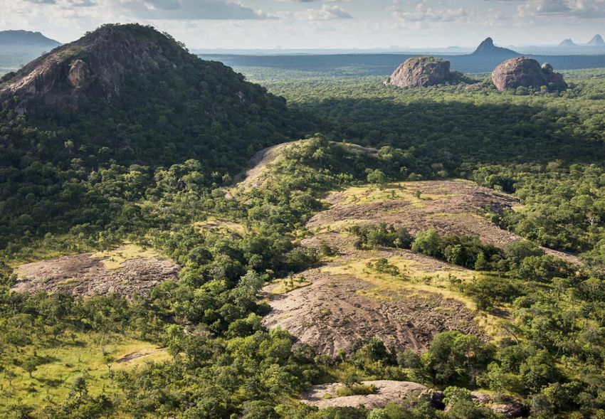
Citation
WCS, Government of Mozambique & USAID. 2021. Key Biodiversity Areas (KBAs) Identified in Mozambique:
Factsheets VOL. II. Red List of threatened species and ecosystems, identification and mapping of key biodiversity
areas (KBAs) in Mozambique. USAID / SPEED+. Maputo. 70pp.

Layout
Sarah Markes (WCS) has developed the complete layout of this report.

Acknowledgments:
The project team would like to thank the United States Agency for International Development (USAID), through
the SPEED+ Project "Supporting the Policy Environment for Economic Development" for funding the project.
We would also like to thank the following individuals from the institution, Afonso Madope, Vera Julien, Kevin
Carlucci, Ashok Menon, Sérgio Chitara, Danielle Tedesco, Nathan Sage and João Carlos Fernando, for the
support that brought the project to its conclusion according to the objectives initially defined.
We deeply thank the various national and international individuals and organisations for their valuable
support and contributions, without which it would not have been possible to carry out this project.
We highlight the following individuals: Ivete Maibaze (former National Director of the Environment and currently
Hon. Minister of Land and Environment), Guilhermina Amurane (National Director of Environment), Alexandre
Bartolomeu, Ana Paula Francisco, Andrew Plumptre, Domitilla Raimondo, Krystal Tolley, Luca Malatesta,
Eduardo Videira, Natasha Ribeiro, Alima Taju, Paula Santana Afonso, Armindo Araman, Célia Macamo, Muri
Soares, Mervyn Lotter, Alice Massingue, Valério Macandza, Isabel Silva, Jonathan Timberlake, John Burrows,
Lize Von Staden, Silvia Krikman, Alan Gardiner and Erica Tovela. A full list of technical contributors and their
institutions can be found in Annex 5.
We are particularly grateful to the following institutions for their special contribution to the project, such as
the provision of information, data or means: Direccção Nacional do Ambiente (DINAB), Instituto Nacional de
Investigação Pesqueira (IIP)*, Instituto de Investigação Agrária de Moçambique (IIAM)*, Museu de História
Natural de Maputo (MHN)*, Entomoteca do Ministério da Agricultura (MASA)*, Direcção Nacional de Florestas
(DINAF), World Wide Fund for Nature (WWF), Centro Terra Viva (CTV), Gorongosa Restoration Project (GRP),
Endagered Wildlife Trust (EWT), Marine Megafauna Association (MMA), Faculty of Natural Sciences of the
University of Lúrio, Department of Biological Sciences of the Faculty of Sciences and the Faculty of Agronomy
and Forestry Engineering of the Eduardo Mondlane University (institutions marked with “*” received data
management assistants on their premises to facilitate data compilation).
We wish to give special thanks to the "SECOSUD-II Project" which provided the KBAs and Red List project with
a team of four technicians who provided support as data management assistants, complementing the project
team.
We would also like to thank the following donors who in any way contributed to the results and dissemination
of this project: Agence Française de Développment (AFD), Fonds Français pour l'Environnement Mondial
(FFEM), Fondation Mava, NORAD and The Tiffanny & Co. Foundation.

                                                                                                                    3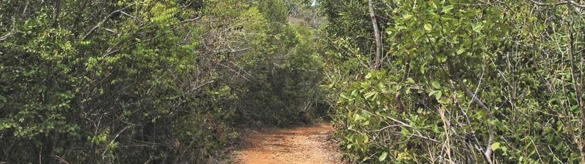
contents
Introduction                              5
About this report                         6
How are KBAs identified?                  7
KBAs identified by the project            8
KBA Factsheets:
   NJESI PLATEAU                          12
   NIASSA SPECIAL RESERVE                 14
   PALMA                                  16
   VAMIZI                                 18
   QUITERAJO                              20
   TARATIBU                               22
   ERÁTI                                  24
   MATIBANE FOREST RESERVE                26
   MOUNT RIBÀUÉ- MPHALWE                  28
   MOUNT INAGO                            30
   APAIPS                                 32
   MOUNT NAMULI                           34
   MOUNT MABU                             36
   MOUNT CHIPERONE                        38
   DERRE FOREST RESERVE                   40
   TCHUMA TCHATO                          42
   SERRA CHOA                             44
   MACHIPANDA                             46
   CHIMANIMANI NATIONAL PARK              48
   GORONGOSA-MARROMEU COMPLEX             50
   INHASSORO-VILANKULOS                   52
   GREAT BAZARUTO                         54
   TOFO                                   56
   CHONGOENE                              58
   MANHIÇA-BILENE (LIMPOPO FLOODPLAIN)    60
   MATUTUÍNE                              62
   LICUÁTI FOREST RESEREVE                64
   MAPUTO SPECIAL RESERVE                 66
   PONTA DO OURO PARTIAL MARINE RESERVE   68

                                               4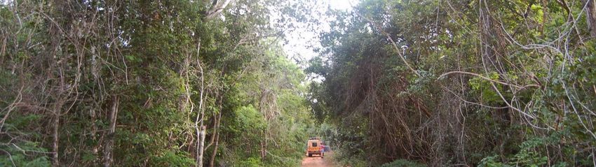
introduction
Key Biodiversity Areas (KBAs) are sites contributing       on Red List criteria, identification of KBAs, and
significantly to the global persistence of biodiversity,   delineation of KBA boundaries. Dozens of face-
both in terrestrial, freshwater, marine and                to-face and remote meetings were held to share
underground systems. KBAs are identified based on          information, including specific meetings to establish
internationally accepted scientific criteria, allowing     the National Coordinating Group, and to validate
to support i) spatial planning and conservation            proposed KBAs.
priority setting, ii) strategic expansion of protected
area networks, iii) inform environmental safeguard         As a result, the project allowed to formally establish
policies for the private sector, iv) provide               the National Coordination Group that guides not
opportunities for local communities, and v) are            only the KBAs process, but also the Red Listing. It is
indicators of Convention of Biological Diversity           currently composed of about 20 institutions, many
(CBD) Aichi Targets 11 and 12, as well as Sustainable      of them from the Government, being chaired by
Development Goals (SDGs) 14 and 15.                        DINAB. The project identified and mapped 29 KBAs
                                                           for Mozambique, of which 25 are terrestrial, and
The global standard for identifying KBAs was               4 are marine occupying a total area of 139,947.05
established in 2016 through the KBA Partnership,           km2. At least 15 areas with potential to be triggered
which is currently composed of 13 of the world's           as KBAs in the future have also been identified,
leading nature conservation organizations, whose           provided that more information is collected to
goals are to identify, map and document KBAs               reapply the criteria.
globally, as well as promote conservation actions
and inform and influence public policy and private         The 29 KBAs were triggered by 180 species, with
sector decision making that impacts KBAs.                  the majority consisting of plant species (57%).
                                                           Plants were also responsible for triggering most
Recognizing the importance of this initiative in           of the KBAs, namely 18 of the 29 identified. The
improving conservation activities, the United States       B1 criterion (applied to restricted range species)
Agency for International Development (USAID),              was responsible for triggering 79 % of the KBAs,
through the SPEED+ Project "Supporting the                 indicating that most of the triggering species are
Policy Environment for Economic Development",              endemic or near-endemic to Mozambique.
funded the project "Red List of Threatened
Species, ecosystems, identification and mapping            The 29 KBAs that were identified and mapped
of Key Biodiversity Areas (KBAs) in Mozambique",           through this project are crucial to guide the
which started in February 2019 in a collaborative          preparation of development and land use plans
partnership between WCS-Mozambique, and the                (terrestrial and marine), from the local to the national
National Directorate of Environment (DINAB),under          level. Their inclusion as a decision-making support
the Ministry of Land and Environment (MTA)                 tool helps to minimize the impact of infrastructure
                                                           and development projects and to support the
The implementation of the project involved the             strategic expansion of the national network of
creation of a coordination team and 8 technical            Protected Areas, strengthening the conservation
taxonomic working groups (plants, insects, reptiles        policy framework.
and amphibians, freshwater fish, birds, mammals,
marine biodiversity in general, and terrestrial            The information produced thorough this project
ecosystems).                                               contributes to the achievement of CBD goal 12
                                                           that encourages countries to ensure the protection
The project had the involvement and contribution of        of all endemic, rare and threatened species. It
more than 100 national, regional and international         also contributes to the effective implementation
experts, and more than 20 national institutions            of the National Biodiversity Strategy and Action
(government, academia, research institutions,              Plan (NBSAP) required by the Convention on
conservation partners, Civil Society and the private       Biological Diversity (CBD), constituting a valuable
sector). Three major workshops, involving about            tool for Mozambique to align with the new global
130 people, were held to train Mozambican experts          Biodiversity framework post-2020.

                                                                                                                      5
About this report
This report corresponds to Volume II of the                      protection for the Key Biodiversity Areas
complete package of the project "Red List of                     (KBAs) identified in Mozambique (only
Threatened Species, Ecosystems, Identification                   available in Portuguese)
and Mapping of Key Biodiversity Areas (KBAs) in                  VOL. IV - Legal Framework of the Red List of
Mozambique", which is comprised of 3 other                       Threatened Species and Ecosystems and of the
volumes that can be consulted independently:                     Key Biodiversity Areas (KBAs) in Mozambique
                                                                 (only available in Portuguese)
VOL. I - Final Report: Red List of threatened
species, ecosystems, identification and                          This report presents the factsheets for each
mapping of Key Biodiversity Areas (KBAs) in                      of the 29 KBAs identified under this project,
Mozambique (available in Portuguese and                          which briefly describe the characteristics
English)                                                         of the site, the rationale behind them, the
VOL. III - Brief analysis and recommendations                    triggered criteria, the triggering species, and
on the type of management and possible                           the main threats to which they are subject.

PHOTO CREDITS
COVER - Frank af Petersens. INSIDE; Njesi landscapes - Mac Stone/BINGO; Cordylus meculae - William Branch, Artisornis
sousae - Sam Jones; Niassa Special Reserve landscapes - Valdemar Jonasse, Lycaon pictus - Thomas Retterath; Palma
landscapes - John Burrows, Nothobranchius hengstleri - Béla Nagy, Ochna dolicharthros - Frances Chase; Vamizi
landscape - Craft of architecture, Caranx ignobilis - Randall, J.E. ; Quiterajo landscape top and last - Jonathan Timberlake,
bottom - John Burrows, Acacia quiterajoensis - Warren McCleland, Warneckea cordiformis - John Burrows; Taratibu
landscape top - John Burrows, bottom - Hugo Costa, Nothophryne unilurio - Harith Farooq; Eráti landscape - Hugo
Costa; Matibane Forest Reserve landscape - Mervyn Lotter, Icuria dunensis - Jo Osborne; Mount Ribàué-Mphalwe
landscape - Ton Rulkens, Aloe rulkensii - T Rulkens, Nothophryne ribauensis - Conradie et al.; Mount Inago landscape
& Cymothoe baylissi - Julian Bayliss, Rhampholeon bruessoworum - EDGE programme, APAIPS landscape - WWF, Icuria
dunensis - Jo Osborne, Mount Namuli landscape - Jonathan Timberlake, Apalis lynesi - Ross Gallardy, Paraxerus vincenti
- Ronnie Owens, Rhampholeon namuli - Julian Bayliss; Mount Mabu landscape - Jonathan Timberlake, Atheris mabuensis
& Nadzikambia baylissi - Julian Bayliss, Swynnertonia swynnertoni - Francois du Plessis; Mount Chiperone landscape -
Julian Bayliss, Chamaetylas choloensis - Nik Borrow, Rhampholeon nebulauctor - Harith Farooq; Derre Forest Reserve
landscape - Natasha Ribeiro, Tarenna longipedicellata - Bart Wursten, Nothobranchius krysanovi - Brian Watters; Tchuma
Tchato landscape - Mervyn Lotter, Oreochromis mortimeri - Michael K. Oliver; Serra Choa landscape top - Ton Rulkens
& overleaf left- John Burrows, Hirundo atrocaerulea - Warwick Tarboton; Machipanda landscape - Senorhorst Jahnsen,
Hirundo atrocaerulea - Warwick Tarboton; Chimanimani landscape - Marc Stalmans, Dissotis pulchra - Bart Wursten,
Strongylopus rhodesianus - Alan Channing, Rhampholeon marshalli - Mike Buckham, Xyris asterotricha - Sharon Louw;
Gorongosa-Marromeu - Marc Stalmans, Rhampholeon gorongosae - Piotr Naskrecki, Bugeranus carunculatus - Gerhard
Theron, Panthera leo - Gorongosa Lion Project; Inhassoro-Vilankulos landscape - Marc Stalmans, Xylia mendoncae,
Croton inhambanensis & Ecbolium hastatum - Warren McCleland; landscape overleaf - John Burrows; Grande Bazaruto
landscape - Marc Stalmans, Jatropha subaequiloba - T Rulkens, dune landsacpe - John Burrows; Tofo landscape - Mervyn
Lotter, Mobula birostris - Andy Murch, Stegostoma tigrinum - Ross D. Robertson, Rhincodon typus - Derek Keats, Mobula
alfredi - Guy Stevens; Chongoene landscape - Marc Stalmans; Manhiça-Bilene landscape - John Burrows, Raphia australis
- Ton Rulkens, Chetia brevis - Rob Palmer, Memecylon incisilobum - John Burrows; Matutuíne landscape - Hendrik van den
Berg, Sclerochiton apiculatus - Naseeba Sidat; Licuáti Forest Reserve - Naseeba Sidat & overleaf - John Burrows, Psydrax
fragrantissima - Cefox, Empogona maputensis - Francois du Randt, Maputo Special Reserve - Marc Stalmans, Silhouettea
sibayi - Ricky Taylor, Scarabaeus bornemizzai - Christian Deschodt, Loxodonta africana - Colina Verdemoz; Ponta do Ouro
landscape - sunsafaris & overleaf Marc Stalmans, Sousa plumbea - Brett Atkins, Parablennius lodosus - Etrusko25, Caranx
ignobilis - reeflifesurvey.com.

                                                                                                                                6
How are KBA s identified?
The process for identifying and delineating Key             Sites should ideally be assessed against all relevant
Biodiversity Areas (KBAs) followed the new KBA              criteria for which data are available, but meeting
Global Standard (IUCN, 2016), which establishes             thresholds under any of the criteria or sub-criteria is
all the criteria to assess and identify sites as KBAs       enough for a site to be recognized as a KBA, provided
and can be applied at different levels: genetic             that supporting documentation requirements are
diversity, species and ecosystems. Collectively, the        properly met. Individual biodiversity elements may
criteria address different aspects by which sites           trigger more than one criterion at the same site
contribute significantly to the global persistence of       (IUCN, 2016). For more details on the KBA criteria
biodiversity. In total, there are 11 criteria grouped       and how they should be appropriately applied,
into 5 categories, namely:                                  please consult the global KBA guidelines (IUCN,2020)

A. Threatened biodiversity (Criteria A1 and A2)             Within the scope of this assessment, it was not
B. Geographically restricted biodiversity (Criteria         possible to apply all existing KBA criteria, only those
   B1, B2, B3 and B4)                                       relevant to the species were considered. Criteria A2,
C. Ecological integrity (Criterion C)                       B4 and C applicable to ecosystems were not used.
D. Biological processes (Criteria D1, D2 and D3)            Other criteria such as B3, D1a, D3 were not applied
E. Very high irreplaceability, as determined                due to lack of available information. The table
   through quantitative analysis (Criterion E)              below shows all criteria along with their thresholds,
                                                            which have been applied as part of the assessment
The KBA criteria provide quantitative thresholds            conducted in Mozambique. Since population data
to ensure that KBA identification is objective,             are not available for most species, in many cases,
repeatable, and transparent. Different parameters           especially for plants, herpetofauna, freshwater fish,
can be used for the assessment, in the following            and insects, assessments were conducted using
order of priority: (i) number of mature individuals,        distribution parameters (e.g. range or localities).
(ii) area of occupancy, (iii) extent of suitable habitat,
(iv) range, (v) number of localities, and (vi) distinct
genetic diversity.

  A. THREATENED BIODIVERSITY
  A1a          ≥0.5% of global population size and ≥5 reproductive units (RU) of a CR/EN species
  A1b          ≥1.0% of global population size and ≥10 RU of a VU species
  A1c          ≥0.1% of global population size and ≥5 RU of a species listed as CR/EN due only to past/current
               decline [= Red List A1, A2, A4 only]
  A1d          ≥0.2% of global population size and ≥10 RU of a species listed as VU due only to past/current
               decline [= Red List A1, A2, A4 only]
  A1e          Effectively the entire population size of a CR/EN species

  B. GEOGRAPHICALLY RESTRICTED BIODIVERSITY
  B1. Individual geographically         ≥10% of global population size and ≥10 RU of any species
  restricted species
  B2. Co-occurring                      ≥1% of global population size of each of a number of restricted range
  geographically restricted             species in a taxonomic group: ≥2 species or 0.02% of the total number of
  species		                             species in the taxonomic group, whichever is larger

  D. BIOLOGICAL PROCESSES
  D1.          Demographic aggregations
  D1b          Site is among largest 10 aggregations of the species

                                                                                                                      7
KBA s identified by the project
During the first phase of the project “Red List of Threatened Species and Ecosystems and Identification and
Mapping of Key Biodiversity Areas (KBAs) in Mozambique”, 29 KBAs were identified and mapped.

                                                                 KBA                           PROVINCE
                                                                 1. Njesi Plateau              Niassa
                                                                 2. Niassa Special Reserve     Niassa
                                                                 3. Palma                      Cabo Delgado
                                                                 4. Vamizi                     Cabo Delgado
                                                                 5. Quiterajo                  Cabo Delgado
                                                                 6. Taratibu                   Cabo Delgado
                                                                 7. Eráti                      Nampula
                                                                 8. Matibane Forest Reserve    Nampula
                                                                 9. Ribáuè-Mphalwe             Nampula
                                                                 10. Mount Inago               Nampula
                                                                 11. APAIPS                    Zambezia
                                                                 12. Mount Namuli              Zambezia
                                                                 13. Mount Mabu                Zambezia
                                                                 14. Mount Chiperone           Zambezia
                                                                 15. Derre Forest Reserve      Zambezia
                                                                 16. Tchuma-Tchato-
                                                                     Cahora Bassa Lake         Tete
                                                                 17. Serra Choa                Manica
                                                                 18. Machipanda                Manica
                                                                 19. Chimanimani
                                                                     National Park             Manica
                                                                 20. Gorongosa and
                                                                     Marromeu Complex          Sofala
                                                                 21. Inhassoro-Vilankulos      Inhambane
                                                          N      22. Great Bazaruto            Inhambane
                                                                 23. Tofo                      Inhambane
                                                                 24. Chongoene                 Gaza
                                                                 25. Manhiça-Bilene            Gaza
  legend                                                         26. Matutuine                 Maputo
        Mozambique EEZ                                           27. Licuáti Forest Reserve    Maputo
        29 Identified KBAs                                       28. Maputo Special Reserve    Maputo
        Mozambique provinces                                     29. Ponta do Ouro
                                                                     Partial Marine Reserve    Maputo

                                                                                                              8
NAME PROVINCE
other potential areas which 1 Pemba Bay Cabo Delgado
need more information to 2 Memba Nampula
trigger KBA s 3 Morrumbala Zambézia
4 North Region of Mount Namuli Zambézia
There are 15 areas, which were not triggered
5 Buzi Sofala
as KBAs but that have potential for such.
6 Sofala Bank Sofala
Additional information needs to be collected 7 Coutada 5 Sofala
about the triggering species that occur there, 8 Inharrime Inhambane
and also about current threats. Therefore, it is 9 Panda-Mandlakazi Inhambane
possible that these sites might be triggered as 10 Pomene National Reserve Inhambane
KBAs in the near future. 11 Limpopo National Park Gaza
12 Inhaca Island Maputo
13 Mount Libombos Maputo
14 Maputo North Maputo
15 Maputo Bay Maputo
Number of KBA s identified in 4%
terrestrial and marine realms
96%
The KBAs identified in this project, cover a total
area of about 139,947.05 km2, from which about
96% correspond to 25 terrestrial KBAs and 4% to TERRESTRIAL KBAs
4 marine KBAs. MARINE KBAs
Coverage of the KBA s identified 17% 1% 10%
in Mozambique
KBAs cover 10% of the entire national territory,
with terrestrial, and freshwater KBAs covering
17% of the continental territory and marine KBAs
covering 1% of the Exclusive Economic Zone .
% OF TERRITORY COVERED BY KBAs
% OF REST OF TERRITORY
Continental EEZ Entire national
territory territory
9
% of trigger species by                                                            3% 2% 1% 1%
Taxonomic groups                                                         4%
The 29 KBAs were triggered by 180 species, of
                                                                    5%
which, the majority are plant species (57%). The
groups with the lowest number of triggering
                                                            6%
species were marine mammals and marine fishes
(Osteichthyes), both with only 1%.                         6%
  PLANTS                    AMPHIBIANS
  TERRESTRIAL REPTILES      TERRESTRIAL MAMMALS
  BIRDS                     MARINE FISH (CHONDRICHTHYES)
  INSECTS                   MARINE FISH (OSTEICHTHYES)
  FRESHWATER FISH           MARINE MAMMALS                           15%                               57%

Number of KBA s by Taxonomic groups                                                2 2 1
The taxonomic group that triggered the most                              6                                 18
KBAs was the plant group, having triggered
18 of the 29 identified KBAs, followed by
terrestrial reptiles with 11 KBAs. The marine fish           6
(Chondrichthyes) was the group with the fewest
number of KBAs triggering only one KBA.

  PLANTS                    AMPHIBIANS
  TERRESTRIAL REPTILES      TERRESTRIAL MAMMALS
                                                                7
  BIRDS                     MARINE MAMMALS
  INSECTS                   MARINE FISH (OSTEICHTHYES)                                                          11
  FRESHWATER FISH           MARINE FISH (CHONDRICHTHYES)                     7
                                                                                           8

% of KBA Criteria triggered
                                                                                                79%
Criterion B1 - applied to species with restricted        72% 69%
distribution, was the most frequently triggered,
(in around 79 % of the total KBAs), suggesting
that most of the KBAs triggering species are
endemic or near-endemic to Mozambique. The
second most triggered criterion was A1a (applied                                          34%
to endangered EN and critically endangered CR
                                                                             21%                      24%
species). The criterion D1b related to ecological
aggregations was the less triggered.                                                10%                         7%
                 % OF KBAs TRIGGERED OVER ALL SITES        A1a A1b           A1c    A1d   A1e    B1   B2        D1b

                                                                                                                      10
% of kba s under
formal protection
From the 29 KBAs identified in
this project, about 62% (n=18)
are currently under some
formal protection, of which 41%
are fully protected (n=12) and
21% partially protected (n=6).
Around 38% (n=11) do not have
any type of formal protection.
legend
KBAs with formal
protection
KBAs with partial formal
protection
KBAs without formal
protection
EEZ
N
Mozambique provinces
% of kba area under formal protection 15%
Around 85% of the total area covered by KBAs is under
some type of formal protection, including: i) 20% (n=6) 85%
that overlaps with forest reserves, corresponding to a total
area of 2,430.06 km2; and ii) 17% (n=5) of sites designated
by international conventions, such as Ramsar sites and
World Heritage Sites (Biosphere Reserve), corresponding
to a total area of 5,436.45 km2. About 15% of the total area % TOTAL AREA OF KBAs UNDER
covered by the KBAs’ identified during this project is not FORMAL PROTECTION
under any form of formal protection. % TOTAL AREA OF KBAS WITHOUT
FORMAL PROTECTION
The following section comprises detailed factsheets for the 29 KBAs identified for Mozambique
during the project “Red List of Threatened Species, Ecosystems, identification and mapping of Key
Biodiversity Areas (KBAs) in Mozambique”. Images of the site and trigger species are included
where possible.
11KBA
KEY BIODIVERSITY AREAS Njesi Plateau SITE ID:
6699
Admin Region: Niassa
KBA Area: 1,996.27 km2 Coordinates: -12.58 S, 35.18 E
current protection category: Partially covered by community
Conservation Area
pre-existing designation: KBA (old criteria), IBA, AZE
0 20km
kba criteria triggered: A1a, A1e, B1
Site description
trigger species
This KBA is situated in the highland areas in northern Lichinga,
Artisornis sousae EN (NJESI ENDEMIC)
Niassa Province to the north-west Mozambique, and includes
Cordylus meculae LC (NORTH MOZAMBIQUE ENDEMIC)
three key mountains namely Njesi plateau, Mount Chitagal
and Mount Sanga, covering an area about 1,996 Km2. Being
within the least populated province across all provinces of
Mozambique, this area has not been settled and there are no
signs of recent clearing for agriculture. However, Jones et al.
(2017) noted the presence of hunters with numerous snares
of different sizes targeting all kind of animals. The vegetation
is mainly of Afromontane grassland with sparsely distributed
rocky outcrops forest patches together with gallery forests
(Osborne et al., 2019). Jones et al. (2017) suggest that the
forest patches on Mt Sanga and Mt Chitagal present a closed
canopy forest, whereas the Njesi vegetation patches showed Cordylus meculae
low hight with an open canopy wooded vegetation. The
lower areas of the mountains are dominated by extensive
miombo woodland with occasional intergrade zones of
mixed woodland types at higher altitudes.
Artisornis sousae
main threats
Hunting pressure (high density of snares),
uncontrolled fires
12rationale
Despite that this site has not been surveyed Lizard (Cordylus meculae) listed as Least Concern (with
extensively, the area is regarded as of high biodiversity a total range of about 3,900 km2) and one bird, the
richness with latest results, for example Jones et al. Mozambique Forest-warbler (Artisornis sousae), listed
(2020), Jones et al. (2017) and Osborne et al. (2019), as Endangered under the IUCN Red List, with the Njesi
showing important discoveries. The botanical findings highlands encompassing its entire known population
by Osborne et al. (2019) include the orchid Satyrium (Jones et al. 2020). Additionally, it includes several
shirense, previously only know from Malawi, which other bird range-extensions of both conservation and
presents a new record for Mozambique. A list of 179 biogeographical importance such as the Dapple-throat
bird species is presented by Jones et al. (2017) from (Arcanator orostruthus) (VU), and 15 Afromontane
the three main mountains of the highlands, including biome-restricted species, including two species new
Chitagal, Sanga and Njesi. Of those, 85 species occur for Mozambique - Montane Nightjar (Caprimulgus
in the Njesi Plateau. In addition, the study revealed poliocephalus) and Dark Batis (Batis crypta) (Jones et al.
the presence of 37 spiders of which seven were 2020).
new species to science, alongside with two new
records out of 12 dragonfly species. Obviously, these Due to all the reasons presented above, it is clear that
findings testify the biological importance of the area this site is contributing significantly to the persistence
which, in turn, makes good case for its conservation, of global biodiversity and therefore qualifies as a KBA.
having already been identified as Important Bird Despite its ecological and biological importance, the
Area (IBA, MZ015), Key Biodiversity Area (KBA), and Njesi Plateau is not formally protected. Therefore, it is
Alliance for Zero Extinction (AZE) site (Jones et al. believed that the KBA status on this site should draw
2020). Based on current information, this site holds the attention of the conservation authorities in the
a significant proportion of the global population of country as well as at international level to address the
two threatened species, which meet the KBA criteria Njesi plateau for formal protection.
at this site, namely: one reptile, the Mecula Gridled
references
l Jones, S., Clause, J., Geeraert, L., Jamie, G., Patel, H., Sumbane, E. and Jocque, M. 2020. The avifauna, conservation and biogeography of the Njesi
Highlands in northern Mozambique, with a review of the country’s Afromontane birdlife. Ostrich, 91: 45 – 56. DOI: 10.2989/00306525.2019.1675795
l Jones, S., Clause, J., Geeraert, L., Jamie, G., Patel, H., Sumbane, E., van Berkel, T. and Jocque, M. 2017. The Njesi Plateau expedition: a biological
assessment of Mt Chitagal, Mt Sanga and the Njesi Plateau in Niassa Province, Mozambique. BES Report 6.3. Biodiversity Inventory for
Conservation. Glabbeek, Belgium, 80 pp.
l Osborne, J., Datizua, C., Banze, A., Mamba, A., Mucaleque, P. and Rachide, T. 2019. Niassa province – Lago district mountains and Njesi plateau.
Mozambique TIPAs fieldwork report.
13KBA
KEY BIODIVERSITY AREAS Niassa Special Reserve SITE ID:
49163
Admin Region: Niassa
KBA Area: 42,707.52 km2
Coordinates: -12.07 S, 37.44 E
current protection category: Special Reserve, Buffer Zone
pre-existing designation: N/A
0 50km
kba criteria triggered: A1a, A1b, A1c, A1d, B1
Site description
trigger species
This KBA encompasses the Niassa Special Reserve (NSR),
Loxodonta africana EN
including its buffer zone, covering an area of about 42,707
Hippopotamus amphibius VU
km2. The NSR was recategorized in May 2020 by the Council
Lycaon pictus EN
of Ministers and is Mozambique’s largest conservation area
Panthera leo VU
(and the third largest protected area in Africa). It covers
Cycloderma frenatum EN
two provinces: Niassa and Cabo Delgado and is believed to
Cordylus meculae LC (NORTH MOZAMBIQUE ENDEMIC)
support the largest concentration of wildlife remaining in
Nothobranchius niassa VU (NSR ENDEMIC)
Mozambique (Bauer et al., 2015). The NSR is connected to
the Selous Game Reserve in Tanzania to the north, through
the Selous-Niassa corridor, which allows wildlife to move
between the two Reserves (Allan et al., 2017). Together, the
NSR and the Selous Game Reserve form a massive ~150,000
km2 trans-frontier conservation area (Booth and Dunham,
2014; Allan et al., 2017), albeit not yet being effectively
managed as such. The climate of the area is tropical sub-
humid, with mean annual rainfall of 900 mm. The annual
mean temperature ranges between 20°C to 26°C during the
dry season from May to October and it is about 30°C during Lycaon pictus
the wet season from November to April. NSR is well known
for its spectacular granite inselbergs that stand above the
surrounding landscape (Booth and Dunham 2014). Drainage
is dominated by the Rovuma and Lugenda Rivers, which are
large, braided, sand rivers with strong perennial flows (Booth
and Dunham 2014). A central watershed between these rivers
feeds an extensive network of seasonally inundated wetlands
or dambos as well as numerous seasonal rivers lined with
Loxodonta africana
dense riparian woodland (Booth and Dunham 2014). Around
70% of the NSR is covered by miombo woodland interspersed
main threats
with drier areas of bushed savannah, which includes over 800 Slash and burn shifting agriculture, alluvial mining of
species of plants, half of which are endemic (Ribeiro et al., gold and rubies, bush meat snaring and poisoning
2018; Booth and Dunham 2014).
14rationale
NSR is renowned for having the largest and best- Lappet-Faced Vulture (Torgos tracheliotos, EN), White-
preserved tracts of miombo woodland left in Africa backed Vulture (Gyps africanus, CR) and the Taita
(Ribeiro et al., 2008), providing critical habitat for Falcon (Falco fasciinucha, VU). Despite being regarded
many of Africa’s wide-ranging species and threatened as an area of high biodiversity importance, the NSR
mega-fauna (Bauer et al., 2015). Faunal importance faces numerous challenges. These include the growing
of the NSR is illustrated by seven species meeting human population of more than 60,000 people
KBA criteria, including mammals, freshwater fish, found in 42 villages inside this protected area. These
and reptiles. The seven trigger species comprise communities conduct shifting agriculture, bushmeat
four threatened mammals including the African hunting and alluvial mining, all of which impact the
Elephant (Loxodonta africana, EN), Lion (Panthera leo, biodiversity of NSR (Niassa Carnivore Project, 2018). In
VU), Wild dog (Lycaon pictus, EN) and Hippopotamus spite of the challenges, Niassa Special Reserve has been
(Hippopotamus amphibius, VU). Additional trigger identified as a critical protected area for continent-wide
elements at this site include one threatened and lion recovery given that it could well support over 1,000
endemic freshwater fish, the Killifish (Nothobranchius individuals (Lindsey et al., 2017). In addition, it is believed
niassa, VU). The species’ entire population is inside the that the NSR can potentially support approximately
NSR (Valdesalici et al., 2012). The sixth and seventh 50,000 elephants, which is over ten times its current
trigger elements are reptiles, including the threatened population (Robson et al., 2017). Currently, the residual
Zambezi Flapshell Turtle (Cycloderma frenatum, EN) and wildlife populations are still large enough to extent that
the range restricted Girdled lizard (Cordylus meculae, they could recover naturally if levels of persecution
LC) only found in Mecula within the NSR and on Mount decreased, and threats are managed. The KBA status
Sanga and Chitagal. Besides these species, the NSR is highlights the importance of this site in contributing to
also home to several threatened bird species, such as the persistence of global biodiversity.
references
l Allan, J., Grossmann, F. Craig, R., Nelson, A., Maina, J., Flower, K., Bampton, J. , Deffontaines, JB. , Miguel, C., Araquechande, B. & Watson, J.
(2017). Patterns of for est loss in one of Africa’s last remaining wilderness areas: Niassa national reserve (northern Mozambique). Parks. 232.
10.2305/IUCN.CH.2017.PARKS-23-2JRA.en.
l Bauer, H., Chapron, G., Nowell, K., Henschel, P., Funston, P., Hunter, L. T., Macdonald, D. W., & Packer, C. (2015). Lion (Panthera leo) populations
are declining rapidly across Africa, except in intensively managed areas. Proceedings of the National Academy of Sciences of the United States
of America, 112(48), 14894–14899. https://doi.org/10.1073/pnas.1500664112
l Booth, V. R. and dunham, k. M. (2014) Elephant poaching in Niassa Reserve, Mozambique: population impact revealed by combined survey
trends for live elephants and carcasses. Fauna & Flora International, Oryx, doi:10.1017/S0030605314000568
l Branch, William & Rödel, Mark-Oliver & Marais, Johan. (2005). A new species of rupicolous Cordylus Laurenti 1768 (Sauria: Cordylidae) from
Northern Mozambique. African Journal of Herpetology. 54. 131-138. 10.1080/21564574.2005.9635526.
l Cangela, A. da C. N. P. (2014). Caracterização e Mapeamento do Regime de Queimadas na Reserva Nacional de Niassa. Tese de Mestrado.
Universidade Eduardo Mondlane, Maputo. 72 pp.
l Lindsey, P.A., Petracca, L.S., Funston, P.J., Bauer, H., Dickman, A., Everatt, K., Flyman, M. et al. (2017). The performance of African protected areas
for lions and their prey. Biological Conservation 209: 137-149. doi.org/10.1016/ j.biocon.2017.01.011
l Mittermeier, R.A., Mittermeier, C.G., Brooks, T.M., Pilgrim, J.D., Konstant, W.R., da Fonseca, G.A.B. and Kormos, C. (2003). Wilderness and
biodiversity conservation. Proceedings of the National Academy of Sciences of the United States of America, 100 (18): 10309-10313. doi.
org/10.1073/pnas.1732458100
l Parker V. 2005. Birds of the Niassa Reserve, Mozambique. Bright Continent Guide 4. Cape Town: Avian Demography Unit.
l Ribeiro, Natasha & Saatchi, Sassan & Shugart, Herman & Washington-Allen, Robert. (2008). Aboveground biomass and Leaf Area Index (LAI)
mapping for Niassa Reserve, northern Mozambique. Journal of Geophysical Research (Biogeosciences). 113. 10.1029/2007JG000550.
l Robson, A.S., Trimble, M.J., Purdon, A., Young-Overton, K.D., Pimm, S.L. and van Aarde, R.J. (2017). Savanna elephant numbers are only a quarter
of their expected values. PloS ONE 12: e0175942. doi.org/10.1371/ journal.pone.0175942
l Spottiswoode, C. N, Fishpool , L. DC & Bayliss, J. L. 2016: Birds and biogeography of Mount Mecula in Mozambique’s Niassa National Reserve,
Ostrich, DOI: 10.2989/00306525.2016.1206041
l Timberlake, J., Golding, J., Clarke, P. (2004). Niassa Botanical Expedition June 2003. Occasional Publications in Biodiversity No. 12. Bulawayo,
Zimbabwe. 43 pp.
l Valdesalici, S., Bills, R., Dorn, A., Reichwald, K. & Cellerino, A. (2012): Nothobranchius niassa (Cyprinodontiformes: Nothobranchiidae), a new
species of annual killifish from northern Mozambique.Ichthyological Exploration of Freshwaters, 23 (1): 19-28.. Ichthyological Exploration of
Freshwaters. 23.
15KBA
KEY BIODIVERSITY AREAS palma SITE ID:
49159
Admin Region: Cabo Delgado
KBA Area: 4,555.62 km2
Coordinates: -13.87 S, 39.81 E
current protection category: Partially covered by game farms
pre-existing designation: N/A
0 40km
kba criteria triggered: A1a, A1b, A1e, B1, B2
Site description
trigger species
This site covers most of Palma district located at the
Scolecoseps broadleyi LC (MOZAMBIQUE ENDEMIC)
north-east end of Cabo-Delgado Province, about 484
Nothobranchius krammeri VU (MOZAMBIQUE ENDEMIC)
km away from Pemba in Northern Mozambique. Its
Nothobranchius hengstleri EN (MOZAMBIQUE ENDEMIC)
borders include the Rovuma River to the North, which
Chassalia colorata EN (MOZAMBIQUE ENDEMIC)
is also the border with Tanzania, Nangade district to
Grewia limae EN (MOZAMBIQUE ENDEMIC)
the West, Mocímboa da Praia to the South and the
Pavetta lindina EN
Indian Ocean to the East (MICOA 2012; MAE, 2014). The
Crossopetalum mossambicense EN (MOZAMBIQUE ENDEMIC)
proposed site covers an area of about 4,556 km2 and
Vepris allenii EN (MOZAMBIQUE ENDEMIC)
also includes a small portion of the northern part of
Clerodendrum lutambense VU
the Nangade district (West of Palma) and Mocímboia
Coffea schliebenii VU
da Praia (South of Palma). The climate is regarded
Oxyanthus strigosus EN
as dry sub-humid with annual mean temperature of
Ormocarpum schliebenii NT
26.2ºC as the hot and rainy season can reach 35ºC with
Oxyanthus biflorus EN
annual rainfall ranging from 800 to 1,000 mm. Soils are
Ochna dolicharthros VU (MOZAMBIQUE ENDEMIC)
mainly sandy, ranging from washed to slightly washed,
Acacia quiterajoensis LC (MOZAMBIQUE ENDEMIC)
predominantly yellow to greyish-brown. Palma
Mimosa busseana LC
district lies mostly between 80 and 180 m above sea-
Didymosalpinx callianthus EN
level. Vegetation of major interest is the so called dry
coastal forest and it is within the Zanzibar-Inhambane
regional mosaic, a phytochorion ranging from Somalia
southwards to South Africa through the coastline
(Timberlake et al., 2011), which is of global conservation
importance. According to Timberlake et al. (2011), the
flora in this area is very distinguished and differs from
that occurring more inland through the Zambezian
regional center of endemism. For over a decade, Palma Nothobranchius hengstleri
district has gained more attention due to discoveries of
onshore oil and gas which brings enormous pressure main threats
to biodiversity. More recently it has been one of the Human development areas associated with megaprojects,
focus areas of armed conflict in Cabo Delgado, between oil & gas, armed conflict
insurgents and the national defense forces.
16rationale
Palma district is home to number of rare, range one Near Threatened (NT) (Ormocarpum schliebenii)
restricted and endemic or near-endemic species and two LC (Acacia quiterajoensis and Mimosa
across several taxonomic groups of fauna and flora. busseana). In addition to plant species, the trigger
Being within White’s Zanzibar-Inhambane regional species include two threatened freshwater fish namely:
mosaic, Palma has a distinctive flora, particularly from Nothobranchius hengstleri (EN) and Nothobranchius
the coastal dry forests. A total of 17 species triggered krammeri (VU), and the reptile Scolecoceps broadleyi
the KBA criteria at this site, of which 14 are restricted (LC) of conservation importance due to its narrow
range plant species, namely eight Endangered (EN) distribution. Because it hosts significant populations
(Oxyanthus biflorus, Grewia limae, Chassalia colorata, of the 17 species mentioned above, Palma qualifies as
Crossopetalum mossambicense, Oxyanthus strigous, a Key Biodiversity Area. It is hoped that this KBA status
Didymosalpinx callianthus, Vepris allenii and Pavetta can catalyze the mobilization of resources to ensure
lindina) three Vulnerable (VU): (Coffea schliebenii, the proper management of the area, so that global
Clerodendrum lutambense and Ochna dolicharthros), biodiversity can persist over time.
Ochna dolicharthros
references
l Timberlake, J., Goyder D., Crawford F., Burrows J., Clarke G. P., Luke Q., Matimele H., Müller T., Pascal O., de Sousa C., Alves T. (2011) Coastal dry
forests in northern Mozambique. Plant Ecology and Evolution. National Botanic Garden of Belgium and Royal Botanical Society of Belgium –
ISSN 2032-3921
l Ministério para a Coodernação da Acção ambiental-MICOA (2012) Perfil ambiental e mapeamento do uso actual da terra nos distritos da zona
costeira de Moçambique - Distrito de Palma Projecto de Avaliação Ambiental Estratégica da Zona Costeira – Moçambique, IMPACTO
l Ministério da Administração Estatal- MAE. 2014. Perfil do distrito de Palma Província de Cabo Delgado. Available online: www.cabodelgado.gov.
mz
17KBA
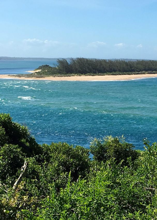
KEY BIODIVERSITY AREAS vamizi SITE ID:
49173
Admin Region: Cabo Delgado
KBA Area: 86.5 km2
Coordinates: -13.94 S, 39.29 E
current protection category: Community Sanctuary (not yet formalised)
pre-existing designation: N/A
0 2 miles
kba criteria triggered: D1b
Site description
trigger species
Vamizi is a tropical island situated at 11°S in the Northern
Caranx ignobilis LC
Mozambique; it has approximately 12 km long and 2 km
wide stretching along an east–west axis. The KBA has 86.5
km2. It is bounded to the north and south by deep canyons.
Close to 500 m deep, these canyons supply cooler water
to the reefs from the depths of the Mozambique Channel,
which may offer protection from warm water events and
thus avert coral bleaching (Davidson et al. 2006). The island
is surrounded by a fringing reef with associated shallow
lagoon where coral bommies are interspersed with sandy
patches. At the northern edge of this platform, the reef slopes
plunge steeply into the canyons, whereas the eastern edge
is a vertical wall with numerous overhangs. The southern
and western side of the island has a gentle slope in shallow
lagoon with patchy seagrass meadows, macroalgae, coral
bommies and coral reef patches. On the north side, the coral
form a continuous barrier between live coverage of 30-60%
and is dominated by Acropora species (Davidson et al. 2006,
Hill et al. 2009, Sola, Silva, et al. 2015). The island is situated
where the South Equatorial Current splits into the north-
flowing East African Current and south-flowing Mozambique
Current and this Northern Mozambique Channel (NMC) area
has been described as the second hotspot of Indo-Pacific
marine biodiversity (Obura 2012, McClanahan et al. 2014).
Vamizi Island is under influence of the northeast monsoon Caranx ignobilis
from October to March, which bring warm temperatures
and seasonal rains while the southeast monsoon, from main threats
April to September is associated with the cooler dry season Overfishing, illegal fishing, use of harmful fishing
(Davidson et al. 2006). While Vamizi Island sits outside the gear (including mosquito nets), activities related to
boundaries of the Quirimbas National Park, it benefits from oil & gas, climate change
the protection of a community-based management regime.
18rationale
This site is one of 10 largest aggregations of giant In addition, there are mass-spawning events occurring
trevally (Caranx ignobilis), estimated at more than 1,000 every year on the reefs of the Vamizi, and likely extending
individuals by Silva et al. (2014). It is only second to to adjacent islands of Metundo, Rongui and Tecomaji,
the largest aggregation worldwide recorded by Daly which involves the synchronized reproduction of tens
et al. (2018) in Ponta do Ouro Partial Marine Reserve of coral species (Sola et al. 2016).
(PPMR), which provides the maximum estimate of In addition, Vamizi is a confirmed rookery for green
2,413 individuals. The record of Silva et al. (2014) at this turtles Chelonia mydas (EN) and hawksbill turtles
site represented the first identified spawning location Eretmochelys imbricata (CR) (Pereira et al. 2009, 2014,
for giant trevally in the Western Indian Ocean. Garnier et al. 2012), where the highest density of nests,
Establishing the occurrence of a vital process such countrywide, are recorded annually for the former
as the spawning location of a large valuable teleost species (Louro et al. 2006, Pereira et al. 2009). The ca.
predator reinforce the no-take designation at this 50 females that nest annually in Vamizi represent the
site (Silva et al. 2014) and highlights the importance most important green turtle population in Mozambique
of developing community co-fisheries management (Trindade, 2012).
programs for protecting such processes (Silva et al. In summary, in addition to triggering the threshold
2014). This is particularly important for giant trevally for a KBA criterion for an important fish species, this
because spawning locations are considered to be site contains a wide variety of marine biodiversity of
highly predictable due to their stable occurrence over regional and global importance and is the scene for
space and time (Silva et al. 2014). key biological processes, which, combined with the
This site also hosts some of the most diverse and existence of a climate-adaptive center, make it a site
pristine coral reefs of East Africa (Garnier et al. 2008, where high biodiversity may persist in a changing
Hill et al. 2009, McClanahan & Muthiga 2011, Obura climate, assuming that effective measures are
2012). implemented to manage for its resilience.
references
l Davidson J., Hill N., Muaves L., Mucaves S., Marques da Silva I., Guissamulo A., Shaw A., London Z.S. of (2006) Vamizi Island, Mozambique, Marine
Ecological Assessment. Maluane
l Garnier J., Hill N., Guissamulo A., Silva I., Witt M., Godley B. (2012) Status and community-based conservation of marine turtles in the northern
Querimbas Islands (Mozambique). Oryx 46:359–367
l Garnier J., Silva I., Davidson J., Hill N., Muaves L., Mucaves S., Guissamulo A., Shaw A. (2008) Co management of the Reef at Vamizi Island,
Northern Mozambique (DO Obura, J Tamelander, and O Linden, Eds.). Mombasa
l Hill N., Davidson J., Silva I., Mucaves S., Muaves L., Guissamulo A., Debney A., Garnier J. (2009) Coral and Reef Fish in the Northern Quirimbas
Archipelago, Mozambique – A First Assessment. Western Indian Ocean Jornal of Marine Science 8:1–12
l Louro C.M., Perreira M.A., Costa A.C. (2006) REPORT ON THE CONSERVATION STATUS OF MARINE TURTLES IN MOZAMBIQUE. Maputo
l McClanahan T.R., Ateweberhan M., Darling E.S., Graham N.A.J., Muthiga N.A. (2014) Biogeography and Change among Regional Coral
Communities across the Western Indian Ocean. PLoS ONE 9:e93385
l McClanahan T., Muthiga N. (2011) Climate Change Priority Assessment of the Northern Islands of Mozambique: Vamizi Trip Report.
l McClanahan T.R., Muthiga N.A. (2017) Environmental variability indicates a climate-adaptive center under threat in northern Mozambique coral
reefs. Ecosphere 8
l Obura D. (2012) The Diversity and Biogeography of Western Indian Ocean Reef-Building Corals. Plos One 7
l Pereira M.A.M., Litulo C., R S., Leal M., Fernandes S., Tibirica Y., Williams J., Atanassov B., Carreira F., Massingue A., Marques da Silva I. (2014)
Mozambique Marine Ecosystem Review. Maputo
l Pereira M.A.M., Videira E.J.S., Narane D.A. (2009) Monitoria, marcação e conservação de tartarugas marinhas em Moçambique. Maputo,
Mozambique
l Silva I.M., Hempson T., Hussey N. (2014) Giant trevally spawning aggregation highlights importance of community fisheries management no-
take zones. Marine Biodiversity:1–2
l Sola E., Marques da Silva I., Glassom D. (2015) Spatio-temporal patterns of coral recruitment at Vamizi Island, Quirimbas Archipelago,
Mozambique. African Journal of Marine Science 37:557–565
l Sola E., Marques da Silva I., Glassom D. (2016) Reproductive synchrony in a diverse Acropora assemblage at Vamizi Island, Mozambique. Marine
Ecology:1–13
l Sola E., Silva I. da, Glassom D. (2015) An annotated and illustrated checklist of species of the coral genus Acropora (Cnidaria: Scleractinia) from
Vamizi Island, Mozambique. 56:807–844
l Trindade, J. 2012. Factores que influenciaram a escolha da praia de nidificação por tartarugas verdes (Chelonia mydas) em Vamizi, Moçambique,
entre 2003 e 2012. Dissertação mestrado em biologia da conservação. Universidade de Lisboa. 49pp
19KBA
KEY BIODIVERSITY AREAS Quiterajo SITE ID:
49162
Admin Region: Cabo Delgado
KBA Area: 3,063.8km2 Coordinates: -12.01 S, 31.35 E
current protection category: Partially included in a National
Park and covered by game farms
pre-existing designation: N/A
0 20 km
kba criteria triggered: A1a, A1b, A1e, B1, B2
Site description
trigger species
The Quiterajo KBA is a coastal area found in Macomia
Warneckea cordiformis CR (MOZAMBIQUE ENDEMIC)
district, about 45 km south of Mocímboa da Praia in Cabo
Grewia limae EN (MOZAMBIQUE ENDEMIC)
Delgado province, Northern Mozambique. This site covers
Oxyanthus strigosus EN
an area of about 3,063.80 km2 and it runs southward into
Pseudomussaenda mozambicensis EN
the Quirimbas National Park which has been declared
Pavetta lindina EN
a Biosphere Reserve by UNESCO. The annual average
Vepris allenii EN (MOZAMBIQUE ENDEMIC)
temperatures range between 24 ºC and 26 ºC (MAE, 2014).
Tarenna pembensis EN (MOZAMBIQUE ENDEMIC)
The rainfall average is around 900 -1,100 mm/year. Potential
Micklethwaitia carvalhoi VU (MOZAMBIQUE ENDEMIC)
evapotranspiration (Penman) significantly exceeds rainfall
Stylochaeton tortispathus VU (MOZAMBIQUE ENDEMIC)
from May to November–December, giving a growing season
Acacia latispina LC (MOZAMBIQUE ENDEMIC)
of around 4–5 months (Pascal, 2011). The rains generally
Acacia quiterajoensis LC (MOZAMBIQUE ENDEMIC)
start in early December, with a long hot dry period before
Justicia gorongozana LC (MOZAMBIQUE ENDEMIC)
that. In terms of vegetation this site holds various types of
Maerua andradae LC (MOZAMBIQUE ENDEMIC)
dry forest, miombo woodland, mixed woodland, floodplain
Mimosa busseana LC
grassland, small lakes and grassy drainage lines (Timberlake
Ormocarpum schliebenii LC
et al., 2011; Pascal, 2011). In the coastal zone, there are
also mangroves and flooded herbaceous vegetation (MAE,
2014). This area has a significant diversity of species of wild
animals, reptiles, birds and plants (MAE, 2014). This is also
one of the focus areas of armed conflict in Cabo Delgado,
between insurgents and the national defense forces.
Acacia quiterajoensis Warneckea cordiformis
main threats
Agriculture expansion, logging, armed conflict
20rationale
Timberlake et al. (2011) have highlighted Quiterajo as and Four Least Concern species: Acacia quiterajoensis,
one of the four key areas (together with Pundanhar- Justicia gorongozana, Mimosa busseana and Maerua
Nangade, Rio Macanga-Nhica do Rovuma and andradae. This illustrates that Quiterajo, being within
Lupangua) for conservation of coastal forests and White’s Zanzibar-Inhambane regional mosaic, holds a
associated vegetation types in northern Mozambique. unique flora particularly from the coastal dry forests.
This conclusion was achieved as a result of extensive There are also two species of conservation concern,
expeditions carried out in the coastal forests of namely Chassalia colorata (EN) and Duosperma
Northern Mozambique in 2008 and 2009, which dichotomum (VU) which did not trigger the criteria at
regarded Quiterajo as being home to number of rare, this site. However, these species trigger KBA status in
range restricted and endemic or near-endemic species, Palma where they are known to occur in more than
particularly for flora (Timberlake et al., 2010; Pascal, one locality.
2011). A total of 15 plant species among rare, range
restricted and threatened triggered KBA status in Quiterajo holds a significant portion of a much more
Quiterajo. There are seven threatened species where extensive complex of coastal forests in northern
one is Critically Endangered (Warneckea cordiformis), Mozambique, which is probably the largest remaining
six are Endangered: Grewia limae, Oxyanthus strigosus, area of this forest type on the Eastern African coast.
Pavetta lindina, Tarenna pembensis, Pseudomussaenda Due to what is explained above, it has been shown that
mozambicensis and Vepris allenii; and three are the biodiversity in Quiterajo is of global importance,
Vulnerable: Micklethwaitia carvalhoi, Stylochaeton and therefore qualifies as a Key Biodiversity Area.
tortispathus and Acacia latispina. The list of trigger Hopefully this status will catalyse actions to supress
species includes restricted range species, such as: ongoing threats on an unprotected global resource.
Ormocarpum schliebenii, which is Near Threatened,
references
l Ministério da Administração Estatal (MAE). 2014. Perfil do distrito de Macomia província da Cabo Delgado. Available online: http://www.
portaldogoverno.gov.mz
l Pascal, O. (compiler) 2011. The Coastal Forests of Northern Mozambique, 2008 2009 expeditions “Our Planet reviewed” Programme Report no
1. Pro-Natura International/Muséum national d’Histoire naturelle, Paris, 160 pp
l Timberlake1, T., Goyder, D., Crawford, F., Burrows, J., Clarke, G., Luke, Q., Matimele, H., Müller, T., Pascal, O., de Sousa, C. and Alves, T. 2011.
Coastal dry forests in northern Mozambique. Plant Ecology and Evolution 144(2): 126 – 137.
l Timberlake1, T., Goyder, D., Crawford, F. and Pascal, O. 2010. Coastal dry forest in Cabo-Delgado: Botany/Vegetation. Nonpublished report.
London, Royal Botanic Gardens, Kew and Paris, Pro Natura International.
21KBA
KEY BIODIVERSITY AREAS Taratibu SITE ID:
49170
Admin Region: Cabo Delgado
KBA Area: 25km2 Coordinates: -12.82 S, 39.68 E
current protection category: Included in a National Park,
Buffer Zone and a private concession
pre-existing designation: N/A
0 2 km
kba criteria triggered: A1a, A1e, B1
Site description
trigger species
Taratibu is an area which is partially within the Quirimbas
Nothophryne unilurio CR (TARATIBU ENDEMIC)
National Park (QNP) in Cabo Delgado Province, Northern
Rytigynia torrei EN (TARATIBU ENDEMIC)
Mozambique. The KBA covers an area of about 25 km2 and
lies within the Taratibu concession area, comprised of 35,000
hectares located at bloc “A” of the QNP, between southern
Latitudes 12º 0’ S and 12º 38’ S, and Eastern Longitudes
39º 32’ E and 39º 58’ E (Nanvonamuquitxo et al., 2019). The
climate in this site is dry sub-humid with two distinctive
seasons which include a hot and rainy season, and a much
cooler and dry season from May to September. The average
temperature throughout the year varies between 20 ºC and
25 ºC (Nanvonamuquitxo et al., 2019). The annual rainfall
ranges from 800 to 1,200 mm, between October and March.
The typical phytoecology of the region is the miombo
woodland (Nanvonamuquitxo et al., 2019, Sitoe et al., 2010). Nothophryne unilurio
According to Nanvonamuquitxo et al. (2019), this area has a
history of disturbance by logging, fire use and the common
practice of shifting agriculture.
main threats
Logging, slash and burn shifting agriculture, poaching
22You can also read