Farndon - 2016 to 2030 - Neighbourhood Development Plan - Royden History. Co. Uk
←
→
Page content transcription
If your browser does not render page correctly, please read the page content below

Farndon
Neighbourhood Development Plan

            2016 to 2030
      Pre-submission Draft for Consultation—December 2015
                         V7.1 December 2015
Table of Contents
1. Introduction ................................................................................................................ 5
2. Plan Development, Vision and Objectives .............................................................. 10
3. Policy Development and Summary ......................................................................... 13
        Policy 1 – The Local Economy........................................................................... 15
        Policy 2 – Homes to Meet the Needs of the Village .......................................... 21
        Policy 3 – Protecting the Built Environment....................................................... 29
        Policy 4 - Facilities for Local People .................................................................. 35
        Policy 5 - Transport and Communication .......................................................... 39
        Policy 6 - Landscape and Environment ............................................................. 45
4. Next steps ................................................................................................................ 49

Maps
1.   Farndon New Parish Boundaries ……………..9
2.   Dee Flood Plain ……………………………….26
3.   SHLAA Map…………………………………….27
4.   Conservation Areas…………………………...33
5.   Farndon Street Map OS sheet 117….………42

Annexes
Annex 1 – Household Questionnaire 1 (December 2012) & Results & Analysis
Annex 2 – Business Questionnaire (December 2012) & Results & Analysis
Annex 3 – Household Questionnaire 2 (January 2015) & Results & Analysis
Annex 4 – Strategic Housing Land Availability Assessment (SHLAA 2010)

Additional Documents
Section 1 - Steering Committee Minutes x 31
Section 2 - Timeline
Section 3 - Basic Conditions Statement
Section 4 - Environmental Report or Screening Statement
Section 5 - National Census 2011 – Summary for Farndon
Section 6 - Farndon/Cheshire House Prices 1996 to 2010
Section 7 - Farndon, Planning Applications 2010 to 2015
Section 8 - Farndon, Listed Buildings
Section 9 – Farndon, Conservation Area – CWaC Planning Portal
Section 10 - Farndon to Chester bus timetable – C56 route
Section 11 - Farndon, Traffic Survey – CWaC A 14178 and A 14179
Section 12 - Building for Life 12 Criteria, Design Council 2012.

References
List of references mentioned in the text …………………………… 52

                                                                          2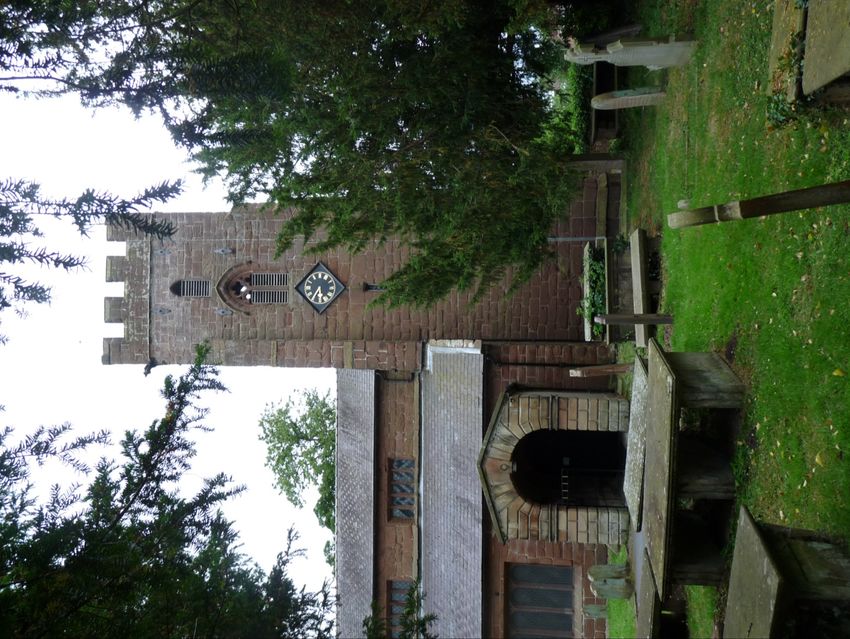
Farndon is a village sitting on the
border of England and Wales.
Historically an important crossing
point of the River Dee, the 14th
century bridge (on cover) is a
treasured monument and still in
daily use.

A church has stood on this hill for
over a thousand years. Around it
are architecturally important
houses and buildings which give
the village its personality and style.

                                         3
There is an eclectic mix of
building styles from different
ages. Tudor, timber frame,
Georgian and modern are
mixed together, ranging
from the functional to the
down-right quirky.

                                 4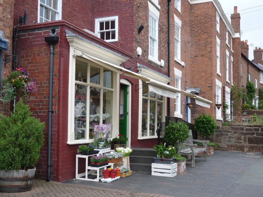
1. Introduction

In March 2012 Farndon Parish Council established a small Steering Group to consult local
residents and based on the opinions of the village, prepare a Neighbourhood Plan for the 20 years
from 2016 to 2030.

During most of the time the Neighbourhood Plan was in preparation Farndon Parish was more or
less limited to the village itself plus half of the hamlet of Crewe-by-Farndon. However, in April 2015
the parish boundaries were extended to include the settlement of Kings Marsh to the east and all of
Crewe-by-Farndon. Community consultation was broadened to cover the larger area as soon as
the Parish Council was notified of the new boundaries.

Preparation of the Neighbourhood Plan provided an opportunity to connect the Localism Act
(2011), the National Planning Policy Framework (2012), the Cheshire West and Chester
Council Local Plan designation of Farndon as a ‘Key Service Centre’ (2012) and the Chester Local
Plan (January 2015), with the views and opinions of Farndon residents about the future of the
village.

Farndon residents were involved in the development of the Plan from the very beginning through
the distribution of a series of information leaflets, village meetings, coffee mornings and afternoons,
drop-in discussion events and completion of two household and one business questionnaire.
Alongside the consultations information was gathered about possible development sites, brownfield
sites, the scope and structure of the local economy and associated employment opportunities.
Traffic and wildlife surveys were conducted, natural and scientific limitations across the Parish
investigated, the developing Chester Local Plan read and commented upon, the robustness of local
services discussed with providers and the distribution of the local population, demographics and
travel to work patterns researched.

The Farndon Neighbourhood Plan is therefore based on both legislative requirements and the
views of the local community. Every attempt has been made to provide a local planning document
on which to base a realistic approach to future growth in Farndon, be it for housing, service
provision or economic development, whilst recognising the limitations imposed by the flood plain to
the east and the high speed road to the south .

Farndon – History

Farndon lies eight miles south of the city of Chester and is set on a sandstone outcrop above the
River Dee, which forms a natural border between England and Wales. Dee Cliffs are an important
Site of Special Scientific Interest because at this point the river has cut down into the Bunter Pebble
Beds and exposed a sequence of river-laid rocks formed within the Triassic period 205 million
years ago when England was a low-lying desert region close to the equator. Here the Dee, tidal in
those days, becomes shallower and the ford just above Farndon was used from ancient times as
an important strategic crossing place between the two countries and was fought over from Roman
times until the English Civil War.

Ferentone, as Farndon was originally named, means ‘fern-clad hill’ and the results of excavation in
the churchyard and the curved nature of the defensive ditch – now the High Street - suggest that
Farndon was originally a Bronze Age settlement. The circular churchyard is indicative of an
important early monastic site and an indication that the site has been a place of worship since
Anglo-Saxon or even Celtic times. No trace of the monastery remains.

                                                   5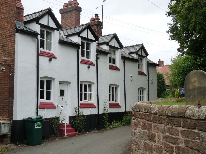
Roman roads criss-cross Cheshire and Farndon lies near the junction of the Roman road between
Chester and Wroxeter and the Dee crossing from England into Wales. The Roman record in
Farndon is scanty but Roman fragments have been found in the churchyard and the Roman tiles
stamped ‘Legio XX’ – the logo of the Twentieth Legion (Valeria Victrix) based at Chester – found at
Crewe Hill, were probably from the Roman tile factory in Holt (Bovium).

Farndon church is dedicated to St Chad who in AD 669 became the first Bishop of the Kingdom of
Mercia and was famous for touring his diocese establishing churches wherever he went. St Chad
probably visited Farndon and founded the church, along with the five other churches dedicated to
him across Cheshire, as well as St Chad’s over the Welsh border in Holt.

Cheshire, especially the area around Farndon, was of military importance because of its proximity
to Wales and the on-going wars between the two countries. The first Earl of Chester – known
locally as Hugh Lupus – made responsible by William the Conqueror for keeping the peace in the
area, created a secular sanctuary for outlaws at Kings Marsh to the east of Farndon around 1071.
Criminals could stay for a year and a day if they paid a fine, built a shelter overnight and had smoke
rising from the chimney by dawn. Not surprisingly many brigands were attracted to the area from all
over England and provided local, indentured manpower for the Earl’s army in his wars with the
Welsh.

In 1086, the Domesday Book recorded a population of 37 in Farndon, land for 16 ploughs, a mill, a
fishery and a given value of, in total, 180 shillings. The importance of St Chad’s was demonstrated
by the presence of a village priest and two other priests, all with land. The church at that time would
have been of timber construction but the foundation outline of the present building and the tower,
both of which date from the 14th century, is of stone.

At the same time as the church tower was built - about 1338 - the monks of St Werburgh’s Abbey in
Chester built Farndon bridge. The wars with the Welsh had finished and the road through Farndon
and over the bridge supported the lucrative trade in salt between Nantwich and Wales. In 1485, a
Lancastrian force of 3,000 marched across it on the way to the Battle of Bosworth Field. Farndon
bridge is now a Grade I listed building and also a scheduled ancient monument.

John Speed the Elizabethan historian and map-maker was baptised at Farndon in 1552. It is said
that he first began to study ‘ land that is afar off ’ from the tower of Farndon church. He later moved
to London where he became an eminent cartographer and in 1598 presented maps to Queen
Elizabeth I. One of the roads in Farndon, Speed’s Way, is named after him.

During the Civil War of the 17th century, the church was a garrison outpost for the Roundheads
whereas Holt Castle just across the river was held for the Cavaliers. 1643 saw a Civil War skirmish
known as the Battle of Farndon Bridge when Farndon was destroyed by fire and St Chad’s left
derelict. In September 1645, the army of Charles I crossed the Dee at Holt on the way from mid
Wales to raise the siege of Chester. They were defeated at the Battle of Rowton Moor and Chester
fell to the Parliamentarians. In 1658 due to the damage wreaked by the Civil War the church,
excepting the tower, was completely rebuilt with the addition of the Barnston Chapel and at the
same time, the bells were recast.

Four years later in 1662 following the Restoration, William Barnston the local landowner and a
supporter of Charles I during the Civil War, commissioned the ‘Civil War Window’ in the Barnston
Chapel to commemorate the Royalist defenders of Chester. It is a fascinating illustrative record of
the times depicting some of Cheshire’s leading Royalists and is a military memorial.

                                                   6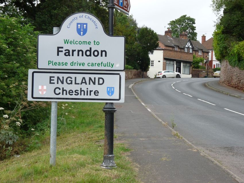
Farndon has its share of war memorials. The Barnston obelisk on Churton Road was erected to the
memory of Roger Barnston who died of injuries sustained during the Indian Mutiny at the relief of
Lucknow in 1857 – the family having lived in Farndon for 600 years. Many young men from the
village served in the Boer War and both World Wars. Those 23 residents who died in the World
Wars are commemorated on the War Memorial in the churchyard and the Memorial Hall close to
the church was built by public subscription in memory of the fallen.
During the 19th century Farndon church re-instated the ancient custom of Rushbearing, a tradition
which is celebrated each July, installed a new peal of eight bells and made alterations to the church
interior to resemble the layout seen today. It is now a Grade II* listed building.
Rock Chapel at the corner of the High Street and Church Street, opened in 1889, burned down in
1957 and was rebuilt and re-dedicated in 1958. It continues to this day serving worshippers of the
United Reform Church and hosts those of the Catholic faith.
The 19th century also saw an annual influx of people who came to pick the famous Farndon
strawberries and the first ten years of the 20th century brought a telephone service to the
Post Office and gas to the village. Electricity came in the late 1920s and piped water by the early
1930s but mains drainage did not arrive until the 1950s. The horse bus to Chester, Malpas and
Wrexham survived until the motorbuses of the 1930s.
In 1664 Farndon was a small village with an estimated population of 225. More precise figures can
be found in the ten-yearly censuses rising from 357 residents in 1801 to 560 in the late 1930s when
council houses at Crewe Lane and private houses on Churton Road were built. Over the next
years further housing developments appeared and during the 20 years between 1951 and 1971 the
population of the village doubled to 1,162. In 2011 the population was 1,517.
There have been a surprising number of schools in Farndon since the first one – the Parish School
- was built by subscription in 1629. Two private boarding schools, The Academy and Farndon Hall
existed by 1850, Farndon House and Farn Hill schools by 1864, Holly Bank catering for eight young
ladies by 1870, an Infant school by 1896 and Kings Lee school by 1897. Of these eight schools,
Farndon Parish School is the only one that still exists and is now on its third site. There is some
interesting 1859 graffiti scratched onto the wooden window shutters of The Lodge, Church Lane,
which was once the boarding house for students attending Farndon Hall.
At one time Farndon supported ten public houses catering for day-trippers, strawberry pickers, the
Welsh on Sundays when Wales was ‘dry’, as well as the local population. Of these, The Greyhound
and The Farndon remain to serve the village along with the restaurant at Top Farm, the butcher’s,
the paper shop, the pharmacy and Post Office, the flower shop, the chandler’s, hairdressers,
beauty salon and a number of small commercial businesses. Brewery Motors is no longer the
brewery it was during the 19th century but is now a motor garage.
Farndon grew as a village because it commands an important crossing into Wales and this may be
reason that it was overlooked by the merchants of Chester and Nantwich and few large houses are
found in the village. Holly Bank is one of them and is Grade II listed as are the Black and White
Cottages, The Chimes, Tudor House and others, and some cottages in the High Street are listed as
Grade III.
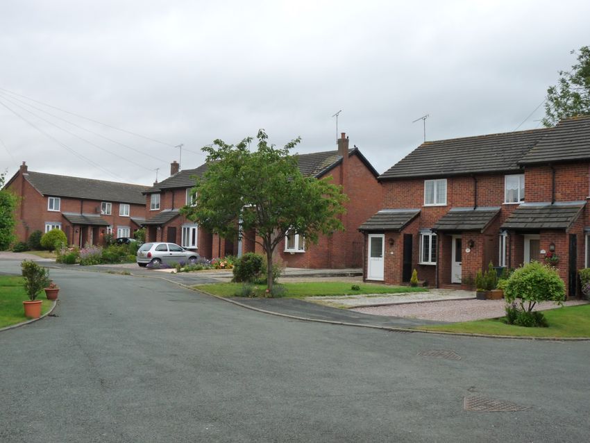
The existing housing stock dates from the 17th century with much of the High Street built during the
18th century. More modern style housing is found behind the principal roads and Farndon has been
described as a ‘pleasant intermixing of buildings of various styles and periods’.
7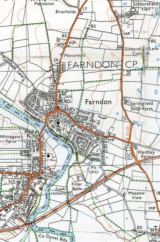
Farndon Parish Council dates from 4th December 1894 and Farndon itself has been under the
jurisdiction of Cheshire West and Chester Council since it was established on 1 st April 2009.
On the 1st April 2015, Farndon parish boundaries were extended to include the settlement at Kings
Marsh and the entire hamlet of Crewe-by-Farndon.
Bibliography
Doomsday Book 1086 – Phillimore 1978 – 263a (B1) and 266d (14-1)
History and Gazetteer of Cheshire – Francis White and Co -1860
The King’s England, Cheshire – Arthur Mee - 1938
Cheshire Before the Romans – W.J.Varley - 1964
Farndon – The History of a Cheshire Village – Frank A Latham – 1985
The Parish Church of St Chad Farndon – Cheshire County Council – 1989
Hidden Highways of Cheshire – RJA Dutton – 1999
Cheshire Historic Towns Survey – Cheshire County Council - 2003
Farndon A Gateway Village – Chester City Council
Dee Cliffs Farndon Site of Special Scientific Interest – English Nature.
8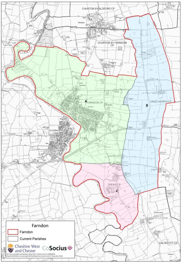
9
2. Plan Development, Vision and Objectives
Residents of Farndon – of all ages - were closely involved in the development of the
Neighbourhood Plan and chose each of the six policies through a process of community
consultation including the distribution of information leaflets, open drop-in events, village meetings,
discussions with primary school children, discussions with business owners and the analysis of one
business and two household questionnaires.
Consultations and preparation of the Plan were interrupted during 2013 and the second household
questionnaire delayed by some months whilst the residents and Parish Council fought against a
planning application for 105 houses on the edge of the village. This would bring the number of
houses approved in less than four years to 231 – substantially in excess of the 200 allocated by
Cheshire West and Chester Council for the whole period 2010 to 2030. The appeal was lost, the
development approved and work on the Neighbourhood Plan recommenced.
Community feedback – of course – reflected the disappointment felt by residents about the large
and rapid increase in the size of the village, high stress levels on public services, loss of agricultural
land and the absence of an opportunity to grow the village incrementally and sustainably.
Nevertheless, residents continued to support the development of the Plan and their feedback, when
taken alongside the background information about Farndon and the national legislative basis of
neighbourhood planning, led to the development of a vision, of achievable objectives, and
sustainable policies for the years until 2030.
The Vision and Objectives for Farndon were agreed at the “Drop-in Consultation” held at Farndon
Memorial Hall on 17th April 2013.
Vision
“ In twenty years time Farndon will still be a rural village with a strong community ethos. It will
value its heritage, river and surroundings while providing people with a safe and sustainable
environment. Farndon will be a welcoming place providing local employment and encouraging
visitors.”
Objectives
Protect and maintain the rural character of the landscape and the natural environment.
Protect the built environment, heritage assets and the Conservation Area.
Strengthen existing economic activities and support new opportunities for local employment.
Strengthen public facilities.
Ensure that housing growth reflects the needs of residents identified through community
consultations.
Ensure that future development is limited to ‘brownfield’ and SHLAA sites and is sustainable.
Respect the vernacular with respect to building materials, height, massing and design.
10Policies
The local economy.
Homes to meet the needs of the village.
Protecting the built environment.
Facilities for local people.
Transport and communication.
Protecting landscape and environment.
Documentary Evidence
The vision, objectives and policies are based on: -
Questionnaires - two household and one business questionnaire with records of responses,
narrative and graphic analyses.
Information leaflets and posters.
Meeting notes - from information sessions, drop-in meetings, discussions with local business,
local landowners, the Women’s Institute and with pupils at Farndon Primary School.
National legislation plus local plans and reports prepared by Cheshire West and Chester
Council and predecessors, Natural England and other environmental organisations.
Next stages
Neighbourhood Planning regulations require that the proposed plan be subject to a six week
‘Pre-Submission Consultation’ before formal submission to the local authority. During this period,
the plan will be publicised locally and brought to the attention of residents, local landowners, people
who work or run businesses in the parish, statutory consultation bodies, the local authority, the
Environment Agency, Natural England, Historical England and others.
An explanatory leaflet will be delivered to each house in the parish describing how, where and
when comments can be made. The plan will be posted on the Parish Council website and
available in hard copy at village ‘drop-in’ events. Comments will be analysed, the plan revised and
submitted to Cheshire West and Chester Council for the mandatory six week publicity period, the
independent examination and ultimately, a parish referendum.
1112
3. Policy Development
The policies in the Farndon Neighbourhood Plan follow directly from consultations held around the
parish ranging from discussions with local businesses and school children, to the results of two
household and one business questionnaire and comments made at a number of meetings with
residents from all age groups.
It is appreciated that the government has set pre-conditions for the policies to be included in
Neighbourhood Plans which are land use and development related and it is in this context that six local
policies – economy, homes, built environment, facilities, transport and communication, and landscape
and environment - have been developed.
Each policy is described separately and each is considered in the context of the parish, its location,
history, residents and their views, relevant national legislation, local planning policies, and advice from
bodies such as Natural England. For ease of reference, the legislation is listed at the end of each policy
section along with a note of linked annexes.
A number of issues raised during community consultations are somewhat indirectly linked to land
use – they are aspirations- and are included for the sake of completeness with the caveat that the
Parish Council will pursue the subject separately on behalf of the village.

Residents believe that when taken together the six policies support development that is sustainable
and consequently, planning proposals must conform to them. The Parish Council will work alongside
Cheshire West and Chester Council and developers to ensure that Farndon remains a rural village with
a growing economy and a vibrant sense of self and belonging.

Summary of Six Policies
        Policy                                               Subject
1 - Economy           1.1 Protect and promote employment opportunities,
                      1.2 Encourage use of riverbank.
2 – Housing           2.1 Utilise ‘brownfield land’ first and then SHLAA

                      2.2 Limit house building to seven properties a year unless there is a demonstrable
                          need for first-time homes or sheltered accommodation for residents,

                      2.3 Provide a mix of housing including smaller two and three bedroomed homes for
                          outright purchase …. Houses defined as ‘affordable’ to be built for local people
                          … and to remain ‘affordable’ in perpetuity,
                      2.4 Enhance the natural and built environment of Farndon with Cheshire-style house
                          design complying with Building for Life 12 Criteria,
                      2.5 Housing schemes which will exceed the seven per year, to be staged over a
                          number of years, of varied style and size built in small groups, reflect the
                          village character, respect the local vernacular and avoid the anodyne style of
                          estate-type building.

3 – Built             3.1 New development to be low key and preserve views and vistas,
    environment
                      3.2 Conservation Area and listed buildings respected,
                      3.3 Brownfield sites prioritized.
4 – Facilities        4.1 Proposals for development will be required to prepare a
                          ‘Development Impact Assessment’,
                      4.2 Developers must liaise with the Cheshire Footpath Society,
                      4.3 Proposals must contribute positively to Farndon.

5 - Communications    5.1 Road safety and congestion,
                      5.2 Pedestrians and cyclists.
6 - Environment       6.1 Protect and conserve natural assets.
                      6.2 Protect green spaces,
                      6.2 Conserve the landscape.

                                                      13
14
The Local Economy—Leading to Policy 1

Background

Historically, agriculture - and in the 19th century education - was the most prominent business
sector and employer in the area. The national decline in the size of the agricultural workforce has
affected Farndon and although there are still a significant number of local people working in
agriculture, there are many fewer employees.

Until the 1960s there were three working farms within the village itself. Bottom Farm and Church
Farm have been converted into housing whereas Top Farm and the outbuildings are now a
restaurant, small workshops and retail space although some of the units are recently empty. The
Tile Shop ceased trading and the two grocery shops have closed, one of which has been converted
into two houses. One of the three public houses, The Nag’s Head, has been replaced by two retail
units and eight dwellings and the riverside café (now closed) is currently subject to a planning
application. Monument Place, the small industrial estate on the edge of the village, is largely empty.

The pattern in Farndon parish is one of agricultural buildings converted into homes and in a few
cases into small workshops, although some companies are relocating outside the village and the
business is lost. There may be a cross-border effect from the Wrexham Industrial Estate, although
Farndon has more to offer to very small enterprises.

The local economy is almost a mirror of the local facilities which comprise a small range of shops,
public houses, a restaurant, holiday homes and bed-and-breakfasts plus the surgery, Post Office,
pharmacy and school along with personal services such as a beauty salon, hairdressing, florist and
professional services including architecture, office services, kitchen design, building, heating, small
scale manufacturing, car repair and leisure vehicle storage. And for our dogs, a kennels and a
grooming salon. The Country Market on Wednesdays and the monthly Sunday Farmers’ Market
complete the picture.

No suitable sites for renewable energy have been identified or proposed in the area covered by the
Neighbourhood Plan. A planning application is expected shortly for a solar farm on 55 acres of
Grade 3b agricultural land near Shocklach, about three miles south of Farndon. Any economic
effects will be considered when the plans are made public.
The Neighbourhood Plan recognises that while the majority of residents work outside the village,
the local economy should be supported by encouraging the reuse, and thereby sustainable use, of
currently vacant industrial spaces ranging as they do from small offices to workshops, rather than
allowing new build commercial premises.

                                                  15
Community Consultation
Farndon could be described as a ‘gentle’ place to live – a country village that should be maintained
and nurtured. It cannot be described as having a vibrant, thriving buzz and it is interesting to
examine the responses made by residents to the suggestion that the Parish Council should
promote Farndon in Chester and Wales – 47% strongly agree and 24% agree (71%) and promote
tourism – 46% and 26% respectively (72%) – these are the two lowest scores on the proposed
economic policy by some margin. In fact, they are the two lowest scores for any proposed policy
except for one. The highest score under ‘economic growth policies’, 89%, was support for high
speed broadband, which arrived in Farndon in the spring of 2015.
There is evidence that residents would welcome improved facilities on the riverbank and to
maintain that area for leisure and recreation (80%), that a local Business Support Group would be
helpful (82%) and that current employment areas such as Top Farm, Brewery Motors and
Monument Place should be protected and promoted (84%).
Consultation with the Farndon business community identified a desire for development of currently
empty premises to expand the small business presence rather than build on green fields, concerns
about the absence of high speed broadband (now resolved) and lack of parking.
Policy 1 — Economy (Parts 1 & 2)
1.1 Protect and promote employment opportunities
Farndon currently has a number of vacant business premises – generally small except at
Monument Place where larger industrial spaces are available. Proposals which would result in loss
of business will be required to demonstrate that reasonable attempts have been made to preserve
employment opportunities and that these premises are no longer viable.
1.2 Encourage use of common land along the riverbank
The River Dee and the nearby cliff area are designated SSSI’s and any proposed use or
development of this area must be consistent with the objectives for conserving or enhancing the
SSSI.
Many local people and visitors enjoy the riverbank. It is an important geological Site of Special
Scientific Interest and extends all along the Triassic sandstone cliffs, fishing pegs for licensed use
are available as the riverbank is common land, riverside footpaths run to the north and south of the
bridge with further south, a boardwalk maintained by the Parish Council and Cheshire West and
Chester Council. Farndon Parish Council is currently discussing the re-opening of the public
toilets and clearing the picnic area to make the area attractive .
16Aspirations
i) Employment Opportunities
One barrier to their use might be the level of business rates and there is an option for businesses to
be given a business rates ‘holiday’ for a few years to enable them to become established. Cheshire
West and Chester Council have the power to provide business rate relief and will be approached to
make the concession available for Farndon. If successful, the local Borough Councillor will be asked
to allocate some his discretionary £10,000 per annum budget to market business opportunities in
Farndon
It is anticipated that these two initiatives would encourage new business to locate to Farndon with
multiple benefits. Empty premises would be utilised, new employment opportunities would revitalise
the local economy and the possibility of conversion of empty units into housing would be reduced.
ii) Farndon Business Support Group
It is an option for the Parish Council to recommend the establishment of a Business Support Group at
the Sports and Social Club when the new status is confirmed later in 2015.
17Supporting Legislation and Advice
Chester District Local Plan (2006) retained - EC6, EC11, EC12
CWaC Rural Regeneration Strategy and Action Plan 2011
Cheshire Community Action – Rural Community Profile for Farndon (Parish) January 2012
National Planning Policy Framework 2012: Achieving Sustainable Development - paragraphs
6 to 10
Building for Life 12 Criteria, Design Council 2012 number 10
Local Government Information Unit ‘Administration of Business Rates in England. Discussion
Paper’ – 22 May 2014
CWaC Local Plan Part One 2015
Strategic Objectives SO 3
Economy ECON 1.
Annexes
a. Household Questionnaire 1 (December 2012)
Actions on Dee Area
What impacts will development have?
b. Business Questionnaire (December 2012)
Analysis – text
Analysis - graphic
c. Household Questionnaire 2 (January 2015).
Promoting economic growth and employment opportunities
Protecting the built environment
d. National Census 2011 – Summary for Farndon.
1819
20
Homes to Meet the Needs of the Village—Leading to Policy 2
Background
Farndon parish now covers the village itself, the settlement of Kings Marsh to the east and the
hamlet of Crewe-by-Farndon to the south. The 2011 census recorded a total of 740 houses in the
new parish the majority of which are in the village centre, then spread along the High Street to
Barton Road and to the north on Churton Road.
In 2012, Cheshire West and Cheshire published Preferred Policy Options – PD04 Rural Area, in
which Farndon was identified as a ‘Key Service Centre’ with a proposed level of new housing
provision 2010–2030 (and annualised) as 200 (10 dwellings per annum), confirmed by the adopted
Local Plan 2015 – with the justification: -
Considered a reasonable level of growth due to size and function of settlement and flood risk
constraints and
Strategic Housing Land Availability Assessment (SHLAA) 2010 identifies sufficient sites to
meet this requirement’.
Villages can be fragile environments and development should be carefully considered for settling
and style and volume. The most appropriate approach to building, especially in villages, is
considered to be incremental growth harmonising with the existing character and scale of the area.
These are requirements of the National Planning Policy Framework 2012 and the Cheshire West
and Cheshire Council Preferred Policy Direction PD01 and reflect the principles of sustainable
development combined with respect for the natural and historic environment of the locality.
Sustainable communities rely on a variety of local services to accommodate the needs of the
existing residents and able to absorb or expand to meet stresses of an increased population.
Incremental housing growth ensures that services gain time to respond.
Although Farndon has an ageing population with a higher average than the United Kingdom as a
whole, there are many young people born or raised in the village who would like to stay and bring
up families. The current housing mix and cost – house prices being higher than the Cheshire West
and Chester Council average - makes the choice of down-sizing or first-time buying very
challenging and there is a need where possible, to accommodate changing personal
circumstances.
It was thought that incremental housing growth over the 20 year period at the rate of build advised
by Cheshire West and Chester Council and taking account of the differing sizes of the brownfield
and SHLAA sites – they range from 2 to 58 – would allow for cottage style and family homes on
small sites, with ‘affordable’ units incorporated into the larger mixed-size build sites. Over time,
Farndon would develop but not change in character.
However, during the period 2010 to 2015, planning permission was awarded for a total of 231
houses and it is with this background and in this environment that the community consultations
have been undertaken and the Neighbourhood Plan developed.
21Community Consultation
The issues identified by the residents during the initial consultations – undertaken before the
approval of four large developments - were clear and can be summarised as follows:
A better mix of housing and an increase in homes for first-time buyers,
No major developments in the village and all development to be phased over a number of
years,
Small-scale housing and in-fill preferred.
Further village consultations followed the approval of 223 houses on four sites within two years and
the realisation that on the two developments then in progress, Elan (32 properties) and Redrow (40
properties), the only properties for sale were four and five bedroomed houses with the smaller two
and three bedroomed homes allocated for rent or shared ownership. That this mix did not meet the
needs, or the previously expressed preferences of residents, can be seen in the responses to the
second household questionnaire: -
22 Future development to include smaller homes to buy outright – 83% agreed
Developers must meet community ideals – 89% agreed
Provide broader complementary development – 84% agreed
New housing must meet the Farndon Plan criteria – 92% agreed
Development to be restricted in Farndon to seven homes per year – 80% agreed
Exemption from the seven homes per year rule for sheltered or starter homes – mixed results
with 58% agreeing, 21% neutral and 21% disagreeing.
Policy 2 — Housing (Parts 1 to 5)
2.1 Utilise ‘brownfield land’ first as in the Housing Bill 2015 and then consider other sites within the
built up area of Farndon. Development would thereby be small scale, in-fill and not impinge on
quality agricultural land.
N.B.This Farndon Plan does not seek to allocate individual sites.
For the SHLAA site near the Dee, the most southerly part floods regularly and is unsuitable for
housing. North of this, the land drains to the Dee so impacts on the river in terms of water
quality particularly, therefore water run-off, supply and disposal need to be considered.
2.2 Limit house building in Farndon to seven properties a year, unless there is a demonstrable
need for first-time homes or sheltered accommodation for residents. Reviewed on a five
yearly basis.
2.3 Provide a mix of housing including smaller two and three bedroomed homes for outright
purchase to allow for downsizing and first time buyers. Houses defined as ‘affordable’ to be
built for local people in accordance with the most recent legislation and to remain ‘affordable’
in perpetuity.
232.4 Enhance the natural and built environment of Farndon with Cheshire-style house design
complying with Building for Life 12 Criteria, Design Council 2012.
2.5 Housing schemes which will ultimately exceed the seven per year favoured by the residents –
such as the two sites already approved at Top Farm and Churton Road - should nevertheless
be staged over a number of years. Houses should be of varied style and size built in small
groups, reflect the village character and designed to fit the location. Above all, they should
respect the local vernacular and avoid the anodyne style of estate-type buildings that
surround many rural villages.
The clear intention of this Neighbourhood Plan housing policy is to ensure that Farndon remains a
rural village, offers a mix of properties in small developments to suit the local population, is
sustainable with respect to services and facilities and does not become a dormitory village.
Supporting Legislation and Advice
Site of Special Scientific Interest (SSSI) notified (Under Section 28 of the Wildlife and
Countryside Act) 1981
Chester District Local Plan (2006) retained - EC6, EC11, EC12
Strategic Housing Land Availability Assessment (SHLAA 2010)
Localism Act 2011
National Planning Policy Framework 2012: Achieving sustainable development - paragraphs
6 to 10
Building for Life 12 Criteria, Design Council 2012 – all
CWaC Local Plan 2015 (Part One)
Preferred Policy Option Rural Area (Key Service Centre) PDO4
Preferred Policy Direction (Sustainable Development) PD01
Strategic Objectives SO 3
Economy ECON 1
Housing Bill 2015.
Annexes
Farndon/Cheshire House Prices 1996 to 2010
National Census 2011 – Summary for Farndon
Household Questionnaire 1 (December 2012)
Household Questionnaire 2 (January 2015)
Farndon, Planning Applications 2010 to 2015.
2425
26
27
28
Protecting the Built Environment—Leading to Policy 3

Background

Farndon is an ancient village dating back to pre-Saxon times with Roman undertones and
consequently has a long history and a rich built heritage dating mainly from the 14 th century.
Roman roads run close to Farndon and Roman fragments have been found in the churchyard and
at Crewe Hill but there is no evidence of a settlement, although there was a Roman tile factory over
the bridge in Holt.
It is with the bridge and the present St Chad’s church tower that the current visible built
environment in Farndon begins. Both were built in 1338/9 AD by the monks of St Werburgh’s
Abbey in Chester. The bridge is a Grade I listed building and a scheduled ancient monument and
the Church, where the nave dates from 669AD, is listed as Grade II. In total, there are 15
additional Grade II buildings in Farndon ranging from the Barnston War Memorial to cottages on
the High Street and two table tombs in the churchyard. The centre of Farndon, mostly but not
exclusively the High Street, is a designated Conservation Area and interestingly, the High Street
describes a semicircle as it is built on the line of the ancient defensive ramparts.
The combination of listed buildings and the Conservation Area define Farndon as a settlement of
great value and interest and this heritage is very important to the residents. It must be protected so
that Farndon, set as it is in an agricultural landscape, remains essentially a rural village with ancient
roots.

Community Consultation

There has been considerable concern registered by residents that new development on the
approaches to the village does not contribute to the established heritage. Properties are ‘modern
estate type’ with no reference to the local character where Cheshire brick and slate roofs are
common - these standards were included in the Cheshire County Council Supplementary Planning
Document 2007 section 4.2. The village consultation showed almost 100% agreement with the
need to protect Farndon.

29 Development must not be prominent in scale, visually dominant or significantly change the
character of the village – 92% agree
Not adversely affect key distinctive views into and out of Farndon with particular attention to
listed buildings, open space, the Conservation Area and key landscape features – 96% agree
Development in or adjacent to any listed building or the Conservation Area should enhance
the character of that structure – 92% agree
Linking new development with existing residential areas by road and public footpaths to
ensure integration of Farndon as a whole – 93% agree
Consideration must be given to building on ‘brownfield sites’ before submitting plans to build
on open countryside – 96% agree
Incremental development to enable gradual expansion and evolution of facilities – 94%
agree.
A clear wish to conserve Farndon including buildings, views and landscape, and to ensure that it
remains a rural village.
Policy 3—Built Environment (Parts 1 to 3)
3.1 New development to be low key and preserve views and vistas
Farndon is a tightly contained village surrounded by modern housing estates mostly built since the
1960s on agricultural land. All new development should respect the local character of the
Conservation Area in design and materials, it should not be massed, nor built to a height as to
destroy the visual lie of the land, which in Farndon rises towards the Church, or block views into
and out of the village, especially the Conservation Area.
30The local landscape and villagescape must be respected as recommended in Building for Life 12
Criteria numbers 5, 6, and 7 and the character of the village not significantly changed.
3.2 Conservation Area and listed buildings respected
The design of all new houses, alterations, conversions and extensions to buildings within or
adjacent to the Conservation Area or listed buildings should respect the logic and distinctive
heritage of conservation in the design, use of quality building materials in the vernacular and
preservation of natural features including trees and hedgerows. It is important to conserve and
enhance the character of buildings close to or within eye line of any new development.
3.3 Brownfield sites prioritised
The Queen’s Speech of 27 May 2015 included a new Housing Bill requiring the prior use of
‘brownfield land’ and the establishment of a statutory register with the aim of getting development
plans in place on 90% of suitable brownfield land by 2020. This is the preference (96%) expressed
by residents. There are three small ‘brownfield sites’ in Farndon and developers will be required to
consider these sites before putting forward plans to build on other SHLAA sites or on the green
fields which surround the village.
Development proposals that do not contribute positively to the Farndon built environment or the
distinctive character of the Conservation Area will not be permitted.
Aspirations
Two issues included in the consultation here are considered elsewhere. Developers should: -
Ensure the integration of new buildings with Farndon as a whole, by careful planning of roads
and footpaths - Policy 6
Build incrementally to allow gradual expansion and evolution of supporting facilities - Policy 4.
31Supporting Legislation and Advice
Chester District Local Plan (2006) retained - Natural Built Environmental Designations
Sites of Special Scientific Interest ENV 28
Scheduled Monuments ENV 31 and
Conservation Area ENV 35 to 44
Cheshire County Council – Historic Landscape Characterisation 2007 -pages 26 and 27
Cheshire County Council – Supplementary Planning Document 2007 – Design for Residential
Development - section 4.2
National Planning Policy Framework 2012 paragraphs 29 to 46
Neighbourhood Planning (General) Regulations 2012 No 637
Building for Life 12 Criteria, Design Council 2012 numbers 5, 6 and 7
CWaC Local Plan 2015 (Part One) – strategy 10 and 11
Queen’s Speech and Bills 2015 page 27-29 - Housing Bill 2015.
Annexes.
Household Questionnaire 1 (December 2012) – Environment Priorities
Household Questionnaire 2 (January 2015) – Protecting the Built Environment
Farndon Conservation Area – map
Farndon Conservation Area – CWaC Planning Portal
Farndon Listed Buildings.
3233
34
Facilities for Local People—Leading to Policy 4

Background

As is the case with many rural villages, local services have declined during the past 20 years and
although most day-to-day needs can be met in either Farndon or Holt, larger items and specialist
services require a journey, usually by car, to Chester, Wrexham, Liverpool or Manchester.

Retail facilities in Farndon include a Post Office and pharmacy, butcher combining a delicatessen
and general store, newsagent, florist with gift shop, a chandler’s including kitchen design and a dry
cleaning service, a beauty salon, a wedding dress service, two hairdressers, a pottery, dog
grooming and boarding kennels. Two public houses are to be found on the High Street, although a
third has closed. There is a restaurant but the sole café has closed.

Conversely, public services have come under increasing pressure. In spring 2015, Farndon surgery
merged with the Rookery Surgery Tattenhall (renamed “Village Surgeries Group”), to accommodate
an increasing number of patients, the Church of England primary school expanded to meet
increased demand with the addition of an in-house nursery and two mobile classrooms and the
Dandelion Nursery at Monument Place has recently reopened to accommodate pre-school
children.

Farndon has two churches, St Chad’s, Church of England and the United Reform Church at Rock
Chapel. The Memorial Hall opposite St Chad’s hosts a wide range of activities from yoga sessions,
badminton to meetings of the Women’s Institute and Parish Council, the mobile library parks there
and the Hall serves as a Polling Station. Farndon Sports and Social Club – with the support of the
Parish Council will soon become the ‘Farndon Community Trust’ - offers a wide range of facilities
including a bowling green, tennis courts, a sports field, a skateboard park, a bar and social events
hall. Farndon Farmer’s Market is held there on the first Sunday of each month and a car boot sale
on Bank Holidays.

Some years ago a number of fishing pegs were built into the riverbank but the Environment Agency
no longer has resources to maintain them. As the river bank to the south of the bridge as far as the
boardwalk is ‘common land’, fishing – with license - is available and after discussions with the Holt
and Farndon Fishing Club, it was agreed that rather than lose the facility, Farndon Parish Council
would take responsibility with the proviso that the pegs were fully repaired and cleaned before they
were transferred. The public toilets on the riverbank, owned and managed by Cheshire West and
Chester Council, are currently closed and fenced off and the Parish Council is actively seeking a
solution.

Farndon has received an allocation under Section 106, for the replacement of two bus shelters on
Barton Road but to date no support has been received for the amelioration of the wider impact of
four large housing developments on village facilities – most notably the surgery and the school – or
on the existing infrastructure to provide essential new infrastructure.

                                                 35
Community Consultation
Concerns about retaining village services and the ever-increasing pressure on existing facilities
were clearly expressed by residents as follows:
Support and retain existing facilities - the primary school, surgery, church, chapel and
community buildings – 97% agreed
Improve existing recreational facilities - 91% agreed
Developers’ impact assessment to identify issues – 98% agreed
Safe easy access for new residents to village facilities – 93% agreed
Developers to engage to improve access to facilities and services – 92%
Understand the needs of young people – 86% agreed
All sectors of the community catered for – 97% agreed.
Developers must Engage to
Improve Access to Facilities &
Services
6% 1% 1%
Strongly Agree
21% Agree
Neutral
71%
Disagree
Strongly Disagree
36Policy 4—Facilities
Proposals for development will be required to identify their likely impact on local infrastructure ,
services and facilities and to demonstrate how any such impacts will be addressed.
4.1 The ‘Development Impact Assessment’ must cover anticipated numbers of new pupils at the
school and patients at the surgery, numbers of cars and weight of increased traffic and
disruption associated with new building activities including provision of gas, electricity, water and
sewage. Developers must demonstrate how they will ensure that they safely link development
to village services and finance the improvement of village infrastructure and services to offset the
impact of each development.
4.2 Developers will be expected to liaise with the Cheshire Footpath Society, local landowners and
farmers to ensure that new and existing footpaths are clearly marked and accessible, with
sufficient grassed area retained to allow safe passage when crops are planted.
4.3 Proposals that do not positively contribute to Farndon will be resisted. Local businesses have
expressed the opinion that further extension of parking prohibitions would have a detrimental
effect on business and might affect their viability.
Aspiration
As neighbourhood planning is a devolved responsibility of the Parish Council, the Parish Council
should be involved in discussions with developers from an early stage and before submission of
planning proposals.
Supporting Legislation and Advice
Chester District Local Plan (2006) retained - Village Shops RET 12 and 13
CWaC Rural Regeneration Strategy and Action Plan 2011
CWaC Preferred Policy Option (Key Service Centre) 2011 PDO4
National Planning Policy Framework 2012:
Achieving Sustainable Development - paragraphs 6 to 10
Deliver Facilities – paragraph 70
Building for Life 12 Criteria, Design Council 2012 numbers 1,2 and 11.
CWaC Local Plan 2015 (Part One) – strategy 8 and 11
The Town and Country Planning (DMP) (England) Order 2015 section 5.2
Annexes
Household Questionnaire 1 (December 2012).
What impacts will development have?
Which services are important?
Household Questionnaire 2 (January 2015) – Better facilities for local people.
3738
Transport and Communication—Leading to Policy 5

Background
Farndon developed about 2,000 years ago at the point where a ford across the River Dee enabled
the passage of east-west traffic from North Wales to Cheshire and the Midlands. About a mile east
of Farndon at Kings Marsh this road the A 534, intersected with the north-south Roman road from
Chester to Wroxeter. It is now the Bishop Bennet Way, a public footpath and bridleway.

Originally the A534 went through Farndon over the 14th century bridge, now a scheduled
monument and up the High Street, but due to damage to the bridge by increasingly heavy traffic the
village was bypassed in 1986, with the High Street rejoining the main road about a mile east of the
village and a T-junction in the centre of the village leading north to Chester along the B5130.

It was anticipated that Farndon would become a typical ‘sleepy village’ but that did not prove to be
the case. Despite the A534 bypass, traffic continues to be a problem in the village and whilst most
heavy east-west traffic bypasses, local traffic does not and much of the west-north traffic uses the
bridge Farndon is the only public crossing of the Dee in Cheshire, south of Chester.

The tight juxtaposition of the village junction results in a heavy traffic flow during peak hours,
carrying vehicles north towards Chester from Holt and further west, plus local traffic and cars doing
the ‘school run’ from the wider area in all directions – Wrexham, Holt and Rossett to the west,
Clutton to the east, Churton to the north and Shocklach to the south - to the primary school 100
yards north of the High Street junction, the pre-school nursery a further 400 yards and school
buses to and from the secondary school in Malpas. Cycling, particularly at ‘school time’, is a
dangerous activity.

Congestion is of particular concern at peak times and during normal shopping hours due to the
absence of dedicated parking areas near the school, local residential on-street parking and the
narrowness of the village roads. There are two car parks, one at Top Farm for use by people
working in the adjacent commercial premises and the second at the Memorial Hall, 200 yards south
of the High Street, opposite the Church, which is out-of-the-way and far from the school.

                                                  39
A more adequate network of footpaths linking existing and any new housing developments with the
village centre and the school would be helpful, but only if well maintained, as they would pass
through or close to agricultural land.
Public transport is scant and limited to weekdays and Saturdays with an hourly bus in the morning
and two buses in the afternoon on the C56 Wrexham to Chester route and vice versa. There are
no services in evenings or on Sundays and no direct buses from Farndon to the nearest railway
stations eight miles away in Chester and Wrexham. Most people – 80%- rely on private cars for
almost all journeys, adding to the congestion.
Until recently, broadband connections in Farndon were slow but during spring 2015, Superfast
Broadband (fibre) was brought to the village by Connecting Cheshire. Mobile signals remain erratic
with poor coverage in many places.
Community Consultation
Consultation and feedback clearly demonstrated that residents were very concerned about the
following issues:
New developments must realistically identify and demonstrate the additional level of traffic
they will generate and how it will be managed – 98% agreed
Pedestrians and cyclists must be catered for in all applications – 96% agreed
Applications must include new or enhanced footpath links – 91% agreed
Need for better broadband and telecommunication systems – 86% agreed
Other issues raised as concerns are outside the control of the parish and include lack of
public transport and the need for improved parking facilities in the centre of the village.
Neither is it realistic to include a policy to improve mobile phone connections in the Farndon
Plan.
0% Traffic Impact Assesment
1% required
1%
9%
Strongly Agree
Agree
Neutral
89% Disagree
Strongly Disagree
Policy 5—Communication (Parts 1 & 2)
5.1 Road safety and congestion
Developers must, in all applications, include a realistic assessment of the impact that the inevitable
increase in traffic will have on the normal life of the village, especially at peak and school times,
and must clearly identify the mitigating actions they will incorporate into the development with the
timetable for delivery. Safe walking routes to school and the centre of the village are a requirement
as are conformity with the relevant Building for Life 12 Criteria. Development where unacceptable
levels of traffic and associated dangers will be generated and cannot be ameliorated will not be
approved.
405.2 Pedestrians and cyclists
New developments must include provision for safe, wide, smooth surfaced and direct footpaths
and cycle routes from the development into the village centre and to the school. If appropriate, the
new footpaths should link with the existing network of public footpaths which should be enhanced
by the developer to provide safe passage. Developments on roads where no pavements or
footpaths exist will be the subject of discussions between the Parish Council, developers and
planners.
Supporting Legislation and Advice
Chester District Local Plan (2006) retained - Planning for Community Safety (January 2005)
paragraph 7.2
National Planning Policy Framework 2012 paragraphs 29 to 46
CWaC Local Plan 2015 (Part One) – strategy 10 and 11
Building for Life 12 Criteria, Design Council 2012 numbers 1, 3, 7, 8, 9 and 10.
Annexes
Household Questionnaire 1 (December 2012) – Main method of Transport
Household Questionnaire 2 (January 2015) – Transport and Communication
Ordinance Survey Landranger Map sheet 117 – Public Footpaths
Bus Timetable C56 Route
Farndon Traffic Survey – CWaC A 14178 and A 14179.
4142
43
44
Landscape and Environment—Leading to Policy 6

Background

Farndon is a rural parish, surrounded on three sides by agricultural land and on the fourth by the
River Dee where it forms the national boundary with Wales and flows between the flood plain to the
west and a Triassic sandstone cliff to the east designated by Natural England as the Dee Cliffs
Farndon Site of Special Scientific Interest (S.S.S.I), one of the seven geological S.S.S.I sites in
Cheshire.

Agriculture is, and has been for centuries, the primary use of land in the Farndon parish and wider
district with characteristically large dairy farms interspersed with fields of arable grain and fodder
crops. Most of the land in the parish is classified as Grade 2 and 3 and some to the north of the
village is ‘best and most versatile agricultural land’.

The landscape is typical of the Cheshire plain with gently rolling open fields, high tree filled
hedgerow and small copses. All of these provide habitat and protective areas for a variety of
wildlife from brown hares, rabbits, foxes and badgers to a large bird population, migratory and
otherwise, including Canada geese, swallows, swifts, finches, woodpeckers, great and blue tits and
owls. Along the river are swans, mallard ducks, herons, sand-martins, kingfishers and snipe and in
the ditches, great-crested newts.

Farndon is located at the point where the ford across the Dee was the first public crossing point of
the river south of Chester and so it remains, although a bridge, now a Grade I listed monument,
was built in the 14th century. Consequently, because Farndon was ‘on the way to somewhere else’
the settlement remained small until the 1960s when housing was built on a few fields close to the
village. The farmhouses and outbuildings of the three working farms within the village boundary
were converted to housing or small commercial use. Three ‘brownfield sites’ are undeveloped.

As a consequence, there are few local green spaces within the village itself and residents rely for
informal recreation on the riverbank which is in part, common land and on the network of footpaths
which run through the fields to the north, south and east.

                                                   45
You can also read