Urban Center Flood Risk Management Subproject in Ninghai County Resettlement Action Plan
←
→
Page content transcription
If your browser does not render page correctly, please read the page content below
Public Disclosure Authorized

                               World Bank-financed Ningbo Sustainable
                               Urbanization Demonstration Project
Public Disclosure Authorized

                                    Urban Center Flood Risk Management
                                        Subproject in Ninghai County
Public Disclosure Authorized

                                          Resettlement Action Plan
Public Disclosure Authorized

                                              Ninghai Project Management Office (PMO)
                                                              October 2019

                                                                    I
Letter of Commitment

         II
Foreword
I. Purpose of preparing this RAP
1 The RAP is prepared in accordance with the applicable laws of the People’s Republic of China
and local regulations and a series of provisions in the Bank Operational Policy OP4.12 on
Involuntary Resettlement for the purpose of “developing an action plan for resettlement and
restoration for the people affected by the project, so that they benefit from the project, their standard
of living is improved or at least restored after the completion of the project”.

II.   Definitions of terms
                                           Displaced persons
2 Based on the criteria for eligibility for compensation, “Displaced Persons” may be classified in
one of the following three groups:
      a) those who have formal legal rights to land (including customary and traditional rights
      recognized under the laws of the country);
      b) those who do not have formal legal rights to land at the time the census begins but have a
      claim to such land or assets-provided that such claims are recognized under the laws of the
      country or become recognized through a process identified in the RAP; and
      c) those who have no recognizable legal right or claim to the land they are occupying.
3 Persons covered under paragraphs 2(a) and (b) are provided compensation for the land they
lose, and other assistance. Persons covered under paragraph 2(c) are provided resettlement
assistance in lieu of compensation for the land they occupy, and other assistance, as necessary, to
achieve the objective set out in this policy, if they occupy the project area prior to a cut-off date①
established by the borrower and acceptable to the World Bank. Persons who encroach on the area
after the cut-off date are not entitled to compensation or any other form of resettlement assistance.
All persons included in paragraph 2(a), (b), or (c) are provided compensation for loss of assets other
than land.

III. Compensation and resettlement measures
4 To address the following impacts of the involuntary taking of land: (i) displacement or loss of
shelter; (ii) lost of assets or access to assets; or (iii) loss of income sources or means of livelihood,
whether or not the affected persons must move to another location, an RAP or a resettlement policy
framework shall be prepared to cover the following:
      (a) The Resettlement Action Plan or resettlement policy framework includes measures to
      ensure that the displaced persons are:
      ➢ informed about their options and rights pertaining to resettlement;
      ➢ consulted on, offered choices among, and provided with technically and economically
feasible resettlement alternatives; and
      ➢ provided prompt and effective compensation at full replacement cost②, for losses of assets
attributable directly to the project.
      (b) If the impacts include physical displacement, the RAP or resettlement policy framework
      includes measures to ensure that the displaced persons are:
      ➢ provided assistance (such as moving allowances) during displacement; and
      ➢ provided with residential housing, or housing sites, or, as required, agricultural sites for
which a combination of productive potential, locational advantages, and other factors is at least
equivalent to the advantages of the old site.
      (c) Where necessary to achieve the objective of the policy, the Resettlement Action Plan or
      resettlement policy framework also includes measures to ensure that displaced persons are:
      ➢ offered support after displacement, for a transition period, based on a reasonable estimate

①
   Normally, this cut-off date is the date the census begins. The cut-off date could also be the date the roject
area was delineated, prior to the census, provided that there has been an effective public dissemination of
information on the area delineated, and systematic and continuous dissemination subsequent to the
delineation to prevent further population influx.
②
  "Replacement cost" is the method of valuation of assets that helps determine the amount sufficient to
replace lost assets and cover transaction costs. In applying this method of valuation, depreciation of
structures and assets should not be taken into account.
                                                        II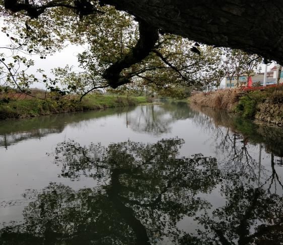
of the time likely to be needed to restore their livelihood and standards of living;
     ➢ provided with development assistance in addition to compensation measures described in
paragraph 4(a)(iii), such as land preparation, credit facilities, training, or job opportunities.
5 Cut-off date: means the date of publication of the announcement of land acquisition and
property demolition in this project. After this date, the displaced persons shall not build, rebuild or
expand their properties; shall not change the uses of their properties and land; shall not lease their
land, lease, sell or purchase their properties; and any person that moves in after this date shall not
qualify as a displaced person.

                                                   IV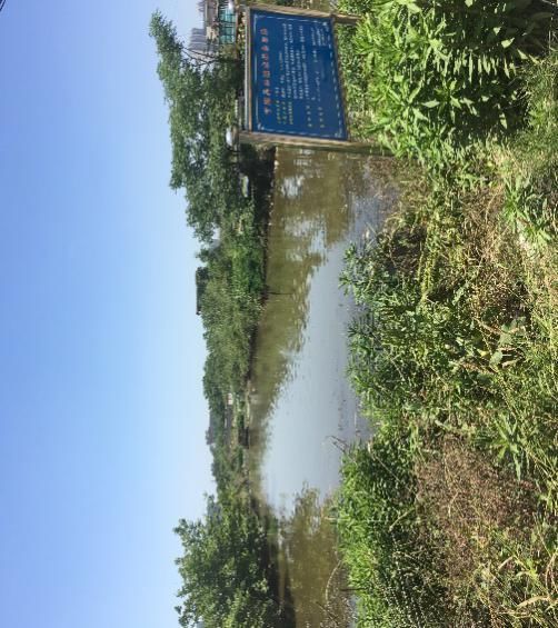
Contents
FOREWORD............................................................................................................................................................ III
DISPLACED PERSONS ......................................................................................................................................... III
1 OVERVIEW OF THE SUBPROJECT .................................................................................................................. 1
   1.1 BACKGROUND OF THE SUBPROJECT....................................................................................................................... 1
   1.2 OVERVIEW OF RESETTLEMENT IMPACTS ................................................................................................................ 1
   1.3 LAND APPROVAL ...................................................................................................................................................... 1
   1.4 LINKED PROJECTS.................................................................................................................................................... 7
     1.4.1 Ninghai Chengbei WWTP ............................................................................................................................ 7
     1.4.2 Ninghai Desheng New Material Co., Ltd. ................................................................................................... 7
2 IMPACTS OF THE SUBPROJECT ..................................................................................................................... 8
   2.1 MEASURES TO REDUCE RESETTLEMENT ................................................................................................................ 8
     2.1.1 Design and Site Selection Principles .......................................................................................................... 8
     2.1.2 Option Comparison ....................................................................................................................................... 8
   2.2 RANGE OF RESETTLEMENT IMPACT SURVEY........................................................................................................ 10
   2.3 SURVEY METHODS AND PROCESS ........................................................................................................................ 12
   2.4 IMPACTS OF PERMANENT LA..................................................................................... ERROR! BOOKMARK NOT DEFINED.
     2.4.1 Permanent LA .................................................................................................. Error! Bookmark not defined.
     2.4.2 LA Impact Analysis .......................................................................................... Error! Bookmark not defined.
     2.4.3 Impacts of Temporary Land Occupation .................................................................................................. 16
     2.4.4 Affected Population ..................................................................................................................................... 17
     2.4.5 Affected Ground Attachments and Infrastructure ................................................................................... 18
3 SOCIOECONOMIC PROFILE ............................................................................................................................19
   3.1 NINGHAI COUNTY AND AFFECTED TOWNSHIPS / SUB-DISTRICTS ........................................................................ 19
     3.1.1 Ninghai County ............................................................................................................................................ 19
     3.1.2 Affected Townships / Sub-districts ............................................................................................................ 19
     3.1.3 Affected Villages .......................................................................................................................................... 20
   3.2 AFFECTED POPULATION ........................................................................................................................................ 21
     3.2.1 Ethnic and Gender Analysis ...................................................................................................................... 22
     3.2.2 Age Distribution ........................................................................................................................................... 22
     3.2.3 Educational Level ........................................................................................................................................ 23
     3.2.4 Land Resources........................................................................................................................................... 23
     3.2.5 Household Income and Expenditure ........................................................................................................ 23
4 LEGAL FRAMEWORK AND POLICIES............................................................................................................25
   4.1 LAWS AND POLICIES ON RESETTLEMENT .............................................................................................................. 25
   4.2 BANK POLICY ......................................................................................................................................................... 26
   4.3 DIFFERENCES BETWEEN THE BANK POLICY AND PRC LAWS, AND REMEDIES ................................................... 26
   4.4 RESETTLEMENT POLICIES OF THE SUBPROJECT .................................................................................................. 29
     4.4.1 Permanent LA .............................................................................................................................................. 29
     4.4.2 Basic Farmland ............................................................................................................................................ 31
     4.4.3 Temporary Land Occupation ..................................................................................................................... 32
     4.4.4 Crops and Ground Attachments ................................................................................................................ 32
   4.5 BASIC ENDOWMENT INSURANCE FOR URBAN AND RURAL RESIDENTS ............................................................... 32
   4.6 ENDOWMENT INSURANCE FOR LEFS .................................................................................................................... 32
     4.6.1 Eligibility ........................................................................................................................................................ 32
     4.6.2 Review and Handling .................................................................................................................................. 32
     4.6.3 Pension ......................................................................................................................................................... 33
     4.6.4 Fundraising ................................................................................................................................................... 33
     4.6.5 Endowment Insurance for LEFs in the Subproject Area ....................................................................... 34
   4.7 RESTORATION PROGRAM FOR AHS ...................................................................................................................... 37
5 COMPENSATION RATES OF THE SUBPROJECT ........................................................................................42
   5.1 PERMANENT LA ..................................................................................................................................................... 42
     5.1.1 Rural Collective Land .................................................................................................................................. 42

                                                                                       I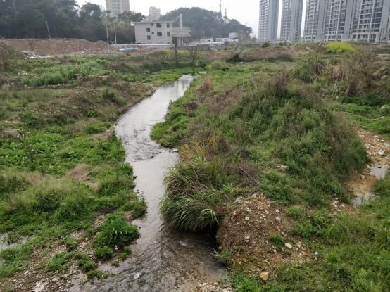
5.1.2 Basic Farmland ............................................................................................................................................ 42
   5.2 TEMPORARY LAND OCCUPATION .......................................................................................................................... 42
   5.3 CROPS AND GROUND ATTACHMENTS ................................................................................................................... 42
   5.4 TAXES AND FEES ................................................................................................................................................... 43
6 RESETTLEMENT AND INCOME RESTORATION ..........................................................................................44
   6.1 OBJECTIVE OF RESETTLEMENT ............................................................................................................................. 44
   6.2 RESTORATION PROGRAM FOR PERMANENT LA ................................................................................................... 44
     6.2.1 Cash Compensation ................................................................................................................................... 44
     6.2.2 Employment ................................................................................................................................................. 44
     6.2.3 Skills Training ............................................................................................................................................... 45
     6.2.4 Social Security ............................................................................................................................................. 45
   6.3 RESTORATION PROGRAMS FOR TEMPORARY LAND OCCUPATION ...................................................................... 45
     6.3.1 Temporary Construction Area ................................................................................................................... 45
     6.3.2 Temporary Living Area ............................................................................................................................... 45
   6.4 RESTORATION PROGRAMS FOR CROPS AND GROUND ATTACHMENTS ............................................................... 46
   6.5 SUPPORTING MEASURES FOR VULNERABLE GROUPS ......................................................................................... 46
7 ORGANIZATIONAL STRUCTURE AND IMPLEMENTATION SCHEDULE ..................................................47
   7.1 RESETTLEMENT AGENCIES ................................................................................................................................... 47
     7.1.1 Organizational Setup .................................................................................................................................. 47
     7.1.2 Organizational Responsibilities ................................................................................................................. 47
   7.2 STAFFING AND EQUIPMENT ................................................................................................................................... 48
     7.2.1 Staffing .......................................................................................................................................................... 48
     7.2.2 Equipment .................................................................................................................................................... 48
   7.3 INSTITUTIONAL CAPACITY BUILDING ..................................................................................................................... 49
   7.4 RESETTLEMENT IMPLEMENTATION SCHEDULE ..................................................................................................... 49
     7.4.1 Principles for Coordination between Resettlement and Construction ................................................. 49
     7.4.2 Resettlement Implementation Schedule .................................................................................................. 49
8 PUBLIC PARTICIPATION AND INFORMATION DISCLOSURE ...................................................................51
   8.1 MEANS AND MEASURES OF PUBLIC PARTICIPATION ............................................................................................ 51
     8.1.1 Means ........................................................................................................................................................... 51
     8.1.2 Participation and Consultation Measures ................................................................................................ 51
   8.2 PUBLIC PARTICIPATION ACTIVITIES AT THE PREPARATION STAGE ...................................................................... 52
   8.3 GRIEVANCE REDRESS ........................................................................................................................................... 53
     8.3.1 Procedure ..................................................................................................................................................... 53
     8.3.2 Recording and Feedback of Grievances and Appeals .......................................................................... 54
     8.3.3 Contact Information for Grievance Redress ............................................................................................ 54
9 RESETTLEMENT BUDGET ...............................................................................................................................55
   9.1 RESETTLEMENT BUDGET ....................................................................................................................................... 55
   9.2 FUNDING SOURCES AND ANNUAL INVESTMENT PLAN .......................................................................................... 55
   9.3 FUND DISBURSEMENT, MANAGEMENT AND MONITORING .................................................................................... 56
     9.3.1 Fund Disbursement ..................................................................................................................................... 56
     9.3.2 Fund Management and Monitoring ........................................................................................................... 56
10 M&E ....................................................................................................................................................................58
   10.1 INTERNAL MONITORING ....................................................................................................................................... 58
     10.1.1 Procedure ................................................................................................................................................... 58
     10.1.2 Scope .......................................................................................................................................................... 58
     10.1.3 Reporting .................................................................................................................................................... 58
   10.2 EXTERNAL MONITORING...................................................................................................................................... 59
     10.2.1 External M&E Agency ............................................................................................................................... 59
     10.2.2 Procedure and Scope ............................................................................................................................... 59
     10.2.3 Reporting .................................................................................................................................................... 60
   10.3 POST-EVALUATION .............................................................................................................................................. 60
11 ENTITLEMENT MATRIX ...................................................................................................................................61

                                                                                       II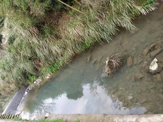
APPENDIX 1: LAND USE SITES ..........................................................................................................................62
APPENDIX 2: RESETTLEMENT DUE DILIGENCE REPORT ON THE HUAILU RIVER AND BAMBOO
BROOK COMPONENTS ........................................................................................................................................65
APPENDIX 3: PROVISIONS OF NINGHAI COUNTY ON COMPENSATION AND RESETTLEMENT FOR
LAND ACQUISITION (NCG [2014] NO.15) ..........................................................................................................75
APPENDIX 4: DETAILED RESETTLEMENT BUDGET ......................................................................................76
APPENDIX 5: DETAILED BUDGET FOR ENDOWMENT INSURANCE FOR LEFS.......................................84

                                                                 List of Tables
        Table 1-1 Scope of the Subproject ............................................................................................ 2
        Table 1-2 Summary of Impacts of Permanent LA ..................................................................... 3
        Table 1-3 Land Approval Schedule ........................................................................................... 7
        Table 2-1 Comparison of Options for the Huailu River Component .......................................... 8
        Table 2-2 Comparison of Options for the Meilin Brook Component.......................................... 9
        Table 2-3 Comparison of Options for the Qiaoxiapan River Component .................................. 9
        Table 2-4 Comparison of Options for the Xunan Brook Component....................................... 10
        Table 2-5 Comparison of Options for the Xujia River Component .......................................... 10
        Table 2-6 Summary of Resettlement Impacts ......................................................................... 11
        Table 2-7 LA Impact Analysis (Village Level) .......................................................................... 13
        Table 2-8 Summary of Land Loss Rates ................................................................................. 16
        Table 2-9 Summary of Temporarily Occupied Land................................................................ 17
        Table 2-10 Summary of Affected Vulnerable Groups ............................................................. 17
        Table 2-11 Basic Information of Vulnerable AHs .................................................................... 18
        Table 2-12 Summary of Affected Crops .................................................................................. 18
        Table 2-13 Summary of Affected Ground Attachments .......................................................... 18
        Table 3-1 Socioeconomic Profile of Ninghai County in 2018 .................................................. 19
        Table 3-2 Socioeconomic Profile of Affected Villages ............................................................. 20
        Table 3-3 Distribution of Samples ........................................................................................... 22
        Table 3-4 Land Resources of Sample Households ................................................................. 23
        Table 3-5 Income and Expenditure of Sample Households .................................................... 24
        Table 4-1 Comparison between PRC Policies and Bank Policies .......................................... 28
        Table 4-2 Location-based Land Prices of Ninghai County ...................................................... 30
    Table 4-3 Contribution Levels and Benefits of Endowment Insurance for LEFs of Ninghai County                                           34
        Table 4-4 Summary of Affected Population Eligible for Endowment Insurance for LEFs ....... 35
        Table 5-1 Summary of LA Compensation Rates of Ninghai County ....................................... 42
        Table 5-2 Summary of Crop Compensation Rates of Ninghai County ................................... 42
        Table 5-3 Summary of Ground Attachment Compensation Rates of Ninghai County ............ 42
        Table 5-4 Summary of Taxes and Fees .................................................................................. 43
        Table 6-1 Public Welfare Jobs Available ................................................................................. 44
        Table 6-2 Jobs Generated at the Construction and Operation Stages ................................... 45
        Table 6-3 Summary of Local Skills Training Programs ........................................................... 45
        Table 6-4 Jobs Available to Vulnerable Groups ...................................................................... 46
        Table 6-5 Assistance / Training Programs for Vulnerable Groups .......................................... 46
        Table 7-1 Staffing of Resettlement Agencies .......................................................................... 48
        Table 7-2 Operational Training Program for Resettlement Agencies ..................................... 49
        Table 7-3 Resettlement Implementation Schedule ................................................................. 50
        Table 8-1 Public Participation Activities at the Preparation Stage .......................................... 52
        Table 8-2 Public Participation Plan ......................................................................................... 53
        Table 8-3 Grievance Registration Form .................................................................................. 54
        Table 8-4 Contact Information for Grievance Redress ............................................................ 54
        Table 9-1 Resettlement Budget ............................................................................................... 55
        Table 9-2 Funding Sources ..................................................................................................... 55
        Table 9-3 Annual Investment Plan .......................................................................................... 56
        Table 10-1 Sample Schedule of LA and HD ........................................................................... 58
        Table 10-2 Sample Schedule of Fund Utilization .................................................................... 59
        Table 10-3 Resettlement M&E Schedule ................................................................................ 60

                                                                List of Figures
          Figure 1-1 Preliminary Examination Document ......................................................................... 7
          Figure 7-1 Organizational Chart .............................................................................................. 47
          Figure 8-1 Fund Disbursement Flowchart ............................................................................... 56
                                                                 II
ABBREVIATIONS

AH       -      Affected Household
AP       -      Affected Person
DMS      -      Detailed Measurement Survey
FGD      -      Focus Group Discussion
HD       -      House Demolition
LA       -      Land Acquisition
LEF      -      Land-expropriated Farmer
M&E      -      Monitoring and Evaluation
                Ninghai County Natural Resources and
NCNRPB   -
                Planning Bureau
NCWB     -      Ninghai County Water Bureau
PRC      -      People’s Republic of China
RAP      -      Resettlement Action Plan
RIB      -      Resettlement Information Booklet

                          Units

             Currency unit =       Yuan (RMB)
             1.00 yuan     =       $0.15
             1 hectare     =       15 mu

                               V
1 Overview of the Subproject
   1.1 Background of the Subproject
    The Subproject is a Phase 3 subproject of the Ningbo Sustainable Urbanization Demonstration
Project. The Subproject aims to improve the resistance of Ninghai County to flood risks. The
engineering and non-engineering measures selected will make Ninghai County better prepared,
and protect important assets and susceptible groups from potential floods.
    According to the Feasibility Study Report, the Subproject consists of 11 river management
components, namely the Huailu River, Xunan Brook, Longyan Brook, Bamboo Brook, Meilin Brook,
Dianqianwang Brook, Qiaoxiapan River, Lingjiao’aoli River, Xujia River, Puhu Lake, and Dongshan
Flood Diversion Canal, with a total length of 23.57km. The estimated gross investment in the
Subproject is 681.4248 million yuan, and the planned construction period is 2019-2021.

   1.2 Overview of Resettlement Impacts
       In the Subproject, resettlement is caused by Land Acquisition (LA) for the Xunan Brook,
Longyan Brook, Meilin Brook, Dianqianwang Brook, Qiaoxiapan River, Lingjiao’aoli River, Xujia
River, Puhu Lake, and Dongshan Flood Diversion Canal mainly. 340.64 mu of cultivated land (28.8
mu of basic farmland, 281.45mu of ordinary farmland and 30.39 mu of garden land), 47.43 mu of
woodland, 0.66 mu of protected farmland, 217.24 mu of collective construction land and 68.43 mu
of unused land will be acquired for the Subproject, affecting 5 sub-districts / towns in Ninghai
County (Meilin, Qiaotouhu, Yuelong and Taoyuan Sub-districts, and Huangtan Town), 36
administrative villages and 42 groups. The Subproject will affect 1,065 households with 3,256
persons, in which 859 households with 2,581 persons will be affected by LA, 105 households with
368 persons by temporary land occupation, and 101 households with 307 persons by ground
attachments. See Table 1-1
       1) Resettlement impacts of the Huailu River Component: Within the land used for the
Bank-financed component (Huailu River Component), 62 households with 145 persons will be
affected by HD for the Qiaotouhu Village Reconstruction Project (Phase 1), including 54 houses on
collective land, where all AHs have signed HD compensation agreements and received
compensation, and 8 houses (commercial residences) on state-owned land, where the resettlement
willingness survey has been completed, and a preliminary resettlement program has been drafted,
pending approval. A resettlement due diligence investigation has been conducted on this project in
order to learn its LA, HD and resettlement.
       2) Resettlement impacts of the Bamboo Brook Component: With the land used for the
Bank-financed component (Bamboo Brook Component), LA for the Zhukou Third Village HD
Reconstruction Project has been completed, and HD on collective land largely completed by 2015.
However, the residential houses of 8 households with 20 persons within the boundary line of the
Bamboo Brook have not been demolished, all on collective land. By the end of July 2019, all the 8
AHs had signed HD compensation agreements, and the compensation paid. However, some AHs
still live in their existing houses because the resettlement houses have not been completed, and will
live until the year end. Through consultation, the 8 AHs will not receive the transition subsidy until
relocation. A resettlement due diligence investigation has been conducted on this project.
       See Appendix 2.

   1.3 Land Permitting
     In August 2019, the Ninghai County Natural Resources and Planning Bureau (NCNRPB) gave
a preliminary opinion on the land used for the Subproject (see Figure 1-1), thinking that it complied
with the national land supply policy and was rational in scale.
     The Master Land Utilization Plan of Ninghai County is being prepared, where the basic
farmland within the boundary line of the Subproject will be converted into water resources
construction land. NCNRPB plans to submit the information for basic farmland conversion to the
State Council in November 2019, and conversion is expected to be completed by the end of June
2020. The Ninghai County Water Bureau (NCWB) will apply for land use quotas for ordinary
farmland, garden and woodland in batches. See Table 1-3 Land Permitting Schedule.

                                                  1
Table 1-1 Scope of the Subproject
                                                                                                                            Construction
No.       River                                   Scope of construction                                   Affected groups                                 Remarks
                                                                                                                              period
                   1) Managing the 3.07km segment from Qian’ao Village to Taoyuan North Road to                                         Included in HD for urban and rural
                   resist once-in-20-years floods                                                            Qian’ao,                   reconstruction, HD completed,
        Bamboo                                                                                                              Dec. 2019 –
1                  2) Arranging weir and dam structures, reducing river flow rate, and improving the         Zhudong,                   Resettlement Due Diligence Report on
         Brook                                                                                                               Nov. 2021
                   water environment                                                                          Zhukou                    the Huailu River and Bamboo Brook
                   3) Constructing flood banks of 5.64km, and reconstructing 9 weirs and dams                                           Components prepared (See Appendix 2)
                   1) Managing a waterway of 4.82km, with a design river width of 8-20m and a riverbed                                  Included in HD for urban and rural
                   level of 13.5-1m                                                                                                     reconstruction, HD mostly completed,
                   2) Upstream segment: from the Shenhai Expressway to the south of Xiazheyang                                          with 8 houses remaining, Resettlement
                   Village, to be straightened to comply with the plan                                      Meiyuan,        Oct. 2019 – Due Diligence Report on the Huailu River
2     Huailu River
                   3) Downstream segment: from Jiu’an South Road to the Huangdun Harbor, consisting         Qiaotouhu        Sep. 2021 and Bamboo Brook Components
                   of two branches, where the north branch is 1.0km long, with a design river width of                                  prepared (See Appendix 2)
                   15m and a riverbed level of 1.0m, and the south branch is 0.80km long, with a design
                   river width of 20m and a riverbed level of 1.5-1.0m
                   1) Managing a waterway of 2,180m, in which the main waterway is 1,259m long, the                                        Involving additional LA and no HD,
                   new tributary 145m and the branch 776m long;                                                                            impacts included in this RAP
                   2) Constructing banks of 3,450m, including 1984m for the main waterway, 290m for
                   the new tributary and 1,176m for the branch;
                                                                                                          Caohu, Houxilin
        Longyan 3) Constructing a 2.5X1.2m regulating sluice;                                                               Oct. 2019 –
3                                                                                                         Shangchangtou,
         Brook     4) Constructing a weir and reconstructing 4 for the main waterway, constructing one                      Sep. 2021
                                                                                                             Xiafanxi
                   for the new tributary and one for the branch, constructing two tractor bridges, and
                   burying 26 culverts with a total length of 210m;
                   5) Constructing 6 waterfront footpaths with a total length of 820m, 5 waterfront
                   platforms and 17 river access paths
                   1) Managing a waterway of 2.02km, and constructing two weirs for impoundment        Yuanfeng, Tu’ao,                    Involving additional LA and no HD,
                   2) Involving 6 bridges, including 3 tractor ones and 3 pedestrian ones              Lingtou, Xinanxu, Mar. 2020 –       impacts included in this RAP
4     Xunan Brook
                                                                                                       XinanLiu, Luojia, Mar. 2021
                                                                                                       Fanjia, Qianyang
                     1) Constructing banks for the M4+150-M6+490 segment and a 3×3m flood drainage       Tujia, Dingjia, Jul. 2020 –       Involving additional LA and no HD,
5      Meilin Brook
                     sluice                                                                              Dianqianwang     Dec. 2021        impacts included in this RAP
      Dianqianwang Managing a waterway of 1,014.2m to resist once-in-50-years floods for Meilin        Meilin, Daluzhou, Oct. 2019 –       Involving additional LA and no HD,
6
          Brook      Sub-district                                                                            Wufu         Sep. 2021        impacts included in this RAP
        Dongshan 1) Managing a waterway of 2.93km, connecting lakes, and improving the surrounding         Tang’anli,                      Involving additional LA and no HD,
          Flood      water environment to resist once-in-20-years floods                                   Wangshe,      Jan. – Dec.       impacts included in this RAP
7
        Diversion 2) Managing a waterway of 2.93km, constructing flood banks of 5.616km and box           Zhukouchu,        2021
          Canal      culverts of 45m                                                                        Yangjia
8      Lingjiao’aoli Managing a downstream waterway of 2.6km, and constructing two weirs and 7 tractor      Lingjiao     Jan. – Dec.       Involving additional LA and no HD,

                                                                                        2
Construction
No. River Scope of construction Affected groups Remarks
period
River bridges 2021 impacts included in this RAP
Managing a waterway of 2,500m, with a riverbed width of 10-20m, a riverbed level of Involving additional LA and no HD,
26.00-16.50m, an average longitudinal gradient of 3.8‰, a design flood level of Fanjia, Yanlin, impacts included in this RAP
Apr. 2020 –
9 Xujia River 26.30-19.50m, and constructing 4 tractor bridges Qianyang,
Mar. 2021
Flood control standard: once-in-20-years floods; flood drainage standard: no Xujiaxin
inundation within 24 hours for once-in-20-years 24-hour rainstorms
Constructing a waterway of 1.08km, pipelines of 5.6km, two diversion pump stations Jun. 2020 – HD completed in 2015
10 Puhu Lake Beihu
(5.0m3/s in total), 4 weirs, a diversion work (1.0m3/s) and multiple valves Dec. 2021
1) Managing a waterway of 1.353km from Tianming Lake to Taoyuan North Road, Qiaoxiapan, Involving additional LA and no HD,
Qiaoxiapan connecting lakes, and improving the surrounding water environment to resist Xipangxu, May 2020 – impacts included in this RAP
11
River once-in-20-years floods Xingjiang, Apr. 2021
2) Constructing flood banks of 2.376km and box culverts of 215m Liheyang
Source: Feasibility Study Report of the Subproject
Table 1-2 Summary of Impacts of Permanent LA3
Permanent LA
Farmland Affected
Sub-district /
Component Village Group Basic Protecte Construct Unused Total
township Ordinary Garden Wood Water Pop
farml d ion land land
farmland land land surface HHs ulati
and farmland
on
Qiaotouhu Qiaotouhu 6.54 7.24 0.77 0 0 1.25 12.36 0 28.16 23 69
Tujia Tujia 2.12 3.55 0.53 0 0 1.44 0 0 7.63 7 25
Qiaotouhu
Meilin Brook Dingjia Dingjia 1.48 1.65 0 0 0 0.56 0 0 3.69 4 12
Sub-district
Linjia Linjia 1.34 1.58 0 0 0 0 0 0 2.92 2 10
Subtotal 11.48 14.01 1.3 0 0 3.25 12.36 0 42.4 36 116
Qiaotouhu Dingjia Dingjia 0 0.88 0 0 0 0 0 0.05 0.93 2 5
Huailu River Sub-district Qiaotouhu Qiaotouhu 0 2.21 0 0 0 0 25.67 0.1 27.98 23 75
Meilin Meiyuan Wangjia 0 13.29 8.74 17.07 0 0 0 3.98 43.08 24 65
3 The affected population includes that affected by permanent LA and temporary land occupation.
3Permanent LA
Farmland Affected
Sub-district /
Component Village Group Basic Protecte Construct Unused Total
township Ordinary Garden Wood Water Pop
farml d ion land land
farmland land land surface HHs ulati
and farmland
on
Sub-district Hejia 0 9.8 4.83 0 0.66 0 9.47 2.96 27.71 28 72
Xiazheyan
0 2.71 1.76 0 0 0 0 0 4.47 16 41
g
104.1
Subtotal 0 28.89 15.33 17.07 0.66 0 35.14 7.09 93 258
7
Dianqianwang Meilin Meilin 3.77 1.9 0 0 0 0 7.44 0 13.11 145 437
Brook Meilin Daluzhou Daluzhou 0 0 2.35 0 0 0 0 0 2.35 31 78
(Dushan Sub-district Wufu Tashan 1.55 2.5 0 0 0 0 0 0 4.05 19 40
Canal) Subtotal 5.32 4.4 2.35 0 0 0 7.44 0 19.51 195 555
Tang’anli Tang’anli 0.81 0.06 1.97 1.82 0 0 0 0 4.65 58 185
Dongshan
Wangshe Wangshe 0.77 0.07 1.55 1.4 0 0 2.33 0 6.11 71 236
Flood Taoyuan
Zhukouchu Zhukouchu 0.4 0 0 0.08 0 0 2.61 0 3.09 23 70
Diversion Sub-district
Yangjia Yangjia 0.39 0 0.26 0 0 0 0.47 0 1.13 14 43
Canal
Subtotal 2.37 0.13 3.78 3.3 0 0 5.41 0 14.98 166 534
Zhudong Zhudong 0 6.27 0 4.54 0 0 23.3 0 10.81 12 50
Bamboo Taoyuan
Zhuxi Zhuxi 0 3.67 0 4.15 0 0 0 0 31.12 31 142
Brook Sub-district
Subtotal 0 9.94 0 8.69 0 0 0 0 41.93 43 192
Qiaoxiapan Qiaoxiapan 0 0 0 3.53 0 0.03 5.01 9.55 18.13 23 49
Qiaoxiapan Taoyuan Xipangxu Xipangxu 0 0.36 0.51 2.09 0 0 3.96 14.33 21.26 8 24
River Sub-district Xingjiang Xingjiang 0 0.17 0.64 3.37 0 0.01 3.29 5.24 12.7 14 50
Liheyang Liheyang 0 0.01 0.44 0 0 0 2.94 0 3.39 32 113
Subtotal 0 0.54 1.59 8.99 0 0.04 15.2 29.12 55.48 77 236
Xujia River Yuelong Fanjia Fanjia 0 45.38 0.02 0 0 0 26.26 8.08 79.73 39 141
4Permanent LA
Farmland Affected
Sub-district /
Component Village Group Basic Protecte Construct Unused Total
township Ordinary Garden Wood Water Pop
farml d ion land land
farmland land land surface HHs ulati
and farmland
on
Sub-district Luojia Luojia 0 18 0 0 0 0 0 23.44 41.44 17 45
Xujiaxin Xujiaxin 0 0.36 0 0 0 0 0 0 0.36 2 5
Qianyang Qianyang 0 1.17 0 0 0 0 0 0 1.17 2 7
Subtotal 0 64.91 0.02 0 0 0 26.26 31.52 122.7 60 198
Yuelong
Puhu Lake Beihu Beihu 0 0 0 0 0 0 82.27 0.13 82.4 104 378
Sub-district
Lingjiao’aoli Yuelong
Lingjiao Lingjiao 9.63 44.67 6.04 0 0 0 15.29 0 75.62 41 131
River Sub-district
Shishezha
0 0.55 0 0 0 0 0 0 0.55 3 9
ng
Yuanfeng Mapoyuan 0 0.42 0 0 0 0 0 0 0.42 2 7
Zhaojiasha
0 0.17 0 0 0 0 0 0 0.17 3 8
n
Lingtou Lingtou 0 0 0 0.69 0 0 0.69 0 1.38 3 8
Yuelong Tu’aohu 0 3.02 0 0 0 0 0 0 3.02 6 20
Xunan Brook Tu’ao
Sub-district Tu’aocai 0 2.53 0 0 0 0 0 0 2.53 6 19
Xinanxu Xinanxu 0 27.47 0 0 0 0 0 0 27.47 32 89
XinanLiu XinanLiu 0 8.84 0 0 0 0 0 0 8.84 20 62
Luojia Luojia 0 12.12 0 0 0 0 0 0 12.12 22 60
Fanjia Fanjia 0 12.82 0 0 0 0 0 0 12.82 22 58
Qianyang Qianyang 0 13.52 0 2 0 0 2 0 17.52 22 58
Subtotal 0 81.46 0 2.69 0 0 2.69 0 86.84 141 398
5Permanent LA
Farmland Affected
Sub-district /
Component Village Group Basic Protecte Construct Unused Total
township Ordinary Garden Wood Water Pop
farml d ion land land
farmland land land surface HHs ulati
and farmland
on
Yuelong
Caohu Caohu 0 1.5 0 0 0 0 2.2 0.57 4.27 41 80
Sub-district
Houxilin 0 14 0 2 0 0 11 0 27 41 120
Longyan
Brook Huangtan Shangchan
Xinhua 0 16 0 2 0 0 2 0 20 15 40
Town gtou
Xiafanxi 0 1 0 0 0 0 0 0 1 12 20
Subtotal 0 32.5 0 4 0 0 15.2 0.57 52.27 109 260
698.2 325
Tota 28.8 281.46 30.41 44.74 0.66 3.29 217.24 68.43 1065
7 6
Source: NCNRPB and sub-district statistics
6Table 1-3 Land Permitting Schedule
Item Progress
Land use application Jul. 2019
Preliminary land review approval Aug. 2019
Issue of preliminary land examination document Aug. 2019
Basic farmland re-planning Nov. 2019 – Jun. 2020
Issue of ordinary farmland quota May 2020
Figure 1-1 Land Preliminary Review Approval
1.4 Linked Projects
At the design stage, the Ninghai PMO attached great importance to the identification of linked
projects together with the IA and the feasibility study agency. The following projects are linked to the
Subproject:4
1.4.1 Ninghai Chengbei WWTP
According to the EIA report, wastewater generated by the Subproject will be finally treated at
the Ninghai Chengbei WWTP. This WWTP is located in Youjia Village, Taoyuan Sub-district, with a
gross investment of 165 million yuan, a floor area of 150 mu and a design treatment capacity of
120,000 tons/day, designed to collect and treat wastewater in the downtown area of Ninghai County.
It is constructed in 4 stages, where Phases 1 and 2 have been completed and put into operation,
with a total treatment capacity of 60,000 tons/day, and the EIA report was approved by the Ninghai
County Environmental Protection Bureau in 2002; the EIA report for Phase 3 was approved by the
Ninghai County Environmental Protection Bureau in 2013, and Phase 3 is under construction. Since
wastewater generated by this project can be treated timely, it involves neither LA nor HD.
1.4.2 Ninghai Desheng New Material Co., Ltd.
According to the EIA report, river sludge will be sent to Ninghai Desheng New Material Co., Ltd.
for brick making after drying. This company is located in Dianqianwang Village, Qiaotouhu
Sub-district, being a new-type baked brick manufacturer with an annual production capacity of 60
million hollow blocks (bricks). The EIA report was approved by the Ninghai County Environmental
Protection Bureau in August 2012, and accepted in December 2013. Since waste generated by this
project can be utilized effectively, it involves neither LA nor HD.
4 This policy applies to all project activities resulting in voluntary resettlement, regardless of its funding source.
It also applies to other activities resulting in voluntary resettlement, which are judged by the Bank to be: a)
directly and materially related to the Bank-financed project; b) required to realize the objectives specified in
the project document; and c) implemented or planned to be implemented with the project.
72 Impacts of the Subproject
2.1 Measures to Reduce Resettlement
2.1.1 Design and Site Selection Principles
The design agency and the owner have taken the following measures to reduce the
Subproject’s impacts:
1) At the planning stage, the design agency optimized and compared different options to take
the impacts of the Subproject on the local society and economy into account as much as possible.
2) Resettlement impacts have been minimized at the design stage on the following principles:
a) Avoiding or minimizing occupation of existing and planned residential areas;
b) Avoiding or minimizing occupation of high-quality farmland;
c) Gaining access to the proposed construction sites through existing state and local roads;
and
d) Minimizing construction impacts on nearby residents.
At the RAP preparation and implementation stage, when LA or HD is unavoidable, the following
measures will be taken to reduce the local impacts of the Subproject:
a) Strengthen the collection of basic information, make an in-depth analysis of the local
present socioeconomic situation and future prospect, and develop a feasible RAP based on the
local practical conditions to ensure that the APs will not suffer losses due to the Subproject.
b) Encourage public participation actively and accept public supervision.
c) Strengthen internal and external monitoring, establish an efficient and unobstructed
feedback mechanism and channel, and shorten the information processing cycle to ensure that
issues arising from project implementation are solved timely.
d) Notify the AHs in advance, and conduct construction after harvest or before sowing.
2.1.2 Option Comparison
At the design stage, the subproject design was optimized continually through repeated
fieldwork to minimize negative and resettlement impacts while realizing the original effect.
1) Huailu River Component
This component consists of the following segments: 1) from the Yonglin Line to the Shenhai
Expressway, 0.38km long; 2) from the Shenhai Expressway to the south of Xiazheyang Village,
1.5km long; and 2) from the fork to the Huangdun Harbor, 1.1km long, mainly including river
dredging, revetment renovation and bank construction. According to the Standard for Flood Control
(GB50201-2014), the class of a flood control work is based on the importance of its subject of
protection and the beneficiary area. Since the subject of protection of this component is important,
the class of river structures is 4 and that of bank structures IV. See
Table 2-1 Comparison of Options for the Huailu River Component.
Table 2-1 Comparison of Options for the Huailu River Component
Component Pro/con Option A Option B Option C Option D Conclusion
Excellent Less LA than Less LA costs, Least LA costs,
drainage, less Option A solving the resisting Option C
Pro
Huailu River investment blocking problem once-in-20-years recommended
(Meilin timely floods through
Segment 1) High LA costs, High Longer culvert Difficult comprehensive
Con difficult investment, length and higher construction comparison
construction excavating costs than Option
8Component Pro/con Option A Option B Option C Option D Conclusion
newly A
completed
Meilin Road by
130m
Good terrain Excellent plot Excellent plot Excellent plot
and landscape, integrity, high integrity, high integrity, high
Pro less LA and land utilization land utilization, land utilization
investment shortest route, Option C
Huailu River less investment recommended
(Meilin Poor plot Potential risks, Adverse to Bad terrain, through
Segment 2) integrity, long inconvenient catchment much LA, high comprehensive
drainage line construction, investment comparison
Con
large amount of
excavation,
high investment
Less Short waterway / /
Pro investment, high
plot utilization Option A
Huailu River Long waterway Low land / / recommended
(Qiaotouhu utilization, high through
Segment) HD costs, poor comprehensive
Con
drainage, comparison
construction of
many bridges
Source: Feasibility Study Report of the Subproject
2) Meilin Brook Component
This component includes river dredging and broadening, bank and revetment construction, etc.
The existing Meilin Brook is much narrower than the required width of 12-20m, and close to schools,
plants and settlements. The following 3 options have been drafted. See
Table 2-2 Comparison of Options for the Meilin Brook Component.
Table 2-2 Comparison of Options for the Meilin Brook Component
Component Pro/con Option A Option B Option C Conclusion
Straightening Meeting the Straightening
Pro the waterway to planned flood the waterway
Option A
avoid houses drainage capacity
recommended
Increasing the High investment High HD costs
Meilin Brook through
number of in canal
comprehensive
Con embedded broadening and
comparison
culverts, higher culvert support
investment
Source: Feasibility Study Report of the Subproject
3) Qiaoxiapan River Component
This component includes river management in the downtown area of Ninghai County, and flood
bank and ecological landscape construction to resist once-in-20-years floods, including river
management for 1.353km, and construction of flood banks of 2.376km and box culverts of 215m.
The following 3 options have been drafted. See .
Table 2-3.
Table 2-3 Comparison of Options for the Qiaoxiapan River Component
9Component Pro/con Option A Option B Option C Conclusion
Good water access, High strength and High scour
beautiful appearance, beautiful appearance resistance,
Pro high strength, low costs of precast concrete good wall Option A
masonry, fast stability recommended
Qiaoxiapan construction through
Large land occupation, Slow construction, Poor ecology comprehensive
difficult policy difficult quality and water comparison
Con
processing control, requiring access, high
special testing investment
Source: Feasibility Study Report of the Subproject
4) Xunan Brook Component
This component involves river management for a length of 2.02km, from the Yonglin Double
Railway bridge and culvert to the box culvert on Xingning South Road. The following 3 options have
been drafted. See
Table 2-4 Comparison of Options for the Xunan Brook Component.
Table 2-4 Comparison of Options for the Xunan Brook Component
Component Pro/con Option A Option B Option C Conclusion
Smallest land Involving the excavation High scour
occupation of natural riverbed, no resistance,
Pro
adverse impact on good wall Option B
aquatic ecology stability recommended
Xunan
Involving riverbed High bank filling Maximum LA through
Brook
lining, which is requirement, slow and HD impacts comprehensive
Con adverse to aquatic construction, difficult comparison
ecology restoration quality control, requiring
and conservation special testing
5) Xujia River Component
The Xujia River is a branch of the Yangxi Brook, with a full length of 3,100m and a width of
2-33m.
This component aims to relieve the flood pressure of the Xinan area of Yuelong Sub-district,
and improve the flood drainage capacity of this area, thereby protecting local personal and property
safety, and improving the local water environment, with a river management length of 2,500m. The
following two options have been drafted. See Table 2-5 Comparison of Options for the Xujia River
Component.
Table 2-5 Comparison of Options for the Xujia River Component
Component Pro/con Option A Option B Conclusion
Short route, less LA, no Low technical requirements for Option A
Pro
HD, low investment construction recommended
Xujia River High technical Long route, more LA, demolition through
Con requirements for of 3 houses, high investment comprehensive
construction comparison
Source: Feasibility Study Report of the Subproject
2.2 Range of Resettlement Impact Survey
According to the data provided by the feasibility study agency, the 11 components of the
Subproject involve Taoyuan, Yuelong, Qiaotouhu and Meilin Sub-districts, and Huangtan Town:
1) The Xunan Brook affects 8 villages (Yuanfeng, Lingtou, Tu’ao, Xinanxu, Xinanliu, Luojia,
Fanjia and Qianyang) with 11 groups in Yuelong Sub-district; 2) The Meilin Brook affects 4 villages
(Qiaotouhu, Tujia, Dingjia and Linjia) with 4 groups in Qiaotouhu Sub-district; 3) The Huailu River
10affects 3 villages (Dingjia, Qiaotouhu and Meiyuan) with 5 groups in Qiaotouhu and Meilin
Sub-districts; 4) The Dianqianwang Brook (Dushan Canal) affects 3 villages (Meilin, Daluzhou and
Wufu) with 3 groups in Meilin Sub-district; 5) The Dongshan Flood Diversion Canal affects 4 villages
(Tang’anli, Wangshe, Zhukouchu and Yangjia) with 4 groups in Taoyuan Sub-district; 6) The
Bamboo Brook affects 2 villages (Zhudong and Zhuxi) with 2 groups in Taoyuan Sub-district; 7) The
Qiaoxiapan River affects 4 villages (Qianxiapan, Xipangxu, Xingjiang and Liheyang) with 4 groups
in Taoyuan Sub-district; 8) The Xujia River affects 4 villages (Fanjia, Luojia, Xujiaxin and Qianyang)
with 4 groups in Yuelong Sub-district; 9) The Puhu Lake affects Beihu Village with one group in
Yuelong Sub-district; 10) The Lingjiao’aoli River affects Lingjiao Village with one group in Yuelong
Sub-district; 11) The Longyan Brook affects Caohu Village in Yuelong Sub-district and Xinhua
Village in Huangtan Town with 4 groups. See Table 2-6.
Table 2-6 Summary of Resettlement Impacts
Component Sub-district / township Village Group
Shishezhang
Yuanfeng Mapoyuan
Zhaojiashan
Lingtou Lingtou
Tu’aohu
Tu’ao
Xunan Brook Yuelong Sub-district Tu’aocai
Xinanxu Xinanxu
XinanLiu XinanLiu
Luojia Luojia
Fanjia Fanjia
Qianyang Qianyang
Qiaotouhu Qiaotouhu
Tujia Tujia
Meilin Brook Qiaotouhu Sub-district
Dingjia Dingjia
Linjia Linjia
Dingjia Dingjia
Qiaotouhu Sub-district
Qiaotouhu Qiaotouhu
Wangjia
Huailu River
Meiyuan Hejia
Meilin Sub-district
Xiazheyang
Fangqian Fangqian
Dianqianwang Meilin Meilin
Brook (Dushan Meilin Sub-district Daluzhou Daluzhou
Canal) Wufu Tashan
Tang’anli Tang’anli
Dongshan Flood Wangshe Wangshe
Taoyuan Sub-district
Diversion Canal Zhukouchu Zhukouchu
Yangjia Yangjia
Zhudong Zhudong
Bamboo Brook Taoyuan Sub-district
Zhuxi Zhuxi
Qiaoxiapan Qiaoxiapan
Qiaoxiapan Xipangxu Xipangxu
Taoyuan Sub-district
River Xingjiang Xingjiang
Liheyang Liheyang
Fanjia Fanjia
Luojia Luojia
Xujia River Yuelong Sub-district
Xujiaxin Xujiaxin
Qianyang Qianyang
Puhu Lake and
Yuelong Sub-district Beihu Beihu
Associated River
Lingjiao’aoli
Yuelong Sub-district Lingjiao Lingjiao
River
11Component Sub-district / township Village Group
Yuelong Sub-district Caohu Caohu
Houxilin
Longyan Brook
Huangtan Town Xinhua Shangchangtou
Xiafanxi
2.3 Survey Methods and Process
During the fieldwork, a number of survey methods, including interview, observation, literature
study, etc., were used, collecting extensive resettlement information, providing a powerful basis for
the preparation of this RAP. 10 FGDs were held, in which 44% of the participants were women.
During March 25-27, April 24-26, May 13 and May 20-15, 2019, the task force conducted a
sampling survey, interviews and FGDs in the subproject area, covering population, resettlement
impacts, expected resettlement modes, etc. During the survey, the task force collected comments
on resettlement from village committees and villagers, and conducted extensive consultation.
From May to June, 2019, the Subproject’s resettlement impacts were verified, and this RAP
prepared through consultation with the owner and the design agency.
The key findings of the survey are as follows:
1) Most of the APs know that the Subproject is about to break ground and support it.
2) The Subproject involves permanent LA, occupation of state-owned construction land and
ground attachments.
3) The Subproject affects no ethnic minority.
2.4 Impacts of Permanent LA
2.4.1 Permanent LA
340.64 mu of cultivated land (28.8 mu of basic farmland, 281.46mu of ordinary farmland and
30.41 mu of garden land), 44.74mu of woodland, 0.66 mu of protected farmland, 240.56mu of
collective construction land and 68.43 mu of unused land will be acquired for the Subproject,
affecting 5 sub-districts / towns in Ninghai County (Meilin, Qiaotouhu, Yuelong and Taoyuan
Sub-districts, and Huangtan Town), 36administrative villages and 42 groups. The Subproject will
affect 1,065 households with 3,256 persons, in which 859 households with 2581persons will be
affected by LA, 105households with368persons by temporary land occupation, and 101 households
with 307persons by ground attachments.,See Table 1-2 and Table 2-7.
2.4.2 LA Impact Analysis
A comparative analysis has been made on the cultivat ed areas of the affected villages before
and after LA. The per capita cultivated areas of the 36 affected villages are below 1 mu. The AHs
will lose part of agricultural income due to LA, and their lost income will be compensated for at the
specified rates.
Among the36 affected villages, 35 have land loss rates of below 10%, and 14 have land loss
rates of below 1%。 It can be seen that these villages will be affected slightly by LA.
The per capita income loss rates of the 36 affected villages are below 4%,and 20have income
loss rates of below 1%. The village with the lowest per capita lost income is Liheyang Village,
Taoyuan Sub-district (3.24 yuan).
The main crops of the affected villages are paddy rice, corn and vegetables, and the main
income sources of the AHs are outside employment, vegetable cultivation and stockbreeding. Since
the Subproject is linear in shape, and mostly involves broadening or reconstruction, most AHs are
affected slightly. See Table 2-7.
12You can also read