Fire Operations Plan 2017/18 2019/20 - Port Phillip Region - Forest Fire Management ...
←
→
Page content transcription
If your browser does not render page correctly, please read the page content below
Fire Operations Plan
2017/18 – 2019/20
Port Phillip Region
Acknowledgements
DELWP Port Phillip Region and District Fuel Management staff. FFMVic planning
staff from Port Phillip Region. East Central Bushfire Risk Landscape. DELWP
Environment and Natural Resources (Biodiversity), Forest Management, Cultural
Heritage, Historical Heritage and Engagement values specialists. Parks Victoria,
Melbourne Water and VicForests values specialists. Aboriginal Victoria.
Wurundjeri Tribe Land and Compensation Cultural Heritage Council. Bunurong
Land Council Aboriginal Corporation. Country Fire Authority, Local Government
and private property owners involved in cross tenure burn planning for this Fire
Operations Plan.
Photo credit
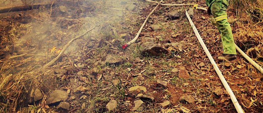
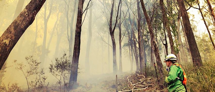
Paul Hitch
© The State of Victoria Department of Environment, Land, Water and Planning (DELWP) 2016
This work is licensed under a Creative Commons Attribution 4.0 International licence. You are free to re-use the work under that licence,
on the condition that you credit the State of Victoria as author. The licence does not apply to any images, photographs or branding,
including the Victorian Coat of Arms, the Victorian Government logo and the Department of Environment, Land, Water and Planning
(DELWP) logo. To view a copy of this licence, visit http://creativecommons.org/licenses/by/4.0/
ISBN 978-1-76047-731-8 (pdf/online)
Disclaimer
This publication may be of assistance to you but the State of Victoria and its employees do not guarantee that the publication is without
flaw of any kind or is wholly appropriate for your particular purposes and therefore disclaims all liability for any error, loss or other
consequence which may arise from you relying on any information in this publication.
Accessibility
If you would like to receive this publication in an alternative format, please telephone the
DELWP Customer Service Centre on 136186, email customer.service@delwp.vic.gov.au,
or via the National Relay Service on 133 677 www.relayservice.com.au. This document is
also available on the internet at www.delwp.vic.gov.au.
Port Phillip Region Fire Operations Plan 2017/18 – 2019/20 Page 2
Contents

Assistant Chief Fire Officer Foreword ........................................................................................................... 4
Purpose and objectives of the Port Phillip Region Fire Operations Plan .................................................. 5
Purpose............................................................................................................................................................. 5
Objective ........................................................................................................................................................... 6
Strategic Bushfire Management Planning .................................................................................................... 6
Bushfire Risk Reduction ................................................................................................................................. 7
Working with communities ............................................................................................................................. 8
Maintaining and enhancing Ecosystem Resilience ..................................................................................... 9
Indigenous Burning in Port Phillip Region ................................................................................................. 12
Melbourne Water Planned Burns ................................................................................................................. 12
Endorsement .................................................................................................................................................. 13
Viewing the Port Phillip Region Fire Operations Plan ............................................................................... 13
How to become involved in the Fire Operations Planning Process ......................................................... 14
Appendix (i): Schedules of Activities .......................................................................................................... 15
YARRA DISTRICT SCHEDULE ..................................................................................................................... 15
Appendix (ii): Schedules of Activities ......................................................................................................... 23
METROPOLITAN DISTRICT SCHEDULE ..................................................................................................... 23
Appendix (iii): Schedules of Activities ........................................................................................................ 33
MELBOURNE WATER SCHEDULE .............................................................................................................. 33
Appendix (IV): Schedules of Activities ........................................................................................................ 36
MELBOURNE FIRE AND EMERGENCY PROGRAM SCHEDULE .............................................................. 36
Appendix (V): Fire Management Zones ....................................................................................................... 38
AMENDMENTS TO FIRE MANAGEMENT ZONES ....................................................................................... 38
Glossary ......................................................................................................................................................... 39

         Port Phillip Region Fire Operations Plan 2017/18 – 2019/20                                                                                  Page 3
Assistant Chief Fire Officer Foreword

The Department of Environment, Land, Water and Planning (DELWP) in collaboration with Parks Victoria (PV)
has developed this Fire Operations Plan (FOP) to outline where fuel management activities will be undertaken
on public land across the Port Phillip Region. It is designed to implement DELWP’s long term strategic bushfire
management plans that outline how we will manage the risk of bushfires, while maintaining and improving
natural ecosystems.
Safer Together: A new approach to reducing the risk of bushfire in Victoria outlines the Victorian Government
approach to reducing the risks of bushfire. It focuses on how effective our actions are in reducing risk, not just
the amount of activity we undertake and aims for a more integrated approach across public and private land.
It commits the Victorian Government to maintaining bushfire risk at or below 70% across the state. This FOP
outlines how fuel management activities in the Port Phillip Region will contribute to meeting this state-wide risk
reduction target as well as those for maintaining ecosystem health. It has been shaped by a variety of
information, such as risk-based planning detailed within our strategic bushfire management plans, specialist
input from Forest Fire Management Victoria (FFMVic*) staff and key industries, as well as knowledge from local
communities and key stakeholders such as the CFA and local councils.
Safer Together also commits the CFA and FFMVic to working more closely to deliver the best bushfire risk
reduction outcomes for Victorians. In recognising that bushfire risk occurs across all land, we have identified
cross-tenure burns on this FOP that cover both public and private land. These will primarily be led by FFMVic
staff with CFA assisting in the planning and delivery. Over time, CFA and FFMVic burns will be planned more
collaboratively as the two agencies continue to work closely together.
At present, CFA planned burns on private land are documented in Municipal Fire Management Plans held by
the relevant local government authority. Municipal Fire Management Plans also include roadside and railway
side burns where applicable. These burns are not listed or part of this plan.
Fuel management is one of the most effective ways to reduce the impacts of bushfires to communities and the
environment.
FFMVic staff work with interest groups and the wider community to understand how planned burns may impact
people and industries and to gain important local knowledge to better plan and deliver fuel management
activities. Based on feedback and local knowledge from local communities and key stakeholders, we review
and update the Port Phillip Region FOP each year. We may make changes to burns or other fuel management
activities, however our highest priority in carrying out fuel management activities is always the need to reduce
the impact of bushfires on life and property.
I would like to acknowledge the significant work that has been put into developing this FOP, both by FFMVic
staff and their local communities, and I encourage your continued input to ensure our plans protect those
assets and values which are important to all Victorians.

Shannon Devenish
Acting Assistant Chief Fire Officer DELWP, Port Phillip Region

* Forest Fire Management Victoria (FFMVic), consists of specialist staff from DELWP, Parks Victoria,
Melbourne Water and Vic Forests.

                      Port Phillip Region Fire Operations Plan 2017/18 – 2019/20     Page 4
Purpose and objectives of the Port Phillip Region
Fire Operations Plan
Purpose
The maps and schedules contained within this FOP set out where and when fuel management activities are
planned to occur for the period 2017/18 to 2019/20 within the Port Phillip Region.
These activities are carried out to reduce bushfire fuels – like leaves, twigs, bark and grass – to make
bushfires less intense so that firefighters have a better chance of protecting communities. Activities are also
undertaken to maintain the health of ecosystems that rely on fire to regenerate.
It is important to note that the ability to carry out burns is dependent on seasonal and local weather
conditions. To allow for this, planned burns from the second and third years of the Plan may be brought
forward to the current year to replace a burn planned for the first year.
This document consists of District or agency sub-plans and contains the following schedules:
Schedule 1 – Planned Burns. This schedule lists planned fuel reduction, ecological and other
planned burns by indicative year for the three-year period.
Schedule 2 – Non-Burn Fuel Treatments. This schedule lists the program that uses methods other
than burning to achieve certain fuel management objectives.
Schedule 3 – Strategic Fuelbreaks. This schedule provides an overview of strategic fuelbreaks to
be constructed during the three-year period. The locations of strategic fuelbreaks are included for
information only. These activities are approved via other DELWP and Parks Victoria processes.
The following Districts are part of the Port Phillip Region:
Yarra District Metropolitan District
Map 1: Port Phillip Region
Burns associated with logging regeneration as well as small heap and grass burns are not included in the
Fire Operation Planning process.
Purpose Page 5The FOP is prepared, and will be implemented in accordance with the Code of Practice for Bushfire
Management on Public Land 2012 (the Code), Safer Together: A new approach to reducing the risk of
bushfire in Victoria and relevant FFMVic Instructions, Manuals and Guidelines.
Objective
The Port Phillip Region FOP has been developed to implement strategies set out in DELWP’s strategic
bushfire management plans which address DELWP’s legal obligations, policy commitments and objectives,
including:
• bushfire risk reduction to protect human life and property,
• maintaining and enhancing ecosystem resilience, and
• achieving other desired outcomes as identified by communities.
The activities within the Port Phillip Region FOP are designed to balance outcomes across all
objectives.
Strategic Bushfire Management Planning
In consultation with CFA and communities, DELWP has developed long-term strategic bushfire management
plans to identify where it is best to undertake fire management to achieve the above objectives.
The strategies apply four Fire Management Zones (FMZ) as described in the Code. This zoning establishes
the primary objective for fuel management in different areas of the landscape and include:
Asset Protection Zone (APZ): where intensive fuel management provides the highest level of
localised protection to human life and property;
Bushfire Moderation Zone (BMZ): where there is fuel management to reduce the speed and
intensity of bushfires, either close to towns or as they spread through the landscape;
Landscape Management Zone (LMZ): where fuel management is done to reduce fuel hazard,
improve ecosystem resilience and manage the land for particular uses (such as forest regeneration
and water catchment protection); and
Planned Burning Exclusion Zone (PBEZ): where there is no planned burning, mainly to protect
areas that can’t tolerate fire.
The zones and other strategies in strategic bushfire management plans inform the development of the FOP.
They are used to determine where fuel management activities need to be carried out over the next three-
year period to meet the longer-term strategy’s objectives, if weather and other conditions permit.
Burns are planned across all available fire management zones (APZ, BMZ and LMZ) for maintaining bushfire
risk to desired levels. It is just as important to carry out planned burns in remote areas, as fires can start in
these areas and spread to threaten houses and communities.
The proposed FOP supports the implementation of the approved East Central fuel management strategy in
the Strategic Bushfire Management Plan (SBMP). The East Central SBMP outlines key Priority Fuel
Management Areas where risk reduction is most beneficial. At the end of 2016, Fire Management Zones
within the Priority Fuel Management Areas were assessed and some were modified to reflect the intent of
the Priority Fuel Management Areas in line with the SBMP.
To create a strategic FOP, Districts were set a range of hectares to position a certain amount of planned
burns in APZ and BMZ zones, as these now reflect the intent of the SBMP. The targets were based on how
many hectares of each zone is within the District and accounted for suitable planned burning rotations of
these zones to maintain effectiveness at reducing bushfire behaviour. No targets were set for LMZ unless
Districts nominated planned burns in this zone for ecological or risk reduction purposes. The target was met
by all Districts.
Port Phillip Region Fire Operations Plan 2017/18 – 2019/20 Page 6The East Central fuel management strategy works in a combination of burning close to assets to protect
them from fire by direct flame contact and by undertaking burning often long distances away from the assets
to change the behaviour of fire and reduce spotting and fire convection.
Within Yarra District, planned burns aim to reduce fuel hazard for the protection of life and property in four
large sub-catchments. These include Healesville, Warburton and adjacent towns, Powelltown and Bunyip
State Park and towns to the south. These planned burns are a part of a larger mosaic of burns that,
combined, aim to reduce risk to larger settlements. There are also a few planned burns situated within Yarra
State Forest and Yarra Ranges National Park which are treated on longer rotations but aim to protect
Melbourne’s designated water supply catchments and slow the spread of large bushfires moving into the
bush. Several smaller burns aim to reduce localised risk to specific areas such as Cockatoo and
Beaconsfield Upper.
Metropolitan District planned burns are also based on sub-catchments, but have smaller areas due to the
nature of the District being largely peri-urban development. The Dandenongs, Lysterfield and Warrandyte
planned burns in APZ/BMZ are all for the protection of nearby residents as well as for communities living
downstream under bushfire weather conditions. Arthur’s Seat planned burn consolidates efforts from
previous years. There is proportionally a large amount of planned burning in LMZ in Metropolitan District as
these areas are being treated for positive ecological fire regimes.
Bushfire Risk Reduction
Safer Together: A new approach to reducing the risk of bushfire in Victoria sets out the Victorian
Government’s commitments to reducing the risk of bushfire in Victoria. It adopts a risk reduction target to
guide fuel management, maintaining bushfire risk at or below a residual risk of 70% in the long-term.
Residual risk, is the risk, on average, that bushfires will impact on life and property across the landscape. It is
expressed as the percentage of the risk that remains after bushfire history and fuel management (mainly
planned burning) activities are considered.
Each DELWP District works towards managing the local risk on public land which collectively will meet the
Statewide risk reduction target.
Following the 2016/2017 FOP delivery, the East Central risk landscape is at 76% residual risk. The short-
term target for East Central is to stabilise the increase in risk to below 90%, as areas impacted by the Black
Saturday Bushfires re-grow, and once again become flammable. The 2017/2018 Port Phillip Region FOP is
projected to keep the residual risk to 77% over the next three years.
East Central Residual Risk Profile
100
84
90
76
80
Residual Risk
70
76 77
60
50
40
30
20
10
0
1980
1981
1982
1983
1984
1985
1986
1987
1988
1989
1990
1991
1992
1993
1994
1995
1996
1997
1998
1999
2000
2001
2002
2003
2004
2005
2006
2007
2008
2009
2010
2011
2012
2013
2014
2015
2016
2017
2018
2019
2020
Historical Residual Risk
Predicted Residual Risk with the Fire Operations Plan
Predicted Residual Risk without fuel treatment
Figure 1. East Central Bushfire Risk Landscape Residual Risk Profile (years 1980 - 2017), with projected Residual Risk
Profile (years 2018 – 2020) following implementation of the 2017/18 – 2019/20 FOP, or without.
Port Phillip Region Fire Operations Plan 2017/18 – 2019/20 Page 7East Central contributes to 33% of the statewide residual risk. By maintaining the risk in East Central
beneath the goal of 90%, and indeed beneath 80%, the 2017/2018 Port Phillip Region FOP will contribute to
East Central’s proportion of state-wide risk reduction.
Table 1. Total area planned for fuel treatment (planned burning) for the 2017/18 – 2019/20 FOP.
Year 1 (ha) Year 2 (ha) Year 3 (ha) Total
Metropolitan District 658 858 835 2352
Yarra District 4187 3165 3205 10556
Port Phillip Region 4845 4023 4040 12908
East Central Residual Risk Profile
100
90 84
80 81
80 76
70 76 76 75 77
Residual Risk
60
50
40
30
20
10
0
2013 2014 2015 2016 2017 2018 2019 2020
Historical Residual Risk
Predicted Residual Risk with the Fire Operations Plan
Predicted Residual Risk without fuel treatment
Figure 2. Projected residual risk (years 2018 – 2020) following implementation of the 2017/18 – 2019/20 FOP, or
without.
As well as a risk reduction target, Safer Together also commits DELWP and CFA to sharing responsibility for
cross-tenure fuel management with private landholders and local Government. In the past, DELWP managed
bushfire risk on public land only and CFA on private land, whereas Safer Together is about transitioning to
delivering burns together, regardless of land tenure.
While this FOP covers predominantly planned burning on public land, several cross-tenure planned burns
are also included, where fuel management based on risk has been identified.
Where cross-tenure burns have been included on this FOP, representatives from either, or both, CFA and
DELWP have worked collaboratively with the relevant landholder(s) to plan the burn. Burns conducted
partially or wholly on private land are always undertaken with the landholder’s consent.
In future, we aim to have a greater number of private land burns on the FOP, where risk assessment
indicates it is needed. More private landholders will be involved in fuel management strategy development,
and they and the CFA will be empowered to conduct burns on private land with the support of FFMVic.
Working with communities
Managing bushfire risk is an ongoing and shared responsibility in which everyone has a role. To work well
with communities to manage bushfire risk, DELWP operates under the principles of the DELWP Community
Charter and CFA operates under the CFA Service Delivery Strategy 2015-2020.
Port Phillip Region Fire Operations Plan 2017/18 – 2019/20 Page 8In the Port Phillip Region, DELWP and CFA form partnerships with each other to work with communities,
while each agency also maintains relationships with communities independent of each other. Under Safer
Together, partnerships between DELWP, CFA, local government and other agencies will continue to be
enhanced so that communities receive the best level of service.
DELWP works all year round with communities to understand and reduce bushfire risk. As a part of
delivering Safer Together, DELWP has worked with many key stakeholders and partners to develop the
FOP, including Traditional Owner groups, local Government, community groups, individual community
members, peak environment groups, tourism boards and agricultural businesses. These bodies have
provided valuable input by highlighting important values for protection and fuel treatment nominations.
Engagement occurred through various channels, including written submissions, face-to-face meetings, field
visits, community information events, and telephone conversations. This local knowledge has been
incorporated in determining where planned burns take place, how they should be delivered and what values
should take place. This FOP will have most effect on communities of the Gembrook, Healesville, Upper
Yarra Valley, Little Yarra Valley, Dandenong Ranges, Lysterfield, Eltham and St Andrews area. We will be
working closely with these, and other communities to manage this.
Individuals, agencies and community groups in Port Phillip Region are encouraged to contact DELWP at any
time of the year to discuss fuel management and planned burning in their local area.
Consistent with Safer Together: A new approach to reducing the risk of bushfire in Victoria both Yarra and
Metropolitan Districts work with the CFA to identify and undertake fuel management opportunities to reduce
bushfire risk on private property and Committee of Management (COM) land adjacent to our public land
estate. These cross tenure burns provide an increased level of risk reduction as burn boundaries can be
placed more strategically or logically when adopting a tenure blind approach. Often FFMVic are able to bring
burn edges out to paddocks, or closer to houses than would otherwise not be possible. In some cases,
where tracks do not exist or access is too difficult, burns would not be possible at all without the inclusion of
private property or COM land. District staff work closely with both local CFA brigades, CFA Vegetation
Management Officers (VMO), private land owners and local Government to plan, prepare and deliver these,
and other burns.
There are fourteen cross tenure burns currently scheduled in this FOP. These burns are located across all
three CFA Districts in Port Phillip Region, Districts 08, 13 and 14.
An example that positively demonstrates full implementation of the Safer Together Policy in Port Phillip
Region is the Cockatoo – Garden City Estate, cross tenure fuel reduction burn. This burn has been planned
over three separate land tenures, including private property, Crown Land under Committee of Management
by Cardinia Shire Council, and Wright Forest Bushland Reserve, managed by Parks Victoria. Whilst FFMVic
is the lead agency, the CFA, Cardinia Shire Council and private property owners are working collaboratively
with FFMVic around the planning, engagement, preparation and operational delivery of the burn.
Planning and delivering this burn with a tenure blind approach allows for a higher level of localised protection
of human life, property and assets, than would otherwise not be possible if cross tenure burning was not an
option.
The township of Cockatoo and surrounding area was heavily impacted by the 1983 Ash Wednesday
bushfires which has left a sense of nervousness amongst the community.
Important ecological values such as the Azure Kingfisher, Hair pin Banksia and Speckled Warbler, have
been identified in or near the planned burn area. Values specialists from DELWP and PV, in collaboration
with FFMVic planning staff are working closely to ensure the burn can be effectively delivered without
impacting these ecological values.
Maintaining and enhancing Ecosystem Resilience
FFMVic is committed to maintaining or improving the resilience of natural ecosystems and their ability to
deliver services such as biodiversity, water, carbon storage and forest products. SBMPs include
consideration of ecosystem resilience at a strategic level over the long term, particularly how we can
measure it. However, FFMVic is working towards developing a more detailed understanding of how planned
burning might impact flora and fauna, and how we can use fire to maintain and enhance ecosystem
resilience into the future.
Port Phillip Region Fire Operations Plan 2017/18 – 2019/20 Page 9FFMVic policy defines ecosystem resilience as an ecosystem’s capacity to absorb both natural and
management-imposed disturbance but still retain its basic structure, function and identity.
In planning and measuring the environmental impacts of bushfire management, FFMVic uses Tolerable Fire
Intervals (TFI) as a surrogate of ecosystem resilience. Additional measures relating to the Geometric Mean
Abundance of species in a community and to Vegetation Growth Stage Structures will be recognised in the
future FOPs.
Port Phillip Region, as a part of the East Central Bushfire Risk Landscape, has more specific landscape
objectives to avoid ecologically significant area such as:
• Longest unburnt vegetation (oldest areas of an ecological vegetation class) to help vegetation types
transition into older growth.
• Targeting areas within TFI, and avoiding areas below TFI wherever possible.
• Assessing the protection provided by the FOP to reduce bushfire risk, as well as the potential impact
on key Environment Protection and Biodiversity Conservation Act 1999 (EPBC Act) species and
communities.
• Avoiding planned burning and ignition in Leadbeater’s Possum habitat and identifying and protecting
colonies.
• Identifying the growth stage distribution of areas targeted in each year of the FOP to avoid treating
large areas of juvenile vegetation where such a fire regime is inappropriate.
Table 2. Estimated total area (ha) of Port Phillip below, within and above TFI following implementation of each FOP year.
Port Phillip Region Below TFI ha Within TFI ha Above TFI ha No Recorded Fire
2017/18 FOP History ha
Year 1 (2018) 117955 46854 4311 26588
Year 2 (2019) 87825 77139 4315 26429
Year 3 (2020) 87351 77751 4293 26313
Total all years 293130 201744 12919 79330
Across Port Phillip Region, a total of 293,130ha (approximately 50%) of the region is estimated to be below
minimum TFI and 214,663ha (approximately 37%) is estimated to be either within or above maximum TFI at
the completion of the three year FOP. In year one of the FOP approximately 117,955ha (60%) of the region
is predicted to be Below TFI, with 46,854ha (24%) Within and 4,311ha (2%) Above TFI. The trend over the
following years of the FOP is similar with the majority below TFI (45%) and the remainder either within TFI
(40%) or above maximum TFI (2%) for years two and three of the FOP. This suggests that areas across Port
Phillip are recovering post 2009 Black Saturday fires with a dramatic shift of areas Below TFI to Within TFI
between years one and two of the FOP (24% year one to 40% in years two and three).
Table 3. Estimated area (ha) of Port Phillip Region being burnt below TFI, represented as a function of relationship with
Fuel Management Zoning (FMZ).
Port Phillip Region APZ ha BMZ ha LMZ ha PBEZ ha
2017/18 FOP
Year 1 (2018) 75 44 26 0
Year 2 (2019) 161 189 28 0
Year 3 (2020) 76 832 12 4
Total all years 312 1065 65 4
Across the Port Phillip Region, a total of 1446ha is estimated to be burnt while below minimum TFI at the
completion of the three year FOP. Of this the majority will occur in APZ (22%, 312ha) and BMZ (74%,
1065ha) areas; this is consistent with the broader ECBRL bushfire fuel management strategy which
promotes the targeting of high risk areas, for risk reduction outcomes. Over the last 12 months ECBRL in
conjunction with Port Phillip and some neighbouring DELWP Regions has implemented its bushfire fuel
management strategy through a process of fire management zone review. The majority of the former “priority
Port Phillip Region Fire Operations Plan 2017/18 – 2019/20 Page 10fuel management areas” (PFMA) are now represented in the FMZs as either APZ or BMZ. There are
however some areas in the Yarra catchment area within the PFMA which have not been implemented as yet.
Table 4. Estimated growth stage distribution (ha) throughout the Port Phillip Region, following implementation of the
FOP.
Growth Stage across Juvenile ha Adolescent ha Mature Old No Recorded Fire
Port Phillip Region ha ha History ha
2017/18 FOP
Year 1 (2018) 59029 25871 78498 4263 26588
Year 2 (2019) 36599 39187 87512 4514 26429
Year 3 (2020) 34154 39093 90148 4544 26313
Total all years 129782 104151 256168 13321 79330
Across Port Phillip Region, it is predicted that the landscape will be almost evenly split between younger
(40% Juvenile and Adolescent) and older (46% Mature and Old) vegetation growth stages after the
completion of the three year FOP. Approximately 14% of the Region has No Fire History recorded, which
means that the vegetation growth stage is unknown. This trend is similar for each of the three years of the
FOP with 59,029ha (30%) in Juvenile and 78,498ha (40%) in Mature growth stages in year one (2018);
39,187ha (20%) in Adolescent and 87,512ha (45%) in Mature growth stages in year two (2019); and
39,093ha (20%) in Adolescent and 90,148ha (46%) in Mature growth stages in year three (2020). This data
also suggests that there is predicted to be a shift from Juvenile vegetation to Adolescent over the next three
years; which indicates ecosystems are recovering post the 2009 Black Saturday fires.
Across the whole of the ECBRL, of which Port Phillip Region is apart, the FOP has attempted to address the
ecological objectives as mentioned above. The current Port Phillip Region FOP has been effective in
addressing the ecological objectives by minimising areas being burnt below TFI, while at the same time
targeting areas for burning in APZ and BMZs where risk reduction for human life and property is high. This is
consistent with the ECBRL strategy, where areas of APZ and BMZ are prioritised for treatment as they have
high risk reduction benefits. Conversely, areas of LMZ should only be targeted to meet ecological outcomes,
i.e. to achieve a desired vegetation growth stage structure. The analysis above also indicates that despite
the implementation of the FOP, areas in Port Phillip Region are recovering post 2009 Black Saturday fires
with large areas transitioning from Juvenile to Adolescent growth stages.
Though it is not shown in the analysis above, areas of Leadbeater’s Possum Habitat have been incorporated
into fire planning at a tactical or operational level. Identified habitat is excluded as much as practical from fuel
management.
Unburnt vegetation provides critical habitat for a large range of taxonomic groups, especially immediately
after adjacent areas are burnt. It acts as a resource for animals, which will then disperse as the burnt area
regenerates. Long-unburnt vegetation has particular benefits, specifically hollows that form only in old trees
and are used by arboreal mammals, birds, bats and reptiles. It is for this reason that across the ECBRL, of
which Port Phillip, Hume and Gippsland Regions intersect, there have been areas chosen across different
Ecological Vegetation Classes as “longest unburnt” (logging history is also considered) representative areas.
These representative areas are considered in the FOP process and any potential negative impacts mitigated
at a tactical level, i.e. burn exclusion. Across the ECBRL there are 10 planned burns (one in Port Phillip, six
in Gippsland and three in Hume Regions) which contain these longest unburnt areas; as stated mitigations,
will occur at a tactical level.
Across the ECBRL the Leadbeaters Possum Gymnobelideus leadbeateri, Long-nosed Potoroo Potorous
tridactylus, Spotted Tailed Quoll Dasyurus maculatus, Southern Brown Bandicoot Isoodon obesulus, Smoky
Mouse Pseudomys fumeus and Greater Glider Petauroides volans are priority species for the BRL to monitor
both the impacts of planned burning and risk from bushfire. Most of this work is being undertaken as per an
ongoing state-wide project aimed at assessing potential impacts on Matters of National Environmental
Significance, stated later in this document. However, the Leadbeater’s Possum has been a particular priority
species due to the predicted decline of the species and threat from fire, both planned and bushfire. Within
the ECBRL in the Murrindindi, Yarra and Latrobe Districts, where the species occurs, any potential negative
impacts from the FOP are mitigated at a tactical level using the species predicted habitat layer (LBP
Occupancy Model) and tactical planning, i.e. burn exclusion.
Port Phillip Region Fire Operations Plan 2017/18 – 2019/20 Page 11This current FOP supports ecological priorities by containing approximately 1312 ha of ecological burning,
which is aimed at either promoting or maintaining ecosystem function and species of specific vegetation
communities (i.e. grasslands) and or ensuring diversity of growth stages across parts of the landscape. The
Port Phillip Region FOP also supports ecological priorities by focusing burning activities in areas deemed of
strategic importance for bushfire risk reduction and, outside of these areas, limits burning below TFI.
Furthermore, areas that have been identified as Longest Unburnt have been mapped and will be excluded
from planned burning at a tactical level by FFMVic fuel management teams. See Table 5 for an annual area
summary of planned burning scheduled to be undertaken for ecological outcomes.
Table 5. Total area ha of fuel management (planned burning) scheduled for each year of the 2017/18 – 2019/20 FOP, for
ecological outcomes.
Year 1 (ha) Year 2 (ha) Year 3 (ha) Total
Metropolitan District 386.6 577.5 307.7 1271.8
Yarra District 3.9 12.5 24.4 40.8
Port Phillip Region 390.5 590 332.1 1312.6
Potential impacts on species and communities listed under the EPBC Act or the Victorian Flora and Fauna
Guarantee Act 1988 (FFG Act) have been addressed at the operational review stage of the FOP. Records of
listed species from the Victorian Biodiversity Atlas were used to identify potential conflicts with proposed
burns and works. Advice has been provided regarding the potential nature of any impacts, along with
recommendations to eliminate, mitigate or minimise potential threats to these values during planned burning.
DELWP is currently developing a strategic assessment process to identify, assess and mitigate potential
impacts of the planned burning program on Matters of National Environmental Significance.
Indigenous Burning in Port Phillip Region
There are three Traditional Cultural Heritage burns scheduled on the Port Phillip Region FOP, located in
Paul Range, Yarra District, that will be delivered by FFMVic staff in conjunction with Wurundjeri Tribe Land
and Compensation Cultural Heritage Council (WTLCCHC). These burns will be undertaken for social,
cultural, and fuel reduction outcomes, and will directly allow the Aboriginal people of Wurundjeri to be
involved in our work across landscapes, environment and communities.
These are the first Traditional Cultural Heritage planned burns to be included in a Port Phillip FOP. FFMVic
and WTLCCHC are committed to nurturing a collaborative relationship that will increase the capacity for
undertaking Indigenous burning within the Region, now and into the future.
Melbourne Water Planned Burns
Melbourne Water (MW) undertake planned burning to provide protection outcomes for Melbourne’s water
supply catchments, and to reduce the bushfire risk to human life and property in areas surrounding these
catchments. MW have 17 burns planned to be undertaken during the next three years on land outside the
Fire Protected Area. All planning, approvals and delivery of these burns is the responsibility of Melbourne
Water and CFA. A complete list of these burns can be seen in Appendix iii. An area summary of MW planned
burns is illustrated in Table 6 below. MW burns are included in this FOP for stakeholder and community
notification purposes.
Table 6. Melbourne Water planned burns located in Port Phillip Region, scheduled for the 2017/18 – 2019/20 FOP.
Year 1 (ha) Year 2 (ha) Year 3 (ha) Total
Melbourne Water 639.6 419.8 543.1 1602.5
Port Phillip Region Fire Operations Plan 2017/18 – 2019/20 Page 12Endorsement
The 2017/18 – 2019/20 Fire Operations Plan for the Port Phillip Region has been endorsed by the following
DELWP staff:
DELWP
Chief Fire Officer: Stephanie Rotarangi
Deputy Chief Fire Officer: Darrin McKenzie
A/ Assistant Chief Fire Officer Port Phillip Region: Shannon Devenish
The cross-tenure planned burns have been nominated in partnership with CFA, local Government and the
community. Endorsement of these burns is via standard DELWP endorsement and approval processes.
Noting for on ground ignition and delivery of cross tenure burns, DEWLP and CFA agency responsibilities
remain unchanged.
Viewing the Port Phillip Region Fire Operations
Plan
The 2017/18 – 2019/20 Fire Operations Plan for the Port Phillip Region can be viewed during normal
business hours at the following office locations:
Location Address
Powelltown Main Road, Powelltown
Woori Yallock 7-11 Symes Road, Woori Yallock
Gembrook 10 Beenak East Road, Gembrook
Olinda Woolrich Road, Oinda
Warrandyte Pound Bend Road, Warrandyte
Knoxfield 609 Burwood Highway, Knoxfield
Rosebud 2 Hinton Street, Rosebud
Viewing the Plan online:
You can view the Port Phillip Region Fire Operations Plan online at:
http://www.ffm.vic.gov.au/bushfire-fuel-and-risk-management/fire-operation-plans
Upcoming burns
Burns that will be conducted within the next ten days (weather conditions permitting) can be viewed at:
http://www.ffm.vic.gov.au/bushfire-fuel-and-risk-management/planned-burns
You can also sign up to the Planned burning notification system (PBNS) to receive automated SMS and
email notifications about planned burns on public land when they are close to being carried out.
Port Phillip Region Fire Operations Plan 2017/18 – 2019/20 Page 13How to become involved in the Fire Operations
Planning Process
DELWP welcomes comment on fire management all year round, on all parts of the planning process – both
strategic and operational. Please be aware that due to the planning cycle your comments relating to fire
operations may be included in next year’s Fire Operations Plan.
Comments and suggestions about DELWP fire management planning in Port Phillip can be sent to:
Regional Fuel Management Coordination
PO Box 264
Woori Yallock
Victoria, 3139
Planned Burning Email contact details:
Comments may also be sent by email to: planned.burns@delwp.vic.gov.au
Port Phillip Region Fire Operations Plan 2017/18 – 2019/20 Page 14Appendix (i): Schedules of Activities
YARRA DISTRICT SCHEDULE
SCHEDULE 1: PLANNED BURNS
The activities in this schedule are planned burns.
Please note that the planned burn year and season identified for each planned burn is indicative only and may be changed due to weather conditions and
operational requirements.
Abbreviations in Schedule 2: ‘**’ asterisk on burn name denotes a cross tenure burn; PV - Parks Victoria; COM - Committee of Management; DELWP- Department of Environment Land Water and
Planning; PP – Private Property; MW – Melbourne Water; FRB - Fuel Reduction Burn; ECO - ecological burn; FMZ – Fire Management Zone; APZ - Asset Protection Zone; BMZ – Bushfire Moderation
Zone; LMZ - Landscape Management Zone; PBEZ – Planned Burn Exclusion Zone; NZ -Not Zoned.
Planned Burns 2017/18
Local Planned New
Burn General Land Burn Burn Type
Government Burn Name Land Management Objective FMZ Burn Burn
Number Location Manager Season (FRB/ECO)
Area Size (ha) Yes/No
Cardinia PP-YRA- Beaconsfield - 2km S of Beaconsfield COM Autumn FRB To develop fuel reduced areas of sufficient width NZ 57.7 No
Shire GEM-0003 O`Neil Road** Upper and continuity to reduce the speed and intensity of
bushfires.
Yarra PP-YRA- Beenak - 0.1km E of Beenak PV/PP Autumn FRB To provide bushfire protection outcomes by LMZ 101.6 No
Ranges Shire GEM-0011 Hakea Road reducing overall fuel hazard and bushfire hazard in
the landscape.
Yarra PP-YRA- Camberville - 10.5km NE of Upper Yarra PV Autumn FRB To develop a fuel reduced area to the North of the BMZ 2346.3 No
Ranges Shire PMW-0002 Woods Point Dam Upper Yarra Dam.
Road
Cardinia PP-YRA- Cockatoo - 1.3km W of Cockatoo PV/COM Autumn FRB To provide the highest level of localised protection NZ 37.3 Yes
Shire GEM-0015 Garden City /PP to human life, property and community assets
Estate** identified as highly valued including the Cockatoo
township.
Yarra PP-YRA- East Warburton 4km E of East Warburton DELWP Autumn FRB To develop fuel reduced areas of sufficient width BMZ 1097.2 No
Ranges Shire POW-0019 - Crooked and continuity to reduce the speed and intensity of
Creek bushfires.
Yarra PP-YRA- Gilderoy - 1.5km S of Gilderoy DELWP Autumn FRB To build on protection works in the adjacent Asset BMZ 78.9 No
Ranges Shire POW-0023 Torbet Road Protection Zone.
YARRA DISTRICT SCHEDULE Page 15Yarra PP-YRA- Powelltown - 1km W of Powelltown DELWP Spring FRB To provide the highest level of localised protection APZ 25.9 No
Ranges Shire POW-0004 Eucalyptus to human life, property and community assets
Drive identified as highly valued including the
Powelltown township.
Yarra PP-YRA- Three Bridges - 1km NW of Three Bridges DELWP/ Spring FRB To develop fuel reduced areas of sufficient width NZ 17.5 No
Ranges Shire POW-0021 Little Yarra PP and continuity to reduce the speed and intensity of
Creek** bushfires.
Cardinia PP-YRA- Tonimbuk - 3km W of Tonimbuk PV/PP Autumn FRB To develop fuel reduced areas of sufficient width BMZ 219.0 No
Shire GEM-0006 Dingo Ridge and continuity to reduce the speed and intensity of
Track** bushfires.
Yarra PP-YRA- Toolangi - 4km SW of Toolangi DELWP Autmn/Winter ECO To modify the vegetation abundance across the LMZ 3.9 Yes
Ranges Shire POW-0011 Glenwood Link planned area to assist the promotion of localised
Track grasses and understory species through
indigenous burning practices.
Yarra PP-YRA- Toolebewong - 3km NNW of Mount DELWP/ Autumn FRB To develop fuel reduced areas of sufficient width BMZ 145.8 No
Ranges Shire POW-0005 Nyora Road** Toolebewong PP and continuity to reduce the speed and intensity of
bushfires.
Yarra PP-YRA- Warburton - Mt 3km W of Warburton DELWP/ Autumn FRB To provide the highest level of localised protection APZ 51.0 Yes
Ranges Shire POW-0008 Little Joe PP to human life, property and community assets
Track** identified as highly valued including including
private assets in the Millgrove and Hooks Road
area.
Yarra PP-YRA- Wesburn - 1km E of Wesburn DELWP/ Autumn FRB To provide the highest level of localised protection APZ 5.0 No
Ranges Shire POW-0020 Yarra Silvan PP to human life, property and community assets
Conduit** identified as highly valued including the Wesburn
and Old Warburton townships, in conjuction with
other burns in the Mt Little Joe area.
Cardinia PP-YRA- Emerald – 1.5km NE of Emerald PP Spring ECO/FRB To modify the vegetation abundance across the NZ 1.5 Yes
Shire GEM-0016 Lawsons Road planned area to assist the promotion of White Star
Bush (Asterolasia asteriscophora subsp. albiflora).
Port Phillip Region Fire Operations Plan 2017/18 – 2019/20 Page 16Planned Burns 2018/19
Local Planned New
Burn General Land Burn Burn Type
Government Burn Name Land Management Objective FMZ Burn Size Burn
Number Location Manager Season (FRB/ECO)
Area (ha) Yes/No
Yarra MW0048 Camberville - 13KM NE Reefton PV Autumn FRB To provide an irregular mosaic of areas of fuel BMZ 1128.5 No
Ranges Shire Bears Creek reduction which will complement works in adjacent
fuel management zones.
Yarra PT0051 Don Valley - 2km NE of Don Valley DELWP Autumn FRB To provide a high level of strategic protection to APZ 110.2 No
Ranges Shire Rifle Range human life, property and highly valued assets in the
Station Road area.
Cardinia GB0016 Gembrook - 1km N of Whites Corner COM Spring FRB To develop fuel reduced areas to reduce the spread BMZ 22.9 No
Shire Gillwell** of wildfire for the protection of Gillwell Scout Camp
Cardinia GB0042 Gembrook - 6km NE of Tonimbuk PV Autumn FRB To develop fuel reduced areas of sufficient width BMZ 267.4 No
Shire Reids Track and continuity to reduce the spread of wildfire.
Cardinia PP-YRA- Gembrook - 4.6km NE of Gembrook PV Autumn FRB To develop fuel reduced areas of sufficient width BMZ 158.4 Yes
Shire GEM- Ridge Track and continuity to reduce the speed and intensity of
0010 bushfires.
Yarra WY0005 Healesville - Rd 2.5km NE of Healesville PV/MW Autumn FRB To provide a high level of strategic protection to APZ 85.6 No
Ranges Shire 15 human life, property and highly valued assets in the
vicinity of the Maroondah Dam.
Yarra PP-YRA- Mcmahons 1km S of McMahons DELWP Spring FRB To provide the highest level of localised protection APZ 84.6 Yes
Ranges Shire POW- Creek - Cedar Creek to human life, property and community assets
0010 Cresent identified as highly valued including the McMahons
Creek township.
Yarra PP-YRA- Mcmahons 4km S of McMahons DELWP Autumn FRB To develop fuel reduced areas of sufficient width BMZ 795.2 No
Ranges Shire POW- Creek - Muddy Creek and continuity to reduce the speed and intensity of
0007 Creek Road bushfires.
Yarra PP-YRA- Millgrove - 1km S of Millgrove DELWP Autumn FRB To provide the highest level of localised protection APZ 71.6 Yes
Ranges Shire POW- Warburton to human life, property and community assets
0016 Highway identified as highly valued including properties in the
Millgrove and Wesburn area.
Yarra PP-YRA- Reefton - Two 2km NE of McMahons DELWP Autumn FRB To develop a fuel reduced area to the North of the BMZ 2.6 No
Ranges Shire POW- Mile Creek Creek Reefton CFA Station.
0006
Yarra PP-YRA- Three Bridges - 1.5km SW of Three DELWP Autumn FRB To develop fuel reduced areas of sufficient width BMZ 75.3 No
Ranges Shire POW- Manna Gum Bridges and continuity to reduce the speed and intensity of
0003 Track bushfires.
Yarra PP-YRA- Three Bridges - 1.9km S of Three Bridges DELWP Autumn FRB To develop fuel reduced areas of sufficient width BMZ 185.3 No
Ranges Shire POW- Mount Beenak and continuity to reduce the speed and intensity of
0002 bushfires.
Yarra PP-YRA- Toolangi - 3.2km SW of Toolangi DELWP Autumn/Winter ECO To modify the vegetation abundance across the BMZ 12.5 Yes
YARRA DISTRICT SCHEDULE Page 17Ranges Shire POW- Dixons Creek planned area to assist the promotion of localised
0018 East Branch grasses and understory species through indigenous
burning practices.
Cardinia PP-YRA- Tynong North - 2.7km NE of Maryknoll PV Autumn FRB To develop fuel reduced areas of sufficient width BMZ 164.6 Yes
Shire GEM- Pharoahs Gully and continuity to reduce the speed and intensity of
0012 Track bushfires.
Port Phillip Region Fire Operations Plan 2017/18 – 2019/20 Page 18Planned Burns 2019/20
Local Planned New
Burn General Land Burn Burn Type
Government Burn Name Land Management Objective FMZ Burn Size Burn
Number Location Manager Season (FRB/ECO)
Area (ha) Yes/No
Cardinia PP-YRA- Cockatoo - 2.3km NW of Cockatoo PV Autumn FRB To provide the highest level of localised protection APZ 6.9 Yes
Shire GEM- Banksia to human life, property and community assets
0014 Track identified as highly valued including the township of
Cockatoo.
Yarra PP-YRA- Dixons Creek 4km NE of Dixons Creek DELWP Autumn/Winter ECO To modify the vegetation abundance across the BMZ 24.4 Yes
Ranges POW- - Link Track planned area to assist the promotion of localised
Shire 0024 grasses and understory species through
indigenous burning practices.
Cardinia GB0017 Gembrook - 3 KM NW OF Whites Corner PV Spring FRB To provide an irregular mosaic of areas of fuel BMZ 38.7 No
Shire Clarkes reduction which will complement works in adjacent
Creek Track fuel management zones.
Cardinia PP-YRA- Gembrook - 7.6km E of Gembrook PV Autumn FRB To develop fuel reduced areas of sufficient width BMZ 366.2 Yes
Shire GEM- Lawless and continuity to reduce the speed and intensity of
0013 Creek bushfires.
Cardinia GB0041 Gembrook - 7km SE of Gembrook PV Autumn FRB To develop fuel reduced areas of sufficient width BMZ 216.6 No
Shire Yarrabubba and continuity to reduce the spread of wildfire.
Track
Yarra WY0008 Healesville - 5km E of Healesville PV Autumn FRB To develop fuel reduced areas of sufficient width BMZ 197.8 No
Ranges Boxs Hill and continuity to reduce the spread of wildfire.
Shire
Yarra PP-YRA- McMahons 1km SW of McMahons Creek DELWP Autumn FRB To build on protection works in the adjacent Asset BMZ 617.5 Yes
Ranges POW- Creek - MM Protection Zone.
Shire 0015 Fireline
Cardinia GB0036 Officer - 2.5km N of Officer COM Autumn FRB To develop fuel reduced areas of sufficient width NZ 14.2 No
Shire Haunted and continuity to reduce the spread of wildfire.
Gully Road**
Yarra PP-YRA- Reefton - 2.7kn NE of Reefton DELWP Autumn FRB To develop a fuel reduced area to the North BMZ 1244.1 Yes
Ranges PMW- Doctors West of Melbournes water supply catchment area
Shire 0005 Creek (Upper Yarra) and associated infrastructure.
Yarra PT0054 Reefton - 1km W of Reefton DELWP Autumn FRB To provide a high level of strategic protection to BMZ 15.7 No
Ranges Yarra River human life, property and highly valued assets in
Shire the Reefton township area.
Yarra PT0052 Three 2km SE of Gladysdale DELWP/PP Autumn FRB To develop fuel reduced areas of sufficient width BMZ 266.4 No
Ranges Bridges - and continuity to reduce the spread of wildfire.
Shire Barber Hill
Track**
Yarra PT0049 Toolangi - 3km E of Toolangi DELWP Autumn FRB To provide a high level of strategic protection to APZ 21.3 No
Ranges Glenwood human life, property and highly valued assets in
YARRA DISTRICT SCHEDULE Page 19Shire Drive the Glenwood Drive area.
Yarra PT0043 Toolebewong 2km W of Mt Toolebwong DELWP/PP Autumn FRB To develop a fuel reduced corridor North West of BMZ 143.7 No
Ranges - Chapman Warburton Valley.
Shire Road**
Yarra PT0021 Wesburn - 1km W of Old Warburton DELWP Autumn FRB To provide an irregular mosaic of areas of fuel APZ 31.3 No
Ranges Yankee Jims reduction which will complement works in adjacent
Shire Creek fuel management zones.
Port Phillip Region Fire Operations Plan 2017/18 – 2019/20 Page 20SCHEDULE 2: NON-BURN FUEL TREATMENTS 2017/18
The table below contains a summary of proposed non-burn fuel treatments over the following year. Some of these fuel treatments are annual, with others
prioritised based on the seasonal conditions and which planned burns are scheduled. Accompanying maps provide detail on where these fuel treatment
activities are located. Note that the maps show approximate areas only and the actual treatment area will be dependent on the condition of the fuels at the time
of assessment. Please contact your local DELWP or Parks Victoria office if further detail is required.
Parks Victoria DELWP Other
Works by Land Manager
(ha) (ha) (ha)
Hectares Planned 152.2 199.9 NIL
YARRA DISTRICT SCHEDULE Page 21SCHEDULE 3: NEW STRATEGIC FUELBREAKS 2017/18
DELWP and Parks Victoria work together to establish and maintain a network of strategic fuelbreaks to expand the protection of communities, forests and parks
from the risk of bushfire. A strategic fuelbreak is a strip of land where vegetation has been modified to reduce the amount of fuel available to burn during a
bushfire. Strategic fuelbreaks are an important tool for fire management on public land. They provide a fuel-reduced area from which to conduct back burning
ahead of an approaching bushfire or to assist in the implementation of a planned burn.
Machinery is used to clear vegetation generally within a 15-20-metre-wide strip. In some instances, this width could be up to 40m. Existing roads and tracks are
considered part of the clearing. Where possible, overstorey trees are retained to provide shading and connection between the trees for wildlife and landscape
values. The locations of strategic fuelbreaks are included for information only. These activities are approved via other DELWP and Parks Victoria processes.
CFA strategic fuel breaks are included in Municipal Fire Management Plans.
Strategic fuel break maintenance is an annual program and included in Schedule 2 above.
Road or Location Name Locality Operation Type Distance (km)
No new Strategic Fuelbreaks are being constructed in the Yarra District.
Port Phillip Region Fire Operations Plan 2017/18 – 2019/20 Page 22Appendix (ii): Schedules of Activities
METROPOLITAN DISTRICT SCHEDULE
SCHEDULE 1: PLANNED BURNS
The activities in this schedule are planned burns.
Please note that the planned burn year and season identified for each planned burn is indicative only and may be changed due to weather conditions and
operational requirements.
Abbreviations in Schedule 1: ‘**’ asterisk on burn name denotes a cross tenure burn; PV - Parks Victoria; COM - Committee of Management; DELWP- Department of Environment Land Water and
Planning; PP – Private Property; MW – Melbourne Water; FRB - Fuel Reduction Burn; ECO - ecological burn; FMZ – Fire Management Zone; APZ - Asset Protection Zone; BMZ – Bushfire Moderation
Zone; LMZ - Landscape Management Zone; PBEZ – Planned Burn Exclusion Zone; NZ -Not Zoned.
Planned Burns 2017/18
Local Planned New
Burn General Land Burn Burn Type
Government Burn Name Land Management Objective FMZ Burn Size Burn
Number Location Manager Season (FRB/ECO)
Area (ha) Yes/No
Mornington PP-MET- Cape Schanck - 1.5km E of Cape Schank PV Summer ECO To modify the vegetation structure across the LMZ 22.7 No
Peninsula RBD-0004 Kadwell Brk planned area to assist the promotion of Coastal
Shire Woodland.
Brimbank City PP-MET- Derrimut - MELWAYS 39 I8 PV Autumn ECO To modify the vegetation structure across the LMZ 20.0 No
BBK-0003 Fitzgerald Rd planned area to assist the promotion of Basalt
South Grassland.
Brimbank City PP-MET- Derrimut - Fulton MELWAYS 39 E7 PV Autumn ECO To modify the vegetation structure across the LMZ 4.4 No
WDL-0004 Dr Sth planned area to assist the promotion of Basalt
Grassland.
Nillumbik Shire PP-MET- Eltham - 3.5km ESE of Eltham PV Autumn ECO To provide bushfire protection outcomes by reducing LMZ 5.5 No
WSP- Laughing Waters overall fuel hazard and bushfire hazard in the
0005 Road** landscape.
Nillumbik Shire PP-MET- Eltham - 4km ESE of Eltham PV Autumn FRB To develop fuel reduced areas of sufficient width and BMZ 15.7 No
WSP- Overbank Rd continuity to reduce the speed and intensity of
0004 bushfires.
Yarra Ranges PP-MET- Ferny Creek - FERNY CREEK PV Autumn FRB To provide the highest level of localised protection to APZ 34.7 No
Shire DRP-0023 Helen Trk (MELWAYS 66 B10) human life, property and community assets identified
as highly valued including residents in the vicinity of
Hilton & Clarke Roads .
Yarra Ranges PP-MET- Ferny Creek - 1km NW of Ferny Creek PV Autumn FRB To provide the highest level of localised protection to APZ 19.5 No
Shire DRP-0022 Janesdell Ave human life, property and community assets identified
Port Phillip Region Fire Operations Plan 2017/18 – 2019/20 Page 23as highly valued including Ferny Creek & Tremont.
Unincorporated PP-MET- French Island - 5km ENE of Tankerton PV Autumn ECO To promote ecological resilience in Heathland LMZ 47.7 No
RBD-0010 Cemetery (sands) (general) by manipulating the growth stage
distribution.
Unincorporated PP-MET- French Island - FRENCH ISLAND PV Autumn ECO To modify the vegetation structure across the LMZ 241.3 No
RBD-0009 Mcleod West (VICMAP 6875 C7) planned area to assist the promotion of Heathland
(sands) (general).
Hume City PP-MET- Greenvale - 2km SW of GREENVALE PV Autumn FRB To modify the vegetation structure across the LMZ 18.2 Yes
WDL-0024 Woodlands Hill planned area to assist the promotion of Basalt
South Grassland.
Hume City PP-MET- Greenvale- GREENVALE (MELWAYS PV Spring ECO To modify the vegetation structure across the LMZ 10.7 No
WDL-0008 Moonee Ponds 178 A10) planned area to assist the promotion of Basalt
Creek Grassland.
Yarra Ranges PP-MET- Lysterfield- 2.4km E of Lysterfield PV Autumn FRB To develop a fuel reduced area to the West of BMZ 8.2 No
Shire LYS-0006 Ryans Road residents in the vicinity of Ryans Road
West
Yarra Ranges PP-MET- Montrose - 3km E of Montrose PV Spring FRB To provide the highest level of localised protection to APZ 21.5 No
Shire DRP-0003 Mountain (Melways 52 J7) human life, property and community assets identified
Crescent as highly valued including properties in the vicinity of
Mount Dandenong Tourist Road and Mountain
Crescent.
Melton City PP-MET- Mount Cotterell - 5km NE of Mount Cotterll PV Autumn ECO To modify the vegetation structure across the LMZ 22.4 No
WDL-0022 Troups Rd East planned area to assist the promotion of Basalt
Grassland.
Yarra Ranges PP-MET- Mt Dandenong - 4km NW of Olinda PV Autumn FRB To provide the highest level of localised protection to APZ 54.5 No
Shire DRP-0013 Kyeema Trk (Melways 52 E12) human life, property and community assets identified
as highly valued including Sky High Restaurant, B &
Bs and private residents along Ridge Road &
Observatory Road.
Yarra Ranges PP-MET- Olinda - Barges 3.5km NE of OLINDA PV Autumn FRB To develop a fuel reduced area to the South West of BMZ 69.1 No
Shire DRP-0025 Tk Silvan Water treatment plant and the Olinda township
to the East.
Yarra Ranges PP-MET- Olinda - Basin / 0.7km W of Olinda PV Autumn FRB To provide the highest level of localised protection to APZ 6.8 No
Shire DRP-0020 Olinda Rd human life, property and community assets identified
as highly valued including Olinda township.
Mornington PP-MET- Point Nepean - POINT NEPEAN - PV Autumn ECO To modify the vegetation abundance across the LMZ 1.8 No
Peninsula RBD-0008 Harrisons Bowl MELWAYS 166 K9 planned area to assist the control of Coastal Tea
Shire Tree.
Mornington PP-MET- Point Nepean - POINT NEPEAN - PV Autumn ECO To modify the vegetation abundance across the LMZ 2.2 No
Peninsula RBD-0007 Wilsons Folley MELWAYS 167 A11 planned area to assist the control of Coastal Tea
Shire East Tree.
Melton City PP-MET- Ravenhall - 1km E of Ravenhall PV Autumn FRB To modify the vegetation structure across the LMZ 24.7 Yes
WDL-0021 Robinsons Road planned area to assist the promotion of Basalt
Grassland.
Yarra Ranges PP-MET- Sassafras - 1.3km N of Sassafras PV Autumn FRB To provide the highest level of localised protection to APZ 6.8 No
Port Phillip Region Fire Operations Plan 2017/18 – 2019/20 Page 24You can also read