Jakarta NMT Vision and Design Guideline - ITDP Indonesia
←
→
Page content transcription
If your browser does not render page correctly, please read the page content below
Jakarta NMT Vision and Design Guideline
CONTENT

1       1. INTRODUCTION
    1           1.1 Foreword
    1           1.2 Goals
    1           1.3 Scope of Work
    2           1.4 Methodology

3       2. WHY WALKING?
 3             2.1 Facts and Data
 4             2.2 Benefit of Walking

5       3. COMPLETE STREETS DEFINITION
    5          3.1 Distribution of Road Space
    6          3.2 Type of Road Users

7       4. SIDEWALK
    7          4.1 Distribution of Sidewalk Space

8       5. JAKARTA
 8             5.1 Jakarta Vision 2017 - 2022
 9             5.2 Vision Implementation Elements
		9     		5.2.1 Complete
		16    		5.2.2 Safe
		22    		5.2.3 Comfortable
		27    		5.2.4 Humanist
 32            5.3 Design Guideline
		32    		5.3.1 Design Type
		51    		              5.3.2 Ruang Usaha
 55            5.4 Recommendations for Location Plan
		56    		5.4.1 Basics of Planning Process
		59                    5.5.2 Defining Priority Area
		62                    5.5.3 Examples of Working Area
		63    		              5.5.4 Budget Estimation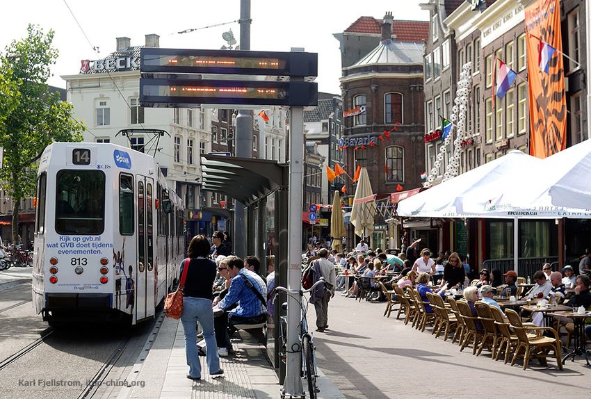

INTRODUCTION

             1
                    1.1 FOREWORD
                   The Institute for Transportation Development Policy (ITDP) is a nonprofit
                   institution that was established since 1985 and headquartered in New York,
                   USA with a main focus on creating sustainable transportation in cities all
                   around world. ITDP Indonesia has provided more than ten years of technical
                   assistance to the DKI Jakarta, Medan and Pekanbaru provincial governments
                   regarding mass public transportation, parking systems and improvement of
                   pedestrian facilities.

                   In several discussions with Dinas Bina Marga of the DKI Jakarta Province, the
                   ITDP also has the same concern related to efforts to realize a network of
                   access for non-motorized transport with great quality and can be used by
                   everyone. Therefore, this book was formulated to provide guidance both in
                   the standards for the implementation of planning and design in road spaces
                   in Jakarta. The formulation in this book is the result of a field survey by the
                   ITDP Indonesia team, a study of various sources, such as TOD Standard 3.0
                   (ITDP), Global Street Design Guide (NACTO), Access for All: Guidance Note on
                   Inclusive Street Design for Asia and the Pacific (ITDP-ADB), dan Guidelines for
                   Planning, Provisioning and Utilization of Pedestrian Network Infrastructure
                   and Facilities (Kementerian Pekerjaan Umum).

                    1.2 GOALS
                   This book was prepared to complement the related official, especially Dinas
                   Bina Marga of the DKI Jakarta Province, to formulate human mobility
                   networks guideline plan in DKI Jakarta for the next 5 years. Containing a 2017-
                   2022 vision that focuses on pedestrian networks with detail elements to
                   realize this vision, this document can also be used as a reference framework
                   for improving pedestrian facilities (and cyclists) in Jakarta.

                   In addition to explaining the standards of various elements contained in the
                   detail element of the vision, ITDP Indonesia also gave recommendations on
                   selected location that are in accordance with the vision which are then
                   detailed into recommendations for priority locations that can be used as
                   reference for development for 5 years.

                    1.3 SCOPE OF WORK
                   The scope of work on the preparation of this document includes the
                   selection of the location of sidewalk construction and / or other pedestrian
                   access in DKI Jakarta for the next 5 years, recommendations for the
                   distribution of road space and sidewalks, design guidelines, and estimated
                   allocation for the budget. Bicycle paths and supporting component are
                   additional topics that can also be prepared parrallel with sidewalks and
                   pedestrian access in DKI Jakarta.

Caption 03
Source

                                                 Jakarta NMT Vision and Design Guideline             1
1.4 METHODOLOGY

                       STANDARD ARRANGEMENT

                       TOD STANDARD 3.0                     GLOBAL STREET DE-            ACCESS FOR ALL:            PEDOMAN PERENCA-
                                                               SIGN GUIDE              ON INCLUSIVE fOR ASIA        NAAN, PENYEDIAAN,
                                                                                         AND THE PACIFIC            DAN MANFAAT PRAS-
                                                                                                                    ARANA DAN SARANA
                                                                                                                       PEJALAN KAKI

                     LOCATION RECOMMENDATION PLANNING PROCESS

                       1                                             2                                     3
                           Mapping Transit Spot Location                          500 m Buffer                 Choosing the Path and Area

                            (Transjakarta, KRL, MRT, LRT)

                                                                     Priority Determinant Factors:

                                                                         Jumlah Penumpang (TJ & KRL)

                                                                             Laporan Warga (QLUE)

                                                                             Pusat Kegiatan (POI)

                                                                          Potensi Integrasi Antar Moda

                       4
                              Priority Determination

2   Jakarta NMT Vision and Design Guideline
WHY WALKING?

2
                                     2.1 FACTS AND DATA

 Sidewalk

   RQM=
      kilometer                                    SVRS=
                                                       kilometer                               N=
                                                                                                pejalan kaki
 panjang
DKI Jakartatrotoar DKI Jakarta
              sidewalk   length2015
                                 2015             panjang jalanroad
                                                   DKI Jakarta  DKI Jakarta
                                                                    length 2015
                                                                            2015             tewas tiap 6 road
                                                                                             DKI Jakarta   hari di Jakarta
                                                                                                                length  2015
  (Jakarta
      (JakartaDalam   Angka
               Dalam Angka   2016)
                           2016)                    (Jakarta
                                                      (Jakarta Dalam  Angka
                                                               Dalam Angka   2016)
                                                                           2016)             (JakartaPolda
                                                                                            (Ditlantas Dalam
                                                                                                           MetroAngka  2016)
                                                                                                                 Jaya 2014)

 >NOR=
    micron/m3                                    PRNP=
                                                    langkah/hari                               >QM
                                                                                                 % PNS
 kandungan partikel polusi udara              rata-rata jumlah langkah orang Indonesia     DKI Jakarta mengalami obesitas
        di Jakarta Utara                                 (Stanford University)                (Dinas Kesehatan DKI Jakarta)
      (Desert Research Institute)

                                    DATA FROM QLUE DURING #PEDESTRIANFIRST CAMPAIGN
                                    (1 AUGUST - 5 September 2017)

                                    During the #PedestrianFirst campaign period which takes place
                                    simultaneously with month of “Walking properly on the sidewalk”, there are
                                    complaints that go through application that related to violation on pedestrian
                                    facilities as much 643 report.

                                    Of the 643 reports that entered, West Jakarta is a city with the most related
                                    reports with disturbances on the sidewalk. Number of reports in West Jakarta
                                    is 31% of total reports submitted.

                                    The amount of complaint entered through the application QLUE does
                                    represent that region have a poor management, but can describe the amount
                                    of participation community to catch problems in the field and can be used for
                                    consideration of prioritizing the plan or development.

                                                                         Jakarta NMT Vision and Design Guideline               3
2.2 BENEFIT OF WALKING

                        Walking can be identified as a characteristic of modern urban life. The reason
                        why people walk varies. Some people choose to walk from their origin point to
                        a destination, some walk only to reach transit points, and there are also peo-
                        ple who walk for sightseeing and traveling around the city. Walking became
                        the first option for people to mobilize as it does not charge any fee. Besides
                        providing economic benefits, walking provides a variety of other benefits, in-
                        cluding:

                                        PUBLIC HEALTH

                                        •    Increasing physical activity
                                        •    Decreasing air and sound pollution
                                        •    Lowering mental stress and physic

                                        QUALITY OF LIFE

                                        •    Promoting social interaction
                                        •    Increasing the creation of public space
                                        •    Connecting people
                                        •    Create a lively city

                                        ENVIRONMENT SUSTAINABILITY

                                        •    Increasing access to green area
                                        •    Lowering carbon emission
                                        •    Promoting a better water management as green space
                                             expands in pedestrian area
                                        •    Additional vegetations works not only as shades but
                                             also give a good impact for the climate

                                        ECONOMICS

                                        •    Promoting business opportunities
                          Rp            •    Increasing investment value in corridors passed by
                                             pedestrian
                                        •    Creating an added economic value within local people
                                        •    Increasing region value

                                        SOCIAL JUSTICE

                                        •    Walking can be done by all segments of citizen
                                        •    Facilitating vulnerable groups such as elderly people,
                                             child, and disabled people

4   Jakarta NMT Vision and Design Guideline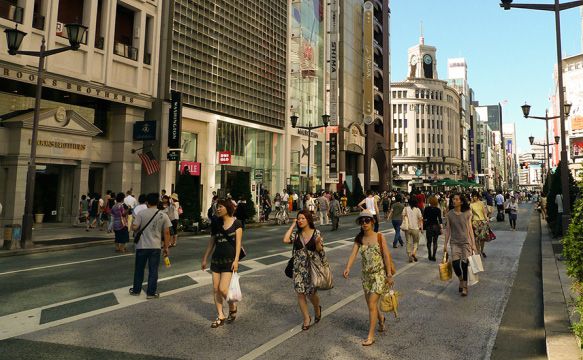
COMPLETE STREET
DEFINITION
3 3.1 DISTRIBUTION OF ROAD SPACE
SETBACK
Setback is a vacant space/yard inside a building's
ground area, located closest to the street.
Sidewalks are dedicated road space for pedestrians
SIDEWALKS that are defined safe from the motorized vehicles
distruption. This space is designed according to the
basic needs of pedestrians including material
selection.
The vehicle lane is a path that can be passed by
VEHICLE LANE cars, motorcycles, or other motorized vehicles.
A dedicated bus lane (also known busway) is a
BUS LANE separated lane from the vehicle, either physically
or just marked, which can only be passed by the
bus and/or BRT.
Space as high as a road body that can be used for
ON-STREET PARKING a vehicle stop (car) which is indicated by certain
markers.
A safe path that can only be used by bicycle users
BICYCLE LANE specifically. Can be separate paths with security
such as bollards or planter boxes, or can be in the
form of mixed space with pedestrians.
In certain cases and/or road spaces, this line can
SERVICE LANE only be used for ambulances, fire trucks, and so on.
It can also be traversed by all vehicles that will
enter and/or turn into neighborhood roads or
building parcels.
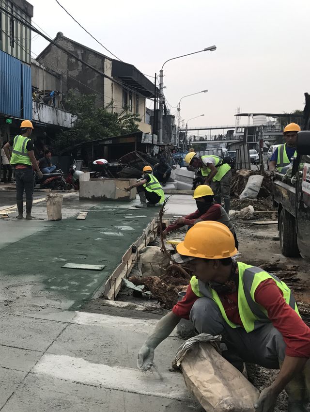
Jakarta NMT Vision and Design Guideline 5
Distribution of road
        space before the
    sidewalk renovation

           Jatinegara, 2017

                                        ALL USER                           ALL AGE                             ALL ABILLITIES

                              Basically the term of complete streets refers to roads that can accommodate a variety of road users
                              from various ages and with various abilities. In addition, the intended road must be safe, comfortable,
                              and the design should qualify the needs of various groups. It should be understood that in the
                              realization of complete streets, the mindset of road space use should also change into prioritizing
                              pedestrian space before private vehicles lane. The mindset of prioritizing motorized vehicles, especially
                              cars, is an obstacle in realizing complete street. Mindsets that should be possessed in realizing
                              complete street are as follows :
                                          Make sure there is a road space to accommodate people to walk. If the road does not have a
                               1.         sidewalk yet, then prioritize the procurement of pedestrian space first.

                                        Organizing space for cyclists. Cycling paths can be formed into a safe path that is physically
                              2.        separated, or in a form of shared lanes with other modes.

                                        After walking and cycling spaces are available, then add space for road-based public
                              3.        transportation such as buses. The intended road space includes bus lanes and other facilities
                                        such as bus stops.

                                        Then, the remaining space can be provided for motorized vehicles, such as cars. Vehicle lanes
                              4.        can be used either by private cars, taxis, motorbikes, and so on.

                                        If there are remaining spaces that also support land use and / or activities in the area, then
                              5.        on-street parking can be added

                      3.2 TYPE OF ROAD USERS
                              As the aforementioned explains, the priority for road users should be sequentially starting with
                              pedestrians, cyclists, public transport users, commercial use, services and private vehicle users.

6      Jakarta NMT Vision and Design Guideline
SIDEWALK
4
DISTRIBUTION OF SIDEWALK SPACE
Jakarta NMT Vision and Design Guideline 7JAKARTA
5 5.1 JAKARTA VISION 2017-2022
Towards
Walkable Jakarta
2022
Creating a complete, safe, comfortable, and humanist pedestrian space that
also promote for increasing uses for public transportation.
COMPLETE
• Walkways
• Crossings
• Access to Transit
• Complementary Uses
• Access to Food
• Access to Public Spaces
• Speed
SAFE
• Lightings
• Bollards
• Driveways Density
• Pedestrian Refuges
• Sidewalk Extension
• Curbs
• Shades and shelters
COMFORTABLE
• Active Frontage
• Permeable Frontage
• Small Blocks
• Seatings
• Tree/Plant/ Landscape
• Waste Bins
• Placemaking
HUMANISTIC
• Tactile
• Wayfindings
• Signage
• Ramps
8 Jakarta NMT Vision and Design Guideline5.2 VISION IMPLEMENTATION ELEMENTS
5.2.1 COMPLETE
Complete means building a network of pedestrian facilities that are not partial and have a single unit of
function. In this case, pedestrian access was built and/or repaired to connect all of Jakarta resident and
to encourage walking activities as a choice of urban mobility. This approach can be made by linking
various land uses and activities to public transportation. Some key words from complete vision
elements include: walkways, crossings, access to transit, complementary uses, access to food, and
access to public spaces.
1 WALKWAYS
Durability and completeness of pedestrian lines are the main prerequisites for the construction of
sidewalks. This path must be adjusted to accessibility standards and applicable regulations. Complete
walkways can also be defined as follows:
• Special lanes, separate and safe for pedestrians
• A shared street whose design accommodates people walking safety and limit maximum vehicle
speed of 15km/hour
• Path or small lane specifically made for pedestrians
Surabaya Continuous
Sidewalk
To fulfill this point, pedestrian space must also be designed to be friendly to people with disabilities in
accordance with local standards and regulations. This line must also be equipped with adequate street
lights. Disturbances in the walkways caused by the surrounding development must be accompanied by
alternative pedestrian routes that are safe and adequate.
Jakarta NMT Vision and Design Guideline 92 CROSSINGS
The crossing is placed on all intersections and spacing every 80-100 meters. In some cases, road
crossings can also be placed for 150 meters. Not only placed at the intersection, crossings can also be
placed in the middle of the block. Safe crosswalks can be defined as follows:
• Marked and has a marking width of at least 2 meters
• Accessible to persons with disabilities
• If the length of the crossing crosses more than two traffic flows, it must be equipped with a
crossing island that also accommodates persons with disabilities
Crossings in Kyoto
Same-level crossings is the best form of crossing and gives priority to people walking. This crossing can
work well if a clear crossing marker is included. On some roads that are passed by vehicles with speeds
above 30 km/hour, a marker for crossing locations can be added. In addition, crossings should have
short distances, this aim to increase safety for people who cross the road.
Same-level Crossings
10 Jakarta NMT Vision and Design GuidelineThe types of same=level crossings are as follows:
a Conventional Crossings
The Conventional crossing is a type of crossing that is generally found at
intersections on the main road. This type of crossing can be used in locations
with a number of pedestrians from low to high. Crossings need a marker and
are placed at the intersection. Roads with a variety of vehicle speeds can use
the following crossing designs even with a low to solid traffic volume.
b Diagonal Crossings
This type of crossing allows pedestrians to move the side of the road at the
intersection of at least 4 branches in one time phase simultaneously. During
this crossing phase, all motorized vehicles are given a signal to stop. This type
of crossing can be implemented only at intersections with high pedestrian
volumes with wide enough pedestrian and crossing spaces.
In practice, this type of crossing provides benefits such as improving safety and
reducing waiting times for walking people.
c Raised Crossings
Raised crossings or walkways as high as sidewalks are usually placed on
residential streets that are quite dense in traffic, both for people walking and
passing vehicles. The speed of vehicles passing in the road space mentioned
is less than 30 km/hour. This crossing usually has no signal.
Besides being able to be applied in a busy residential area, this type of
crossing can also be applied to roads with high commercial activities or also
small roads that are directly connected with larger roads (meaning there are
differences in vehicle speed).
Jakarta NMT Vision and Design Guideline 11d Traffic Calmed Crossings
Traffic calmed crossings is usually located mid-block of the road. This
crossing have reminder elements that can be either speed bump, line
markers, or even pads to reduce the speed of motorized vehicles to remind
that there will be crossings afterward. The placement is in the vehicle lane at
5-10 meters before the crossing space. If the volume of vehicles passing is
increasing and pedestrians find it increasingly difficult to find the crossing
phase, additional signals can be made for this type of crossing.
Traffic Calmed
Crossing,
Rotterdam
Traffic Calmed
Crossing, Calgary
(by Steven Vance)
e Pelican Crossings
This type of crossing is usually placed between blocks on a road that is quite
wide with quite high traffic. Pedestrians who will cross the road are asked to
press a button that automatically activates the light signal to order the
vehicle to stop. Then, people have some time to cross the road while the
vehicle stops.
f Staggered Crossings
Staggered crossings are a type of crossing that is not parallel to a road with
at least two traffic flows. The application of staggered crossings provides an
opportunity for pedestrians to keep a distance from the speed of motorized
vehicles. The minimum median width or island crossing is 3 meters and the
offset distance between the two crossings is not more than 1 meter. This
crossing can be applied as a crossing in the middle of a block for roads that
accommodates vehicle speeds above 30 km/hour.
As with previous crossings, if there is an increase in the volume of vehicles
passing, then additional markers, signals, or even speed bumps can be done.
12 Jakarta NMT Vision and Design Guidelineg Pinchpoint/Yield Crossings
Pinchpoint/yield crossings are crossings in the middle of a block that shorten
the distance of crossing someone. This crossing can be applied to roads that
are passed by vehicles at speeds below 30 km/hour. By expanding the
pedestrian area, the vehicle space is reduced, for example, from two lanes to
one lane and ultimately forcing motor vehicle drivers to reduce speed when
approaching the crossing. This extension of the pedestrian space must leave
at least 3.5 meters of space so that emergency vehicles can still be passed,
such as firefighters and ambulances.
3 ACCESS TO TRANSIT
Supporting the creation of complete pedestrian facilities means connecting
pedestrian facilities to the mass transit system. Improving the walking
facilities around the transit area, create a complete function of urban
mobility function. Priority area that need to be prioritized to support this
function: are 500 – 1.000 meters from the center point of the bus stop/
station or the same as a 10 minute walk. This public transportation includes:
• High-capacity stops or stations (such as Transjakarta, KRL Commuter
Line, MRT, LRT)
• Bus stop or station with direct transit service that connects the area to
the previous points within 5 km
Jakarta NMT Vision and Design Guideline 13Fresh Food Store - Lyon
Mixed use area - Tokyo
4 COMPLEMENTARY USES
In creating complete pedestrian facilities, it is necessary to arrange an area that supports the creation
of mixed land use area. It’s means to combine land use between residential areas and non-residential
areas within the same area. Complementary land uses in a development area can be defined in these
two categories:
• Internally complementary, is the concept of mixed-use in its development under condition that the
house function is not less than 15% and not more than 85%.
• Contextually complementary, an area can be defined to complement larger context if more than
half of the total built-up floor area is dedicated to functions that balance the use of the dominant
land around it. Or it could also be a mixed area that includes the internally complementary aspect
in the middle of the area with percentage of residential land use between 40-60%.
14 Jakarta NMT Vision and Design GuidelineFresh Food Store - Lyon
5 ACCESS TO FOOD
Within a 500-meter radius of the construction area or transit station, there must be a place to get the
food from the source needed. In this context, the food sources include fresh vegetables and fruit, fresh
dairy products, meat, chicken and seafood. The food sources can be sold by traditional markets,
roadside traders, minimarkets/supermarkets/hypermarkets or market that opened periodically (weekly,
two daily, etc) and can be easily accessed by the public.
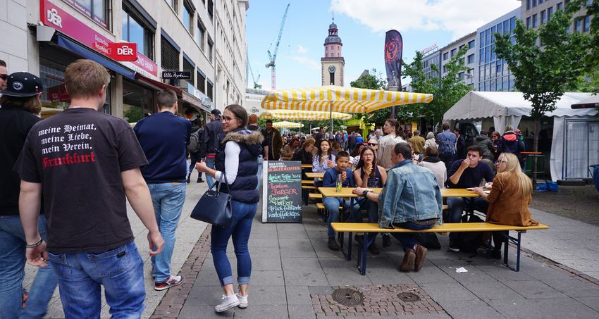
6 ACCESS TO PUBLIC SPACES
The development of pedestrian facilities will have a complete function if it also connects people to the
location of public and social facilities. These public spaces can mean schools, markets, parks, hospitals,
pharmacies, playgrounds, and so on. Pedestrian facilities around this location can be a priority because
it is also a location that can create high human activity and more specifically pedestrians.
Public Park - Frankfurt
Jakarta NMT Vision and Design Guideline 155.2.2 SAFE
Safe means placing pedestrians as a priority. Maintain safety and security in pedestrian spaces.
Minimizing criminal acts that might occur to pedestrians in public spaces, as well as preventing
accidents that could potentially occur to pedestrians. Some of the physical to support safe elements
are: speed regulation, intersection, lighting, bollards, signals, driveways density, pedestrian refuges,
sidewalk extensions, and curb.
1 SPEED REGULATION
Setting and limiting the speed of vehicles in each road lane can help facilitate safe walking for most
people. Vehicle speed is related to the stopping distance, the breadth of view, and the level of injury
that can be caused by it.
Stopping distance and
vehicle speed regulation
From the picture above, it is explained that a car traveling at a speed of 30 km/h if it stops the vehicle
suddenly, then the car will be able to stop at 5 meters from the point the driver stepped on the brake.
If the car driven at a speed of 40 km/h wants to stop suddenly, then the new car can stop 18 meters
afterwards. And if the driver of the vehicle carrying the vehicle at a speed of 50 km/h wants to stop
suddenly, then the new vehicle will be able to stop after 25 meters.
From several other studies (Pasanen 1993, DETR 1998, Rosen and Sanders 2009, and Tefft 2011) show that
there is a relationship between vehicle speed and pedestrian death risk in urban areas in developed
cities. Vehicles traveling less than 20 km/h can cause 0-1% risk of pedestrian death. While vehicles with
speeds of 40 km/h can cause a 25% risk of pedestrian death. While the risk of death is biased to 60%
when people are run over by a vehicle that runs 50 km/hour. Above 70km/h, the risk of death increases
to 100%.
The pictures below illustrate the relationship between the speed of the car and the broad view of the
driver of the car. The faster the car, the wider the narrow view. Therefore, the more invisible the
activities of people in the walking room which further increases the risk of accidents
16 Jakarta NMT Vision and Design GuidelineVehicle Visibility
at 20 kmph
Vehicle Visibility
at 30 kmph
Vehicle Visibility
at 40 kmph
Vehicle Visibility
at 50 kmph
Jakarta NMT Vision and Design Guideline 172 LIGHTING
Bm
Am
Cm
Illustration of lighting in
pedestrian area
Lighting is one of the important elements that creates security in road space. Besides suppressing the
possibility of criminal acts, lighting is also able to turn on the pedestrian lane and make pedestrians
visible at night.
Lamps on the pedestrian lane must be able to ensure the level of lighting (lumen) is in accordance with
the designation of the area. In commercial areas, lighting should be brighter and in residential areas
made bright enough to prevent dark spots. Physical facilities of lighting facilities are attempted not to
interfere with the free space to walk or not to disturb the guiding tiles.
3 BOLLARDS
Examples of bollard
in Amsterdam 90-100cm
Installation of bollards can improve pedestrian safety and security. By installing a bollard, it will reduce
the risk of injury that can befall pedestrians on the sidewalk due to the negligence of the driver of the
motorized vehicle or the pedestrian negligence itself. The existence of bollard can also reduce the entry
of a number of vehicles onto the sidewalk and prevent damage to sidewalk surfaces and other street
furniture.
Bollard can be installed in a conflict room or a meeting between pedestrians and motorized vehicles
such as vehicle access to the building (driveway), intersection, and crossing. Bollards placement should
not interfere with pedestrian space in general, guide tiles and bicycle lanes. Bollard has various types
and shapes. Generally the bollard is in the form of a pole with a height of 1 meter, besides that there is
also a bollard pole which is shorter, or spherical, or equipped with other markers, etc. The selection of
bollard forms can be discussed based on the location of the laying and its uses.
The distance between bollards with one another is 90-100 cm. This adjusts the space requirements of
wheelchair users, namely 75-80cm or also people with luggage that requires space of 75-90cm.
18 Jakarta NMT Vision and Design Guideline4 DRIVEWAY DENSITY
Continuous sidewalk on
driveway area - Honolulu
Elements that can increase the safety and safety points of pedestrians on the sidewalk are the limits of
the density and/or number of driveways. Vehicle access as intended by the driveway is ramps that
stretch to the entrance of the vehicle into the building which cuts people's walking paths. This access
can be connected with off-street parking activities or also with loading and unloading activities.
Along with regional arrangement, the driveway density should also be regulated. Density that is proper
according to the TOD Standard 3.0 ITDP is 2 or less per 100 meter face block.
5 PEDESTRIAN REFUGE
Illustration of pedestrian
refuge
Crossing islands are provided for crossing people through more than two lanes of vehicle traffic or in
conditions where vehicle speed and volume do not allow pedestrians to do single-stage crossing. The
features of the crossing island are as follows:
Jakarta NMT Vision and Design Guideline 19a Pedestrian Refuge Islands
The design is equipped with a marker and enough
space for people to wait before crossing the road.
Can be added signals or marker lights, bollard, or
curb if needed in accordance with traffic
Pedestrian refuge island - conditions. The crossing island must be clearly
Hongkong visible both in the afternoon and at night. Ideally
this space length is 10-12 meters with a width of
1.8-2.4 meters so that it can create a safe crossing
waiting room.
b Median Tips
The crossing island at each intersection should
have a tip which is an extension of the crossing
room. This means to give a broad impression on
the pedestrian area and crossing the road. The
median tips must be parallel to the pedestrian
lane so that passing vehicles reduce their speed
Median tips - New York and make the crossing lane clear. This is also
useful for protecting pedestrians while waiting to
cross the road.
b Median Cut Through
In mid-block crossings where the traffic conditions
are quite high, a median cut-through can be used.
Its dimensions are like the dimensions of a
crossing island and its location follows the laying
Median cut-through -
Nagoya of a mid-block crossing. When installed on a road
where a vehicle is traveling at speeds above 30
km/h, signals and markers can be added
20 Jakarta NMT Vision and Design Guideline5 SIDEWALK EXTENSION
Sidewalk extensions can reduce crossing distances and increase the level of security for people walking.
Physically, sidewalk extensions narrow the road section for motorized vehicles and expand the waiting
room for pedestrians and mix elements of street furniture, such as park benches, trees, transit places,
and street lights. Sidewalk extensions can be classified into three parts, namely:
a Corner Aligments
Corner alignments expand the pedestrian area at
the intersection by designing a smaller
intersection radius. By reducing the intersection
radius, it will increase the visibility of people
walking. In addition, this condition also forces
motor vehicles to slow down when turning. With
this approach, the walking space is wider, the
crossing distance is shorter, and more continuous.
b Bulb-Outs
Bulb-outs aims to expand pedestrian space
adjacent to the on-street parking area. This type
can be installed in locations that coincide with the
existence of on-street parking. This design can
have an impact on increasing visibility of people
walking due to reduced vehicle speed, reducing
crossing distances, and providing extra waiting
space, and can be used for space for adding road
accessories and landscaping such as benches and
plants.
The dimensions adjust the existing road space to
the width of the sidewalk. This type of design is
also included in the traffic calming strategy.
b Slip Lane Removal
Slip lane removal is an extension of the
pedestrian space that occupy vehicle space and
traffic islands at the intersection. Usually, this
condition is used at the main intersection and has
the potential to harm pedestrian security. This can
reduce the level of risk of accidents at
intersections where the existing conditions
provide the opportunity for the vehicle to turn left
directly. By utilizing or eliminating the left turn
space, it will reduce conflicts between motorized
vehicle users and crossing pedestrians.
The spaces that are removed can be used as
additional waiting rooms when going to cross,
where road accessories, or also landscape
elements.
Jakarta NMT Vision and Design Guideline 216 CURBS
This road element is used to make physical boundaries between sidewalks with bicycle lanes or also
with motorized lanes. Directly, the existence of curbs prevents motorized vehicles from occupying
sidewalk space or even just entering it. Curb is also used as access to drain water on the road.
The recommended curb does not have a height of more than 15 cm. The proper installation of the curb
is adjusted to the crossing so that it can be accessed by everyone.
Kerb at Frankfurt,
Germany
5.2.3 COMFORT
Comfortable pedestrian facilities means making pedestrian passages pleasant and can give an
impression. In realizing a sense of comfort, walking space will involve the five human senses.
Comfortable walking space can be a supporting factor that creates more people to walk. Comfortability
contribute to the creation of a more pleasant walking experience in the city so someone wants to walk
longer or even further. Some elements that support the creation of comfortable sidewalks are shades/
shelters, trees/plants/landscape, visually active frontage, permeable frontage, small blocks, seating,
waste bins, and placemaking.
1 SHADES AND SHELTER
Installation of shade facilities can increase comfort when walking. Shade facilities can be either
artificial or natural shade that serves as a protection from weather such as rain or the hot sun in urban
area. This component includes trees, a canopy, or also the roof of a building. A road space can also be
classified as having a shade if at the most blazing hours the walking space is covered in the shadow of
the surrounding buildings (meaning pedestrians are not exposed to sunlight) in full.
Pedestrian
shades at Kuala
Lumpur, Malaysia
22 Jakarta NMT Vision and Design Guideline2 VISUALLY ACTIVE FRONTAGE
The face of the building is the side of the building that directly adjacent to the pedestrian space.
Visually, the face of the building is called active if there is a minimum of 20% of the surface area of the
building that is one level with pedestrians in the form of transparent walls, or windows, or rolling door
shops which when the activity hours walk open or at least can be seen by walking people. The addition
of the exterior of buildings seen by passive pedestrians on the side of the building (dead walls) can be
called an attempt to activate the facade of the building.
By creating a visually active building face, it can increase the comfort and safety of people walking
outside the building. Without realizing it, the face of an active building can have an important role in
maintaining one's mood while walking and creating a pleasant walking experience. Activities in buildings
such as shops or restaurants that have an active building face can divert a person's tiredness or fatigue
while walking so that someone can walk longer or farther.
Besides being able to increase comfort while walking, this active frontage design can also increase
security points in running space. The existence of activities and people in the building can make the
road space also become active and more alive so as to minimize the possibility of criminal acts.
On a regional scale, the area that has more than 90% of the face of an active building has the highest
value to achieve the creation of a good TOD area. Conversely, if less than 50% of the face of the building
is active in the area, then the area has the lowest value or is classified as an area that does not support
walking activities.
Visually Active Frontage at
Karawaci, Indonesia
Visually Active Frontage at
Guangzhou, China
Jakarta NMT Vision and Design Guideline 233 PERMEABLE FRONTAGE
Permeable frontage is direct access to buildings from the face of buildings directly adjacent to the
pedestrian space. The assessment can be done by calculating the amount of access for pedestrian to
the building every 100 meters.
Permeable frontage includes the access to shops, restaurants and cafes, pedestrian access to the park,
and all access to buildings specifically for pedestrians. The value of the region will be determined by the
average amount of accesses per 100 meters. The area will have the highest value if the average entrance
access per 100 meters is 5 or more and has the lowest value if the average entry access is less than 3
per 100 meters
Street with visually
active and permeable
frontage at Amsterdam,
The Netherlands
4 SMALL BLOCKS
Regions that have small building blocks will make it easy to move from one road to another for
pedestrians. The existence of small building blocks will shorten the distance of travel that must be
taken by someone while providing a choice of shortcuts for pedestrians.
Buildings that are 150 meters long or more are classified as large building blocks that are less
comfortable for pedestrians. The length of the building that is less than 110 meters is included in the
small building block which in the creation of the TOD area has the highest value. 'Cutting' blocks that are
too large can be done by adding pedestrian-specific access that is open to the public for at least 15
hours a day. This pedestrian-specific designation aims to give access that crosses the building to reach
another road adjacent to the building without having to walk around the building by the pedestrian.
Small blocks at
Guangzhou, China
24 Jakarta NMT Vision and Design Guideline5 SEATINGS
Benches on a sidewalk at
Chengdu, China
Provision of benches is made to facilitate pedestrians to sit or rest for some time. The addition of these
elements can increase comfort on the sidewalk. This type of benches can vary, either with the backrest
or not. Comfort can also be improved by providing sufficient legroom and not disturbing pedestrian free
space of at least 1.5 meters. The placement of the bench can be adjusted according to the conditions
and width of each sidewalk. Some things to consider when putting a bench are as follows:
• It is placed outside the pedestrian free space with a minimum width of 1.5 meters.
• Not placed on access to and out of buildings.
• Not placed above, or too tight, or disturbing the guide tiles.
• Priority is placed adjacent to the area that invites a lot of human activities such as parks,
playgrounds, sports facilities, kiosks, and other commercial facilities.
• If placed facing the building, the distance is at least 100 cm from the curb.
• If placed facing outward (towards the road), then a minimum distance of 200 cm from the curb.
• The distance between the benches adjusts the land use and / or building activities around.
• If it is close to public areas with high walking activities, it can be placed every 20 meters or less.
6 TREE/PLANT/LANDSCAPE
Trees on a sidewalk at
Budapest, Hungary
Addition of trees, plants, or other landscape elements to pedestrian facilities not only serves as shade,
but is also useful for creating a pleasant atmosphere on the sidewalk. He can also contribute to the
creation of character or also regional identity. More broadly, these elements can control weather or
even climate, improve air conditions, filter pollutants, and have an impact on human physical health.
Jakarta NMT Vision and Design Guideline 25Some things to consider in laying out landscape elements on the sidewalk are:
• Types of trees or plants to be used
• Volume of land available under pavement
• Spacing between trees
• Space for landscape elements is not in the middle of walking space and it is recommended that a
straight line on the buffer side be given a distance from the curb
• The depth of planting of each tree is adjusted to the type of root and the period of tree growth
• You can install tree gates that still allow perfect water absorption into the soil
7 WASTE BINS
Waste bin on a sidewalk
at Macau
Cleanliness is one of the comfort criteria in the pedestrian facilities provided. Sidewalks that are clean
and free of bad odors, can encourage the creation of a good walking climate. One way to realize cleanliness
in walking space, it is necessary to provide trash bins. Placement of trash can be based on the location of
landfills such as in commercial and public spaces.
Some other things that need to be considered in the provision of bins are:
• The distance between trash cans is at least 20 meters
• The placement does not interfere with free space on foot
• It is recommended to be put together in the utility room in a straight line
• Available at intersections and adjacent to crossing locations
The design and dimensions of the bin can adjust to the character of the area or other preferences.
Furthermore, the provision of trash cans must also execute by good management of regional waste to
actualize a clean and comfortable walking space
26 Jakarta NMT Vision and Design Guideline5.2.4 HUMANISTIC
Humanistic means to realize pedestrian access that can be used by all people and all ages and genders.
These include men, women, people with disabilities, children, and parents. Some supporting elements
from humanists include tactile, wayfinding, signage and ramp. The provision of humanist pedestrian
space also means the availability of sufficiently wide space that accommodates a variety of users on the
sidewalk.
The space requirements for various types of pedestrians are as follows:
Or the minimum width can be defined as 1.5-1.8 meters based on the need for space for adults and one
room to overtake because the speed of walking of different people. In general, the speed of people
walking is as follows:
1 TACTILE
Guiding tiles (tactile paving) are installed above the sidewalk surface to provide a marker for people
with limited vision. There are two types of tiles, each of which has a different function. The first type is
tiles with line markers, and the other types are tiles with dot markers.
Tiles with a pattern arising lines indicate that people can continue to follow the next guide tile and tiles
with a pattern appear to indicate a warning so that people who cross stop briefly or be careful because
they will enter the conflict area (pedestrian meeting area with vehicles motorized). The guide tiles
themselves usually have different colors or materials, so people are aware of the special pathway for
those with disabilities.
Jakarta NMT Vision and Design Guideline 27Sidewalks with tactile
paving at Shanghai,
China
The installation of guide tiles between line patterns and points pay attention to the following conditions:
• Before the inrit (vehicle entry access), the pattern will set to dots. When inrit, followed by a
line pattern, and after inrit ends with a dot pattern.
• On the ramp and crossing or conflict area which is forced to break the direction tile, it is
indicated by a point pattern and ‘captured 'again with a dot pattern before proceeding with a
line pattern.
• Guide tiles must be installed free from obstacles and/or interference
• Tactile must also be minimal from defections that are not too important
2 WAYFINDING
Good walking facilities are also able to provide sufficient information for anyone who passes it. Wayfinding
can directly provide information for pedestrians regarding multi-modal transit information. Not only that,
wayfinding installation can help provide direction orientation where a person is located and directions
regarding the nearest station or other public facilities location. Wayfinding can be either a thin board or
a board with electrical installations and lights.
By installing the wayfinding, someone will feel more comfortable and secure because they know their
current position along with information on the location around it. In addition, a person can also know the
distance to be traveled to and/or from the nearest transit point.
Illustration of
wayfinding visibility
28 Jakarta NMT Vision and Design GuidelineWayfinding installation is recommended to be placed in strategic locations such as stops, stations, public
open spaces, and commercial areas. Next, the installation is done every time it takes 5-10 minutes from
and to that location. In other placement recommendations, wayfinding can also be installed adjacent to
a large intersection to provide directional orientation when walking after the intersection. The installation
distance at the intersection is 8-10 meters from the intersection. Can be placed on both sides or one of
them, adjusts to the needs and uses of the area's land.
Wayfinding at Frankfurt
The shape and size of the wayfinding can be varied according to the size of the body of the local community.
This must be done so that the information available can be captured by the eye. The type and size of
letters found in wayfinding must also be clearly legible. The choice of language, graphic design, and maps
that are informed must be universally understood because people who will access can be local
communities, workers, commuters, and tourists. In a better design, a good wayfinding can accommodate
the needs of blind people by providing information in braille that is placed in strategic places such as
shelters, stations and commercial areas.
Wayfinding at Bandung
Jakarta NMT Vision and Design Guideline 293 SIGNAGE
Signposts or markers can be divided into two, namely signpost for motorists and signposts for pedestrians.
Signposts for vehicles have a height that is different from the height of the sign intended for pedestrians.
Pedestrian signs are installed at the height of the eye range ranging from 2-3 meters. While signposts for
vehicles are placed higher so that from a distance the motorist can see the information addressed to him
clearly, the height of this sign refers to the standard.
Signage positioning at
Frankfurt
Placement of information boards is placed outside the pedestrian-free space. It is recommended to
be placed in the utility room and/or buffer. The choice of location is based on the needs or conditions
of each road space.
4 RAMP
Sidewalk ramp at Tokyo
Ramp provision is carried out to facilitate persons with disabilities who use wheelchairs or other
walking aids. Installation of the ramp is done in a walking room that has a height difference at one
point. The three ramp elements are:
30 Jakarta NMT Vision and Design Guideline• Slope, the selection of material in this area must be anti-slip and the recommended slope ratio
is 1:12 or equal to 8%. The width of the ramp is at least the same as the minimum width of free
space that is 1.5-1.8 meters or recommended to have a width of 2-2.4 meters.
• Top landing, on the upper side of the slope. The minimum width of this area is equal to the
width of the slope or equal to the width of the free space that is 1.5-1.8 meters.
• Side flares, are wings on both sides of the slope which is added to prevent danger from tripping
when a person with disability maneuvers on the ramp. The ramp can also be matched with
tactile. This area cannot be more than 1:10.
Jakarta NMT Vision and Design Guideline 31DESIGN GUIDELINE
6 6.1 DESIGN TYPE
6.1.1 DESIGN A
EXISTING CONDITION
The width of the road is less than or equal to 3 meters. Majority of land use
function as commercial or tourism destination.
ROAD SAMPLE
Gang Gloria, Glodok
DESIGN PLAN
Roads with these characteristics should be designed only for pedestrians.
Pedestrian activity can generate regional economic and increase safety in the
area.
Existing
Design Plan
32 Jakarta NMT Vision and Design Guideline6.1.2 DESIGN B
EXISTING CONDITION
The width of the road is less or equal to 3 meter. Majority of land use function as housing.
ROAD SAMPLE
H. Noim street, Ragunan
DESIGN PLAN
On small roads with residential land use as majority, it is recommended that the design that creates
shared street to share space between pedestrians and bicycles. Motorcycle use is limited only by
homeowners on the road. Treatment for pedestrian safety can be by adding speed bump or also the
application of rules of the vehicle that should not be driven when crossing.
Existing
Design Plan
Jakarta NMT Vision and Design Guideline 336.1.3 DESIGN C
EXISTING CONDITION
width of the road 3-3.5 meter. Majority of land use function as comercial activity
ROAD SAMPLE
H. Ridi street, Ciledug
DESIGN PLAN
On a 4 meter wide road that has active commercial activity on its right and left, it is advisable to apply a
shared street that allows pedestrians to remain safe despite sharing space both on a bicycle and a
motorcycle. The use of the speed bump is also recommended for this type.
Existing
Design Plan
34 Jakarta NMT Vision and Design Guideline6.1.4 DESIGN D
EXISTING CONDITION
width of the road 3-3.5 meter. Majority of land use function as housing.
ROAD SAMPLE
Way Seputih street, Tanjung Duren.
DESIGN PLAN
On a residential road with a width of 5 meters, it can be directed to become a road together with a given
speed bump and can be traversed limited by the car. Roads like this are not recommended to use asphalt
material which gives priority to motorized vehicles. Enforcement of one-way roads, can be arranged on a
small site or more larger sites.
Existing
Design Plan
Jakarta NMT Vision and Design Guideline 356.1.5 DESIGN E
EXISTING CONDITION
width of the road 5.5-10 meter. Majority of land use function as housing.
ROAD SAMPLE
Bangka street
DESIGN PLAN
Design plan for neighborhood road with 5.5-10 meter width road can be implemented through three
alternative design:
Existing
1
First Separate road space to road for the vehicle (can be covered by asphalt) and space for walkways for
Alternative
pedestrians on the one side of the road.
36 Jakarta NMT Vision and Design GuidelineRoad space can be divided into spaces for vehicles, bicycle spaces, and space for pedestrians. Vehicle
space is separated from the path of cyclists and pedestrians. While the bicycle space can be as high
2
as the sidewalk or as high as the road that is given a physical barrier to the vehicle lane and also a
Second physical barrier or markers towards the pedestrian path. At least 6 meters of road space can only be
Alternative selected using this design.
3
Third
Alternative
In this design, road space can be grouped for vehicle and pedestrian on the both side of the road.
The reason for providing access to pedestrians and bicycle lanes on roads located in residential areas
designated for spaces that are not intended for vehicles can be used as a social space for local
residents while providing added value to the area both socially, environmentally, healthily,
economically, and even recreational functions.
Providing vehicle access in the form of one lane and one direction can be developed to scale one area
so that the calculation of vehicles going in and out of the area can be monitored.
Jakarta NMT Vision and Design Guideline 376.1.6 DESIGN F
EXISTING CONDITION
width of the road 5.5-10 meter. Majority of land use function as commercial or mixed use.
ROAD SAMPLE
Palmerah Selatan Street.
DESIGN PLAN
Design plan for neighborhood road with 5.5-10 meter which has commercial uses on the both side of the
road width road can be implemented through three alternative design:
Existing
1
First
Alternative
Allocate 1 road lane and walkways on the both side of the road. Walkways and vehicle road separated
with clear distinction.
38 Jakarta NMT Vision and Design Guideline2 ads with a width of at least 9 meters can use this design. The lane of the vehicle is placed in the middle
then followed by the laying of bicycle lanes on both sides and also the sidewalk. The bicycle lane is
Second
Alternative given a physical limit to the vehicle lane and can be provided with physical barriers or markers on the
sidewalk.
3
Third
Alternative Roads with a minimum width of 8 meters can be allocated for parking spaces on the road body which
is 2 meters wide. Sidewalks on both sides can also be placed side by side with the face of the building.
Prioritizing pedestrians on roads where the majority of buildings have commercial activities capable
of increasing regional economic activity. People find it easier to shop and go in and out of shop
buildings or restaurants. In addition, people also get added value in the form of security values when
walking.
Jakarta NMT Vision and Design Guideline 396.1.7 DESIGN G
EXISTING CONDITION
width of the road 7.5 - 10 meters. Majority of land use function as mixed use.
ROAD SAMPLE
Karet Pedurenan street.
DESIGN PLAN
On roads with a width of 7.5-10 meters with the use of mixed land and having a high volume of traffic, an
approach can be made with the following two designs:
Existing
40 Jakarta NMT Vision and Design Guideline1
First Accommodate two directions each one lane of the vehicle. Added to this road are sidewalk facilities on
Alternative one side of the road. Accommodate two directions each one lane of the vehicle. Added to this road are
sidewalk facilities on one side of the road.
2
Second
Alternative On wider roads such as 8.5 or 9 meters, you can start with two design alternatives that place two-way
vehicle lanes and are given sidewalks on both sides of the building.
Prioritizing pedestrians on roads where the majority of buildings have commercial activities capable of
increasing regional economic activity. People find it easier to shop and go in and out of shop buildings or
restaurants. In addition, people also get added value in the form of security values when walking.
Jakarta NMT Vision and Design Guideline 416.1.8 DESIGN H
EXISTING CONDITION
width of the road 10-15 meter. Majority of land use function as mixed use.
ROAD SAMPLE
Cemara street, Menteng.
DESIGN PLAN
There are three alternative designs that can be selected or combined on roads with a width of 10-15
meters:
Existing
1
First
Alternative
Roads with a width of 10 meters can be allocated for 2-way road space for vehicles and sidewalks on
both sides. Next to the road that is getting wider, a wider addition is made to the sidewalk. If the free
space on the sidewalk is 2 meters, then you can add street furniture similar to a bench on one side.
Additions can be made on the road with a width of 14 meters or on a road of 15 meters, in the sidewalk
space on both sides can be added.
42 Jakarta NMT Vision and Design Guideline2
Second
Alternative
The second design provides additional bicycle lanes that can be placed on both sides starting on
roads with a minimum width of 11 meters.
3
Third
Alternative On roads with a minimum width of 12 meters in an area that has commercial land use, you can add
space for the parking area on the road on one side only.
As previous alternatives, the placement of road space in the suggested design can be developed with
a combination that can be included in one road segment. Placement can be done based on the width
and activity of the building.
Jakarta NMT Vision and Design Guideline 436.1.9 DESIGN I
EXISTING CONDITION
width of the road 18 - 25 meters. Majority of land use function as mixed use and has public transport.
ROAD SAMPLE
Mampang Prapatan street
DESIGN PLAN
A road with 18-25 meters that already has a special route for public transportation, can be carried out
three design approaches as follows:
Existing
1
First
Alternative
In a road space that has a bus stop in the center, a vehicle lane next to it can be followed by pedestrian
walkways.
44 Jakarta NMT Vision and Design Guideline2
Second On road sections with bus stops in the middle and wider, 1.5 meters of each bicycle lane can be added
Alternative on both sides. On both sides of the road it can be placed sidewalks with a minimum width of 2 meters
free of interference.
3
Third
Alternative On the part of the road that does not have a bus stop but is still passed by a special bus lane, it can
be given two-way vehicle lanes of two lanes each.
Jakarta NMT Vision and Design Guideline 456.1.10 DESIGN J
EXISTING CONDITION
width of the road 15-25 meter. Majority of land use function as mixed use.
ROAD SAMPLE
Bulevar Barat street, Kelapa Gading
DESIGN PLAN
On roads with a width of 15-25 meters with mixed land use, the following four designs can be used:
Existing
1
First
Alternative
Provide two lanes of two-way vehicles and parking spaces for vehicles on the road on one side. Then
the remaining space can be used to place wide sidewalks on both sides. If there is a minimum of 2
meters of free space, shops or street furniture can be placed in the sidewalk space
46 Jakarta NMT Vision and Design Guideline2
Second
Alternative On roads with a minimum width of 16 meters, 2 directions of vehicles can be placed each with 2 lanes
which also have sidewalks on both sides.
3
Third The width of the road with a minimum of 18 meters can be added to a shop on one side, provided that
Alternative the store width varies between 1 meter - 2 meters. Free sidewalk space can also be allocated with a
minimum width of 2 meters.
4
Fourth
Alternative In a room with a minimum width of 20 meters, you can also add parking on the body of the road on one
side.
Jakarta NMT Vision and Design Guideline 476.1.11 DESIGN K
EXISTING CONDITION
width of the wider than 25 meter. Majority of land use function as mixed use and has public
transportation.
ROAD SAMPLE
Perintis Kemerdekaan street.
DESIGN PLAN
On roads of this type, it is recommended to construct the complete street which means that it
accommodates all road users, all ages, and all abilities on the road. Roads of this type have sidewalk
components, bicycle lanes, bus lanes, vehicle lanes, and if necessary parking spaces can be added on
both sides of the road. While the combination can be adjusted to the function of the building adjacent
to the pedestrian space. The wider the road space, the priority is given to the width of the sidewalk
first and then it can be followed by bicycle lanes, bus special lanes, and so on. Addition of sidewalk
width can also be followed by adding plants, benches, kiosks, and so on.
Existing
Design Plan
48 Jakarta NMT Vision and Design Guideline6.1.12 DESIGN L
EXISTING CONDITION
Road is located on the side of the river
ROAD SAMPLE
Sunter Karya Utara 1 street
DESIGN PLAN
In some roads that have rivers or water bodies in the middle of the road space, several design
approaches can be carried out below:
Existing
Jakarta NMT Vision and Design Guideline 491
First Provide two lanes of two-way vehicles and parking spaces for vehicles on the road on one side. Then
Alternative the remaining space can be used to place wide sidewalks on both sides. If there is a minimum of 2
meters of free space, shops or street furniture can be placed in the sidewalk space
2
Second
Alternative
On roads with a minimum width of 16 meters, 2 directions of vehicles can be placed each with 2 lanes which also have sidewalks
on both sides.
3
Third
Alternative
If there are conditions that cannot make the sidewalk side by side with the building, then pedestrian space can be added in the
middle adjacent to the water body, bicycle lane and park.
50 Jakarta NMT Vision and Design Guideline6.2 MARKETPLACE
It is undeniable that the laying of shops on the street and also street vendors (PKL) in pedestrian spaces
is often debated. Some support the existence of this business actor, and some others are against it. Not
only in Indonesia, it is easy to find views of people who use the road space to run their businesses
because of economic motives. Some shop buildings or restaurants were found to expand the area of
selling their goods or services to the sidewalk or in front of their buildings. There are also small shops or
trade carts or just trade stalls scattered in various corners of the city. Some are mobile, some are
temporary stalls, and some are semi-permanent (some cases have even turned into permanent buildings).
By doing additional shops or trade stalls on the sidewalk or also widening the activities of shops and
restaurants into a walking room that can add activity on the sidewalk. This business actor can be an
active driver of road space. Stalls or other trade stalls, can be a tool to activate the passive facade of the
building. Increased activity in the road space will simultaneously increase security in the walking space
which was previously passive (or even dormant). On the other hand, the presence of pedestrians also
increases economic value for both business and regional actors.
Sidewalk division between
marketplace and pedestrian
at Amsterdam, The
Netherlands
Some things to note when accommodating trading activities on the sidewalk are as follows:
• Sidewalk width (the position of the business actor can be done outside the free walking space
which is at least 2 meters)
• The type of business that is permitted
• The amount of space provided for business
• Permission and supervision
• Time of space use or scheduling
• Related regulations or rules
• Complementary activities such as cleanliness, access to electricity, and water
Jakarta NMT Vision and Design Guideline 51You can also read