KOMITI ITI AROTAKE MAHERE Ā-ROHE DISTRICT PLAN REVIEW SUBCOMMITTEE - 18 May 2021
←
→
Page content transcription
If your browser does not render page correctly, please read the page content below
KOMITI ITI AROTAKE MAHERE Ā-ROHE
DISTRICT PLAN REVIEW SUBCOMMITTEE

                                                                              11 May 2021

                   Order Paper for the meeting to be held in the
            Council Chambers, 2nd Floor, 30 Laings Road, Lower Hutt,
                                       on:

        Tuesday 18 May 2021 commencing at 2.00pm

                                   Membership

                                           Cr S Edwards (Chair)

           Cr K Brown                                 Cr B Dyer
           Deputy Mayor T Lewis (Deputy               Cr N Shaw
           Chair)
           Maiora Dentice (endorsed by Te Rūnanganui o Te Ati Awa)
           Ashley Ede (endorsed by both the Wellington Tenths Trust and the Palmerston
           North Māori Reserves Trust)

 For the dates and times of Council Meetings please visit www.huttcity.govt.nz

 Have your say
 You can speak under public comment to items on the agenda to the Mayor and Councillors
 at this meeting. Please let us know by noon the working day before the meeting. You can do
 this by emailing DemocraticServicesTeam@huttcity.govt.nz or calling the Democratic
 Services Team on 04 570 6666 | 0800 HUTT CITY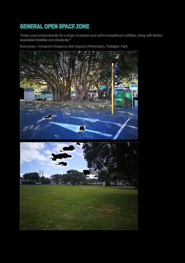
DISTRICT PLAN REVIEW SUBCOMMITTEE
Membership: Chair of Policy, Finance and Strategy
Committee
4 other councillors
Up to 2 representatives appointed by Iwi
NOTE:
Elected members should hold current certification under
the Making Good Decisions Training, Assessment and
Certification Programme for RMA Decision-Makers.
The Chair should in addition hold Chair certification.
Standing Orders 30 and 31 outlining provisions for
Tangata Whenua and Taura Here do not apply to this
Subcommittee, and Iwi appointees will have full voting
rights as members of the Subcommittee under Standing
Orders.
Meeting Cycle: As required
Quorum: 4
Reports to: Policy, Finance and Strategy Committee
PURPOSE:
To make recommendations to the Policy, Finance and Strategy Committee, for
recommendation to Council on the matters to be addressed in the full review of the
District Plan and development of a Proposed District Plan.
Provide:
Direction to Council officers on all matters relating to the drafting of content for the
review of the District Plan. This includes but is not limited to:
scoping and investigation of the issues
engagement on possible content
development of discussion documents and other draft documents for
consultation
development of a Draft District Plan for consultation
development of a Proposed District Plan for statutory consultation.
General:
Any other matters delegated to the Subcommittee by Council in accordance with
approved policies and bylaws.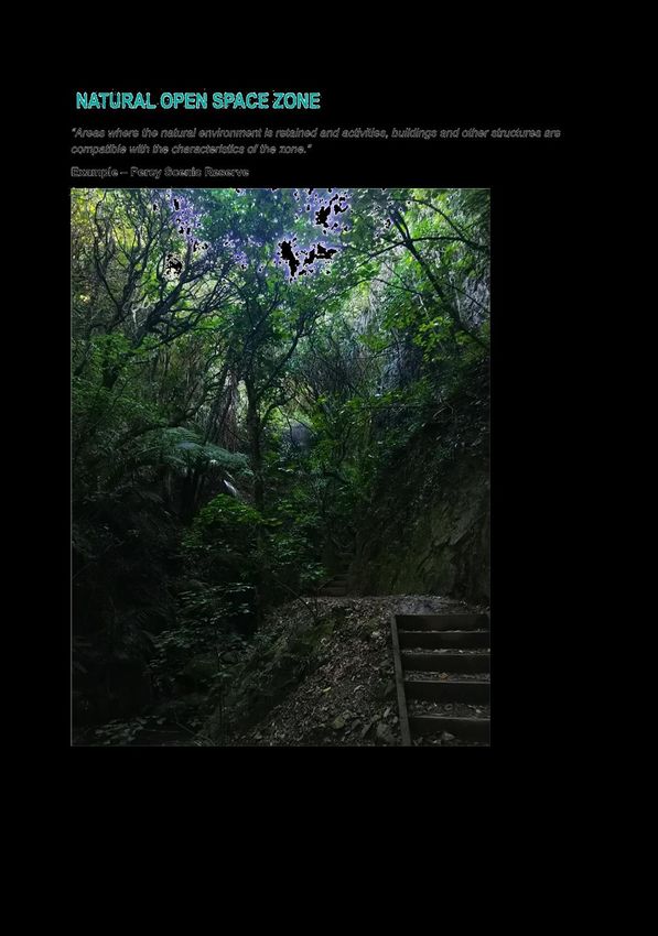
HUTT CITY COUNCIL

     KOMITI ITI AROTAKE MAHERE Ā-ROHE | DISTRICT PLAN REVIEW
                         SUBCOMMITTEE

 Meeting to be held in the Council Chambers, 2nd Floor, 30 Laings Road, Lower Hutt
                                        on
                    Tuesday 18 May 2021 commencing at 2.00pm.

                                  ORDER PAPER

                               PUBLIC BUSINESS

1.   OPENING FORMALITIES - KARAKIA (21/618)

     Ki a tau ki a tātou katoa
     Te atawhai o tō tatou
     Ariki o Ihu Karaiti
     Me te Aroha o te Atua
     Me te whiwhinga tahitanga
     Ki te wairua tapu
     Ake ake ake
     Amine

2.   APOLOGIES

3.   PUBLIC COMMENT

     Generally up to 30 minutes is set aside for public comment (three minutes per
     speaker on items appearing on the agenda). Speakers may be asked questions on
     the matters they raise.

4.   CONFLICT OF INTEREST DECLARATIONS

     Members are reminded of the need to be vigilant to stand aside from decision
     making when a conflict arises between their role as a member and any private or
     other external interest they might have.

5.   MINUTES (21/678)

     Meeting minutes District Plan Review Subcommittee, 18 February 2021             5

6.   URBAN FORM AND DEVELOPMENT - INTENSIFICATION AREAS
     (21/649)

     Report No. DPRS2021/2/107 by the Senior Environmental Policy Analyst         15

     CHAIR’S RECOMMENDATION:

      “That the recommendations contained in the report be endorsed.”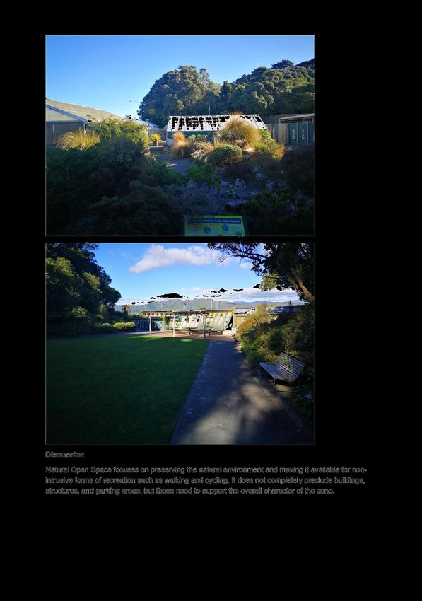
4                                  18 May 2021

7.    OPEN SPACE - ZONES, CLASSIFICATION OF SITES AND
      ENGAGEMENT (21/632)

      Report No. DPRS2021/2/108 by the Policy Planner                                22

      CHAIR’S RECOMMENDATION:

       “That the recommendations contained in the report be endorsed.”

8.    NOTABLE TREES (20/1175)

      Report No. DPRS2021/2/109 by the Policy Planner                                46

      CHAIR’S RECOMMENDATION:

       “That the recommendations contained in the report be discussed.”

9.    INFRASTRUCTURE (21/44)

      Report No. DPRS2021/2/110 by the Senior Environmental Policy Analyst           61

      CHAIR’S RECOMMENDATION:

       “That the recommendation contained in the report be endorsed.”

10.   TRANSPORT (21/50)

      Report No. DPRS2021/2/111 by the Senior Environmental Policy Analyst           74

      CHAIR’S RECOMMENDATION:

       “That the recommendation contained in the report be endorsed.”

11.   QUESTIONS

      With reference to section 32 of Standing Orders, before putting a question a
      member shall endeavour to obtain the information. Questions shall be concise
      and in writing and handed to the Chair prior to the commencement of the
      meeting.

Kate Glanville
SENIOR DEMOCRACY ADVISOR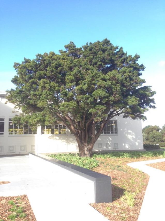
Attachment 1                    Meeting minutes District Plan Review Subcommittee, 18 February 2021

DEM15-4-13 - 21/678 - MINUTES                                                                Page 5
Attachment 1                    Meeting minutes District Plan Review Subcommittee, 18 February 2021

DEM15-4-13 - 21/678 - MINUTES                                                                Page 6
Attachment 1                    Meeting minutes District Plan Review Subcommittee, 18 February 2021

DEM15-4-13 - 21/678 - MINUTES                                                                Page 7
Attachment 1                    Meeting minutes District Plan Review Subcommittee, 18 February 2021

DEM15-4-13 - 21/678 - MINUTES                                                                Page 8
Attachment 1                    Meeting minutes District Plan Review Subcommittee, 18 February 2021

DEM15-4-13 - 21/678 - MINUTES                                                                Page 9
Attachment 1                    Meeting minutes District Plan Review Subcommittee, 18 February 2021

DEM15-4-13 - 21/678 - MINUTES                                                               Page 10
Attachment 1                    Meeting minutes District Plan Review Subcommittee, 18 February 2021

DEM15-4-13 - 21/678 - MINUTES                                                               Page 11
Attachment 1                    Meeting minutes District Plan Review Subcommittee, 18 February 2021

DEM15-4-13 - 21/678 - MINUTES                                                               Page 12
Attachment 1                    Meeting minutes District Plan Review Subcommittee, 18 February 2021

DEM15-4-13 - 21/678 - MINUTES                                                               Page 13
Attachment 1                    Meeting minutes District Plan Review Subcommittee, 18 February 2021

DEM15-4-13 - 21/678 - MINUTES                                                               Page 14
15 18 May 2021
District Plan Review
Subcommittee
23 April 2021
File: (21/649)
Report no: DPRS2021/2/107
Urban Form and Development - Intensification
Areas
Purpose of Report
1. Update the District Plan Review Subcommittee (the subcommittee) on the
progress of the intensification aspect of the Urban Form and Development
topic of the District Plan review.
2. Seek direction from the subcommittee to undertake public engagement on
the walkable catchments for providing intensification under the National
Policy Statement on Urban Development (NPS-UD). The purpose of this
engagement would be to seek community feedback on what is an
appropriate walkable catchment in the Lower Hutt context.
Recommendations
That the Subcommittee endorses the following approach for the next stage of the
intensification part of the Urban Form and Development topic:
(1) engage with the community and seek feedback on the walkable catchment
areas for enabling intensification under Policy 3 of the National Policy
Statement on Urban Development (NPS-UD) based on Option 3 – which
would include presenting maps of potential intensification areas based on
GIS network analysis of walkable catchments of:
the city centre;
railway stations on both the Hutt Valley and Melling lines; and
a potential Metropolitan centre in Petone;
(2) carry out further work to determine ‘accessibility’ and ‘relative demand’ in
Lower Hutt for the purposes of Policy 3(d) of the NPS-UD; and
(3) carry out further work to determine the “qualifying matters” for excluding
areas for intensification required under Policy 3 of the NPS-UD.
DEM15-4-13 - 21/649 - Urban Form and Development - Intensification Areas Page 1516 18 May 2021
Background
3. The purpose of the Urban Form and Development topic within the district
plan review is to:
a. provide high level direction and set the high level zoning framework for
the District Plan review.
b. provide objectives in the reviewed district plan to provide strategic
direction to the other chapters of the plan with regard to urban form and
development.
4. On 11 November 2020, the District Plan Subcommittee received an initial
briefing on the Urban Form and Development topic of the District Plan
Review.
5. The Subcommittee resolved the following:
a. directs officers to undertake the urban form and development
component of the District Plan Review through the following approach
(Option 1 outlined in the Options section of the report):
i. investigate and engage on how the intensification direction of the
NPS-UD can be given effect to through the District Plan review;
ii. investigate and engage on the extent to which further
intensification should be enabled in existing urban areas subject to
natural hazards.
iii. investigate and engage on how and when greenfield development
could be enabled in Upper Fitzherbert and Kelson.
iv. carry out spatial identification of the planned future urban form of
Hutt City, and develop provisions for the urban form and
development chapter.
b. directs officers to undertake a more expansive greenfield option for
developing the city with investigations of potential greenfield areas
outside of Upper Fitzherbert and Kelson in the Western Hills including
the Kilminster Block, Moores Valley and Coast Road (Option 2
outlined in the Options section of the report).
6. This report will focus on the intensification aspects of the subcommittee
resolution above. The points relating to greenfield development will be
addressed in a subsequent report.
7. Under policy 3(a, b, and c) of the NPS-UD Council is required to enable the
following intensification through the District Plan:
a. As much development as possible in the city centre.
b. At least six storeys within metropolitan centres and within at least a
walkable catchment of:
DEM15-4-13 - 21/649 - Urban Form and Development - Intensification Areas Page 1617 18 May 2021
i. the edge of the city centre.
ii. The edge of any metropolitan centres.
iii. Rapid transit stations.
8. These requirements to enable intensification under policy 3 are only able to
be modified to the extent necessary to accommodate the following
‘qualifying matters’:
Matters of national importance (specified in section 6 of the Act. This
includes historic heritage and natural hazards among others).
Other national policy statements.
The safe and efficient operation of nationally significant
infrastructure.
Open space provided for public use.
Designations and heritage orders.
Iwi participation legislation.
Provision of sufficient business land suitable for low density uses.
Any other matter that makes high density development inappropriate
in an area, if supported by an evaluation report (requirements for the
evaluation report are stated in the NPS-UD).
Discussion
9. Following the resolution of the District Plan Subcommittee on 11 November
2020, the District Plan team has produced conceptual and indicative maps of
walkable catchments of 400, 600, 800, and 1000 metres for each of the
following areas:
a. The Lower Hutt City Centre
b. The potential metropolitan centre of Petone
c. Rapid transit stations on the Hutt Valley and Melling rail lines.
10. These conceptual and indicative walkable catchment maps have not been
modified to accommodate the ‘qualifying matters’ for excluding areas from
intensification, set out in paragraph 8 above. Further work is required to
determine where the ‘qualifying matters’ may apply and how they should be
addressed through the district plan.
11. The purpose of this report is to seek direction from the subcommittee on
engaging with the community to seek feedback on the potential walkable
catchments for enabling intensification under policy 3 of the NPS-UD.
12. The centres of intensification identified under Plan Change 43 and now
zoned Suburban Mixed Use and Medium Density Residential were based in
part on walkable catchments around rail stations and centres. These centres
were generally based around an approximate distance of 400 metres,
however there was some variation. These intensification centres identified
under plan change 43 are unlikely to be sufficient to give effect to the NPS-
UD as they do not cover every railway station or the edge of the city centre.
Some of these centres may also not cover a sufficient area to be considered a
true ‘walkable catchment’.
DEM15-4-13 - 21/649 - Urban Form and Development - Intensification Areas Page 1718 18 May 2021
Options
13. The recommended approach for the next stage of the intensification part of
the Urban Form and Development topic is to:
a. Engage with the community and seek feedback on the walkable
catchment areas for enabling intensification under policy 3 of the NPS-
UD. Alternate options for this engagement are presented below. The
purpose of this engagement is to seek feedback on what is a walkable
catchment in the Lower Hutt context.
b. Carry out further work to determine ‘accessibility’ and ‘relative
demand’ in Lower Hutt for the purposes of policy 3(d) of the NPS-UD.
c. Carry out further work to determine the ’qualifying matters’ for
excluding areas from the intensification required under Policy 3 of the
NPS-UD especially for:
i. Natural hazards.
ii. Historic Heritage.
iii. Residential character.
iv. Maori culture and traditions, customary rights, any matter related
to Iwi participation legislation.
Option 1
14. Option 1: Engage with the community and seek feedback on the walkable
catchment areas for enabling intensification under policy 3 of the NPS-UD
based on distances and walking times described in metres and minutes
respectively from:
a. the city centre.
b. railway stations on both the Hutt Valley and Melling lines; and
c. a potential Metropolitan centre in Petone.
15. This option would not include maps of the specific areas potentially affected
by the policy but could use a conceptual map to illustrate how the zoning
may apply. This option could include distances and walking times ranging
from 400 meters or five minutes, to 1 km or 13 minutes.
16. This option would have the disadvantage of providing less information for
the community to engage with and would provide less certainty on which
specific areas may be affected.
Option 2
17. Engage with the community and seek feedback on the walkable catchment
areas for enabling intensification under policy 3 of the NPS-UD based on
maps of ‘crow flies’ radii, or circles, around:
DEM15-4-13 - 21/649 - Urban Form and Development - Intensification Areas Page 1819 18 May 2021
a. the city centre.
b. railway stations on both the Hutt Valley and Melling lines. and
c. a potential Metropolitan centre in Petone.
18. This option would include high level maps of the areas potentially affected
with the circles of various distances ranging from 400 metres to 1 km
overlaid.
19. This option would provide more information for the community to engage
with and a better means of understanding the potentially affected areas than
option 1. It would also enable a generalised discussion of the approximate
size of the area affected without a focus on specific individual sites.
20. However, these conceptual areas could overstate the areas affected as ‘crow
flies’ circles are generally larger than the area affected by the actual walking
distance (see the image in Figure 1 below which shows the difference
between these two). It would also provide less information for the public to
engage with than maps of the specific walking distances affected based on
GIS network analysis.
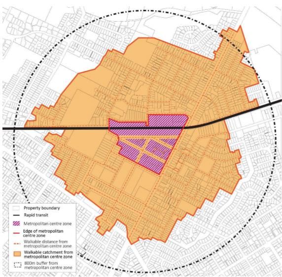
Figure 1: Example of difference between an 800-m walkable catchment from the edge of a
centre zone and an 800-m radius circle from a centre point.
DEM15-4-13 - 21/649 - Urban Form and Development - Intensification Areas Page 1920 18 May 2021
Option 3
21. Engage with the community and seek feedback on the walkable catchment
areas for enabling intensification under policy 3 of the NPS-UD based on GIS
network analysis to show maps of actual walking distances from:
a. the city centre.
b. railway stations on both the Hutt Valley and Melling lines; and
c. a potential Metropolitan centre in Petone.
22. This option would include maps of the areas potentially affected with the
specific mapped walking distances of 400, 600, 800, and 1 km shown at a
high level.
23. This option would provide a high level of information for the public to
engage with, and would provide a more realistic illustration of the size of the
areas within different walking distances.
24. A downside of this option is that it may focus discussion on specific
individual properties rather than on the broad areas – i.e. what is a walkable
catchment/distance in the Lower Hutt context. It also may imply a stronger
degree of certainty on the zoning implications than is the case with the
current information.
Climate Change Impact and Considerations
25. The matters addressed in this report have been considered in accordance
with the process set out in Council’s Climate Change Considerations Guide.
26. Intensification and a more compact urban form can reduce greenhouse gas
emissions by reducing the overall need for travel, increasing use of public
and active transport, reducing car use, and providing more energy efficient
housing types. By contrast a greater reliance on greenfield growth is likely
to increase overall emissions.
27. The effects of sea level rise also have implications for urban form and
development as this will increase the risk to existing urban areas in low lying
and coastal locations.
Engagement
28. Given the scale and significance of the intensification aspect of the Urban
Form and Development topic for the District Plan Review, a high level of
engagement will be required with key stakeholders, the community and iwi.
29. While the exact dates and forms of this engagement have not been finalised
it is anticipated that this engagement will involve:
a. Community open days, including open days held in different suburbs.
b. Community surveys through the Bang the Table online consultation
tool.
DEM15-4-13 - 21/649 - Urban Form and Development - Intensification Areas Page 2021 18 May 2021
c. Ongoing meetings with key stakeholders.
d. On request, meetings with specific property owners, groups of property
owners, and community or interest groups, and
e. Updates on the progress of the District Plan Review through Council’s
social media avenues and website, with additional media releases at key
stages of the Review.
30. The results of the community engagement will be reported to the
subcommittee for direction on selecting a walkable catchment.
Legal Considerations
31. Section 79(1)(c) of the Resource Management Act 1991 (RMA) requires local
authorities to commence a review of a provision of a district plan if the
provision has not been a subject of a review or change in the previous 10
years. Section 79(4) provides scope for local authorities to commence a full
review of a district plan. All sections and changes must be reviewed and
then the plan be publically notified (79(6)&(7)). Schedule 1 sets out
requirements for the preparation, change and review of plans.
32. The National Planning Standards set out standards to which every policy or
plan must comply. Chapter 7 requires Local Authorities to either amend
their plan or notify a proposed plan within 5 years of the planning standards
coming into effect (April 2024).
33. Section 8 of the RMA requires all person exercising functions/powers under
it to take into account the principles of the Treaty of Waitangi.
34. As a tier one territorial authority council is required to give effect to the
intensification provisions of the National Policy Statement on Urban
Development by notifying a proposed plan change no later than August
2022.
Financial Considerations
35. The high level urban form of the city can have implications for infrastructure
costs. Further work is required to determine the specifics of this.
36. Options 1, 2, and 3 would be undertaken within the current District Plan
Review budget.
Appendices
There are no appendices for this report.
Author: Joseph Jeffries
Senior Environmental Policy Analyst
Reviewed By: Hamish Wesney
Head of District Plan Policy
Approved By: Helen Oram
Director Environment and Sustainability
DEM15-4-13 - 21/649 - Urban Form and Development - Intensification Areas Page 2122 18 May 2021
District Plan Review
Subcommittee
20 April 2021
File: (21/632)
Report no: DPRS2021/2/108
Open Space - Zones, Classification of Sites
and Engagement
Purpose of Report
1. This report is to seek direction and confirmation from the subcommittee
about the approach for the open space chapter in preparing the draft district
plan with regards to:
the number and types of zones to be used for open space areas;
the policy around the assessment of sites into different open space
zones;
the special treatment of certain sites; and
an approach to engagement with mana whenua and private landowners
for sites currently within recreation activity areas that may be
considered for an open space zoning
Recommendations
That the Subcommittee:
(1) receives the information in the report;
(2) directs officers to undertake classification of open space sites in accordance
with the proposed Option 5, being into the [General] Open Space Zone, the
Natural Open Space Zone, the Sport and Active Recreation Zone, and
identifying those sites for which further engagement or special treatment is
recommended. This classification would be used to prepare the draft District
Plan; and
(3) directs officers to engage with stakeholders identified for existing recreation
activity area sites identified as having special issues. This engagement would
include mana whenua and landowners of sites that are not in public
ownership.
DEM15-4-13 - 21/632 - Open Space - Zones, Classification of Sites and Engagement Page 2223 18 May 2021
For the reasons that it makes the best use of Council’s existing information about
open space areas, it is consistent with existing council plans, policies, and
strategies, and it provides an approach that, when the notified district plan takes
legal effect, will give a greater practical level of certainty to the community about
activities in open space areas.
Background
Open space in Lower Hutt
2. Lower Hutt has numerous areas of open space within its borders that
provide opportunities for recreation, conservation, sports, community
activities, and to provide ecosystem services such as protecting our water
catchments. There are more than 22,000 hectares of land used as reserve,
conservation, parkland, or in privately owned recreation zoned sites.
3. The vast majority of this land is within the Belmont, East Harbour, and
Wainuiomata regional parks and the Remutaka Forest Park, which between
them account for slightly over half of Lower Hutt’s total land area. However,
the majority of individual open space locations are managed by Hutt City
Council and for most Lower Hutt residents their closest reserve will be a
Hutt City Council managed site.
4. Open space areas include beaches, playgrounds, gardens, sports fields,
stands of native bush, golf courses, and cemeteries, and are home to a wide
range of indoor facilities including museums, pools, and libraries.
5. Different land is managed for different purposes, including environmental
values, recreational opportunity, aesthetic values, cultural values, or for
flood control. Often land will be managed for multiple purposes.
What is covered by open space?
6. Open Space Zones are a topic whose exact scope will need to be decided by
Council. The term comes from the National Planning Standards, and is
similar to the Recreation Activity Areas in the operative district plan.
7. Open Space Zones could be used to manage some combination of:
Public parks and reserves, including cemeteries and regional parks
Public sector conservation land
Indoor community and recreational facilities on public land
Undeveloped public land with no specific purpose
Private sports and recreational club facilities
Land that is co-managed by local or central government and mana
whenua (eg the Parangārahu Lakes and the harbour islands)
DEM15-4-13 - 21/632 - Open Space - Zones, Classification of Sites and Engagement Page 2324 18 May 2021
8. “Open Space” in this context does not include private household open space
such as yards and gardens, landscaped areas around commercial premises,
and so on.
9. Public open space is primarily managed by the city council, regional council,
and government through management plans directing operations and
appropriate activities based on the purpose of each reserve. Open space land
is protected from development in the long term through status under the
Reserves Act or Conservation Act.
10. The RMA is a regulatory tool and controls activities, development, and land
use. Use of this regulatory tool should be complementary with those
management plans, not contradictory.
Operative district plan approach
11. The current District Plan approach mostly dates from when the current plan
became operative in 2003, although provisions relating to flood control for
the Hutt River were inserted in 2006, and numerous plan changes have
rezoned land out of the Recreation zones.
12. The current District Plan manages open space through a variety of zones, but
chiefly:
Passive Recreation
General Recreation
River Recreation
Special Recreation – [Pito-one] Foreshore
Special Recreation – Hutt Park Visitor Accommodation
Special Recreation – Seaview Marina
Rural (particularly for regional parks and DoC conservation land)
13. Each zone balances managing amenity, character, and conservation values
with controls on development, particularly the built environment. The scope
for activities is fairly broad and reflects that the types of activities are
generally controlled in management plans.
14. The objectives for each of the Recreation zones have common themes. These
can be summarised as:
Protecting the character of open space areas
Protecting natural and ecological values
Protecting public access to rivers and margins
Protecting the amenity of any adjoining residential areas
DEM15-4-13 - 21/632 - Open Space - Zones, Classification of Sites and Engagement Page 2425 18 May 2021
Protecting steeper and more heavily vegetated land from intensive
use and development, particularly to protect its visual amenity
Recognising the value of Regional Parks
Manage non-recreational activities to ensure they do not detract from
conservation and recreational values
Control the siting, size, and design of buildings, and limiting their
number, to protect the amenity of open space areas
Avoiding flood hazards and protecting flood control structures and
the flood carrying capacity of rivers
15. Provisions support these objectives by providing for recreational and
ancillary activities of a certain scale as permitted activities, and requiring
resource consent for larger scale activities.
16. The operative district plan also supports the adequate provision of open
space for the needs of the community by requiring financial and/or in-kind
contributions when land is subdivided and developed.
Policy direction
17. There is substantial existing city, regional, and national direction for the
management of recreation and conservation in open space areas.
18. City and national direction has not substantially changed in the lifetime of
the plan. Regional direction has changed to be more similar to existing city
direction for natural and conservation areas, by phasing out commercial
forestry and agriculture activities.
19. Hutt City Council has provided substantial direction for the management of
parks in the Reserves Strategic Direction, the Leisure and Wellbeing
Strategy, the Integrated Community Facilities Plan, and the various reserves
management plans, as well as various other more area- or subject-specific
plans such as Go Outside and Play and the Urban Forest Plan.
20. Our assessment is that the key resource management issues for this topic are:
Providing for recreational, educational, and leisure activities
Whether to provide for additional activities beyond those
Visual character and amenity, including effects on neighbours and
the streetscape
External effects (e.g. transport network, hazards, stormwater
management)
Protecting and enhancing biodiversity and other natural
environmental values
Ensuring tangata whenua activities are provided for
DEM15-4-13 - 21/632 - Open Space - Zones, Classification of Sites and Engagement Page 2526 18 May 2021
Discussion
Scope
21. Some matters are deeply connected to open space areas and are dealt with to
some degree in the various Recreation Activity Areas at present, but are the
subject of their own reports and are not dealt with significantly in this report,
being:
the Seaview Marina
public access to lakes, rivers, and the coast
activities that occur on the surface of water (currently handled within
the River Recreation zone)
indigenous biodiversity
natural character
coastal character
significant features and landscapes
temporary activities
natural hazards (flooding)
historic heritage
22. This separation of topics does not preclude these matters being treated
differently in open space areas to other areas in the District Plan.
23. This report does not cover the provision or funding of new open space areas,
for example in response to residential growth. This is handled within the
topics Urban Form and Development, Subdivision, and Financial
Contributions.
Regulatory approach
24. Open space zones, except for privately owned sites, will have their activities
managed through management plans and the decisions of the relevant level
of government.
25. However, the District Plan can also regulate activities, and this allows a more
“level playing field” between the assessment of activities on private land and
in public open space, and also gives a greater degree of long-term
predictability to the community about what type and scale of activities will
occur in open spaces.
26. The District Plan thus can take several broad approaches:
a) To provide relatively liberal provisions that apply in all open space
areas, and rely on methods outside the district plan to manage
environmental and social effects of activities in open space.
DEM15-4-13 - 21/632 - Open Space - Zones, Classification of Sites and Engagement Page 2627 18 May 2021
b) To provide relatively generic and discretionary provisions that apply in
all open space areas, and rely on case-by-case resource consent
assessments of the scale and nature of activities to be provided for in
different situations.
c) To provide more detailed rules about activities that are anticipated in
open space areas, which would vary by area.
27. These options are not absolute, but represent a trade-off between directions.
A point can be selected between these options.
28. The discretionary approach in (b) is likely to have high administrative costs
and provide little extra certainty to the community, and so we recommend
an approach that is somewhere along the spectrum from the permissive
approach in (a) to the detailed approach in (c).
29. The point along this spectrum and level of detail depends on the degree to
which Council desires to give certainty to the community.
Zones
30. If different spatial areas are to receive separate treatment, the primary way to
achieve this is through the use of zones.
31. A more fine-grained spatial differentiation can be made through the use of
overlays, precincts, and site-specific controls. These would allow the district
plan to modify the policy approach and provision in specific areas.
32. The purpose of having different spatial approaches would be to apply
different provisions in different areas; particularly different rules for
permitted activities, but also potentially different objectives and policies.
33. Accordingly, a greater level of detail about activities in the plan would
suggest using a larger number of different zones; a more generic and
permissive policy approach would suggest using fewer zones.
34. The Open Space zones provided by the National Planning Standards are:
Natural Open Space Zone Areas where the natural environment is
retained and activities, buildings and other
structures are compatible with the
characteristics of the zone.
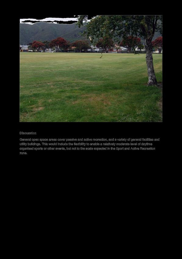
[General] Open Space Zone Areas used predominantly for a range of
passive and active recreational activities,
along with limited associated facilities and
structures.
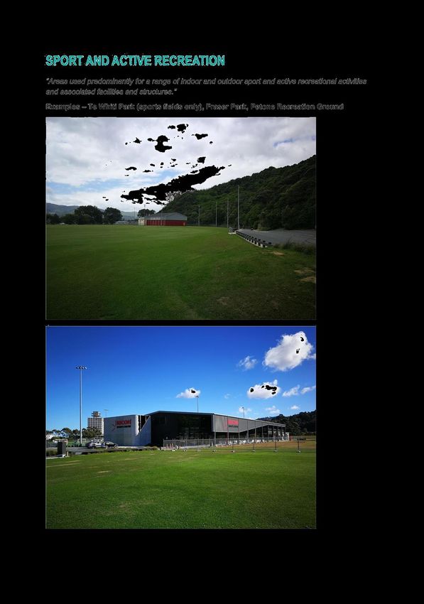
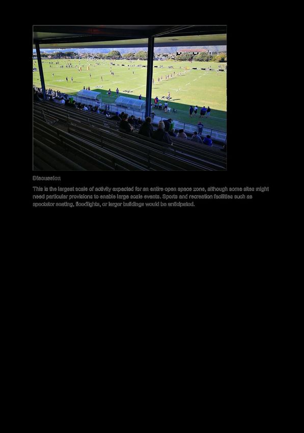
Sport and Active Areas used predominantly for a range of
Recreation Zone indoor and outdoor sport and active
recreational activities and associated
facilities and structures.
DEM15-4-13 - 21/632 - Open Space - Zones, Classification of Sites and Engagement Page 2728 18 May 2021
35. Some open space areas could also be managed using other zones, and
examples could include the Māori Purpose Zone, centres zones such as City
Centre or Neighbourhood Centre, or Mixed Use.
36. Some open space zones are also currently managed as rural zones in the
operative district plan. This approach may suit sites that mix recreation with
grazing, horticulture, and forestry. However, the only such areas in Lower
Hutt at present are the Belmont and East Harbour regional parks, where the
regional council is phasing out these rural activities.
Classification of sites
37. Officers have gathered available information on existing recreation-zoned
land and other public land, through desktop study and site visits. This
information includes but is not limited to the work done to date by the Parks
and Recreation unit on classifying council-owned open space into the parks
categories recommended by Recreation Aotearoa (formerly NZ Recreation
Association).
38. This analysis has found that the bulk of the open space land managed by
Hutt City Council, Wellington Regional Council, and the Department of
Conservation easily meets the description of one or a combination of the
zones in the National Planning Standards given above.
39. Where land is not currently zoned for recreation, has no official Reserves Act
or Conservation Act purpose, and is either not owned by Hutt City Council,
or held for a purpose other than providing parks and reserves, we
recommend that the land is not managed with an open space zoning, and
that the zoning for that land be considered in another more relevant topic.
40. Examples of classifications of sites into each of these three zones are given in
Appendix 1.
Sites with specific issues
41. Some other sites currently zoned Recreation present issues that mean while
they may be suitable to manage as open space; they do not naturally fit into
one of the National Planning Standards open space zones. These other sites
present issues where further engagement or assessment is needed to decide
on the approach.
42. The major categories of such sites identified are:
Community facilities where the number and scale of buildings and
activities is much more extensive than for parks in general.
Major facilities that periodically attract large numbers of visitors or that
host large-scale temporary activities.
Public land that is home to tangata whenua-operated activities.
Sites that are public land but are associated with nearby Māori land.
Sites co-managed by mana whenua
DEM15-4-13 - 21/632 - Open Space - Zones, Classification of Sites and Engagement Page 2829 18 May 2021
Privately-owned land
A variety of other one-off situations
43. The National Planning Standards also provide for the use of special-purpose
zones, precincts, overlays, and site-specific controls. These can be used to
vary or augment the provisions of a zone as they apply in particular places.
44. Approaches could include using a zone other than open space, applying site-
specific provisions, a precinct, or an overlay, or it could turn out that the site
can adequately be managed using a standard open space zone. There may
also be other options suggested by stakeholders during engagement.
45. Decisions on the approach for these sites can be made at a later date after
engagement and when the impact of provisions on particular sites is known.
46. These sites are listed in Appendix 2.
Options
47. Officers have sufficient information to begin classifying the majority of open
space sites into proposed zones to be included in the draft district plan, once
the Subcommittee confirms an approach for management of open space in
the plan.
48. All suggested approaches involve the use of at least one Open Space zone, as
it is considered that the unique resource management issues and range of
activities in public open space are impractical to manage in a zone designed
for any other purpose.
49. The treatment of sites with specific issues (as identified above) will be
presented to the Subcommittee to be decided once officers have engaged
with affected parties.
Option 1: Single General Open Space Zone with permissive approach, relying
primarily on methods other than the district plan
50. This approach would apply the [General] Open Space Zone to all open space
sites, and continue with similar objectives and policies to those common
across the existing District Plan and other council plans, policies, and
strategies. However, the rules would treat the broadest range of open space
activities as permitted, with activity standards that would allow most
activities in most locations to proceed without resource consent.
51. All activities in public open space would be managed for their
environmental effects in large part through methods other than the district
plan.
DEM15-4-13 - 21/632 - Open Space - Zones, Classification of Sites and Engagement Page 2930 18 May 2021
Assessment of Option 1
Advantages Simplifies District Plan review
Reduces administrative workload for Hutt City Council
and the regional council
Disadvantages Would require a separate approach for managing effects
on privately owned sites
Less certainty for the community about which activities
are expected on open space sites
Would still require operators of activity on open space to
undertake some level of in-house assessment of the
effects of proposals
Conclusion Not recommended
Option 2: Single General Open Space Zone with discretionary approach, relying
primarily on resource consents
52. This approach would apply the [General] Open Space Zone to all open space
sites, and continue with similar objectives and policies to those common
across the existing District Plan and other council plans, policies, and
strategies. However, rules would permit a relatively limited level of
development and resource consents would be required for all but the most
limited of projects.
53. All activities would be assessed for their environmental effects primarily
through resource consents, with similar processes applied regardless of
location.
54. This is not recommended due to the administrative workload and extra cost
it would create, the lack of certainty it would give to the community, and the
risk that when consents for large-scale activities in open space are routine,
the areas that the community may particularly value will receive no
additional scrutiny.
DEM15-4-13 - 21/632 - Open Space - Zones, Classification of Sites and Engagement Page 3031 18 May 2021
Assessment of Option 2
Advantages Simplifies District Plan review
In principle, provides a more thorough assessment of
individual projects
Disadvantages Would be disproportionately burdensome for privately
owned sites, compared to likely approach in other zones
High compliance and administrative costs associated
with a high number of resource consents
Less certainty for the community about which activities
are expected on open space sites, as the one-size-fits-all
approach means any site could be considered for any
project
Substantial increase in workload and cost for Hutt City
Council and regional council undertaking operations
Conclusion Not recommended
Multi-zone approaches
55. These approaches would continue with similar objectives and policies to
those common across the existing District Plan and other council plans,
policies, and strategies. However, multiple zones would be used and sites
would be allocated between them. Each zone would have different emphasis
in policies and objectives.
56. In general, the zones would anticipate types of uses and a level of activity
consistent with the descriptions of those zones in the National Planning
Standards (see paragraph 34 above).
57. The different zone provisions could anticipate a higher or lower level of land
development, a larger or narrower range of activities, and greater or lesser
protection for natural landscapes and native vegetation (including
regenerating vegetation).
58. Within these options there are choices for the extent to which precincts,
overlays, and site-specific controls are used for sites with particular issues.
For the most part, these choices will need to be made at a site-by-site level
and should not be made until engagement has occurred.
59. However, at a strategic level, the Subcommittee can decide whether the
multi-zone approach would use:
Option 3: the [General] Open Space Zone and Natural Open Space Zone,
or
DEM15-4-13 - 21/632 - Open Space - Zones, Classification of Sites and Engagement Page 3132 18 May 2021
Option 4: the [General] Open Space Zone and Sport and Active
Recreation Zone, or
Option 5 (recommended): all three zones: [General] Open Space,
Natural Open Space, and Sport and Active Recreation.
60. Managing Open Space primarily through multiple zones reduces the
administrative burden of requiring consents in those open space areas where
large-scale development and activities are anticipated, while providing more
scrutiny in areas identified as needing additional protection.
61. The use of a separate Natural Open Space Zone would allow a greater level
of discretion and scrutiny for those sites with particular landscape, character,
or other values suggesting development should be more carefully managed.
It would also signal and protect sites that do not currently consist of
significant areas of indigenous biodiversity but where Council intends to
enhance or regenerate the biodiversity values.
62. However, with or without a Natural Open Space Zone, existing significant
landscapes, areas of natural and coastal character, and areas of significant
indigenous biodiversity that occur on public land can be identified in
overlays that would apply to any open space zone.
63. The use of a separate Sport and Active Recreation Zone would signal those
sites where Council intends to allow or promote larger or more intensively
used recreational and community facilities, and would provide more
certainty to the community about where such facilities are anticipated.
64. However, as an alternative, sites where larger-scale community facilities are
anticipated could be developed through resource consents.
DEM15-4-13 - 21/632 - Open Space - Zones, Classification of Sites and Engagement Page 3233 18 May 2021
Assessment of features in common for Options 3-5
Advantages Makes best use of existing information held by Council
Greater level of consistency with Council’s existing
Reserves Strategy, which anticipates different
management of activities on different sites
Provides greater certainty to the community about the
activities anticipated in different open space areas
Allows the resource consenting function of council to be
targeted to assessing those projects that carry the largest
risk of unanticipated adverse effects
A multi-zone approach also provides the maximum
flexibility if the detail of provisions and further
engagement suggests a change in approach, as a multi-
zone approach can be more easily converted to a single
zone than vice-versa
Disadvantages Requires assessment of each site (although much of this
work has already been done)
Requires a slightly greater level of direct stakeholder
engagement
Results in a somewhat more complex district plan with
more zones
As the use of sites changes in future, may require plan
changes to rezone sites from one open space zone to
another, which would not be required with a single-zone
approach
Assessment of using Natural Open Space Zone (Options 3 and 5)
Advantages Allows Council to identify and protect areas of
landscape value, character value, or natural values, that
may not reach the level of significance that would justify
protections as a significant landscape or significant area
of indigenous biodiversity
Allows Council to identify areas where it seeks to
regenerate or enhance native vegetation that current
does not exist or is not significant
Recognises the amenity significance of recreation in a
natural setting
DEM15-4-13 - 21/632 - Open Space - Zones, Classification of Sites and Engagement Page 3334 18 May 2021
Disadvantages More restrictions on the use of land, which may inhibit
future uses of the land if they are inconsistent with the
objectives for a Natural Open Space Zone
Requires assessment of sites
Assessment of using Sport and Active Recreation Zone (Options 4 and 5)
Advantages Allows Council to identify areas where it wants to
provide for sport and recreation activities with a higher
intensity of use, and provide a more streamlined
consenting system and policy support for larger-scale
recreation facilities
Provides a greater degree of certainty to the community
that these locations are where the largest-scale recreation
facilities will be located
Recognises the city-wide and region-wide significance of
Lower Hutt’s sports and recreation facilities
Disadvantages Existence of such a zone may be misinterpreted in
consent processes to imply that sports and active
recreation facilities are to be discouraged outside the
zone
Requires assessment of sites
Conclusion
The recommended approach is Option 5.
Climate Change Impact and Considerations
65. The matters addressed in this report have been considered in accordance
with the process set out in Council’s Climate Change Considerations Guide.
66. Management of the city’s open space networks through the District Plan has
the potential to affect the city’s net emissions both positively and negatively.
For example rules on vegetation can help ensure carbon sinks are provided
for and maintained.
67. Open space areas are also a key part of managing natural hazards,
particularly flooding, by acting as flood storage and natural buffer zones.
Our changing climate and increased risks from these hazards reinforces this
importance.
68. Climate change mitigation and adaptation will be considered as a key part of
the review.
69. The impact of specific district plan provisions on climate change cannot be
considered until those district plan provisions are drafted and assessed.
DEM15-4-13 - 21/632 - Open Space - Zones, Classification of Sites and Engagement Page 3435 18 May 2021
Consultation
70. A significant number of sites present specific issues that will require further
stakeholder engagement before presenting options to the Subcommittee.
Particularly relevant stakeholders are mana whenua, some operators of
activities on public land under leases and concessions, and private
landowners of currently recreation-zoned sites.
71. All options include the existing engagement planned for the wider district
plan review, as well as engagement through the draft district plan and
formal submissions process.
Legal Considerations
72. Council is required under s79(1)(c) of the Resource Management Act 1991 to
commence a review of any provisions of the district plan that have not been
reviewed or changed within the last 10 years. This time period has already
elapsed for parts of the Recreation Activity Area chapters.
73. Part 2, Part 5, and Schedule 1 of the RMA set out the requirements for
Council to consider when reviewing and changing its plan. This includes
being in accordance with the national planning standards and national
policy statements, giving effect to the regional policy statement, and having
regard to management plans and strategies prepared under other legislation
(e.g. the Reserves Act).
74. Section 85 of the RMA, and Environment Court case law (e.g. Golf (2012) Ltd
v Thames-Coromandel District Council [2019] NZEnvC 112) provide that
privately-owned land can be zoned for open space purposes under some
circumstances, provided that the land must still be capable of “reasonable
use”. Open space zoning cannot be used to prevent all development on
privately-owned land against the owners or occupiers’ wishes.
Financial Considerations
75. All of the discussed options can be carried out within the existing budget for
the District Plan review.
76. We are unable to provide specific estimates, but in general, the greater the
degree of discretion and the more restrictive the rules that apply to open
space, the greater the cost to Council to undertake its activities in future
under the plan. This is due to the greater number of resource consent
applications required, the greater complexity of those applications, and the
higher the costs involved in complying with the consent conditions.
Appendices
No. Title Page
1 Examples of classification of open space sites into the zones of the 37
National Planning Standards
2 Sites needing further engagement or special treatment 43
DEM15-4-13 - 21/632 - Open Space - Zones, Classification of Sites and Engagement Page 3536 18 May 2021 Author: Stephen Davis Policy Planner Reviewed By: Hamish Wesney Head of District Plan Policy Approved By: Helen Oram Director Environment and Sustainability DEM15-4-13 - 21/632 - Open Space - Zones, Classification of Sites and Engagement Page 36
Attachment 1                        Examples of classification of open space sites into the zones of the National
                                                                                             Planning Standards

DEM15-4-13 - 21/632 - Open Space - Zones, Classification of Sites and Engagement                         Page 37
Attachment 1 Examples of classification of open space sites into the zones of the National
Planning Standards
DEM15-4-13 - 21/632 - Open Space - Zones, Classification of Sites and Engagement Page 38Attachment 1 Examples of classification of open space sites into the zones of the National
Planning Standards
DEM15-4-13 - 21/632 - Open Space - Zones, Classification of Sites and Engagement Page 39Attachment 1 Examples of classification of open space sites into the zones of the National
Planning Standards
DEM15-4-13 - 21/632 - Open Space - Zones, Classification of Sites and Engagement Page 40Attachment 1 Examples of classification of open space sites into the zones of the National
Planning Standards
DEM15-4-13 - 21/632 - Open Space - Zones, Classification of Sites and Engagement Page 41Attachment 1 Examples of classification of open space sites into the zones of the National
Planning Standards
DEM15-4-13 - 21/632 - Open Space - Zones, Classification of Sites and Engagement Page 42Attachment 2 Sites needing further engagement or special treatment
Name Current Assessment
Zoning
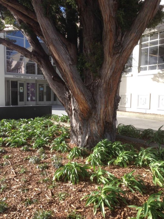
Hikoikoi Reserve - Lions Recreation Does not fit easily into National Planning Standards
& McEwan Parks categories
Williams Park (incl. Days Recreation Does not fit easily into National Planning Standards
Bay Playcentre) categories
Moera Reserve Recreation Does not fit easily into National Planning Standards
Community Centre categories
Woburn Park and Ride Recreation Does not fit easily into National Planning Standards
categories
Hutt Recreation Ground Recreation Does not fit easily into National Planning Standards
categories
Huia Pool Recreation Does not fit easily into National Planning Standards
categories
Odlin Gallery Recreation Does not fit easily into National Planning Standards
categories
Waterloo Playcentre Recreation Does not fit easily into National Planning Standards
categories
Waterloo Reserve Recreation Does not fit easily into National Planning Standards
categories
Civic/Riddiford Gardens, Recreation Does not fit easily into National Planning Standards
War Memorial Library, categories
Administration Building,
etc.
Court House Lawn / Recreation Does not fit easily into National Planning Standards
Crooked Elm categories
Dowse Square Recreation Does not fit easily into National Planning Standards
categories
Dowse Museum Recreation Does not fit easily into National Planning Standards
categories
Epuni Community Centre Recreation Does not fit easily into National Planning Standards
categories
Mitchell Park (part) Recreation Does not fit easily into National Planning Standards
categories
15 Seddon Street Recreation Does not fit easily into National Planning Standards
categories
Walter Mildenhall Park Recreation Does not fit easily into National Planning Standards
Regional Bowls Centre categories
Walter Mildenhall Park Recreation Does not fit easily into National Planning Standards
categories
Naenae Olympic Indoor Recreation Does not fit easily into National Planning Standards
Pool categories
Taita Community Hub Recreation Does not fit easily into National Planning Standards
categories
Taine and Tocker Street Recreation Does not fit easily into National Planning Standards
Reserve categories
Taita Community Trust Residential Does not fit easily into National Planning Standards
and Pomare categories
Multicultural Resource
Centre
DEM15-4-13 - 21/632 - Open Space - Zones, Classification of Sites and Engagement Page 43Attachment 2 Sites needing further engagement or special treatment
Between 198 and 200 Recreation Does not fit easily into National Planning Standards
Eastern Hutt Road categories
Stokes Valley Indoor Pool Recreation Does not fit easily into National Planning Standards
categories
Silverstream Landfill Recreation Does not fit easily into National Planning Standards
categories
Avalon Park Recreation Does not fit easily into National Planning Standards
categories
Fraser Park Recreation Does not fit easily into National Planning Standards
categories
Roy Nelson Recreation Does not fit easily into National Planning Standards
Neighbourhood Park categories
Petone Recreation Various Does not fit easily into National Planning Standards
Ground categories
Petone Station Car Park Recreation Does not fit easily into National Planning Standards
categories
Wainuiomata Clean Fill Recreation Does not fit easily into National Planning Standards
(small part), next to categories
wastewater station
Hutt Valley District Court Recreation Does not fit easily into National Planning Standards
categories
16 Knights Road Recreation Does not fit easily into National Planning Standards
categories
WEL cabinet near Recreation Does not fit easily into National Planning Standards
Naenae Park categories
Hutt Valley Badminton Recreation Does not fit easily into National Planning Standards
Association categories
Pito-one Foreshore Recreation Does not fit easily into National Planning Standards
categories & engagement with Mana Whenua needed
Hutt Park Recreation Does not fit easily into National Planning Standards
categories, engagement with occupiers needed, special
provisions for campground needed
Mākaro Island Rural Engagement with Mana Whenua needed
Matiu (Somes) Island Rural Engagement with Mana Whenua needed
Mokopuna Island Rural Engagement with Mana Whenua needed
Hikoikoi Reserve (Nga Recreation Engagement with Mana Whenua needed
Tekau centre)
Honiana Te Puni Reserve Recreation Engagement with Mana Whenua needed
Wainuiomata Marae Recreation Engagement with Mana Whenua needed
(part)
East Harbour Regional Recreation Engagement with Mana Whenua needed
Park (area around
Parangarahu Lakes)
Owhiti Urupa (part used Recreation Engagement with Mana Whenua needed
as Car Park)
Te Whiti Park (Waiwhetu Recreation Engagement with Mana Whenua needed
Medical Centre, etc.)
Te Maori Cultural Centre Various Engagement with Mana Whenua needed
Waiwhetu Marae (part) Various Engagement with Mana Whenua needed
DEM15-4-13 - 21/632 - Open Space - Zones, Classification of Sites and Engagement Page 44Attachment 2 Sites needing further engagement or special treatment
Samoan Baptist Church Recreation Engagement with occupiers needed
of Wainuiomata and the
Girl Guides Association
of NZ - WOA Branch
(next to fire station)
Wainuiomata fire station Recreation Engagement with occupiers needed
including Neville Twort
Park
Muritai Tennis Club Recreation Engagement with occupiers needed
105 Wainuiomata Road Recreation Engagement with owner needed
22B Woodvale Grove Recreation Engagement with owner needed
8 Cambridge Tce Recreation Engagement with owner needed
Hutt Bowling Club Recreation Engagement with owner needed
12 Shaftesbury Grove Recreation Engagement with owner needed
30 Shaftesbury Grove Recreation Engagement with owner needed
17 Rakau Grove Recreation Engagement with owner needed
15 Reynolds Bach Drive Recreation Engagement with owner needed
(etc)
Boulcotts Farm Heritage Recreation Engagement with owner needed
Golf Club
Avalon Tennis Club Recreation Engagement with owner needed
Korokoro Cemetery Recreation Engagement with owner needed
127 Western Hutt Road Recreation Engagement with owner needed
Belmont Regional Park Recreation Further engagement with GWRC needed
(pasture areas outside
Kilmister Block)
Keith George Memorial Recreation Further engagement with UHCC needed
Park
Seaview Marina Recreation Handled in separate topic
Kilmister Block Rural Handled in separate topic
Gravel extraction site at Recreation Will require special treatment of gravel extraction
Hutt River mouth
Note: this does not include sites included in the assessment that:
Are not currently zoned Recreation, are not legal reserve, and are not currently used for
recreation or conservation
Minor boundary adjustments to avoid split zonings
DEM15-4-13 - 21/632 - Open Space - Zones, Classification of Sites and Engagement Page 45You can also read