Lexton Township Framework Plan 2018 - Pyrenees Shire Council
←
→
Page content transcription
If your browser does not render page correctly, please read the page content below
Lexton Township Framework Plan 2018
Contents:

Introductory analysis
     A story of place                                 3
     Urban form                                       4
     Heritage                                         5

Strategic context
     Why do we need this plan?                        6
     What’s driving change?                           7
     The findings in a nutshell                       7
     Current policies and strategic directions        8
     Opportunities and Threats                        9

Seven Principles for managing change
     Bringing Out the History                        11
     Located at the Crossroads                       12
     A Hybrid Landscape                              13
     More generous design /
     A caring, progressive Town                      14
     Designing With Water                            15
     More Constructive Planning Policies             16
     Finding the Way Between Two Bookends            18

Land Demand Assessment                               19
     Place-based approach and Ecological Framework   19
     Pyrenees Futures Ecological System              20
     Existing Conditions Plan                        21
     Framework Plan                                  22
     Place Activation                                23

Implementation plan                                  24
     Urban Design and Place Activation               24
     Further Planning Work                           25
     Advocacy                                        26

Urban Design Guidelines                              27

Appendix                                             29
     Pyrenees Futures Lexton - Your Views            29

 2    Copyright © Pyrenees Shire Council. 2018.           Document Layout by Tin Box Design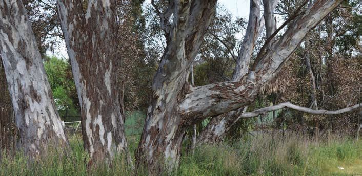
A Story of Place
Pyrenees Shire Council recognises the Djadja Wurrung         The town’s distinctive topography is formed by the
people as the traditional owners of the land on which        eastern edge of the Pyrenees Ranges (known to the
Lexton stands today.                                         Djadja Wurrung as Pilliwin-panyul), from which several
                                                             creeks flow. The town’s grid was set on the Burnbank
When Major Thomas Mitchell travelled through the area        Creek (named after the first pastoral run), which meanders
now known as Lexton on his trek from Portland through        north-south through the town, running north towards the
to Sydney, he was stunned at what he saw. From here,         Loddon River and flowing into the Bet Bet Creek. The
the phrase “a valley of the finest description” has come     creek, fringed by red gums, remains a defining feature of
to permeate the area’s history. Two years after Mitchell     the town today.
penned these words, European settlement began with
pastoral runs taken up from 1838 (Oulton, 1995).             Although some diggings were established near Lexton,
                                                             the town had a minimal reliance on mining and was
It is likely that the mosaic of grasslands and eucalypts     instead in its early days a predominantly agricultural and
that Mitchell encountered had been formed through the        forestry-related settlement. The town’s timber cutting
careful land management of the Djadja Wurrung people.        history is reflected in the town centre through the use of
The area around Lexton was originally inhabited by the       rough-hewn timber fencing along Burnbank Creek and in
Galgal Balug clan of the Djadja Wurrung tribe. The clan’s    Toll Bar Park.
name roughly translates as “the people with tame dogs”.
                                                             By 1852, the town had become an administrative and
Lexton’s creeklines and topography are attributed in         legal centre boasting a post office, courthouse and police
traditional knowledge to the movement of Mindi, the          presence with a school established by 1855. By 1900
Rainbow Serpent, whose tail carved out the waterways         churches and a public hall were established. Orchards
that remain central to Djadja Wurrung cultural identity      were established, and in 1903 the Australian Handbook
including the creeks around Lexton. According to the         described the red gum grown in the area as being of
Djadja Wurrung Country Plan:

 “    Our rivers are the veins of Country, and
      provide food and medicine, and places to
      camp, hunt, fish, swim and hold ceremonies.
      They are places that are central to our creation
      stories, and many of our cultural heritage sites
      are associated with waterways – burial sites,
      birthing sites and middens.

 “    Our waterways are places that we connect with
      our ancestors and pass traditional knowledge
      on to our children and grandchildren…These
      are significant parts of our Country that link us
      to our past and will provide for our future”
      (Dja Dja Wurrung Aboriginal Clans Corporation, 2014)

The introduction of grazing runs and further settlement      “excellent quality”. Oats, wheat, hay, peas, beans and
brought about the dispossession of Aboriginal people         potatoes were grown. Lexton’s administrative role made
through violence, dislocation and the spread of diseases     it the centre of the Lexton Shire, and the former Shire Hall
like smallpox.                                               building is today used for community events.

Lexton’s location at a confluence of creeks and early
tracks has seen the town being described as the
“crossroads of early Victoria”. Today, this theme remains
with a meeting of highways at the town’s main junction,
and the junction of the Burbank Creek with an un-named
tributary some 500m north of the general store.

                                                                                                                       3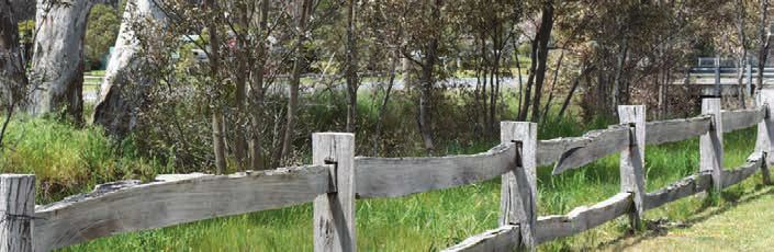
Urban form
Lexton’s form is dominated by a grid laid out on a south-   Housing is mostly concentrated around this centre,
west to north-east axis on the banks of the Burnbank        particularly to the east, west and north. Residential
Creek. While the grid appears on the surface to provide     streets are mostly narrow carriageways, with generous
for a well-organised and compact town, the tension          verges up to 30m and an informal mix of exotic,
between the grid layout and the creeklines is a major       deciduous and eucalyptus street tree plantings. Streets
issue affecting the town’s development today.               further to the south (such as Waldy Street and Robertson
                                                            Street) are fringed with eucalypts that create an
Two arms of the Burnbank Creek run through the town.        evocative bushland setting, somewhat reflective of more
The Burnbank Creek has its source south-east of             rural areas of the Pyrenees. Houses in these areas tend
Lexton’s town centre and flows north through the town.      to be nestled behind tree growth on allotments above
The main creekline roughly follows the alignment of the     2000m2.
Sunraysia Highway through the town centre, while the
secondary arm meanders through the western edge of          Vegetation plays an important role in defining Lexton’s
Lexton. The two arms join some 500m north-west of the       urban form. The Burnbank Creek’s banks are dominated
Co-op Store. Much of the original town centre is formed     by red gums, which form a distinctive part of Lexton’s
around the junction between the Sunraysia Highway and       imagery. The Sunraysia Highway includes plantings of
Waubra-Lexton Road. The town centre’s eastern side is       deciduous exotic trees south of the town centre, as
defined via a service road separated from the Sunraysia     well as a distinctive planting of pine trees on the town’s
Highway by a concrete verge.                                northern approach. This “hybrid landscape” gives the
                                                            town a rich and distinctive variety of seasonal shades.
Despite this, many of the original shops on the east of
the Sunraysia Highway are now in residential use with       South of the town centre, fewer residential blocks are
a mechanic’s garage continuing to operate; while the        built on with a number used for grazing activity. Some
Co-op Store and the Pyrenees Hotel form the social          blocks (particularly those within 100m of the banks of
crux of the town centre. Further community assets are       the Burnbank Creek) are encumbered by their inability to
dispersed around the town, with the Lexton Recreation       treat wastewater on site under Environmental Protection
Reserve (including a football oval and golf course)         Authority regulations. This may have contributed to the
south-west of the town grid and the Lexton Community        hollowed out sections of the town’s grid south of the
Hall 1.5km west of the Co-op Store.                         General Store, along the creekfronts.

                                                            The town’s southern approach is largely characterized
                                                            by eucalypt dry-woodland style vegetation that is typical
 Wayfinding between these                                   of the northern side of Toll Bar Hill. These plantings give
 community assets has been                                  way to a more formal row of exotics after the stone town
                                                            entrance sign.
 identified as an important issue.

 4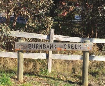
Heritage
Despite the town’s rich history as one of Victoria’s
earliest settlements, Lexton was not studied as a distinct
heritage precinct in Pyrenees Shire’s previous heritage
study (2001). There are currently no heritage overlays
that apply to any places in Lexton and this plan will
recommend that Heritage Studies be done to explore the
significance of historic buildings in the town including
churches, the Pyrenees Hotel and the creekline around
the Burnbank Creek.
The Pyrenees Shire Heritage Precinct Study (2001)
does identify a list of buildings of potential heritage
significance in the town centre, and this plan
recommends that the heritage significance of these
places is reviewed. Of particular interest are the
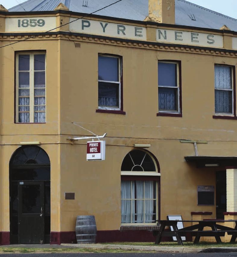
Pyrenees Hotel (built in 1852) and the former Shire Hall
building.
Aside from reviewing heritage protections, there are
opportunities to better tell the stories of the town’s
heritage, which will be further explored in subsequent
Two large homesteads south of Lexton, Ercildoune sections of this plan.
and Mount Mitchell, are both included on the Victorian
Heritage Register and subject to Heritage Overlay
policies in the Pyrenees Planning Scheme.
5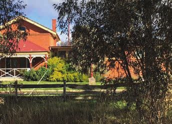
Why do we need this plan?
Lexton, and the broader Pyrenees Shire, are becoming increasingly attractive places for people to live. They are also
changing places, influenced by environmental, social, economic and geographical factors.

The Lexton Township Framework Plan is aimed at generating a partnership between community, Council and
government agencies to own this change. It seeks to do this by engaging community aspirations and building from
place-based research to achieve:

     Reform to policies in the Pyrenees Planning Scheme that guide the town’s
     future development over the medium-long term.
     Short-to-medium term improvements in the town’s design, put in place
     through an implementation plan included on page 24.

This plan takes a place-based approach, which recognises and seeks to foster Lexton’s unique character and
attributes into the future. These elements are valuable in further forming a proud, distinctive community.

This framework plan is vital in ensuring that growth and change does not overwhelm the town’s character or its fabric,
but rather contributes to it.

 The plan’s structure is based around:                         Each of the plan’s actions are formed
     Seven themes identified through community                 around the seven themes identified
     engagement in Lexton;                                     through community engagement. These
     An ecological framework that Council is using             actions are grouped around:
     for settlement planning as part of the Pyrenees              Planning policy reforms (also known as “statutory
     Futures project. This framework recognises the               actions”) that will lead to reform of the Pyrenees
     multi-dimensional nature of our townships and                Planning Scheme, inform future land use and
     seeks to respond to five overlapping factors that            development decisions.
     influence a town’s dynamics: resilience, character,
                                                                  Urban design interventions that relate to how
     prosperity, wellbeing and connectedness.
                                                                  Lexton looks, feels and works as a town.
     The framework provides a means for analysis
     of existing conditions and identify areas that
     planning needs to address.

 6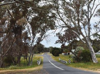
What’s driving change?
Changing function of the town: Lexton was                     Population and demographic fluctuation: After
originally established with a key role in regional            a fall in population from the 1990s, Lexton’s population
governance. With the gradual centralization of                has rebounded above 230 people, which is around the
institutions and the merger of the Lexton Shire into the      level of the mid-1950s. Demographics of the town have
Pyrenees Shire Council in 1995, the town’s role has           also changed significantly: in the 2016 Census, Lexton
changed to be primarily that of a service centre for          had a portion of its population aged 5-14 significantly
surrounding agricultural areas. Community engagement          above the Victorian state and Pyrenees Shire average.
conducted as part of Pyrenees Futures revealed strong         This suggests that young families are moving to the
links between the town and its farming hinterland,            town, and has meant that local sporting clubs have
while there is also evidence of people moving to the          fielded more junior teams. Community engagement
town because of its attractive natural landscape. This        conducted in the development of this plan suggested
change from administrative centre to agricultural and         that new generations of families with ties to the district
lifestyle centre further amplifies the need for planning      were choosing to live in town to start families of their
to carefully consider growth opportunities that respect       own. At the same time, around 27 percent of the town’s
key landscape characteristics, such as viewlines to the       residents are aged 60-74, suggesting the importance of
Pyrenees and native bushland.                                 maintaining services, social opportunities and walkable
                                                              areas around the town centre.
Climate change: Modelling suggests that Lexton
can expect more extreme weather as a result of                Moving town centre: With the opening of the Co-op
climate change. Dryer and warmer conditions may be            Store on the western side of Burnbank Creek, the main
exacerbated given Lexton’s location north of the Great        focus of activity in the town centre has moved. It is vital
Dividing Range.                                               that planning and urban design support the retention
                                                              of the Co-op Store as a vital service in town, and that
Climate modeling completed for the broader Pyrenees           public realm improvements focus on making the town
Shire completed as part of the Future Landscapes              centre around the creek more attractive.
(Cunningham et al 2016) project suggests that:

   Mean annual temperatures will rise between 2°C (low
   emissions scenario) and 3.2°C (higher emissions              The findings in a nutshell…(7 themes)
   scenario) by 2070. The increases in temperature              This plan is centred on seven themes identified
   will be higher in summer than winter, reflecting the         through community engagement in Lexton.
   potential for more extreme weather conditions.               A summary of the engagement findings is provided in
   Many ecosystems (particularly grasslands) around             the Appendix of this report. The themes are:
   Lexton will experience difficulty in adapting to climate
   change. Riparian forests in the area however should          1. Bringing Out the History
   remain adaptable.                                            2. Located at the Crossroads
   Rainfall is likely to increase slightly across the           3. A Hybrid Landscape
   Pyrenees by 2030, but may decline substantially by
   2070 under a high emissions scenario. Rainfall in            4. More generous design /
   spring and winter will likely decline, with summer and          A caring, progressive town
   autumn falls less certain.                                   5. Designing With Water
   Most pasture species and wheat will remain viable            6. More Constructive Planning Policies
   around Lexton.
                                                                7. Finding the Way Between Two Bookends

                                                                The plan is set out with actions distilled from each
                                                                theme. These actions include core planning policy
                                                                and strategy measures, urban design interventions
                                                                and matters that can be addressed through Council
                                                                advocacy or working with other agencies. These
                                                                actions then flow through to an implementation
                                                                plan, and new township planning policy that will
                                                                be incorporated into Council’s Municipal Strategic
                                                                Statement to guide development and manage change.

                                                                These themes are explored in further detail from
                                                                pages 11 to 18.

                                                                                                                        7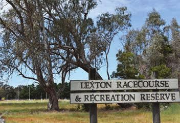
Current policies and strategic directions
 A key plank in analysis and planning is an assessment of Lexton’s strengths, opportunities, and threats facing
 the town. This assessment has been based on the Pyrenees Futures Ecological Framework, and informed by
 research and community engagement.

 Research activities conducted as part of                     This literature review has further augmented engagement
 the Lexton Framework plan include:                           and research conducted as part of this plan’s
                                                              development.
      Audits of current planning policies.
      Reviews of policies, plans, written histories and       Current spatial planning policy identifies Lexton as centre
      archaeological documents.                               for an agricultural district specializing in fine merino wool
      Data including ABS Census information and               production. It identifies the constraints created by the
      reviews of building permit data.                        Burnbank Creek’s flow through town, including potential
                                                              flood risks, and discrepancies between development
      Observational activity mapping in the town centre       patterns and historic land zoning.
      to better understand pedestrian movement.

                                                              Current policies also:
 Community engagement activity
 conducted as part of the plan includes:                         Seek to constrain development on hilly land outside
                                                                 the township
      A township walk with local residents.
                                                                 Focus any residential development either side of the
      A community drop-in session.                               Sunraysia Highway and to the north of the township;
      Community surveys.                                         while restructuring other land holdings.
      Workshops with agencies and Council staff.
                                                              Current policies also seek to introduce planning overlays
                                                              to manage flood risks from the Burnbank Creek. This
                                                              work has not yet been done, although it is recognised
                                                              that current EPA regulations around wastewater
The next section includes a brief policy and literature       treatment do constrain residential development in areas
review. A summary of community engagement findings            around the Burnbank Creek, due to the requirement for
was released in April 2018 and can be found in the            effluent treatment areas to be more than 100m away
Appendix of this report.                                      from the creekline.

                                                              Pyrenees Shire Council’s Council Plan for 2017-2021
Documents have informed this plan’s                           commits Council to reviewing its planning framework
development, including:                                       through Pyrenees Futures, as a settlement planning
                                                              approach that is forward-looking and works with
     Current policies that influence local and regional
                                                              communities including Lexton.
     land use planning in the Pyrenees Planning Scheme
     (including the Municipal Strategic Statement, Central    The Lexton Community Action Plan 2010-2015 (CAP)
     Highlands Regional Growth Plan and an audit of           has been produced through a partnership of community
     current zoning and overlays). It should be noted         groups. It mostly focuses on social infrastructure
     that these policies are under review via the Lexton      projects that are outside the scope of this document, but
     Township Framework Plan.                                 also includes relevant directions that have informed this
                                                              framework plan including:
Existing documents that are guiding this
project, including:                                              A strong position that growth is required if the town is
                                                                 to “survive and thrive into the future”, with a focus on
     Pyrenees Shire Council Plan 2017-2021.                      welcoming new community members.
     The Lexton Community Action Plan.                           Guidelines or policy directions for building houses,
     Pyrenees Shire Council Heritage Precinct Study (2001).      developing businesses and retaining productive farms.
     Dhelkunya Dja (The Dja Dja Wurrung Caring for               Upgrading the Recreation Reserve as a key focal
     Country Plan).                                              point for community activity.
                                                                 A desire for improved telecommunications services.

                                                              The Lexton Township Framework Plan is a vital plank
                                                              in delivering reformed planning policies, identifying
                                                              and facilitating opportunities for growth and to better
 8                                                            integrating the Recreation Reserve into the town’s fabric
                                                              through wayfinding initiatives.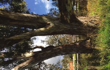
Opportunities and Threats
             STRENGTH/OPPORTUNITY                            THREAT

Place         Rich history and strong, evocative              Lack of heritage policies protecting
character     landscapes.                                     significant built form or landscapes.
              Major Mitchell Trail and the identity as the    Lack of interpretive signage/information
              “crossroads of early Victoria”.                 regarding significant heritage assets or
              Red gums along creekline and hybrid             local stories.
              landscape theme.                                Maintenance of sections of public/
              Foothills of Pyrenees Ranges to the west of     private space.
              town.                                           Hardness of design in the town centre
              Opportunity to work with Dja Dja Wurrung        (particularly concrete verges along
              around landscape stories.                       service road).
              Opportunity to strengthen links between
              town and creekfront/surrounding bushland.
              Opportunity for placemaking projects to
              create a more attractive, defined town
              centre.

Resilience    Strong levels of community volunteerism.        Natural disaster risk (bushfires and
              Strong links with surrounding farming           flooding), potentially exacerbated by
              districts.                                      climate change, landscape character
              Opportunities for small-scale food              and location of town centre along creek
              production (around farming areas in             frontage.
              town grid).                                     Dependence on Ballarat for a range of
              Community groups (including sporting            services.
              clubs).                                         Lack of public transport connections to
              Presence of Co-op Store and potential for       surrounding towns.
              this to function as more of a social hub.       Lack of sewerage infrastructure.
                                                              Need to protect Burnbank Creek’s role
                                                              as part of a broad water catchment.

Economic      Potential to create activity hub around Co-     Lack of commercial/industrial activity in
prosperity    op Store and Pyrenees Hotel.                    the town centre.
              Location at crossroads of major arterial        Highly restrictive planning policies
              roads (Sunraysia Highway and Beaufort-          on fringes of original grid (application
              Talbot Roads).                                  of Farming Zone and Restructure
              Rainbow Serpent Festival – and potential        Overlay) may be restricting desirable
              for spin-off arts activities/exhibitions.       opportunities for growth.
              Opportunities for home-based businesses         Constrained blocks along Burnbank
              or portable traders to provide services.        Creek, particularly south of town centre.
              Opportunities to reform planning policies
              to open up opportunities for housing
              growth away from creekline and away
              from bushfire-prone areas.

                                                                                                          9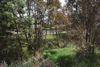
Opportunities and Threats continued

                 STRENGTH/OPPORTUNITY                        THREAT

 Wellbeing        Access to walking trails in nearby          Need for further public transport
                  bushland and surrounding town great for     connections to nearby centres.
                  exercise and links to nature.               Dependence on nearby centres for
                  Constant connection to nature.              health, retail and education.
                                                              Limited footpath network.
                                                              Safety implications – traffic along
                                                              Sunraysia Highway.

 Connectedness    Opportunity to plant themed avenues of      Lack of wayfinding (such as clear
                  vegetation between major destinations       directional signs) makes Recreation
                  (for example, town centre and Recreation    Reserve in particular difficult to access.
                  Reserve).                                   Lack of coherence in street tree
                  Opportunity to work with North Central      plantings makes town layout less
                  CMA and Dja Dja Wurrung to develop          legible.
                  an open space corridor along Burnbank       Creekline/topography makes accessing
                  Creek including walking trails and          Recreation Reserve from town centre
                  interpretive signage.                       challenging.
                  Opportuntiies for growth within walking     No defined sense of entrance to
                  distance (400m – five minutes walk) of      town around Robertson Street, which
                  town centre.                                presents the key gateway to the Lexton
                                                              Recreation Reserve.
                                                              Dispersed public infrastructure –
                                                              including Lexton Hall and Lexton
                                                              Recreation Reserve – located away from
                                                              town centre.

10
Seven Principles for Managing Change
Bringing Out the History
Background Strategies and Actions
Lexton is one of Victoria’s earliest settlements. The area
is rich with many thousands of years of stories and while Planning Policy Reform
there is local pride in this history, many rightly feel its Commission an expert Heritage Study into the
stories are not told in the urban landscape. Lexton town centre, with particular reference to
This history, combined with the beautiful natural the shire hall and Pyrenees Hotel.
landscape, provides rich cues to cultivate an even Act on the study’s recommendations by
stronger sense of place in Lexton, and potentially attract amending the Pyrenees Planning Scheme or
important cultural, social and economic development referring recommendations to the Victorian
opportunities. Heritage Council, as appropriate.
Despite this rich history, there are currently no places
subject to heritage protection under the Pyrenees
Planning Scheme. Urban Design and Place Activation
Draw on the town’s historic links with the timber
industry in the design of public infrastructure,
including street furniture and fencing.
Develop a material palette for urban design that
includes raw timber effects, corten steel, red
brick (notable in the Shire Hall) and cream render
(notable in the Pyrenees Hotel).
Work with community groups around a program
of interpretive signage and/or exhibitions at the
Lexton Co-op Store to better tell stories of the
town’s heritage.
Work with the Dja Dja Wurrung in line with its
Dhelkunya Dja Country Plan to tell the stories of
key waterways, such as the Burnbank Creek.
11Located at the Crossroads
Background Strategies and Actions
Referred to as the crossroads of early Victoria, the
theme of junctions repeats in Lexton’s urban form. The Planning Policy Reform
crossroads around the Sunraysia Highway and Beaufort- Focus residential growth within walking distance
Lexton/Lexton-Talbot Roads follows from intersection (400m-800m radius) and to the north-east of
points of historical tracks that ran into Victoria’s inland. the main junction to ensure better access to the
The form of these tracks is suggested in the meandering town centre, on blocks that can accommodate
approach that these roads take into Lexton, and the wastewater treatment.
town centre today is largely centred around this junction.
Today, this strategic location and Lexton’s proximity
to larger settlements provides important opportunities Urban Design and Place Activation
for the town’s future. Lexton is also near Toll Bar Hill,
which marks a point of landscape transition between the Beautify and soften the appearance of built form
south and north of the Great Dividing Range. As the first around the main junction, particularly the concrete
town north of the divide, Lexton’s location presents the service road barrier along the Sunraysia Highway.
opportunity to present a unique sense of place, based Work with the community to further explore
on the local landscape. the history of the crossroads tracks and
investigate opportunities to revive and form new
interpretative trails.
Include a sculpture/public art point immediately
north of the service road opening on the south-
bound side of the Sunraysia Highway to create
a sense of arrival in the town centre. This could
be based on a crossroads theme or linked to the
Burnbank Creek.
Develop Williamson Street from its junction with
Lexton-Ararat Road, Skene Street, as a civic
spine with tree planting and seating.
12A Hybrid Landscape
Background Strategies and Actions
Lexton’s mix of exotic vegetation in the town grid and
native eucalypts along the creekline creates an evocative Urban Design and Place Activation
landscape that changes with seasons and brings in Foster the hybrid landscape theme by extending
many different shades of green. It is key to the town’s exotic street tree plantings to integrate with
sense of place and needs to be fostered. existing eucalypts along the Sunraysia Highway,
Typical forms in the town include river red gums along from Russell Street south to Robertson Street.
Burnbank Creek’s fringes, incomplete rows of oak Introduce further canopy trees to provide shade in
trees and similar species along the Sunraysia Highway, Toll Bar Park.
dispersed deciduous plantings along built up residential Introduce native strappy vegetation in the median
streets around the town centre, and eucalypts fringing strip between Sunraysia Highway and the service
streets in the south of the town where there is a mix of road to replace the hard and weedy concrete
farming land and dispersed dwellings. edge.
Deciduous canopy trees in the town centre are important Fill in gaps in tree planting along Skene Street
in providing shelter in summer, while letting in light in (particularly north of Williamson Street) and along
winter. Native vegetation is vital in providing a distinctive Anderson Street between Skene Street and the
sense of place, as well as habitat for wildlife. Exotic Sunraysia Highway to improve residential amenity
species are particularly notable in their role in creating a while preserving sight lines at intersections.
sense of arrival along the Sunraysia Highway, although As land north of Skene Street is rezoned, ensure
these plantings do not extend to the southern town tree planting continues further north to help
boundary. Replicating this hybrid landscape theme of form Skene Street as a secondary spine and
interspersed deciduous trees among eucalypts further encourage movement south toward Lexton-Talbot
south to Robertson Street is an important opportunity to Road.
create a stronger sense of arrival in the town.
Building on these themes through street tree planting
and landscaping is important in strengthening this sense
of place.
13More generous design /
A caring, progressive town
Background Strategies and Actions
Lexton residents are proud of being part of a caring
community of people that pitch in. This characteristic Urban design and place activation
can be further fostered through small-scale changes Work with the Co-op Store Committee to design
to urban design that provide more enjoyable places for and develop an outdoor seating area between
people to gather. the Co-op Store and the Burnbank Creek to act
Despite its attractive creekfront setting, the town as a social anchor in the town centre. Retain the
centre (apart from Toll Bar Park) currently provides little existing tree as a focal point providing shade and
incentive for people to stop, linger and socialise. In many shelter.
areas, the design is hard and dominated by concrete and Provide socially-configured seating near the
asphalt with little public seating or amenities. intersection of Williamson Street and Lexton-
Ararat Road.
There are significant opportunities to beautify the area
Provide a walking path from the Lexton
and provide well-designed public amenities like seating,
Community Hall, to the General Store and Toll Bar
set up in configurations that encourage socializing.
Park.
Public art that reflects the rich landscape and regional
history can also create a sense of play and fun around Preserve the dappled viewline from the Sunraysia
the town centre. Parts of this work may be done in Highway west towards the Co-op store through
collaboration with the local community through a the creekfront eucalypts.
placemaking approach. Earmark a site at the northern end of the junction
between the Lexton-Ararat and Williamson Roads
These two themes have been merged in this plan, for a potential sculpture/public art installation
because a more generous design can further contribute and seating pod to create a sense of arrival in the
to Lexton’s sociable, caring community feel. town centre from the west.
Provide a drinking fountain at the Toll Bar Park
with an extra tap to fill dog bowls.
14Designing With Water
Background Strategies and Actions
Lexton’s development has historically been constrained
by the conflict between the urban grid and the alignment Planning Policy Reform
of the Burnbank Creek that runs through the town Focus residential development opportunities more
centre. Community engagement has identified a history than 100m from any creeklines and within walking
of localized flooding immediately around the Burnbank distance (around 400m-800m) from the town
Creek and its tributary and a current lack of sewerage centre to avoid conflicts with the Burnbank Creek.
means some residential-zoned blocks around the main
creek line are constrained due to an inability to treat Conduct further reviews of preliminary flood
wastewater onsite in accordance with EPA regulations. modelling to determine whether further planning
policies are necessary to restrict development
The town’s relationship to Burnbank Creek also brings along creeklines.
about the potential for flooding. Community engagement Consider revising Restructure Overlay application
conducted as part of Pyrenees Futures and further along creeklines only in the event that blocks are
preliminary flood modelling commissioned by Council sewered.
suggest that flood waters can rise and fall quickly. There Acknowledge that some blocks currently
is evidence of waters rising toward the steps of the Co- zoned for residential or township use that are
Op Store, and nearby houses. immediately next to creeklines are constrained, in
Preliminary flood modelling conducted by Utilis lieu of consolidation or sewer provision.
Consultants suggests residential properties around
Williamson Street, to downstream of Anderson Street,
are at particular flood risk. Urban design and place activation
From a planning policy point of view, future development Consider water or creek-related themes in public
opportunities need to be identified away from the art installations near the Burnbank Creek.
creeklines to minimise flood risk. Council is also Ensure street furniture near the creekline in
conducting an investigation of flood modeling along the the town centre is designed to be adaptive to
Burnbank Creek to determine if any further planning inundation risk.
policies are required to mitigate flood risk. Work with the Dja Dja Wurrung on potential
opportunities to share stories and traditional
knowledge relating to Lexton’s waterways in the
landscape.
Review the potential for wetland plantings and
revegetation on public land, particularly north of
Lexton’s town centre and around the Recreation
Reserve.
Work with Central Highlands Water to engage the
community and develop a feasibility study around
potential introduction of sewerage to Lexton.
15More Constructive Planning Policies
Background
Community Action Plans and engagement conducted as Current planning policies include a Restructure Overlay
part of Pyrenees Futures have identified a demand for applied around the fringes to contain the township’s
planning policies that are more constructive in attracting growth and to encourage consolidation of blocks, many
more residents to Lexton. There are multiple spatial and of which are in different ownership.
policy factors that contribute to this dynamic, including:
The Restructure Overlay currently prevents growth in
The confluence of creeklines and the town some areas where housing is desirable, including the
centre grid, which along with historical patterns north-eastern and south-eastern edges of town where
of subdivision has led to constrained lots being no flooding, environmental, vegetation or bushfire
produced. These lots are constrained in that they may constraints to housing are present.
be too small or located too close to the Burnbank
Creek in order to treat wastewater onsite in line with Many survey respondents expressed frustration with
current EPA restrictions. the constraints that a lack of sewerage has imposed
on potential development. Reticulated sewerage
Bushfire-prone and steep land, particularly to the
provision may provide a range of benefits including
east of the township. These areas are particularly
freeing up constrained residential-zoned land, reducing
constrained and should not be developed.
environmental risks to the Burnbank Creek that may be
Pyrenees Futures has identified the potential for growth posed by septic systems.
in areas that are close to the town centre and a suitable
However, the introduction of sewerage infrastructure is
distance from creeklines. In the short term, a further
likely to come at a significant cost. Given the potential
growth corridor can be considered to the north-east of
costs and implications of introducing sewerage
Lexton, away from fire-prone land and on the fringe of
infrastructure, this strategy can only recommend a
the current township.
feasibility study be produced before further community
engagement on the issue is conducted. This can be
considered in the medium term (3-10 years).
16Strategies and Actions
Planning policy reform Further actions
Focus residential development opportunities more Work with Central Highlands Water to commission
than 100m from any creeklines and within walking a feasibility study of potential sewering of residential
distance (around 400m-800m) from the town blocks in Lexton, particularly surrounding the
centre to avoid conflicts with the Burnbank Creek. Burnbank Creek.
Encourage consolidation of residential-zoned Following the feasibility study, conduct a
blocks in the town centre to sizes that can community engagement process that provides
accommodate on-site wastewater treatment. options around service levels and potential
Recognise that historical subdivision and zoning funding models.
patterns have led to a proliferation of constrained
residential land.
Direct short-term growth via rezoning to the
north-east of the intersection between Skene and
Nicholls Streets. Remove the Restructure Overlay
from land between Skene Street and West Street
and rezone to Low Density Residential Zone with a
0.4ha minimum size as a primary growth corridor.
Before rezoning, develop an outline development
plan for the site that will lead to a Development
Plan Overlay being applied to the area. This will
include directions to:
Require the north-east growth area to include
a road network that reflects the area’s
topography and provides for a connected grid
generally reflective of the rest of the township.
grid road pattern, reflective of the rest of the
township and connecting to the existing road
network, without cul-de-sacs.
Include staging, beginning with areas closer to
the township.
Ensure building envelopes are applied on lots
with an emphasis on preserving side setbacks
and open viewlines to the east and west.
Require street tree planting along Skene Street
to encourage traffic to move to the south
towards the town centre.
Rezone land along Hall Street, east of Gladstone
Street and west of Lexton-Ararat Road, to Rural
Living Zone in recognition of the area’s high-level
of amenity and substantially rural-residential
patterns of use.
Following the release of land in the north-eastern
growth area, rezone land north of the Lexton
Ararat Road (shown on the framework map)
to Rural Living Zone with a 2ha subdivision
minimum, in recognition of the area’s high amenity
and lack of environmental constraints. This should
only be done following an outline development
plan for the area.
In the event that sewer is provided, review
Restructure Overlay controls in south of town.
17Finding the Way Between Two Bookends
Background Strategies and Actions
While Lexton’s grid should in theory make for a
compact settlement form, the natural landscape and Planning Policy Reform
historic development patterns have led to a dispersal of Ensure the whole Lexton Recreation Reserve
community infrastructure throughout the town. The town and Golf Course are rezoned to Public Park and
centre and Recreation Reserve in particular form north- Recreation Zone to protect the function of the area.
south “bookends” at opposite ends of the town and
are both significant foci of activity. The Lexton Hall, to
the north-west of the town centre, is another important
location. Urban design and place activation
Form a trail of sporting-themed signage or public
Signage and wayfinding between these locations
art (football, netball, cricket or golf) running from
is limited and confusing. Visitors in particular have
the Co-op Store to the Recreation Reserve.
understandably experienced difficulty getting to the
Lexton Recreation Reserve along the Sunraysia Highway Sporting-themed signage or public art (football,
or from the town centre; which is a particular problem if netball or golf) at the intersection of Sunraysia
you have a match to get to. Highway and Robertson Street as a potential key
access point to the reserve.
Public art, customized signage schemes, wayfinding Extend hybrid native-exotic tree plantings further
information and urban design all have important roles to south along Sunraysia Highway to Robertson
play in helping locals and visitors alike get around. Street to create a stronger sense of arrival before
this junction.
Work with the community to develop design cues
at other key intersections leading to the reserve,
and bring the theme of the recreation reserve into
the township.
18Land Demand Assessment
To understand potential growth pressures on Lexton, an VIF report projects a demand for 36 dwellings across
assessment of indicative demand for residential land and that region between 2016 and 2026 (or 3.6 per year).
dwelling construction has been done. This information is Given the low level of predicted demand, it should be
important in guiding potential future land releases. noted that changes to planning policies on the fringes of
Avoca and the ongoing westward growth of Ballarat may
The assessment has used current building permit affect these projections.
data, current population information and regional
population projections conducted through the Victorian On the basis of recent building permit data, Pyrenees
Government’s Victoria In Future (2016) report. In Lexton, Futures projects that Lexton will provide for around
the assessment has focused on housing because one-third of this demand. An annual demand for 1-2 new
of the limited amount of commercial and industrial dwellings can be expected in Lexton over the next five
development that has occurred in recent years. years.
This can be accommodated primarily through infill
Current demand in Lexton is primarily driven development in the short-term, where blocks can be
consolidated to achieve the sizes required for waste
by a mix of tree-change movers and families
water treatment. Due to constraints on some township
from surrounding farming districts. blocks relating to wastewater treatment, and the need to
strengthen the town core, a staged incremental release
Over 2014-2016, three building permits for houses were of land in the north-east growth area over the next
issued for houses in Lexton, all during 2016. Many of 5-10 years is desirable. This will ensure more housing
these dwellings were located around or north of the town development is directed to areas within walking distance
centre, in areas away from creeklines. of the town centre.
VIF does not provide a full population or dwelling growth It should be noted that the low projections in VIF reports
projection for Lexton. It does provide figures covering may change due to regional factors, so land releases
a broader region within Pyrenees Shire. This region should be reviewed every five years.
takes also takes in Avoca, Amphitheatre, Moonambel,
Landsborough and districts in between.
Place-based approach and Ecological Framework
The Lexton Township Framework Plan is one of nine This framework sets the strategic environment in which
settlement plans Council is producing as part of the the Pyrenees Futures strategy works and the broad
Pyrenees Futures project. Each settlement plan is areas that the Lexton Township Framework Plan will
based on an ecological framework that recognises five consider.
interlinked factors that sit at the heart of a place.
Page 20 Pyrenees Futures Ecological System
Page 21 Existing Conditions Plan
Page 22 Framework Plan
Page 23 Place Activation
1920
Pyrenees Futures Ecological System
DRIVERS AND INPUTS OUTPUTS
Civic communal hearts (town centres)
Spatial issues Guiding investment
Place-based framework plans
For example... Addressing disadvantage Sharing the harvest (equality) Planning framework
Place/township activation Fostering more diverse agricultural base Place activation plans
Township growth Local jobs (focused on town centres)
Supporting physical activity
Equality and disadvantage Land supply
(including walking)
Shared prosperity Planning for tourism
Food security
New industries
Community cohesion Towns as healthy settings Settings-based Health Model
Climate change Reducing social isolation Appreciative inquiry For example...
Demographic change (ageing, Asset-based growth Integration with Healthy and Well
population growth, health issues). Pyrenees.
Urban form/design Place governance, including
Wellbeing Prosperity Pyrenees character
partnerships with community and
Understanding
External issues and projects natural/built assets
agencies
For example... Place governance
State-significant projects Town centres
Regional Growth Plans Heritage Other supported projects
State/Federal Policy environment For example...
Place
Revised/new flood mapping,
Place heritage studies, should funding
Knowledge and information Resilience Character become available.
For example...
Community engagement
Social learning (between Council
Climate change
and communities)
(mitigation and adaptation) Connectedness
Partnerships Disaster mitigation Identity Planning scheme reform
Data Biodiversity Belonging
For example...
Reducing fossil fuel dependence Township settlement policies,
leading to future rezoning
Access (transport, culture) or overlays
Governance and policy
Social isolation vs. close knit communities
For example... Partnerships
New Council Plan IMPLEMENTATION
Planning scheme reform
Integrating planning with broader
policy framework (Healthy and
Well Pyrenees, Pyrenees Growth Council objectives Ongoing engagement Primary deliverables
Strategy, etc.) Community objectives Adaptive management Secondary projectsFINAL DRAFT
Pyrenees Futures:
Lexton
Existing Conditions
Plan
Legend
Town boundary
Historic boundary
Town entry
Crossroads
Node
Escaping views to hills
Arterial road
Local street
Rural lane
Core township area
Township
Public open space
Existing heavily
vegetated area
Farming zone
Rural conservation zone
Bushfire management
overlay
Waterbody
100m buffer to
LEXTON H6 watercourse
BUSHLAND
RESERVE Contour
LEXTON RECREATION
RESERVE & GOLF
COURSE
Project Ref: 2018.394
Dwg No.: UDD-001
Scale 1:10000@A3
Date: 20.07.18
Revision: A
2122
FINAL DRAFT
Pyrenees Futures:
Lexton
Framework Plan
Legend
Town boundary
Historic boundary
Town entry
Reinforce crossroads
Node
Escaping views to hills
Arterial road
Local street
Rural lane
Potential new road
Existing pedestrian
bridge
Core township area
Stage 1 residential
development (LDRZ min
1ha)
Stage 2 residential
development
Potential rural living
zone (min 2ha) .
*
Rural living zone to
reflect current
development pattern
Remove restructure
overlay
LEXTON H6 Public open space
BUSHLAND
RESERVE Bushfire management
overlay
Waterbody
100m buffer to
watercourse
*Bushfire and flooding impacts
subject to further investigation
LEXTON RECREATION
RESERVE & GOLF
COURSE
Project Ref: 2018.394
Dwg No.: UDD-001
Scale 1:10000@A3
Date: 17.08.18
Revision: BFINAL DRAFT
Pyrenees Futures:
Lexton
Place Activation
Legend
Town boundary
Pyrenees Futures: Historic boundary
Lexton Local park
Seating node
Place Activation Wayfinding / public art
Reinforce main street
Legend Complete planting gaps
TOLL BAR Soften edge to service
PARK Town boundary road with low rise
plantings
Arterial road
Historic boundary
Local street
Local park Rural lane
Existing pedestrian
bridge
Seating node
Potential pedestrian
connection
Improve legibility and
Wayfinding / public art provide visual
consistency
Potential green link
Reinforce main street
Public open space
Complete planting gaps Waterbody
LEXTON H6 Soften edge to service
TOLL BAR BUSHLAND
PARK RESERVE
road with low rise
plantings
Arterial road
Local street
Rural lane
LEXTON RECREATION Existing pedestrian
RESERVE & GOLF
COURSE bridge
Project Ref: 2018.394 Potential pedestrian
Dwg No.: UDD-001 connection
Scale 1:10000@A3
Date: 20.07.18 Improve legibility and
Revision: A provide visual
23
consistency
Potential green link
Public open spaceImplementation plan Urban Design and Place Activation ACTION PRIORITY TIMELINE RESOURCES COMMENTS Develop an outdoor seating area High 1-2 years
Urban Design and Place Activation continued
 ACTION                                   PRIORITY        TIMELINE    RESOURCES           COMMENTS

 Develop a sculpture point at the         Medium          1-5 years   $20,000             Grant and
 northern entrance to the Sunraysia                                                       partnership
 Highway service road                                                                     opportunities

 Fill in tree planting gaps along         Medium          1-5 years
Advocacy
 ACTION                                  PRIORITY      TIMELINE    RESOURCES        COMMENTS

 Work with the Dja Dja Wurrung in        High          1-3 years   TBC              Potential to seek
 line with its Dhelkunya Dja Country                                                grant opportunities
 Plan to tell the stories of key
 waterways, such as the Burnbank
 Creek, through public art and
 landscape works.

 Work with Central Highlands Water       Medium        1-3 years   TBC (depending   This feasibility
 towards a feasibility study regarding                             on funding       study should
 costs and options for sewer                                       and grant        form the basis
 infrastructure in Lexton                                          opportunities)   of a community
                                                                                    engagement
                                                                                    project that
                                                                                    provides scenarios
                                                                                    and funding
                                                                                    models for
                                                                                    potential sewer
                                                                                    provision

 Following the sewerage feasibility      Following                 TBC (depending
 study, conduct a community              feasibility               on funding and
 engagement process that puts            study                     partnership
 forward costs and options                                         opportunities)

 Work with the North Central CMA to      Ongoing
 maintain river red gums in Burnbank
 Creek as required

26
Urban Design Guidelines
These guidelines focus on the design of public realm in and around Lexton’s town centre. They provide guidance for
colour palettes, guidance on plant species selection, materials and themes for public art projects.
Colour Palette Design Temporary seats and tables can be used outside the
General Store as a trial to assess optimal layout.
Materials should focus on links to Lexton’s timber town
Ensure street furniture near the creekline in the town
and farming heritage, as well as prominent colours and
centre is designed to adapt to inundation risk.
materials on public buildings (such as cream render,
exposed timber and red brick).
Public Art Themes
Public Seating Design
Lexton’s geography provides powerful cues for public
Public seating in the town centre should be designed art, including its location as the first town north of the
to encourage social interaction (including, for Great Dividing Range, and at the confluence of early
example, the use of benches at right angles to tracks and roads.
promote conversation). In consultation with the Dja Dja Wurrung, interpretive
Public seating in the town centre should use the sculptures and murals are encouraged to reference
backs of seats or structures like fences to provide an the town’s waterways and evocative landscape of the
edge, and take advantage of viewlines to the creek or Pyrenees hills.
surrounding hillsides. The town’s timber and sheep grazing history.
Permanent seats should include backs and focus on
providing for ergonomic design.
Seating Concept 1 Seating Concept 2 Seating Concept 3
Benches placed at right angles Benches placed at right angles to Lone bench placed along a path,
with their backs to established promote social interaction - one facing an attractive landscape
vegetation, promoting social bench sitting against the wall of an viewline. Single benches should be
interaction and a safe edge. established building, with plantings placed in locations that encourage
behind the second to provide a contemplation and taking in an
softer edge to roads or pathways. attractive view, but otherwise
Potential for table in the middle. avoided.
Seating Concept 4 Seating Concept 5 Seating Concept 6
Temporary seats and tables can Benches can be placed at right Chairs and tables can be placed in
be placed in configurations that angles under canopy trees to social configurations under canopy
encourage social interaction, provide shelter. Picnic tables may trees. These should be oriented
against building edges and oriented also be used. These benches should to take advantage of any available
so minimise exposure to prevailing where possible be oriented to take viewlines, pathway access and
winds. advantage of viewlines and access preferably provide shelter from the
to paths. north-west.
27Urban Design - Town Centre Species Guide
Encourage traditional construction materials including Tree planting within the town centre should focus on
rough-hewn timber, exposed beams, cream render, using exotic canopy trees to create a stronger sense of
red brick and non-zincalume sheet metal. threshold, while using strappy green leafed vegetation to
Encourage signage to reflect colours of commercial soften edges and promote a link to the town’s creeklines.
and public buildings.
Tree planting in residential areas should focus on
Discourage the use of fences that obscure views of
Indigenous species in order to promote a sense of
places or building frontages from the streetfront.
connection to native landscape.
Use strappy riparian vegetation to soften the edges
of the service road barrier on the Sunraysia Highway
(and replace agapanthus growing in the centre Exotic/Canopy Species
median). Pyrus ussuriensis (Manchurian Pear)
Quercus canariensis (Algerian Oak)
Urban Design - Residential Areas
Quercus Robur (English Oak)
Promote wide road reserves (15-20m) with swale
Quercus Coccinea (Scarlet Oak)
drains in new residential development areas to
preserve the openness of landscape character. Schinus mole (Peppercorn)
Complete street tree planting on Skene Street, Ulmus Glabra (Scotch Elm)
providing a north-south spine into new areas of
subdivision. Indigenous Species
Promote social cohesion in new development areas
Acacia dealbata (Silver Wattle)
by preventing culs-de-sacs or loop roads, and
developing Skene Street/Lexton-Ararat Road as Acacia implexa (Lightwood)
walkable corridors. Acacia mearnsii (Black Wattle)
Use deciduous street trees or 6-8m native species Acacia melanoxylon (Blackwood)
to fill planting gaps in residential areas north of (Drooping sheoak – replace)
Clapperton Street.
Banksia marginata (Silver Banksia)
Eucalyptus camaldulensis (River Red Gum)
Eucalyptus leucoxylon (Yellow Gum)
Corymbia Citriodora (Lemon Scented Gum)
Eucalyptus Cladocalyx (Sugar Gum)
Eucalyptus obliqua (Messmate Stringybark)
References
Cunningham, S; Hossain, H; Romeijn, H 2016 Future Landscapes: Pyrenees Biodiversity Action Plan 2016,
Deakin University, Geelong.
Dja Dja Wurrung Clans Aboriginal Corporation 2014 Dhelkunya Dja: Dja Dja Wurrung Country Plan 2014-2034, Bendigo.
Oulton, M 1995 A Valley of the Finest Description: A History of the Shire of Lexton, (3rd edition)
Margaret Oulton and Pyrenees Shire Council, Pyrenees Shire.
28Appendix
Pyrenees Futures in Lexton:
Your Views
What’s this all about?
Over November and December 2017, Council worked This summary collates what we’ve heard into a series of
with Lexton residents to inform a framework plan that themes that we’re drawing on to produce a Framework
will guide future development and urban design across Plan to guide future planning policy and land use; and
the town. Urban Design Guidelines that will focus on how the town
looks, feels and functions. These themes are linked
These sessions revolved around people’s direct and form the basis of plans that will be placed on public
experience of Lexton, what they love about the town, exhibition.
what characteristics need to be preserved or build on,
and what people would like to see happen in the future. The information from this engagement process will be
blended with research and technical analysis Council has
This work is important because of the need to update completed on a range of issues as the draft Framework
planning policies that will guide and influence change in Plan and Urban Design Guidelines are developed.
Lexton over the next ten years. This plan also seeks to
deliver quick, low-cost improvements to the public realm For more information, please visit our Pyrenees Futures
in Lexton. website at www.pyrenees.vic.gov.au/futures or contact
Council’s Planning Department on 5349 1100 or via
This process has involved more than 40 people in a futures@pyrenees.vic.gov.au
range of forums including:
Drop-in sessions at the Lexton Co-op Store
A town walk involving a group of local residents
Discussions with service authorities and Council staff
Surveys run online and in hard copy at the Lexton
Co-op Store.
Thanks to all who have been
involved in helping shape this plan
and Lexton’s future.
29Theme 1: Bringing Out the History Theme 3: A Hybrid Landscape
Established in 1846, Lexton is one of Victoria’s oldest Lexton is characterised by the red gums that fringe
towns – and the area’s Aboriginal heritage goes back the town’s creeklines, which many people describe as
thousands of years beforehand as Dja Dja Wurrung majestic, and the eucalypt-dominated landscape of
country. rolling hills around the town that begins to the north of
Toll Bar Hill. This landscape that extends throughout the
Cues to these stories lie in the buildings and landscape. town and surrounding bushland is evocative, beautiful
Local residents are proud of these stories but feel that and widely appreciated.
more needs to be done to reveal and share it. Ideas
include interpretive signage at key sites (including in the While many residents value the ambience and character
town centre) and historical town walks. that the red gums bring to the town centre, others value
the seasonality, shade and appearance that exotic trees
like oaks give to parts of the town centre.
Theme 2: Located at the Crossroads
Lexton is known as the cross-roads of early Victoria The town itself can be read as a hybrid native and exotic
because of its central and pivotal location in early landscape; created by a scenic valley and defined by
European settlement. This theme repeats in Lexton’s red gums along the creek line and exotic trees that are
fabric: from the cross-roads of the Sunraysia Highway a defining feature at a number of points in the town
and roads to Beaufort and Talbot, to the confluence of grid. This provides a distinctive character that should be
creeks near the town centre. fostered into the future, particularly through further street
tree plantings.
Today, residents appreciate being close to larger cities
with their services, while being surrounded by peace
“
and quiet and scenic landscapes. Planning must seek
to preserve these traits that make Lexton a great place I love the picturesque scenery, fresh air, no
to live, while making the most of the town’s strategic pollution. Crossroads of Sunraysia Highway and
location. Beaufort-Maryborough Roads. Open spaces
and residential housing not overcrowded.
Friendly faces, a history of community co-
operation.” - Survey response
“ I love the views. We’re in a valley with great hilly
views right around.” - Survey response
30You can also read