Miami River Commission Meeting Minutes April 5, 2021
←
→
Page content transcription
If your browser does not render page correctly, please read the page content below
Miami River Commission
                                Meeting Minutes
                                  April 5, 2021

The Miami River Commission (MRC) public meeting convened at noon, April 5, 2021, Main
Library Auditorium, 101 W. Flagler.

Miami River Commission (MRC) Policy Committee Members and/or Designees attending:
Horacio Stuart Aguirre, MRC Chairman
Patty Harris, designee for Governor
County Commissioner Eileen Higgins
Maggie Fernandez, designee for Commissioner Higgins
David Maer, designee for Miami-Dade ST Attorney Fernandez-Rundle
Megan Kelly, designee for City of Miami Mayor Suarez
Jim Murley, designee for Miami-Dade County Mayor Cava
Philip Everingham, designee for Miami Marine Council
Neal Schafers, designee for Downtown Development Authority
Bruce Brown, Miami River Marine Group
Sandy O’Neil, designee for Greater Miami Chamber of Commerce
Tom Kimen, Neighborhood Representative appointed by City of Miami
Sallye Jude, Neighborhood Representative appointed by Miami-Dade County

MRC Staff:
Brett Bibeau, Managing Director

Others attending interested in the River:
Sign in sheets available upon request.

   I)      Chair’s Report

MRC Chairman Horacio Stuart Aguirre provided the following report:

In lieu of Miami Riverday in 2021, the Miami River Commission is reaching out to Riverday
sponsors and any potential new supporters with the “Your Miami River” fundraising campaign,
where 90% of all donations will be spent directly removing litter and invasive plant species,
landscaping, and painting over graffiti along the Miami River.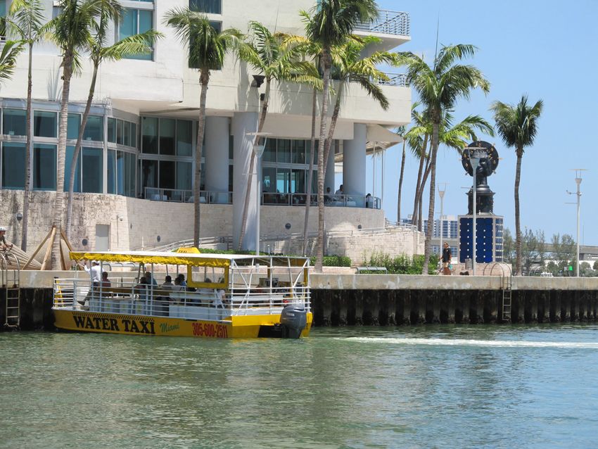
Miami River Commission Public Meeting Minutes
April 5, 2021
                                            -2-
In addition, advertisements are currently for sale in the 18th Annual Miami River Map and Guide.
We appreciate everyone which has already placed their ads, and we announce this “last call” for
any additional potential advertisement purchases before we send the map to the printers.

The Miami River Commission has been actively assisting the efforts of the City, County, State,
and private sector to clean up the Miami River District. In addition to the maintenance
professionals the MRC pays to remove litter, invasive plant species, graffiti and provide
landscaping services along the Miami River, the MRC thanks the volunteers from Hands on Miami
whom on March 13 picked up garbage along the shoreline in City owned Curtis Park, and on
March 27 picked up garbage along the Miami River’s shoreline at the County owned affordable
housing at 1407 NW 7 ST. In addition, the MRC thanks the volunteers from Hands on Miami
whom on April 10 will pick up garbage along the shoreline in City owned Curtis Park, and on
April 24 will pick up garbage along the Miami River’s shoreline at the County owned affordable
housing at 1407 NW 7 ST.

The Miami River Commission thanks the City of Miami for recently removing two derelict vessels
from the Miami River.

The MRC unanimously adopted their amended February 1, 2021 public meeting minutes.

   II)     Consideration of Land Use and Zoning Amendment at 1100-1110
           NW North River Drive from T4 to T5
Steve Wernick, Wernick and Co., distributed and presented a Letter of Intent, Plans, and draft
Covenant (available at http://www.miamirivercommission.org/Agenda04.05.21.html) for their
proposed Land Use and Zoning Amendment at 1100-1110 NW North River Drive from T4 to T5,
featuring the code required public Riverwalk.

Jim Murley, Chair of the MRC’s Urban Infill subcommittee, distributed pages 26-30 of the MRC’s
adopted strategic plan, the Miami River Corridor Urban Infill Plan. Mr. Murley noted the sites 2
existing single-family homes are considered “contributing structures” in the subject designated
“Spring Garden Historic District”. Therefore, in addition to the proposed land use and zoning
amendments to increase the site’s density, the proposal would require a “Certificate of
Appropriateness” for the proposed demolition of the 2 single family homes, followed by a
“Certificate of Approval” for the proposed new construction, from the City of Miami ‘s Historic
and Environmental Preservation Board. MRC Urban Infill Subcommittee Chairman Murley
suggested the MRC recommend denial of the proposed Land Use and Zoning Amendments at
1100-1110 NW North River Drive.

A letter from Ernie Martin in opposition to the subject up-zoning was distributed. Mr. Carlos
Salas, President of the Spring Garden Civic Association, distributed their petition with 93
signatures and letter of opposition to the proposed up-zoning. Numerous Spring Garden residents
spoke in opposition to the proposed up-zoning.

The MRC unanimously (12-0) recommended denial of the proposed Land Use and Zoning
Amendments at 1100-1110 NW North River Drive.

                               PUBLIC DOCUMENT
Miami River Commission Public Meeting Minutes
April 5, 2021
                                      -3-

III. Miami River Commission Subcommittee Reports
   A. Greenways Subcommittee - MRC Director Bibeau distributed copies of the “Miami
      River Greenway Update – Aerials presented from East to West – 3/2/21”. The document
      depicts the 6.75 miles of constructed public Miami River Greenway, and the remaining
      3.25 miles which need to be constructed by the City, County, FDOT, and Miami Parking
      Authority. Currently 4 sections of the public Riverwalk are under construction at Aston
      Martin Residences (private sector), both sides of the 1 ST Bridge (FDOT), and Fern Isle
      Park (City of Miami). The MRC is pursuing multiple public and private funding sources
      for the remaining funding needed to construct and help maintain the remaining sections of
      the public Riverwalk.

IV.   New Business

The meeting adjourned.

                              PUBLIC DOCUMENT
MIAMI RIVER CORRIDOR URBAN INFILL PLAN                                                                      VISION FOR THE RIVER

                                                                       SPRING GARDEN/HIGHLAND PARK/MEDICAL
                                                                       CENTER (7th Avenue to 12th Avenue, north bank)

 Miami River Seafood and Lobster in East Little Havana

 physical and cultural enhancement to the neighborhood but
 will provide improved educational opportunity as well.                Like much of the Miami River corridor, these neighborhoods
                                                                       were once home to pioneer homesteaders, starch millers, and
 A redevelopment site of particular interest in this district is the   tourist-attraction operators. One early Miami settler, William
 former Miami News site, a large riverfront parcel to the east of      Wagner, established a homestead in the 1850s in what is today
 NW 12th Avenue. The successful redevelopment of this site is          called Highland Park; the house he built for his family remained
 viewed by many as a critical to the success of the surrounding        in place until the 1970s and now stands, restored, in Lummus
 area. While its size and waterfront location are appealing, the       Park. Wagner’s daughter sold his land in 1909; in 1911 the
 site has limited access; the possibility of improving access to the   homestead was platted as a subdivision called Highland Park.
 site from NW 12th Avenue southbound should be investigated            The first lots had been sold and the neighborhood’s first houses
 so as to improve the site’s linkage to the medical and civic          built when in 1913 the area was annexed into the City of
 centers flanking 12th Avenue just across the river.                   Miami, the western boundary of which had previously been
                                                                       7th Avenue.

                                                                       Miami’s third mayor, John Sewell, built a mansion northwest of
                                                                       Highland Park in 1916; Halissee Hall, as he named it, remains
                                                                       today in the midst of the Jackson/University of Miami Medical
                                                                       Center that grew up all around it.

 Redevelopment site- The former Miami News Site (20)

                                                                       Two-story masonry house in Spring Garden

                                                                                      Prepared by Kimley-Horn and Associates, Inc.-June, 2002
                                                                                      Prepared for the Miami River Commission                   26
MIAMI RIVER CORRIDOR URBAN INFILL PLAN                                                                             VISION FOR THE RIVER

 This district’s riverfront remained undeveloped until 1918;
 however, an entrepreneur known as Alligator Joe ran a
 successful attraction for tourists visiting by riverboat at the
 point formed by the intersection of the river and Wagner
 Creek. Spring Garden subdivision remains today as one of
 Miami’s four historic districts and the active Spring Garden
 Civic Association.

 Allowable uses along the Spring Garden riverfront are medium-
 density multifamily residential; allowable uses along Wagner
 Creek (known as the Seybold Canal south of NW 11th Street)
 are liberal commercial, restricted commercial, office, and both
 single-family and medium-density multifamily residential.

 Liberal commercial zoning is inappropriate for the riverfront,
 and should be re-oriented toward water-dependent commercial
 or industrial use, possibly allowing associated mixed-use
 development for increased compatibility with the both the
                                                                             Spring Garden Neighborhood Conservation District study area, outlined
 Spring Garden and Lummus Park neighborhoods and with                        in red (21)
 the river itself. Similarly, residential development as allowed
 under the medium-density residential zoning classification                  the scale and character of the historic district.
 is not appropriate to the riverfront; the establishment of
 stricter height, FAR, and parking limits for these parcels is               Running from southeast to northwest through the Spring
 recommended so as to maintain the scale and character of the                Garden/Highland Park/Medical Center neighborhood is
 Spring Garden waterfront.                                                   Wagner Creek, a partly culverted, partly exposed tributary of
                                                                             the Miami River. South of NW 11th Street, in Spring Garden,
 As on the riverfront, liberal commercial uses should not be                 this water body is navigable and is known as the Seybold
 allowed on the Seybold Canal; water-dependent commercial                    Canal. Not long ago declared to be the state’s most polluted
 or industrial uses, with associated mixed-use development,                  waterway, efforts to improve Wagner Creek have been moving
 should be required where zoning presently allows for liberal                forward slowly; efforts to dredge contaminated sediment from
 commercial. Existing single-family zoning along the canal                   the creek are moving forward and the Miami River Greenway
 should be protected, while multifamily zoning should be                     Master Plan recommends improving the banks of the creek with
 treated as discussed in the previous paragraph so as to maintain

 Looking north up the Seybold Canal. On the right is canal front property,   One story masonary house with mediterranean details
 that is well suited for water-dependant commercial or industrial uses.

                                                                                             Prepared by Kimley-Horn and Associates, Inc.-June, 2002
                                                                                             Prepared for the Miami River Commission                   27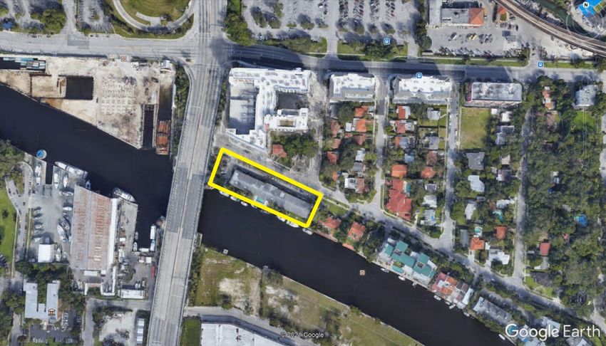
MIAMI RIVER CORRIDOR URBAN INFILL PLAN                                                                    VISION FOR THE RIVER

                                                                  Spring Garden’s tropical riverfront character
 Two-story masonry house in Spring Garden

 walkways and passive green spaces to the extent possible.        intersection of NW 13th Street and 8th Avenue.

 North of NW 11th Street is Highland Park, a residential          The recent construction of new single family housing in the
 neighborhood distinguished by its significant concentration      neighborhood has sparked interest in the preservation of
 of frame vernacular single family homes dating from 1910s        Highland Park, and the Miami City Commission has issued
 and 1920s. Few of its houses are elaborately ornamented, but     a directive to rezone the neighborhood to lower density.
 its wood frame houses feature functional elements appropriate    A survey the neighborhood’s historic resources is under
 to the climate of the region, with porches, deep overhanging     way; already a portion of the area has been found eligible
 eaves, and layouts inviting cross-ventilation. The design of     for listing in the National Register of Historic Places. A
 the neighborhood is of particular significance; Highland Park    neighborhood conservation district should be established to
 stretched long and narrow from NW 11th to 20th Streets,          encourage restoration of the neighborhood’s historic housing
 with blocks focusing on a series of centrally-located open       and to ensure that alterations and new development in the
 spaces reminiscent of the neighborhood squares of Savannah,      neighborhood reflect the massing, siting, and articulation of
 Georgia.                                                         existing structures.

 The neighborhood fell into decline as the decades wore on,       Between the Spring Garden Historic District and Highland
 and its original plan was interrupted with the construction
 in the late 1960s of an embanked highway severing the
 neighborhood at NW 14th Street. North of 14th the area was
 zoned Governmental/ Institutional to compliment the adjacent
 hospital-related uses, while the southern remnant was targeted
 for related high-density residential and office development.
 Construction of the Culmer Metrorail station at NW 11 Street
 reinforced this intent, but Highland Park failed to develop as
 anticipated. The area became one of speculative investment and
 deferred maintenance, with few homeowners and a transient
 renter population. Another result of the decline was the
 alteration of the characteristic features of many of its homes
 – porches enclosed, and floor plans subdivided by the creation
 of rental units. Preserved, however, were the neighborhood’s
 mature oak, banyan, and mahogany trees, as well as one of its
                                                                  Mature tree canopy in roundabout at NW 13th Street and NW 8th Avenue
 original community greens – a mahogany-shaded circle at the

                                                                                   Prepared by Kimley-Horn and Associates, Inc.-June, 2002
                                                                                   Prepared for the Miami River Commission                   28
MIAMI RIVER CORRIDOR URBAN INFILL PLAN                                                                              VISION FOR THE RIVER

 Wood frame house with roof bracket details in Highland Park                A potentially historic house in Highland Park that has been severely altered
                                                                            from its original layout

 Park is a group of blocks forming a triangle; this area should be
 investigated for its potential to simultaneously 1) accommodate
 higher-density development taking advantage of the nearby                  vernacular, bungalow, and Mediterranean revival structures
 Culmer Metrorail station and 2) compliment the adjacent                    – and mature tree canopies, including oak hammocks and
 historic neighborhoods of Spring Garden and Highland Park.                 a generous assortment of gumbo limbo, mahoganies, royal
 Key factors in ensuring compatibility include location of                  poincianas, coconut palms and royal palms.
 parking, height and unit density of development, and treatment
 of project edges and entrances. In keeping with the open,                  Central to this transitional area between the two neighborhoods
 eyes-on-the-street urbanism of Spring Garden and Highland                  is the Culmer Metrorail station. In keeping with Miami-Dade
 Park, gates and high walls would be inappropriate, as would                Transit’s policy of encouraging transit-oriented development at
 auto-oriented entry ways. All new development should respect               all Metrorail stations, it is anticipated that an RFP for public-
 the one- to two-story frame and masonry residential stock of               private development will be released by the transit agency in the
 these neighborhoods, with their rich and eclectic architectural            near future. Guidelines for development compatible in scale and
 character – including substantial concentrations of frame                  character with the adjacent historic district should be developed
                                                                            prior to release of an RFP, and Miami-Dade transit should
                                                                            involve representatives of the City of Miami Planning Zoning
                                                                            Department, the Miami River Commission as well as residents
                                                                            of the Spring Garden and Highland Park neighborhoods in the
                                                                            project selection process.

                                                                            The Jackson Memorial and University of Miami Hospitals
                                                                            situated to the north of Highland Park, together with
                                                                            the Lindsay Hopkins Technical School, the Miami-Dade
                                                                            Community College Medical Campus, County Medical
                                                                            Examiner’s Office, and numerous other health-related
                                                                            institutions in the district, form an major employment center
                                                                            not only for the middle river but for the region. Secreting two
                                                                            historic structures that offer clues to the medical center’s past
                                                                            – Halissee Hall and the Alamo, the original Miami Hospital
                                                                            building – the complex is a labyrinthine warren of structures,
                                                                            streets, and pedestrian ways much in need of a master plan. Also
                                                                            in need of room to expand, the complex’s major institutions
 Highland Park Neighborhood Conservation District study area, outlined in   should partner to ensure that their growth does not negatively
 red (22)

                                                                                             Prepared by Kimley-Horn and Associates, Inc.-June, 2002
                                                                                             Prepared for the Miami River Commission                   29
MIAMI RIVER CORRIDOR URBAN INFILL PLAN                                                                          VISION FOR THE RIVER

 impact the surrounding neighborhoods. The University of                provided so as to benefit the large employment and residential
 Miami has taken steps toward initiating such a partnership;            base of this district.
 its neighboring institutions should give the effort their full         North of the riverfront, there are several distinct
 participation and carry it forward. Together, these entities could
 make strategic investments that would both improve their own
 environment – including access to and amenities for the Miami
 River, Wagner Creek, and the area’s parks – and the quality of
 life of their neighborhoods, including Highland Park, Spring
 Garden, Lummus Park, the Civic Center, and Allapattah.

 CIVIC CENTER/ MEDICAL CENTER (12th Avenue to
 17th Avenue, north bank)

                                                                        Merrill Stevens- Miami’s oldest waterfront industrial business

                                                                        “neighborhoods”: a cluster of government-owned court-related
                                                                        uses (including the State’s Attorney’s office and a County
                                                                        jail), a cluster of bail bondsmen’s offices (many located in
                                                                        converted single family homes, including several historic
                                                                        houses), a pair of hospitals (Cedars, a private hospital, and a
                                                                        Veteran’s Hospital and residential facility), and predominantly
                                                                        medium-density multifamily residential district distinguished
                                                                        by difficult circulation and lack of coherence and neighborhood
  This neighborhood was once home to the Miami Golf Links.              identity. As in Spring Garden, Highland Park, and the Medical
  The Miami Country Club, located at the river’s edge, lives            Center, Wagner Creek should be cleaned and made accessible
  on only in the subtlest of ways: a tiny residential subdivision       to the public – both to neighborhood residents and to the
  called Golf View Park. Today, the Civic Center riverfront             neighborhood’s many workers – to the greatest extent possible.
  is zoned not for recreation but for an awkward trio of uses:
  mainly office, waterfront industrial, and a small section of          A potentially significant redevelopment opportunity in the
  medium-density multifamily residential.                               Civic Center neighborhood focuses on the Mahi Shrine site
                                                                        (24). Located on the riverfront with close proximity to the
  Another significant chapter in the Civic Center neighborhood’s        Civic Center’s court complex and public and private hospitals,
  heritage is Merrill Stevens, the neighborhood’s sole industrial       this site also has excellent north-south transportation access via
  waterfront business – and Miami’s oldest such business. Merrill       NW 12th and 17th Avenues. With the cooperation of Miami-
  Stevens is a strong presence on the Civic Center waterfront and       Dade County, two County-owned surface parking lots located
  an important contributor to the region’s marine economy.              to the east of the Shrine site could be jointly developed in a
                                                                        public-private venture (25); such a partnership would result in
  The remainder of the Civic Center’s waterfront, however, is           creation of the Miami River’s largest waterfront development
  less vital. An underutilized civic club on a substantial riverfront   site. Commercial (including restaurants, cafes, bookstores, and
  parcel lies adjacent to acres of surface parking lots, and a gated    shops), residential, office, and hotel uses could be linked to the
  multifamily structure stands in the way of public access to           water’s edge via a “Riverwalk”-type plaza and accessed both
  the river. Consideration should be given to rezoning all non-         from the greenway as well as from the river itself.
  waterfront industrial parcels along this segment of the Miami
  River for mixed use development encouraging water-dependent           The following page illustrates one of many development sce-
  and related uses as well as restaurants, markets, and residential.    narios that could occur on the Mahi Shrine Site and the surface
  Public access to the river should be maximized and amenities          parking lots to the east.

                                                                                         Prepared by Kimley-Horn and Associates, Inc.-June, 2002
                                                                                         Prepared for the Miami River Commission                   30
701 Brickell Avenue, Suite 3300 | Miami, FL 33131 | T 305.374.8500 | F 305.789.7799
Holland & Knight LLP | www.hklaw.com
Ines Marrero Priegues
(305) 789-7776
ines.marrero@hklaw.com
May 27, 2021
Via Electronic Mail
Mr. Brett Bibeau
Managing Director
Miami River Commission
1407 NW 7 Street, Suite D
Miami, FL 331245
Re: Rio Mio, LLC Application for Land Use and Zoning Change of 1160 NW N
River Drive
Presentation for Miami River Commission Recommendation
Dear Mr. Bibeau,
The undersigned represents Rio Mio, LLC (the “Owner” and/or “Applicant”), the owner
of the property located at 1160 NW North River Drive (the “Property”). The Applicant has filed
an application with the City of Miami requesting a change to the Future Land Use Map designation
of the Property from Medium Density Restricted Commercial to Restricted Commercial and
companion application to rezone the Property from T5-O to T6-8-O (the "Application"). The
Applicant is requesting the opportunity to present the Application to the Miami River Commission
at its next available meeting for its review and recommendation to the Miami City Commission.
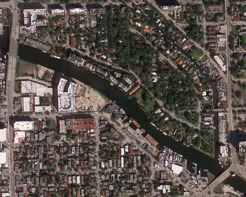
The Property consists of six contiguous platted lots located on the north side of the Miami
River, immediately west of NW 12 Avenue and south of the State Road 836 ramp. The Property
is identified by tax folio number 01-3135-026-0050. In total, the Property consists of 40,741
square feet (±0.93 acres). The aerial below shows the Property location.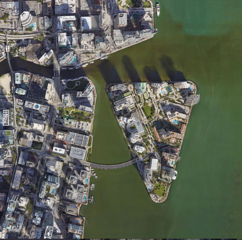
In April 2001, the Miami River Commission (“MRC”) adopted the Miami River Greenway
Action Plan (the “Action Plan”), which sets forth certain goals and objectives for the future of the
Miami River. Based on the Action Plan, the proposed project is located within the “Middle River.”
Within the Middle River, the land use is primarily characterized by single family and multi-family
housing that abuts the river and extends throughout adjacent neighborhoods.

        The Application falls directly in line with the Action Plan's goals and objectives. The
current use of the property is a residential multi-family apartment complex and will maintain the
existing residential use of the property as to not disrupt existing uses. The Applicant is proposing
a luxury residential development that will bring significant traction to the river and together with
the proposed riverwalk, the development will further serve as an attractive destination for local
residents and tourists, while providing improved access to the river. The Applicant is also
maintaining existing boat slips to continue to encourage the use of the river. Moreover, significant
resources will be invested into the property to ensure the property maintains its level of luxury
while using best management practices to improve the river’s water quality and ecosystem when
possible. Lastly, the Applicant will comply with the Miami River Greenway concept plan in order
to create and improve surrounding river greenway trails.

        As part of the Application, the Applicant is proffering a covenant to the City of Miami
acknowledging and accepting the presence of the existing Working Waterfront 24-hour operations,
committing to complying with the Miami 21 Waterfront standards, view corridors and setbacks.
All future residents will be made aware of and required to comply with the covenant before
occupying the premises. Furthermore, as part of the proposed covenant, the Applicant is limiting
the proposed building height to eight (8) stories. The Applicant is committed to working with the
City of Miami to provide an attractive residential project that will benefit and improve the existing
surrounding community and the Miami River experience in the Middle River. The rezoning of the
Property and its redevelopment will provide an opportunity to provide a publicly accessed
riverwalk, currently non-existent. The rezoning and redevelopment of the Property will also
provide an opportunity and to create continuous pedestrian path from NW 11th Street to the
Riverfront                 via                    NW                     11th                  Place.

                                                 2
Based on the foregoing, we request the opportunity to present the Application to the MRC
at its next available meeting for its review. We respectfully look forward to a favorable
recommendation of the Application.
Sincerely,
HOLLAND & KNIGHT LLP
Inés Marrero-Priegues
3Rio Mio Project Miami River Commission Presentation
Property Aerial
Property Location
Existing vs. Proposed FLUM Redesignation
Existing – Medium Density Restricted Commercial        Proposed – Restricted Commercial
Existing vs. Proposed Rezoning Designations
Existing – T5-O                              Proposed – T6-8O
Site Photograph
Surrounding Area

  New Modera Riverhouse at 11th multi-family luxury apartment building       View of properties east of the Property and on the northern bank of the Miami River
located at 1170 NW 11 Street and zoned T6-8-O (directly north of Property)
Surrounding Area

New Waterline Miami River Project located across the river at 1001 NW 7th Street
Proposed Project
Proposed Project
Proposed Project
Conceptual Site Plan
Shadow Study
Shadow Study
Project Highlights

Project provides ample parking for residents and visitors
Compliance with Miami River Greenway Action Plan
• In April 2001, the Miami River Commission (“MRC”) adopted the Miami River
  Greenway Action Plan (the “Action Plan”), which set forth certain goals and objectives
  for the future of the Miami River.
• Based on the Action Plan, the proposed project is located within the “Middle River.”
  Within the Middle River, the land use is primarily characterized by single family and
  multi-family housing that abuts the river and extends throughout adjacent
  neighborhoods.
Compliance with Miami River Greenway Action Plan
• Proposed project falls directly in line with the Action Plan’s goals and objectives.
   • The proposed project is a residential project that will maintain the existing residential
     use of the property and will not disrupt existing uses.
   • The Applicant is proposing a luxury development that will bring significant traction to
     the river and together with the proposed riverwalk, the development will further
     serve as an attractive destination for local residents and tourists, while providing
     improved access to the river.
   • The Applicant is also providing boat slips to continue to encourage the use of the river.
   • Significant resources will be invested into the property to ensure the property
     maintains its level of luxury while using best management practices to improve the
     river’s water quality and ecosystem when possible.
   • Furthermore, the Applicant will comply with the Miami River Greenway concept plan
     in order to create and improve surrounding river greenway trails.
Compliance with Miami Riverfront Standards • As part of the proposed application, the Applicant is proffering a covenant to the City of Miami that will demonstrate future compliance with the City’s riverfront standards. • Future residents will be made aware of and required to comply with the covenant before occupying the premises. • Applicant is limiting the proposed building height to eight (8) stories. • Applicant is committed to working with the City of Miami to provide an attractive residential project that will benefit and improve the existing surrounding community and the river.
Questions?
Declaration of Restrictive Covenants
Folio No(s): 01-3135-026-0050

 Document prepared by:
 Office of City Attorney
 444 S.W. 2nd Avenue, Suite 945
 Miami, FL 33130-1910

 Return Recorded Copy to:
 City of Miami
 Office of Zoning, Attn: Zoning Administrator
 444 S.W. 2nd Avenue, 2nd Floor
 Miami, FL 33130-1910

 Folio No(s): 01-3135-026-0050
                                                              (Space Above for Recorder's Use Only)

                         DECLARATION OF RESTRICTIVE COVENANTS

          THIS DECLARATION OF RESTRICTIVE COVENANTS (the "Declaration"), made

this ____ day of ________, 2021, by RIO MIO, LLC, a Florida limited liability company (the

"Owner"), in favor of the CITY OF MIAMI, FLORIDA, a municipality of the State of Florida

(the "City").

                                       WITNESSETH:

          WHEREAS, Owner holds fee-simple title to certain property in the City of Miami,

 Florida, located at 1160 NW North River Drive, legally described in Exhibit "A" attached

 heretoand made a part hereof (the "Property"); and

          WHEREAS, the Owner sought and obtained a Future Land Use Map redesignation

 pursuant to Ordinance No. ______________ for the Property; and

          WHEREAS, the Owner sought and obtained a rezoning approval pursuant to Ordinance

 No. __________ for the Property; and

                                                Page 1 of 7
Declaration of Restrictive Covenants
Folio No(s): 01-3135-026-0050
WHEREAS, the Owner is desirous of making a voluntary binding commitment to assure
that the Property shall be developed in accordance with the provisions of the Declaration herein;
and
NOW THEREFORE, the Owner, for valuable consideration, the receipt and adequacy of
which are hereby acknowledged, voluntarily covenants and agrees that the Property shall be
subject to the following restrictions that are intended and shall be deemed to be a covenant
running with the land and binding upon the Owner of the Property, and its heirs, grantees,
successors, and assigns as follows:
1. Recitals. The recitals and findings set forth in the preamble of this Declaration
are hereby adopted by reference thereto and incorporated herein as if fully set forth in this
Section.
2. Restrictions: The Owner hereby makes the following voluntary declarations
running with the land concerning the use of the Property:
a. The owner shall allow waterfront access to the public from 6:00 AM to 10:00
PM along the river walk to be developed as part of a multi-family residential project
on the Property.
b. The proffered river walk will be designed in accordance with Article 3,
Section 3.11 and Appendix B of the Miami 21 Code.
c. The Owner recognizes that legally permitted existing Working Waterfront
24-hour operations may currently exist proximate to the Property. Therefore, Owner
agrees:
Page 2 of 7Declaration of Restrictive Covenants
Folio No(s): 01-3135-026-0050
(i) Not to object or otherwise attempt to impede any legally permitted Working
Waterfront 24-hour operations;
(ii) To provide all future tenants and prospective owners of the Property notice of
the existing Working Waterfront 24-hour operations and will include a
provision to agree not to object to legally permitted Working Waterfront 24-
hour operations in each lease and or Condominium Sale Documents;
(iii) That it is solely the Owner's responsibility to design its structures to
accommodate legally permitted Working Waterfront 24-hour operations; and
(iv) That it will not pursue any claims for liability, loss or damage, whether
through litigation or otherwise, against permittees engaging in Working
Waterfront 24-hour operations, related to noise, smoke, fumes, federally
regulated bridge operations, and/or other quality of life issues that might
result from legally permitted Working Waterfront 24-hour operations
d. Notwithstanding the Property’s T6-8O zoning, any new development on the
property will not exceed maximum height of eight (8) stories.
3. Effective Date. This Declaration shall constitute a covenant running with the title
to the Property and be binding upon Owner, its successors and assigns upon recordation in the
Public Records of Miami-Dade County, Florida. These restrictions shall be for the benefit of,
and a limitation upon, all present and future owners of the Property and for the public welfare.
4. Term of Covenant. This voluntary Declaration on the part of the Owner shall
Page 3 of 7Declaration of Restrictive Covenants
Folio No(s): 01-3135-026-0050
remain in full force and effect and shall be binding upon the Owner, its successors in interest and
assigns for an initial period of thirty (30) years from the date this Declaration is recorded in the
public records, and shall be automatically extended for periods of ten (10) years, unless
modified, amended or released prior to the expiration thereof.
5. Inspection and Enforcement. It is understood and agreed that any official
inspector of the City of Miami may have the right at any time during normal working hours of
the City of Miami’s inspector to enter upon the Property for the purpose of investigating the use
of the Property, and for determining whether the conditions of this Declaration and the
requirements of the City's building and zoning regulations are being complied with. After notice
and an opportunity to cure, an action to enforce the terms and conditions of this Declaration may
be brought by the City and may be by action at law or in equity against any party or person
violating or attempting to violate any covenants of this Declaration or provisions of the
building and zoning regulations, either to restrain violations or to recover damages. This
enforcement provision shall be in addition to anyother remedies available under the law.
6. Amendment, Modification, Release. This Declaration may be modified,
amended, or released as to any portion or all of the Property only after the occurrence of a
determination of the Zoning Administrator that the Declaration is no longer necessary to
preserve and protect the Property for the purposes herein intended. Any amendment,
modification, or release shall be executed by the Zoning Administrator, or his or her successor or
designee, and be in a form acceptable to the City Attorney.
7. Severability. Invalidation of any one of these covenants by judgment of Court
shall not affect any of the other provisions of this Declaration, which shall remain in full force
Page 4 of 7Declaration of Restrictive Covenants
Folio No(s): 01-3135-026-0050
and effect.
8. Counterparts/Electronic Signature. This Declaration may be executed in any
number of counterparts, each of which so executed shall be deemed to be an original, and such
counterparts shall together constitute but one and the same Declaration. The parties shall be
entitled to sign and transmit an electronic signature of this Declaration (whether by facsimile,
PDF or other email transmission), which signature shall be binding on the party whose name is
contained therein. Any party providing an electronic signature agrees to promptly execute and
deliver to the other parties an original signed Declaration upon request.
9. Recordation. This Declaration will be e-recorded by the City of Miami, at the
Owner's expense, in the public records of Miami-Dade County, Florida upon full execution.
10. No Vested Rights. Nothing in this Declaration shall be construed to create any
vested rights whatsoever to the Owner, its successors and assigns.
SIGNATURE PAGES TO FOLLOW
Page 5 of 7Declaration of Restrictive Covenants
Folio No(s): 01-3135-026-0050
IN WITNESS WHEREOF, the undersigned has set his hand and seal this day of
, 2021.
RIO MIO, LLC, a Florida limited liability
company
By:
Witnessed by: Jorge Ariel Lopez
(TWO WITNESSES FOR EACH PERSON SIGNING).
Witnesses:
Print Name: ___________________________
Print Name: ____________________________
STATE OF FLORIDA
COUNTY OF MIAMI-DADE
The foregoing instrument was acknowledged before me by means of physical presence
or online notarization, this day of _________, 2021, by Jorge Ariel Lopez as manager of
Rio Mio, LLC, a Florida limited liability company, who is personally known to me or who has
produced _________________ as identification.
Notary Public, State of Florida
Print Name: _________________________
My Commission Expires:
Page 6 of 7Declaration of Restrictive Covenants
Folio No(s): 01-3135-026-0050
CITY OF MIAMI:
APPROVED AS TO CONTENTS:
Daniel Goldberg, Esq.
Zoning Administrator
APPROVED AS TO LEGAL
FORM AND CORRECTNESS:
Victoria Mendez,
City Attorney
Page 7 of 7Declaration of Restrictive Covenants
Folio No(s): 01-3135-026-0050
Exhibit “A”
Page 8 of 7Miami River
Commission
Miami River
Greenway Update
Aerials presented from East to West 04.13.21
LEGEND
City of Miami Site
Miami-Dade County Site
Miami Parking Authority Site
FDOT
Existing Greenway
Private Sector Public RiverwalkPublic Riverwalk
under construction
Aston Martin Residences
ge
Brickell Brid
Miami River CommissionMiami Parking Authority
• Geographic Area:
South Shore beneath Brickell Bridge
• Construction Status: Fully funded
and designed awaiting comple-
tion of Brickell Bridge Maintenance
Project
M over
Brickell Bridge
o
South Miami Avenue Bridge
Met r
SE 5
Stree One Brickell
t • Geographic Area:
South Shore from Brickell Bridge to
Brickell on the River.
• Construction Status: City
SE 6 Commission Approved and applied
Stree
t for Phase One building
permit - Seek temp riverwalk in
vacant Phase 2One River Point
• Geographic Area: North Shore from
Miami Avenue Bridge to Ivy and Mint
• Construction Status: Public riverwalk in
approved One River Point submitted building
permit application
Second Avenue Bridge
South Miami Avenue Bridge
MetroRail Bridge
SE 6 Street
Edge on Brickell
• Geographic Area:
Latitude on the River 55 South Miami Avenue
• Geographic Area: Road
Riverwalk connector between • Construction Status:
the existing riverwalks at Plans approved by the
Latitude on the River and be- City of Miami
neath 2nd Avenue Bridge
• Construction Status: SE 7 Street
Funded and designed await-
ing building permitBridge
Flagler ST.
City of Miami
• Geographic Area:
1 SW South River Dr and Flagler St deadend
into SW North River Dr.
• Construction Status: Needs funding and design
Vacant Restaurant idge
1ST. Br
• Geographic Area:
North Shore between
First & Flagler Bridges FDOT’S First Street Bridge
• Construction • Geographic Area:
Status: Beneath and adjacent to new First
80 percent complete- Street Bridge
construction stopped • Construction Status:
Under construction
Approved Wharf
• Geographic Area:
North Shore Riverwalk, from
I-95 to First Street Bridge
I-95
• Construction Status:
Plans approved
Second Avenue Bridge
Miami River SAP
• Geographic Area:
South Shore River-
walk from 2nd Av-
enue Bridge to Jose
Marti Park
• Construction
Miami River Commission
Status:
City approved SAP-
submitted Phase 1
building permit
applicationNW 5 Street
ge
rid
.B
St
5
NW NW N
orth R
iver D
r.
NW
Sou
th
Riv
er
Dr.
NW 3 Street
Gramps on the River
• Geographic Area: 341 NW South
River Dr
• Construction Status:
City of Miami approved,
Lu
construction commencing 2021
m
m
NW 2 Street
us
Riverfront Restaurant
Pa
• Geographic Area:
rk
311 NW South River Dr.
• Construction Status:
City of Miami approved, construc-
tion commencing 2021
NW 1 Street
Riverfront Restaurant
• Geographic Area:
131-125 NW South River Dr.
Bridge
• Construction Status: Flagler St.
City of Miami approved plansNaheem Khan
• Geographic Area: 1175 NW South
River Drive
• Construction Status: Lease pending
County approval
ridge
NW
NW 12 Ave. B
Nor
th R
iver
Dr.
NW 7 Avenue
NW 7 Street
NW 10 Avenue
NW
Waterline Miami So
ut
• Geographic Area: 1001 NW 7 ST h
Ri
• Construction Status: ve
Phase 1 complete, Phase 2 rD
r.
commences construction 2021
555 River House
• Geographic Area: 663-517 NW South River Dr. g e
• Construction Status: City Commission item to rid
.B
be considered in 2021 St
5
NWNW
Nor
th R
iver Good 1690 NW North River Dr.
Dr. • Geographic Area: 1690 NW FDOT 836
North River Dr. • Geographic Area: Under 836
• Status: City approved plans • Status: Communicating with
and site cleared. FDOT.
NW 17 Avenue
NW 13 Street City of Miami
• Geographic Area: North
Shore NW 12 Ave. to 836
• Status: Awaiting transfer of
funds from County.
way
p ress
x
hin E
olp
6/D
. 83
S.R
City of Miami
NW 13 Ave
• Geographic Area: South Shore
NW 12 Ave
from 836 to Tamiami Canal
• Status: Needs funding and design
City of Miami
• Geographic Area: NW 12
Ave to NW 13 Ave
• Status: Needs funding and
design
South River Dr.NW
No City of Miami
rth • Geographic Area: NW North River Dr. from
Riv River Landing to NW 27 Ave.
er
Dr • Status: $2 million Federal grant portion under
NW 22 Ave
.
design - additional funding & design needed
River Dr.
NW North
City of Miami
• Geographic Area: Sewell Park
• Status: Awarded FIND Phase 1
NW 17 Avenue
& 2 grants for design and con-
struction
City of Miami
• Geographic Area: South Shore
from 836 to Tamiami Canal
NW 22 Ave
• Status: Needs funding and design Sewell Park
South River Dr
NW 11 StNW 20 St
NW 26 Ave
NW 27nd Ave
City of Miami
• Geographic Area: NW North
River Dr. from River Landing to
NW 27 Ave.
• Status: $2 million Federal grant
portion under design - addition-
al funding & design needed
NW
No
rth
Riv
er
Dr
.
NW
16 S
tree Brisas Del Rio
t Ro
ad • Geographic Area: 1583 NW
2507 NW 16 St Road
• Geographic Area: 2507 NW 24 Ave
16 St Road • Status: City approved plans
• Status: City approved
NW 22nd Ave
zoning change
NW 24nd Ave
City of Miami
• Geographic Area: South Shore
from 836 to Tamiami Canal
• Status: Needs funding and design
NW 14 StreetNW 20 St
NW
So
ut
hR
ive
rD
r.
City of Miami
• Geographic Area: South Shore
from 836 to Tamiami Canal
• Status: Needs funding and designSalinity Dam LEGEND
Option 1
Option 2
Option 3
MDC Current Project
NW Existing Greenway
So
ut City of Miami Site
h
Ri
ve
rD No
r. rt
h
Element Hotel MIA Ri
v er
Dr
EVEN Hotel MIA .
Radisson Hotel
Staybridge Suite MIA
So
ut
NW 25 St h Ri
ve
rD
r.
NW 37 Avenue
Miami
Palmer
Intermodal Lake
Center
e
Av
NW
33
24
NW
ST
RD
NW 21 ST
Sheraton Miami Hotel &
Executive SuitesNo
rt
h
Ri
ve
rD
r
. Dade County
Miami
• Geographic Area: NW South River
NW 25 St Dr. from Tamiami Canal Bridge to
So MIC
ut • Status: Phase 1 funded and under
h design
Ri NW
ve
rD So
r. ut
h
Ri
ve
rD
Palmer Lake r.You can also read