Main Heading West Hagbourne Conservation Area Character Appraisal
←
→
Page content transcription
If your browser does not render page correctly, please read the page content below
Main Heading

   West Hagbourne
 Conservation Area
Character Appraisal
 The conservation area character appraisal - this sets
    the context for the proposals contained in Part 2.
    Part 1 was adopted by Council in September and
                       is included for information only.

                                         April 2006
Part 1
Introduction                                  there is a presumption against the
                                              demolition of such buildings. Important
This conservation area character
                                              trees are also identified. These are
appraisal has been undertaken to
                                              usually highly visible from public places
assist in defining the special character
                                              and/or they contribute to the setting of
of the West Hagbourne Conservation
                                              a listed building. Important open
Area. An appreciation of this special
                                              spaces are identified, as these are a
character is essential in order to
                                              vital element in the character of an
manage change within the
                                              area. Character is defined not just by
conservation area.
                                              buildings, walls and trees, but also by
This appraisal is part of the duty placed     the spaces between them. These
on the local authority by the 1990            contribute to the setting of buildings.
Planning (Listed Buildings and                They allow views around the area and
Conservation Areas) Act to determine          they are often an important element in
which parts of their area are areas of        the historical development of a
special architectural or historic interest,   settlement.
the character or appearance of which it
                                              Important unlisted walls are identified.
is desirable to preserve or enhance.
                                              These are usually built of local
The Act also states that the local
                                              materials and help to define spaces
planning authority should, from time to
                                              and frame views. Lastly, important
time, formulate and publish proposals
                                              views into, out of and around the
for the preservation and enhancement
                                              Conservation Area are identified. It
of these Conservation Areas. These
                                              should be appreciated that a
are the subject of a separate
                                              Conservation Area's character does not
management plan.
                                              end with a line drawn on a map. Often
As part of this exercise a plan of the        the character is closely associated with
conservation area has been produced           attractive views out to surrounding
which aims to identify the elements           countryside, sometimes via gaps
which contribute to the character. The        between buildings. Views within an
plan includes the conservation area           area such as that to a church or
boundary, listed buildings (buildings         particularly attractive group of buildings
identified by the Department of Culture,      are also important.
Media and Sport as being of special
                                              In addition, an Archaeological
architectural or historic interest), former
                                              Constraint Plan is included. The
Grade III listed buildings (a now
                                              character and history of an area are
obsolete category but where the
                                              closely linked to its archaeological
buildings may still be of architectural or
                                              remains. A general area of
historic interest) and other buildings of
                                              archaeological constraint covers much
local note. This latter group consists of
                                              of the conservation area; however,
buildings that play a part in establishing
                                              there are no Scheduled Ancient
the character of the street scene but
                                              Monuments. The Historic Environment
have not yet been considered to be of
                                              Record (HER), which is maintained by
sufficient importance to meet the
                                              Oxfordshire County Council, contains
current criteria for listing. Recent
                                              no records of sites or find spots in the
government guidance contained in
                                              village. However, the locations of four
PPG.15 -Planning and the Historic
                                              buildings appear on the record and
Environment indicates, however, that
                                              these have been shown on the plan

                                                                    WEST HAGBOURNE CONSERVATION AREA CHARACTER APPRAISAL            1
                                                                                               South Oxfordshire District Council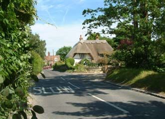
along with their HER reference
                                     number.

                                     The appraisal sets out firstly the wider
                                     historical and geographical context of
                                     the village. A detailed appraisal of the
                                     village follows this, dealing with each
                                     part of the village in turn.

2   WEST HAGBOURNE CONSERVATION AREA MANAGEMENT PLAN
    South Oxfordshire District Council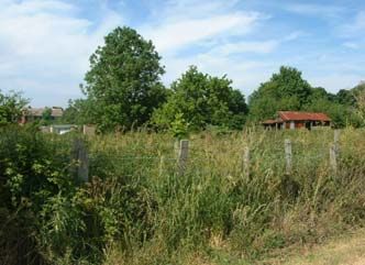
1. West Hagbourne                          also the earliest written reference to
   - the History of the Area               the Hagbournes, then called
                                           hacceburnan. The stream and the
Prehistory                                 network of springs, brooks and ditches
                                           associated with it have played an
There are two ancient thoroughfares
                                           important role in the history of West
near West Hagbourne; the Ridgeway
                                           Hagbourne causing local flooding and
and the Icknield Way. The Icknield Way
                                           mishaps with at least one fatal
dates from between 3000 and 1600 BC
                                           accident.
and probably originated as a trading
route between East Anglia and              An early written reference to the village
Wiltshire. Although it has never been      is found in Domesday Book, which
systematically excavated, nearby           refers to Walter fitz Other holding the
Hagbourne Hill has yielded both            manor of West Hagbourne in 1068. He
Bronze Age and Iron Age finds. It is not   was later made first constable of
clear whether the artefacts are            Windsor Castle and founded the
evidence for continuous settlement         Windsor dynasty, which continued to
throughout the Bronze and Iron Ages        hold the manorial estate of West
or whether Hagbourne Hill was a            Hagbourne for nearly 600 years. As a
special place in the landscape where       result West Hagbourne came to be
items of significance were deposited.      known as Windsor Hakebourne.
There is also archaeological evidence      There is no evidence to support the
for a Romano-British burial ground and     myth that East and West Hagbourne
possibly a settlement on Hagbourne         were once one village before they were
Hill. Within the village itself Roman      separated by the seventeenth century
coins have been found at Thatch            'Great Fire' of East Hagbourne. The fire
Cottage and York Road, the latter          started to the east end of East
dating from between 350 and 353 AD.        Hagbourne and stopped at its church
                                           which is a substantial distance from
The medieval village                       West Hagbourne. Furthermore the two
The name Hagbourne evolved over the        villages have separate entries in
centuries from the Saxon Hacca and         Domesday Book and were tithed and
the Old English burn, meaning a small      taxed separately as far back as the
stream. This produced Haccaburn.           reign of Edward the Confessor (1042-
According to local tradition Hacca was     1066). No trace of buildings linking the
the name of a soldier who arrived with     two villages has been revealed by
the Saxon Army. Having sailed along        aerial photography nor have any
the Thames he is said to have claimed      physical remains been discovered on
the land near the stream that runs         the ground.
through the Hagbournes and out to the      From its entry in Domesday Book West
Thames at Wallingford. There is no         Hagbourne appears to have been a
direct evidence for this version of        typical medieval English village,
events but Hakka's Brook, as it is now     organised around a manorial system
known, was mentioned in a charter          based on Anglo-Saxon serfdom. The
from around 895 AD, whereby King           first manor house was built on the site
Alfred exchanged various pieces of         of Manor Farm. Its location, slightly
land including Hagbourne, with the         apart from the main settlement and the
Bishop of Winchester. This document is     homes of villains and serfs, was

                                                                 WEST HAGBOURNE CONSERVATION AREA CHARACTER APPRAISAL            3
                                                                                            South Oxfordshire District Council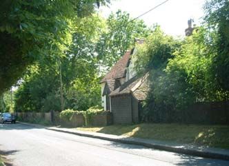
customary at the time. All that remains           cross in West Hagbourne is identified
                                     today on the site of the manor is the             in a survey of 1410 or 1411. It recorded
                                     village pond and possible vestiges of a           that Richard Wyndeford "holds one
                                     moat.                                             messuage with curtilage formerly of
                                                                                       Elias Skynner at the High Cross in the
                                     The more modest homes of the populace
                                                                                       vill of Westhakeborne". This indicates
                                     were probably small timber framed buildings
                                                                                       at least that the cross was within the
                                     utilising natural materials that were available
                                                                                       village and next to a house. The base
                                     in the locality such as wattle, daub and
                                                                                       of a stone cross can be seen today on
                                     thatch. These homes would typically have
                                                                                       the edge of the nearby hamlet of
                                     had a small plot of land called a close.
                                                                                       Coscote. The presence of five farms
                                     In 1086 the lord of the manor of West             within a mile of each other is testament
                                     Hagbourne held jurisdiction over 14               to the village's historic farming
                                     villagers and their families who were             practices. Medieval farm workers in the
                                     tied to the manor. There were also ten            settlement were tied to two manors.
                                     cottagers attached to the manor who               Farming was a cooperative affair that
                                     depended on what they could grow on               concentrated on the three fields or
                                     their close and on occasional                     open field farming system. Fields were
                                     employment. Working for the lord or               used in rotation for spring wheat,
                                     providing produce paid the 'rent' on              winter-sown wheat or left fallow to
                                     these smallholdings. This system was              allow the soil to recover and to provide
                                     still in evidence in 1367 when a dowry            grazing. The fields were divided into
                                     document refers to one tenant                     furlongs and distributed amongst the
                                     providing the lord with a hen each year.          community according to status.
                                     The presence of a mill in West
                                     Hagbourne is also known from                      The post medieval village
                                     Domesday Book. Although it is known               In the late Tudor period corn, wool and
                                     to have been in existence in the reign            cloth became important trading
                                     of Henry VIII its location is not marked          commodities in Berkshire (the village,
                                     on any known maps of the village.                 now in Oxfordshire) was in Berkshire
                                     Before the Reformation a chapel of                until the local government
                                     ease served West Hagbourne and St                 reorganisation of 1974). This
                                     Andrew's Church in East Hagbourne                 influenced farming in the village as
                                     was used as a parish church in the                most farms developed a mixed
                                     post-Reformation era. The site of the             economy with arable farming and
                                     chapel was confirmed in September                 sheep rearing. Sheep rearing was
                                     2004 by a resistivity survey carried out          easier on enclosed land and from as
                                     by the Berkshire Archaeology                      early as 1517 there are records of the
                                     Research Group (BARG).                            enclosure of land in West Hagbourne.
                                                                                       A postscript to a Court Roll of 1660 for
                                     There is an apocryphal story that the
                                                                                       West Hagbourne records the enclosure
                                     Lower Cross in East Hagbourne was
                                                                                       of common land. During the Civil War
                                     originally located in West Hagbourne
                                                                                       West Hagbourne appeared on a list of
                                     but at the turn of the 20th century was
                                                                                       villages accused of giving quarter to
                                     'kidnapped' by some of the inhabitants
                                                                                       both Royalist and Parliamentary armies
                                     of East Hagbourne. There is no hard
                                                                                       and probably suffered from plundering
                                     evidence for this version of events;
                                                                                       at the hands of each. The rate of
                                     however, the presence of a medieval

4   WEST HAGBOURNE CONSERVATION AREA MANAGEMENT PLAN
    South Oxfordshire District Council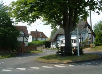
enclosure of common land slowed as a         By the mid-nineteenth century fruit
result of the unrest.                        growing had begun to be of special
                                             economic significance for West
The Rocque map published in 1761
                                             Hagbourne and the surrounding
shows that, while some common land
                                             villages. The village lies in a rich fruit
around Down Farm had been
                                             growing area and produce could be
enclosed, the village was still
                                             transported by rail to Oxford and
surrounded by open fields, meadow
                                             Covent Garden. Upton station, which
land and commons. The three open
                                             opened in 1882, was within easy
fields were still in evidence in the later
                                             walking distance. The 1843 Inclosure
eighteenth century. They were called
                                             Award records more than twenty
the City, the Lower and the Down
                                             orchards in the village.
Fields and are depicted on the 1775
Craven Estate Map. At this time Lord         The 1843 Inclosure Award also
Craven was lord of the manor of East         mentions six farms, numerous cottages
Hagbourne and the holder of tithing          and gardens, two public houses, a malt
rights in West Hagbourne.                    house (next to Woodleys) and several
                                             houses serving as shops. Several
Common land, where villagers could
                                             buildings, which do not exist today, are
graze their livestock, continued to be
                                             mentioned including barns and a
an important resource for villagers into
                                             chapel attached to Moor Lane. A sale
the eighteenth century. During this time
                                             notice of 1897 recorded that one of the
it comprised the Cow and Sheep
                                             rooms of Thatch Cottage was used as
Downs near Down Farm and the Wet
                                             a chapel. The 1851 census documents
and Dry Moors in Moor Lane. Beyond
                                             four thatched cob walls in Moor Lane,
the commons was wasteland and at
                                             The Square and the High Street (now
the edge of the manor woodlands
                                             Main Street). Today only a section of
provided materials for house building,
                                             cob wall remains in the High Street.
utensils, fencing and fuel. The
wastelands, despite their name, were         The Horse and Harrow appears on a
an important source of gravel, turf,         map of 1754 but is probably older still.
bracken and berries. Hay meadows             The 1843 Inclosure Award records that
were also of great importance to             William Morland owned the inn.
provide winter fodder for livestock. The     However, it is likely that the inn had an
eighteenth century saw further               earlier association with the nearby
enclosure acts accompanied by                Morlands Brewery in West Ilsley, which
increased efficiency in farming              was established in 1726. The Harwell-
methods.                                     Streatley turnpike once ran past the
                                             Horse and Harrow with a tollgate
Throughout the nineteenth century the
                                             outside the pub and a small tollhouse
land continued to be the biggest source
                                             on the opposite side of the road. The
of employment in Berkshire. By the
                                             toll brought trade to the Horse and
early 1840s as much as 114 acres had
                                             Harrow, it also benefited from its
been enclosed in West Hagbourne,
                                             proximity to Cow Lane, an ancient
leaving 903 untouched. The 1843
                                             driftway for taking cattle to the market
'West Hagbourne Inclosure Award'
                                             in Abingdon.
(sic.) enclosed Cow Down and Sheep
Down along with the remainder of the         Between 1846 and the 1870s
village's open fields.                       landowners experienced a period of
                                             prosperity. However, agriculture in the

                                                                    WEST HAGBOURNE CONSERVATION AREA CHARACTER APPRAISAL            5
                                                                                               South Oxfordshire District Council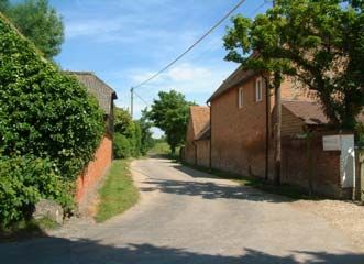
last quarter of the nineteenth century    West Hagbourne's two manors
                                     suffered from successive wet seasons,
                                     inflation and competition from cheap      i. Windsor Manor
                                     imports. Arable and livestock farmers     Evidence for the nature of West
                                     were the most severely affected and a     Hagbourne's first manor comes from a
                                     dramatic fall in the price of wool        document relating to the dowry granted
                                     affected the sheep farmers of the         to Clarice de Windsor on the death of
                                     Berkshire Downs. In response, those       her husband, Richard de Windsor, in
                                     farms that could afford to, invested in   1367. The manor house was evidently
                                     dairy farming. The many farms that        of high status having a chamber, more
                                     could not, stood vacant. The              than one storey, a solar and an oratory
                                     importance of fruit growing declined in   or private chapel. Oratories were very
                                     later years of the nineteenth century     unusual and were fashionable in very
                                     and many orchards were built on in the    high status manor houses in the mid-
                                     twentieth century as fruit growing        fourteenth century. Other unusually
                                     became less profitable.                   high status features mentioned in the
                                     The twentieth century saw increased       dowry document include chimneys and
                                     mechanisation through the application     a cellar (then a storage room on the
                                     of modern scientific understanding to     ground floor of the house), a kitchen
                                     farming. Hedges were grubbed up to        garden and a kitchen. These would be
                                     accommodate larger machinery. In the      in addition to the principal room of the
                                     1930s cheap imports of corn from          house - the hall.
                                     Canada and wool and lamb from             Clarice de Windsor went on to marry
                                     Australia and New Zealand                 John York. Together they extended and
                                     disadvantaged West Hagbourne              rebuilt the south aisle and chapel of St
                                     farmers. During the 1930s some            Andrew's Church in East Hagbourne,
                                     farmers, in common with other farmers     leaving their family coats of arms on
                                     nationally, responded to the changing     the front.
                                     economic climate by leaving the village
                                                                               In 1403, however, Clarice's holdings
                                     to seek work in the New World. In
                                                                               are recorded as a 'ruinous messuage'.
                                     recognition of this decline in rural
                                                                               This probably reflects, and was
                                     population the burden of the tithe
                                                                               exacerbated by, the transfer of rent to
                                     system was lifted by act of parliament
                                                                               West Hagbourne's second manor.
                                     in 1936.
                                                                               Clarice de Windsor held an important
                                     The bus shelter was built in 1954 as a    position in the social structure of West
                                     war memorial to the men from West         Hagbourne in the late fourteenth
                                     Hagbourne who were killed in both         century and is buried in St Andrew's
                                     world wars. For several centuries the     Church in East Hagbourne.
                                     village had two public houses, the
                                                                               The Windsor family lost its connection
                                     Wheatsheaf Inn on the northern
                                                                               with West Hagbourne when Richard
                                     boundary and the Horse and Harrow,
                                                                               Windsor sold the manor to Stephen
                                     which is still a thriving village pub.
                                                                               Thompson of London in 1661 for £600.
                                     The village once boasted a bakery, a      The land continued to change hands
                                     malt house, and several small shops.      until it was acquired by the Pococks
                                     However, 1970 saw the closure of the      who held it for nearly two centuries and
                                     last village shop and sub post office.    probably rebuilt the manor on the

6   WEST HAGBOURNE CONSERVATION AREA MANAGEMENT PLAN
    South Oxfordshire District Council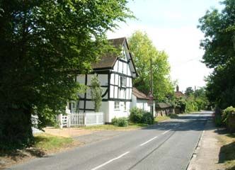
original site in the latter half of the     Both Windsor and Watlingtons manors
seventeenth century. When it was            were sold in 1660s and over the
rented out to William Nelson in 1665        subsequent 250 years Watlingtons
the manor comprised the house, a malt       belonged to a number of different
house, a 'foddening' house, ox house,       families. John Sherwood bought the
dove cote, stables, three barns and         Watlingtons in around 1675; his
gardens. By 1767 the dovecote was           granddaughter Mary married Dr
replaced by a pigeon house but              Cooper, who also owned York Farm in
otherwise remained much the same. In        1754 and in 1919 it was sold at
1889 the manor was sold to Eli and          auction.
Leopold Caudwell of Blewbury. The
manor was eventually sold to Dennis         Farming history
Napper in 1909. In 1917 his daughter
married into the Lay family who still       i. Down Farm
own and farm the land to this day.          Down Farm lies on what was once
                                            common land known as Hagbourne
ii. Watlingtons Manor
                                            Down to the north west of the village. It
West Hagbourne's second manor was           was originally part of the manor
called Watlingtons and concerned the        identified in Domesday Book that came
area which is today known as Grove          to be known as the Windsor Manor.
Manor Farm. Being less well                 The earliest written reference is a grant
documented than the Windsor manor           of land in around 1574 from the lord of
the source of its name is unknown. The      the manor 'Thomas Wyndesor' and his
Victoria County History suggests that it    family to William Dunche of 'Little
could have been referred to in              Wytenham'. In 1642 the Down is
Domesday Book as a hide that was            referred to in an agreement which
farmed independently from the               appears to enclose the common land
manorial land. In 1355 Edmund de            on the Down, one of the earliest
Chelrey acquired Watlingtons Manor; it      enclosures that took place in West
was passed down through Sybil de            Hagbourne. The enclosed land was
Chelrey who married Thomas                  later known as Hagbourne Down Farm
Beckingham. Watlingtons Manor was           being shortened to Down Farm in the
passed down through the remainder of        1930s (the farm's distance from the
the fourteenth century, the whole of the    village precludes its inclusion within the
fifteenth century and the early sixteenth   conservation area).
century through the intermarriage of
the Chelrey, Beckingham and Windsor         ii. York Farm
families bringing the two manors            York Farmhouse is the oldest in the
together. The Windsors held both            village. The vernacular architect CRJ
manors through marriage in the first        Currie in his article 'Larger Medieval
half of the sixteenth century and Mary      Houses in the Vale of the White Horse'
Beckingham inherited both manors            dates the oldest parts of the house to
later in the same century. Both manors      1264 or 1265. Modernisation in the
were passed down through her nephew         seventeenth and eighteenth centuries
Edward de Windsor who then                  destroyed many of the older features
conveyed Windsor Manor to Ann               but much of the timber frame remains
Newton.                                     and pre-1350 methods of construction

                                                                  WEST HAGBOURNE CONSERVATION AREA CHARACTER APPRAISAL            7
                                                                                             South Oxfordshire District Council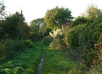
are still discernible. Tree ring dating    enlarged, its tenants from 1805 were
                                     suggests that both the hall and the        the Lousley family. They extended the
                                     wing were built in the winter of 1284-85   land associated with the farm, which
                                     or soon after.                             had come to be known as West
                                                                                Hagbourne Farm, by about 200 acres.
                                     York Farm was a freehold of the
                                                                                Eliza Pocock inherited the farm lease
                                     Windsor manor for several centuries,
                                                                                and married George Harrison. The
                                     the property became known as York
                                                                                1883 census records that they lived at
                                     Place after the York family who held it
                                                                                the manor. Their son then sold the farm
                                     in the latter part of the fourteenth
                                                                                to Eli and Leopold Caudwell in 1889. In
                                     century. In the sixteenth century York
                                                                                1892 Eli bought out Leopold and
                                     Farm became part of the Dunch
                                                                                substantially extended the farm,
                                     family's extensive estates. In 1684 it
                                                                                building a house called the Laurels in
                                     was purchased by the Loders who
                                                                                York Road. In 1904 he built another
                                     were a very successful local farming
                                                                                similar house next-door, which is now
                                     family. In 1754 the farmhouse was
                                                                                known as 2 York Road.
                                     owned by Dr Cooper. Mary Cooper
                                     outlived her husband but at the time of    Following Eli Caudwell's death the farm
                                     her death was declared insane and          was bought by Dennis Napper of
                                     intestate. Her property, which included    Didcot, who gave a farm to each of his
                                     York Farm and the Watlingtons, passed      three children. Two of these farms
                                     to her second cousin Sir John Pollen.      were in West Hagbourne, the other
                                     York Farm was sold to the Aldworth         being Grove Manor Farm. Manor Farm
                                     family in the years preceding 1843 and     went to Eliza Napper who married John
                                     became part of the Grove Manor             E Lay. At this time the farm was
                                     Estate.                                    extended to about 300 acres. John
                                                                                Lay's special contribution to the
                                     In the nineteenth century York Farm
                                                                                community, which included raising
                                     became known as Bullock's Farm after
                                                                                money for fellow villagers and chairing
                                     its long-standing tenant John Bullock.
                                                                                the Parish Council, was widely
                                     The farm was subsequently run by
                                                                                recognised. During his time the farm
                                     bailiffs before it was bought at auction
                                                                                was dedicated to arable farming. Cattle
                                     by the Allens of Down Farm. The land
                                                                                were reared for beef but there was
                                     purchased included two cottages,
                                                                                never a dairy herd. The farm also
                                     which are now known as York Farm
                                                                                produced free-range eggs, pullets and
                                     Cottage and The Square. The Allens'
                                                                                cockerels. In 1999 planning permission
                                     farming activities included sheep
                                                                                and listed building consent were
                                     farming, horse breeding and milk
                                                                                granted to the Lay Family to convert
                                     production and they continue to farm
                                                                                several farm outbuildings to residential
                                     the land to this day.
                                                                                use.
                                     iii. Manor Farm
                                                                                iv. Grove Manor Farm
                                     The high status of Clarice de Windsor's
                                                                                Grove Manor Farm is the site of
                                     manor house and its ruinous condition
                                                                                Watlingtons Manor, whose history has
                                     in 1403 have already been described.
                                                                                already been outlined. The oldest part
                                     The oldest part of the house found
                                                                                of the present house dates from the
                                     today at Manor Farm dates from the
                                                                                mid seventeenth century; however, it is
                                     late seventeenth century. In the
                                                                                encased in brick and was altered in the
                                     nineteenth century the house was

8   WEST HAGBOURNE CONSERVATION AREA MANAGEMENT PLAN
    South Oxfordshire District Council
eighteenth century. In the nineteenth of the land that once made up Ivy Farm
century it was owned by the Aldworth and built Chapel Hayes. Chapel Hayes
Family. The extensive estate was today continues the tradition of fruit
divided into seven lots and sold at growing with free range hens roaming
auction in 1919. The estate included the orchards.
nearly thirty orchards, fifteen cottages
and York Farm. Grove Manor Farm and vi. Ragged Farm
its cottages were bought by Dennis Ragged Farm was a small holding by a
Napper. His successful business, pond on Moor Lane which is now just a
selling horses to the Great Western ditch. Moor Lane may originally have
Railway, was based at Grove Manor been one of the tracks through the
Farm and the GWR came to be a village that followed the baulks and
major buyer of local grain. headlands created by the medieval
The character of Grove Manor Farm ploughing system. Ragged Farm
changed significantly in the twentieth included a cottage and its well, which
century. The farm had been well known were in existence in the eighteenth
for fruit growing until the orchards century. However, in the nineteenth
surrounding it were dug up in 1952 and century they were replaced by gardens
the gate lodge was demolished in the and little evidence of the farm remains
1960s to allow the building of a new today.
dwelling.
v. Ivy Farm
Ivy Farm was a small holding of two
and a half acres with a farmhouse in
the heart of the village and
approximately 28 acres off the road
which leads to Chilton. West
Hagbourne's medieval chapel is
believed to have stood on land behind
the late twentieth house called Chapel
Hayes, which until 1974 was part of Ivy
Farm (See the Archaeological
Constraint Plan).
Joseph and Hannah Lousley moved
from Manor Farm to Ivy Farm
sometime after 1881. In 1895 the farm
was bought by Thomas Keep. From
1915 the Napper family owned Ivy
Cottage, the barns, stables, garden,
orchard and outbuildings. However, 26
acres known as Hagbourne land was
sold off separately. The area of land
associated with Ivy Farm shrank further
in 1971 when Ivy Cottage and its
outbuildings were sold to the Sages. In
1974 the Scotts bought the remainder
WEST HAGBOURNE CONSERVATION AREA CHARACTER APPRAISAL 9
South Oxfordshire District Council10 WEST HAGBOURNE CONSERVATION AREA MANAGEMENT PLAN
South Oxfordshire District Council2 The Established however, have a very strong
Character architectural character and is of great
historic interest with the buildings of
Introduction York Farm to the north of the road and
those of Woodleys to the south.
East and West Hagbourne are united
by the Hakka's Brook but visually The conservation area boundary, which
separated by a disused railway line runs to the north to encompass the
whose embankment is a striking historic farm buildings at York Farm,
landscape feature, foreshortening follows the line of a small brook flanked
views to the east of the village. by thick mixed hedgerow and mature
Coscote is an isolated hamlet between trees. The boundaries to York Road are
the two villages. The high ground of characterised by simple grass verges
Hagbourne Hill dominates views to the and post and rail fencing that lend
southwest of the village. From Moor views along the street a distinctively
Lane the paddock land and more open rural appearance. Further in, towards
fields beyond characterise views to the the core of the village there are more
south. From the heart of the robust brick and stone walls associated
designated conservation area, with historic dwellings (see Fig. 1).
however, there are fewer views
towards the wider landscape but
equally important views along historic
street scenes. Timber framing, together
with plain clay tile and thatch, are
characteristic building materials found
in historic dwellings and larger barns in
the conservation area. Red brick is
used more commonly for boundary
walls and outbuildings with some stone
boundary walls and one notable cob
and thatch wall in the heart of the
village. Most historic dwellings have
retained the painted timber casement
or sash windows typical of historic
building tradition. Simple post and rail
fences and five bar gates contribute to Fig. 1 York Road
the particularly rural character of the Rough grassland, paddocks and open
village with its farms almost out space are an appropriate setting for the
numbering its historic houses. buildings of York Farm. The agricultural
character of the farmstead remains
York Road apparent. The boundary here is a
The east - west section of York Road is simple rural fence rather than the more
characterised to the west by modern robust garden walls or domestic
housing development and the hedges associated with dwellings on
architectural and historic value of these York Road. This agricultural setting
buildings is not sufficient to justify an enhances the contribution that the farm
extension to the conservation area. buildings make to the special character
The easterly section of the road does, of the conservation area. The retention
WEST HAGBOURNE CONSERVATION AREA CHARACTER APPRAISAL 11
South Oxfordshire District Councilof the buildings in their original use and The close functional relationship of the
setting enhances the rural character farmhouse and the historic farm
and appearance of the conservation buildings is apparent. The high status
area. of the farmhouse is evident from its
jettied cross wing, which is an
The historic farm buildings are built of
important focal point in the street. This
locally available materials including
early timber framed building's long
timber, stone, brick and
plain tile roof sweeps down towards the
weatherboarding with plain clay tile
street. There is a perception of space
roofs. The farm's corrugated metal
to the east of the farmhouse but views
roofs have weathered to a mottled
are screened by a tall redbrick wall.
green and are in keeping with their
This wall connects York Farmhouse to
functional, agricultural setting.
York Farm Cottage whose early origins
The traditional buildings and boundary are also apparent and contribute
treatments found in this part of the greatly to the conservation area's
conservation area, on the whole, historic interest. The rhythm of the
successfully protect the village's past cottage's timber frame and its large
and present identity as a farming rendered infill panels contrasts with the
community. The farm remains on the solid, uninterrupted, redbrick walls of
edge of the village and, it still clearly Woodley's outbuildings that dominate
defines the northern extent of the the street to the south. York Farm
historic village. Cottage's thatched roof also contrasts
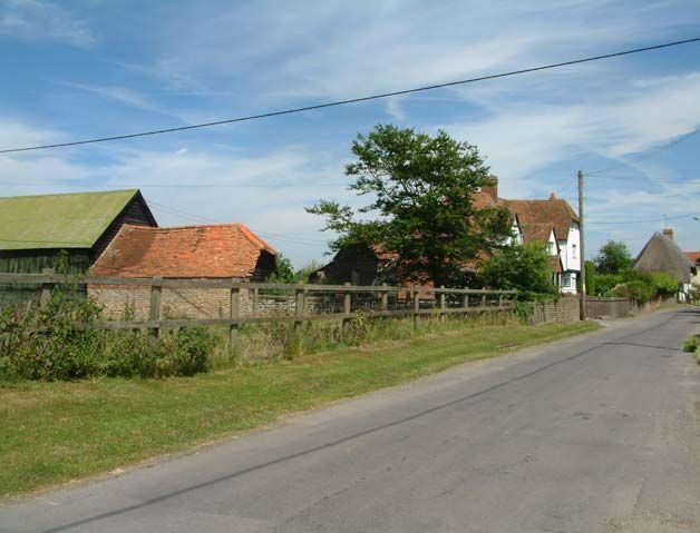
From York Road there are glimpsed with the neighbouring orange/red plain
views of open fields and modern farm clay tile roofs of York Farmhouse (see
buildings to the north of York Farm. Fig. 3).
The modern farm buildings form a
separate group from the older buildings
on the farmstead and appear to be
more closely allied with the open fields
beyond the village envelope. Views of
the farmstead are possible from the
road that links East and West
Hagbourne and the open fields to
either side of the road provide an Fig 3. Woodleys
appropriate setting for this farming
village (see Fig. 2). Where York Road meets Main Street it
widens to form a triangular space
which accommodates what appears to
be a village green in miniature. A focal
point in the village, this area also
accommodates the bus shelter, which
is also a war memorial, a village notice
board and a bench with a memorial
plaque to Mr John E Lay (see history
Fig 2. York Farm House section), (see Fig. 4).
12 WEST HAGBOURNE CONSERVATION AREA MANAGEMENT PLAN
South Oxfordshire District Councilof York Farm Cottage. Woodley's flank
wall encloses York Road but its front
elevation is set back from the green
within a substantial garden.
On the green itself a mature horse
chestnut at the centre of this open
space is an important focal point in the
small island of open space. The green
Fig 4. Bus shelter, bench and phone box
is boarded by natural stone setts and in
The space is also dominated by summer is decorated with wooden
historic buildings. The Square fronts barrels containing flowers and shrubs.
the green and is a building of local The importance of this open space
note. Its simple form is characteristic of within the community is apparent; it
traditional buildings in the locality and it forms an attractive gateway to the
was associated historically with York historic village core (see Fig. 6).
Farm. The Square sits slightly further
back from the road than its neighbour
York Farm Cottage, which is set back
from the road by a grass verge. Views
of paddock and orchard on the
northern margins of the village are
available between The Square and
York Farm Cottage. The space
between these buildings is
Fig 6. York Farm Cottage and Woodleys
characteristic of the older parts of the
conservation area, which tend not to
Important views are available from the
stand too closely together but to stand
green. Looking southwards views
in reasonably sized garden plots (see
terminate in the duck pond and are
Fig. 5).
characterised by the concentration of
historic houses that flank Main Street.
To the west views follow York Road
and are also characterised by the
concentration of historic buildings
flanking the highway.
Views out of the conservation area
along the eastern section of Main
Street are dominated by substantial
Fig 5. York Farm Cottage and the Square
twentieth century red brick houses and
bungalows of a variety of materials.
To the west of the green Woodleys, a
seventeenth century thatched cottage
Moor Lane
with timber framing and large painted
brick infill panels, echoes the Moor Lane branches off from Main
construction and, to a certain extent, Street passing the back gardens of
the appearance of York Farm Cottage, twentieth century housing to its north
although the clay tile roof of Woodleys and just two dwellings to its south. The
contrasts with the long sweeping thatch lane is dominated by greenery. Its
WEST HAGBOURNE CONSERVATION AREA CHARACTER APPRAISAL 13
South Oxfordshire District Councilinformal character becomes The scarcity of buildings to the south of
increasingly rural and it eventually Moor Lane is in striking contrast to the
narrows to become a footpath. Today it relatively close knit houses of Main
appears to serve as a back lane to the Street. To the east of York Road the
twentieth century housing where its two thatched cottages which survive
northern boundary is characterised by here are accommodated in relatively
modern fencing (see Fig. 7). large garden plots. Both are thatched,
of timber frame construction with
rendered in-fill panels. Enard Cottage
probably dates from the medieval
period while Thatch Cottage is likely to
have been built in the 17th century. It is
Thatch Cottage that features in views
from Main Street (see Fig. 9).
Fig 7. Moor Lane
The lane's southern boundary is a
brook culveted in places to allow
access to the historic cottages and
crossed by a simple timber footbridge
to allow access onto the public footpath
to the east of the village. Behind the Fig 9. Thatch Cottage
stream the boundary to the paddocks
to the south is a simple timber post and Moor Lane narrows to a footpath,
rail fence and its five bar gate which leads out of the village to the
contributes further to the lane's rural south of Grove Manor Farm. Views of
character and appearance. Wide views weather boarded and plain clay tile
are available from the eastern roofed buildings associated with Grove
extremity of the track which are Manor Farm can be seen from the
dominated by the disused railway pathway and glimpses of the
embankment . This is a continuous farmhouse itself are available (see Fig.
feature across the horizon and appears 10).
to enclose the village and its paddocks
forming a physical boundary between
land used in conjunction with the
buildings of the village and the open
fields beyond (see Fig. 8).
Fig 10. View from footpath to the south of
Grove Manor Farm
Only glimpsed views back into the
village are available from the public
footpath which runs southwards from
Fig 8. Enard Cottage Moor Lane. The path curves around
14 WEST HAGBOURNE CONSERVATION AREA MANAGEMENT PLAN
South Oxfordshire District CouncilPart 2
paddocks and orchards. A tall mixed Main Street
hedgerow screens the buildings to
Main Street from its junction with Moor
Main Street but trees can be glimpsed
Lane to the duck pond has a relatively
which allow the perception of open
enclosed feel. Buildings either front the
space. At the junction of the path with
highway or are slightly set back from it.
the track way to Manor Farm the
Blissetts, Broomsticks and Wycherts
orchards and chicken houses of this
are of a substantial size and their
important open space can be seen.
height relative to the width of the road
The embankment still dominates
begins in places to emphasis the
easterly views from the footpath, where
narrowness of the street. The
it severs the village from East
constricted nature of the road here is
Hagbourne (see Fig. 11).
exacerbated by the frequency of traffic,
which at times, is particularly high. The
historic timber framed dwellings of
Main Street form an important group of
great architectural and historic interest.
They are characterised by their more
domestic appearance and their location
in the core of the village in contrast to
the historic farmsteads on the village
Fig 11. The disused railway embankment periphery (see Fig. 13).
To the south, the buildings of Upton
can be glimpsed in the distance. As the
trackway leads into the village before
being squeezed between the buildings
of Manor Farm and Ivy Farm, it affords
important views into the conservation
area. Both the historic and modern
agricultural buildings of Manor Farm
Fig 13. Broomsticks
can be seen on the edge of the village
although the visibility of these buildings
Whilst there is a concentration of
is dependant on the seasons. In
historic buildings Main Street does not
summer views are partially screened
have a built up or urban character. The
by deciduous trees and hedgerow (see
boundaries of Wycherts and
Fig.12).
Broomsticks enclose the street but are
relieved by mature trees, hedgerows,
shrubs and the duck pond. Several
boundaries are of historic interest with
traditional redbrick walls at Ivy Farm
and the eighteenth century cob wall at
Wycherts (see Fig. 14).
Fig 12. Views eastward from the
conservation area boundary
WEST HAGBOURNE CONSERVATION AREA CHARACTER APPRAISAL 15
South Oxfordshire District CouncilFig 14. Wycherts Fig 15. Blissetts
The street is dominated by historic dwellings on the northern stretch of
dwellings. Broomsticks, a painted brick Main Street. The farmhouse was built
and rendered building sits to the north in the early eighteenth century but its
of a large garden plot containing red brick frontage dates from the early
mature trees and is a building of local nineteenth century. Its height and
note. Wycherts probably dates from the overall appearance give it a low-key,
late seventeenth century and is of large modest character. The relatively intact
panel timber frame construction on a survival of the cottage and its small
brick base with a plain tile roof. Its farmstead make a substantial
height makes it a focal point in the contribution to the conservation area's
street scene. Blissetts to the south of wealth of traditional farm buildings (see
Broomsticks is a mid seventeenth Fig. 16).
century timber frame house also with
large infill panels on a rendered base
but with a thatched roof. Blissetts is
also of a substantial height and its
location at the sharp turn in the road
and the jettied west facing gable make
it especially prominent in the
streetscene. Its simple post and rail
fencing, the glimpsed views of fruit
Fig 16. Ivy Farm
trees in its curtilage, the duck pond
opposite and the fields and farms to
After Main Street turns sharply at the
the south of the village give this part of
duck pond the concentration of historic
the conservation area a particularly
houses on the highway ends abruptly
rural character (see Fig.15). Chapel
with Green Thatch, a seventeenth
Hayes is a twentieth century bungalow
century cottage. It too is timber framed,
set well back from Main Street and
with large rendered infill panels and a
screened by deciduous trees. Its
thatched half hipped roof. Seen across
orchards are of special significance
the duck pond it contributes greatly to
being the only ones left in the heart of
the village's unique character and
the village.
provides a focal point in views into the
Ivy Farm appears to address the track village from the track from the fields
leading past the duck pond to Manor which enters the village between Ivy
Farm rather than Main Street. The and Manor Farms (see Fig. 17).
farmhouse, its barns and outbuildings
form a self contained group less
closely aligned with the earlier
16 WEST HAGBOURNE CONSERVATION AREA MANAGEMENT PLAN
South Oxfordshire District CouncilTo the south is a substantial wall of red
bricks laid in a traditional garden wall
bond with half round copings. Ivy
Farm's barn faces onto the track way,
its traditional boarded doors contribute
to the solidity of this group of buildings
and emphasises their agricultural
origins.
Fig 17. Green Thatch from Main Street and
To the south of Main Street the last
across the duck pond
buildings in the heart of the village are
The farmstead to the east of the village
outbuildings that belong to Green
is Manor Farm; its farmhouse dates
Thatch and the transition from village
from the late seventeenth century and
to open field is sudden (see Fig. 19).
dominates views from Main Street's
southern extremity. Set further back
from the road it is isolated from the
group of timber-framed dwellings on
Main Street and is now separated to a
certain extent from its historic farm
buildings, which are now used as
offices. However, from the location of
the house outside the main village core
and from its proximity to the former Fig 19. Green Thatch from Main Street
farm buildings it remains apparent that
it was once a farmhouse (see Fig. 18). The boundary is a mixed hedgerow
and the open fields and the buildings of
Manor Farm house beyond can be
seen across a metal five bar gate. The
survival of the village's historic
southern boundary is apparent, and the
close relationship between the historic
village and its farmland setting has
been retained (see Fig. 20).
Fig 18. Lane between the buildings of Ivy
The road, which here runs north from
Farm and Manor Farm Main Street, lies outside the
Despite conversion to offices, the conservation area but does affect its
historic barns' utilitarian appearance setting; views along it would be
still contributes to the character and available from the fields to the south.
appearance of the conservation area. There are wider views here towards
The parked cars, for example, have Hagbourne Hill and the concentration
significantly altered the site's character. of modern housing to the north is left
From the trackway between the behind, with more dispersed modern
buildings of Ivy Farm and Manor Farm, dwellings and the Horse and Harrow
however, the simple, solid appearance public house.
of the brick buildings has survived. The
boundary walls and buildings enclose
the lane forming a visual gateway to
the village.
WEST HAGBOURNE CONSERVATION AREA CHARACTER APPRAISAL 17
South Oxfordshire District CouncilManagement proposals
Proposals for the preservation and
enhancement of the conservation area
are included in a separate document
West Hagbourne Conservation Area;
Management Plan. This includes
details of the proposed extension to the
conservation area, proposals for the
Fig 20. Manor Farmhouse across fields
when viewed from Main Street maintenance of historic buildings, trees
and open spaces, design guidance for
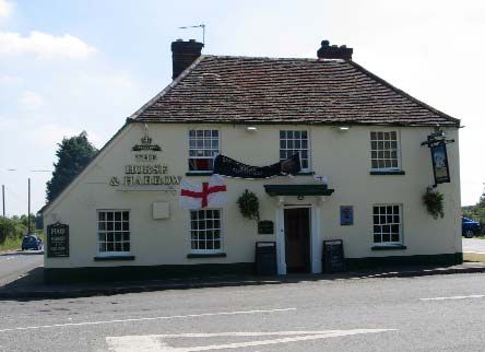
The Horse and Harrow is some
new development and public realm
distance form the village core but is
works and relevant conservation
very much felt to be an integral part of
policies. This document is available
the village and forms a visually
from South Oxfordshire District
gateway point to the village when
Council, Conservation and Design
approaching form the west. The
Team; tel 01491 823771 or email:
building is of historic and architectural
conservation@southoxon.gov.uk
interest and the long unbroken sweep
of its tiled roof over a single storey out
Acknowledgements and
shut contributes to the street scene.
Bibliography
The building benefits from an informal
green setting, appropriate to its location The history section relies on the
on the edge of the village (see Fig. 21). invaluable information contained within:
Windsor Hakebourne Published by the
West Hagbourne Village History Group
in 2000.
Fig 21. The Horse and Harrow Public House
18 WEST HAGBOURNE CONSERVATION AREA MANAGEMENT PLAN
South Oxfordshire District CouncilYou can also read