Phase 1 Environmental Site Assessment Werribee Employment Precinct Werribee VIC - VicUrban - AWS
←
→
Page content transcription
If your browser does not render page correctly, please read the page content below
VicUrban

                                  Phase 1 Environmental Site Assessment
                                           Werribee Employment Precinct
                                                            Werribee VIC
                  _________________________________________________________________________

                                                                                  22 March 2009
                                                                           REF: 08164RPTF01.doc

____________________________________________________________________________________________
Werribee Employment Precinct, Werribee VIC
Phase 1 Environmental Site Assessment
08164RPTF01.doc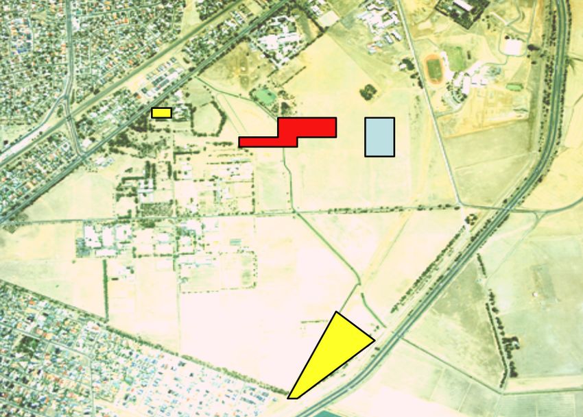
Document Distribution and Control

Compass Environmental Pty Ltd
ABN: 29 938 692 270
Suite 6, 5 Rose Street Hawthorn East Victoria Australia 3123
Tel: +61 3 9819 4704 Fax: +61 3 9819 4724
www.compassenviro.com.au

Document Status
      Revision                          Date                Status              Written by             Reviewed by
            0                    22 March 2009               Final                GS/DS                        DS

Document Distribution
 Revision            Copy No.                 Format           Date                          Issued to
       0                   2                 Hardcopy      22 March 2009                  Tom Maidment
                           1             Electronic (CD)                                      VicUrban
       0                   1                 Hardcopy      22 March 2009        Compass Environmental Pty Ltd
                                              (Original)

Approval for Issue
 Revision                              Date                                     Approved by
       1                       22 March 2009                                   Margaret Mazur
                                                                      Principal Environmental Hydrogeologist

____________________________________________________________________________________________
Werribee Employment Precinct, Werribee VIC
Phase 1 Environmental Site Assessment
08164RPTF01.doc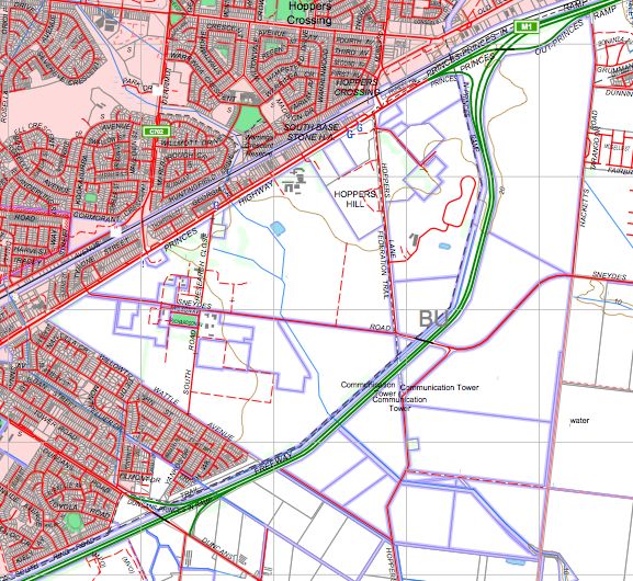
Contents
1    INTRODUCTION ................................................................................................................................. 1

    1.1    ZONES ............................................................................................................................................ 1

2    SCOPE OF WORK .............................................................................................................................. 3

3    SITE CHARACTERISATION .............................................................................................................. 4

    3.1    SITE SETTING .................................................................................................................................. 4
    3.2    SURROUNDING LAND USE ................................................................................................................ 5
    3.3    COUNCIL PLANNING SCHEME ........................................................................................................... 6

4    TOPOGRAPHY, GEOLOGY AND HYDROGEOLOGY ...................................................................... 7

    4.1    TOPOGRAPHY .................................................................................................................................. 7
    4.2    REGIONAL GEOLOGY ....................................................................................................................... 8
    4.3    REGIONAL HYDROGEOLOGY ............................................................................................................. 9

5    SITE HISTORY REVIEW................................................................................................................... 10

    5.1    REVIEW OF HISTORICAL AERIAL PHOTOGRAPHS .............................................................................. 10
    5.2    REVIEW OF HISTORICAL AERIAL PHOTOGRAPHS - OITE SURROUNDINGS ........................................... 18
    5.3    ENQUIRY TO LOCAL HISTORICAL SOCIETY ....................................................................................... 18
    5.4    REVIEW OF EARLY STATE RESEARCH FARM BUILDING REPORT ........................................................ 19
    5.5    EPA VICTORIA PRIORITY SITES REGISTER ...................................................................................... 20
    5.6    ENQUIRY TO LOCAL COUNCIL ......................................................................................................... 20
    5.7    ENQUIRY TO THE LOCAL WATER AUTHORITY ................................................................................... 21
      5.7.1       Trade Waste.......................................................................................................................... 21
      5.7.2       Property Sewerage Plans ..................................................................................................... 21
    5.8    INTERVIEW WITH SITE PERSONNEL ................................................................................................. 23
      5.8.1       Department of Primary Industries – All Zones ...................................................................... 23
      5.8.2       Food Sciences Australia – Zone B ........................................................................................ 25
      5.8.3       University of Melbourne Veterinary Science Clinical Centre – Zone C ................................. 26
      5.8.4       CSIRO – Zone E ................................................................................................................... 26
      5.8.5       Department of Primary Industries – Zone A .......................................................................... 27
    5.9    REVIEW OF DPI HISTORIC PLANS ................................................................................................... 27

6    SITE INSPECTION ............................................................................................................................ 29

7    POTENTIAL FOR SITE CONTAMINATION ..................................................................................... 30

    7.1    ON-SITE ........................................................................................................................................ 30
    7.2    OFF-SITE ....................................................................................................................................... 38

8    RECOMMENDATIONS ..................................................................................................................... 39

9    REFERENCES .................................................................................................................................. 40

10     LIMITATIONS .................................................................................................................................. 41

____________________________________________________________________________________________
Werribee Employment Precinct, Werribee VIC
Phase 1 Environmental Site Assessment
08164RPTF01.doc
Figures
Figure 1               Plan of Zones
Figure 2               Site Inspection – Zone A
Figure 3               Site Inspection – Zone B
Figure 4               Site Inspection – Zone C
Figure 5               Site Inspection – Zone D
Figure 6               Site Inspection – Zone E
Figure 7               Site Inspection – Zone F
Figure 8               Site Inspection – Zone G
Figure 9               Site Inspection – Zone H

Appendices
Appendix A             Site Inspection Records
Appendix B             Current Site Users and Landata Property Reports
Appendix C             Historical Aerial Photographs
Appendix D             Extract From EPA Priority Sites Register
Appendix E             Historical DPI Plans
Appendix F             Property Sewerage Plans
Appendix G             Site Photographs
Appendix H             Groundwater Database Search
Appendix I             Historical Society Plan

____________________________________________________________________________________________
Werribee Employment Precinct, Werribee VIC
Phase 1 Environmental Site Assessment
08164RPTF01.doc
1             Introduction

Compass Environmental was engaged by VicUrban to conduct a Phase 1 Environmental Site
Assessment at the proposed Werribee Employment Precinct, Werribee VIC (the “site”). The site
comprises a 755-hectare parcel of land, and is currently occupied by a variety of land uses, including
open farmland and commercial premises, associated with government and commercial agricultural and
animal research. The site comprises the former State Research Farm, excluding 170 hectares of
freehold land.

The assessment is being conducted for due diligence purposes as part of consideration of possible
development options for the site, and to provide a framework for further environmental testing. A range
of proposed land uses are being considered for the site, including residential (low to high density),
commercial and industrial. The site location is shown in figure 1.

The objectives of the assessment were as follows:
! To collate and review readily available site history and relevant background information in relation to
        the site.
! To identify potential contaminants and/or potential environmental issues at the site associated with
        the current and former uses of the land.

1.1           Zones
For the purpose of the assessment, the site has been divided into eight zones. The zones and main
operations/users within each zone are outlined in table 1 below. Figure 1 shows the layout of the
adopted zones.

Table 1                 Site Zones and Users
                                                    Approximate
Zone                       Area of Site                                            Main Operations/Users
                                                   Area (hectares)
             West: area bound by Sneydes Road,                       DPI - Old Farm buildings and Student residences (both
    A                                                    30
              Princes Highway and North Road.                                               vacant).
                                                                     DPI - Food Sciences Australia and Soil Sample Library
             West: area bound by Sneydes Road,                       DPI - Gilbert Chandler Building and portables (vacant)
    B         South Road and Wattle Avenue (in           55                     Vegetable Growers Association
                               part).                                                        Pivot
                                                                                            Eureka
            North: area bound by Princes Highway                      University of Melbourne Veterinary Science Clinical
    C                                                    30
                      and Hoppers Lane.                                                     Centre
                                                                                  DPI - New Farm Compound
               Central: area bound by Sneydes                                    DPI - 600 Sneydes Rd offices
    D                                                    95
            Road, North Road and Hoppers Lane.                              DPI - Pig Research and Training Centre
                                                                           Animal Reproductive Technical Services
                                                                            DPI - EH&C State Chemistry Laboratory
                                                                                       DPI - KRC Library
            South: area bound by Sneydes Road,
    E                                                   120                         Prince Henry’s/Monash
            Princes Freeway and Wattle Avenue.
                                                                                            CSIRO
                                                                               Meat Research Training Centre/
____________________________________________________________________________________________
Werribee Employment Precinct, Werribee VIC
Phase 1 Environmental Site Assessment
08164RPTF01.doc
                                                                                                                       Page 1
Approximate
Zone Area of Site Main Operations/Users
Area (hectares)
North: area bound by Hoppers Lane,
Princes Highway and Princes
F 30 DPI
Freeway. This area is in two separate
parts.
East: area bound by Sneydes Road,
G 150 DPI
Princes Freeway and Hacketts Road.
South: area bound by Sneydes Road,
H Princes Freeway, Hacketts Road and 245 DPI
Harrisons Road.
____________________________________________________________________________________________
Werribee Employment Precinct, Werribee VIC
Phase 1 Environmental Site Assessment
08164RPTF01.doc
Page 22 Scope of Work
The Phase 1 Environmental Site Assessment was carried out in accordance with the general
requirements of Australian Standard Guide to the sampling and investigation of potentially contaminated
soil Part 1: Non-volatile and semi-volatile compounds (AS4482.1-2005) and the National Environment
Protection (Assessment of Site Contamination) Measure (NEPC, 1999).
The following scope of work was implemented:
Site history review
! Review of historical aerial photographs.
! Enquiry to local historical society.
! Review of early State Research Farm building report (Sands 2001).
! Review of EPA Priority Sites Register.
! Discussion with local Council regarding the history of the area (including the location of
former/current council waste transfer/disposal tips).
! Search for available trade waste records.
! Review of available property sewerage plans.
! Interviews with site personnel.
! Review of available DPI historic plans.
Appraisal of regional and local geology and hydrogeology
! Appraisal of geology and hydrogeology including a review of available geological, hydrogeological
and topographical maps.
Site inspection
! Detailed site inspection to determine current site condition and to check for any visual evidence of
potential contamination.
! Inspection of apparent condition and use of adjacent properties.
Reporting
! Preparation of report, including detailed appraisal of potential for site contamination and
recommendations for further assessment.
____________________________________________________________________________________________
Werribee Employment Precinct, Werribee VIC
Phase 1 Environmental Site Assessment
08164RPTF01.doc
Page 33 Site Characterisation
3.1 Site Setting
The site comprises an area of 755 hectares. The remaining 170 hectares of the former State Research
Farm is a freehold land and is not subject to this investigation. The site is bound by Princes Highway to
the north, Hacketts Road to the east and Harrisons Road and Wattle Avenue (in part) to the south and
west. The Princes Freeway crosses the site in a north-south direction. Sneydes Road crosses the site in
an east-west direction and was formerly known as the East and West Road.
The site is predominantly open farmland, managed by DPI. An area of the site surrounding the
intersection of North/South Road and Sneydes Road (in an approximate radius of 500m) comprises
numerous buildings associated with both Government and Commercial research enterprises.
The site comprises a number of parcels of land, as outlined in tables 2 to 11.
Table 2 600 Sneydes Road
Lot/Plan or Crown Description SPI Zone
PARISH OF DEUTGAM Allot. 2015 2015\PP2518 A
Allot. 2017 2017\PP2518 B and E
Allot. 2023 2023\PP2518 H
Allot. 1A Sec. C 1A~C\PP2518 A, C and D
Allot. 1P Sec. C 1P~C\PP2518 E
Allot. 1T Sec. C 1T~C\PP2518 B
Allot. 1W Sec. C 1W~C\PP2518 E
Allot. 2A Sec. C 2A~C\PP2518 G
Allot. 3 Sec. C 3~C\PP2518 H
Allot. 3A Sec. C 3A~C\PP2518 H
PARISH OF DEUTGAM Allot. 22 Sec. E 22~E\PP2518 H
Allot. 23 Sec. E 23~E\PP2518 H
Allot. 30 Sec. E 30~E\PP2518 H
Allot. 47 Sec. E 47~E\PP2518 H
Allot. 48 Sec. E 48~E\PP2518 H
Allot. 49 Sec. E 49~E\PP2518 H
Allot. 50 Sec. E 50~E\PP2518 H
PARISH OF TARNEIT Allot. 11D Sec. B 11D~B\PP3552 G
Table 3 200 Hoppers Lane
Lot/Plan or Crown Description SPI Zone
PARISH OF DEUTGAM Allot. 3B Sec. C 3B~\CPP2518 H
Table 4 240 Hoppers Lane
Lot/Plan or Crown Description SPI Zone
PARISH OF DEUTGAM Allot. 1 Sec. C 1~C\PP2518 F
Allot. 1G Sec. C 1G~C\PP2518 F
____________________________________________________________________________________________
Werribee Employment Precinct, Werribee VIC
Phase 1 Environmental Site Assessment
08164RPTF01.doc
Page 4Table 5 246 Hoppers Lane
Lot/Plan or Crown Description SPI Zone
PARISH OF DEUTGAM Allot. 9C Sec. B 9C~B\PP2518 F
Table 6 South Road
Lot/Plan or Crown Description SPI Zone
PARISH OF DEUTGAM Allot. 2003 2003\PP2518 B
Table 7 671 Sneydes Road
Lot/Plan or Crown Description SPI Zone
PARISH OF DEUTGAM Allot. 1S Sec. C 1S~C\PP2518 B
Table 8 Lot 2019 Hoppers Lane
Lot/Plan or Crown Description SPI Zone
PARISH OF DEUTGAM Allot 2019 2019\PP2518 H
Table 9 Lot 2020 Hoppers Lane
Lot/Plan or Crown Description SPI Zone
PARISH OF DEUTGAM Allot 2020 2020\PP2518 H
Table 10 Lot 2024 Hoppers Lane
Lot/Plan or Crown Description SPI Zone
PARISH OF DEUTGAM Allot 2024 2024\PP2518 H
Table 11 Lot 2025 Hoppers Lane
Lot/Plan or Crown Description SPI Zone
PARISH OF DEUTGAM Allot 2025 2025\PP2518 H
3.2 Surrounding Land Use
The site is located on the south side of the Princes Highway, Werribee VIC. The use of the land in the
vicinity of the site (as of 25 February 2009) is described in the table below.
Table 12 Surrounding Land Use
Direction Land use
Residential across Princes Highway. A service station is located on the corner of Princes Highway and
Derrimut Road, approximately 50 m from the northern boundary of the site. The Melbourne – Geelong railway
North line is located further to the north. South of the Princes Highway is the Werribee Police Station, the Victoria
University of Technology, the Hoppers Crossing Pumping Station, a community radio telecommunications
tower, the Werribee Mercy Hospital and the Agrifoods Technology Centre.
South Market gardens.
East Residential within the Point Cook residential development precinct.
Residential directly to the west of the site in the northern end and residential across Wattle Avenue at the
West
southern end.
____________________________________________________________________________________________
Werribee Employment Precinct, Werribee VIC
Phase 1 Environmental Site Assessment
08164RPTF01.doc
Page 53.3 Council Planning Scheme
At the time of this assessment, the following zones and planning overlays applied to the site under the
Wyndham City Council Planning Scheme. Landata Property and Planning reports are included in
appendix B.
Table 13 Council Planning Schemes
Address / Lot/Plan
Planning Zones Planning Overlays Heritage Register
Crown Description
Allotment 2019 Parish
Deutgam (Hoppers
Lane)
Allotment 2020 Parish
Deutgam (Hoppers
Lane)
Allotment 2024 Parish
Deutgam (Hoppers ! Development Plan Overlay
Lane) (DPO)
Allotment 2025 Parish ! Development Plan Overlay –
Deutgam (Hoppers Schedule 4 (DPO4)
Lane) ! Special Use Zone – Schedule 5
(SUZ5)
671 Sneydes Road None
! Schedule to the Special Use
Zone – Schedule 5
240 Hoppers Lane
8 South Road
! Design and Development
Overlay (DDO)
! Design and Development
246 Hoppers Lane Overlay- Schedule 1 (DDO1)
Werribee ! Development Plan Overlay
(DPO)
! Development Plan Overlay –
Schedule 4 (DPO4)
! Design and Development
Overlay (DDO)
! Design and Development
! Public Use Zone – Service and
Overlay- Schedule 1 (DDO1)
Utility (PUZ1)
! Development Plan Overlay
! Schedule to the Public Use VHR H1961 – State
600 Sneydes Road (DPO)
Zone – Schedule 5 (SUZ5) Research Farm
! Development Plan Overlay –
! Schedule to the Special Use
Schedule 4 (DPO4)
Zone – Schedule 5
! Heritage Overlay (HO)
! Heritage Overlay Schedule
(HO75)
! Farming Zone – Schedule 2 ! Development Plan Overlay
(FZ2) (DPO)
200 Hoppers Lane None
! Schedule Farming Zone – ! Development Plan Overlay –
Schedule 2 Schedule 4 (DPO4)
____________________________________________________________________________________________
Werribee Employment Precinct, Werribee VIC
Phase 1 Environmental Site Assessment
08164RPTF01.doc
Page 64 Topography, Geology and Hydrogeology
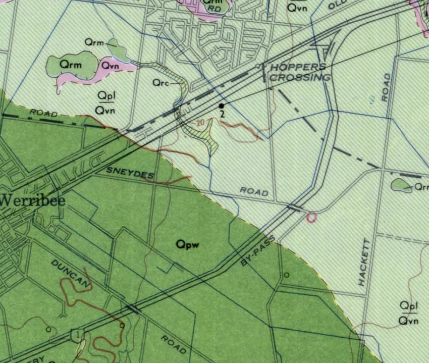
4.1 Topography
The site is relatively flat with a ground elevation of approximately 20 m AHD (refer to topographic map
below). The general fall of the land is to the south east.
VicMap Topographic Map 1:30,000
Map No. T7822-3-2-N
(Note, all elevations are provided in m AHD)
____________________________________________________________________________________________
Werribee Employment Precinct, Werribee VIC
Phase 1 Environmental Site Assessment
08164RPTF01.doc
Page 74.2 Regional Geology
The Geological Survey of Victoria 1:63,360 series Melbourne Map sheet indicates the majority of the
site (with the exception of the south western part) is underlain by Quaternary Newer Volcanics formation
(Qvn; olivine basalt, olivine labradorite basalt, dark to light grey, coarsely vesicular, minor inter-bedded
silty clay and baked soils) overlain by a thin veneer of windblown silt and clayey silt (Qpl). The south
western area of the site is underlain by Quaternary Deutgam Silt (Qpw) comprising silt, grey to grey
brown, with abundant carbonate nodules, gravel, sand, silty sand in lower parts of the sequence, minor
gravel and sand of levees.
Quaternary colluvium (Qrc; comprising minor slump deposits, poorly sorted gravel, sand and sandy silt)
is shown to be present in the area along the alignment of the drainage channel (entering the north of the
site).
Regional Geology
(Extract from The Geological Survey of Victoria 1:63,360 series Melbourne Map sheet)
____________________________________________________________________________________________
Werribee Employment Precinct, Werribee VIC
Phase 1 Environmental Site Assessment
08164RPTF01.doc
Page 84.3 Regional Hydrogeology
A review of the Department of Sustainability Victorian Resources Data Warehouse identified 17
groundwater bores at the site. The intended purpose of the wells is unknown.
The wells were installed to depths ranging from 15.5 m to 248.5 m below ground level. Groundwater
bore details are summarised in table 14 below. The groundwater bore location plan, tabulated bore
report details and available bore lithologies and groundwater chemistry data are included in appendix H.
Table 14 On-site Groundwater Bores
Lower Total
Bore Upper Electrical
Install Screen screened soluble
Bore ID depth screened conductivity pH
date length (m) interval (m salts
(m) interval (m bgl) (uS/cm)
bgl) (mg/L)
BORE 59857 9-Dec-75 38.0 8.000 38.000 30.000 - - -
BORE 59858 9-Dec-75 38.31 8.000 38.000 30.000 - - -
BORE 59940 13-Apr-82 45.56 - - - - - -
BORE 59726 1-Jan-70 39.6 - - - - - -
BORE 59517 25-Aug-65 25.9 1.830 13.100 11.270 - - -
BORE 60039 10-Nov-82 248.5 - - - - - -
BORE 129210 26-Oct-96 38.0 12.500 38.000 25.500 3,100 - -
BORE 59581 27-May-70 44.8 - - - 4,292 2,519 8.80
BORE 59710 1-Jan-70 18.3 - - - - - -
BORE 59877 7-Apr-82 45.56 - - - - - -
BORE 59725 1-Jan-70 18.3 - - - - - -
BORE 306038 16-Oct-81 189.0 - - - 4,850 3,148 8.40
BORE 115713 18-Mar-94 31.0 4.000 31.000 27.000 12,000 7,193 8.20
BORE 115054 24-Nov-94 15.5 0.500 15.500 15.000 1,800 - -
BORE 59879 13-Apr-82 45.56 - - - - - -
BORE 59859 5-Dec-75 38.0 8.000 38.000 30.000 - - -
BORE 59878 8-Apr-82 45.56 - - - - - -
Notes: Bgl = below ground level, “-“ = Unknown
The regional groundwater is expected within the underlying basalt; at a depth of 10-20 m. Given the
likely presence of a near surface layer of silts at the site, there is the possibility of a shallow and
localised aquifer system in areas of former swampy deposits. The shallow groundwater, if present, could
potentially be discharging to the shallow drainage channel that traverses the site.
The topography and elevation of the land suggest the direction of regional groundwater flow to be in a
southerly/south easterly direction towards Port Phillip Bay.
The nearest surface water bodies include the Werribee River located approximately 2.8 km to the south
west and the Port Phillip Bay located approximately 3.8 km to the south east of the site at its closest
point.
____________________________________________________________________________________________
Werribee Employment Precinct, Werribee VIC
Phase 1 Environmental Site Assessment
08164RPTF01.doc
Page 95 Site History Review
The following sources of information were researched to determine the history of the site and the
adjacent land:
! Review of historical aerial photographs at the Aerial Photography Library, Land Information Centre,
Laverton.
! Enquiry to local historical society.
! Review of early State Research Farm building report (Sands 2001).
! Review of EPA Priority Sites Register.
! Discussion with local Council regarding the history of the area (including the location of
former/current council waste transfer/disposal tips).
! Search for available trade waste records.
! Review of available property sewerage plans.
! Discussion with available site personnel.
! Review of available DPI historic plans.
The findings of the site history review are summarised below.
5.1 Review of Historical Aerial Photographs
A total of 28 historical aerial photographs dated between 1951 and 1991 were viewed. Observations
interpreted from the photographs are provided in tables 15 to 22 below. Copies of the aerial
photographs are provided in appendix C.
Table 15 Summary of Historical Aerial Photo Review - Zone A
Photograph Observations
01/1951 ! A large group of buildings are present in the south east corner of the zone (currently known as the
Run: 23 Old Farm).
Film: 1417 ! To the east and south east of the Old Farm compound there is a number of small structures that
Photo: 149 appear to be sheds.
Scale: 1:12000 ! Irrigation furrows overlay the eastern half of the zone.
! In the far north of the zone a building can be seen in the area of the Student Residences.
! A building expected to be the Farm Manager’s residence is located in the northern part of the zone
with a number of attached sheds.
! A dam is situated north of the Old Farm buildings.
! A second dam is located centrally within the zone.
! A drainage channel can be seen transecting the zone in a west to east direction.
! The A. R. Raw Laboratory building is visible to the west of the Old Farm.
! The men’s quarters can be seen to the north east of the Old Farm.
02/1960 ! A shed to the east of the farm manager’s house is no longer visible.
Run: 24W ! The structures to the south east of the old farm building are no longer visible.
Film: 1099 ! A car park is now visible in the area of the Student Residences in the north of the zone.
Photo: 56 ! An unknown structure (building?) is present to the north of the Old Farm building.
Scale: 1:9600 ! The A. R. Raw laboratory building appears to have another wing attached to its north.
! A shed can be seen to the north of the A. R. Raw laboratory.
12/1965 ! Development has occurred in the area of the Student Residences, with another building to the
____________________________________________________________________________________________
Werribee Employment Precinct, Werribee VIC
Phase 1 Environmental Site Assessment
08164RPTF01.doc
Page 10Run: 14W south.
Film: 1896 ! Buildings have been constructed to the north of the A. R. Raw laboratory.
Photo: 15 ! The structures to the east of the Old Farm are no longer visible.
Scale: 1:19200 ! A shed is present to the south west of the Old Farm.
! A number of grain silos have been constructed to the south of the Old Farm central building.
! A shed is present in the southern courtyard of the Old Farm.
! A shed is present north of the Old Farm.
12/1971 ! No significant changes are visible.
Run: 46
Film: 2561
Photo: 193
Scale: 1:9600
03/1979 ! Several buildings have been demolished in the southern section of the Student Residences in the
Run: 11 north of the zone.
Film: 3370 ! A Spray Shed (noted on historical plans) is visible north of the Old Farm.
Photo: 174
Scale: 1:10000
06/1991 ! The farm manager’s house is no longer visible and appears to have been demolished.
Run: 21 ! The shed in the southern courtyard of the old farm is no longer visible.
Film: 4408
Photo: 159
Scale: 1:15000
Table 16 Summary of Historical Aerial Photo Review - Zone B
Photograph Observations
01/1951 ! Numerous residential houses are located in the north east of the zone along Wilson Avenue.
Run: 23 ! Farm buildings are visible along the west side of South Road.
Film: 1417 ! The Old Dairy compound is located centrally east within the zone.
Photo: 149 ! The remainder of the zone appears to be covered in paddocks with irrigation furrows.
Scale: 1:12000 ! The Gilbert Chandler building is visible in the north at the junction of Dairy and Sneydes Road.
02/1960 ! There has been an increase in the number of residential properties in the north east of the zone
Run: 24W along Wilson Avenue.
Film: 1099 ! More residential houses are constructed to the south east of Wilson Avenue.
Photo: 56 ! A potential drainage structure is visible extending in a westerly direction from the Old Diary
Scale: 1:9600 Compound.
12/1965 ! No significant changes are visible.
Run: 14
Film: 1896
Photo: 15
Scale: 1:19200
12/1971 ! The Gilbert Chandler building appears to have had an addition made to it in the form of an east
Run: 46 wing.
Film: 2561 ! There appears to be an additional building located to the north of the Old Dairy.
Photo: 193
Scale: 1:9600
03/1979 ! No significant changes are visible.
Run: 11
Film: 3370
Photo: 174
Scale: 1:10000
06/1991 ! A northern building has been demolished in the Old Dairy, while another one has been built slightly
Run: 22W to the west of the former building.
Film: 4408 ! A number of residential properties along Wilson Avenue have been demolished.
Photo: 137 ! The drainage structure heading west from the Old Dairy Compound now appears to be overgrown
____________________________________________________________________________________________
Werribee Employment Precinct, Werribee VIC
Phase 1 Environmental Site Assessment
08164RPTF01.doc
Page 11Scale: 1:15000 and no longer in use.
! The Food Science Australia facility has been constructed along Sneydes Road to the west of the
Gilbert Chandler College. This building appears to have a large pile of disturbed soil to its west.
Table 17 Summary of Historical Aerial Photo Review - Zone C
Photograph Observations
01/19 ! The site appears to be open farmland.
Run: 23
Film: 1424
Photo: 149
Scale: 1:12000
02/1960 ! A small building appears in the very northern area of the zone.
Run: 24
Film: 1099
Photo: 54
Scale: 1:9600
12/1965 ! A large area of disturbed soil can be seen in the north of the zone.
Run: 13 ! Three buildings and an access road are now visible in the north.
Film: 1896
Photo: 35
Scale: 1:19200
12/1972 ! The Melbourne University Veterinary Science Facility has been constructed centrally within the
Run: 45 zone. It has a large number of buildings and associated car parking areas.
Film: 2572 ! There appears to be three distinct paddocks to the south of the University buildings.
Photo: 49
Scale: 1:9600
03/1979 ! No significant changes are visible.
Run: 10
Film: 3321
Photo: 160
Scale: 1:10000
06/1991 ! A building has been demolished from the south west area of the University buildings.
Run: 22W ! The site has similar layout to the present.
Film: 4408
Photo: 127
Scale: 1:15000
____________________________________________________________________________________________
Werribee Employment Precinct, Werribee VIC
Phase 1 Environmental Site Assessment
08164RPTF01.doc
Page 12Table 18 Summary of Historical Aerial Photo Review - Zone D
Photograph Observations
01/1951 ! A number of buildings can be seen along the east side of North Road, including the shearing shed
Run: 23 (as currently located at the site).
Film: 1424 ! The tractor testing ground is located in the western half of the zone.
Photo: 149 ! A building is now located south of the tractor testing ground (in the area of the current piggery).
Scale: 1:12000 ! The land in the eastern part of the zone is open paddocks.
01/1951 ! A number of drainage channels are visible across the paddocks; one flowing along the northern
Run: 23 boundary of the zone and then turning in a southerly direction, the other flowing from the west and
Film: 1424 then joining the above channel. The location of the channels appears to be as observed at the time
Photo: 148 of site inspection.
Scale: 1:12000 ! There is a dam located near the junction of the drainage channels.
02/1960 ! The tractor testing ground has been moved to the west.
Run: 24 ! A building has been constructed in the south west of the zone.
Film: 1099 ! A number of additions have made to the buildings along the east side of North Road.
Photo: 55 ! A cricket pitch has been constructed in the north west of the zone.
Scale: 1:9600 ! A stockpile of soil is located to the south of the cricket pitch.
12/1965 ! A number of buildings have been constructed in the area of the piggery.
Run: 14 ! Areas of disturbed soil are visible in areas indicated by DPI to have been used for burial of animal
Film: 1896 carcasses.
Photo: 15
Scale: 1:19200
12/1971 ! The tractor testing track is visible north of the piggery. The track is consistent with the current layout.
Run: 46 ! South of the tractor testing track there appears to be an area of disturbed soil (refuse pile).
Film: 2561 ! Several more buildings have been constructed in the area of the piggery.
Photo: 192
Scale: 1:9600
03/1979 ! Animal enclosures have been constructed in the south west of the zone.
Run: 11 ! An area of construction is visible in the north east of the zone.
Film: 3370 ! Additional buildings have been constructed to the south and east of the piggery area.
Photo: 174
Scale: 1:10000
06/1991 ! A large area of disturbed soil is visible to the south of the tractor testing track.
Run: 22W ! A large tract of disturbed soil can be seen in the far eastern corner of the zone. This appears to be
Film: 4408 associated with the Melbourne Water Hoppers Crossing Pumping Station (located to the north east
Photo: 137 of the site).
Scale: 1:15000 ! A large dam and an area of stockpiled soil is visible along the northern boundary of the zone.
____________________________________________________________________________________________
Werribee Employment Precinct, Werribee VIC
Phase 1 Environmental Site Assessment
08164RPTF01.doc
Page 13Table 19 Summary of Historical Aerial Photo Review - Zone E
Photograph Observations
01/1951 ! The zone contains several paddocks and irrigation furrows.
Run: 23 ! A drainage channel runs along the northern boundary of the zone and then south through the
Film: 1424 eastern area.
Photo: 149
Scale: 1:12000
02/1960 ! In the north west corner of the zone a building complex in the current area of the State Chemistry
Run: 25 Laboratory has been constructed with large building and a number of smaller structures visible. This
Film: 1087 is thought to be the S.S. Cameron Laboratory.
Photo: 58
Scale: 1:9600
12/1965 ! Some alterations have been made to the area of the current State Chemistry Laboratory with the
Run: 14W addition of small shed like structures to the south east.
Film: 1896
Photo: 15
Scale: 1:19200
12/1971 ! Further additions have been made to the State Chemistry Laboratory with a new large building
Run: 46W constructed to replace the small shed like structures to the south east.
Film: 2561 ! Sheep Yards E17 have been constructed centrally within the zone.
Photo: 192 ! Areas of disturbed soil can be seen in the far south east in the area of buried carcasses.
Scale: 1:15000
03/1979 ! Development in the area of the State Chemistry Laboratory area has increased, with the addition of
Run: 11 a new south wing to the large easterly building.
Film: 3370 ! A number of sheds and stock yards can now be seen to the east of the State Chemistry Laboratory.
Photo: 174 ! Areas of disturbed soil are located along the area of the drainage channel in the eastern area of the
Scale: 1:10000 zone.
03/1979 ! A car park has been constructed to the south of the area of the State Chemistry Laboratory. To the
Run: 11 south of this car park area there is a new large building constructed.
Film: 3370
Photo: 172
Scale: 1:10000
06/1991 ! The building in the far north west area of the State Chemistry Laboratory has now been demolished.
Run: 22W ! The car park area to the south of the area of the State Chemistry Laboratory is no longer in use and
Film: 4408 is overgrown with vegetation
Photo: 137 ! A building has been constructed in the north east area of the zone.
Scale: 1:15000 ! The area of the Melbourne Water City Trunk Sewer appears to have large areas of disturbed soil
along its length.
____________________________________________________________________________________________
Werribee Employment Precinct, Werribee VIC
Phase 1 Environmental Site Assessment
08164RPTF01.doc
Page 14Table 20 Summary of Historical Aerial Photo Review - Zone F
Photograph Observations
01/1951 ! The zone appears to be open farmland with irrigation furrows.
Run: 22
Film: 1424
Photo: 149
Scale: 1:12000
02/1960 ! No significant changes are visible.
Run: 24W
Film: 1099
Photo: 54
Scale: 1:9600
12/1965 ! No significant changes are visible.
Run: 13W
Film: 1896
Photo: 34
Scale: 1:19200
12/1971 ! The paddock in the north west corner of the zone is showing a different layout in fencing/cultivation.
Run: 46W
Film: 2561
Photo: 191
Scale: 1:15000
01/1979 ! No significant changes are visible.
Run: 10
Film: 3321
Photo: 160
Scale: 1:10000
03/1979
Run: 11
Film: 3370
Photo: 172
Scale: 1:10000
06/1991 ! A water trough is now visible in the north west corner of the zone.
Run: 22W
Film: 4408
Photo: 137
Scale: 1:15000
06/1991
Run: 22W
Film: 4408
Photo: 137
Scale: 1:15000
____________________________________________________________________________________________
Werribee Employment Precinct, Werribee VIC
Phase 1 Environmental Site Assessment
08164RPTF01.doc
Page 15Table 21 Summary of Historical Aerial Photo Review - Zone G
Photograph Observations
01/1951 ! The zone appears to be open farmland with irrigation furrows.
Run: 22 ! A dam (now known as dam E03) can be seen centrally along the eastern boundary.
Film: 1424
Photo: 149
Scale: 1:12000
01/1951
Run: 23
Film: 1417
Photo: 149
Scale: 1:12000
02/1960 ! A paddock in the south of the zone has been divided into numerous sections.
Run: 24W
Film: 1099
Photo: 52
Scale: 1:9600
12/1965 ! The zone appears to have had another change in the pattern of farm activities; the paddocks have
Run: 13W been divided and split again into separate sections.
Film: 1896
Photo: 34
Scale: 1:19200
12/1971 ! The zone fencing and separation now appears to have been converted back to a more open
Run: 45W farmland layout.
Film: 2572
Photo: 47
Scale: 1:15000
01/1979 ! The paddock in southern part of the zone appears to have been ploughed.
Run: 10
Film: 3321
Photo: 160
Scale: 1:10000
01/1979
Run: 11
Film: 3370
Photo: 171
Scale: 1:10000
06/1991 ! Several small buildings have been constructed in the north east of the zone.
Run: 21W
Film: 4408
Photo: 157
Scale: 1:15000
____________________________________________________________________________________________
Werribee Employment Precinct, Werribee VIC
Phase 1 Environmental Site Assessment
08164RPTF01.doc
Page 16Table 22 Summary of Historical Aerial Photo Review - Zone H
Photograph Observations
01/1951 ! The zone appears to be open farmland.
Run: 23 ! A dam (now known as dam E04) is visible in the north east corner of the zone.
Film: 1417
Photo: 149
Scale: 1:12000
02/1960 ! To the west of the zone there appears to be some potential construction in the area were the
Run: 25W drainage channel intersects the site.
Film: 1087
Photo: 57
Scale: 1:9600
12/1965 ! Farm Shed E14 can be seen along the south west boundary.
Run: 14W ! A residential house has been constructed in the central west of the zone.
Film: 1896 ! Sheep yard E06 is visible east centrally.
Photo: 17
Scale: 1:19200
12/1971 ! Cattle Yard E11 has now been constructed south centrally.
Run: 46W ! The addition of a shed has been made to the east of the central residential property.
Film: 2561 ! Silage pit E15 has been constructed to the west of Farm Shed E14.
Photo: 191
Scale: 1:15000
01/1979 ! Sheep Yard E09 is now visible in the north west of the zone.
Run: 11 ! An unknown structure has been constructed along the north west boundary.
Film: 3370 ! Sheep Yard E10 is visible centrally within the zone.
Photo: 171
Scale: 1:10000
01/1979
Run: 11
Film: 3370
Photo: 172
Scale: 1:10000
06/1991 ! Pump Shed E12 has been constructed to the east of Farm Shed E14 along the south west boundary
Run: 22W of the zone.
Film: 4408 ! Dam E16 has been constructed along the south west boundary of the zone.
Photo: 136 ! Disturbed soil is located in the south of a tree wind break in the north of the zone. This appears to be
Scale: 1:15000 consistent with the area of Dam E05 identified during the site inspection.
____________________________________________________________________________________________
Werribee Employment Precinct, Werribee VIC
Phase 1 Environmental Site Assessment
08164RPTF01.doc
Page 175.2 Review of Historical Aerial Photographs - Site Surroundings
Observations interpreted from the historical aerial photographs for the surrounding areas are provided in
table 23 below. Copies of the aerial photographs are provided in appendix C.
Table 23 Summary of Historical Aerial Photo Review – Surrounding Areas
Photograph Observations
1951 ! The areas surrounding the site predominantly comprise open farmland, with the exception of several
Various areas of isolated pockets of residential housing to the north west.
! Market gardens are located to the south and west of the site.
! The Melbourne to Geelong railway is located to the north of the site.
! The Princes Freeway is yet to be constructed through the site. A drainage channel is located along
the alignment of the future Princes Freeway.
1960 ! A petrol station has been constructed to the north of the site along the Princes Highway, consistent
Various with the current location.
1965 ! The areas of residential housing to the north west of the site have expanded.
Various ! Areas of residential properties are being developed to the south west of the site.
! The Princes Freeway has been constructed, dividing the site.
1979 ! Significant residential development has commenced to the north of the site in the current area of
Various Werribee.
1991 ! Residential development to the north west of the site has increased.
Various ! The Melbourne Water Hoppers Crossing Pumping Station has been constructed.
! The Victoria University of Technology has been constructed, including the driver training track in its
current location.
5.3 Enquiry to Local Historical Society
Compass Environmental made an enquiry to the local Historical Society of Werribee on 11 March 2009
and discussed the site’s history with Mr Lance Pritchard. Mr Pritchard is a co-author of a historical
publication about history of the Werribee region titled Werribee The First 100 Years (James and
Pritchard 2008).
Only limited site history information was provided Mr Pritchard and the above publication, as follows:
! Before the mid 1830s, Werribee was mainly made up of open plains. It was in 1836 when the first
settlers arrived, with a small portion of Werribee being utilised for farming of crops and grazing of
cattle and sheep.
! The site was originally established as the State Research Farm by the Government in 1912,
occupying 405 hectares of what was previously known as the Werribee Park Estate. The State
Research Farm was established for the purpose of improving agricultural productivity in Victoria.
Experiments initially adopted included wheat improvement, crop rotation, manure treatment, solving
irrigation issues, study of moisture movement in soil, soil nitrification, livestock milk yield and export
of sheep for mutton. A plan from the Department of Agriculture State Research Farm Werribee
Victoria 1964 provided by the Historical Society shows the layout of the site in 1964 (refer to
Appendix I).
! A School of Dairy Technology was opened within the State Research Farm in 1939. The facility was
extended in 1968 with the construction of the Gilbert Chandler Institute of Dairy Technology.
____________________________________________________________________________________________
Werribee Employment Precinct, Werribee VIC
Phase 1 Environmental Site Assessment
08164RPTF01.doc
Page 18! During operation of the State Research Farm buildings were erected to facilitate continuing
expansion and changes. The University of Melbourne Veterinary Science Clinic was established at
the site in the late 1960’s.
5.4 Review of Early State Research Farm Building Report
In 2001 Robert Sands Pty Ltd conducted a review of the significance of the remaining early State
Research Farm buildings for the Department of Natural Resources and Environment (Sands 2001).
The report provided the following information regarding the history of the site:
! In 1912 a block of land of approximately 466 hectares located along Melbourne-Geelong Railway
line was transferred to the Department of Agriculture for the Central Research Farm (later renamed
to the State Research Farm). In 1912 the site comprised five large paddocks, named after their
previous owners. Two dams were noted to be present along the shallow drain in the western and
central parts of the site (refer to figure 4 in Sands 2001).
! Prior to establishing the State Research Farm, the land was used for growing oat hay.
! Within several years of the formation of the State Research Farm, the majority of the land was
subdivided into rectangular paddocks of 10 acres or multiples.
! A site plan dated 1913 (figure 5 in Sands 2001) indicated a farm buildings complex comprising a H
shaped group of buildings to the west of the intersection of West Road and North Road. Two large
and one small dam were located to the north of the farm buildings. A Railway Field was shown
adjacent to the Melbourne to Geelong Railway in the north east part of the site, adjacent to the
outfall sewer line. A small dam was noted in the north west corner of the railway field.
! Around 1915 a further 400 hectares was purchased, increasing the farm’s area to approximately
843 hectares.
! The Farm Buildings area (referred to elsewhere in this report as the Old Farm) was located on the
highest point of the land and included an office building, brick silos, a hay shed with a laboratory,
stables which later were used for servicing of tractors, farm store, carpenters workshop, blacksmith
forge and machinery area, numerous machinery sheds, manager’s house, a dairy and barn.
! In 1919 farm residential men’s quarters were built (to the north east of the main farm buildings) to
accommodate returned soldiers after the First World War, as part of the training in the new
agricultural techniques before their settlement on farms. The buildings were removed in 1997.
! A large dam was present to the north of the men’s quarters. The dam was still present at the site in
2001, described as a sanctuary for birds with willows and tamarisks growing around the banks.
! Around the 1920s a wooden building, which formed a part of the Department of Agriculture’s
Pavilion at the Royal Show grounds, was located to the south west of the men’s quarters. The
building was used as living quarters for some years and then became a store. The building was
removed in 1997.
! Houses for families were built in various parts of the farm. The residential houses along the highway
were built just after the Second World War, with the houses along Wilson and Richardson Streets
were built over a period of 1912 to 1970.
! In 1922 student quarters were opened for students on the North Road near the Highway.
! A brick research laboratory with glasshouses was built in 1937 to the west of the main farm
buildings. This building was extended in the 1960s, with the new wings named the George S.
Gordon and Alan R Raw Laboratories.
____________________________________________________________________________________________
Werribee Employment Precinct, Werribee VIC
Phase 1 Environmental Site Assessment
08164RPTF01.doc
Page 19! In 1939 the School of Dairy Technology was built and was extended in 1965. The buildings soon
became inadequate and in 1968 the Gilbert Chandler Institute of Dairy Technology was built on the
same site (on the corner of West Road (current Sneydes Road) and Diary Road).
! In 1960 the S.S. Cameron Laboratory for research of animal husbandry was built at the corner of
South and East Roads.
! The dairy was moved to its current site on Dairy Road in 1942.
! By the mid 1980’s the State Research Farm started to diversify, with three section emerging: an
Animal Research Institute, a Food Research Institute and Agricultural Engineering Unit. A portion of
the land was leased.
A review of a 1988 plan of the site (Figure 9 in Sands 2001) showed buildings layout at that time. The
northern two buildings of the H-shaped complex in the Old Farm area were used to house workshops,
store and garage, with the central and southern buildings occupied by machinery sheds and a cereal
research barn. The former men’s quarters (used for staff accommodation) with an adjacent garage and
a septic tank were still present to the north east of the old building complex. An incinerator was noted
immediately north of the glasshouse complex in the north west section of the Old Farm area. A research
farm was located in the south east corner of the area. A large swamp (former dam), a dam and a lily
pond were marked to the north of east of the main building area.
5.5 EPA Victoria Priority Sites Register
Compass Environmental conducted a search of the EPA Priority Sites Register on 3 March 2009 and 16
March 2009. The search indicated that the site is not listed on the register. The nearest known Priority
Site was Werribee Zoo, located approximately 4.1 km from the site. A copy of the extracts from the
Register is included in Appendix D.
5.6 Enquiry to Local Council
Enquiries to the local Wyndham City Council on 3 and 10 March 2009 provided very limited information
regarding the site, as follows:
! No known Council landfills were located at the site. The closest known landfill to the site was the
Wests Road landfill, located approximately 8.4 km to the south west of the site.
! Alterations were made to a laboratory on 6 September 2001. No specific address was available.
! Additions were made to the Food Processing Plant in 2000.
! Alterations were made to an unknown office in 2000.
! Alterations were made to room 315 (building unknown) on 6 July 2003.
Council indicated that additional planning and building permit information was likely held in archives,
however sufficient time was not available as part of this investigation to obtain the archived planning and
building permits for the site.
____________________________________________________________________________________________
Werribee Employment Precinct, Werribee VIC
Phase 1 Environmental Site Assessment
08164RPTF01.doc
Page 205.7 Enquiry to the Local Water Authority
5.7.1 Trade Waste
Compass Environmental made an enquiry to the local water authority, City West Water. The enquiry
indicated several current Trade Waste Agreements are associated with the site. The information made
available is listed in table 24 below.
Table 24 Trade Waste Records
Street Name Trade Waste Agreement Entity
Hacketts Lane None listed
Hoppers Lane Victorian University of Technology
North Road Monash University Physiology Department
Princes Hwy University of Melbourne Vet Science Clinic
Sneydes Road Victorian Institute of Animal Science Piggery
National Foods Limited
Department of Primary Industries
Department of Primary Industries Piggery Research
Victorian Institute of Animal and Science
Food Science Australia
South Road CSIRO Livestock Industries
INCITEC limited
A written consent from the entities holding the trade waste agreements will be required to obtain any
further information regarding the available records. This information could not be obtained within the
time available for this review.
5.7.2 Property Sewerage Plans
Property Sewerage Plans are managed on behalf of City West Water by Casey Services. The plans
provided by Casey Services are detailed in tables 25 to 28 below. No plans were available for zones C,
F, G and H. Copies of plans are included in appendix F.
Table 25 Property Sewerage Plans - Zone A
Property
Sewerage Plan Date of Plan Observations
No.
P.S 578128 –
! Workshop garage located on the old farm property north of the hay shed.
Werribee 20/12/94
! Machinery shed located south of the hay shed.
MCS003907
! Fodder Conservation Research Shed located north of Sneydes Road.
P.S 578128
! Workshop garage located on the old farm property north of the hay shed.
Sewerage Plan 20/6/95
! Machinery shed located south of the hay shed.
Scale: 1:2500
! Two laboratory buildings located west of the workshop garage.
____________________________________________________________________________________________
Werribee Employment Precinct, Werribee VIC
Phase 1 Environmental Site Assessment
08164RPTF01.doc
Page 21Table 26 Property Sewerage Plans - Zone B
Property
Sewerage Plan Date of Plan Observations
No.
P.S 578128/23
23/02/96 ! Gilbert Chandler School of Dairy Technology.
Werribee
! Laboratory and photo sinks and possible waste acid discharge points located in the
food pilot building.
P.S 578128/10
3/1994 ! Floor waste located in the food pilot building.
Werribee
! Laboratory, engineering, microbiology and chemistry rooms located in the Gilbert
Chandler Institute Building.
P.S 578128
Sewerage Plan 20/6/95 ! Gilbert Chandler Institute of Dairy Technology located south of Sneydes Road.
Scale: 1:2500
! “Relocated Tuckshop” located west of lecture room containing a portable grease
interceptor trap.
P.S 578128/34 30/04/96
! Storm water drain visible on the perimeter of the Gilbert Chandler Institute labelled
“S” on the broken lines on plan.
Table 27 Property Sewerage Plans - Zone D
Property
Sewerage Plan Date of Plan Observations
No.
! Machinery shed located east of North Road.
! Poultry pens located east of machinery shed.
P.S 578128 – ! Piggery located further east from poultry pens.
Werribee 20/12/94 ! Isolation lab located south of the piggery.
MCS003907 ! Animal Research Institute located further south of the piggery.
! A sewerage drain runs west from the Animal Research Institute Building to North
Road.
P.S 578128 ! Machinery shed located east of North Road.
Sewerage Plan 20/6/95 ! Poultry pens located east of machinery shed.
Scale: 1:2500 ! Artificial Insemination Quarantine Shed located north of Sneydes Road.
Table 28 Property Sewerage Plans - Zone E
Property
Sewerage Plan Date of Plan Observations
No.
! S.S. Cameron Animal Research Laboratory (currently known as State Chemistry
P.S 578128 –
Laboratory) located south of Sneydes Road.
Werribee 20/12/94
! Incinerator room/ Post Mortem located south at the S.S. Cameron Animal Research
MCS003907
Laboratory.
! S.S. Cameron Animal Research Laboratory located south of Sneydes Road.
P.S 578128 ! Incinerator room/ Post Mortem located south at the S.S. Cameron Animal Research
Sewerage Plan 20/6/95 Laboratory.
Scale: 1:2500 ! Store and workshop located south of the Incinerator room/ Post Mortem.
! Experimental piggery located further south of the store and workshop.
! Milking Shed located south of the P.H.I.M.R. Animal House (currently known as
MRTC – Meat Research & Training Centre).
P.S 578128/33
! Silt pit located west in the P.H.I.M.R. Animal House.
Trade Waste Plan 27/05/96
! Sampling point located south of the silt pit.
page 1 of 2
! Sampling point from the pumpwell/macerator (slurry waste breakdown) located
further north of the silt pit.
____________________________________________________________________________________________
Werribee Employment Precinct, Werribee VIC
Phase 1 Environmental Site Assessment
08164RPTF01.doc
Page 22! Laboratory sink, floor waste areas and silt pit located inside the P.H.I.M.R. Animal
House.
P.S 578128/33
Trade Waste Plan 27/05/96 ! Existing sewer drain visible south of proposed building running east on plan.
page 2 of 2
! Silt trap and silt pit located at the west end of the P.H.I.M.R. Animal House building.
! IC – inspection chamber (a sewer pit) located further north west and south west of
the silt pit and silt trap.
P.S578128/12 07/12/95
! NA 8 – neutralising apparatus (a chemical pit for buffering waste before discharge)
located south of the silt trap and silt pit.
! GIT – Grease interceptor trap located north of the silt trap and silt pit.
5.8 Interview with Site Personnel
Compass Environmental conducted interviews with various site personnel to obtain an understanding of
the operational history of the site. The following sections provide a summary of relevant information
discussed at the meetings.
5.8.1 Department of Primary Industries – All Zones
An interview was conducted with Mr Gary Nugent (DPI Facilities Manager) and Lynn McClusky (Facility
Officer) on 25 February 2009. The following information was provided:
! The site was originally constructed as a Department of Agriculture Research Site in 1912.
! The east paddocks has been recently cropped.
! The site has been flood irrigated with up to 700 ML of water per year. This volume has significantly
been reduced since 1997.
! A row of Monterey Pines (2.5 km) had been planted in 1912 along the western/southern boundary of
the site. Trees were removed in recent years along a 1 km stretch in the northern area where the
site directly abuts the adjacent residential properties.
! A water standpipe supplying recycled water from the Werribee Sewerage Farm is being constructed
in the centre of the site.
! A former steam plant including a boiler was located near the heritage listed Old Farm Buildings, and
was used for steam generation for the silos.
! Pivot is located at the site, however only operates as an analytical laboratory. No testing is
conducted at the site.
! The Gilbert Chandler Building was constructed in 1938 and had a renovation in 1969.
! The area of the Vegetable Growers Association has had numerous tenants over the years, all
predominantly engaged in research on the effectiveness of chemicals (such as herbicides,
enhanced plant growth, etc).
! An incinerator was located in the Melbourne University Veterinary Clinic area for cremation of
animals.
! The dam in the east of zone D was filled with refuse.
! The drainage channel had its flow restricted in the 1980s because of the construction of the West
Gate Freeway to the south of the site; the drains beneath the freeway are understood to be too
small, with the site forming a retention basis for flood waters. As the site has been designed for flood
irrigation, when the site floods, very large areas are inundated. There are no longer any flushing
flows and the drainage channel is now visibly full of rubbish and oily sediments.
____________________________________________________________________________________________
Werribee Employment Precinct, Werribee VIC
Phase 1 Environmental Site Assessment
08164RPTF01.doc
Page 23You can also read