Miombo Eco-region "Home of the Zambezi" 2012
←
→
Page content transcription
If your browser does not render page correctly, please read the page content below

rEpOrT

2012

 miombo Eco-region
 “Home of the Zambezi”
 Conservation Strategy: 2011-2020
Published July 2012 by WWF-World Wide Fund For Nature
(formerly World Wildlife Fund), Miombo Eco-region Programme, Harare,
Zimbabwe. Any reproduction in full or in part of this publication must
mention the title and credit the publisher as the copyright owner.

© text and graphics: 2012 WWF
All rights reserved

The material and geographical designations in this report do not imply the
expression of any opinion whatsoever on the part of WWF concerning the
legal status of any country, territory, or area or concerning the delimitation
of its frontiers or boundaries.

© 1986 Panda symbol WWF-World Wide Fund For Nature
(formerly known as World Wildlife Fund)

® “WWF” and “living planet” are WWF Registered Trademarks 07.08 (6k)

CONTENTS
Acronyms							                                                   1
Foreword							                                                   2
Executive Summary						                                           3

Introduction								5
Miombo Eco-region overview						5
Achievements of WWF offices and projects				 7

The Zambezi River basin focus						10
Motivation for realigning WWF’s geographic focus			                10
Status of biodiversity in the Zambezi River Basin				              10
Major threats to and opportunities for biodiversity conservation		 11
Focal landscapes for the conservation strategy				                 16

Revised miombo eco-region conservation strategy			25
Strategy development process						25
Vision of the strategy							25
Goals of the strategy							26
Strategic programme framework					26
Strategic plan for 2011-2015						31

Implementation framework						33
Key partners								33
Eco-region coordination and governance 				 35

Annexes								36

ACRONYMS
                             ABS		    Areas of Biological Significance
                             CAMPFIRE Community Area Management Programme for
                             		Indigenous Resources
                             CBNRM    Community Based Natural Resources Management
                             CBO      Community Based Organizations
                             CDM      Clean Development Mechanism
                             CEA NI   Coastal East Africa Network Initiative
                             CPP      Community Partnership Park
                             COPASSA  Conservation for Partnerships for Sustainability for
                             		Southern Africa
                             ESARPO   Eastern and Southern Africa Regional Programme Office
                             Eflows   Environmental Flows
                             FSC      Forest Stewardship Council
                             FAO      Food and Agricultural Organization
                             GDP      Gross Domestic Product
                             GHG      Green House Gas
                             GMA      Game Management Area
                             HSAF     Hydropower Sustainability Assessment Forum
                             HWC      Human Wildlife Conflict
                             ILUC     Indirect Land Use Change
                             ITCZ     Inter Tropical Convergence Zone
                             KAZA     Kavango Zambezi
                             NGO		    Non-Governmental Organisation
                             NO       National Office
                             PES      Payment for Ecosystem Services
                             PPCP     Private Public Community Partnership
                             REDD+    Reduced Emissions from Deforestation and forest
                             		Degradation
                             RSB      Roundtable on Sustainable Bio-fuels
                             SADC     Southern African Development Community
                             SARPO    Southern Africa Regional Programme Office
                             SEA      Strategic Environmental Assessment
                             TFCA     Transfrontier Conservation Area
                             WWF      World Wide Fund for Nature
                             ZRB      Zambezi River Basin

WWF-Miombo Eco-region Conservation Strategy 		   Page 1
FOREWORD
       WWF Eastern and Southern Africa Regional Programme Office (ESARPO)
       is pleased to share its revised Miombo Eco-region Conservation Strategy
       for 2011 to 2020. It was formulated through a series of consultations,
       interactions and meetings with relevant teams and partners within and
       outside the WWF Network.

       The Miombo woodland is one of the 35 eco-regions/priority places of
       the Global Programme Framework of WWF. It is extraordinarily rich in
       biodiversity and is home to over 65 million people. The Miombo Eco-region
       Conservation Strategy focuses on WWF’s conservation efforts within the
       Zambezi River Basin (ZRB) of the eco-region. It outlines responses to
       biodiversity conservation challenges, and at the same time, opportunities
       within the Basin and is informed by the ESARPO Strategic Plan of 2011 to
       2015. We are targeting only eight priority focal landscapes within the Basin
       to ensure synergy and coherence in our work within Southern Africa. The
       Strategy will guide our conservation delivery efforts by tackling key drivers
       to biodiversity loss and ensuring that the Basin and its associated ecological
       processes remain the life line for people and nature for generations to come.
       The Strategy, led by the Miombo team, with ongoing support from relevant
       country offices and ESARPO, will succeed with the integral support of our
       many partners and communities with which we work.

       I wish to express our sincere gratitude and appreciation to all who
       contributed to the development and review of this document. We look
       forward to further collaboration and enhanced partnerships during its
       implementation in order to leverage greater impact from the limited
       resources that are available. It remains our collective responsibility to stop
       the degradation of the planet’s natural environment and to build a future in
       which humans live in harmony with nature!

       Yours sincerely,

       Niall O’connor
       REGIONAL REPRESENTATIVE, ESARPO

                             WWF-Miombo Eco-region Conservation Strategy 		     Page 2
EXECUTIVE SUMMARY
The World Wide Fund for Nature (WWF) has been working in the Miombo eco-region for about 25
years, addressing different conservation issues that include freshwater, forests, species, protected area
networks, livelihoods and education. This has been done in collaboration with various partners, from
both conservation and non-conservation oriented sectors. The efforts have contributed to a number of
successes that include: supporting participatory natural resources management approaches; linking
conservation delivery and livelihood improvement; facilitating the conservation and sustainable use of
WWF flagship species; supporting the development of policy and strategy frameworks for sustainable
bio-energy investments; and facilitating the development of environmental flows.

A 2009 WWF Programme Audit of Eastern and Southern Regional Programme Offices noted the vast
extent of the Miombo eco-region and identified a need to focus WWF’s conservation efforts within the
Zambezi River Basin (ZRB) and to revise the Miombo Eco-region Conservation Strategy accordingly.
The Basin is representative of the ecoregion as it covers a third of its geographical area and is home
to over 60% of its human population. The Revised Strategy will be implemented in eight priority focal
landscapes by WWF offices and their partners. The landscapes are: Upper Zambezi; Kavango Zambezi
Trans-frontier Conservation Area (TFCA); Middle Zambezi-Luangwa Valleys; Lower Shire Valley;
Zambezi Delta; Malawi-Zambia TFCA; Lake Malawi/Niassa/Nyasa; and Bangweulu Basin.

The Strategy will seek to enhance conservation delivery and ensure synergy between various WWF
projects (including existing ones) at the priority landscapes and represents a shift away from the
current project approach to a programmatic approach to projects and priority landscapes. This
involves collaboration between initiatives that feed into overarching objectives; and sharing lessons
between projects and landscapes. The Strategy also seeks to effectively link conservation and
livelihoods.

The Revised Miombo Eco-region Conservation Strategy addresses a number of threats and
opportunities to biodiversity conservation in the ZRB. Its vision is “By 2050, the Zambezi River Basin
and associated ecological processes are the lifeline for people and nature, where sustainable natural
resource use contributes to socio-economic development and wildlife thrives”.

The Strategy aims to enhance conservation delivery by focusing on four strategic programme
components whose objectives are as follows:

a. Ecological networks and ecosystem integrity: To develop robust and resilient ecological networks
within the focal landscapes of the Zambezi River Basin by protecting, restoring and managing
biodiversity patterns and processes;

b. Sustainable and equitable use of natural resources: To enhance good governance that promotes
equitable access and sustainable use of natural resources with a focus on community level benefits and
empowerment;

c. Responsible and fair trade and investment: To optimize the sustainability of market mechanisms
(trade/investment) for ecosystem goods and services that benefit people and nature; and,

d. Climate change adaptation and mitigation: To create greater resilience (flexibility of ecosystems and

WWF-Miombo Eco-region Conservation Strategy 		    Page 3

land use) to cope with and minimize climate change impacts.
Main strategies for effecting conservation delivery for each programme component are elaborated. A
Strategy Oversight Group will be established to coordinate project development; financial resource
mobilization; and project implementation, monitoring and reporting under the Revised Strategy.
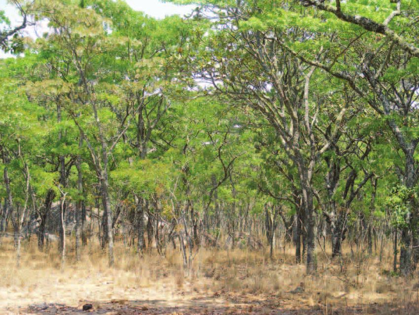
WWF-Miombo Eco-region Conservation Strategy Page 4INTRODUCTION This chapter presents a historical account of work carried out by WWF and its partners in the Miombo eco-region over the last 25 years. Miombo Eco-region overview The Miombo woodland is a dominant vegetation type that covers 3.6 million square kilometres, spreads over ten countries of Southern Africa and is globally recognized for its biological diversity and potential for nature based tourism. “Miombo” is the Swahili/Bantu word for Brachystegia, a genus of large trees, which characterizes this African woodland. The term is now used to cover other associated vegetation types found in Southern Africa. The woodland is linked to the Zambezi River and its tributaries such as the Kafue, Luangwa and Shire (Fig 1) and provides crucial life support systems for over 65 million people. Indeed, some of Southern Africa’s iconic national parks- Hwange, Chobe, South Luangwa, Lower Zambezi and Mana Pools-with their globally significant populations of mega-fauna (e.g. elephant-WWF flagship species, rhino-WWF flagship species, lion, buffalo and leopard) and flora such as the Zambezi /African teak-WWF footprint impacted species are found in the Miombo woodland. Consequently, securing its conservation and sustainable use is critical for the socio-economic development of Southern Africa. It is therefore not surprising that the woodland is one of the 35 priority ecoregions/priority places of the Global Programme Framework of the World Wide Fund for Nature (WWF). With input from regional and international scientists, WWF identified 26 Areas of Biological Significance (ABS) throughout the Miombo eco-region in the early 2000s. The areas became focal landscapes for WWF’s conservation and footprint work in the ecoregion. ABSs are large landscapes that represent biodiversity, ecological processes and goods and services of an ecoregion. The Victoria falls-one of the, “Seven Wonders of the World,” is on the Zambezi River WWF-Miombo Eco-region Conservation Strategy Page 5
Figure 1: The woodland and river system network of the Miombo eco-region

                                          WWF-Miombo Eco-region Conservation Strategy 		   Page 6
Achievements of WWF offices and projects WWF has been working in the Miombo ecoregion for over 25 years, addressing different conservation issues that include: freshwater, forests, species, protected area networks, livelihoods and environmental education. This has been accomplished through collaboration with partners, from both conservation and non-conservation oriented sectors, albeit with limited coordination between projects. Results of these different initiatives have not always been adequately documented and shared in an integrated manner-making it difficult to assess the impact of WWF’s work in the ecoregion. Notwithstanding, the organization’s efforts have contributed to a number of achievements that include: participatory natural resources management; linking conservation delivery with livelihood diversification and improvement; conservation and sustainable use of WWF flagship species; policy and strategy frameworks for sustainable bio-fuel investments; and environmental flows. The achievements are elaborated in this section. Participatory natural resources management With technical, financial and/or oversight support from WWF and other partners, several Basin states have supported Community Based Natural Resource Management (CBNRM) programmes and activities for more than two decades. These initiatives, which include the Community Areas Management Programme for Indigenous Resources (CAMPFIRE) in Zimbabwe; Namibian National CBNRM Programme (Community Conservancies); and the Regional Southern Africa CBNRM Programme have greatly influenced global thinking on sustainable use and devolved systems of natural resources management. Unfortunately, the effectiveness of the CAMPFIRE Programme has declined considerably under the adverse socio-economic conditions in Zimbabwe of the past decade. However, some observers have reported the high level of resilience of the CAMPFIRE programme despite the adverse socio-economic conditions in the country. Namibia’s CBNRM programme continues to flourish with lessons learnt being shared with neighbouring communities in Zambia and elsewhere, partially by building synergy with the Regional Southern Africa CBNRM programme. CBNRM is an incentive based conservation and development approach that is implemented by people who live with and directly depend on biological resources. Its success has largely depended on the level of devolution, donor commitment, policy changes, links with tourism and hunting and the economic viability of the resource base for initiatives such as hunting, tourism and enterprise development. The key economic driver of CBNRM in Southern Africa has been wildlife (large mammals), mostly through trophy hunting and eco-tourism. The potential role of veld products in these areas is only beginning to be realized through value addition and commercialization. Such products have potential for nutritional, pharmaceutical and industrial use, and for generating income for rural people. Consequently, they have the capacity to broaden the economic viability of CBNRM initiatives. One advantage of veld products is their wider distribution when compared to wildlife. Linking conservation delivery with livelihood diversification and improvement WWF is promoting the formal management of traditional or communal land by local communities in the Bangweulu Basin (Zambia) using honey production, fish farming and conservation agriculture as entry points/incentive systems. Under this initiative, some 27 532 ha of traditional land was mapped out, characterized and delineated for active management. Of the mapped area, 730 ha were set aside for local level management through formal agreements drawn up by communities and sanctioned by the traditional leadership. The remaining land will be zoned and participatory land use plans developed collectively by local institutions, traditional leaders and local communities. WWF-Miombo Eco-region Conservation Strategy Page 7
The latter received training in by-law formulation and subsequently elaborated rules on the
management of the land. The laws highlight what can and cannot be done on the zoned land and were
ratified by the traditional leadership.

The success of this initiative will largely depend on the level of direct benefits that accrue to
communities from honey production, fish farming and conservation agriculture. In the area of honey
production, a revolving fund was established to enable members of bee keeping groups to increase the
number of hives per individual from three to at least seven. Beekeepers are also encouraged to feed
bees to enhance their productivity.

Conservation and sustainable use of WWF flagship species

Together with its partners, WWF has been working in assisting governments of Southern Africa to
conserve and sustainably use wildlife species such as elephants. This has included support to the
improved management of wildlife in Protected Areas (PA); and in catalysing the implementation of
sustainable use initiatives such as CAMPFIRE in Zimbabwe and the national CBNRM in Namibia.
Conservation and sustainable use approaches adopted by governments have resulted in increases in
elephant numbers over time. For example, Zimbabwe’s elephant population steadily increased from
4 000 in 1900 to 120 000 in 2008.

Another example of successful species conservation work has occurred in the Caprivi region of
Namibia. Census work has documented increasing wildlife populations along the north-east rivers
and flood plains between 2004 and 2007; and 2007 and 2009 respectively. The increase in wildlife
both within protected and conservancy areas may be attributed to the movement of wildlife within
the Caprivi and movements between Botswana and the Caprivi as well as local conservation initiatives
such as conservancies which encourage increased wildlife numbers through reduced poaching and
game introductions.

Rising wildlife population numbers have led to increased human-wildlife conflicts. The birth of
CAMPFIRE in the early 1980s was, among other things, aimed at addressing this challenge. WWF, in
partnership with the Food and Agricultural Organization (FAO) and BioHub (a consortium of local
and international Non Governmental Organizations-NGOs) supported the development of a toolkit for
Human-Elephant Conflict management. The kit is being promoted in a number of Southern African
countries. In Namibia, WWF and its partners have assisted conservancies in the Caprivi region to
develop an internal insurance scheme that provides a fixed level of reimbursement for documented
cases of damage by wildlife.

Policy and strategy frameworks for sustainable bio-energy investments

WWF carried out studies to assess the status of bio-fuel production in Southern Africa. The studies
showed that although Malawi, Mozambique, Zambia and Zimbabwe have established sugarcane
industries, only Malawi and Zimbabwe can produce significant amounts of bio-ethanol from
molasses, a sugar by-product. All four study countries (plus Botswana) have initiated some work on
Jatropha cultivation for bio-diesel production. However the latter is still in its infancy. Current bio-
fuel investments in the study countries range from large to small scale. The former are supported
by national and international investors and the latter are mostly facilitated by Non Governmental
Organizations (NGOs).

                                                  WWF-Miombo Eco-region Conservation Strategy 		      Page 8
With respect to large scale bio-fuel production, the studies showed that such initiatives are operating in a policy vacuum as national bio-fuel policies are still evolving and are usually not more than general statements on renewable energy or on bio-fuels. The studies demonstrated that without sound policies and strategies, benefits from such investments will have no bearing on poverty alleviation; respect for human rights; or environmental conservation. Consequently, they recommended the need for a regional bio-fuels policy and strategy framework that would inform the development of country specific bio-fuel policies and strategies. The regional framework was adopted by the Southern African Development Community (SADC) at a joint WWF and SADC regional meeting. Environmental flows Hydropower generation in the Zambezi River Basin is essential for meeting the ever increasing energy demands of Southern Africa and additional dams are planned for this purpose. They include the Mphanda Nkuwa hydropower dam in Mozambique and the new Kafue Gorge Lower in Zambia. Artificial reservoirs for hydropower generation such as Kariba, Kafue and Cabora Bassa gorges have modified the Middle and Lower Zambezi Basin by altering the flow and flood regime downstream, including the Zambezi delta. The dams have changed downstream ecology, largely through the loss of seasonal high and low flows and sediments trapped behind the dam wall. This has contributed to habitat loss and declines in plant and animal biodiversity. Environmental flows (Eflows) are the quantity, timing and quality of water flows required to sustain freshwater and estuarine ecosystems and the people who depend on the ecosystems. It implies mimicking-within given limitations-natural flows in the river basin. An understanding of the upstream-downstream consequences and stakeholder trade-offs is therefore a key element in the design and management of water courses such as the Zambezi River Basin. This mitigates many threats associated with the disruption of natural river flows by dams and other large infrastructural works including irrigation. In partnership with other stakeholders, WWF made a breakthrough in environmental flows that involved the modification of the Itezhi-Tezhi dam operating rules in the Kafue flats. This resulted in the release of freshets mimicking natural flows that existed before the construction of the dam. However, there is need for enhanced understanding and quantification of possible effects of environmental flow releases and verification of project benefits where possible. This will further require high level negotiation and persuasion at the level of decision makers to obtain the necessary buy-in and internalization of environmental flows management. This is mainly because of the strategic nature of dam operations. WWF-Miombo Eco-region Conservation Strategy Page 9
THE ZAMBEZI RIVER
BASIN FOCUS
This chapter provides justification for revising the Miombo Eco-region Conservation Strategy with a
focus on the Zambezi River Basin (ZRB). It gives a brief overview of the biodiversity status of the Basin
including major biodiversity threats and opportunities; and describes priority focal landscapes for
future WWF work.

Motivation for realigning WWF’s geographic focus
The 2009 WWF Programme Audit of the Eastern and Southern African Regional Programme Offices
noted the vast extent of the Miombo eco-region and identified a need to focus WWF’s conservation
work within the ZRB and to revise the Miombo eco-region conservation strategy accordingly. The ZRB
is representative of the eco-region as it covers a third of its geographical area, is home to over 60%
of its human population and accommodates eight of its 26 ABSs. Consequently, the Revised Miombo
Eco-region Strategy focuses on the ZRB and is informed by the Eastern and Southern Africa Regional
Programme Office (ESARPO) Conservation Plan of 2011-2015.

Status of biodiversity in the Zambezi River Basin
The ZRB is a multiple catchment basin that covers 1.3 million square km and is the largest basin in
Southern Africa. It is shared by eight riparian states (Table 1).
Table 1: Proportion of riparian states comprising the Zambezi River Basin
   Riparian state       Proportion
                      within Basin, %
Zambia                               41
Zimbabwe                             19
Angola                                11
Mozambique                            11
Malawi                                 8
Botswana                               6
Namibia                                2
Tanzania                               2

The Basin is divided into three sections that differ in landscape characteristics, geological history
and biodiversity. They are the upper Zambezi-comprising the headwaters of the Zambezi and Liuwa-
Mussuma area; the Middle Zambezi-covering Victoria Falls to the confluence of the Luangwa river;
and the lower Zambezi-starting at the confluence of the Luangwa river to the coast at Chinde and
includes the Shire river. The Basin is home to about 38 million people and accommodates some 33% of
the total population of six riparian states (Chenje, 2000). It is an area of high biodiversity value and is
critical to human livelihoods as illustrated by the following:

                                                 WWF-Miombo Eco-region Conservation Strategy 		     Page 10
• It has more than 6 000 species of flowering plants, 650 species of birds and 200 species of
mammals. The latter includes elephant and rhino, WWF flagship species;
• It consists of some of Southern Africa’s most important sub-ecosystems, biomes and landscapes
characterized by teak forest reserves in Zambia and Zimbabwe; and wetlands and protected
areas such as Chobe National Park in Botswana, Liwonde in Malawi, Gorongoza-Marromeu in
Mozambique, Kafue and Luangwa in Zambia and Hwange in Zimbabwe;
• Its rivers provide most of Southern Africa’s power generation; irrigation; domestic and industrial
water supply; ecosystems use; and inter basin transfers. Water demand for some of these uses is
shown in Table 2: and,
• It provides livelihood to some of the poorest communities of southern Africa who depend on
subsistence agriculture and the exploitation of natural resources for survival. It is estimated that
close to 60% of households across the Basin live on less that $1/day.
Table 2: Water demand for select uses in riparian states during 1995 (million cubic metres/year)
Riparian Domestic & Stock Mining & Irrigation Total
state industrial energy
Angola 1 720 272 15 750 2 757
Botswana 175 44 65 47 331
Malawi 730 23 5 1 820 2 578
Mozambique 135 65 10 3 000 3 210
Namibia 200 70 15 248 533
Tanzania 1 690 70 10 10 450 12 220
Zambia 532 60 20 1 580 2 192
Zimbabwe 697 30 30 4 980 5 737
Source: Chenje, 2000.
Major threats to and opportunities for biodiversity conservation
Major threats
Major threats to the integrity of biodiversity in the ZRB include: high population growth;
environmental degradation; weak national institutions; large scale infrastructural and agricultural
investments; and climate change. They are highlighted in this section.
a. High population growth
The Basin has a human population that is growing at an average rate of 2.9% annually, is
predominantly poor and dependent on subsistence agriculture and natural resources. Population
growth is linked to land clearing for agriculture and for wood energy (including charcoal). Wood is
the primary energy source for rural communities who constitute the bulk of the population of riparian
states. Its demand in urban areas is also on the increase due to the high cost and limited availability
of electricity. Deforestation contributes to loss of habitat; and increased soil erosion and river
sedimentation that negatively impact water quality. Industrial expansion is also increasing the levels of
water pollution and raising demands on water and ecological resources.
WWF-Miombo Eco-region Conservation Strategy Page 11According to the 2000 State of the Environment Report for the ZRB, poverty is probably the biggest
single constraint to the effective conservation of the Basin and its biological components. With the
exception of Botswana, riparian states are poor countries whose external debt, terms of trade and
market access, and dependence on single commodities combine to create an adverse macroeconomic
climate (Table 3). Furthermore, inadequate access to capital, employment and markets, top down
development, natural disasters, over dependence on agriculture and decreasing land availability
contribute to natural resource degradation.
Table 3: Some key socio-economic statistics on riparian states
Riparian GDP ($ GDP per Population Urbanization (%)
state billions) capita ($) (millions)
Angola 9.76 696.9 14.0 42.4
Botswana 6.50 2 796.0 1.7 46.4
Malawi 2.28 198.0 11.5 15.0
Mozambique 4.09 226.0 18.1 23.0
Namibia 2.82 1 667.0 1.8 27.0
Tanzania 9.74 266.0 33.6 30.0
Zambia 4.34 392.0 10.7 35.0
Zimbabwe 22.00 1 891.0 11.6 33.6
Source: SADC, 2006
b. Environmental degradation
The Basin is experiencing significant levels of environmental degradation and biodiversity loss
(Chenje, 1998). Table 4 shows changes that took place on selected land cover types between 1990 and
2006. The greatest changes occurred to primary woodlands and wet grasslands that were reduced by
9.2% and 7.5% respectively. The greatest expansion was rain-fed agriculture, mixed woodlands and
settlement areas. The loss of vegetation cover contributes to biodiversity loss, increased run off, soil
loss, decreased base flows, and siltation of water bodies and reduced tourism opportunities.
Table 4: Change in some land cover types in the ZRB: 1990-2000; and 2000-2006
Land cover type % cover % cover % change % cover % change
in 1990 in 2000 1990 to 2000 in 2006 2000 to 2006
Primary woodland 22.6 15.8 -6.5 13.1 -2.7
Mixed woodland 22.8 28.8 +5.9 31.3 +2.5
Built up areas 5.7 11.4 +5.7 13.4 +2.3
Rain fed agriculture 11.7 17.9 +6.2 21.3 +3.4
Irrigated fields 0.1 3.5 +3.4 4.4 +0.9
Wet grasslands 13.8 7.7 -6.1 6.3 -1.4
Open grasslands 9.6 5.4 -4.2 4.9 -0.7
Deep water body 6.1 4.1 -2.0 3.2 -0.9
Rivers 1.9 0.6 -1.3 0.5 -0.1
Source: WWF SARPO, 2007
WWF-Miombo Eco-region Conservation Strategy Page 12c. Weak national institutions
National institutions that deal with biological resources in the Basin states are generally weak in policy
formulation; enforcement of legislation; and provision of management oversight on various resources.
In addition, the implementation of SADC wide protocols such as those on: shared watercourse
systems; wildlife conservation and law enforcement; energy; trade; and forests is inadequate. This
is largely attributed to inadequate human and financial resources (SADC, 2006). In addition, local
level institutions that deal with biological resources have been weak, especially under communal land
tenure systems. Furthermore, there has been limited participation by women in existing institutional
structures.
d. Large scale infrastructural and related investments
Large investments include transportation, dams and communication infrastructure; extractive
industries; and bio-energy plantations as elaborated below.
Transportation and communication infrastructure: Increased demands for development are resulting
in new roads, power lines and communication towers/lines being built. These developments frequently
traverse biodiversity sites or interrupt wildlife migration corridors.
Extractive industries: The global rise in demand for oil and minerals has contributed to increased
prospecting and development of mines or oil fields in some Basin states. Some of this is taking
place in national park areas. Unfortunately, such developments frequently occur at the expense of
unique biodiversity assets although little of the generated benefits go back into conservation or rural
development.
Bio-energy plantations: European and Chinese investors are actively seeking land for bio-fuel
feedstock cultivation in some Basin states. This is in response to a recent surge of interest in bio-fuels
caused by high prices of imported fossil fuels, energy security and climate change concerns; while the
major motivation for embracing bio-fuels by basin states is a desire to promote rural development
and reduce poverty. However, improper large scale bio-fuel investments may in fact create high Green
House Gas (GHG) emissions if they lead to direct land use change or indirect land use change (ILUC).
Consequently, they can be an emerging driver of global warming, habitat alteration, biodiversity loss,
food insecurity and community displacement and disenfranchisement, if not properly guided and
responsibly implemented. Community level bio-fuel feedstock production, processing and utilization
can also be a livelihood diversification and enhancement option.
e. Climate change
Climate models indicate that there will be a 1.5-2.5 degrees Celsius temperature increase across the
Zambezi river basin within the coming 40 years. Rainfall predictions across the Basin vary. In general
terms, four main regions with different rainfall predictions are considered relevant for the Basin. They
are:
• The south region (southern Zambia, Botswana, Namibia, Zimbabwe and Mozambique) is expected
to receive less rainfall particularly less winter rainfall and a condensed summer rainfall season
(albeit with little change in total summer rainfall). Some projections suggest decreased mean
annual rainfall of up to 10% by the end of the 21st century;
WWF-Miombo Eco-region Conservation Strategy Page 13• The north eastern part of the Basin (eastern Zambia-part of Kafue and Luangwa and Malawi)
will experience an increase in mean annual rainfall as a result of a wetting trend emanating from
Tanzania. Besides the increase in annual rainfall that could even reach 10%, the intensity of
rainfall events is projected to increase, with longer dry-spell duration intra-seasonality. Shifting
onset of the rains and marked rainfall variability in the early rainy season is anticipated;
• In the northwest (western Zambia, Angola-Upper catchment & Kafue) there will be opposing
wetting and drying instances based on the movement of the Inter-Tropical Convergence Zone-
(ITCZ); and,
• The coastal portion of the Basin (southern Malawi and coastal Mozambique-Lower Shire and the
Delta), that part which mostly concerns the delta, will experience opposing wetting and drying
instances and will be subject to increased cyclonic activity of higher intensity and possibly higher
frequency.
In order to get a better understanding of the hydrological consequences (like river discharges) of
climate change, other factors than rainfall need to be taken into account, like evapo-transpiration
and water retention and discharge characteristics of the system. These factors are determined by
development scenarios in the Basin such as increase in irrigated area, planned dams and other
developments that affect water use and regulation. It is therefore recommended to assess relevant
development scenarios to gain a better understanding of hydrological responses of the system. For
example, analyses to date show that although the Upper Zambezi might receive 5% more rainfall, the
increase of evaporation will result in the same amount of runoff or even decrease river flows depending
on the development and deforestation rate in the area. The Zambezi river main stem will experience
some to severe drying. The Kafue basin can expect the same level of water stress as the Upper Zambezi.
The Luangwa river is expected to see an increase in runoff, more peaks of floods and more water in the
river, but with a strong increase in irrigation, this could as well result in significant drying of regulated
systems. The same accounts for the Shire river. The Zambezi delta with the increased cyclonic activity
will (especially with more runoff from the Shire) generate more water in the Zambezi, but with
increased extremes and longer dry periods.
Understanding of the hydrological responses of the Zambezi basin to climate change is of great
importance to WWF because-besides expecting significant and diverse climate change responses
as described above-it determines to a great extend the sustainability of many conservation and
development initiatives being promoted by WWF. The aquatic and water dependent terrestrial systems
and thereby animal life are heavily impacted upon by the changing environment. As climate changes
different areas experience shifting temperatures and water availability. As such, species may migrate
or become extinct which affects the viability of eco-tourism and game parks. The key areas of risk
within the Zambezi River Basin from an environmental standpoint are primarily the Kafue sub-basin,
the Barotse flood plains, the Zambezi delta, Lake Malawi and the Shire river. Another example is that
high impact flooding events are expected (if appropriate steps are not taken) to occur more often
downstream of Victoria falls, especially in the Delta, hence putting people and wildlife at risk. Building
more dams would be a mal-adaptation response to this problem as the technocratic approach to water
management (e.g. construction of dams) is the very reason for unpredictable floods to take place.
Moreover, dams might very well be at risk throughout the Basin with possible reduced river flow over
several years hampering the ability of dams to generate electricity. Consequently, WWF’s ecosystem
approach to water management can be an effective and sustainable response to flooding.
WWF-Miombo Eco-region Conservation Strategy Page 14Major opportunities Major opportunities for biodiversity conservation and sustainable use in the Basin include: vast forest, woodland and wildlife resources; the untapped potential to add value to natural resources; its long history of participatory community-based natural resources management and the potential to further develop and expand it; and the existence of a network of protected areas that, combined with communally managed areas present unlimited tourism opportunities. They are elaborated in this section. a. Vast forest, woodland and wildlife resources Forests and woodlands constitute the dominant vegetation cover of the Basin and are therefore of vital importance in the regulation of river catchments. They help maintain the supply of water for irrigation, industry, hydropower and human consumption. When wetlands are well managed through balanced land use, woodlands absorb excessive rainfall during the rainy season that is gradually released during the dry season. In this way, they regulate stream flows and minimize both downstream flooding and drought conditions (maintenance of environmental flows). Woodlands also play an important role in reducing global warming as they are significant sinks of carbon dioxide. This offers riparian states opportunities to benefit from existing and potential carbon markets under voluntary schemes such as the Clean Development Mechanism (CDM) to trade their carbon stocks. Furthermore, the Reduced Emissions from Deforestation and forest Degradation (REDD+) offers riparian states an additional opportunity to benefit from global carbon trade. Carbon trading can be an important incentive for rural communities and nations to practice good environmental stewardship. With respect to wildlife, the miombo forests and woodlands provide habitat and wildlife corridors for species such as the elephant, buffalo, rhino, leopard and lion which are important for consumptive and non-consumptive tourism. Wildlife corridors are increasingly becoming important in TFCA wide conservation and tourism ventures. b. Untapped potential for value addition to natural resources With the exception of wildlife-based hunting and tourism, much of the Basin’s biological resources are of low economic value in their natural state. This is further compounded by a lack of linkages to global markets with the result that local communities derive little benefit from them. Consequently, some CBNRM initiatives that focus on resources such as veld products have had limited success. This has generated interest in bio prospecting; value addition through transformation; improved marketing (e.g. creation of producer associations) to external buyers; and in exploring opportunities offered by carbon trading. c. Enabling legal frameworks Governance changes on ownership and access to natural resources are beginning to emerge in some riparian states. For example, local bodies and communities are being empowered to manage and benefit from communal resources through the process of decentralization and devolution of administrative powers and responsibilities. This was the cornerstone of CAMPFIRE in Zimbabwe and Community Conservancies in Namibia. Customary ownership of land is also receiving legal recognition in some Basin states. For example, Mozambique’s land reform law of 1997 recognises customary land rights over local resources. Similarly, Namibia’s Nature Conservation Act of 1996 provided a basis for communal area conservancies and granted conservancy members the right to consumptive uses of WWF-Miombo Eco-region Conservation Strategy Page 15
wildlife. However, the impact of some of these policy changes on the sustainable management of
biological resources still remains to be seen in countries where they have been implemented while
in countries such as Zambia, resource tenure, even on customary land, remains not well articulated
and certainly not adequate as an incentive for local community participation in natural resources
management.

d. Existence of a network of protected areas

The proportion of Basin states under protected areas ranges from 6.6 % in Angola to 30.4% in Zambia.
Protected areas have the following attributes:

•   They have rich forest and wildlife biodiversity that has facilitated the development of a booming
    tourism industry;
•   They provide habitats for endangered species of flora and fauna. For example, the bulk of
    “Important Bird Areas” for threatened bird species such as the crowned crane and bearded vulture
    are found in protected areas; and,
•   They offer opportunities for TFCA initiatives as over 60% of them straddle international
    boundaries.

However, the integrity of most protected areas is threatened by poor management largely caused
by financial and human capacity constraints faced by Park’s Authorities; wildlife poaching by local
communities and national and international syndicates; and climate change.

Focal landscapes for the Conservation Strategy
Landscape prioritization

The revised Miombo Eco-region Strategy will be implemented in eight priority focal landscapes
selected by WWF. The pre-selection of landscapes is intended to ensure synergy and coherence
of the organization’s work. The landscapes are: Upper Zambezi; Kavango Zambezi (KAZA) TFCA;
Middle Zambezi-Luangwa Valleys; Lower Shire Valley; Zambezi Delta; Malawi-Zambia TFCA; Lake
Malawi/Niassa/Nyasa; and Bangweulu Basin (Fig 2). Reasons for choosing the landscapes include the
following:

•   They have considerable ecological inter-connectivity (e.g. Upper Zambezi & KAZA TFCAs);
•   They hold sizeable populations of flagship species (elephant and rhino) and footprint impacted
    species (the Zambezi/African teak);
•   They offer opportunities for trans-boundary work and are receiving collective investment priority
    by their respective governments (e.g. Upper Zambezi, KAZA, Middle Zambezi-Luangwa valleys
    and Malawi-Zambia TFCA);
•   WWF has used participatory approaches in its natural resource conservation work in most of the
    focal landscapes already. Similar approaches will be used to deliver on the strategic programme
    areas of the revised Miombo Conservation Strategy; and,
•   WWF and its partners have been working in most of the landscapes for some time and have made
    considerable investments and established important partnerships that should be followed through.

                                                WWF-Miombo Eco-region Conservation Strategy 		   Page 16
The eight landscapes cover a total area of 1 137 000 square km. For purposes of maximizing conservation impact, the landscapes were further prioritized into two groups. Group 1 landscapes are those that will require direct WWF engagement and investment while those in Group 2 will require less investment and can be transitioned to other external partners and/or can be used for cross cutting policy and advocacy work. Group 1 landscapes cover 923 000 square km and consist of Kavango- Zambezi TFCA, Middle Zambezi- Luangwa valleys, Upper Zambezi and Zambezi Delta. Bangweulu River Basin, Malawi-Zambia TFCA, Lower Shire Valley and Lake Malawi/Niassa/Nyasa comprise the Group 2 landscapes and cover 214 000 square km. Details on the area coverage and country spread of the landscapes is given in Table 5. Three of the Group 1 landscapes are found in Zambia; two in Zimbabwe; and one each in Mozambique and Namibia. With respect to Group 2 landscapes, Mozambique and Zambia host two while Tanzania has one. Fig 2: Geographical location of the focal landscape WWF-Miombo Eco-region Conservation Strategy Page 17
Table 5: Landscape land area and country coverage

   Priority landscapes         Area (1000 Country coverage
                                  km2)
                                                Ang       Bots     Mal    Moz Nam Tanz           Zam     Zim
                   Group 1
 Kavango – Zambezi TFCA                454      X          X                       X                 X    X
          Middle Zambezi -             223                                                           X    X
           Luangwa Valley
            Upper Zambezi              218      X                                                    X
             Zambezi Delta              28                                 X
                       Total           923      2          1       0       1       1       0         3     2
                   Group 2
          Bangweulu Basin               83                                                           X
   Malawi – Zambezi TFCA                52                         X                                 X
         Lower Shire Valley             41                         X       X
      Lake Malawi / Niassa              38                         X       X               X
                       Total           214      0          0       3       2       0       1         2     0

Landscape prioritization

The eight focal landscapes are briefly described in this section.

a. Kavango Zambezi Trans-frontier Conservation Area

The Kavango Zambezi (KAZA) TFCA is situated in the Okavango and Zambezi river basins where the
borders of Angola, Botswana, Namibia, Zambia and Zimbabwe meet. It is a joint initiative between
governments of the five riparian states to collectively form and manage what will eventually become
the largest TFCA in the world. Once formalized, it will encompass about 287 132 square km of land
that includes 36 national parks and game reserves; a significant number of forest reserves; community
conservancies; GMAs; and wildlife management areas; with open communal areas serving as linkages
between the conservation areas across the landscape.

KAZA TFCA has a rich array of conservation assets that include: approximately half of Africa’s
elephant population; small but increasing numbers of black rhino; the Okavango Delta, the world’s
largest Ramsar site; extensive and untouched wetlands and riparian habitats along the Okavango and
Zambezi Rivers; intact but increasingly threatened teak forests; and a large number of endangered,
threatened or rare mammals, birds, reptiles and plants.

                                                    WWF-Miombo Eco-region Conservation Strategy 		       Page 18
The TFCA offers the following opportunities:
• It is one of the least populated and under developed landscapes remaining in Africa. Consequently,
it has immense potential to be developed as one of the continent’s eminent tourist destinations;
• There is high potential to enhance recovery of wildlife stocks in low-density wildlife areas of the
landscape through translocations and natural range expansion;
• It can potentially become an important testing ground for the development and introduction of
standards and protocols for the use and trade of natural resource products, water management
and distribution schemes and other payment for environmental service type mechanisms; and,
• There is extensive potential to increase land under conservation management through the creation
of new parks, forest reserves and community managed areas.
b. Middle Zambezi-Luangwa Valleys
The Mid Zambezi-Luangwa Valleys landscape is shared by Zambia and Zimbabwe.
The Mid Zambezi Valley is an extension of the African Rift Valley. On the Zimbabwe side, it consists
of three national parks (Mana Pools-a world heritage site; Matusadona; and Kariba); five safari
areas; and communal lands (Dande and Mukwiche). On the Zambian side it encompasses the Lower
Zambezi National Park; and three GMAs namely Chiawa, Luano and Rufunsa. Mana Pools and
Lower Zambezi National Parks form part of the proposed Mid Zambezi-Luangwa Valley TFCA. The
Chiawa GMA “houses” the Chiawa Partnership Park. The Park will be a community and leaseholder
managed protected area. It offers an innovative model for conservation management that involves
local communities. The Zambezi valley is characterized by broken topography, low rainfall and poor
soils which limit agricultural production and rural settlement. Given the fragile nature of the valley,
wildlife is probably the valley’s most valuable asset. Its vegetation is characteristically dry deciduous
Colophospermum mopane and open woodland with trees and shrubs of varying height and density.
On higher ground and above the escarpment, miombo woodlands of Julbernardia globiflora and
Brachystegia species predominate. The valley holds significant wildlife populations and is one of
Zimbabwe’s foremost wildlife attractions. Its large mammals include elephants, buffalo, lion, impala,
hippo; has two Important Bird Areas; and carries 30 fish species and the crocodile. It used to be a
rhino habitat and there are plans to reintroduce the species into the Matusadona National Park, an
ideal habitat for the endangered species. The main land uses in settled areas include subsistence and
cash cropping and livestock production. Poaching and extractive industries threaten Mana Pools
National Park. For example, multiple exploratory mining projects recently commenced in the Lower
Zambezi Catchment Area from Lake Kariba downstream along the Zambezi river through the New
Partnership Park, and within the Lower Zambezi National Park.
Two large man-made lakes (Lake Kariba and Lake Cahora Bassa) are found in the Middle Zambezi.
Apart from generating the much needed hydro power, the dams are important tourist attractions and
affect environmental flows of the Zambezi River Basin. New power generation projects in the valley
will threaten the landscape’s ecosystem integrity. In addition, the valley presents suitable geological
formations for uranium, oil and natural gas prospecting. This and any eventual extraction of such
deposits frequently takes place at the expense of unique biodiversity assets, with little of the generated
revenue going back to conservation or rural development.
The Luangwa Valley is located in the eastern province of Zambia and is an extension of the Great East
Rift Valley. It consists of major protected areas (South Luangwa and North Luangwa) and several
Game Management Areas (buffer zones). It is drained by a network of streams including the Luangwa
WWF-Miombo Eco-region Conservation Strategy Page 19river and is home to the Luangwa floodplains (a Ramsar site and Important Bird Area).The Luangwa
river is not dammed for hydro power generation hence its flows are assured and occur naturally.
However, it could be targeted for hydro power generation projects. The valley consists of riverine
vegetation, Miombo tree species (e.g. African ebony and Natal mahogany) and Mopane woodlands;
and provides habitats for wildlife and fisheries. It shelters large populations of wildlife including
elephant, hippo, fish, birds and the wild dog and a founder population of black rhino has already
been reintroduced in the North Luangwa Park. It is also an important tourist destination as well as
a designated Ramsar site. Among the key threats to the valley are charcoal production, agricultural
expansion, illegal trade in wildlife products, human wildlife conflicts and extractive industries.
c. Upper Zambezi
The Upper Zambezi landscape starts on the Benguela plateau in Angola and extends through Zambia’s
remote western region down to Victoria Falls. Its western side includes the Barotse floodplain-a
Ramsar site; Sioma, Liuwa Plains and West Lunga National Parks; and Lukwakwa Game Management
Areas. The Barotse floodplain is famous for its fisheries and annual Barotse ceremony of “Kuomboka”
which is characterized by the movement of the Barotse people and their King from the floodplain
(when flooded) to the upland areas. The Liuwa Plains National Park is a large grassy plain and wooded
area. It witnesses Africa’s second largest wildebeest migration between Angola (Mussuma area) and
Zambia each year. The landscape has a total of 13 Important Bird Areas. The Barotse floodplains are
a critical water retention system for recharging the Zambezi River during winter and early periods of
summer before the onset of floods and control flooding downstream.
The vegetation of the Upper Zambezi is diverse and comprises western Zambezian grasslands,
Cryptosepalum dry forests, Zambezian Baikea woodlands and flooded grasslands. On the Angolan
side the country’s central highlands are dominated by Angolan miombo and extensive patches of
Cryptosepalum dry forests. Within the diverse vegetation of the landscape is a variety of wildlife
such as Sitatunga, wildebeest and the wattled crane. Rare and large mammals like cheetah, lion,
roan antelope and the African wild dog as well as buffalo, hartebeest and zebra are also found. Its
freshwater bodies carry various fish species.
Potential threats to the landscape include agricultural expansion, illegal trade in timber and wildlife
products, wild fires and human wildlife conflicts. Major opportunities are: the existence of a relatively
unexploited natural resource base and its associated tourism potential, including bird watching; the
proposed Liuwa-Musuma TFCA that provides suitable ecological conditions for wildebeest migration
between Zambia and Angola; and the huge upland forests (especially the Crytosepalum) that are
suitable for forest carbon trading through the REDD+ mechanism.
d. Zambezi Delta
The Zambezi Delta is a very diverse landscape. Its vegetation types include dry miombo and Acacia-
Combretum woodlands; Acacia woodlands in the valley; coastal forest with Brachystegia speciformis
on the Cheringoma plateau; and grasslands and swamps; as well as mangroves and littoral vegetation.
It has a number of protected areas including Gorongosa National Park, Marromeu Buffalo Reserve
and three Game Management Areas (coutadas). The remainder is under subsistence farming, although
commercial sugar plantations covered a significant area in the past.
WWF-Miombo Eco-region Conservation Strategy Page 20Plant diversity is high owing to the wide range in altitude and habitats. Historically, large mammal
diversity was high, but numbers greatly declined during and after the civil war. However, there are
now signs of recovery. The main wildlife concentrations are on the rift valley floor (elephant and plains
game) and on the Marromeu grasslands (buffalo and elephant). Bird diversity is high owing to habitat
diversity, with a number of localised forest species on Mt Gorongosa and Cheringoma, and important
wetland bird populations in the rift valley basin and the Zambezi Delta grasslands/wetlands. Tourism
potential is high, and is principally wildlife-based (mostly hunting), although infrastructure is
inadequate.
Major threats to the Delta’s biodiversity are commercial logging in the forests of Cheringoma, an influx
of subsistence cultivators and poaching. The wetlands have been impacted upon by the construction
of dams upstream. This adversely affects the Zambezi river flows and natural flooding regimes in
the delta. In addition, commercial agriculture, particularly sugar, may have a marked impact on the
landscape in future. Extensive fires sweep across the grasslands regularly, causing much destruction.
The Zambezi delta offers the following opportunities:
• River flows can be modified by implementing environmental flows;
• The Marrameu complex is already a Ramsar site and has a management plan. Based on this
experience, the development of a Ramsar site north of the river is possible; and,
• The delta has a number of programmes that can compliment WWF’s work. They include the
disaster early warning programme by the Red Cross and the community based biomass production
programme by Solidaridad.
e. Bangweulu River Basin
The Bangweulu Basin is located in north eastern Zambia. Although it falls outside the ZRB, a decision
was made to continue working in the landscape in recognition of WWF’s long and continuing
commitment to the area. The landscape is one of the most diverse areas in southern Africa. It consists
of more than 11 900 square km of seasonally flooded plains and permanent swamps and has two
dominant vegetation types namely swamp grassland in the lowlands and the Miombo woodlands in the
uplands. The vegetation-water complex provides a cross section of habitats for wildlife. The Bangweulu
Swamps do not only contain globally threatened and biome restricted species but also globally
important congregations particularly of stock, herons and water fowl. The importance of the landscape
derives from the following:
• It provides unique habitats for different species; and breeding and nesting sites for fish and birds;
• The landscape accounts for 20% of Zambia’s annual fish production and is important to local
traditional fisher communities;
• It has two national parks, five GMAs and about 40 forest reserves that hold considerable
biodiversity;
• Its extensive and largely intact forest areas provide an opportunity for the country and the resident
communities to benefit from global carbon trade through the REDD+ mechanism;
• It contains endemic and globally important species such as the black lechwe and shoebill stork;
and,
• It provides a source of livelihood for thousands of poor communities through the provision of
goods and services such as timber, game, fish, charcoal, wood fuel, fruits, medicines, edible insects,
mushrooms and spices.
WWF-Miombo Eco-region Conservation Strategy Page 21Major human activities in the upland areas of the landscape are low yielding shifting agriculture and
commercial charcoal production. On the other hand, fishing is the primary activity in the swamps and
wetlands although semi-permanent hoe cultivation is on the increase. Seasonal fishing attracts large
numbers of people who illegally overfish the swamps. Recently Zambia introduced a new concept in
African conservation-a “Community Partnership Park (CPP)”. This is a protected area with the status
of a national park but owned by the local community and managed by a private sector partner. Such
commercialization of conservation and natural resource management introduces new challenges and
opportunities. This raises the need to strengthen civil society to become a strong independent voice in
the management of biodiversity.
f. Malawi-Zambia TFCA
The Malawi-Zambia TFCA consists of Nyika and Kasungu National Parks and Vwaza Marsh Wildlife
reserve in Malawi and the Lukusuzi National Park in Zambia. Governments of the two countries have
combined the Nyika and the Kasungu/ Lukusuzi TFCAs to form this TFCA or landscape. The following
developments have taken place in the TFCA:
• An institutional framework consisting of committees and working groups was established. The
committees are addressing issues such as tourism, immigration, joint management and security;
• The Kasungu-Lukusuzi TFCA and Nyika TFCA project plans have been drafted and approved
respectively; and,
• A draft international treaty was approved by Ministers of Environment of both countries. The
signing of the Treaty by their respective Presidents will formally establish the TFCA.
Nyika National Park and Vwaza wildlife reserve are located in northern Malawi and have World
Heritage site status. The former is centred on a high undulating montane grassland plateau and has
a large number of plant species. It carries species such as the elephant and hippo. The Lukusuzi and
Kasungu National Parks are separated by traditional land on the Zambian side. This provides an
ecological link between the parks. Large ungulates (elephants and buffalo) move between the parks
through this ecological corridor. The parks are dominated by the Brachystegia boehmii woodland
and montane grassland. In addition, a number of forest birds move seasonally up and down the
escarpment. The Wattled Crane, a globally threatened bird species, is present and so is Mpasa, an
endemic fish species that breeds in small rivers running off the escarpment. The landscape has the
following protected areas: the Nkotakota Wildlife Reserve in the south, and the Nchisi, Chikangura
and southern part of Viphya Forest Reserves in the north. It has good access and scenery and has
significant potential for ecotourism.
Threats to the landscape include the construction of small dams on rivers running off the escarpment,
exotic timber plantations on the Viphya Plateau in the north; the invasion of alien tree species onto the
plateau grasslands; shifting cultivation; poaching; overfishing; increasing demand for wood fuel and
human encroachment into protected areas.
g. Lower Shire Valley
The Lower Shire Valley landscape consists of the Lower Shire Valley and its immediate surroundings
in Malawi and Mozambique. On the Malawi side it has one national park (Lengwe) two wildlife
reserves (Majete and Mwabvi) and four forest reserves. The Mozambique side has no formally
protected areas but some high biodiversity areas that could be candidates for some protection (e.g.
Morrumbala and Chiperone mountains).
WWF-Miombo Eco-region Conservation Strategy Page 22You can also read