MISSISSIPPI RIVER CORRIDOR CRITICAL AREA - City of Saint Paul
←
→
Page content transcription
If your browser does not render page correctly, please read the page content below
MISSISSIPPI RIVER CORRIDOR
                              CRITICAL AREA

Adopted - November 18, 2020                                237
                                                            237
Introduction
                      The Mississippi River Corridor Critical Area (MRCCA) Chapter guides land use and development along the
                      Mississippi River. Saint Paul contains 17 miles of river and 26 miles of shoreline within its city limits, the longest
                      of any municipality within the Critical Area. While other plans have been adopted as part of the Comprehensive
                      Plan that address the city’s relationship to the Mississippi (e.g. the Great River Passage Master Plan), the
                      Critical Area chapter uniquely responds to the requirements of Minnesota Rules, Chapter 6106, which lays out
                      a regulatory framework to protect the MRCCA’s resources and manage the balance between natural systems,
                      urban development, recreation, and commerce. (Note: The Water Resources Management Chapter contains
                      policies and implementation actions for surface water, groundwater, water supply and distribution, stormwater
                      and wastewater.)

                      Designated by Governor’s Executive Order in the 1970s, the Mississippi River Corridor Critical Area is a land
                      corridor along the Mississippi River in the Twin Cities Metropolitan Area governed by special land planning
                      requirements and land development regulations. These regulations, which are implemented through local
                      MRCCA plans and ordinances, protect and preserve the natural, scenic, recreational, and transportation
                      resources of this section of the Mississippi River. The MRCCA comprises 72 miles of river and 54,000 acres of
                      surrounding land in 30 local jurisdictions. Saint Paul’s portion of the Critical Area is shown on Figure 1.

                      In 1988, the U.S. Congress established the Mississippi National River and Recreation Area (MNRRA), a unit of the
                      National Park System, that shares the same boundary as the MRCCA. The Park’s Comprehensive Management
                      Plan (CMP), signed by the Governor and Secretary of the Interior, incorporates by reference the MRCCA
                      program for land use management. Rather than institute a separate layer of Federal regulations, the MNRRA
                      largely relies on the MRCCA to manage land use within the Park. This reliance establishes a unique partnership
                      and framework for land use management among local, State and Federal governments to protect the intrinsic
                      resources of the Mississippi River Corridor.

                      The City has made significant progress on furthering the goals and strategies laid out in the 2002 Mississippi
                      River Corridor Plan. Through improvements at Lilydale Regional Park, Upper Landing Park, Chestnut Plaza
                      (including City House), Harriet Island Regional Park (including Raspberry Island), both the character of public
                      space at the river’s edge and public access to the river have been greatly enhanced. Individual master plans
                      were prepared for key riverfront development sites – West Side Flats, Upper Landing, Victoria Park and
                      Ford – that took the design guidelines in the 2002 Plan to the next level. These master plans guide private
                      development and public infrastructure consistent with the goals of the Mississippi River Corridor Plan.

238   MISSISSIPPI RIVER CORRIDOR CRITICAL AREA                                                                               SAINT PAUL FOR ALL
Perhaps most significantly, the City Council adopted the Great River Passage Master Plan in 2013 as an
addendum to the Saint Paul Comprehensive Plan. The Great River Passage Master Plan contains guiding
principles, goals, objectives and concept plans to connect new and enhanced parks and natural areas along the
city’s 26 miles of shoreline with one another and with adjacent neighborhoods. The Master Plan is a community-
based vision with a corridor-wide perspective. It identifies transformative recreation and leisure opportunities
along the river, and balances them with the protection and restoration of natural resources, adding value to
adjacent land uses while respecting community and neighborhood desires for better access to the river. The
Plan represents an evolution and refinement of previous efforts, with the addition of specific recommendations
that will help Saint Paul work toward enhancing the natural environment and recreational qualities of the river,
as well as the livability and economic vitality of the city. In 2017, the City Council adopted the Saint Paul River
Balcony Master Plan, looking in more detail at one of the most popular ideas from the Great River Passage
Master Plan. The River Balcony is envisioned as a 1.5-mile pedestrian pathway along the downtown bluff from
the Science Museum to Union Depot, with connections to both the river’s edge and the rest of downtown.
Additional supporting materials for MRCCA Chapter policies can be found in the appendices beginning of page
250.

The following goals guide the           1. Recognition, celebration and protection of the defining feature of Saint Paul for
MRCCA chapter:                             the benefit of the health, safety and welfare of the residents of the city, state,
                                           region and nation
                                        2. Protection and enhancement of the unique urban ecology of the river corridor
                                           and valley
                                        3. An economically-vibrant working river
                                        4. High-quality and sustainable development that enhances the natural environment
                                        5. Equitable public access/strong connections to the Mississippi River
                                        6. The river as the backbone of a community-building network that extends beyond
                                           the shoreline and into the fabric of the surrounding neighborhoods
                                        7. Balance between all of the ways the river is a resource to Saint Paul -
                                           environmental, natural, economic, cultural, social, physical, recreational, historic,
                                           spiritual

Adopted - November 18, 2020                                                                                                        239
Districts                                            4. Pig’s Eye – The area just northwest of Pig’s
                                                              Eye Lake is designated as CA-ROS in the
      Six districts are defined in the MRCCA Rules,           Rules, but industrial on the City’s Future
      based on the natural and built character of             Land Use Map. Further, the CA-ROS district
      different areas of the river corridor. In addition      allows maximum heights of 35’ and the CA-
      to the state-mandated districts, the City of            UM district allows maximum heights greater
      Saint Paul has identified four reaches to guide         than 65’ with a CUP, while the underlying
      future land use and development within its river        zoning, I3 Restricted Industrial, allows
      corridor.                                               heights of 75’ as-of-right, with the option to
                                                              go higher with greater setbacks.
      There are four key locations with potential
      conflicts between the MRCCA Districts, the           Policy CA-1. Guide land use and development
      Future Land Use districts and/or zoning.             activities consistent with the management
      These are areas where Saint Paul will need           purpose of each of the MRCCA districts.
      to a strike a balance between the economic
      and social benefits of redevelopment and the
      natural, cultural and recreational resources of
      the Mississippi River. The City will utilize the
      criteria provided in the MRCCA Rules to evaluate
      potential visual impacts of additional height
      and if/when mitigation is needed. In some
      cases, the City may pursue flexibility in building
      height and/or district designation in the MRCCA
      ordinance.
      1. Ford Site – The underlying zoning districts
          (F2 Residential Mixed Low, F3 Residential
          Mixed Mid, F5 Business Mixed and F6
          Gateway) allow building heights 7-17’ taller
          than those permitted in the CA-RTC and CA-
          UM districts.
      2. Shepard Davern – The CA-RTC district
          allows heights of up to 48’ with a
          Conditional Use Permit (CUP), whereas the
          underlying zoning of T3 allows heights of up
          to 55’ without a CUP.
      3. West Side Flats – The CA-UM district allows
          maximum heights of 65’ without a CUP,
          while the underlying zoning of T3M (West
          Side Flats Master Plan) allows building
          heights of 75’ as-of-right and up to 90’ with
          a CUP.

240                                                                                       SAINT PAUL FOR ALL
Primary Conservation Areas
                                                   The River Reaches                                    wetlands, ponds, and lakes. Its features were
                                                                                                        formed by dynamic natural processes and
Primary conservation areas (PCAs) define key                                                            frequent flood events that inundate much of
natural and cultural resources and features        The Great River Passage Master Plan provides
                                                                                                        the area. The Valley is a place of constant
that are addressed by the MRCCA rules.             the long-term vision for orienting the city          change, and most areas within this reach are
These resources include shore impact zones,        toward the river, and connecting parks and           undeveloped, except for widely scattered high
wetlands, floodplains, confluences with major      natual areas along the river to one another and      points at the valley’s edges.
tributaries, bluff impact zones, native plant
                                                   adjacent neighborhoods. The plan divides the
communities, and significant existing vegetative                                                        Downtown Reach
stands, natural drainage routes, unstable soils    Saint Paul riverfront into four “reaches:”
                                                                                                        The more natural landscapes of the Gorge and
and bedrock, tree canopies, and cultural and                                                            the Valley give way to dramatic urban forms
historic properties. Key features and resources    Gorge Reach                                          of Downtown on the bluffs and the structured
have been defined as PCAs throughout the           The Gorge is a deep river valley located west of     river edges on the east bank. On the west
MRCCA districts to ensure that they are given      downtown that is defined by steep limestone          side, the geometric lines and engineered flood
priority consideration for protection. Maps CA-2                                                        control levees, along with marinas and smaller-
                                                   cliffs and heavily wooded slopes that come
through CA-6 and HP-1 through HP-5 identify                                                             scale commercial buildings bisected by bridges,
locations of PCAs within the MRCCA boundary.       right to the river’s edge. The Gorge Reach
                                                                                                        presents a very different urban river edge
Additional information on Primary Conservation     extends from the Minneapolis city limits at the
                                                                                                        character.
Areas can be found in Map P-1 and Appendix         upstream end near the historic Meeker Dam, to
B in the Parks, Recreation and Open Space          Fort Road (7th Street West) to the south. With       Floodplain Reach
chapter; the regional park master plans; Map       the exception of the Ford Lock and Dam #1,           The Floodplain Reach is a landscape of
WR-1 in the Water Resources Management                                                                  contrasts. The vast open spaces of lakes,
                                                   and the occasional bridge crossing high above,
chapter; and Maps HP-1 through H-5 in the                                                               wetlands, and floodplain forests of the Pig’s
Heritage and Cultural Preservation chapter.        river travelers are completely separated from
                                                                                                        Eye area are a counterpoint to the heavily
                                                   the city that comes right to the top of the bluffs
                                                                                                        wooded and steeply sloping Highwood bluffs
Policy CA-2. Protect Primary Conservation          above them. This is a place of great scenic          that define the eastern edge of the valley.
Areas through planning, land use and land          beauty, ecological richness and diversity.           Heavy industrial uses at both ends of the reach
alteration regulations, and other tools.                                                                are connected by Highway 61 (also known as
                                                   Valley Reach                                         the Great River Road National Scenic Byway)
Policy CA-3. Minimize impacts to PCAs from         The vertical bluffs of the Gorge give way to         and heavily used rail lines, which form a major
public and private development and land use        the steeply wooded slopes of the Valley at the       barrier between the bluffs and floodplain
activities.                                        confluence of the Mississippi and Minnesota          landscapes. The industrial uses and major
                                                   Rivers. The Valley Reach extends from the            transportation infrastructure contrast with the
Policy CA-4. Regulate development in the           Fort Road Bridge to Downtown. The Valley is a        less densely developed and heavily wooded
floodplain consistent with the requirements of     broad floodplain of expansive swamp forests,         neighborhoods to the east.
the Federal Emergency Management Agency
(FEMA) and the FEMA Flood Insurance Program
(FIP).                                             Policy CA-6. Promote the preservation and            Policy CA-8. Restore removed native plant
                                                   re-establishment of natural vegetation on            communities and natural vegetation in riparian
Policy CA-5. Manage vegetation and conduct         privately-owned property.                            areas as development occurs.
vegetation restoration consistent with park
master plans and MRCCA requirements.               Policy CA-7. Consider alternative design             Policy CA-9. Explore permanent protection
                                                   standards related to subdivision and                 measures (such as acquisition and conservation
                                                   development of land within the MRCCA, such as        easements) to protect PCAs.
                                                   conservation design or transfer of development
                                                   rights, in order to protect or restore PCAs.
Adopted - November 18, 2020                                                                                          MISSISSIPPI RIVER CORRIDOR CRITICAL AREA   241
MRCCA Districts                                        • River Towns and Crossings District (CA-              •   Urban Mixed District (CA-UM)
                                                         RTC)                                                       The Urban Mixed District includes large
  The six MRCCA districts located within the                The River Towns and Crossings District                  areas of highly urbanized mixed use that
  City of Saint Paul are described below and                is characterized by historic downtown                   are a part of the urban fabric of the river
  Illustrated on the proceeding page:                       areas and limited nodes of intense                      corridor, including institutional, commercial,
                                                            development at specific river crossings,                industrial, and residential areas and parks
  •     Rural and Open Space District (CA-ROS)              as well as institutional campuses that                  and open space. The CA-UM district must
        The Rural and Open Space District is                predate designation of the Mississippi                  be managed in a manner that allows for
        characterized by rural and low-density              River and that include taller buildings. The            future growth and potential transition of
        development patterns and land uses and              CA-RTC district must be managed in a                    intensely developed areas that does not
        includes land that is riparian or visible from      manner that allows continued growth and                 negatively affect public river corridor views
        the river, as well as large, undeveloped            redevelopment in historic downtowns and                 and that protects bluffs and floodplains.
        tracts of high ecological and scenic value,         more intensive redevelopment in limited                 Restoring and enhancing bluff and
        floodplain, and undeveloped islands. Many           areas at river crossings to accommodate                 shoreline habitat, minimizing erosion and
        primary conservation areas exist in the             compact walkable development patterns                   flow of untreated storm water into the
        district. The district must be managed to           and connections to the river. Minimizing                river, and providing public access to and
        sustain and restore the rural and natural           erosion and the flow of untreated storm                 public views of the river are priorities in the
        character of the corridor and to protect            water into the river, providing public                  district.
        and enhance habitat, parks and open                 access to and public views of the river,
        space, public river corridor views, and             and restoring natural vegetation in riparian        •   Urban Core District (CA-U)
        scenic, natural, and historic areas.                areas and tree canopy are priorities in the             The Urban Core District includes the urban
                                                            district.                                               cores of Minneapolis and Saint Paul. The
  •     River Neighborhood District (CA-RN)                                                                         CA-UC district must be managed with the
        The River Neighborhood District is               •   Separated from River District (CA-SR)                  greatest flexibility to protect commercial,
        characterized by primarily residential               The Separated from River District is                   industrial, and other high-intensity urban
        neighborhoods that are riparian or readily           characterized by its physical and visual               uses, while minimizing negative impacts to
        visible from the river or that abut riparian         distance from the Mississippi River.                   primary conservation areas and minimizing
        parkland. The district includes parks                The district includes land separated                   erosion and flow of untreated storm water
        and open space, limited commercial                   from the river by distance, topography,                into the river. Providing public access to
        development, marinas, and related land               development, or a transportation corridor.             and public views of the river are priorities in
        uses. The CA-RN district must be managed             The land in this district is not readily visible       the district.
        to maintain the character of the river               from the Mississippi River. The CA-SR
        corridor within the context of existing              district provides flexibility in managing
        residential and related neighborhood                 development without negatively affecting
        development, and to protect and enhance              the key resources and features of the river
        habitat, parks and open space, public river          corridor. Minimizing negative impacts to
        corridor views, and scenic, natural, and             primary conservation areas and minimizing
        historic areas. Minimizing erosion and the           erosion and flow of untreated storm water
        flow of untreated storm water into the               into the Mississippi River are priorities in
        river and enhancing habitat and shoreline            the district.
        vegetation are priorities in the district.

242   MISSISSIPPI RIVER CORRIDOR CRITICAL AREA                                                                                                   SAINT PAUL FOR ALL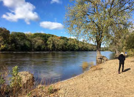
CA-0.1
Figure Mississippi
1: MRCCA River
Districts in Saint PaulCorridor Critical Area and Districts
Larpenteur Ave
Co Lake
m o Arlington Ave Phalen
Av
e
Lake
Payne Ave
Arcade St
Como
Maryland Ave Maryland Ave
Rice St
@
A
?
Jackson St
Ene r gy P ark
§
¦
¨
280
Dr 35E
Front Ave Case Ave
White Bear Ave N
Co llwater Ave
Pierc m Sti
Johnson P kwy
e Butl o
er R Av d
te Pha len Blv
Prior Ave N
n dalia St
Fairview Ave
e
Snelling Ave
Earl St
Minnehaha Ave Minnehaha Ave
St
Dale St
h 6th St
Thomas Ave 7t
Va
Ma rion St
3rd St
University Ave
§
¦
¨ 94
§
¦
¨ 94
Mo
Ro
nd
Lexington Pkwy
Burns Ave
W
Marshall Ave
u
sB
be
Up
ab
lvd
Ruth St
Selby Ave r Rd pe
rt
as
rne rA
St
Mi
Wa
ha
ss fton R
iss d
Victoria St
St
Summit Ave Downtown Reach ippi
Grand Ave
Ri
lvd
v
to B
er
Pla
Ay d
St £
¤
52
h
Saint Clair Ave 7t Ce
Cleveland Ave
sa
Mi
r
Rd
§
¦
¨
Cretin Ave
ll
Ch
35E
a e r Aft on Rd
ve
z Low
St
Stryker Ave
Smith Ave
Hamline Ave
McKnight Rd
Randolph Ave
£
¤
Snelling Ave
61
Floodplain Reach
Ford Pkwy
Districts Pig's
Eye
Lake
CA-RN River Neighborhood
Sa
Montreal Ave
Gorge
int
Reach CA-ROS Rural and Open Space
Pa
ul
Av
CA-RTC River Towns and Crossings
e
Rd
d
ar
ep CA-SR Separated from River
Sh
CA-UC Urban Core
Valley Reach
CA-UM Urban Mixed
Water
Mississippi River Corridor Critical 0 0.5 2 1
Area Boundary by River Reach Miles
Source: City of Saint Paul (2016); Minnesota DNR (2016)
Adopted - November 18, 2020 MISSISSIPPI RIVER CORRIDOR CRITICAL AREA 243
Shore Impact Zones                                 Public River Corridor Views                         Restoration Priorities

  Shore Impact Zones (SIZs) are lands located        A primary objective of the Critical Area Act is     Restoration of natural vegetation and plant
  between the ordinary highway water level           to protect views to and from the Mississippi        growth within the MRCCA has many benefits,
  of public waters and a line parallel to it at a    River. The Public River Corridor Views (PRCVs),     including the stabilization of soils, retention
  setback of 50 percent of the requirement           defined in Appendix C, are the highly-valued        and filtration of runoff, provision of habitat
  MRCCA district structure. SIZs apply to the        views within the river corridor, including views    and recharging of groundwater. The City of
  Mississippi, all of its backwaters, and its four   toward the river from public parkland, historic     Saint Paul supports the restoration of natural
  key tributaries (i.e., the Crow, Rum, Minnesota,   properties and public overlooks, as well as         vegetation throughout the MRCCA and will
  and Vermillion Rivers). The locations of the       views towards bluffs from the opposite shore.       support efforts of its local government partners
  SIZs are provided on Map CA-2.                     The wide variety of terrain and topographical       to do so. The DNR native plant communities/
                                                     features that lie within the MRCCA boundary         significant vegetative stands and opportunity
                                                     have blessed the city with some of the best         areas for vegetation restoration are mapped in
                                                     public views in the region. See Appendix C for      Map CA-6.
                                                     an overview of Public River Corridor Views and
                                                     details on each view.                               Land in the MRCCA in Saint Paul generally
                                                                                                         falls into one of four categories: parkland;
                                                     Policy CA-10. Regulate building height,             other public land, such as right-of-way; small
                                                     placement and design consistent with the intent     residential parcels; or land held as larger
                                                     of the MRCCA rules to protect, enhance and          parcels but already established as industrial or
                                                     minimize impacts to Public River Corridor Views.    institutional uses. It is not likely that substantive
                                                                                                         restoration projects on land in any of these
                                                     Policy CA-11. Protect and minimize impacts to       categories is feasible, since no substantial future
                                                     PRCVs from public development activities.           subdivisions of residential land are likely; public
                                                                                                         land other than parkland already serves other
                                                     Policy CA-12. Consider designated Public            public purposes that are likely incompatible
                                                     River Corridor Views from other communities         with vegetation restoration; and change from
                                                     in developing dimensional standards, view           industrial or institutional uses to uses more
                                                     impact evaluation procedures, and mitigation        compatible with vegetative restoration on the
                                                     identification procedures.                          remaining large parcels is unlikely due to both
                                                                                                         ownership and non-MRCCA policy reasons,.
                                                     Policy CA-13. Support shorter buildings closer to   Some restoration of existing vegetative
                                                     the river’s edge and taller buildings as distance   communities to enhance ecological function
                                                     from the river increases in order to maximize       within existing regional parks in the MRCAA
                                                     views of and from the river, and preserve visual    may be possible, but this would not constitute
                                                     access to the river as a public good (rather than   vegetative restoration for the purposes of the
                                                     privatized right).                                  MRCCA Rules. However, careful analysis of the
                                                                                                         identified vegetation restoration opportunity
                                                     Policy CA-14. Protect and minimize impacts          areas should be undertaken to identify any
                                                     to PRCVs from public and private vegetation         areas where a project may be feasible.
                                                     management activities.

244   MISSISSIPPI RIVER CORRIDOR CRITICAL AREA                                                                                            SAINT PAUL FOR ALL
Unstable soils are generally a result of a
combination of factors, including soil type,           Bluff Impact Zones
type/amount of vegetative cover and slope.
A general soil erosion susceptibility analysis         The MRCCA rules define the Bluff Impact Zone        2. A natural escarpment or cliff with a slope
based on slope is shown on Map CA-8. Some              as the bluff and land within 20 feet of the         that rises at least ten feet above the ordinary
known previous slope failures in Saint Paul            bluff (top of bluff and toe of bluff), as shown     high water level or toe of the slope, whichever
are also shown on the map. Bedrock may also            below. A “bluff” is defined within Minnesota        is applicable, to the top of the slope, with a
be susceptible to erosion, though over longer          Rule Section 6106.0050 Subp. 8 as a natural         slope of 75 degrees or greater.
timelines. Bedrock formations in Saint Paul are        topographic feature having:
shown on Map CA-9.                                     1. A slope that rises at least 25 feet and the
                                                       grade of the slope averages 18 percent or
Policy CA-15. Support re-establishment on both         greater measure over a horizontal distance of
publicly- and privately-owned property of native       25 feet, as follows:
plants and/or natural vegetative communities              a. Where the slope begins above the ordinary
to provide wildlife habitat, soil stabilization, and      high water level, from the toe of the slope to
runoff filtration.                                        the top of the slope; or
                                                          b. Where the slope begins below the ordinary
Policy CA-16. Protect native and existing                 high water level, from the ordinary high water
vegetation during the development process,                level to the top of the slope; or
and require restoration if any is removed by
development. Priorities for restoration include
stabilization of erodible soils, riparian buffers
and bluffs or steep slopes visible from the river.

Policy CA-17. Sustain and enhance ecological
functions (habitat value) during vegetation
restoration.

Policy CA-18. Seek opportunities to restore
vegetation to protect and enhance identified
PRCVs.

Policy CA.-19. Seek opportunities to restore
vegetation in identified restoration priority areas
through site plan review and related vegetation
permits.

Policy CA-20. Evaluate proposed development
sites for erosion prevention, and bank and sloe
stabilization issues; require restoration as part
of the development process.

Policy CA-21. Pursue opportunities to clean-
up known areas of significant contamination
(such as the Pig’s Eye Superfund site) within the
Critical Area.
Adopted - November 18, 2020                                                                                             MISSISSIPPI RIVER CORRIDOR CRITICAL AREA   245
Surface Water Uses
  Native Plant Communities and                         Significant vegetative stands depict those
  Significant Existing Vegetative                      considered significant by the National Park
                                                                                                         In Saint Paul, surface water uses vary from
  Stands                                               Service and Minnesota DNR because they
                                                                                                         barge operations and fleeting to recreational
                                                       are largely intact and connective to native
                                                                                                         boating. Via barges, Saint Paul is an import
  Native plant communities are defined within          communities. Significant Vegetative Stands
                                                                                                         destination for products vital to the region, such
  the MRCCA rules as a plant community that            are described by the Metropolitan Council as
                                                                                                         as road salt, cement, fertilizer, aggregate and
  has been identified as part of the Minnesota         follows:
                                                                                                         other commodities. Barge fleeting currently
  Biological Survey (MBS) or biological survey                                                           takes place mostly in the Downtown and
  issued or adopted by a local, state or federal        This vegetation provides high ecological
                                                                                                         Floodplain reaches; it should be avoided in
  agency. The MBS further identifies a Native           value in addition to the water quality and
                                                                                                         the Valley Reach upriver of the confluence of
  Plant Community as a group of native                  scenic values of “natural vegetation.”
                                                                                                         the Mississippi and Minnesota rivers and in the
  plants that interact with each other and the          Ecologically, this vegetation provides
                                                                                                         Gorge Reach. Recreational boating occurs all
  surrounding environment in ways not greatly           species diversity, habitat for endangered
                                                                                                         along the Mississippi River in Saint Paul, but is
  altered by humans or by introduced plant              and threatened plants (supporting 19 state-
                                                                                                         heaviest at the marinas and landings noted on
  or animal species. These groups of native             listed rare plant species and 15 state-listed
                                                                                                         Map CA-7.
  plant form recognizable units, such as an             rare animal species in the MRCCA), and
  oak forest, a prairie, or a marsh, that tend to       a continuous corridor where plants and
                                                                                                         The area of greatest potential conflict between
  repeat across the landscape over time. The            animals can naturally spread and disperse.
                                                                                                         barge and recreational uses is in the central
  Minnesota Department of Natural Resources             This latter characteristic is especially
                                                                                                         riverfront, generally between the High Bridge
  (DNR) describes the importance of native plant        important as habitat becomes more
                                                                                                         and Lafayette Bridge. Harriet Island Park,
  communities as:                                       fragmented, climate change accelerates, and
                                                                                                         Chestnut Plaza, Raspberry Island, the Minnesota
                                                        invasive species increase. In addition, these
                                                                                                         Boat Club, Paddleford Riverboat excursions
      Native plant communities provide a range          vegetation areas serve as living remnants of
                                                                                                         and the public dock generate significant boat
      of ecological functions that are increasingly     the original native communities that existed
                                                                                                         traffic in a relatively small area. At times of high
      recognized as valuable for the quality of life    in the corridor, even though they do not meet
                                                                                                         water, recreational boating may be restricted or
      in Minnesota and even for human health and        the size and quality criteria to be classified
                                                                                                         prohibited, especially in the Downtown Reach.
      safety. Among these functions are water           as a Native Plant Community by the MBS.
                                                                                                         Surface water uses are illustrated on Map CA-7.
      filtration, flood moderation, carbon storage,
      moderation of water-table level, local           Native Plant Communities and Significant
                                                                                                         Policy CA-22. Recognize the Mississippi
      temperature moderation, erosion control,         Existing Vegetative Stands in Saint Paul are
                                                                                                         River as a “working river” that is integral to
      and development and enrichment of soil.          identified in Map CA-6.
                                                                                                         the economies of Saint Paul, the Twin Cities
      Large tracts of native plant communities                                                           Metropolitan Area, Greater Minnesota and the
      provide opportunities for sustainable                                                              Upper Midwest, with trade connections to the
      resource use, such as logging systems that                                                         world through New Orleans and the Panama
      mimic natural cycles in forests and help                                                           Canal.
      to perpetuate all the beneficial functions
      that plant communities provide while also                                                          Policy CA-23. Balance commercial, industrial
      supplying commercial products.                                                                     and recreational surface water uses.

                                                                                                         Policy CA-24. Provide for barge fleeting,
                                                                                                         avoiding areas where it could have a negative
                                                                                                         impact on PCAs.

246   MISSISSIPPI RIVER CORRIDOR CRITICAL AREA                                                                                            SAINT PAUL FOR ALL
Water-Oriented Uses Existing water-oriented uses are identified on Policy CA-32. Partner with the Saint Paul Port
Map CA-7. Authority to remediate contaminated sites in
the river corridor.
Industry and commerce are an important Policy CA-25. Prioritize protection of natural
function of the Mississippi River in Saint Paul. resources, nature-based recreation and public Policy CA-33. Support the redevelopment of
The shipping industry also serves Greater access to the Mississippi River in the Gorge vacant and underutilized industrial sites as
Minnesota and the Upper Midwest. Located Reach. mixed-use urban villages that reconnect the city
1,800 miles inland from the Gulf of Mexico, the to the river, where these sites are not able to be
Saint Paul Port is a hub in the intermodal freight Policy CA-26. Prioritize protection of natural reused as commercial or industrial businesses
transportation system, where barge, rail and resources, nature-based recreation and public having an economic or operational need for a
truck traffic intersect. Agricultural products access to the Mississippi River in the Valley river location.
and other bulk materials are brought by rail and Reach.
truck from throughout the Upper Midwest, and Policy CA-34. Design new public and private
transferred to barges that travel to downriver Policy CA-27. Prioritize urban development, development to embrace the river and turn its
ports. Barge Terminal #1, Barge Terminal #2, activation of the riverfront, public access and face to it, so that the river’s edge becomes the
Southport Terminal and Upper River Services green connections to the Mississippi River in the city’s shared “front yard.”
are major locations requiring water access. Downtown Reach.
While there are no confirmed prospects for
the immediate future, the City acknowledges Policy CA-28. Prioritize a balance between
that river-related, shipping-related and river- urban development and natural resources
dependent industrial and commercial uses protection, and public access to the Mississippi
will continue to locate in the river corridor, River in the Floodplain Reach.
and be integral to Saint Paul’s quality of life
and continued economic growth. The City Policy CA-29. Limit commercial and industrial
recognizes that careful management of these land uses along the river to those having
uses is critical to avoid or minimize adverse an economic or operational need for a river
effects on the river. The City of Saint Paul location, provided that they do not:
regulates land use in these port areas. However, 1. have a significant adverse impact on water
barge fleeting is regulated by permits issued by or air quality in the river corridor; or
the United States Army Corps of Engineers. 2. substantially impair the visual character of
the corridor from adjacent neighborhoods
In addition, there are four recreational marinas or the river itself.
in Saint Paul – Watergate Marina, two marinas
managed by the Saint Paul Yacht Club (one by Policy CA-30. Support the replacement, as
the High Bridge, the other just upriver from the leases expire, of non-river-related businesses
Wabasha Bridge), and a marina between the with river-related businesses at Barge Terminal
Wabasha and Robert Street bridges. There #1, Barge Terminal #2, Red Rock and Southport.
are two canoe/kayak landings, a boat launch
at Hidden Falls, and a boat landing where the Policy CA-31. Minimize the visual and physical
Paddleford riverboats dock. The marinas and impacts of river-related commercial and
landings are all located in City or regional parks. industrial land uses through native vegetation
Watergate Marina is the planned location and landscaping.
for a new Environmental Learning Center as
envisioned in the Great River Passage Master
Plan.
Adopted - November 18, 2020 MISSISSIPPI RIVER CORRIDOR CRITICAL AREA 247Historical and cultural sites found Open Space & Recreational Transportation & Public Utilities
within the MRCCA boundary as Facilities
listed in the National Register of The Mississippi River corridor has been and
Historic Places. Open spaces and recreational features provide continues to be a critical transportation corridor
an opportunity for the public to engage with for movement of goods and people. For the
The City of Saint Paul is rich in history and purposes of this chapter, public transportation
the river. Saint Paul will continue to support
deeply connected to its past. The Mississippi facilities include transportation facilities
the connection between the public and the
River plays a large role in this connection to provided by federal, state, county or local
river through the planning, development and
the past. Those who have lived on the lands government and dedicated to public use, such
maintenance of open spaces and recreational
that now make up the City of Saint Paul have as roadways, transit facilities, railroads and
features. Several regional bike trails connect
understood the importance of the Mississippi bike/pedestrian trails. Public utilities include
and carry people through MRCCA; the City of
for thousands of years as a source of life and electric power facilities, essential services and
Saint Paul currently owns seven parks within
spirituality. The following list of the historical transmission facilities. Two power plants exist
it. Open space and recreational facilities are
and cultural sites listed in the National Register along the river: an Xcel Energy natural gas
identified in the Parks, Recreation and Open
of Historic Places within the MRCCA boundary facility on Shepard Road, and a District Energy
Space Chapter on Map PR-1.
1. Lock and Dam No. 2 co-generation facility in downtown. Xcel also
2. Edward Sr. and Markell Brooks House maintains a series of electric transmission
Policy CA-35. Maintain and expand public
3. Giesen-Hauser House towers along the north side of the central
access to the river’s edge.
4. Indian Mounds Park Site riverfront. The power generating facilities
5. Carvers Cave do not negatively impact PRCVs, but the
Policy CA-36. Maintain and expand open
6. West Summit Avenue Historic District transmission towers have a significant negative
space and recreational facilities along the river,
7. Highland Ford Parkway Bridge (intercity impact on PRCVs and, in some cases, obstruct
connect them with one another as part of the
Bridge) public access to the river. The existing power
Great River Passage, and connect them to
8. Mendota Bridge generation and transmission facilities are
adjacent neighborhoods.
9. Saint Paul Municipal Grain Terminal (City shown on Map CA-7. A buried gas pipeline,
House) not shown on map, also crosses the Mississippi
Policy CA-37. Prioritize the use of park
10. Harriet Island Pavilion River in Saint Paul. No new power generation
dedication funds for public river access on sites
11. Anthony Yoerg Sr. House or transmission facilities within the MRCCA are
immediately adjacent to the river’s edge.
12. Riverview Branch Library known to be planned.
13. Saint Matthew School
Policy CA-38. Encourage the creation,
14. Colorado St. Bridge (Bridge No. L8803) Maps T-10, T-16, and T-18 in the Transportation
connection and maintenance of open space,
15. Holman Field Administration Building Chapter show existing, planned and potential
recreational facilities and other public
16. Riverside Hanger Complex (Holman Field) transitways and streets within the MRCCA.
connections to the Mississippi River.
17. Minnesota Boat Club Boathouse (on Policies regarding public utilities within the
Raspberry Island) MRCCA boundaries are similar to those city-
Policy CA-39. Identify and encourage the
18. Chapel of Saint Paul Site wide.
connection of land in the CA-SR district to
19. Robert Street Bridge (Bridge No. 9036)
existing and planned parks and trails.
20. Lowertown Historic District Policy CA-41. Ensure multi-modal access to
21. U.S. Post Office and Custom House the river and connections to the broader
Policy CA-40. Encourage applying park
22. Irvine Park Historic District transportation system.
dedication requirements within the MRCCA to
improve public river access.
Policy CA-42. Minimize impacts to PCAs and
PCRVs from solar and wind generation facilities,
public transportation facilities and public utilities.
248 MISSISSIPPI RIVER CORRIDOR CRITICAL AREA SAINT PAUL FOR ALLThis page intentionally left blank. Adopted - November 18, 2020 MISSISSIPPI RIVER CORRIDOR CRITICAL AREA 249
Appendix A
  Maps of MRCCA
  Map CA-1: Future Land Uses in MRCCA......................... 251
      Map CA-2: Shore Impact Zones....................................... 252
      Map CA-3: Floodplain and Wetlands.............................. 253
      Map CA-4: Natural Drainage Ways................................ 254
      Map CA-5: Bluffs and Bluff Impact Zones..................... 255
  Map CA-6: Native Plant Communities and Significant
  Vegetative Stands............................................................... 256
      Map CA-7: Utilities, Water-Oriented Uses and
      Surface-Oriented Uses....................................................... 257
      Map CA-8: Unstable Soils.................................................. 258
      Map CA-9: Bedrock............................................................. 259

  Appendix B
  Figure CA-1: Dimensional Standards within
  the MRCCA - Heights .........................................................260
  Figure CA-2: Dimensional Standards within
  the MRCCA - Structures and Setbacks........................... 261

      Appendix C
  Public River Corridor Views.............................................. 262

  Note: These appendices provide supporting content for MRCCA-related policies and satisfy associated Metropolitan Council requirements.

250     MISSISSIPPI RIVER CORRIDOR CRITICAL AREA | Appendix A                                                                              SAINT PAUL FOR ALL
CA-0.3
Map Future
CA-1: Future Land
Land Uses Uses
in MRCCA in the Mississippi River Corridor Critical Area Districts
@
A
?
280
§
¦
¨
35E
CA-RN §
¦
¨
94
CA-RN
§
¦
¨
94
CA-UC
CA-RN
CA-RTC CA-UM
Mi
ss
iss
ipp
CA-RN i
CA-RTC CA-UM CA-RN
Ri
ve
CA-RTC
r
£
¤
52
CA-ROS
CA-RN
§
¦
¨
35E
CA-RN ChCe
avesar
CA-UM
CA-UM zS
t
OS
CA-SR
CA-RN
CA-ROS CA
-R
£
¤
61
Water
CA-UM Future Land Uses MRCCA Districts Pig's CA-RN
CA-
Eye
Downtown CA-RN River Neighborhood Lake
R
CA-ROS Rural and Open Space
OS
Mixed-Use
CA-R
CA-SR Separated from River
CA-RTC Urban Neighborhood
CA-RTC CA-UC Urban Core
CA-R
Semi-Rural
er
O
CA-UM Urban Mixed
at
S
W
CA-ROS CA-RN Industrial CA-RTC River Towns and Crossings
O
CA-ROS Major Parks and
S
Open Spaces District border
CA-U
Civic and Institutional
M
CA-ROS Transportation
Ü Neighborhood Nodes
0 0.5 1 2
Miles
Source: City of Saint Paul (2018); Minnesota DNR (2016)
Adopted - November 18, 2020 Appendix A | MISSISSIPPI RIVER CORRIDOR CRITICAL AREA 251Map CA-2: Shore Impact Zones
CA-1 Shore Impact Zone in the Mississippi River Corridor Critical Area
Larpenteur Ave
The Shore Impact Zone (SIZ) is defined as the land located
Co Lake
m Arlington Avebetween the ordinary high water level (OHWL) of public
Phalen
waters and a line parallel to it at a setback of 50 percent
o
Av
e
Lake
of the required setback for structures. SIZs apply to the
Payne Ave
Arcade St
Como
Maryland Ave Maryland Ave
Mississippi, all of its backwaters, and its four key tributaries.
Rice St
@
A
?
Jackson St
Ene r gy P ark
The structure setback and SIZ varies by district and river.
§
¦
¨
280
Dr 35E
Front Ave Case Ave
White Bear Ave N
Co llwater Ave
Pierc m Sti
Johnson P kwy
e Butl o
er R te Av d
Pha len Blv
Prior Ave N
n dalia St
Fairview Ave
e
Snelling Ave
Earl St
Minnehaha Ave Minnehaha Ave
St
Dale St
h 6th St
Thomas Ave 7t
Va
Ma rion St
3rd St
University Ave
§
¦
¨ 94
§
¦
¨ 94
Mo
Ro
nd
Lexington Pkwy
Burns Ave
W
Marshall Ave
u
sB
be
Up
ab
lvd
Ruth St
Selby Ave d pe
er R
rt
as
rn rA
St
Mi
Wa
ha
ss fton R
iss d
Victoria St
St
ipp
Summit Ave i
Grand Ave
Ri
Blvd
v
to
er
Pla
Ay d
St £
¤
52
h
Saint Clair Ave 7t Ce
Cleveland Ave
sa
Mi
r
Rd
§
¦
¨
Cretin Ave
ll
Ch
35E
a e r Aft on Rd
ve
z Low
St
Stryker Ave
Smith Ave
Hamline Ave
McKnight Rd
Randolph Ave
£
¤
Snelling Ave
61
Ford Pkwy
Pig's
Eye
Lake
Sa
Montreal Ave
int
Pa
Shore Impact Zones
ul
Av
e
Rd Mississippi River Corridor Critical Area Boundary
d
ar
ep
Sh
0 0.5 2 1
Miles
Source: City of Saint Paul (2016); Minnesota DNR (2016)
252 MISSISSIPPI RIVER CORRIDOR CRITICAL AREA | Appendix A SAINT PAUL FOR ALLMap CA-3: Floodplain and Wetlands
CA-2 Floodplain and Wetlands in the Mississippi River Corridor Critical Area
Larpenteur Ave
Co
m Floodplains are defined as the areas adjoining a watercourse that
Arlington Ave
Lake
Phalenhave been or hereafter
may be covered by a regional flood. These areas contribute to the current and future flow
o
Av
e
Lake
of the river,
Como and hinder development at certain levels. The Federal Emergency Management
Payne Ave
Arcade St
Maryland Ave Maryland Ave
Agency (FEMA) Flood Insurance Rate Maps should be consulted for specific requirements
Rice St
@
A
?
Jackson St
Ene r gy P ark
for the various flood zones and boundaries. 35E Wetlands are transitional lands between
§
¦
¨
280
Dr
terrestrial and
Front aquatic
Ave systems where the water table is usually at or near the surface ior
Case Ave the
White Bear Ave N
Co llwater Ave
Pierc m St
Johnson P kwy
e Butl
landr is
e R tecovered by shallow
o
Av water. Wetlands include hydric soils,
Pha len Blv
d areas that are inundated
Prior Ave N
n dalia St
Fairview Ave
e
Snelling Ave
or saturated by surface or ground water for periods that support hydrophytic vegetation,
Earl St
Minnehaha Ave Minnehaha Ave
t
and areas that support hydrophytic vegetation under 7normal S circumstances.
6th St The Mississippi
Dale St
th
Thomas Ave
Va
River meets the Minnesota River at the eastern tip of Pike Island.
Ma rion St
3rd St
University Ave
§
¦
¨ 94
§
¦
¨ 94
Mo
Ro
nd
Lexington Pkwy
Burns Ave
W
Marshall Ave
u
sB
be
Up
ab
lvd
Ruth St
Selby Ave r Rd pe
rt
as
rne rA
St
Mi
Wa
ha
ss fton R
iss d
Victoria St
St
ipp
Summit Ave i
Grand Ave
Ri
Blvd
v
to
er
Pla
Ay d
St £
¤
52
h
Saint Clair Ave 7t Ce
Cleveland Ave
sa
Mi
r
Rd
§
¦
¨
Cretin Ave
ll
Ch
35E
a e r Aft on Rd
ve
z Low
St
Stryker Ave
Smith Ave
Hamline Ave
McKnight Rd
Randolph Ave
£
¤
Snelling Ave
61
Ford Pkwy
Pig's
Floodplain and Wetlands Eye
Lake
Sa
Montreal Ave
int
National Wetland Inventory Wetlands
Pa
ul
Floodplain
Av
e
Rd
rd Mississippi River Corridor Critical Area Boundary
e pa
Sh
"
m
!
er
Bdote - Confluence of the Mississippi
a Riv and Minnesota Rivers
sot
ne
Min
c
0 0.5 2 1
Miles
Source: City of Saint Paul (2016); Minnesota DNR (2016)
Adopted - November 18, 2020 Appendix A | MISSISSIPPI RIVER CORRIDOR CRITICAL AREA 253Map CA-4: Natural Drainage Ways
CA-3 Natural Drainage Ways in the Mississippi River Corridor Critical Area
Larpenteur Ave
Co Lake
m o Arlington Ave Phalen
Av
e
Lake
Payne Ave
Arcade St
Como
Maryland Ave Maryland Ave
Rice St
@
A
?
Jackson St
Ene r gy P ark
§
¦
¨
280
Dr 35E
Front Ave Case Ave
White Bear Ave N
Co llwater Ave
Pierc m Sti
Johnson P kwy
e Butl o
er R te Av d
Pha len Blv
Prior Ave N
n dalia St
Fairview Ave
e
Snelling Ave
Earl St
Minnehaha Ave Minnehaha Ave
St
Dale St
h 6th St
7t
Natural drainage routes include rivers
Thomas Ave
Va
Ma rion St
3rd St
and streamsUniversity
that provide
Ave drainage from
surrounding land. Existing drainage §
¦
¨ 94
94
§
¦
¨
Mo
routes within the City of SaintMarshall
PaulAve
Ro
nd
Lexington Pkwy
Burns Ave
W
u
sB
be
Up
ab
include Minnehaha Creek, the Minnesota lvd
Ruth St
Selby Ave r Rd pe
rt
as
rne rA
St
Mi
Wa
ha
ss fton R
River, Phalen Creek, Battle Creek, Fish iss d
Victoria St
St
ipp
Summit Ave i
Creek,
Grand Ave and several perennial streams.
Ri
Blvd
v
to
er
Pla
Ay d
St £
¤
52
h
Saint Clair Ave 7t Ce
Cleveland Ave
sa
Mi
r
Rd
§
¦
¨
Cretin Ave
ll
Ch
35E
a e r Aft on Rd
ve
z Low
St
Stryker Ave
Smith Ave
Hamline Ave
McKnight Rd
Randolph Ave
£
¤
Snelling Ave
61
Ford Pkwy
Pig's
Eye
Lake
Sa
Montreal Ave
Natural Drainage Ways (rivers and streams)
int
Pa
Mississippi River Corridor Critical Area Boundary
ul
Av
e
Rd
d
ar
ep
Sh
0 0.5 1 2
Miles
Source: City of Saint Paul (2016); Minnesota DNR (2016)
254 MISSISSIPPI RIVER CORRIDOR CRITICAL AREA | Appendix A SAINT PAUL FOR ALLCA-4
Map CA-5: BluffsBluffs and
and Bluff Bluff
Impact Impact
Zones Zones in the Mississippi River Corridor Critical Area
Larpenteur Ave
Co The MRCCA rules define
Lake
the Bluff Impact Zone
m
o
Av
Arlington Ave as the bluff and land within 20 feet of the bluff
Phalen
e
Lake
(top of bluff and toe of bluff).
Payne Ave
Arcade St
Como
Maryland Ave Maryland Ave
Rice St
@
A
?
Jackson St
Ene r gy P ark
§
¦
¨
280
Dr 35E
Front Ave Case Ave
White Bear Ave N
Co llwater Ave
Pierc m Sti
Johnson P kwy
e Butl o
er R te Av d
Pha len Blv
Prior Ave N
n dalia St
Fairview Ave
e
Snelling Ave
Earl St
Minnehaha Ave Minnehaha Ave
St
Dale St
h 6th St
Thomas Ave 7t
Va
Ma rion St
3rd St
University Ave
§
¦
¨ 94
§
¦
¨ 94
Mo
Ro
nd
Lexington Pkwy
Burns Ave
W
Marshall Ave
u
sB
be
Up
ab
lvd
Ruth St
Selby Ave d pe
er R
rt
as
rn rA
St
Mi
Wa
ha
ss fton R
iss d
Victoria St
St
ipp
Summit Ave i
Grand Ave
Ri
Blvd
v
to
er
Pla
Ay d
St £
¤
52
h
Saint Clair Ave 7t Ce
Cleveland Ave
sa
Mi
r
Rd
§
¦
¨
Cretin Ave
ll
Ch
35E
a e r Aft on Rd
ve
z Low
St
Stryker Ave
Smith Ave
Hamline Ave
McKnight Rd
Randolph Ave
£
¤
Snelling Ave
61
Ford Pkwy
Pig's
Eye
Lake
Sa
Montreal Ave
int
Bluffs and Bluff Impact Zones
Pa
ul
Av
Mississippi River Corridor Critical Area Boundary
e
Rd
d
ar
ep
Sh
0 0.5 2 1
Miles
Source: City of Saint Paul (2016); Minnesota DNR (2016)
Adopted - November 18, 2020 Appendix A | MISSISSIPPI RIVER CORRIDOR CRITICAL AREA 255Native Plant Communities, Significant Existing Vegetative Stands, and Vegetation
CA-5
Map CA-6: Restoration
Native Plant Priorities
Communities in the Existing
and Significant Mississippi RiverStands
Vegetative Corridor Critical Area
Larpenteur Ave
Co Lake
m Arlington Ave Phalen
o
Av
e Lake
Payne Ave
Arcade St
Como
Maryland Ave Maryland Ave
Rice St
@
A
?
Jackson St
Ene r gy P ark
§
¦
¨
280
D r 35E
Front Ave Case Ave
White Bear Ave N
Co llwater Ave
Pierc m Sti
Johnson P kwy
e Butl o
er R
te Av Blv d
Prior Ave N
Pha len
n dalia St
Fairview Ave
e
Snelling Ave
Earl St
Minnehaha Ave Minnehaha Ave
St
Dale St
h 6th St
Thomas Ave 7t
Va
Ma rion St
3rd St
University Ave
§
¦
¨ 94
§
¦
¨ 94
Mo
Ro
nd
Lexington Pkwy
Burns Ave
W
Marshall Ave
u
sB
be
Up
ab
lvd
Ruth St
Selby Ave r Rd pe
rt
as
rne rA
St
Mi
Wa
ha
ss fton R
iss d
Victoria St
St
ipp
Summit Ave i
Grand Ave
Ri
lvd
v
to B
er
Pla
Ay d
St £
¤
52
h
Saint Clair Ave 7t Ce
Cleveland Ave
sa
Mi
r
Rd
§
¦
¨
Cretin Ave
ll
Ch
35E
a e r Aft on Rd
ve
z Low
St
Stryker Ave
Smith Ave
Hamline Ave
McKnight Rd
Randolph Ave
£
¤
Snelling Ave
61
Ford Pkwy
Pig's
Vegetation Priority Elements Eye
Lake
Sa
Montreal Ave
int
Native Plant Communities
Pa
ul
Significant Existing Vegetative Stands
Av
e
Rd
rd Vegetation Restoration Priorities (Bluff
e pa
Sh and shore impact zones, floodplains, and
wetlands not already covered by native
plant communities and significant
existing vegetative stands)
Mississippi River Corridor Critical Area
Boundary
0 0.5
2 1
Miles
Source: City of Saint Paul (2016); Minnesota DNR (2016)
256 MISSISSIPPI RIVER CORRIDOR CRITICAL AREA | Appendix A SAINT PAUL FOR ALLUtilities, Water-Oriented Uses, and Surface-Water Uses in the Mississippi
MapCA-10
CA-7: Utilities,
River Water-Oriented Uses andArea
Corridor Critical Surface-Water Uses
Larpenteur Ave
Co
mo
Av Arlington Ave
e
Payne Ave
Arcade St
Maryland Ave Maryland Ave
Rice St
@
A
?
Jackson St
280 Ene r gy P ark
Dr
Front Ave §
¦
¨
35E
Case Ave
White Bear Ave N
Co llwater Ave
P ie rc m Sti
Johnson P kwy
e Butl o
er R te Av d
Phale n Blv
Prior Ave N
n dalia St
Fairview Ave
e
Snelling Ave
Earl St
Minnehaha Ave Minnehaha Ave
St
Dale St
h 6th St
Thomas Ave 7t
Va
Ma rion St
3rd St
University Ave
Upper River Services §
¦
¨94
§
¦
¨ 94
Mo
W
Minneapolis Rowing Club
Ro
nd
Lexington Pkwy
Burns Ave
ab
Marshall Ave
u
District Energy sB
be
Up
as
lv d
Ruth St
Selby Ave d pe
er R
rt
ha
Barge Terminal Two rn rA
St
Wa fton R
St
d
Victoria St
Summit Ave
Grand Ave Minnesota Boat Club
Public Blvd
lato Dock
P
Ay d
S
Paddleford Riverboats
h
t
Kelly's Landing
£
¤
52 Barge Terminal One
Saint Clair Ave 7t
Cleveland Ave
Mi
Rd
§
¦
¨
Cretin Ave
ll
35E e r Afton Rd
Saint Paul Lo w
Stryker Ave
Xcel Energy Yacht Club
Smith Ave
Hamline Ave
McKnight Rd
Randolph Ave
Metro Plant Canoe/Kayak
ADM Grain Landing
Snelling Ave
Canoe/Kayak Southport £
¤
61
Landing Terminal
Ford Pkwy
Ford Hydro Plant
Ford Dam Water Uses and Utilities Canoe/Kayak
Sa
Montreal Ave Landing
in t
(proposed)
!
(
B Barge Terminal É Power-Generation
Pa
ul
Av
Hidden Falls y Dock
! Wastewater
e
Boat Launch Rd Red Rock
d
ar Terminal
Sh
ep |
! Canoe/Kayak
Barge Fleeting Area
Watergate Marina Gerdau Steel
n Lock and Dam
! 115kV Transmission Lines
Services
Canoe/Kayak
í Commercial Boating
Mississippi River
Landing
Water-Oriented Use Corridor Critical
0 0.5 2 1
Miles
Source: City of Saint Paul (2018); Minnesota DNR (2016)
Adopted - November 18, 2020 Appendix A | MISSISSIPPI RIVER CORRIDOR CRITICAL AREA 257MapCA-8.1 Unstable
CA-8: Unstable Soils Soils in the Mississippi River Corridor Critical Area
Larpenteur Ave
Co
Currently there is not a comprehensive inventory of all unstable soils
Lake
m o
and bedrock in Saint Paul. Information regarding
Arlington Ave past landslides can be
Phalen
found in the DNR report Historical Landslide Inventory for the Twin Cities
Av
e
Lake
Metropolitan Area (2016). The known historical landslides from this report
Payne Ave
Arcade St
Como
Maryland Ave Maryland Ave
located in the Saint Paul MRCCA are mapped here. Beyond these areas
Rice St
@
A
?
Jackson St
Ene r gy P ark
§
¦
¨
280
Dr where a historical landslide 35E has occurred, other areas, including those with
Front Ave
steep
om slopes and areas of natural water runoff, could be unstable.
Case Ave
White Bear Ave N
C ater Ave
Pierc tillw
Johnson P kwy
e Butl o S
er R te Av d
Pha len Blv
Prior Ave N
n dalia St
Fairview Ave
e
Snelling Ave
Earl St
Minnehaha Ave Minnehaha Ave
SwedeSt
Hollow
Dale St
h
1969 6th St
Thomas Ave 7t
Va
East Seventh Street
Ma rion St
3rd St
University Ave North side, above Phalen Creek
Wagener Block §
¦
¨94
§
¦
¨ 94 1892
Mo
Ro
Pleasant Street nd
Lexington Pkwy
Burns Ave
W
Ave
u
Marshall sB
be
Above Schurmeier House U
ab
lvd pp
Ruth St
Selby Ave Indian
r Rd Mounds
rt
er
as
1892 Bench Street rne
St
Mi
WaRegional Park A fton R
ha
ss
Above Grote's iss d
Victoria St
2014
St
ipp
Summit Ave Grand Hill 1879 i
Grand Ave
Ri
Apartment Parking Lot lvd
v
to B
er
2014 Pla
Ay d
St £
¤
52
h Wabasha Street Ce Wabasha Bakery
Saint Clair Ave 7t
2018
Cleveland Ave
sa
Mi
2011
rC
Rd
§
¦
¨
Cretin Ave
ll
35E ha e r Aft on Rd
ve
zS Low
t
Stryker Ave
Smith Ave
Hamline Ave
McKnight Rd
Randolph Ave
Lilydale Park
(Two locations) £
¤
Snelling Ave
61
2013
Ford Pkwy
Pig's
Unstable Soils Eye
Lake
Sa
Montreal Ave
int
Soil Erosion Susceptibility
Pa
Hidden Falls Park High
ul
Av
Near West 7th Street
e
& Shepard Road d Rd
1987 ar Low
ep
Sh
Landslide
Mississippi River Corridor
Critical Area Boundary
0 0.5 2 1
Miles
Source: City of Saint Paul (2016); Minnesota DNR (2016)
258 MISSISSIPPI RIVER CORRIDOR CRITICAL AREA | Appendix A SAINT PAUL FOR ALLCA-8.2
Map CA-9: Bedrock
Bedrock Geology in the Mississippi River Corridor Critical Area
Larpenteur Ave
Co Lake
m Arlington Ave Phalen
o
Av
e
Lake
Payne Ave
Arcade St
Como
Maryland Ave Maryland Ave
Rice St
@
A
?
Jackson St
Ene r gy P ark
§
¦
¨
280
Dr 35E
Front Ave Case Ave
White Bear Ave N
Co llwater Ave
Pierc m Sti
Johnson P kwy
e Butl o
er R te Av d
Pha len Blv
Prior Ave N
n dalia St
Fairview Ave
e
Snelling Ave
Earl St
Minnehaha Ave Minnehaha Ave
St
Dale St
h 6th St
Thomas Ave 7t
Va
Ma rion St
3rd St
University Ave
§
¦
¨ 94
§
¦
¨ 94
Mo
Ro
nd
Lexington Pkwy
Burns Ave
W
Marshall Ave
u
sB
be
Up
ab
lvd
Ruth St
Selby Ave r Rd pe
rt
as
rne rA
St
Mi
Wa
ha
ss fton R
iss d
Victoria St
St
ipp
Summit Ave i
Grand Ave
Ri
Blvd
v
to
er
Pla
Ay d
St £
¤
52
h
Saint Clair Ave 7t Ce
Cleveland Ave
sa
Mi
r
Rd
§
¦
¨
Cretin Ave
ll
Ch
35E
a e r Aft on Rd
ve
z Low
St
Stryker Ave
Smith Ave
Hamline Ave
McKnight Rd
Randolph Ave
£
¤
Snelling Ave
61
Ford Pkwy
Pig's
Bedrock Geology Eye
Lake
Sa
Montreal Ave
int
Decorah Shale
Pa
ul
Jordan Sandstone
Av
e
Rd
d Platteville-Glenwood Fm
ar
ep
Sh
Prairie Du Chien Group
St. Peter Sandstone
Mississippi River Corridor
Critical Area Boundary
0 0.5 1 2
Miles
Source: City of Saint Paul; Minnesota DNR
Adopted - November 18, 2020 Appendix A | MISSISSIPPI RIVER CORRIDOR CRITICAL AREA 259Appendix B
Figure CA-1: Dimensional Standards within the MRCCA - Height
Structure Height
The height of structures, including accessory structures, is determined by local ordinance,
provided that it is no taller than the heights defined for each of the MRCCA districts as defined
in Minnesota Rules Section 6106.0120. The height established for each district may also be
modified through the Conditional Use Permit process, provided that the specific criteria are met.
The defined structure height within each district is as follows:
District Height
CA-ROS 35 feet
CA-RN 35 feet
CA-RTC 48 feet, provided that tiering of structures away from the Mississippi River and
from blufflines is given priority, with lower structure heights closer to the river and
blufflines, and that structure design and placement minimizes interference with
public river corridor views.
CA-SR Height is determined by the local government’s underlying zoning requirements,
provided the structure height in the underlying zoning is generally consistent
with the height of the mature treeline, where present, and existing surrounding
development, as viewed from the ordinary high water level of the opposing shore.
CA-UM 65 feet, provided tiering of structures away from the Mississippi River and from
blufflines is given priority, with lower structure heights closer to the river and
blufflines, and that structure design and placement minimize interference with
public river corridor views.
CA-UC Height is determined by the local government’s underlying zoning requirements,
provided tiering of structures away from the Mississippi River and blufflines is given
priority, with lower structure heights closer to the river and blufflines, and structure
design and placement minimize interference with public river corridor views.
Source: Minnesota Rule Section 6106.0120 Subp. 2.
260 MISSISSIPPI RIVER CORRIDOR CRITICAL AREA | Appendix B SAINT PAUL FOR ALLYou can also read