MONITORING WEATHER AND CLIMATE FROM SPACE - EPS-SG Overview for CSPP / IMAPP User's Group Meeting 15 April 2015
←
→
Page content transcription
If your browser does not render page correctly, please read the page content below
MONITORING WEATHER
AND CLIMATE FROM SPACE

               EPS-SG Overview for CSPP / IMAPP
               User’s Group Meeting

               15 April 2015
EPS-SG Programme Overview

•    Achieved approval of the scope and contents of the EPS-SG Programme
     Proposal which includes the draft cooperation agreements with ESA, CNES,
     DLR and NOAA. Full funding to be confirmed by June 2015.

       •    EUMETSAT responsible for the system, operations, ground segment
            development, LEOP and launch services and recurrent elements

       •    ESA responsible for development of the Metop-SG satellites and certain
            instruments (MWS, 3MI, RO, SCA, MWI and ICI), as well as the Copernicus
            S-5 instrument

       •    CNES responsible for the development of the IASI-NG instrument and
            delivery of the A-DCS4 instrument

       •    DLR responsible for the development of the METimage instrument

       •    NOAA and EUMETSAT will share responsibilities for the polar ground stations
            in Svalbard and McMurdo

2   EUM/LEO-EPSSG/VWG/15/800891   15/04/2015
EPS-SG Phase B – Summary Status

       • System Preliminary Design Review (PDR) started in March 2015

       • ESA: Prime contractors for the Metop-SG A and B satellites
         selected and Phase B2 kicked off in June 2014. PDR planned for
         September 2015.

       • CNES: IASI-NG PDR started in March 2015.

       • CNES: The first flight model of A-DCS4 for EPS-SG is under
         assembly.

       • DLR: METimage instrument PDR started in March 2015.

       • EUM: Overall Ground Segment PDR planned for September 2015

3   EUM/LEO-EPSSG/VWG/15/800891   15/04/2015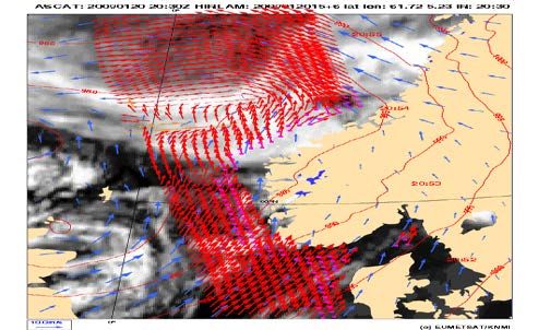
Launches and Orbits

• Nominal launches:
      •    2021            Metop-SG A1
      •    2022            Metop-SG B1
      •    2028            Metop-SG A2
      •    2029            Metop-SG B2
      •    2035            Metop-SG A3
      •    2036            Metop-SG B3

• Sun Synchronous Orbit at 835 km mean altitude, 09:30 LTDN
• Identical orbit as for EPS => shared orbit between Metop and
  Metop-SG satellites

• Controlled re-entry of the satellites into the South Pacific Ocean
  Uninhabited Area at the end of operational life

4   EUM/LEO-EPSSG/VWG/15/800891   15/04/2015
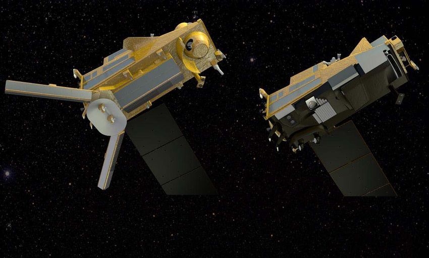
Metop-SG Dual Satellite Configuration

5   EUM/LEO-EPSSG/VWG/15/800891   15/04/2015
Metop-SG Satellite Key Parameters

     Satellites Key Parameters                        Satellite A                       Satellite B
                                               METimage, IASI-NG, MWS,                SCA, MWI, ICI,
    Payload Complement
                                                    S-5, 3MI, RO                       RO, Argos-4
    Mass (kg)                                    4,017 (+135 adaptor)              3,818 (+135 adaptor)
    Fuel (kg)                                             654                                618
    Total ΔV (m/s)                                325.8 m/s (of which 68% is for controlled re-entry)
    Stowed Dimensions (m)                       6.5 (+0.55) x 2.97 x 3.46        6.1 (+0.55) x 2.91 x 3.43
    Power Consumption (kW)                                3.60                              2.53
    Nominal Mode                                                 Yaw steering – gyroless
    Safe Mode                                              Earth pointing – 3 axes stabilised
    Data Storage (Gbit)                                  600 (sized for 1.5 orbits of Satellite A)
    Average Data Rate (Mbps)                      65 (day) & 25 (night)               19 (day & night)
    Ka-band Downlink (Mbps)                        781 (2 channels)                  390.5 (1 channel)
    X-band Downlink (Mbps)                                                  80
    Lifetime                                          Nominal = 7.5 years, Extended = 9.5 years

6   EUM/LEO-EPSSG/VWG/15/800891   15/04/2015
EPS-SG Direct Broadcast

•    Roughly 20-fold increase of sensing data rates from EPS to EPS-SG, with
     a corresponding increase in global and direct broadcast data rates

•    Direct broadcast data rates will be 80 Mb/s, making it impossible to
     remain in L-band as per EPS. X-band has been chosen instead; L-band
     will not be supported on the Metop-SG satellites

•    Satellite A has a much higher peak data rate than Satellite B, but both
     satellites will have exactly the same direct broadcast data rates (filler data
     to be inserted on Satellite B)

•    In routine operations, Satellite B will be flying about 90° / 25 minutes
     ahead of Satellite A. Metop satellites will also be flying in the same orbit,
     with Metop-C nominally at 90° after Metop-SG A1 until its de-orbiting

7   EUM/LEO-EPSSG/VWG/15/800891   15/04/2015
EPS-SG Direct Broadcast Key Parameters

                    Characteristic               NPP/JPSS-1                   EPS-SG
      Reception Station Performance                22.7 dB/K                 22.7 dB/K
      Requirement, G/T
      Typical Resulting Antenna Size                 2.4 m                      2.4 m
      Data Rate (Instrument Data)                   16 Mb/s                   80 Mb/s
      Radio Frequency                               7.8 GHz                   7.8 GHz
      Modulation Scheme                               QPSK                  Offset QPSK
      Polarisation                                    RHCP                      RHCP

  •     The parameter G/T is the main driver for the Reception Station Performance
        Requirements. For EPS-SG, the plan is to match the NPP requirement;
  •     The G/T depends on the full chain of equipment including antenna dish quality and size,
        antenna tracking performance, feed, LNA, cabling, etc;
  •     With good quality equipment, the required G/T can be achieved with a 2.4m antenna
        dish. To add additional margins for severe weather conditions and to mitigate potential
        local RF interference, a larger dish size may be chosen.

Slide: 8
8    EUM/LEO-EPSSG/VWG/15/800891   15/04/2015
Observation missions

                      Mission                    Instrument           Applications Benefitting
Hyper-spectral Infrared Sounding                     IASI-NG        NWP, NWC, Air Quality, CM
                                                                    NWC, NWP, CM, Hydrology,
Visible/Infra-red Imaging                           METimage
                                                                    Oceanography
Microwave Sounding                                    MWS           NWP, NWC, CM

Radio Occultation Sounding                             RO           NWP, CM
                                                                    Ozone-UV, Air Quality, CM,
Nadir viewing UV/VIS/NIR/SWIR Sounding              Sentinel-5
                                                                    Composition-Climate interactions
Multi-viewing, -channel, -polarisation
                                                       3MI          Air Quality, CM, NWC
Imaging
                                                                    NWP, NWC, Oceanography,
Scatterometry                                          SCA
                                                                    Hydrology
                                                                    NWP, NWC, Hydrology, CM,
Microwave Imaging                                     MWI
                                                                    Oceanography
Ice Cloud Imaging                                      ICI          NWP, NWC, Hydrology, CM

            NWP: Numerical Weather Prediction; NWC: Nowcasting; CM: Climate Monitoring

 9   EUM/LEO-EPSSG/VWG/15/800891   15/04/2015
Hyper-spectral infrared sounding: IASI-NG
Objectives
• Temperature/humidity profile at high vertical
resolution
• Clouds, trace gases (O3, CO, CH4, CO2,...)
• Sea/land/ice surface temperature
• Aerosols, Volcanic Ash
Breakthrough
Implementation
• Development of Fourier Transform
Doubling of radiometric and spectral resolution
of IASI for the benefit of weather forecast and
Spectrometer IASI-NG by CNES
atmospheric composition
Key performances 75% more information in temperature profiling,
particularly PBL
• spectral range: 645 – 2760 cm-1
• spectral resolution: 0.25 cm-1 30 % more information in water vapour profiling
• radiometric calibration: 0.25 K
•
•
stability: 0.1 K
radiometric noise: 0.045 – 1.1 K
Quantification of trace gases which are currently
only detected
• pixel size: 12 km
• spatial sampling: 25 km Vertical resolution of trace gases instead of
• cross-track scan columnar amounts only
10 EUM/LEO-EPSSG/VWG/15/800891 15/04/2015Optical imaging: METimage
Objectives
• Hi-res cloud products, incl. microphysics
• Aerosols
• Polar AMVs
• Vegetation, snow, fire
• Sea/ice/land surface temperature Breakthrough
• Support to sounding missions
Implementation
• Development of METimage by DLR
Far more spectral channels than AVHRR for
the benefit of measuring more variables
Key performances
• 20 channels: 0.443 – 13.345 µm
• absolute calibration: Higher spatial sampling (500 m):
5% (short-wave) more complete coverage through
0.5 K (long-wave) greater likelihood to measure surface
• radiometric sensitivity: variables in partly cloud conditions
SNR 60 – 500 (short-wave)
0.05 – 0.2 K (long-wave)
• spatial sampling: 500 m Better radiometric resolution for more
• cross-track scan accurate quantification of many variables
11 EUM/LEO-EPSSG/VWG/15/800891 15/04/2015Microwave sounding: MWS
Objectives
• Temperature/humidity profiles in clear and
cloudy air
• Cloud liquid water total column
• Imagery: precipitation
Breakthrough
Implementation Addition of a quasi-window channel at
• ESA development 229 GHz (recommended by ITSC-11)
Key performances Cirrus cloud information giving a better
humidity retrieval performance
• 24 channels: 23.8 – 229 GHz
• absolute calibration: 0.5 K
• radiometric noise: 0.2 – 1.6 K
Addition of sounding channels
• footprint size: 17 – 40 km
+ 2 channels at 53-54 GHz
• cross-track scan
+ 2 channels at 183.31 GHz
More information on temperature and
water vapour profiles
12 EUM/LEO-EPSSG/VWG/15/800891 15/04/2015Scatterometry: SCA
Objectives
• ocean surface wind vectors
• soil moisture
• snow equivalent water
• sea-ice type
Breakthrough
Implementation
• ESA development Increase of spatial resolution to 25 km
Better approach of coast lines
Key performances
• C-band carrier frequency Increase of swath width to >1100 km
• VV + VH polarisation Enhanced coverage
• measurement range: 4 – 40 m/s
• Radiometric resolution: 3% Addition of VH polarisation
• spatial resolution: 25 km
• dual swath: 550 km each
Covers higher wind speeds without saturation, will
benefit observation of tropical and extra-tropical
storms
13 EUM/LEO-EPSSG/VWG/15/800891 15/04/2015Radio occultation sounding: RO
Objectives
• Refractivity profiles at high vert. resolution
• Temperature / humidity profiles
• PBL top and tropopause height
• Ionospheric electron content
Implementation
• ESA development
Breakthrough
Key performances
• tracking of GPS and Galileo satellites Tracking of GPS and Galileo satellites
• optional: GLONASS and COMPASS to double the number of occultation
• RO on two satellites: > 2600 occultations per day measurements, optionally also
• bending angle accuracy: 0.5 µrad or 0.2% GLONASS and Beidou
Equipment of both Metop-SG
satellites with RO
14 EUM/LEO-EPSSG/VWG/15/800891 15/04/2015Microwave imaging: MWI
Objectives of a new mission
• precipitation and cloud products RSS (2011)
• water vapour profiles and imagery
Cloud Liquid Column mm
• sea-ice, snow, sea surface wind
Breakthrough: 18 channels
Implementation
• ESA development Continuity of key microwave imager
channels for weather forecast
Key performances
•
•
18 channels: 18.7 – 183 GHz
dual polarisation (V, H) up to 89 GHz
Inclusion of dedicated sounding
channels (118.75 GHz)
• V polarisation at higher frequencies
• radiometric accuracy: 1 K Enhanced precipitation measurements
• radiometric sensitivity: 0.6 – 1.2 K through inclusion of dedicated sounding
• Footprint size: 10 – 50 km channels
• spatial sampling: 7 km Extended suite of 183.31 GHz channels
• conical scan
water-vapour and cloud profiling
15 EUM/LEO-EPSSG/VWG/15/800891 15/04/2015Ice cloud imaging: ICI
Objectives of a new mission
Cloud products, in particular ice clouds
• Snowfall detection and quantification
• Water-vapour profiles and imagery
Implementation
NASA: Aura/MLS
• ESA development
Key performances Breakthrough: 11 channels
• 11 channels: 183 – 664 GHz
• single polarisation (V) for all channels Establishes operational ice-cloud
• dual polarisation (V, H) at 243 and 664 GHz imaging mission
• radiometric accuracy: 1 – 1.5 K
• radiometric sensitivity: 0.6 – 1.9 K
• Footprint size: 15-16 km Support of weather forecast,
• spatial sampling: 7.5 km hydrology, and climate monitoring
• conical scan
16 EUM/LEO-EPSSG/VWG/15/800891 15/04/2015Multi-viewing Multi-channel
Multi-polarisation Imaging: 3MI
Objectives of a new mission
• Aerosol – optical thickness, particle size,
type, height, absorption
• Volcanic Ash
• Cloud phase, height, optical depth
Kaufman et al. (2002)
• Surface albedo
Breakthrough:
Implementation
• ESA development Enhanced spatial sampling (4 km)
Improves separation of cloudy areas
Key performances
• 12 channels: 0.41 – 2.13 µm
• 3 polarisations: 0°, 60°, -60° 12 spectral channels (9 polarised),
• up to 14 views extending into the UV and SWIR
• radiometric bias: 3% Better aerosol characterisation
• SNR: 200
• spatial sampling: 4 km
• push-broom scan (2200 km swath) Higher angular resolution (14 views)
Better phase function characterisation
17 EUM/LEO-EPSSG/VWG/15/800891 15/04/2015Nadir-viewing UVNS sounding: Sentinel-5
Nadir viewing UV/VIS/NIR/SWIR sounding
Objectives
• Ozone profile and column
• Columns of CO2,SO2, NO2, H2O,
CO, CH4
• Aerosol optical depth
• Columns of BrO, HCHO, OCHCHO
XX
• Volcanic Plumes
XX X
Implementation
• Copernicus Sentinel-5 to be Breakthrough
embarked on Metop-SG
• ESA development
Drastically increased spatial sampling (7 km)
Key performances for the benefit of air quality monitoring
• spectral range: 0.27 – 2.385 µm Extended spectral range into the near and
• spectral resolution: 0.25 – 1 nm shortwave infrared regions
• radiometric calibration: 1 – 2% to measure aerosols as well as methane and
• SNR: 120 - 1500 carbon monoxide in the PBL
• spatial sampling: 7 km
• Cross-track scan
18 EUM/LEO-EPSSG/VWG/15/800891 15/04/2015Synergy of observation missions
Observation missions are
highly complementary Essential co-registrations
• Co-registration of measurements will allow to • IASI-NG – METimage – Sentinel-5
optimise the information extraction • MWI - ICI
• Synergy to be considered in payload distribution
of a dual satellite configuration Desired co-registrations
• IASI-NG – MWS
• METimage – 3MI
• IASI-NG – Sentinel-5 – 3MI
• MWI – SCA
19 EUM/LEO-EPSSG/VWG/15/800891 15/04/2015Direct Broadcast Data Content
EPS-SG Direct Broadcast data will include:
Data for each EPS-SG instrument (i.e. source packets)
HKTM, inc. satellite ancillary data (NAVATT)
Admin messages (as for Metop satellites)
Dedicated Virtual Channels used for different data types,
multiplexed in the X-band data stream.
Dedicated APIDs to distinguish packets for different instruments,
NAVATT, HKTM, ADMIN messages.
Format and structure of all packets compliant with CCSDS and
ECSS standards with appropriate tailoring.
20 EUM/LEO-EPSSG/VWG/15/800891 15/04/2015Direct Broadcast Data Content - NAVATT
Metop-SG satellites will provide in X-band NAVigation and ATTitude
(NAVATT) packets including satellite ancillary data:
Orbit state vectors
Attitude quaternions
Flags indicating platform state (e.g. manoeuvres, pointing
modes, on-board time synchronisation, etc.)
Platform state at the time of instrument data acquisition available in
real-time, high frequency and accuracy (e.g. ~10m for orbit)
Flags (e.g. on-going manoeuvres) useful to identify and handle non-
nominal conditions impacting products quality.
21 EUM/LEO-EPSSG/VWG/15/800891 15/04/2015Direct Broadcast Data Content – ADMIN messages In continuity with Metop, Metop-SG satellites will also broadcast ADMIN messages including planned satellites/instrument activities e.g. manoeuvres, instrument decontamination, anomalies, etc. ADMIN messages will provide information on future/planned events, complementing real-time events and orbit/attitude parameters provided in NAVATT packets. ADMIN messages will be formatted according to the Multi-Mission Administrative Message (MMAM) format in continuity with EPS. http://oiswww.eumetsat.int/UMS/webapps/mmams/generated/index 22 EUM/LEO-EPSSG/VWG/15/800891 15/04/2015
Direct Broadcast Data Content – Timing information Metop-SG satellites will embark GNSS receivers for on-board orbit determination and time synchronisation. On-board time will be kept synchronised to GPS time. All Direct Broadcast data will be time-stamped with GPS time. On-ground data correlation to UTC will be simplified – no need for coefficients-based conversion between OBT/UTC. Only correction of leap seconds (available from IERS). NAVATT data will include flags indicating the status of on-board time synchronisation – it can indicate anomalies with potential impact on products quality 23 EUM/LEO-EPSSG/VWG/15/800891 15/04/2015
EPS-SG Products Processing Software
EUMETSAT and partners responsible for implementation of L1/L2
processing software used at EUMETSAT Headquarters in Darmstadt to
generate EPS-SG mission products in NRT.
L1 software for selected EPS-SG instruments later on adapted by the
EUMETSAT SAFs (including NWP SAF) for execution in local mission
context / provision to local user.
To support future use in local mission context, design drivers for L1
software development:
Highly modular design
Clear separation between common libraries, COTS and algorithms
Portability to multiple computing platforms (HW/OS)
Testing on commonly available platform (x86/64bits Linux kernel)
24 EUM/LEO-EPSSG/VWG/15/800891 15/04/2015EPS-SG Products Formats
NetCDF used as native format for EPS-SG products generated at
EUMETSAT – but different or additional formats (e.g. BUFR) may be
disseminated to the users for selected products and/or instruments.
Pros of NetCDF are well known - open standard, self-describing,
portable, APIs available, widely used in the EO satellites users
community.
Benefits for L1/L2 processing software – with an outlook to its future use
in local mission context:
Simplified handling, reading/writing of input/output products
Increased SW portability to multiple platforms (HW/OS)
Simplified conversions from/to other product formats.
Use of standard APIs - improved SW modularity and maintainability
25 EUM/LEO-EPSSG/VWG/15/800891 15/04/2015Auxiliary Data for local processing Ground-computed, static or quasi static auxiliary data will be also needed for local processing e.g. instrument calibration parameters, look- up tables, etc. In addition some EPS-SG instruments will routinely generate calibration data at pre-defined orbital positions which may not be in visibility of the local stations – this data will be only available at EUMETSAT. Auxiliary data generated or used at EUMETSAT and needed for local processing will be regularly made available to local users – unless already distributed by other entities (e.g. ECMWF). Goal is to ensure maximum consistency between locally generated and centrally generated products. 26 EUM/LEO-EPSSG/VWG/15/800891 15/04/2015
You can also read