National Hurricane Center Product Description Document: A User's Guide to Hurricane Products
←
→
Page content transcription
If your browser does not render page correctly, please read the page content below
National Hurricane Center Product Description Document:
          A User’s Guide to Hurricane Products
                            June 2021

                    Department of Commerce

         National Oceanic and Atmospheric Administration

                     National Weather Service

           National Centers for Environmental Prediction

                    National Hurricane Center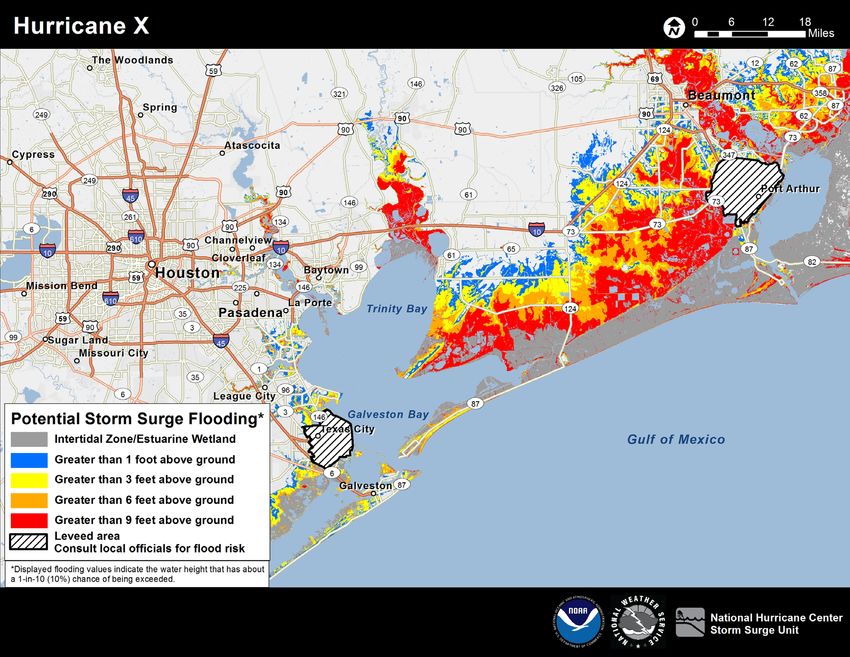
Table of Contents
1. National Hurricane Center Advisories………………………………………3
1. Text Products ....................................................................................................5
a. Tropical Cyclone Public Advisory ...........................................................5
b. Tropical Cyclone Forecast Advisory .....................................................10
c. Tropical Cyclone Discussion .................................................................14
d. Tropical Cyclone Surface Wind Speed Probabilities.............................17
e. Tropical Cyclone Update .......................................................................21
f. Tropical Cyclone Watch Warning Product ............................................24
g. Aviation Tropical Cyclone Advisory .....................................................26
h. Tropical Weather Outlook .....................................................................28
i. Special Tropical Weather Outlook .........................................................30
j. Monthly Weather Summary....................................................................32
2. Graphical Products .........................................................................................34
a. Tropical Cyclone Track Forecast Cone and Watch/Warning Graphic ..34
b. Tropical Cyclone Surface Wind Speed Probabilities.............................37
c. Tropical-Storm-Force Wind Time-of-Arrival Graphics ........................39
d. Cumulative Wind History ......................................................................41
e. Tropical Cyclone Wind Field Graphic ...................................................43
f. Storm Surge Watch and Warning Graphic ............................................45
g. Potential Storm Surge Flooding Map ....................................................46
h. 48-Hour Graphical Tropical Weather Outlook ......................................47
i. 5-Day Graphical Tropical Weather Outlook ..........................................50
3. Non-Operational Products .............................................................................53
a. Tropical Cyclone Reports ......................................................................53
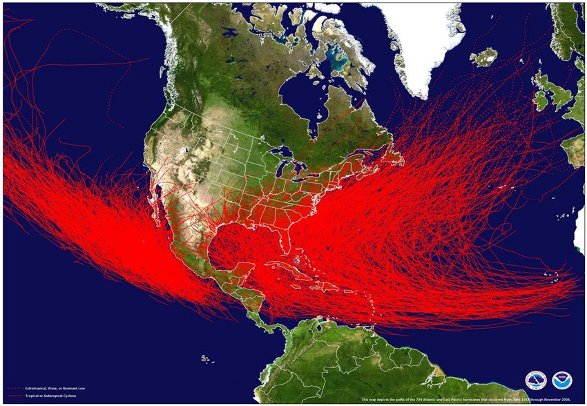
b. Seasonal Summary Table and Track Maps ............................................53
2
National Hurricane Center
                      Tropical Cyclone2 Advisories

Whenever a tropical cyclone is active, the National Hurricane Center (NHC) issues tropical
cyclone advisory packages comprising a suite of official text and graphical products.
Advisory packages are also issued for certain post-tropical cyclones 3 and potential tropical
cyclones 4. This suite of advisory products is issued every 6 hours, at 0300, 0900, 1500, and
2100 UTC. Local issuance times are shown in the table below 5.

                                          Local Issuance Times      Local Issuance Times
                   Advisory Issuance
      Basin                                 During Daylight           During Standard
                     Times (UTC)
                                              Saving Time                   Time
                   0300, 0900, 1500,        5 am, 11 am, 5 pm,        4 am, 10 am, 4 pm,
     Atlantic
                         2100                  11 pm EDT                  10 pm EST
     Eastern
                   0300, 0900, 1500,        2 am, 8 am, 2 pm,         1 am, 7 am, 1 pm,
      North
                         2100                  8 pm PDT                   7 pm PST
     Pacific

The primary text products are the Public Advisory, the Forecast/Advisory, the Tropical
Cyclone Discussion, and the Wind Speed Probability product. Graphical products include
the track forecast cone/watch-warning graphic, wind speed probability graphics, arrival of
tropical-storm-force wind graphics, the tropical cyclone wind field graphic, and a
cumulative wind history graphic. A Storm Surge Watch and Warning Graphic will be
available whenever life-threatening inundation from storm surge is possible along any
portion of the Gulf or Atlantic coasts of the United States and along the coasts of Puerto
Rico and the U.S. Virgin Islands within 48 hours. A potential storm surge flooding map,
tropical cyclone storm surge probabilities, and exceedance probability graphics are also
issued with each advisory whenever a storm surge watch or warning or a hurricane watch

2
  Except when clear from context, in this document the term “tropical cyclone” is
understood to also include subtropical cyclones, potential tropical cyclones, and post-
tropical cyclones. The definition of these terms can be found in the NHC on-line glossary
at: http://www.hurricanes.gov/aboutgloss.shtml
3
  Post-tropical cyclone advisories are issued when a post-tropical cyclone continues to
pose a significant threat to life and property, and if the transfer or responsibility to
another office would result in an unacceptable discontinuity of service.
4
  Advisories on potential tropical cyclones may be issued for disturbances that are not yet
a tropical cyclone, but which pose the threat of bringing tropical storm or hurricane
conditions to land areas within 48 hours.
5
  Local issuance times here are shown for the Eastern and Pacific time zones, however
the time zone used will vary depending on the location of the tropical cyclone.
                                                                                           3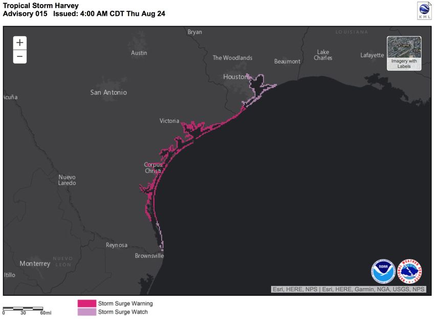
or warning is in effect for any portion of the Gulf or Atlantic coasts of the continental
United States, and can be issued at other times as appropriate.

Intermediate Public Advisories are issued at 3-hour intervals between regular advisory
packages when coastal tropical cyclone watches or warnings are in effect. A Special
Advisory package may be issued at any time to advise of an unexpected significant change
in the cyclone, or when watches or warnings for the United States need to be unexpectedly
issued.

If a tropical cyclone dissipates, NHC advisories are discontinued. Under certain
circumstances, advisory responsibility is transferred to the National Weather Service’s
Weather Prediction Center (WPC). This transfer will occur when a tropical depression or
its remnants is inland over the conterminous United States or northern Mexico, poses a
threat of heavy rains and flash floods in the United States, and is not forecast to regain
tropical storm intensity or re-emerge over water.

NHC has the option to continue issuing advisory packages after tropical cyclones have
become post-tropical (a post-tropical cyclone is any closed area of low pressure that used
to be a tropical cyclone but no longer is one). NHC will continue its advisory packages on
post-tropical cyclones when they pose a significant threat to life and property, and when
the transfer of responsibility to another office would result in an unacceptable discontinuity
in service. In addition, hurricane and tropical storm watches and warnings can remain in
place for these systems. For systems that become post-tropical over water and no longer
pose a significant threat to life and property, the meteorological agency with marine
warning responsibility will assume responsibility for the system.

                                                                                            4
NHC Text Product Descriptions

Tropical Cyclone Public Advisory

Product Description: The Tropical Cyclone Public Advisory is the primary tropical
cyclone information product intended for a general audience. It provides critical tropical
cyclone watch, warning, and forecast information for the protection of life and property.

The Public Advisory has five sections:

1) A summary table of several cyclone parameters is placed at the top of the product in a
fixed format that is suitable for parsing by computer software. This section contains the
cyclone position in latitude and longitude coordinates, its distance from a well-known
reference point, the maximum sustained winds, the cyclone’s current direction and speed
of motion, and the estimated or measured minimum central pressure.

 2) A summary of all current coastal watches and warnings for the cyclone with recent
changes to the watches and warnings highlighted at the top.

3) A discussion of the cyclone’s current characteristics, including location, motion,
intensity, and pressure and a general description of the predicted track and intensity of the
cyclone over the next 72 hours. When conditions warrant, a discussion of the cyclone’s
forecast track and intensity through 5 days will be included. Any pertinent weather
observations will also be included in this section.

4) A section that includes information on hazards to land, generally within the time period
when watches and/or warnings are in effect. This section includes information on hazards
such as storm surge, wind, rainfall, tornadoes, and rip currents associated with the cyclone.

5) A section that states the time of the next advisory issuance.

Availability: Public Advisories are part of a suite of products issued for active cyclones
every six hours at 0300, 0900, 1500, and 2100 UTC. Local issuance times are shown in
the table on the following page. When coastal watches or warnings are in effect,
Intermediate Public Advisories are issued at 3-hour intervals between the regular Public
Advisories. Special Public Advisories may be issued at any time to advise of an unexpected
significant change in the cyclone’s intensity or track or when watches or warnings for the
United States are to be issued.

                                                                                           5
Local Issuance Times Local Issuance Times
Advisory Issuance
Basin During Daylight During Standard
Times (UTC)
Saving Time Time
0300, 0900, 1500, 5 am, 11 am, 5 pm, 4 am, 10 am, 4 pm,
Atlantic
2100 11 pm EDT 10 pm EST
Eastern
0300, 0900, 1500, 2 am, 8 am, 2 pm, 1 am, 7 am, 1 pm,
North
2100 8 pm PDT 7 pm PST
Pacific
Product Headers: WMO and AWIPS headers are given in the table below. The final
numeric digit in each header is assigned on a rotating basis by system number, i.e.,
WTNT31 KNHC would be used for the first, sixth, and eleventh Atlantic system that NHC
has written advisories on in a given year, while WTNT32 KNHC would be used for the
second, seventh, or twelfth system, and so on.
Basin WMO Header(s) AWIPS Header(s)
Atlantic WTNT31-5 KNHC MIATCPAT1-5
Eastern North Pacific WTPZ31-5 KNHC MIATCPEP1-5
Example:
ZCZC MIATCPAT1 ALL
TTAA00 KNHC DDHHMM
Product
BULLETIN header/valid time
Hurricane Florence Advisory Number 56
NWS National Hurricane Center Miami FL AL062018
500 AM EDT Thu Sep 13 2018
...OUTER RAIN BANDS OF FLORENCE ARE APPROACHING THE COAST OF NORTH Headline
CAROLINA...
...LIFE-THREATENING STORM SURGE AND RAINFALL EXPECTED...
SUMMARY OF 500 AM EDT...0900 UTC...INFORMATION
---------------------------------------------- Summary table
LOCATION...32.8N 74.7W
ABOUT 205 MI...325 KM ESE OF WILMINGTON NORTH CAROLINA formatted for
ABOUT 250 MI...405 KM ESE OF MYRTLE BEACH SOUTH CAROLINA parsing
MAXIMUM SUSTAINED WINDS...110 MPH...175 KM/H
PRESENT MOVEMENT...NW OR 315 DEGREES AT 15 MPH...24 KM/H
MINIMUM CENTRAL PRESSURE...956 MB...28.23 INCHES
6WATCHES AND WARNINGS
-------------------- Watch/Warning section with
changes highlighted at the top
CHANGES WITH THIS ADVISORY:
The Tropical Storm Watch from north of the North Carolina/Virginia
border to Cape Charles Light Virginia and for the Chesapeake Bay south
of New Point Comfort has been changed to a Tropical Storm Warning.
SUMMARY OF WATCHES AND WARNINGS IN EFFECT:
A Storm Surge Warning is in effect for...
* South Santee River South Carolina to Duck North Carolina
* Albemarle and Pamlico Sounds, including the Neuse and Pamlico Rivers
A Storm Surge Watch is in effect for...
* Edisto Beach South Carolina to South Santee River South Carolina
* North of Duck North Carolina to the North Carolina/Virginia border
A Hurricane Warning is in effect for...
* South Santee River South Carolina to Duck North Carolina
* Albemarle and Pamlico Sounds
A Hurricane Watch is in effect for...
* Edisto Beach South Carolina to South Santee River South Carolina
A Tropical Storm Warning is in effect for...
* North of Duck North Carolina to Cape Charles Light Virginia
* Chesapeake Bay south of New Point Comfort
Interests elsewhere in the southeastern and mid-Atlantic states should
monitor the progress of Florence.
A Storm Surge Warning means there is a danger of life-threatening
inundation, from rising water moving inland from the coastline. For a
depiction of areas at risk, please see the National Weather Service
Storm Surge Watch/Warning Graphic, available at hurricanes.gov. This
is a life-threatening situation. Persons located within these areas
should take all necessary actions to protect life and property from
rising water and the potential for other dangerous conditions.
Promptly follow evacuation and other instructions from local officials.
A Storm Surge Watch means there is a possibility of life- threatening
inundation, from rising water moving inland from the coastline.
A Hurricane Warning means that hurricane conditions are expected
somewhere within the warning area, in this case within the next 12 to
24 hours. Preparations to protect life and property should be nearing
completion.
A Hurricane Watch means that hurricane conditions are possible within
the watch area. A watch is typically issued 48 hours before the
anticipated first occurrence of tropical-storm-force winds, conditions
that make outside preparations difficult or dangerous.
A Tropical Storm Warning means that tropical storm conditions are
expected somewhere within the warning area.
7For storm information specific to your area, including possible inland
watches and warnings, please monitor products issued by your local
National Weather Service forecast office.
Storm discussion and outlook
DISCUSSION AND OUTLOOK
At 500 AM EDT (0900 UTC), the center of Hurricane Florence was located
near latitude 32.8 North, longitude 74.7 West. Florence is moving
toward the northwest near 15 mph (24 km/h), and this general motion,
accompanied by a gradual decrease in forward speed, is expected to
continue through today. A turn to the west-northwest and west at an Location and
even slower forward speed is expected tonight and Friday, and a slow movement
west-southwestward motion is forecast Friday night and Saturday. On
the forecast track, the center of Florence will approach the coasts of
North and South Carolina later today, then move near or over the coast
of southern North Carolina and eastern South Carolina in the hurricane
warning area tonight and Friday. A slow motion over eastern South
Carolina is forecast Friday night through Saturday night.
Maximum sustained winds are near 110 mph (175 km/h) with higher gusts.
Little change in strength is expected before the center reaches the Intensity
coast, with weakening expected after the center moves inland.
Florence is a large hurricane. Hurricane-force winds extend outward
up to 80 miles (130 km) from the center and tropical-storm-force winds
extend outward up to 195 miles (315 km). A NOAA buoy located about 80
Size
miles (130 km) south of the center of Florence has recently reported
sustained winds of 52 mph (83 km/h) with a gust to 64 mph (104 km/h).
The estimated minimum central pressure based on data from the aircraft
is 956 mb (28.23 inches).
Pressure
Hazards
HAZARDS AFFECTING LAND Section
----------------------
STORM SURGE: The combination of a dangerous storm surge and the
tide will cause normally dry areas near the coast to be flooded
by rising waters moving inland from the shoreline. The water has
the potential to reach the following heights above ground if peak
surge occurs at the time of high tide...
Cape Fear NC to Cape Lookout NC, including the Neuse, Pamlico,
Pungo, and Bay Rivers...9-13 ft
North Myrtle Beach SC to Cape Fear NC...6-9 ft
Cape Lookout NC to Ocracoke Inlet NC...6-9 ft Storm
South Santee River SC to North Myrtle Beach SC...4-6 ft surge
Ocracoke Inlet NC to Salvo NC...4-6 ft
Salvo NC to North Carolina/Virginia Border...2-4 ft
Edisto Beach SC to South Santee River SC...2-4 ft
The deepest water will occur along the immediate coast in areas
of onshore winds, where the surge will be accompanied by large
and destructive waves. Surge-related flooding depends on the
relative timing of the surge and the tidal cycle, and can vary
8greatly over short distances. For information specific to your
area, please see products issued by your local National Weather
Service forecast office.
RAINFALL: Florence is expected to produce heavy and excessive rainfall
in the following areas...
Rainfall
Coastal North Carolina into far northeastern South Carolina...20 to 30
inches, isolated 40 inches. This rainfall would produce catastrophic
flash flooding and prolonged significant river flooding.
Rest of South and North Carolina into southwest Virginia...6 to 12
inches, isolated 24 inches.
WIND: Hurricane conditions are expected to reach the coast within the
hurricane warning area this evening or early Friday. Winds are Wind
expected to first reach tropical storm strength by later this morning
or early this afternoon, making outside preparations difficult or
dangerous. Preparations to protect life and property should be nearing
completion.
TORNADOES: A few tornadoes are possible in eastern North Carolina Tornadoes
through Friday.
SURF: Swells generated by Florence are affecting Bermuda, portions of
the U.S. East Coast, and the northwestern and central Bahamas. These
swells are likely to cause life-threatening surf and rip current Surf
conditions. Please consult products from your local weather office.
NEXT ADVISORY
-------------
Information on next
Next intermediate advisory at 800 AM EDT. Advisory issuance
Next complete advisory at 1100 AM EDT.
$$
Forecaster Brown
NNNN
9Tropical Cyclone Forecast/Advisory
Product Description: The Tropical Cyclone Forecast/Advisory contains current and
forecast storm information in a fixed format suitable for parsing by computer software.
It contains a list of all current coastal watches and warnings, cyclone position, intensity,
and direction and speed of motion. It also includes the current maximum radial extent of
12-ft seas, as well as the maximum radial extent of winds of 34, 50, and 64 kt in each of
four quadrants around the storm. The Forecast/Advisory contains quantitative forecast
information on the track and intensity of the cyclone valid 12, 24, 36, 48, 60, 72, 96, and
120 h from the forecast’s nominal initial time, with size information forecast out to 72 h.
Tropical storm and 50-kt wind radii are forecast out to 72 h and hurricane-force wind
radii are forecast out 48 h.
The Forecast/Advisory also contains the predicted status of the cyclone for each forecast
time. This status may include any of the following: inland, dissipating, dissipated, or
post tropical. “Post tropical” describes a cyclone that no longer possesses sufficient
tropical characteristics to be considered a tropical cyclone; however these cyclones can
continue to produce heavy rains and high winds. A remnant low is a post-tropical
cyclone that no longer possesses the convective organization required of a tropical
cyclone and has maximum sustained winds of less than 34 knots. An extratropical
cyclone is a cyclone of any intensity for which the primary energy source results from the
temperature contrast between warm and cold air masses.
Availability: Forecast/Advisories are part of a suite of products issued for active cyclones
every six hours at 0300, 0900, 1500, and 2100 UTC. Local issuance times are shown in
the table below. Special Forecast/Advisories may be issued at any time to advise of an
unexpected significant change in the cyclone’s intensity or track or when watches or
warnings are to be issued.
Local Issuance Times Local Issuance Times
Advisory Issuance
Basin During Daylight During Standard
Times (UTC)
Saving Time Time
0300, 0900, 1500, 5 am, 11 am, 5 pm, 4 am, 10 am, 4 pm,
Atlantic
2100 11 pm EDT 10 pm EST
Eastern
0300, 0900, 1500, 2 am, 8 am, 2 pm, 1 am, 7 am, 1 pm,
North
2100 8 pm PDT 7 pm PST
Pacific
10Product Headers: WMO and AWIPS headers are given in the table below. The final
numeric digit in each header is assigned on a rotating basis by cyclone number, i.e.,
WTNT21 KNHC would be used for the first, sixth, and eleventh Atlantic cyclones, while
WTNT22 KNHC would be used for the second, seventh, or twelfth cyclones, and so on.
Basin WMO Header(s) AWIPS Header(s)
Atlantic WTNT21-5 KNHC MIATCMAT1-5
Eastern North Pacific WTPZ21-5 KNHC MIATCMEP1-5
Example:
ZCZC MIATCMAT1 ALL
TTAA00 KNHC DDHHMM Product
HURRICANE DELTA FORECAST/ADVISORY NUMBER 9 header/valid time
NWS NATIONAL HURRICANE CENTER MIAMI FL AL262020
2100 UTC TUE OCT 06 2020
CHANGES IN WATCHES AND WARNINGS WITH THIS ADVISORY...
THE GOVERNMENT OF CUBA HAS DISCONTINUED THE TROPICAL STORM WATCH
FOR THE PROVINCE OF LA HABANA.
SUMMARY OF WATCHES AND WARNINGS IN EFFECT... Watch/
Warning
A HURRICANE WARNING IS IN EFFECT FOR... section
* TULUM TO DZILAM MEXICO
* COZUMEL
A TROPICAL STORM WARNING IS IN EFFECT FOR...
* CUBA PROVINCE OF PINAR DEL RIO
* ISLE OF YOUTH
* PUNTA HERRERO TO TULUM MEXICO
* DZILAM TO PROGRESSO MEXICO
A HURRICANE WARNING MEANS THAT HURRICANE CONDITIONS ARE EXPECTED
SOMEWHERE WITHIN THE WARNING AREA. PREPARATIONS TO PROTECT LIFE
AND PROPERTY SHOULD BE RUSHED TO COMPLETION.
A TROPICAL STORM WARNING MEANS THAT TROPICAL STORM CONDITIONS ARE
EXPECTED SOMEWHERE WITHIN THE WARNING AREA WITHIN 36 HOURS.
INTERESTS ALONG THE NORTHERN GULF OF MEXICO COAST SHOULD MONITOR
THE PROGRESS OF DELTA. HURRICANE AND STORM SURGE WATCHES WILL
LIKELY BE ISSUED FOR A PORTION OF THIS AREA ON WEDNESDAY.
11HURRICANE CENTER LOCATED NEAR 18.9N 84.1W AT 06/2100Z
POSITION ACCURATE WITHIN 15 NM
PRESENT MOVEMENT TOWARD THE WEST-NORTHWEST OR 300 DEGREES AT 15 KT
ESTIMATED MINIMUM CENTRAL PRESSURE 956 MB
EYE DIAMETER 5 NM Current
MAX SUSTAINED WINDS 125 KT WITH GUSTS TO 150 KT. position,
64 KT....... 25NE 20SE 15SW 20NW. intensity, and
50 KT....... 40NE 30SE 30SW 30NW. structure
34 KT....... 90NE 80SE 60SW 80NW.
12 FT SEAS..150NE 60SE 30SW 90NW.
WINDS AND SEAS VARY GREATLY IN EACH QUADRANT. RADII IN NAUTICAL
MILES ARE THE LARGEST RADII EXPECTED ANYWHERE IN THAT QUADRANT.
REPEAT...CENTER LOCATED NEAR 18.9N 84.1W AT 06/2100Z
AT 06/1800Z CENTER WAS LOCATED NEAR 18.5N 83.5W
FORECAST VALID 07/0600Z 20.2N 86.1W
MAX WIND 135 KT...GUSTS 165 KT.
64 KT... 25NE 20SE 15SW 20NW. 12 hour forecast
50 KT... 40NE 30SE 30SW 30NW.
34 KT...100NE 80SE 60SW 80NW.
FORECAST VALID 07/1800Z 21.8N 88.8W
MAX WIND 105 KT...GUSTS 130 KT. 24 hour forecast
64 KT... 25NE 20SE 15SW 20NW.
50 KT... 50NE 40SE 20SW 40NW.
34 KT...110NE 80SE 60SW 90NW.
FORECAST VALID 08/0600Z 23.0N 91.1W
MAX WIND 110 KT...GUSTS 135 KT.
64 KT... 30NE 25SE 20SW 25NW.
36 hour forecast
50 KT... 60NE 40SE 30SW 40NW.
34 KT...120NE 100SE 70SW 100NW.
FORECAST VALID 08/1800Z 24.4N 92.6W
MAX WIND 115 KT...GUSTS 140 KT. 48 hour forecast
64 KT... 30NE 25SE 20SW 30NW.
50 KT... 60NE 50SE 40SW 50NW.
34 KT...140NE 120SE 80SW 110NW.
FORECAST VALID 09/0600Z 25.9N 93.2W
MAX WIND 115 KT...GUSTS 140 KT. 60 hour forecast
50 KT... 60NE 50SE 40SW 50NW.
34 KT...140NE 120SE 80SW 110NW.
FORECAST VALID 09/1800Z 28.0N 92.9W
MAX WIND 110 KT...GUSTS 135 KT. 72 hour forecast
50 KT... 60NE 60SE 40SW 50NW.
34 KT...140NE 130SE 90SW 110NW.
12EXTENDED OUTLOOK. NOTE...ERRORS FOR TRACK HAVE AVERAGED NEAR 150 NM
ON DAY 4 AND 175 NM ON DAY 5...AND FOR INTENSITY NEAR 15 KT EACH DAY
OUTLOOK VALID 10/1800Z 32.4N 90.9W...INLAND 96 hour forecast
MAX WIND 55 KT...GUSTS 65 KT.
OUTLOOK VALID 11/1800Z 35.5N 87.3W...POST-TROP/REMNT LOW
MAX WIND 20 KT...GUSTS 30 KT. 120 hour forecast
REQUEST FOR 3 HOURLY SHIP REPORTS WITHIN 300 MILES OF 18.9N 84.1W
INTERMEDIATE PUBLIC ADVISORY...WTNT31 KNHC/MIATCPAT1...AT 07/0000Z
NEXT ADVISORY AT 07/0300Z
$$
FORECASTER BROWN
NNNN
13Tropical Cyclone Discussion
Product Description: The Tropical Cyclone Discussion describes the rationale for the
forecaster’s analysis and forecast of a tropical cyclone. It will typically discuss the
observations justifying the analyzed intensity of the cyclone, a description of the
environmental factors expected to influence the cyclone’s future track and intensity, and a
description of the numerical guidance models. It may also describe the forecaster’s degree
of confidence in the official forecast, discuss possible alternate scenarios, and highlight
unusual hazards, and provide a summary of key messages. The product also includes a
table of forecast positions and intensities in knots and miles per hour out to 120 h. This
table also indicates the forecast status of the cyclone, which may include any of the
following: inland, dissipated, or post tropical. “Post tropical” describes a cyclone that no
longer possesses sufficient tropical characteristics to be considered a tropical cyclone;
however these cyclones can continue to produce heavy rains and high winds. A remnant
low is a post-tropical cyclone that no longer possesses the convective organization required
of a tropical cyclone and has maximum sustained winds of less than 34 knots. An
extratropical cyclone is a cyclone of any intensity for which the primary energy source
results from the temperature contrast between warm and cold air masses.
Availability: Tropical Cyclone Discussions are part of a suite of products issued for active
cyclones every six hours at 0300, 0900, 1500, and 2100 UTC. Local issuance times are
shown in the table below. Special Discussions may be issued at any time to advise of an
unexpected significant change in the cyclone or when watches or warnings are to be issued.
Local Issuance Times Local Issuance Times
Advisory Issuance
Basin During Daylight During Standard
Times (UTC)
Saving Time Time
0300, 0900, 1500, 5 am, 11 am, 5 pm, 4 am, 10 am, 4 pm,
Atlantic
2100 11 pm EDT 10 pm EST
Eastern
0300, 0900, 1500, 2 am, 8 am, 2 pm, 1 am, 7 am, 1 pm,
North
2100 8 pm PDT 7 pm PST
Pacific
Product Headers: WMO and AWIPS headers are given in the table below. The final
numeric digit in each header is assigned on a rotating basis by cyclone number, i.e.,
WTNT41 KNHC would be used for the first, sixth, and eleventh Atlantic cyclones, while
WTNT42 KNHC would be used for the second, seventh, or twelfth cyclones, and so on.
Basin WMO Header(s) AWIPS Header(s)
Atlantic WTNT41-5 KNHC MIATCDAT1-5
Eastern North Pacific WTPZ41-5 KNHC MIATCDEP1-5
14Example:
ZCZC MIATCDAT3 ALL
TTAA00 KNHC DDHHMM
Hurricane Laura Discussion Number 26 Product
NWS National Hurricane Center Miami FL AL132020 header/valid time
400 AM CDT Wed Aug 26 2020
Satellite images indicate that Laura has become a formidable
hurricane since yesterday evening. Deep convection has intensified
and become more symmetric, with an eye now trying to clear out. An
earlier Air Force Hurricane Hunter mission found flight-level winds
of 104 kt, along with peak SFMR values of 86 kt, which supported the
90-kt intensity on the intermediate advisory. Since that time,
however, the cloud pattern has only continued to improve, so the
initial wind speed is set to 95 kt for this advisory. Notably, the
aircraft also recorded that the extent of the hurricane-force winds
have increased substantially northeast of the center. A pair of
Hurricane Hunter planes should be in the area within a couple of
hours.
The hurricane has intensified a remarkable 40 kt during the past 24
hours, and there are no signs it will stop soon, with shear
remaining low-to-moderate over the deep warm waters of the central
Gulf of Mexico. Guidance is noticeably higher than before, so the
new peak intensity will be raised to 115 kt, and some models are
even a little higher. Increasing shear is expected to slightly
weaken the hurricane close to landfall, so the new forecast keeps
the previous 105-kt intensity near the coast. Laura will
weaken rapidly after landfall, but it will likely bring
hurricane-force winds well inland over western Louisiana and Free form
eastern Texas. In the extended range, there is some chance that forecast
Laura re-intensifies as a tropical cyclone off the Mid-Atlantic discussion
coast, instead of becoming part of a frontal system, but for now
the forecast will stay extratropical at 96 hours and beyond.
Recent satellite shows that Laura has turned northwestward, now
estimated at 13 kt. There are no substantial changes to the track
forecast to report. The hurricane should gradually turn toward the
northwest and north over the next day or two as it moves around the
western periphery of a mid-level high. The models are in very good
agreement on the center of Laura moving into extreme southwestern
Louisiana or southeastern Texas in about 24 hours, so no changes
were made to the previous NHC forecast. Later in the forecast period
the weakened cyclone should turn toward the east-northeast and move
with increasing forward speed while embedded within the mid-latitude
westerlies. The official track forecast is shifted southward at
longer range, not too far from the latest consensus track model
predictions.
It should be mentioned Laura is now a large hurricane, and wind,
storm surge, and rainfall hazards will extend far from the center.
Do not use the cone graphic for any representation of these hazards,
it is just for the center uncertainty.
15Key Messages. Note that
these are not provided with
every discussion
Key Messages:
1. Life-threatening storm surge with large and dangerous waves is
expected to produce potentially catastrophic damage from San Luis
Pass, Texas, to the Mouth of the Mississippi River, including areas
inside the Port Arthur Hurricane Flood Protection system. This surge
could penetrate up to 30 miles inland from the immediate coastline
in southwestern Louisiana and southeastern Texas. Actions to protect
life and property should be rushed to completion as water levels
will begin to rise later today.
2. Hurricane-force winds are expected tonight in the warning area
from San Luis Pass, Texas, to west of Morgan City, Louisiana, and
the strongest winds associated with Laura's eyewall will occur
somewhere within this area. Hurricane-force winds and widespread
damaging wind gusts are also expected to spread well inland into
portions of eastern Texas and western Louisiana early Thursday.
3. Widespread flash flooding along small streams, urban areas, and
roadways is expected to begin this afternoon into Thursday from far
eastern Texas, across Louisiana and Arkansas. This will also lead
to minor to isolated moderate freshwater river flooding. The heavy
rainfall threat and localized flash and urban flooding potential
will spread northeastward into the middle-Mississippi, lower Ohio
and Tennessee Valleys Friday night and Saturday.
FORECAST POSITIONS AND MAX WINDS
Forecast
INIT 26/0900Z 26.1N 90.7W 95 KT 110 MPH position and
12H 26/1800Z 27.4N 92.4W 115 KT 130 MPH intensity table
24H 27/0600Z 29.7N 93.5W 105 KT 120 MPH...NEAR COAST
36H 27/1800Z 32.4N 93.7W 50 KT 60 MPH...INLAND
48H 28/0600Z 34.8N 92.9W 30 KT 35 MPH...INLAND
60H 28/1800Z 36.4N 91.0W 25 KT 30 MPH...INLAND
72H 29/0600Z 37.3N 87.3W 30 KT 35 MPH...INLAND
96H 30/0600Z 38.0N 74.5W 35 KT 40 MPH...POST-TROP/EXTRATROP
120H 31/0600Z 44.0N 60.0W 45 KT 50 MPH...POST-TROP/EXTRATROP
$$
Forecaster Blake
NNNN
16Tropical Cyclone Surface Wind Speed Probabilities
Product Description: The Tropical Cyclone Surface Wind Speed Probability product is
a tabular text product that provides the likelihood (expressed as a percentage) of sustained
(1-min average) winds meeting or exceeding specific thresholds at particular locations.
There is also a graphical version of this product, described in part immediately below and
more fully later in this document.
Location-specific information is given in the form of probabilities of sustained winds
occurring at or above the thresholds of 34 kt (tropical storm force), 50 kt, and 64 kt
(hurricane force), over specific periods of time as discussed below. These probabilities are
provided for coastal and inland cities as well as for offshore locations (e.g., buoys). These
probabilities are based on the track, intensity, and wind structure (size) forecasts from the
National Hurricane Center and their historical error characteristics.
Two kinds of location-specific probabilities are defined below:
Cumulative occurrence probabilities – These values tell you the probability the wind event
will occur sometime during the specified cumulative forecast period (0-12, 0-24, 0-36
hours, etc.) at each specific point. These values are provided in both the text and graphical
form of the Surface Wind Speed Probability product. In the text product, the cumulative
probabilities appear in parentheses (example provided below). The graphical products
depict only cumulative values.
Onset probabilities – These values tell you the probability the wind event will start
sometime during the specified individual forecast period (0-12, 12-24, 24-36 hours, etc.)
at each specific point. These values are provided only in the text NHC product. They are
the values outside of the parentheses.
Availability: This product is part of a suite of products issued for active cyclones every six
hours at 0300, 0900, 1500, and 2100 UTC. Local issuance times are shown in the table
below. Special Wind Speed Probability products may be issued at any time to advise of an
unexpected significant change in the cyclone or when watches or warnings are to be issued.
Local Issuance Times Local Issuance Times
Advisory Issuance
Basin During Daylight During Standard
Times (UTC)
Saving Time Time
0300, 0900, 1500, 5 am, 11 am, 5 pm, 4 am, 10 am, 4 pm,
Atlantic
2100 11 pm EDT 10 pm EST
Eastern
0300, 0900, 1500, 2 am, 8 am, 2 pm, 1 am, 7 am, 1 pm,
North
2100 8 pm PDT 7 pm PST
Pacific
17Product Headers: WMO and AWIPS headers are given in the table below. The final
numeric digit in each header is assigned on a rotating basis by cyclone number, i.e.,
FONT11 KNHC would be used for the first, sixth, and eleventh Atlantic cyclones, while
FONT12 KNHC would be used for the second, seventh, or twelfth cyclones, and so on.
Basin WMO Header(s) AWIPS Header(s)
Atlantic FONT11-5 KNHC MIAPWSAT1-5
Eastern North Pacific FOPZ11-5 KNHC MIAPWSEP1-5
Example:
ZCZC MIAPWSAT4 ALL
TTAA00 KNHC DDHHMM
TROPICAL STORM ISAAC WIND SPEED PROBABILITIES NUMBER 23
NWS NATIONAL HURRICANE CENTER MIAMI FL AL092012
2100 UTC SUN AUG 26 2012
AT 2100Z THE CENTER OF TROPICAL STORM ISAAC WAS LOCATED NEAR
LATITUDE 24.2 NORTH...LONGITUDE 82.3 WEST WITH MAXIMUM SUSTAINED
WINDS NEAR 50 KTS...60 MPH...95 KM/H.
Z INDICATES COORDINATED UNIVERSAL TIME (GREENWICH)
ATLANTIC STANDARD TIME (AST)...SUBTRACT 4 HOURS FROM Z TIME
EASTERN DAYLIGHT TIME (EDT)...SUBTRACT 4 HOURS FROM Z TIME
CENTRAL DAYLIGHT TIME (CDT)...SUBTRACT 5 HOURS FROM Z TIME
WIND SPEED PROBABILITY TABLE FOR SPECIFIC LOCATIONS
CHANCES OF SUSTAINED (1-MINUTE AVERAGE) WIND SPEEDS OF AT LEAST
...34 KT (39 MPH... 63 KPH)...
...50 KT (58 MPH... 93 KPH)...
...64 KT (74 MPH...119 KPH)...
FOR LOCATIONS AND TIME PERIODS DURING THE NEXT 5 DAYS
PROBABILITIES FOR LOCATIONS ARE GIVEN AS OP(CP) WHERE
OP IS THE PROBABILITY OF THE EVENT BEGINNING DURING
AN INDIVIDUAL TIME PERIOD (ONSET PROBABILITY)
(CP) IS THE PROBABILITY OF THE EVENT OCCURRING BETWEEN
18Z SUN AND THE FORECAST HOUR (CUMULATIVE PROBABILITY)
PROBABILITIES ARE GIVEN IN PERCENT
X INDICATES PROBABILITIES LESS THAN 1 PERCENT
PROBABILITIES FOR 34 KT AND 50 KT ARE SHOWN AT A GIVEN LOCATION WHEN
THE 5-DAY CUMULATIVE PROBABILITY IS AT LEAST 3 PERCENT.
PROBABILITIES FOR 64 KT ARE SHOWN WHEN THE 5-DAY CUMULATIVE
PROBABILITY IS AT LEAST 1 PERCENT.
18- - - - WIND SPEED PROBABILITIES FOR SELECTED LOCATIONS - - - -
FROM FROM FROM FROM FROM FROM FROM
TIME 18Z SUN 06Z MON 18Z MON 06Z TUE 18Z TUE 18Z WED 18Z THU
PERIODS TO TO TO TO TO TO TO
06Z MON 18Z MON 06Z TUE 18Z TUE 18Z WED 18Z THU 18Z FRI
FORECAST HOUR (12) (24) (36) (48) (72) (96) (120)
- - - - - - - - - - - - - - - - - - - - - - - - - - - - - - - - - -
LOCATION KT
FT PIERCE FL 34 9 2(11) X(11) X(11) X(11) X(11) X(11)
W PALM BEACH 34 14 2(16) X(16) X(16) X(16) X(16) X(16)
MIAMI FL 34 99 X(99) X(99) X(99) X(99) X(99) X(99)
MARATHON FL 34 99 X(99) X(99) X(99) X(99) X(99) X(99)
MARATHON FL 50 14 X(14) X(14) X(14) X(14) X(14) X(14)
KEY WEST FL 34 99 X(99) X(99) X(99) X(99) X(99) X(99)
KEY WEST FL 50 99 X(99) X(99) X(99) X(99) X(99) X(99)
MARCO ISLAND 34 99 X(99) X(99) X(99) X(99) X(99) X(99)
FT MYERS FL 34 48 1(49) 2(51) X(51) X(51) X(51) X(51)
VENICE FL 34 37 5(42) 2(44) 1(45) X(45) 1(46) X(46)
TAMPA FL 34 18 8(26) 3(29) 2(31) X(31) 1(32) X(32)
TALLAHASSEE FL 34 X 7( 7) 10(17) 6(23) 6(29) 1(30) X(30)
ST MARKS FL 34 1 9(10) 9(19) 6(25) 5(30) 1(31) 1(32)
Probability of
APALACHICOLA 34 3 11(14) 16(30) 9(39) 7(46) 1(47) X(47) winds of at least
APALACHICOLA 50 X X( X) 2( 2) 2( 4) 1( 5) 1( 6) X( 6) 34 kt beginning at
APALACHICOLA 64 X X( X) X( X) 1( 1) X( 1) X( 1) X( 1) Pensacola, FL
during the 12-
PANAMA CITY FL 34 1 11(12) 20(32) 13(45) 7(52) 1(53) 1(54) hour period from
PANAMA CITY FL 50 X X( X) 3( 3) 4( 7) 3(10) 1(11) X(11) 06z Tuesday to
PANAMA CITY FL 64 X X( X) X( X) 1( 1) 1( 2) X( 2) X( 2) 18z Tuesday
COLUMBUS GA 34 X X( X) 3( 3) 6( 9) 11(20) 2(22) 1(23)
MONTGOMERY AL 34 X X( X) 7( 7) 10(17) 18(35) 3(38) 1(39) Cumulative
MONTGOMERY AL 50 X X( X) X( X) X( X) 5( 5) 2( 7) X( 7) probability of
MONTGOMERY AL 64 X X( X) X( X) X( X) 1( 1) 1( 2) X( 2) winds of at least
34 kt at
PENSACOLA FL 34 X 6( 6) 24(30) 25(55) 14(69) 2(71) X(71) Pensacola, FL for
PENSACOLA FL 50 X X( X) 2( 2) 14(16) 12(28) 1(29) 1(30) the 48-hour
PENSACOLA FL 64 X X( X) X( X) 4( 4) 5( 9) 2(11) X(11) period ending at
18z Tuesday.
MOBILE AL 34 X 3( 3) 22(25) 31(56) 20(76) 2(78) X(78)
MOBILE AL 50 X X( X) 2( 2) 15(17) 21(38) 2(40) X(40)
MOBILE AL 64 X X( X) X( X) 3( 3) 12(15) 1(16) X(16)
19Note the sum of the onset probabilities
0 + 3 + 22 + 33 = 58 from 0-48 hours is equal to the cumulative
occurrence probability at 48 hours
GULFPORT MS 34 X 3( 3) 22(25) 33(58) 21(79) 2(81) X(81)
GULFPORT MS 50 X X( X) 2( 2) 19(21) 22(43) 2(45) X(45)
GULFPORT MS 64 X X( X) X( X) 5( 5) 13(18) 2(20) X(20)
STENNIS SC 34 X 2( 2) 19(21) 32(53) 23(76) 3(79) 1(80)
STENNIS SC 50 X X( X) 1( 1) 15(16) 22(38) 2(40) X(40)
STENNIS SC 64 X X( X) X( X) 4( 4) 12(16) 1(17) X(17)
BURAS LA 34 X 5( 5) 29(34) 33(67) 14(81) 2(83) 1(84)
BURAS LA 50 X X( X) 5( 5) 25(30) 15(45) 2(47) X(47)
BURAS LA 64 X X( X) 1( 1) 8( 9) 11(20) 1(21) X(21)
JACKSON MS 34 X X( X) 3( 3) 11(14) 33(47) 6(53) 1(54)
JACKSON MS 50 X X( X) X( X) X( X) 12(12) 4(16) X(16)
JACKSON MS 64 X X( X) X( X) X( X) 3( 3) 2( 5) X( 5)
NEW ORLEANS LA 34 X 1( 1) 16(17) 29(46) 23(69) 3(72) 1(73)
NEW ORLEANS LA 50 X X( X) 1( 1) 10(11) 18(29) 3(32) 1(33)
NEW ORLEANS LA 64 X X( X) X( X) 1( 1) 9(10) 1(11) X(11)
BATON ROUGE LA 34 X X( X) 9( 9) 18(27) 24(51) 6(57) X(57)
BATON ROUGE LA 50 X X( X) X( X) 2( 2) 14(16) 3(19) X(19)
BATON ROUGE LA 64 X X( X) X( X) X( X) 5( 5) 2( 7) X( 7)
NEW IBERIA LA 34 X X( X) 7( 7) 12(19) 20(39) 7(46) X(46)
NEW IBERIA LA 50 X X( X) X( X) 1( 1) 9(10) 2(12) 1(13)
NEW IBERIA LA 64 X X( X) X( X) X( X) 3( 3) 2( 5) X( 5)
SHREVEPORT LA 34 X X( X) X( X) 1( 1) 9(10) 6(16) 1(17)
PORT ARTHUR TX 34 X X( X) X( X) 3( 3) 10(13) 5(18) X(18)
PORT ARTHUR TX 50 X X( X) X( X) X( X) 1( 1) 2( 3) 1( 4)
PORT ARTHUR TX 64 X X( X) X( X) X( X) X( X) 1( 1) X( 1)
$$
FORECASTER PASCH
NNNN
20Tropical Cyclone Update
Product Description: The Tropical Cyclone Update (TCU) is issued to inform users of
significant changes in a tropical cyclone between regularly scheduled public advisories.
Such uses include:
- To provide timely information of an unusual nature, such as the time and
location of landfall, or to announce an expected change in intensity that results
in an upgrade or downgrade of status (e.g., from a tropical storm to a
hurricane).
- To provide a continuous flow of information regarding the center location of a
tropical cyclone when watches or warnings are in effect and the center can be
easily tracked with land-based radar.
- To provide advance notice that significant changes to storm information will
be conveyed shortly, either through a subsequent TCU or Special Advisory.
- To announce changes to international watches or warnings made by other
countries, or to cancel U.S. watches or warnings.
- To issue a U.S. watch or warning, but only if the TCU precedes a special
advisory that will contain the same watch/warning information, and indicates
the special advisory will be issued shortly.
When a TCU is issued and any storm summary information has changed from the
previous Public Advisory (e.g., upgrade from tropical storm to hurricane), a storm
summary section identical in format to that found in the Public Advisory will also be
included. If new data suggest that a change in status of the tropical cyclone has occurred,
but the forecaster is not prepared to update all of the storm information, a TCU can be
issued without the storm summary information and indicate that another TCU or special
advisory changing the storm status will be issued shortly. In that case, the first TCU will
not officially change the storm status, but will simply provide users with the information
that a change in status is forthcoming. If a TCU is issued to only modify watches and
warnings and there are no changes to the storm summary information (e.g., position,
intensity, movement, pressure, etc.) from the previous NHC public advisory, then the storm
summary information will not be included in the TCU.
Availability: TCUs issued to provide updated center position information when
watches/warnings are in effect are issued in between scheduled TCPs near the beginning
of each hour. All other TCUs are issued on an event-driven basis.
Product Headers: WMO and AWIPS headers are given in the table below. The final
numeric digit in each header is assigned on a rotating basis by cyclone number, i.e.,
WTNT61 KNHC would be used for the first, sixth, and eleventh Atlantic cyclones, while
WTNT62 KNHC would be used for the second, seventh, or twelfth cyclones, and so on.
21Basin WMO Header(s) AWIPS Header(s)
Atlantic WTNT61-5 KNHC MIATCUAT1-5
Eastern North Pacific WTPZ61-5 KNHC MIATCUEP1-5
Example 1: TCU to provide a continuous flow of information when watches or
warnings are in effect and the center can be easily tracked with land-based radar.
ZCZC MIATCUAT4 ALL
TTAA00 KNHC DDHHMM Product
header/valid
Hurricane Isaac Tropical Cyclone Update time
NWS National Hurricane Center Miami FL AL092012
1100 AM CDT Wed Aug 29 2012
...11 AM POSITION UPDATE...
Free form
A gust to 67 mph was recently reported at Shell Beach Louisiana.
Tropical storm conditions are continuing along the Mississippi and
discussion
Alabama coasts.
SUMMARY OF 1100 AM CDT...1600 UTC...INFORMATION
--------------------------------------------------
LOCATION...29.6N 90.7W Summary Table
ABOUT 1 MI...2 KM W OF HOUMA LOUISIANA Formatted for
ABOUT 45 MI...75 KM SW OF NEW ORLEANS LOUISIANA Parsing
MAXIMUM SUSTAINED WINDS...75 MPH...120 KM/H
PRESENT MOVEMENT...NW OR 310 DEGREES AT 6 MPH...9 KM/H
MINIMUM CENTRAL PRESSURE...972 MB...28.70 INCHES
$$
Forecaster Stewart
Example 2: TCU to change the status of a tropical cyclone
ZCZC MIATCUAT4 ALL Product
TTAA00 KNHC DDHHMM
header/valid
Hurricane Isaac Tropical Cyclone Update time
NWS National Hurricane Center Miami FL AL092012
1120 AM CDT Tue Aug 28 2012
...RECONNAISSANCE DATA INDICATE ISAAC FINALLY ACHIEVES HURRICANE
STATUS... Free form
discussion
Reports from and Air Force Reserve Hurricane Hunter Aircraft indicate
that maximum winds associated with Isaac have increased to 75 mph (120
km/h). On this basis, Isaac is being upgraded to a hurricane
22SUMMARY OF 1120 AM CDT...1620 UTC...INFORMATION
-----------------------------------------------
LOCATION...28.1N 88.6W
Summary Table
ABOUT 75 MI...115 KM SSE OF THE MOUTH OF THE MISSISSIPPI RIVER Formatted for
ABOUT 160 MI...250 KM SE OF NEW ORLEANS LOUISIANA Parsing
MAXIMUM SUSTAINED WINDS...75 MPH...120 KM/H
PRESENT MOVEMENT...NW OR 310 DEGREES AT 10 MPH...17 KM/H
MINIMUM CENTRAL PRESSURE...975 MB...28.79 INCHES
$$
Forecaster Stewart/Beven
NNNN
Example 3 - TCU to notify users that change in status is forthcoming
ZCZC MIATCUAT2 ALL
TTAA00 KNHC DDHHMM Product
header/valid
Tropical Depression Seven Tropical Cyclone Update time
NWS National Hurricane Center Miami FL AL072008
200 PM EDT Mon Aug 25 2008
Preliminary reports from an Air Force Hurricane Hunter aircraft
indicate that Tropical Depression Seven has strengthened. A Special Free form
Advisory will be issued within the next 30 minutes to update the discussion
intensity forecast and watches and warnings for Hispaniola.
$$
Forecaster Pasch
NNNN
Example 4 - TCU to update watches or warnings (no change in storm summary
information)
ZCZC MIATCUAT4 ALL
TTAA00 KNHC DDHHMM Product
header/valid
Hurricane Ike Tropical Cyclone Update time
NWS National Hurricane Center Miami FL AL092008
600 PM AST Fri Sep 05 2008
At 600 PM AST (2200 UTC), the Government of the Bahamas has issued a
Hurricane Watch for the Southeastern Bahamas, including the Acklins,
Crooked Island, the Inaguas, Mayaguana, and the Ragged Islands, as well
Free form
as for the Turks and Caicos Islands. discussion
No other changes are required from the 500 PM AST Advisory.
$$
Forecaster Blake/Beven
23Tropical Cyclone Watch Warning Product
Product Description: The Tropical Cyclone Watch Warning product summarizes all new,
continued, and canceled tropical cyclone wind and storm surge watches and warnings for
the U.S. Atlantic, Gulf, and Pacific coasts, Puerto Rico, and the U.S. Virgin Islands, in a
form suitable for decoding by computer software.
Availability: This product is issued concurrently with all Tropical Cyclone Public
Advisories (whether routine, Intermediate, or Special) for which a U.S. watch or warning
is continued, posted, changed, or cancelled.
Product Headers: WMO and AWIPS headers are given in the table below. The final
numeric digit in each header is assigned on a rotating basis by cyclone number, i.e.,
WTNT81 KNHC would be used for the first, sixth, and eleventh Atlantic cyclones, while
WTNT82 KNHC would be used for the second, seventh, or twelfth cyclones, and so on.
Basin WMO Header(s) AWIPS Header(s)
Atlantic WTNT81-5 KNHC MIATCVAT1-5
Eastern North Pacific WTNT81-5 KNHC MIATCVEP1-5
Example:
000
WTNT84 KNHC 081457
TCVAT4
MICHAEL WATCH/WARNING ADVISORY NUMBER 8
NWS NATIONAL HURRICANE CENTER MIAMI FL AL142018
1057 AM EDT MON OCT 8 2018
.HURRICANE MICHAEL
CAUTION...THIS PRODUCT ONLY APPROXIMATELY CONVEYS THE EXTENT OF
TROPICAL CYCLONE WIND AND SURGE WATCHES AND WARNINGS. PLEASE SEE THE
LATEST PUBLIC ADVISORY FROM THE NATIONAL HURRICANE CENTER FOR THE
PRECISE LATERAL EXTENT OF WIND WATCHES AND WARNINGS ALONG THE
COAST...AS WELL AS THE APPROXIMATE LATERAL EXTENT OF SURGE WATCHES AND
WARNINGS. THE PRECISE EXTENT OF SURGE WATCHES AND WARNINGS CAN BE FOUND
IN THE NWS NATIONAL DIGITAL FORECAST DATABASE HAZARD GRIDS.
FLZ014-015-027-108-112-114-115-118-127-128-134-204-206-082300-
/O.CON.KNHC.HU.A.1014.000000T0000Z-000000T0000Z/
/O.CON.KNHC.SS.A.1014.000000T0000Z-000000T0000Z/
1057 AM EDT MON OCT 8 2018 /957 AM CDT MON OCT 8 2018/
$$
24FLZ050-139-142-148-149-151-155-082300-
/O.CON.KNHC.SS.A.1014.000000T0000Z-000000T0000Z/
/O.CON.KNHC.TR.A.1014.000000T0000Z-000000T0000Z/
1057 AM EDT MON OCT 8 2018
$$
FLZ007>013-016>018-026-028-034-201>203-205-GAZ155>157-082300-
/O.CON.KNHC.HU.A.1014.000000T0000Z-000000T0000Z/
1057 AM EDT MON OCT 8 2018 /957 AM CDT MON OCT 8 2018/
$$
GAZ123-125-127-142>146-158-159-082300-
/O.UPG.KNHC.TR.A.1014.000000T0000Z-000000T0000Z/
/O.EXA.KNHC.HU.A.1014.000000T0000Z-000000T0000Z/
1057 AM EDT MON OCT 8 2018
$$
ALZ055>060-065>069-262>266-FLZ019-029-239-242-248-249-251-
GAZ120>122-124-126-128>131-147-148-160-161-082300-
/O.CON.KNHC.TR.A.1014.000000T0000Z-000000T0000Z/
1057 AM EDT MON OCT 8 2018 /957 AM CDT MON OCT 8 2018/
$$
ATTN...WFO...MOB...TAE...TBW...
25Aviation Tropical Cyclone Advisory
Product Description: The Aviation Tropical Cyclone Advisory is issued to provide short-
term tropical cyclone forecast guidance for international aviation safety and routing
purposes. The Aviation Advisory lists the current cyclone position, motion, and intensity,
and includes forecast positions and intensities valid 6, 12, 18, and 24 h after the advisory
issuance time (0300, 0900, 1500, or 2100 UTC). This is in contrast to the forecast positions
provided in the Tropical Cyclone Discussion and Forecast/Advisory, which are relative to
the nominal initial times of 0000, 0600, 1200, and 1800 UTC. It is important to note that
forecast values in the Aviation Tropical Cyclone Advisory are obtained by interpolation
from the values contained in the Forecast/Advisory.
Availability: This product is part of a suite of products issued for active cyclones every six
hours at 0300, 0900, 1500, and 2100 UTC. Local issuance times are shown in the table
below. Special Aviation Tropical Cyclone Advisory products may be issued at any time to
advise of an unexpected significant change in the cyclone or when watches or warnings are
to be issued.
Local Issuance Times Local Issuance Times
Advisory Issuance
Basin During Daylight During Standard
Times (UTC)
Saving Time Time
0300, 0900, 1500, 5 am, 11 am, 5 pm, 4 am, 10 am, 4 pm,
Atlantic
2100 11 pm EDT 10 pm EST
Eastern
0300, 0900, 1500, 2 am, 8 am, 2 pm, 1 am, 7 am, 1 pm,
North
2100 8 pm PDT 7 pm PST
Pacific
Product Headers: WMO and AWIPS headers are given in the table below. The final
numeric digit in each header is assigned on a rotating basis by cyclone number, i.e.,
FKNT21 KNHC would be used for the first, sixth, and eleventh Atlantic cyclones, while
FKNT22 KNHC would be used for the second, seventh, or twelfth cyclones, and so on.
Basin WMO Header(s) AWIPS Header(s)
Atlantic FKNT21-5 KNHC MIATCAAT1-5
Eastern North Pacific FKPZ21-5 KNHC MIATCAEP1-5
26Example:
FKPZ22 KNHC 211436
TCAPZ2
TROPICAL STORM GENEVIEVE ICAO ADVISORY NUMBER 21
NWS NATIONAL HURRICANE CENTER MIAMI FL EP122020
1500 UTC FRI AUG 21 2020
TC ADVISORY
DTG: 20200821/1500Z
TCAC: KNHC
TC: GENEVIEVE
ADVISORY NR: 2020/021
OBS PSN: 21/1500Z N2500 W11448
MOV: NW 09KT
INTST CHANGE: WKN
C: 1001HPA
MAX WIND: 040KT
FCST PSN +6 HR: 21/2100Z N2544 W11543
FCST MAX WIND +6 HR: 035KT
FCST PSN +12 HR: 22/0300Z N2628 W11643
FCST MAX WIND +12 HR: 030KT
FCST PSN +18 HR: 22/0900Z N2713 W11746
FCST MAX WIND +18 HR: 025KT
FCST PSN +24 HR: 22/1500Z N2752 W11846
FCST MAX WIND +24 HR: 025KT
RMK: THE FORECAST POSITION INFORMATION IN
THIS PRODUCT IS INTERPOLATED FROM
OFFICIAL FORECAST DATA VALID AT 0000...
0600...1200...AND 1800Z.
NXT MSG: 20200821/2100Z
27Tropical Weather Outlook
Product Description: The Tropical Weather Outlook discusses significant areas of
disturbed weather and their potential for development during the next 5 days, including a
categorical forecast of the probability of tropical cyclone formation during the first 48
hours, and during the entire 5-day forecast period. The 48 h and 5-day probabilities of
formation for each disturbance are given to the nearest 10% and expressed in terms of one
of the following categories: low probability of development (0-30%), medium probability
(40-60%), and high probability of development (70-100%). The Outlook also includes a
general description of locations of any active cyclones and their WMO and AWIPS headers
during the first 24 hours of their existence.
Availability: Tropical Weather Outlooks are issued every six hours from 15 May–30
November for the Atlantic Basin and the eastern North Pacific Basin, at 0000, 0600, 1200,
and 1800 UTC. Local issuance times are shown in the table below.
Local Issuance Times
Outlook Issuance Local Issuance Times
Basin During Daylight
Times (UTC) During Standard Time
Saving Time
0000, 0600, 1200, 2 am, 8 am, 2 pm, 1 am, 7 am, 1 pm,
Atlantic
1800 8 pm EDT 7 pm EST
Eastern
0000, 0600, 1200, 5 am, 11 am, 5 pm, 4 am, 10 am, 4 pm,
North
1800 11 pm PDT 10 pm PST
Pacific
Product Headers: WMO and AWIPS headers are given in the table below.
Basin WMO Header AWIPS Header
Atlantic ABNT20 KNHC MIATWOAT
Eastern North Pacific ABPZ20 KNHC MIATWOEP
28Example:
ZCZC MIATWOAT ALL
TTAA00 KNHC DDHHMM Product
Tropical Weather Outlook header/valid
NWS National Hurricane Center Miami FL time
800 PM EDT Mon Oct 14 2014
For the North Atlantic, Caribbean Sea and the Gulf of Mexico:
The National Hurricane Center is issuing advisories on newly formed
Tropical Depression Eleven, located in the central Gulf of Mexico.
A broad area of low pressure located a couple of hundred miles south-
southwest of Jamaica is accompanied by showers and thunderstorms. Free form
This disturbance remains disorganized, and development, if any, should discussion
be slow to occur over the next couple of days while it moves slowly about
northwestward. Environmental conditions are expected to be marginally existing
conducive for some development when the system moves over the
disturbances
northwestern Caribbean Sea and the southern Gulf of Mexico later this
week. Locally heavy rainfall is possible over portions of Haiti and
Jamaica today, and will likely spread across the Cayman Island and
eastern Cuba on Tuesday.
* Formation chance through 48 hours...low...10 percent.
* Formation chance through 5 days...low...30 percent.
A trough of low pressure could form over the extreme southwestern Gulf
of Mexico and Bay of Campeche in a few days...and some development of
this system is possible by midweek.
* Formation chance through 48 hours...low...near 0 percent.
* Formation chance through 5 days...low...20 percent.
&&
Public advisories on Tropical Depression Eleven are issued under Product header
WMO header WTNT31 KNHC and under AWIPS header MIATCPAT1. information for
Forecast/Advisories on Tropical Depression Eleven are issued under active tropical
WMO Header WTNT22 KNHC and under AWIPS header MIATCMAT1. cyclones that have
formed within the
$$
Forecaster Brown past 24 h
NNNN
29Special Tropical Weather Outlook
Product Description: A Special Tropical Weather Outlook is issued when there have been
important changes with areas of disturbed weather over tropical or subtropical waters that
need to be conveyed before the next scheduled release of the Tropical Weather Outlook.
The potential for tropical cyclone formation for each disturbance within the next 48 hours,
and 5 days is given to the nearest 10% and expressed in terms of one of the following
categories: low probability of development (0-30%), medium probability (40-60%), and
high probability of development (70-100%). The Special Tropical Weather Outlook can be
used to report the findings of reconnaissance aircraft missions, and can also be used to
discuss disturbances when Tropical Weather Outlooks are not routinely issued. The
disturbance being updated in the Special Tropical Weather Outlook will be highlighted at
the top of the product, and other systems discussed in previous Tropical Weather Outlooks
will also be included.
Availability: This is an event-driven product issued as needed.
Product Headers: WMO and AWIPS headers are given in the table below.
Basin WMO Header AWIPS Header
Atlantic ABNT20 KNHC MIATWOAT
Eastern North Pacific ABPZ20 KNHC MIATWOEP
30Example
Special Tropical Weather Outlook
NWS National Hurricane Center Miami FL
530 PM EDT Wed Jun 5 2013 Product
header/valid
For the North Atlantic, Caribbean Sea and the Gulf of Mexico: time
Special Outlook issued to update discussion on the low pressure
area in the Gulf of Mexico.
Updated...An Air Force reconnaissance aircraft was able to identify a
well-defined circulation in the low pressure area over the east-central
Gulf of Mexico late this afternoon. Based on this finding, the National Free form
Hurricane Center will initiate advisories on Tropical Storm Andrea
within the next hour or so. discussion
* Formation chance through 48 hours...high...near 100 percent.
* Formation chance through 5 days...high...near 100 percent.
Although the shower activity associated with a tropical wave located a
little less than 1000 miles east of the Lesser Antilles has increased
some, the wave is heading westward toward a region where the upper
level winds are not favorable for development.
* Formation chance through 48 hours...low...10 percent.
* Formation chance through 5 days...low...20 percent.
$$
Forecaster Berg
31Monthly Tropical Weather Summary
Product Description: The Monthly Tropical Weather Summary briefly describes the
previous month’s tropical cyclone activity and provides a summary table for all of the
season’s tropical cyclones to date.
Availability: The Monthly Tropical Weather Summary is issued at 8 am local time on the
first day of the month following each month of the hurricane season. The Tropical Weather
Summary issued on 1 December will give a brief account of the entire season.
Product Headers: WMO and AWIPS headers are given in the table below.
Basin WMO Header AWIPS Header
Atlantic ABNT30 KNHC MIATWSAT
Eastern North Pacific ABPZ30 KNHC MIATWSEP
Example:
ABNT30 KNHC 011156
TWSAT
Monthly Tropical Weather Summary
NWS National Hurricane Center Miami FL
800 AM EDT Fri Oct 01 2010
For the North Atlantic, Caribbean Sea, and the Gulf of Mexico
Eight tropical storms formed in the Atlantic Basin during the month of
September. Three of these storms, Igor, Julia, and Karl, became major
hurricanes, and Lisa reached hurricane status. These numbers are well
above the long-term (1944-2009) averages of 4 tropical storms, 2
hurricanes, and about 1 major hurricane for the month of September.
Also, the formation of eight named storms ties 2002 for the record
number of named storms formation in the month of September. In terms of
accumulated cyclone energy (ACE), which measures the combined strength
and duration of tropical storms and hurricanes, tropical cyclone
activity in September was about 78 percent above average.
So far this season, overall tropical cyclone activity to date is about
53 percent above the long-term median.
Reports on individual cyclones, when completed, are at the web site of
the National Hurricane Center: www.hurricanes.gov/2014atlan.shtml
SUMMARY TABLE
32You can also read