New and Emerging Technologies for Sustainable Fisheries: A Comprehensive Landscape Analysis
←
→
Page content transcription
If your browser does not render page correctly, please read the page content below
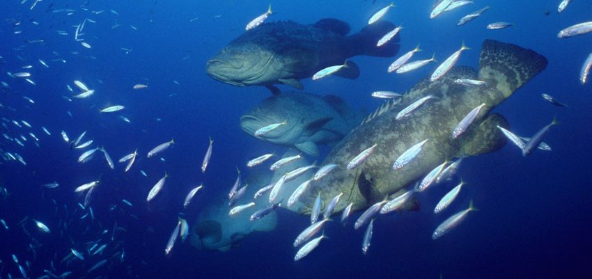
Photo by Pablo Sanchez Quiza

New and Emerging Technologies
for Sustainable Fisheries:
A Comprehensive Landscape Analysis

Environmental Defense Fund | Oceans Technology Solutions | April 2021
New and Emerging
Technologies for
Sustainable Fisheries:
A Comprehensive Landscape Analysis

Authors:
Christopher Cusack, Omisha Manglani,
Shems Jud, Katie Westfall and Rod Fujita
Environmental Defense Fund

Nicole Sarto and Poppy Brittingham
Nicole Sarto Consulting

Huff McGonigal
Fathom Consulting

To contact the authors please submit a message through: edf.org/oceans/smart-boats

                                                                                     edf.org | 2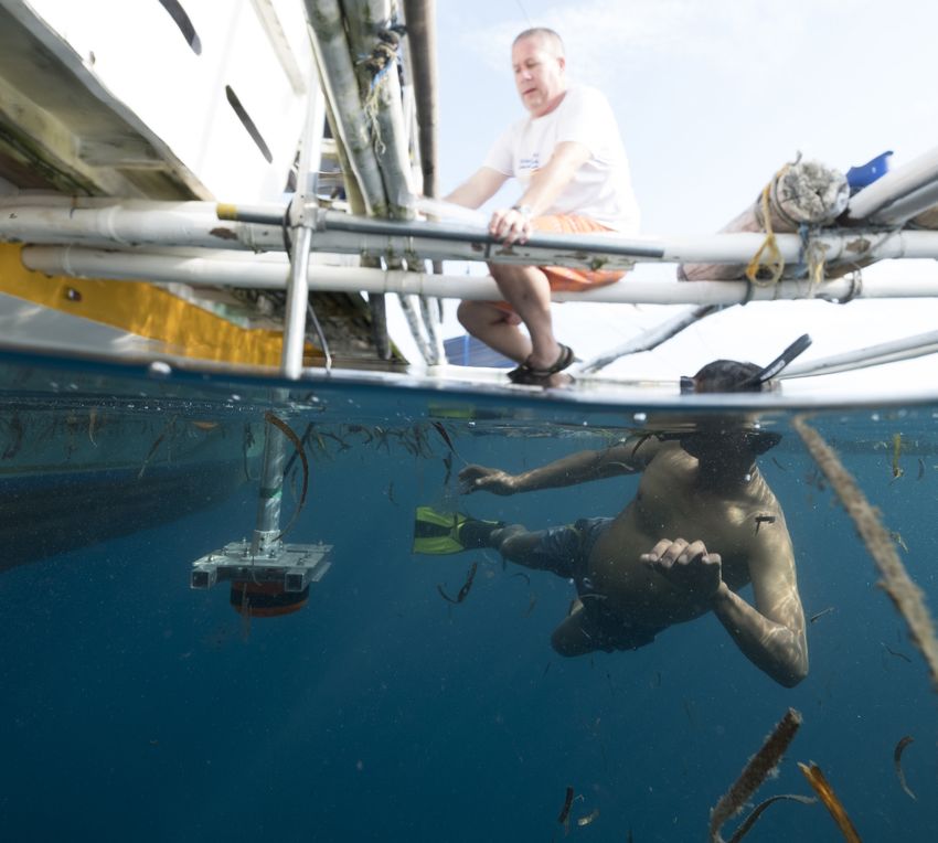
Contents
List of Acronyms....................................................................................................................................................... 5
1. Introduction..............................................................................................................................................................7
2. Transformative Technologies......................................................................................................................... 10
    2.1 Sensors............................................................................................................................................................ 10
    2.2 Satellite remote sensing............................................................................................................................12
    2.3 Data Collection Platforms........................................................................................................................ 13
    2.4 Smartphones..................................................................................................................................................14
    2.5 Citizen scientists......................................................................................................................................... 15
    2.6 Data connectivity........................................................................................................................................ 15
    2.7 Artificial Intelligence................................................................................................................................... 16
    2.8 Data Systems and the Cloud....................................................................................................................17
    2.9 Fishing gear modifications........................................................................................................................17
    2.10 Biotech.......................................................................................................................................................... 18
3. On-the-Water Activities................................................................................................................................... 19
        3.1 Accounting for fisheries catch and effort....................................................................................... 19
        3.1.1 Electronic Monitoring.......................................................................................................................... 19
        3.1.2 Electronic Reporting.............................................................................................................................21
        3.1.3 Remote sensing for estimating catch and effort......................................................................22
        3.1.4 Shore-based cameras........................................................................................................................22
    3.2 Compliance monitoring.............................................................................................................................23
        3.2.1 Vessel tracking devices......................................................................................................................23
        3.2.2 Remote Tracking for Monitoring, Control and Surveillance.................................................. 24
    3.3 Stock abundance and productivity estimation..................................................................................25
        3.3.1 Visual camera surveys........................................................................................................................25
        3.3.2 Acoustics for assessments..............................................................................................................26
        3.3.3 eDNA and genetics............................................................................................................................. 27
    3.4 Ocean ecosystem monitoring.................................................................................................................28
        3.4.1 Mapping ocean ecosystems.............................................................................................................28
        3.4.2 Pollution monitoring...........................................................................................................................29
        3.4.3 Monitoring marine animal health...................................................................................................30
        3.4.4 Acoustic ecosystem monitoring.....................................................................................................30
        3.4.5 Monitoring coral reef health............................................................................................................ 31
        3.4.6 Oceanographic observing................................................................................................................. 31

                                                                                                                                                                                 edf.org | 3
3.5 Increasing the transparency of the supply chain.............................................................................32
        3.5.1 Reducing seafood fraud.....................................................................................................................33
        3.5.2 Sourcing responsible seafood.........................................................................................................33
        3.5.3 Tracking small-scale seafood..........................................................................................................34
    3.6 Data integration and management.......................................................................................................35
        3.6.1 Improving fishing operations...........................................................................................................35
        3.6.2 Deriving new value from an ocean data ecosystem................................................................36
4. Ocean Technologies Funding Environment...............................................................................................38
    4.1 Funding sources...........................................................................................................................................39
        4.1.1 Domestic governments.......................................................................................................................40
        4.1.2 Bilateral aid agencies..........................................................................................................................42
        4.1.3 International financial institutions.................................................................................................42
        4.1.4 Multilateral Institutions......................................................................................................................44
        4.1.5 Philanthropic foundations.................................................................................................................44
        4.1.6 Non-governmental organizations...................................................................................................47
        4.1.7 Private finance......................................................................................................................................48
        4.1.8 Accelerators...........................................................................................................................................49
    4.2 Recent funding activities..........................................................................................................................50
        4.2.1 Increasing amount & diversity of funding................................................................................... 51
        4.2.2 Recent trends by technology type................................................................................................. 51
        4.2.3 Exceptions to increasing trends.....................................................................................................53
    4.3 Future outlook..............................................................................................................................................53
        4.3.1 Transparency.........................................................................................................................................53
        4.3.2 Data integration, access and use...................................................................................................54
        4.3.3 Institutional capacity building.........................................................................................................54
        4.3.4 Implementation conditions..............................................................................................................54
        4.3.5 Small-scale fisheries..........................................................................................................................55
        4.3.6 Scientific research..............................................................................................................................56
        4.3.7 Emerging interests..............................................................................................................................56
5. Acknowledgements...........................................................................................................................................57
6. References............................................................................................................................................................57

                                                                                                                                                                              edf.org | 4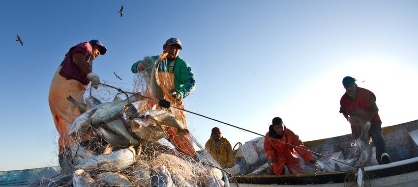
List of Acronyms
		  ADB Asian Development Bank
		AFMA Australian Fisheries Management Authority
		AFSC Alaska Fisheries Science Center
		 AI Artificial Intelligence
		   AIS Automatic Identification System
		  AWS Amazon Web Services
		  BDC Berring Data Collective
		  BDP Big Data Project
		 BFAR Bureau of Fisheries and Aquatic Resources (Philippines)
		 CI Conservation International
		CPUE Catch Per Unit Effort
 DARPA Defense Advanced Research Projects Agency

		   DFI Development Finance Institution
		DL Deep Learning
		  DNB Day Night Band
		  DOV Diver Operated Vehicle
		  EDF Environmental Defense Fund
		   EEZ Exclusive Economic Zone
		EFCA European Fisheries Control Agency
		   EIB European Investment Bank
		EIF European Investment Fund
		EM Electronic Monitoring
		  EMR Electronic Monitoring and Reporting
		  ERP Enterprise Resource Planning
		EU European Union
		  FAD Fish Aggregating Device
		  FAO Food and Agriculture Organization (of the UN)
		   FIP Fishery Improvement Project
		GDST Global Dialogue for Seafood Traceability
		  GEF Global Environment Facility
		 GFW Global Fishing Watch
		  GPS Global Positioning System
		   GSI Genetic Stock Identification
		  GSM Global System for Mobile communications
		  IMO International Maritime Organization
		   IUU Illegal, Unreported and Unregulated (fishing)
		 JICA Japan International Cooperation Agency
		LiDAR Light Detection and Ranging
		  MCS Monitoring Control and Surveillance
		  MPA Marine Protected Area
		  MSC Marine Stewardship Council
		  MSP Marine Spatial Planning
		  NFC Near Field Communications
		NFWF National Fish and Wildlife Foundation
		  NGO Non-Governmental Organization
		NOAA National Oceanic and Atmospheric Administration

                                                                  edf.org | 5
OECD Organisation for Economic Cooperation and Development
		      PNA Parties to the Nauru Agreement
		    PSMA Port State Measures Agreement.
		      RFID Radio Frequency Identification
		       RFP Request for Proposals
		      ROV Remotely Operated Vehicle
		      RUV Remote Underwater Vehicle
		     SALT Seafood Alliance for Legality and Traceability
		    SAPO Sistema de Alerta, Prediccion, y Observacion
		      SAR Synthetic Aperture Radar
		       SBI Smart Boat Initiative
		      SDG Sustainable Development Goal
SERNAPESCA Chile National Fisheries Agency

          SK
		Saltonstall-Kennedy
		     SLAR Side-Looking Aperture Radar
		      SOF Sustainable Oceans Fund
		       SSF Small-Scale Fishery
		      TNC The Nature Conservancy
		      TUV Towed Underwater Vehicle
		      UAS Unmanned Aerial System
		UN United Nations
		    USAID United States Agency for International Development
		     USGS United States Geological Survey
		      USV Unmanned Surface Vehicle
		     VIIRS Visual Infrared Imaging Radiometer Suite
		      VMS Vessel Monitoring System
		   WCPFC Western and Central Pacific Fisheries Commission
		    WCPO Western and Central Pacific Ocean
		     WWF World Wildlife Fund

                                                                   edf.org | 6
Photo by seapics.com

1. Introduction

                                                                     advances that are impacting everyone on Earth. Perhaps the
   The oceans are at an inflection point. The excesses               most important category has been the proliferation of commu-
of the 20th century — over-exploitation of most of our               nications networks to reach all corners (and some depths) of
accessible biological resources, over-pollution by plas-             our globe. Cellular networks that support the 3.5 billion peo-
tics and other chemicals, over-crowding of coastal and               ple that now use a smartphone are becoming faster and more
marine space by unorganized and competing interests                  accessible. Tens of thousands of micro-satellites, some the size
and over-capitalization of extractive industries — are               of grilled cheese sandwiches,1 are being launched to form mesh
being tempered by a rapidly growing realization that                 networks over large areas of the earth’s surface. New methods of
these excesses are having very real consequences, not                communicating underwater, such as hydro-acoustic modems,2
just for marine life and ocean ecosystems, but for the               are being developed. This communication infrastructure is
food security and nutrition of the world’s population,               supporting and driving forward a digital revolution. The advent
the livelihoods of the communities that depend on the                of cloud-based computing, which effectively gives anybody with
ocean and the very future of humanity itself.                        an adequate internet connection access to a super-computer, is
                                                                     decentralizing access to new technologies and allowing them to
    The huge scale of detrimental impacts to the world’s oceans      be applied in more places around the world. New sensor tech-
are a direct result of the rapid technological change that we have   nologies that are expanding the range of data types that can be
experienced since the first industrial revolution. This broad        collected — and reducing the costs of collecting that data — are
change is not only causing the greatest existential threat we        expanding our horizons for what is possible to understand about
have ever faced — a warming climate — but has driven mas-            the oceans and our influences on them. New analysis tools that
sive increases in our ability to harvest the ocean’s mineral and     leverage the power of artificial intelligence are increasing our
biological resources, new manufacturing processes on land            ability to make use of these expanding datasets in ways that we
that have resulted in huge amounts of effluent leaking into the      never would have thought possible until recently. The ability of
ocean and atmosphere and rapid globalization, enabled by             more users to create more value from more information is driv-
better communications and transportation, that has upended           ing the development of integrated technologies, where single
traditional ways of life in favor of consumption-based existenc-     information sources are being used by multiple parties. A data
es. It is ironic then, that emerging technologies are not just the   management paradigm that emphasizes free use, access and
reason that we have come to realize the scale of these impacts       sharing is taking over from one of information monoliths, where
but are also essential for mitigating and reversing them. The past   the parties that collect data are the only ones to store and use it.
several decades have seen an incredible range of technological           The fourth industrial revolution, where integrated tech-

1
    https://swarm.space/
2
    http://www.teledynemarine.com/acoustic-modems                                                                             edf.org | 7
nologies are increasingly being used to automate production                  central role played by emerging technologies. For example,
processes is happening now and at the same time as the fourth                countries participating in the PSMA are able to identify which
wave of environmentalism, where environmental responsibil-                   vessels to sanction because we have technology-based vessel
ity is becoming an integral part of doing business. This nexus               tracking and seafood tracing systems. Understanding which
represents a grand opportunity to utilize new technologies to                areas to protect under the 30x30 initiative in order to maximize
foster environmental sustainability in ways that are aligned with            ecological protection while minimizing conflicts with other
business operations and the result is the restructuring of most              ocean users depends on our ability to understand and map the
of the world’s industries — a restructuring that has the emerg-              spatial distribution of marine habitats and anthropogenic activ-
ing potential of digital technologies at its heart. And while most           ities. And the UN’s Decade of Ocean Science has been declared
industries are moving towards this new paradigm quickly the                  in recognition that we now possess the technologies needed to
world’s fisheries are being left behind. There are many underly-             make a giant leap forward in understanding not just the ocean’s
ing reasons for this: fishermen are often disenfranchised, poorly            ecosystems, but how our activities impact them. Collaborative
organized and lack a voice in the policy process; fish are difficult         agreements such as these, which initiate national-level re-
to count; fishermen are often independent operators that are                 sponses, have important roles to play in driving technological
highly dispersed and hard to keep track of; and many fisheries               innovation. For example, the International Maritime Organiza-
are difficult to manage, which has resulted in their depletion to            tion (IMO) has a mandate requiring the global shipping fleet to
levels far-below their potential. All of these factors (as well as           halve greenhouse gas emissions by 20507 which has contributed
many others) complicate efforts to ‘normalize’ or ‘rationalize’ the          to the possibility of zero emission vessel propulsion systems
management of not just the resource, but the entire industry,                entering the market by 2030 (Leape et al. 2020), and the IMO
making efforts to improve fisheries difficult from both logistical           Cape Town Agreement on fishing vessel safety8 should help to
and investment perspectives. However, the factors that make                  reduce risks to commercial fishing crews by setting achievable
investment in technological progress difficult also represent the            performance standards for vessel construction and design.
areas where technology can make the most impactful differences
and drive the most progress towards a digital future for fisheries.          Government regulations can be important drivers of
                                                                             innovation, especially if regulatory agencies focus on
And while progress has been slow, a widespread mo-                           writing regulations that are responsive to the current
bilization of human, capital and political resources has                     technological state of play but also incentivize further
been occurring over the past decade, with new tech-                          innovation and achievement of efficiencies.
nologies at its core, aimed at reversing the impacts of
previous actions while charting a course for sustainable                         Governments are also playing an important role in provid-
use of the oceans.                                                           ing funding for technological development and serving as a
                                                                             conduits for funding, such as World Bank investments. Overall,
    This global mobilization toward sustainable use is taking on             the funding environment for fisheries and ocean technol-
a sense of increased urgency and is reflected by the establish-              ogies is strengthening with traditional sources of philan-
ment of United Nations (UN) Sustainable Development Goal 14                  thropic, non-governmental organization (NGO), government
(SDG 14) in 2015, which aims to “conserve and sustainably use                and multi-lateral funding for technology development and
the oceans, sea and marine resources for sustainable develop-                fishery improvement being increasingly complemented by
ment”3 as well as the UN declaration of a Decade of Ocean                    return-seeking investments through impact funds and the
Science for Sustainable Development4 with an overarching goal                private sector. Funding technology development for fisheries
of reversing declining ocean health and gathering stakehold-                 and sustainable oceans uses has always been challenging as the
ers behind a common framework to ensure that all countries                   established market for these products and services is relatively
benefit from ocean science in their sustainable development                  small. For example, while funding for aquaculture innovations
of the oceans. Other global initiatives that have gained traction            that have a clear commercial imperative is plentiful, funding for
include the FAO-led Port State Measures Agreement (PSMA),5                   fisheries monitoring and ocean science is relatively lacking. This
which aims to fight illegal, unregulated and unreported (IUU)                is beginning to change. Increasingly, a ‘blue economy’ approach
fishing by refusing port services, including offloading capabil-             is being taken to investing in the oceans space for sustainabili-
ities, to vessels engaged in these activities, and the IUCN’s call           ty-focused investments, often framed in the context of achiev-
to protect at least 30% of the area of the ocean by 2030 with no             ing SDG 14. This approach is underpinned by the belief that
extractive activities allowed (30x30).6 Efforts such as these are a          there will be significant ongoing growth in the blue economy
recognition that the challenges facing our sustainable use of the            and that while most of the mechanisms for creating monetary
ocean are too big to be tackled piecemeal.                                   value are currently poorly understood, they will continue to
    None of these initiatives would be achievable without the                become elucidated.

3
  https://sdgs.un.org/goals/goal14
4
  https://en.unesco.org/ocean-decade
5
  http://www.fao.org/port-state-measures/en/
6
  https://www.iucn.org/resources/issues-briefs/marine-protected-areas-and-climate-change
7
  https://www.imo.org/en/MediaCentre/PressBriefings/Pages/06GHGinitialstrategy.aspx
8
  https://www.imo.org/en/MediaCentre/PressBriefings/Pages/25-Torremolinos-Conference.aspx                                          edf.org | 8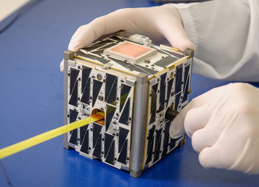
tion monoliths’, a new ocean data ecosystem, in which data
We don’t understand how value in the oceans space will
                                                                       are shared more widely, local and traditional knowledge are
be created in the future, just that the potential is massive.
                                                                       better integrated and the environment for data innovation is
    However, the path towards a strong, sustainability-focused         healthy, is happening now (Leape et al. 2020). This new ocean
ocean economy has a gap in it, a result of the circular notion         data ecosystem will usher in an age of ‘radical transparency’ in
that a strong market for ocean technologies is needed to drive         fisheries and oceans activities and as the tools and processes for
technological innovation but to stimulate this market invest-          wider — and easier — sharing of ocean data improve, more and
ments in technological solutions need to occur now when it is          more data users will appear, demanding more interoperability
not well-defined. This is where technology accelerators, private       and integration of data. To ensure the sustainable use of our
investors and specific philanthropic funders are coming in,            ocean we need to understand, in a measurable way, the impacts
bridging this gap with financial and often technical support. But      of our actions. Emerging technologies that are integrated into
stimulating this market is more than just a question of funding        this new data ecosystem will enable a greater and more flexible
aimed at increasing the supply of technological innovations.           understanding of marine processes and how they respond to
What is also needed is a stimulation of demand for the infor-          anthropogenic influences and underpin all efforts to engage in
mation that will be collected using these innovations, demand          sustainable management of any ocean industry — none more
which will come from a widening array of users. One source of          so perhaps than the fishing industry.
information demand is relatively well described: major seafood             What are the broad technological advances that are having
buyers are increasingly emphasizing responsible sourcing of            major implications for global fisheries and marine resource
seafood that is environmentally friendly, safe, avoids lining the      management? Who are the major players involved in driv-
pockets of nefarious supply chain actors and involves a fair dis-      ing fisheries and oceans management towards a new digital
tribution of benefits to all nodes in the supply chain. Consumers      paradigm? What challenges are being effectively addressed and
are willing to pay for these characteristics (e.g. Fonner and Sylvia   which are not? To answer these questions (and many more), this
2015; Zander and Feucht 2018) which imparts direct value to            document provides a landscape analysis of the technological
collecting traceability data. And while securing this information      ‘state of play’ as well as current activity relating to the use of
has traditionally involved the use of interoperable traceability       new and emerging technologies to help solve common fish-
systems that have been out of reach of all but the biggest com-        ery-related challenges at the global, regional and national levels,
panies, these functions are increasingly becoming available to         including the individuals, organizations, countries and technol-
many more supply chain actors, including small-scale fishers,          ogy service providers engaged in these activities. Activities range
through smartphone and cloud-based applications.                       from on-the-water technical implementations of cameras or
                                                                       other sensors to collect data, to regional scale efforts to monitor
Increasing the demand for information will depend not                  illegal fishing using satellites, to global scale efforts to stream-
only on demonstrations that value — both direct mon-                   line and modernize data management systems. Activities are
etary value and indirect conservation value — can be                   focused on solving situation-specific challenges and, although
derived from information in geographies where techno-                  each fishery is different, we have identified a group of challenges
logical literacy is already high, but in increasing the ca-            that are common to many fisheries and that serve as focal points
pacity of potential users of information in geographies                for this report. These challenges are: accounting for fisheries
where that literacy is not high.                                       catch and effort, compliance monitoring, stock abundance and
                                                                       productivity estimation, ocean ecosystem monitoring, increas-
    New technologies have a critical role to play here as, increas-    ing the transparency of the supply chain and data integration
ingly, the requirements for human capital to undertake valu-           and management. We start in section 2 by providing an overview
able tasks are being subsumed by the technology itself. Recent         of the technologies that are helping to transform management
advances in technology have improved the cost-effectiveness of         of the oceans space and discuss the current and likely future
existing data collection techniques but have also expanded the         implications that these developments are having. In section 3
suite of tools at the disposal of fishery managers looking to make     we discuss the major categories of fishery-related challenges
informed management decisions. Advances have come in our               named above and discuss specific practical initiatives aimed at
ability to convert data to knowledge, and to use that knowledge        addressing them. We conclude in section 4 with an overview of
to effect successful fisheries and oceans management. More-            the funding and financing environment that these initiatives
over, more rapid and intensive data collection supported by            operate in and discuss current and future trends in the major
technology, machine learning and artificial intelligence dramat-       types of funding categories.
ically enhances the potential for adaptive fisheries and oceans
management in response to changes in the ocean due to global
warming or other drivers.
    The amount of fisheries and ocean data being collected is
increasing exponentially, driven both by increases in the supply
of data (through improvements and cost reductions in sensors
and the platforms that support these sensors), and the demand
for data. And mirroring the wider move away from ‘informa-
                                                                                                                               edf.org | 9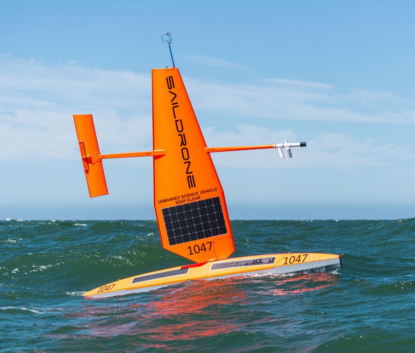
Photo by Leslie Von Pless/EDF

2. Transformative Technologies

                                                                     and artificial intelligence which enable us to make sense of, and
   The transformative potential of the digital revolution            draw value from, the huge amounts of data that characterize
is growing exponentially, driven by rapid improvements               this revolution. In this section we give a broad overview of some
in functionality and reductions in cost of sensors that              of the most important technological advances and discuss
collect information, platforms that house sensors and                potential implications of these advances for fisheries and ocean
in the technologies used to compile, analyze, transmit,              management.
store and access data.
                                                                     2.1 Sensors
    While rapid improvements are being made in almost every
field of study or application, technical advances that are key       Sensors measure physical or chemical variables such as light
to improving sustainable fisheries and ocean management              and sound and translate these measurements into digital
are occurring in several areas. These include the development        information, or data. They are the foundation of ocean moni-
of sensors that translate the wide spectrum of physical phe-         toring and scientific discovery: more and better sensors means
nomena to measurable digital information, the proliferation of       more and better data. The evolution of sensors is being driven
constellations of satellites that monitor the ocean, the advent of   by miniaturization and power reduction (Leape et al. 2020). Re-
fully autonomous data collection platforms that can explore the      ducing the amount of power needed to operate a sensor, often
extent of the marine environment without need for human con-         by making it smaller, means that it can operate for longer on a
trol and improvements in fishing technology that are increasing      set amount of battery power or can reduce the amount of energy
operational efficiency while minimizing environmental harm.          needed to be generated through solar panels or other methods.
But the most important advances are those that are fueling           Power reductions in turn help to drive miniaturization, which
all industries — not just ocean-based ones. These include the        enables sensors to be placed on new and smaller platforms
large-scale uptake of smartphones to all corners of the globe, the   which themselves require less energy to operate. Some sensors
associated prodigious increases in speed and reach of wireless       are so small that they are now being embedded on the systems
data networks that are making the Internet of Things (where all      tasked with carrying data such as fiber optic cables (Zhan, 2020),
things are connected) possible, the ongoing shift from mono-         and they require so little power to operate that they can be
lithic computer servers to cloud-based computing (which brings       placed onto the backs of bumblebees (Iyer et al., 2020).
the power of a super-computer to anyone with an internet con-
nection) and the development of the fields of machine learning
                                                                                                                            edf.org | 10
Optical sensors spectral imaging to identify species of fish based on their
Cameras used in fisheries and ocean monitoring have ben- electromagnetic signature (pers. comm. S. Romain).
efited from advances driven by the market for smartphone
cameras. Compared to just a few years ago, cameras are now Acoustic sensors
smaller, lighter, higher resolution, capture images at a higher The ocean is on average ten trillion times opaquer than the
frame rate, have greater zoom capabilities, perform better atmosphere (Leape et al. 2020) so while cameras are suited
in low light conditions and are available at a much-reduced for operating above the surface, acoustics hold much great-
cost. Off-the-shelf camera systems designed for the transpor- er promise for exploring the ocean’s depths. An increasing
tation industry are durable enough to withstand conditions number of acoustic tools are being developed for new uses
common to the high seas and Arctic. SnapIT,9 a New Zealand and existing tools are constantly improving (Baumgartner et
based technology company, has designed camera systems for al., 2018). These include long-baseline positioning tools that
fisheries monitoring that are submersible to 4000m. Cam- track ships and divers, acoustic sound traps that record ocean
eras that record up to a 360o field of view are now available, soundscapes, echosounders that paint a picture of the ocean
meaning that monitoring everything above (or below) a underneath a platform, side scan sonars that help fisher-
plane is feasible, with software performing focus and zoom men locate fish and acoustic doppler profilers that measure
functions after image capture. These new systems have the the speed and direction of water currents. The ballooning
potential to reduce the number of cameras needed for a given world of ocean acoustics includes estimating fish population
situation and effectively let viewers explore vessel activities abundance, assessing behavior and distributions of fish and
in their own virtual reality experience. Hyperspectral camer- mammal species, acoustically tagging and tracking endan-
as go beyond the visible light spectrum and capture inputs gered species and using long-range low frequency acoustic
continuously across the entire electromagnetic spectrum. thermometry to assess global warming by measuring polar
While these types of cameras are being used in the food and pack ice thickness as well as glacier and ice-sheet stability
manufacturing sectors (to sort out rotten food from fresh, (Howe et al., 2019).
for example; (Elmasry et al., 2012; Xu & Sun, 2017)), their full
potential has yet to be realized in the oceans space. Recently, Biochemical sensors
however, researchers have been exploring the use of hyper- The increasingly wide range of biochemical sensors that
have potential applications for the oceans is mainly a result
of technology transfer from the medical and pharmaceutical
industries. Spectral flow cytometry10 and other spectroscopic
techniques (e.g. (Cabernard et al., 2018; Schymanski et al.,
2018) have huge potential to transform the ways we observe
and manage the ocean. Advances in biochemical sensors and
related instrumentation are the key to identifying objects
like micro-plastics or harmful algae in water samples. These
advances are translating to faster, more portable analyses that
offer more users the ability to monitor pollution and water
quality. Biochemical sensors record key metrics of climate
change, such as carbon dioxide levels, the pH of water and
Photo by SnapIT
concentrations of methane, and help scientists to study
biological responses of marine life in response to climate
stresses such as increasing ocean acidification (Stillman &
A SnapIT solar VMS unit Paganini, 2015). As these sensors become more precise, de-
pendable, small and inexpensive, their deployment becomes
more widespread (McPartlin et al., 2016). Formerly, collecting
information on chlorophyll, salinity, depth, currents, turbid-
ity, oxygen saturation and other oceanographic variables was
restricted to well-funded scientific research projects. The cost
and size of oceanographic sensors has now decreased to the
point where hand-deployed instruments by citizen scientists
or inexpensive sensor arrays attached to small-scale fishing
Photo by NEO
vessels are now feasible.
Hyperspectral camera
Radar
mounted on a rotary drone
While natural aperture Side Looking Airborne Radar
9
https://www.snapit.group/
10
h
ttps://www.thermofisher.com/ca/en/home/life-science/cell-analysis/flow-cytometry/flow-cytometry-learning-center/
flow-cytometry-resource-library/flow-cytometry-methods/spectral-flow-cytometry-fundamentals.html edf.org | 11(SLAR) has been in use for decades to observe sea ice drift
and detect oil spills,11 advances in Synthetic Aperture Radar
(SAR; a subset of SLAR) technology that have occurred over
the last decade are significant for many reasons. SAR in-
volves the emission of radar pulses and the detection of the
return signals when they bounce off objects (such as the ocean
surface) to create two dimensional images that can then be
analyzed. The resolution of SAR images has improved to the
point where we can now detect schools of fish swimming at or
near the surface from the wavelets that form from their wake
Photo by NASA
(Klemas, 2013). SAR systems are not impacted by clouds or
inclement weather, as are visible spectrum cameras, so they
may hold the key to full-time fishery surveillance. They are now
small and energy-efficient enough to be mounted on drones NASA cubeSAT
and micro-satellites, and it is clear that they have a significant
role to play in future monitoring of the marine space.
2.2 Satellite remote sensing
LiDAR
Radar bounces radio waves off objects — Light Detection As sensors decrease in size, cost and power requirements,
and Ranging (LiDAR) effectively does the same thing with la- they become more suitable for wider use on a variety of
sers. LiDAR is now the primary source of geospatial data used platforms, including satellites where these factors are critical.
by researchers for mapping of the sea floor. The simplicity, Satellite technology has driven a remote sensing revolution,
low cost, small size and low power requirements of radio- which has seen a shift from largely experimental missions
metric LiDAR systems mean that they can be flown in small driven by big government institutions to more nimble proj-
aircraft and drones (Santos, 2000). LiDAR provides a more ects that support a wider variety of users and needs (Leape
cost-effective alternative to ship-based Sound Navigation et al. 2020). Small satellites, which have benefited greatly
and Ranging (SoNAR) for mapping and monitoring shallow from advances in miniaturization, are being launched with
water coral reef ecosystems (Costa et al., 2009). As well as greater frequency: while less than 1,000 small satellites were
SAR, LiDAR possesses significant potential for defining the launched from 2006 to 2015, some analysts predict that 7,000
geographical extent of suitable fishing grounds, particularly at will be launched between 2018 and 2027.12 Approximately
a scale that is relevant to resource exploitation as instruments 82% of these satellites will be part of constellations built by
are small enough to be mounted on drones such as surface or major corporations such as SpaceX and Amazon tasked with
autonomous underwater vehicles (AUVs). a variety of purposes such as expanding space-based broad-
band internet and improving earth imaging.
Increasing satellite capacity expands the coverage area
and interval of rapidly improving sensors such as SAR, optical
sensors such as the Day Night Band (DNB),13 and the Visible
Infrared Imaging Radiometer Suite (VIIRS).14 It is now pos-
sible to detect the glow from a single streetlight from 800km
above the surface of the earth, and we can track small illegal
fishing vessels at night and through inclement weather. Small
satellites equipped with SAR systems, capabilities traditional-
ly associated with large government agencies, are becoming
more widespread and this has major implications for marine
surveillance. Capella Space15 and IceEye16 are two companies
launching constellations of SAR-equipped small satellites.
Photo by Geneinno
Capella plans to have an operational network by 2022 and
will eventually launch a total of 36 satellites, meaning that
their customers will be able to order ‘on demand’ images of
Geneinno Titan a particular target at least once per hour at a remarkable 20
T1 Underwater Drone inch resolution over a 5km by 5km area.17 IceEye plans an 18
satellite constellation with similar capabilities. While Capella’s
11
https://www.ioscproceedings.org/doi/abs/10.7901/2169-3358-1983-1-349
12
https://euroconsult-ec.com/6_August_2018
13
https://earthdata.nasa.gov/worldview/worldview-image-archive/the-day-night-band-enhanced-near-constant-contrast-of-viirs
14
https://viirsland.gsfc.nasa.gov/Products/NASA/BlackMarble.html
15
https://www.capellaspace.com/
16
https://www.iceye.com/satellite-missions
17
https://news.mongabay.com/2019/08/no-place-to-hide-for-illegal-fishing-fleets-as-surveillance-satellites-prepare-for-lift-off/ edf.org | 12service model is geared towards supporting defense and in- Underwater drones
telligence services,18 IceEye is focused more towards helping Underwater drones are impacting many ocean industries,
find illegal fishing vessels, identify human trafficking and including extending the reach of scientific research. They are
other rights abuses.19 instrumental in exploring the seabed and inspecting under-
sea platforms or pipelines and also provide new opportuni-
2.3 Data Collection Platforms ties to the pharmaceutical industry, allowing the study and
collection of new specimens that might hold immense value
Mirroring improvements in satellite technology, ocean-based to humankind (World Economic Forum, 2017). While many
data collection platforms such as semi-autonomous drones drones are tethered to surface vessels, Autonomous Under-
and buoys have benefited from miniaturization and power water Vehicles (AUVs) operate without the continued control
reduction and, importantly, advances in the field of power of human operators and are either pre-programmed to con-
harvesting. Along with lower power use, the ability to harvest duct set underwater missions or use Artificial Intelligence (AI)
energy from the sun or waves (or even microbial fuel cells to decide on routes and activities autonomously. Most AUVs
that leverage the natural oxidation of detritus on the seafloor can operate to 200 m depth, with some operating beyond
to harvest energy; Reimers and Wolf (2018)) and then to store 5000 m. Fish-like drones, which can be self-propelled for
this energy for future use in advanced battery systems (such about 8 hours are already being used alongside other drones
as aluminum based systems that use seawater; (Tian et al., in coral reef monitoring (Pieterkosky et al., 2017). While some
2021)) has driven a revolution in the design and capabilities AUVs such as HabCam20 and Slocum gliders, are extremely
of data platforms. Thanks to improvements in data trans- expensive, others, such as the consumer-focused Trident
mission (including the increasing use of acoustic modems; drone21 are much less costly and more accessible.
(Sendra et al., 2015)), platforms are becoming increasingly
connected. Advances in processing capabilities mean that
‘swarms’ of platforms with distributed intelligence are very
much becoming the dominant paradigm for undersea obser-
vation and monitoring systems. And data collection platforms
are increasingly eschewing the need for human control.
Semi-autonomous drones are generally tasked to follow par-
ticular tracks or look for particular objects and collect various
types of information by a human programmer, and then left
to perform those tasks autonomously. Drones can be config-
ured with a number of sensors, processors and data trans-
mitters that can provide high quality real-time observations
to scientists and managers (Colefax et al., 2018), including
acoustic technologies such as tag telemetry receivers and
passive acoustic recorders.
Photo by Getty
Aerial drones
Aerial platforms such as airplanes or balloons that
help fishermen locate fish have been in use for decades
(Santos, 2000), but we are now seeing a wholesale change in
the way these tools are being deployed and used. The de- Surface drones
creasing costs of aerial drones, increasing flight times and Surface drones (or unmanned surface vehicles; USVs) op-
easier launch and retrieval at sea are rapidly expanding the erate on the interface between the ocean and the atmosphere
utility of Unmanned Aerial Vehicles (UAVs; Colefax, Butcher, and are thus able to study both the environment underneath
and Kelaher 2018). The range of compact sensors that UAVs the drone, such as the seafloor and water column, as well as
can be equipped with has widened significantly over the last the atmosphere above it. Positioned on the surface they can
decade and now include low-light digital cameras, thermal transmit data faster and more cost effectively than underwa-
infrared radiometers, LiDAR and SAR (Harris et al., 2019). ter drones, and also have access to a constant source of solar
Among many other uses, their potential for fisheries Monitor- energy. For example, Liquid Robotics Wave Glider22 uses a
ing, Control and Surveillance (MCS) has the attention of pol- combination of solar arrays to harness power for instruments
icy-makers, environmentalists and researchers alike (Toonen and kinetic wave energy for propulsion in an innovative two
& Bush, 2020). part design. Surface drones such as the wave glider can be
fitted with an array of sensors and other data collection in-
18
https://www.bbc.com/news/science-environment-51296585
19
https://www.bbc.com/news/science-environment-51296585
20
https://habcamvm.whoi.edu/about/
21
https://www.sofarocean.com/products/trident
22
https://www.liquid-robotics.com edf.org | 13struments and can actively collect and transmit (via satellite, being equipped with echosounders that can help fishermen
cell or broadband) real-time data for up to a year in ideal determine the species composition beneath Fish Aggregat-
conditions. There is significant potential for USVs to reduce ing Devices (FADs).29 Buoys are now being deployed as part
the cost of ocean data collection and to expand the spatial of networks of interconnected devices and sensors that can
and temporal coverage of acoustic stock surveys (Greene et solve bigger challenges, such as effectively combatting IUU
al., 2014). Other surface drones include the Datamaran23 and fishing by detecting illegal fishing vessels (Ng et al., 2020).
the Saildrone.24 USVs are beginning to see application to the For example, DARPA’s ‘Ocean of Things (OoT) program30 will
commercial space. For example, Aker BioMarine,25 a compa- encompass thousands of drifting buoys that collect ocean-
ny that fishes for krill in Antarctic water, uses a Sailbuoy26 to ographic and other sensor information — including activity
help their vessels hunt for krill aggregations.27 data on vessels, aircraft and even marine mammals — and
then transmit data via satellite to the cloud.
Marine animals
A small but potentially significant area of innovation is the
use of marine animals to collect data by outfitting them with
small Conductivity-Temperature-Depth Satellite Relay Log-
gers (CTD-SRLs) which collect information and transmit data
automatically to servers via satellite (Treasure et al., 2017).
Small radar detectors have also been mounted on albatrosses,
who range farther than drones ever could, to help in detecting
illegal fishing.31
Fishing vessels and their gear
The technology used by fishermen to hunt for and catch
Photo by Saildrone
fish has improved to the point where the wheelhouse of a
modern fishing vessel more resembles that of a spaceship
than of the HMS Titanic. More and more vessels are being
equipped with advanced sonar devices that can be used to
A Saildrone USV help map the seafloor to a high resolution, and with ocean-
ographic sensors that could expand the existing network of
ocean observing data. Several initiatives have also focused
Buoys on placing sensors on fishing vessels and their gear to aid in
Buoys have been used for decades to collect and transmit the collection of oceanographic data. As one example, the
oceanographic data, but recent changes in their design and eMOLT32 program in the Northeast United States equips lob-
the way they are deployed have huge implications for ocean ster traps with oceanographic sensors. The data collected are
management. ‘Smart’ buoys are now equipped with sophis- then shared between fishermen (to help them understand the
ticated computers, cameras, oceanographic sensors, data relationship between bottom conditions and lobster catch)
loggers and satellite transmission systems, and are capable and scientists.
of being re-tasked at a moment’s notice for new data mis-
sions. Buoys are now self-powered through solar panels and 2.4 Smartphones
can remain at sea for long periods of time (Henriques et al.,
2016). Low-cost buoys are a vital tool for monitoring climate Around 3.5 billion people now use smartphones, in effect
change impacts as they can be deployed extensively by a wide giving almost half of the world’s population fingertip access to
variety of organizations (Vitale et al., 2018). For example, a portable personal computer. Smartphones incorporate GPS
Sofar Ocean’s Spotter28 buoy is solar-powered and transmits sensors and Bluetooth connectivity meaning that they can act
real-time wave, wind and temperature data to a cloud based as analysis, storage and transmission devices for a huge range
portal which allows easy access to information from the glob- of variables. For example, biochemical sensors that detect
al network of Spotter buoys, while the Spotter ‘Dashboard’ marine toxins are being integrated with smartphones (Su et
allows easy data analysis and visualization. Buoys are also al., 2017) for portable use in the field, and smartphone apps
23
http://www.automarinesys.com/
24
https://www.saildrone.com
25
https://www.akerbiomarine.com/
26
http://www.sailbuoy.no/
27
https://thefishsite.com/articles/small-drone-set-to-deliver-big-data-on-antarctic-krill
28
https://www.sofarocean.com/products/spotter
29
https://satlink.es/en/
30
https://oceanofthings.darpa.mil/
31
https://www.bbc.com/future/article/20200708-the-albatrosses-who-catch-pirates-on-the-high-seas
32
https://www.fisheries.noaa.gov/feature-story/low-cost-technology-helps-connect-fishermen-and-students-science edf.org | 14for fisheries monitoring and management are proliferating impacting every one of earth’s industries.36 This is a future
(see section 3.1.3). Perhaps the most important character- of the Internet of Things (IoT), where devices automatically
istic of smartphones for future marine fishery management transmit data between each other for the purposes of per-
is that they allow two-way data transfer, which opens up the forming functions automatically and dynamically without the
prospect of managers having real-time influence on fishing need for human intervention. The Ocean of Things (OoT),37
activity, especially in small-scale fishery contexts (Bradley currently being developed by DARPA and discussed above,
et al., 2019). is a harbinger of what is to come for ocean users. However,
to make this future a reality, billions of new connections will
be required — connections that rely on close-range de-
vice-to-device technologies such as Bluetooth and Near Field
Communications (NFC), medium range connections through
WiFi and cellular networks, and long-range technologies such
as satellite communications. The IoT will also drive a funda-
mental shift in the design of our data architectures (Leape
et al. 2020). Sensors will become smart and will perform
computational tasks independent of the network at large, and
Photo by Muhammad Fadli
workflows and processes will become increasingly automatic,
driven by distributed intelligence.
Although lightning-fast 5G cellular networks are set to be
a key component of the digital future (It has been estimated
that the global economic impact of 5G will reach $12 trillion
by 2035),35 a key tradeoff for the oceans space is limited range
compared to 4G networks. 4G towers have ranges of up to
10km compared to less than 1km for 5G infrastructure38. And
although we can expect more cellular infrastructure in coastal
2.5 Citizen scientists areas for marine users and perhaps internet mesh networking
to extend range seawards, the introduction of 5G networks
The digital revolution is causing wholesale societal chang- may have limited direct impact on ocean industries. However,
es. Thanks to smartphones, the internet and ready access to this does not diminish the scale of the shift in overall con-
the cloud, ordinary citizens are now able to collect and ana- nectivity that are we are about to see. Nearly 750,000 miles of
lyze a huge array of data types. There is increasing interest in fiber optic cable on the ocean floor already connect the world
tapping this incredibly powerful source of scientific discovery and new cables are continually being laid.39 Satellite commu-
and contribution, and tools are being developed to support nications are undergoing a step change with current move-
this. For example, smartphone apps are being designed to al- ment towards small satellites which are less costly and easier
low members of the public to engage in science by submitting to launch providing thousands of new platforms to facilitate
photos or other data that can be used to update species distri- data connectivity, and much of this capability will impact the
bution maps (Silverman 2016; Leape et al. 2020). Smartphone marine space. Between 2018 and 2027 over 7000 small satel-
apps have been used to help track pollution and improve lites are expected to be launched (compared to less than 1000
flooding forecasting (Leape et al. 2020), as well as track between 2006 and 2015), as part of a growing global space
distribution shifts of reptiles.33 MERMAID34 is an online-of- industry that is expected to generate $1.1 trillion in revenue
fline cloud based platform that allows scientists to share and by 2040, approximately 40% of which will be linked to inter-
analyze coral reef surveys, with over 570 registered users.35 net services.40 While much of this infrastructure will enable
high bandwidth communications, increases in low-band-
2.6 Data connectivity width, low-cost communications such as Swarm which might
just enable transfer of text messages from anywhere on the
We are on the cusp of the fifth generation (5G) of telecom- surface of the earth also has significant potential to improve
munications. While 4G connected people to each other and marine space connectivity, especially for small-scale fishers.
to the power of the internet with unprecedented reach and To fill in communication gaps, advances are being made
speed, 5G promises to connect everything to everything else, in providing connectivity to the internet to remote areas
ushering in societal change on an unprecedented scale and through internet mesh networking, which propagates a
33
https://www.herpmapper.org/
34
https://datamermaid.org/
35
https://www.newswise.com/articles/new-tech-lets-marine-scientists-track-real-time-health-of-coral-reefs-around-the-world
36
https://www.weforum.org/agenda/2018/01/the-world-is-about-to-become-even-more-interconnected-here-s-how/
37
https://www.darpa.mil/program/ocean-of-things
38
https://www.businessinsider.com/5g-high-speed-internet-cellular-network-issues-switch-2019-4
39
https://www.nytimes.com/interactive/2019/03/10/technology/internet-cables-oceans.html
40
https://www.seattlebusinessmag.com/technology/boeing-back-race-build-space-based-internet edf.org | 15You can also read