DRAFT NEWBRIDGE TRANSPORT PLAN Public Consultation Document January 2019 - Noel Heavey
←
→
Page content transcription
If your browser does not render page correctly, please read the page content below
DRAFT NEWBRIDGE TRANSPORT PLAN Public Consultation Document January 2019
Draft Newbridge Transport Plan   1
                                    Public Consultation Document

CONTENTS

INTRODUCTION                                               2

CURRENT TRANSPORT STATUS                                   3

ISSUES AND CHALLENGES                                      6

ALTERNATIVE TRANSPORT APPROACHES                           7

STRATEGY OVERVIEW                                          8

PUBLIC REALM IMPROVEMENTS                                 13

SUMMARY                                                   17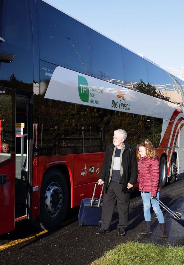
2 Draft Newbridge Transport Plan
Public Consultation Document
INTRODUCTION
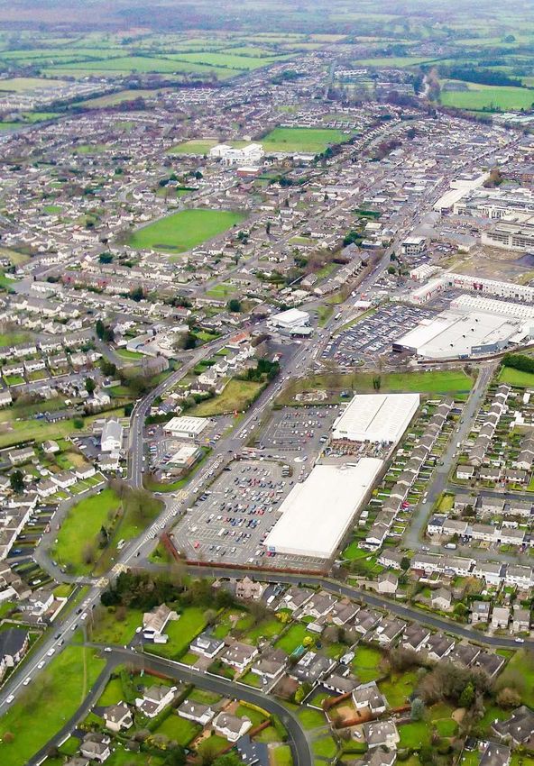
Newbridge is the largest town in Co. Kildare, with a population of
22,742 (2016 Census). It grew rapidly from the 1990s onwards, with its
population doubling between 1991 and 2011. The town is a significant
employment and retail destination serving local residents and a
wide hinterland, and it is also a commuter town in the Greater Dublin
Area, housing people who work in Naas, Dublin and a range of other
employment destinations.
Newbridge is also scheduled to grow significantly over the next two
decades. Figures prepared by the National Transport Authority (NTA)
based on the Government’s National Planning Framework indicate that
the population of Newbridge will increase to 31,167 by 2035, an increase
of 37% over the 2016 levels.
Planning for that increased growth is necessary to ensure that the town
can function and flourish into the future. A key part of that planning
is addressing the current and future transport needs of the town and
surrounding areas.
The Newbridge Transport Plan is intended to provide an overall
framework for the development of transport in Newbridge over the next
decade and beyond.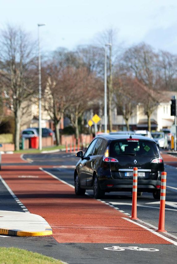
Draft Newbridge Transport Plan        3
                                                                                                                              Public Consultation Document

CURRENT TRANSPORT STATUS

ROADS AND STREETS                       Fig. 1: Strategic Road Links                                                                                          R445
                                                                                              Barretstown

                                                                                                                                                  7
                                                                                                                                                 M
The R445 regional road runs
through the town centre and links
Newbridge with Naas to the north-        Milltown
east and Kildare to the south-west.
The R445 crosses the River Liffey

                                                                                                                   45
at St. Conleth’s Bridge, which is the

                                                                                                                  R4
                                   5
                                R41

only river crossing point within the
town.

                                                                                                                            M7
                                                                          St
Approximately two kilometres                                                 at
                                                                                io
                                                                                  n
south of the town centre, the M7                                                      Ro
                                                                                         ad

                                                               Mor
motorway provides a bypass of

                                                                                                                                                                R448
                                                                  ri
                                                                 sto
the town for long-distance traffic.

                                                                                                 5
                                                                     w

                                                                                                  4
                                                                                               R4
                                                                      n
Junction 12 on the south side of
                                                                       Ro
                                                                          a
                                                                          d
the town and Junction 10 to the                                                          Newbridge
north of the town, provide access
to and from the motorway for
traffic going to or from Newbridge.
                               41
                                  3
                                                                       45

                               R
                                                                  R4

                                                      R4
                                                        13                                                   M7
While Newbridge is well served by                                                                                                       L2
                                                                                                                                          02
                                                                                                                                             3

good road links, traffic congestion
                                           R445      M7                                                                          KEY
within the town and on the main
approaches, is a significant issue.                                                                                              R445

                                                                                                      Athgarvan

                                                                                                                                                      R412
                                                                                                                                 Motorway

                                                                                                                                 Rail
                                            The Curragh                                               R4
                                                                                                        13
                                                                                                                        9
                                                                                                                                  8
                                                                                                                                 R4
                                                                                                                                   4

                                                                                                                       M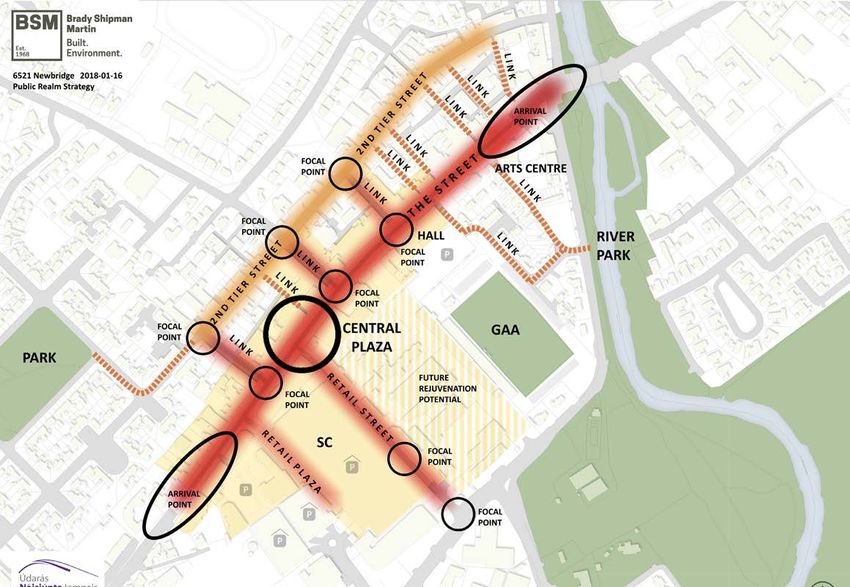
4   Draft Newbridge Transport Plan
    Public Consultation Document

    RAIL SERVICES                                                                 The main Sate operated services are routes 126, 126N, 123 and 124.
                                                                                  Newbridge is also served by a number of commercial operators who
    Newbridge Train Station is located approximately 800m to the north of         provide licenced bus services. These include an hourly service operated
    the town centre. The station is served by the Dublin to Kildare/Portlaoise,   by Dublin Coach travelling from Portlaoise to Dublin Airport and also
    Dublin to Cork/Limerick/Tralee, Dublin to Waterford, Dublin to Galway         servicing Monasterevin, Kildare, Newbridge, Naas and Red Cow Luas.
    and Dublin to Westport/Ballina routes.                                        This service, which operates 24 hours a day, provides an interchange
                                                                                  connection with Luas at the Red Cow stop, allowing further connections
    The station provides commuter rail services to Dublin to Heuston station      into Dublin City Centre.
    as well through the Phoenix Park Tunnel including stations to Grand
    Canal Dock. Each weekday a total of 71 trains stop at Newbridge Station,      Other bus services include the DCU02, ITC02, NUM08 and UCD01 college
    with 38 of these services transporting passengers into Dublin. While the      services, operating during term time only.
    majority of these services terminate at Heuston Station, five services each
    day from Newbridge Station connect to Connolly and Pearse stations            LOCAL BUS SERVICES
    through the Phoenix Park Tunnel.
                                                                                  In addition to the regional bus services, there are two local bus services
    A Park and Ride area is located to the immediate north and south of the       both of which are commercial services operated under licence. The No.
    train station, allowing for combined car and rail journeys, mainly to and     129 runs between Kilcullen and Newbridge, stopping at 15 stops within
    from Dublin.                                                                  Newbridge town. Route 826 operating between Monasterevin and Naas
                                                                                  has seven stops within Newbridge.
    REGIONAL BUS SERVICES
                                                                                  In addition, a number of services are operated by Local Link Kildare
    Newbridge is well-served with regional bus transport. A total of 156          South Dublin. These include services between Newbridge and Killina,
    buses stop in Newbridge each weekday, excluding some additional               Caragh, Rathagan and Athy.
    college bus services that operate during term time only. The majority of
    these services connect to Dublin, but some services link to Naas, Kildare,    While the main spine of the town and the residential areas to the north of
    Monasterevin, Kilcullen and Rathangan.                                        the town centre are relatively well served by bus transport, the south east
                                                                                  of the town, including Newbridge Business Park, has only a limited level
                                                                                  of bus service.
Draft Newbridge Transport Plan   5
                                                                                Public Consultation Document

CYCLING
There is currently only a limited provision of cycling facilities in
Newbridge, with only a small level of designated cycles lanes developed
to date.

PARKING
Newbridge is much better positioned that most towns in the provision
of off-street car parking facilities. The Whitewater Shopping Centre has
roughly 1,700 no. spaces and the Courtyard Shopping Centre car park has
roughly 850 no. spaces.

In addition, the town centre has on-street parking throughout the
majority of its length. There is also parking provided at the train station.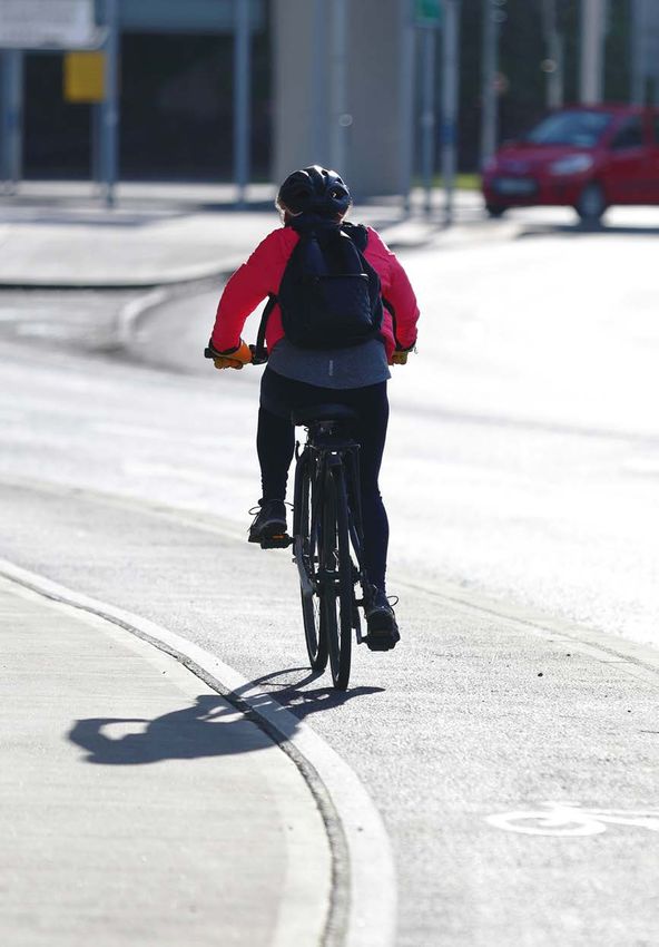
6   Draft Newbridge Transport Plan
    Public Consultation Document

    ISSUES AND CHALLENGES

    The key transport issues and challenges that need to be addressed in
    developing Newbridge’s transport plan include:

    ››   Traffic congestion within the town and approaching the town;

    ››   Defining and supporting the role of the main spine of the town –
         Edward Street and Main Street;

    ››   The need to ensure that the town centre is an attractive, vibrant and
         thriving place for users;

    ››   Protecting and growing the retail and commercial areas of the town;

    ››   Enabling public transport to be more useful to more people, allowing
         an alternative means of travel for some journeys;

    ››   The provision of a safe cycling network throughout the town;

    ››   Enhancing pedestrian linkages and putting in place new walking
         connections for some communities and estates; and

    ››   Increasing the park and ride capacity and the level of cycle parking
         provision at the train station.

    The purpose of the Newbridge Transport Plan is to provide an overall
    framework that will provide for the transport needs of the town over the
    next decade or more. The plan is intended to set out the general package
    of measures at a concept level, with the full details of the individual
    measures to be developed at later stages as individual projects.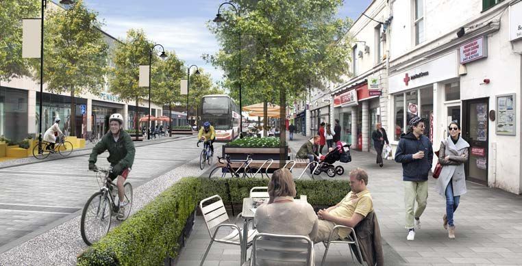
Draft Newbridge Transport Plan   7
                                                                                                                               Public Consultation Document

ALTERNATIVE TRANSPORT APPROACHES

In developing a transport plan for Newbridge, there are two different        While the first approach will deliver increased traffic movement, the
approaches that can be adopted.                                              second approach would see improvements for all transport modes in
                                                                             addition to providing the potential for rejuvenation of the town centre.
The first approach is a traditional traffic management approach that
focuses on facilitating increased traffic flow and maximising the level of   The layout of Newbridge provides the opportunity to fully embrace the
vehicular throughput. The second approach focusses on accommodating          second approach, improving all transport modes and enhancing the core
and enhancing all of the transport modes – car, bus, rail, cycling and       town centre area. Accordingly, this is the basis on which this transport
pedestrian movement - and developing those modes in tandem with the          plan has been developed.
enhancement of the townscape.

   OPPORTUNITIES FOR NEWBRIDGE
   There were two potential approaches in preparing this plan, which would be determined by the overall objective for the town centre and the
   Main Street:

                 Traditional traffic management approach:                            Improvement but no big gain for the
        1        Focus on improving traffic flow and                                 town centre.
                 throughput.

                 Multi-modal Transport approach:                                     Regeneration of the town, providing
        2        Focus on all transport modes and exploit                            the opportunities for business and
                 town centre enhancement potential.                                  retail to thrive.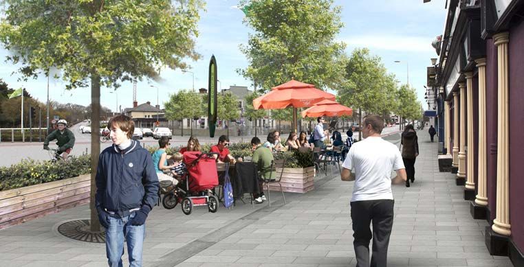
Barretstown
8 Draft Newbridge Transport Plan
Public Consultation Document
STRATEGY Milltown
OVERVIEW
Newbridge provides a unique opportunity to implement a comprehensive Fig. 2: Core Traffic Concept
5
R41
transport plan in tandem with the potential of dramatically enhancing the
town centre, in particular the main spine formed by Edward Street and
Main Street. Currently the main flow of traffic follows two largely parallel
routes – the Edward Street/Main Street corridor and the Athgarvan Road 45
R4
corridor.
The core concept of the transport plan is to route through traffic
around the town centre via the Athgarvan Road initially, supplemented Potential future
College Farm Southern Orbital Relief Road
subsequently by the Southern Orbital Relief Road (incorporating a
second bridge over the River Liffey), and remove through traffic from St
at
io
Edward Street and Main Street. n
Ro
ad
t
The Naas Road to Great Connell Road section of the Southern Orbital Core St
re
e
Relief Road is currently under construction and due for completion in Q4, Town M
ai
n
Centre
Mo
2019.
rri
t
sto
e
re
St
wn
d
d
The traffic calming of Edward Street/Main Street, limiting its use to local
ar
Ro
a
Ro
w
a
Ed
an
d
vehicular access together with public transport and cycling, provides the ga
rv
h
At
opportunity for major street changes to enhance the appearance, vitality
and ambience of these streets. The revised layout will ensure that access KEY
to all car parks, shops and businesses will be maintained. Millfield
Liffey Hall
Motorway
The reduced traffic levels along Edward Street/Main Street would enable Potential
dramatic 13enhancements to be made to the streetscape along these Curragh Grange
R4
Future Road
45
streets.
R4
Through Traffic
M7
R4
13 Route
Rail
M7Draft Newbridge Transport Plan 9
Public Consultation Document
Widening of footpaths, new
surfacing, tree planting, provision
of seating, the creation of
designated focal points plus
arrival points, together with the
construction of a central plaza will
transform the town centre area. An
overall concept layout of the town
centre is shown in Figure 3. Later
sections give indicative details
of some of these public realm
proposals.
Fig. 3: Urban Realm Concept Layout10 Draft Newbridge Transport Plan
Public Consultation Document
The following sections set out the various actions envisaged under the
Newbridge transport plan.
ROADS / STREETS
›› Increase the traffic capacity of Athgarvan Road by:
• Reconfiguring the junctions at either end;
• Implementing changes to intermediate junctions along the road;
• Widening / additional lanes on approaches to some junctions;
›› Remove through traffic from Main Street / Edward Street spine;
• As a first step to full removal of through traffic, the traffic volumes
could initially be reduced by signage, lower speed limit (30kph) in
central area and traffic signal controls limiting through movement;
›› Put in place alternative traffic circulation arrangement for town centre:
• Figure 4 provides an example of a potential circulation layout –
other layouts are possible;
• Changes to Cutlery Road to allow car park access from Athgarvan
Road;
›› Implement public realm improvements in town centre – details in later
section;
›› Implement additional signage to reinforce use of M7 for longer
distance traffic; and
›› Either in tandem with the above or subsequently, complete the
construction of the Southern Orbital Relief Route.Draft Newbridge Transport Plan 11
Public Consultation Document
PUBLIC TRANSPORT Fig. 4: Indicative Traffic Circulation following Plaza development
›› Improve bus infrastructure throughout Newbridge – new bus poles
with expanded route and service information plus additional bus
et
shelters;
re
St
re
St et
›› at
Ey
Prioritise bus movement along Main Street by providing a bus/taxi/ io
n St
re
Ro n
cycling only section as part of the plaza development, thereby fully ad ai
M
removing general through traffic. Prior to the introduction of this bus
only section, other measures to reduce through traffic may be put in
place;
›› Enhance the local bus service by expanding the existing routes or
et
re
providing an additional service;
St
y
nr
››
He
Expand car parking provision at Newbridge Train Station;
He
›› Increase and enhance cycle parking facilities at Newbridge Train nr
y
St
Station; and re
Cu
et
tle
ry
›› Provide a direct walking and cycling connection alongside the railway
Ro
ad
line to connect residential areas such as Rosconnell and Roseberry and ad
Ro
adjacent areas to Newbridge Train Station. KEY rv
an
ga
Car Park th
Access/Exit A
One Way Traffic
et
re
St
d
Two Way Traffic
ar
w
Ed
Bus Only
Car ParkLA
C KM
! K12
KB
IL L
DU
ER
ER
SH
IL L
RY
LA
WN
NE
TE
!
TO
BLA CKMILLERSHILL TA
ES
DS
LD
BL
AR
12 Draft K21
Newbridge
Transport Plan F IE
AC
!
LL
GH
HI
KB
PO
ER
Public Consultation Document NB1
RA
RY
!
HILL
LA
RA
T
NE
HB
A
N
GH
NB1
!
GL
RI
DE
RA
EB
KS
R
E
OA NB4
CU
!
E
TH
TH
E
TH
SO POLL
K15
OA
UT AR
TH
DSTO
E
HG
TH
WN
OA
KS
RE
E
EN MO
E
OA
RO
KS
EL
AD
KS
CU
M
R K
S
RA
OLD
BE R
RG PA
E
E
R
R O AD
!!
AG
O
O
!
SO
LL
M
UT
VI
HG
NB4
E
TH
RE
EN K15
CA N
EN NB3
N
ASHFIELD 1 5 RO
ON S
RO R4 S EB
ER
W
AD RY
H
T
EE
OW
LA
N
M
HA
LAN
W
KF
IE
G TO
LD
! !
N
GH
DE
LIT
AR
N PA
!
RA
TL
!
K15
SG
N
EC
K20
DE
OL
UR
RD
O
RK
NN
AR
D
KA
K20
HC
EL
GR
SG
KT3
N
RO
L
TA
SC
T
RD
E
AR
RA
AD
GR
LI
EN
LE
E
KA
CYCLING
T
TS
R
EN
TL
TO
EI
NE WTOW N
RO
N
WN
EC
W
RO
Fig. 5: Greater Dublin Area Cycle Network for Newbridge
AD
TA
L
O
EL
CU
!
SC M7 M7
N
AD
AR
N
N
KILDARE LE M7 M7
R
N
EL
TS M7L L
!
O
RA
TO
2
I
L
C
12 M7 N N
WN E
AS
K12
GR
LD
GH
T RO M7
S O
O
EB M7 M7 C
E
ER 12 E
TL
KT1
EN
RY
MA R
HA LIT
M7
››
W
KF IEL
D RY M7
RO
KF ER
Implement the proposals set out in the Greater Dublin Area Cycling
IE
YVIL
LD W RO EB
LD
!
HA L
AD
S S EL
EB RO
OL DC
IE
NN
V
OL D RO
ER
KF
RO
LE
RY O
DC
W
SE
OL
HA
ON NE
BE
Network for Newbridge as set out in Figure 5; and
RO
R
SE
R
!
N Y
KILDARE
AD RA
BE
W H
LL
TO IL
R
RIC DS L
R
DU
K15
R
Y
!
KA OL
E
N KA M7
K
H
TH
M RD D
E
L EB
R
RIC
IL
UR RO SE CO
U
PA
ST
BR
L
R4
BERR
EN
MILL LA NE
RY OW NN
››
Y HI
Y
ID
1
AV
LL EL
CK G
R
EA N
3
KT1
E
BU
L
Provide cycle parking stands in key locations throughout Newbridge.
ST
L
EL
S
LE
N
!
KN O
AI
N
O
SC
RO
AG H
R445 R44 5 MO NAST
ER EVIN KT2 M7
CR
L
RO AD
O
CO L
TA
NS
PEDESTRIAN NETWORK
TO
R4 15
WN
GH
DU
!
FR
RA
!
N
IA
M
R
A GH
ST
M7
UR
CU R
O
N
KT2
RY
W R4
LE
M7 N
K20
R
1
W
2
I
EG
3
!
CU R
M7
R41 5
ES
››
TH
T
BLA
M7
Provide enhanced pedestrian facilities in the town centre through
! !
NE WBRIDGE
M7
C KB
M7
FR
IA KT3
GH
SY
RS
M7
K12
ER R
CA
TO
13 M7 NB1
RA
!
W
M
M7 N
OR
M7
Y LA
R
OA
street improvements and additional pedestrian crossing facilities;
M7
R415
L
CU
E
AB
K
EL
NB2 R4
RO
N
RO
BE
1
NN
M7 3
E
AD
M7
FRIARSTOWN
AD
M7
YR
M7
CO
13 M7 M7
RY WEST
AT
OA
AS
RA
AGH
E
T
CU RR
HR
GR
D
HB
BA
››
LI
DU NM R ID
F
RO
O
!
UR RY
FE
E
Create a new pedestrian K12route to provide access from College Farm
AD
EAST
GR
DA
Y
DU NM UR
BL
GH
VI
RA
E
BLA
AC
CO
EW
AT
CK R
MIL CU
KB
UR
CO
LE
RS
ER
T
GR EY AB
H IL
NN
area to the train station;
L
RY
NATIONAL
EL
LA
L
WN
NE
TE
TO
TA
BEY
TH
BLA CKMILLER SHILL
STUD FARM
ES
DS
E
GREATCONNELL
LD
››
BL
AV
AR
IE
!
EN
HF
AC
RO AD
Create a new pedestrian route to provide access from Lakeside estate
!
LL
!
U
HIG
KB
PO
E
V
! !
ER
NB1 NB3
RY
!
R415 R415
K18
/ Dara Park area to the train station; and
LA
RA
T
K21
NE
HB
NEWBRIDGE
GH
NB1
!
TULLY WES T TULLY WES T
R ID
RA
E
NN KS
R
IL L SILLIOTHILL CLU AIN A ILEA TU
LL IO TH OA NB4
CU
NE WTOWN
!
L LY
EA HE
TH
ST T
››
AD
E
TH
POLL RO
K15
OA
AR
Create various additional pedestrian links to improve accessibility from
TH
DSTO
E
AN
TH
WN
OA
KS
RV
E
MO
E
KIL
GA
OA
TULLY EA ST OR
KS
GR
EL
R4 15
EF H
ST
BE
TH
AT
KS
CU
M
IE
EA
R K LD
S
RA
OL D
LIN
EA
R
BE R PA
TC O
PA
residential areas to key locations and to better link residential areas
O
RG R
N
E K
Y
GE
R
RO AD
!!
LL
N
NN
O LD
W
LA
! !
O IE
!
TU
LF
TO
M
EL L
VIL
MIL
TU L
S
NB4
!
E
throughout Newbridge.
EN
K18
TH
K15 K19
D
VE
LY
G RO
R4 1
AD
TH E
NB3 M7
EA
K
M
NB3 R
ER
ASHFIELD PA
5
ST
E
TH
W
M7
N LO
LL
!
HA
LL
5
G
LAN
TU LL
HA
1
TO W
R
E
R4
EA
TH
E
!
EN
K21
G TO
TC
TH
!
N
!
RE
Y EA
O
GH
OW
W NS
N
G
N
N PA
NT
!
RA
M7
EL
!
K15 K20
ST
O
K20
L
OL
S
LM
UR
BR O
M7
EN
R
T
BE
D
K
K20
HC
GR
KT3
RO
DD
N
T
E
RA
AD
AW
AD
MA
EN
RO AD
EL
RO
E
TH RO
CU
M7
TH
M7
AD
M7 M7 E
KILDARE TH
R
M7
Legend:
!
RA
ct: 2
I Title:
12 M7
M7
GR
GH
M7
M7 M7 M7 M7
E
12 W
VIE
KT1
EN
MA R
M7 TH E M7
M7
! !
RO
Primary/Secondary Feeder
PROPOSED CYCLE NETWORK E Employment Zones } Town Centre
YVIL
M7
!
AD
V
ES TO WN
OL D RO
YCLE NETWORK PLAN FOR
LE
Inter-Urban Minor Greenway
! H Hospitals !
U University
KILDARE NEWBRIDGE & KILDARE
AD
WALSH
HE GREATER DUBLIN AREA
! ( !
E
M7
Greenway
P V Village Centre
LEB
!I Institute of Technology
R4
Permeability Link
1
CK G
3
KT1
SHEET N19 Dublin - Primary
!
N
2
I Stations
!
KN O
W
!t Shopping Centre
TO
K19
AG H
ES
T2 M7
SH
Dublin - Secondary County Council Boundaries
CR
CO LL
AL
O TA
W
NS
TO
R41 5
WN
GH
ROSE TOW
!
N
RA
!
A GH
M7
CU R
W
MIL FO
AL
KT2 R4
K20
SH
R
1 3
!
CU R
R41 5
ES
RD
TO
M7
AD
W
KT3 RO
N
GH
GH
M7 R RA
M7 CU
RA
M7
R
M7
R415
LL AS
CU
R4 Y VI
M7 1 3 N O LL
13
M7 M7 M7 CO N
M7 M7
AGH
AGH R41 3 R41
CU RR 3
CU RR
R413 R4
13
GH
R RA
CU
GRDraft Newbridge Transport Plan 13
Public Consultation Document
PUBLIC REALM IMPROVEMENTS
Edward Street: Reconfigure Edward to create the feeling of a street Figure 7: Edward Street - Before
rather than a road. The street can be narrowed allowing the creation of
wider footpaths which can incorporate street furniture including seating
for cafes and shops plus tree planting. The aim is to create a pleasant
street environment where people will want to linger and enjoy the retail
and cultural facilities in the town.
Figure 6: Edward Street Concept
Figure 8: Edward Street - After14 Draft Newbridge Transport Plan
Public Consultation Document
Main Street: A similar street concept to Edward Street is proposed to Figure 10: Main Street - Before
continue into Main Street incorporating wider footpaths and introducing
a cycle lane. On-street car parking is provided with parking bays and
trees interspersed. The improved public realm will draw pedestrians onto
the Main Street providing connection between the retail and cultural
attractions.
Figure 9: Main Street Concept
Figure 11: Main Street - AfterDraft Newbridge Transport Plan 15
Public Consultation Document
Cutlery Road: Cutlery Road is proposed to be reconfigured to allow Figure 13: Cutlery Road - Before
two-way access to and from Athgarvan Road to the Whitewater Car Park,
with the northern half of the street retained as one way but with the
traffic flow reversed in direction. Along the one way section of the street
pavement extensions with planting and seating can be provided, along
with other street enhancements such as lighting.
Figure 12: Cutlery Road Concept
Figure 14: Cutlery Road - After16 Draft Newbridge Transport Plan
Public Consultation Document
Entrance Points: At the northern and southern ends of the town, it is Figure 16: Main Street and Athgarvan Road Junction - Before
proposed to introduce street changes that creates an attractive “arrival
point” for the town centre. At the junction of Main Street and Athgarvan
Road, it is proposed to utilise the space available to enhance the
streetscape, improving the environment of the cultural buildings of the
Arts Centre and library and providing street planting, seating, lighting
and enhanced surfacing. An indicative layout is shown in Figure 15.
Figure 15: : Junction of Main Street and Athgarvan Road
Figure 17: Main Street and Athgarvan Road Junction - AfterDraft Newbridge Transport Plan 17
Public Consultation Document
SUMMARY
Newbridge is forecast to grow by over eight thousand people over the
next 15 years and transport changes will be essential to cater for that
growth. The preparation of a Newbridge transport plan provides the
opportunity to consider how Newbridge should develop in the years
ahead.
The draft proposals set out in this document envisage an integrated set
of measures that are intended to cater for the transport needs of the
town over the next decade and beyond. But just as importantly, those
proposals seek to ensure that Newbridge is a thriving, vibrant town which
is an attractive place to live, visit, shop and socialise.
At its core, the proposals seek to redistribute through traffic along
the central spine of the town onto Athgarvan Road, and also onto the
Southern Orbital Relief Route when completed. This then facilitates a
traffic-calmed town centre core, allowing the streetscape of the town to
be dramatically improved, improving its overall attractiveness and appeal.
Coupled with various road and street improvements, and including
pedestrian, cycling and public transport measures, this package of
proposals are intended to provide a framework for the development of
transport in Newbridge over the next decade and beyond.National Transport Authority
Dún Scéine
Harcourt Lane
Dublin 2
D02 WT20
Údarás Náisúnta Iompair
Dún Scéine
Lána Fhearchair
Baile Átha Cliath 2
D02 WT20
arna dearadh ag
arna dearadh ag
designed by
arna dearadh ag
designed by
arna dearadh ag
Tel: +353 1 879 8300
www.nationaltransport.ieYou can also read