Our Living Coast Livingstone Coastal Hazards Adaptation Strategy - Livingstone Shire Council
←
→
Page content transcription
If your browser does not render page correctly, please read the page content below
Our Living Coast
    Livingstone Coastal Hazards Adaptation Strategy

1
Table of Contents
Mayor's Message.........................................................................................................................................................3
1.0 Introduction.............................................................................................................................................................4
             1.1 Purpose of the Our Living Coast Strategy...............................................................................................4
             1.2 A community driven plan for a resilient coast........................................................................................6
             1.3 How did we develop the Our Living Coast Strategy?......................................................................7
             1.4 Our journey in responding to coastal hazards....................................................................................8
2.0 Our Coastal Values.............................................................................................................................................10
             2.1 Our Coast...............................................................................................................................................10
             2.2 Our Coastal Environment......................................................................................................................12
             2.3 Our Coastal Economy.........................................................................................................................13
             2.4 Our Coastal Lifestyle.............................................................................................................................14
3.0 Living with our Changing Coast.........................................................................................................................16
             3.1 What are the coastal hazards affecting our coast?................................................................................18
             3.2 How may these changes impact us?................................................................................................21
4.0 What can we do? A strategy for everyone......................................................................................................26
             4.1 Our adaptation principles are a foundation for a resilient future......................................................24
 4.2 Desired Coastal Outcomes...................................................................................................................24
 4.3 Pathways for a resilient future coast.....................................................................................................27
 4.4 A strategic approach to adaptation......................................................................................................28
 4.5 Our whole of shire strategic adaptation actions................................................................................32
 4.6 Our local adaptation pathways...........................................................................................................33
		4.6.1 Stanage.................................................................................................................................................34
		 4.6.2 Farnborough and Bangalee.................................................................................................................36
		 4.6.3 Yeppoon...............................................................................................................................................38
		 4.6.4 Rosslyn, Lammermoor and Kemp Beach..............................................................................................41
		 4.6.5 Mulambin, Kinka Beach and Causeway Lake.................................................................................45
		 4.6.6 Emu Park and Zilzie............................................................................................................................48
		 4.6.7 Keppel Sands......................................................................................................................................52
		4.6.8 Joskeleigh............................................................................................................................................55
		 4.6.9 Great Keppel Island...........................................................................................................................57
5.0 Our Implementation Plan....................................................................................................................................59
Glossary...............................................................................................................................................................66
References.................................................................................................................................................................67
Appendix A - Indicative Pathway Actions and Triggers for Localities....................................................................68
Mayor's Message
    The Livingstone coast is a dynamic and varied landscape. Stretching for some 300 kilometres, our coastal
    zone encompasses pristine coastal wetlands, estuaries and inlets, extensive sandy beaches, unique coastal
    townships, offshore islands and a rich diversity of cultural, economic and environmental values.

    Our coast is highly valued by our traditional owners, local communities, businesses and residents of the
    broader Livingstone shire, and visitors to the area. The coastal landscape and access to the coast underpins
    not only our economy but our lifestyle here. Everyone in our community has a role in caring for our coast and
    we all need to work together.

    The Livingstone coastline is currently prone to coastal hazard impacts such as erosion and storm tide
    inundation, driven by cyclones and storm events. These coastal hazard impacts are predicted to increase with
    climate change.

    The Queensland Government and the Local Government Association of Queensland (LGAQ) have provided
    funding and support to Livingstone Shire Council to develop a strategic approach to managing coastal
    hazards and to ultimately produce the Our Living Coast Strategy.

    Our Living Coast provides a roadmap of actions that enables us to be better prepared to reduce the impacts
    of coastal hazards on our communities, environment, cultural values, infrastructure, liveability and services.

    Mayor Andy Ireland

                               Acknowledgement
                                  of Country
                    Livingstone Shire Council acknowledges and pays respect to the Darumbal and
                      Woppaburra people as Traditional Custodians of the land within Livingstone.
                     Council also acknowledges and pays its respects to the Aboriginal and Torres
                                 Strait Islander people who now reside within this area.

                  The Our Living Coast Strategy commits to acknowledging the history and ongoing
                    contributions of Aboriginal and Torres Strait Islander people to the Livingstone
                           region and the fundamental role they play in shaping our region.

3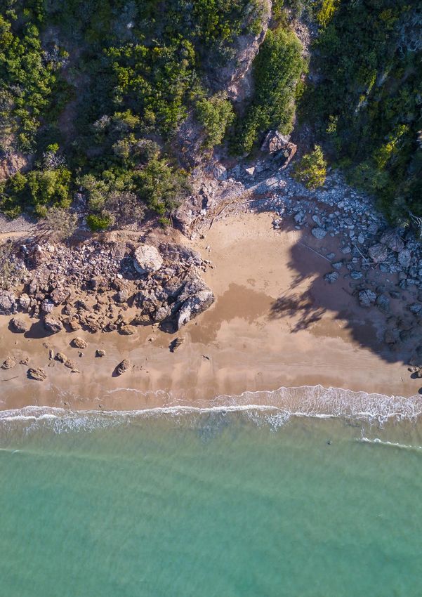
1.0 Introduction
    1.1 Purpose of the Our Living Coast Strategy
    The Our Living Coast Strategy provides direction for how we can work together to better manage and respond
    to coastal hazard risks and strengthen the resilience of our coastal places, our coastal economy and our
    coastal environment.

    From Stanage in the north to Fitzroy River in the south, the Livingstone coast has countless picturesque sandy
    beaches, coastal townships and offshore islands which makes it an ideal tourist destination and place to live.

    Coastal environments are always changing and being shaped by wind, tides and currents and changing sea
    levels. Impacts from these natural processes include storm tide inundation, coastal erosion and sea level rise.
    Referred to as coastal hazards, they can affect our region’s natural and built environment, our day to day lives,
    our community’s wellbeing and our economy.

    The Our Living Coast Strategy provides an understanding of how our coast is being affected by coastal
    hazards today and how our coast might change in the future under the influence of a changing climate.
    Understanding current and future coastal hazard risks and how they might impact our community means we
    can proactively plan, prepare and respond to these risks over time.

    The Our Living Coast Strategy focusses on the following coastal hazards:
          Storm tide inundation is the temporary                    Climate change is the change in the present
       inundation or flooding of low lying coastal land           day climate due to warming of our atmosphere.
         by abnormally high ocean levels caused by                 This will influence how coastal hazards impact
                cyclones and severe storms.                                       on our coastal areas.

         Source: Livingstone Shire Council, 2019                    Source: Queensland Times, 2016

           Coastal erosion is the loss of land, beach or             Sea level rise is the increase in sea level
       dunes by wave or wind action, tidal currents, water           caused by global warming due to climate
        flows or permanent inundation from sea level rise.         change. This results in an increase in the extent
       Coastal erosion can be short term or long term and           of land subject to periodic tidal inundation,
       is influenced by changing climate conditions, sand            coastal erosion and storm tide inundation.
                  supply and human influences.

4        Source: The Morning Bulletin, 2016                         Source: The Chronicle, n.d.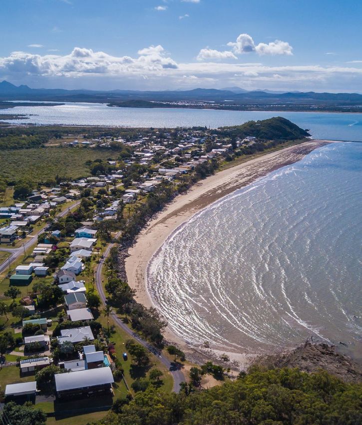
THE QCOAST2100 PROGRAM

    Livingstone Shire Council prepared the Our Living Coast Strategy using funding provided through
    the QCoast2100 program.

    The QCoast2100 program is a state-wide initiative of the Queensland Government and Local
    Government Association of Queensland (LGAQ). The program has been designed to assist
    Queensland coastal local governments with funding and technical support to progress the
    preparation of plans and strategies to address climate change related coastal hazard risks.

    The purpose of the Our Living Coast Strategy is to:

       Provide a strategic framework for a coordinated and whole of coast
     response for what actions we will take to adapt to and manage coastal
                                  hazard risks.

     The strategy will inform decision making and guide the management of our
                                coastline. This includes:
                         • infrastructure and asset management
                                  • land use planning
                               • foreshore management
                                • nature conservation
                                      • recreation
                               • cultural heritage values
                                 • other public assets

5
1.2 A community driven plan for a resilient coast
    Caring for our coast now and into the future is a shared responsibility involving Council, State and
    Commonwealth Governments, stakeholders, business owners, Traditional owners, property owners, residents
    and the community. Having a shared vision and framework that underpins Our Living Coast Strategy is
    important. Council has sought to involve the community and a wide range of key stakeholders to provide input
    and share their experiences on our changing coast and to ensure the strategy responds to the needs
    and expectations of our community. This strategy has been developed in consultation with:

          Council
      Representatives                                            Community
         (Internal                    External                                              The Broader
                                    Stakeholders                  Reference                 Community
         Technical                                                 Group
      Working Group
       & Councillors)

    Broad community engagement from May to August 2019 included participation in a community survey, more
    than eight events across the region’s coastline and online material on Council’s project website. Engagement
    also occurred in August 2020 through a series of community factsheets.

    The Technical Working Group, Community Reference Group and External Stakeholders provided feedback at
    key decision points across all project stages.

6
1.3 How did we develop the Our Living Coast Strategy?
    The Our Living Coast Strategy has been developed to align with the process and requirements of the
    QCoast2100 Minimum Standards and Guidelines for Queensland (LGAQ & DEHP, 2016).

                                                PHASE 1
                           Commit               Plan for life of project stakeholder and community engagement
        Getting
        Ready              and Get
                                                PHASE 2
                            Ready               Scope coastal hazard issues for our coast

                                                 PHASE 3
                                                 Undertake a coastal hazard assessment and prepare updated
                                                 hazard extent mapping to identify areas exposed to current and
                                                 future coastal hazards
     Understanding         Identify              COMMUNITY AND STAKEHOLDER ENGAGEMENT TOUCHPOINT
      our coastal
        hazard               and                 PHASE 4
                                                 Identify key natural, cultural, economic and community values
      challenges            Assess               and assets in coastal hazard areas
       and risks
                                                 PHASE 5
                                                 Undertake risk assessment of key assets, values and infrastructure
                                                 in coastal hazard areas
                                                 COMMUNITY AND STAKEHOLDER ENGAGEMENT TOUCHPOINT

                                                 PHASE 6
                                                 Identify potential adaptation options to respond to coastal
                                                 hazard risks
                            Plan,                COMMUNITY AND STAKEHOLDER ENGAGEMENT TOUCHPOINT
         How
        we will           Respond                PHASE 7
       respond                                   Undertake socio-economic appraisal of adaptation options to
                            and                  prioritise options and to understand benefits and investment costs
                           Embed                 PHASE 8
                                                 Strategy development, implementation and review
                                                 COMMUNITY AND STAKEHOLDER ENGAGEMENT TOUCHPOINT

    The process to develop the strategy has included technical studies and engagement activities that together
    form the evidence underpinning the strategy. The outputs from this work have:

    • Identified existing coastal hazard extents for coastal erosion, storm tide inundation and sea level rise, and
      how these extents might be expected to change in the future under the influence of rising sea levels over
      different timeframes: present day, medium term (2050 – increase in sea level of 0.3m) and longer-term
      (2100 – increase in sea level of 0.8m), as part of Phase 3
    • Assessed vulnerability and risks to a broad range of assets and environmental, social, cultural,
      recreational, infrastructure and economic values within coastal hazard areas, as part of Phases 4 and 5.
      This included identifying priortities and distinguishing which risks need responding to today and risks that
      can wait.
7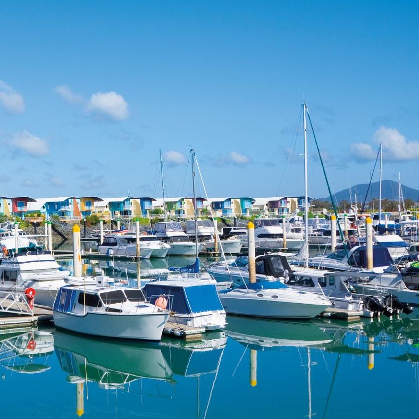
• Identified strategic adaptation options to ‘treat’ or manage coastal hazard risks,
      as part of Phases 6 and 7
    • Identified ‘tools’ to deliver the adaptation options
    • Outlined indicative timing and sequencing of strategic adaptation actions over time
      using 'pathways' approach
    • Defined roles and responsibilities for implementing actions
    • Identified potential funding sources
    • Outlined monitoring and review expectations

         Key considerations for strategic adaptation actions for the Livingstone Shire include:

         Financial sustainability – adaptation can be expensive, and we can’t protect the whole coastline.
         We need to focus on low cost solutions wherever we can, and prioritise where and when we invest
         in high cost adaptation responses
         Protection of special places and infrastructure – protecting important assets should not be at the
         expense of what we value and love
         Maximising benefits – when we invest in coastal hazard adaptation, we want to make sure
         that we maximise community benefits for the shire as a whole

    1.4 Our journey in responding to coastal hazards
    Living with coastal hazards has been part of our history and will continue to be part of our future. Natural
    coastal processes have been ongoing for millennia and the people of the Darumbal nation and Woppaburra
    people have deep experience and knowledge of natural coastal processes, extreme weather and connection
    with sea and country.

    Livingstone is leading the way in disaster management through their state-of-the-art Local Disaster
    Coordination Centre and Community Resilience Hub. The Hub provides a central location for all emergency
    service agencies to work cooperatively during natural disasters and it also functions as an important
    community resource for advice, guidance and education to help build community resilience and prepare for
    future extreme weather.

    Council have already been undertaking various coastal activities and works to protect community
    infrastructure, for example a seawall adjacent to Yeppoon Beach, provision of an alternative road connection
    between Yeppoon and areas immediately north of Spring Head, and active management of the dunes on
    Kemp Beach.

    Drawing on our collective experience of past coastal hazard events provides the foundation for us to build
    on what we know works well in our community, as well as improve and plan our response to future coastal
    hazards risks to minimise disruption and manage future change along our coastline.

8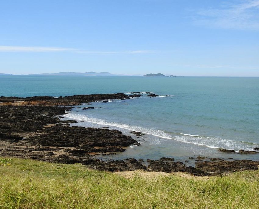
"We know our climate is changing and impacts will be
    experienced differently. For the Livingstone Coast, we expect climate
     change will mean that coastal hazards, including extreme weather,
            will become more severe and frequent over time."

9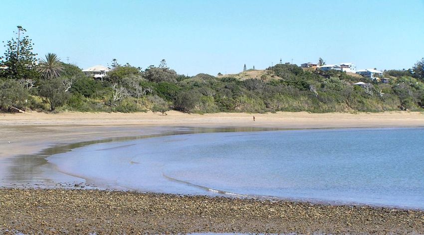
2.0 Our Coastal Values
     2.1 Our Coast
     Located on the Capricorn Coast in central Queensland, our shire has over 300 kilometres of coastline
     stretching from Stanage in the north to Fitzroy River in the south.

     Our coastline is diverse – comprising scenic unspoilt coastlines, wetlands, waterways, islands, national parks,
     rainforest, seaside towns and expansive farmland. Located on the Tropic of Capricorn, we enjoy a subtropical
     climate with wet and humid summers and mild winters. This weather underpins our outdoor lifestyle which is
     centred around the coast where we live, work and relax.

     LIVINGSTONE AT A GLANCE

                                         36,300
                                             residents in 2016
                                                                      55,740                                   estimated
                                                                                                               residents
                                                                                                               by 2041

                                                                                                   AGING
                                                                                                   POPULATION
                                                                                                   RESIDENTS AGED

      15         COASTAL
                 COMMUNITIES
                                                                                                   65                   LIVINGSTONE 18.4%
                                                                                                                 (2018) QLD 15.4%

                     INCREASE IN RESIDENTS                                                                50%
                     1.6%                    per year
                                             (2016 - 2041)
                                                                                                          of population lives
                                                                                                          in the major coastal
                                                                                                          centres of Yeppoon
                                                                                                          and Emu Park

10     Source:   Livingstone Shire Council's Corporate Plan 2020-2030 and Livingstone Community Plan - Towards 2050
Each part of our coast is different. Each coastal community has its own unique character, and identitying
special places that people love for different reasons.
Each coastal community also has varying exposure to coastal hazards and will be impacted in different
ways. The adaptation actions in this strategy respond to the unique needs and impacts of coastal hazards for
different parts of our coast.
STANAGE
a remote fishing settlement located at the northernmost area of the Shire
FARNBOROUGH
a rural area that incorporates a large area of Byfield National Park and the former
Capricorn International Resort
BANGALEE
a smaller coastal settlement that provide us with scenic views and endless
swimming, walking and picknicking activities
YEPPOON
the bustling commercial and tourist centre
ROSSLYN BAY
links us with the marine industry and is an important gateway to the whole of the
central Queensland coast
CAUSEWAY LAKE
is hotspot for tourists and residents and a hub for boating and fishing
KEMP, LAMMERMOOR, MULAMBIN & KINKA BEACHES
places where families, friends and visiting tourists can play and relax
EMU PARK
is a lively settlement which is touched by the legacy of Captain James Cook
GREAT KEPPEL ISLAND & THE KEPPELS
important destinations for locals and tourists
KEPPEL SANDS
a quiet coastal settlement spread along a long beach front road
JOSKELEIGH
a remote coastal settlement that provides scenic coastal views
112.2 Our Coastal Environment
Our coast is a beautiful scenic landscape characterised by a unique combination of coastal landforms
including rocky headlands, pocket beaches, estuaries, bays, dunes and offshore reefs. Our wetlands,
waterways, natural foreshores, beaches, islands and coastal vegetation support a diverse and flourishing
ecosystem of plants and animals.
Waterways and wetland areas such as the Fitzroy River, Ross Creek, Cawarral Creek, Mulambin Creek and
Corio Bay Wetlands are important habitat areas for native species.
There are many important nature conservation areas that support large extents of protected ecosystems,
including Byfield National Park, Capricorn Coast National Park and Broadsound Islands National Park.
Our lifestyle, liveability and the reasons why people love to visit our coast are underpinned by the natural
beauty of our coastal landscapes and our bustling coastal towns. Our coastal environment support a variety
of places that hold special cultural, natural, social and economic values to residents and visitors.
OUR COASTAL ENVIRONMENT AT A GLANCE:
3803 Wetland
Wildlife
Species2
11,800km2
SHIRE AREA1 300km1
Coastline
49
Rare or 1392km 22
threatened
plant species2 Wetlands
TOTAL PROTECTED AREA IN THE SHIRE
(State Forests, Conservation Parks,
Resource Reserves and National Parks1)
200km2
12 Source: 1. Council's Corporate Plan 2020-2030
2. Queensland Government (DES), Wetland Info, 20202.3 Our Coastal Economy
Jobs and the economy are identified as important priorities for the future of the Livingstone Shire. Key
employment areas for our shire include accommodation and food services, tourism, retail, education and
training, manufacturing, construction, agriculture, forestry and fishing.
Coastal dependent infrastructure, particularly to support recreational boating and fishing, are important for
the local economy and are key tourism drivers. Tourism is a key economic contributor that spans across retail,
accommodation and food services. This sector added $52 million (5%) to the shire’s economy in 2018/2019
and was also a high employer that generated approximately 20% of local jobs . New and existing tourist
uses, such as those located at Great Keppel Island and Rosslyn Bay Harbour that are focussed on cultural or
natural environment features, will continue to play an important role in our economy and tourism industry.
How we respond to coastal hazards today and in the future will directly influence the strength of existing
businesses, our lifestyle and why people to choose to visit or live on the coast.
The Rosslyn Bay Marina is a regionally significant facility that attracts
locals and people from surrounding areas. It is the only all-tide, open
water access point on the Capricorn Coast.
15,346 average international visitors per year3
$52 million
valued added by tourism
(5% of shire's industry and 0.4% of QLD's industry4)
13 Source: 3. Livingstone Community Plan 2020-2030
4. id Livingstone Shire Economic Profile, 20202.4 Our Coastal Lifestyle
Our coastal places are the foundation for our outdoor, relaxed beach lifestyle. 65% of our population
choose to live in the larger coastal centres in our shire – Yeppoon and Emu Park5. These places front sweeping
sandy beaches and foreshore parklands with facilities that support boating, fishing, swimming, walking and
community gatherings.
The engagement informing the Our Living Strategy has helped us understand what our communities value most
on the coast and why these areas are important.
Some of our favourite ways to use our most loved coastal places include enjoying the scenic coastal views,
appreciating the lush natural coastal environment and delighting in water or foreshore recreational activities,
such as swimming, snorkelling, boating and fishing, running and cycling.
Our favourite ways to enjoy our coastal places include6:
• Recreational activities in the water, along the foreshore
and at the water's edge
• Experiencing scenic views and natural coastal environment and landscapes
• Spiritual and cultural connection
• Picnics and BBQs with friends and family
• Community events, such as markets and festivals
• Visiting cafes, restaurants and shops
Our ideal qualities of the beach or foreshore include6:
• Sandy beaches
• Natural areas adjoining the coastal foreshore
• Naturally vegetated dunes
• Presence of wildlife
• Open parks and reserves adjoining the foreshore
• Infrastructure to support access and enjoyment of the foreshore
14 Source: 5. Based on ABS 2016 census data
6. Data based on Phase 3&4 community survey results3.0 Living with our Changing Coast
Our coastal areas are dynamic places that have been formed over a long time by natural processes, such as
wave and wind action, ocean tides and currents. These natural coastal processes are also known as coastal
hazards when they potentially impact on buildings, community infrastructure, places of cultural importance and
our natural areas.
The Our Living Coast Strategy focuses on the coastal hazards of storm tide inundation and coastal erosion and
how these coastal hazards are expected to change under the influence of sea level rise from future climate
change. The extent of coastal land potentially impacted by coastal hazards, as well as the consequences of
these coastal hazards, are expected to increase into the future.
Most people are aware of daily changes to our coast, beaches and dunes caused by the rise and fall of tides
and actions of waves and wind. Some of us during our lifetime, have also experienced more extreme coastal
hazard events in Livingstone, such as erosion associated with severe tropical cyclone Marcia in 2015 and
tropical cyclone Debbie in 2017. Less obvious changes include the gradual widening of the dune system along
most of Kinka Beach over the past 20 years.
These natural coastal processes, whether occurring daily or from more extreme weather events, have always
impacted and shaped our coast.
Coastal hazards and their impacts – experienced past and present – will continue in the future and are part
of living on the coast. How we have experienced past coastal hazards and how we choose to respond in the
future will change over time. Improving our resilience to coastal hazards is a continual journey for everyone
and it is important that we build on what we have learned works well for our region.
Our 'lived experience' with coastal hazards means
we can build on what works well for our shire.
15Climate change is expected to increase the extent, severity and frequency of coastal hazards. For example,
tropical cyclones are expected to be more intense and a greater extent of low lying land will be affected by
periodic inundation because of sea level rise.
One of the best lines of defence to protect our coastal infrastructure and valued places from coastal hazard
impacts, is our natural environment – a wide beach, healthy dunes, coastal vegetation and intact habitats –
which provides a protective buffer. These are also the qualities and features that our community values most on
the coast.
We can expect to see a range of changes to our coast from coastal hazard impacts in the short and long-term.
Changes and Impacts we are experiencing now:
Erosion damage to buildings Narrowing of beaches and Limited natural access paths to
and private properties loss of sand beaches or loss of access
Source: ABC, 2014 Source: Piorewicz, 2002 Source: Zimmer, 2010
Degraded natural systems and
Loss of coastal vegetation and Dune erosion from large tides
changing ecosystems adjoining
natural habitat
coastal areas
Source: The Morning Bulletin, n.d. Source: The Morning Bulletin, n.d. Source: Worldwide Elevation Map, 2020
Damage to road infrastructure
and access being cut-off
resulting in isolation risk.
Source: The Morning Bulletin, 2017
16Other changes and impacts include:
Increase in extent of land, Damage to important
buildings and infrastructure Changes to water flows in infrastructure (e.g. jetties, major
exposed to the sea waterways and wetlands roads, boat ramps)
Source: Seniors, 2017 Source: The Northern Star, 2017 Source: ABC Capricornia, 2014
Reduced effectiveness of
coastal protection measures Changing patterns of sand
Disappearing foreshore areas
(e.g. sandbagging) movement and accretion
Source: Daily Mercury, n.d. Source: Livingstone Shire Council, 2019 Source: The Morning Bulletin, 2016
3.1 What are the coastal hazards affecting our coast?
This strategy is forward-looking and considers coastal hazards to 2100. The Queensland State Planning Policy
2017 requires all Councils to adopt this same timeframe, year 2100, to account for climate change impacts
in its strategic land use planning. By this time, it is projected that the Queensland coastline will experience a
0.8m sea level rise and a 10% increase in cyclone intensity.
The climate change projections for sea level rise in this strategy are based on best available international
science from the Intergovernmental Panel on Climate Change (IPCC).
To inform the Our Living Coast Strategy, a coastal hazards assessment, including updated hazard extent
mapping of storm tide inundation, coastal erosion and sea level rise has been prepared for three planning
horizons – short term (present day), medium term (around 2050 – a 0.3m sea level rise ) and long term
(2100 – a 0.8m sea level rise) (available on Council’s website).
The coastal hazard mapping indicates how coastal hazard extents may potentially change over time under the
influence of sea level rise, and supports monitoring impacts and changes over time, preparing for change and
making informed decisions about growth, development and investment on our coast. Council will also update
the mapping as new and updated climate science becomes available.
17HOW RISKS CHANGE ON THE LIVINGSTONE COAST - AT A GLANCE
An analysis of risk shows that:
• More of our beaches, public and community infrastructure and places that matter most (special places)
will be at a very high risk of erosion because this is the most prevalent coastal hazard affecting our coast,
and our communities are clustered along the coastline.
• Fewer special places will be outside the erosion hazard area or at a low risk over time. This means our
exposure is increasing and more of our coastal assets will be exposed to erosion.
• Sea level rise presents a lower risk to our special places. This is because its impacts are gradual and
experienced over time, and mainly confined to places close to our estuaries.
• Climate change will increase the level of risk to our special places because of sea level rise, with some
becoming high risk over time.
• Storm tide inundation does not present as high a risk over time because these events are infrequent and
are temporary. However, the number of special places at a low risk today
will decrease over time as more places become vulnerable to inundation.
The main coastal hazard affecting Livingstone Shire is erosion, with
the entire open coast frontage exposed. In parts of the coast like Yeppoon,
natural landforms and coastal protection works have already been
used to reduce erosion impacts.
18There are also areas exposed to potential storm tide inundation, particularly along our coastal waterways,
flooding adjoining low-lying land. Areas within Keppel Sands, Emu Park, Mulambin, Yeppoon, Farnborough
and the Keppel Islands are susceptible. However, the dune system along our coast provides some protection
against inundation directly from the sea.
The coastal hazard risk to these special places will increase over time.
Sea level rise is predicted to permanently or periodically inundate this same low-lying land – where natural
habitats and grazing areas are located. Zilzie, Keppel Sands, Yeppoon and Farnborough areas are notably
exposed to sea level rise in the future.
3.2 How may these changes impact us?
We all have special places, features or memories of the coast that are important to us for different
reasons – economic, social, environmental, cultural or personal. These places are at risk when coastal
hazards threaten to impact them.
RISK is the combination of likelihood (or how often we think a coastal hazard may occur) and the
consequence of it occurring (or what we expect an impact of the coastal hazard to look like).
RISK= LIKELIHOOD OF A HAZARD OCCURRING x CONSEQUENCE OF IMPACT IF IT DOES OCCUR
Risk can be to people's safety, our natural environment and wildlife habitats, Traditional owner values,
buildings, infrastructure (roads, stormwater, water and waste water), private property, community facilities,
critical infrastructure (hospitals and emergency facilties), our places of social and cultural importance and our
lifestyle and economic prosperity.
Risks can be either direct (e.g. inundation of a road) or indirect (e.g. inundation that isolates a community)
and can be assessed across a range from low to extreme risk.
The community and stakeholders told us what coastal areas are valued the most and why. We used this
information to understand the consequence of coastal hazards as part of the risk assessment.
Our coastal hazard risk today will be different to our future risk. For example, an area not exposed to coastal
hazards today may be exposed in the future, therefore the risk to that area increases over time. This is true
for important locations such as Bell Park, Emu Park Surf Life Saving Club and sections of the Scenic Highway
which are not at risk of erosion today, but are expected to be at a high risk in the future (around 2050 and
2100). Residential areas and the caravan park at Keppel Sands are not currently exposed to sea level rise
risks today, but will be by 2100.
To identify risk along our coast, we need to first understand the impact of coastal hazards: how much it affects
(or what is exposed to coastal hazards) and how it impacts (or the consequences for) our special places and
important infrastructure. We determine this by looking at our special places, land uses, communities and public
infrastructure and how exposed they are to current coastal hazard impacts. This is undertaken from a social,
economic and environmental perspective:
19Social for example, impacts to the community, services, culture and wellbeing; disruption
caused; loss of life or injury; and public attention from coastal hazards.
Economic for example, financial impacts to repair damaged properties, infrastructure
and business e.g. loss of employment, business and tourism; failure of infrastructure; and
recovery costs from coastal hazards.
Environment for example, impacts to the environment; level of harm and remediation
required; length of recovery; potential for containment; and loss of species and habitat
from coastal hazards.
The above elements help us to better understand the effects of coastal hazards. They explain the degree of
impact to our community, economy and environment should a coastal hazard event occur. The scale and
timeframe of the social, economic or environmental impact are also important. The value we place on the parts
of the coast affected, how sensitive we are to impacts and how we cope with these impacts are considered in
our overall risk.
To understand the potential impacts of coastal hazards in Livingstone Shire and what infrastructure and areas
are exposed to coastal hazard risk today and by 2100, a technical analysis was undertaken of:
• Council asset databases to identify Council owned and managed infrastructure – e.g. buildings, roads,
water supply, sewerage, drainage, foreshore park infrastructure, critical infrastructure, natural areas/
conservation parks;
• Data from external infrastructure and asset providers, including State agencies;
• The Livingstone Planning Scheme land use zoning.
The land use zoning analysis indicated a small area of our Shire's total existing urban area is
expected to be impacted – with less than 1% being exposed to coastal hazard risks in the future. A
summary of land use zones7 exposed to coastal hazard risks to 2100 is provided below.
Coastal erosion out to 2100 to impact:Temporary storm tide inundation out to 2100 is expected to impact:
These changes mean that our community and open space areas – like our foreshores, parks, and clubs – are
     more exposed to coastal erosion and storm tide inundation because they often co-locate on the coast to take
     advantage of natural values.

     Our conservation and environmental areas are also exposed to coastal hazards over time. Coastal erosion
     and storm tide inundation are likely to affect these areas more than sea level rise. This will have implications for
     our coastal habitats and how we manage and care for these areas.

     The locations of our coastal tourism assets, such as on Great Keppel Island, make them more exposed to
     storm tide inundation over time. Future urban areas close to the coast supporting our population growth
     will also experience increased exposure to storm tide inundation and erosion by 2100. This may reduce the
     development potential of these areas and have other implications for emergency management response.
     Outside of our urban areas, there is also rural land along the coast that is vulnerable to erosion and storm tide
     inundation by 2100.

     The following special places and important infrastructure on our coast are also exposed to coastal hazard
     impacts –today and in the future. A technical risk assessment for the whole of Livingstone Shire identified the
     following at high or very high risk:

               11 SEGMENTS OF                       7 BEACHES/                         3 CARAVAN
              IMPORTANT ROAD                        DUNE AREAS                            PARKS
               multiple coastal hazard               sea level rise and                sea level rise and
              impacts, including erosion              erosion impacts                   erosion impacts

                  COASTAL                         AGRICULTURAL                       5 COMMUNITY
               FRONTAGES OF                     LAND IN STANAGE                         FACILITIES
               NATURAL AREAS
                                                   sea level rise impacts          mostly erosion but also sea
                   multiple coastal                                                     level rise impacts
                   hazard impacts

                                                 11 RESIDENTIAL                         3 PIECES OF
                  1 VILLAGE                     AREAS + 1 FUTURE                    INFRASTRUCTURE -
                   CENTRE                          EMERGING                              EMU PARK
               (KEPPEL SANDS)                  COMMUNITY AREAS                       WASTE TRANSFER
                       coastal                  mostly erosion but also sea         STATION, STANAGE
                   erosion impacts                   level rise impacts               COAST GUARD
                                                                                       AND LOCAL
                                                                                       BOAT RAMPS
22                                                                                multiple coastal hazard impacts
We know some of these special places are of shire-wide or regional significance:
• Fitzroy River to Corio Bay estuarine wetlands are at a high risk of sea level
rise and erosion in the future.
• The open coast and natural wetlands at Stanage and the Keppel Islands are
at a high risk of storm tide inundation in the future.
• Local boat ramps are at a high risk of storm tide inundation and sea level
rise in the future.
The coastal hazard risk to these special places will increase over time.
234.0 What can we do? A STRATEGY FOR EVERYONE
The vision for the Livingstone Coast will be achieved by working towards six strategic coastal outcomes and
aligning adaptation approaches with the agreed adaptation principles for the Livingstone Shire. The strategy
identifies implementation actions to manage the risks from coastal hazards and to enhance the resilience of our
coastal areas. This is essential to ensure our communities today, as well as future generations, can continue to
enjoy our coast and valued lifestyle.
4.1 Our adaptation principles are a foundation for a resilient future coast
The development of this strategy and its implementation is underpinned by a set of principles and a hierarchy
of preferred adaptation approaches, developed with input from key stakeholders and to reflect broader
community engagement findings on key coastal values and best practice coastal hazard risk management
approaches.
They form part of the strategy framework and provide a foundation for considering the suitability of different
adaptation approaches and supporting consistent decision making for the implementation of shire-wide and
tailored strategic adaptation actions for each community and locality.
The principles underpinning adaptation in Livingstone Shire are to:
Retain and enhance our shire's unique coastal identity and character. This means adaptation
responses 'look good' and complement the landscape setting.
Protect the function of ecological processes, habitats and biodiversity values.
Prioritise public funding of solutions for key 'public good' infrastructure over private benefit.
Prioritise risk management for settlements in higher risk areas to reduce future exposure using
sustainable and cost-effective means.
Prioritise natural ecosystem based options and 'soft' solutions over hard infrastructure options.
Look for opportunities to maximise investment value and achieve multiple benefits. This means
adaptation responses are not solely designed for their engineering function.
Seek solutions that are evidence-based, reflect best practice and are tailored to the risk and
local values.
Build community awareness of risk and resilience and partner together in the implementation
of actions.
24OUR VISION
Our Living Coast is part of who we are
and underpins our lifestyle. Everyone in our
community works together to look after our coast. The
decisions we make today support us to be resilient to
coastal hazards now and in the future.
25The hierarchy of preferred adaptation approaches, in order of highest to lowest preference is:
1. Avoid placing new high value or long life assets into higher risk areas and transition existing assets out of
higher risk areas over time.
2. Build resilience by protecting or reinstating natural coastal ecosystems in the first instance.
3. Build community resilience by strengthening individual capacity and awareness and understanding of
coastal hazard risks.
4. Adapt and modify existing and future assets to accommodate risks and timeframes – e.g. build ‘higher
and stronger’ in areas of tolerable risk.
5. Protect / defend assets to the impacts of a defined event, while also understanding limitations and
residual risk.
4.2 Desired coastal outcomes
The vision for Our Living Coast will be achieved by working to six strategic outcomes:
1. Our resilience to coastal hazards is founded on community awareness, collaboration and sharing
information across government, Traditional Owners, business, landowners and the community.
2. A holistic and shared understanding of current and future coastal hazard risks, based on up to date
climate change information is used to inform coastal hazard adaptation actions and initiatives.
3. Adaptation options provide an integrated pathway response and align with best practice coastal
management approaches appropriate to the level of risk.
4. Coastal hazard adaptation options complement the coastal landscape setting and character of local
coastal places and provide multiple public benefits for our communities
5. Natural coastal environments, landforms and habitats are healthy, diverse and valued for their
contribution to reducing and managing coastal hazard risks.
6. Coastal hazards and future climate change impacts are recognised, planned for and considered in
decision making to improve the resilience of public infrastructure and reduce the future exposure of
communities to coastal hazards.
264.3 Pathways for a resilient future coast
To respond to the challenge of not knowing precisely the timing of when coastal hazards may occur or the
rate of coastal change, best practice adaptation planning calls for a flexible ‘pathways’ approach, which is a
sequence of adaptation action/s (or combination of actions) to be implemented over time.
The implementation of actions relies on ‘trigger points’ linked to changing coastal hazard conditions over time,
with decisions informed by regular monitoring of ‘on the ground’ changes and impacts. Once an adaptation
action is implemented, it is used until it is no longer effective or viable to manage the risk or extent of change,
at which time another action may be required and the next step is taken. This is called a trigger point. Trigger
points can also be used in locations where hazards are not yet occurring but are projected to occur in the
future.
The pathways approach supports flexible and informed decision making that responds to change as it is
needed, supporting Council to take a coordinated and strategic approach to the sequencing, prioritisation
and tailoring of adaptation actions.
There is no ‘one size fits all’ approach to adaptation and every community and locality will have its own
locally responsive adaptation pathway and sequenced actions over the short, medium and longer term to
respond to current and future coastal hazard risks.
Everyone has a responsibility to care for the coast and has a role in coastal hazard adaptation action.
Council will be responsible for implementing actions for the protection and management of its infrastructure
and land. External asset managers and private land owners will have the responsibility to maintain their
assets in a way that supports the outcomes of the Our Living Coast Strategy. Council will be seeking
opportunities for partnerships and collaboration with community stakeholders, residents, business, state
agencies, other stakeholders, entities and traditional owners to deliver the outcomes of this strategy.
274.4 A strategic approach to adaptation
The range of adaptation actions included in this strategy support an adaptation pathways approach to
mitigate coastal hazard risks and impacts over time.
Three themes for adaptation have been defined for the Our Living Coast Strategy – Maintain and Improve,
Modify, and Planned Transition. For each theme, whole of shire strategic adaptation actions are defined
and described and form the basis for adaptation pathways to be applied to different parts of the coast.
In addition to whole of shire strategic adaptation actions, there are also a suite of local adaptation option
pathways that will need to be further considered in association with the attitude of the community at the time.
1. Whole of shire strategic adaptation actions
Implemented over the lifetime of the strategy
2. Local adaptation option pathways
Options that need to be further considered based on community attitudes at the time
These are described below.
MAINTAIN AND IMPROVE
Strategic adaptation actions maintain the current risk profile. These actions rely strongly on regular
monitoring to understand the extent of coastal change at the local level and to identify when a trigger
point is reached. These actions also include activities and programs often already being undertaken
such as community awareness raising, active management of natural areas and ecosystems, emergency
response, land use planning and asset management.
While these actions do not always directly reduce the risk of coastal hazards, they are important to
improve and strengthen the resilience of our coast over time.
The strategic adaptation actions under the theme of 'Maintain and Improve' include:
MONITOR
Undertake monitoring to observe coastal changes and determine if trigger points are being
reached for the implementation of adaptation actions.
Monitoring will inform how risk profiles are changing over time and if adaptation pathway
actions are appropriate and effective or need adjusting. Monitoring also improves our
understanding of coastal processes and coastal hazards over time. Monitoring covers a wide
variety of activities and may involve examining beach condition, changes in mangrove and
vegetation coverage, turtle nesting periods and use of beaches, changes in dune habitat
coverage and dune stability, distance from an erosion escarpment, damage to beach access
and other infrastructure, asset condition, performance and maintenance regimes, frequency of
tidal inundation, number of properties impacted by hazard events etc.
28COMMUNITY AWARENESS AND EDUCATION
Build community understanding, awareness and resilience for coastal hazard risk adaptation
by providing ongoing information and messaging about coastal hazards, risks, monitoring
and adaptation risks.
This includes building on existing Council programs and resources, for example in disaster
preparedness, response and recovery, as well as coastal hazard specific campaigns and
communications materials including signage, events and newsletters and social media.
EMERGENCY RESPONSE
Monitoring and early warning systems, including evacuation strategies and community
engagement. Council, State Emergency Service, volunteers and local disaster management
groups are particularly key in leading the response to keep the community safe. Council's
Disaster Management Plan provides information on preparation, response and recovery to
potential coastal hazard events.
ECOSYSTEM MANAGEMENT
Support and strengthen natural coastal habitats, dune processes and protect and restore
degraded wetland habitat through habitat management programs such as planting
of vegetation on dunes and within and around wetlands and waterways. Particular
consideration will be given to the protection and management of turtle nesting areas. This
provides both ecological and amenity benefits and provides an opportunity to involve and
build community capacity to manage coastal hazard risks and undertake monitoring.
GEOTECHNICAL INVESTIGATION AND DETAILED EROSION STUDY
The selection of adaptation responses in some areas will benefit from site-specific geotechnical
investigation and detailed erosion studies to better understand natural coastal hazard processes
at the beach segment scale. Geotechnical investigations can also locate potential offshore sand
reserves for beach nourishment purposes.
PLANNING RESPONSES
Implementing land use planning responses that are risk appropriate for the location in the
coastal hazard area.
Getting the strategy right and making informed risk based decisisons for future land use,
development and infrastructure will be based on a complete understanding of risk. Land use
and development policy, zoning and development controls will be used to maintain the current
risk profile in areas of acceptable and tolerable risk. In coastal hazard areas where the risk is
high or intolerable, land use planning will be used to reduce or avoid increasing the future risk
exposure of people, buildings, community facilities and infrastructure.
These actions build on current planning scheme requirements and may also involve
development controls such as setbacks and planning processes such as master planning or
trigger-based development approvals. Particular attention will be given to avoiding future
vulnerable uses and people (e.g. aged care, schools, hospitals, emergency services) and
reducing the future intensity of uses within higher risk areas.
29MODIFY
Strategic adaptation actions that actively seek to 'modify' and reduce the risk of current and future
coastal hazards and apply to coastal hazard areas where the risk is intolerable or will become so
in the future. These actions include various engineering (soft and hard) options and hazard resilient
design measures to protect assets and reduce the impacts of coastal hazards.
Under the theme of 'Modify' there are 4 strategic adaptation actions that seek to physically alter
existing coastal environments to respond to coastal hazard risks affecting people and property.
The strategic adaptation actions under the theme of 'Modify' include:
COASTAL ENGINEERING (SOFT)
Protect beaches and foreshore areas from coastal hazards using localised soft engineering
solutions, such as:
• Dune construction and restoration - artificial construction of new dunes or improving the
function of existing dunes using imported sand from inactive sand sources
• Dune augmentation - increasing the crest height or functional integrity of existing dunes
through the addition of imported sand from offshore/inactive sand sources
• Beach nourishment - manual placement of sand on the beach using inactive sand sources to
maintain existing beaches and dunes
• Beach scraping - manual pushing of a thin layer of sand from the beach face (above
high tide) towards the dunes to stabilise dunes from further slumping; usually implemented
following minor erosion.
Implementation of these actions is intended to compliment the existing function of natural areas
and should only be undertaken where and when it is environmentally appropriate to do so.
COASTAL ENGINEERING (HARD) COASTAL ENGINEERING (SOFT)
Using hard engineering solutions to protect areas adjacent to foreshore and creek fronts from
coastal hazards including:
• Levees/dykes - an artificial barrier often constructed of earth covered in vegetation to
prevent inundation
• Seawalls/scour protection - a wall or embankment constructed of rock or concrete along
the dune parallel to the beach or along a waterway to stop coastal erosion. Can be
designed to also limit inundation
• Groynes and artifical headlands - an artificial barrier constructed perpendicular to the
beach to trap and hold beach sediments
• Tide flaps or valves on stormwater pipes - permit one-way flow only and stop salt water
flowing upstream
• Tide gates - permanent artificial barriers across a waterway to stop elevated water levels
from moving to upstream areas
30MODIFY INFRASTRUCTURE AND HAZARD RESILIENT DESIGN
Allow for continued use of infrastructure, buildings and assets where the coastal hazard risk
is acceptable or tolerable, but when upgrading or building new assets, the design is to be
resilient to or accomodate coastal hazard impacts.
Appropriately locating and designing roads, water, drainage, waste water and solid waste
treatment, electricity and telecommunications can help services to remain operational during
and after a coastal hazard event. Examples include raising land levels and building on piles
to increase the height of building floor levels to reduce the level of exposure to temporary
inundation. Asset management and maintenance decisions are informed by a complete
understaning of coastal hazard risks and asset owners consider implications for the design life
and resilience of assets to coastal hazards.
PLANNED TRANSITION
Planned or managed interventions to transition an area to an alternative land use; may involve
relocation of assets that are exposed to unacceptable risks.
The strategic adaptation actions under the theme of the 'Planned Transition' include:
RELOCATE INFRASTRUCTURE
Relocate assets, infrastructure and buildings to lower risk areas or outside of the coastal hazard
extent area. Monitoring will be important to determine when relocation may be socially and
economically acceptable.
ACCEPT THE RISK AND EMBRACE COASTAL PROCESSES
Embrace natural coastal processes without intervention or change to current management
arrangements, including:
• Accept loss of land affected by coastal hazards on unprotected shorelines
• Allow coastal dunes and habitats to migrate landward
• Allow dunes to recede without intervention and accept there will be damage or
loss to infrastructure
314.5 Our whole of shire strategic adaptation actions
This strategy includes a range of strategic adaptation actions that apply to the whole coast in Livingstone Shire
and are intended to be implemented over the lifetime of the strategy.
A monitoring program, as well as community awareness and education, will be fundamental to underpin the
implementation of all adaptation pathways at shire-wide and local levels.
Community and stakeholder feedback was very clear on the importance of keeping open coast beaches
and maintaining existing dunes, as well as protecting built community assets in key locations against coastal
hazards, particularly erosion. Some locations will also benefit from further geotechnical investigation and a
detailed erosion study to better understand the nuances of coastal hazards at the beach segment scale.
Adaptation actions have been prepared based on short, medium and long-term preliminary priorities
which are linked to projected sea level rise and indicative coastal hazard extent mapping prepared
for three timeframes - present day, 2050 (0.3m sea level rise) and 2100 (0.8m sea level rise)
Short-term Medium-term Long-term
Current coastal Coastal hazard risks around Coastal hazard risks around
hazard risks 2050 (0.3m sea level rise) 2100 (0.8m sea level rise)
The indicative timing for the implementation of the whole of shire strategic adaptation actions is shown below.
Indicative Timing
Themes Strategic Adaptation Actions
Short-Term Medium-Term Long-Term
Monitor
Ecosystem management
Community awareness and education
Maintain
and
Improve Emergency response
Planning response
Geotechnical investigation and detailed
erosion study
324.6 Our local adaptation pathways
Each locality in Livingstone is different and requires unique adaptation actions to support key community values,
respond to the local risk profile and reflect best practice principles for coastal hazard risk management. In
addition to the whole of shire strategic adaptation actions, local adaptation option pathways and supporting
implementation actions for each locality in the shire have also been developed. For indicative pathways actions
and triggers in response to coastal hazards, please refer to Appendix A.
An overview of strategic adaptation actions specific for each locality in the Shire, including:
• Stanage – Chapter 4.6.1
• Farnborough and Bangalee – Chapter 4.6.2
• Yeppoon – Chapter 4.6.3
• Rosslyn, and Lammermoor and Kemp Beach – Chapter 4.6.4
• Mulambin, Kinka Beach and Causeway Lake – Chapter 4.6.5
• Emu Park and Zilzie – Chapter 4.6.6
• Keppel Sands – Chapter 4.6.7
• Joskeleigh – Chapter 4.6.8
• Great Keppel Island – Chapter 4.6.9
For each local area a summary of key places and values, implications of coastal hazards and an adaptation
pathway to respond to coastal hazards have been provided.
33You can also read