Pūhoi to Warkworth Motorway Public Private Partnership - (PPP)
←
→
Page content transcription
If your browser does not render page correctly, please read the page content below
Pūhoi to Warkworth
Motorway Public
Private Partnership
(PPP)
Client Under a Public Private Partnership (PPP) contract,
Auckland Transport (AT) the Northern Express Group (NX2) will finance,
design, construct, manage and maintain the Pūhoi
Services to Warkworth motorway for 25 years following the
Tender, detailed design and construction phase expected five-year construction period.
services as the design joint venture (DJV). Beca and
Tonkin + Taylor each carried primary responsibility for After the 25-year concession, NX2 will handover
areas of the services within the DJV and contributed to management and maintenance of the highway to the
the delivery of others. NZ Transport Agency.
Specifically, Beca was primarily responsible for: team Beca and Tonkin + Taylor, in joint venture (Design Joint
leadership and design management; construction Venture) are providing tender design, detailed design
phase services; structures, geotechnical engineering and construction phase services for the construction
for structures, roading and landscape design; planning; joint venture (Fletcher/ACCIONA).
contaminated land management and Greenroads
Design philosophy
sustainability framework.
A range of factors influenced our design approach for
Tonkin+ Taylor was primarily responsible for: the P2Wk motorway including:
geotechnical engineering, water engineering, ecology,
• Flexible consent conditions
and construction phase support.
• The NZ Transport Agency’s desired Key Outcomes for
Project overview the project
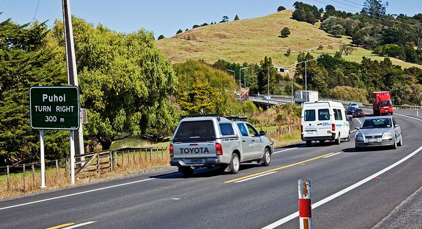
The Pūhoi to Warkworth project (P2Wk), due to open
• The PPP contract model – e.g. the optimisation of
to the public in 2021, will extend Auckland’s Northern
capital spend versus operations and maintenance
Motorway (SH1) 18.5km from the Johnstone’s Hill
costs over a 30-year contract, through close
Tunnels to just north of Warkworth.
interaction between the design and construct, and
It is the first stage of the Ara Tūhono – Pūhoi to operations and maintenance teams
Wellsford Project and will help drive regional economic • Safety in Design
growth and development to support access and
connectivity for local communities. Flexible consent conditions
The Resource Management Act (RMA) conditions
By delivering a safer, more efficient and resilient
applied to P2Wk were unique – lacking the common
connection between Pūhoi and Warkworth, the new
“Condition 1” requirement for the design and
motorway will reduce journey times (especially during
construction approach to be in general accordance
peak holiday periods and weekends), improve freight
with what was submitted with application documents.
efficiency, and hopefully, save lives.
In its place, the Board of Inquiry (BoI) used a set of     for the Concession Period and the asset’s residual
outcomes, designation conditions and an Urban and          life, and provided the NZ Transport Agency with a
Landscape Design Framework (ULDF) to outline the           high quality, durable asset at handback. For example,
intent, and an outcomes-focused approach for               although not ‘preferred’ by the ULDF, we opted to
the project.                                               seal the median and behind barriers to minimise
We leveraged the wide designation provided by the          maintenance activity and cost, and protect the
flexible consent conditions of the PPP to optimise the     integrity of the pavement whilst improving safety.
partnerships’ alignment, and used the ULDF to guide        The highly contractual nature of a PPP contract
our design choices.                                        required a very structured approach to our design
These flexible consenting conditions supported an          management. This was particularly evident in the
innovative approach to the project, but also brought       way we had to manage third-party reviewers with
with it a heavy responsibility - the NZ Transport Agency   no statutory response timeframes - in a highly
was in effect entrusting their reputation to us.           programme-driven environment.
                                                           We took a statistical approach to our delivery risk
Collaborative approach
                                                           and set a 43-week design programme, of which only
Throughout our decision-making and the Urban and
                                                           approximately 50 percent was allocated to design
Landscape Design Sector Plan (ULDSP) process, we
                                                           effort.
worked closely with the project’s Iwi collective Hōkai
                                                           The remaining time was required to obtain internal NX2
Nuku, stakeholders and communities.
                                                           reviews, peer reviewers and other approvals/reviews
Hōkai Nuku is the authorised voice of four Iwi and Hapū
                                                           from key stakeholders including Auckland Council,
mana whenua – Ngāti Manuhiri, Ngāti Mauku/Ngāti
                                                           Auckland Transport, Hōkai Nuku and the NZ Transport
Kauae of Te Uri o Hau, Ngāti Rango of Kaipara and Ngāti
                                                           Agency.
Whātua.
                                                           Of our 236 design packages delivered to date over a
Key outcomes                                               4-stage process, 97 percent were delivered on time.
In line with the flexible consent conditions, the NZ       One hundred percent of our construction packages
Transport Agency set four Key Outcomes for the P2Wk        were delivered on time.
project, which drove all our design choices:
                                                           Geometrics and road alignment
• Protecting and enhancing the NZ Transport Agency’s
                                                           With a significant earthworks volume, we recognised
 reputation
                                                           early on the importance of optimising the alignment
• Delivering a high-quality asset                          within the designation.
• High and sustained safety outcomes                       We opted for a curvilinear alignment which follows the
• Delivering predictable journeys for customers            natural topography of the land, thereby minimising the
To ensure we delivered value to the NZ Transport           footprint, improving safety for drivers by encouraging
Agency, our tender initially found the lowest-cost         consistent speeds, and providing a better customer
design then sought enhancements and refinements,           experience. By promoting consistent driving speeds,
drawn from a register of over 100 value-add                the curvilinear alignment also has a positive impact on
opportunities.                                             fuel consumption and vehicle emissions.

Our final design solution represented an optimised         Our alignment choice also enabled us to eliminate a
combination of design choices to achieve the Key           number of bridges from the Indicative Design (the
Outcomes.                                                  design presented as part of the BoI process), thereby
                                                           minimising upfront and whole-of-life costs, improving
PPP model
                                                           safety and delivering a better experience for drivers.
The PPP model influenced both our design choices and
our approach to design management.                         Our alignment philosophy provided a design that
                                                           minimised fills, fitting much more closely to the natural
We took a whole-of-life approach to every design
                                                           ground, lessened embankment heights and shortened
choice, ensuring we made the right investment choices
bridges. This provided considerable environmental Structures
benefits both visually and for the footprint effects on TOur D&C structures team, including bridge architectural
flora and fauna. designer Monk Mackenzie and constructors, balanced
For example, in one case where the alignment was a number of considerations when designing the
required to traverse a stand of mature kauri trees, our structures.
approach of careful and detailed mapping of individual These included whole-of-life costs, safety, delivering a
native tree locations and sizes, allowed us to minimise positive driver experience and meeting the requirements
tree removal. of the ULDF.
To verify our choice of alignment, we tested it against The ULDF called for an understated, elegant and
a Trimble Quantm (a specialist and powerful software minimal, and in some cases recessive aesthetic, so all
package that provides an optimised alignment based bridges feature slender designs for the spans and deck
on an array of inputs) review during the tender phase. soffit lines that are pure and uniform in construction
The results showed that our experienced geometrics depth.
designers had already got it right. Edge barriers incorporate precast down-stands
to provide a simple and elegant elevation with no
Pavement
visible services. Visual aspects of the bridges from
Although noise minimising Open Graded Porous
all stakeholder’s perspectives were considered in our
Asphalt (OGPA) pavement was only required by consent
designs. This included river and local road users, and
condition over two lengths of the alignment, our
residents.
consortium opted for an OGPA pavement across the
entire length of the alignment. The Pūhoi and Ōkahu Viaducts (Te Arawhiti ki Pūhoi
and Ōkahu) and Moirs Hill Bridge (Te Tapuwae o
We felt this delivered value by meeting all of the Key
Kahumatamoemoe) are all steel girder structures to
Outcomes – improving safety by reducing water spray,
provide consistency and balance elegance and cost.
durability (delivery of a high-quality asset), protecting
and enhancing the NZ Transport Agency’s reputation We opted to construct steel girder bridges rather
through noise reduction and ride quality, and than steel ladder bridges (the most common typology
minimising the requirement for maintenance (resulting for medium span bridges in New Zealand) based on
in less impact on drivers through lane closures). Acciona’s experience constructing this bridge type on
other projects internationally. Steel girder bridges are
High quality OGPA pavement also has a positive impact
built extensively across Europe and are simpler, safer
on fuel consumption and emissions..
and lower-cost to construct and maintain.
Northern Connection
The connection of the P2Wk motorway to the existing
SH1 just north of Warkworth (the Northern Connection)
was a key concern for the Client – with impacts on all
four Key Outcomes (safety, journey time reliability,
quality and NZ Transport Agency’s reputation).
Our design solution was an at-grade roundabout,
providing a safe transition between the motorway and
local road environment, and easing congestion with
the use of slip lanes.
Our design also delivered future-proofing by providing
a staged upgrade option to meet the increasing
requirements of the road if required in the future.Geotechnical challenges and solutions Another significant challenge arose from fill packets
The motorway notably passes through a variety where the motorway passed over the pervasively
of landscapes that strongly reflect the underlying sheared rock mass of the Northland Allochthon. In order
geology, ranging from flat alluvial infilled valley to maintain the required carriageway grade, a number of
systems to the unforgiving, forest covered, steep options were considered for keying the fill foundations
slopes developed on the 20 million-year-old Pākiri into these sheared rocks resulting in the selection of
Formation sedimentary rocks in the central section of shear keys using, where possible, the local high grade
the project. rock.
At the outset of the design process it was recognised The issue of utilising site-won materials for early
that the footprint of the motorway should be construction is often compromised by poor quality
kept to a minimum width to minimise its effect materials that require stripping and storage to enable
on the environment, especially through the steep access to better quality materials. The Pūhoi to
central section. To maintain suitable grades on the Warkworth motorway was no exception, however, the
carriageway, we adopted a bold approach with deep design team sourced quarry sites within the designation
cuts in the high central section; these cuts were to enable early production of site-won high quality
designed with steep, tall slopes partially covered with materials along with the location of fill sites for the
wire mesh drapes leaving the lower slopes in bare rock unsuitable materials stripped to waste.
to clearly expose the geological structure.
Ecology
However, this approach demanded a full understanding The landscape surrounding the P2Wk motorway is home
of the underlying geology and geological structure to a wide variety of at-risk and threatened native flora
which, in turn, required detailed geotechnical and fauna.
investigations to gather the necessary information.
We were involved heavily through design optioneering
The detailed geotechnical investigations were
to make sure these sensitive species were considered
undertaken by NX2 following the fixing of the
in the overarching design approach, and we worked
motorway alignment. This was achieved by drilling
closely with construction teams to implement
fully cored both vertical and angled drill holes
management measures, once the project commenced in
using drill rigs lifted into place by helicopters to
earnest.
minimise disturbance to the natural environment.
The information was pieced together to produce a An assessment of ecological effects, undertaken by
geological structural map that became the central BioResearchers in the BoI phase, identified ecological
focus for the final route selection using, wherever values along the project footprint which informed
possible, favourable geological conditions identified by the resource consent conditions. Thus, the resource
the investigations. consent, along with Department of Conservation (DoC)
translocation permits for threatened fauna, defined
Immediately north of the central section, the
what was to be avoided, salvaged or protected within
motorway designation corridor crosses a stand of
the project area. Similarly, a range of construction-
kauri and a local stream in an area known as the “Eco-
phase management regimes were developed for
Viaduct”. This presented a dual challenge of preserving
implementation by the construction team.
the kauri and designing the bridge abutment on a relic
landslide. While the original concept envisaged a tall In order to find out what species were living in the
viaduct structure, we developed an alternative lower project area, the ecology team had identified and
structure that would not shade the kauri and also measured native flora and fauna, investigated stream
required less geotechnical input for the abutment in ecology and mapping habitats where native species
the relic landslide area. could be living. The team worked closely with AucklandEcology cont... at the start of the project. Given their location close
Council, Department of Conservation, Ministry for to a haul road, they are monitored for dust to prevent
Primary Industries (MPI) and Hōkai Nuku to make sure negative impact from excessive dust settling on leaves.
that appropriate survey and salvage methods were
The project ecologists have also identified and collected
in place.
seed from a colony of threatened short-hair plume
Further work during the construction phase of the grass. The seeds from the graceful, feathery grass are
project included fish salvage, night-spotting for being propagated in the nursery where they will grow
geckos, and harvesting of native plant species for into plant stock for planting out during the landscaping
propagation in a nursery. phase of the project.
Native canopy trees (kauri, tānekaha, pūriri, tōtara,
Given that the project area included the Pūhoi
kahikatea, rimu, rewarewa and taraire) within the
estuary and the Mahurangi Harbour, a regular marine
project area were measured to determine their
monitoring programme was adopted to check the
diameter at breast height (DBH) to calculate mitigation
sensitive marine environment for impacts from the
requirements. The team measured more than 3,300
construction. This involved monitoring of animals,
trees, of which approximately half (1,561) were felled by
plants and the marine substrate.
May 2018. To mitigate for the loss of these trees within
Stream mitigation 20 years, at least 50 hectares will be restored with
The construction of instream structures and the filling these native canopy species. The proposed mitigation
in of streams (e.g. as a result of spoil sites) reduces planting will be undertaken in two stages. In Stage 1
stream quality and overall habitat availability for native pioneer species (e.g. kānuka, mānuka) will be planted
freshwater fauna. We assessed all streams prior to to allow the establishment of a shelter canopy for the
construction and calculated an appropriate amount of second stage planting of light intolerant species such
offset stream restoration. As a result, the mitigation as rimu. Overall, the mitigation planting, will connect
includes restoration of 20 metre-wide riparian margins habitat across the wider landscape.
on either side of stream channels with plants that Wetland loss will be offset at a 1:1 ratio, equating to
shade and protect the stream and allow freshwater approximately five hectares of wetlands which forms
fauna to thrive. an integral part of the landscape plans, along with
The project features 8.7km of stream restoration terrestrial mitigation of canopy species and locations for
planting – 6.3km as mitigation for 31 culverts, and short haired plume grass.
2.4km for stream diversions.
Wildlife
Vegetation To avoid negative impact on birds, vegetation clearance
The ecology team have searched and collected a took place outside of the breeding season between
variety of species in the project area to ensure ‘at risk’ September and December. Where this was not feasible,
or ‘threatened’ species are appropriately treated and/ shrubs and trees were checked for active bird nests
or relocated as appropriate. This includes a native and, if positively identified, were felled at a later stage. In
Danhatchia orchid which had been identified within the wetland areas where the call of fernbirds was identified
designation as part of the Assessment of Ecological during the wetland bird survey early on in the project, a
Effects within the BoI phase. The area was cordoned carefully monitored vegetation clearance approach was
off to avoid damage or removal of any orchid plants adopted to prevent harm to the birds.
during the construction phase.
Other activities included freshwater ecology along
NZ’s native green mistletoe streams and terrestrial work with geckos, skinks, snails
A woody epiphytic semi-parasite which has been and bats.
declining since the early 1900s has been found to grow
Prior to the construction of the temporary causeway,
on tōtara trees within the project footprint. These
ecologists and representatives from Hōkai Nuku
plants were identified and flagged by the ecologists
collected more than 34,000 mud snails from the ŌkauWildlife cont... Specialist care was required for a colony of very rare
Inlet and relocated them. These snails are native to indigenous long-tailed bats (Chalinolobus tuberculatus)
New Zealand and live in great numbers on mudflats. within the project area. These thumb-sized bats with
Additionally 50 Rhytid snails were salvaged and a wingspan of barely 150mm have the highest threat
released in a predator-proof relocation site. ranking of “nationally critical”. To provide an indication
of bat activity and roosting habitat (within tree cavities),
The construction of culverts and other stream
ecologists conducted a large-scale acoustic survey
structures required the dewatering of streams, which
and ongoing monitoring during the design and early
are home to native fish species. To ensure their safety
construction phase. Follow-up surveys included the
during construction, more than 10,000 fish, kōura and
visual inspection of hundreds of trees along the 15km
native freshwater mussels were relocated beforehand.
corridor that had to be felled for the new highway and
The ecologists used the electric fishing method, associated access roads.
whereby a current temporarily stuns the fish which
Long-tailed Bats have large “home ranges” and do
float to the surface so they can be scooped into nets
not respond to manual relocation and fail to survive
and relocated upstream or downstream of the impact
in captivity. As a result, prior to felling any “high risk”
area. Relocated fish included giant and banded kōkopu
trees, extensive acoustic surveys were conducted
(adult whitebait), giant bullies, and long-fin eels, some
to ensure bats were not at risk of being harmed. All
of which measured over 1.5m.
“high risk” trees needed to be felled before the end of
However, the fish relocation near the Pūhoi River could the survey season (1 October – 31 April) when weather
not utilise conventional methods due to the challenging conditions were favourable for bat emergence. However,
low-lying and wide profile of the gully with thick a small number of bats hadn’t evacuated their roost
wetland vegetation to boot. The solution was a 12-ton in a small stand of trees located in a steep gully; they
digger fitted with large paddles which kept the digger kept returning every morning after their night outings
‘afloat’ on top to remove the surface vegetation while and seemed unlikely to vacate their existing habitat.
an ecologist assisted with the fish identification and This would have precluded the scheduled felling and
relocation. would have hampered project progress. Thus, following
consultation with DoC and other bat experts, the team
We adopted extensive fish passage monitoring (both trialled an innovative solution involving large flood lights
pre-construction and post-construction) to safeguard that lit up the habitat area throughout the night and
the natural cycle for native freshwater fauna. This eventually caused the bats to not return to their roost
means that local fish species can continue to travel in the morning, and the stand of trees could be felled
unimpeded to find habitat, food and mates; for some without the risk of harming bats.
species this means traveling to the ocean and back
to complete their lifecycle. To facilitate successful Tree felling protocols were successfully used for the
fish passage, culverts were designed with features to main felling season 2016/17 and for subsequent felling
enhance fish passage, for example including baffles to seasons of remnant pockets of trees without any bats
reduce water velocities. being harmed in the process.
After 538 hours searching for geckos, the team of
ecologists salvaged 36 forest geckos and one pacific
gecko which were held at the Massey University
Reptile Facility (MURF) and were released at the
relocation site in December 2017. Despite the extensive
deployment of onduline artificial cover objects across
21 possible habitat areas, only one copper skink was
captured as a result of manual search.Water Engineering naturally low. What’s more, the wetland outlets can be
The project features an effective and innovative shut in the event of an oil spill in order to contain the
stormwater design to manage motorway runoff while spill in the wetland and prevent it from entering the
also catering for the large number of watercourses wider environment.
that cross the motorway alignment. Thus the design
The motorway drainage features a number of spill
avoids, remedies or mitigates adverse environment
points where flows that are greater than those needing
effects efficiently and practically.
to be treated, can spill back into the environment.
Culverts This effectively mimics the natural hydrology with the
Along its 18.5km length, the project includes over added benefit of reducing the size of the stormwater
50 culvert installations (both concrete and HDPE) infrastructure.
with a total culvert length of over 6.3km. At up to
Aquaplaning
2.5m diameter and 220m in length, and beneath
A key objective of the stormwater design was to
embankments that are up to 45m high, culverts include
assess and minimise the risk of aquaplaning which can
a number of multi-barrel installations with up to 11
occur when a layer of water builds between the wheels
barrels.
of a vehicle and the road surface. This can result in a
The importance of facilitating fish passage through the loss of traction and control of a vehicle with dramatic
culverts was a key design driver and was addressed consequences. To address this, we have used slot
with the use of fish baffles, spat ropes and submerged drains to intercept long flow paths and to reduce the
culverts. Within this approach, we have focused on risk of aquaplaning while complying with NZ Transport
balancing the energy dissipation while accommodating Agency standards. Comprehensive aquaplaning
fish passage. assessment for the entire motorway alignment has
informed the placement of slot drains and fed into the
The issue of debris blockage was also addressed geometric design.
by assessing the culvert catchments to determine
whether they might be susceptible to blockage. Where Innovation
we identified a risk of debris blockage, we included The project’s stormwater, landscaping and ecology
debris screens, debris fins and relief risers to mitigate solutions are designed to be complementary and
the blockage risk. sympathetic. This is particularly notable at the Te
Arawhiti pua Ngahere (Kauri Eco Viaduct) where the
Where necessary we’ve designed a number of stream proposed motorway crosses a watercourse and a
diversions with low flow channels, rock riffles, ponds, significant stand of kauri trees. At this location, an
boulders and rootwads to provide habitat. under-bridge watering system will irrigate the slopes
beneath the bridge to ensure a continuous landscaping
Additionally, flood modelling for the Mahurangi River
approach. The watering system utilises technology
demonstrates that the project impact on the existing
that is typically used for onsite wastewater treatment
flooded areas is compliant with the Resource Consent
and mimics natural rainfall, while in-ground irrigation
requirements
lines allow plants to flourish. This approach will provide
Motorway drainage a cohesive and consistent landscape with connectivity
A combination of rock lined swales, rock cut swales between significant areas.
and piped reticulation conveys the motorway runoff to
one of 13 wetlands for water quality treatment. These
wetlands are typically 30m wide and 80 to 100m long
and provide extended detention that helps channel
protection for frequent storm events. They feature
banded bathymetry with small topsoil bunds that
will retain water during times when water levels areConstruction Phase Support (CPS) What’s more, the CPS role also helps to clarify and
As a key aspect of this project, CPS fulfils a dual role by optimise the design throughout. Primarily this is
providing certification as well as design clarification achieved by augmenting existing data with site
and optimisation. observations; it helps to confirm that the ground
conditions are consistent with design assumptions.
For the certification requirements, the CPS team In this manner, any deviation in ground conditions (i.e.
undertakes construction monitoring to CM4 level not evident in earlier investigations) can be accurately
which involves frequent reviews of site conditions. identified and appropriately addressed during
The CPS team effectively represents the designers by construction.
observing key elements of the construction process to
confirm that it meets the design. This gives the Design In the context of the project area’s highly variable
or CPS Lead confidence to sign producer statements or ground conditions, which vary from very steep
certificates. rock cuts (up to 85 degrees) to flat boggy land, and
an overall ambitious earthworks programme, this
observational input is crucial for proactively managing
risks on site that can cause potential instability or
help utilise resources. As such, it makes a tremendous
project contribution by helping refine the design.You can also read