Paths & trails strategy 2018 - South Gippsland Shire Council
←
→
Page content transcription
If your browser does not render page correctly, please read the page content below
2018 paths     & trails strategy

SOUTH GIPPSLAND SHIRE COUNCIL

paths & trails strategy
2018

A review and update of the 2010 Paths & Trails Strategy and policy
review that includes a prioritised and costed project list with descriptions.

       Review of 2010 Paths & Trails Strategy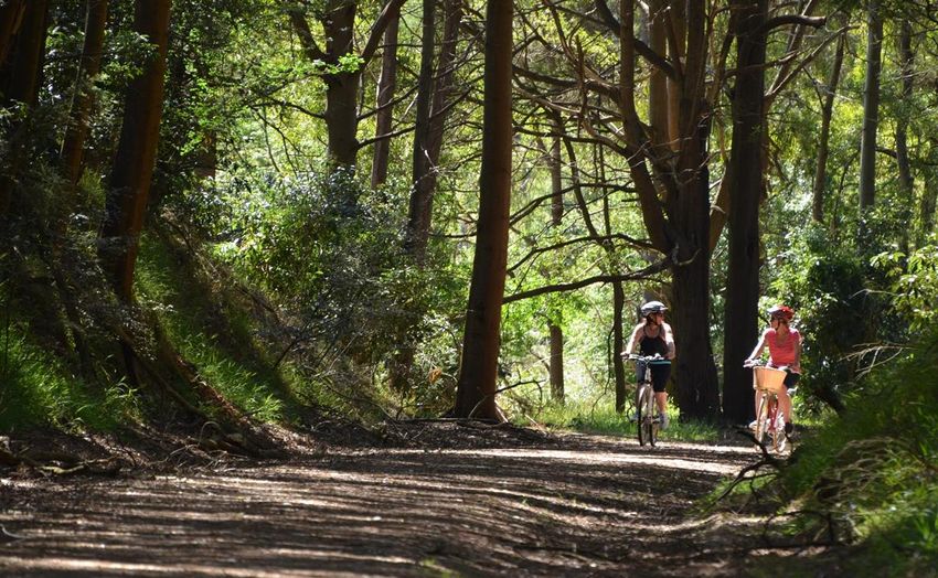
SOUTH GIPPSLAND SHIRE COUNCIL

 Andrew Nixon Land Use Management

Prepared by:

Andrew Nixon Land Use Management
Postal Address: P.O. Box 528, Mallacoota Vic. 3892
Mobile: 0429 144 270 Email: asnix@bigpond.com

DISCLAIMER OF LIABILITY

This report is a document that has been prepared by Andrew Nixon Land Use
Management. The consultant has undertaken this analysis in their capacity as advisor
in accordance with the scope and subject to the terms associated with this study.

Readers should note that this report may include implicit projections about the future
which by their nature are uncertain and cannot be relied upon, as they are dependent
on potential events which have not yet occurred. For these reasons and others, facility
development is inherently risky and frequently things do not turn out as planned.

In preparing this report, the consultant has relied upon information supplied by third
parties: South Gippsland Shire Council, Vic Roads, Bicycle Network, community groups,
and individuals, along with publicly available information. The consultant has not
attempted to verify the accuracy or completeness of the information provided.

The consultant does not undertake any responsibility arising in any way whatsoever to
any person or organisation, except South Gippsland Shire Council in respect of
information set out in this report, including any errors or omissions therein-through
negligence or otherwise however caused.

Review of the 2010 Paths & Trails Strategy
2018 paths   & trails strategy

                Thanks to the South Gippsland Shire community,
                  the Staff at the South Gippsland Shire Council,
                   as well as community groups and individuals
             for their contribution to the development of this review.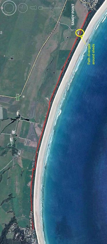
SOUTH GIPPSLAND SHIRE COUNCIL

contents

1. executive summary ................................................................................. 3
2. introduction .............................................................................................. 5
3. vision ........................................................................................................ 9
     3.1 2018 Guiding Principles ............................................................................................................... 9

4. 2010 strategy review ............................................................................. 11
     4.1 Community Response to the 2010 Strategy ............................................................................ 11
     4.2 2017 Review Objectives ............................................................................................................. 12
     4.3 Significant Changes – Then to Now ......................................................................................... 12
            4.3.1 Design Concerns.............................................................................................................. 14
     4.4 2010 Strategy Project Priority List Review .............................................................................. 14
            4.4.1 Summary of Outcomes ................................................................................................... 14
            4.4.2 Completed Projects ......................................................................................................... 15
            4.4.3 SGSC Footpath Extension Program ............................................................................... 16
            4.4.4 Remaining Projects ......................................................................................................... 16
            4.4.5 Funding Outcomes 2010-2017 ....................................................................................... 18
     4.5 Funding Opportunities ............................................................................................................... 18
            4.5.1 Federal Government ........................................................................................................ 18
            4.5.2 State Government............................................................................................................ 19
     4.6 Maps 2010-2017......................................................................................................................... 21
     4.7 2010 Project Priority Matrix (PPM) ........................................................................................... 22
     4.8 2018 PPM Revised ..................................................................................................................... 25

5. community consultation ....................................................................... 26
     5.1 Consultation Methodology ........................................................................................................ 26
            5.1.1 Inputs into the 2017 Review of the 2010 Strategy ....................................................... 27
            5.1.2 Future Community Consultation Methods .................................................................... 28

6. description & assessment of new projects ......................................... 30
     6.1 Great Southern Rail Trail (GSRT) .............................................................................................. 31
            6.1.1 The GSRT: Leongatha to Nyora Extension .................................................................... 31
            6.1.2 The GSRT: Welshpool to Hedley Extension ................................................................... 33
            6.1.3 Future GSRT Management ............................................................................................. 33
            6.1.4 Consultation / Research ................................................................................................. 34

Review of the 2010 Paths & Trails Strategy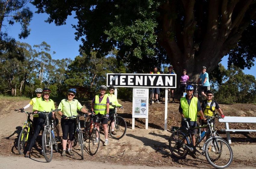
2018 paths    & trails strategy

         6.2 Hoddle Mountain Trail ............................................................................................................... 34
                6.2.1 Consultation / Research ................................................................................................. 35
                6.2.2 Hoddle Mountain Trail Route.......................................................................................... 35
                6.2.3 Mount Hoddle Trail Issues .............................................................................................. 36
                6.2.4 SGSC Resolutions ........................................................................................................... 36
         6.3 Waratah Way .............................................................................................................................. 37
                6.3.1 The Gap to Waratah Bay ................................................................................................. 38
                6.3.2 Consultation / Research ................................................................................................. 40
                6.3.3 Map of Waratah Way ....................................................................................................... 41
                6.3.4 Outcomes of Community Consultation ......................................................................... 42
         6.4 Acacia Way, Walkerville ............................................................................................................. 43
                6.4.1 Consultation / Research ................................................................................................. 44
         6.5 Walkerville Foreshore Shared Path ........................................................................................... 45
         6.6 Mossvale Park ............................................................................................................................ 45
                6.6.1 Consultation / Research ................................................................................................. 46
         6.7 Agnes River Road Walk .............................................................................................................. 46
                6.7.1 Consultation / Research ................................................................................................. 47
         6.8 Mountain Bikes........................................................................................................................... 48
         6.9 Coal Creek to Ritchies Reserve ................................................................................................. 49
         6.10 Isabella Blvd to Hannah Rise Crescent Shared Path .............................................................. 49

    7. 2018 strategy review ............................................................................. 50
    8. 2018 action plan .................................................................................... 51
         8.1 2018 Strategy Action Plan ......................................................................................................... 52

    9. appendices ............................................................................................. 56
         9.1 2018 Project List ........................................................................................................................ 57
                9.1.1 Construction Projects ..................................................................................................... 57
                9.1.2 Linemarking and Signage Projects ................................................................................ 59
                9.1.3 Projects on VicRoads Roads .......................................................................................... 60
         9.2 Costs Table ................................................................................................................................. 61
         9.3 Gale Street Preliminary Costs for “Waratah Way” ................................................................... 63
         9.4 References .................................................................................................................................. 65
                9.4.1 Design Standards ............................................................................................................ 65
                9.4.2 Strategic Documents ...................................................................................................... 65

                                                                                                                                              p. 2/66
SOUTH GIPPSLAND SHIRE COUNCIL

1.   executive summary

     The vision of a rail trail that bisects the South Gippsland Shire creating a central
     active transport spine is within reach after twenty years of the initial section of the
     Great Southern Rail Trail (GSRT) being constructed.

     The central rail trail ‘spine’ provides the opportunity from which other connecting
     paths and trails can eventually radiate, linking South Gippsland’s towns and
     communities.

     The 2018 Project List (Appendix 1) continues to reflect this strategy, the focus still
     on establishing the ‘spine’. The list proposes a variety of ‘spurs’ in the form of
     shared paths, on-road cycle lanes, walking trails, and combinations of all these. The
     aim is to provide viable, safe, interesting connections, and networks between
     towns, points of interest, and other destinations. These proposed networks and
     links will, as a result, offer the community health, social, environmental, and
     economic benefits far into the future.

     A common matter raised with several new projects is the retrofitting of a desired
     standard of infrastructure into limited space combined with unresolved land tenure

     Review of the 2010 Paths & Trails Strategy
2018 paths & trails strategy
issues. For these to succeed, the process requires good planning, negotiating, and
a lot of good will.
Of the ninety six (96) projects listed in the 2010 Strategy:
Seventeen were completed; 18%
Ten are in the ‘pipeline’, i.e. either nearly completed, designed, budgeted, or a
part of another project. For example, the Foster, Loch, and Korumburra
streetscapes; 10%
Two were partially completed and there are no further plans to extend; 2%
One will not be completed (Toora to Tin Mine Road); 1%
Leaving sixty-six projects; 69% from 2010 unresolved as:
Many are cycle lanes that create circuits in towns. These don’t receive
high ratings usually because they are a single user type and although
safer, they are still not ideal.
The major inter-town cycle routes are primarily on VicRoads managed
roads which doesn’t have the funding to provide the works necessary.
Some just didn’t meet the assessment criteria well enough (and therefore
have a low priority).
Some of which could be regarded as ‘nice to do’ and might be
constructed in an ideal world with unlimited funding.
The Footpath Extension Program has been successful outside of the of 2010
Strategy and has been separated from the 2018 Project List and will continue to
operate with a separate budget.
Communities consistently consider paths and trails as high priority projects when
asked by Council during the community planning processes. This feedback helps
confirm survey data that walking, cycling, and horse riding constitute the largest
recreational activity group undertaken by community members. This assumption is
corroborated by all recreation research carried out in the past twenty years1.
1
Exercise, Recreation and Sport Survey (ERASS) was a joint initiative of the Australian Sports Commission and
State and Territory Departments of Sport and Recreation, conducted on an annual basis between 2001 and
2010. ABS Participation in Sport and Physical Recreation data for 2013-14
p. 4/66
SOUTH GIPPSLAND SHIRE COUNCIL

2.   introduction

     The 2010 Paths & Trails Strategy (2010 Strategy) is a result of recommendations in
     the South Gippsland Shire Council (SGSC) Recreation Plan 2007 and its sister
     document, the SGSC Open Space Strategy 2007, to update and review the 2001
     Bicycle/Walking/Riding Paths & Trails Strategy (2001 Strategy).

     With the successful completion of several sections of the GSRT, the unfortunate
     demise of the tourist rail, and suggestion of several other shared paths by the
     South Gippsland community, Council identified the need to desktop review / update
     of the 2010 Strategy and incorporated it in its Council Plan 2017-2021.

     Review of the 2010 Paths & Trails Strategy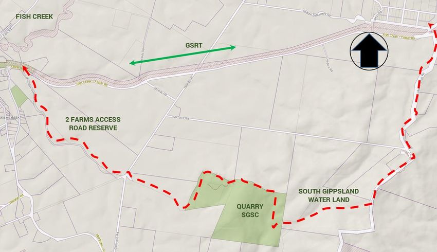
2018 paths   & trails strategy

    The flowchart below illustrates the basis of the current 2010 Strategy review.

                          Flowchart of 2010 Paths & Trails Strategy Review

    SGSCs 2017 review of the 2010 Strategy looks at how effective the strategy was in
    application over the past seven years. The Project Priority Matrix (PPM) aims to
    provide an improved decision-making process whereby future paths and trails can
    be assessed against each other using value parameters and weightings. These
    investment decisions will often be made in conjunction with grant funding
    opportunities.

    The 2017 review is a result of a desktop consideration of the many community
    studies and plans derived from Council’s consultation with the community which
    seeks to determine and identify the community’s needs and aspirations. A search
    of the SGSC internal documentation relating to paths and trails included requests,
    letters, and submissions. Paths and trails feature heavily in many of these
    community documents. Residents of the Shire have a strong interest in
    participating in walking (running), cycling (including club competition) and horse
    riding as recreational activities and in fact underpins the sometimes-overlooked

                                                                                  p. 6/66
SOUTH GIPPSLAND SHIRE COUNCIL
fact that walking, together with cycling, constitutes by far the largest recreational
activity/activities in Australia2.
This review reconfirms previous projects and provides a brief synopsis of some
new projects. The types of projects on the 2018 Project List (Appendix 1) include:
Off-road shared paths;
Off-road walking paths;
Sealing road shoulders and line marking for safer cycling; and
Improving bicycle signage of designated routes.
The linking of gaps in the footpath network to ensure connectivity to destinations in
urban areas is managed through the Footpath Extension Program which is now
separated from this strategy.
The associated 2018 Project Priority Matrix (PPM) defined on page 25 seeks to
provide a method of determining the priority of projects using a weighting system
based on a range of both qualitative and quantitative values (these are open to
discussion as there is little empirical data and therefore the allocated values are
subjective). It is anticipated that PPM will be used as an ongoing assessment tool
that is modifiable, updatable, and is responsive to changing community needs,
available funding, and accessible to both the Council and the community as a
reference document. A summary of the projects and priorities is included in
Appendix 1.
To improve the relevance of the PPM in the decision-making process, consideration
could be given to the use of recognised data collection and analysis methods to
collect asset user and economic data to help support or clarify project priority
assumptions. This data will in turn assist in Council’s decision-making process.
Some data collection methods include counting (infra-red) equipment, cameras,
student driven surveys of users, video survey methods, economic modelling, and
surveys of business can all help focus future paths and trails planning and assist in
assessing the outcomes of the past decisions associated with the Paths & Trails
Strategy. Some of these methods are currently being considered by staff.
2
Participation in Sport and Active Recreation, Australia 2011-12 Report
Review of the 2010 Paths & Trails Strategy2018 paths & trails strategy
The Shire has a slow growing
population3 at an annual growth rate
of 1.4% (Shire average)4 with a high
proportion of older persons. The
ageing population can be attributed
to the Shire being seen as a highly
desirable retirement destination and
younger people moving away for
work, education and other
opportunities.
This review, as did the 2010
document, considers equestrian
PCRT
trails. A separate network for this
user group has not been developed.
Horse riders are generally restricted
to dedicated private trails, bush trails
in State parks, quiet country roads
and rail trails. Examples are the
GSRT, several proposed paths
described in the Nyora paths
feasibility study and the Welshpool –
Port Welshpool shared path. Future
options may include the proposed
Leongatha to Nyora section of the
GSRT, Nyora to Cranbourne, and the
Nyora to Anderson rail trails.
3
3
Based on available data (ABS & id – The
Population Experts website)
4
SGSC Blueprint For Social Community
Infrastructure 2014- 2029
p. 8/66SOUTH GIPPSLAND SHIRE COUNCIL
3. vision
The overarching vision for the 2018 Paths & Trails Strategy is:
To develop South Gippsland’s walking,
cycling, and horse riding pathway network
for all abilities, and where practicable,
safely connect South Gippsland’s
residents, businesses, and visitors to town
centres, schools and main tourist
attractions.
The 2018 Strategy implementation actions can
be found in Section 8 – 2018 Action Plan.
3.1 2018 Guiding Principles
To achieve this vision, seven principles are listed which provide a guiding
framework for the development and implementation of a successful walking, horse
riding, and cycling network as follows:
THE SOUTH GIPPSLAND EXPERIENCE
Capitalise on South Gippsland’s spectacular surrounds, providing a range of memorable and
unique journeys through its diverse landscapes. Regional trails will traverse and connect to the
coast, plains, and wetlands in the south, farmland and rolling hills around the GSRT, natural
bushland and hills in the north.
Review of the 2010 Paths & Trails Strategy2018 paths & trails strategy
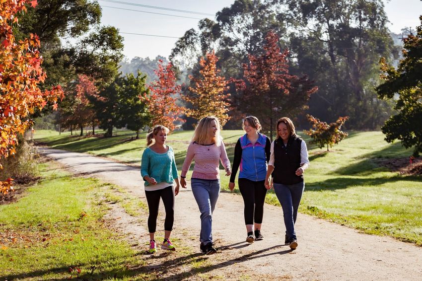
HEALTH & WELLBEING
Enhance the health and wellbeing of the community by providing the safe environment and
infrastructure that supports participation in local recreational experiences. Being active
supports good physical and mental health. The walking, horse riding, and cycling network will
create walkable neighbourhoods, enjoyable recreational experiences, as well as an increased
sense of social connectedness within the local community.
ALL ABILITIES ACCESS
The walking, horse riding, and cycling network will be inclusive of people with mobility
difficulties including people in wheelchairs, prams, and mobility scooters. Infrastructure such
as Disability Discrimination Act (DDA) compliant paths, ramps, and rest areas will be prioritised
on appropriate trails.
SAFETY & PERCEPTION
Create a safe and comfortable walking, horse riding, and cycling environment for all users.
Priority will be provided to pedestrians, horse riding, and cyclists, over motor vehicles along key
routes and within town centres. People will feel safer using the streets and trails that have
increased passive surveillance and improved lighting.
CONNECTING PEOPLE & PLACES
An integrated and more accessible network will provide convenient access for locals and
visitors to town centres and key destinations. Strategic links and pedestrian priority routes will
support walking, horse riding, and cycling as the preferred transport option when moving
through town centres, to and from schools, and making local trips. Importantly, the network will
strengthen the existing stop and drop zones in South Gippsland. Additionally, the regional trail
network will connect townships across the Shire and beyond.
AWARENESS & EDUCATION
Create an environment in South Gippsland Shire where walking, horse riding, and cycling are
logical and enjoyable travel options. Break down the social and psychological barriers that
prevent walking, horse riding, and cycling by raising awareness of the many benefits of being
active. Support community events, education programs, as well as a comprehensive signage
and wayfinding strategy to promote local opportunities.
ECONOMY AND TOURISM
High quality infrastructure contributes to a healthy and strong local economy and adds to the
visitor experience, enhancing the prosperity of the community. Council will work with
stakeholders to increase economic growth and employment prospects. It will develop policies
and pursue projects to improve the capacity of local residents and business to be part of this
growth.
p. 10/66SOUTH GIPPSLAND SHIRE COUNCIL
4. 2010 strategy review
4.1 Community Response to the 2010 Strategy
The 2010 Strategy provided a detailed approach to assessing community projects.
The community understood that rankings didn’t preclude any project if
circumstances arose that allowed individual projects to proceed, such as specific
funding opportunities. As an example, the community recognised the potential of
the GSRT to the Shire with its potential flow-on effects.
Nevertheless, the Shire also got on with implementing some local projects of lower
priority. Many projects put forward through the 2010 consultation process would
have been great to get up but are beyond the current resources available in the
suggested time frames. An example are the difficulties identified in the shared path
linking the GSRT in Foster to Wilsons Promontory. Perhaps once the full GRST has
been constructed and more Council funding and resources become available,
efforts can be directed to developing some of these major spur links.
Review of the 2010 Paths & Trails Strategy2018 paths & trails strategy
4.2 2017 Review Objectives
This 2017 review is to:
Review the 2010 Paths & Trails Strategy and examine how effective it was,
i.e. what were the outcomes and how it can be improved.
Determine what the community and user expectations are and what can
realistically be achieved where stated.
Establish a hierarchy of the most appropriate routes, trails, paths, linkages,
and circuits, and developing a list of priority projects by three (3) Project
Classes; Construction Projects, On-road Linemarking & Signage Projects, and
Projects on VicRoads Roads (Appendix 1).
Update and establish the cost of constructing bicycle, walking, riding paths,
and trails, and to review and examine alternative methods and materials
using the rates (Appendix 2).
Determine ongoing management responsibilities, particularly maintenance
being the highest cost, together with risk and liability. Provide a strategic
approach to the provision of a comprehensive cycling and walking network.
Present review outcomes for Council including a draft five plus year action
plan (Section 8).
Provide some recommendations for improved processes relating to SGSCs
paths and trails.
4.3 Significant Changes – Then to Now
Much of the information contained in the 2010 Strategy is still current and holds
true for today. There has been some updating of design specifications and design
philosophy by Austroads / ARRB (and other bodies). These changes include
specifications on shared path width, methods to achieve separation of users, on-
road cycle lane design, curve radii limits, and construction materials (rolling
surfaces). The relevant information on design standards can be found at:
https://www.onlinepublications.austroads.com.au.
Incident data and user surveys, primarily from urban (city) shared pathways,
indicates that separation of users (walkers, cyclists, horse riders, and cars) is of
p. 12/66SOUTH GIPPSLAND SHIRE COUNCIL
critical importance. The conflict occurs due to the differing speeds, vehicle size, use
patterns, and space available, for example:
Cyclists can travel much faster than walkers.
Walkers (recreational) tend to wander especially those with dogs.
Horses due to their size can intimidate and block other users.
Pedestrians, cyclists, and horse riders, although legally able to use any road,
do not mix well, particularly in numbers for the above reasons.
The changes to design/construction standards reflect these issues by
recommending:
The widening of paths (2.5 metres or more, 4 metres would be nice!) and/or
recommending complete separation of users by constructing separate
paths.
By providing a physical barrier (e.g. ‘w’ section traffic barriers) for which the
style would depend on the road’s speed limit.
Improving surface materials, with the aim of improving rolling speed,
stability, and life span/maintenance costs.
Differentiating the surface colour (buff coloured stone in a spray seal etc.)
providing a visual cue for drivers.
Guide posts as a visual barrier, cue for motorists.
Separate user paths.
These items can significantly increase the construction costs for any proposal and
usually result in a multitude of design and construction options that need to be
considered early on in the community consultation and development process.
For example, placing users on a formal or recognised ‘shared path’ on a road
shoulder that adjoins a 100kph road with no vehicle - pedestrian separation is a
high-risk strategy that doesn’t meet Council’s ‘duty of care’. Cyclists and pedestrians
can and do currently use road shoulders on rural roads as the only realistic option.
The difference is the formality of the route.
Engineering solutions used to resolve such safety issues include:
Reducing the speed limit;
Review of the 2010 Paths & Trails Strategy2018 paths & trails strategy
Pushing the path further into the road reserve to achieve greater separation
from vehicles;
Highlighting the path by colouring the surface; and
Constructing barriers.
4.3.1 Design Concerns
Shared cycle and parking lanes are now viewed as virtually unworkable as a single
parked car pushes the cyclists onto the traffic lane creating an unacceptable risk.
Cycle lanes adjacent to parking lanes without separation have caused many
incidents, i.e. drivers opening car doors in the path of cyclists being the major
issue. As a result, authorities are reluctant to implement this style of cycle route.
4.4 2010 Strategy Project Priority List Review
4.4.1 Summary of Outcomes
The Project Priority List from the 2010 Strategy has been reviewed to determine the
status of the ninety-six (96) projects listed as of 2017 (*Note: The 2010 Project
Priority List included footpath proposals from the 2010 Footpath Extension
Program).
Of the ninety six (96) projects listed in the 2010 Strategy:
Seventeen were completed; 18%
Ten are in the ‘pipeline’, i.e. either nearly completed, designed, budgeted, or a
part of another project. For example, the Foster, Loch, and Korumburra
streetscapes; 10%
Two were partially completed and there are no further plans to extend; 2%
One will not be completed (Toora to Tin Mine Road); 1%
Leaving sixty-six projects; 69% from 2010 unresolved as:
Many are cycle lanes that create circuits in towns. These don’t receive
high ratings usually because they are a single user type and although
safer, they are still not ideal.
The major inter-town cycle routes are primarily on VicRoads managed
roads which doesn’t have the funding to provide the works necessary.
p. 14/66SOUTH GIPPSLAND SHIRE COUNCIL
Some just didn’t meet the assessment criteria well enough (and therefore
have a low priority).
Some of which could be regarded as ‘nice to do’ and might be
constructed in an ideal world with unlimited funding.
Status Snapshot of the 2010 Strategy Projects
4.4.2 Completed Projects
Several large projects were completed in the past seven years including four
sections of the GSRT:
Foster to Toora.
Toora to Welshpool.
Upgrade of the Welshpool to Port Welshpool Trail – completed with savings
from the Toora to Welshpool GSRT funding.
Koonwarra to Meeniyan Black Spur section which included substantial
bridge remediation / replacement.
These projects received substantial funding from the Victorian State Government
and the SGSC.
Several shorter off-road shared paths were completed:
Toora to the Toora Recreation Reserve: by the SGSC.
Review of the 2010 Paths & Trails Strategy2018 paths & trails strategy
The extension of the Tarwin Lower/Venus Bay shared path along Jupiter
Boulevard to the Venus Bay shops: by the SGSC.
The Roy Henderson Trail, Manuka Street to Shallow Inlet: by the Sandy Point
Foreshore Committee of Management (CoM) and Department of
Environment, Land, Water and Planning (DELWP).
Strzelecki Highway – north side, from Wanke Road to Balook Street: by the
SGSC.
Port Welshpool – along Corner Inlet from Long Jetty Caravan Park to the
public toilets: by the SGSC.
4.4.3 SGSC Footpath Extension Program
Many of the projects listed in the 2010 Strategy were urban footpaths. The
Footpath Extension Program (FEP) was included in the 2010 PPM. Most of those
items included from the FEP focused on connecting disparate sections of the
existing urban footpath network. Due to FEPs standalone budget and for the sake
of streamlining this review document, the FEP has been removed from the 2018
Project List and is managed separately.
The Forward Capital Works Program budget identifies continued funding for the
FEP at varying levels reflecting the community support for this program.
4.4.4 Remaining Projects
The project list in 2010 was intentionally an extensive ‘wish list’. All projects that
fell under the broad heading “Paths and Trails” that had been identified by the
SGSC, the community, and external authorities, were included to show what was
being considered by the broader community and could, as a result, be considered
against each other. Many were not feasible due to topography, land ownership, area
constraints, and some were / are just too costly.
The community repeatedly identifies the need for safe cycling, horse riding, and
walking i.e. not on roads mixing with vehicles. Unfortunately, in the attempt to
create logical and effective links between facilities and destinations, some on-road
routes are unavoidable. By creating a cycle lane or directing users onto the road
implies a ‘duty of care’ upon the SGSC. This duty of care can be achieved through
good design using recognised standards. However, in many cases, retrofitting a
p. 16/66SOUTH GIPPSLAND SHIRE COUNCIL lane or path onto existing infrastructure will not allow Council to meet those standards without expensive engineering solutions and/or land purchases/lease etc. When designing a path/trail/lane, safety is of the highest consideration. Recognised standards are followed to ensure all safety issues are addressed and the SGSC does not expose itself to unnecessary liability risks. The above scenario partly explains why some paths, cycle lanes, and cycle line marking haven’t been completed. For example, the shared path from the Korumburra Secondary College to Radovick Street Korumburra requires a width that is not available along the road reserve and may require some land acquisition. It is still highly rated in this document and may need stronger community support to drive it. Sections of the cycle network which includes Jumbunna Road is listed on VicRoads ‘Principal Bicycle Network & Strategic Cycling Corridors Gippsland’ as a priority and as such may be suitable for funding from VicRoads. Most streets and roads in South Gippsland fall below the critical traffic volume of 3,000 vehicles per day and hence don’t trigger the Austroads, AARB design, and Australian Standards (AS) criteria. This combined with low request numbers by the community (2017 request review) to Council has resulted in no new cycle lane marking carried out in the intervening years. One site that achieved a fairly high priority ranking and recommended as a trial site in the 2010 Strategy was the intersection of Ogilvy Street (Nerrena Road) and the South Gippsland Highway. Since then, the Leongatha heavy vehicle alternate route has been completed resulting in a redesigned intersection with traffic lights and pedestrian crossing points across the South Gippsland Highway and a bike holding / stopping space at the intersection. However, there are no marked designated lanes coloured or otherwise linking cyclists over the rail bridge (no space) to the west or linking back to the lanes marked in Ogilvy Street. This situation could easily be rectified and is listed in the 2018 Project List (projects on VicRoads roads). Most of the 2010 on-road cycle lane / network recommendations still stand and have been included in Appendix 1 as part of this review for ongoing consideration by the community and the SGSC as populations and cycle use steadily increase. Review of the 2010 Paths & Trails Strategy
2018 paths & trails strategy
4.4.5 Funding Outcomes 2010-2017
Significant funding from the Federal Government, Victorian Government, and the
SGSC was secured by Council for the completion of the Foster to Welshpool / Port
Welshpool and Black Spur sections. Now completed, the rail trail runs uninterrupted
from Leongatha to Welshpool, a length of seventy-two kilometres.
The remaining projects were funded by the SGSC from the Capital Works Program
budget. DELWP and Parks Victoria contributed to the construction by the Sandy
Point Foreshore Committee of Management of the Ray Henderson path.
Some community driven paths and trails projects were partially funded by the SGSC
Community Grants Program.
Many Federal Government funding programs have, over the past seven years, been
reduced or discontinued. Examples of discontinued programs are the:
Provincial Pathways Program
Small Towns Development Fund
Regional Partnerships Program
Funding through the State Government programs were reasonably successful with
money coming from the Premier’s Community Support Funding.
Sometimes funding has been opportunistic. The 2010 Strategy provided strategic
and planning support for funding programs when new grants became available.
4.5 Funding Opportunities
There are several Federal, State, and Local Government grant programs. These
mainly focus on improving infrastructure for safety and connectivity.
4.5.1 Federal Government
Building Better Regions Fund
The Building Better Regions Fund will invest nearly $500 million over four years in
infrastructure projects and community investments to create jobs, drive economic
growth, and build stronger regional communities into the future.
p. 18/66SOUTH GIPPSLAND SHIRE COUNCIL
Community Development Grants Program
The Australian Government has established the Community Development Grants
Program to support needed infrastructure that promotes stable, secure, and viable
local and regional economies.
National Stronger Regions Fund
The National Stronger Regions Fund invests in infrastructure projects which deliver
economic benefit and address disadvantage.
Stronger Communities Program
The Stronger Communities Program is providing $67.5 million over three funding
rounds that commenced in 2015/16.
Regional Growth Fund
The Australian Government will provide $472.2 million over four years from
2017/18 to establish the Regional Growth Fund.
4.5.2 State Government
Several of the programs below are linked to the Federal funding initiatives but are
administered and enhanced by the Victorian State Government.
Regional Jobs and Infrastructure Fund
The Regional Jobs and Infrastructure Fund (RJIF) is the Victorian Government’s
overarching regional development package. It invests in growing jobs, building
infrastructure, and strengthening communities in regional Victoria.
Regional Development Victoria (RDV) manages the RJIFs three programs:
Regional Infrastructure Fund (RIF)
Regional Jobs Fund (RJF)
Stronger Regional Communities Plan (SRCP)
Rural Development Program Stream
Investing in local infrastructure, creating opportunities for economic growth, and
enhancing the appeal and liveability of rural towns and surrounding areas.
Review of the 2010 Paths & Trails Strategy2018 paths & trails strategy
Productive and Liveable Cities & Centres Program Stream
Supporting significant infrastructure projects in regional cities, centres, and towns.
Enabling Infrastructure Program Stream
Supporting regional industries to innovate, build resilience, and improve their
adaptability to changing economic and environmental conditions.
Community Capacity Building Program Stream
Developing and strengthening local people’s capacity to make a difference in their
communities.
Regional Skills Fund
A targeted, place-based regional skills grants program driven by industry in
partnership with the tertiary sector, working to build local capacity, resilience, and
support jobs creation.
Population Attraction Program Stream
Attracting groups, such as professionals and skilled labour, businesses, families,
and young people to regional Victoria.
Community Road Safety Grants
The TAC offers community groups in Victoria the opportunity to apply for funding
for road safety projects under the Community Road Safety Grants Program. This
program aims to:
Encourage community involvement in local road safety programs that are
consistent with Victoria's Road Safety Strategy.
Provide opportunities for local community groups to develop and implement
effective road safety projects targeting specific local road safety issues.
Local Government Grants for Small-Scale Infrastructure
Local Government Areas (LGAs) in Victoria have the opportunity to apply for
funding for small-scale infrastructure treatments to address pedestrian and cyclist
safety under the Local Government Grants Program. This program aims to:
p. 20/66SOUTH GIPPSLAND SHIRE COUNCIL
Encourage Local Government involvement in cyclist and pedestrian safety
projects that are consistent with the Towards Zero 2016-2020 Road Safety
Strategy and Action Plan.
Provide opportunities for LGAs to develop and implement low cost, effective
infrastructure treatments targeting cyclist and pedestrian safety issues.
Principal Pedestrian Networks
Walking is the most participated in the form of active transport. In recognition of
this, the department has developed guidelines to assist local councils to develop
Principal Pedestrian Networks (PPNs).
The PPN process involves mapping out and planning for a higher quality walking
environment on key routes to local activity centres such as shops, schools, and
transport hubs.
4.6 Maps 2010-2017
In the 2010 Strategy, each proposed project together with the existing walking,
shared paths, and cycle routes in each town was mapped by hand. It was intended
that these maps would be made available to communities upon request to assist in
their planning. It was also intended that the maps would be transferred to the SGSC
Geographic Information System (GIS).
It is not in this review’s scope to update the paths and trails maps again by hand,
nor is it necessary as the bulk of the 2010 map information, i.e. the Shire footpath
network has already been mapped on the GIS. The remaining completed shared
paths, rail trails, walking tracks, and cycle lanes/routes still need to be mapped in
the GIS and would be relatively achievable due to the small number completed.
The proposed paths and trails could also be mapped in their own ‘layers’ making all
the proposals readily visible and available on demand.
Council will need to allocate extra resources for the completion of this mapping
project.
Review of the 2010 Paths & Trails Strategy2018 paths & trails strategy
4.7 2010 Project Priority Matrix (PPM)
The proposals identified in 2010 were prioritised based on the adoption and
modification of ‘Prioritisation of Bicycle Infrastructure Proposals’ commissioned by
the Australian Cycling Council and prepared by Ian Ker and Adam Sidebottom, ARRB
Group Ltd Project No. WC5227 - December 2005.
The weighting values were subjective and based on community and SGSC officer’s
observations, records, complaints database, accident counts, and personal
experience. The PPM (and underlying spread sheet) was a live document and
allowed for future modification or reprioritisation if other data become available, or
when priorities changed.
It should be noted that prioritisation of bicycle infrastructure proposals require:
Comparable information across a diverse range of initiatives.
A framework for undertaking comparative assessment of that information.
Techniques for handling information of various types and quality of
information including:
Monetary
Quantitative, non-monetary
Qualitative
Descriptive
Analytically-derived
Politically derived
Policy-derived
Professional judgement
Traditionally, transport and related initiatives have been evaluated within a
benefit-cost framework that is heavily reliant upon the quantification of outcomes
and their conversion into monetary values. Whilst benefit-cost analysis is still a
valid and necessary component of evaluation, it is insufficient to accommodate the
broad range of government and community objectives that initiatives must
increasingly address – often reflected in the shorthand of triple-bottom-line or
p. 22/66SOUTH GIPPSLAND SHIRE COUNCIL
sustainability assessment. In this broader context, not all criteria will be measurable
in quantitative terms. Emerging guidance on project appraisal, including national
methodology being developed under the AusLink National Land Transport Plan,
acknowledges the need for and value of both quantitative and qualitative measures
in response to the broad range of criteria identified as being relevant. Current
Australian practice in the area of infrastructure project evaluation ranges from
formal multi-criteria analyses to subjective internal rankings.
A key priority for walking/cycling infrastructure was the completion of the strategic
networks. Feedback received from stakeholders generally supported an outcome
which produced prioritisation parameters that were5:
Safe and easy to use;
Developed specifically for walking/cycling rather than an adaptation of a
road-based tool;
Provided a clear ranked list of projects; and
Enabled easy and robust justification of prioritised projects.
The PPM is designed as a decision-support system, rather than a prescriptive
ranking toolkit. Recent developments in project prioritisation in transport have
generally adopted a similar approach, but in the case of walking / bicycle facilities,
less detailed than that proposed here.
The PPM is at the core of the proposed methodology and is structured in such a
way that it reflects the prioritisation parameters identified by stakeholders. The
PPM will not, in isolation, provide decision makers with a definitive list of projects
using their associated scores or rankings. Instead, this approach presents the
decision maker with all necessary information with which to make decisions.
To clarify, the importance of the PPM is in the consistent, comparable information
for each proposal it presents by addressing fixed criteria and objectives. These
features can be summarised as:
Consistent and comprehensive information across all project proposals.
5
This feedback is derived from ‘Prioritisation of Bicycle Infrastructure Proposals’ commissioned by the Australian
Cycling Council and is used to reflect common outcomes of ‘active transport’ surveys.
Review of the 2010 Paths & Trails Strategy2018 paths & trails strategy
Quantitative and qualitative aspects for all criteria where applicable.
Leaves the decisions in the hands of the decision makers.
Values, objectives, and criteria could be based on stakeholder
input/feedback (this needs to be developed).
Facilitates the consideration of projects that are difficult to assess by
traditional benefit cost analysis.
Allows informed quantitative analysis using a simple multi-criteria analysis.
PPM Methodology Diagram
This methodology is a decision-support system which has the following aims to:
Locate the responsibility of decision making with decision makers, not the
proponents, analysts, or toolkit developers.
Present all relevant information, both quantitative and qualitative, that will
aid in the decision-making process.
Allow easy comparison of proposals for the purposes of prioritisation.
The PPM is divided into seven (7) objectives and twenty (20) sub-objectives. Each
sub-objective requires a qualitative impact assessment as well as the provision of
appropriate measurements or estimates (‘metrics’) related to the criterion. In all
p. 24/66SOUTH GIPPSLAND SHIRE COUNCIL
cases, a qualitative assessment is required. For the measurements or estimates
related to the project, the proponent is asked to add whatever information or data
they think is relevant to the proposal.
Given the disparate nature of proposals, directly comparable quantitative
requirements are not possible when dealing with multiple projects. If a PPM was
being used to assess a number of different options for the same problem (for
example, a shared path versus a bridge at grade) then directly comparable
quantitative measures should be prescribed in the assessment framework. This
PPM recommends some indicative values which may be generic and relevant to a
high proportion of projects but are by no means universal or comprehensive. For
example, walking paths will have a universal ‘0’ for the cycle values.
4.8 2018 PPM Revised
This review has recognised several issues surrounding the original 2010 PPM
spreadsheet:
It was large with 96 projects.
Only identified project responsibility in a general fashion, not department /
officer level.
Included the Footpath Extension Program that was already operating
independently with its own budget.
Although considered complex, this helped spread the valuing process and
reduce the subjectivity of the valuation process.
Several significant omissions in the objectives e.g. environmental impacts,
level of service / DDA compliance and catchment size, have been included in
the revised 2018 PPM.
Projects of similar type can be readily sorted (using excel spreadsheet format)
within the PPM and therefore readily compared when considered for funding.=
Review of the 2010 Paths & Trails Strategy2018 paths & trails strategy
5. community consultation
5.1 Consultation Methodology
This desktop review / update of the 2010 Strategy has considered priorities
highlighted from a broad range of inputs including community plans, town
infrastructure blueprints, town infrastructure plans, community requests, meeting
feedback notes, SGSC officer works programs, outcomes from the Our Say internet
community consultation, budget submissions, section 223 submissions, and the
Capital Works Program funding process amongst others.
p. 26/66SOUTH GIPPSLAND SHIRE COUNCIL
5.1.1 Inputs into the 2017 Review of the 2010 Strategy
FINAL 2018 STRATEGY
Inputs into the 2017 Review of the 2010 Strategy
Telephone discussions regarding individual proposals were held with lead
community members and groups to help this review clarify their aims, gather extra
data, and to confirm intentions on specific projects. Those spoken to include the
Walkerville Residents and Ratepayers Association, Sandy Point Community Group,
Prom Country Tourism, Friends of Agnes Falls, Mossvale Advisory Committee, and
various unsuspecting shop keepers.
If the information available was sufficient to determine route, land ownership, user
type, and estimate costs, the proponents weren’t generally contacted. For example,
the Hoddle Mountain Trail Management Group recently made a comprehensive
Review of the 2010 Paths & Trails Strategy2018 paths & trails strategy
PowerPoint presentation to Council. This information together with that sourced
from Council’s internal data systems, including letters of opposition, were used in
the ranking and analysis of that project.
During the individual discussions, the subject of the GSRT was briefly raised. The
general consensus of those asked believed the GSRT and its future extensions
could only contribute in the long term to the well-being of the broader community,
eventually providing links and context to their specific projects.
On conclusion of the desktop review / update of the 2010 Strategy, a draft 2017
Strategy was placed on public exhibition for comment after the open briefing to
Council and members of the public on 20 September 2017.
5.1.2 Future Community Consultation Methods
The internet is already being used by the SGSC in their community consultation
process in the form of the Our Say feedback forum. This could be expanded to
include an on-line project mapping forum. Several councils, such as Greater
Dandenong City and Bass Coast Shire Council have used the internet to allow their
communities to directly identify paths and trail opportunities in their municipalities.
This strategy employs innovative techniques to ensure the community enjoyed
multiple opportunities to contribute. ‘Crowd Spot’, a visual consultation tool,
enabled people to have their say online by sharing comments about specific
geographic locations on an interactive map. Community members had the
opportunity to identify spots where they liked or disliked to ride/walk and spots
where they had an idea about how the location could be improved. This
engagement tool was supported by community consultation, including paper based
surveys and community conversations at designated events. At Greater Dandenong
City, over 500 residents were engaged in the consultation phase, with 336
community members utilising the Crowd Spot Map. The results of the consultation
informed the development of their Path & Trails Strategy and action plan.
p. 28/66SOUTH GIPPSLAND SHIRE COUNCIL
Example of the ‘Crowd Spot’ consultation process
Greater Dandenong City
Review of the 2010 Paths & Trails Strategy2018 paths & trails strategy
6. description & assessment
of new projects
Several new off-road paths have been included in the 2018 Project List. Some have
been driven by respective communities appreciating the benefits off-road paths and
trails can bring to their local environment and several have been included because
of their potential to provide Shire wide benefit.
p. 30/66SOUTH GIPPSLAND SHIRE COUNCIL
Those that require significant further development are briefly described on the
following page.
6.1 Great Southern Rail Trail (GSRT)
6.1.1 The GSRT: Leongatha to Nyora Extension
Due to the cessation of the Nyora to Leongatha tourist rail, an opportunity now
exists to extend the GSRT from Leongatha through to Nyora via Ruby, Kardella,
Korumburra, Bena, and Loch at a length of 43kms.
GSRT Extension - Leongatha to Nyora and Beyond
If the GSRT is extended to Nyora, it will become the second longest continuous rail
trail in Victoria and be of national significance in terms of accessible rail trails.
This opportunity allows the development of the trail beyond the Shire boundary,
linking it to the rail head at Cranbourne (or Clyde, if the suburban rail is extended).
As to when and how the GSRT extension to Nyora proceeds is dependent on
external funding. Staging its development may be critical to its future success.
Options may include:
A. Construct the GSRT the full length – Leongatha to the Shire boundary.
Review of the 2010 Paths & Trails Strategy2018 paths & trails strategy
B. Leongatha to Korumburra 14km – this allows the linking of the Shire’s two
major population centres together with old station sites of Ruby and
Kardella.
C. Korumburra to Nyora including Bena and Loch.
D. Develop the rail land and buildings in Leongatha and Korumburra, an option
that allows significant community benefit in the short term for less capital
outlay (for the trail). The inter town connections can be developed later.
Further to the above extensions, the rail reserve from Nyora to Anderson in the
Bass Coast Shire provides further connectivity options. This option may be
considered after all the above GSRT options have been completed rather than
diverting users away to the Bass Coast Shire and the coast beyond via Anderson.
After reviewing the Cardinia Shire’s Paths & Trails Strategy, it could be supposed
that they have a similar strategy. Their strategy doesn’t propose extending the rail
trail connections south to the South Gippsland Shire or north to the City of Casey.
Instead they have focused their future trail developments a few kilometres either
side of the townships Koo Wee Rup and Lang Lang. This approach may make
linking Nyora with the suburban rail head difficult in the future.
GSRT - The Whole Picture Completed
Wonthaggi
Anderson
p. 32/66SOUTH GIPPSLAND SHIRE COUNCIL
As the Nyora-Leongatha tourist train operated up until a few years ago, most of the
infrastructure should be sound enough to use for the rail trail. Some preliminary
structural investigations confirm this. The extension of the trail from Welshpool to
Hedley and beyond has not been used by trains for many years. Further feasibility
and engineering reports would be required before costs can be apportioned.
Major rail trail road crossing designs, for example at the South Gippsland Highway
in Leongatha, have not been resolved and may add substantially to the final cost of
this Leongatha to Nyora section. This crossing design may be integrated with the
Leongatha Station and Bair Street link development plans. Preliminary cost
estimates are approximately $1.5 million.
6.1.2 The GSRT: Welshpool to Hedley Extension
There is also an opportunity to extend the GSRT east from Welshpool to Hedley and
beyond to Alberton, linking with the Wellington Shire’s plans to take the ‘Tara Trail’
from Yarram to Port Albert, thereby creating a truly iconic piece of infrastructure,
Cranbourne to Port Albert or Yarram.
GSRT Extension - Welshpool to Alberton (Yarram)
6.1.3 Future GSRT Management
Currently, the GSRT from Leongatha to Welshpool is on crown land and was
managed by the GSRT CoM on behalf of DELWP. Due to increased complexity and
the level of GSRT management required, the volunteer committee was finding it
difficult to continue. Lack of volunteers has resulted in the committee’s demise
with the committee handing the responsibility back to DELWP in June 2017. DELWP
have since appointed a new GSRT CoM.
Review of the 2010 Paths & Trails StrategyYou can also read